ongoing site management plan summary erindale grove … · 2016. 1. 21. · erindale grove estate,...
TRANSCRIPT

rpsgroup.com.au
ONGOING SITE MANAGEMENT PLAN SUMMARY Erindale Grove Estate North Beach Road, Gwelup

ONGOING SITE MANAGEMENT PLAN SUMMARY Erindale Grove Estate North Beach Road, Gwelup
Prepared by:
38 Station Street, SUBIACO WA 6008 PO Box 465, SUBIACO WA 6904
T: 618 9211 1111 F: 618 9211 1122
W: rpsgroup.com.au
Report No: C10144:10
Version/Date: Rev 0, December 2011
Prepared for:
NORTH BEACH INVESTMENTS PTY LTD
C/O Michael Lurie & Associates
Level 2, 41 Colin Street
WEST PERTH WA 6005


Ongoing Site Management Plan Summary
Erindale Grove Estate, North Beach Road, Gwelup
C10144:10, Rev 0, December 2011 DOCUMENT STATUS / DISCLAIMER
Document Status
Version Purpose of Document Orig Review Review Date
Format Review
RPS Release Approval
Issue Date
Rev 0 Final for Issue StuCam ColCor 07.12.11 SN 08.12.11 P. Bourgault 08.12.11
Disclaimer This document is and shall remain the property of RPS. The document may only be used for the purposes for which it was commissioned and in accordance with the Terms of Engagement for the commission. Unauthorised copying or use of this document in any form whatsoever is prohibited.


Ongoing Site Management Plan Summary
Erindale Grove Estate, North Beach Road, Gwelup
C10144:10, Rev 0, December 2011 Page i
TABLE OF CONTENTS Page
1.0 INTRODUCTION .................................................................................... 1
1.1 Background ................................................................................................................. 1
1.2 Purpose ........................................................................................................................ 1
2.0 LOCATION OF RESIDUAL ACM IMPACTED SOIL AND MANAGEMENT MEASURES.................................................................. 2
2.1 Background ................................................................................................................. 2
2.2 Uncontaminated Residential Property Lots.......................................................... 2
2.2.1 Remediation and Control Measures .............................................................................................. 2
2.2.2 Ongoing Management ........................................................................................................................ 2
2.2.3 Corrective Actions ............................................................................................................................. 3
2.2.4 Adjacent Road Reserves ................................................................................................................... 3
2.3 Impacted Residential Lots ........................................................................................ 3
2.3.1 Remediation and Control Measures .............................................................................................. 3
2.3.2 Ongoing Management ........................................................................................................................ 5
2.3.3 Corrective Actions ............................................................................................................................. 5
2.4 Road Reserves ............................................................................................................ 6
2.4.1 Remediation and Control Measures .............................................................................................. 6
2.4.2 Ongoing Management ........................................................................................................................ 9
2.4.3 Corrective Actions ............................................................................................................................. 9
3.0 PROCEDURES FOR UNDERTAKING SUBSURFACE ACTIVITIES ............................................................................................10
3.1 Background ............................................................................................................... 10
3.2 Management of Significant Subsurface Disturbance ......................................... 10
3.3 Management of Minor Subsurface Disturbance ................................................. 11
3.3.1 Contingency Plans for Site Incidents .......................................................................................... 12
3.4 Reinstatement of Control Measures..................................................................... 12
Ongoing Site Management Plan Summary
Erindale Grove Estate, North Beach Road, Gwelup
C10144:10, Rev 0, December 2011 Page ii
FIGURES (contained within report text) Page
Figure A: Schematic of the Installed Geotextile Barrier over Lots ........................................... 4
Figure B: Soakwell Penetrating the Warning Barrier ................................................................... 6
Figure C: Schematic of a Typical Remediated Service Trench ................................................... 7
Figure D: Schematic showing a Typical On-site Validated Unsealed Verge ............................ 8
(compiled at rear of report)
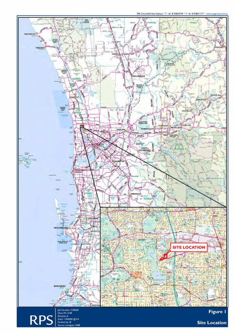
Figure 1: Site Location
Figure 2: ACM Contamination Status of Lots
Figure 3: Detail of Road Reserves
PLATES (contained within report text) Page
Plate A: Installation of Geotextile Barrier .................................................................................... 5
Ongoing Site Management Plan Summary
Erindale Grove Estate, North Beach Road, Gwelup
C10144:10, Rev 0, December 2011 Page 1
1.0 INTRODUCTION
1.1 Background
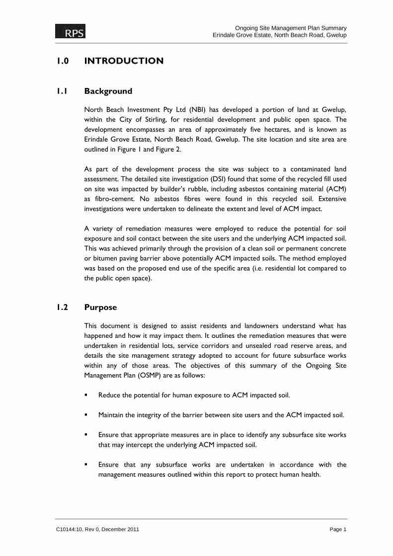
North Beach Investment Pty Ltd (NBI) has developed a portion of land at Gwelup, within the City of Stirling, for residential development and public open space. The development encompasses an area of approximately five hectares, and is known as Erindale Grove Estate, North Beach Road, Gwelup. The site location and site area are outlined in Figure 1 and Figure 2. As part of the development process the site was subject to a contaminated land assessment. The detailed site investigation (DSI) found that some of the recycled fill used on site was impacted by builder’s rubble, including asbestos containing material (ACM) as fibro-cement. No asbestos fibres were found in this recycled soil. Extensive investigations were undertaken to delineate the extent and level of ACM impact. A variety of remediation measures were employed to reduce the potential for soil exposure and soil contact between the site users and the underlying ACM impacted soil. This was achieved primarily through the provision of a clean soil or permanent concrete or bitumen paving barrier above potentially ACM impacted soils. The method employed was based on the proposed end use of the specific area (i.e. residential lot compared to the public open space).
1.2 Purpose
This document is designed to assist residents and landowners understand what has happened and how it may impact them. It outlines the remediation measures that were undertaken in residential lots, service corridors and unsealed road reserve areas, and details the site management strategy adopted to account for future subsurface works within any of those areas. The objectives of this summary of the Ongoing Site Management Plan (OSMP) are as follows: Reduce the potential for human exposure to ACM impacted soil. Maintain the integrity of the barrier between site users and the ACM impacted soil. Ensure that appropriate measures are in place to identify any subsurface site works
that may intercept the underlying ACM impacted soil. Ensure that any subsurface works are undertaken in accordance with the
management measures outlined within this report to protect human health.
Ongoing Site Management Plan Summary
Erindale Grove Estate, North Beach Road, Gwelup
C10144:10, Rev 0, December 2011 Page 2
2.0 LOCATION OF RESIDUAL ACM IMPACTED SOIL AND MANAGEMENT MEASURES
2.1 Background
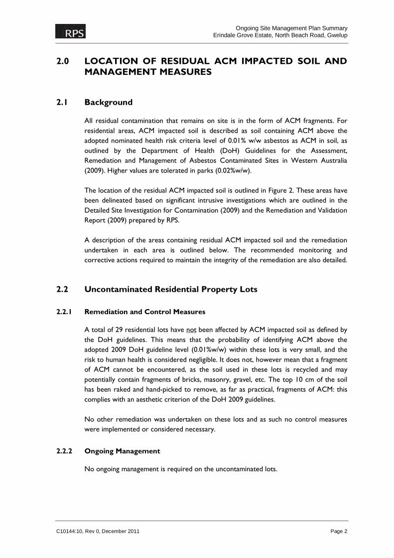
All residual contamination that remains on site is in the form of ACM fragments. For residential areas, ACM impacted soil is described as soil containing ACM above the adopted nominated health risk criteria level of 0.01% w/w asbestos as ACM in soil, as outlined by the Department of Health (DoH) Guidelines for the Assessment, Remediation and Management of Asbestos Contaminated Sites in Western Australia (2009). Higher values are tolerated in parks (0.02%w/w). The location of the residual ACM impacted soil is outlined in Figure 2. These areas have been delineated based on significant intrusive investigations which are outlined in the Detailed Site Investigation for Contamination (2009) and the Remediation and Validation Report (2009) prepared by RPS. A description of the areas containing residual ACM impacted soil and the remediation undertaken in each area is outlined below. The recommended monitoring and corrective actions required to maintain the integrity of the remediation are also detailed.
2.2 Uncontaminated Residential Property Lots
2.2.1 Remediation and Control Measures
A total of 29 residential lots have not been affected by ACM impacted soil as defined by the DoH guidelines. This means that the probability of identifying ACM above the adopted 2009 DoH guideline level (0.01%w/w) within these lots is very small, and the risk to human health is considered negligible. It does not, however mean that a fragment of ACM cannot be encountered, as the soil used in these lots is recycled and may potentially contain fragments of bricks, masonry, gravel, etc. The top 10 cm of the soil has been raked and hand-picked to remove, as far as practical, fragments of ACM: this complies with an aesthetic criterion of the DoH 2009 guidelines. No other remediation was undertaken on these lots and as such no control measures were implemented or considered necessary.
2.2.2 Ongoing Management
No ongoing management is required on the uncontaminated lots.
Ongoing Site Management Plan Summary
Erindale Grove Estate, North Beach Road, Gwelup
C10144:10, Rev 0, December 2011 Page 3
2.2.3 Corrective Actions
No corrective actions are required for the uncontaminated lots.
2.2.4 Adjacent Road Reserves
Uncontaminated Residential lots with frontage onto Nolan Crescent (shaded green on Figure 3) may have soils impacted with ACM at depths below 1 m in the unsealed road verge area immediately adjacent to the lot. All unsealed road verge areas (shaded blue on Figure 3) are covered by at least 1 m of validated fill. For information on management of ACM impacted soil within unsealed road reserve areas, please refer to Section 2.4.
2.3 Impacted Residential Lots
2.3.1 Remediation and Control Measures
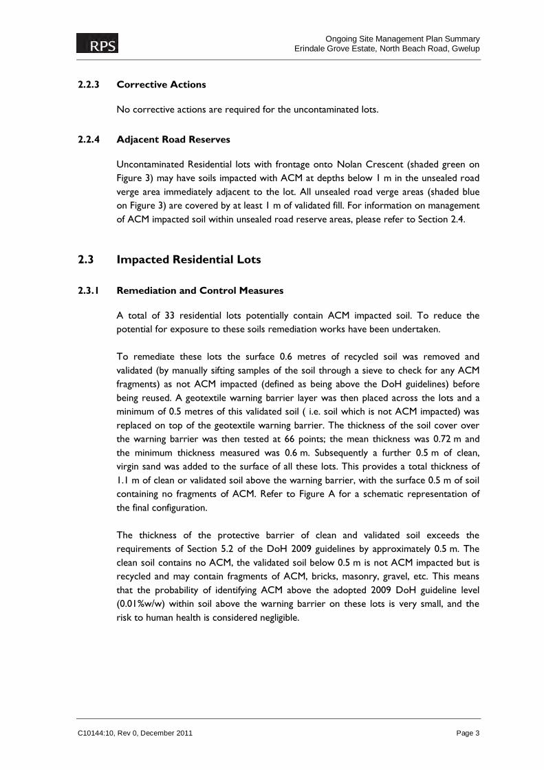
A total of 33 residential lots potentially contain ACM impacted soil. To reduce the potential for exposure to these soils remediation works have been undertaken. To remediate these lots the surface 0.6 metres of recycled soil was removed and validated (by manually sifting samples of the soil through a sieve to check for any ACM fragments) as not ACM impacted (defined as being above the DoH guidelines) before being reused. A geotextile warning barrier layer was then placed across the lots and a minimum of 0.5 metres of this validated soil ( i.e. soil which is not ACM impacted) was replaced on top of the geotextile warning barrier. The thickness of the soil cover over the warning barrier was then tested at 66 points; the mean thickness was 0.72 m and the minimum thickness measured was 0.6 m. Subsequently a further 0.5 m of clean, virgin sand was added to the surface of all these lots. This provides a total thickness of 1.1 m of clean or validated soil above the warning barrier, with the surface 0.5 m of soil containing no fragments of ACM. Refer to Figure A for a schematic representation of the final configuration. The thickness of the protective barrier of clean and validated soil exceeds the requirements of Section 5.2 of the DoH 2009 guidelines by approximately 0.5 m. The clean soil contains no ACM, the validated soil below 0.5 m is not ACM impacted but is recycled and may contain fragments of ACM, bricks, masonry, gravel, etc. This means that the probability of identifying ACM above the adopted 2009 DoH guideline level (0.01%w/w) within soil above the warning barrier on these lots is very small, and the risk to human health is considered negligible.
Ongoing Site Management Plan Summary
Erindale Grove Estate, North Beach Road, Gwelup
C10144:10, Rev 0, December 2011 Page 4
Figure A: Schematic of the Installed Geotextile Barrier over Lots
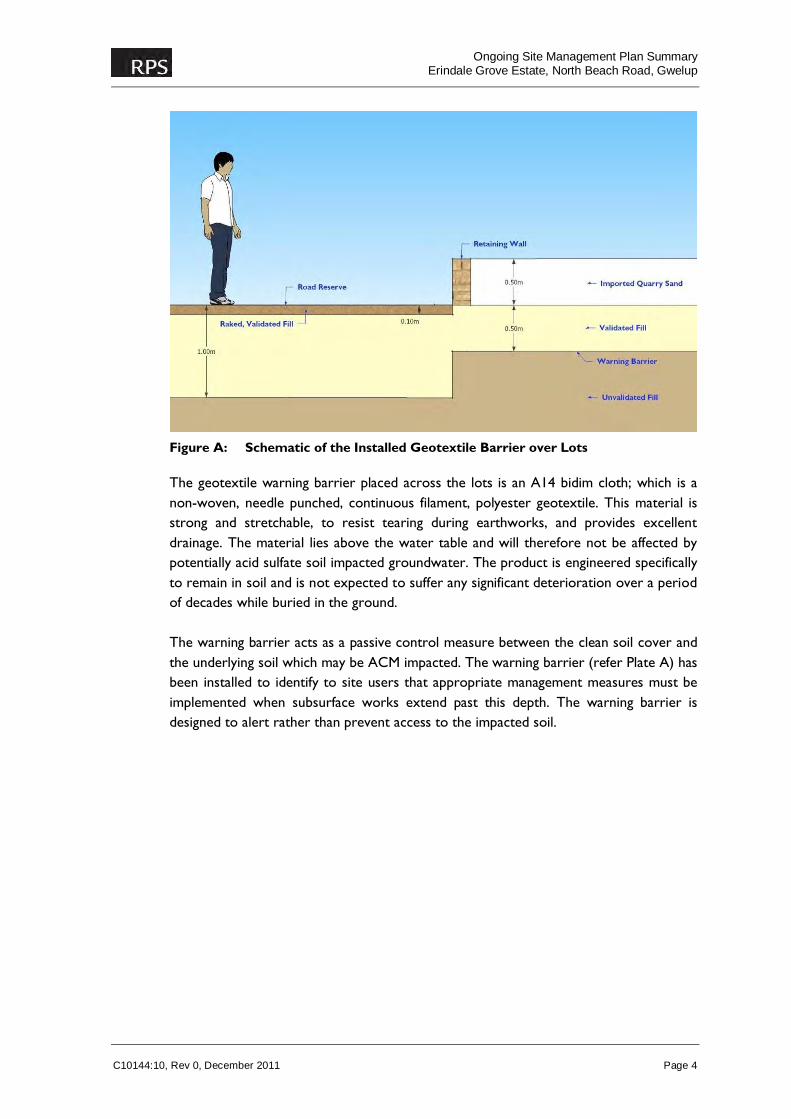
The geotextile warning barrier placed across the lots is an A14 bidim cloth; which is a non-woven, needle punched, continuous filament, polyester geotextile. This material is strong and stretchable, to resist tearing during earthworks, and provides excellent drainage. The material lies above the water table and will therefore not be affected by potentially acid sulfate soil impacted groundwater. The product is engineered specifically to remain in soil and is not expected to suffer any significant deterioration over a period of decades while buried in the ground. The warning barrier acts as a passive control measure between the clean soil cover and the underlying soil which may be ACM impacted. The warning barrier (refer Plate A) has been installed to identify to site users that appropriate management measures must be implemented when subsurface works extend past this depth. The warning barrier is designed to alert rather than prevent access to the impacted soil.
Ongoing Site Management Plan Summary
Erindale Grove Estate, North Beach Road, Gwelup
C10144:10, Rev 0, December 2011 Page 5
Plate A: Installation of Geotextile Barrier
2.3.2 Ongoing Management
Ongoing management to ensure the integrity of the warning barrier will be vested with the owners of the land. However, it is important that the land owners are made aware of the control measures that have been put in place to alert them as to the potential for ACM impacted soils to be encountered. The land is classified “Remediated for Restricted Use” with a Memorial on the Certificate on Title. This will notify the land owner that contamination exists on the land and of the need to follow the approved OSMP. Special measures are required for subsurface activities below the warning barrier. Deeper excavations (using any normal method) will be allowed on the proviso that appropriate management measures are in place to prevent the relocation of soils from below the warning barrier to above the warning barrier, and to ensure that the warning barrier is reinstated; see Section 3.0.
2.3.3 Corrective Actions
Any works undertaken below the warning barrier should be undertaken in accordance with the Procedures for Undertaking Subsurface Activities as outlined in Section 3.0.
Ongoing Site Management Plan Summary
Erindale Grove Estate, North Beach Road, Gwelup
C10144:10, Rev 0, December 2011 Page 6
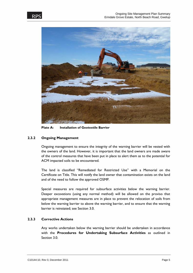
Following subsurface activities the warning barrier must be replaced where it has been disturbed and all appropriate measures undertaken to ensure that the warning barrier abuts any structures that progress through the barrier (e.g. soakwells). Large soakwells which penetrate the barrier should have at least 30cm of clean sand placed at the bottom of the soakwell, see Figure B. All services such as power or sewer which may be accessed in the future for maintenance purposes should be excavated to 0.1 m below the required service base depth, where the warning barrier should be replaced and 0.1 m of clean soil backfilled prior to re-installation of the service. No soil other than the top 1.0 m cover should be used as backfill above the warning barrier. Clean soil should be added to account for any soil that cannot be reused, and the top 0.1 m of soil should be free of visible fragments of ACM.
Figure B: Soakwell Penetrating the Warning Barrier
2.4 Road Reserves
2.4.1 Remediation and Control Measures
Road reserves extend through several areas of the site which may include ACM impacted soil. These have been backfilled with either imported quarry sand or validated recycled fill. The road reserve is comprised of the following components: roadway
Ongoing Site Management Plan Summary
Erindale Grove Estate, North Beach Road, Gwelup
C10144:10, Rev 0, December 2011 Page 7
service corridors sealed verges unsealed verges. This summary OSMP describes measures pertaining only to service corridors and unsealed verges: information relating to the other areas is contained in the full OSMP. As stated earlier, the validated soil cover is not ACM impacted but it does not necessarily mean that a fragment of ACM cannot be encountered as the soil is recycled and may potentially contain fragments of bricks, masonry, gravel, etc. The probability of identifying ACM above the adopted 2009 DoH guideline level (0.01%w/w) within these soils is very small, and the risk to human health is considered negligible.
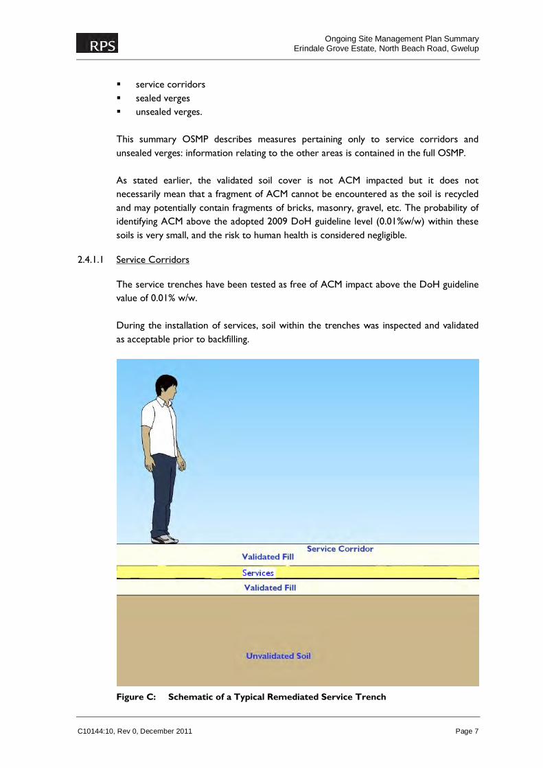
2.4.1.1 Service Corridors
The service trenches have been tested as free of ACM impact above the DoH guideline value of 0.01% w/w. During the installation of services, soil within the trenches was inspected and validated as acceptable prior to backfilling.
Figure C: Schematic of a Typical Remediated Service Trench

Ongoing Site Management Plan Summary
Erindale Grove Estate, North Beach Road, Gwelup
C10144:10, Rev 0, December 2011 Page 8
The material within all service trenches is considered to present no hazard to people undertaking future works within the service trenches. However, any services work undertaken outside the existing service trench (i.e. installing a new services corridor) may encounter ACM impacted soil. It will be clearly visible where the soil profile changes from clean backfill; which is brown, orange or yellow in colour; to the ACM impacted fill which is dark grey to black in colour, with extensive amounts of construction and demolition material.
2.4.1.2 Unsealed Verges
The unsealed areas of the road reserve are predominantly comprised of areas where service corridors have been installed. The soil within the service trenches has been validated to the full extent of the services and there is a very low probability that ACM will be identified (in excess of acceptable levels) within these areas. Refer to Figure D for a schematic representation. There are several small areas of unsealed verge which were not collocated with service corridors. These areas have been individually validated as not ACM impacted, to a depth of 1.0 m. Given they are located in the road reserve, are not readily accessible by the public (for the purposes of excavations), and are not utilised for services, a warning barrier is not in place below the validated clean soil cover. There may be shallow excavations required for irrigation pipes, but there is no reasonable expectation of them penetrating to, or below, 1.0 m.
Figure D: Schematic showing a Typical On-site Validated Unsealed Verge
Ongoing Site Management Plan Summary
Erindale Grove Estate, North Beach Road, Gwelup
C10144:10, Rev 0, December 2011 Page 9
2.4.2 Ongoing Management
2.4.2.1 Service Corridors
No ongoing management of the service trenches is required other than maintenance in the event of service failure. If work within the service trench extends beyond the current walls and base of the trench (considered unlikely) there is potential that ACM impacted soil may be encountered and works should be undertaken in accordance with the Procedures for Undertaking Subsurface Activities outlined in Section 4.0.
2.4.2.2 Unsealed Verges
These areas are not expected to require ongoing management.
2.4.3 Corrective Actions
2.4.3.1 Service Corridors
If ACM impacted soil (i.e. outside the original backfilled material) is encountered during works within service trenches the material should be removed and replaced with clean soil. It will be apparent as such soils contain large amounts of construction and demolition materials and are dark grey to black in colour. The ACM impacted soil should be disposed of at a suitable landfill licensed to accepted asbestos impacted soil. All ACM impacted soil should be managed in accordance with Section 3.0.
2.4.3.2 Unsealed Verges
If ACM impacted soil is encountered during works within unsealed verges the material should be removed and replaced with clean soil. It will be apparent as such soils contain large amounts of construction and demolition materials and are dark grey to black in colour. The ACM impacted soil should be disposed of at a suitable landfill licensed to accepted asbestos impacted soil. All ACM impacted soil should be managed in accordance with Section 3.0.
Ongoing Site Management Plan Summary
Erindale Grove Estate, North Beach Road, Gwelup
C10144:10, Rev 0, December 2011 Page 10
3.0 PROCEDURES FOR UNDERTAKING SUBSURFACE ACTIVITIES
3.1 Background
Prior to the commencement of any subsurface activities within those parts of the site that may contain ACM impacted soil, it is important that site users are made aware of the existing control measures and the importance of maintaining these measures. As there is potential to intersect ACM impacted soil during subsurface works in the road reserve or impacted residential lots (i.e. those with a warning barrier), all activities should be undertaken in accordance with the procedures outlined below. This will assist in reducing the potential risk to future site workers, residents and the environment as a whole. It should be noted that the warning pertains to the potential presence of ACM and that confirmation as to the actual presence (if any) of ACM will be made at the time of the excavation by visual observation. Nonetheless it should be assumed that ACM is present regardless of visual observations, as a precautionary measure.
3.2 Management of Significant Subsurface Disturbance
For significant excavations (where there is significant disturbance of ACM impacted soils), such as the construction of new pipelines, the following safe work practices should be employed: The ground to be excavated should be wetted down and there should be dust
control in place such as a hose, fitted with a fine spray attachment, and with an adequate supply of water. Work should preferably be undertaken during favourable weather conditions, when the wind is low and the soil is moist. If any visible dust is generated, further dust control corrective actions should be taken.
Appropriate personal protective equipment (PPE) should be worn in accordance
with prevailing WorkSafe health and safety guidelines and the recommendations for clean-up management contained in Appendix B of the Guidelines for the Assessment, Remediation and Management of Asbestos Contaminated Sites in Western Australia (2009)1.
The clean soil cover (from above the warning barrier) should be segregated into a
stockpile where it can be reused.
1 This guidance does not clearly state what PPE is appropriate if working with soils that may contain small amounts of ACM. The risk from exposure to ACM fragments in soil if worked in a damp condition is considered to be low and so the level of PPE should be determined on the potential for unacceptable exposure.
Ongoing Site Management Plan Summary
Erindale Grove Estate, North Beach Road, Gwelup
C10144:10, Rev 0, December 2011 Page 11
Any soil from below the warning barrier excavated from the site should be placed in controlled stockpiles such as on top of builder’s plastic (or directly into a skip bin/truck) and disposed of to a landfill licensed to accept such soil. The stockpiled soil should be kept moist and should be appropriately covered during transport.
Soil from below the warning barrier should be removed to a landfill licensed to accept such soil on the day on which they are excavated.
As part of normal operating procedure, major excavations such as the construction of new pipelines will require preparation of a health and safety plan prior to commencement of such works. The plan should take account of relevant procedures described in this OSMP.
Upon completion of works, the surface 0.1 m of soil should be confirmed as free
from visible fragments of ACM.
3.3 Management of Minor Subsurface Disturbance
For minor excavations (where there is minimal disturbance of ACM impacted soils), such as shallow trenching or digging in soakwells, the following safe work practices should be employed (as at 2010): The ground to be excavated should be wetted down and there should be dust
control in place such as a hose, fitted with a fine spray attachment, and with an adequate supply of water. Work should preferably be undertaken during favourable weather conditions, when the wind is low and the soil is moist. Should conditions be dry and windy, all work should be postponed until calm conditions prevail.
Appropriate personal protective equipment (PPE) should be worn in accordance
with prevailing WorkSafe health and safety guidelines and the recommendations for clean-up management contained in Appendix B of the Guidelines for the Assessment, Remediation and Management of Asbestos Contaminated Sites in Western Australia (2009)2.
The clean soil cover should be segregated into a stockpile where it can be reused. Any excess ACM impacted soil excavated from the site should be placed in
controlled stockpiles such as on top of builder’s plastic (or directly into a skip bin/truck) and disposed of to a landfill licensed to accept such soil. The stockpiled soil should be kept moist and should be appropriately covered during transport.
2 This guidance does not clearly state what PPE is appropriate if working with soils that may contain small amounts of ACM. The risk from exposure to ACM fragments in soil if worked in a damp condition are considered to be low and so the level of PPE should be determined on the potential for unacceptable exposure.
Ongoing Site Management Plan Summary
Erindale Grove Estate, North Beach Road, Gwelup
C10144:10, Rev 0, December 2011 Page 12
Stockpiles of soil that may contain ACM should not remain on site for an extended period of time or be left unsupervised (i.e. overnight).
Given that ACM is the only contaminant of concern, no air monitoring is considered necessary as fibres are highly unlikely to be emitted.
Upon completion of works, the surface 0.1 m of soil should be confirmed as free from visible fragments of ACM.
3.3.1 Contingency Plans for Site Incidents
Where the warning barrier has been breached and potentially ACM impacted soil has been inadvertently brought to the surface, the site supervisor or person in control of the work being undertaken must take action to make good the removed soil and warning barrier as soon as practicable. Given the ACM that is present is not fibrous it represents minimal risk even if it is brought to the surface with no controls in place. The primary objective is to avoid the spread of such soils into clean areas. An investigation into the cause and impact of the incident should be carried out to determine measures that should be employed to prevent a reoccurrence of the incident and provide a resolution of any problems created by the incident.
3.4 Reinstatement of Control Measures
Any control measures that have been implemented as part of the remediation must be reinstated following the completion of works, specifically: The geotextile warning barrier within impacted residential lots must be repaired
with like or similar material. Where services penetrate through the barrier they must be surrounded (walls and base) with a minimum 10 cm thickness of clean soil backfill consistent with the DoH (2009) advice that ACM fragments should not be visible within the first 10 cm of the soil profile. The warning barrier should be first installed into the excavation prior to placement of clean soil and infrastructure item.

FIGURES

290 Churchhill Ave Subiaco | T +61 8 93824744 | F +61 8 93821177 | www.rpsgroup.com.au
Job Number: C08268Date: 05.12.08Revision: AScale: 1:500000 @ A4Drafted by: SFSource: Landgate, 2008
Figure 1
Site Location
SITE LOCATION


NORTH BEACH ROAD
GRIMWOOD AVENUE
NOLA
N C
RESC
ENT
CARE
NIUP
AVE
NUE
JODRELL RD
38 Station Street, Subiaco | T +61 8 92111111 | F +61 8 92111122 | www.rpsgroup.com.au
Job Number: C10144Date: 30.08.11Scale: 1:1,000 @ A3Revision: ADrafted by: MASource: Orthophoto - NearMap, 20.04.11
Figure 3Detail of Road Reserves
LEGENDStage 2 BoundaryLodged cadastreResidential Lots, Not ACM impactedMinimum 1.0m Validated Fill0.5m of Clean Fill Over 0.5m of Validated Fill Over Warning Barrier
0 10 20 30 405metres
°