ontario commercial vehicle survey
TRANSCRIPT
MINISTRY OF TRANSPORTATION
FREIGHT DEMAND MODELLING: TOOLS FOR PUBLIC SECTOR DECISSION MAKING
Ontario Commercial Vehicle Survey – Use of GIS for Data Collection, Processing, Analyses
and Dissemination
Presented at
September 26, 2006
Presenter: Selva SureshanPresenter: Selva SureshanDiscussant: Rob TardifDiscussant: Rob TardifOntario Ministry of TransportationOntario Ministry of Transportation
MINISTRY OF TRANSPORTATION
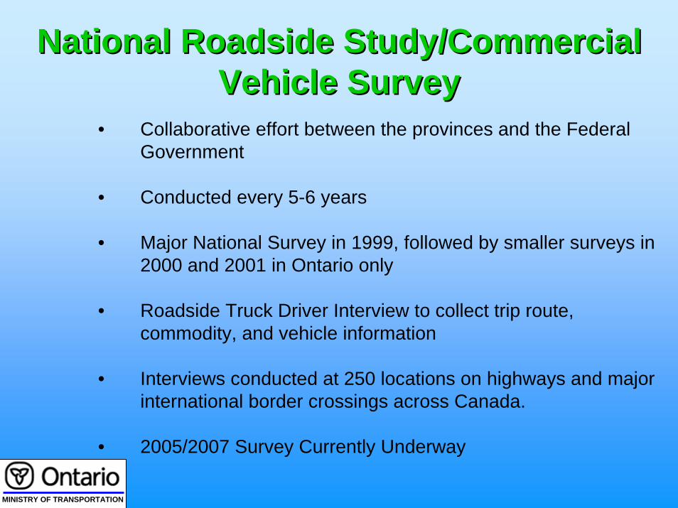
National Roadside Study/Commercial National Roadside Study/Commercial Vehicle SurveyVehicle Survey
• Collaborative effort between the provinces and the Federal Government
• Conducted every 5-6 years
• Major National Survey in 1999, followed by smaller surveys in 2000 and 2001 in Ontario only
• Roadside Truck Driver Interview to collect trip route, commodity, and vehicle information
• Interviews conducted at 250 locations on highways and major international border crossings across Canada.
• 2005/2007 Survey Currently Underway
MINISTRY OF TRANSPORTATION
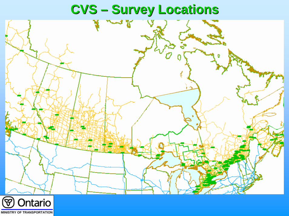
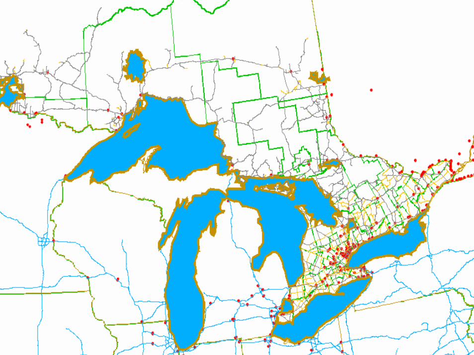
CVS CVS –– Survey Locations Survey Locations
MINISTRY OF TRANSPORTATION
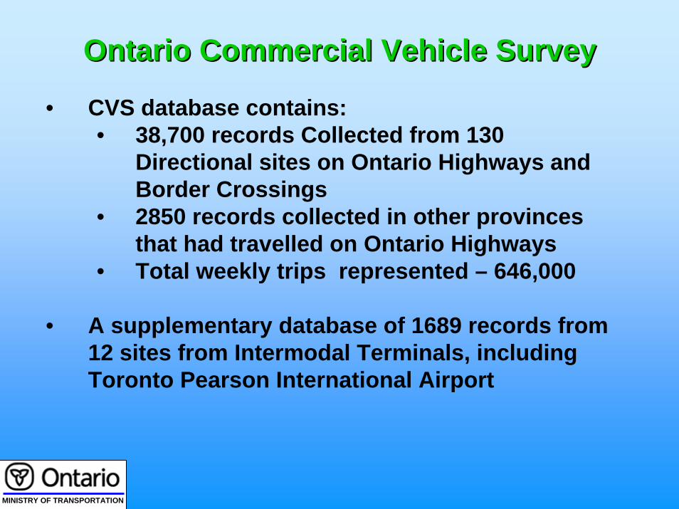
Ontario Commercial Vehicle Survey Ontario Commercial Vehicle Survey
• CVS database contains: • 38,700 records Collected from 130
Directional sites on Ontario Highways and Border Crossings
• 2850 records collected in other provinces that had travelled on Ontario Highways
• Total weekly trips represented – 646,000
• A supplementary database of 1689 records from 12 sites from Intermodal Terminals, including Toronto Pearson International Airport
MINISTRY OF TRANSPORTATION
DATA COLLECTION

MINISTRY OF TRANSPORTATION
Data CollectedData Collected
•Trip •trip stops , inter-provincial and international borders crossed
•Commodity•name, weight, dangerous goods, origin and destination
•Vehicle• type, body style, number of axles, weight and spacing, capacityutilization
•Company•Name, license plate jurisdiction, base city,for-hire/private
•Driver•base city, driver training, experience
Up to 100 pieces of information collected, including:

MINISTRY OF TRANSPORTATION
Details of Trip InformationDetails of Trip Information
• Trip Origin and Destination• Stop immediately prior to the survey • Stop immediately after the survey• Provincial entry and Exit Points• International border entry and exit points
up to two entry and two exit points• Survey Location• Highways used for the trip
Up to 11 geographic points directly related to the trip

MINISTRY OF TRANSPORTATION
Other Data Related to Trip MakingOther Data Related to Trip Making
•Commodity Origin and Destination
•Commodity Name
•Carrier Data•Name•Company Base•Type of Business (for hire, private)
•Driver Base

MINISTRY OF TRANSPORTATION
TRIP DATA REVIEW AND CLEANSING

MINISTRY OF TRANSPORTATION
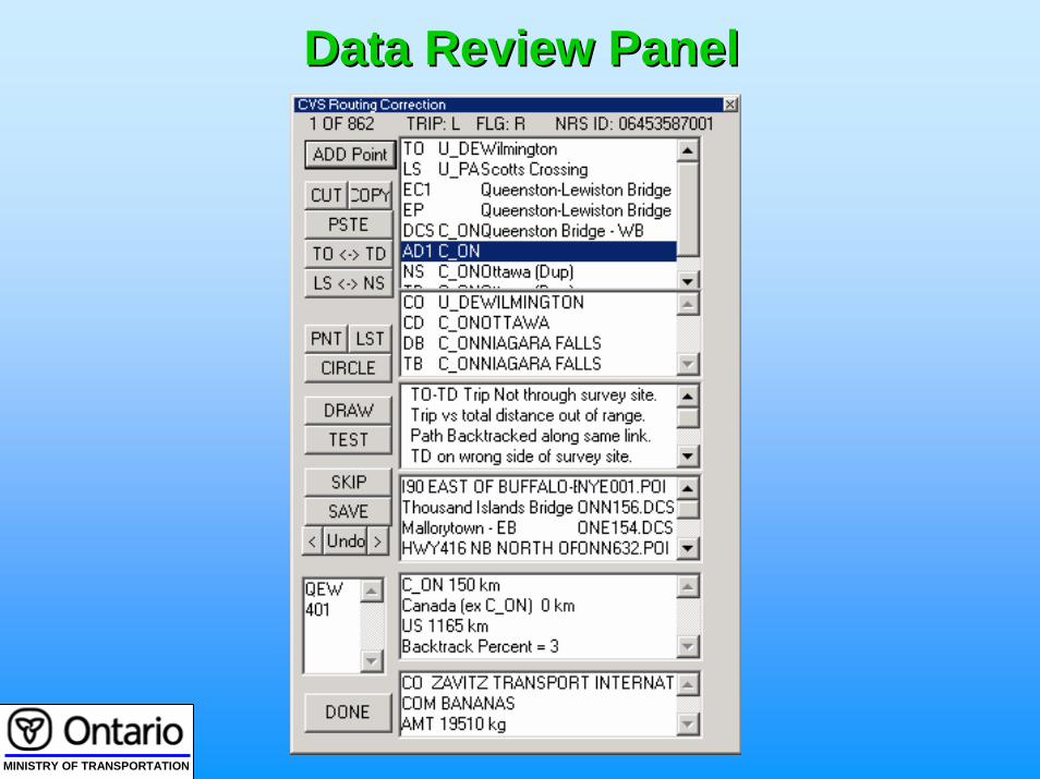
Review of Individual Survey RecordsReview of Individual Survey Records
• Each Survey Record was reviewed individually
• GISDK based TransCAD application was used to review routes and make corrections
• Additional fields are calculated once the routing is accepted• Distance travelled in each province and state• Points of Interest passed

MINISTRY OF TRANSPORTATION
Why is it Important to Get the Route Why is it Important to Get the Route Correct?Correct?
A survey is a sample for all the survey stations along the trip route
The expansion factor of a record is affected by the number of survey stations passed along the trip
MINISTRY OF TRANSPORTATION
Data Review PanelData Review Panel
MINISTRY OF TRANSPORTATION
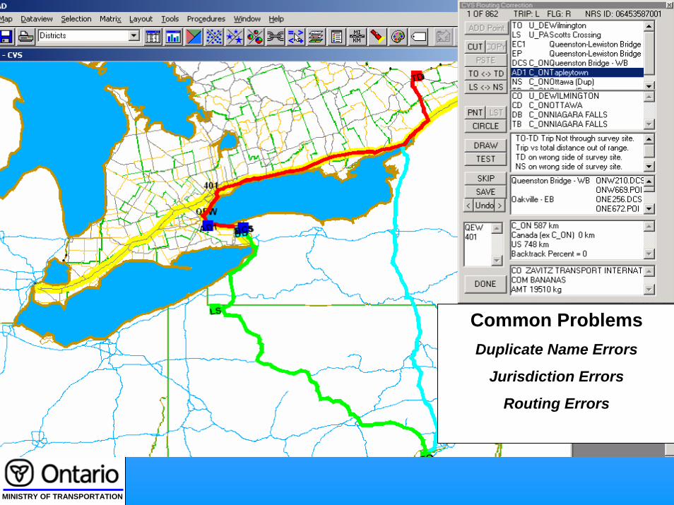
Common ProblemsDuplicate Name Errors
Jurisdiction Errors
Routing Errors

MINISTRY OF TRANSPORTATION
DATA ANALYSIS AND ASSIGNMENTS

MINISTRY OF TRANSPORTATION
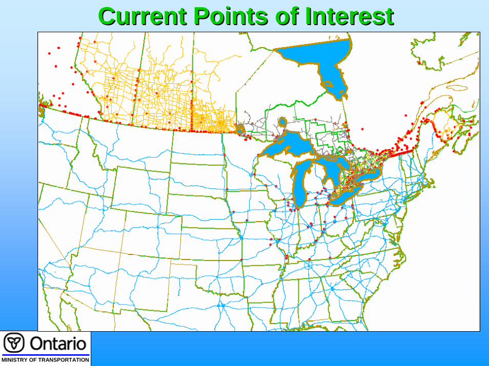
Points on Interest (POI)
• Any point on the highway network
•All NRS survey sites across Canada• All international and Interprovincial Crossings•Other points
• Can be added as required
• Currently more than 1000 directional POIs Across Canada and the U.S.
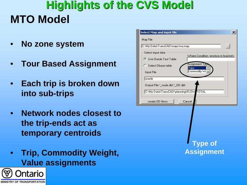
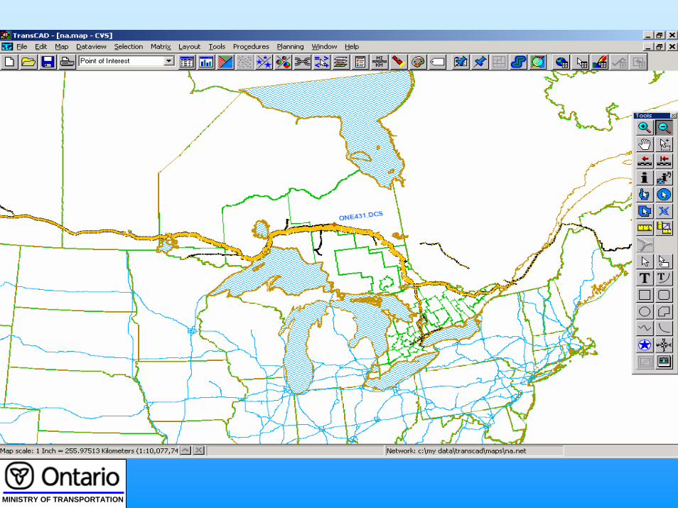
Highlights of the CVS Model Highlights of the CVS Model
MINISTRY OF TRANSPORTATION
Current Points of InterestCurrent Points of Interest
MINISTRY OF TRANSPORTATION
MINISTRY OF TRANSPORTATION
Type of Assignment
MTO Model
• No zone system
• Tour Based Assignment
• Each trip is broken down into sub-trips
• Network nodes closest to the trip-ends act as temporary centroids
• Trip, Commodity Weight, Value assignments
Highlights of the CVS Model Highlights of the CVS Model

MINISTRY OF TRANSPORTATION
Trip Assignment ResultsTrip Assignment Results

MINISTRY OF TRANSPORTATION
Select Link AssignmentSelect Link Assignment
“Select Link Point”

MINISTRY OF TRANSPORTATION
Data Retrieval Screen Data Retrieval Screen
Selection Condition referring to
“Select Link Point”
MINISTRY OF TRANSPORTATION

MINISTRY OF TRANSPORTATION
REPORTING

MINISTRY OF TRANSPORTATION
FEATURES OF CVS REPORTING SYSTEMFEATURES OF CVS REPORTING SYSTEM
•Application developed using ArcGIS, Crystal Reports, and Adobe Acrobat
•Creates a 3 or 4 page predefined report containing Charts, graphs and a thematic map of Ontario
•Output is in Acrobat format that can be distributed electronically

MINISTRY OF TRANSPORTATION
Selected LocationsHighlighted
CVS Reporting SystemCVS Reporting System

MINISTRY OF TRANSPORTATION
Types of ReportsTypes of Reports
1. Data Collection Site Report
2. General Point of Interest Report
3. Area Report
4. Corridor Report
5. Custom Report

MINISTRY OF TRANSPORTATION
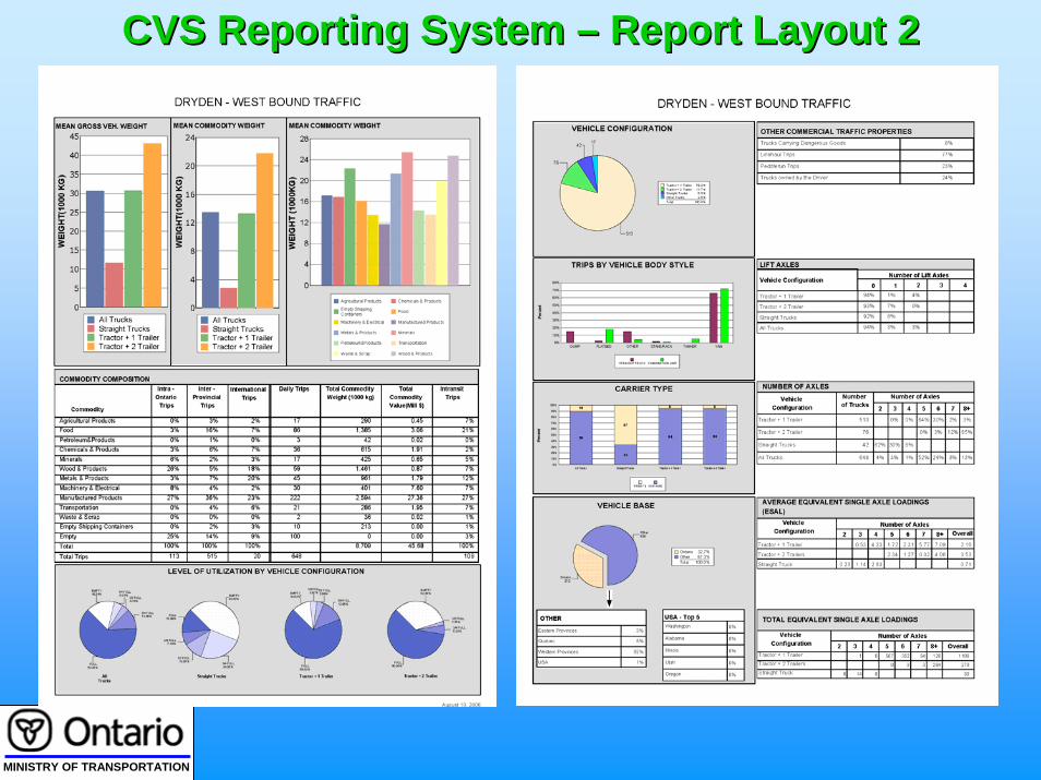
CVS Reporting System CVS Reporting System –– Report Layout 1Report Layout 1
MINISTRY OF TRANSPORTATION
CVS Reporting System CVS Reporting System –– Report Layout 2Report Layout 2

MINISTRY OF TRANSPORTATION
LESSONS LEARNED and PROCESS IMPROVEMENTS

MINISTRY OF TRANSPORTATION
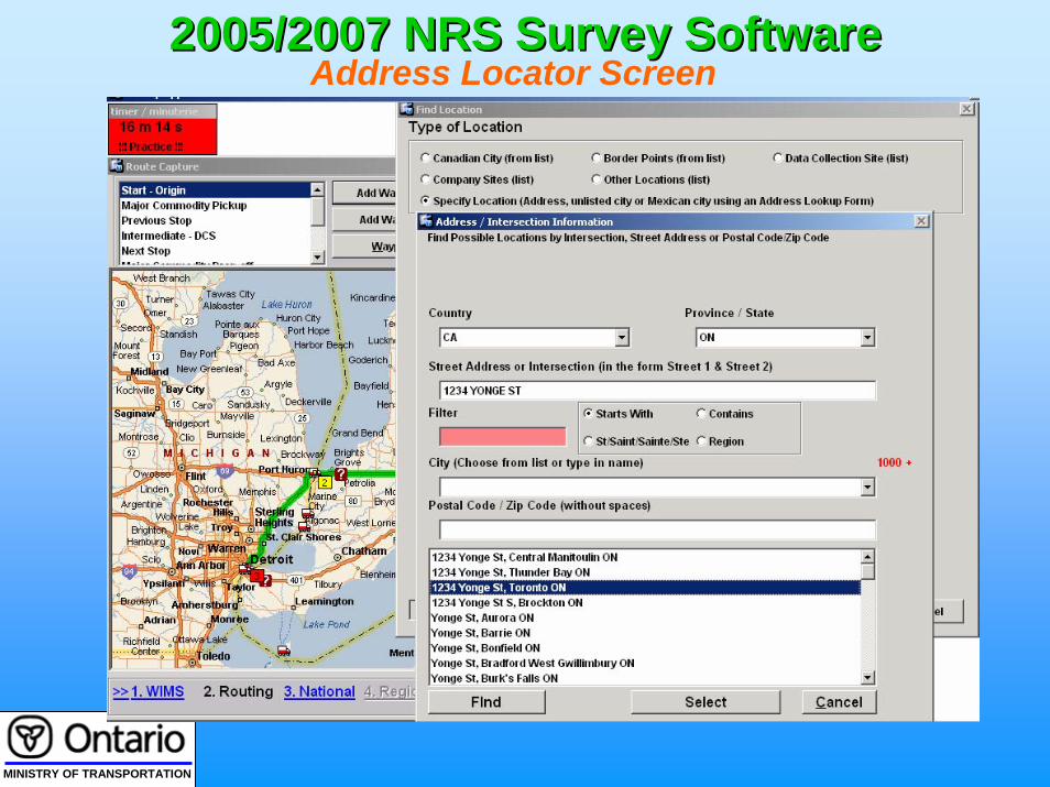
“Insufficient Routing information Collected adds significant Delays to Data Processing”
Measures Taken to Mitigate this Shortcoming
•2006 National Roadside Study Survey Software Integrates Routing Component using Microsoft MapPoint
•Address Level information is Collected to accurately project the trip route
•Built-in Validity checks to Ensure Core Route Data is Collected – e.g. Border Crossings for International Trips
MINISTRY OF TRANSPORTATION
2005/2007 NRS Survey Software 2005/2007 NRS Survey Software Address Locator Screen

MINISTRY OF TRANSPORTATION
2005/2007 NRS Survey Software 2005/2007 NRS Survey Software Review of Highways Used
MINISTRY OF TRANSPORTATION
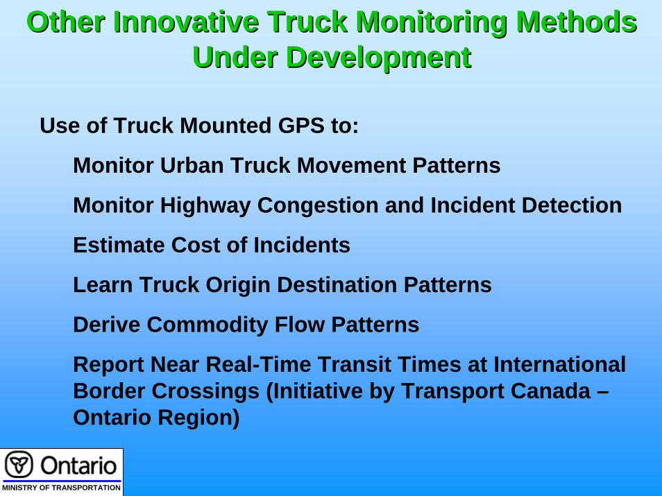
Other Innovative Truck Monitoring Methods Other Innovative Truck Monitoring Methods Under Development Under Development
Use of Truck Mounted GPS to:
Monitor Urban Truck Movement Patterns
Monitor Highway Congestion and Incident Detection
Estimate Cost of Incidents
Learn Truck Origin Destination Patterns
Derive Commodity Flow Patterns
Report Near Real-Time Transit Times at International Border Crossings (Initiative by Transport Canada –Ontario Region)

MINISTRY OF TRANSPORTATION
Advantages of GPS TechnologyAdvantages of GPS Technology
Continuously Monitor Truck’s Location – record the position every few seconds
O-D Data for Many Trips for the Same Truck Can be Collected Compared to a Single Trip From a Survey
Data Not Limited to Trucks – Useful to Analyse General Traffic Conditions

MINISTRY OF TRANSPORTATION
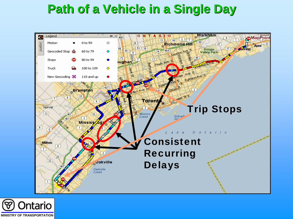
Single Day Coverage of GPS Equipped Trucks Single Day Coverage of GPS Equipped Trucks --20052005
MINISTRY OF TRANSPORTATION
Consistent Recurring Delays
Path of a Vehicle in a Single DayPath of a Vehicle in a Single Day
Trip Stops

MINISTRY OF TRANSPORTATION
Trip ReportTrip Report

MINISTRY OF TRANSPORTATION
Peace Into USAStart Date End Date Stop Time Crossing Time
MINISTRY OF TRANSPORTATION
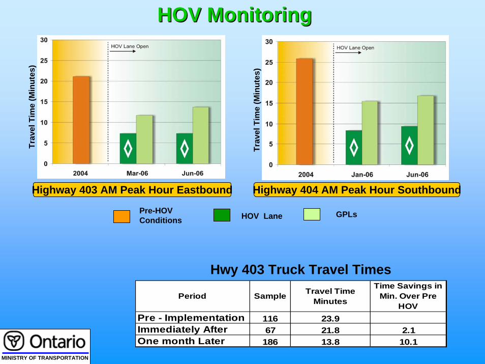
Highway 403 AM Peak Hour Eastbound Highway 404 AM Peak Hour Southbound
Trav
el T
ime
(Min
utes
)
HOV Lane GPLsPre-HOV Conditions
HOV MonitoringHOV Monitoring
Sample Travel Time Minutes
Time Savings in Min. Over Pre
HOV116 23.967 21.8 2.1
186 13.8 10.1
Pre - ImplementationImmediately AfterOne month Later
Period
Trav
el T
ime
(Min
utes
)
Hwy 403 Truck Travel Times

MINISTRY OF TRANSPORTATION
Discussant: Rob TardifDiscussant: Rob Tardif
Ontario has been involved in roadside data collection for 40 years.Primary Objective:Increase awareness then prioritize Freight infrastructure
investments.Support $2 B annual investment in highway maintenance and
expansion.Time interval 5 years, 2 years of data collection• Costs: Intercept surveys $5 million, Traffic Counts/WIM +$1
million• Coverage 50% urban truck trips, 70% inter-city VKT’s &
trips• Enables project and link level analysis.• Promotes multi-modal Freight Model development
MINISTRY OF TRANSPORTATION
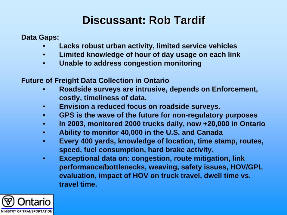
Discussant: Rob TardifDiscussant: Rob TardifData Gaps:
• Lacks robust urban activity, limited service vehicles• Limited knowledge of hour of day usage on each link• Unable to address congestion monitoring
Future of Freight Data Collection in Ontario• Roadside surveys are intrusive, depends on Enforcement,
costly, timeliness of data.• Envision a reduced focus on roadside surveys.• GPS is the wave of the future for non-regulatory purposes • In 2003, monitored 2000 trucks daily, now +20,000 in Ontario• Ability to monitor 40,000 in the U.S. and Canada• Every 400 yards, knowledge of location, time stamp, routes,
speed, fuel consumption, hard brake activity.• Exceptional data on: congestion, route mitigation, link
performance/bottlenecks, weaving, safety issues, HOV/GPL evaluation, impact of HOV on truck travel, dwell time vs. travel time.

MINISTRY OF TRANSPORTATION
Discussant: Rob TardifDiscussant: Rob TardifFuture of Freight Data Collection in Ontario – Continued
• Access to 3rd party GPS data is a privilege• Planners must respect carrier privacy• Demonstrate benefits to carriers & their associations• Challenges exist in linking Roadside/GPS/WIM/ATR data
Limitations:• Huge volume of data forms data management issues• No software to support GPS data processing &
dissemination • GPS data lacks information related to:
•Commodity, utilization, empty moves, truck type, carrier name, carrier type, licence plate, axle weights & spacing.
• GPS sample may form a biased sample.• Calibration remains critical and even more complex.• Access in the long-term remains unknown• Regulatory efforts to deploy system wide remain uncertain.