operations of an autonomous surface vehicle aboard the ... · asv-global control and mission...
TRANSCRIPT

Operations of an Autonomous Surface Vehicle Aboard the NOAA SHIP Fairweather US Hydrograpahic Conference Val Schmidta and Rob Downsb a) Center for Coastal and Ocean Mapping, School of Marine Science and Ocean Engineering, University of New Hampshire b) NOAA, Office of Coast Survey
Abstract In late July of 2018, National Oceanographic and Atmospheric Administration (NOAA) SHIP Fairweather set sail from Nome, Alaska for 10 days of survey above the Arctic Circle in the vicinity of Point Hope, Alaska. In addition to her four survey launches, she was outfitted with the Bathymetric Explorer and Navigator (BEN), an autonomous surface vehicle (ASV) owned and operated by the Center for Coastal and Ocean Mapping at the University of New Hampshire. The effort marked the first deployment of an autonomous surface vehicle by NOAA’s Office of Coast Survey in the Arctic for hydrographic survey. The collaborative endeavor aimed to build and test new operational models, introduce the crew to ASV operations, and identify (and where possible immediately fix) short-comings in the ASV’s mission planning interfaces, operator awareness, navigation capability, data collection and processing. This paper provides an overview of the cruise and those findings.
Introduction The use of autonomous systems for seafloor survey holds the promise of increased efficiency, safety, data quality and endurance over traditional manned launches. However, the devil remains in the details as survey operators learn how to safely and effectively integrate unmanned systems into their survey operations. In July of 2018 the NOAA SHIP Fairweather, in collaboration with the University of New Hampshire’s Center for Coastal and Ocean Mapping, set sail for Point Hope, Alaska to explore these details – to learn how unmanned systems might be integrated into their operations, what impact it might have on survey efficiency, data quality, manning and other factors. This report summarizes the findings from that endeavor.

Figure 1. ASV-BEN, a “C-Worker 4” model ASV operated by the Center for Coastal and Ocean
Mapping.
The Center for Coastal and Ocean Mapping owns and operates a “C-Worker 4”-model ASV, the “Bathymetric Explorer and Navigator” or ASV-BEN. ASV-BEN is the result of a design collaboration with ASV Global Ltd. and was manufactured by ASV Global in 2016. The vehicle is powered by 30 HP Yanmar diesel with jet propulsion, has a top speed of 5.5 knots, a maximum endurance of 16 hours and is equipped various operator-aiding sensors including a marine radar, AIS, color and FLIR cameras and depth sounder. For hydrographic survey the Center has integrated a Kongsberg EM2040P multibeam echo-sounder, AML Oceanographic sound speed probe and Applanix POS/MV v5 inertially aided GPS. In addition, the Center has replaced the ASV-Global control and mission planning systems with “Project11” - the Center’s software framework for marine robotics. Project11 is built on the Robotic Operating System (ROS) and is designed to allow rapid and nimble survey planning, tighter integration with hydrographic sensors and improved vehicle control and behavior.
Figure-2. ASV-BEN and the NOAA SHIP Fairweather in the vicinity of Point Hope, Alaska.

The Fairweather is a 231 ft vessel commissioned in 1968. She carries up to 4 survey launches and conducts hydrographic surveys along the West coast of the Continental US and Alaska. With 4 launch davits the Fairweather has limited deck space and just a single boom-style crane mounted midships at the forward end of the fantail. The Fairweather has a complement of 51 crew with additional berthing for visiting scientists. The ship’s survey department has 7 workstations for survey processing connected via 10 Gbps fiber to the ship’s network attached storage (NAS).
Logistics
Figure 2 Packing of ASV-BEN for shipment to Kodiak, AL where it was loaded aboard the
Fairweather.
To accommodate the ship’s schedule and make use of crane and fork-lift facilities, ASV-BEN was shipped to US Coast Guard Station Kodiak, Alaska where it was loaded aboard the Fairweather during a regularly scheduled port call. Shipment of the vehicle required modification of the

ASVs antenna mast, allowing it to be folded to reduce the vehicle’s height on its trailer. This modification allowed the vehicle to be easily rolled into and out of a standard height shipping container. Two additional 48in x 48in x 46in crates of gear and a disassembled cradle for the ASV were also shipped in the container. A team from the Center met the shipment in Kodiak and the Coast Guard provided excellent facilities and personnel support for unloading the equipment, assembly of the ASV’s cradle and crane support for loading aboard the ship. The ship then set sail for survey operations and transit North. Some four weeks later the ASV operations team embarked aboard the Fairweather during another regularly scheduled port call in Nome, Alaska to begin subsequent collaborative operations above the Arctic Circle. Prior to setting sail from Nome the ASV was repositioned from a storage location centerline between the ship’s davits to the fan-tail beneath the ship’s A-frame where it would be readily accessible. The ship usually maintains a small launch in this location, but in practice the launch is used infrequently and was left in Nome during these operations to accommodate the ASV. Sidescan operations by the Fairweather would not have been possible with the ASV stowed in this way beneath the A-frame. An alternative storage location exists on the port side of the fantail adjacent to the ship’s J-frame that would have accommodated towing sidescan, but this confined space was less desirable unless absolutely necessary.
Figure 3. Deck of the Fairweather showing the ASV’s storage location on the aft fantail,
deployment and retrieval location on the port side and pilot forward. Also prior to departure the ASV gear was broken-out to assemble the 12 foot ASV telemetry system antenna mast and to install the operator’s and developer’s stations in the ship’s survey workspace. The antenna mast and “operator’s telemetry box” (OTB) were installed atop the Fairweather’s stack and secured with ratchet straps. This arrangement kept RF cables relatively short (10 m) to prevent unnecessary losses and placed the antennas approximately 22 m above the water. Nonetheless, the ship’s forward mast structure reduced telemetry ranges in the forward direction by more than half. Power, ethernet and emergency stop cables were run from a weather box at the base of the antenna mast, within which the OTB was stowed, down inside the pilot house to the survey work area where the operator’s station was installed.

Figure 4. Roland Arsenault, software engineer at the Center, manning the ASV operating station
set up within the ship’s survey processing area. The ASV’s factory operator’s station requires just a single laptop with optional external monitor. The Center has added a second laptop and monitor to interface with the “Project11” back-seat driver, a third laptop for sonar data acquisition and a fourth laptop to provide a developer’s interface to the ASV. Three desk areas were taken up by this gear, but this did not impede the survey team’s data processing efforts. An unexpected two-day delay in departure of the Fairweather from Nome afforded some time to practice deployment of the ASV pier-side and operation of the vehicle within Nome’s boat basin. The ASV was deployed from the ship’s centrally mounted boom crane over the port side of the vessel, aft of the ship’s J-frame. The boom crane was not ideal, as the reach and swing of the crane was long, creating the potential for uncontrolled swinging of the vehicle, and thus limited deployments to calm seas – no more than 3 ft waves with little swell was deemed safe. The A-frame and J-frame provided too little reach to deploy the vessel without danger of colliding with the ship’s hull. The deployment location would also prove challenging as the stern of the ship begins to taper beneath the deck at this location providing a dangerous area under which the ASV could be swept and damaged. No better deployment location was possible due to the ship’s launch davits and other equipment.

Figure 5. ASV-BEN being deployed using the ship’s boom-crane.
To deploy the ASV lines were looped through a forward towing bale on the vehicle and aft through the vehicle’s jet guard to provide tending lines, while the hook was attached to the single-point lifting bale with a lifting strap and release. The Center arrived with a “brailler” type release, and although other release options were available on board, this mechanism was deemed preferable by the crew for its ability to release quickly and cleanly. Fenders were positioned alongside the ship and the ASV was placed in the water some distance away, painters were recovered, the engine started and the lifting bale released. When possible, the crane hook was lowered sufficiently to drop the ASV’s lifting bale across the deck prior to release to prevent unnecessary damage. Once free, operators would pilot the ASV away from the ship and conduct final pre-mission checks.
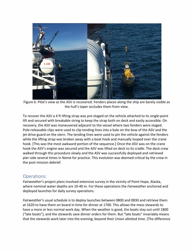
Figure 6. Pilot’s view as the ASV is recovered. Fenders places along the ship are barely visible as
the hull’s taper occludes them from view. To recover the ASV a 4 ft lifting strap was pre-staged on the vehicle attached to its single-point lift and secured with breakable string to keep the strap both on deck and easily accessible. On recovery, the ASV was maneuvered adjacent to the vessel where two fenders were staged. Pole-releasable clips were used to clip tending lines into a bale on the bow of the ASV and the jet-drive guard on the stern. The tending lines were used to pin the vehicle against the fenders while the lifting strap was broken away with a boat hook and manually looped over the crane hook. [This was the most awkward portion of the sequence.] Once the ASV was on the crane hook the ASV’s engine was secured and the ASV was lifted on deck to its cradle. The deck crew walked through this procedure slowly and the ASV was successfully deployed and retrieved pier-side several times in Nome for practice. This evolution was deemed critical by the crew in the post-mission debrief.
Operations: Fairweather’s project plans involved extensive survey in the vicinity of Point Hope, Alaska, where nominal water depths are 10-40 m. For these operations the Fairweather anchored and deployed launches for daily survey operations. Fairweather’s usual schedule is to deploy launches between 0800 and 0830 and retrieve them at 1620 to have them on board in time for dinner at 1700. This allows the mess stewards to have a more or less normal work day. When the weather is good, the boats stay out until 1800 (“late boats”), and the stewards save dinner orders for them. But “late boats” invariably means that the stewards work later into the evening, beyond their Union allotted time. [The difference
between the Fairweather (NOAA?) and other scientific ships is striking. There is no mid-rats, not even self-serve.] The ASV was deployed just after deployment of the launches and recovered just prior to recovery of the launches. This sequence ensured launch support to tend the ASV if necessary, but sometimes resulted in insufficient hands during ASV deck operations. During ASV operations, the ASV was operated by a 2-person team (1-person during meals). ASV Global’s factory software provides few graphical warnings, no automated hazard detection and not audible alarms. Experience has shown that this limitation requires dedication of an operator focused on vehicle system health to catch unexpected failures that, while infrequent, can occur without warning. This operator would also plan missions and pilot the ASV via joystick when necessary. Two laptops provide these two interfaces -- the “ASView Bridge” software provided by ASV Global for vehicle health and the Center’s “Project11” marine robotics framework for rapid mission planning interface, along with low-level control of the sonar and joystick piloting of the ASV. Bandwidth for these operations requires less than 1 Mbps and can be sustained by the ASVs telemetry systems to as far as 8 km. A second operator is dedicated to sonar operation and data acquisition. A third laptop provided a Windows Remote Desktop connection to a Windows PC aboard the ASV for this role. This PC ran Kongsberg’s “Seafloor Information Systems” (SIS) (version 4), Applanix “POS View”, and the Hydro Office Sound Speed Editor to interface with the sonar, POS/MV and to facilitate loading sound speed profiles respectively. This role was often augmented by Fairweather survey staff for cross-training purposes. The telemetry link for this operation generally requires 2 Mbps and is often the limiting telemetry link (of <4 km) during survey operations.

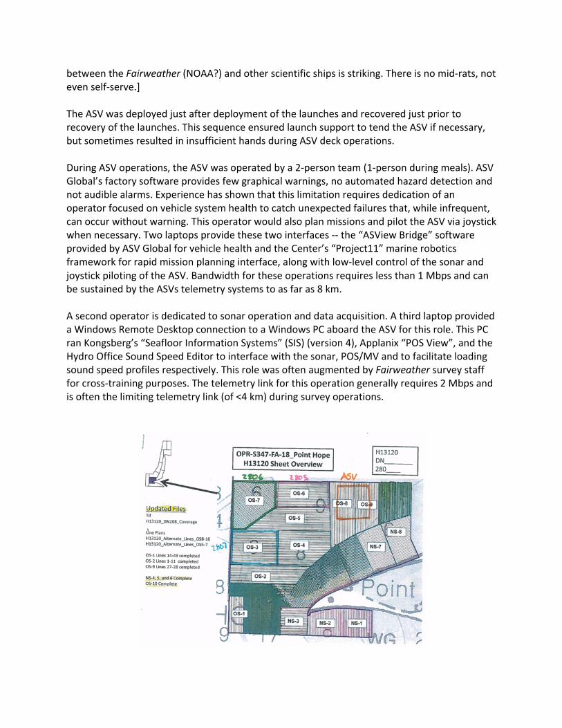
Figure 7. An example of a day’s ASV tasking, along with that of two of the ship’s launches (2806 and 2805). The ASV’s operational area is centered around the ship’s mooring location to ensure
good telemetry. The Fairweather’s summer assignment involved extensive survey in the vicinity of Point Hope, Alaska. Daily survey tasking was provided to the ASV team from the ship’s Operations Officer, along with that of the other launches (Figure XX). Tasking was initially limited to regions in which full telemetry to the ASV could be maintained while the ship remained at anchor. Sufficient bandwidth to support Windows Remote Desktop would be the limiting factor. Later as reliability and on-line survey tools improved, the ASV was authorized to operate beyond the range of bandwidth to support Remote Desktop (about 4 km), passing into and out of that range along each survey line.
Figure 8. An overview of ASV-BEN’s daily survey data collection along with data collected by
NOAA launches from this and previous cruise legs.

Survey tasking was provided for 4 days with a final over-night operation. Each day the ASV completely roughly 20-30 linear nm of coverage, an area approximately half of that of the faster manned survey launches who could survey at 10 knots vs the 5 knot maximum speed of the C-Worker 4. Generally, the weather was extremely favorable with sea states of two or below and winds less than 15 knots. On only a single day were conditions deemed too rough for safe deployment/retrieval. (The ASV is capable of survey in worse conditions but safety during deck operations remains limiting.) Data collected by the ASV was deemed hydrographic survey quality. But the Center (embarrassingly) failed to properly to fully patch test the system prior to arrival, made blunders in the survey offsets and did not arrive with a complete documentation and calibration package for all systems. The Fairweather’s survey team graciously aided in correcting these deficiencies and the ASV-acquired data was submitted along with regularly acquired data. The Fairweather’s survey team processed all ASV acquired data with launch data, with little extra effort. Also of note, routine ASV survey operations were hindered by unpredictable, intermittent power failures to critical systems in the ASV’s hydrographic payload (notably computers, sonar and POS/MV). These spurious failures manifest as unexplained power cycles of systems, sometimes affecting a single system, sometimes several systems at once. Stability of systems appeared to increase during the operating day, but generally worsened over the course of the deployment. Efforts to isolate the cause of the problem proved ineffective during the deployment, but would later be localized to two power switching and monitoring systems, which have subsequently been replaced. With each failure the ASV was forced to loiter until the affected system could be restored and POS/MV data collection had resumed for 5 minutes. These failures, while not catastrophic, were the largest source of inefficiency and hassle in the system and have been a priority for remedy.
Findings and Recommendations The Fairweather provided a suitable and capable platform for ASV operations. There was more than adequate operator station space and bunk room for the operators themselves. While a four-person ASV team was deployed to the ship and two-person teams were used for operation for these trials, a single ASV technician could have augmented the crew and with some software polishing and additional training the system could have been operated by onboard coxswains and survey technicians. While deck space for the ASV was limited and the boom-style crane did not provide the control afforded by a knuckle crane, A-frame or davit system; a single vehicle of C-Worker 4 or 5 was easily accommodated with appropriate weather limits. Fuel for the ASV was pulled from the Fairweather’s diesel tanks. This was easily enough done, similar to launch refueling. Unfortunately, operations aboard the Fairweather marked the beginning of chronic fuel problems for the ASV, none directly related to Fairweather support. There were several causes, including an improper factory mounting of the ASV’s fuel vents resulting in seawater intake into the ASVs tanks in rough weather, and storage of the ASV with untreated fuel that became bio-fouled. These factors would destroy a set of injectors in future

operations and prompt reworking fuel vents, increasing the volume of the fuel-water separator, installation of dual fuel filters and routine pre-filtering of fuel. Although common in other hydrographic data acquisition packages, the addition of the automatic incrementing of sonar data files at the termination of a line and the ability to begin a survey from any intermediate point within it were added to the Center’s Project11 framework during operations aboard the Fairweather. The latter proved immensely useful in recovery from payload power failures. On July 31st, ASV-BEN completed survey operations at the end of the day, was recovered aboard the Fairweather and redeployed for overnight survey operations. It was found that the vehicle could be recovered, refueled, data disks swapped and redeployed in under 40 minutes. Only a single other vessel, a tug and tow supplying Point Hope, was encountered during ASV operations. The vessel’s path intercepted a portion of the ASV’s survey area and it was hailed to inform it of our operations. The vessel’s Captain inquired as to the size, markings, light configuration, and AIS configuration of the ASV. The inquiry provided a useful reminder of what other mariners might expect to see (and what they might not). When operating for a prolonged duration in an area, Notice to Mariners and communication with the local community was deemed prudent. Other findings identified during the expedition debrief include (in no particular order):
• Dockside walk-though and practice of deployments and recovery were deemed critical to successful deck operations.
• A 6 ft (rather than 4 ft) length of strap staged on the lift point for recovery would allow the hook and “headache ball” to be kept well away from the ASV’s antenna mast to prevent accidental damage while looping the strap over the hook.
• The ASV’s AIS system was only detectable to about 6 km, and its radar signature is quite small. Both could be improved.
• The ASV’s AIS system could not be switched off while the vehicle was powered on deck. This caused the ship’s radar systems to alarm continuously.
• Deploying the ASV prior to the ship’s launches and retrieving it afterward would help ensure sufficient hands on deck for handling.
• The C-Worker 4 provides a nice-to-have shallow draft capability for the Fairweather. • A faster, long-range vehicle would provide the ability to operate in tandem with the
Fairweather underway and would increase endurance to multiple-day operations. Such a vehicle would take up even more deck space.
• While the single point pick of the ASV-BEN is convenient for crane deployments, the ability to lift the vehicle with davits would increase the weather window for safe deployments.
• Alternatively, it is estimated that removal of a single manned launch and its davit would provide sufficient deck space for three C-Worker 4 sized vehicles.

• The Cobham (now Domo Tactical) IP radios that are the primary telemetry link to the ASV provide insufficient bandwidth at ranges beyond 3-4 km for the current autonomy level of ASV-BEN and its hydrographic payload.
Conclusion ASV-BEN was deployed for survey from NOAA Ship Fairweather for 4 days and one overnight in July and August 2018. The linear distance traveled per day deployed is listed in Table 1., with a mean distance traveled per day of 50 nm and a maximum of 64 nm. Actual “survey miles” were somewhat less due to non-survey transits, but equated to roughly one-half the linear distance covered by a typical survey launch.
Table 1
Day Distance Traveled 28th: 84.5 km, 45.6 nm 29th: 65.6 km, 35.4 nm 30th: 117.8 km, 63.6 nm 31st: 82.6 km, 44.6 nm 1st (overnight) 113.4 km, 61.3 nm ---------------------------------------------- Total: 463.9 km, 250.5 nm Mean: 92.7 km, 50.1 nm
The mode of operation used, at anchor, is in contrast to work done by TerreSond and others whose operations tend to be tandem survey operations with the ASV flanking a host vessel. The C-Worker 4 model of ASV was designed for easy handing for the Center’s autonomy research operations rather than to survey at speeds suitable for flanking operations with a host ship, and could achieve speeds to do so. Nonetheless, vessels like the C-Worker 4 can provide shallow water mapping capability and meaningful increases to the survey coverage for at-anchor survey operations like those presented here. Flanking operations do not generally operate at the limits of the telemetry system. However, operations at anchor that require a constant telemetry link have a limited operating area. Desktop studies have been conducted to design survey geometries to maximize coverage during survey operations with restricted telemetry ranges. These may be unnecessary with telemetry systems such as the Kongsberg Marine Broadband Radio, which might have provided sufficient coverage for all ASV and launch survey areas from a single location. Expanding beyond the telemetry range and operating with no operator supervision, requires increased autonomy not currently available to ensure both safe operation of the vessel and quality data acquisition. This remains a primary line of research for the Center.

In either mode, even within telemetry range, only with increased autonomy can multiple vehicles be operated safely. Vehicles must operate with sufficient autonomy to take action when faced with obstacles, or to warn an operator for assistance when no safe action is clear. In addition, tools for monitoring data acquisition and survey data product generation must be both automatic and autonomous. That is, able to self-monitor and auto generate data products, but also to warn operators and self-correct the acquisition strategy when warranted. One could imagine the scenario in which two of the Fairweather’s launches and associated davits were removed and six C-Worker 4 model vehicles were put in their place. It might be realistic that five of these ASVs would operational at any given time, but let us consider all six. Suppose further that the boom crane was replaced with a knuckle crane capable of servicing both sides of the vessel, perhaps with automated surge compensation capability to increase the launch and recovery weather window. Also suppose that a long-range, mesh-networking telemetry system were put in place that could double the radius of the system used here. One could imagine two teams of operators for day-time operations, each monitoring three ASVs. Each team would have a cross-trained “pilot” and “survey tech”, to manage the vessels during survey. A second pair of teams would operate the vessels at night. The six ASVs could be deployed from 0800-0900, and retrieved from 1600-1700, refueled, data disks swapped, and redeployed 1800-1900 to be recovered at 0400-0500 to be prepped for the next day. A deck team of 4, plus a crane operator could deploy and retrieve the vehicles each day. This scenario would not materially change the manning of the ship, and with all six ASVs deployed could theoretically increase the survey capability of the two removed launches by 50% during the day and another 150% at night. The operators would operate from the relative safety and comfort of the ship rather than the smaller launches, and have ready guidance from more senior operators and assistance for breaks when they need it. Monitoring of three vessels instead of just one would require better engineered interfaces to the vehicles and their data collection systems. Improvements would include the ability to warn operators when attention is needed related either to safety of ship or the survey mission, and GUI interfaces for operators to nimbly and quickly manage and task vehicles who may be harm’s way.
Acknowledgements Many thanks are in order for the tireless patience and support of the Captain Mark Van Waes and the crew of the NOAA Ship Fairweather. Their can-do attitude and thoughtful assistance were essential to the success of these operations. In addition, Chief Bosun’s Mate Randy Sigman and his staff at USCG Station, Kodiak, AK provided terrific support facilitating loading and transfer of the ASV aboard the ship. Captain Rick Brennan and Andy Armstrong of NOAA’s Office of Coast Survey provided tireless support along the way. This work is supported by NOAA Grant NA15NOS4000200.
