origin – destination survey
TRANSCRIPT

Definition, Objective and Methodology
Origin – Destination SurveyMohammed HarshB.Urban PlanningLovely Professional University

Terminologies:
Origin is the location where a trip begins. It is described in terms of a street address, a monument (e.g.,a well-known location, an office building, a school, etc.), a street intersection or a district. All surveyorigins have been geo-coded for precision.
Destination is the location where a trip ends. It has similar attributes as the trip origin. Origin-destination describes both ‘ends’ of a single trip. This term is commonly abbreviated to ‘O-D.’ Trip, or person trip, is a single or one-directional movement of one person from one point (origin) to a
second point (destination), for a single purpose. For example, the commute from home to workrepresents one trip.
Modes describe the types of transportation services that are used by residents in the region. For thepurposes of the survey, they include: auto driver, auto passenger (as distinct from the driver), publictransit (bus or rail), Para transit, school bus, motorcycle, taxi, ferry, walking and cycling.
Modal share is the proportion of trips by any given mode out of the total trips by all modes, for a giventime period.
Purpose describes the reason that the trip is made. Trip purposes comprise work or work related (i.e.,going to work or going somewhere outside one’s normal place of work to conduct business)
Household is the basic analytical unit of the survey sample. It corresponds to a group of people,whether related or unrelated, who live together in the same location.

Definition:
Origin‐destination (O‐D) surveys provide a detailed picture of the trip patterns and travelchoices of a city’s or region’s residents.
These surveys collect valuable data related to households, individuals and trips. Thisinformation allows stakeholders to understand :
Travel patterns and characteristics
Measure trends
Provide input to travel demand model development
Forecasting, and planning for area‐wide transportation needs and services
Progress in implementing transportation policies.

Purpose:
In a transportation study, it is often necessary to know the exact origin and destination ofthe trips.
It is not only necessary to know how many trips are made, but also group these trips withreference to the zones of their origin and destination.
Other information yielded by the O-D survey includes :
Land-use of the zones of origin & destination.
Household characteristics of the trip-making family.
Time of the day when journeys are made.
Trip purpose.
Mode of travel.

Objectives:
The specific objectives to which O-D survey data can be put are :To determine the amount of by-passable traffic that enters a town, thus establish the need for a bypass.
To develop trip generation and trip distribution models in the transportation planning process.
To determine the extent to which the present highway system is adequate and to plan new facilities.
To assess the adequacy of parking facilities and to plan for future.

Preliminaries:
The purpose for which an O-D survey is required determines the extent of preliminarypreparations for organizing the survey.
For instance, if the survey is needed as part of an urban transportation planning process ofa larger town, it will be necessary to define the study area and sub-divide it into zones.
The origins and destinations can then be related to these zones. In the study of transportation problems of towns, big or small, it is usually necessary to
define external cordon lines, which are imaginary lines at the boundary of study area. In big towns, it may also be necessary to select some internal cordon lines, which may be
concentric rings. For checking the accuracy of the survey data, it may be necessary to have screen-lines,
which are imaginary lines dividing the area into parts. Screen-line divides the area into 2 or more equal parts. More screen-lines more accurate data. Sometimes even some physical features are considered as a screen line. River,Canal,Mountains etc.

Survey Techniques:
The following are some of the techniques available for conducting an O-D survey :
Home interview survey
Road-side interview survey
Post-card questionnaire survey
Registration number plate survey
Tags on vehicles
ROAD SIDE INTERVIEW
HOME INTERVIEW

The National Committee on Urban Transportation, (USA) has brought out proceduremanuals, laying down the methodology for conducting O-D surveys.
By combination of some survey methods, it is possible to economically collect O-D data fortowns of different sizes.
Usually it is adequate to carry out only an external cordon O-D survey in towns with lessthan population 5,000.
This is because in such small towns the traffic from outside is the one which influences thetraffic pattern.
For towns with population in the range of 5,000 – 75,000 the external-internal cordonsurveys are most appropriate.
The external cordon is selected at the edge of urban development and internal is located atthe limits of central business district.
Road-side interviews at the intersection of the roads with these cordon yield O-D data. For large cities, with population more than 75,000 , the most effective method is to
combine external cordon survey with a home-interview survey.
Survey Techniques:

Home Interview Survey:
One of the most reliable type of surveys for collection of origin and destination data. Mainly focuses on travel pattern of the residents of the household and general
characteristics of the household influencing trip-making. The information on travel pattern includes :
Travel pattern includes number of trips made
Their origin and destination
Purpose of trip
Travel mode
Time of departure and arrival
HomeSchool
Play Ground

Home Interview Survey:
The information on household characteristics includes types of dwelling unit, number ofresidents, age, sex, race, vehicle ownership, number of drivers, family income and so on.
Based on these data it is possible to relate the amount of travel to household and zonalcharacteristics and develop equations for trip generation rates.
It is impractical and unnecessary to interview all the residents of the study area. Since travel patterns tend to be uniform in a particular zone, it is sufficient if a sampling
procedure is employed. Size of sample is determined on basis of population of the study area and according to
standards. Population of study area Minimum sample sizeUnder 50,000 1 in 10 households50,000 to 150,000 1 in 8 households150,000 to 300,000 1 in 10 households300,000 to 500,000 1 in 15 households500,000 to 1,000,000 1 in 20 householdsOver 1,000,000 1 in 25 households
Home Interview Survey:
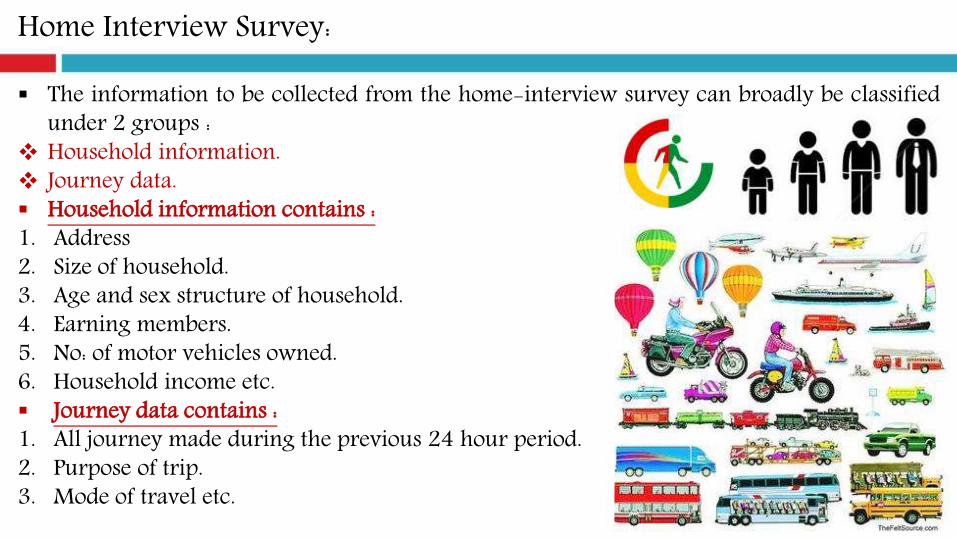
The information to be collected from the home-interview survey can broadly be classifiedunder 2 groups :
Household information. Journey data. Household information contains :1. Address2. Size of household.3. Age and sex structure of household.4. Earning members.5. No: of motor vehicles owned.6. Household income etc. Journey data contains :1. All journey made during the previous 24 hour period.2. Purpose of trip.3. Mode of travel etc.

Road-side Interview Survey:
Road-side interview survey is one of the methods of carrying out a screen-line or cordonsurvey.
The road-side interview survey can be done either directly interviewing drivers of vehiclesat selected survey points or by issuing prepaid post cards containing questionnaire to allor sample of the drivers.
The survey points are selected along the junction of the cordon-line or screen-line withthe roads.
Less than 5000 population – External cordon is sufficient. For dual carriageways or roads with very little traffic the traffic in both the directions is
dealt with simultaneously. In other cases the traffic in 2 directions will be interviewed at different times. If the survey covers most of the day it may be sufficient to interview traffic in one direction
only and to assume that the journeys in the opposite direction are the same as the directioninterviewed.

Post-card Questionnaire Survey:
In this method, reply-paid questionnaires are handed over to each of the drivers or asample of them at the survey points and requesting them to complete the information andreturn by post.
The method avoids delay caused to the drivers by direct road-side interview method butsuffer from disadvantage that the response may not be good.
Registration Number Plate Survey:
Registration number plate survey consists of nothing the registration numbers of vehiclesentering or leaving an area at survey points located on the cordon line.
By matching the registration numbers of vehicles at the points of entry and exit from thearea, one is enabled to identify 2 points on the paths of the vehicle.

Tags on vehicles:
In this method, at each point where the roads cross the cordon line, vehicles are stoppedand a tag is affixed, usually under a windscreen wiper.
The tags for different survey stations have different shapes and/or color to identify thesurvey stations.
The vehicles are stopped again at the exit points where the tags are removed. The times of entering and leaving the area may be marked on the tags in order to enable
the journey times to be determined.
Accuracy of O-D Survey data:
The data obtained from the home-interview survey is usually cross-checked with the dataobtained from the screen-line and cordon counts.

CASE STUDYBhavnagar – Vataman Road (Gujarat)
Gujarat Infrastructure Development Board (GIDB)GANDHINAGAR
Survey Location:
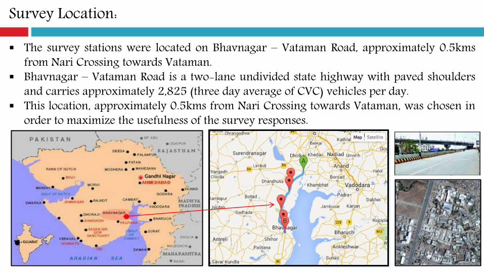
The survey stations were located on Bhavnagar – Vataman Road, approximately 0.5kmsfrom Nari Crossing towards Vataman.
Bhavnagar – Vataman Road is a two-lane undivided state highway with paved shouldersand carries approximately 2,825 (three day average of CVC) vehicles per day.
This location, approximately 0.5kms from Nari Crossing towards Vataman, was chosen inorder to maximize the usefulness of the survey responses.

Time of Survey:
A Classified Volume Count (CVC) survey was conducted, as part of the study, in order toobtain traffic volume. The counting was started Thursday, September 1, 2005.
Data was to have been collected for 72 hours – from 07:30 AM until 07:30 AM next day-on all three days.
Since the Bhavnagar – Vataman road carries a substantial amount of commercial traffic;the roadside interviews were conducted for 24 hours on Sunday, September 4.
Data was to have been collected for 24 hours – from 08:00 AM until 08:00 AM next day.
Selecting the Survey Sample for Origin-Destination (O-D) Survey:
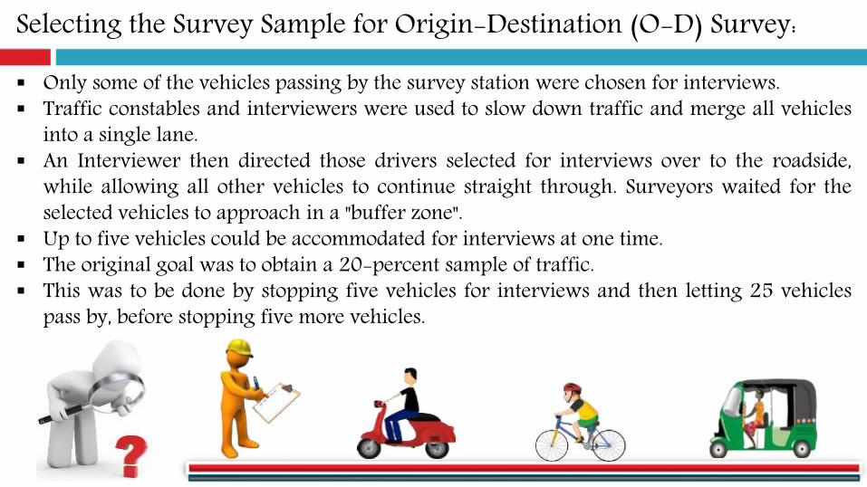
Only some of the vehicles passing by the survey station were chosen for interviews. Traffic constables and interviewers were used to slow down traffic and merge all vehicles
into a single lane. An Interviewer then directed those drivers selected for interviews over to the roadside,
while allowing all other vehicles to continue straight through. Surveyors waited for theselected vehicles to approach in a "buffer zone".
Up to five vehicles could be accommodated for interviews at one time. The original goal was to obtain a 20-percent sample of traffic. This was to be done by stopping five vehicles for interviews and then letting 25 vehicles
pass by, before stopping five more vehicles.

Selecting the Survey Sample for Origin-Destination (O-D) Survey:
However, after operating the stations for a short time, it became apparent that a muchlarger sample could easily be obtained without jeopardizing traffic safety.
As soon as the vehicles previously selected for interviews had left the survey station andmerged back into traffic on road, the traffic constables and interviewers would direct thenext five vehicles over to the roadside (rather than waiting for 25 vehicles to pass bybefore starting to select again).
While these vehicles were being interviewed, all other traffic was permitted to pass by thesurvey station.
When it was time to direct more vehicles over to the survey station, the traffic constablesand interviewers would normally choose the next five vehicles.
Interview Questions:
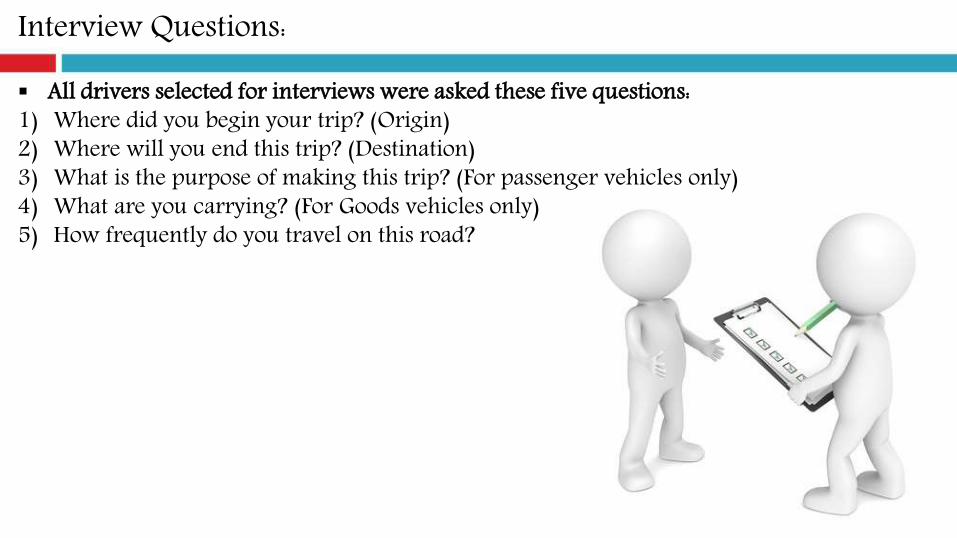
All drivers selected for interviews were asked these five questions:1) Where did you begin your trip? (Origin)2) Where will you end this trip? (Destination)3) What is the purpose of making this trip? (For passenger vehicles only)4) What are you carrying? (For Goods vehicles only)5) How frequently do you travel on this road?

O-D Matrix (Bhavnagar – Vataman Road):

Key Findings:
Maximum CAR run from Bhavnagar to Ahmadabad (21%) followed by Ahmadabad toBhavnagar (14%).
Maximum LCV run from Ahmadabad to Bhavnagar (21%) followed by Surat to Bhavnagar(9%).
Maximum GOVERNMENT BUS run from Nari to Bhavnagar (34%) followed by Bhavnagarto Nari (31%).
Maximum PRIVATE BUS run from Bhavnagar to Ahmadabad (18%) followed byAhmadabad to Bhavnagar (17%).
Maximum TRUCK run from Nirma to Bhavnagar (10%) followed by Bhavnagar to Nari(8%).
Maximum MULTI AXEL run from Ahmadabad to Bhavnagar (6%) and Amreli to Vadodarafollowed by Bhavnagar to Vadodara (4%).

Sample Questionnaire:
Recreation and Highway Travel Survey (Year 2000)Inyo & Mono County
Topaz Station US 395 and Nevada State Line
Sweetwater Station Jct. US 395 and SR 182

Sample Questionnaire:
Royal Government of Cambodia Road Asset Management Project
Community survey activity
