origin, evolution and paleoclimatic-ecologic significance of sand dunes in the mutonga drainage,...
TRANSCRIPT

Youmal of African Earth Sciences, Vol. 5, No. 5, pp. 491--499, 1986 0731-7247/86 $3.00 + 0,00 Printed in Great Britain Pergamon Journals Ltd.
Origin, evolution and paleoclimatic--ecologic significance of sand dunes in the Mutonga drainage, Mount Kenya
WILLIAM C. MAHANEY
Geography Department, Atkinson College, York University, 4700 Keele Street, North York, Ontario, Canada M3J 2R7
and
JOHN R. SVENCE
Botany Department, University of British Columbia, Vancouver, British Columbia, Canada V6T 2B1
(Received for publication 22 January 1986)
Abstract--An extensive dune field in the Mutonga drainage on the eastern flank of Mount Kenya yielded information regarding the nature and age of the sediments, soil characteristics, vegetation distribution and paleoclimate. Surface sediments consist of silty--clayey materials with ~40% sand, whereas subsurface sediments consist largely of poorly altered sands, possibly of wind-blown origin. The data suggest that desiccation, be~nning about ~ 1500 yr ago, resulted in removal of vegetation and emplacement of dunes over an older surface that may have a wind-blown origin. This interpretation supports the pollen chronology for the Mount Kenya area.
INTRODUCTION
THE LATE-HoLOCENE pollen sequence for the Mount Kenya area (Figs. 1 and 2) depicts cooler and drier conditions (<2000 yr BP) for Mount Kenya following the wetter and presumably warmer climatic optimum (4500-2000 yr BP) (Coetzee 1967). Aside from late Holocene glacial advances of low magnitude (Mahaney 1982a,b, 1983, 1984a,b, 1986) and minor amounts of stream alluviation (Mahaney 1984b), there is little geomorphic evidence to substantiate cooler and drier climate after 2000 radiocarbon years ago. During the course of Quaternary stratigraphic investigations on Mount Kenya (1983/84) we uncovered an extensive dune field in the Mutonga drainage in the Mount Kenya ericaceous zone. In this paper the properties of the soil formed in a representative dune (Fig. 2), as well as particle size, soil mineralogy and chemistry, and vege- tation properties, are used to discuss the origin and evolution of the dune field and its paleoclimatic significance.
reaching 2250 mm (at 2500 m); the northern slopes are driest with ~ 1000 mm annually. On the western flank of the mountain, precipitation rises from ~ 500 mm at Naro Moru (2000 m) to ~ 1000 mm on the high moorland (~3500 m), and then drops in the central peaks areas (~4300 m) to ~750--800 mm (Coetzee 1967). Evapo- transpiration data are not available for Mount Kenya. Temperature extrapolations (Coe 1967, Thompson 1966) suggest that temperatures at 4200 m average 3.1- 3.6°C (from observations taken during two periods in
FIELD AREA
A number of deposits of postglacial dunes are found in the ericaceous zone of Mount Kenya (Figs. 1 and 3). These deposits have been assigned a postglacial age on the basis of topographic position (Baker 1967), as well as degree of soil expression (Mahaney 1979, 1980, 1981, 1982a,b, 1984b).
The ericaceous and Afroalpine zones rise from ~ 3100 m to the summit of Mount Kenya at 5199 m. Precipi- tation derived from the Indian Ocean is delivered by the Tropical Easterly Wind Belt and the classical monsoon system. The southeast slopes are wettest with rainfall
Fig. 1. Location of dunefieid between Mugi Hill and the Giant's Billiard Table, Mount Kenya Afroalpine area.
491

492 W . C . ]V[AHANEY and J. R. SPENCE
i 14 C POLLEN CHRONOLOGY < ~ EPOCHS GEOLOGIC EVENTS CHRO- (SACRED LAKE~
~.>.,,~ NOLOGY =nd VEGETATION HUMIDITY ZONE /TEMPERATURE
0.3?-
.07-
LEWIS
~'~O ~ ADVANCE
-.,~" TYNDALL DRY MONTANE
~" RAIN FOREST ~ ' ADVANCE
DUNE BUILDING BEGINS
bJ
z B Z 2.0- A L L U V I A T I O N (DRY)
w MAXIMUM
o C HUMID CaLL UVIATION
o FOREST
4.0 - _j (WET) D
LOWER o E TIMBERLINE
DARWl N F (WET) -.t-
HUMID F O R M AT I ON G MONTANE
FOREST
(WET)
COOLER?
CL IMATIC
OPTI MUM
Y
COOLER x
WARMER
w T . O H+Cb ho¢ixon with plonl fro(IWlimtl in olluvioI fan { l i t l TVZ8) ,
O. Ab h~, l lan (site TV4),1940~120yrlk BR. (G( lk-8273) IOQ20) 66701170y r l .O .R (Gok-82?6) C. Ab hori,on (site LND),34~{~qOOym. II.~'(IIGS-7*56) Z. Ab horizon in al luvial fan (s te TVS3),6840s16Oyrs B.P DAb horilon (s~te T V 3 3 ) t 4 3 1 0 t i l O I R l k B P ~ k - 8 2 i 4 ) ( B e t a - 9 0 8 ? ) E Plant fragments in alluvial fan ( s i l l ONT 3) t4375 s IOOyrs. Rp (SGS- 753) F Ab horizon ( • l l TV33) ,4480 I I60y rs . BiD(GOK-§215) G Or(Ionic-r ich sediment a# 140cm.Clepth In al luv ia l fa~1 (site LNIS}, 5280= I lO BP(HGS-757)
Fig. 2. Geologic, radiocarbon and pollen chronologies for the mid- to late-Holocene on Mount Kenya, East Africa.
1948; Coetzee 1967, Hedberg 1964). Precipitation drops from the western to the northern and eastern flanks (Pedgley 1966), affecting leaching effectiveness in the soil systems.
Vegetation
The dominant timberline species is Hagenia abyssinica (Rosaceae). Above timberline a zone of shrub-steppe (the ericaceous zone of Hedberg 1951) is much more extensive on the northeastern side than on other flanks of the mountain, extending from timberline to about 3700 m. Above this elevation the vegetation gradually merges into the nival zone (Hedberg 1964, Coe 1967). The study area (Fig. 3) is located at about 3200 m, in the lower part of the ericaceous zone.
METHODS
A study site was selected on a topographically high and well-drained dune crest (Fig. 4). Soil samples were collected from each horizon described in the field follow- ing the nomenclature of the Soil Survey Staff (1951, 1975) and Birkeland (1984). Particle size analyses (Soil Survey Staff 1951, Folk 1968) were performed on the <2 mm fractions; coarse grade sizes (>63/zm) were deter- mined by sieving, whereas fine grained sizes (<63/zm) were calculated by sedimentation following procedures established by Bouyoucos (1962) and Day (1965). Chemical analyses of the < 2 mm fractions include pH on a 1:1 paste, total organic nitrogen by the Kjeldahl
method (Bremner 1965); cation exchange capacity and extractable cations with 1N NH4OAc (Peech etal. 1947, Schollenberger and Simon 1945). Organic carbon was determined by the Walkley-Black (1934) method. Iron was extracted with sodium dithionite-citrate (Fed) according to procedures outlined by Holmgren (1967), and pyrophosphate extractable iron (Fep) was deter- mined following procedures established by McKeague and Day (1966), using atomic absorption spec- trophotometry.
The mineralogy of the < 2/zm grade size was deter- mined after agitating samples with a cell dismembrator and pretreating with H202. Clay was centrifuged onto ceramic tiles, air dried, and X-rayed following proce- dures established by Whittig (1965) and Jackson (1956).
Plant collections and observations were made in July 1984. As far as possible, deposits were mapped at the time collecting was done, but the aerial extent of the dunefield was mapped from 1:50,000 aerial photo- graphs. Vegetation was sampled with a 2 m x 2 m quadrat. Species cover was assessed by the following scale: + = trace, essentially no cover, 1 = 1%, 2 = 1- 5%, 3 = 5-25%, 4 = 25-50%, 5 = 50-75%, 6 = 75- 100%. All nomenclature follows Hedberg (1957).
RESULTS AND DISCUSSION
Compound paleosol
Site BT1 was selected on a representative dune surface (Fig. 3). A soil profile formed in the crest of a dune

Origin and evolution of sand dunes in the Mutonga drainage, Mount Kenya 493
Fig. 3. Sand dunes in the Mutonga Trench, eastern flank of the Mount Kenya Afroalpine area.
revealed a fairly well-developed Entisol (ground soil) over a buried Entisol. Together they form a compound paleosol (Table 1). This paleosol profile contains a ground (surface) soil that coarsens downward with loam textures in the solum and sandy loam textures in the subsoil. Soil horizon propert ies show little variation with depth in the surface soil; however consistence and the nature of some soil horizon contacts may be related to root frequency and to frost heave processes. In particu- lar, a change in consistence between the A12 and A13 horizons may be caused by the decrease in fine root (1-2 m m diameter) frequency which tapers off abruptly at
50 cm depth. Wavy-transit ional boundaries often seen in the surfaces of paleosols on Mount Kenya (Mahaney 1981, 1982a, 1984a) and elsewhere in other alpine areas in western N Amer ica (Mahaney 1974, 1978, Mahaney et al. 1984a,b, Mahaney and Sanmugadas 1983) is attri- buted to frost heave of surface material .
The usual 10 Y R hues observed in the ground soil intensify to 7.5 Y R in the buried pedon suggesting larger amounts of organic mat te r and ' f ree ' iron oxides, as well as increased wetness. Because both the A b and Cbox horizons have an aeolian origin no lithological discon- tinuities were interpreted f rom the data. The underlying paleosol is an Entisol (thin pedon without a B horizon) formed in a combinat ion of aeolian silt (Ab) and aeolian sand (Cbox). The absence of roots below the ~ 5 0 cm level, coupled with a dry climate (see Field Area data), suggest that there is likely little biogeochemical contami-
Table 1. Paleosol BTI* in the Mutonga drainage, Mount Kenya Afroalpine area
Depth Horizon (cm) Description*
All 0--12
A12 12-43
A13 43-53
Clox 53--76
Ab 76--94
Cbox 94+
Brownish black (10 YR 3/1 m) (10 YR 3/2 m) (10 YR 3/2 d) loam, very friable consistence, nonplastic and nonsticky, and wavy, transitional boundary Brownish black (10 YR 3/2 m) and dark brown (10 YR 3/3 d) loam, very friable consistence, nonplastic and nonsticky, and wavy, transitional boundary Brownish black (10 YR 2/2 m) and dark brown ( 10 YR 3/4 d) loam, friable consistence, nonplastic and nonsticky, and clear, abrupt boundary Dark brown (10 YR 3/3 m), brownish black ( 10 YR 2/3m) and dull yellowish brown (10 YR 4/3 d) sandy loam, friable consistence, nonplastic and nonsticky, and clear abrupt boundary Brownish black (7.5 YR 2/2 m) and dark brown (10 YR 314 d) loam, friable consistence, nonplastic and nonsticky and wavy, transitional boundary. Radiocarbon dated at 1490 _+ 80 YR BP (Beta - 10820) Brown (7.5 YR 4/6 m) and yellowish brown (10 YR 5/6 d) sand, loose consistence, nonplastic and nonsticky
* Profile BT1 is located on Fig. 1. t Soil descriptions follow Birkeland (1984) and Soil Survey Staff
(1951, 1975). Colors were taken from Oyama and Takehara (1970) in the moist (m) and dry (d) states. Consistence is given in the moist state.

494
IJ "-'P -I
9 9 " 9 9
SIEVE ANALYSIS
÷t +2 *3
W. C. MAHANEY and J. R. SPENCE
MATERIAL <2000p - REPRESENTATIVE TEST SAMPLE
SEDIMENTATION ANALYSIS
",4 *5 *6 ÷7 +8 *9 +10 +11 "12 '~13 4.14
-I
r~
99
90
80
70
6O
SO
4,0
30
2O
I0
0.01 2000
/
/ t It ..
../~ 7-
Y
/
j f
/ ~ . - = o
• . ' 4
. . . . . . . .
Al l A I2 A I3 Cox
BT1
Ab C box - --
Soil Profi e
I000 500 250 '25 63 31.2 15.6 7.8 S.9 1.95 0 . ~ 0.49 0.24
WENTWORTH GRADE SCALE (MICRONS)
Fig. 5. Particle size diagram for the BT1 soil profile, Mutonga dunefield, Mount Kenya Afroalpine area.
0 i2 00E
nation in the Ab horizon which would affect the radiocarbon date of 1490 + 80 yr (13C adjusted) (Beta- 10820).
Particle size
Analysis of the particle size data in Fig. 5 shows that the A l l , A12, A13 and Ab horizons of the compound paleosol have similar particle size ratios (approximately 45% sand, 40% silt and 15% clay). The Cox and Cbox horizons are coarser, and the Cbox horizon has the most coarse texture. Calculation of mean phi values for these distributions using the 16th, 50th and 84th percentiles, gives the following values:
A l l 4.6 A12 4.7 A13 4.5 Cox 3.6 Ab 4.5 Cbox 1.8.
These data confirm that, in both the buried paleosol and in the ground soil, there is a considerable coarsening trend downward. The data also show that the mean phi center of gravity for both the surface solum and the paleosolum (Ab horizon) are approximately the same.
Soil mineralogy and chemistry
X-ray analysis of the BT1 profile revealed a similar mineralogic composition of the <2/zm fraction. Quartz and plagioclase feldspar dominate throughout with les- ser amounts of magnetite, hematite and pyroxene. There are no allochthonous minerals in the <2 /xm fraction which might suggest an airfall origin. No crystal- line clay minerals were detected in any horizons.
The pH profile (Table 2) is fairly uniform in paleosol BT1, ranging from 6.0 to 6.4, and suggesting little if any downward movement of H + ions. Measurements of electrical conductivity in each horizon show that total salt content is low (<0.1) throughout the profile. Ratios of Ca/Mg (exchangeable ions) diminish with depth in the
Origin and evolution of sand dunes in the Mutonga drainage, Mount Kenya 495
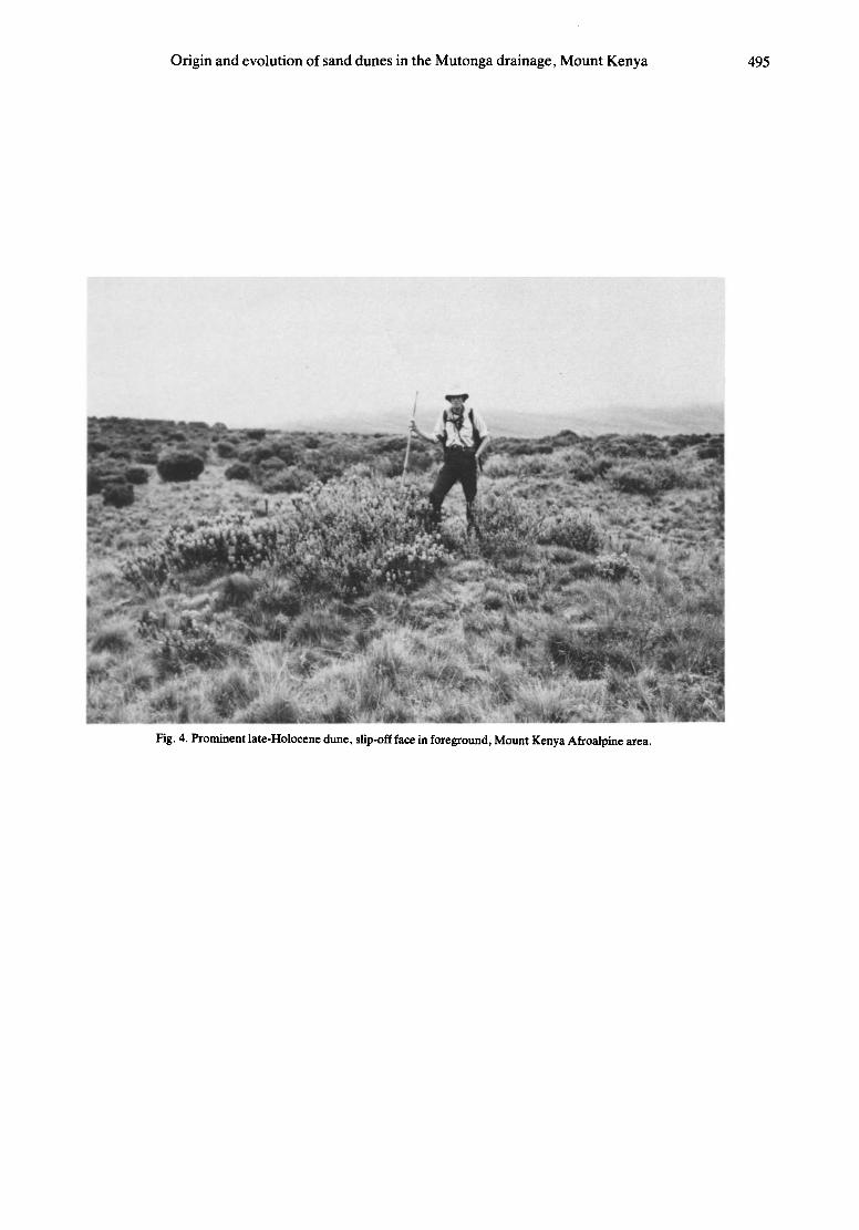
Fig. 4. Prominent late-Holocene dune, slip-off face in foreground, Mount Kenya Afroalpine area.

496 W . C . MAHANEY and J. R. SPENCE
Y
Fig. 6. Dunefield south of the Mutonga Trench, Mount Kenya Afroalpine area.

Origin and evolution of sand dunes in the Mutonga drainage, Mount Kenya 497
Table 2. Selected chemical properties* of the < 2 mm fractions of the soil horizons in profile BT1, Mount Kenya ericaceous zone
Fe (%) in extract Exchangeable cations (meq/100g)
CEC Base E.C. Organic Citrate- Depth pH (meq/ saturation (mmhos/cm carbon Nitrogen Dithionite Pyrophosphate
Site Horizon (cm) (1:1) Na + K + Ca 2+ Mg3+ 100g) (%) 25*) (%) (%) Fe d Fep
BT1 A l l 0-12 6.2 0.05 0.59 8.40 1.90 30.0 36 0.04 9.64 0.606 1.18 0.48 A12 12--43 6.2 0.06 0.41 5.17 1.08 28.2 24 0.03 7.78 0.544 1.12 0.57 A13 43-53 6.4 0.06 0.17 4.59 1.44 19.6 32 0.02 4.03 0.278 1.20 0.48 Cox 53-76 6.1 0.06 0.16 0.94 0.34 14.5 10 0.01 3.12 0.179 1.23 0.33 Ab 76-94 6.0 0.08 0.28 1.12 0.41 20.0 9 0.01 3.52 0.256 1.23 0.45
Cbox 94+ 6.0 0.05 0.14 0.38 0.11 9.3 7 0.01 0.65 0.050 0.98 0.03
* Site is located on Fig. 3.
profile, indicating a low leaching power, and little down- ward movement. The exchangeable cations Na and K do not display any noticeable trends that could be used to prove downward movement; the high amount of K in the A l l horizon may result from plant recycling. Taken together these data tend to confirm that the radiocarbon date for the BT1-Ab horizon is likely unaffected by biogeochemical contamination.
Base saturation decreases with depth in the ground soil reaching the lowest level in the buried profile. This distribution tends to support the hypothesis that the buried pale.sol formed in a wetter climate some time priorto 1490 + 80 yr BP (presumably during the climatic optimum), while the ground soil formed in a drier climate (Fig. 2). The distributions of organic carbon and nitrogen with depth show a slight decline downward in the ground soil, followed by a rise in the buried A horizon (buried soil solum), and subsequent decline in the Cbox horizon.
Extractable Fe provides important information on the relative ages of the two paleosols (e.g. insoluble Fed) and movement within the profile from the distribution of organically bound Fe (Fep). As shown in Table 2 citrate- dithionite Fe increases only slightly with depth into the buried pale.sol and then decreases somewhat in the subsoil of the buried pale.sol. This data suggests that the ground soil might comprise locally redistributed and preweathered material supporting the mineralogical data from the <2 /xm fraction. The pyrophosphate extractable Fe distribution suggests little movement in the profile. When compared with the soil colors in Table 1, the Fe values in the Ab horizon do not provide an explanation for the redder (7.5 YR) hues. Fibrous organic materials in the Ab horizon, however, had reddish-brown (7.5 YR) hues which might affect the overall soil matrix color.
Pale,climatic-ecologic interpretation
The palynological data available for the area shown in Fig. 2 (Coetzee 1967) show that a climatic optimum (warmer and wet) period ended after 2000 radiocarbon years ago. This was followed by a drier and cooler period (pollen zone Z) which culminated in relatively recent glacial advances (Mahaney 1982b, 1983, 1984a, 1985). The data shown in this paper suggest that around 1500 radiocarbon yr ago the ancient land surface was covered
with presumably new and fresh geological materials, emplaced as an intricate complex of dunes. Because the Cox and Cbox horizons are so coarse compared with the soil sola, it is presumed that the major airfall influx of silt may have been preceded by movement of coarser sand, possibly by saltation along the land surface.
At higher elevations in the ericaceous zone vegetation is more open than in the dunefield, with much bare rocky soil occurring. This would suggest that if a minor climatic deterioration (cooler and drier still) phase were to ensue, we might expect that the vegetation cover in the dunefield would decline, thus destabilizing the existing dunes and setting the stage for new and active air-fall influxes of material.
The dunefield is located in the ericaceous belt as defined by Hedberg (1951). Erica arborea and Phillipia keniensis are the most important shrub species in this zone, although Protea kilimandscharica becomes impor- tant on dry and rocky interfluves. The dwarfed nature of the shrub stratum in the ericaceous zone is apparently maintained by recurrent fires (Hedberg 1951). No evidence of fire was found in the dunefield, although abundant evidence for fire exists in the surrounding vegetation. The shrub stratum in the dunefield is strik- ingly different from that in the surrounding vegetation (see Fig. 6). Instead of Erica and Phillipia, the dominant species are Alchemilla argyrophylla and Artemisia afra, with lesser amounts of Euryops brownei. Cover data for three different-sized dunes are presented in Table 3.
Table 3. Cover data for three dunes; large (>4 m across, >1 m high); medium (>3 m across, >0.5 m high), and small (>2 m across, <0.5 m
high)
Species Large Medium Small
A r t e m i s i a a f ra 5 4 4 A l c h e m i l l a a r g y r o p h y l l a 2 3 - -
E u r y o p s b r o w n e i 2 - - A g r o s t i s spp. 3 3 3 H a b e n s t r e t i a d e n t a t a 2 1 - F e s t u c a pUger i 1 - -
C a r d u u s p l a t y p h y l l u s 1 1 + D i e r a m a p e n d u l u m 1 - - C o n y za s u b s c a p o s a + - + H e l i c h r y s u r a o d o r a t i s s i m u m + + -
T r i f o l i u m sp. + - - H a p l o s c i a d i u m a b y s s i n i c u m + - - Bar t s ia a b y s s i n i c a + - -
Totalcover 86.5% 68.5% 52.5%
kF~S ~ : 5 -9

498 W . C . MAHANEY and J. R. SPENCE
Table 4. Distribution of four shrub species on 51 dunes
Table 5. Available water calculated from field capacity (1/3 bar) and permanent wilting point (15 bar) moisture values
Number Species of dunes
Artemisia afra 9 A Ichemilla argyrophylla 18 Euryops brownei 2 Erica arborea A. afra + A. argyrophylla 9 A. afra + E. brownei 2 A. argyrophylla + E. brownei 1 A. afra + A. argyrophylla + E. brownei 8 A. afra + E. brownei + E. arborea 1 All four species 1
15 bar 1/3 bar (permanent
Soil Depth field wilting Available H20 site* Horizon (cm) capacity point) (F.C.-P.W.P.)
BT1 A l l 0-12 36.4 29.4 7.0 A12 12-43 31.8 25.8 6.0 A13 43--53 28.2 15.5 12.7 Cox 53-76 25.2 10.9 14.3 Ab 76-94 27.0 13.9 13.1
Cbox 94+ 14.8 7.4 7.4
* Site BT1 is located on Fig. 3.
Total cover varies from 86.5% on the largest dune to 52.5% on the small dune surface. The shrub species dominates the cover on all three dunes. A sparse under- story ofAgrostis spp. and a variety of herbs exist beneath the shrub stratum.
Presence or absence of the shrub species was noted on 51 dunes. These data are presented in Table 4. Of those dunes with a single shrub species, 18 have A. argyrophylla, 9 have A. afra, and only2 have E. brownei. Among dunes with more than one shrub species, the most common combinations are A. afra-A. argyrophylla, or all three shrubs. E. brownei is signifi- cantly more likely to be found with another shrub species than it is to be found alone (g 2 = 16.25, d.f. = 1, signifi- cance <0.001). A. afra is also significantly more likely to occur in mixed situations than alone 0( 2 = 21.44, d.f. = 1, significance <0.001), but is much more com- mon alone than E. brownei. A. argyrophylla appears to do equally well alone, or with another species. Erica arborea was only noted twice, both times associated with the other species.
Age since stabilization and revegetation of the dunes is unknown, but must be less than 1490 + 80 yr BP. The longevity of the shrub species is unknown, but is prob- ably on the order of 10-100 yr. It thus seems likely that at least several generations of shrub species have col- onized in the dunes. Based on the data in Table 3, there appears to be a difference in ability to establish on a dune between the shrubs. Assuming that no major differences exist in physical properties between dunes with a single shrub species and those with more than one, a hypothesized colonization sequence would be initial establishment of either A. afra or A. argyrophylla, with the latter species more likely to colonize first. This is followed by establishment of E. brownei and occasional E. arborea under the canopy of the initial colonizers. Such a sequence might occur, both following initial dune stabilization, as well as death of a previous shrub species. An alternative possibility would be that all shrubs can establish on the dunes equally well, and A. afra and A. argyrophylla are better competitors on the dunes than the other two species.
The data presented above indicate that this dunefield has affected the character of the vegetation in the area for at least the last 1500 yr. The soil in the dunefield, with more coarse sands than in the surrounding non-dune
areas, holds low moisture (Table 5), which may in turn favor the species in the dunefield over Erica and Phil- lipia, which dominate most of the ericaceous zone on Mount Kenya. This interpretation supports the known ecology of A. afra, which is considered characteristic of drier areas than either Erica or Phillipia (Coetzee 1967). A. afra is especially prominent on the northeast side of Mount Kenya in areas like the dunefield, such as sandy alluvial deposits. This has important implications for pollen studies in East Africa, since A. afra is an impor- tant indicator of xeric conditions in paleoclimatic interpretations.
CONCLUSIONS
The data discussed in this paper tend to support the pollen chronology developed by Coetzee (1967) for the Mount Kenya area. Particle size distributions for a compound paleosol show that in each case the emplace- ment of silty-aeolian material follows development of a sandy wind-blown surface. Since the Ab horizon in the buried paleosol is dark in color, but does not contain live roots, we conclude that the paleosurface was formerly stabilized by a vegetation cover just as it is today; probably consisting of the same species presently found on the dunes. A deterioration in present-day climate may well have the effect of producing a new and active dune field.
Acknowledgements--This research was supported by grants from the National Geographic Society (Washington, DC) and the Natural Sciences and Engineering Research Council of Canada. Field work was authorized by The Office of the President, Geologic Survey, and Mountain National Parks, Republic of Kenya. We thank Simon Kamakia and Joseph Camillo for assistance in the field. Laboratory analyses were completed in the Geomorphology and Pedology Labo- ratory in Atkinson College with the help of Drew Clarke and Rick Boyer. We are particularly indebted to Tor and Sue Allan (Hunters East Africa Ltd), and staff at Meru Mountain Lodge for logistical support.
REFERENCES
Baker, B. H. 1967. Geology of the Mount Kenya Area Rept. No. 79, Geological Survey of Kenya.
Birkeland, P. W. 1984. Soils and Geomorphology, Oxford. Bouyoucos, G. J. 1962. Hydrometer method improved for making
particle size analyses of soils. Agron. J. 65,464--465.

Origin and evolution of sand dunes in the Mutonga drainage, Mount Kenya 499
Bremner, J. R. 1965. Total nitrogen. In: Methods of Soil Analysis (Edited by Black, C. A.), pp. 1149-1176. Am. Soc. Agron., Madi- son, WI.
Coe, M. J. 1967. The Ecology of the Alpine Zone of Mr. Kenya. Junk, The Hague.
Coetzee, J. A. 1967. Pollen analytical studies in East and Southern Africa. Palaeoecol. Afr. 3, 1-146.
Day, P. 1965. Particle fractionation and particle size analysis. In: Methods of Soil Analysis (Edited by Black, C. A.), pp. 545-567. Am. Soc. Agron., Madison, WI.
Folk, R. L. 1968. Petrology of Sedimentary Rocks, Hemphill Drawer M., University Station, Austin, Texas.
Hedberg, O. 1951. Vegetation belts of the East African mountains, Svensk ~ot. Tidsk. 45,140-202.
Hedberg, O. 1957. Afroalpine vascular plants. A taxonomic revision. Symb. Bot. Upsal. 15, 1-411.
Hedberg, O. 1964. Features of Afroalpine Plant Ecology, Aimquist and Wiksells, Uppsala.
Holmgren, G. S. 1967. A rapid citrate dithionite extractable iron procedure. Soil Sci. Soc. Am. Proc. 31,210-211.
Jackson, M. L. 1956. Soil Chemical Analysis--Advanced Course, Dept. Soil Science, U. of Wisconsin, Madison.
Mahaney, W. C. 1973. Neoglacial chronology in the fourth of July Cirque, central Colorado Front Range. Bull Geol. Soc. Am. 83, 161-170.
Mahaney, W. C. 1974. Soil stratigraphy and genesis of Neoglacial deposits in the Arapaho and Henderson Cirques, Central Colorado Front Range. In: Quaternary Environments: Proceedings of a Sym- posium (Edited by Mahaney, W. C.), Geographical Monographs, no. 5, pp. 197-240.
Mahaney, W. C. 1978. Late Quaternary stratigraphy and soils in the Wind River Mountains, western Wyoming. In: Quaternary Soils (Edited by Mahaney, W. C.), pp. 223-264. Geoabstracts, Norwich.
Mahaney, W. C. 1979. Reconnaissance Quaternary stratigraphy of Mr. Kenya. Palaeoecol. Afr. XI, 163-170.
Mahaney, W. C. 1980. Late Quaternary rock glaciers, Mount Kenya, Kenya. J. Glaciol. 25,492-497.
Mahaney, W. C. 1981. Paleoclimate reconstructed from paleosols: evidence from the Rocky Mountains and East Africa. In: Quater- nary Paleoclimate (Edited by Mahaney, W. C.), pp. 227-247. Geoahstracts, Norwich.
Mahaney, W. C. 1982a. Correlation of Quaternary glacial and perigla- cial deposits on Mount Kenya, East Africa with the Rocky Moun- tains of western U.S. XI INQUA Congress, Abstracts, Vol. 1, U.S.S.R., 1-9 August 1982, p. 208.
Mahaney, W. C. 1982b. Chronology of glacial deposits on Mount Kenya, East Africa. Palaeoecol. Afr. 14, 25--43.
Mahaney, W. C. 1983. Chronology of Quaternary glacial deposits on Mount Kenya, East Africa. Geol. Ass. Canada Abstracts, p. 256.
Mahaney, W. C. 1984a. Soils of the Mount Kenya area, their forma- tion, ecological and agricultural significance (with soil map, scale 1 : 125,000): discussion. Mountain Res. Develop. 4, 284-285.
Mahaney, W. C. 1984b. Late glacial and postglacial chronology of Mount Kenya, East Africa, Palaeoecol. Aft. 16, 327-341.
Mahaney, W. C. 1986. Late glacial and Holocene paleoclimate of Mount Kenya, East Africa. Zeitschrift far Gletscherkunde und Glazialgeologie, in press.
Mahaney, W. C., Boyer, M. G., Halvorson, D. L. and Sanmugadas, K. 1984a. Glacial chronology of the Rocky Mountains: some prob- lems from observations in western Wyoming. In: Correlation of Quaternary Chronologies (Edited by Mahaney, W. C.), pp. 225- 241. GeoBooks, Norwich, U.K.
Mahaney, W. C., Piegat, J., Halvorson, D. and Sanmugadas, K. 1984b. In: Quaternary Dating Methods (Edited by Mahaney, W. C.), pp. 355-374. Elsevier, Amsterdam.
Mahaney, W. C. and Sanmugadas, K. 1983. Early Holocene soil catena in Titcomb Basin, Wind River Mountains, Western Wyom- ing. Zeitschrift far Geomorphologie 27,265-281.
McKeague, A. and Day, J. 1966. Dithionite- and oxalate extractable Fe and A1 as aids in differentiating various classes of soils. Can. J. Soil Sci. 46, 13-22.
Oyama, M. and Takehara, H. 1970. Standard Soil Color Charts. Japan Research Council for Agriculture, Forestry and Fisheries.
Pedgley, D. E. 1966. Rainfall of Mount Kenya. Weather 21,176-188. Peech, M. L., Alexander, T., Dean, L. A. and Reed, J. F. 1947.
Methods of soil analyses for soil fertility investigations. U.S.D.A. Circ. 757, Washington, D.C., p. 25.
Schollenberger, C. J. and Simon, R. H. 1945. Determination of exchange capacity and exchangeable bases in soils--ammonium acetate method. Soil Sci. 59, 13-24.
Soil Survey Staff 1951. Soil Survey Manual, U.S. Gov't. Printing Office, Washington, D.C.
Soil Survey Staff 1975. Soil Taxonomy. Agriculture Handbook 436, U.S.D.A., Washington, D.C.
Thompson, B. W. 1966. The mean annual rainfall of Mount Kenya. Weather 21, 48--49.
Walkley, A. and Black, I. A. 1934. An examination of the Degtjareff method for determining soil organic matter, and a proposed modifi- cation of the chromic acid titration method. Soil Sci. 34, 29-39.
Whittig, L. D. 1965. X-ray diffraction techniques for mineral identifi- cation and mineralogical composition. In Methods of Soil Analysis (Edited by Black, C. A.), pp. 671-696. Am. Soc. Agron., Madison, WI.