overview of the school mapping exercise overview of school mapping
Post on 19-Dec-2015
264 views
TRANSCRIPT
Overview of the Overview of the
School Mapping ExerciseSchool Mapping Exercise
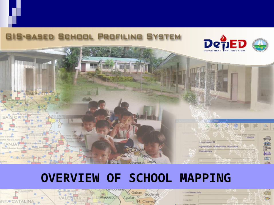
OVERVIEW OF SCHOOL MAPPING
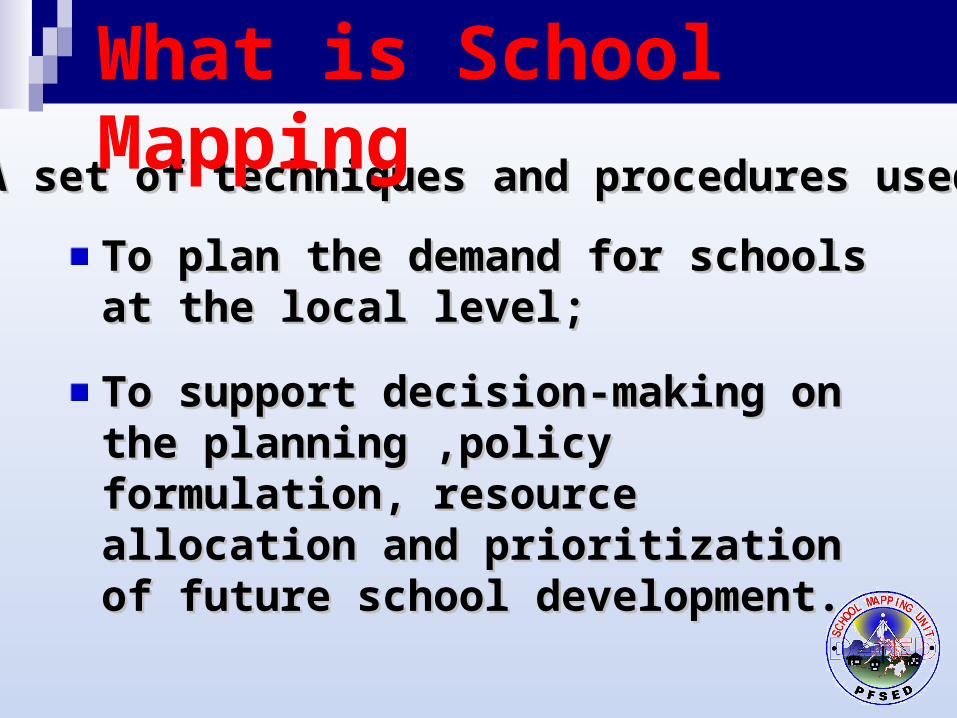
A set of techniques and procedures used:A set of techniques and procedures used:
To plan the demand for schools at To plan the demand for schools at the local level;the local level;
To support decision-making on the To support decision-making on the planning ,policy formulation, planning ,policy formulation, resource allocation and prioritization resource allocation and prioritization of future school development. of future school development.
What is School Mapping
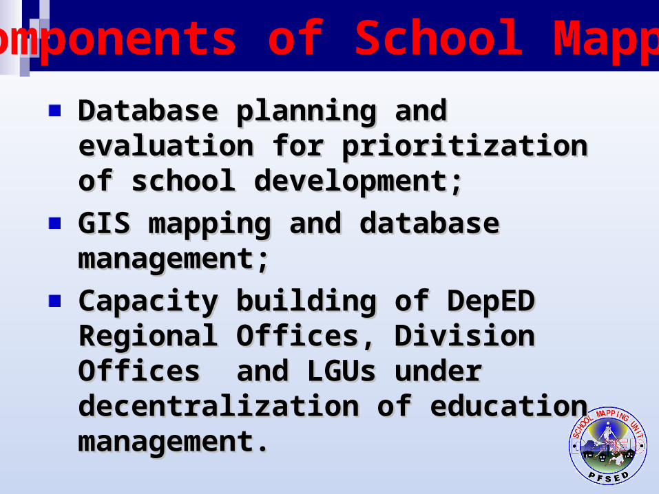
Components of School Mapping
Database planning and evaluation Database planning and evaluation for prioritization of school for prioritization of school development;development;
GIS mapping and database GIS mapping and database management;management;
Capacity building of DepED Regional Capacity building of DepED Regional Offices, Division Offices and LGUs Offices, Division Offices and LGUs under decentralization of education under decentralization of education management.management.
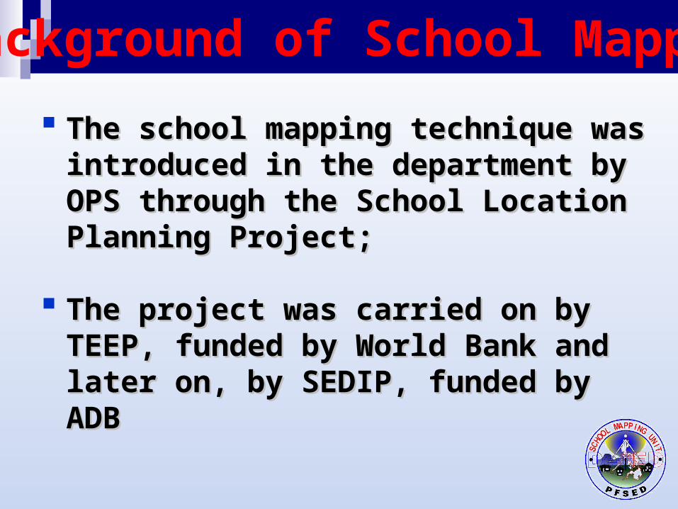
The school mapping technique was The school mapping technique was introduced in the department by OPS introduced in the department by OPS through the School Location Planning through the School Location Planning Project;Project;
The project was carried on by TEEP, The project was carried on by TEEP, funded by World Bank and later on, by funded by World Bank and later on, by SEDIP, funded by ADBSEDIP, funded by ADB
Background of School Mapping
TEEP mapping outputs contributed to the improvement of access to elementary education particularly to the over-all management of pilot elementary schools;
SEDIP mapping aimed to develop a comprehensive database on secondary education and provide a tool for school planning in a more rational and efficient manner.
Background …. 2
In continuing the school mapping In continuing the school mapping exercise, NAMRIA was tapped by the exercise, NAMRIA was tapped by the department to provide the following:department to provide the following:
After turnover of the TEEP and SEDIP After turnover of the TEEP and SEDIP outputs to PFSED-OPS, a need for a more outputs to PFSED-OPS, a need for a more detailed and extensive mapping exercise detailed and extensive mapping exercise should be undertaken to cover the should be undertaken to cover the remaining provinces;remaining provinces;
Background …. 3
Training of selected DepED engineers Training of selected DepED engineers and architects on the basics of hazard and architects on the basics of hazard mapping, map layout, digitizing, data mapping, map layout, digitizing, data gathering and consolidation of data gathering and consolidation of data outputs;outputs;
Assist DepEd in the integration of TEEP Assist DepEd in the integration of TEEP and SEDIP mapping outputs, and SEDIP mapping outputs, development and establishment of a development and establishment of a School Mapping System as one of the School Mapping System as one of the priority projects of PFSED.priority projects of PFSED.
Background …. 4
On-the-job training of trained engineers and architects was pilot-tested in St. Bernard, Southern Leyte during the Guinsaugon incident.
Background ….5
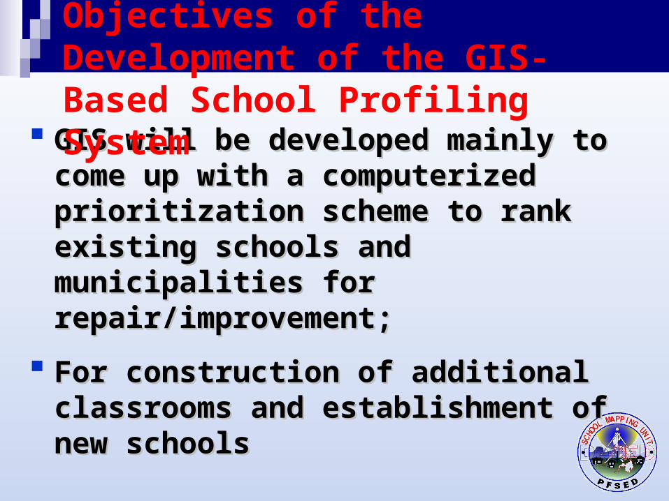
GIS will be developed mainly to come up GIS will be developed mainly to come up with a computerized prioritization with a computerized prioritization scheme to rank existing schools and scheme to rank existing schools and municipalities for repair/improvement;municipalities for repair/improvement;
For construction of additional For construction of additional classrooms and establishment of new classrooms and establishment of new schoolsschools
Objectives of the Development of the GIS-Based School Profiling System
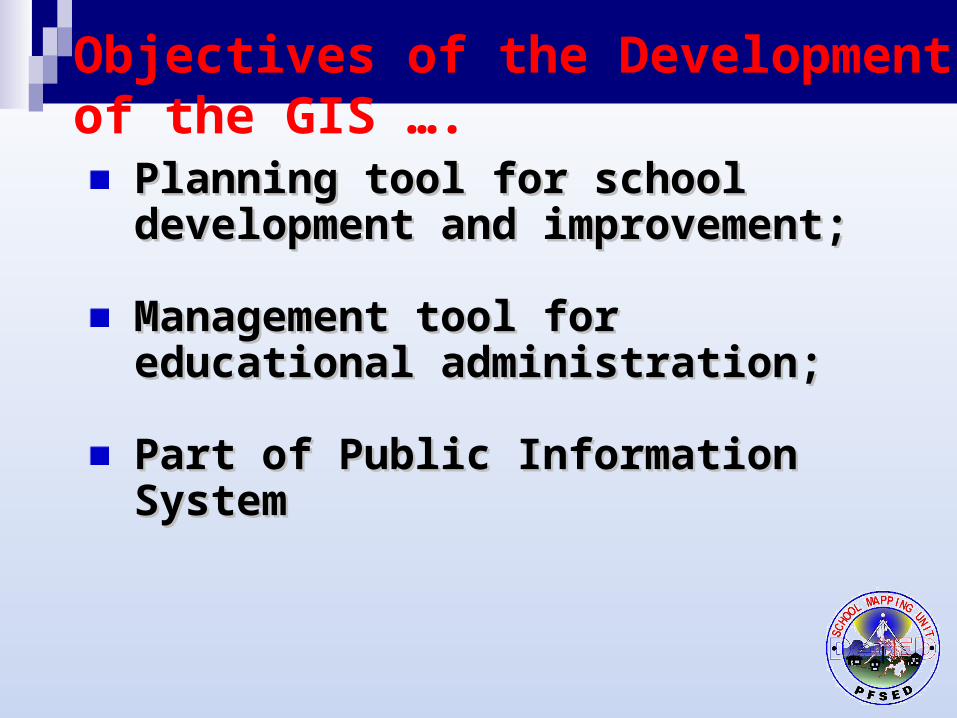
Planning tool for school Planning tool for school development and improvement;development and improvement;
Management tool for educational Management tool for educational administration;administration;
Part of Public Information SystemPart of Public Information System
Objectives of the Development of the GIS ….
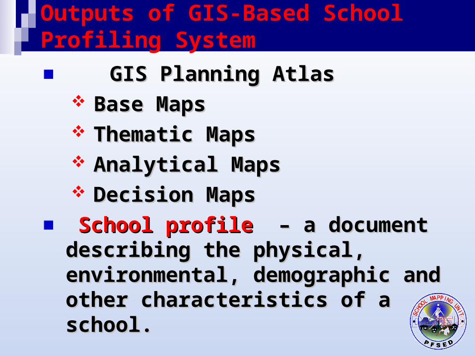
GIS Planning AtlasGIS Planning Atlas Base MapsBase Maps Thematic MapsThematic Maps Analytical MapsAnalytical Maps Decision MapsDecision Maps
School profileSchool profile – a document describing – a document describing the physical, environmental, demographic the physical, environmental, demographic and other characteristics of a school. and other characteristics of a school.
Outputs of GIS-Based School Profiling System
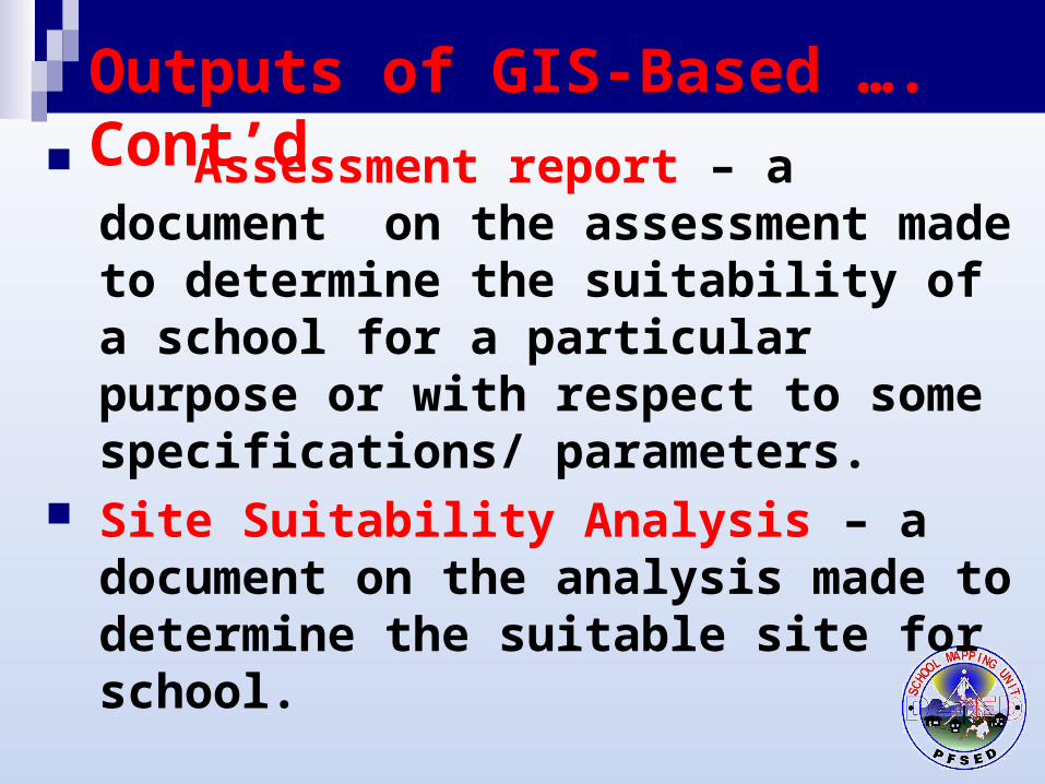
Assessment report – a document on the assessment made to determine the suitability of a school for a particular purpose or with respect to some specifications/ parameters.
Site Suitability Analysis – a document on the analysis made to determine the suitable site for school.
Outputs of GIS-Based …. Cont’d
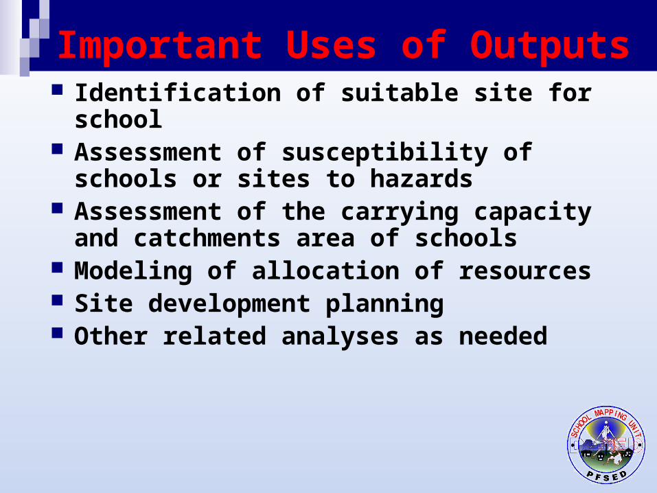
Important Uses of Outputs Identification of suitable site for school Assessment of susceptibility of schools or
sites to hazards Assessment of the carrying capacity and
catchments area of schools Modeling of allocation of resources Site development planning Other related analyses as needed
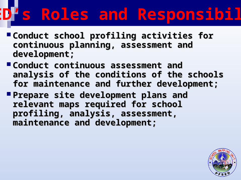
PFSED’s Roles and Responsibilities Conduct school profiling activities for continuous Conduct school profiling activities for continuous
planning, assessment and development;planning, assessment and development; Conduct continuous assessment and analysis of Conduct continuous assessment and analysis of
the conditions of the schools for maintenance the conditions of the schools for maintenance and further development;and further development;
Prepare site development plans and relevant Prepare site development plans and relevant maps required for school profiling, analysis, maps required for school profiling, analysis, assessment, maintenance and development;assessment, maintenance and development;
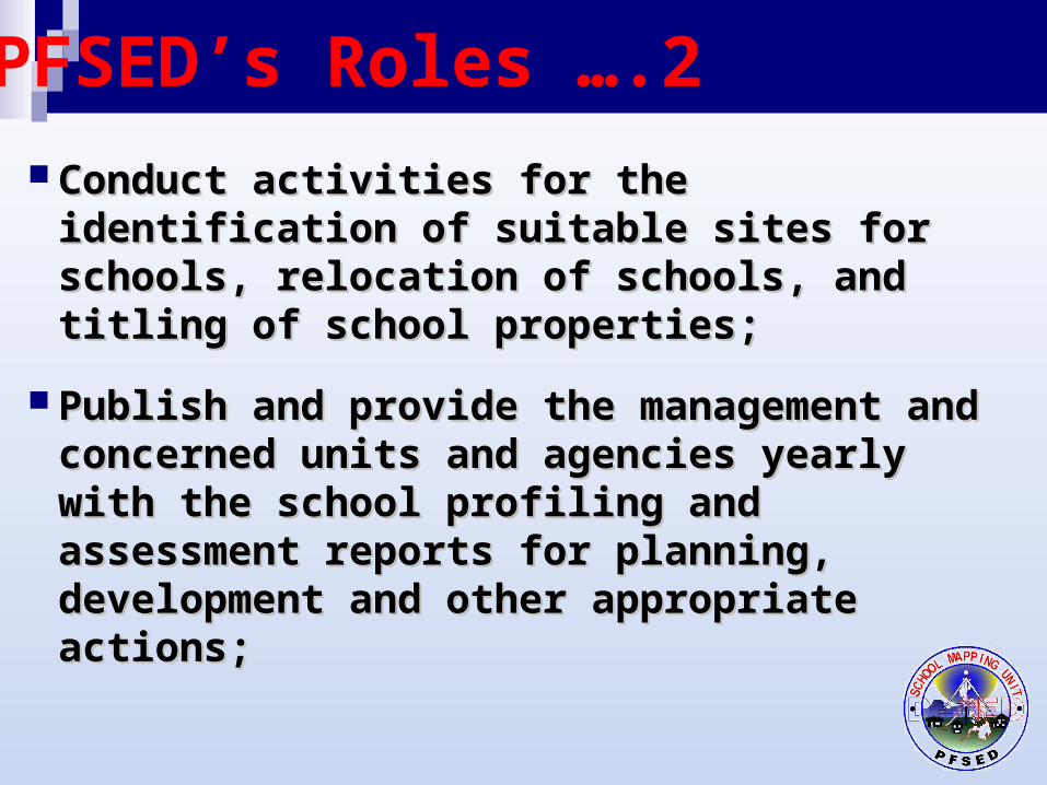
PFSED’s Roles ….2
Conduct activities for the identification of Conduct activities for the identification of suitable sites for schools, relocation of suitable sites for schools, relocation of schools, and titling of school properties;schools, and titling of school properties;
Publish and provide the management and Publish and provide the management and concerned units and agencies yearly with the concerned units and agencies yearly with the school profiling and assessment reports for school profiling and assessment reports for planning, development and other appropriate planning, development and other appropriate actions;actions;
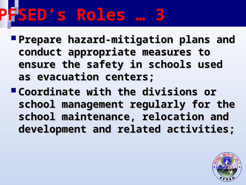
PFSED’s Roles … 3
Prepare hazard-mitigation plans and conduct Prepare hazard-mitigation plans and conduct appropriate measures to ensure the safety in appropriate measures to ensure the safety in schools used as evacuation centers;schools used as evacuation centers;
Coordinate with the divisions or school Coordinate with the divisions or school management regularly for the school management regularly for the school maintenance, relocation and development maintenance, relocation and development and related activities;and related activities;
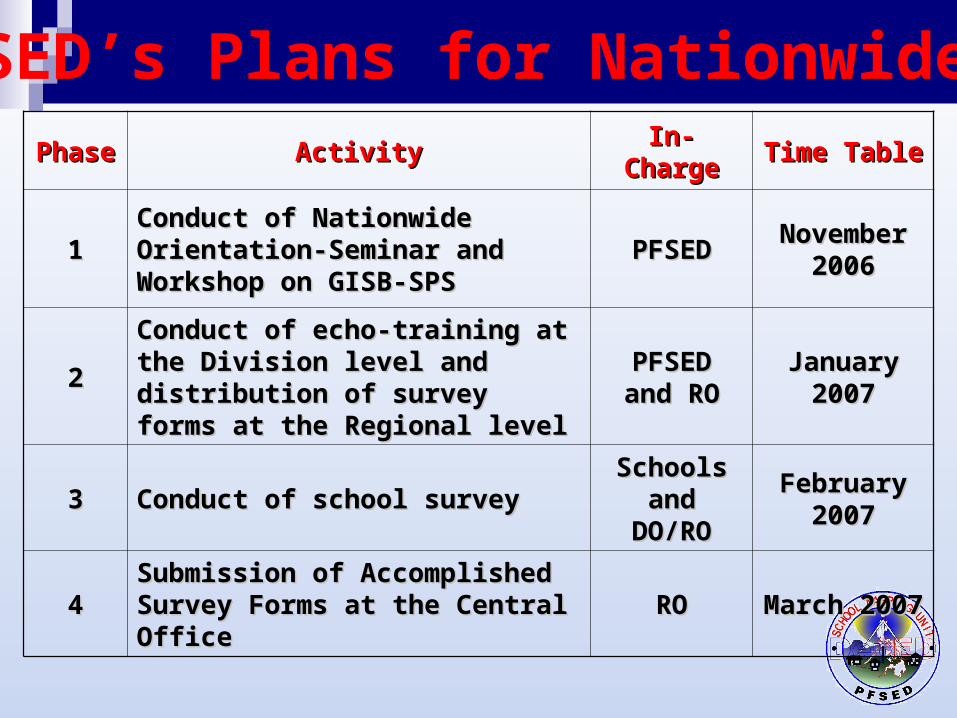
PhasePhase ActivityActivity In-ChargeIn-Charge Time TableTime Table
11Conduct of Nationwide Conduct of Nationwide Orientation-Seminar and Orientation-Seminar and Workshop on GISB-SPSWorkshop on GISB-SPS
PFSEDPFSED November November 20062006
22Conduct of echo-training at the Conduct of echo-training at the Division level and distribution of Division level and distribution of survey forms at the Regional levelsurvey forms at the Regional level
PFSED and PFSED and RORO
January January 20072007
33 Conduct of school surveyConduct of school survey Schools Schools and DO/ROand DO/RO
February February 20072007
44Submission of Accomplished Submission of Accomplished Survey Forms at the Central Office Survey Forms at the Central Office RORO March 2007March 2007
PFSED’s Plans for Nationwide SME
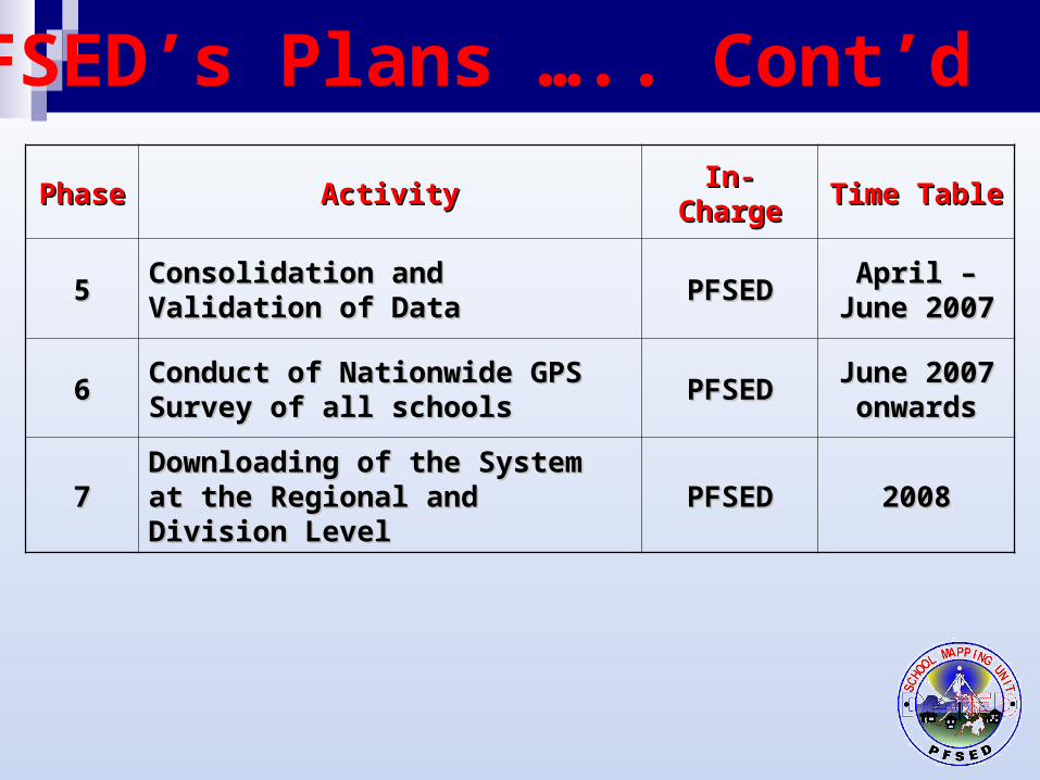
PhasePhase ActivityActivity In-ChargeIn-Charge Time TableTime Table
55Consolidation and Validation of Consolidation and Validation of DataData PFSEDPFSED April – June April – June
20072007
66Conduct of Nationwide GPS Conduct of Nationwide GPS Survey of all schoolsSurvey of all schools PFSEDPFSED June 2007 June 2007
onwardsonwards
77Downloading of the System at the Downloading of the System at the Regional and Division LevelRegional and Division Level PFSEDPFSED 20082008
PFSED’s Plans ….. Cont’d

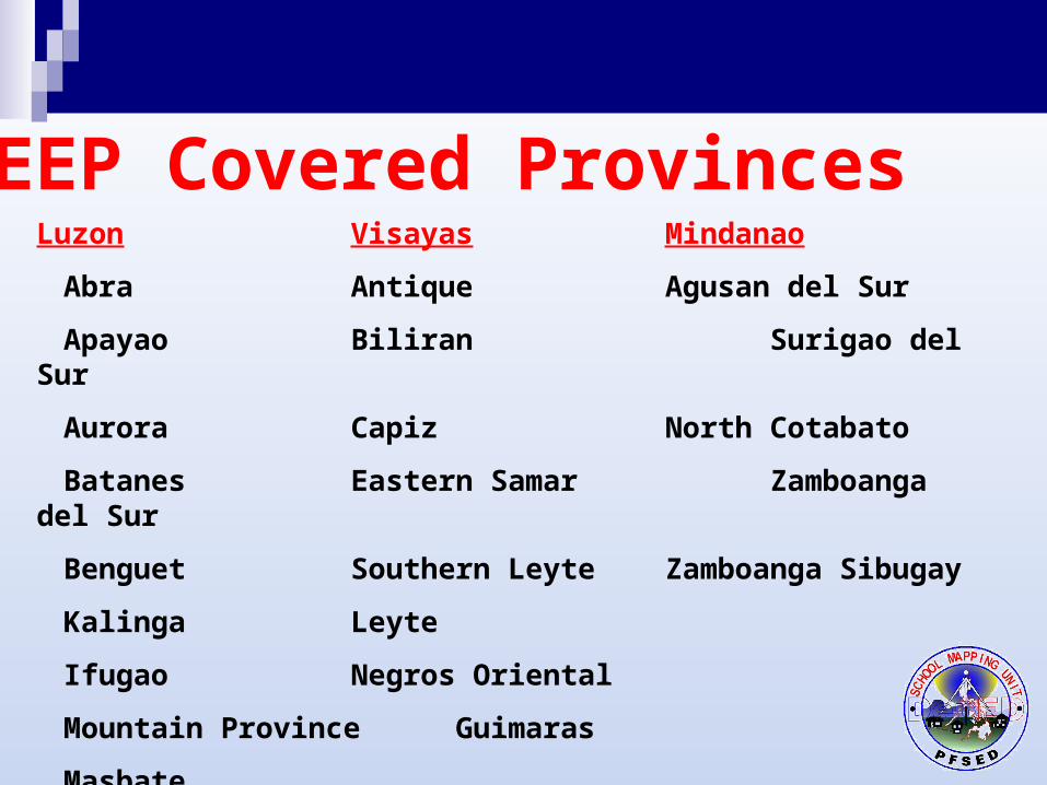
TEEP Covered ProvincesLuzon Visayas Mindanao
Abra Antique Agusan del Sur
Apayao Biliran Surigao del Sur
Aurora Capiz North Cotabato
Batanes Eastern Samar Zamboanga del Sur
Benguet Southern Leyte Zamboanga Sibugay
Kalinga Leyte
Ifugao Negros Oriental
Mountain Province Guimaras
Masbate
Romblon
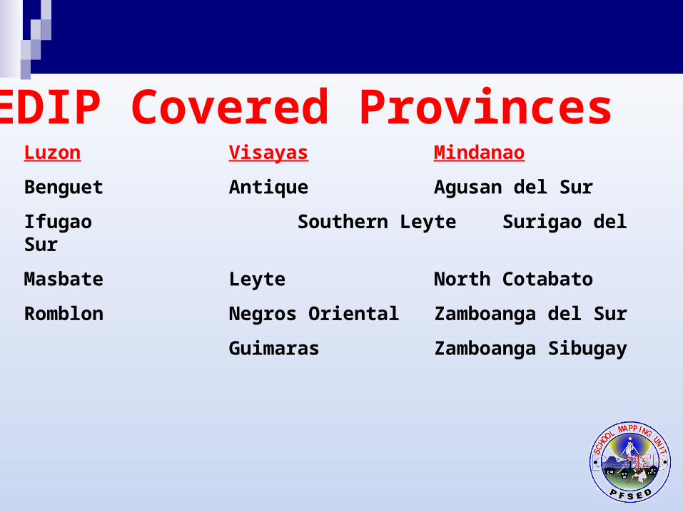
SEDIP Covered ProvincesLuzon Visayas Mindanao
Benguet Antique Agusan del Sur
Ifugao Southern Leyte Surigao del Sur
Masbate Leyte North Cotabato
Romblon Negros Oriental Zamboanga del Sur
Guimaras Zamboanga Sibugay