p a g e - apgn2019.com€¦ · creative tourism management in satun unesco global geopark, thailand...
TRANSCRIPT
| P a g e
i | P a g e
FOREWORDS
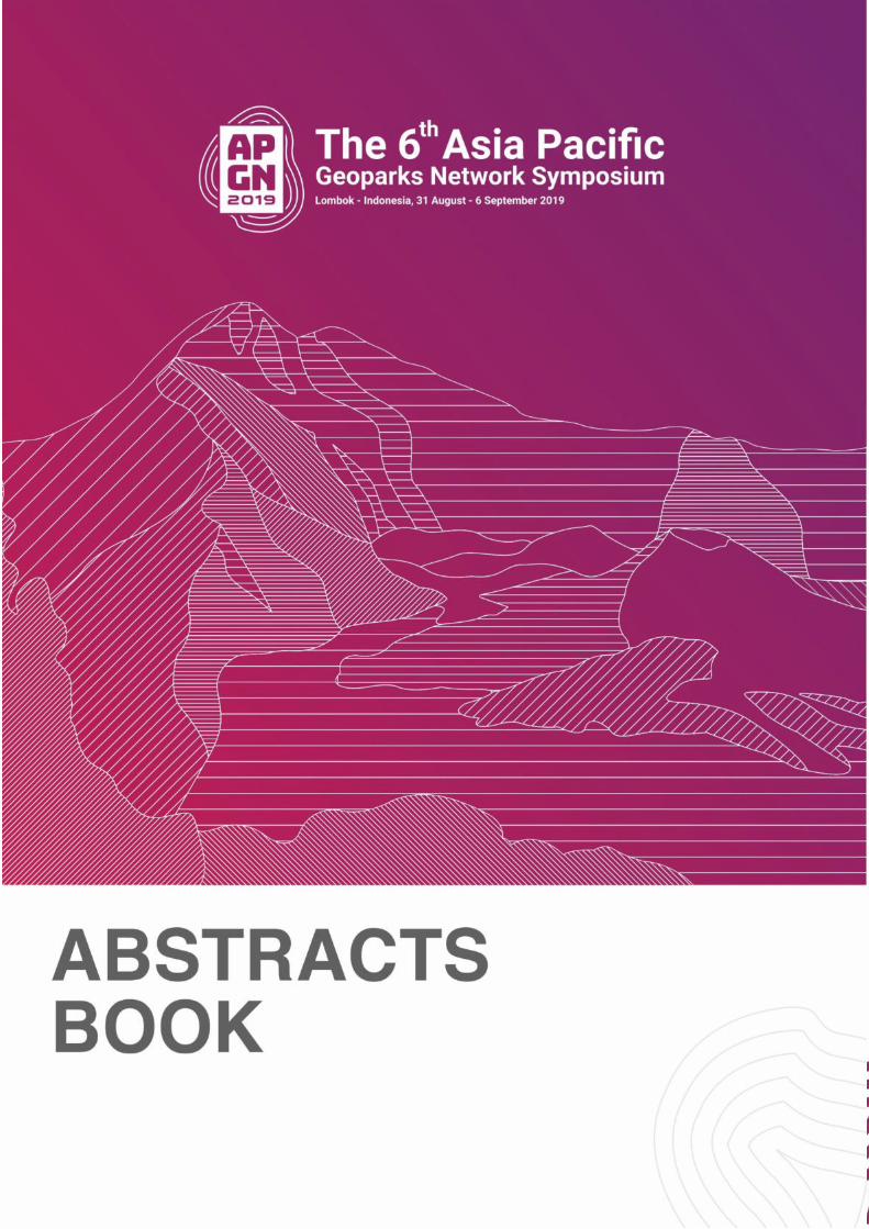
The 6th Asia Pacific Geoparks Network (APGN) Symposium is held in beautiful Lombok,
Indonesia from Aug. 31 to Sep. 6, 2019. This symposium includes 5 topics, which are 1)
Empowering local socio-economic for sustainable development; 2) Engaging Communities,
geohazard risk and recovery; 3) Popularizing scientific knowledge for public education; 4)
Promoting aspiring global geoparks; 5) Networking volcanic and karst landscape global
geoparks. This abstract book composes of 219 abstracts about these 5 topics, including 156
oral presentations and 63 poster presentations.
The 6th APGN Symposium will have in-depth discussion centered on sustainable development,
geohazards risk and control and prevention, public education and volcanic landscape of
geoparks. This symposium will give us an excellent and valuable opportunity to exchange
experiences and discuss issues about APGN Geoparks management. I believe this symposium
will promote the exchange and cooperation among APGN Geoparks, and further improve our
management capacities for better protection of the geological heritages and natural
heritages.
At last, I would like to express my sincere thanks to all the participants and colleagues for their
supports and considerations, and wish all the success of the 6th APGN Symposium!
Thank you very much!
19 August 2019
APGN Coordinator
Prof. HE Qingcheng
ii | P a g e
THEME OF THE 6TH ASIA PACIFIC GEOPARKS NETWORK
SYMPOSIUM:
“UNESCO GLOBAL GEOPARKS TOWARDS SUSTAINING LOCAL COMMUNITY AND REDUCING GEOHAZARD RISK”
TOPICS
1. EMPOWERING LOCAL SOCIO-ECONOMIC FOR SUSTAINABLE DEVELOPMENT
2. ENGAGING LOCAL COMMUNITIES, GEOHAZARD RISK AND RECOVERY
3. POPULARIZING SCIENTIFIC KNOWLEDGE FOR PUBLIC EDUCATION
4. PROMOTING ASPIRING GLOBAL GEOPARK
5. NETWORKING VOLCANIC & KARST LANDSCAPE UNESCO GLOBAL GEOPARK
SCIENTIFIC COMMITTEE
No Name Institution
1 Kristof Vandenberghe UNESCO
2 Prof. Nikolas Zouros Global Geopark Network
3 Dr. Guy Martini UNESCO Global Geoparks Council
4 Prof. Dr. HE Qingcheng APGN Advisory Committee
5 Prof.Ibrahim Komoo APGN Advisory Committee
6 Dr. Mahito Watanabe APGN Advisory Committee
7 Dr. Soojae Lee APGN Advisory Committee
8 Dr. Tran Tan Van APGN Advisory Committee
9 Prof. Setsuya Nakada APGN Advisory Committee
10 Dr. Ka Ming Yeung Head of Hongkong UGGp of China
11 Hanang Samodra, M.Sc., APGN AC
12 Prof. Zhang Jianping APGN AC
13 Maurizio Burlando Parco Beiqua
14 Dr. Yunus Kusumabrata Indonesian Geopark National Commission
15 Azwir Malaon Indonesian Geopark National Commission
16 Prof. Dr. H. Lalu Husni, S.H., M.Hum. University of Mataram
17 Drs. H. Arsyad Abdul Gani, M.Pd Training Institute of Education of Mataram
18 Prof. Kusno, DEA, Ph.D. University of Muhammadyah Mataram
19 Rector of Hamzanwadi University
Representativ of the University:
Hamzani Wathoni
University of Hamzanwadi
20 Prof. Dr. Ida Bagus Windia Adnyana Special Staff of Governor of West Nusa Tenggara
for Environment and Natural Resources
iii | P a g e
KEYNOTE SPEECHESS
1. APGN COORDINATOR (PROF HE QINGCHENG)
Risk assessment, monitoring and warning system of Geohazards in APGN
Geoparks
As of May 2019, there are 60 APGN Geoparks in 8 Asia-Pacific countries, include volcanic type,
karst type, and danxia landform, and so on. All geoparks formed by the complex geological
processes, which sometime become geohazards and cause serious damages to tourists and
geological heritages. Therefore, we need to develop effective measures to protect the geological
heritages in geoparks and for the better management of them.
Firstly, conduct geological investigation and risk assessment. Through modern techniques such
as data collection, remote sensing and field survey, we need to clarify the potential risk sites of
geohazards. Then carry out risk assessment centered on susceptibility, hazards by qualitative
analysis, quantitative or semi-quantitative analysis.
Secondly, develop monitoring stations and monitoring and warning system. By the utilization of
modern techniques such as RS, GIS and GPS, we can monitor different indices such as
precipitation, water table and displacement of hazards-bearing bodies, and so on. The monitoring
data should be sent to management sectors automatically for further analysis and warning
people.
Finally, we should establish monitoring system of monitoring and warning composed of a series
of measures such as intelligent acquisition system, automatic analysis of warning information and
sending messages, and launch emergency provision in order to protect tourists and valuable
geological heritages in geoparks.
2. PRESIDENT OF GGN (PROF NIKOLAOS ZOUROS)
3. MINISTER OF TOURISM, REPUBLIC OF INDONESIA (DR. IR. ARIEF YAHYA, M.SC)
Geopark For Sustainable Tourism Development
Geopark as a regional development management concept, initiated by UNESCO around the
2000s, utilizes the sustainability of geodiversity, biodiversity, and cultural diversity resources not
only for conservation efforts (to protect geological sites) but also to educate and improve socio-
economic level of local communities. Referring to UNESCO Global Geopark (UGGp) standard, it is
compulsary that geopark should be managed using principle of empowering local communities
with the aim of gradually increasing the welfare of the community through natural tourism
activities (geotourism and ecotourism), cultural tourism and other creative economic activities.
Furthermore, geopark can become a solution to the sustainable utilization of natural resources
(geodiversity and biodiversity) and cultural diversity while promoting environmental
conservation and protection. Geopark development also encourages the development of tourism
services, including small and medium-sized businesses, creative industries, hospitality,
iv | P a g e
agriculture, culinary and several other related sectors to improve capability of local economy and
hence advance regional economic development. Generally, management of geopark cannot be
last in sustainable manner without the development of knowledge-based responsible tourism
involving all related stakeholders, including government, local communites, educational
institutions, private sectors, and media. Therefore, the Government of Indonesia is committed
to develop geopark as a sustainable tourism destination with the tagline spirit of "Conserve more,
prosperous more".
Target being set up of developing geopark as a thematic tourism destination is aimed to create
geopark as a world class tourism destination based on knowledgeable science, community
participation, innovation and creative economy that meets international standards including
implementing 4 geopark fundamental principals, including conservation, management, visibility
and networking, and at the same time implement the 10 focus areas of geopark development for
supporting the achievement of Sustainable Development Goals, and fulfilling the UNESCO's self-
assessment criteria. To date, Indonesia currently has four UNESCO Global Geoparks, namely:
Batur UGGp, Bangli Regency, Bali Province (2012); Gunung Sewu UGGp in Yogyakarta-Central
Java-East Java Provinces (2015); Rinjani-Lombok UGGp in Lombok, West Nusa Tenggara Province
(2018); and Ciletuh- Palabuhanratu UGGp in Sukabumi Regency, West Java Province (2018). In
addition, there are 15 National Geoparks, including Toba Caldera (Aspiring UGGp), Belitong Island
(Aspiring UGGp), Tambora, Raja Ampat, Merangin Jambi, Bojonegoro, Maros Pangkep, Pongkor,
Karangsambung-Karangbolong, Meratus, Silokek, Sawahlunto, Sawahlunto, Ngaraisianok-
Maninjau, Natuna and Banyuwangi. The number will continue to increase considering that
Indonesia possesses very rich and diverse geological heritages with 110 indentified geological
heritage potentials.
As a highlight, the key issues to the successful development of geopark as a thematic based
tourism destination include the availability of comprehensive interpretation of geotourism trails
as attractive tourism promotion, better tourism accessibility, availability of tourism amenities,
well managed geosite management, and also community-based tourism development in the
geopark area. In the future, geopark is expected to contribute more to the development of
Indonesia’s sustainable and responsible tourism.
v | P a g e
CONTENT FOREWORDS ......................................................................................................................................... i
THEME OF THE 6TH ASIA PACIFIC GEOPARKS NETWORK SYMPOSIUM: ............................................. ii
TOPICS .............................................................................................................................................. ii
SCIENTIFIC COMMITTEE .................................................................................................................... ii
KEYNOTE SPEECHESS ............................................................................................................................iii
1. APGN COORDINATOR (PROF HE QINGCHENG) .........................................................................iii
2. PRESIDENT OF GGN (PROF NIKOLAOS ZOUROS) .......................................................................iii
3. MINISTER OF TOURISM, REPUBLIC OF INDONESIA (DR. IR. ARIEF YAHYA, M.SC) .....................iii
ORAL PRESENTATION: Empowering Local-Socio Economic For Sustainable Development ................ 1
IMPACT OF CILETUH-PALABUHANRATU GEOPARK DETERMINATION ON THE NUMBER OF
REGIONAL TOURISTS VISIT ................................................................................................................ 1
CREATIVE TOURISM MANAGEMENT IN SATUN UNESCO GLOBAL GEOPARK, THAILAND .................. 2
TIANZHUSHAN UNESCO GLOBAL GEOPARK VIGOROUSLY PROMOTES LOCAL SOCIO-ECONOMIC
SUSTAINABLE DEVELOPMENT ........................................................................................................... 3
DEVELOPMENT OF COMMUNITIES IN HUANGANG DABIESHAN UNESCO GLOBAL GEOPARK .......... 4
LINKING COMMUNITY EMPOWERMENT AND CONSERVATION: CASE STUDY TRIGONA HONEY
FARMING IN BELITONG ISLAND ........................................................................................................ 5
MOBILIZING UNESCO GLOBAL GEOPARK FOR SUSTAINABLE TOURISM DEVELOPMENT IN NON
NUOC CAO BANG GOEPARK .............................................................................................................. 6
TATENO GORGE GEOSITE” IN ASO UNESCO GLOBAL GEOPARK: RECOVERING FROM THE 2016 KUMAMOTO EARTHQUAKES ............................................................................................................ 7
NEW CHALLENGE AT “NAKADAKE GEOSITE”..................................................................................... 8
CAPACITY-BUILDING FOR GEOPARKIAN THROUGH TRAINING MODULES: EXPERIENCE FROM LUGG
.......................................................................................................................................................... 9
THE EVOLUTION OF LANGKAWI UNESCO GLOBAL GEOPARK: VISION, LESSON AND INNOVATION 10
THE SIGNIFCANT ROLES SHILIN GLOBAL GEOPARK PLAY IN SUSTAINABLE LOCAL DEVELOPMENT. 11
CULTURAL HERITAGE, A DRIVING FORCE OF GOEPARK DEVELOPMENT ......................................... 12
RESEARCH PROGRESS OF GEOLOGICAL RELICS AND GEOPARKS IN CHINA FROM 2000 TO 2019 ... 13
TOURIST CAVE CONSERVATION IN MINE-AKIYOSHIDAI GEOPARK - LEARNING FROM PAST
FAILURES ......................................................................................................................................... 14
CREATING GEOPRODUCTS TO INCREASE LIVELIHOOD OF COMMUNITIES ON SMALL ISLAND
GEOPARK INDONESIA ..................................................................................................................... 15
GEOTOURISM MANAGEMENT OF KHORAT ASPIRING UNESCO GLOBAL GEOPARK’S : PARTICIPATORY OF LOCAL COMMUNITY ........................................................................................ 16
EXPLORATION AND PRACTICE ON COOPERATION BETWEEN GEOPARKS AND COMMUNITIES ...... 18
----TAKING LEIQIONG UNESCO GLOBAL GEOPARK AS AN EXAMPLE ............................................... 18

vi | P a g e
LEAP FOR LOCAL ECONOMIC DEVELOPMENT IN HONAM REGION: MUDEUNGSAN UNESCO
GLOBAL GEOPARK, KOREA .............................................................................................................. 19
THE GEOGUIDE SYSTEM OF MINE-AKIYOSHIDAI KARST PLATEAU GEOPARK .................................. 20
DEVELOPMENT APPROACHES AND MANAGEMENT STRATEGIES OF SATUN UNESCO GLOBAL
GEOPARK, SOUTHERN THAILAND ................................................................................................... 21
TRANSFORMING GUTTERS INTO FISH PONDS, AN APPROACH TO STOP LITTERING BEHAVIOR IN
BANYUWANGI GEOPARK ................................................................................................................ 22
ENGAGING LOCAL COMMUNITIES IN THE PROMOTION AND DEVELOPMENT OF ZHANGJIAJIE
UNESCO GLOBAL GEOPARK OF CHINA ............................................................................................ 23
EMPOWERING COMMUNITIES THROUGH HERITAGE CONSERVATION: EXAMPLES FROM
MALAYSIAN PERSPECTIVES ............................................................................................................. 24
THE APPLICATION OF LOCAL WISDOM IN SUSTAINABLE DEVELOPMENT ....................................... 25
COMMUNITY EMPOWERMENT AROUND PONGKOR GEOPARK TOWARDS GLOBAL GEOPARK ..... 26
WOMEN EMPOWERMENT IN TOURISM ON WAIGEO ISLAND, RAJA AMPAT.................................. 27
GEOPARK CORNER AS A MEDIA TO INCREASE LOCAL PEOPLE INVOLVEMENT IN GEOTOURISM .... 28
DEVELOPMENT OF SOCIAL CAPITAL AND REGIONAL IDENTITY IN IZU PENINSULA UGGP .............. 29
CHANGES IN GUIDED TOUR OPERATION AFTER UNESCO GLOBAL GEOPARK DESIGNATION IN IZU
PENINSULA, JAPAN ......................................................................................................................... 30
TRAINING FOR COFFEE SHOP MANAGEMENT AND BARISTA FOR LOCAL COMMUNITIES IN THE
RINJANI-LOMBOK GEOPARK AREA .................................................................................................. 31
IMPLEMENT PLANS ON THE BASIS OF RESPECTING NATURE, STRENGTHEN PROTECTION
FOLLOWING TIMES DEVELOPMENT ................................................................................................ 32
THE CULTURAL-TOURISM APPROACH FOR SUSTAINABLE DEVELOPMENT - A CASE STUDY AT
BATUR GLOBAL GEOPARK ............................................................................................................... 33
DEVELOPMENT OF INSTANT SWEET PALM DRINK PRODUCT AS AN ECONOMIC SOLUTION FOR
ILLEGAL LOGGING IN AIK BUAL VILLAGE, LOMBOK ......................................................................... 34
TRADITIONAL RESOURCE MANAGEMENT PRACTICES SASI IN RAJA AMPAT, .................................. 35
WEST PAPUA, INDONESIA ............................................................................................................... 35
A SUSTAINABLE TOURISM FOR LOMBOK ........................................................................................ 36
GEOTOURISM IN BELITONG GEOPARK: ENHANCEMENT OF INTERPRETATION MATERIALS AND
PROPOSED DEVELOPMENT OF TOURISM DESTINATIONS TOWARDS SUSTAINABLE TOURISM ...... 37
RESTORATION STRATEGY ON THE STOVEN AND THE NAM SALU OPEN PIT AREA .......................... 38
LOCAL COMMUNITIES AND SUSTAINABLE ECONOMIC ................................................................... 39
IN BELITONG NATIONAL GEOPARK ................................................................................................. 39
SUSTAINABLE ISLAND DEVELOPMENT INITIATIVE (SIDI) IN NATUNA ISLAND GEOPARK ................. 40
GEOTUORISM MILENIAL IN MERANGIN NATIONAL GEOPARK : INTERPRETATION MATERIAL OF
TOURISM DESTINATIONS TOWARD SUSTAINABLE TOURISM, SMART TOURISM AND NATURAL
PRESERVATION ............................................................................................................................... 41
POSTER PRESENTATION: Empowering Local Socio-Economic Sustainable Development ................ 42
vii | P a g e
BIOGEOTRAIL KUBANG BADAK, LANGKAWI UNESCO GLOBAL GEOPARK ....................................... 42
INTELLIGENT TAISHAN UNESCO GLOBAL GEOPARK WITH INTELLIGENT MANAGEMENT SYSTEMS 43
COMMUNITY DEVELOPMENT: ESSENCE OF GEOPARK DEVELOPMENT OF YANDANGSHAN UNESCO
GLOBAL GEOPARK ........................................................................................................................... 44
KAYAKING TOUR AND OCEAN CLEANUP FOR LOCAL DEVELOPMENT IN THE SAN'IN KAIGAN
GEOPARK IN JAPAN ......................................................................................................................... 45
IMPACT OF YUNTAISHAN GLOBAL GEOPARK ON RURAL ECONOMY - TAKE THE ANSHANG VILLAGE
AS AN EXAMPLE .............................................................................................................................. 46
STONE TOWN ITOIGAWA PROJECT - COOPERATION WITH LOCAL BUSINESSES IN FOR SUSTAINABLE
DEVELOPMENT ............................................................................................................................... 47
NEW COMPOSITE GEOTRAILS CONNECTING GEOLOGICAL, CULTURAL, HISTORICAL OF THE BUSAN
NATIONAL GEOPARK ....................................................................................................................... 48
COMMUNITY BASED ECOTOURISM DEVELOPMENT IN RAJA AMPAT ( WARKESI VILLAGE, WEST
WAIGEO NATURE RESERVE) ............................................................................................................ 49
LOCAL ECONOMIC DEVELOPMENT AND COMMUNITY INVOLVEMENT IN TAISHAN GLOBAL
GEOPARK ........................................................................................................................................ 50
GEOPARK CORNER AS THE CENTER FOR LOCAL ECONOMIC IMPROVEMENT IN THE TAMBORA
GEOPARK AREA ............................................................................................................................... 51
BELITONG NATIONAL GEOPARK, LOCAL ECONOMY AND SUSTAINABLE RURAL DEVELOPMENT .... 52
EMPOWERMENT OF MUNCAR BANYUWANGI COASTAL WOMEN THROUGH DEVELOPMENT OF
ECO-COEFFICIENCIES MODELS IN EFFORTS TO IMPROVE HOUSEHOLD ECONOMICS ..................... 53
EMPOWERING OF CATTLE FARMER THROUGH LEUCAENA PLANT IN RINJANI MOUNTAIN AREA .. 54
THE GEOPARK AS AN ALTERNATIVE TO SUSTAINABLE DEVELOPMENT MODELS IN INDONESIA: A
CASE STUDY OF BUGG..................................................................................................................... 55
ORAL PRESENTATION: Engaging Communities, Geohazard Risk And Recovery ............................... 56
TSUNAMI MITIGATION ZONE BASED ON WAVE RUN-UP ESTIMATION IN CILETUH
PALABUHANRATU GEOPARK........................................................................................................... 56
DISASTER RISK REDUCTION MEASURES CONDUCTED BY SAKURAJIMA-KINKOWAN GEOPARK AND
KAGOSHIMA CITY ............................................................................................................................ 57
LOCAL ENGAGEMENT AND BOTTOM-UP ACTIVITY IN MINE-AKIYOSHIDAI GEOPARK: SUCCESSES
AND DIFFICULTIES ........................................................................................................................... 58
LET’S PROTECT OUR HOME TOWN! FUN WAY OF LEARNING ABOUT COREOPSIS LANCEOLATA, AN
IAS ................................................................................................................................................... 59
GEOHAZARD RISKS IN UGGPS AND METHODS FOR DISASTER MITIGATION ................................... 60
HOW DOES SDGS RELATED TO LOCALS LIFE IN MUROTO UGGP? - SEARCHING AN EFFECTIVE WAY
TO RECOGNIZE SDGS- ..................................................................................................................... 61
DEMONSTRATION OF CLIMATE CHANGE IN THE YANGAN-TAU GEOPARK (RUSSIA) ...................... 62
JAPANESE GEOPARK NETWORK AND MINE-AKIYOSHIDAI GEOPARK: CURRENT SITUATION AND
CHALLENGES ................................................................................................................................... 63
viii | P a g e
INHERITANCE OF DISASTERS BY INDIGENOUS 'AINU' PEOPLE AND CULTURAL PRESERVATION IN
THE TOYA-USU UGGP ...................................................................................................................... 64
LUSHAN GEOHARZARD PREVENTION SCIENTIFIC POPULARIZATION .............................................. 65
GOOD DECISIONS NEED GOOD DATA PROGRAM OF IPG TO PROVIDE DECISION MAKERS WITH
HIGH QUALITY INFO ........................................................................................................................ 66
GEO-HAZARD MITIGATION AND ENVIRONMENTAL PRESERVATION THROUGH LOCAL WISDOM .. 67
RECENT ACTIVITIES OF ASO VOLCANO AND IDEAS FOR EDUCATION AND DISASTER PREVENTION
ACTIVITIES ....................................................................................................................................... 68
FORMS OF COMMUNITY PARTICIPATION IN JIUHUASHAN GEOPARK ............................................ 69
TSUNAMI MONUMENTS SIGNIFICANCE AND GEOPARK’S ROLE ON AWARENESS IN IZU PENINSULA, JAPAN.............................................................................................................................................. 70
INVOLVEMENT OF INDONESIAN GEOLOGIST ASSOCIATION OF NUSA TENGGARA IN GEOHAZARD
MITIGATION IN RINJANI-LOMBOK GEOPARK .................................................................................. 71
THE CHANCE TO DEVELOP NEW GEOTRAIL IN RINJANI-LOMBOK GEOPARK AFTER LOMBOK
DESTRUCTIVE EARTHQUAKES IN 2018 ............................................................................................ 72
GEOLOGICAL DISASTERS ANALYSIS USING ANALITICAL HIERARCHY PROCESS FOR DEVELOPMENT
GEOTOURISM IN LOMBOK RINJANI UNESCO GLOBAL GEOPARK: CASE STUDY IN PEMENANG
DISTRICT .......................................................................................................................................... 73
NATURAL SCHOOL "LINSUM" .......................................................................................................... 74
THE KEEPER OF NATURAL RESOURCES FOR GEOSITE TEBAT RASAU CONSERVATION .................... 74
RISK ASSESSMENT, MONITORING AND WARNING SYSTEM OF GEOHAZARDS IN THE ASIA PACIFIC
GEOPARKS ....................................................................................................................................... 75
POSTER PRESENTATION: Engaging Communities, Geohazard Risk And Recovery............................ 76
PREDICTION AND MANAGEMENT OF GEOHAZARD RISK USING 3D IMAGE ON THE COLUMNAR
JOINTS IN MUDEUNGSAN UNESCO GLOBAL GEOPARK ................................................................... 76
PETROLEUM GEOPARK BOJONEGORO ............................................................................................ 77
GROUNDWATER MANAGEMENT STRATEGIES BASED ON ANALYSIS OF GROUNDWATER BALANCE
IN BELITONG GEOPARK REGION ..................................................................................................... 78
ORAL PRESENTATION: Popularizing scientific knowledge for public education ................................. 79
INDIGENOUS KNOWLEDGE OF GEOHERITAGE IN ASPIRING QUANG NGAI GEOPARK (VIETNAM) . 79
PROGRAMS FOR EDUCATIONAL DEVELOPMENT IN KHORAT ASPIRING UNESCO GLOBAL GEOPARK,
NE THAILAND .................................................................................................................................. 80
LANGKAWI UNESCO GLOBAL GEOPARK DISCOVERY CENTRE: NEW FACILITY FOR PUBLIC
EDUCATION ..................................................................................................................................... 81
LINKING GEOLOGICAL AND BIOLOGICAL ELEMENTS THROUGH GEOTRAILS DEVELOPMENT IN
LANGKAWI UNESCO GLOBAL GEOPARK .......................................................................................... 82
EDUCATIONAL TOURISM IN UNESCO GLOBAL GEOPARKS OF CHINA ............................................. 83
REVIEW OF GLOBAL GEOPARKS’ POPULAR SCIENCE ACTIVITIES AND THE SIGNIFICANCE .............. 84
GEO-EDUCATON PROGRAMS OF MUDEUNGSAN UNESCO GLOBAL GEOPARK ............................... 85
ix | P a g e
SYSTEMATIZATION OF LOCAL ENVIRONMENTAL EDUCATION AND INTER-REGIONAL EXCHANGE . 86
THE EFFECTIVENESS OF UTILIZING GEOPARKS IN YOUTH EDUCATION ........................................... 87
IMPROVEMENT OF GEOSITE PRESENTATION AT A FAULT EXPOSURE IN ITOIGAWA UNESCO
GLOBAL GEOPARK ........................................................................................................................... 88
DESCRIPTION OF GEOLOGICAL PROCESSES IN FOLKLORE OF THE LOCAL POPULATION OF YANGAN-
TAU GEOPARK ................................................................................................................................. 89
CHEONGSONG UNESCO GLOBAL GEOPARK MAKES HARMONY WITH MUSIC ............................... 90
DEVELOPING INFRASTRUCTURE AND PROGRAM FOR GEOEDUCATION AT CHEONGSONG UNESCO
GLOBAL GEOPARK ........................................................................................................................... 91
UNDERSTANDING OF REGIONAL SCIENTIFIC IMPORTANCE BY LOCAL RESIDENTS - IN CASE OF
SAN’IN KAIGAN UGGP ..................................................................................................................... 92
THE DISCOVERY AND EVALUATION OF GEOLOGICAL HERITAGE PROJECT AND ITS POPULARIZING
TO PUBLIC ....................................................................................................................................... 93
THE PROGRAM IMPROVEMENT PLAN OF GANGWON PALEOZOIC NATIONAL GEOPARK, KOREA .. 94
BIOGEOTRAIL KUBANG BADAK, LANGKAWI UNESCO GLOBAL GEOPARK ....................................... 95
GEOPARKS FOR ENHANCED MULTIDIMENSIONAL SUSTAINABILITY IN THE ASIA AND PACIFIC
REGION (GEMS) .............................................................................................................................. 96
THE STRUCTURAL AND BOTTOM-UP MECHANISMS FOR TAIWAN'S GEOPARKS ............................ 97
STRENGTHENING GEOSCIENCE RESEARCH AND POPULARIZATION, BOOSTING GEOPARK
SUSTAINABLE DEVELOPMENT ......................................................................................................... 98
SCIENCE POPULARIZATION IN CHINESE GEOPARKS: DANXIASHAN UNESCO GLOBAL GEOPARK OF
CHINA AS AN EXAMPLE ................................................................................................................... 99
UNESCO GLOBAL GEOPARKS AND STUDY TRAVEL ........................................................................ 100
GEOSCIENCES POPULARIZATION, PROMOTION AND EDUCATION ACTIVITIES .............................. 101
LEARNING GEOLOGICAL PHENOMENON THROUGH TRADITIONAL GAMES; STUDI CASE:
TAMBORA’S 1815 ERUPTION ........................................................................................................ 102
LOCAL COMMUNITY PARTICIPATION FOR TOUR INTERPRETER DEVELOPMENT IN CILETUH
GEOPARK AREA , INDONESIA ........................................................................................................ 103
OPEN THE FIELD TRIPS OF THE GLOBAL GEOPARK - TAKING THE TAINING UNESCO GLOBAL
GEOPARK AS AN EXAMPLE ............................................................................................................ 104
GEOTHEATER AS A GEOPARK EDUCATIONAL MEDIA FOR STUDENTS, GENERAL PUBLIC AND
TOURISTS. ..................................................................................................................................... 105
INTRODUCTION OF RAJA AMPAT'S GEOSITE POTENTIAL VALUE FOR LOCAL COMMUNITIES (CASE
STUDY: RAJA AMPAT).................................................................................................................... 106
GEOPARK BELITONG IN THE LITERATION FRAME (BELITONG GEOLITERATION) ........................... 107
RASAU CONSERVATION WHICH HAS A THOUSAND BENEFITS AND UNIQUE ................................ 108
GEOSITE OF TEBAT RASAU REGION .............................................................................................. 108
PROMOTING CONSERVATION IN GEOSITE THROUGH YOUTH PROGRAM: CASE STUDY YOUTH
CAMP AT TEBAT RASAU AND THE NAM SALU OPEN PIT ............................................................... 109
x | P a g e
POSTER PRESENTATION: Popularizing Scientific Knowledge For Public Education ........................ 110
THE LINKAGE BETWEEN GEOLOGICAL AND NON GEOLOGICAL SITES IN CILETUH-PALABUHANRATU
GEOPARK ...................................................................................................................................... 110
EDUCATIONAL SUPPORT FOR LOCAL ELEMENTARY SCHOOL STUDENTS IN SHILIN GLOBAL
GEOPARK ...................................................................................................................................... 111
WATER MANAGEMENT FOR TOURISM DESTINATION IN SMALL ISLAND GEOPARK INDONESIA .. 112
RESEARCH ON THE POPULAR SCIENCE TOURISM DEVELOPMENT MODEL OF HENAN SONGSHAN
GLOBAL GEOPARK ......................................................................................................................... 113
HOW TO POPULARIZE PERIDOTITES DERIVED FROM THE EARTH’S MANTLE. ............................... 114
CROSS-GEOPARK LEARNING CLASS WITH USING THE SKYPE SERVICE .......................................... 115
RESULTS AND SUBJECTS ABOUT EDUCATION FOR STUDENTS IN THE SAN’IN KAIGAN UNESCO GLOBAL GEOPARK, JAPAN............................................................................................................. 116
THE VOLCANO EXPERIMENT WORKSHOP TO UNDERSTAND VOLCANIC PHENOMENA ................ 117
EVALUATION OF EXPLANATION PANELS SETTLING AT GEOPARK'S SITES IN UNZEN VOLCANIC AREA
UGGP, JAPAN ................................................................................................................................ 118
DISCUSSION ON INTERNET AND SCIENCE POPULARIZATION COMMUNITY MODEL BASED ON
INTERNET SHARING ECONOMIC ................................................................................................... 120
FORAGING RACE: A MEDIA TO CONSERVE PLANTS IN RINJANI GEOPARK ................................... 121
RAJA AMPAT AS THE GLOBAL EPICENTER OF CORAL REEF FISH BIODIVERSITY ............................. 122
USING A TWO-LINE MODEL FOR THE DEVELOPMENT OF A GEOPARK .......................................... 123
FORMATION MECHANISM OF THE PALISADES CAVES: A CASE OF TAINING UNESCO GLOBAL
GEOPARK IN CHINA ....................................................................................................................... 124
DIVERSITY OF FLORA IN THE REGION GEOSITE KERANGAS FOREST AIK KETIAU CENDIL VILLAGE OF
KELAPA KAMPIT DISTRICT ............................................................................................................. 125
REVIEW AND PROPOSAL OF THE AGE PILLOW LAVA OF SIANTU FORMATION, AN EFFORT TO
IMPROVE THE RESEARCH ASPECTS OF GEOLOGICAL HERITAGE OF BELITONG GEOPARK ............ 126
UNIQUE PELILEAN (TARSIUS) OF PULAU BELITONG GEOPARK...................................................... 127
A REVIEW ON THE POTENTIAL ETHNOMEDICINE IN RINJANI UNESCO GLOBAL GEOPARK BY SASAK
ETHNIC PEOPLE ............................................................................................................................. 128
A TOXICOLOGICAL REVIEW OF THE CHEMICAL COMPOSITION OF COFFEE FROM PONGKOR
NATIONAL GEOPARK ..................................................................................................................... 129
DIVERSITY AND CONSERVATION OF WILD FRUITS IN BELITONG ISLAND GEOPARK ...................... 130
STRATEGIC STEPS IN DEVELOPMENT AND MANAGEMENT OF INDONESIAN GEOHERITAGE ........ 131
POTENCY OF EDUCATION HISTORICAL TOURISM OF WORLD WAR II JAPANESE CAVES AND
BUNKERS IN COASTAL BANYUWANGI ........................................................................................... 132
REHANA: CULTURAL STUDIES AND ENGINEERING OF METAL-BASED PRODUCTS IN THE PANDE BESI
BANYUWANGI COMMUNITY......................................................................................................... 133
STUDY OF MUNCAR TRADITIONAL FISHERIES SHIP BANYUWANGI DISTRICT AS BASIC FOR
DEVELOPMENT OF INDONESIA'S MARINE RESOURCES POTENTIAL .............................................. 134
xi | P a g e
THE GEOPARK: AN AUTHENTIC MATERIAL FOR ENGLISH LANGUAGE TEACHING. ........................ 135
POPULARIZING SITUS KAWITAN FOR PUBLIC EDUCATION ............................................................ 136
GEOPARK AND ETHNO-BOTANY OF ORPHAN PLANTS OF OSING INDIGENOUS FOOD SYSTEM IN
BANYUWANGI ............................................................................................................................... 137
TRADITIONAL GAME OF THE OSING TRIBLE BANYUWANGI REGENCY .......................................... 138
IDENTIFICATION OF TRADITIONAL LENGTH AND LARGE MEASUREMENTS AS A BANYUWANGI
TOURISM EDUCATIONAL MATERIAL ............................................................................................. 139
DESCRIPTION STUDY OF RIVER BRIDGES AND RESERVOIRS DUTCH HERITTAGE AS EDUCATIONAL
TOURISM OBJECTS IN BANYUWANGI............................................................................................ 140
BIOETHANOL OF EUCHEUMA COTTONII AS GREEN ENERGY POTENTIAL ALTERNATIVES FOR
BANYUWANGI ............................................................................................................................... 141
ORAL PRESENTATION: Promoting Aspiring Global Geoparks .......................................................... 142
AN INNOVATIVE MOBILE APPLICATION TECHNOLOGY TO PROMOTE BELITONG ASPIRING UNESCO
GLOBAL GEOPARK ......................................................................................................................... 142
CHALLENGES AND RESULTS OF THE NPO GENBUDO GUIDE CLUB, JAPAN .................................... 143
MALAYSIA-INDONESIA GEOPARKS NETWORK: STRATEGIC NEED FOR BOTTOM- UP
COMMUNICATION AND BEST PRACTICES ..................................................................................... 144
PUBLIC EDUCATION IN UNESCO GLOBAL GEOPARKS: EXAMPLES FROM MALAYSIAN AND
INDONESIAN GEOPARKS ............................................................................................................... 145
GEODIVERSITY OF THE KRAYAN HIGHLAND: INVENTORY AND GEOTOURISM POTENTIAL IN
SUPPORTING THE ASPIRING KALTARA GEOPARK .......................................................................... 146
KHORAT ASPIRING GEOPARK: A BOTTOM-UP APPROACH THROUGH A HOME-TEMPLE- SCHOOL
MODEL IN GEOCONSERVATION .................................................................................................... 147
LABUAN ASPIRING GEOPARK: OFFERING ITS HYDROCARBON HERITAGE TO THE WORLD .......... 148
IDENTIFYING GEOSITES AND PROMOTING GEOTOURISM AT ASPIRING STONG GEOPARK,
MALAYSIA ..................................................................................................................................... 149
INTERNATIONAL VALUE OF THE GEOLOGICAL FEATURES IN LONGYAN ASPIRING GLOBAL
GEOPARK, FUJIAN, CHINA ............................................................................................................. 150
PHETCHABUN ASPIRING GEOPARK : FROM THE BEGINNING OF A PLATE BOUNDARY TO THE
JOURNEY OF CULTURES ................................................................................................................ 151
YANGAN-TAU GEOPARK: THE FIRST ASPIRING GLOBAL GEOPARK OF RUSSIA .............................. 152
GEOTOURISM BOX AS A METHOD FOR ASSESSING GEOTOURISM ATTRACTION .......................... 153
DISCOVERY ASPIRING GEOPARK: CELEBRATING GEOLOGICAL HERITAGE ON THE BONAVISTA
PENINSULA, CANADA .................................................................................................................... 154
DAK NONG ASPIRING UNESCO GLOBAL GEOPARK - "THE LAND OF SOUNDS".............................. 156
AN ASPIRING JEONBUK WEST COAST GLOBAL GEOPARK, KOREA ................................................. 157
ACTIVITIES OF HAKUSAN TEDORIGAWA NATIONAL GEOPARK ..................................................... 158
THE ESTABLISHMENT OF LONGYAN ASPIRING GLOBAL GEOPARK ................................................ 159
EMOTIONS IN A LAND OF MOTIONS ............................................................................................. 160
xii | P a g e
MOTIVATION AND KNOWLEDGE BUILDING OF STUDENT TOWARDS CILETUH UNESCO GLOBAL
GEOPARK, SUKABUMI ................................................................................................................... 161
WEST JAVA CONSUMER PERCEPTION TOWARDS CILETUH UNESCO GLOBAL GEOPARK (CUGG),
SUKABUMI, INDONESIA ................................................................................................................ 162
THE HERITAGE DIVERSITY OF PONGKOR GEOPARK AND ITS DEVELOPMENT TOWARD AS GLOBAL
GEOPARK ...................................................................................................................................... 163
A PROMOTIONAL STRATEGY FOR UPLIFTING VISITORS AND IMPROVING THE LOCAL COMMUNITY
WELFARE AT THE PONGKOR ......................................................................................................... 164
PROMOTING GEODIVERSITY AND GEOTOURISM POTENTIAL ....................................................... 165
IN ASPIRING GEOPARK NORTH KALIMANTAN ............................................................................... 165
EX-COAL MINING AREA AS A GEOPARK IN SAWAHLUNTO, WEST SUMATERA ............................. 166
THE GEOSITES VARIATIONS AS SUPPORTED OF NATIONAL GEOPARK OF MERATUS MOUNTAIN,
SOUTH KALIMANTAN .................................................................................................................... 167
GEOTOURISM AND GEOPARKS IN WEST SUMATRA: SPECIAL INTEREST TOURISM ALONG THE
GREAT SUMATRAN FAULT ............................................................................................................ 168
DEVELOPMENT OF NATUNA GEOPARK THROUGH SUSTAINABLE ISLAND DEVELOPMENT INITIATIVE
(SIDI) ............................................................................................................................................. 169
EXHIBITING BENEFITS OF ECOLOGY AND SOCIO-ECONOMIC RAJA AMPAT MARINE PROTECTED
AREA, BIRD'S HEAD SEASCAPE, WEST PAPUA ............................................................................... 170
THE CREATION AND CONSTRUCTION OF UNESCO GLOBAL GEOPARK-CASE STUDY OF ZHANGYE
INSPIRING UNESCO GLOBAL GEOPARK ......................................................................................... 171
GEODIVERSITY AND GEOUTOURISM: A TOOL FOR SUSTAINABLE DEVELOPMENT IN NATUNA
ISLANDS ........................................................................................................................................ 172
MERANGIN JAMBI NATIONAL GEOPARK ....................................................................................... 173
PROMOTING A UNESCO GLOBAL GEOPARK FOR SUSTAINABLE DEVELOPMENT IN BANYUWANGI
GEOPARK, INDONESIA .................................................................................................................. 174
THE RESPONSIBILITY OF INTERNATIONAL RELATIONS STAFF IN ESTABLISHING THE HIGH QUALITY
STATUS OF SAN'IN KAIGAN GLOBAL GEOPARK, JAPAN ................................................................. 175
HIGHLIGHTS OF THE GEOLOGICAL-RELATED ATTRACTIONS AND TOURISM DEVELOPMENT OF
RINJANI - LOMBOK GEOPARK AND LOMBOK ISLAND ................................................................... 176
POSTER PRESENTATION: Promoting Aspiring Global Geoparks ...................................................... 177
THE PRESENT SITUATION AND DEVELOPMENT OF GEOPARK MANAGEMENT IN CHINA: THE
EXAMPLE OF YUNTAISHAN GLOBAL GEOPARK ............................................................................. 177
ASPIRING GEOPARKS OF NORTH GYEONGSANG PROVINCE, KOREA............................................. 178
HOW CAN WE SUSTAIN LOCAL COMMUNITIES NEAR A VOLCANO ............................................... 179
THAT REPEATS ERUPTIONS? ......................................................................................................... 179
LOCAL SUSTAINABLE DEVELOPMENT THROUGH GEOTOURISM ................................................... 180
IN NANKI KUMANO GEOPARK....................................................................................................... 180
GYEONGBUK DONGHAEAN AS AN ASPIRING GEOPARK: ............................................................... 181
xiii | P a g e
VALUES AND REASONS TO BE A GEOPARK.................................................................................... 181
DISCOVERY ASPIRING GEOPARK: A NORTH AMERICAN CANDIDATE FOR ..................................... 182
UNESCO GLOBAL GEOPARK DESIGNATION ................................................................................... 182
ACOUSTIC CHARACTERISTICS OF ANGKLUNG BANYUWANGI: PRESERVATION AND POTENTIAL OF
THERAPY BASED ON TRADITIONAL MUSICAL INSTRUMENT ......................................................... 183
THE EXOTIC HERITAGE OF BATIK BANYUWANGI FROM COASTAL EAST JAVA ............................... 184
ORAL PRESENTATION: Networking volcanic and karst landscape global geoparks ........................ 185
KARANGSAMBUNG-KARANGBOLONG GEOPARK, AMAZING KARST LANDSCAPE ABOVE THE
ANCIENT OCEANIC FLOOR............................................................................................................. 185
AUSTRALIA’S ANCIENT AND UNIQUE HOTSPOT: HILTABA GEOTOURISM ..................................... 186
PUBLIC EDUCATION PROGRAM ON DONG VAN KARST PLATEAU UNESCO GLOBAL GEOPARK ..... 187
SUSTAINABLE USES ON THE CUESTA DIP SLOPES IN THE KHORAT GEOPARK, NE THAILAND........ 188
UNIQUE LIMESTONE IN THE MINE-AKIYOSHIDAI KARST PLATEAU ASPIRING GLOBAL GEOPARK . 189
VOLCANIC ACTIVITIES OF BIYANGDO ISLET ON JEJU ISLAND AND ITS UTILIZATION AS A GEOPARK
...................................................................................................................................................... 190
THE VALUE OF HANTANGANG GEOPARK AND ITS PASSION FOR A UNESCO GLOBAL GEOPARK. . 191
DAKNONG GEOPARK - FROM ERUPTION TO REVOLUTION ........................................................... 192
KARST GEOPARKS IN VIETNAM: CURRENT STATUS, PROBLEMS AND POTENTIAL ........................ 193
DIFFERENTIATION OF VALUES AMONG UNESCO GLOBAL GEOPARKS IN VOLCANIC AREAS ......... 194
INNOVATIVE PUMP AND TURBINE TECHNOLOGY FOR WATER SUPPLY IN DONG VAN UNESCO
GLOBAL GEOPARK, VIETNAM ........................................................................................................ 195
GEOPARK NETWORKING FOR SUSTAINABLE DEVELOPMENT IN WEST NUSA TENGGARA PROVINCE
...................................................................................................................................................... 196
POSTER PRESENTATION: Networking volcanic and karst landscape global geoparks .................... 197
EVOLUTION OF THE NEUNGJU BASIN IN THE MUDEUNGSAN GLOBAL GEOPARK, SOUTH KOREA 197
SCIENTIFIC RESERCH AND SCIENCE EDUCATION OF SHILIN GLOBAL GEOPARK ............................ 198
YAMAGUCHI UNIVERSITY SUPPORT TO MINE AKIYOSHI GEOPARK IN JAPAN. .............................. 199
THE VOLCANO EXPERIMENT WORKSHOP TO UNDERSTAND VOLCANIC PHENOMENA ................ 200
DANYANG GEOPARK IN KOREA. .................................................................................................... 201
GEOLOGICAL CHARACTERIZATION OF VOLCANIC ROCKS IN CHEONGSONG UNESCO GLOBAL
GEOPARK ...................................................................................................................................... 202
THE VOLCANIC LANDSCAPE IN ARXAN UNESCO GLOBAL GEOPARK ............................................. 203
THE PARTNERSHIP TRIAL WORK IN THE XINGYI AUGGP, CHINA ................................................... 204
REVIEW AND PROPOSAL OF THE AGE PILLOW LAVA OF SIANTU FORMATION, AN EFFORT TO
IMPROVE THE RESEARCH ASPECTS OF GEOLOGICAL HERITAGE OF BELITONG GEOPARK ............ 205
POLICY COLLABORATION IN THE DEVELOPMENT OF CILETUH-PALABUHANRATU GEOPARK ....... 206

xiv | P a g e
1 | P a g e
ORAL PRESENTATION: Empowering Local-Socio Economic For
Sustainable Development
IMPACT OF CILETUH-PALABUHANRATU GEOPARK DETERMINATION ON THE NUMBER
OF REGIONAL TOURISTS VISIT
Rinaldi Ikhram1, Ilham M. Saputra2, Romlah3
1Ciletuh-Palabuhanratu Geopark Management Board, email : [email protected] 2 West Java Tourism and Cultural Office, Indonesia/West Java, email: [email protected]
3 West Java Tourism and Cultural Office, Indonesia/West Java, email: [email protected]
Session: Empowering local socio-economic sustainable development
Since the beginning of national geopark determination in 2015, Ciletuh-Palabuhanratu Geopark has
been developed into one of the leading tourist destination not only in West Java region but also in
national scale. Whereas before, this area has not much touched by development, let alone known by
many people or even visited by tourists. This paper will discuss the ratio of tourist visitation before
and after national geopark establishment based on tourism department statistics This ratio changes
will be explained through questionnaire about basic knowledge of geopark and tourist motivations for
visiting Ciletuh-Palabuhanratu Geopark. The result shows significant impact of Ciletuh-Palabuhanratu
establishment on the number of regional tourists visit. One of the remarkable thing of Ciletuh-
Palabuhanratu Geopark is the development of regional infrastructure begun from an idea to establish
the geopark. Before the geopark establishment, the economic income from tourism is not yet
contribute in large amount. This is because tourism activities are only concentrated in well-known
sites such as Palabuhanratu, Ciracap, Surade and Cisolok. The most obvious change occurred in Ciemas
district, the predominant of Ciletuh-Palabuhanratu Geopark, before geopark determination in 2015,
this area only had a few tourist visits while it increase 25.8 times in 2016.
2 | P a g e
CREATIVE TOURISM MANAGEMENT IN SATUN UNESCO GLOBAL GEOPARK, THAILAND
Ms.Yuwaree Choksuansap1, Professor Dr. Krongchai Hatta 2, Dr. Thaweesak Putsukee3
1Satun UNESCO Global Geopark, email: [email protected] 2Consultant of Satun UNESCO Global Geopark, PhD. Lecturer (Sustainable Development), Thaksin University,
Thailand, email: [email protected] 3PhD. Lecturer (Sustainable Development), Thaksin University, Thailand, email: [email protected]
Session : Empowering local socio-economic for sustainable development
The concept of creative tourism is applied by Satun UNESCO Global Geopark, Thailand as a mechanism
for tourism management as it is a model of cultural tourism emphasizing on authentic engagement
and experience through participatory activities and learning by creating bonds with local people as
area and cultural owners. This leads to income distribution to the local area and economic
development for the community. This article presents the creative tourism activities under the
community participation in managing tourism successfully and achieving better well-being by
exhibiting cultural capability of the community, operations and summary of lessons learned. This leads
to creative tourism management for sustainable economic development at community level to the
next generation.
3 | P a g e
TIANZHUSHAN UNESCO GLOBAL GEOPARK VIGOROUSLY PROMOTES LOCAL SOCIO-
ECONOMIC SUSTAINABLE DEVELOPMENT
Huang Wen1
1Tianzhushan UNESCO Global Geopark, China, email: [email protected]
Session: Empowering local socio-economic for sustainable development
In recent years, Tianzhushan UNESCO Global Geopark has rapidly developed the geotourism economy
with more and more tourists year by year. Tianzhushan Global Geopark Administrative Committee has
actively promoted the community development through co-construction, co-management and co-
sharing system, skill training, financial support, science popularization, competition events and other
measures, achieving comprehensive benefits. There has been newly increased opportunities of
employment and broadened channel of employment has promoted the farmland transfer and scale
operation, and has spring up a batch of family farms and farmers’ specialized cooperatives, becoming one of “national key hundred strong counties of tea production”. Trichosanthes seed of Tianzhushan has won the national geographical indication products protection certification, accelerating the
agricultural efficiency. The administrative committee has sponsored Tianzhushan prose, photography,
painting and calligraphy, international sports competitions, international arts and cultural exchange
festivals and other activities to greatly mobilize the culture creation enthusiasm of communities.
Cultural scenic spots have been built up and opened in sequence and intangible cultural heritages
have been passed on and developed. Local government and the geopark administrative committee
have vigorously propelled the construction of “tourism city, charming town, beautiful village and happy homeland”, not only improving residents’ living condition, but also attracting more tourists to check in and take a holiday. Residents have further improved their awareness of environment
protection, and have firmly established green and low-carbon development concept, farmers have
paid great attention to develop eco-friendly industry, and private-invested scenic spots have emerged
in large numbers, expediting the eco-cultural construction.
4 | P a g e
DEVELOPMENT OF COMMUNITIES IN HUANGANG DABIESHAN UNESCO GLOBAL
GEOPARK
Li Feng1, Liu Jinsong2, Gao Zhifeng3
1Huanggang Dabieshan UNESCO Global Geopark, email: [email protected] 2 Huangang Dabieshan UNESCO Global Geopark, China/APGN, email : [email protected]
3Huangang Dabieshan UNESCO Global Geopark, China/APGN, email : [email protected]
Session: Empowering local socio-economic for sustainable development
Huangang Dabieshan UNESCO Global Geopark, China characterized by continental orogenic belt
structure and granite mountain landscape is a newly labeled UNESCO Global Geopark in 2018. With
an area of 2625.54km2, it is the hometown to 9.3 million inhabitants and is surrounded by 23
townships and 452 villages.
With the development of a UNESCO Global Geopark, many innovations and actions are gradually
changes its civil and cultural environment.A large number of Geo-communities has come into use and
is playing a leading role in people’s daily life, including activities concerning with Geo-conseversation
and popularization of scientific knowledge for public education. More and more inhabitants devote
themselves to the sustainable development of the Geopark and their living surroundings by promoting
their traditional cultural heritages in partnership with Geopark managers.
Sustainable development modes between its communities and the Geopark are sure to be achieved
in the near future. Water is to a fish, what a geopark is to its communities.
5 | P a g e
LINKING COMMUNITY EMPOWERMENT AND CONSERVATION: CASE STUDY TRIGONA
HONEY FARMING IN BELITONG ISLAND
Diaz Pranita1, Budiman Mahmud Musthofa2
1Pusat Kajian dan Inovasi Vokasi Universitas Indonesia, email: [email protected] 2Pusat Kajian dan Inovasi Vokasi Universitas Indonesia, Indonesia, email: [email protected]
Session: Empowering local socio-economic for sustainable development
As part of national geopark area, East Belitong, has to think and choose program creatively on how to
make local people willing to preserve nature and geopark heritage, while at the same time improving
their welfare, to conform with the geopark value: celebrating the earth heritage and sustaining local
people. Participating in Trigona honey cultivation is believed as one of the local initiative to support
empowerment and conservation since cultivating Trigona honey means community must preserve the
forest and not damaging the nature and geological heritage. As a reward to conservation movement,
local community can get additional considerable monthly income from honey farming, and the area
can also be developed into agro tourism. The objective of this paper is to propose an empowerment
and business ecosystem model of Trigona honey farming in East Belitong. It is a qualitative research
and data are collected by observation, in depth interviews and FGD. The result shows that to get
optimum level of local community participation in Trigona honey farming, the role of local initiative
as agent of change is very important, and local initiatives usually related to sustainable development,
as they try to balance people, planet and prosperity implementation. The dynamics of conservation
and empowerment proposes as community development model which can be replicate in other
similar areas. This study contribute on the idea of local initiatives who become local champions that
are able to share knowledge and add economic value, results in a more permanent and sustainable
effect on community empowerment

6 | P a g e
MOBILIZING UNESCO GLOBAL GEOPARK FOR SUSTAINABLE TOURISM DEVELOPMENT
IN NON NUOC CAO BANG GOEPARK
Vi Tran Thuy1, Truong The Vinh2
1Non nuoc Cao Bang UNESCO global geopark, Vietnam, email: [email protected] 2 Non nuoc Cao Bang UNESCO global geopark, Vietnam, email: [email protected]
Session: Empowering local socio-economic for sustainable development
Cao Bang, a fontier province located in the northeast of Viet Nam, is far away from the economic
centers of Viet Nam. Though it is located in a disadvantaged area of Viet Nam, its history has been
associated with the development and independence struggle for independence of Viet Nam. Apart
from historical significances, the province is also well-known for its biodiversity, mineral deposits,
natural landscapes, diversity in cultures of ethnic minority groups, and especially geological heritage.
Though the province has lots of pontials for tourism development, those potentials haven’t been mobilized properly and sustainably for tourism bussiness. In addition, the increased number of visitors
to Cao Bang in the last few years have also influenced remarkably the natural landscapes, geological
heritage, traditional practices of local communities. In addition, Cao Bang hasn’t had much experience in the management and development of these values and has been struggling in finding an alternative
approach for the tourism development. The problems arising from tourists and economic
development footprint has urged the province to pay serious consideration to the promotion,
mobilization, and preservation of these values. The successful story of the first UGGp in Viet Nam,
Dong Van Karst plateau UGGp in Ha Giang, has encouraged the province to make best efforts to
develop the UGGp model in Cao Bang. This presentation will focus on examining the development of
Non nuoc Cao Bang UGGp in Cao Bang province as a solution for the sustainable development
approach to the tourism industry of Cao Bang.
7 | P a g e
TATENO GORGE GEOSITE” IN ASO UNESCO GLOBAL GEOPARK: RECOVERING FROM THE 2016 KUMAMOTO EARTHQUAKES
Shino Miyakita1, Akinobu Ishimatsu2, Shin’ichiro Ikebe3
1Aso Geopark Promotion Council, Japan., email: [email protected] 2Aso Geopark Promotion Council Office, Japan, email: [email protected]
3Organization: Aso Geopark Promotion Council Office, Japan, email: [email protected]
Session Topic: Empowering local socio-economic for sustainable development
In Aso UNESCO Global Geopark, more than 20 of our 33 geosites are damaged by the 2016 Kumamoto
Earthquakes. Especially, “Tateno Gorge Geosite” was severely damaged including the collapse of the “Aso-Ohashi Bridge”. It’s an area around barranco and an important site since it has an active fault group, which had continued the formation of Caldera Lake and collapse due to its activities.
New Aso-Ohashi Bridge is now under the reconstruction by the Ministry of Land, Infrastructure,
Transport and Tourism at the downstream of its original location. At the beginning of planning,
Japanese Geopark Committee pointed out our poor governance over the destruction of heritages for
the reconstruction due to lack of reliable system to share plans in the area. It’s important to share information between the council and business constituents in the early stage of planning in order to
consider landscapes of sites. Learning from this, we have built a system to get the picture in advance
and exchange opinions in order to balance recovery and reconstruction. Since the Ministry has
deepened the understanding of our geopark activities and we have been building a good relationship,
we have also developed a reliable system with the prefectural and local governments and that have
strengthened our governance significantly.
Aso UNESCO Global Geopark is determined to contribute to the world and local communities by
sharing lessons learned from disasters and also continue building relationship and systems that allows
us to manage and also promote our activities while proceeding recovery work.
8 | P a g e
NEW CHALLENGE AT “NAKADAKE GEOSITE”
Akinobu Ishimatsu1, Shino Miyakita2
1Aso Geopark Promotion Council, Japan, email: [email protected] 2Organization: Aso Geopark Promotion Council, Japan, email: [email protected]
Session: Empowering local socio-economic for sustainable development
In October 2016, 6 months after the Kumamoto Earthquakes in April, Mt. Nakadake had an explosive
eruption and caused severe damage to the geopark area. Now the site is still in the process of recovery
but Nakadake Geosite has been re-opened for visitors in April, 2018. However, the number of visitors
who could actually see the crater remains 50% per year since the volcanic gas regulations are
frequently announced. Aso City, which manages the toll road to the crater, also manages surveillance
system for the volcanic gas, other monitoring system, and the safety for the visitors. The city relies on
income from the toll road to manage the system and has concern of shortage of budget affected by
the volcanic gas regulations.
As a geosite has global value, it’s an important task and challenge for us to increase the rate of visitors. Aso City had conducted volcanic gas survey over half a year in order to work on the task while ensuring
the safety by carefully watching the volcanic activities and sharing information with related
organizations. As a result, the city concluded that the main cause is the wind direction at the site and
decided to consider installing a new observatory area at the different location in addition to the
existing observatory area.
Aso UNESCO Global Geopark is working on a new challenge to promote world’ safest and secure volcanic tourist destination by combining disaster countermeasures and tourism promotion.
9 | P a g e
CAPACITY-BUILDING FOR GEOPARKIAN THROUGH TRAINING MODULES: EXPERIENCE
FROM LUGG
Tanot unjah1, Norhayati Ahmad2, Sharina Abdul Halim3, Azmil Munif Mohd Bukhari & Rasanubari
Asmah Ramah4
1Langkawi Research Centre, Institute for Environment and Development (LESTARI), Universiti Kebangsaan
Malaysia, Malaysia, email: [email protected] 2 Langkawi Research Centre Institute for Environment and Development (LESTARI) Universiti Kebangsaan
Malaysia (UKM) 43600 Bangi Selangor, Malaysia, email: [email protected] 3Geopark Unit Langkawi Development Authority (LADA) 07000 Langkawi, Kedah, Malaysia,
email: [email protected]
Session: Empowering local socio-economic for sustainable development
Development of geopark includes empowering the local through a series of capacity building
employed as training modules for economic development as well as knowledge dissemination.
Training modules are planned and conducted by researcher and geopark coordinator for various group
of stakeholder at the geopark. However, we take notice that different type of training modules were
prepared for different stage of geopark development depending on stakeholders. Developing training
modules for geopark stakeholder take into consideration several key factors includes i) the need or
objective of the training ii) target group that need training, iii) current level of understanding or
training; iv) design training; v) develop training material; vi) implement training; vii) evaluate training;
and viii) refine, adjust and repeat the training. Throughout this process more than 8 types of training
modules have been created in the past 12 years by targeting local primary school, local and
international university student, teacher, service provider, nature guide, and a city guide, manager of
geopark and implementer of geopark. These training modules are being improved and improvised
based on the stages of geopark development related to particular stakeholder involved. Most of the
training are collaborative work between a research institution and geopark manager or district
education unit and our local community. Training module develop through this collaborative work
gives better insight on the need of the local stakeholder. In the future, we foresee more training
modules are needed to cater to the needs and demands of various stakeholders in a geopark.
10 | P a g e
THE EVOLUTION OF LANGKAWI UNESCO GLOBAL GEOPARK: VISION, LESSON AND
INNOVATION
Azmil Munif Mohd Bukhari1, MOHD FAIZ HILMI2
1Langkawi Development Authority, Malaysia, email: [email protected] 2 Universiti Sains Malaysia, 11800 Gelugor, Penang, Malaysia, email: [email protected]
Session: Empowering local socio-economic for sustainable development
The tourism industry played an important role in the economic well being of the Langkawi Island's
community. Langkawi is positioned as an archipelago of 99 islands. One of the major tourist attractions
in Langkawi is the geopark brand that serves as a tool for heritage conservation as well as income
generation for the local community. In 2007, it was awarded the Global Geopark status by the United
Nations Educational, Scientific and Cultural Organisation (UNESCO) for its geological heritage of
international value and exemplary management. The Geopark has significantly contributed to
socioeconomic, resource and knowledge opportunities in Langkawi. In addition, the establishment of
Langkawi Geopark has generated new jobs novel economic activities and additional sources of income,
especially for locals. The paper will focus on investigating the past, present and future challenges faced
by Langkawi Geopark. It then explores how Langkawi Geopark innovatively responded to those
challenges. Reflecting on the past, this study provides a brief account of the geopark development
covering the geopark concept, heritage conservation and the role of Langkawi Geopark in boosting
the local community socioeconomic development activities. Present challenges include addressing the
issue of whether Geopark status positively enhances livelihoods and the sustainability of island
communities, tourist expectation and satisfaction. Looking ahead, uncontrolled land development
may threaten the natural environment and inevitably harm the future of Langkawi as a tourist
destination. Given the economic importance of Langkawi Geopark to the country, effective and
innovative mechanisms are crucial to ensure its sustainable development. On the whole, innovative
socio-economic
11 | P a g e
THE SIGNIFCANT ROLES SHILIN GLOBAL GEOPARK PLAY IN SUSTAINABLE LOCAL
DEVELOPMENT
Jihong BAO1, Wenxiang BI2, Juying MENG3, Kejian XU4
1Resources Management Division, Shilin Global Geopark Administ:rative Bureau, China,
email: [email protected] 2Shilin Global Geopark Administrative Bureau China, email: [email protected]
3Resources Management Division, Shilin Global Geopark Administrative Bureau China,
email: [email protected] 4China University of Geoscience, Beijing China, email: [email protected]
Session : Empowering local socio-economic for sustainable development
Shilin, located in southwestern China’s Yunnan province, was inscribed as a Global Geopark in 2004. As one of the oldest and well-developed Geoparks in China, Shilin has made great achievements in
sustainable local development during the past 16 years.
Firstly, the international brand of Global Geopark has attracted millions of visitors annually and
tourism has already become pillar industry; part of the tourism revenue was used to improve the
community infrastructure and livelihoods.
Secondly, booming tourism has created some regular and occasional jobs such as tour guides, park
cleaner, family-run inn owner, restaurant owners, patrolmen, handicrafts men and producer, sellers
of local products, etc.
Thirdly, regular workshops on geoheritage conservation and Geopark management were carried out
among local residents to raise their awareness.
Fourthly, established close collaborations with local tourist enterprises, artisan and women’s cooperatives producing local food and drinks.
Geopark construction and tourism development has resulted in the increasing income of local
residents, and this in return helps to gain their self-confidence and self-pride for the environment
where the live. For future, Shilin Global Geopark will continue to enable community to enjoy more
benefits of tourism as well as Geopark developmet.
12 | P a g e
CULTURAL HERITAGE, A DRIVING FORCE OF GOEPARK DEVELOPMENT
Jihong BAO1, Wenxiang BI 2, Juying MENG3, Kejian XU4
1Resources Management Division, Shilin Global Geopark Administrative Bureau, China,
email: [email protected] 2Shilin Global Geopark Administrative Bureau China, email: [email protected]
3Resources Management Division, Shilin Global Geopark Administrative Bureau China,
email: [email protected] 4China University of Geoscience, Beijing China, email: [email protected]
Session: Empowering local socio-economic for sustainable development
Shilin, approved as a Global Geopark in Feb 2004, is well known for its exceptional natural beauty,
scientific significance and splendid ethnic minority culture.
The west side of the Geopark is basin characterized by flat topography, abundant water resources and
mild climate. The basin has therefore been occupied by human beings since very ancient times. Local
Sani people, a branch of Yi nationality, have been living in the Shilin area for generations and created
colorful culture.
Because there is an obvious linkage between the culture and Shilin (stone forest) karst, the culture
has been regarded as “stone culture” or “stone forest culture”. Folktales, poems, housing styles, festivals and celebrations all exhibit the long historic connection with the stone forest. The epic
Ashima enjoys great popularity. The lively and bustling “Torch Festival”, the bright and cheerful dance “Axitiaoyue”(Dance to music), and affectionate song “Guests from afar please stay here” are known far and wide.
With great involvement of local community, cultural tourism within the Geopark is developing rapidly.
We can say, the unique culture of ethnic minority and historical culture is the important guarantee for
sustainable development of community economy. This paper, based on the mutually beneficial co-
existence and common progress of the Geopark with its cultural relics, will discuss how the ethnic
minority culture enhances the development of Geopark in Shilin County.
13 | P a g e
RESEARCH PROGRESS OF GEOLOGICAL RELICS AND GEOPARKS IN CHINA FROM 2000
TO 2019
JUNQING HAO1, Dandan LI2, Lina LIU3, Di ZHANG4
1Xi'an university of finance and economics, China, email: [email protected] 2Xi'an university of finance and economics, China, email: [email protected] 3Xi'an university of finance and economics, China, email: [email protected] 4Xi'an university of finance and economics, China, email: [email protected]
Session: Empowering local socio-economic sustainable development
After nearly two decades of development, Chinese geological relics protection and practice of
geoparks is ahead of the world, but theoretical research is relatively loose and lagging. There is still a
lack of systematic literature review and theoretical summary. Based on China knowledge network, the
largest database in China, this paper selected 609 papers on geoparks and 458 papers on geological
relics collected from 2000 to 2019, and used CiteSpace software, a knowledge mapping analysis tool,
to sort out the research progress of Chinese geological relics and geoparks. The author of the paper,
the publishing institution, the clustering maps of keywords reflecting the research hotspots, and the
timeline of keywords that reflecting the evolution of the research hotspots are drawn. Through the
visualization analysis of the knowledge map, it is believed that the research on Chinese geological
relics and geoparks is shifting from decentralization to centralization, the research results are
becoming more theoretical and the research background is showing a trend of diversification.
14 | P a g e
TOURIST CAVE CONSERVATION IN MINE-AKIYOSHIDAI GEOPARK - LEARNING FROM
PAST FAILURES
Tatsuo SUEOKA1, Tristan Gray2
1Mine-Akiyoshidai Karst Plateau Geopark, Japan.
Email: [email protected] 2Mine-Akiyoshidai Karst Plateau Geopark Japan.
Email: [email protected]
Session: Empowering local socio-economic sustainable development
We wish to share the previous failings and current measures regarding the Akiyoshidou cave, whose
natural environment is being lost due to long years of use as a tourist cave, and to share ideas for
conservation with other tourist cave areas.
Akiyoshidou, one of our main geosites, has been used as a tourist cave since 1909. In 1975, its most
popular year, around two million people visited the cave. This period of large tourist income lasted for
a time; circumstances changed, however, and, in the 1990s, the number of visitors began to fall.
Today, visitors number around 500 to 600 thousand annually.
The cave is operated directly by the local authority, and installations including a footpath and lighting
were fitted long ago. It is fair to say that conservation was neglected while the running of the local
authority, which relied on tourist income, was the sole focus.
Naturally, the cave would be a place of darkness few enter. Now, as a result of tourist use, algae and
fungi grow on the flowstones, undeniably the effects of human activity; we face a situation in which
we must think about harmony between tourism and conservation, and move towards earth-friendly
tourism.
Mine Akiyoshidai Geopark will present our experiences, problems and solutions as examples for those
geoparks who are already using caves for tourism within their geopark activities, or those who are
considering doing so. Along with our international friends, we wish to think further about how we use
our natural resources for tourism sustainably.
15 | P a g e
CREATING GEOPRODUCTS TO INCREASE LIVELIHOOD OF COMMUNITIES ON SMALL
ISLAND GEOPARK INDONESIA
Ayu Krishna Yuliawati1, Rofi Rofaida2, Budhi G. Pamungkas3, Mohamad Sapari Dwi Hadian4
1 UPI, Indonesia, email: [email protected] 2UPI, Indonesia, email: [email protected]
3UPI,Indonesia, email: [email protected] 4Indonesia, email: [email protected]
Session: Empowering local socio-economic for sustainable development
Indonesia has many small islands geopark that grew to be a national tourism destination. The Small
Medium Enterprise (SMEs) communities located in the area contribute to the creation of geoproducts
that supply the booming geotourism industry. The study examines how geoproduct are created in the
local communities, and the role of stakeholders such as geopark management and local government
in the process with their policies regarding to the creation of geoproduct. This is an explanatory study
and methodology used in the study is descriptive method, with field observation, in-depth interview,
and desk study. Result shows that most geoproducts are products that have already existed before
the geopark was established and new creation of product is developed to enter the geotourism
market. Creating geoproduct in the SMEs involves observation of needs and wants of tourists, ideas
creation, prototyping product, market testing, branding and complying to mandatory regulations
before selling the product to the market. Stakeholders such as geopark management and local
government have a key role in definingand regulating the geoproduct. Therefore, through this study
recommendation is about the need to facilitate creation of new geoproducts that involves
participation of consumer and other stakeholders in the process.
Keywords: Geoproduct, Small Island Geopark, Indonesia
16 | P a g e
GEOTOURISM MANAGEMENT OF KHORAT ASPIRING UNESCO GLOBAL GEOPARK’S : PARTICIPATORY OF LOCAL COMMUNITY
Nattinee Thongdee1, Kwan-isara Phumsiripaiboon2, Supaporn Lamwunnawong3, Kamonthat
Nuananan4
1Khorat Aspiring UNESCO Global Geopark, Thailand, email: [email protected] 2Nakhon Ratchasima Rajabhat University, Thailand, email: [email protected]
3Nakhon Ratchasima Rajabhat University, Thailand, email: [email protected] 4Nakhon Ratchasima Rajabhat University, Thailand, email: [email protected]
Session: Empowering local socio-economic for sustainable development
The objectives of this research are to 1) develop local community participatory in geotourism
management of Khorat Aspiring UNESCO Global Geopark 2) develop networking and mechanism of
local community in geotourism management and 3) increase competitiveness of geotourism in Khorat
Aspiring UNESCO Global Geopark area. This study employs qualitative and participation action
procedure. This study adopts primary data and field, in-depth interview, group discussion and public
of discussion. The key informants are local community in five districts of Khorat Aspiring UNESCO
Global Geopark.
The results of the study shows the vision of geotoruism network is collaborative and cooperative for
create and increase of geotourism and sustainability of local community in Khorat Aspiring UNESCO
Global Geopark area. From this study was 1) identify the significance of geo tourism sites in five
districts, 2) developed two main geo tourism routes which is cuesta route and ancient elephant route,
3) geotourism activity and 4) identify geotourism target tourist, 5) identify marketing communication
message for target tourist. Moreover, this study also developed for geotourism management by local
people participatory.
Suggestions and recommendations for Khorat Aspiring UNESCO Global Geopark area are: there should
be a development in understanding and knowledge of geopark, geotoruism marketing concept. Khorat
Aspiring UNESCO Global Geopark should more developing understanding of local people in tourism
management.
17 | P a g e
SUSTAINABLE DEVELOPMENT ON CULTURAL ECOTOURISM, CASE OF QINLING
ZHONGNANSHAN UNESCO GLOBAL GEOPARK
Li Yue1, Yang Jianping2
1Qinling Zhongnanshan Global Geopark Management Office, China.
Email: [email protected] 2 Qinling Zhongnanshan Global Geopark Management Office, China.
Email: [email protected]
Session: Empowering local socio-economic for sustainable development
Being adjacent to Xi’an city which was a centre of politics and economic activities in ancient China, Qinling Zhongnanshan Geopark boasts many cultural sites, especially those related to religious
cultures. As a result the geopark a mosaic area not only of abundant geological entities with special
scientific importance, ecological and tourism resources but also of archaeological, historical and
cultural values.
By introduce the temples, hill villas, folk customs and artwork in the geopark, this paper describes the
present situation of the cultural tourism development and intends to start further discussion and
study on this issue in order to promote the sustainable use of cultural tourism. The aim of
development of cultural tourism will not only protect cultural heritages of geopark, but also
disseminate Chinese culture and promote tourism of geopark.
18 | P a g e
EXPLORATION AND PRACTICE ON COOPERATION BETWEEN GEOPARKS AND
COMMUNITIES
----TAKING LEIQIONG UNESCO GLOBAL GEOPARK AS AN EXAMPLE
Huang Wenzhao1, Yang Changuo2, Jie Yusheng3, Lu Chunyu4
1Management Board of Leiqiong Global Geopark of China, China, email: [email protected]
2Management Board of Leiqiong Global Geopark of China, China, email: [email protected] 3Management Board of Leiqiong Global Geopark of China, China, email: [email protected]
Session: Empowering local socio-economic for sustainable development
Community co-operation is the important content driving the construction and development of
geoparks. Aiming at better popularizing the concept of UNESCO global geopark, accelerating the
mutual development of Leiqiong UNESCO Global Geopark and the communities by utilizing its brand
awareness, as well as realizing the unification and mutual promotion of economic, social and
environmental benefits, Leiqiong compiles the operating instructions for cooperative partners.
Cooperative partners are selected on the basis of relevant standards and requirements. Combining
cooperative partners’ features with goals of education, tourism and the development of partners, Leiqiong further expands the participation from society which strengthens the community’s acceptance of UNESCO global geopark. Community development are better promoted by participating
in the construction of geopark. Strong support are given to resources protection, education
popularization and sustainable development of geopark simultaneously.
Key words: community co-operation, education, sustainable development
19 | P a g e
LEAP FOR LOCAL ECONOMIC DEVELOPMENT IN HONAM REGION: MUDEUNGSAN
UNESCO GLOBAL GEOPARK, KOREA
Min Huh1, Jong-Sun Kim2, Yeseul Kim3, Yeon Woo4
1 Faculty of Earth Systems and Environmental Sciences & Korea Dinosaur Research, Korea.
Email: [email protected] 2Geoconvergence Research Center, Chonnam National University, Korea/Gwangju,
email: [email protected] 3Faculty of Earth Systems and Environmental Sciences & Geoconvergence Research Center, Chonnam National
University, Korea/Gwangju, email: [email protected] 4Green City Office, Gwangju Metropolitan City, Korea/Gwangju, email: [email protected]
Session: Empowering local socio-economic for sustainable development
The southwestern part of Korea is called the so-called Honam. Among the Honam areas, there is a
‘treasure’ of Gwangju and its surrounding area. It is Mudeungsan Mountain. The ‘Geopark’ was selected as a globalization plan of Mudeungsan from the result of research project for two years in
2011. The geopark was an important and good strategy for saving the local economy. In May 2013,
‘Geopark team’ was established in Gwangju for the first time. After the conditional certification from National Geopark in 2014, the various efforts were to implement the conditions. In 2017, the
Mudeungsan area which was recognized by the government as a possibility of regional economic
development using geopark was selected as the local leading project and received the budget of 2.5
million dollar. The Mudeungsan Geotourism Center was open for leading the projects and researches,
and this center has been carrying out the activation of integrated geotourism, geobrand development,
and globalized promotion projects. In particular, the development of brand design and documentary
films of public relations are important as achievements. Since the certification of UNESCO Global
Geopark, the Mudeungsan area has been transformed into UGG, and these efforts are ongoing. We
are carrying out various researches to improve the accessibility of Mudeungsan for the people of the
world to enjoy, and we are establishing “Southeast Asia Global Geopark Platform Center” where geoparkians from all over the world can gather.
Keywords: local economy accessibility Platform Center
20 | P a g e
THE GEOGUIDE SYSTEM OF MINE-AKIYOSHIDAI KARST PLATEAU GEOPARK
Tomoyuki NARASAKI1, Tristan Gray2
1Mine-Akiyoshidai Karst Plateau Geopark, Japan, email: [email protected] 2Mine-Akiyoshidai Karst Plateau Geopark, Japan, email: [email protected]
Session: Empowering local socio-economic for sustainable development
Retiring after a long time working in Tokyo, I took part in guide training courses with my wife with the
intention of learning more about the place I grew up in. Picking up ‘geo-knowledge’ was interesting, and, seeing young people from other places working hard for the benefit of my town, I began taking
part in geopark activity as a guide. What I think have been particularly good are the following three
points.
1. My world expanded. Learning about geological phenomena such as plate tectonics was new to
me. The variety of books I read increased, and I visited many places which I should not have been able
to, had I not become involved in geopark activity.
2. My human relations grew. It is something for which I am very grateful that the number of
opportunities I have had to talk and to drink with lots of different people, including the young people
who introduced me to the geopark, has increased.
3. Through knowledge, my love for my area increased.
This is a personal story, but a year ago I lost my wife. I began working part-time on the guide desk at
the Geopark Centre, which relieved the monotony of my daily life. I should like to talk briefly about
my own reasons for becoming a guide as well as the guide system and Guide Association, and the
activities thereof, at Mine-Akiyoshidai Geopark.
Keywords: Geoguide,Bottom-up activity,Local empowerment
21 | P a g e
DEVELOPMENT APPROACHES AND MANAGEMENT STRATEGIES OF SATUN UNESCO
GLOBAL GEOPARK, SOUTHERN THAILAND
Dr.Pongsak Thongnueakhaeng1, Dr.Jaroon Duangkrayom2
1Songkhla Rajabhat University, Thailand, email: [email protected] 2Nakhon Ratchasima Rajabhat University, Nakhon Ratchasima, Thailand, email: [email protected]
Session: Empowering local socio-economic for sustainable development
Satun UNESSCO Global Geopark is covered by four districts of Satun Province including Thung Wa,
Manang, La-Ngu, and Muang. The acceptance concept of the park is driven by a common aspiration
for achieving sustainable development. The park was established by the Satun Official Governor in
2015 and became to be the first UNESCO Global Geopark of Thailand in 2018. Satun UNESSCO Global
Geopark is well known for its limestone mountain ranges, abundance of Paleozoic invertebrate fossils
and network of beautiful islands. Satun Geopark was recognized as both diverse geological and
cultural heritage as well as efforts at the site to promote conservation, education, and tourism best
practices in a holistic manner. Same as all UNESCO Global Geoparks, Satun Geopark has been granted
the UNESCO status for four year periods (2018-2021), after that a re-validation process will take place.
The Satun UNESSCO Global Geopark Division has been specially created under the management of the
Satun UNESSCO Global Geopark Association. This association is supported by Satun Provincial
Administrative Organization, fourteen sub district Administrative Organization, and two sub district
Municipality coordination committees. These committees play important roles in advising Satun
UNESSCO Global Geopark and other stakeholders on various aspects of the park’s development, particularly on scientific research input, planning for future development, recommendations of areas
or sites for conservation and locally and internationally promotion of Satun Geopark. This paper will
highlight on development approaches and management strategies for Satun UNESSCO Global Geopark
since its establishment.
Keywords: Community development, Tourism, Satun Geopark
22 | P a g e
TRANSFORMING GUTTERS INTO FISH PONDS, AN APPROACH TO STOP LITTERING
BEHAVIOR IN BANYUWANGI GEOPARK
Januarani Razak1
1Geopark Nasional Banyuwangi, Indonesia, email: [email protected]
Session: Empowering local socio-economic for sustainable development
Many environmental issues are caused by human’s habits which bring negative effects to the environment. Various strategies to change human’s behaviors often failed as self-awareness is low.
Gambiran, a district in Geopark Banyuwangi use fish cultivation as a method to stop people from
throwing their litters into the waterways. There are 6 locations of waterways that are turned into fish
ponds: Banyu Bening 1, Banyu Bening 2, Banyu Bening 3, Maskumambang, Kedung Rumping, and
Waduk Lecari. First, all the litters in the waterways are removed. Some filters are installed to make
sure that a certain part of waterways will be free from litters. Finally, fish are put into the waterways.
The result shows that the existence of fish in those waterways has succeeded in changing people’s behavior. They now feel that it is an improper act to carelessly throw out their litters in waterways
wherein the fish live. Other positive effects are that people feel proud of their environment and it is
more comfortable for them to live. Among the 6 fish cultivation locations, some of them even give
economical advantage to the people living nearby. It also serves as a new way to educate children and
raising their awareness about preserving the environment. This strategy is hoped to become an
example of successful attempt in changing the behaviour of a social system for a better living place.
Keywords: behavior change, fish cultivation, waterways
23 | P a g e
ENGAGING LOCAL COMMUNITIES IN THE PROMOTION AND DEVELOPMENT OF
ZHANGJIAJIE UNESCO GLOBAL GEOPARK OF CHINA
He-Qing HUANG1, Jie XU2, Ying ZHANG3
1Chinese Academy of Sciences, China, email: [email protected] 2Administrative office of Zhangjiajie UNESCO Global Geopark, China; [email protected] 3Administrative office of Zhangjiajie UNESCO Global Geopark, China; [email protected]
Session: Empowering local socio-economic for sustainable development
Zhangjiajie UNESCO Global Geopark is located in the western Hunan Province of China and has been
one of the top-listed tourist destinations of China, attracting several millions of visitors from home
and aboard each year. The main geoheritage in the geopark is characterized by more than 3000
vertical sandstone pillars and peaks of up to 350 m in height, which represent a spectacular form of
sandstone landform variety in terms of geomorphic properties, formation and controls. In addition,
there are more than 10 ethnical groups living in the area and they all have very distinct cultures, such
as singing, dancing, hand-knitting, sand-painting, gathering medical hers, cooking, etc.
Over the last several decades, our geopark has conducted a lot of practices on engaging various local
cultures in the promotion and development of our geopark, such as the joint development of several
cultural and performing art platforms, a cultural park within the geopark, local enterprises and
companies, folk inns, and more. This presentation provides a detailed introduction of these practices
and the consequent effects.
Keywords: Geopark development, Cultural engagement, Business partnership, Community
cooperation, Zhangjiajie UGGp

24 | P a g e
EMPOWERING COMMUNITIES THROUGH HERITAGE CONSERVATION: EXAMPLES
FROM MALAYSIAN PERSPECTIVES
Sharina Abdul Halim1
1Institute for Environment and Development (LESTARI) Universiti Kebangsaan Malaysia,email:
Session: Empowering local socio-economic for sustainable development
Amongst the many opportunities that lie in a geopark, particularly for socio-economic and community
development, is the potential for empowering communities through integrated heritage conservation
processes. It has been widely acknowledged that engaging community throughout planning and
development provides the opportunity for a heritage conservation initiative to sustain itself. I argue
that community engagement in geopark development is a key ingredient to ensure success in any
geopark-based activity. Using examples from the Malaysian experiences, UNESCO Global Geopark and
three National geoparks, heritage conservation in local communities is examined to elaborate how
communities could be empowered to manage heritage resources in the context of geopark
development. Main findings from these studies indicated that empowering processes for communities
typically involves a clear sense of direction, benefits, focal point or leadership, impacts that are
sustainable, and detailed planning. It is also pertinent to understand that efforts undertaken by
communities in conserving heritage resources are at different stages, more sharing of best the
practices and addressing challenges at the grassroots level are required in order to ensure that
communities are empowered to conserve their heritage. These efforts emphasize the critical need to
strengthen their shared values and sense of belonging, not only for the sake of present but also for
future generations.
Keywords: heritage; leadership; shared value
25 | P a g e
THE APPLICATION OF LOCAL WISDOM IN SUSTAINABLE DEVELOPMENT
Dr. Ir. Hj. Hidayati, M.Si1, Naomi2
1,2Toba Caldera Geopark Management Board, Indonesia, email: [email protected]
Session: Empowering local socio-economic for sustainable development
Empowering local communities in sustainable development is related to local wisdom. Local wisdom
is an informal institution that regulates the relationship to the management of resources in a
community. Local wisdom has a strategic role in the learning process of how to stay in harmony with
nature for its management in the form of economic and socio-cultural benefits.
Empowerment of local communities is very strategic if used as a basis for development because local
communities understand the potential of the area so that exploration methods can be realized and
avoid exploitation of natural resources excessively beyond their carrying capacity. This is in order to
create stability and commitment in supporting sustainable development to improve the welfare of
local communities in the region.
Empowerment of local communities is related to local wisdom because local people have original
knowledge on how to sustainably use natural resources in their habitat. And the elements of the
government are present by providing government policies to remain harmonious including exploring
local values and regulations (local wisdom) through the seminar and workshops to improve the
community's ability to use technology and other knowledge and improve the quality and quantity of
local communities in the region.
Commitment and synergy of all social strengths of society are needed for a development process that
is harmonious and broadly beneficial for the entire community by involving the values of local wisdom
which ultimately reaches the empowerment of local socio-economic communities for sustainable
development with a "bottom-up" approach.
Keywords: Local wisdom, sustainable development
26 | P a g e
COMMUNITY EMPOWERMENT AROUND PONGKOR GEOPARK TOWARDS GLOBAL
GEOPARK
Riny Kusumawaty1, Shobirin Sukian2, Luluk Setyaningsih3
1Geopark Pongkor Management Agency; Regional Research and Development Agency of Bogor Regency,
Indonesia, email: [email protected] 2Geopark Pongkor Management Agency; PT Antam, Pongkor Gold Mining Business Unit; Indonesia/West Java,
email: [email protected] 3Geopark Pongkor Management Agency; Faculty of Forestry, Nusa Bangsa University, Indonesia/West java,
email: [email protected]
Session: Empowering local socio-economic for sustainable development
Pongkor Geopark (PG) is a beautiful geopark located in the west region of Bogor Regency, Indonesia,
spreading across especially over 15 Subdistricts and 172 Villages, within an area of 130 thousand Ha.
The income level of communities in this area is the lowest compared to other regions in this regency.
Existence of a well-managed area of the PG does not only presents a geopark region with international
standards but it is also expected to improve the welfare of the local communities. Empowerment of
communities around this Geopark is important in order to ensure the realization of prosperity and
sustainability. Since the development of the PG as a tourist area, amount of community empowerment
activities has emerged including the provision of tour guide services, agricultural tour packages,
culture and art performance services, culinary and souvenir outlets as well as development of
agriculture, fisheries, and livestock sector. Activists of empowerment are generally local community
leaders, the District Government of Bogor, academia and some corporates. The media used for
empowerment activities includes the community discussions, research and community service, CSR,
education and training and others based on the geo-site of the Geopark. Furthermore, the emergence
of several communities’ empowerment occurs gradually in each PG geo-site, however, the vast
developments in some established geo-site have been developed. Moreover, being a challenge to
empower the community by involving representatives of the community groups in the preparation of
the Global Geopark programs and mainstreaming of women in the Geopark area in every activity.
Keywords: Pongkor, empowerment, local community leader
27 | P a g e
WOMEN EMPOWERMENT IN TOURISM ON WAIGEO ISLAND, RAJA AMPAT
Ana R Septiana1
1Fauna & Flora International - Indonesia Programm, E-mail: [email protected]
Session: Empowering local socio-economic for sustainable development
Raja Ampat, as one of Indonesia's leading tourist destinations, has established community-based
tourism as the leading sector in the Regency Government's Long Term Development Plan. It is hoped
that this will contribute to improving the welfare of the community. Tourism is also potential to
promote gender quality and empower women. Observations and interviews were conducted in
several villages located in 3 districs, Tiplol Mayalibit, Teluk Mayalibit and South Waigeo, Waigeo Island
– Raja Ampat. Results shows that women has role in socio/cultural and economic, including as home
stay keepers, cooking groups, culture activity groups, handicraft producers, and local product makers.
It was also known that there were efforts from the government through various trainings to improve
their role in tourism, but it has not shown sustainability, especially in production process. Some
strategies are suggested to address these issues; there are separation location in production and
packaging process. Considering accessibility and procurement of resources, raw materials to become
ready-made products is done in villages; meanwhile, product packaging can be done in Waisai city.
This strategy is expected to increase the role of women through community-based tourism in Waigeo
Island.
Keywords: Empowerment, Women, Tourism, Waigeo, RajaAmpat
28 | P a g e
GEOPARK CORNER AS A MEDIA TO INCREASE LOCAL PEOPLE INVOLVEMENT IN
GEOTOURISM
Amanda Fauziah1, Ridwan Syah2, Makdis Sari3
1Tambora Geopark, Indonesia, email: [email protected] 2Tambora Geopark, Indonesia,email: [email protected]
3Tambora Geopark, Indonesia,email : [email protected]
Session: Empowering local socio-economic for sustainable development
As a new niche of tourism, the practices of geotourism are growing rapidly in Indonesia. It has showed
the direct impact for the development of the local economy where the communities take part as the
main stakeholders. No wonder that nowadays geotourism is known as a sustainable tourism strategy.
However, the real challenges in developing geotourism in rural areas are the local communities
themselves. Lack of management and business skills, insufficient markets and low visitors are a few
reasons this anomaly happens, especially in newly formed geopark areas, like in Tambora Geopark. As
a process in promoting geotourism, the managers of Tambora Geopark involved local communities to
discover new strategies and innovation. This collaboration led to renovating the old warehouse into a
creative and dynamic mini tourist information center, called Geopark Corner. The main purpose of
Geopark Corner is not just for giving information about Tambora Geopark, but also for developing a
sustainable local economy. This is accomplished by filling the gap between the demand from tourists
and the supply of the local resources. The concept of the Geopark Corner then develops into a broader
range of activities offered to visitors, such as art workshops, geopark discussion sessions, networking,
and tour packages. These opportunities stimulate local communities to become involved and actively
participate in arranging the activities. The presence of the Geopark Corner can attract visitors to the
geopark territories, and stimulate geotourism marketing while also making a positive contribution to
the involvement of local communities through the popularization of the local heritages.
Keywords: geotourism, local communities, sustainable, geopark
29 | P a g e
DEVELOPMENT OF SOCIAL CAPITAL AND REGIONAL IDENTITY IN IZU PENINSULA
UGGP
Atsuko Niina1, Yusuke Suzuki2, Haruna Tsukamoto3, Yoshie Nakada4
1Izu Peninsula Geopark Promotion Council, Japan, email:[email protected] 2Izu Peninsula Geopark Promotion Council, Japan, email :[email protected]
3Izu Peninsula Geopark Promotion Council, Japan , email: [email protected] 4Izu Peninsula Geo Guide Association, Japan,email: [email protected]
Session: Empowering local socio-economic for sustainable development
The geopark is one of the environment friendly regional development programs for sustainable
development. Social capital and regional identity have been developed under the geopark initiative.
One of the important things is to provide various opportunities so that many people can understand
the geology and the locality and enter the human network in the geopark. The aim of this study is to
clarify how a geopark developed social capital and regional identity in two cases; networking marine
activity businesses and holding public talks in the Izu Peninsula UGGp.
Many marine activity services such as diving, sea kayaking and snorkelling are in the Peninsula. A diver
wanted to know about submarine geology because his customers had asked him about it. He told the
president of the Geo Guide Association that he wanted to study the geology. She took this opportunity
and started to build a network of marine activity businesses supported financially by the Shizuoka
Prefectural Government. They organised workshops with scientists to study geology and the geopark
concept and make maps, posters and a website. Finally, they developed sales promotion tools, and
entered the geopark network. Social capital was formed in this way.
Public talks named Geo café are held in the geopark. These are casual events. Various topics including
nature science and local culture are provided by scientists and local residents. The events have
succeeded in helping participants understand the nature of our planet and the locality of the
Peninsula. This helps promote their awareness of regional identity.
Keywords: social capital, regional identity, Izu
30 | P a g e
CHANGES IN GUIDED TOUR OPERATION AFTER UNESCO GLOBAL GEOPARK
DESIGNATION IN IZU PENINSULA, JAPAN
Yoshie NAKADA1
1Izu Peninsula Geo Guide Association, Email: [email protected]
Session: Empowering local socio-economic for sustainable development
The Izu Peninsula in Japan is located ca. 100 km west of Tokyo. Due to the accessibility to Tokyo, the
peninsula has attracted more than forty million tourists per year. The Izu Peninsula Geo Guide
Association has operated a guide tour service during the past five years. Originally in Japan, group
tourism was not popular, so individual tourists were prone to travel using self-guided tourism. Until
2018, the association received about one hundred guided tour request per year by individual tourists
as well as local school excursions. The Izu Peninsula Geopark assigned 117 geosites in the territory.
The guided tours concentrated on the specific sites because of their popularity and accessibility.
The Izu Peninsula was designated as a UNESCO Global Geopark in 2018. Subsequently, the association
has received increasing requests for guided tours. The number of the tours were increased 2.6 times
in 2018. Among those tours, the emergence of the geosite interpretation is noteworthy. However, the
majority of the guide requests are concentrated more at the specific sites. These sites are; the active
fault park, the cinder cone volcanic mountain, and the sea caves. The accessibility to these sites
accelerates the tourism concentration. The tendency is not only for guided tours but individual tourist
as well. Due to this increased access, the visitor counts at the geopark museum and a waterfall last
year was doubled. The association also tentatively commenced walk-in visitor guide tours and receives
favorable receptions. Further and continuous operations will lead visitors to these fascinating sites
and will moderate the carrying capacity at the specific sites.
Keywords: guided tour, Global geopark designation

31 | P a g e
TRAINING FOR COFFEE SHOP MANAGEMENT AND BARISTA FOR LOCAL
COMMUNITIES IN THE RINJANI-LOMBOK GEOPARK AREA
Indriyatno1, Meliawati ANG2, M. Akbar M Siddik3, Lalu Ramli4
1Forestry Study Program of University of Mataram,email: [email protected] 2Rinjani-Lombok UGGp, Indonesia, email:[email protected]
3Rinjani-Lombok UGGp, Indonesia, email:[email protected] 4Rinjani-Lombok UGGp, email: [email protected]
Session: Empowering local socio-economic for sustainable development
Designation of Rinjani-Lombok Geopark to become UNESCO Global Geopark give chances and
challenges for geopark itself and communities within the area. The community can take advantage of
this momentum to increase economic income by utilizing NTFPs. However, some communities do not
have biodiversity management standards in geopark area.
One of the biodiversity that has been used and known for hundreds of years is coffee. Coffee plants
grow almost all over the edge of the forest area in Mount Rinjani. Some community groups have begun
to learn about coffee treatment correctly, but most others still manage coffee conventionally which
actually decreases the quality of coffee. Coffee needs increase along with the development of the
Tourism Village in the geopark area. So an SOP is needed in treating coffee for all community groups
starting from roasting to serving guests.
The challenges often encountered in the development of coffee businesses are the high price of tools
and the lack of community skills. To deal with this challenge, the geopark management board
collaborated with the Forestry Study Program of the University of Mataram and several professional
Baristas to design a training model for the community. This training is intended for geopark working
groups providing coffee raw materials and coffee shop groups in their respective villages. The purpose
of this training is to provide knowledge and skills in managing coffee from technical to non-technical
aspects. The material provided was the introduction of raw materials for coffee, grinding, manual
brewing, making ready-made coffee and café management.
Keywords: biodiversity, coffee, training for communities, Rinjani-Lombok Geopark
32 | P a g e
IMPLEMENT PLANS ON THE BASIS OF RESPECTING NATURE, STRENGTHEN
PROTECTION FOLLOWING TIMES DEVELOPMENT
Chen Jia Li1
1 Zhijindong Cave UGGp, email: [email protected]
Session: Empowering local socio-economic for sustainable development
1.Geopark Information
2.Making good planning and formulation to provide a basis for development and construction
3. Implementing Planning carefully and Improving Infrastructure
4.Paying equal attention to Protection and Construction, and take Precedence in the Protection of
Geological Relics
33 | P a g e
THE CULTURAL-TOURISM APPROACH FOR SUSTAINABLE DEVELOPMENT - A CASE
STUDY AT BATUR GLOBAL GEOPARK
I Gede Wiwin Suyasa1
1Batur UNESCO Global Geo-park Tourism Development Board, email: [email protected]
Session: Empowering local socio-economic for sustainable development
Batur UNESCO Global Geopark situated at Kintamani is indeed a charming name that might ignite
curiosity towards it its existence.
Kintamani or Cintāmaṇi (Sanskrit language; Devanagari: चिन्तामणि), also spelled as Chintamani is a
wish-fulfilling jewel within both Hindu and Buddhist traditions. Within Hinduism it is connected with
the gods, Vishnu and Ganesha. https://en.wikipedia.org/wiki/Cintamani 6/29/2019. While words of
Batur in the ancient Balinese language, refer to a shrine dedicated to the Ruler (the King). Combination
of those these words would certainly mean something that would gaining gain interest to be explored
exploration and further in-depth research.
Batur panoramic beauty are is known by its unique landscapes of geological significance where the
highland plateau ended at the rim of an ancient crater and in the depth of the forming a deep caldera
wall. Inside the crater, a young volcano and a lake were formed are side by side. it’s a Mount Batur Mountain together with and the Lake of Batur symbolize the “rhwa-bhineda” representing positive and negative, day and night, male and female, the king and the queen that all referred to fertile land
and prosperity of the wish-fulfilling jewels.
Tourism approach are is proven to be holistic, it elevates all aspects of life. That’s why therefore Owing to its positive impacts, UNWTO highly recommend the tourism approach to augment the geological
diversity, biological-diversity and cultural diversities of for interpreting the geological landscape.
Quality tourism demand requires a good quality life of the local community support. the highlight of
The quality of life is a vibrant culture. Which In Kintamani, a good quality of lifelihood could easily be
observed from the art and festivity (traditional routine) of the people.
The This presentation will elaborate the role of cultural-tourism in elevating improving the people
quality life of the people within UGG Batur, Bali, Indonesia.
Keywords: unique landscape, local culture, tourism approach, role of cultural tourism cultural
tourism approach
34 | P a g e
DEVELOPMENT OF INSTANT SWEET PALM DRINK PRODUCT AS AN ECONOMIC
SOLUTION FOR ILLEGAL LOGGING IN AIK BUAL VILLAGE, LOMBOK
Winarti S.Hut1, Meliawati ANG2, Firmansyah3, Andi Chairil Ichsan4
1Founder of Instant Sweet Palm Drink Product of Aik Bual,email: [email protected] 2Rinjani-Lombok UGGp, Indonesia,email: [email protected]
3Environmental and Forestry Office of West Nusa Tenggara Province, Indonesia,email:
[email protected] 4Forestry Study Program Mataram University, email:[email protected]
Session: Empowering local socio-economic for sustainable development
Aik Bual Village is one of the buffer villages at the foot of Mount Rinjani forest in Central Lombok
situated in the center of Rinjani Geopark area. A dozen Many years ago this area was known as an
illegal logging area until the local community felt the impacts of environmental change degradation,
especially lack of water. For a better future, starting in 2011 the community began to rehabilitate the
forest.
To support the economy, the community then began to develop Non-Timber Forest Products in the
form of Instant Drink from palm sugar. This product is produced from Community Forest Areas
managed by the Forest Farmers Group. This product comes from the water of sugar palm plant
(Arenga pinnata) which is crystallized into flour to that can be last for one year without preservatives.
In developing of such products, many parties outside the government have been involved, such as the
Flora Fauna International Institute (FFI), Gaia Institution, Transform Institution, etc. Furthermore, the
forest in the village of Aik Bual has received a PLAN VIVO certificate and received Payment Ecosystem
Services (PES) from British American Tobacco (BAT) in 2016 respectivelly.
A total of 5% of the total purchase of raw materials from the community is allocated for supporting
the business development of women's groups in Aik Bual. Todays, people in of Aik Bual are no longer
part of the illegal logging group but transformed turn into the forest guards because they have realized
that high-quality of palm sugar products can only be are obtained from sustainable forest.
35 | P a g e
TRADITIONAL RESOURCE MANAGEMENT PRACTICES SASI IN RAJA AMPAT,
WEST PAPUA, INDONESIA
Awaludinnoer1, Purwanto2, Lukas Rumetna3, Yohanes Maturbongs4
1The Nature Conservancy Indonesia Ocean Program-- Raja Ampat Field Office, email: [email protected] 2Center of Excellent LPPM University of Papua, Indonesia
3The Nature Conservancy Indonesia Ocean Program-- Raja Ampat Field Office Indonesia 4The Nature Conservancy Indonesia Ocean Program-- Raja Ampat Field Office Indonesia
Session: Empowering local socio-economic for sustainable development
Sasi is a traditional resource management practice used by local communities in most of the eastern
part of Indonesia, to open and close areas for fishing, in single or multiple fisheries target species in a
certain period of time. Since 2012, local community in Folley village, Raja Ampat has declared 2.357
hectares of their coastal areas as a Sasi area for sea cucumbers as important resources for their
communities. They protect Sasi areas by conducting regular patrol and harvest sea cucumbers only
for 1 or 2 weeks per year. Supported by their local government and religion leaders, local communities
develop a harvest strategy prior to closing and opening, size limitation for the harvest.
The Nature Conservancy provides scientific recommendation to ensure their harvest strategy is synced
to sustainable use principles. A trained monitoring team, consist of local community, local government
and other partners collected data of the size, species and total individuals during harvesting period.
The annual data indicates an increased number of sea cucumber species in Sasi areas from 6 species
in 2013 to 13 species in 2016 and an increased average of total harvest from 191 individuals per day
in 2013 to 681 individuals per day in 2016. The income of local community from opening the Sasi area
was also increased approximately 3 times from 2013 to 2017. This positive result indicating that Sasi
system is an effective natural resource management in improving both species biodiversity and local
communitie’s income in Raja Ampat.
36 | P a g e
A SUSTAINABLE TOURISM FOR LOMBOK
Sarah MICHEL1, Meliawati ANG2, Misbahib Haraha3, Chairul Mahsul4
1AgroSup Dijon, [email protected] 2Rinjani-Lombok UGGp,[email protected]
3Rinjani-Lombok UGGp,[email protected] 4Rinjani-Lombok UGGP,[email protected]
Session: Empowering local socio-economic for sustainable development
This study is about the actual tourism development in Rinjani-Lombok Geopark area and its impact to
the environmental conditions. For that, Seven villages included within in the geopark were chosen and
they are all related associated to the sea, mountain, countryside or culture. This Village diversity
chosen represents shows the touristic potential of Lombok Island. For each village, we met the people
and asked questions about the actual tourism activities in the village, about including their feeling on
tourism, about positive and negative impacts, about their vision of the future and about
environmental actions. Thus, thanks to the answers
By analyzing the data collected, the Rinjani-Lombok geopark can was able to understand the general
opinion, the needs and things which must have to be changed or set up improved. In fact, working
together and with the hands on involvement of local communities in tourism decisions are was keys
for successful activities of sustainable tourism. In addition, environmental aspects are were also crucial
to build up a sustainable tourism. The result of the study shows that local people are was not all ready
to welcome more tourists. They need help, advice, tools and knowledge to develop themselves
tourism in their village in the proper manner. Moreover, most of them are afraid to lose their
traditions and culture because of tourists influence.
Furthermore At the present time, waste management and protection of natural resources are not
already being the concern and in the mind-set of local people. Therefore, the government must should
provide trainings and knowledge about all those aspects to make sure that tourism development is
will be based on community participation and is eco-friendly activities. Finally, it is crucial to build up
a t sustainable tourism best practice that starts from the beginning.
37 | P a g e
GEOTOURISM IN BELITONG GEOPARK: ENHANCEMENT OF INTERPRETATION
MATERIALS AND PROPOSED DEVELOPMENT OF TOURISM DESTINATIONS TOWARDS
SUSTAINABLE TOURISM
Oman Abdurahman1, Hirmas Fuady Putra2
1Geological Museum, Geological Agency, MEMR, email: [email protected] 2 Department of Biology, Faculty of Mathematic and Natural Science, IPB University,
email: [email protected]
Session: Empowering local socio-economic for sustainable development
One of the pillars fundamental of activities that must should be carried out at UNESCO Global Geopark
(UGGp) is geotourism as a form of sustainable tourism (SaT) for supporting the economic growth of
the local community. Recently, we conducted a brief study of the aspects of geotourism that have
taken place at Belitong Geopark. The method used is was a comparison of the elements of geotourism
standards, especially with regard to material interpretation; and SaT standards, namely the
Sustainable Tourism Pillar for tourism destinations from the Global Sustainable Tourism Council
(GSTC).
The result are will become some inputs regarding geotourism and geosites revitalization that exist as
tourist destinations to be able to meet comply as many criteria as possible from the criteria of SaT.
The geosites can be divided into nautical and non-maritime destinations which they all have potential
to become SaT destinations. The proposed geotourism development includes enriching geotourism
interpretation materials in form, process, tourism, geodasar, geo+, and geohistory. Whereas The
proposed development of SaT destination covers areas: strengthening inter-institutional
coordination, synchronizing sustainable strategies, local community economics, strengthening
cultural identity, tourism packages, environment, access for disabled people, access to information
and tourism services.
This study is expected to contribute to the sustainability of sustainable economic pillars of geopark in
the form of geotourism and destinations that meet sustainable tourism standards.
Keywords: UNESCO Global Geopark, Belitong Geopark, geotourism, geosite, sustainable tourism.
38 | P a g e
RESTORATION STRATEGY ON THE STOVEN AND THE NAM SALU OPEN PIT AREA
Zulfikar Arrlianda1, ST. M.Si (Han)2, Yus Saepul Bachtiar, ST3 , Edwinata Bustami3
1Belitong Geopark, email: Zulfikar [email protected]
Session: Empowering local socio-economic for sustainable development
The Stoven belongs to The Nam Salu Open Pit Geosite of Belitong Geopark. According to the history,
in the past, the Stoven was a facility from of tin mining operation in the past that was built by Dutch
Colonial which shows the heritage value. It was actually remain of the tower that function as a chimney
of the smelter furnace and chimney from a smelter. As the site was surrounded by ex-tin mining, a
restoration is required to strengthen the nearby land structure nearby and to keep conserve one and
the only heritage remains from tin mining of in the Kik Karak complex, Kelapa Kampit. The Land
restoration was are urgently needed, because the zone contains fraction of heavy metals inside the
tailings or waste resulting from washing tin ore washing.
To overcome this problem local government has initiated a collaboration with a tin mining company
who operates an IUP (Mining Exploitation License) and Environment Service to take some strategies
strategic step through CSR (Corporate Social Responsibility) program. The program objective that is
aimed was to achieve SDG’s, includes land restoration and local community empowerment. Human capacity building are conducted through various workshop such as Conservation Based on Society
Empowerment; the Multi-Layer Product Restoration Concept (MLP); 3R Waste Management; Making
Liquid and Solid Organic Fertilizers; Vegetation Utility of Casuarina equisetifolia as an alternative fuel
source/ Renewable energy. As the result, there are 18 members of stoven community who has gained
the benefit from the program by developing a nursery and farming to fulfill the restoration in the ex-
tin mining.
Keywords : Land Restoration, CSR, Local Community Empowerment, Human Capacity Building
39 | P a g e
LOCAL COMMUNITIES AND SUSTAINABLE ECONOMIC
IN BELITONG NATIONAL GEOPARK
Ishar1, Didik Ardianto2
1Research and Development Planning Agency of Belitung Timur,email: [email protected] 2Research and Development Planning Agency of Belitung Timur
Session: Empowering local socio-economic for sustainable development
Belitong Island has been designated as National Geopark by the Geopark National Committee Central
Government and is currently in the process of gaining recognition as a Unesco Global Geopark (UGGp).
Determination and recognition of this geopark status will give beneficial impacts, one of them is on
the improvement of local economic. The aim of this study is to know understand and investigate the
role of local communities in utilizing the economic opportunities associated with geopark that exist in
Belitong Geopark Island.
This study uses a descriptive approach, with a sample of 58 people sample representing 16
communities in sixteen Geosites of Belitong Geopark and 10 ten local government officials. Primary
data collection using questionaires with the Analytic Hierarchy Process data were analyzed to obtain
the priority role that must has to be taken by the communities.
The results found that setting up a geoproduct market was more priority than others. The
recommendations are the establishment of a geoproduct development center, improvement of
community marketing management skills and digital economy development.
Keyword: Geopark, Communities, Economic, Geoproduct.
40 | P a g e
SUSTAINABLE ISLAND DEVELOPMENT INITIATIVE (SIDI) IN NATUNA ISLAND GEOPARK
Wahyudin Dindin1
1Ministry of Foreign Affairs, [email protected]
Session: Empowering local socio-economic for sustainable development
Since 2016, the Ministry of Foreign Affairs in cooperation with its academic counterparts and related
ministries has been organizing the SIDI (Sustainable Island Development Initiative) program, an
initiative aimed at developing small islands in the outermost regions of Indonesia through
empowering local communities under the spirit of sustainability. This program has become a reference
in the cooperation of the Indian-Ocean Rims Association (IORA) and the South China Sea Workshop.
The series of SIDI program was launched initially at Poteran Island (Madura, East Java) and in Maratua
Island (East Kalimantan) in 2016 and have been carried out throughout 2017 and 2018 in the Natuna
Islands of Riau Province. Activities in this northern-most part of Indonesia consist of developing the
island’s digital infrastructure (energy, telecommunications and the development of mobile applications); empowering local communities in cultivating marine resources including seaweed
farming and the development of agro-marine studies in local schools; joint academic networking
sessions (seminars, joint-research and field studies), and so forth. SIDI activities are carried out in
partnership with the Institute Teknologi Sepuluh November (ITS) Surabaya, the Ministry of Maritime
Affairs and Fisheries (KKP), Wismar University of Applied Sciences (Germany), Raja Ali Haji Maritime
University (UMRAH), as well as various state owned companies such as PT. Telkomsel, Pertamina, and
PLN.
The main objective of these activities is to further introduce the island’s potentials to various stakeholders at home and abroad by promoting sustainable community-based socio-economic
enhancement programs so that its local communities are able to develop local economies and, in turn,
improving their welfare while keeping in mind the importance of maintaining the island’s sustainability of Island’s ecosystem. The community in the Natuna Islands embraced the program and took steps to further promote their island by taking the initiative to establish the Natuna Islands as one of
Indonesia’s newest National Geopark, and is currently in the process of preparing its application to UNESCO to become part member of the UNESCO Global Geopark Network.
Keywords: Sustainable Island, Empowering local communities, Natuna Geopark
41 | P a g e
GEOTUORISM MILENIAL IN MERANGIN NATIONAL GEOPARK : INTERPRETATION
MATERIAL OF TOURISM DESTINATIONS TOWARD SUSTAINABLE TOURISM, SMART
TOURISM AND NATURAL PRESERVATION
Penggiat Alam Sejalan1, Dedi Kautsar2
1Geopark information center, Geopark Museum,email: [email protected] 2Faculty of sains technonology JAMBI University (UNJA),email: [email protected]
Session: Empowering local socio-economic for sustainable development
Merangin towards Smart Tourism" is has been chosen as a theme that is to encouraged to make
promote Merangin Regency area that has a Merangin Jambi National Geopark increasingly known to
potential visitors, including local tourists, Nusantara Travelers (WISNU) and Foreign Tourists
(WISMAN). Merangin has been designated as a National Geopark, and now is preparing to submit
application dossier to become recognized as member of UNESCO Global Geopark
In the Merangin National Geopark region, there are many possesses many highly valuable and
knowledgeable unique destinations that still need waiting to be developed, starting from sport
tourism, culture tourism, and other tourism attractions. Based on the data of the visit of tourist visitors
in the to Geopark region Merangin Geopark itself, especially it shows that Geopark Merangin Rafting
and Geopark Merangin Parariver tubing, can be said to have started rapidly increasing, and will
continue to increase with the development of tourism conscious groups. to develop the tourism object
itself. With many of the Positive impact of tourist arrival of tourists, it makes one of the efforts to has
improved the local people welfare as well as their competency of human resources of the people
especially in the area of tourism objects. and strengthen the tourism elements namely Attractions,
Amenities, and especially Accessibility for Cultural, Natural, Artificial Tourism Attractions and tour
packages, as an important part in developing existing tourist destinations in Merangin Regency..
Geopark Merangin is one of the Tourism Potentials of Merangin Regency which will be developed into
an International class (global Geopark).
Keywords : UNESCO Global Geopark (UGG), Geopark Nasional Merangin Jambi, Smart Tourism,
Culture tourism, Sport tourism, Sustanible Tourism.
42 | P a g e
POSTER PRESENTATION: Empowering Local Socio-Economic
Sustainable Development
BIOGEOTRAIL KUBANG BADAK, LANGKAWI UNESCO GLOBAL GEOPARK
Norhayati Ahmad1, Tanot Unjah2, Sharina Abdul Halim3, Azmil Munif Bukhari4
1Langkawi Research Centre (PPL), Institut for Environment & Development (LESTARI), Universiti Kebangsaan
Malaysia,email: [email protected] 2Langkawi Research Centre (PPL-UKM), Malaysia,email: [email protected]
3Langkawi Research Centre (PPL-UKM), Malaysia, email: [email protected] 4Langkawi Development Authority (LADA), Malaysia, email: [email protected]
Session: Empowering local socio-economic sustainable development
Kubang Badak is a small and quaint fishermen village located at the northwest of Langkawi Island.
Kubang Badak BioGeoTrail is the latest geotourism product, coordinated and implemented by LADA
together with the local community and Langkawi Research Centre (LRC). This new geotourism product
is an innovation, attempting to integrate geological, biological and cultural heritage attractions for a
geotourism trail. Research was done to identify a total of 12 important pit stops or sites that have
unique geological, biological and cultural heritage to be introduced to local and oversea tourists. This
product is unique as each site has its own interesting stories on all three key components: the
geological, biological and cultural heritage. There are sites that are more interesting biologically, thus,
will be emphasized more than the other two components. A training module and a booklet were
produced and finally, workshops were conducted to train the local guides. The booklet helps visitors
understand better the process of geological formation and the natural history that eventually formed
human civilization and culture, especially in coastal areas. This geotourism product is managed by the
Kubang Badak Fishermen Cooperative to help improve the livelihood of the fishermen through this
alternative source of income. The development of this product is based on the Quintuple Helix Model,
in which all five major players are involved: the academics, the government, the civil society, the
industry, and the natural environments. Using this model, the natural environments are conserved,
while being used as drivers for knowledge production and innovation, therefore defining
opportunities for knowledge tourism or geotourism.
43 | P a g e
INTELLIGENT TAISHAN UNESCO GLOBAL GEOPARK WITH INTELLIGENT
MANAGEMENT SYSTEMS
Fei Han1, Lulin Wang2
1China University of Geosciences,email: [email protected] 2China University of Geosciences, China, email: [email protected]
Session: Empowering local socio-economic sustainable development
Effective sustainable development of Geoparks remains as a goal according to the guidelines of GGN,
therefore, the development of models of best practice and quality-standards for territories that
integrate the protection and preservation of geoheritage sites in a strategy for regional sustainable
economic development should be adopted by Geopark management system. Taishan UNESCO Global
Geopark takes the tide of information technology by incorporating Artificial Intelligence technique,
big data analyzing technique, cloud computing technique and Internet of Things Mode into the
Geopark development strategy.
In the process of promoting the transformation from digital geo-areas to intelligent geo-areas, the
capacity of data collection and sensory ability have been greatly elevated, and the cloud computing
service have been effectively put to use in the target-promotion in the geo-tourism management.
Taishan UNESCO Geopark has signed a cooperative agreement with one of the leading technological
enterprises in China in the research and application of the intelligent security and protection system
and intelligent monitoring. Successively, the intelligent fire-prevention, the intelligent monitoring of
the tourist flow and face recognition technique have been initiated, which has played a direct or
indirect role in the effective geo-area management and tourist service. The two parties aim to create
an “AICloud-based Demonstration Center” for the intelligent tourism of Taishan UNESCO Global Geopark, a benchmark for the national intelligent tourism industry.
44 | P a g e
COMMUNITY DEVELOPMENT: ESSENCE OF GEOPARK DEVELOPMENT OF
YANDANGSHAN UNESCO GLOBAL GEOPARK
Qinfei Lu1
1Management Committee of Yandangshan UNESCO Global Geopark, [email protected]
Session: Empowering local socio-economic sustainable development
The missions of a geopark are to protect geological relics and natural environment, popularise
geoscience and foster local sustainable tourism development. Yandangshan is always keen in
encouraging involvement of local residents in its geopark development. This paper reviews the
community development of Yandangshan through geopark management in the past ten years.
Researches are conducted to explore the available geological and tourism resources, the degree and
forms as well as the impacts of involvement in utilising these resources by local residents. Significant
outcomes of better knowledge and care of their available resources are noticed in the community
through geoscience promotional activities, creation of geo-cultural village, organising farm and
agricultural tourism as well as the establishment of local community interest groups. Yandangshan has
also set up special funding policy to support community development. As part of the environmental
improvement strategy for local community, three high-quality residential quarters have been built in
originally crowded and environmentally degraded areas. They are designed, constructed and
promoted in a unified way with over 80% occupancy rate at present. Community development
continues at the same time as the geopark develops. Local residents enjoy the growing social and
economic benefits brought to the communities. In 2018, 36 neighbouring communities have actively
participated in the geopark and tourism development. The GDP has been increased to 50,000 yuan
(USD 7,500) per capita with over 30,000 local residents directly or indirectly engaged in geotourism
activities.
45 | P a g e
KAYAKING TOUR AND OCEAN CLEANUP FOR LOCAL DEVELOPMENT IN THE SAN'IN
KAIGAN GEOPARK IN JAPAN
Koji Hasegawa1, Miki Takata2, Yasuko Tsuchida3
1US KAYAK, email: [email protected]
2US KAYAK, Japan/Tottori,email: [email protected] 3US KAYAK, Japan/Tottori, email: [email protected]
Empowering local socio-economic sustainable development
The San’in Kaigan Geopark has igneous rocks and geological strata that are related to the formation of the Sea of Japan about 25 million years ago as well as diverse coastal terrains such as cliffs and sea
caves eroded by waves. In this poster, we introduce our activities for the local development across
the San’in Kaigan Geopark.
We conduct the kayaking tours in Uradome Kaigan Coast, a part of the San’in Kaigan Geopark since 2006. Our tours are highly recognized because people can see the history of earth closely. Recently
the tour draws media attention in and out of Japan, and the number of visitors has been dramatically
increasing year by year.
On the other hand, the scenic view are often spoiled by the ocean waste. A lot of waste are drifted
from overseas, or flowed down by a swollen river after heavy rain. We hold ocean cleanup events as
the narrow sea caves are accessible only by kayaks. Floating fishing gears and plastic waste are mainly
collected at the events and kayaking tours. Sometimes we ask our guests to pick up waste, or the
guests voluntarily pick up waste during the tour.
Thus our activities contribute to the development in Uradome Kaigan Coast and the San’in Kaigan Geopark from two aspects of the “local economy” and “ecosystem conservation”. Our continuing activities will be the key for sustainable development in this area, and to keep the precious
environment for future generation.
46 | P a g e
IMPACT OF YUNTAISHAN GLOBAL GEOPARK ON RURAL ECONOMY - TAKE THE
ANSHANG VILLAGE AS AN EXAMPLE
Yu Jitao1, Yan Bairen2, Li Jinling3, Feng Baochun4
1Management Committee of Yuntaishan Global Geopark, Email: [email protected]
2Management Committee of Yuntaishan Global Geopark,China, [email protected] 3Management Committee of Yuntaishan Global Geopark,China, [email protected] 4Management Committee of Yuntaishan Global Geopark,China, [email protected]
Session: Empowering local socio-economic sustainable development
The Yuntaishan geopark in Henan Province was approve by the Ministry of Land and Resources in
2002. In 2004, the Yuntaishan entered the Global Geopark Directory ,which is a comprehensive
geopark that focuses on gorge landforms and water landscapes, supplemented by natural ecology and
cultural landscapes, and integrates aesthetic values and scientific values.After more than ten years of
construction and development, Yuntaishan has greatly improved the urban environment and
promoted the development of the local economy and society. For example, the village on the bank of
the Yuntaishan Park developed from an obscure and primitive small village to a well-known rich village.
By reviewing its development history:the original stage of the mountain village ,the Participation stage
of the mountain village,the development Stage of Mountain Village,the consolidation stage of the
village.And analyzing its driving mechanism,such as geological park construction and development
stimulate tourism, strong support from local governments,leading role of leaders,impact of the
national economic growth environment, geographical advantages of Anshang villages are
superior.Through this paper, the influence of the development of the Yuntaishan Global Geopark on
the development of rural areas has been recognized by more people.
Keywords: Rural Economy Impact Geopark
47 | P a g e
STONE TOWN ITOIGAWA PROJECT - COOPERATION WITH LOCAL BUSINESSES IN FOR
SUSTAINABLE DEVELOPMENT
Dr. Takahiko Ogawara1, Theodore Brown2, Yosuke Ibaraki3, Takeo Kobayashi4
1Fossa Magna Museum (Itoigawa UNESCO Global Geopark), email: [email protected] 2 Itoigawa UNESCO Global Geopark, Itoigawa, Niigata, Japan, email: [email protected]
3Fossa Magna Museum, Itoigawa, Niigata, Japan,email: [email protected] 4Itoigawa UNESCO Global Geopark, Itoigawa, Niigata, Japan, email: [email protected]
Empowering local socio-economic sustainable development
Itoigawa UNESCO Global Geopark is home to Japan’s only deposit of gemstone-quality jade. The
geological complexity of the region has resulted in a wide variety of stones and minerals which can be
found along the pebble beaches, making stone collection and identification a popular activity not only
among tourists but among school groups.
In order to better make use of this geological diversity, preserve it for future generations and connect
it with sustainable regional development, the Itoigawa UNESCO Global Geopark and the City of
Itoigawa made the “Stone Town Itoigawa Declaration” in June 2019. As part of this new project, efforts are being made to connect with local and regional businesses and merchants to produce new products
with the goal of revitalizing the regional economy and increasing awareness of Itoigawa’s geological diversity and heritage.
This presentation outlines the background, activities and goals of the Stone Town Itoigawa Project.
Keywords: geological diversity, sustainable development, stones
48 | P a g e
NEW COMPOSITE GEOTRAILS CONNECTING GEOLOGICAL, CULTURAL, HISTORICAL OF
THE BUSAN NATIONAL GEOPARK
Hyeongseong Cho1, Seungwon Shin2, Karyung Kang3, Hyoun Soo Lim4
1Gyeongsang National University, email: [email protected] 2Pusan National University, Republic of KOREA/ Busan Metropolitan City,email: [email protected]
3Environmental Conservation Division, Busan Metropolitan City, Republic of KOREA/ Busan Metropolitan City,
email: [email protected] 4Pusan National University, Republic of KOREA/ Busan Metropolitan City,email: [email protected]
Session: Empowering local socio-economic sustainable development
The Busan National Geopark, composed of 20 geosites, was certificated by the Minister of
Environment of South Korea in November, 2013. The Busan National Geopark’s geosites located in ocean, mountain, and estuary have advantage of urban geopark in accessibility to geosites and well-
equiped tourism infrastructures. In this study, we discussed value and significance of the park based
on the study of some geoheritages, especially focused on geotrail courses including the Nakdonggang
estuary, Songdo peninsula, Taejongdae, Oryukdo-Igidae, and Geumjeongsan. Various estuary
landforms and sedimentary structures are scattered all over the Nakdonggang estuary geosite, which
is the nation’s largest present delta. The Songdo peninsula geosite, located in the Dadaepo Basin which
is a pull-apart basin, provides a basis for the interpretation of tectonic setting, deformation history,
sedimentary environment of the SE Korea in the Late Cretaceous. The Taejongdae geosite has a variety
of coastal erosion and uplift landforms with a high tourism value. Furthermore, geological structures
and sedimentary features with a high scientific and educational value are discovered in the site.
All the geosites show the geodiversities and have been posted on previous research papers or used in
academic purposes, so that their academic values have been demonstrated. The Busan National
Geopark also has a significant advantage of urban geopark in accessibility to the geosites through
public transportation, well-equipped education system, and tourism infrastructures in Busan
metropolitan city. The inhabitants can thus develop the local economy by preserving the geoheritages
and nature resources and participating in the geopark operation.
Keywords: Busan National Geopark, geopark, geosite, geotrail,
49 | P a g e
COMMUNITY BASED ECOTOURISM DEVELOPMENT IN RAJA AMPAT ( WARKESI
VILLAGE, WEST WAIGEO NATURE RESERVE)
Sari Ramadhan1, ugeng Rahadjo2, Andhy Priyo Sayogo3, Maurits Kafiar4
1Fauna and Flora International- Indonesia Programme, email: [email protected] 2 Fauna and Flora International- Indonesia Programme, Indonesia, email: [email protected]
3Fauna and Flora International- Indonesia Programme, Indonesia,email: [email protected] 4Fauna and Flora International- Indonesia Programme, Indonesia, email: [email protected]
Session: Empowering local socio-economic sustainable development
Ecotourism is the best approach to sustainable tourism development. It insists on a balance between
economic benefits, environmental sustainability and the well-being of local communities. In Warkesi
Village Raja Ampat, there is a community that manages ecotourism birdwatching called the bird of
paradise (Red BoP & Wilson BoP). There are many endemic and threatened wildlife that can only be
found on Batanta and Waigeo islands. The Warkesi Village bordering the West Waigeo Nature Reserve
is also included in the Raja Ampat Geopark Area Biological Heritage Site. Observation, in-depth
interviews, participatory mapping, and focus group discussion are conducted in the framework of data
collection and assistance to strengthen these local community institutions in managing forest
resources.
Communities belonging to the Warkesi Forest Farmers Group manage an area of 1,260 hectares,
divided into intensive utilization zones and ecotourism utilization zones. Before the existence of
assistance activities for ecotourism development, in addition to farming, some people worked as
hunters and illegal loggers. These people have now turned to careers as guides and managers of bird
spots. Since June 2018 there have been 121 tourists coming from Europe (38.34%), Asia (36.32%),
Indonesia (26.23%), and also from Australia, Africa, America and the UK. Every tourist who observes
birds of paradise will be charged Rp. 250,000, -. This income is distributed to indigenous peoples,
organizational and operational guides, tourist consumption, and for forest protection activities
(patrol). Through a community-based ecotourism management approach, it is expected that the
public will obtain economic benefits evenly and preserve the forest resources.
Keywords: Community Ecotourism Raja Ampat Waigeo
50 | P a g e
LOCAL ECONOMIC DEVELOPMENT AND COMMUNITY INVOLVEMENT IN TAISHAN
GLOBAL GEOPARK
Ding Haiyang1, Niu Jian2
1Taishan UNESCO Global Geopark, [email protected] 2 Taishan UNESCO Global Geopark, China,+86-0538-5369336, [email protected]
Session: Empowering local socio-economic sustainable development
Taishan UNESCO Global Geopark, covering an area of 418.36km², is located in central-western
Shandong Province. In 1987, Mount Taishan was named the world cultural and natural heritage site
by UNESCO. It became a global geopark in 2006.Home to numerous geoheritage and cultural relics,
Taishan is an epitome of China’s colourful culture. After the expansion of Taishan global geopark in
2018, in addition to taishan's main geoarea,the geopark includes three towns with 100,000
residents.Based on the protection of taishan geoheritage and other heritage resources,rationally using
taishan resources to drive the local economic development is an important subject.In recent years,
Taishan global geopark has adopted a series of policies and measures to promote the sustainable
development of Taishan global geopark. 1.Carry out environmental education, improving the public's
awareness of protecting heritage resources and stimulating the public's enthusiasm to participate in
the construction and management of Taishan global geopark through lectures and distribution of
publicity materials; 2.Design more tourism routes to attract more different types of tourist groups,
such as popular science routes, education and research routes, and hiking routes; 3.Carry out
geoheritage investigation and build geological and cultural villages, attracting more tourists to the
villages to drive the economic development of village; 4.Promote the Development of Tourism
Products with Local Characteristics. Some local businesses helped in the design and development of
geopark souvenirs based on specific geosite features and the natural setting of Taishan Geopark;
5.Various kinds of geotourism activities have been carried out by making strategic partnership
agreements with local companies.
Keywords: Taishan Global Geopark; Economic Development;
51 | P a g e
GEOPARK CORNER AS THE CENTER FOR LOCAL ECONOMIC IMPROVEMENT IN THE
TAMBORA GEOPARK AREA
Makdis Sari1, Drs. H. Bambang M. Yasin2, Ir. Ridwansyah, MM., M.Tp3
1Tambora Geopark,Indonesia, email: [email protected] 2Regent of Dompu, West Nusa Tenggara Province, Indonesia, email: [email protected]
3Ir. Ridwansyah, MM., M.Tp,Tambora Geopark, Indonesia.
Session: Empowering local socio-economic sustainable development
Geopark Corner is functioned as a Geopark Tambora Information Center, Kempo Village is a strategic
area for the procurement of Geopark Corner because Kempo Village is the Main Entrance of Geopark
Tambora, as well as the main road leading to a number of Featured Geosite and several Climbing Paths
in Tambora. Geopark Corner also functions as a Shelter when going on a trip to Geosite, as the Center
for Souvenirs for Tambora Geopark, as a Community Containers as a Local Economic Growth Icon, as
a Stimulus for the emergence of Micro, Small and Medium Enterprises (UMKM) in Kempo Village.
The purpose of this study was to determine the Community Economic Improvement after the Geopark
Corner in Kempo Village. The methodology used in this study is Cost and Profit analysis (Л = TR –TC).
The results showed that after the Geopark Corner, several Tambora geopark Local Community
experienced a very significant increase in income, where several Local Community (Pokja) such as the
“Sampela Mbali” Local Community experienced an increase in income from Rp. 3,000,000 per month to Rp. 6,000,000. 100% income. The Sampela Mbali Local Community sells products from potential
biodiversity owned by the Tambora Geopark such as the potential of Non-Wood Forest Products
(coffee, honey, cashew, corn, ganitri seeds, songga, karau, etc.). Then the second group was the Siwe
Tambora Local Community also experienced an increase in income from Rp. 1,500,000 to Rp.
3,000,000, this group sold typical Tambora food products, namely Kahangga and Karoto Sahe, this
food was the only one in the world.
Keywords: Tambora geopark, Geopark Corner, Economic Increase.
52 | P a g e
BELITONG NATIONAL GEOPARK, LOCAL ECONOMY AND SUSTAINABLE RURAL
DEVELOPMENT
Ishar1
1Research and Development Planning Agency of Belitung Timur, [email protected]
Session: Empowering local socio-economic sustainable development
Belitong National Geopark, which is on the process to being approved to get Unesco Global Geopark
status, is expected to provide generate local economy and sustainable rural development. The
purpose of this study is to determine the influence of the Belitong National Geopark on local economy
and rural development.
Descriptive approach uses to analyze (N=50) local resident sample that representing 20 communities
in sixteen Geosites of Belitong National Geopark (8 communities at Belitung and 12 communities at
East Belitung Regency) and ten local government officials. Primary data collection using
questionnaires, interview guides, focus group discussions (FGD) and observations.
The result found that for local economy, Belitong Geopark can promote local businesses such as create
new local products, while for rural development, Geopark it can also create new jobs through involving
local communities in many geopark activities.
Keyword: Belitong, Geopark, Local economy, Rural Development
53 | P a g e
EMPOWERMENT OF MUNCAR BANYUWANGI COASTAL WOMEN THROUGH
DEVELOPMENT OF ECO-COEFFICIENCIES MODELS IN EFFORTS TO IMPROVE
HOUSEHOLD ECONOMICS
Nadya Adharani, S.Pi., M.Si1, Sulistiono, S.Si.2, M.Si, Feby Indriana Yusuf, S.Si., M.Sc3
1Universitas of PGRI Banyuwangi,email: [email protected] 2University of PGRI Banyuwangi , email: [email protected]
3University of PGRI Banyuwangi , email: [email protected]
Session: Empowering local socio-economic sustainable development
Muncar is an area famous for the potential of fisheries in Banyuwangi district. One of the factors in
coastal areas is women that play an important role in households relying on marine resources. In
economic activities, coastal women contribute and dominate in their regions.
Nowdays, fish exploitation occurred in Muncar which was continuously carried out and extreme
seasonal changes made it difficult to get fish, therefore the existence of coastal women supporting
household income inclusion is required. However, to support the potential of women fishermen in
improving the economy it is necessary to formulate a strategy for empowering women through the
concept of coefficient. The principle of eco-efficiency is production that is precise and efficient so that
it benefits both economically and environmentally.
54 | P a g e
EMPOWERING OF CATTLE FARMER THROUGH LEUCAENA PLANT IN RINJANI
MOUNTAIN AREA
Yusuf Akhyar Sutaryono1, M. Yusfi Abdani Khoir2, Ryan Aryadin Putra1, Dedi Supriadi1 dan Sukardi2
1Konsorsium Riset Ruminansia Besar, Fakultas Peternakan Universitas Mataram, Jl. Majapahit No.62 Kota
Mataram, Nusa Tenggara Bar. 83115 2Community of Self Sufficient Technology of Senanggalih Village of East Lombok District
Corresponding email: [email protected]
Session: Empowering local socio-economic sustainable development
One of plant found growth in Mount Rinjani area is the Leucaena leucocephala. This tree legume is a
high quality feed souce for ruminant but of little known and used. Community empowerment for
people leave arround Mount Rinjani was conducted through the use of this tree legume as feed
source. This empowerment was organized through training and technology transfer to increase the
knowledge in processing and conserving leucaena leaves to make a hay for cattle feed. Farmers were
also assisted to find market for the dry leucaena. The result showed the increased of community
knowledge and capacity in processsing the leucaena leaves and ability in marketing the dry leucaena.
With this scheme the farmer not only increase their knowledge in using available resouces in Rinjani
area but also ncreased their income.
Keywords: Community empowerment, Leucaena, Mount Rinjani, farmer income.
55 | P a g e
THE GEOPARK AS AN ALTERNATIVE TO SUSTAINABLE DEVELOPMENT MODELS IN
INDONESIA: A CASE STUDY OF BUGG
Dewa Ketut Setia Darma1, I Putu Sucita Maiva Utama2, I Gede Gian Saputra3
1Batur UNESCO Global Geopark, email: [email protected] 2Batur UNESCO Global Geopark Indonesi, email: [email protected]
3Bali Tourism Institute Indonesia ,emakil: [email protected]
Session: Empowering local socio-economic for sustainable development
Indonesia has many geological diversities (geodiversity) to be developed using geopark concept for
improving people's welfare. However, these resources have limitations, therefore an appropriate
strategy is required to utilize it for sustainable regional development. Geopark is a model of
sustainable development proven to be able to improve people's welfare without over-exploiting
natural resources. This study aims to reveal the Batur UNESCO Global Geopark (BUGG) development
in improving local socio-economic empowerment, thus becoming a model of sustainable regional
development. The study used a system thinking approach and dynamic system method to analyze the
implementation of the geopark concept to accelerate local economic growth and equitable
distribution of people's welfare in a sustainable manner.
Nowadays, high demand of many local governments in Indonesia to develop their territory as a
geopark is a rapid response to the shifting paradigm in the development of the regions. Since BUGG
was first established in 2012, BUGG has become a pioneer and role model in the development of
geopark in Indonesia. There have been many improvements in the management and infrastructure of
BUGGs to meet geopark standards. Before the establishment of BUGG, the serious problems were the
uncontrolled growth of illegal mining activities, the weak tourism management and activities in the
geopark area, and low socio-economic empowerment of the local community. The geopark
development is a strategic choice suitable to be blended with local socio-economic character of the
community in Batur Caldera geopark.
56 | P a g e
ORAL PRESENTATION: Engaging Communities, Geohazard Risk And
Recovery
TSUNAMI MITIGATION ZONE BASED ON WAVE RUN-UP ESTIMATION IN CILETUH
PALABUHANRATU GEOPARK
Katon Sena Ajie Nugraha1 , Andhika Nurul Wahidah2
1 Geopark and Geological Hazard Research Center Padjadjaran University, Indonesia
E-mail: [email protected] 2 Geopark and Geological Hazard Research Center Padjadjaran University, Indonesia
E-mail: [email protected]
Session: Engaging Communities, geohazard risk and recovery
Ciletuh Palabuhanratu Geopark area is located at the south of West Java and facing to the
south Java subduction zone. Furthermore, there are some active faults under the sea that potentially
trigger a tsunami including Cimandiri and Palabuharatu fault zone. This study discusses the zonation
of a tsunami impact that can occur in the geopark area. The estimated impact of a tsunami is calculated
by tsunami run up with some variable, there are roughness aperture, coastal morphology, and tsunami
height estimation. Based on the calculations, it shows three areas that have a high impact value, there
are Palabuhanratu, Ciletuh, and Ujung Genteng area. Even though they are the ‘heart’ of the geopark tourism area, it needs disaster risk reduction in the form of determining the evacuation route to the
assembly point and healthcare facilities.
57 | P a g e
DISASTER RISK REDUCTION MEASURES CONDUCTED BY SAKURAJIMA-KINKOWAN
GEOPARK AND KAGOSHIMA CITY
Hikari Shiba1, Chikako Tamari2
1 Sakurajima-Kinkowan Geopark Promotion Council, Japan, e-mail: [email protected] 2 Sakurajima-Kinkowan Geopark Promotion Council, Japan, e-mail: [email protected]
Session: Engaging Communities, geohazard risk and recovery
Sakurajima-Kinkowan Geopark is located in Kagoshima city, on the southernmost tip of Kyushu Japan.
Sakurajima, one of the most active volcanoes in the world and Kinkowan bay which was formed by
volcanic activity are situated in the centre of the Geopark. As small scale eruptions happen on a daily
basis, the area is said to be a place where we can feel the breathing ofthe earth.
Since disaster risk reduction is indispensable for living with active volcanoes, Sakurajima-Kinkowan
Geopark has been conducting original programmes such as Sengi card game and "Hai fes" volcanic ash
festival through which participants can learn about possible disasters in their region.
In addition, Kagoshima city formulated"Model City framework of volcanic disaster risk reduction" in
March 2019. The framework is intended to encourage the residents to prepare for disasters through
deepening their understanding of their region and possible natural hazards. Kagoshima city aims to
contribute to the world by sharing Know-How on volcanic disaster risk reduction and collaborating
with other volcanic areas.
During the oral presentation, the followings are explained in detail:
1. Disaster risk reduction programes conducted by Sakurajima-Kinkowan Geopark
2. Background and purpose of "Model City framework of volcanic disaster risk reduction"
3. Exchanges between the two Japanese and Indonesian volcanic regions, Kagoshima city and
Sleman Regency, Special Region of Yogyakarta
58 | P a g e
LOCAL ENGAGEMENT AND BOTTOM-UP ACTIVITY IN MINE-AKIYOSHIDAI GEOPARK:
SUCCESSES AND DIFFICULTIES
Tomoko Muratani1, Tristan Gray2
1 Mine-Akiyoshidai Karst Plateau Geopark, Japan, e-mail: [email protected] 2 Mine-Akiyoshidai Karst Plateau Geopark, Japan, e-mail: [email protected]
Session: Engaging Communities, geohazard risk and recovery
Mine Akiyoshidai Geopark would like to share the successes and difficulties of our efforts to involve
local people in geopark activity, and to think about how we can develop better activities.
Geoparks are based on ‘bottom-up’ activity. We also always emphasise community-led governance:
the Geopark Operational Committee is made up of representatives of people’s associations, the tourism board, commerce and industry, national and prefectural authorities, Japan Rail, universities,
the board of education and members of the local assembly; this structure facilitates comprehensive
activities with local people.
Many new activities come from our local guides. The Guide Association is made up of 70 guides
certified by the geopark and is one of the central activity hubs of our geopark. Our guides are also
actively involved in organising and running geopark events.
However, only part of the local population is actively involved in geopark activity, and we have not
managed to involve the whole territory. Among reasons given are ‘I don’t know what I can do for geopark activity’, ‘I can’t get interested in SDGs and geology.’ We are often asked what the benefits to locals are of geopark activity; often, economic benefits are expected and spiritual satisfaction not
considered.
We think it important to go earnestly into these areas and to discuss with individuals how we
overcome these barriers to involvement in our geopark activities, and how we support the
independent spirit of local people. Success, however, does not always accompany our efforts; we wish
to solve these problems by working with APGN colleagues.
59 | P a g e
LET’S PROTECT OUR HOME TOWN! FUN WAY OF LEARNING ABOUT COREOPSIS LANCEOLATA, AN IAS
Chika Tanimoto1, Haruka Saitō2, Tatsuru Takanashi3
1 Shimane Prefectural Oki High School (Oki Islands UGGp), Japan , e-mail: [email protected] 2 Shimane Prefectural Oki High School, Japan 3 Shimane Prefectural Oki High School, Japan
Session: Engaging Communities, geohazard risk and recovery
Shimane Prefectural Oki High School is located within the Oki Islands UGGp area and cooperates
closely with the Geopark Promotion Committee. As a part of this cooperation, a compulsory course
for 1st and 2nd grade students called ‘Integrated Studies’ focuses mainly on studying about the geopark and local resources. Students form small groups which choose one topic for their 2-year
research project. Our group decided to research about invasive species of plants and protection of the
local ecosystem.
Lanceleaf tickseed (Coreopsis Lanceolata) was designated in 2006 by the Ministry of the Environment
(MoE) as an Invasive Alien Species (IAS). It is spread widely around the Oki Islands. It is important to
raise the interest of the local residents and ensure participation in nature protection and conservation
activities.
Lanceleaf tickseed is very difficult to tell apart from other plants when not in bloom, which is also the
best time to pull up the plants and remove them. Because of this we created a tool that helps to easily
recognise the plant – a bookmark with useful information and a leaf sample.
The bookmarks were used during a community lecture and follow-up field work during which the
participants searched for the plant and removed it. We are continuing this project after becoming 3rd
grade students and hope to bring more focus to this issue.
60 | P a g e
GEOHAZARD RISKS IN UGGPS AND METHODS FOR DISASTER MITIGATION
Yugo Nakamura1
1 Muroto Geopark Promotion Committee, Japan, e-mail: [email protected]
Session: Engaging Communities, geohazard risk and recovery
In this presentation, we will summarize the current situation of disaster mitigation activities in the
UNESCO Global Geoparks and discuss future works. Large earthquakes and tsunamis strike the coastal
area of Muroto UNESCO Global Geopark an average of once every 100 to 200 years. Seventy-three
years have passed since the last event, and it is predicted that an earthquake of M8 or more will occur
within the next 30 years with a probability of 70 to 80%. The plate boundary earthquake is one of the
main topics of Muroto UGGp, and traces of past earthquakes are used as geosites for education and
tourism. Geotours conducted in Muroto UGGp always pay attention to an earthquake and tsunami.
At the start of each geotour, geoguides provide information about evacuation routes. On the other
hand, preparations against natural disasters for the whole Muroto UGGp area are carried out mainly
by the government, and the approach by the geopark is limited. Muroto UGGp needs to establish a
disaster mitigation system operated by local people and geopark staffs. Establishment of a
cooperative system between geoparks for disaster mitigation is also an important future work.
61 | P a g e
HOW DOES SDGS RELATED TO LOCALS LIFE IN MUROTO UGGP? - SEARCHING AN
EFFECTIVE WAY TO RECOGNIZE SDGS-
Tsubasa Ogasawara1
1 Muroto Geopark Promotion Committee, Japan, e-mail: [email protected]
Session: Engaging Communities, geohazard risk and recovery
SDGs, a pretty new word for most of locals and even for Geopark staff in Muroto UNESCO Global
Geopark, has been heard everywhere these days. Some of goals such as No.1 or 2 would not sound
“our problem” for most of Japanese. A concept of SDGs also sounds complicated for locals. Then how
does Muroto UGGp promote SDGs as locals’ “our problem?”
First step is that locals know a word of SDGs even they do not know the meaning of it. 1) Muroto
Municipal Library introduced “SDGs sections” and prepared books and magazines for each 17 goal. 2)
A Muroto Geopark newsletter, publishing once a month, writes about SDGs occasionally. 3) Ten-
Geopark information centers which distributes information of Muroto UGGp post a SDGs poster.
Next step is to consider what SDGs are and what we could do for it. Muroto UGGp will held a
promoting event of SDGs collaborating on an entertainment company to tell locals on SDGs in an
amusing way. Locals will notice that SDGs are not difficult and their lifestyle could be a good example
to achieve several goals.
Final step is to make locals to find that achieving SDGs is something relating to their lifestyle. Muroto
UGGp aims that locals know that SDGs are their problems they should work on. The presentation will
show how locals have changed throughout the above steps.
Keywords: SDGs/ local engagement/ education
62 | P a g e
DEMONSTRATION OF CLIMATE CHANGE IN THE YANGAN-TAU GEOPARK (RUSSIA)
Bogdan Ekaterina1, Belan Larisa2, Akbashev Alfred3
1 Yangan-Tau geopark, Russia, e-mail: [email protected] 2 Yangan-Tau geopark, Russia, e-mail: [email protected]
3 Yangan-Tau geopark, Russia, e-mail: [email protected]
Session: Engaging Communities, geohazard risk and recovery
Yangan-Tau Geopark is located in the Ural Mountains. This territory is characterized by sufficient
natural security and practically has no high risk of natural disasters. But climate change is
demonstrated.
Analysis of meteorological data showed that for this area over the past 80 years, the average
temperature has increased 2.3 C°. Until 2012, there was a tendency to a decrease in precipitation.
Extreme phenomena are growing every year. In 2010 was long period of drought and extremely high
temperatures (average temperatures of June-August are exceeded by 5-7 degrees).
This weather phenomenon has led to a sharp increase in the incidence of bacterial infection of birch
trees. This disease is characteristic of more southern latitudes, and climate change and extreme
weather events led to its aggressive spread throughout the territory of the Republic of Bashkortostan
and the Yangan-Tau geopark. As a result of the bacterium, wood of birch in a short time turns into dry
rot.
In the Yangan-Tau geopark, birch is the main tree species forming its landscape. In order to preserve
the birch forests, work has begun on the formation of a map of foci of infection. There are used
methods of decipher space images to creation this map. Also through social networks and Whatsapp
information is collected from the local population about the location of contaminated sites.
The resulting map will serve as a tool for organization to combat the spread of the disease.
Keywords:Climate change, birch, local population
63 | P a g e
JAPANESE GEOPARK NETWORK AND MINE-AKIYOSHIDAI GEOPARK: CURRENT SITUATION
AND CHALLENGES
Kazuhiro Yuhora1
1 Tottori University of Environmental Studies, Japan, e-mail: [email protected]
Session: Engaging Communities, geohazard risk and recovery
10 years have passed since the founding of the Japanese Geoparks Network in 2009. Until now, 44
areas have been designated Japanese Geoparks, of which nine are certified UNESCO Global Geoparks.
The Japanese Networks strives to achieve an operation which considers the unique conditions of
Japanese areas whilst remaining founded on the criteria set down for UNESCO Global Geoparks.
The presenter experienced for himself the difficulty of spreading geopark activity to local communities
in his role as specialist of the Muroto UNESCO Global Geopark. He now works as a university lecturer
and is involved in geopark evaluation missions. He is also involved in considering activities which
involve local communities with the committees of various Japanese geoparks. In this presentation, in
addition to introducing the current situation and challenges regarding the Japanese Geopark Network,
he will discuss the potential for contribution to the Geopark Network of the Mine-Akiyoshidai Karst
Plateau Geopark, which is applying to become a UNESCO Global Geopark.
Keywords: Japanese Geopark Network, Bottom-up activity
64 | P a g e
INHERITANCE OF DISASTERS BY INDIGENOUS 'AINU' PEOPLE AND CULTURAL
PRESERVATION IN THE TOYA-USU UGGP
Kagaya Nire1, Asami Nakay2
1 Toya-Usu UGGp, Japan, e-mail: [email protected] 2 Toya-Usu UGGp, Japan
Session: Engaging Communities, geohazard risk and recovery
The indigenous people of the Hokkaido region in Japan are the Ainu people. There are communities
of Ainu people, and the cultural tradition activities have been continued in the area of Toya-Usu
UGGp.
In the past, the Ainu people did not use literature, so knowledge and culture has been transmitted by
oral tradition. An epic form called "Yukar" was used for this oral communication. There is the Yukar
that told about the disaster of the pyroclastic flow from Usu volcano in 1820 and a notice on
preparation for the repeated eruption. We can learn the techniques and minds of effective disaster
risk reduction from the Ainu culture. In Toya-Usu UGGp, guides carry out a disaster risk reduction
education tour by introducing this kind of story.
It is one of the role of the UNESCO global gepark to support cultural preservation of the indigenous
culture and language. Even today, many Ainu-derived place names exist in the Toya-Usu UGGp. The
parts of the geopark's name “Toya” and “Usu” are also named by Ainu language.
We consider that the local Ainu language names are culturally important, that should be protected
and handed down to future generations. We conducted a basic survey in 2018 on the names of places
that exist in geoparks. Currently, we are organizing the survey results and planning a publication
dealing with Ainu language names. It will be completed in 2020.
Keywords: Indigenous people, Volcano, DRR,
65 | P a g e
LUSHAN GEOHARZARD PREVENTION SCIENTIFIC POPULARIZATION
Xiong Weiqiang1, Huang Tao2
1 Lushan UNESCO Global Geopark, China, e-mail: [email protected] 2 Lushan UNESCO Global Geopark, China, e-mail: [email protected]
Session: Engaging Communities, geohazard risk and recovery
From a tectonic structure perspective, Lushan is a fault block mountain with well developed rock joint.
Snow accumulation in winter and heavy rainfall in flood season lead to geological hazards such as
landslides, mud-rock flow, rock collapse in some areas. The geopark has taken proactive prevention
and treatment measures; provided popularization on the scientific knowledge of haphazard; and
carries out emergency response exercises in order to enhance safety consciousness and to safeguard
the safety of residents and visitors.
Keywords: Lushan Geoharzard Prevention Scientific Popularization
66 | P a g e
GOOD DECISIONS NEED GOOD DATA PROGRAM OF IPG TO PROVIDE DECISION
MAKERS WITH HIGH QUALITY INFO
Jorge Rui De Carvalho Martins1, Eugenio Soares2, Helio Casimirio Guterres3
1 Instituto do Petroleo e Geologia, Timor-Leste, e-mail: [email protected] 2 IPG, Timor Leste, e-mail: [email protected]
3 IPG, Timor Leste, e-mail: [email protected]
Session: Engaging Communities, geohazard risk and recovery
There is strong empirical data that provision of pre-competitive geoscience data in the form of
geological maps and associated databases, does lead to significant and diverse economic and social
benefits. The availability of Detailed Geological Data can lead to the prevention of various negative
impact of development for different sectors of the society. Planning of resilient infrastructure
development, needs a sound understanding of geological hazards and groundwater systems, thus
community safety in the faces of rare but devastating geological events such as earthquakes,
landslides and tsunamis is essential to prosecuting an effective development agenda for a country like
Timor Leste set in a geologically volatile region.
Geologically Dili is formed on around 25 km2 of water transported sediments (alluvial) that deposited
on a step submarine slope. Prospect development of the city will spread out the city analogous to the
coast and upwards onto the hill-face zone. Because the alluvial sediments slow and amplify seismic
waves generated from adjacent seismic zones (BSSC 2006), and topographic ridges also amplify
earthquake waves (Hough et al. 2010), earthquakes pose risk for such developments. The sediments
also host important groundwater aquifers (Ximenes et al. 2018) that are being abstracted without any
clear understanding of the potential for subsidence (e.g., Amos et al. 2014).
The end will change the response to earthquake shaking (Iida 1999) and the scale of tsunami
inundation. City expansion onto the steep range front behind Dili will jeopardize slope stability and
impact landslide risk (Holcombe Elizabeth et al. 2016).
Keywords: Geological Data, Goehazards, Resiliant infrastructure.
67 | P a g e
GEO-HAZARD MITIGATION AND ENVIRONMENTAL PRESERVATION THROUGH LOCAL
WISDOM
Gagarin Sembiring, Ir.1
1 Toba Caldera Geopark Management Board, Indonesia, e-mail: [email protected]
Session: Engaging Communities, geohazard risk and recovery
One consequence of the tectonic setting of Sumatra Island, Indonesia which is the meeting point of
two major tectonic plates in the world, namely Eurasian continental plate and Indo-Australian oceanic
plate, was the occurance of Toba Supervolcano eruption 74,000 years ago with VEI > 8 and left the
largest volcanic caldera lake in the world, nowadays known as the Toba Caldera Geopark. Activities
after Supervolcano eruption are marked by lake sediment deposite resurgent, formation of volcanic
cones, lava domes and geothermal manifestations.
Over time, Toba Caldera Geopark region is realized as it is now with its unique ecosystem. Ecosystems
that have the potential for natural disasters due to their geological position such as earthquakes, lake
tsunamis, landslides and volcanic eruptions.One of the uniqueness of the community, living in
harmony with its nature, both mitigating geo-hazards and rituals to preserve the environment.
Traditional House is one example of the local cultural heritage of construction with specific
architecture that uses local resources that have been considered mitigation such as earthquake, lake
tsunami, and volcanic eruption.
Traditional rituals place a set of offerings for the Almighty in a certain place for giving them such a
good nature. Believed by giving high esteem to nature as a place of Creator, the Creator will look after
them. The place to do the ritual is called a sacred place.This sacred place can also exist because of
Myth and Legend. This place very respected, so it is not allowed to speak impolite or throw garbage.
Keywords: Local wisdom, geo-hazards, mitigation, Toba
68 | P a g e
RECENT ACTIVITIES OF ASO VOLCANO AND IDEAS FOR EDUCATION AND DISASTER
PREVENTION ACTIVITIES
Shin'ichiro Ikebe1, Shin'ichiro Ikebe2, Tsuneomi Kagiyama3, Kazunori Watanabe4
1 Aso Geopark Promotion Council, Japan, e-mail: [email protected] 2 Aso Geopark Promotion Council, Japan, e-mail: [email protected] 3 Aso Geopark Promotion Council, Japan, e-mail: [email protected] 4 Aso Geopark Promotion Council, Japan, e-mail: [email protected]
Session: Engaging Communities, geohazard risk and recovery
Nakadake had a major eruption on October 8th, 2016. Although some researchers considered the
effects of the "Kumamoto Earthquakes" that occurred in April of this year, no relation was found from
many observation results. The characteristics of the eruption is having some small cinders (volcanic
lapilli) scattered over a wide range from north to northeast of the crater. Small cinders (volcanic lapilli)
caused a wide range of damage to window glasses and agricultural greenhouses.
After the eruption, Nakadake had a calm period for 2.5 years but the decrease of the water pool
became remarkable from the beginning of 2019, and flame phenomena and eruptions of volcanic ash
have been continuously observed by the camera at the Aso Volcano Museum.
Nakadake is an important geosite in Aso UNESCO Global Geopark, and many people visit when the
activity of the crater is calm. At the same time, it has been revered as an object of faith in old times,
while active volcanic activity has caused various disasters. In this way, Mt. Nakadake has been a part
of many people’s lives for a long time.
Under such circumstances, the alarm transmission based on regularity of activity has been reviewed
and the new alarm system is in the process to utilize a method to issue an alarm by detecting a deep
magma reservoir and an increase in pressure just below the crater. We believe that such new findings
must be reflected in educational activities and disaster prevention activities for local people and
tourists.
Keywords: Aso, Volcano, Education, Disaster Prevention
69 | P a g e
FORMS OF COMMUNITY PARTICIPATION IN JIUHUASHAN GEOPARK
Zhang Shiping1
1 Administrative Committee of Jiuhuashan National Geopark, China, e-mail: [email protected]
Session: Engaging Communities, geohazard risk and recovery
Jiuhuashan Geopark is located in Chizhou, South Anhui, with an area of 139.7 km2. The Geopark joined
Global Geoparks Network in 2019. Jiuhuashan is a national natural and cultural heritage site, also one
of the four famous Buddhist mountains in China. Up to 2018, there are 17,460 community residents
in the Geopark. They play an important role in the geopark development. They participate in geopark
construction as following forms: (1) Community residents operate catering and accommodation, and
develop agricultural products with local characteristics, promoting the sustainable development of
the community economy. (2) Community residents take active part in geopark conversation, such as
geosite protection, regular mountain patrol, monitoring forest diseases and insects, geohazard
prevention, etc. (3) The geopark provides community residents with jobs first, like cleaner and security
guard, also offers free sites for tourist business operation along the tourist routes, and eight
community business associations have been established. (4) Every year, Jiuhuashan Geopark funds to
select tourism service volunteers from the local people. (5) In order to develop and inherit the
traditional culture in Jiuhuashan, cultural activities are held regularly in the community, and
encouraging them to inherit the traditional culture, enriching the tourist activities. (6) As the geopark
develops, the number of tourists has increased rapidly, most of the community residents could speak
mandarin, and some of them consciously learn English and Korean, and actively participate in tourism
services.
Keywords: Jiuhuashan Geopark, Community residents, Participation
70 | P a g e
TSUNAMI MONUMENTS SIGNIFICANCE AND GEOPARK’S ROLE ON AWARENESS IN
IZU PENINSULA, JAPAN
Katsuhiko Asahi1
1 Izu Peninsula UNESCO Global Geopark, Japan, e-mail: [email protected]
Session: Engaging Communities, geohazard risk and recovery
The Izu Peninsula UGGp locates at the Izu Peninsula, which bulges into the Pacific Ocean from the
central part of the mainland of Japan. And the peninsula is wedged between two different subduction
zones which develop on the rim of the Philippine sea palate. Since the both trenches cause submarine
deformation or earthquakes, the coastal area of the peninsula has been suffered from tsunamis
regularly. Local communities used to raise memorial stones so that it can be a warning for future
repeating tragedy reminder among people as well as victims’ memorials. Most of these stone monuments are records of tsunami events in 1605, 1703, 1854 and 1923. Tsunami reached height,
the area of tsunami-devastation, or human damage was carved on the stones. In most cases these
memorials remain in midtowns in Izu, the local communities are likely to recognize these existences
on a daily basis. It contributes people for awareness of evacuation beyond the points in case of
earthquake. We play an important role of protection the monuments through the site designation and
integrate individual records in order to encourage public awareness. Consequently, the geopark can
be a strong tool for preservation from disintegration of the past records, and avoidance and mitigation
of possible future disasters.
Keywords: tsunami, memorial stone, hazard awareness
71 | P a g e
INVOLVEMENT OF INDONESIAN GEOLOGIST ASSOCIATION OF NUSA TENGGARA IN
GEOHAZARD MITIGATION IN RINJANI-LOMBOK GEOPARK
Meliawati ANG1, Kusnadi2, Juraedah Dwi Anggraini3, Yuniar Pratiwi4
1 Rinjani-Lombok UGGp, Indonesia, e-mail: [email protected] 2 Energy and Mineral Resources of West Nusa Tenggara Province, Indonesia, e-mail: [email protected]
3 Public Works and Public Housing Office of West Nusa Tenggara, Indonesia, e-mail: [email protected] 4 Indonesian Geologist Association, Indonesia, e-mail: [email protected]
Session: Engaging Communities, geohazard risk and recovery
Rinjani-Lombok UGGp is situated in Nusa Tenggara Archipelago which is part of eastern Indonesia.
Nusa Tenggara itself is quite complicated in geological point of view because of the location between
2 main faults namely Flores Fault in the north and Subduction zone in the south. Even though have
ranging in geological diversity, but there is no university which has geological program in West Nusa
Tenggara or East Nusa Tenggara. In West Nusa Tenggara (province), where Rinjani-Lombok located, at
the moment has 2 volcano geoparks and this province is the first province in Indonesia developed
more than one geopark and this development is one because of the role of IAGI of West Nusa
Tenggara. IAGI actively engaged with provincial government and geopark management board in
identification of geological diversity, popularizing scientific knowledge to mitigation of geohazard.
Realizing the vulnerability of geological hazards in the Geopark area, IAGI as the only geological
organization in Nusa Tenggara has always partnered with the Rinjani-Lombok Geopark Management
Board to provide education to the community in the area while waiting for a disaster subject matter
in the curriculum for schools to be issued. The activities carried out are teaching in schools in the
geopark area, a geotourism seminar that included disaster resilience issues, held disaster discussions/
seminars for students and local communities as well as actively assisting local governments in
development planning by paying attention to disaster aspects in the geopark area.
Keywords: Geologist Association, geohazard mitigation, Rinjani-Lombok UGGP
72 | P a g e
THE CHANCE TO DEVELOP NEW GEOTRAIL IN RINJANI-LOMBOK GEOPARK AFTER
LOMBOK DESTRUCTIVE EARTHQUAKES IN 2018
Kusnadi1, Meliawati ANG2, Juraedah Dwi Anggraeni3, Yuniar Pratiwi4
1 Energy and Mineral Resources of West Nusa Tenggara Province, Indonesia,
E-mail: [email protected] 2 Rinjani-Lombok UGGp, Indonesia, e-mail: [email protected]
3 Public Works and Public Housing Office of West Nusa Tenggara, Indonesia, e-mail: [email protected] 4 Indonesian Geologist Association, Indonesia, e-mail: [email protected]
Session: Engaging Communities, geohazard risk and recovery
Geologically, the Lombok earthquake series in 2018 is a unique earthquake because it differs from the
general characteristics of earthquake. Commonly, in one earthquake cycle only one destructive
earthquake occurs while in Lombok in one earthquake cycle there were 5 times destructive
earthquake. The earthquakes occurred at a shallow depth in 29th July 2018 with magnitude 6.4 SR, 5th
August 2018 with magnitude 7 SR, 9th August 2018 with magnitude 5.9 SR and 2 times in 19th August
2018 with magnitude 6.3 SR and 6.9 SR.
This earthquake can be a very interesting scientific story to be studied and to be shared in the form of
a story telling. In addition to the uniqueness of the process, the phenomenon of the Lombok
earthquake have resulted in the emergence of several geological features such as sea corals which are
elevated to the surface, rupture surfaces that extend and align the damaged buildings.
All phenomenon that occurred in the Lombok earthquake in 2018 occurred in the Rinjani-Lombok
Geopark area so that all of those potential can be packaged into a tour package with a special brand,
namely geohazard-tour. In addition, there are cultural aspects that are closely related to the local
wisdom of society addressing the potential for earthquake disasters in Gumantar Village in the form
of traditional Sasak-Lombok tribal houses made from bamboo and resistant to earthquake shocks in
2018. These cultural aspects can be combined with geological features as a learning that local cultural
wisdom is also an efforts to reduce earthquake risk from generation to generation.
Keywords : Earthquake, Geopark, Rinjani-Lombok, Geotrail, geohazard-tour
73 | P a g e
GEOLOGICAL DISASTERS ANALYSIS USING ANALITICAL HIERARCHY PROCESS FOR
DEVELOPMENT GEOTOURISM IN LOMBOK RINJANI UNESCO GLOBAL GEOPARK: CASE
STUDY IN PEMENANG DISTRICT
Alpiana1, Irwan2, Diah Rahmawati3
1 Tambora Geopark, Indonesia, e-mail: [email protected] 2 Muhammadyah Mataram University, Indonesia, e-mail: [email protected] 3 Muhammadyah Mataram University, Indonesia, e-mail: [email protected]
Session: Engaging Communities, geohazard risk and recovery
Pemenang District located in North Lombok Regency, West Nusa Tenggara Province, which is one of
the Lombok Rinjani Unesco Global Geopark sites with high potential for geotourism. As a center for
tourism, Pemenang geotourism site should be require standart for a safe environmental condition
that supports the development of geotourism. Thus, this study will analysis and considering the
potential geological disasters for sustainable geotourism development in Pemenang area.
For geological disaster analysis was performed Analytical Hierarchy Process (AHP) method using
ArcGIS 10.4 software. Data analyzed consisting lithology, structural geology, and potential disaster
(floods, landslides, earthquakes, and tsunami).
The Analytical Hierarchy Process results shows the consistency ratio of the tourism zone about 0.0182
which indicate that the Pemenang geotourism site was require for standart tourism destination with
safe environmental condition. This result supported by geological disaster analysis which shows the
Pemenang geotourism site generally categorized having low geological disaster.
Keyword : Analitycal Hierarchy Process, geotourism, geological disaster
74 | P a g e
NATURAL SCHOOL "LINSUM"
THE KEEPER OF NATURAL RESOURCES FOR GEOSITE TEBAT RASAU CONSERVATION
Yus Saepul Bahtiar1
1 Belitong Island Geopark, Indonesia, e-mail: [email protected]
Session: Engaging Communities, geohazard risk and recovery
Tebat Rasau is one of the geosites in Belitung Island that lifts the uniqueness of the swamp ecosystem
located in the ancient river that is Lenggang River, as a tourist attraction. Continuing conservation
efforts need to be done, so that the sustainability of the ecosystem around Tebat Rasau can be
maintained and provide long-term benefits. The LANUN community as a geosite manager of Tebat
Rasau, chose a natural school to transmit the spirit, how to understand and manage environmental-
based natural resources to the surrounding school-age children.
Natural School LINSUM (Lestari-Mandiri-Sederhana-Umum-Mendidik) is carried in hopes of preserving
the school and its natural activities, can be independent, simple in action but optimal in the work, can
be applied to the public good participants stakeholders Teachers and provide an environmentally
education. LINSUM's Natural school combines learning model based on environmental and local
potentials that Geosite Tebat Rasau.
The learning materials provided at the LINSUM Natural School include the introduction of flora and
fauna around Tebat Rasau, the composting, make liquid fertilizer and plant seedlings. Learners are
also introduced to traditional activities and games to training skill leadership, communication,
coordination and cooperation. The traditional activities and games include mulut, gasing and
mentandik.
The existence of the LINSUM Natural school needs to be supported to preserve the sustainability of
conservation activities and utilization of sustainable natural resources in the geosite of Tebat Rasau.
Especially by improving the trainers/teachers’s quality, developing effective and creative learning methods and providing adequate learning resources.
75 | P a g e
RISK ASSESSMENT, MONITORING AND WARNING SYSTEM OF GEOHAZARDS IN THE
ASIA PACIFIC GEOPARKS
HE Qingcheng1, Fang Hao2, Yang Lichao3
1 Chinese Academy of Geological Sciences, China, e-mail: [email protected] 2 Administration for Chinese Institute for Geo-environment Monitoring, China,
3 Administration for Chinese University of Geosciences, Beijing, China
Session: Engaging Communities, geohazard risk and recovery
Asia Pacific Geoparks are mainly distributed in Asia and coastal areas of Pacific regions, which are characteristic
with tectonic active zones and active structural system. It is widely known that Asia continent is composed of at
least 6 large-sized and middle-sized platforms and 4 tectonic active zones scattered among the platforms. The
structural system with intense tectonic activities distributed along the coastal areas of Pacific regions is one of
the 3 super-large active structural systems in the world. This structural system conforms with distribution of the
newest orogenic belt, intense earthquake belt and modern volcanic zone, geothermal and geophysical abnormal
belt, and spring belt. Due to these reasons, the geoparks in this region have high possibilities of occurrence of
geohazards such as volcanic explosion, earthquake, landslide, torrential flood, debris flow, and seaquake, and
so on. Geological process brings plentiful resources and rich and colorful landscapes for geoparks, the
geohazards, however, may cause serious damage to geoparks and severe harm to tourists. It is important to
recognize the harms of these geohazards and it is also a new challenge for geoparks management on addressing
these geohazards. Therefore, it’s necessary to take measures to prevent geoparks from geohazards through the
following aspects.
Firstly, it’s fundamental to conduct geological investigation and risk assessment to clarify the potential risk sites of geohazards in geoparks. Based on the risk assessment, it’s essential to develop intelligent acquisition system
for field geohazards investigation, and develop database with dynamic update regularly by means of modern
high-tech means.
Secondly, it’s critical to develop monitoring and warning system of geohazards in accordance with specific
resource features and geohazards characteristics of each geoparks. It’s necessary to construct monitoring stations and develop monitoring and warning system including intelligent acquisition and management of
monitoring data, analysis of the monitoring data automatically, sending warning information automatically, and
start the emergency immediately, and so on. In addition, promotion of the prevention awareness of staff and
tourists to geohazards in geoparks also plays a significant role on geohazards control and prevention. It’s important to develop acquisition system of monitoring data on the base of mass prediction and prevention,
forming a monitoring system including intelligent acquisition of monitoring data by electrical instruments such
as mobile phones, report of monitoring data timely, and analysis of the monitoring data automatically, and so
on.
Thirdly, it’s significant to provide suggestions and effective measures for geohazards control and prevention. Geopark managers should provide suitable and effective control and prevention measures in accordance of
specific characteristics of geohazards in each geoparks, and form a management system of geohazards control
and prevention featuring with reasonable regulations and supportive technologies.
Geohazards control and prevention is critical to construction and management of Asia Pacific geoparks, and
effective risk assessment and monitoring and warning system could provide guidance for it, all the geopark
managers, therefore, should pay more attention on this issue.
Keywords: Risk assessment, monitoring, warning system, geohazards control and prevention, Asia Pacific
Geoparks
76 | P a g e
POSTER PRESENTATION: Engaging Communities, Geohazard Risk
And Recovery
PREDICTION AND MANAGEMENT OF GEOHAZARD RISK USING 3D IMAGE ON THE
COLUMNAR JOINTS IN MUDEUNGSAN UNESCO GLOBAL GEOPARK
Jong-Sun Kim1, Min Huh2, Jongyun Jung3, Kun-Ki Kim4
1 Geoconvergence Research Center, Chonnam National University, Korea, e-mail: [email protected] 2 Faculty of Earth Systems and Environmental Sciences & Korea Dinosaur Research Center, Chonnam National
University, Korea, email: [email protected] 3 Faculty of Earth Systems and Environmental Sciences & Geoconvergence Research Center, Chonnam National
University, Korea, e-mail: [email protected] 4 Geochang Granite Research Center, Korea, e-mail: [email protected],
Session: Engaging Communities, geohazard risk and recovery
The most remarkable geosite in the Mudeungsan UNESCO Global Geopark is colonades of columnar
joints in Mudeungsan Mountain. However, as can be seen from the current talus slope, from the past
to the present, columnar joints have been and will continue to be destroyed. The purpose of this study
is to identify geohazard risk areas distributed within the Mudeungsan UNESCO Global Geopark and to
predict the possibility of collapse through the stability evaluation of rock slope and also to propose
monitoring and management plan. First, a field trip has been conducted to select the stability
evaluation area for the steep slopes adjacent to the main geotrail. The rock slope was examined using
surface geological survey and UAV (Unmanned Aerial Vehicle). The dip direction/angle data of the
discontinuity surface is obtained through the 3D modeling of the result. Next, based on this data, the
possibility of geohazard was evaluated through stability evaluation, rockfall simulation analysis, and
so on. Based on these results, we predicted the types and extent of possible geohazard on the slope
of the Mudeungsan UNESCO Global Geopark and suggested recovery, reinforcement and monitoring
strategies. Although there may be active measures and passive measures (avoidance of risk) as
management plan, we would like to recommend passive measures considering the safety of visitors
and the landscape of the Global Geopark.
77 | P a g e
PETROLEUM GEOPARK BOJONEGORO
Dyah Enggarini Mukti,SE,MM1
1 Geopark National Bojonegoro, Indonesia, e-mail: [email protected]
Session: Engaging Communities, geohazard risk and recovery
Bojonegoro National Geopark is such coverage of geological conservative are in Bojonegoro District
that consists of geoheritage, cukture heritage and biodiversity. Bojonegoro coverage has got National
Geopark Certificate, with the iconic site called Wonocolo Petroleum Geoheritage which is unknown
as Little Texas of Indonesia. In Wonocolo Site, there is an anticline Kawengan structure as part of top
site of anticline in right wing and part of left wing. You can find their coverage from upper hill until
down hill that are mostly dominated by petroleum geoheritage. The other iconic sites are Kayangan
Api as the biggest natural bonfire of eternal flame in Asia, Banyu Kuning Geosite, Watu Gandul Geosite
dan Gunung Watu Geosite. Wonocolo Village is one of the regions that has petroleum and gas
reserves or hydrocarbon compounds. In terms of geology, Wonocolo's structure is unique because oil
is formed with a model of a lower fold or a shallow anticline. Only with a depth of approximately 300
meters, oil can be obtained. More than 100 years the villagers drilled traditionally, this is what we
offer as an educational vehicle about the history of the earth and how to get oil. Teksas Wonocolo
have a mini museum as a learning center about petroleum heritage. There are many education
material about petroleum, not just about traditional mining, but also modern mining. The initiative to
transform wonocolo mine with geopark concept is a way to save wonocolo from illegal mining and
minimize environmental damage due to mining.
Keywords: Learning about petroleum, visit Bojonegoro
78 | P a g e
GROUNDWATER MANAGEMENT STRATEGIES BASED ON ANALYSIS OF
GROUNDWATER BALANCE IN BELITONG GEOPARK REGION
Novis Ezuar1
1 Resident Geologist of Belitung Geopark, Indonesia, e-mail: [email protected]
Session: Engaging Communities, Geohazard Risk and Recovery
Approaching Unesco Global Geopark, Belitung island has developed a geopark with a concept of
sinergising diversity ini geology, biology, and culture for a community development that is long term.
To be able to develop a geopark area, the capacity to carry natural resources must be taken into
account, one of those natural resources would be ground water which has been the major source of
daily water usage in Belitung island, from the province of Bangka Belitung. In 2017, with the uprising
number of citizens increases by 2,11%, the number now reach 307.005 population. As a tourism
destination site, the number of tourist also increases. There are 380.941 tourist reported to visit
belitung Island in 2017 which is a higher by 30,01% compared to year 2016. This is one the reason why
ground water is highly needed. Other regions which is also a part of Unesco Global Geopark will also
be filled with tourist, therefore a source for water will be highly demanded. Belitung island is located
on top of granite foundation, which is known to have minimal porosity however is not adequate for
ground water storage. The balance of usage and storage of ground water has to be well managed to
be able to maintan high quality and good quantity of water for continuous usage. Moreover, to
anticipate reduced ground water, a good strategy to maintain ground water source based on the
analysis for ground water balance is needed in belitung island. This research aim to create a formula
for the strategy of maintaining ground water source in Belitung Island Geopark area. Changes in land
use that have caused a reduction in the area of water catchment areas and increased demand for
ground water, are responsible for the lack of groundwater deposits. Determination of water
catchment areas, provision of green open space (RTH), and addition of groundwater recharge must
be included in the planning of geopark area development, so that the sustainability of groundwater
balance is maintained.
Keyword: Geopark, groundwater, sustainable, management
79 | P a g e
ORAL PRESENTATION: Popularizing scientific knowledge for public
education
INDIGENOUS KNOWLEDGE OF GEOHERITAGE IN ASPIRING QUANG NGAI GEOPARK
(VIETNAM)
Do Thi Yen Ngoc1, Tran Tan Van2, Pham Thi Thuy3
1Viet Nam Institute of Geociences and Mineral Resources (VIGMR), Viet Nam
email : [email protected] 2 Viet Nam Institute of Geociences and Mineral Resources (VIGMR), Viet Nam
email: [email protected] 3 Viet Nam Institute of Geociences and Mineral Resources (VIGMR), Viet Nam
email : [email protected]
Session Topic : Popularizing scientific knowledge for public education
Indigenous knowledge of natural environment reflects community awareness of both advantageous
and disadvantageous characteristics, including geological features and geoheritage values, thereby
helping the community adapt, live sustainably and harmoniously with the natural environment of the
homeland where they live.
Aspiring Quang Ngai Geopark is located in the South Central Coast of Vietnam with an area of ~
2000km2. This is an area with many types of terrain such as mountains, midlands, plains and coastal
sandy areas.
Many ancient inhabitants used to live in the Geopark area, for example Sa Huynh and Cham Pa people.
This is also a long-term residence of indigenous inhabitants such as Hre, Cor and Ca Dong peoples of
Mon-Khmer linguistic family - Bahnaric branch. Viet people settled in Quang Ngai in the 15th century,
blending their customs and traditions into the culture of indigenous people, creating a unique culture
interference.
Regarding geology/geoheritage, the study area belongs to a part of the ancient Gondwana
supercontinent with the history of geological evolution in up to 2.5 billion years, 24 stratigraphic units
along with tectonic activities and magma eruptions which were diverse, widespread and continuous
until the last basalt eruptions about 12-1.2-0.1 million years ago, even a few thousand years. These
activities have left at this place extremely rich geoheritage such as waterfalls, craters, basalt rapids
etc. Certainly, the connection between indigenous knowledge and geoheritage in the area will be very
diverse and abundant.
In this special subject, we would like to introduce some indigenous knowledge values of the process
of recognizing natural elements, behaving and adapting to the natural environment expressed in
folklore.
80 | P a g e
PROGRAMS FOR EDUCATIONAL DEVELOPMENT IN KHORAT ASPIRING UNESCO
GLOBAL GEOPARK, NE THAILAND
Dr. Jaroon Duangkrayom1
1. Khorat Geopark, Nakhon Ratchasima Rajabhat University, Thailand, email : [email protected]
Session Topic : Popularizing scientific knowledge for public education
Khorat Aspiring UNESCO Global Geopark is developed the education in geopark area by cooperated
with several partnerships such as the biosphere reserves and natural world heritage that located in
the province, the government enterprise organizations, and Thachangratbumrung school, the first
geopark school attending. The educational programs are activated base on geological, natural and
cultural resources and knowledge in each local especially the resources from cuesta and fossils
scientific areas. Local resources in cuesta are mostly developed by sandstone, dry evergreen and dry
dipterocarp forests, Lam Takong River sedimentation, prehistorical and historical geocultural sites.
The most important fossils are deposited in Mesozoic and Cenozoic eras. Mesozoic fossils are usually
dinosaurs and other vertebrate animals associated such as crocodilians, turtle, fresh water shark, and
fish etc. Cenozoic fossils are usually mammalian especially 10 genera of ancient elephant, rhinos,
orangutan, anthracothere, three toes horse, bovid, deer, and pigs with other vertebrate animals
associated such as crocodilians, turtle, fish etc. After Khorat Geopark project running, there are 25
schools including 15 primary, 2 secondary and 8 high schools have joined with the project. In addition,
at least 9 educational programs were activated and used for school and community developments.
Programs are including 1) educational course trainings 2) youth guide course trainings 3) information
and learning center constructions in geopark schools 4) learning program for student families 5) youth
volunteer 6) local curriculum for geopark schools 7) geopark information for education and
geotourism promoting 8) fossil festival and 9) local product developments.
81 | P a g e
LANGKAWI UNESCO GLOBAL GEOPARK DISCOVERY CENTRE: NEW FACILITY FOR
PUBLIC EDUCATION
Rasanubari Asmah Rahmah Abdul Hamid1
1 Langkawi Development Authority, Malaysia, email : [email protected]
Session Topic : Popularizing scientific knowledge for public education
Dissemination of information are important in building up Global Geoparks visibility and popularity to
the public. Throughout Langkawi, several info-kiosk and information centre were built to disperse
related information about Langkawi UNESCO Global Geopark. The newly built Langkawi UNESCO
Global Geopark Discovery Centre is the latest icon for Langkawi. Langkawi UNESCO Global Geopark
Discovery Centre located at Kilim Karst Geoforest Park. The centre were built with state of the art
technology serves the purposed as centre of knowledge and information about Langkawi Geopark
and Global Geoparks Network for visitor who wish to understand and appreciate the unique heritage
of Langkawi. The centre provides fantastic experience to visitors using feel, touch senses and an
experience through fun edu-tourism concept. The Discovery Centre is highlighting the five elements
of Geopark concept; Langkawi’s geology, flora and fauna, socio-culture and information on Global
Geopark members. The Discovery Centre also equipped with thematic exhibition, dome amphitheatre,
library facility, souvenir kiosk with state of the art technology to attract all level of visitors from small
children to adult. The Langkawi Geopark Discovery Centre is expected to be the latest attraction in
Langkawi and become the must-visit for every tourist.
82 | P a g e
LINKING GEOLOGICAL AND BIOLOGICAL ELEMENTS THROUGH GEOTRAILS
DEVELOPMENT IN LANGKAWI UNESCO GLOBAL GEOPARK
Tanot unjah1 Norhayati Ahmad2 Sharina Abdul Halim3 Ibrahim Komoo4
1 Langkawi Research Centre, Institute for Environment and Development (LESTARI), Universiti Kebangsaan
Malaysia, Malaysia, email : [email protected] 2 Langkawi Research Centre, Institute for Environment and Development (LESTARI), Universiti Kebangsaan
Malaysia (UKM), 43600 Bangi Selangor
3 Langkawi Research Centre, Institute for Environment and Development (LESTARI), Universiti Kebangsaan
Malaysia (UKM), 43600 Bangi Selangor
4 Langkawi Research Centre, Institute for Environment and Development (LESTARI), Universiti Kebangsaan
Malaysia (UKM), 43600 Bangi Selangor
Session Topic : Popularizing scientific knowledge for public education
Geology underpinning life is a fact yet it still appears to be a paradox to the other. Geopark purposely
highlighted the importance of appreciating the geology or the Earth. Linking geological and biological
sites is one of the initiatives to further incubate and nurture the appreciation and connection. Among
the key to this connection are i) the chemical composition or rock type and biodiversity, ii) landscape
and altitude affect the abundant and distribution, and iii) location and climate of rock also create
different geodiversity. In the case, Langkawi UNESCO Global geopark the linking between geological
and biological is in the form of establishing geotrail, info panel development, education and outreach
material to the public. This linkage forges a greater impact in education, conservation and appreciation
of landscape and geology in the area and the country. Through this study of the complexity of life
partially being simplified through the understanding of geology, biology and culture are not separate
fields but parts of a continuum separated by abiogenesis.
83 | P a g e
EDUCATIONAL TOURISM IN UNESCO GLOBAL GEOPARKS OF CHINA
Kejian Xu1 XiyingDi2 Yang Pan3 Han Jiang4
1 Xingwen UNESCO Global Geopark, China, e-mail : [email protected] 2 China University of Geosciences, Beijing, email : [email protected] 3 China University of Geosciences, Beijing, email : [email protected]
4 China University of Geosciences, Beijing, email : [email protected]
Session Topic : Popularizing scientific knowledge for public education
Educational tourism is a new tourism product targeting primary, secondary and high school students
in China, which is becoming more and more popular. Geoparks are fantastic destinations for the
students traveling for educational tour and excursions. They can offer a range of possibilities and
topics for students and some of them are geological tours, cultural tours, wildlife discoveries, eco
tours, rural tours and many more. Such experiences at geopark educations tour will amaze the
students and will give them vast knowledge on the relevant topics. Therefore, how to develop
educational tours which can both satisfy school students’ demand and show heritages in geoparks is of great significance. Xingwen UNESCO Global Geopark is very rich in remarkable geological, natural
and cultural heritages, and has a huge potential for educational tourism. The purpose of this paper to
develop educational tours for varied school groups, which are stimulating and educational. Data were
collected from on-site surveys in Xingwen Geopark. Two questionnaires about school students’ and their parents’ demand for educational tourism were conducted online in 2019. Meanwhile, face-to-
face semi-structured interviews were conducted with Xingwen Geopark Committee in 2018 and 2019.
This paper suggests several strategies for developing educational tourism, such as curriculum, courses,
routes, sites, teachers and their training, etc. Implications for the geopark’s managers and researchers are discussed.
84 | P a g e
REVIEW OF GLOBAL GEOPARKS’ POPULAR SCIENCE ACTIVITIES AND THE SIGNIFICANCE
Wenyan SUN1 Min WANG2 Zhiguang ZHANG3 Yuan ZHENG4
1 Chinese Academy of Geological Sciences, P. R. China, email : [email protected] 2 Chinese Academy of Geological Sciences, P. R. China, email : [email protected]
3 Chinese Academy of Geological Sciences, P. R. China, email : [email protected]
4 Chinese Academy of Geological Sciences, P. R. China, email : [email protected]
Session Topic : Popularizing scientific knowledge for public education
By the end of 2018, there were 140 members of the Global Geoparks Network (GGN), distributed in
more than 30 countries and regions around the world. By summarizing the articles about popular
science activities of ‘GGN Newsletter’ in 11 issues from 2014 to 2018, it is found that popular science activities mainly include exploration, camping, contests, lectures, paintings, seminars, exchange visits,
exhibitions, et al. The content mainly involves geological knowledge related to geoparks, other natural
and cultural knowledge, common sense of life, and so on. The audiences are mainly divided into the
following categories: kindergarten children, students (local primary and secondary school students,
undergraduates, etc.), communities, management staff and tourists.
The purpose and significance of popular science activities are: (1) Raising public awareness of geo-
conservation and protecting natural environment by learning geological knowledge related to
geoparks and other natural and cultural knowledge. (2) Let the public learn how to respond to natural
disasters to reduce casualties. Natural disasters in geoparks usually include volcanic eruption,
earthquake, fire, flood, blizzard/ typhoon, landslide, debris flow, etc. It is important to popularize the
basic knowledge of natural disasters to the public, and to familiarize them with protection measures
that have to be taken before, during and after a specific disaster. (3) Improve teenagers' interest in
learning, develop their practical and teamwork ability, and make them independent, brave and
confident. (4) The children's perspective in these activities can also provide new ideas for management
staff.
85 | P a g e
GEO-EDUCATON PROGRAMS OF MUDEUNGSAN UNESCO GLOBAL GEOPARK
Yeon Woo1 Min Huh2 Jong-Sun Kim3
1 Green City Office, Gwangju Metropolitan City, Republic of Korea, Republic of Korea / Gwangju, email
[email protected] 2 Faculty of Earth Systems and Environmental Sciences & Korea Dinosaur Research Center, Chonnam National
University, Republic of Korea/Gwangju, email : [email protected] 3 Geoconvergence Research Center, Chonnam National University, Republic of Korea/Gwangju, email :
Session Topic : Popularizing scientific knowledge for public education
Among the various projects promoted in the Mudeungsan UNESCO Global Geopark, the geoeducation
program was the most outstanding in the National Geoparks of Korea. The programs were developed
to combine indoor and outdoor classes in conjunction with geosites and currently has four programs
after 2015.
The program for kindergartners called “Let’s make my own fold” is experimenting with infants who have difficulties in geology by approaching the solid earth with the notion that they can bend, making
the fold and fault structures by rubber clay. In addition to the regular programs, there is also a program
called 'Geo School', which is run only during the vacation. In summer and winter vacation, and the
content of middle school earth science course is taught to elementary school students as athletic
learning. What is unique here is that we have arranged our experiments as much as possible so that
the experiment is less interesting to earth science subjects, and we can also proud of our region
because it teaches in connection with the geological attractions of the geopark.
These geoeducation programs are becoming increasingly popular in the way that parents of student
recommend to each other or are recommended by teachers rather than advertising by posters,
leaflets and other promotional materials. In this process, geopark managers and guides feel satisfied
with their activities. And as their activities expanded, the geoparks will become more active.
Keywords: Geo-education, Mudeungsan, Koreageopark, geoschool
86 | P a g e
SYSTEMATIZATION OF LOCAL ENVIRONMENTAL EDUCATION AND INTER-REGIONAL
EXCHANGE
Takumi Harada1 Hiroyuki Tamura2 DeVonna Lynn Lauritzen3
1 Samani Town - Mt. Apoi Geopark Promotional Council, Japan, email : [email protected] 2 Mt. Apoi Geopark Promotional Council, Japan, email : [email protected] 3 Mt. Apoi Geopark Promotional Council, Japan, email : [email protected]
Session Topic : Popularizing scientific knowledge for public education
Mt. Apoi UNESCO Global Geopark is in southern Hokkaido, the northern island of Japan, and is
managed by the Samani Town administration, industry, and cultural organizations within a small town
that hosts a population of 4,000 people. Mt. Apoi, the symbol of Samani Town, is a mountain made
from fresh peridotite rock from the Earth’s mantle. Japan is currently suffering from population
decline, which also affects Samani. There is only one elementary and junior high school in town and
the high schools in the area are no longer integrated with the schools in neighboring towns.
With this in mind, our geopark has developed a variety of local environmental education programs for
the schools, however, these programs were lacking an age appropriate cohesiveness. After becoming
a UNESCO Global Geopark in 2015 we created a systemized program that encompasses all grade levels
that officially began this year. The curriculum starts with peridotite, the building block of the geology
and geological heritage of the Mt. Apoi Geopark, and how it relates to the ecosystem and the human
culture of the area. The children study a variety of topics like rocks, geological formations, flora/fauna,
industries, history, and the indigenous people. We also conduct research trips with other geoparks to
give the children an objective viewpoint.
While the curriculum just began, we will continue to make improvements during its implementation
and strive towards achieving a sustainable community and the SDGs. Going forward we also hope to
pursue more exchange with APGN and GGN members.
Keywords: Education, Exchange
87 | P a g e
THE EFFECTIVENESS OF UTILIZING GEOPARKS IN YOUTH EDUCATION
Kazuhiro Nobe1
1 Oki Islands UNESCO Global Geopark Promotion Committee, Japan, email : [email protected]
Session Topic : Popularizing scientific knowledge for public education
Since 2011, the Oki UNESCO Global Geopark has been carrying out an education program utilizing
resources from geoparks within the region. Collaborating with school officials, education
professionals, and the Japanese Ministry of Environment, we created an educational program for
students from age 10 to 18, and implemented geopark education into the regular curriculum. In 2017,
we initiated school education programs targeting children under 9 years old. As part of these efforts,
we created a picture book targeting children under age 6, which is used at preschool visits and library
events. The picture book introduces Oki’s endemic species, and helps get children more interested in the islands they call home. At the same time, the adults who read the picture books, many of whom
do not know much about geopark activities, might gain an interest in geopark activities. In our
presentation we will showcase concrete examples of how geoparks can be utilized in early childhood
education and the results of these initiatives.
Keywords: Oki Islands UNESCO Global Geopark, early childhood education, school education
88 | P a g e
IMPROVEMENT OF GEOSITE PRESENTATION AT A FAULT EXPOSURE IN ITOIGAWA
UNESCO GLOBAL GEOPARK
Theodore Brown1 Dr. Takahiko Ogawara2 Yosuke Ibaraki3 Dr. Ko Takenouchi4
1 Itoigawa UNESCO Global Geopark, Japan, email : [email protected] 2 Fossa Magna Museum, Itoigawa, Niigata, Japan, email : [email protected] 3 Fossa Magna Museum, Itoigawa, Niigata, Japan, email : [email protected]
4 Fossa Magna Museum, Itoigawa, Niigata, Japan, email : [email protected]
Session Topic : Popularizing scientific knowledge for public education
One of the ‘crowning jewels’ of Itoigawa UNESCO Global Geopark is the Itoigawa-Shizuoka Tectonic
Line, a massive fault which runs through Itoigawa and splits the Japanese Archipelago geologically
between east and west. It is the western boundary of the Fossa Magna, a massive geological rift which
formed as the Japanese Archipelago broke away from the Asian continent. Visitors to the geopark can
observe an exposed section of this massive fault at the Fossa Magna Park, one of the most important
geosites in Itoigawa Geopark.
The fault exposure was first uncovered in 1991—among the first steps toward the development of
Itoigawa Geopark. However, the exposure’s is located on a steep cliff prone to weathering. Retaining walls and irrigation pipes installed to prevent collapse significantly decreased the exposure’s visible area. Years of weathering caused further degradation to the point that the fault was no longer easily
recognizable leading to dissatisfaction not only among geopark specialists and staff, but the general
public as well. It also seriously damaged the site’s value for educators and researchers.
To remedy this situation, a special committee was formed bringing together geopark staff, geological
experts, educators and local residents in order to improve the presentation of the geosite, develop a
clear conservation plan and increase the site's educational value. This report details the background,
progress and achievements of this committee.
Keywords: geosite improvement, fault exposure, education
89 | P a g e
DESCRIPTION OF GEOLOGICAL PROCESSES IN FOLKLORE OF THE LOCAL POPULATION
OF YANGAN-TAU GEOPARK
Galiev Airat1 Akbashev Alfred2 Sadykov Ildar3
1 Yangan-Tau geopark, Russia, email : [email protected] 2 Yangan-Tau geopark, Russia, email : [email protected]
3 Yangan-Tau geopark, Russia, email : [email protected]
Session Topic : Popularizing scientific knowledge for public education
Differentiated relief within the boundaries of the geopark is due to its location. Yangan-Tau Geopark
is located on the border of Europe and Asia, and such forms of relief as mountains, lowlands, ridges,
saddles, caves and many others are concentrated in a small area. The local autochthonous population
sees in geomorphology an inextricable link with their lives, and also gives each geological process a
mythological or legendary explanation. Most of the explanations of certain geological processes are
based on the intervention of higher forces, so, for example, if a spring dried up, it was believed that it
was covered by evil spirits living in the ground. However, quite often one can find quite modern and
logical explanations of some geological processes in folklore, for example, thanks to local beliefs it was
possible to determine the cause of the fire of Mount Yangantau, which has been releasing heat for
250 years. At present, the Geopark's researchers pay attention to the connection between geology
and the local population's ideas about the appearance of life on Earth, ideas about the beyond, which
emphasizes the importance of preserving the geological heritage for the local community.
Keywords: folklore, geological heritage, local communities
90 | P a g e
CHEONGSONG UNESCO GLOBAL GEOPARK MAKES HARMONY WITH MUSIC
HunGeun Lee1
1 Cheongsong UNESCO Geopark, South Korea, email : [email protected]
Session Topic : Popularizing scientific knowledge for public education
The slogan of Cheongsong is ‘Song of Nature, Cheongsong’ which is taken from the second syllable of Cheongsong. In order to raise the brand awareness of its town, one of the geopark guides got an idea
of the word ‘song’, suggesting a special project called ‘Youth Geo-Music Camp’, which was held in Cheongsong Cultural Center based on the theme of ‘the four seasons’ from July 29th to August 3rd. Music has the power to attract people and gather together. Combining tourism with music
education makes children and parents come and even draw their attention to the beautiful nature of
Cheongsong. It makes this camp more competitive. This camp was also derived from the collaboration
with Singing Tree which is the nonprofit organization of music education, Geopark Tour Guide
Cooperative Association, Local Youth Center, and Cheongsong County. This collaboration makes this
event more meaningful and has given strong convictions for the positive role of Geo-Music
Tourism. 2019 Youth Geo-Music Camp offered a wonderfully creative and fun atmosphere for the
youth to explore the nature of Mt. Juwang and Baekseoktan with white rocks. Specially, all of the
campers were amazed by the beauty of the flowerstones when they visited the flowerstone museum.
On the final concert day, the campers performed great music with the impressions they had in nature
in front of the audiences. Everyone was deeply moved by the music and gave them a big round of
applause. Music can be a wonderful partner of Cheongsong UNESCO Global Geopark.
Keywords: Geopark, Geoeducation, Geotourism, Music, Camp
91 | P a g e
DEVELOPING INFRASTRUCTURE AND PROGRAM FOR GEOEDUCATION AT
CHEONGSONG UNESCO GLOBAL GEOPARK
Seongok Ju1
1 Cheongsong UNESCO Geopark, South Korea, email : [email protected]
Session Topic : Popularizing scientific knowledge for public education
The Cheongsong Geopark which was designated as UNESCO global geopark in 2017 ranges in the
variety of forms from mountainous terrains made of welded tuffs, Mesozoic sedimentary rocks,
Cenozoic acidic intrusive rocks to and so on. Education and tourism using geosites are one of major
goals of the geopark programs. The Cheongsong geopark has promoted many activities such as
training guides, making signboards, developing educational touristic programs and textbooks in order
to boost geoeducation and geotourism so far. However, since designated as UNESCO Global Geopark
the need has raised for developing infrastructure and program for geoeducation to provide high-
quality geotour commentaries and education programs for visitors because the numbers of visitors
and the demand for geo-guide tour have remarkably increased.
Hence, Cheongsong geopark newly built a visitor’s center having multiple functions of exhibitions,
experiences, tour commentaries, education, etc and a geological garden nearby Sinseongri Dinosaur
Footprints. Especially, at the geological garden from the main gate to geosites there are many
signboards for the geologic eras, a various rocks and dinosaurs to attract visitors’ geological interest. It also provides chances for the students in the Cheongsong County to improve Earth science literacy
through geology education programs (e.g. Geocamp, GeoDream and Georanger) and managing
partnership schools. It has held the Cheongsong forum, the 13th International Earth Science Olympiad,
a contest for geo-guides, and an excursion for geopark for popularizing knowledge of science. Through
those geology educations the Cheongsong UNESCO Global Geopark has longed for preserving
geoheritages and vitalizing the local economy.
Keywords: Geopark, Geoeducation, Geotourism, Public education
92 | P a g e
UNDERSTANDING OF REGIONAL SCIENTIFIC IMPORTANCE BY LOCAL RESIDENTS - IN
CASE OF SAN’IN KAIGAN UGGP
Noritaka MATSUBARA1
1 Graduate School of Regional Resource Management, University of Hyogo, Shounji 128, Toyooka-shi, Hyogo
668-0014, Japan, email : [email protected]
Session Topic : Popularizing scientific knowledge for public education
Regional self-support is very important things in local community. And one of the important roles of
geopark activities is resident understanding of the regional scientific importance and features.
UNESCO Global Geoparks give international recognition for sites that promote the importance and
significance of protecting the Earth's geodiversity through actively engaging with the local
communities. For this purpose, it is important that local residents participate in geopark activities
positively. However, it is difficult for local residents to understand regional scientific importance and
local geological phenomena. So, we started “geo-communication” with local people. For example, we created “Geopark foot pass” and “geopark walking map” in cooperation with local people, to promote better understanding and communication with local people, government and academia involved in
geopark activities. Local residents could understand geological features through this activity. In this
presentation, I would like to introduce our “geo-communication” activities.
Keywords: community Understanding scientific importance geo-communication
93 | P a g e
THE DISCOVERY AND EVALUATION OF GEOLOGICAL HERITAGE PROJECT AND ITS
POPULARIZING TO PUBLIC
Wansang Ryu1 Soojae Lee2 Changkyu Moon3
1 Korea Geoparks Secretariat, Republic of Korea, email : [email protected] 2 Korea Environment Institute, Republic of Korea, email : [email protected]
3 Korea Geoparks Secretariat, Republic of Korea, email : [email protected]
Session Topic : Popularizing scientific knowledge for public education
Geological heritage is one of the essential elements of a geopark, within which the geological heritage
must be legally protected and at the same time be utilized for education and tourism. Thus in 2014,
Korea National Geopark Secretariat started a project, “the Discovery and Evaluation of Geological Heritage”, through which geological heritage throughout the country, either known or unknown
currently, was discovered, evaluated from the geopark’s perspective, and databased with GIS. The project started to establish evaluation criteria of geological heritage and then applied them to
evaluate the geological heritage of an area. The evaluation criteria were divided into two: one is the
intrinsic values that evaluate geological heritage based on the elements of geology and
geomorphology such as representative, scarcity, diversity, specificity, size, naturalness, and esthetics;
and the other is the additive criteria such as soil, ecology, tourism, accessibility, etc. Geologists
evaluate geological heritage based solely on intrinsic values and divide it into five grades I to V, while
the additive values will be used only for reference. This project is conducted in one of seven total areas
each year (ca. $130,000 USD/year). This project not only builds a basic DB of Korea’s geological heritage but also helps municipal governments to build geoparks or geo-trails using it, and can be a
reference for the research of geologists and geomorphologists as well. Every year each project is
finished, the results are published in an e-book and the GIS data is open to the public.
Keywords: geological heritage, GIS, public
94 | P a g e
THE PROGRAM IMPROVEMENT PLAN OF GANGWON PALEOZOIC NATIONAL
GEOPARK, KOREA
Kang Sun A1 SEO, Geon-hee3
1 Gangwon Paleozoic National Geopark, Republic of Korea, email : [email protected]
Culture and Tourism Department, Jeongseon County, Gangwondo, 26131, Korea, email : [email protected] 2 Culture and Tourism Department, Jeongseon County, Gangwondo, 26131, Korea,
email : [email protected]
Session Topic : Popularizing scientific knowledge for public education
Recently, visitors are increasingly interested in geotourism as they prefer the pattern of FIT (Free
Independent Tour) to group tourism. In Korea, geopark system has been introduced and programs
utilizing geosite are being activated. In this study, we analyze the programs operated by Gangwon
Palezoic National Geopark and propose the method of operation development.
In Gangwon Paleozoic National Geoparkm, 14 programs including educational programs were
conducted and analyzed through survey. The subjects consisted of high school students, eco-tourism
cooperatives, and family-based one-night and two-day programs, respectively. The results of the
questionnaire were mostly satisfactory. Satisfaction came out differently according to the
commentary. The questioner was saddened by the distance among geologic landmarks.
In order to operate the Gangwon Paleozoic National Geopark Program, it should be improved as
follows. First, the expertise of the geopark commentator should be raised. Second, it is effective to
construct various programs at one place rather than a linkage program if the distance between
geosites is long. Third, satisfaction will be enhanced when progress is made including history, culture
and ecology as well as geosite. Fourth, the interest will increase, if the program is focused on the
student and the program should be structured in accordance with the public education level. Finally,
participants need to be provided with a more accessible approach through experience-oriented
programs that come, touch, and feel themselves in a variety of ways.
Keywords: geotouism, program, geopark, commentarys
95 | P a g e
BIOGEOTRAIL KUBANG BADAK, LANGKAWI UNESCO GLOBAL GEOPARK
Norhayati Ahmad1 Tanot Unjah2 Sharina Abdul Halim3 Ibrahim Komoo4
1 Langkawi Research Centre, Institute for Environment and Development, Universiti Kebangsaan Malaysia,
Malaysia, email : [email protected] 2 Langkawi Research Centre, Institute for Environment and Development (LESTARI)
Universiti Kebangsaan Malaysia (UKM), 43600 Bangi Selangor
3 Langkawi Research Centre, Institute for Environment and Development (LESTARI)
Universiti Kebangsaan Malaysia (UKM), 43600 Bangi Selangor
4 Langkawi Research Centre, Institute for Environment and Development (LESTARI)
Universiti Kebangsaan Malaysia (UKM), 43600 Bangi Selangor
Session Topic : Popularizing scientific knowledge for public education
Kubang Badak is a small and quaint fishermen village located at the northwest of Langkawi Island.
Kubang Badak BioGeoTrail is the latest geo-tourism product, coordinated and implemented by LADA
together with the local community and Langkawi Research Centre (LRC). This new geo-tourism
product is an innovation, attempting to integrate geological, biological and cultural heritage
attractions for a geo-tourism trail. The research was done to identify a total of 12 important pit stops
or sites that have the unique geological, biological and cultural heritage to be introduced to local and
overseas tourists. This product is unique as each site has its own interesting stories on all three key
components: the geological, biological and cultural heritage. There are sites that are more interesting
biologically, thus, will be emphasized more than the other two components. A training module and a
booklet were produced and finally, workshops were conducted to train the local guides. The booklet
helps visitors understand better the process of geological formation and the natural history that
eventually formed human civilization and culture, especially in coastal areas. This geo-tourism product
is managed by the Kubang Badak Fishermen Cooperative to help improve the livelihood of the
fishermen through this alternative source of income. The development of this product is based on the
Quintuple Helix Model, in which all five major players are involved: the academics, the government,
the civil society, the industry, and the natural environments. Using this model, the natural
environments are conserved, while being used as drivers for knowledge production.
96 | P a g e
GEOPARKS FOR ENHANCED MULTIDIMENSIONAL SUSTAINABILITY IN THE ASIA AND
PACIFIC REGION (GEMS)
Ai Sugiura1 Dr Karanja Joseph Muiruri2 Ms Kana Furusawa3 Mr Kazuhiro Nobe4 Ms Eri Hata5
1 UNESCO, Indonesia, email : [email protected]
Session Topic : Popularizing scientific knowledge for public education
With the financial support of the Japanese Funds-In-Trust from the Ministry of Education, Culture,
Sports, Science and Technology MEXT, UNESCO Regional Science Bureau for Asia and the Pacific in
Jakarta started the project "UNESCO Global Geoparks for Enhanced Multidimensional Sustainability
(GEMS) in Asia and the Pacific Region" aiming to strengthen the understanding of member states in
the region about the benefits of UNESCO Global Geoparks (UGGp), member states further interest in
establishing UGGp. This will help local capacities to take the necessary action to establish new and
improve existing UGGp in the region.
As part of this project, UNESCO office Jakarta, in collaboration with Japanese Geoparks Network (JGN),
the Japanese Geoparks Committee (JGC) and Oki Islands UGGp, developed an online introduction
course to UGGp (https://elearning-jfit.asia/). This introductory package to UNESCO Global Geopark
was made available on 1 March 2018 and the “Regional Training Course on UGGp –Perpectives for
National Commissions for UNESCO in Asia and the Pacific Region” was organised in Oki from 27-30
May 2018. Twenty-four international participants from 13 countries (Cambodia, Indonesia,
Kyrgyzstan, Lao PDR, Malaysia, Mongolia, Myanmar, Nepal, Philippines, Sri Lanka, Thailand, Timor-
Leste and Vietnam) and three UNESCO Field Offices from the region (Apia, Bangkok and Hanoi Offices)
got the opportunity to learn, discuss and reflect on what were the main challenges faced in their own
context to establish a first or a new UGGp and presented at the end of the training course a roadmap
on the next actions to be taken.
Keywords: National Commission, for UNESCO
97 | P a g e
THE STRUCTURAL AND BOTTOM-UP MECHANISMS FOR TAIWAN'S GEOPARKS
Shew-Jiuan SU1 Jiun-Chuan LIN2 Mei-Yung Chen3
1 National Taiwan Normal University, Taiwan, email : [email protected] 2 Department of Geography, National Taiwan University, TAIWAN, email : [email protected]
3 Department of Mechatronic Engineering, National Taiwan Normal University, TAIWAN,
email: [email protected]
Session Topic : Popularizing scientific knowledge for public education
UNESCO Global Geopark has been one crucial instrument for engaging both the public and private
sectors of societies for conserving and sustaining environmental milieu that may indirectly benefit
human society. Different cultures, societies or countries have varied ways of implementing Geoparks.
In Taiwan, since its introduction, “geopark” has become a conceptually public instrument for landscape conservation and a pragmatic tool for local empowerment and social economy. Both
structural forces and private endeavors are important to Taiwan’s geoparks.
This paper adopts an integral view of governance to delineate both the development of structural
elements and the local and NGO bottom-up dynamism for a better understanding of Taiwan’s geoaprks. Also significance is the approach of political ecology that brings perspective for making
sense of how the locals tend to embrace the steps for landscape and nature conservation. We will
examine how the ideas of governance and the perspective of political ecology intertwine and
commonly pave a comprehensive frame of Taiwan’s geoparks.
This study is based on years of participant observation and interviews, along with the literature review
of global development of geoparks. In particular, the Japanese ways of engaging communities in
geoparks are instrumental in reflecting upon Taiwan’s experience of nature conservation and geopark
promotion. Such international comparison of experience also points out some blind spots of Taiwan’s geopark promotion which will be analyzed as well in the paper.
Keywords: governance, political ecology, empowerment, Taiwan
98 | P a g e
STRENGTHENING GEOSCIENCE RESEARCH AND POPULARIZATION, BOOSTING
GEOPARK SUSTAINABLE DEVELOPMENT
Jing Zhixing1
1 Fangshan UNESCO Global Geopark of China, China, email : [email protected]
Session Topic : Popularizing scientific knowledge for public education
Fangshan UNESCO Global Geopark of China, the first Global Geopark located in the capital city of a
nation, has achieved great progress in terms of geo-heritage protection, geo-science research and
popularization, and region sustainable development by geo-tourism. The work of geo-science research
and popularization was comparatively weak point of the Geopark in the past. In accordance with the
GGN Guidelines and recommendation raised by GGN experts, we have carried out a wide variety of
geo-science popularization materials and activities, developing multi-functional popularization site,
information system, perfecting geo-science explanation panels, and renovating college study base,
boosting visibility and reputation of the Geopark.
Keywords: Geopark, Geoscience popularization, Sustainable development
99 | P a g e
SCIENCE POPULARIZATION IN CHINESE GEOPARKS: DANXIASHAN UNESCO GLOBAL
GEOPARK OF CHINA AS AN EXAMPLE
Chen Fang1 Xiao Wei2
1 Danxiashan UNESCO Global Geopark, China, email : [email protected] 2 Danxiashan UNESCO Global Geopark, China, email : [email protected]
Session Topic : Popularizing scientific knowledge for public education
Danxiashan is famous for its unique and magnificent danxia landscape. It was listed as the first Global
Geopark in 2004 and a World Natural Heritage site of China danxia in 2010. It comprises 680 peaks,
70 villages, 15,000 indigenous residents in a total of 292 km2 area. The geopark has an annual
visitation of 3 million tourists. There are over 4,000 different types of flora and fauna with a significant
amount of endemic species. To arouse the awareness and interest of the scientific value of its
biodiversity among indigenous people, tourists and tourism operators, the management authority of
Danxiashan has implemented a strategy to promote science popularization of its unique ecological
and geological environment. Through the establishment of new attractions such as Natural Academy
with the provision of nature education to students and the public. Over 2,000 indigenous resident,
operators and volunteers have joined the protection of Danxiashan and helped to promote the value
of Danxiashan. Nearly 400,000 people attend nature education courses and activities per year. The
geopark works to create the first science popularization community in China and eventually establish
an environmental and economical sustainable development stronghold in the Chinese geoparks
network.
Keywords: danxiashan, geopark, science popularization
100 | P a g e
UNESCO GLOBAL GEOPARKS AND STUDY TRAVEL
Xie Dong1 Wang Xin2 Liu Baoyin3
1 Yimengshan UNESCO Global Geopark, China, email : [email protected] 2 Yimengshan UNESCO Global Geopark, China, email : [email protected] 3 Yimengshan UNESCO Global Geopark, China, email : [email protected]
Session Topic : Popularizing scientific knowledge for public education
Study travel inherits and develops China's traditional educational concept and humanistic spirit of
"Reading ten thousand books and Traveling ten thousand miles", and becomes a new content and
new way of quality education.
UNESCO Global Geoparks are natural education bases for people. It can enhance their awareness and
understanding of the earth and the rigion they live. Applying study travel in UNESCO Global Geoparks
can broaden people's horizon, enrich their knowledge, and deepen the affinity with nature and
culture, eventually give local people a sense of pride and strengthen their identification with the area.
It is not only about travel but also a deeper knowledge into Geoparks.
What we want to share is the current forms of combining UNESCO Global Geoparks with study travel,
the advantages and deficiencies. We warmly welcome all Geoparks work together to develop and
share new ways and contribute more to UNESCO Global Geoparks career.
Keywords: Study Travel
101 | P a g e
GEOSCIENCES POPULARIZATION, PROMOTION AND EDUCATION ACTIVITIES
Li Yunqian1
1 Administration for Yanqing Global Geopark of Beijing, China, [email protected]
Session Topic : Popularizing scientific knowledge for public education
Yanqing Geopark of China was officially designated as the member of the Global Geoparks
Network (GGN) in September, 2013 (Yanqing UNESCO Global Geopark in 2015). In 2017, Yanqing
Geopark successfully received the first revalidation and got “the green card”.
Yanqing Geopark has paid much attention to the geoscience popularization and education activities,
as well as promotion, and organized 500 geoscience popularization activities integrated with relevant
international Days (such as World Earth Day, World Environment Day and others) and local cultural
and traditional festivals (such as Dragon Boat Festival, Spring Festival and others).
Yanqing Geopark has also organized many geoscience popularization activities in local primary and
middle schools and communities, distributed many science popularization printed materials to local
people, students and geopark visitors. In addition, Yanqing Geopark has made Qianjiadian Primary
school become “Geoscience Popularization School of Yanqing UNESCO Global Geopark”.
Yanqing Geopark recruited 157 young volunteers in the local primary and middle schools, providing
summer social practice opportunities for students. In addition, we selected 54 volunteers from under-
graduates at the China University of Geosciences (Beijing).
All in all, Yanqing Geopark develop and operate geoscience popularization and education activities as
well as promotion to spread awareness of our geological heritage and its links to other aspects of our
natural, cultural and intangible heritage.
Keywords: education, geoscience popularization, volunteer, promotion
102 | P a g e
LEARNING GEOLOGICAL PHENOMENON THROUGH TRADITIONAL GAMES; STUDI
CASE: TAMBORA’S 1815 ERUPTION
Amanda Fauziah1 Muhammad Hajid An Nur2
1 Tambora Geopark, Indonesia, email : [email protected] 2 Institut Teknologi Sumatera, Indonesia, email : [email protected]
Session Topic : Popularizing scientific knowledge for public education
For the past years, the growing importance of education tools in geopark area has been marked by
the increasing of research on this area. The difficulty of communicating complex geological
information and to distribute it to wider public requires tools to make it easier to understand.
However, as they have become a vital attribute in promoting geopark, to simplificate the geological
information become the main challenge. Especially for those who live in rural or remote area which
need some effort to improve the level of people’s willingness to learn about the concept of geopark.
It is essential to create a suitable tools in rural area for local people. Thus, the idea of using traditional
games as an education tool might be a suitable strategy for Tambora Geopark’s case. Traditional games used to pass down certain knowledge and values to children in the old days. It has potential to
be revitalized, modified, and brought into new context; in this case, as an educational tool for Geopark.
Hypothetically, it’s a suitable strategy for several reasons; 1) Traditional games have simple play
system so it’s easy to learn by children and to be modified by designers, 2) Have both sentimental & cultural value in parent’s point of view, 3) The use of local identity may help distinguish Tambora Geopark from others in global context, 4) Indonesia have many traditional games, which each area
can develop their own distinct educational tools that rooted on locality.
Keywords: education tools, traditional games, geopark
103 | P a g e
LOCAL COMMUNITY PARTICIPATION FOR TOUR INTERPRETER DEVELOPMENT IN
CILETUH GEOPARK AREA , INDONESIA
Heru Purboyo Hidayat Putro1 Bunga Astari2
1 School of Architecture, Policy Planning and Development Institute of Technology Bandung, Indonesia
email : [email protected] [email protected]; 2 Tourism Planning Masters Program, email : [email protected]
Session Topic : Popularizing Scientific Knowledge For Public Education
Geopark development involves three elements, namely conservation, education, and sustainable
development. In the element of sustainable development, the concept of sustainable tourism is
applied, one of which is geotourism. Geotourism development is inseparable from the form of
interpretation to support educational needs. Personal interpretation techniques are considered to be
the most powerful and effective approaches. The usual way is to empower people to become
interpreters.
This paper presents the results of research on the interpretation of the Ciletuh - West Java geopark
which was declared as part of Unesco Global Geopark on April 17, 2018. Two aspects will be revealed,
first about the facilities of interpretation, and second about community readiness as tour interpreter.
Community participation is considered important so that certification from Unesco can be extended
after 2022.
The study used descriptive qualitative methods. Data and information are obtained from related
agencies. Interviews were conducted with several stakeholders involved in the formulation and
development of Ciletuh Geopark.
The results of the study indicate that the interpretation in the Ciletuh-Palabuhanratu Geopark area
both non-personal and personal interpretations is available. The other findings show the ability of
local communities still not to meet the criteria as interpreters because of limited knowledge about
geotourism, language skills, and communication. However, the level of community participation in the
development of the Ciletuh-Palabuhanratu Geopark Area is already at the level of partnership,
meaning that the community and government have established good cooperation.
Keywords: geosite tour interpreters, community participation, Ciletuh-Palabuhanratu Geopark,
West Java, Indonesia
104 | P a g e
OPEN THE FIELD TRIPS OF THE GLOBAL GEOPARK - TAKING THE TAINING UNESCO
GLOBAL GEOPARK AS AN EXAMPLE
Chen Ningzhang1 Huang Xiaoguang2 Xie Hong3
1 Taining Global Geopark Administrative Committee, Sanming City, China, email : [email protected] 2 The office for Field Trips of Taining UNESCO Global Geopark, Sanming City, China, 3644004 3 The office for Field Trips of Taining UNESCO Global Geopark, Sanming City, China,3644004
Session Topic : Popularizing scientific knowledge for public education
According to the National Requirements for the Ideological and Moral Education of primary and
secondary school students, we made use of the function of the popular science education of geology
in the global geopark to conduct the courses with the themes of geology, ecology and culture in the
park. The unique and beautiful geological wonders of the geopark attracted students' attention, and
the nature class with rich connotation expanded students' horizons. Let the children understand the
laws of the evolution of the earth in nature, and join the ranks of protecting geological relics and
promoting the sustainable development for the geopark. Taking the field trips of the Zhaixia Grand
Canyon in Taining as an example, this paper discussed the mutual promotion relationship between
the global geopark and the field trips, and proposed the specific method of conducting the field trips
in the global geopark.
Key words: The Field Trips, Nature Courses, Geological Remains Protection, Taining UNESCO Global
Geopark
105 | P a g e
GEOTHEATER AS A GEOPARK EDUCATIONAL MEDIA FOR STUDENTS, GENERAL PUBLIC
AND TOURISTS.
Chandra Foyen1
1 INLA (international nature loving association) of Belitung, Indonesia, email : [email protected]
Session Topic : Popularizing scientific knowledge for public education
The term geopark may sound new to some people, even though the geopark or earth park itself has
long existed and we can even meet it and we see it every day. As a geological heritage that must be
protected and preserved, the geopark must certainly be widely introduced to all levels of society so
that they are not only called to preserve, but also can join together with the government to exploit,
explore potential, appreciate and develop the geological heritage.
Indonesia is a country that has many geopark areas, including on the island of Belitung, a small island
that has a long history with many of its geosites. To introduce these geosites, including those that exist
throughout Indonesia and in the world, then the Natural Nature Geotheater was built in the natural
tourist area of Rimba, the Happy Nature of Belitung. This geotheater is a special vehicle that is used
to become a geopark educational media for students, the general public and tourists.
Periodically or at certain times, for example special visits from certain schools, communities or
organizations, whatever their activities, the Alam Bahagia Geotheater will borrow this opportunity to
play videos or deliver materials about the geopark to them. The aim is so that students, communities
and tourists increasingly recognize the geosites on the island of Belitung, in Indonesia and in the world,
to then find out the benefits and role of the geosite for life. After getting to know and understand the
importance of the geosite and the purpose of the geopark itself, hopefully in the future students,
communities and tourists will show concrete actions to respect, protect and make the best use of this
natural heritage to create a sustainable planet earth and become the best place to live all forms of
life.
106 | P a g e
INTRODUCTION OF RAJA AMPAT'S GEOSITE POTENTIAL VALUE FOR LOCAL
COMMUNITIES (CASE STUDY: RAJA AMPAT)
Yusdi. N. Lamatenggo1 Muhammad Hanif Fikri2
1 Dinas Pariwisata Kabupaten Raja Ampat, Indonesia, email : [email protected] 2 Tourism Office of Raja Ampat Regency
Session Topic : Popularizing scientific knowledge for public education
Geopark is the application of sustainable development principles that manage Geological potency,
Biological potency and Cultural potency in one area with fundamental base of education,
empowerment and conservation towards prosperity and sustainability .
Raja Ampat as a world-scale tourism area turns out to be rich in geopark potency diversities which is
spread throughout Raja Ampat region. This valuable assets has not been fully realized by the general
public, so it has an impact on the way they treat Geosites objects with potentially destructive actions.
Efforts to increase public understanding Geological potential values are carried out through producing
Geopark Interpretation Panels in several geosites, the construction of the Geopark Storefront Building
and the Geopark Goes To School / School Goes To Geopark program to build public understanding and
guarantee the sustainability of geosites from the threat of damage caused by human behavior.
Key words: Geopark, Interpretation Panel, Geosites
107 | P a g e
GEOPARK BELITONG IN THE LITERATION FRAME (BELITONG GEOLITERATION)
Septi Anggraheni1
1 Belitong Geopark, Indonesia, email : [email protected]
Session Topic : Popularizing scientific knowledge for public education
Literacy comes from Latin ‘literatus’ where it means people who learn. literacy in general means a person's ability to process and understand information in the learning process, as well as to solve
problems in daily life. Therefore, literacy becomes an important role in the learning process,
understanding and implementing information received in solving problems in daily life.
Geoliteration plays an important role in the learning process, understanding and applying Geopark
Belitong information to everyday life. The information of the Belitung Geopark will not reap optimal
benefits without the existence of geoliteration which is mobilized in the community, because in
geoliteration the Geopark Belitong not only delivers good and correct information, but also teaches
how the community implements Geopark Belitong information into something useful in life everyday
society. Aside from that, Geoliteration is a literacy movement that will invite the community to
continue to develop to make changes to the problems of the Belitong geopark that it faces.
Belitong's geoliteration emphasizes the conservation of geology, culture and flora and fauna which is
Belitong's natural wealth, in a sustainable manner to improve the economic welfare of its people. The
geoliteration of Belitong continues to be encouraged both through the school literacy movement, the
government and the community. Geoliteration in Belitong is carried out in schools and communities,
among others, through the literacy movement of Geopark Belitong in schools and with the community
through socialization and by directly teaching how they must love and preserve the Belitong endemic
culture, geology and endemic flora. In addition to disseminating information literacy in Geopark
Belitong carried out with publications in mass media both through print media and talk shows on
Belitong local radios, and providing geopark corners in the Belitong District public library, schools,
geosites, restaurants, hotels -hotels and public facilities such as the Airport.
108 | P a g e
RASAU CONSERVATION WHICH HAS A THOUSAND BENEFITS AND UNIQUE
GEOSITE OF TEBAT RASAU REGION
SEKAR MELATI1
1 Belitong Island Geopark, Indonesia, email : [email protected]
Session Topic : Popularizing scientific knowledge for public education
Rasau, known as different, Tebat Rasau geosite with "Perupok" (Pandanus helicopus) is a pandan-type
plant that commonly lives on the banks of rivers and lakes in the Peat swamp area. Habitat includes
Sumatra (including Bangka Island’s and Belitung Island’s), and the Malay Peninsula to Thailand, as well as The natural Habitat of Rasau plants is in the peat swamp area which has unique black water
characteristics such as tea water but is very clear and odorless. Rasau breed through shoots and grows
menggerombol in deep watery places like rivers, lakes and swamps, because its easy-to-grow nature
is not uncommon to become a disruptive plant because it can grow tightly until Covering the flow of
water, Kalimantan.
The growth can reach up to 6 m in height, after a rod height of more than 2 m rods will be one or more
branched. Its leaves collecting at the end, arranged a spiral in three lines; Ribbon-shaped leaf sheets
and overgrown spiky spikes along its edges; Young leaves whitish-white to yellowish while the old
leaves will be dark green. The flowers are white and smell fragrant while the fruit is round to oblong
and looks very tempting because it is almost like jackfruit or Cempedak but the Rasau fruit can not be
eat.
In addition, local people use referrer as the material of the creation of the raft because it includes a
light wooden rod/clay, fishing buoy, fish-based, fish-shelter (Terubok perupok), building
materials/boards, making crafts Hand using leaves, as a regulator of water currents, making the roof
of the building/cottage, as a straw so as to menggurangi the use of plastic straw. There are many more
benefits of Rasau in the Geosite area of Tebat Rasau that must be developed again.
109 | P a g e
PROMOTING CONSERVATION IN GEOSITE THROUGH YOUTH PROGRAM: CASE STUDY
YOUTH CAMP AT TEBAT RASAU AND THE NAM SALU OPEN PIT
Edwinnata1
1 Belitong Geopark Management Board, Indonesia, email : [email protected] /
Session Topic : Popularizing scientific knowledge for public education
Youth has ability to drive a change in community. There are many inintiatives from young people that
bring positive impact to society. In 2018 Youth and Sport Board of East Belitung has started Youth
Camp and choosing Tebat Rasau as the venue. That was about few mounths after local fisherman and
farmer community discovered Tabat Rasau and decided to develop it as a conservation and tourism
attraction. Youth program has been participated by 100 local youth with various background. In
addition, the program has succesfully encouraged the Head of Village to enhance accessibility by
constructing a short road to the area. Several mouths after program, Tebat Rasau officially became a
geosite in Belitong Geopark. In 2019, the program is back and take place at The Nam Salu Open Pit
Geosite. Bringing the theme of Youth Collaboration for Environment, the program has involved 60
youth aged 16-25 years old in 3 days training program with various activities including biodiversity
workshop, tree planting for ex-tin mining restoration, community involvement, project management,
etc. This program has effectively brought the participants and facilitator to level up their knowledge
in conservation and land restoration. As an indicator of program success, the participants commit to
implement a post camp project namely Reducing Single Plastic Use in Household that will be
conducted at some villages in East Belitung Regency. In the future, the youth camp program will
continue at a bigger scale in order to reach international participants.
Keywords: youth education, conservation, youth camp
110 | P a g e
POSTER PRESENTATION: Popularizing Scientific Knowledge For
Public Education
THE LINKAGE BETWEEN GEOLOGICAL AND NON GEOLOGICAL SITES IN CILETUH-
PALABUHANRATU GEOPARK
Rinaldi Ikhram1, Ilham M. Saputra2, Mega Fatimah Rosana3
1 Ciletuh-Palabuhanratu Geopark Management Board, Indonesia, email: [email protected] 2 Ciletuh-Palabuhanratu Geopark Management Board, Indonesia, 3 Ciletuh-Palabuhanratu Geopark Management Board, Indonesia,
Session: Popularizing scientific knowledge for public education
Geological conditions in the Ciletuh – Palabuhanratu Geopark also characterize their biological
conditions, particularly the flora and fauna that live on it. Toponymy is a scientific discussion about
the name of the place, the origin of meaning, and typology. With regard to the area Ciletuh or - in
general - South Sukabumi (pakidulan Sukabumi), toponymy is part of the tradition, even the good
traditions, as through toponymy we can obtain initial information about the state of nature, both
biological and non-biological in an area; and include the message to conserve nature. In Ciletuh and
surrounding area, there are some interesting place names in association with the local natural
conditions. The names that have become initial window of understanding the relationships between
nature and culture. Livelihood is part of the culture. Some important livelihood in Ciletuh and
surrounding communities to become the local culture have great relation to geology such as fishing
and mining of minerals, especially gold. The Ciemas district is well known for gold resources, therefore
many people work as traditional miner for gold.
111 | P a g e
EDUCATIONAL SUPPORT FOR LOCAL ELEMENTARY SCHOOL STUDENTS IN SHILIN
GLOBAL GEOPARK
Jihong Bao1, Wenxiang Bi2, Juying Meng3, Kejian Xu4
1 Resources Management Division, Shilin Global Geopark Administrative Bureau, China
e-mail: [email protected] 2 Shilin Global Geopark Administrative Bureau, China, e-mail: [email protected]
3 Resources Management Division, Shilin Global Geopark Administrative Bureau, China
e-mail: [email protected] 4 China University of Geoscience, Beijing, China, e-mail: [email protected]
Session: Popularizing scientific knowledge for public education
Shilin Global Geopark, located in southwestern China’s Yunnan Province, is one of the earliest and well-developed Geoparks. The Geopark preserves a valuable account of the history of the earth, life
and the environment.
Shilin Geopark always attaches great importance to popular science among school students. For the
last 16 years, Geopark personnel and geomuseum curators provided special educational support for
local elementary school students as following:
1. Geopark personnel paid a regular visit to schools and consult teachers about their plans so as to
make preparations in advance.
2. Students were encouraged to conduct independent studies by listening to local people, reading
documentary records and asking help from teachers.
3. Presentations on Shilin Geopark were given to the students, and students had a chance to chat,
ask questions, interact and share ideas with each other and the presenter.
4. Organized students to visit Shilin Geopark and Geomuseum. During the field trip, Geopark
managers and tour guides provided interesting and easy interpretation. For example, students
studied how the mother river of Shilin County—Bajiang River (an underground river) formed. As a
result, students could comprehend that these ordinary things for them are connected with the
topography of their living area.
5. Geoscience knowledge competition and speech contest on Geopark were carried out annually,
which provided each contestant a good opportunity to give a full play to their talents and improved
their knowledge.
Those activities were popular among students and the response from the students and teachers has
been encouraging.
112 | P a g e
WATER MANAGEMENT FOR TOURISM DESTINATION IN SMALL ISLAND GEOPARK
INDONESIA
Mohamad Sapari Dwi Hadian1, Cipta Endyana2, Mochamad Nursiyam Barkah3, Bombom T. Suganda4
1 Universitas Padjadjaran, Indonesia, e-mail: [email protected] 2 Universitas Padjadjaran, Indonesia, e-mail: [email protected]
3 Universitas Padjadjaran, Indonesia, e-mail: [email protected] 4 Universitas Padjadjaran, Indonesia, e-mail: [email protected]
Session: Popularizing scientific knowledge for public education
Small islands in geopark have limited water resources in Bali, Lombok, Natuna, Raja Ampat and
Belitung. Due to the conditions of the area, the water quality for several islands is relatively poor and
have high salinity.The aim of this study are: to examine the water management in small island geopark
Indonesia and quality also the water potential in the area. The study used qualitative and quantitative
method, where desk study is conducted on water management policy of the small island geopark,
observation and survey to collect water samples and then lab analysis is conducted. The result found
that the quality of water in several small island does not confirm with the standard water quality, the
extreme abstraction of water were found, and contamination in the water resources have been found.
The demand for clean water in the geotourism area is high, but the clean water supply is low. The
recommendation is that the management of geopark area and their stakeholder must develop water
retention (pond) in the island, developing artificial recharge and water management policy must be
revised to ensure that sustainable water supply can be achieved. Impact of the study is the recharge
area can be mapped in the island and therefore water conservation in the area can be conducted.
Keywords: Water Management, Tourism Destination, Small Island Geopark
113 | P a g e
RESEARCH ON THE POPULAR SCIENCE TOURISM DEVELOPMENT MODEL OF HENAN
SONGSHAN GLOBAL GEOPARK
Shengli, Cheng1
1 Songshan Global Geopark, China, e-mail: [email protected]
Session: Popularizing scientific knowledge for public education
The Songshan Global Geopark, a geologic structure-based geological heritage tourism resource,
natural landscapes represented by strange mountain, beautiful river, famous stone, and ancient trees,
as well as cultural landscapes represented by Shaolin Temple and Zhongyue Temple, all have
outstanding viewing and sightseeing values. Ecological value and the value of scientific popular science
education make it become the typical representative of this kind of Global geoparks. Songshan Global
Geopark, based on the integration of popular science tourism resources, scientific evaluation of
geological heritage resources, and analysis of tourist awareness, proposes three models of popular
science tourism development: (1) Rural science education for primary and middle school students: the
target is that local Pupils use geospatial science resources in geoparks to increase students’ interest in learning geoscience. The main activities include the second class, summer camp, geological science
education base, etc.; (2) Teaching practice and educating of popular science for college students.:
relying on the rich geological and geomorphological relics of Geopark to conduct teaching practice
activities. The main activities include curriculum practice teaching, teaching and scientific research
bases, etc.; (3) Popular science education for ordinary tourists: Geological Park has a unique landscape
form and scientific education significance. It combines learning, popularization and tourism activities
of scientific knowledge, comprehensively improve the scientific literacy of tourists. The main activities
include routine daily travel activities and theme day activities.
114 | P a g e
HOW TO POPULARIZE PERIDOTITES DERIVED FROM THE EARTH’S MANTLE.
Kiyoaki Niida1
1 Hokkaido University Museum, Japan, e-mail: [email protected]
Session: Popularizing scientific knowledge for public education
Peridotite is the symbolic geological heritage of the Mt. Apoi UNESCO Global Geopark. It was
experienced in source rocks of basaltic magmas in the Earth’s mantle 50-70 km in depth, then uplifted
by the collision of the North American and Eurasian plates during the building stage of the Hidaka
Mountains before being exposed in as Mt. Apoi on Earth’s surface. The rocks are “fresh,” non-
serpentinized peridotites that show a beautiful layering composed of various peridotite types: dunite,
harzburgite, spinel lherzolite, and plagioclase lherzolite.
It is easy for people to identify the major constituent minerals of peridotite. Also, the textural patterns
of the rocks suggest their origins, however, it is difficult to identify the minerals from the weathered
rock surfaces. For this purpose our geopark organized displays of well-polished rock samples to make
it easier to observe by the naked eye. This is an attractive and effective way to popularize peridotites.
For example, the “Peridotite Plaza” at Samani’s town office displays large meter-sized polished slabs,
and peridotite is also in symbolic displays at public facilities and private companies. Also, the use of
peridotite as the geosite information boards is most practical. Additionally, polished hand-sized
samples with explanations are available for educational purposes. At the laboratory workshops, one
can calculate modal composition of minerals for the classification of peridotite types. The 10 cm-cube
samples are ideal for measuring the density of the rocks. Consequently, we can popularize the
scientific value of Earth’s peridotites by familiarizing peridotite observations and utilizing polished samples.
Keywords: peridotite, Mt. Apoi, Earth's mantle
115 | P a g e
CROSS-GEOPARK LEARNING CLASS WITH USING THE SKYPE SERVICE
Makoto Kumagai1 Yuuki Masuno2 Kyohei Sano3
1 Shirataki Japanese National Geopark, Japan, email : [email protected] 2 Mishima Kikai Caldera Japanese National Geopark, Japan
3 Graduate School of Regional Resource Management, University of Hyogo, Japan
email : [email protected]
Session Topic : Popularizing scientific knowledge for public education
The network is an important piece of Geopark activity. For the educational processes in the Geopark
region, it is important to know about the differences between our birthplace and the other area. In
this study, we performed the Cross-Geopark learning class at elementary school connecting between
Shirataki Japanese National Geopark, where is the northernmost Geopark, Hokkaido, Japan, and
Mishima Village Kikai Caldera Japanese National Geopark, where is the southernmost Geopark,
Kagoshima, Japan, with using the Skype service in order to get more understand of student’s birthplace and develop the communication skill.
Before the class, every student had learned about another Geopark and think the questions they want
to know. Furthermore, these questions, characteristic rocks, and local products in Geopark areas were
traded before the class day.
In the Cross-Geopark learning class, we connected the Geoparks to each other with using the Skype
service, and students asked and answered the questions. Students also learned about the formation
processes of the obsidian which we can observe in each region by Volcanologist from the Hokkaido
University of Education at Asahikawa, Japan.
In this presentation, we report the planning and results of Cross-Geopark learning with using Skype
service.
Keywords: Cross-Geopark learning, Skype, elementary school
116 | P a g e
RESULTS AND SUBJECTS ABOUT EDUCATION FOR STUDENTS IN THE SAN’IN KAIGAN UNESCO GLOBAL GEOPARK, JAPAN
Norihito Kawamura1
1 University of Hyogo, Japan, e-mail: [email protected]
Session: Popularizing scientific knowledge for public education
The author surveyed the data on actual situation in the educational practices for the students in the
San’in Kaigan UNESCO Global Geopark in Japan and found some outcomes and subjects about the program. One of distinctive results is complete education in elementary school level. Some subjects
are enhancing middle school level education and evaluation of the program. Firstly, the author found
good practices in some area, that is, all elementary school students study at the geosites. On the other
hand, junior high school students will served lesser opportunities. Secondly, more efficient evaluation
functions in the area will be required. Because, generally speaking, it has not been developed
improvement methods for educational program in Japan. To promote the educational activities for
kids in the geopark, running authentic educational programs and appropriate evaluation will be
required. In Japan, school teachers have a responsibility on curriculum design on the basis of the
Course of Study, standard curriculum. They can ask local specialist, such as guides in the geopark, for
having a class. In such case, the teachers must evaluate learning results. However, they might not
mark their students’ performances because the teacher has had any chance to know the geopark. To
promote teacher training programs focused on the geopark will be required.
Keywords: school edycation
117 | P a g e
THE VOLCANO EXPERIMENT WORKSHOP TO UNDERSTAND VOLCANIC PHENOMENA
Hikaru Yokoyama1, Osamu Iida2, Chie Kagaya3
1 Hokusho University, Toya-Usu UGGp, Japan, e-mail: [email protected] 2 Toya-Usu Volcano meister network, Japan, e-mail: [email protected]
3 Toya-Usu Volcano meister network, Japan, e-mail: [email protected]
Session: Popularizing scientific knowledge for public education
When a volcano erupts, various volcanic phenomena are happen.We know that those phenomena
sometimes cause volcanic disasters.However, many of the victims of the volcanic disaster haven't
understood about volcano correctly. In Japan, there were many casualties by Mt. Ontake eruption in
2014. However, most of them did not even know that Mt. Ontake is an active volcano. In addition, at
the Mt. Fuego in Guatemala, many of the "pyroclastic flow watchers" who photographed and enjoyed
small scale pyroclastic flows anytime were died by larger pyroclastic flows in 2018 eruption.
Understanding the volcano properly and being at the proper distance is the most reliable way to
reduce volcanic disasters.
In Japan, we have 9 UNESCO Grobal Geoparks and 5 of them have active volcanoes. In Geoparks with
active volcanoes, disaster reduction education is one of the important mission.
And the experiment modelled volcanic phenomena are good way to understand about volcano
without danger.
By the way, even in the Toya-Usu UGGp, disaster reduction education is an important activity. And
Toya-Usu Volcano Meisters are key roles to disaster reduction education activities (presented
2014GGN, 2015APGN,2018GGN). Their important role is to communicate about characteristics of
Mt.Usu and past disaster in preparation for the next eruption.However, because they are not volcano
experts, they are required to keep learning too.
Therefore, we held a volcano experiment workshop for Toya-Usu Volcano Meister to learn volcanic
phenomena. In this presentation, we will report on this workshop, including the contents of some
experiments. This work was supported by JSPS KAKENHI Grant Number 17K01041.
Keywords: education, communication, experiment, disaster, reduction
118 | P a g e
EVALUATION OF EXPLANATION PANELS SETTLING AT GEOPARK'S SITES IN UNZEN
VOLCANIC AREA UGGP, JAPAN
Sean Ota1, Toshiki Higashikawa2, Marekazu Ohno3
1 Glocal Course, Nagasaki Prefecture Koka High School, Japan, e-mail: [email protected] 2 Nagasaki Prefecture Koka High School, Japan, e-mail: [email protected]
3 Unzen Volcanic Area Global Geopark Promotion Office, Japan, e-mail: [email protected]
Session: Popularizing scientific knowledge for public education
Explanation panels (“panel(s)” hereafter) placed at Geopark’s sites are advertising tools to inform local people and tourists about the geological, natural and/or cultural values having these sites. However,
if the panels are too difficult contents and not understandable design, visitors (local people and
tourists) are not able to recognize these values easily. We therefore investigated visitors’ impressions (e.g. total impression, appropriateness of the amount of pictures, the number of words and font size)
on the panel have been set up at a memorial park of houses destroyed by debris flows, which is one
of the main sites of Unzen Volcanic Area UNESCO Global Geopark and try to improve of the panel by
setting up a redesigned panel that reflect the views from the visitors to make more understandable
panel.
Preliminary results show that visitors had impressions such as “too many words” or “it is difficult to
decide where to start reading” on the original panel. Accordingly, we decreased the number of words and made the font larger on the redesigned one. As a result, the number of people who think the
panel became easier to understand has increased. On the other hand, some visitors had negative
impressions on the redesigned panel such as “there’s not enough information” or “it doesn’t tell information that it should.” This implies we decreased the number of letters too much and couldn’t show the importance or the values of the sites enough.
Keywords: Panel Evaluation Unzen UGGp
119 | P a g e
PERMIAN - QUATERNARY GEO-RELICS IN WESTERN CAMBODIA
Kong Sitha1
1 Mineral-Geology Department, Ministry of Mines and Energy, Cambodia, emai: [email protected]
Session: Popularizing scientific knowledge for public education
Cambodia was part of the Gondwanaland continent which broke apart and drifted away to the current
location since Permian. This leads to the paleo-environment change in the Western Cambodia, i.e.
from ocean to continent. So far there are not clear evidence of the geologic sequences in this
Cambodia due to the lack of research, domestic war and the thick overburden. This study combines
the tectonic setting, paleontology and sedimentology data collected from the Western part of
Cambodia. As a result, lineation of the Permian outcrops was found including Early Permian
Radiolarian in Pailin Chert and Fusulina in the limestone from Phnom Sampov in Battambang province.
This region reflects the full sequences of geological significance from the Palaeozoic suturing to the
Quaternary volcanic eruption and Ruby-sapphire bearing basalt. This area is one of the important
geological sites to be promoted as a Geopark since it also includes the biodiversity landscape and
cultural significances. The local communities in Pailin and Battambang use the benefit from this
natural landscape for tourist attraction. In addition, science education in the Country particularly in
the study area is very limited which will be promoted by making this region as a Geopark.
Keywords: Western Cambodia, Radiolarian, Fusulina
120 | P a g e
DISCUSSION ON INTERNET AND SCIENCE POPULARIZATION COMMUNITY MODEL
BASED ON INTERNET SHARING ECONOMIC
Li Xin1, Han Fei2, Meng Yao3, Chang Zhihua4
1Geoparker (Wuhan) Information and Technology Co., Ltd., China, email: [email protected] 2 Geoparker (Wuhan) Information and Technology Co., Ltd. , China, email: [email protected]
3 Geoparker (Wuhan) Information and Technology Co., Ltd. , China, email: [email protected] 4 Geoparker (Wuhan) Information and Technology Co., Ltd. , China, email: [email protected]
Session: Popularizing scientific knowledge for public education
According to the national internet and action strategy, and the current situation of geosciences
popularization and tourism, in order to innovate and promote the geosciences popularization and
tourism working patterns, this article is proposing to build a geopark internet and science community
which is based on the internet to share the economic concept. Unlike conventional working patterns,
popular science community creates and shares new opportunities of geosciences popularization and
tourism through integrating and activating social resources like popular science volunteers, scientific
research, popularization and tourism institutions. This article is systematically discussing the meaning,
function, construction and operation of internet and popular science community by association with
the practice of Danxiashan UNESCO Global Geopark popular science community.
Keywords: Internet, Science Popularization Community
121 | P a g e
FORAGING RACE: A MEDIA TO CONSERVE PLANTS IN RINJANI GEOPARK
Agus Firmansyah1, Iqbal Nur Ardiansyah,2 Ainun Fadilah3
1 Forestry Department, University of Muhammadiyah Malang, Indonesia, email: [email protected] 2 Forestry Department, University of Muhammadiyah Malang, Indonesia, email: [email protected]
3 Forestry Department, University of Muhammadiyah Malang, Indonesia, email: [email protected]
Session: Popularizing scientific knowledge for public education
Geopark is an area that has geological elements in which local communities are invited to play a role
in protecting and improving the function of natural heritage, including the archeological, ecological
and cultural values contained within it. Besides that the purpose of Geopark is more developed, not
just protecting geological heritage. According to the UNESCO GGN (2004), the purpose of Geopark is
to take advantage of, explore, appreciate and develop such geological heritage as well as Biome
Conservation. Looking at the role of geopark which is very important, it needs community participation
in maintaining and preserving the Geopark area. One way that can be done is to make educational
tours that can provide additional information about the elements supporting the geopark, including
naturally growing flora. Foraging Race is a tourist innovation in the Geopark area, where tourists will
be invited to look for plants that can be consumed in the Geopark area. Besides being able to find out
the types of plants that can be eaten, it can also provide information about the importance of
preserving and preserving these plants. Rinjani Geopark is one of the geoparks that can apply this
tourism concept because it sees its abundant biodiversity, so it is possible to conduct foraging
activities. The foraging race concept is that tourists will explore the Rinjani geopark area whose path
has been determined based on information on the existence of edible plants which are packaged in
the form of communicative maps.
Keywords: Foraging, Plant, Rinjani Geopark
122 | P a g e
RAJA AMPAT AS THE GLOBAL EPICENTER OF CORAL REEF FISH BIODIVERSITY
Mark Erdmann 1, Gerald Allen2, Defy Pada3, Nur Hidayat4
1 Conservation International, Indonesia, email: [email protected] 2 Conservation International, Australia, email: [email protected]
3 Conservation International, Indonesia, email: [email protected] 4 Conservation International, Indonesia, email:[email protected]
Session: Popularizing scientific knowledge for public education
Since 2001, Conservation International has been deeply engaged in marine conservation research and
management in Raja Ampat and West Papua, and our efforts to document the mind-boggling
biodiversity of the region have been a primary justification for the gazettement of a network of 9
marine protected areas (MPAs) in Raja Ampat and the more recent designation of the Raja Ampat
Geopark. In this presentation we summarise the results of our marine biodiversity observations in Raja
Ampat, focusing primarily upon reef fishes but also presenting data on hard corals and stomatopod
crustaceans. Our research firmly establishes Raja Ampat and the surrounding reefs of West Papua as
the global epicenter of coral reef fish biodiversity, with 1833 species recorded to date representing
517 genera and 125 families. At least 45 of these species are considered endemic to the region, further
highlighting its conservation importance. West Papua moreover is the only known marine ecoregion
to host over 600 species of scleractinian coral - approximately 75% of the global known species of hard
coral - and it is also home to a world record 56 species of stomatopod crustacean. We present several
hypotheses for the origin and maintenance of this exceptional marine biodiversity, and discuss the
importance of sharing this information with the general public to maintain strong support for
conservation efforts in the Raja Ampat Geopark.
Keywords: taxonomy, West Papua, Biodiversity, fishes
123 | P a g e
USING A TWO-LINE MODEL FOR THE DEVELOPMENT OF A GEOPARK
Ren Fang1, He Qingcheng2
1 Institute of Geomechanics, Chinese Academy of Geological Sciences, China, email: [email protected] 2 Chinese Academy of Geological Sciences, China
Session: Popularizing scientific knowledge for public education
This study presents a communication model application in geopark construction to facilitate
development of a geopark. As sustainable development and science popularization are two of the
major top ten topics for global geoparks. A two-line model is proposed to integrate the story of the
earth as well as integrating human culture in a geopark. The knowledge of earth sciences has been
developed by human beings and also based on the development of nature sciences can human beings
form culture and custom. Each geopark has its own unique cultural heritage. Therefore, in order to
enrich a story telling about a geopark, those two aspects should be paid attention. In order to protect
the geoheritages, physical construction can not be overdone. Thus, a new development model should
be adopted based on the two-line model. For example, Interpretation system construction is crucial
to a geopark and is a shared value. The improvement of the effectiveness of geoheritage
interpretation is still under exploration. From lessons and experiences, this study suggests utilizing
geotourism as a complete contextual communication system, in which a two-line model which focus
on earth science and activities of human beings are integrated to tell stories of a geopark .
Communication channels in geotourism include all mediums, facilities, services and activities which
form an overall experience for tourists. Those channels are contextual with each other to explain
significance and uniqueness of the geopark.
Keywords: Geopark, Geotourism, two-line model
124 | P a g e
FORMATION MECHANISM OF THE PALISADES CAVES: A CASE OF TAINING UNESCO
GLOBAL GEOPARK IN CHINA
Shi Liang1, Luo Jinhua2, Chen Ningzhang3
1 School of Economics and Management, Sanming University, China, email: [email protected] 2 School of Economics and Management, Sanming University, Sanming City in China,
email: [email protected] 3 Taining Tourism Management Committee, Sanming City in China, E-mail: [email protected]
Session: Popularizing scientific knowledge for public education
There are many palisades caves with different styles in Taining UNESCO Global Geopark in China. But
their approbatory reason has not been unified up to now,not to mentioned the cause for their
suborbicular or tabular shape, which has restricted their protection and effective development. In the
past, the reason for caves only focused on different weathering & erosion after the red sandstone
strata explored on the earth's surface, which neglected two key points that the caves just developed
in the sandstone strata and the reason analysis needed think about the characteristics and mechanism
for sandstone diagenesis. Now is the key to the past. The Paleogene sandstone in Bohai Oilfield shows
a great difference in diagenetic periods and physical property, while diagenetic mechanism is still
unclear. Based on data from thin-section analysis, cathodoluminescence analysis,etc in Bohai Oilfield,
we has been systematically studied the diagenetic characteristics and mechanism, main controlling
factors of reservoir quality. On the basis of these results and data from geological analysis, studied
research, annals etc in Taining UNESCO Global Geopark, it can be analyzed that the history of tectonic
evolution, weathering & erosion in the red, and the situation of development and protection in the
caves. Then the formation mechanism and the distribution for the caves can be obtained, which can
be used to more effectively develop and protect them than before.
Keywords: Danxia Palisades Caves; Formation Mechanism
125 | P a g e
DIVERSITY OF FLORA IN THE REGION GEOSITE KERANGAS FOREST AIK KETIAU CENDIL
VILLAGE OF KELAPA KAMPIT DISTRICT
Sekar Melati1
1 Belitong Island Geopark, Indonesia, email: [email protected]
Session: Popularizing scientific knowledge for public education
East Belitung Regency established under Act No. 5 of 2003 with the capital of Manggar is one of the
relatively new expansion districts in Belitung Island, also has a diversity of local plants. Plants that
grow in East Belitung are very diverse, spread over kerangas vegetation, mangrove vegetation, coastal
vegetation and lowland tropical forest vegetation. Each of these vegetation has different types of
plants. Such large biodiversity needs to be preserved especially the diversity of plants because plants
are the producers who play an important role for other survival. Therefore, it is necessary to study the
identification and inventory of Kerangas forest Flora and special data collection about plant diversity
to support the implementation of regional development based on environment so that development
can Run smoothly and the environment is also sustainable and supported from the activities of
Geopark Belitong Island which has obtained the national Belitong Island Geopark. Identification and
inventory of plant diversity is one of the first steps for the development of potential areas (BPS &
Bappekab Belitung, 2002).
Sundaland heath forest, also known as Kerangas forest, is a type of tropical moist forest found on the
island of Borneo, which is divided between Brunei, Indonesia, and Malaysia, as well as on the
Indonesian islands of Belitung and Bangka, which lie to the west of Borneo. The Aik Ketiau Kerangas
Forest is located in the village of Cendil Kelapa Kampit District, about 55 Km from the city center
Manggar, the Heathland forest in this place has a diversity of ecosystems and vegetation because
there has been an association of Padang vegetation and Amau. A unique diversity of Flora is also found
there as there are Nepenthes sp, Drosera burmanii, other types of kerangas forest plants dominated
by broom. There are approximately 3 kinds of bags that are in the Kerangas forest. Nepenthes sp
(English called Tropical pitcher Plant) is a Genus of plants belonging to the family Monotypic. A plant
consisting of at least 103 species is unique in that it is almost entirely a carnivorous, meat-eating plant.
Besides carnivores it is also unique to the shape, size, and color pattern of the pockets. Therefore not
few people keep it. But the existence of Nepenthes sp in the original habitat is precisely threatened
extinction.
126 | A b s t r a c t B o o k
REVIEW AND PROPOSAL OF THE AGE PILLOW LAVA OF SIANTU FORMATION, AN
EFFORT TO IMPROVE THE RESEARCH ASPECTS OF GEOLOGICAL HERITAGE OF
BELITONG GEOPARK
Oman Abdurahman1, Igan S. Sutawidjaja2
1 Geological Museum, Geological Agency, MEMR, Indonesia,email: [email protected] 2 Volcanologist and Special Expert of Association of Indonesian Geologists
Session: Popularizing scientific knowledge for public education
The pillow lava of the Siantu Formation is a geological heritage in Geosite Siantu, Belitong Geopark,
which contains important scientific and educational values. The value of its importance is higher
considering that currently the Belitong Geopark is being submitted to UNESCO to obtain the status of
the UNESCO Global Geopark (UGGp). However, the age of the rock, which has so far been estimated
to be Permocarbon (Pre Tertiary), is still open to be corrected scientifically. Therefore, we conduct
new reviews and proposals for the age of the rock. We have conducted a field inspection of the
appearance of the lava pillow in the Siantu Formation and a comparison with our chosen model. It is
indicated that the age of the pillow lava is much younger than Permocarbon. In addition to field
surveys, we describe rock sections, and do analysts with a comparison of the latest models from
Antonio Castro, 2014. As a result, it was found that the pillow lava intrusion is very likely to penetrate
the Tanjungpandan Granite rocks that are Triassic and other younger rocks. Therefore, we propose
the age of the rock to be Cretaceous (Early Tertiary). This study is still needs to be strengthened by
radioactive dating methods. However, this study can enrich the research side at the geopark.
Keywords: UGGp, geological heritage, pillow lava, granite batholith, mantle, rock age.
127 | A b s t r a c t B o o k
UNIQUE PELILEAN (TARSIUS) OF PULAU BELITONG GEOPARK
Sekar Melati1
1 Belitong Island Geopark, Indonesia, email:[email protected]
Session: Popularizing scientific knowledge for public education
Tarsius from the Belitong Island Geopark is a charismatic beast, because this subspecies is only found
on the island of Belitong. Need further research to uncover the behavior and habit of Tarsius Belitong
life. This Tarsius is made the main attraction on the island of Belitong. One of the places that have
become a tour visit in Belitung Island that many show Tarsius is the Geosite area of Peramun Hill.
Found in several locations, this type of special primates of Belitung Island, found in the area of the
Sepang mountain protected forest. Although in other locations, based on community information,
characteristic of habitat and the distinctive aroma Tarsius, Tarsius allegedly also can be found in the
area of the forest of bathing birds Geosite, but at the time of observation was not found directly or
detected in its existence through its voice. The tarsier Bancanus Saltator or in the local language of
Belitung known as "Pelilean" is one of the new types of Tarsius found and included in the list of the
world's appendix complementing some other types of Tarsius that had been Unidentified. Variations
of the Speciesnya are also found in Sumatra, Borneo, Sulawesi (Indonesia) and the islands of Bohor,
Samar, Mindanau, and Leyte (Philipina). Its wide-rounded eyes and cute nose are very interesting to
behold while the small size is really fitting when it is in the palm of our hands. These monkey-like
animals eat insects that often come out of burned or wooden charcoalBased on Groves (2001), there
are at least 9 species of tarsier, namely (1) Tarsius syrichta found in the Philippine archipelago (Samar,
Leyte, Dinagat, Siarga, Bohol and Mindanau Islands); (2) The tarsier spectrum is found in the lowland
forests of Sulawesi and its Semitian islands such as Togian Island; (3) The tarsier pelengensis found in
Peleng Island; (4) Tarsier sp. located in Selayar Island; (5) Tarsier sangirensis which is found only in the
island of Sangir; (6) The Purnilus tarsier is found in the highland forests of Sulawesi; (8) Tarsier Diane
is found only in highland forests in central Sulawesi and (9) Tarsius Bancanus is located in Borneo,
southern Sumatra, Bangka Island, Belitung Island and Karimata Island.In 2010 there was a taxonomy
revision on Tarsius Bancanus Salvator. Groves and Shekelle (2010), based on morphological characters
and molecular analyses, divide the family into the family of Tarsiidae into three genera, Tarsius,
Cephalopachus and Carlito. Based on the character, the eventual Tarsius Bancanus Salvator was
revised into the genus Cephalopacus under the name Cephalopachus bancanus Saltator. There are
several species of Cephalopachus namely Cephalopacus Bancanus saltator, Cephalophacus bancanus
bancanus, Cephalopachus bancanus borneanus and Cephalopachus bancanus natunensis. The
following distribution areas of the Genus Tarsiidae are presented.Currently Cephalopachus bancanus
saltators fall into the category Endangered (Genting) and its population trends tend to decline. If a
serious conservation effort is not done, both against the population and its habitat, then it is not an
impossible primate endemic to Belitung Island will suffer extinction. The main factors which are the
cause of declining population are deforestation, both for plantation and mining
128 | A b s t r a c t B o o k
A REVIEW ON THE POTENTIAL ETHNOMEDICINE IN RINJANI UNESCO GLOBAL
GEOPARK BY SASAK ETHNIC PEOPLE
SI Rahmawati1, F Izzati2, Y Hapsari3, E Septiana4
1 Research Center for Biotechnology, Indonesia Institute of Science, Cibinong Science Center, Cibinong, Bogor,
Indonesia, email: [email protected] 2 Research Center for Biotechnology, Indonesia Institute of Science, Cibinong Science Center, Cibinong, Bogor,
Indonesia 3 Research Center for Biotechnology, Indonesia Institute of Science, Cibinong Science Center, Cibinong, Bogor,
Indonesia 4 Research Center for Biotechnology, Indonesia Institute of Science, Cibinong Science Center, Cibinong, Bogor,
Indonesia
Session: Popularizing scientific knowledge for public education
UNESCO Global Geopark Rinjani is a geopark with international status admitted by UNESCO as one of
Global Geopark which located in Lombok Island of West Nusa Tenggara Province, located in the
northern part of Lombok Island. As a geopark, Rinjani known has several geological footprints that
have special scientific interest, scarcity or beauty and have three elements: geodiversity, cultural
diversity and biodiversity. From cultural diversity and biodiversity, we can explore medicinal plant that
usually use by Sasak ethnic people, that live in Rinjani area, to cure a disease or known as an
ethnomedicine. This review is to briefly summarize the potentiality of a medicinal plant by using local
wisdom from Sasak ethnic people in Rinjani UNESCO Global Geopark to be a herbal medicine products.
Sasak ethnic people has high values that apply in their interaction with fellow human beings and
nature, an example, the process in giving birth a baby they use Piper betle leaves and Areca catechu
L. seed (Suhupawati, 2013). It is known that piper leaves to relieve a wide range of symptoms from
inflammation. Also, Areca catechu L. seed known as a potent antioxidant that could help the increase
of immune system. We do hope, by using this information, the development of herbal medicine
products from ethnomedicine in Rinjani Geopark will be increase as Sasak ethnic people welfare also
increasing.
Keywords: Ethnomedicine, Rinjani Geopark, Sasak Ethnic People
129 | A b s t r a c t B o o k
A TOXICOLOGICAL REVIEW OF THE CHEMICAL COMPOSITION OF COFFEE FROM
PONGKOR NATIONAL GEOPARK
F Izzati1, SI Rahmawati2, N Utami3, R Harmoko4
1 Research Center for Biotechnology, Indonesia Institute of Science, Cibinong Science Center, Cibinong, Bogor,
Indonesia, email: [email protected] 2 Research Center for Biotechnology, Indonesia Institute of Science, Cibinong Science Center, Cibinong, Bogor,
Indonesia 3 Research Center for Biotechnology, Indonesia Institute of Science, Cibinong Science Center,
Cibinong, Bogor, Indonesia 4 Research Center for Biotechnology, Indonesia Institute of Science, Cibinong Science Center,
Cibinong, Bogor, Indonesia
Session: Popularizing scientific knowledge for public education
Pongkor National Geopark, located on Desa Bantar Karet, Kecamatan Nanggung, Kabupaten Bogor,
has so many prospective and potential plants to develop as medicine as well as commodities. One of
them is coffee, which is one of the most widely consumed beverages in the world. Indonesian coffee
is among the world most famous coffee for its peculiar taste and diversity. The complex flavor of coffee
is attributed to several factors, particularly coffee growing conditions, such as its natural habitat and
climate conditions. Located on such a unique geological landscape, which previously was a gold mining
site, we believed coffee from Pongkor National Geopark has a very distinctive chemical composition.
Despite being safe to consume and its many beneficial sides, coffee was reported to show several side
effects, presumably due to one of its main constituent, caffein. The aim of this review is to briefly
summarize the toxicological aspect of the chemical composition of coffee from Pongkor National
Geopark, which was obtained using Gas Chromatography-Mass Spectrometry (GCMS).
Keywords: Pongkor, Coffee, Toxicology
130 | A b s t r a c t B o o k
DIVERSITY AND CONSERVATION OF WILD FRUITS IN BELITONG ISLAND GEOPARK
Yulian Fakhrurrozi1
1 Belitong Island Geopark, Indonesia, email: [email protected]
Session: Popularizing scientific knowledge for public education
The biodiversity of fruits, ethnic and cultural roles of traditional society in its knowledge, maintenance
and utilization sustainably, has played a big role in increasing the wealth of tropical fruit germplasm
and its conservation efforts . Similarly, the lives of local Malay people living in the inland villages of
Belitung Island.
Wild fruits including the Edibel (Bua utan), compared with the cultivation of the fruit has properties
that generally lack attractive appearance, less delicious taste, have the risk of eating it, less uniform
appearance, less concurrent eyes, and need a certain strategy to eat it. According to the report of
Fakhrurrozi (2001), from local people there are at least 20 types of risky (less safe), if eaten.
The Habitat of Edibel (Bua utan) wild fruits is divided into three kinds, namely natural ecosystems,
artificial ecosystems and the ecosystem of succession, this occurs as a result of traditional
environmental management systems, whether it is a recycled farm farming system and a residential
system typical of the community. Natural ecosystems are native to natural environment or
maintained by nature, artificial ecosystem is an environment that is being occupied/cultivated, and
the ecosystem of succession is the environment that is experiencing the process (preaching).
Fakhrurrozi (2001) In his research report mentions a number of important landscaping units that
became a habitat for the landscape. Among them are the forests ' (jungles), Padangen (Padang), and
Lingkongen ai ' (Residential water source forest) for natural ecosystems, ume (fields) and Pekarangen
(yards) for artificial ecosystems, as well as bebak (fallow land), obsolete bebak (old fallow land), Keleka
(Old Orchard) and the worn-out keleka (old orchards that have long been left) for the ecosystem of
succession. Fakhrurrozi (2001) reported that there are 20 types of a Semiliar type (of a total of 120),
with the fruits of local cultivation that are not generally grouped by local people as an immortal or
rare (rare fruit) For example Kemang (Mangifera kemanga), Guava Kemang ( Syzygium malaccensis)
and Nam-nam (Cynometra cauliflora).
131 | A b s t r a c t B o o k
STRATEGIC STEPS IN DEVELOPMENT AND MANAGEMENT OF INDONESIAN
GEOHERITAGE
Prabowo1, A.Permana2, A.Kusworo3, Dipowiguno4
1 Center for Geological Survey-Geological Agency, Ministry of Energy and Minerals of Indonesia, Indonesia,
Indonesia, email: [email protected] 2 Center for Geological Survey-Geological Agency, Ministry of Energy and Minerals of Indonesia 3 Center for Geological Survey-Geological Agency, Ministry of Energy and Minerals of Indonesia 4 Center for Geological Survey-Geological Agency, Ministry of Energy and Minerals of Indonesia
Session: Popularizing scientific knowledge for public education
As Indonesia located in the South East Asia that resulted by interaction of three large plates namely
Eurasian, Indo-Australian and Pacific plates, this country has diverse geological features due to its long
period geological processes. It means, Indonesia has a lot of geological diversity holding considerable
potential that must then be managed properly. One of the government's steps is an inventory of
geodiversity and geoheritage identification to be developed in line with sustainable development
concept by Center for Geological Survey-Geological Agency-Ministry of Energy and Minerals of
Indonesia. In addition, technical guideline and assessment standard book for the inventory of
geodiversity and geoheritage identification is prepared as referrals to local government, community
and several stakeholders. In the processes of geodiversity inventory, geological study activities are
conducted related to the assessment of its geological diversity such as minerals, rocks, fossils,
landscapes, geological structures, and tectonic processes. Furthermore, based on these assessments,
significant geological features will serve as a geoheritage. The assessment of geoheritage is based on
various valuated aspects of science, education, the potential for sustainable development (such as
geotourism, geopark), and vulnerability to damage. Then, the geoheritage data is compiled in a web-
GIS information system (continuing developed) that can be utilized by several stakeholders that have
interests on it. In terms of legal regulations, the site which is recognized as an geoheritage has a form
of protection based on ministerial regulations.
Keyword: Geoheritage Assessment and web-GIS information systems
132 | A b s t r a c t B o o k
POTENCY OF EDUCATION HISTORICAL TOURISM OF WORLD WAR II JAPANESE CAVES
AND BUNKERS IN COASTAL BANYUWANGI
Gatut Rubiono, MT1, Ikhwanul Qiram, MT2
1 Universitas of PGRI Banyuwangi, Indonesia, email: [email protected] 2 University of PGRI Banyuwangi, Indonesia, email: [email protected]
Session: Popularizing scientific knowledge for public education
Banyuwangi district has some Japanese caves and bunkers of World War II. The location of the objects
are along the Banyuwangi coast as a maritime defense during the war. This structures can be used as
education historical tourism object. There are many similar structures in other area that have been
neglected and do not get enough preservation attention. This research is aimed to identify the potency
of education historical tourism of Japanese caves and bunker in Banyuwangi. The research is done by
field research for the observation of objects physical condition. It is also done by interviewing local
government, historical actors and surrounding community. The result shows that the caves and
bunker have a great potency but have not been used as education historical object.
133 | A b s t r a c t B o o k
REHANA: CULTURAL STUDIES AND ENGINEERING OF METAL-BASED PRODUCTS IN
THE PANDE BESI BANYUWANGI COMMUNITY
Ikhwanul Qiram, MT1, Sutami Dwi Lestari, M.Pd2, Sutami Dwi Lestari, M.Pd3
1 Universitas of PGRI Banyuwangi, Indonesia, email: [email protected] 2; University of PGRI Banyuwangi, Indonesia, email: [email protected] 3 University of PGRI Banyuwangi, Indonesia, email: [email protected]
Session: Popularizing scientific knowledge for public education
The artistic wealth of the Banyuwangi Osing tribe is obtained through a long process of history that
affects various aspects of people's lives. One of the osing tribe's artistic wealth, namely found in the
art of metal processing into a versatile equipment. One of the metal handicraft industries is in
Panderejo Village, Banyuwangi Regency, which is named "Rehana". Community skills in processing
metals are obtained from generation to generation commonly called "blacksmiths". To preserve the
wealth of the art, it is necessary to conduct a cultural study and technical analysis of the production
of blacksmiths in Banyuwangi Regency. The survey was conducted to get a description of the noble
values of culture in the preservation of these skills. In addition, technical studies were also carried out
in the selection of materials, manufacturing processes, mechanical tests and metallurgy analysis to
obtain an overview of product characteristics. The results of the activity become a historical and
cultural documentation based on the local wisdom of the community blacksmiths of Banyuwangi
Regency which contains aesthetic and technical values.
134 | A b s t r a c t B o o k
STUDY OF MUNCAR TRADITIONAL FISHERIES SHIP BANYUWANGI DISTRICT AS BASIC
FOR DEVELOPMENT OF INDONESIA'S MARINE RESOURCES POTENTIAL
Ikhwanul Qiram, MT1, Gatut Rubiono, MT2, Sutami Dwi Lestari, M.Pd3
1 Universitas of PGRI Banyuwangi, Indonesia, email: [email protected] 2 University of PGRI Banyuwangi, Indonesia, email: [email protected]
3 University of PGRI Banyuwangi, Indonesia, email: [email protected]
Session: Popularizing scientific knowledge for public education
Muncar is the second largest fishing port in Indonesia and has a catchment area on the surface of the
Java Strait of Bali covering 960 mil2. The growth in the number of fishermen in Muncar averaged 1.6%
per year. The fishing fleet numbered 1,783 units consisting of 1,049 motorized boat units, 656
outboard motorized boat units and 78 boat units without motors. Preliminary information obtained
states that fishermen looking for fish in the sea use a method of paired boats called slerek. This boat
couple describes the relationship between men and women so that slerek has the function and
characteristics that distinguish it from fishing boats in other areas.
The study of the traditional Muncar fishing boat in Banyuwangi district is part of the basic
development of Indonesia's marine resources potential. Preliminary study was conducted by
identifying fishing boats in terms of design and ethnography. The results of the identification are
arranged into a description of the design and visual appearance of the Muncar fishing boat. The results
of this interview are a description of ethnography (socio-cultural) and the symbolic meaning of the
design and visual appearance of the Muncar fishing boat. The next step is also a technical study of
shipbuilding. Data retrieval is done for material selection, manufacturing process, equipment used
and other technical matters. The results of the study are arranged in the form of technical descriptions
135 | A b s t r a c t B o o k
THE GEOPARK: AN AUTHENTIC MATERIAL FOR ENGLISH LANGUAGE TEACHING.
Tri Mulyati, M.Pd1
1 Universitas PGRI Banyuwangi, Indonesia, email: [email protected]
Session: Popularizing scientific knowledge for public education
Learning English will be effective if it suit to the context where the students live. A context is a soul of
instruction as it is a source of class interaction, task, and knowledge. Inserting Geopark into English
instructional material in this case is really a need since it is not only a way of providing an authentic
material for learners but it is also a way of raising awareness on geoheritage. Banyuwangi Geopark
has been one of National Geopark since 2018. Thus, Developing Geopark based English material is an
issue for teachers. They have to be able to tailor English instructional materials in such a way that
learners learn English and Geopark in a meaningful way.
136 | A b s t r a c t B o o k
POPULARIZING SITUS KAWITAN FOR PUBLIC EDUCATION
Hervina Nurullita, M.A1, Yuli Kartika Efendi2
1 Universitas PGRI Banyuwangi, Indonesia, email: [email protected] 2 Universitas PGRI Banyuwangi, Indonesia, email: [email protected]
Session: Popularizing scientific knowledge for public education
Taman Nasional Alas Purwo become national geopark in Banyuwangi. Taman Nasional Alas Purwo
covers geodiversity, biodiversity, and cultural diversity. There are a site which called Situs Kawitan
(Pura Leluhur Trianggulasi). Situs Kawitan built at the end of Majapahit era, this matter proof by
existence of inscription 1311 saka (1389 M) during the reign of Bhre Wirabhumi. For Java’s people Taman Nasional Alas Purwo has many myth. It beliefs if someone came to Alas Purwo to isolate one
self and golek pesugihan. Even this site included in Taman Nasional, conservation for Situs Kawitan is
needed to protect historical heritage. Purpose of this research is to propose Situs Kawitan as Cagar
Budaya and popularizing this site to community to know all of Banyuwangi historical from this site and
built a new image of Taman Nasional Alas Purwo. This research using historical method; Heuristic,
critic, interpretation and historiography.
137 | A b s t r a c t B o o k
GEOPARK AND ETHNO-BOTANY OF ORPHAN PLANTS OF OSING INDIGENOUS FOOD
SYSTEM IN BANYUWANGI
Nunuk Nurchayati,S.Si., M.Pd.1, Wiwin Indiarti, S.S., M.Hum2
1 Universitas PGRI Banyuwangi, Indonesia, email: [email protected] 2 Universitas PGRI Banyuwangi, Indonesia, email: [email protected]
Session: Popularizing scientific knowledge for public education
Indonesia is the world’s biggest archipelago located in the equator. These very conditions make Indonesia an ideal place for a complex mega-biodiversity. The fact is also completed by a rich cultural
diversity that becoming one of the factors creating Indonesia as global geopark territory. Banyuwangi
is one regent in Indonesia having potency as global geopark for having all the prescribed requirements.
Osing people considered as the indigenous people of Banyuwangi still preserve their traditions. They
use plants both as ritual symbols or ritual meals. The plants are not only the cultivated ones, but
orphan one as well. There are 7 orphan plants in Osing indigenous food system: alang-alang (Imperata
cylindrica), gempol (Nauclea orientalis), kecombrang (Etlingera elatior), talas (Colocasia esculenta),
klampes (Acacia tomentosa), daun sriwangkat dan ecek-ecek. Gempol, klampes, talas dan
kecombrang are used as raw materials of ritual meals. The tastes are unique and having high nutritions
while alang-alang, daun sriwangkat and ecek-ecek are used as bases of ritual meals. Inventory and
identification of orphan plants of Osing people found on the ritual tray is very important in providing
nutrition source alternatives that build Osing indigenous food system. Preserving culture, then, means
preserving the sustainable existence of those plants which also can be viewed as an effort in
conserving endemic plants in Banyuwangi which being one of the bases of geopark concept.
138 | A b s t r a c t B o o k
TRADITIONAL GAME OF THE OSING TRIBLE BANYUWANGI REGENCY
Danang Ari Santoso, M.Pd1, Ikhwanul Qiram, MT2, Moh. Agung Setiabudi, M.Pd3
1 Universitas PGRI Banyuwangi, Indonesia, email: [email protected] 2 Universitas PGRI Banyuwangi, Indonesia, email: [email protected]
3 Universitas PGRI Banyuwangi , Indonesia, email: [email protected]
Session: Popularizing scientific knowledge for public education
Indonesia is a country that has many diverse ethnic cultures. Age development has an impact on
cultural change and local wisdom. The rapid technological advances affect activity in children. Children
are more familiar with modern culture as well as digital games. So that children do not know the
traditional game of ancestral heritage. The research subjects were the Osing tribe of Banyuwangi
Regency. The games analyzed are temeker, santalan, and te'ong-ngan. This research was conducted
by survey method. The results of the study show that the temeker game had several patterns, namely
potpotan, leng-lengan, and ulo-uloan. In this game, you are required to have a strategy and level of
accuracy when you play in order to win the game. Santalan is a game using cigarette packs as a
medium for playing media and in this game, it takes accuracy when doing lessons so that used
cigarette wrap media comes out of the game box. Te'ong-ngan is a game using kreweng media where
children are required to master the accuracy when throwing stones or balls on a kreweng arranged.
This traditional game is in addition to building the social interaction of the Osing community, indirectly
also training children in their motoric development. Train patience and build cooperation in tactics
and strategies played to achieve victory. Identification of the traditional Osing tribe game also provides
benefits in preserving history and culture in the community.
139 | A b s t r a c t B o o k
IDENTIFICATION OF TRADITIONAL LENGTH AND LARGE MEASUREMENTS AS A
BANYUWANGI TOURISM EDUCATIONAL MATERIAL
Feby Indriana Yusuf, S.Si., M.Sc.1, Eko Listiwikono, M.M2
1 Universitas of PGRI Banyuwangi, Indonesia, email: [email protected] 2 University of PGRI Banyuwangi, Indonesia, email: [email protected]
Session: Popularizing scientific knowledge for public education
Banyuwangi Regency is known for its unique culture. Cultural aspects are one aspect of supporting
geotourism development. The life of the peasant community which still maintains traditional culture
is still maintained, among others, seen in traditional farming methods, early salvation of rice
cultivation, harvest celebrations (rice picking) and others. Likewise with the management of
agricultural lands that still use traditional measurement terms or concepts. These measurement
concepts need to be used as mathematical learning material for efforts to develop learning and as an
effort to preserve the traditions of the community. The research was conducted by conducting a field
study of farming communities in the Banyuwangi district. The research locations were selected in 3
sub-districts based on the widest area of rice fields, namely Cluring sub-district, Purwoharjo and
Tegaldlimo according to the data of the Central Bureau of Statistics of Banyuwangi Regency in 2018.
Data was collected by interviewing 5 farmer sources using the snowball method. In addition,
interviews were also conducted with local community leaders. The results of interviews are grouped
in descriptions based on the similarity of information obtained in the form of the concept of
measurement of length and breadth. In addition, the information obtained will be referenced in
reference to measurements of length and breadth in Javanese culture. The results of the study
indicate that there are length and breadth measurement standards that are different from Javanese
culture and international measurement systems.
140 | A b s t r a c t B o o k
DESCRIPTION STUDY OF RIVER BRIDGES AND RESERVOIRS DUTCH HERITTAGE AS
EDUCATIONAL TOURISM OBJECTS IN BANYUWANGI
Gatut Rubiono, MT1, Edi Irwanto, MPd2, Moh. Agung Setiabudi, MPd3
1 Universitas of PGRI Banyuwangi, Indonesia, email: [email protected] 2 University of PGRI Banyuwangi, Indonesia, email: [email protected]
3 University of PGRI Banyuwangi, Indonesi, email: [email protected]
Session: Popularizing scientific knowledge for public education
Banyuwangi Regency has many building herittage during the Dutch colonial period. Banyuwangi also
has a geographical condition in the form of 24 watersheds that flow towards the Bali Strait and Indian
Ocean. The existing forms of the herittage include bridges and river reservoirs which until now are still
functioned by the community. The shape and construction of this water building has characteristics
that can be educational materials as well as tourism objects. These herittages are legacy of the past
technology that can be used as material for research studies on present technology. The results of the
identification can also be a reference for efforts to preserve these historic herittages. The study was
conducted in four sub-districts where many of these herittages were found, namely Siliragung,
Bangorejo, Glenmore and Kalibaru sub-districts. These four sub-districts are agricultural and
plantation areas which are flowed by rivers. Identification is done by mapping the location, measuring
the dimensions of the bridge or river reservoir, the building material used, the shape of the
construction and its functions. Search is also done by searching historical documents or records and
interviews with elder local community. Documentation is done by taking photos from several points
of view. Identification results are arranged in the form of descriptions of each object.
141 | A b s t r a c t B o o k
BIOETHANOL OF EUCHEUMA COTTONII AS GREEN ENERGY POTENTIAL
ALTERNATIVES FOR BANYUWANGI
Nadya Adharani, S.Pi., M.Si1, Sulistiono, M.Si2, Megandhi G. Wardhana, M.P3, Ikhwanul Qiram, M.T4
1 Universitas of PGRI Banyuwangi, Indonesia, email: [email protected] 2 University of PGRI Banyuwangi , Indonesia, email: [email protected]
3 University of PGRI Banyuwangi , Indonesia, email: [email protected]
Session: Popularizing scientific knowledge for public education
Needs tend to increase instead of petroleum oil reserves are depleting. For that bioethanol utilization
as alternative energy sources, need serious attention in addressing the problem of fuel oil at the
moment and for the future. The factors of serious attention is raw materials, production technology,
bioethanol application as kerosene substitution and feasibility of bioethanol. Seaweeds and the
residual pulp of Eucheuma cottonii could be useful as substrate for bioethanol production, because of
the high amount of polysaccharide, cellulose and galactan type.
The results showed that the source of the raw material of bioethanol is quite diverse and available in
sufficient quantities in Indonesia especially in Banyuwangi, however much that needs serious
attention is seaweed. Feasibility of bioethanol has a double advantage because it can create jobs in
the field of cultivation of raw materials, as well as the production of bioethanol industries bioethanol
stove.
142 | A b s t r a c t B o o k
ORAL PRESENTATION: Promoting Aspiring Global Geoparks
AN INNOVATIVE MOBILE APPLICATION TECHNOLOGY TO PROMOTE BELITONG
ASPIRING UNESCO GLOBAL GEOPARK
Veri Yadi1
1PT. VELKO, Indonesia , email: [email protected]
Session: Promoting aspiring global geoparks
Mobile application technology is a radical transformation in a smart innovative tourism strategy used
by the local community to promote Belitong Aspiring Unesco Global Geopark. Called “Belitong Geopark”, this mobile application technology is needed to answer current tourist demands for more options and activities, and private access to tourist destinations. These demands have encouraged
development of an intelligent tourism system that employs professional information staff. They use
flexibility and adaptability measures to gather information that is used for a planning and decision-
making in achieving tourist expectations. This innovative strategy is intended to support a tourism
program for developing a smart destination at geosites. Each geosite must declare the unique
geological value that realistically celebrates its links to biological and cultural heritage. As described in
this paper, the mobile application technology allows tourists to explore geological heritage in
association with biological and cultural heritage using an innovative tool to access google-based maps
of geosite locations, accommodation and the geo-products. This provides a smart tourism platform as
a basis for promoting Belitong Aspiring Unesco Global Geopark.
143 | A b s t r a c t B o o k
CHALLENGES AND RESULTS OF THE NPO GENBUDO GUIDE CLUB, JAPAN
KINOSHITA/ Michinori1, UCHIYAMA/Takeo2
1NPO GENBUDO GUIDE CLUB/ SAN'IN KAIGAN UNESCO GLOBAL GEOPARK, Japan, email: genbudogc-
[email protected] 2 NPO GENBUDO GUIDE CLUB/ SAN'IN KAIGAN UNESCO GLOBAL GEOPARK, JAPAN, email:
Session: Promoting aspiring global geoparks
Operation of the Genbudo Guide Club in Japan, and its work in maintaining successful sustainable
Geo-tourism are described.
The guide organization, which is available for tourists at any time, is an incorporation of professional
guides involved in training of personnel, identification of geo-sites, providing guiding services, and
marketing of geo-tourism using local people and resources. A strategic marketing approach focuses
on individual tourists and groups, and involves networking and information sharing with travel agents,
other guide clubs and the Geopark Council. The challenges faced in networking and building the
capacity and skills of guides are explained. Activities such as participation in conferences, training
workshops and related support operations are highlighted, and future challenges are identified.
144 | A b s t r a c t B o o k
MALAYSIA-INDONESIA GEOPARKS NETWORK: STRATEGIC NEED FOR BOTTOM- UP
COMMUNICATION AND BEST PRACTICES
Ibrahim Komoo1, Che Aziz Ali2, Hanang Samodra3, Budi Martono4
1Malaysian Geopark Implementation Committee, Malaysia, email: [email protected] 2Malaysian Geopark Implementation Committee, Malaysia, email: [email protected]
3Indonesian Geoparks Network, Indonesia, email: [email protected] 4Indonesian Geoparks Network, Indonesia, email: [email protected]
Session: Promoting aspiring global geoparks
The development of Malaysia’s geoparks has been governed by the National Geopark Committee and
the Malaysian Geoparks Implementation Committee, supported by the Department of Mineral and
Geoscience, Malaysia and the Malaysian Geological Heritage Group. Since 2013, a systematic
approach for geopark development has been carried out, and currently, Malaysia has one UNESCO
Global Geopark, four National Geoparks and more than five aspiring National Geoparks. Indonesia, on
the other hand, has been developing its geoparks within the administration of the Kabupaten, with
support since 2009 from Badan Geologi Indonesia and the Ministry of Tourism. Currently, Indonesia
has four UNESCO Global Geoparks and 15 National Geoparks. The relationship between Malaysian and
Indonesian geoparks are smooth and collaborative, involving various joint efforts in the sharing of best
practices. For effective development and sustainable geopark activities between Malaysia and
Indonesia, we proposed the establishment of Malaysian-Indonesian Geoparks Network (MIGN)
designed to support the connectivity and utilization of common culture and tradition. This
presentation will highlight some of the common and synergistic activities carried out by the proposed
Malaysian and Indonesian Geoparks Network.
145 | A b s t r a c t B o o k
PUBLIC EDUCATION IN UNESCO GLOBAL GEOPARKS: EXAMPLES FROM MALAYSIAN
AND INDONESIAN GEOPARKS
Ibrahim Komoo1, Norzaini Azman2
1Institute for Environment & Development (LESTARI), Universiti Kebangsaan Malaysia, Malaysia, email:
[email protected] 2 Faculty of Education, Malaysia, email: [email protected]
Session: Promoting aspiring global geoparks
Public education is one of the crucial elements in the development of geoparks. Education is key in
fostering understanding of the philosophy of geoparks and of heritage conservation, as well as
fostering the development of skills for geotourism and promotion activities. Two types of educational
approaches can be carried out: formal and informal. Within a geopark, various tools for public
education can be used to: i) introduce geoheritage and earth stories, ii) provide information on
integrated heritage conservation, and iii) create awareness on environmental sustainability.
Museums, information center, galleries, geosite information centers and information boards are some
of the preferred tools for geopark education. Geosite information boards are useful written
educational tools that can be used to communicate and inform the public on geological information.
In South East Asia, specifically in Malaysia and Indonesia, geosites information boards have evolved
through four generations in term of the type of contents used. The four generations of information
boards can be categorized as: geological description (first generation); geological interpretation
(second generation); geological/ earth story (third generation); and heritage story by linking aspects
of geology, biology and culture (fourth generation). This presentation will highlight and discuss some
of the examples of Information Boards from the Malaysian and Indonesian Geoparks that have
evolved through those four generations. Since geopark education is for the general public, it is crucial
to strategically design the contents of the information boards that are specific to the audience and
purposes while ensuring that the presentation of contents or themes will
146 | A b s t r a c t B o o k
GEODIVERSITY OF THE KRAYAN HIGHLAND: INVENTORY AND GEOTOURISM
POTENTIAL IN SUPPORTING THE ASPIRING KALTARA GEOPARK
Darajat1, Mega Fatima Rosana2, Mohamad Sapari Dwi Hadian3, Shandra Rama Panji Wulung4
1Government office of North Kalimantan Province, Indonesia, email: [email protected] 2Universitas Padjadjaran, Indonesia, email: [email protected]
3Universitas Padjadjaran, Indonesia, email: [email protected] 4Universitas Pendidikan Indonesia,Indonesia, email: [email protected]
Session: Promoting aspiring global geoparks
The Krayan Highland, located in the western part of Nunukan Regency, North Kalimantan Province,
Indonesia, is a high, folded mountainous area in the Borneo Highlands. The Krayan Highland presents
evidence of this evolution, such as the presence of salt deposits manifested through salt water in the
valleys of the alluvial plains, and also in the structural mountain ranges. Within the valleys there is a
population of the Dayak Lundayeh Indigenous Tribe who take advantage of the geodiversity, including
the processing of salt water into salt. Thus the Krayan Highland area a good candidate for becoming a
Geopark in the future. Despite its rich geodiversity, this region lacks the infrastructure and human
resources in geotourism and planning required for further development of the area. The main
objective of this study is to conduct an inventory of geodiversity in the Krayan Highland and examine
them their potential for geotourism development. The qualitative research method involves desk
study and field survey, descriptive analysis, content analysis, and map analysis. The results reveal that
there are eight main geosites in the Krayan Highlands region that have the potential to be developed
for sustainable geotourism operations. The obstacle for future development is the lack of
geoconservation activities in the area, with very little interpretation available in the geosites, and
insufficient qualified people to manage the area.
147 | A b s t r a c t B o o k
KHORAT ASPIRING GEOPARK: A BOTTOM-UP APPROACH THROUGH A HOME-
TEMPLE- SCHOOL MODEL IN GEOCONSERVATION
Wilailuck Naksri1, Jaroon Duangkrayom2, Pratueng Jintasakul3
1Ortheastern Research Institute of Petrified Wood and Mineral Resources and Biology Program, Faculty of
Science and Technology, Nakhon Ratchasima Rajabhat University, Thailand, email: [email protected] 2Northeastern Research Institute of Petrified Wood and Mineral Resources, Nakhon Ratchasima Rajabhat
University, Nakhon Ratchasima, 30000 Thailand, email: [email protected] 3Northeastern Research Institute of Petrified Wood and Mineral Resources, Nakhon Ratchasima Rajabhat
University, Nakhon Ratchasima, 30000 Thailand, email: [email protected]
Session: Promoting aspiring global geoparks
The objectives and activities of a traditional home-temple-school program for promoting community
involvement are highlighted in Khorat Aspiring UNESCO Global Geopark. The geopark is located in
Nakhon Ratchasima Province, northeastern Thailand. It was established in 2015 and became a
National Geopark in 2018. Khorat Geopark covers an area of 3,167 km². The main geological highlights
are the longest cuesta in southeast Asia and prominent sites with a rich Mesozoic fauna (including
new species of iguanodonts, crocodile, turtle, and fish) and Cenozoic fauna (ten genera of ancient
elephants and new species of ape, rhinoceros and anthracothere). Education and public outreach
programs, such as seminars, Geopark camps, traveling exhibits, fossil festivals, and a photomarathon,
have been arranged by integrating archaeological, ecological, historical, traditional, and cultural
aspects. Reflecting the Buddhist tradition of Thailand, the participation of local people and
communities, is done through the “Home-Temple-School” (HTS) organization. For example, the Ban
Lert Sawat HTS community plays an important role in geoconservation and tourism for the geo-
cultural site at Khao Chan Ngam cave, where the local temple is located. All activities are run by
villagers, monks, teachers and students who live near Khao Chan Ngam, Sikhio District, Khorat
Geopark. Activities include geotrail planning, youth and local guide training, and local product selling,
especially herb spa products. The HTS model is a very effective bottom-up strategy for promoting
Khorat Geopark.
148 | A b s t r a c t B o o k
LABUAN ASPIRING GEOPARK: OFFERING ITS HYDROCARBON HERITAGE TO THE
WORLD
Che Aziz bin Ali1, Norbert Simon2, Ibrahim Komoo3
1UNIVERSITI KEBANGSAAN MALAYSIA, email: [email protected] 2 UKM, Malaysia, email: [email protected] 3UKM, Malaysia, email: [email protected]
Session: Promoting aspiring global geoparks
Labuan is a small island of about 100 km², along with six smaller islands, located in the offshore area
of Sabah and The island is formed by a northward-plunging" asymmetrical" anticlinal nose with a
steeper western limb. Thecore of the anticline exposes the Lower Miocene turbidites of the
Temburong Formation and slope clays of the Setap Shale Formations, while the fluvial-coastal
sandstones of the Middle Miocene Belait Formation outcrop on the flanks. During colonial times,
Labuan was a prolific coalmine field and numerous ex-coal mines are still well preserved today.
Numerous oil and gas seeps are also known from Labuan but no commercial hydrocarbon production
occurs. The island is, however, an interesting place to study the sediments of reservoir rock, as the
Belait Formation is an extension of the reservoir rocks found in the subsurface of the nearby offshore
areas. The same formation is the host for all the coal produced in the past and some coal seams can
still be observed at outcrops. Apart from that, the different rock types and formations create many
beautiful and interesting landscapes valuable for recreation and geo-education. Features such as
sedimentary structures deposited by different processes in diverse sedimentary environments can me
highlighted for public education and raise awareness for geoconservation.
149 | A b s t r a c t B o o k
IDENTIFYING GEOSITES AND PROMOTING GEOTOURISM AT ASPIRING STONG
GEOPARK, MALAYSIA
Kamal Roslan Mohamed1, Che Aziz Ali2, Tanot Unjah3, Ibrahim Komoo4
1Fakulti Sains dan TeknologiUniversiti Kebangsaan Malaysia,Malaysia, email: [email protected] 2Universiti Kebangsaan Malaysia,Malaysia, email: [email protected]
2Universiti Kebangsaan Malaysia,Malaysia, email: [email protected] 3Universiti Kebangsaan Malaysia,Malaysia, email: [email protected]
Session: Promoting aspiring global geoparks
Stong Geopark is located in the state of Kelantan, in the northern part of peninsular Malaysia. The
center of geological attraction here is the Cretaceous igneous magmatic complex, the youngest
igneous rock in peninsular Malaysia. A series of igneous intrusives and a metamorphic rock sequence
coexist with the Stong Magmatic Complex, which includes Schist Taku rock units (Permian) and the
Gua Musang Formation (Permian-Late Triassic). Tectonic processes, denudation and weathering have
formed a varied landscape and interesting landform features such as waterfalls, rapids, hot springs,
caves and karst morphology. The rich geological and biological resources in the Stong Geopark have
been exploited by local communities for their livelihood and survival.
A total of 15 important geological sites have been identified that are evidence of geological evolution
of this area. All these sites can be developed as geo-tourism sites. A mapping and characterization
program of these sites is underway, after which several geotrails will be proposed. It is intended that
the proposed geotrails will provide knowledge and understanding of the geological processes that
brought about the Stong Complex to the general public and tourists, thus enabling them to appreciate
the importance of the geological and biological diversity of Stong Geopark.
150 | A b s t r a c t B o o k
INTERNATIONAL VALUE OF THE GEOLOGICAL FEATURES IN LONGYAN ASPIRING
GLOBAL GEOPARK, FUJIAN, CHINA
Yuanyuan ZHENG1, Wenyuan FU2, Zhenyu HE3, Wenyan SUN4
1Chinese Geoparks Network, Chinese Academy of Geological Sciences, China,
email: [email protected] 2Longyan Aspiring Global Geopark, Fujian, P.R. China,email: [email protected]
3Institute of Geology, Chinese Academy of Geological Sciences, P.R. China, email: [email protected] 4Chinese Academy of Geological Sciences, P.R. China, email: [email protected]
Session: Promoting aspiring global geoparks
Longyan Geopark, covering an area of 2,180km², located in southeastern China, has abundant
geoheritage resources. Widespread multi-episode granite is the most significant geological feature,
which recently has attracted many research teams. The Meihuashan granitic complex, which
dominates the geopark, records tectonic transition of South China in the Mesozoic from the Indosinian
collisional orogenic regime to the Paleo-Pacific Plate subduction regime lasting more than 60 Ma. It is
one of the most significant areas for the study of the Mesozoic tectonic evolution in southeastern
China. The Early Cretaceous volcanic rocks of the Nanyuan Formation, exposed at Nanshanding
Mountain of Laiyuan, represent large-scale volcanic activities associated with the subduction of the
Paleo-Pacific Plate. They can be compared with the volcanic rocks in Mexico and North America on
the eastern coast of the Pacific Ocean. In the Late Cretaceous, the retreat subduction of the Paleo-
Pacific Plate resulted in a long-term extensional tectonic environment in southeast China. The
development of the Liancheng rift basin and formation of super-thick red-bed sedimentary rocks are
a typical reflection of this period. The red-bed sedimentary rocks are the foundation for the
development of the Danxia landscape of Guanzhaishan Mountain. Spectacular cliffs and monoclinic
peak clusters are among the most typical Danxia landforms. Moreover, the Middle-Late Jurassic
Zijinshan granitic complex and the hosting super-large porphyry-epithermal copper-gold deposit have
high international significance as a record of multi-stage tectonic-magmatic activities and
mineralization.
Keywords: Longyan Geopark ,International Geological Value, Granitic Complex
151 | A b s t r a c t B o o k
PHETCHABUN ASPIRING GEOPARK : FROM THE BEGINNING OF A PLATE BOUNDARY
TO THE JOURNEY OF CULTURES
Chanchana Khamcha1, Jantanee Duangkhamsawat2, Dr. Wison Kositanont3
1Department of Mineral Resources, Thailand, email: [email protected] 2Jantanee Duangkhamsawat, Department of Mineral Resources, Thailand
3Phetchabun Aspiring Geopark, Thailand
Session: Promoting aspiring global geoparks
Located in Phetchabun province of central Thailand, Phetchabun aspiring geopark covers three
districts (i.e. Nam Nao, Lom Sak and Mueang Phetchabun) including three national parks. Mountain
ranges characterize the eastern and western areas while the central part is a flat area. It is a very new
aspiring geopark established in 2018 with strong support from local authorities. There are many
attractions such as cliffs, pothole terrain, caves and wildlife. In addition, the Pha Daeng area is also
remarkable, being reported as the suture zone of the Indochina microplate and Shan-Thai microplate.
New discoveries and research have been well published. These are the most important geological
features, adding significantly to the overall geological heritage value to this area.
Moreover, Phetchabun is also reknown for its rich intangible culture. In ancient times, this area
witnessed mixing of the Lanna culture from north, Lan Chang culture from east and Thai Kingdom
from south. In the more recent times, Chinese culture was introduced into the Lom Sak area and its
surroundings, making the area even more culturally diverse and unique.
Phetchabun aspiring geopark has thus revealed its heritage to the outside world. Local people,
communities and governments work together to develop geosites and scenic spots for tourism,
especially those on geotourism routes. A geological syllabus has been created for schools located near
the geosites, not only to help students understand their homeland geology but also to prepare them
as youth guides for visitors.
Keywords: aspiring geopark, plate boundary, Phetchabun
152 | A b s t r a c t B o o k
YANGAN-TAU GEOPARK: THE FIRST ASPIRING GLOBAL GEOPARK OF RUSSIA
Belan Larisa1, Akbashev Alfred2, Kashapov Mars3
1Yangan-Tau geopark, Russia,email: [email protected] 2 Yangan-Tau geopark, Russia, email: [email protected]
3Yangan-Tau geopark, Russia, email: [email protected]
Session: Promoting aspiring global geoparks
Yangan-Tau Geopark is located at the junction of Europe and Asia in the Ural Mountains. There are
more than 50 objects of geological heritage value, including at international level, e.g. the geological
section of the Kungur stage of the Permian period “Mechetlino” - a candidate for the status of “golden spike”, Yangantau mountain with its geothermal features, and large areas containing megafauna remains.
Geopark promotion is carried out on several levels: local and regional, national and international. The
Geopark has its own website http://geopark-yangantau.ru, and pages in social networks: Facebook,
Instagram, Vk, and Ok. Information is regularly published in local, regional and national editions of
newspapers. TV shows about the geopark are being filmed on both local and national television.
The geopark project has also been presented at various exhibitions, both regional and national. The
Geopark organized its own exhibition of photographs by contemporary photographers and the
photographers of Tsarist Russia who captured the landscapes of the Geopark at the beginning of the
20th century.
"Yangan-Tau" Geopark is closely associated with the Russian Geographical Society, which is the largest
public organization in Russia headed by the President of the Russian Federation, V.Putin. The geopark
program has also featured successfully in various competitions.
Keywords: Russia, Ural, aspiring geopark
153 | A b s t r a c t B o o k
GEOTOURISM BOX AS A METHOD FOR ASSESSING GEOTOURISM ATTRACTION
Shandra Rama Panji Wulung1, Budi Brahmantyo2, Arief Rosyidie3, Mohamad Sapari Dwi Hadian4
1Universitas Pendidikan Indonesia, Indonesia, [email protected] 2 Insitut Teknologi Bandung, Jl. Ganesha 10, Bandung 40132, Bandung, Indonesia
3 Insitut Teknologi Bandung, Jl. Ganesha 10, Bandung 40132, Bandung, Indonesia, Universitas 4Padjadjaran,
Sumedang km. 21st Km, 45363, Jatinangor, Indonesia
Session: Promoting aspiring global geoparks
Geotourism is an alternative tourism manifestation that can support the sustainable development
geotourism destination or aspiring geopark. The initial stage to realize it can be done through an
assessment of geodiversity as a reference in determining geotourism attraction. Previously,
assessment method of geotourism attraction was focused on valuation the processes and forms of
geodiversity and tourism activities. The method not involve an evaluating biodiversity and cultural
diversity on geosite that can add a special attraction for geotourists. This article discusses the methods
to assess potential geodiversity as geotourism attraction through geotourism box concept. Six
elements of geotourism box are used as variables in assessing geodiversity, including elements of
process, form, tourism, geobasic, geohistory, and, geo +. This study finds that geotourism box offers
advantages in providing geodiversity assessment, including identification of biodiversity and cultural
diversity of geosite. Geotourism box provides an assessment and understanding of a more diverse
geosite in providing data related to biodiversity and cultural diversity around geosites. Also,
geotourism boxes can be used as a reference in classifying geotourism attraction. Geodiversity that
has unique processes and forms of geological and geomorphological supported by tourism activities
and facilities is classified as geotourism attraction. Whereas geodiversity that only has a unique
process and forms of geological and geomorphological without supported by tourism elements are
classified as geotourism resources. Geotourism resources have the potential to become a geotourism
attraction, if facilities and tourism activities are built in the geosite.
Keywords:
Assesment Method, Geotourism Box, Geodiversity
154 | A b s t r a c t B o o k
DISCOVERY ASPIRING GEOPARK: CELEBRATING GEOLOGICAL HERITAGE ON THE
BONAVISTA PENINSULA, CANADA
Amanda McCallum1, John Norman2
1Discovery Aspiring Geopark, Canada,email: [email protected] 2Discovery Aspiring Geopark, Canada, email: [email protected]
Session: Promoting aspiring global geoparks
Discovery Aspiring Geopark is located on the Bonavista Peninsula of Newfoundland Labrador, Canada.
The region of the aspiring Geopark includes approximately 280 km of stunning rugged coastline and
covers an area of 1150 km2. The Bonavista Peninsula’s diverse geology reveals a unique opportunity to connect how this areas’ geological past shapes the landscape, where people live, what they eat,
and economic activity. Discovery promotes itself as “Half a Billion Years in the Making”, connecting stories of people and their coastal backdrop.
The coastal geology offers a unique opportunity to observe, study, and celebrate one of the most
significant transitions in Earth’s history: the Ediacaran Period, and its associated rise of animal life. With rocks over half a billion years old, the aspiring Geopark is host to some of the most spectacular
and exceptionally preserved Ediacaran fossils anywhere in the world. As a site of continuing scientific
research, new discoveries are still being made, including the recent find of Haootia quadriformis, the
first fossilized evidence of muscular tissue, and possibly the oldest animal fossil.
The Bonavista Peninsula showcases a rich cultural heritage, local folklore and traditions, and an
enchanting colorful history. The aspiring Geopark engages local communities and its residents in the
planning and management of the Geopark, to promote geoconservation and to contribute to local
economies through sustainable geotourism.
Keywords: Discovery Coastal Canada Ediacaran Fossils

155 | A b s t r a c t B o o k
EUROPEAN PERSPECTIVES ON THE JAPANESE GEOPARK NETWORK AND EXPANDING
PARTICIPATION IN THE APGN
Tristan Gray1
1Mine-Akiyoshidai Karst Plateau Geopark, Japan, email: [email protected]
Session: Promoting aspiring global geoparks
Mine-Akiyoshidai Karst Plateau National Geopark in Japan last year hired a new member of staff from
the United Kingdom to oversee its international activities and English-language response.
I should like to talk about some of the features of the Japanese Geopark Network and Japanese
geoparks from a European perspective, particularly with regard to the protection of geological
heritage. For example, though the Japanese profess a deep respect for, and a way of life deeply in
harmony with nature, in reality, disaster prevention consists to every possible extent in intervention
and prevention by unnatural means, such as pouring concrete on slopes on which landslides are prone
to occur. How the geopark concept interacts with both the traditional Japanese way of thought
regarding nature and the modern reality of the need to mitigate the damage caused by natural
disasters will have a major effect on the protection of nature for future generations.
I should also like to present some of the ideas we have for possible international activities with other
Asia-Pacific geoparks and invite our Asia-Pacific colleagues to join us. It has been one of the criticisms
of the Japanese Geopark Network that its contribution to the global network, and particularly to
geopark activities outside the local region, has been weak; in order to rectify this, I shall explain how
we plan to make use of an outside, European perspective on the Japanese network as a springboard
for further Japanese Geopark Network activities within the GGN and particularly within the APGN.
Keywords: GGN, Japanese Geopark Network, Mine-Akiyoshidai Geopark, Geological conservation
156 | A b s t r a c t B o o k
DAK NONG ASPIRING UNESCO GLOBAL GEOPARK - "THE LAND OF SOUNDS"
Tran Nhi Bach Van1, Ton Thi Ngoc Hanh2, Le Thi Hong An3
1Management Board of Dak Nong Geopark,Vietnam, email: [email protected]
2Vice Chairwoman of Dak Nong People's Committee, Management Board of Dak Nong Geopark,
Vietnam,email: [email protected] 3Management Board of Dak Nong Geopark, Vietnam, email: [email protected]
Session: Promoting aspiring global geoparks
Located in Dak Nong province, in the Southwest of the Vietnam’s Central Highlands, Dak Nong Aspiring
UNESCO Global Geopark (DNAUGGp) is the convergence of typical geological, archaeological, cultural
values and biodiversity characteristics of the region. It is a homeland of 40 (of a total 54) ethnic groups
of Vietnam and a part of the “Central Highlands Gong Culture Space” - A Masterpiece of Oral and
Intangible Cultural Heritage recognized by UNESCO in 2005.
This land is also famous through the first lithophone discovery in Vietnam, and in the world, part of
that “Gong Culture Space”. Thus, it is considered the “Mother tone” of the whole folk music realm of this land throughout its history.
As “The Land of Sounds", DNAUGGp is promoting three one-day experience routes, including:
Rhapsody of Fire and Water, Wind of Change Concerto and Sounds of the Earth, using appropriate
tunes. Specifically, DNAUGGp has an identity tune played on lithophone. Each experience route or site
also has its own identity tune. In addition, each site is equipped with a QR-code so that visitors can
listen to the site identity tune. An app is also created to notify tour guides and visitors about the site
they are visiting. These identity tunes are selected carefully to suit the nature and characteristics of
each place and each route. In addition, a high-tech “Music Alive Plant” is installed at Geopark Information Center to offer a fascinating experience to visitors.
Keywords: Land of Sounds, Culture, lithophone, Dak Nong Geopark
157 | A b s t r a c t B o o k
AN ASPIRING JEONBUK WEST COAST GLOBAL GEOPARK, KOREA
Seungyeon Lee1, Ahreum Han2, Seung Hyun Choi3, Soo Jae Lee4
1Buan County Office, Republic of Korea,email: [email protected]
2 Gochang county office, 10 goindolgongwon-gil, Gochang-eup, Gochang-gun, Jellabuk-do 56443, Republic of
Korea, email: [email protected] 3Jeonbuk Provincial Government, 225, Hyoja-ro, Wansan-gu, Jeonju, Jeollabuk-do 54968
email: [email protected] 4Korea Environment Institute, 809 Building B/307 Sicheong-daero Sejong, 30147, Republic of Korea
Email: [email protected]
Session: Promoting aspiring global geoparks
The Jeonbuk west coast (Gochang and Buan County) geopark, located at the Jeollabuk-do province is
certificated as National geopark of Korea in 2017. Our geopark includes twelve geosites which are
formed by the volcanic activity and sedimentation in the Cretaceous, and these are presumed to be
necessary for the study on geological activity in the Northeast Asia at that time. The representative
geosites of our geopark are the Jeokbyeokgang (best place to observing and researching on the
Peperite in Korea) and the Ungok wetlands (designated as a Ramsar) ∙ Dolmen site (UNESCO world heritage). To find out more geological values and develop new geosites, geological study is being
conducted.
Our Geopark aims to contribute to the activation of region economy through operate the various Geo-
education and exploration program. Especially, it is operated in connection with various tourist
attractions which are eco-tourism sites, cultural heritages, and trails so called Jeonbuk Cheolligil road.
And by having partnership with region businesses (villages, stores, and organizations), it is contributing
positive influences on income of local residents and promotion of geopark. These activities are lead
to local residents' interest and participation, which is expected to greatly contribute to the
certification of the UNESCO Global Geopark.
We believe that UNESCO Global Geopark is the excellent opportunity to sustainable development of
our region and conservation of precious natural heritage. So we will do our best to be the UNESCO
Global Geopark member.
Keywords: Jeonbuk_West_Coast, Geopark, Gochang, Buan
158 | A b s t r a c t B o o k
ACTIVITIES OF HAKUSAN TEDORIGAWA NATIONAL GEOPARK
Susan May1, Tsuyoshi Hibino2
1Hakusan Tedorigawa Geopark Promotion Council, Japan,email: [email protected]
2Hakusan Tedorigawa Geopark Promotion Council, Japan, email: [email protected]
Session: Promoting aspiring global geoparks
Hakusan Tedorigawa National Geopark was designated as a Japanese geopark in 2011. We are still
continuing activities to become a member of UNESCO Global Geoparks. Hakusan Tedorigawa Geopark
is located in the central part of the Japanese archipelago facing the Sea of Japan, with a direct distance
of only 50km between the 2702m Mt. Hakusan and the Sea. The Tedori River is one of the fastest
flowing in the country. The source of the river whilst located in a region of low latitude, is also a region
with one of the heaviest snowfalls in the world. Due to this and the high level of geological diversity,
a wide range of changing landscapes can be seen along with lifestyles and culture which have been
shaped to match the environment.
Here in this region, efforts focusing upon the natural environment and culture have been made
multiple times over the years. Since efforts focused on the geopark began in 2010, we have been
working hard to educate people about the environment and geopark in both schools and in society.
In recent years we have been focusing on tourism, providing a wide range of different tours and
introducing the certified tour guide program. Also by forming agreements with the many active groups
in the area, we have been able to ensure that we tackle these challenges together as a region.
Keywords: story, activities, education, tourism, cooperation
159 | A b s t r a c t B o o k
THE ESTABLISHMENT OF LONGYAN ASPIRING GLOBAL GEOPARK
Wensheng LIN1, Tianhua ZHANG2
1Longyan Aspiring Global Geopark, P.R. China, email: [email protected] 2 Longyan Aspiring Global Geopark, P.R. China, email: [email protected]
Session: Promoting aspiring global geoparks
Longyan Geopark is located in Longyan City, Fujian Province, China, covering an area of 2,175 km2.
Through multi-stage tectonic movement, magmatism and diagenesis-mineralization, it has recorded
the tectonic transition of South China in the Mesozoic from the Indosinian collisional orogenic regime
to the Paleo-Pacific Plate subduction regime, serving as one of the most critical area for the study of
the Mesozoic tectonic evolution in southeastern China. Longyan Geopark is abundant in biodiversity,
boasting irreplaceable world-class ecological resources, so that it is an ideal base for researching on
animals and plants classification, ecology and phytocoenosium. Besides, Longyan is the main
habitation of Hakka people, whose migration and residence as well as the unique Hakka ancient
architecture perfectly reflect their wisdom of coexistence with nature.
In recent years, Longyan Geopark has achieved fruitful results in the protection of geological relics,
the popularization of geosciences and the construction of local communities. The deepening geopark
concept and the continuously updated tourism service facilities have promoted the integrative
development of the geopark and villages, significantly driving the development of local economy.
Keywords: Longyan Geopark, Tectonic Evolution, Biodiversity, Hakka People, Integrative
Development
160 | A b s t r a c t B o o k
EMOTIONS IN A LAND OF MOTIONS
Dzung Nguyen1
1Ly Son – Sa Huynh Geopark, Vietnam, email: [email protected]
Session: Promoting aspiring global geoparks
Geoparks are about people. While the former is generated by a wide range of motions, the latter are
set apart by emotions. The Ly Son – Sa Huynh Geopark brings these two together!
In regards to motions, the Geopark has been blessed with diverse geological heritages, including
metamorphic rocks formed hundreds of million years to basaltic rocks aged few thousands of years
ago. The cultural motions in the geopark territory evolved from the Sa Huynh culture about 3,000
years ago, then to the Champa culture around 2,000 years ago and to the Viet culture a few hundred
years ago. The motions are also reflected in the trading route of porcelain on the sea, which can be
seen nowadays in shipwrecks. The motions are also told in the stories of flotilla deployed out to the
Paracel archipelagos to set landmarks. And also in the beautiful motions of folk dances by ethnic
minorities which have been passed down for ages.
All of these motions also bring about ample emotions. Waterfalls born by tectonic movements provide
relaxing moments amongst nature. Immersing oneself in crystal clear beaches melts away all
weariness and sorrow. The rituals commemorating the Paracel soldiers missing in action and soul-
summoning tombs are unique. The well-known events of My Lai and others evoke emotions in all who
experience them. Submerging themselves in the cultural flows, residents and visitors alike find peace
in front of deities in the many temples located throughout the geopark territory. Emotions are
intermingled in a land full of motions.
Keywords: emotions, motions, ly son
161 | A b s t r a c t B o o k
MOTIVATION AND KNOWLEDGE BUILDING OF STUDENT TOWARDS CILETUH UNESCO
GLOBAL GEOPARK, SUKABUMI
Hanif Abdurrahman Wicaksana1, Herry Hudrasyah2
1Institut Teknologi Bandung,Indonesia, email: [email protected] 2 Institut Teknologi Bandung, Indonesia, email: [email protected]
Session: Promoting aspiring global geoparks
Ciletuh UNESCO Global Geopark is the new tourism destination in Indonesia. Ciletuh UGG offered
various attraction consists of geodiversity, biodiversity, and culture diversity. Ciletuh also provides
three main activity consists of conservation, education, and sustainable development for local people.
For the growth in the tourism business, Ciletuh is managed by PAPSI (Paguyuban Alam Pakidulan
Sukabumi) as a local community in Ciletuh. PAPSI had done business from 2013 when Ciletuh
established until now without doing any research regarding its customer. But, since the tourism
industry grows and becoming more competitive, there is a challenge from tourism industry that force
PAPSI to do a research based on motivation towards its customer to know the driving force that makes
them visit Ciletuh UGG. Following the positive trends of visitors that shows a majority of Ciletuh visitor
is a student, PAPSI wants to compare their product and services to the motivation of students. This
research purposed to give a problem solving towards PAPSI. This research conducted a study about
the comparison of Ciletuh product and services using 4Ps analysis (Product, Price, Place, and
Promotion) and customer analysis using regression analysis. Beside that, this research also comparing
the internal analysis of PAPSI with the external factor using PESTLE and Porter’s 5 Forces analysis. The study summarized in cause analysis and found that PAPSI has unclear 4Ps. This research is also giving
a problem- solving analysis and action plan to enhance PAPSI internal condition using the 4Ps
framework. From a product point of view, PAPSI must
Keywords: push-pull; student; willingness to visit
162 | A b s t r a c t B o o k
WEST JAVA CONSUMER PERCEPTION TOWARDS CILETUH UNESCO GLOBAL GEOPARK
(CUGG), SUKABUMI, INDONESIA
Bayu Rifqi Aulia Rachman1, Drs. Herry Hudrasyah, MA2, Reza Ariezta Ervin Rianda3
1Institut Teknologi Bandung (ITB), Indonesia, email : [email protected] 2 Institut Teknologi Bandung (ITB), Indonesia, email: [email protected]
3Institut Teknologi Bandung (ITB), Indonesia, email: [email protected]
Session: Promoting aspiring global geoparks
Geopark is the new tourism phenomenon in Indonesia. Ciletuh Geopark is the new Geopark
phenomenon in west java which has been avowed by UNESCO in April 2018. Ciletuh UNESCO Global
Geopark (CUGG) has conservation area, education, and sustainable development program as their
main missions. Nevertheless, Even though it has been avowed by UNESCO, west java’s customer perception about CUGG is still in a low perception category. The objectives of this research are to find
the west java’s customer current perception about CUGG, and to investigate the proper marketing strategy to be implemented by west java government. Then to find out the result, marketing mix 7P
towards CUGG is used by, and collected using quantitative and qualitative research method. In
quantitative method, the data collected through questionnaire and depth interview. On the other
hand, an observation is used to collect the data. The result shows customers perception towards CUGG
is still having low perception in terms of price, place, promotion, people, physical evidence, and
process. From the findings of this research, it could be concluded that the perception of West Java
customer towards CUGG was still low.
Keywords: Ciletuh, Low-Perception, Consumer-Perception, Marketing, Geopark
163 | A b s t r a c t B o o k
THE HERITAGE DIVERSITY OF PONGKOR GEOPARK AND ITS DEVELOPMENT TOWARD
AS GLOBAL GEOPARK
Denny Sukamto K1, Luluk Setyaningsih2, Ajat Rochmat Jatnika3
1Geopark Pongkor Management Agency, Bogor; Department of Geology, Faculty of Technic, Pakuan
University, Bogor Indonesia, email: [email protected] 2 Geopark Pongkor Management Agency, Bogor; Faculty of Forestry, Nusa Bangsa university, Bogor,
Indonesia/West Java, email: [email protected] 3Geopark Pongkor Management Agency, Bogor; Regional Research and Development Agency of Bogor
Regency, Indonesia/West Java, email: [email protected]
Session: Promoting aspiring global geoparks
“Pongkor Geopark” is a beautiful geopark situated in the Bogor Regency, West Java Province,
Indonesia. This geopark comprises Leuwiliang Anticlinorium Zone at the northern part until
Quaternary Complex of the dormant and active volcano at the southern part of Bogor. This site was
constructed through tectonic activities leading to structural folding of marine sediment within back
arc basin started early Miocene and followed by magmatic activity. These volcanic activities during
Pleistocene until Holocene had led to the formation of super enrichment of high economic
metallogeny mineralization, especially gold and silver, which was considered as quite unique
processes of mineralization which was well known as Precious gold and silver Quarts vein
mineralization type of Pongkor. This situation had released the geological heritage such as Tectonic,
Magmatic – Volcanic, Sedimentation, and Landscape Heritages. The interaction of mineral source and
climate type had created the occurrence of 3 formation of tropical rain forest (low land, sub Montana,
Montana) at the mountainside of Salak with the existence of mega biodiversity of flora (700 species
of trees, 32 of rattan and 258 of orchid) and fauna (27 species of amphibia, 50 of reptiles, 244 of birds,
26 of dragonfly, and 61 of mamalia). Traditional villagers have developed their culture and religion
based on agriculture practices supported by fertile volcanic material, rich in nutrients, minerals and
water. Development and improvement is carried out such as completing amenities, community
empowerment, conservation activities in order to be ready for the Global Geopark.
Keywords: Pongkor, Geodiversity, Biodiversity, Culture, Development
164 | A b s t r a c t B o o k
A PROMOTIONAL STRATEGY FOR UPLIFTING VISITORS AND IMPROVING THE LOCAL
COMMUNITY WELFARE AT THE PONGKOR
Riny Kusumawaty1, La Ode Wahidin2
1Regional Research and Development Agency of Bogor Regency, Pongkor Geopark Management
Indonesia, email: [email protected]
2Regional Research and Development Agency of Bogor Regency; Pongkor Geopark Management,
Indonesia/West Java, email: [email protected]
Session: Promoting aspiring global geoparks
The natural resources and cultures belong to Bogor Regency especially in the western area are
extremely fantastic in terms of geological, biological and cultural diversities. However, the prosperity
of people in the area is situated in the lowest level than other areas in this regency. Specifying the
Pongkor Geopark which is currently certified as a National Geopark locating in this area covering 15
sub-districts and 172 villages is led to able to preserve those resources and stimulate simultaneously
driving up the welfare of communities living in this area. To meet an international recognition as the
UNESCO Global Geopark, a collaborative approach among key stakeholders such as Local Government,
Private Sectors, Higher Education Institutions, Non-local government organizations (NGOs), and the
local communities, is carried out in form of a pentahelix strategy. In line to increase the numbers of
visitors into this geopark, a promotional attempt through various media channels is essential to spread
information related to sundry geo-sites, geo-cultures, and geo-heritages in this geopark. Regarding
smartphones become almost avoidable for both the millennial teenagers and young people as well as
adults in the cities, hence, promoting the geopark via social media is an easy way to reach their
attention. This paper further describes a strategy in promoting the Geopark through social media and
how it can be used to improve the economic generating activities in the Geopark area. Accessible data
and information regarding the potential of this geopark in point of contents, types, and informants
are then discussed further in this
Keywords: Pongkor, Geopark, Social Media, Community
165 | A b s t r a c t B o o k
PROMOTING GEODIVERSITY AND GEOTOURISM POTENTIAL
IN ASPIRING GEOPARK NORTH KALIMANTAN
Darajat Mazunus1, Ayu Krishna Yuliawati2, Oki Oktariadi3, Mohamad Sapari Dwi Hadian4
1North Kalimantan Province Government, Indonesia, email: [email protected] 2 UPI, Indonesia, email: [email protected]
3Oki Oktariadi, Geological Agency, Indonesia, email: [email protected] 4UNPAD, Indonesia, [email protected]
Session: Promoting aspiring global geoparks
Geotourism has high potential to be developed in North Kalimantan. There are several places that can
be named as tourism destinations such as Tarakan, Tanjung Selor, Nunukan-Sebatik Island and Krayan
Plateau this by referring to the geological and non-geological potentials in the two regions. The
purpose of this study is to examine the potential of geotourism in North Kalimantan as well as
promotions carried out by stakeholders. The research method used is qualitative research with
secondary data obtained from reports of activities and primary data by observing geodiversity and
geotourism potential in North Kalimantan and promotional activities that have been carried out. The
results of the study show that North Kalimantan is rich in geotourism potential and tourism promotion
activities strongly support the community's knowledge about the existence of geotourism potential in
North Kalimantan. North Kalimantan has several geosites which can be developed into geotourism
attractions. Promotional activities carried out in the form of online and offline promotions that target
foreign tourists and domestic tourists. The results of this study can be used as a baseline for developing
the North Kalimantan tourism marketing strategy going forward.
Keywords: Promotion, Geotourism, Geodiversity, North Kalimantan
166 | A b s t r a c t B o o k
EX-COAL MINING AREA AS A GEOPARK IN SAWAHLUNTO, WEST SUMATERA
Reza Permadi1, Dian Hadiyansyah2, Ahmad Fadhly3
1Ranah Minang Geopark Task Force Team, Indonesia, email: [email protected] 2Ranah Minang Geopark Task Force Team 3Ranah Minang Geopark Task Force Team
Session: Promoting aspiring global geoparks
Coal was the primary economic generator for the city of Sawahlunto and its surrounding areas. The
role of coal in the region’s economy has been diminished eversince and people and the government are enforced to develop alternatives strategies for moving the region’s economy. One of the strategy
that is now being developed is to turn the ex-coal mining sites for geosites. This strategy was
succesfully applied in many ex-mining areas all over the world and came out with a better economic
condition for its people and the region as well. Based on these facts, development strategies of
Sawahlunto was arranged with new vision to becoming UNESCO Global Geopark and UNESCO World
Heritage in 2020. The objectives of this research are: (1) to find out Geopark development impact to
regional development; and (2) to make a Geopark development strategy at ex-coal mining area. SWOT
Analysis was used to build the tourism development strategy. The result shows that this area suitable
for special interest tourism and edu-tourism. Geopark development in this area could give positive
impact to physical environment, economics and culture aspects. The priority strategies are
development of the geotourism area, service center, coal mining museum and new strategic area
based on the potency of area, direction from regional planning, and low population density.
Key words : ex-coal mining, edu-tourism, Sawahlunto
167 | A b s t r a c t B o o k
THE GEOSITES VARIATIONS AS SUPPORTED OF NATIONAL GEOPARK OF MERATUS
MOUNTAIN, SOUTH KALIMANTAN
Jatmika Setiawan1, Dedy Kristanto2, M Nurjasi S3, Hariyadi4
1Faculty of Mineral Technology, UPN “Veteran” Yogyakarta Indonesia, email: [email protected] 2Faculty of Mineral Technology, UPN “Veteran” Yogyakarta Indonesia 3Faculty of Mineral Technology, UPN “Veteran” Yogyakarta Indonesia 4Faculty of Mineral Technology, UPN “Veteran” YogyakartaIndonesia
Session: Promoting aspiring global geoparks
The Meratus Mountain in South Kalimantan Province have many geosites variations as geodiversity of
National Meratus Mountain Geopark with theme the oldes ofiolite in Indonesia. Meratus Mountain
was formed since 200-150ma from collision interaction of eastern part of Sunda Land with
Pasternoster Continent who striking towards NE-SW in South Kalimantan Province. This mountain
bordered Asam-asam Basin inthe eastern and Barito Basin in the western. National Meratus Mountain
Geopark have 36 geosite point as geodiversity. There are about : 1. Lanau Water Fall, 2. Liang Tapah
cave, 3. Blue Lake, 4. Air Kukup Cave, 5. Berangin Cave, 6. Sulingan Hill, 7. Pono Hill, 8. Rock of Pagat-
Benawa, 9. Liang Hadangan Cave, 10. Hantakan Hot Water, 11. Lok Lagah, 12. Komplec of Mandala
Mountain, 13. Sumaragi Water Fall, 14. Batu Bini Hot Water, 15. Batu Bini Hill, 16. Langara Hill, 17.
Kantawan Hill, 18. Tanuhi Hot Water, 19. Kilat Api Water Fall, 20. Hanai Water Fall, 21. Barajang Water
Fall, 22. Haratai Water Fall, 23. Mandin Tangkaramin Water Fall, 24. Batu Laki Hill, 25. Gatungan Iwak
Water Fall and Lok Bahan Hot Water, 26. Belawaian Water Fall, 27. Baramban Cave, 28. Batu Hapu
Cave, 29. Tambang Traditional Minning of Intan Cempaka, 30. Tahura Sultan Adam, 31. Matang
Keladang, 32. Bukit Kayangan Hill, 33. Bajuin Water Fall and Marmer Cave, 34. Liang Bangkai Cave, 35.
Liang Udud Cave, 36. Perjuangan Hasan Basri Cave and Situs Arkeologi Cave.
Keywards : Geosite, Geopark, Meratus Mountain, ofiolite, geodiversity
168 | A b s t r a c t B o o k
GEOTOURISM AND GEOPARKS IN WEST SUMATRA: SPECIAL INTEREST TOURISM
ALONG THE GREAT SUMATRAN FAULT
Oni Yulfian1
1Tourism Agency of West Sumatra Province, Indonesia, email: [email protected]
Session: Promoting aspiring global geoparks
Minangkabau or West Sumatra Province is an areas that having unique and complex topography,
ranging from the lowlands on the western coast to the highlands known as the “Bukit Barisan”. West Sumatra having various and complete landscapes, there are volcanoes, coasts, lakes, woods and
waterfalls which uncovered. Because of typical morphology and typical culture, the West Sumatra
deserves to be geopark in Indonesia. Geopark is a management concept of regional development in a
sustainable manner, with the purposes of regional development and the development of a people's
economy based on the principles of protection (conservation) againts three diversity; Geo, Bio and
Culture. As many as three national geoparks in West Sumatra; Silokek Geopark, Sawahlunto Geopark
and Ngarai Sianok-Maninjau Geopark. The Geoparks are managed by the geopark agency with
community empowerment. Based on Landsat imagery, Geoparks in West Sumatra are located along
The Great Sumatran Fault, is a large strike-slip fault running the entire length of the island.
Keywords: Minangkabau, geopark, heritage, conservation
169 | A b s t r a c t B o o k
DEVELOPMENT OF NATUNA GEOPARK THROUGH SUSTAINABLE ISLAND
DEVELOPMENT INITIATIVE (SIDI)
Mega Fatimah Rosana1, Wahyudin Dindin2, Izwar Asfawi3
1Padjadjaran University Indonesia,email: [email protected] 2Ministy of Foreign Affair
3Natuna Geopark
Session: Promoting aspiring global geoparks
Sustainable development of the outer islands is one of the nine main programs in the current era of
government. The program applied to realize this is through the concept of geopark which since 2015
has become the official UNESCO program through IGGP. This concept has been applied in the
determination of Natuna geopark which is part of the Riau Islands Province. The success of this
concept is the collaboration between universities that help in identifying the diversity of geology,
biology and culture as well as the potential of local community; the central government that provides
support through various policies; local governments and communities that play a role in the
management of every object that is part of geosite; and local and national media in promoting natuna
with all its natural and cultural wealth. This collaboration parties is called PENTAHELIX.Natuna
Geopark is part of the Riau Islands Province, located on the border with several countries in Southeast
Asia. This geopark includes several large islands and small uninhabited islands. Geologically this area
is a unique area as a result of the collision process of oceanic and continental plates in the Cretaceous
period. The lithology represent rocks from oceanic crust, such as peridotite, gabro and basalt lava, and
deep sea sedimentary rocks in the form of cherts, sandstones and conglomerates that represent rocks
originating from continental crust which are then intruded by youngest batholites granite. Evidence
of strong collisions can be seen in chert sedimentary rocks and sandstones that have been
metamorphosed and folded firmly and raised to form high mountains. The ongoing geological process
causes the granite to experience weathering and erosion which results in very distinctive
morphological forms known as granite tor which are scattered around Mt. Ranai and its coastal area
of Ranai City. The occurence of meteorite rock in Natuna main island is become very important
geology of the area. Besides the Natuna Basin is known to have enormous oil reserves in Indonesia,
diversity of coral reefs and various types of fish, and remains of very historic shipwrecks, and beautiful
marine parks. The culture of the people living on the coast with houses above the sea is also a uniqness
of the culture in Natuna, as well as the diversity of flora and fauna such as Kekah, small monkey living
in the islands. These all become important elements in the sustainable development of Natuna Islands
through the concept of geopark with the motto "celebrating earth heritage sustaining local
community"
Keywords: Natuna Geopark, SIDI, Granite, Kekah
170 | A b s t r a c t B o o k
EXHIBITING BENEFITS OF ECOLOGY AND SOCIO-ECONOMIC RAJA AMPAT MARINE
PROTECTED AREA, BIRD'S HEAD SEASCAPE, WEST PAPUA
Lukas Rumetna1, Nugroho Arif Prabowo2, Awaludinnoer3, Purwanto4
1The Nature Conservancy Indonesia Ocean Program Indonesia, email: [email protected] 2The Nature Conservancy Indonesia Ocean Program 3The Nature Conservancy Indonesia Ocean Program
4Center of Excellent LPPM Universitas Papua
Session: Promoting aspiring global geoparks
Raja Ampat Islands are located in the heart of the Coral Triangle - the center of the world's marine
biodiversity. Data shows that Raja Ampat is home to 75% of the world's coral reefs with 553 types of
coral reefs and 1,437 types of reef fish. Its rich waters provide a source of life and livelihood for more
than 60,000 inhabitants. Local communities in Raja Ampat have cultural links and strong traditional
ownership rights to the area both land and sea. The legal framework has included the mandate of
long-term protection and management of these islands. Destructive and overfishing fisheries
practices, coastal development that is not environmentally friendly, threatens the sustainability of
marine biological resources and communities in Raja Ampat. The Raja Ampat Islands Aquatic Tourism
Park is determined through the Decree of the Minister of Marine and Fisheries of the Republic of
Indonesia 36/ KEPMEN-KP/ 2014, to ensure the sustainability of natural resources and the
sustainability of community livelihoods in Raja Ampat. The potential of fisheries resources in Raja
Ampat is a sector that needs to be utilized, developed and managed properly. Data on catches of
fishermen in Misool and Kofiau show that mackerel, grouper and bubara fish are the most abundant
fish species captured by fishermen. Transportation, infrastructure and market access are often
become obstacles for fishermen to sell their catches. Since 2015 The Nature Conservancy and partners
have initiated assistance for community groups in Kampung Limalas, East Misool District and in Kofiau
District to develop processed seafood products such as abon ikan and processing of salted fish.
Currently abon fish products from Kampung Limalas and salted fish products from the Kofiau District
have been marketed to consumers and the results have greatly helped improve the economy of the
community. Capacity development and knowledge of the community is needed to support sustainable
utilization efforts. Learned from the above practices increasingly gives confidence that if a
conservation area is managed properly, the conservation area will be able to provide economic
benefits to the local community.
171 | A b s t r a c t B o o k
THE CREATION AND CONSTRUCTION OF UNESCO GLOBAL GEOPARK-CASE STUDY OF
ZHANGYE INSPIRING UNESCO GLOBAL GEOPARK
Gao Linjun1, Zhu Pengxian2
1Administration for Zhangye Geopark,China, email: [email protected] 2Administration for Zhangye Geopark China
Session: Promoting aspiring global geoparks
UNESCO Global Geopark is a territory hosting precious geoheritage with international significance,
rich natural resources and abundant cultural relics focusing on geoheritage protection and
conservation, scientific education and local sustainable development. The creation and construction
of a UNESCO Global Geopark is a long-term work which may last for several years with huge effort
made by authority and local people.
Zhangye Inspiring UNESCO Global Geopark is a Chinese National Geopark located in Zhangye City,
middle part of Gansu Province, China covering an area of 1289.71km2 with four areas, Caiqiu also
known as colorful hills area, Binggou Danxia area, Jiugequan area and Chinese Yugur Customs Corridor
area. It holds various internationally significant geoheritage sites as Jiugequan ophiolite suite
recording the evolution of Qilian Ocean and Qilian mount, Caiqiu and Danxia landform formed by
regional tectonic movement. Additionally, numerous geomorphic units as forest, grassland, desert and
glacier and long history also contribute to the creation of unique custom of local Yugur minority.
Since the establishment of national geopark in 2012, the Administration for Zhangye Geopark
implemented a variety of methods concerning with geoconservation, educational programs and local
development which are under the guidelines of UNESCO and GGN. In this paper, the activities in
Zhangye geopark for establishing UNESCO Global Geopark will be presented and the process and
methods of the creation will be discussed.
Key Words: UNESCO Global Geopark; Zhangye Geopark; Geoconservation; Sustainable
development
172 | A b s t r a c t B o o k
GEODIVERSITY AND GEOUTOURISM: A TOOL FOR SUSTAINABLE DEVELOPMENT IN
NATUNA ISLANDS
A.K Permana1, Dipowiguno2, A. Prabowo3
1Center for Geological Survey, Geological Agency Ministry of Energy and Mineral Resources of Indonesia,
Indonesia, email : [email protected] 2Center for Geological Survey, Geological Agency Ministry of Energy and Mineral Resources of Indonesia 3Center for Geological Survey, Geological Agency Ministry of Energy and Mineral Resources of Indonesia
Session: Promoting aspiring global geoparks
Natuna Islands is located in the border to Malaysia, lies between Peninsular Malaysia to the west and
Kalimantan in the east, south west of the South China Sea area. Natuna Islands is very rich in natural
resources and has many significance geodiversity sites as key basis for geotourism and sustainable
development. Geodiveristy of natuna islands mainly consists of granite geomorphological features
“Tors”, the geological processes related to Jurassic Ultramafic Rocks, and sedimentary processes of tertiary sequence. These sites are threatened by many potentially damaging human activities
enhanced by poverty irresponsible management and unawareness of the public and local authorithies.
To develop sustainable tourism in Natuna Island, significance geodiversity sites are need to conserve
for their geoheritage values, whether by state and local government regulation or local wisdom
protection. Geotourism in Natuna Island not only offer series touristic opportunities but also will
enhance and deepen the public appreciation of geodiversity sites related to geological history of the
Natuna Island. This woul d attract the local community involved in geoconservation and geotourism
development or community based trourism in this area. It is well known that currently the geopark
are part of an integrated concept of geoconservation, education and sustainable development. Thus,
Geopark might be the answer for sustainable development in Natuna Islands.
Keyword: Geodiversity, Geotoourism, Natuna Islands
173 | A b s t r a c t B o o k
MERANGIN JAMBI NATIONAL GEOPARK
SUKOSO1
1Tourism, Youth and Sports Office of Merangin District, Jambi Province Indonesia, email:
Session: Promoting aspiring global geoparks
Administratively, Merangin Jambi National Geopark is located in Merangin District. Covering 9 sub-
districts, namely Renah Pembarap, Sungai Manau, Bangko Barat, Bangko, Jangkat, Lembah Masurai,
Jangkat Timur, Pamenang Barat, dan Tabir with a total area of 1,699 km2. The National Geopark
Merangin Jambi name is based on the history of the discovery of geologists since the early 20th
century, namely the fossils of "Jambi Flora" (Zwierzycki and Posthumus, 1926; Jongmans and Gothan,
1935; Li and Yao, 1982; Li, 1995; Rigby , 1998) on the Merangin River and several other rivers, which
contain components of the Catholics and Euramerica flora (Chaloner and Creber, 1988; van Weveren
et al.).
Merangin Jambi National Geopark Region was formed in the era before the existence of the
Archipelago Islands. Has a diverse geological heritage, 11 of which are Featured Geological Areas
(Geosite), namely Batang Merangin, Mengkarang Purba, Sigerincing Waterfall, Sengering Cave, Puncak
Masurai, Lake Pauh, Blue Lake, Lematang Waterfall, Dukun Betuah Waterfall, Batu Bersusun, and Lake
Depati Empat.
Some of the Geosite Merangin Jambi National Geopark turned out to be part of the Masurai Caldera
which was formed from the eruption of Mount Masurai in period I (33,000 years ago) followed by
period II (aged 21,000 years ago). This is known based on the findings of the Geological Agency, the
Indonesian Ministry of Energy and Mineral Resources. The sediment sequence of the eruption is still
intact and complete, so it is able to explain the chronology of the great eruption in the past and is very
useful for the world of education.
174 | A b s t r a c t B o o k
PROMOTING A UNESCO GLOBAL GEOPARK FOR SUSTAINABLE DEVELOPMENT IN
BANYUWANGI GEOPARK, INDONESIA
Wiwin Indiarti, S.S., M.Hum1, Ir. Januarani Razak2
1Universitas PGRI Banyuwangi Indonesia, email: [email protected] 2Banyuwangi Geopark Indonesia, Indonesia, email: [email protected]
Session: Promoting aspiring global geoparks
Geo-tourism, a concept of which originated in Europe, is a growth industry having a new direction
associated with Geoparks. It, promotes continually managed geological sites for geo-heritage
protection, education, research, tourism, job creation, health, and well-being. Banyuwangi Geopark
in Indonesia has great potential for Global Geopark creation because site-planning and infrastructure
already exist there. The Indonesian National Geopark Committee in 2018 declared Banyuwangi
National Geopark and is working towards application for UNESCO Global Geopark status in 2020.
Banyuwangi National Geopark connects and encourages people from geo-science education and geo-
heritage spheres, and also those already managing sites. It also assists the identification of key sites,
and framing policy for future direction and management, and in explaining the significance of geo-
heritage for local communities.
175 | A b s t r a c t B o o k
THE RESPONSIBILITY OF INTERNATIONAL RELATIONS STAFF IN ESTABLISHING THE
HIGH QUALITY STATUS OF SAN'IN KAIGAN GLOBAL GEOPARK, JAPAN
Maki Nakayama1
1San'in Kaigan Geopark Promotion Council,Japan, email: [email protected]
Session: Promoting aspiring global geoparks
San'in Kaigan UNESCO Global Geopark in Japan covers six towns of three prefectures extending 120
km from east to the west, and 30 km from south to north. The Geopark exhibits unique human
lifestyles based on diverse geological features and the natural environment at the time of the
formation of the Sea of Japan. In recent years, with an increasing number of international travelers
from China, South Korea and South-East Asia, more efforts to receive foreign tourists are required in
the Geopark. As a member of GGN, San'in Kaigan aims at making constant efforts through GGN and
regional network (APGN) to promote and improve the global activities.
The author is in charge of international relations as a member of San'in Kaigan Geopark Promotion
Council. His main task is organizing and holding Foreign Travelers Hospitality Lesson' regularly to train
guides in communication skills in non-Japanese languages to promote regional and global Geoparks.
The other task is participation as an official member in the international Cooperation Working Group
of JGN to develop the Asia-Pacific region.
More than eight years have passed since San'in Kaigan Geopark was certified as a member of GGN. In
this presentation the author will share some examples of activities to promote and support the
Geopark activities, and achieving good results in overcoming difficulties.
176 | A b s t r a c t B o o k
HIGHLIGHTS OF THE GEOLOGICAL-RELATED ATTRACTIONS AND TOURISM
DEVELOPMENT OF RINJANI - LOMBOK GEOPARK AND LOMBOK ISLAND
Yudi Satria Purnama1, Nicolaus Lumanaw2, Heryadi Rachmat3
1ETSDC (Environment, Tourism, Social and Development Centre) Indonesia, email: [email protected] 2ETSDC, Indonesia, email: [email protected]
3MAGI (Indonesian Geotourism Society), Indonesia, email: [email protected]
Session: Promoting aspiring global geoparks
Geological, biological and cultural diversity of Lombok and Rinjani Volcano qualify them to become a
member of the UNESCO Geopark network.
Geological features can be of great interest to tourists in various ways in providing scenic beauty,
outdoor activity, and heritage values. This paper descibes how geological-related features can be
characterized and used as tourist attractions. The approach is a desk study on a regional scale.
The results show that Lombok’s geomorphology is characterized by four landscape types, consisting
of 11 landform units, as follows: volcanic landscape with four landform units, coastal landscape with
three units, are faulted hill landscape with two units, and karst landscape with 2 units. On each
landform unit the tourist attractions and activities are rated as being either proven, probable or
possible. Also tourism development is examined under three headings: exploration (of new
destination), mitigation (of injury and fatality) and impact monitoring (of tourist impact).
It is concluded that Lombok’s proven destinations are poorly distributed. Currently, tourist activities are mostly on the southern and the western coasts. Most other identified geological-related
attractions have a probable or possible status. For instance, the volcanic black sediment of the
northern coast for have potential for health tourism, while the faulted hill and karst landscapes in the
southern part of the island have potential for outdoor tourism and recreation. Tourist development
in these areas could offer more destination choices, better distribute tourist pressure within the
environment and increase the currently undeveloped community wealth.
Keyword: attraction, activity, scenic beauty, outdoor activity
177 | A b s t r a c t B o o k
POSTER PRESENTATION: Promoting Aspiring Global Geoparks
THE PRESENT SITUATION AND DEVELOPMENT OF GEOPARK MANAGEMENT IN
CHINA: THE EXAMPLE OF YUNTAISHAN GLOBAL GEOPARK
Zhong Huixue1, Jin Xiaoting2, Feng Baochun3
1 Management Committee of Yuntaishan Global Geopark, China,
email: [email protected] 2 Management Committee of Yuntaishan Global Geopark, China,
email: [email protected] 3 Management Committee of Yuntaishan Global Geopark, China,
email: [email protected]
Session: Promoting Aspiring Global Geoparks
Geopark development in China has been conducted for almost 20 years since 2000, and the UNESCO
Global Geopark Program has played a major role in this. As one of the first group of global geoparks,
Yuntaishan Global Geopark has achieved much success in construction and management, but there
are still some problems and shortcomings. Using the example of Yuntaishan Global Geopark, this
paper analyzes the management status and some current problems of management in Chinese
geoparks. Suggestions are made for solvinging such problems as the overlapping management
functions of various protected areas, the lack of geological heritage survey, registration and
protection, the inadequate methods used to popularize geological science combined with tourism
development, the insufficient development of management functions, and the need to obtain further
sources of funds for the construction and management of geoparks.
178 | A b s t r a c t B o o k
ASPIRING GEOPARKS OF NORTH GYEONGSANG PROVINCE, KOREA
Jung-hoon Kim1, Yun-deuk Jang2, Yong-hyeong Kim3
1 North Gyeongsang Provincial Government, Republic of Korea
email: [email protected] 2 Kyungpook National University, Republic of Korea
email: [email protected] 3 Donghaean Geopark Secretariat, Republic of Korea
email: [email protected]
Session: Promoting Aspiring Global Geoparks
North Gyeongsang province (NGP) is located in the southeastern part of the Korean Peninsula and has
an excellent geodiversity due to its distribution of various rocks formed over various geological
periods. Also, various geological structures and topography formed in NGP have an excellent
landscape and a preservation value.
In addition, NGP has very outstanding historical and cultural heritage along with its nature, so it
needed a way to effectively preserve them. The Geopark is one of the three UNESCO nature
conservation programs along with the World Heritage and the Biosphere Reserve, which is an
integrated conservation program for not only geology but also history, culture, archaeology and
ecology etc. Therefore, NGP has actively introduced the Geopark to preserve the geo-heritage and to
develop it in a sustainable way.
As a result, there are five Geoparks in NGP, three of them (Ulleungdo·Dokdo, Cheongsong, and
Gyeongbuk Donghaean) have been certified as National Geopark of Korea. Among the three,
Cheongsong was also certified as UNESCO Global Geopark in 2017, while the other two geoparks
(Mungyeong and Uiseong) are expected to be certified as National Geopark of Korea.
We would like to report on major geosites, geological importance, etc., with an introduction to each
geoparks.
179 | A b s t r a c t B o o k
HOW CAN WE SUSTAIN LOCAL COMMUNITIES NEAR A VOLCANO
THAT REPEATS ERUPTIONS?
Toru Ishikawa1
1 Kirishima Geopark Council, Japan email: [email protected]
Session: Promoting Aspiring Global Geoparks
The main geological heritage of the Kirishima aspiring Geopark is Kirishima mountain range, which is
characterized by being composed of more than 20 volcanoes and crater lakes. Among them, the
Shinmoedake volcano has been repeatedly erupting for about 10 years, affecting the life, agriculture
and tourist business of people living on the foot of the mountain. In order to sustain the local
community in the face of such eruptions, we are simultaneously trying not only various disaster
prevention efforts for the eruption, but also making good use of the eruption. For example, observing
eruptions and touching actual volcanic materials deepens scientific understanding of the volcano. So,
we have a variety of training courses to learn volcanoes for children using volcanoes as teaching
materials. Also, the eruption makes geotourism in Kirishima more attractive. The environment such
as the mountain topography and surrounding vegetation continues to change significantly due to
repeated eruptions. In other words, it can be said that Kirishima is a place where the scenery changes
and the elements of learning increase with each visit. In this way, the Kirishima area can be a showcase
for a geopark in the foot of an active volcano.

180 | A b s t r a c t B o o k
LOCAL SUSTAINABLE DEVELOPMENT THROUGH GEOTOURISM
IN NANKI KUMANO GEOPARK
Seiya Fukumura1, Masaki Hashizume2, Kazunori Noguchi3, Chuki Hongo4
1 Nanki Kumano Geopark Promotion Council, Japan / Wakayama
email: [email protected] 2 Nanki Kumano Geopark Promotion Council, Japan / Wakayama
email: [email protected] 3 Nanki Kumano Geopark Promotion Council, Japan / Wakayama
email: [email protected] 4 Nanki Kumano Geopark Promotion Council, Japan / Wakayama
email: [email protected]
Session: Promoting Aspiring Global Geoparks
Nanki Kumano Geopark is one of the aspiring geoparks, located at Wakayama and Nara Prefecture,
Japan. In Nanki Kumano Geopark, three different geologic parts (accretionary prisms, forearc basin
sediments, and igneous rocks) were produced in association with the subduction of the plate. The
geopark includes UNESCO's World cultural Heritage site known as the "Sacred Sites and Pilgrimage
Routes in the Kii Mountain Range" and Ramsar Convention known as the “Kushimoto coral communities”. These historical culture and nature are based on landscape and rocks in Nanki Kumano
Geopark.
For local sustainable developments through geotourisms, we strongly promote the following
activities: (1) Educational promotion. For instance, we held “Nanki Kumano Geopark kids school” and published and distributed “Study handbook” for junior high school students. (2) Research grant. The
grant is competitive funds that are intended to significantly develop scientific researches for Nanki
Kumano Geopark. (3) Public promotion. We are distributing a guide book and are posting events on
our website and social networking service. Additionally, we provide information of hot springs,
activities, and geofoods related to geosites. (4) Disaster risk reduction: Nanki Kumano was often
affected by earthquakes, tsunamis, and landslides. To protect people's lives and property, we confirm
an evacuation route and a tide table at geotours. Additionally, we support disaster educations for
school staffs.
181 | A b s t r a c t B o o k
GYEONGBUK DONGHAEAN AS AN ASPIRING GEOPARK:
VALUES AND REASONS TO BE A GEOPARK
YongHyeong Kim1, Jung-hoon Kim2, Yun-Deuk Jang3
1 Gyeongbuk Donghaean Geopark Agency, Republic of Korea
email: [email protected] 2 Division of Environment Policy of Gyeongsangbuk-do (province), Republic of Korea
email: [email protected] 3 Kyungpook National University, Republic of Korea
email: [email protected]
Session: Promoting Aspiring Global Geoparks
Gyeongbuk Donghaean Geopark(refer to Donghaean) was approved as the 9th geopark in Korea on
September 13, 2017. The name of the Geopark is the region located along the east coast of the
Gyeongsangbuk-do, Korea, that includes the four cities (Pohang, Kyeongju, Yeongdeok, and
Ulgin). There exists a variety of ecological, archaeological and cultural heritage as well as outstanding
geological sites, by which the Geotourism could be fertile and attract a lot of visitors every year. The
site (a total of 19) are base on the above characteristics. Of them, in particular, the Yangnam columnar
joint is a typical site since it has a distinct radiating pattern of the joint which is used as a motive of
the logo for the Korea Geopark Network due to its global rarity and scientific importance.
182 | A b s t r a c t B o o k
DISCOVERY ASPIRING GEOPARK: A NORTH AMERICAN CANDIDATE FOR
UNESCO GLOBAL GEOPARK DESIGNATION
Amanda McCallum1, Alana Hinchey2, Yun-Deuk Jang3
1 Discovery Aspiring Geopark, Canada . Email: [email protected] 2 Geological Survey Newfoundland and Labrador, Canada. Email: [email protected]
Session: Promoting Aspiring Global Geoparks
Discovery, located on the Bonavista Peninsula of Newfoundland and Labrador, Canada is known for
its richly interrelated cultural and enchanting historical narratives. The region’s landscape and breathtaking coastal scenery has been shaped by its diverse and dramatic geological past. The aspiring
Geopark encompasses 1150 km2, incorporating 40 significant geological sites, including 10 publicly
accessible sites.
The Discovery Aspiring Geopark lies within the Avalon Zone. The geology is dominated by a complex
assemblage of Neoproterozoic sedimentary, volcanic and plutonic rocks; overlain by Cambrian
sedimentary rocks of a shallow-water setting. The aspiring Geopark preserves a dramatic transition in
Earth history, from Ediacaran to early Cambrian periods. The area contains internationally significant,
exceptionally preserved examples of Ediacaran biota. With over 20 taxa present, these enigmatic
fossils record the oldest architecturally - complex multicellular lifeforms, providing a window to study
the preface to the Cambrian Explosion. Individual specimens, such as that of Haootia quadriformis,
show key biotic developments – in this case the earliest animal possessing fossilized evidence for
muscles.
The aspiring Geopark showcases the enduring impact of glaciation and climate change on the
landscape—the sculpting of rocks in the last ice age; from signs of rising sea level more than 500
million years to raised beaches formed just 10,000 years ago as glaciers retreated. The aspiring
Geopark aims to build on and share the rich geological heritage of the region to enhance and create
new ideas for partnership and product development through sustainable economic development.
183 | A b s t r a c t B o o k
ACOUSTIC CHARACTERISTICS OF ANGKLUNG BANYUWANGI: PRESERVATION AND
POTENTIAL OF THERAPY BASED ON TRADITIONAL MUSICAL INSTRUMENT
Gatut Rubiono1, Ikhwanul Qiram2, SD Lestari3
1 Universitas of PGRI Banyuwangi, Indonesia
email: [email protected] 2 Universitas of PGRI Banyuwangi, Indonesia
email: [email protected] 3 Universitas of PGRI Banyuwangi, Indonesia
email: [email protected]
Session: Promoting Aspiring Global Geoparks
Banyuwangi Regency has traditional musical assets, namely angklung. The existence of traditional
musical instruments presents serious conservation problems. Acoustic characteristics and also the
manufacturing process are very dependent on the hearing ability, knowledge and experience of the
creators (masters). However, supporting documents for traditional musical instruments are relatively
uncommon. It takes an in-depth study of Banyuwangi angklung to preserve traditional musical
instruments and allow the potential of angklung as a medium for music therapy.
The first studies were descriptions of Banyuwangi angklung covering social culture (ethnography) and
the process of making it (production). The next studies were of the technical aspects of Banyuwangi
angklung including material and acoustic characteristics. These studies are based onmeasurement of
material specifications, moisture content and other physical properties. Acoustic characteristics are
indicated by fundamental frequencies and sound envelopes. The results of material tests and acoustic
are compiled into technical books on Banyuwangi angklung traditional music assets.
184 | A b s t r a c t B o o k
THE EXOTIC HERITAGE OF BATIK BANYUWANGI FROM COASTAL EAST JAVA Ikhwanul Qiram1, Gatut Rubiono2
1 Universitas of PGRI Banyuwangi, Indonesia
email: [email protected] 2 Universitas of PGRI Banyuwangi, Indonesia
email: [email protected]
Session: Promoting Aspiring Global Geoparks
Banyuwangi batik is a type of Pesisiran (coastal area) batik. This batik has not been thoroughly studied,
although it is a tourist attraction.This paper describes research aimed at describing the characteristics
of Banyuwangi batik. The research was conducted by literature review and field study. The results
show that the batik has philosophical meaning representing the life of the people and natural
environment. The motif objects are things found in Banyuwangi area, such butterflies, marine
vegetation, and coconut. The motif pattern has either straight or diagonal alignment. Banyuwangi
batik also have contrasting colors, such a combination of red and yellow.
185 | A b s t r a c t B o o k
ORAL PRESENTATION: Networking volcanic and karst landscape
global geoparks
KARANGSAMBUNG-KARANGBOLONG GEOPARK, AMAZING KARST LANDSCAPE
ABOVE THE ANCIENT OCEANIC FLOOR
Chusni Ansori1, Junaedi Fathurahman2, Edy Hidayat3
1 Geological Researcher at LIPI Karangsambung, Geopark Karangsambung-Karangbolong Management Agency,
email: [email protected] 2 Chairman of Geopark Karangsambung-Karangbolong Management Agency, Indonesia, email:
[email protected] 3 Geological Researcher at LIPI Karangsambung, Geopark Karangsambung-Karangbolong Management Agency,
Indonesia, email: [email protected]
Session: Networking Volcanic and Karst Landscape Global Geoparks
Karangsambung Karangbolong National Geopark was established in October 2018. The Geopark’s
identifying theme is karst landscape above the ancient ocean floor. There are six periodsin the
geological history of the landscape and rocks; Ciletuh UGG covers four older periods of geological
history while UGG Gunung Sewu covers four later periods.
The geological history of the Geopark began with the early Java formation in the Cretaceous-
Paleocene era (117 - 55 million years ago/mya) as a mixture of oceanic, continental and metamorphic
rocks of the Luk Ulo Melange Complex subduction zone. The second stage was deep-sea
sedimentation as olistostrome of the Karangsambung and Totogan Formations (55–25 mya). The third
stage was the OAF Ancient Volcanoof the Waturanda and Gabon Formation (25 – 16 mya). The 4th
stage consists of carbonate rocks of the Penosogan and Peniron Formation (16-10 mya). The Peniron
Formation is dominated by reef limestone forming a cockpit karst landscape with caves and
underground rivers. The fifth stage was the Halang Ancient Volcano Formation (10 – 2 mya), while the
sixth stage comprises alluvial and beaches deposits (< 2 mya).
The Geopark is 543,599 km2 in area, with 12 Subdistricts and 117 Villages. It comprises 41 geological
sites, eight biological sites and 10 cultural sites all of which are interesting tourist attractions. The
northern part has a geological field camp and geotourism operations, the central region is focused on
Gombong heritage and the southern region highlights beaches and caves. In combination, the three
regions support the Geopark's mission of conservation, education and empowerment of the local
economy.
186 | A b s t r a c t B o o k
AUSTRALIA’S ANCIENT AND UNIQUE HOTSPOT: HILTABA GEOTOURISM
Professor Patrick James 1
1 University of South Australia, email: [email protected]
Session: Networking Volcanic and Karst Landscape Global Geoparks
The earth shook and vast plumes of ash and lava emerged from the rifting Gawler Craton in South
Australia about 1.5 billion years ago, whilst the atmosphere was wreathed in noxious and stultifying
fumes. Huge volumes of rhyolite and dacite spewed from vents and rifts, tuffs welded and pumice-
laden and flow banded lavas solidified forming majestic stands of contraction columns, whilst granite
feeder dykes and plutons infiltrated into the slowly cooling lava. The pressures caused by this deep
subterranean hotspot began this process leading to the Gawler Ranges (super)Volcanic (GRV) Event,
Australia’s greatest ever Large Igneous Silicic Province (LISP).
A billion years later, about 590 Ma, a monster asteroid more than 5km in diameter landed at the
centre of this GRV supervolcano. What a unique coincidence and how unfortunate was that? This
impact event produced massive pulverized breccias and splashed fragments of GRV detritus for
hundreds of kilometres around, which are found as far away as the Northern Territory and in the
Adelaide Rift Basin to the east
This amazing and unique story of the ancient and unlucky geological hotspot in the Gawler Ranges is
being told to visitors at the Hiltaba Nature Reserve. These stories or “GeoTales” use guided GeoTrails and that utilise familiar items of the modern day; including toilet rolls, coke cans, eggs and lava lamps
– to reveal the enormity of the catastrophic geological events that happened long ago at this
remarkable Australian geological hotspot.

187 | A b s t r a c t B o o k
PUBLIC EDUCATION PROGRAM ON DONG VAN KARST PLATEAU UNESCO GLOBAL
GEOPARK
Do The Vinh1
1Dong Van karst plateau Unesco Global Geopark. Email: [email protected]
Session: Networking Volcanic and Karst Landscape Global Geoparks
Dong Van Karst Plateau UNESCO Global Geopark is located in the northeastern of Ha Giang province.
It shares border with china in the north, total area of over 2.345 km2 . The Dong Van UGGp is created
by at least 80 percent limestone and many fossils of ancient creatures species from 250 - 550 million
years ago.
Dong Van UGGp not only is nature product, a historical of the nature present to human people but
also contain a lot of potential values such as, geological, biological diversity, tourism,
fossils...Especially, the cultural of community 17 ethnic groups on Dong Van UGGp, traditional beauty
need preserving and promoting.
The UNESCO Global Geopark’s educational program focuses on 3 subjects: visitors, local residents and
school children. Educational methods are varied like using local presenters, panels, brochures, guide
books, posters and visual aids, and are integrated with the daily activities of the local people, school
children and tourists. The educational activities have achieved good results, and the UNESCO Global
Geopark is highly supported by the local people. The promotion and conservation activities are done
together by local people, tourists and the government.
The number of visitors has steadily increased at a rate of 30% per year. Regional economic
development is increasingly oriented to tourism economy, and contributes positively to changing the
lives of the 17 ethnic groups of the area and has opened up favourable conditions to fight poverty.
More and more local people are involved in this process of sustainable tourism economic
development.

188 | A b s t r a c t B o o k
SUSTAINABLE USES ON THE CUESTA DIP SLOPES IN THE KHORAT GEOPARK, NE
THAILAND
Wickanet Songtham1
1 Northeastern Research Institute of Petrified Wood and Mineral Resources, Nakhon Ratchasima Rajabhat
University. Email: [email protected]
Session: Networking Volcanic and Karst Landscape Global Geoparks
Khorat Geopark is a national geopark of Thailand located on the southwest margin of the Khorat
plateau as an area part of Nakhon Ratchasima Province, NE Thailand. It consists of cuestas, undulating
terrains and flat plain area. These landforms have been developed by a tectonic uplift to form a
plateau with cuestas along its margin and a superimposed river, Lam Takhong. The dip slope of the
cuestas have been inhabited by humans since at least 3,000 years ago as the remnants of prehistoric
pictographs on some sandstone caves. Dvaravati Kingdom, Khmer Empire and Siam Kingdom have
successively occupied the areas and using sandstone for city building like ruin Sema and Nakhon Raj
ancient cities and then modern Nakhon Ratchasima since King Narai the Great. Modern humans still
inhabit the dip slope for some communities. Dong Ma Fai area is a specific for growing less than 1%
caffeine content Arabica coffee certified by the Department of Intellectual Property regarding as a
geographical index. Local communities have used the areas by setting community enterprises with
restrict boundaries for agricultural activities and residential settlements. Khao Yai Thiang area has
been used by the EGAT after the dam construction with a reservoir. A large upper pond was dug on
the mountaintop to store water pumped up from the reservoir. The water from the upper pond is
flown down to generate electricity together with fifteen electricity wind turbines during the high
electricity consumption. The area is a hot spot of tourism attraction.
189 | A b s t r a c t B o o k
UNIQUE LIMESTONE IN THE MINE-AKIYOSHIDAI KARST PLATEAU ASPIRING GLOBAL
GEOPARK
Koji Wakita1, Hokuto Obara2, Tristan Gray3
1 Yamaguchi University, Mine- Mine-Akiyoshidai Karst Plateau Geopark,
email: [email protected] 2 Mine- Mine-Akiyoshidai Karst Plateau Geopark, Japan, email: [email protected]
3 Mine- Mine-Akiyoshidai Karst Plateau Geopark, Japan, email: [email protected]
Session: Networking Volcanic and Karst Landscape Global Geoparks
Limestone is one the most common sedimentary rocks in the world. Some regions in the world are
underlain by enormous amounts of limestone with a wonderful landscape and beautiful scenery. The
major geosite of the Mine-Akiyoshidai Karst Plateau Geopark is limestone karst. The Mine-Akiyoshidai
Karst Plateau Geopark is proposed as a candidate for a member of UNESCO Global Geopark Network.
A key justification for this is the geological uniqueness of the limestone in the Geopark. The limestone
originated as a calcareous reef in the ancient ocean, “Panthalassa”, about 350 million years ago (Early Carboniferous). This reef developed on volcanic seamounts erupted on the oceanic plate under the
Panthalassa Ocean. The oceanic plate moved slowly toward the margin of the supercontinent
“Pangaea”, together with the seamounts covered by the calcareous reef. Having moved a great distance over about 100 million years, the calcareous reef entered the trench along the island arc of
the Pangaea margin. The limestone thuds became part of an accretionary complex here about 260 Ma
ago (Middle Permian). A unique feature of the limestone of the Mine-Akiyoshidai Karst Plateau
Geopark is its pureness and white colour. Because the calcareous reef was formed on the seamount
far from the continent, no detrital materials and little loess were included in the limestone.
190 | A b s t r a c t B o o k
VOLCANIC ACTIVITIES OF BIYANGDO ISLET ON JEJU ISLAND AND ITS UTILIZATION AS
A GEOPARK
Jeon Yongmun1
Geopark Team, Jeju Heritage Management Division. Email: [email protected]
Session: Networking Volcanic and Karst Landscape Global Geoparks
The volcanic body of Biyangdo Islet consists of the spatter deposit, the scoria deposit and the lava
flows from the bottom. The lowest spatter deposit lies on the northern and western coasts of the islet
and contains agglomerated spatters and large volcanic bombs. Biyangbong, the central part of the
islet, constitutes the scoria cone and its scoria deposits are clast-supported. Its coastal areas are
composed of the lava flows except the west, most of which possess the characteristics of pahoehoe
lava flows. 40Ar-39Ar age dating suggests that the lava flows of Biyangdo are estimated to have
formed around 27,000 years ago. The islet was formed by the strombolian eruption on land at the
time when the sea level was approximately 90 ~ 110 meters lower than it is at present. For a short
period, spatters and large volcanic bombs sprang to form a spatter cone. Its crater, then, shifted,
followed by subsequent volcanic activities at Biyangbong to form Biyang Scoria Cone. During this
process, the pahoehoe lava flowed through its base and formed scoria rafts and collapsed trench
structures. Some lava flows formed chimney-shaped hornitos resulting from bubble burst
phenomenon caused by the fuel-coolant interactions while flowing on the wetland. Volcanic activities
came to an end with a small amount of aa lava flowing southward after the pahoehoe lava eruption.
As the sea level rises, most of the spatter cones have been weathered due to wave erosion and
Elephant Rock and sea stack have been left behind, and Biyangbong, relatively.
Keywords: Jeju Island, volcanism
191 | A b s t r a c t B o o k
THE VALUE OF HANTANGANG GEOPARK AND ITS PASSION FOR A UNESCO GLOBAL
GEOPARK.
Taeyoon Kim1, Dongwon Choi2, Dae-woo Kim3, Don-won Choi4
1= Hantangang River Geopark(Pocheon City), email: [email protected] 2 Hantangang River Geopark(Pocheon City), South Korea, email: [email protected]
3 Hantangang River Geopark(Yeoncheon County), South Korea, email: [email protected] 4 Hantangang River Geopark(Ganwon-do Province), South Korea. Email: [email protected]
Session: Networking Volcanic and Karst Landscape Global Geoparks
Hantangang River originates from the Pyeongang area in Gangwon province, North Korea and flows
down to Cheorwon, Pocheon, and Yeoncheon in Gyeonggi province, South Korea. The total length of
the river is about 141 km long including the length of about 81 km in South Korea. About 500,000 to
130,000 years ago, basaltic lavas were erupted from multiple volcanic activities near Pyeongang area
in North Korea. These lavas flowed down for over 110 km along low land areas (pre-Hantangang River),
and formed the large area of lava plateau in Pyeonggang-Cheorwon-Pocheon- Yeoncheon regions. The
beautiful scenery of basalt gorges has been formed by the erosion of the Hantangang River and its
distributaries. The Hantangang River Basalt Gorge has very significant geological and geoheritage
values to understand the volcanic activities during the Quaternary Period near convergent plate
boundary and the special landforms produced by river erosion in central part of the Korean Peninsula.
Along the river, geological features such as multiple lava flow units, basaltic columnar joints, columnar
joint-produced waterfall, caves, pillow lavas, and paleosols can be found produced by a combination
of volcanic activities and river erosion processes, together with Paleolithic remains. The presence of
pillow lavas which are larger than 1 meter in diameter along the valley provides significant geoheritage
values because it is not common to find such a large amount of pillow lavas on land. Pocheon-si,
Yeoncheon-gun and Cheorwon-gun starts to develop a geopark program along the river with
geotourism and sustainable socio-economic development. Strong involvement of local residents will
assure the strong potential to become a member of Global Network of National Geoparks.
Keywords: Aspiring Global Geopark, Volcanic landscape
192 | A b s t r a c t B o o k
DAKNONG GEOPARK - FROM ERUPTION TO REVOLUTION
Ton Ngoc Bao1,
Daknong Geopark, email: [email protected]
Session: Networking Volcanic and Karst Landscape Global Geoparks
Daknong Geopark, located in Southwest of Vietnam, is considered as the destination for the poorest
people in Vietnam during the 80’s, especially for minority groups in the North and Southerner of the North. They migrated to believe that the agricultural potential of red soil may change their lives.
During the 90’s, a thousand of poor farmers turned to billionaires because of coffee and pepper
plantation.
With more than half of the area covered with volcanic basalt, Dak Nong Geopark has long been famous
for its fertile red soil which supports a dense tropical forest ecosystem with dozens of high-quality
commercial fruit tree species. It made Dak Nong to become one of the world's top exporters of agro-
products. Also, the bauxite found here accounts for 62% of Vietnam's and 20% of the world's total
reserves. Since 2007, the area has also been well known for the discovery of the largest and most
diverse volcanic cave system in Southeast Asia, and especially the recent (2017-2018) discovery of the
relics of prehistoric people who lived in these caves from tens of thousands of years ago.
Volcanic eruption activities which brought a series of disasters a thousand or a million year ago, but
its legacy left a great opportunity for people nowadays. Not only for agriculture, these geological
heritages could help local community to find a new way of living by developing tourism products, and
they can receive benefits directly from preserving and enhancing their values.
Keywords: Daknong, Volcanic, Lava tube, Coffee, Vietnam
193 | A b s t r a c t B o o k
KARST GEOPARKS IN VIETNAM: CURRENT STATUS, PROBLEMS AND POTENTIAL
Tran Tan Van1, Do Thi Yen Ngoc2, Hoang Xuan Don3, Truong The Vinh4
1 Vietnam Institute Of Geosciences And Mineral Resources (Vigmr), email: [email protected] 2 VIGMR, VIETNAM, email: [email protected]
3dong Van Unesco Global Geopark Management Board, Vietnam, email: [email protected] 4 Non Nuoc Cao Bang Unesco Global Geopark Management Board, Vietnam, email: [email protected]
Session: Networking Volcanic and Karst Landscape Global Geoparks
About 20% of Vietnam’s on-land territory, including some 35-40% of North Vietnam, is composed of
karst. Most karst areas are mountainous and inhabited by ethnic minority peoples. Extreme natural
conditions e.g. rugged topography, difficult access, and scarcity of useable land and water, coupled
with high illiteracy, hinder the traditional, self-sufficient, agriculture-based economy and for centuries
these karst areas have remained among the poorest places in Vietnam. Some karst areas are rich in
minerals and forests but they are also not suitable for sustainable development. Many karst areas are
also vulnerable to natural disasters, e.g. flashflood, mud and debris flow, inundation, landslide and
rockfall, along with loss of water from reservoirs, water shortages and widespread pollution, among
others. Degradation of upstream karst areas leads to flooding, siltation, and riverbank and coastal
erosion downstream in the densely populated floodplains and coastal areas.
Karst fortunately has some unique features which, if well understood and appropriately used, could
improve social and economic conditions and contribute to poverty reduction. They might not solve all
the problems of an agriculture-based economy, but they offer alternative ways for a balanced
development and conservation. These features include, for example, beautiful landscapes rich in bio-
diversity and inhabited by diverse ethnic cultures, and impressive cave systems, often containing
abundant underground water supplies. Thus, many karst areas have long become famous tourist
destinations and received international and national recognition. Of particular significance, Dong Van
Karst Plateau and Non Nuoc Cao Bang have joined the UNESCO/GGN and several more are on the way.
Keywords: Karst, natural disasters, tourism, cultures
194 | A b s t r a c t B o o k
DIFFERENTIATION OF VALUES AMONG UNESCO GLOBAL GEOPARKS IN VOLCANIC
AREAS
Setsuya Nakada1
1Japan Geopark Committee, email: [email protected]
Session: Networking Volcanic and Karst Landscape Global Geoparks
Japan has many volcanoes like Indonesia, and many people live around them. While they are receiving
several benefits from volcanoes on a regular basis, they must respond to rare crises of volcanic
eruptions and landslides when heavy rains. Japan has 9 UNESCO Global Geoparks and 39 Japanese
Geoparks. Many of them treat volcanoes and volcanic rocks as their Geosites. Toya-Usu, Unzen
Volcanic Area, Oki Islands, Aso and Izu Peninsula are those examples. The Japan Geopark Committee
had not considered destinations of Global Geopark under the idea how to show Japanese volcanoes.
However, uncontrolled application of the Global Geoparks of volcanic areas in Japan will mislead
tourists to limited volcanic areas, lose their interests in volcanoes and get inadequate understanding
on the values. It is important to sort out the characteristic of volcanic areas and differentiate their
values to sell for tourism. The characteristics of the UNESCO Global Geoparks of volcanic areas in each
country, or possibly in the world, should be differentiated not only from the volcanic point of view but
also in relation to the hazard and culture points of view. For this purpose, exchanging information on
individual characteristics and sharing experiences during volcanic hazards among the UNESCO Global
Geoparks of volcanic areas are important. Thus, networking among those geoparks becomes valuable
in national, regional and world scales.
Keywords: values to sell, individual characteristics
195 | A b s t r a c t B o o k
INNOVATIVE PUMP AND TURBINE TECHNOLOGY FOR WATER SUPPLY IN DONG VAN
UNESCO GLOBAL GEOPARK, VIETNAM
Tran Tan Van1, Ho Tien Chung2, Tran Diep Anh3, Doan The Anh4
1 Vietnam Institute Of Geosciences And Mineral Resources (VIGMR), email: [email protected] 2 VIGMR, VIETNAM, email: [email protected]
3 VIGMR, VIETNAM, email: [email protected] 4 VIGMR, VIETNAM, email: [email protected]
Session: Networking Volcanic and Karst Landscape Global Geoparks
Developing tourism in the Dong Van UNESCO Global Geopark is a good alternative to an agriculture-
based economy. However, this area is a rugged karst area, which is difficult to access and has
insufficient fertile soil and water. Developing eco-tourism here presents a real challenge, particularly
in regard to water supply. Because of this, many attempts have been made in search of a clean water
supply, but the problem remains essentially unsolved.
A multi-disciplinary, multi-partner cooperation among several Vietnamese stakeholders and their
Belgian and German counterparts, attempted to solve this problem. This meeting commenced in 2009
and was implemented in 2013. The aim was to find a good water source, either underground in caves
or from surface streams, and to pump water to the mountain summits from where gravity would take
it to different users. The two essential components of this project included: 1) Applying the so-called
Pump and Turbine (PAT) technology, which utilizes the force of water to rotate a pump coupled with
a turbine to pump water several hundreds of meters uphill; and 2) Constructing a pressure pipe system
that could withstand 60-80 bars of water.
The need for clean water supply for the Dong Van UNESCO Global Geopark was also emphasized in
2018 during UNESCO/GGN revalidation and the efforts of cooperating partners were highly
appreciated. The local provincial authority plans to extend this success story throughout other districts
of the Geopark, as a universal solution to the problem of water supply.
Keywords: Karst, water supply, pump, tourism
196 | A b s t r a c t B o o k
GEOPARK NETWORKING FOR SUSTAINABLE DEVELOPMENT IN WEST NUSA
TENGGARA PROVINCE
Meliawati ANG1, Amanda Fauziah2, Rosiady Husaenie Sayuti, M.Sc, P.hD3
1Rinjani-Lombok UNESCO Global Geopark, email: [email protected] 2Tambora Geopark, email: [email protected]
3University of Mataram
Session: Networking Volcanic and Karst Landscape Global Geoparks
West Nusa Tenggara Province was blessed to have Mount Rinjani and Mount Tambora as two most
powerful volcanic eruptions in human history that brought a richness of geological heritage and
beautiful nature to the people. So it is not surprising that West Nusa Tenggara Province government
strongly supports the concept of geopark to protect the universal value of geoheritages and improve
people’s livelihood through sustainable development. And it turn out that West Nusa Tenggara
Province becomes the first Province in Indonesia that has two geoparks at the same time, namely
Geopark Rinjani-Lombok in Lombok Island and Tambora Geopark in Sumbawa Island.
The rapid development of both geoparks in West Nusa Tenggara Province cannot be separated from
the networking built by the regional government and the geopark management boards. As sister
geoparks, both of the geoparks keep hold joint activities and support each other. The activities that
have been carried out together include the national seminar on geotourism in Lombok, the
international seminar on volcano at Tambora Geopark, exhibition/Geofair in local, national and
international conferences, comparative study, formulation of governor's regulation on geoparks, and,
lastly, APGN Symposium in 2019. The networking has proven that togetherness can improve the
development of both of geoparks and is bringing better impact to people’s lives.
197 | A b s t r a c t B o o k
POSTER PRESENTATION: Networking volcanic and karst landscape
global geoparks
EVOLUTION OF THE NEUNGJU BASIN IN THE MUDEUNGSAN GLOBAL GEOPARK,
SOUTH KOREA
Taejin Choi1, Hyojong Lee2, Min Gyu Kwon3, Min Huh4
1 Chosun University, South Korea/Gwangju, email: [email protected] 2 Seoul National University, South Korea/Seoul, email: [email protected]
3 Chosun University, South Korea/Gwangju, email: [email protected] 4 Chonnam University, South Korea/Gwangju, email: [email protected]
Session: Networking Volcanic and Karst Landscape Global Geoparks
Mudeungsan Global Geopark in South Korea comprises 20 geosites related to Mt. Mudeung, which is
a volcano erupted on Jurassic granites and Cretaceous sedimentary rocks (the Neungju Basin) at 87
Ma (million years ago). The Neungju Basin is a nonmarine basin mostly covered by the volcanic rocks
of Mt. Mudeung, and belong to the geopark with two geosites. The Neungju Basin can provide valuable
information about the histories in this area before the eruption of the Mt. Mudeung. However, the
evolution of the Neungju Basin is not well known, despite its geological importance. Therefore, we are
studying the sedimentary environment, depositional period, and provenance of the Neungju Basin to
provide a further understanding of the Mudeungsan Global Geopark to the public.
According to the study results, sedimentation of the Neungju Basin began at 96 Ma. The sediments
were derived from adjacent basement rocks of all directions and deposited in an alluvial fan, alluvial
plain, and lacustrine environments. The basin frequently received pyroclasts erupted mainly from the
south during its deposition until when the volcanics forming Mt. Mudeung covered the most basin at
87 Ma. After that, only limited sedimentation occurred in the eastern margin of the basin as an alluvial
fan. Through these studies, we found that the Neungju Basin was an ancient volcanic landscape
influenced by volcanic activities forming the Mt. Mudeung. This information makes the public
understand the formation of the Mt. Mudeung easier and enriches the formation history of the Mt.
Mudeung.
198 | A b s t r a c t B o o k
SCIENTIFIC RESERCH AND SCIENCE EDUCATION OF SHILIN GLOBAL GEOPARK
Jihong BAO1, Wenxiang BI2, Juying MENG3, Kejian XU4
1 Resources Management Division, Shilin Global Geopark Administrative Bureau, email: [email protected] 2 Shilin Global Geopark Administrative Bureau, China, email: [email protected]
3 Resources Management Division, Shilin Global Geopark Administrative Bureau, China
email: [email protected] 4 China University of Geoscience, Beijing, China, email: [email protected]
Session: Networking Volcanic and Karst Landscape Global Geoparks
Shilin Global Geopark, covering an area of 350 square kilometers, is located in southwestern China’s Yunnan province. It is unrivalled in the multi-phase complexity of its evolution from Middle Permian
to the present; it preserves and displays all pinnacle-like karsts, almost every existing distinctive
pinnacle karsts can be identified in the park. Shilin Geopark is therefore of great geological and
geomorphological significance.
With easy access and better infrastructure, the Geopark plays an important role in scientific research
and science education. In recent years, Shilin Geopark has done a lot in the following aspects:
1. Established Shilin Research Center jointly with the Chinese Academy of Sciences and carried
out scientific research; 2% of the ticket income was allocated for research each year. The
research results are well applied in practice and enhanced the conservation and sustainable
development of Geopark;
2. Geomuseum served as geoscience popularization base;
3. Installed easily understood interpretation panels within the Geopark and organized regular
training courses for guides to optimize geoscience popularization for visitors;
4. Published popular science readings to spread geoscience to the public;
5. Organized regular science activities and workshops to make sure effective science
popularization.
In short, Shilin Geopark played its full role in scientific research and science education.
199 | A b s t r a c t B o o k
YAMAGUCHI UNIVERSITY SUPPORT TO MINE AKIYOSHI GEOPARK IN JAPAN.
Takanori Nakagawa1, Koji Wakita2
1 Yamaguchi University / Mine-Akiyoshidai Karst Plateau Geopark, email: [email protected] 2 Yamaguchi University / Mine-Akiyoshidai Karst Plateau Geopark, Japan / 1677-1, Yoshida, Yamaguchi-City,
Yamaguchi Prefecture, 753-8512, email: [email protected]
Session: Networking Volcanic and Karst Landscape Global Geoparks
Yamaguchi University is the only public university in Yamaguchi prefecture, in which the Mine-
Akiyoshidai Karst Plateau Geopark is located. The university is composed of earth sciences
departments. Within the Akiyoshidai Science Museum, on top of a plateau, is the Yamaguchi
University Academic Centre, a satellite operation of Yamaguchi University. The Academic Centre was
founded in 2016 as part of an official partnership agreement between Yamaguchi University and Mine-
Akiyoshidai Geopark. In addition to supporting the research activity of students and lecturers, the
Centre also supports the scientific aspects of Mine-Akiyoshidai Geopark’s activities.For example, in 2018 the Centre organised an international symposium, which brought together experts from karst
geoparks across the world in Mine-Akiyoshidai Geopark. The university is also involved in geopark
activities bringing together the people of the region, and university academics often participate in
geopark events to transfer scientific knowledge to visitors.
This presentation will describe the process of forming the partnership between Mine-Akiyoshidai Karst
Plateau Geopark and Yamaguchi University, and how, through the Yamaguchi University Academic
Centre, the geopark and the university work together for mutual benefit.
Keywords: Karst, Mine-Akiyoshidai Geopark, Yamaguchi University
200 | A b s t r a c t B o o k
THE VOLCANO EXPERIMENT WORKSHOP TO UNDERSTAND VOLCANIC PHENOMENA
Hikaru Yokoyama1, Osamu Iida2, Chie Kagaya3
1 Hokusho University, Toya-Usu UGGp, email: [email protected] 2 Toya-Usu Volcano meister network, Japan, email: [email protected]
3 Toya-Usu Volcano meister network, Japan, email: [email protected]
Session: Networking Volcanic and Karst Landscape Global Geoparks
When a volcano erupts, various volcanic phenomena are happen.We know that those phenomena
sometimes cause volcanic disasters.However, many of the victims of the volcanic disaster haven't
understood about volcano correctly. In Japan, there were many casualties by Mt. Ontake eruption in
2014. However, most of them did not even know that Mt. Ontake is an active volcano. In addition, at
the Mt. Fuego in Guatemala, many of the "pyroclastic flow watchers" who photographed and enjoyed
small scale pyroclastic flows anytime were died by larger pyroclastic flows in 2018 eruption.
Understanding the volcano properly and being at the proper distance is the most reliable way to
reduce volcanic disasters.
In Japan, we have 9 UNESCO Grobal Geoparks and 5 of them have active volcanoes. In Geoparks with
active volcanoes, disaster reduction education is one of the important mission.
And the experiment modelled volcanic phenomena are good way to understand about volcano
without danger.
By the way, even in the Toya-Usu UGGp, disaster reduction education is an important activity. And
Toya-Usu Volcano Meisters are key roles to disaster reduction education activities (presented
2014GGN, 2015APGN,2018GGN). Their important role is to communicate about characteristics of
Mt.Usu and past disaster in preparation for the next eruption.However, because they are not volcano
experts, they are required to keep learning too.
Therefore, we held a volcano experiment workshop for Toya-Usu Volcano Meister to learn volcanic
phenomena. In this presentation, we will report on this workshop, including the contents of some
experiments.
This work was supported by JSPS KAKENHI Grant Number 17K01041.
Keywords: education, communication, experiment, disaster, reduction
201 | A b s t r a c t B o o k
DANYANG GEOPARK IN KOREA.
KIM Ho-Geun1, Park Jong-sik2, Baeg Sung-moon3, Hwang Si-yeop4
1Danyang County, Korea/ Chungbuk-Do Danyang-Gun, email: [email protected] 2 Danyang county, Korea/Chungbuk-Do Danyang-gun, email: [email protected] 3 Danyang county, Korea/Chungbuk-Do Danyang-gun, email: [email protected]
Session: Networking Volcanic and Karst Landscape Global Geoparks
The Danyang area is located in the middle part of the Korean peninsula and is characterized by the
sutured zone formed by the collision between the North Korean land and South Korean land. In 2018,
Danyang county hosted around 10 million vistors. Danyang county is well known for its famous tourist
attractions including the Eight Scenic Views of Danyang, cultural heritage(craft and picture),
archeological heritage(pre-history), ecological heritage(national park and forest), Historical(Fortress
and great man), etc. In addition, the Danyang area has many interesting geological heritage related to
the collisions such as multi-layered thrust fault, overturned and/or vertical strata, superimposed old
strata overlain by younger formations, epoch level unconformities and high ridgeline of metamorphic
belts and 202 caves and Karst, etc. Danyang Geopark is composed of Sainam rock(Granite cliff),
Dodamsambong peaks(Karen and Cave), Gudambong peaks(Grinte), Gosu cave, Ondal cave, Nodong
cave, Darian-shear zone(unconformity), Dusan gliding site(Geomorphology), Yeocheonri Karst,
Samtaesan Mt.(Karst and fossil), Mancheonha obsevation(unconformity and geomorphology) and
Seonam valley(Granite and Ecological). The Danyang county will apply for a Korea National Geoparks
registration, and prepare the procedure of certification in Korea Geopark on 2019. It is expected that
Danyang county will make one of the world’s popular tourist destinations (Geoparks).
Keywords: Danyang, Geopark
202 | A b s t r a c t B o o k
GEOLOGICAL CHARACTERIZATION OF VOLCANIC ROCKS IN CHEONGSONG UNESCO
GLOBAL GEOPARK
Jeong Chan Kim1, Chang Woo Kwon2, Seung-Bae Lee3
1Korea Institute of Geoscience and Mineral Resources, email: [email protected] 2 Korea Institute of Geoscience and Mineral Resources, South Korea, email: [email protected]
3 Korea Institute of Geoscience and Mineral Resources, South Korea, email: [email protected]
Session: Networking Volcanic and Karst Landscape Global Geoparks
Cheongsong Global Geopark, designated from UNESCO in 2017, is located in the central eastern area
of the Republic of Korea situated on the eastern margin of the Eurasian Plate. The geopark area is
mostly composed of various types of pyroclastic, sedimentary and intrusive rocks, which formed
during Late Cretaceous period.
To identify the geological values and to develop sustainable geological education program in the
community of the geopark, KIGAM (Korea Institute of Geoscience and Mineral Resources) has begun
a new geological survey project in 2016. As a result, we newly produced geological map, scale
1:10,000, in the area where major geological attractions are shown. Geochemical analyses and age
dating for volcanic rocks were also carried out. Based on field and petrographic observations, the
previous Jubangcheon peperite, one of geosites of the geopark, was reinterpreted that a pesudo-
peperitic texture was produced by secondary hydrofracturing, rather than the synsedimentary
volcanism. KIGAM is currently undertaking the second stage project (2018-2019), with particular
interest on assessment of slope stability of geological attractions.
Keywords: Cheongsong, geopark, volcanic rock, peperite
203 | A b s t r a c t B o o k
THE VOLCANIC LANDSCAPE IN ARXAN UNESCO GLOBAL GEOPARK
Wang Lulin1, Tian Mingzhong2, Cheng Rongshan3
1China University of Geosciences, Beijing, email: [email protected] 2 China University of Geosciences, Beijing, China, email: [email protected]
3 Administration for Arxan Geopark, China, email: [email protected]
Session: Networking Volcanic and Karst Landscape Global Geoparks
Arxan UNESCO Global Geopark is located at the region where the eastern Tianshan-Xing’an fold zone compounds with the Daxing’anling giant uplift belt of the Cathaysian tectonic system. It is also in a topographic boundary zone of China and a crust transition zone geologically. As a volcanic-tectonic
unit, it belongs to the Datong-Daxing’anling Cenozoic volcanic activity zone. Volcanoes in Arxan UNESCO Global Geopark have been active mainly in the Quaternary, and recorded the volcanic
activities in many stages; the Middle Pleistocene, the Late Pleistocene and the Holocene. They gave
rise to grand, diverse, and highly representative volcanic landforms, which cover the full development
process of volcanoes, and make Arxan to be a wonderful base for comprehensive research on volcanic
geology, especially the temporal and spatial distribution, and on petrogenesis of volcanic rocks in
eastern China. With significant scientific values on Cenozoic volcanoes in China, Arxan has always been
a key research location for professionals from universities and research institutes. Moreover, the
Arxan volcano group is an important active volcano activity zone in China. Geoheritages in the geopark
make it possible for us to reconstruct volcanic scenarios and eruptions, and to forecast future
eruptions in time, area and intensity. Based on the volcano reconstruction reseach results, some
geological information could be offered for alerting geological disasters.
Keywords: Arxan, Volcano, Geoheritage, China
204 | A b s t r a c t B o o k
THE PARTNERSHIP TRIAL WORK IN THE XINGYI AUGGP, CHINA
Jichao PENG1, Angui WEN2
1Xingyi National Geopark, email: [email protected] 2 Xingyi National Geopark, People's Republic of China
Session: Networking Volcanic and Karst Landscape Global Geoparks
The Xingyi aspiring global geopark (aUGGp) is situated in Qianxi’nan Buyi & Miao Autonomous Prefecture, Guizhou Province, China, it covers an area of 1456.1 square kilometers; it borders the
townships giving effective managed. In the geopark it features the Triassic paleontological fossil
(Xingyi Fauna fossils) and karst phenomena such as fenglin, fengcong, shilin, bio-tufa, canyon, caves
and waterfalls. In the late 2017, it was accepted by Chinese government as an aUGGp for 2020, after
that it has been managed by the high standard about the partnership establishment.
With more and more communications with the networking partners, Xingyi geopark embodied
different successful experiences and began to set geopark natural education. Xingyi geopark has its
outstanding environment condition that it is free to enter and easy to share except the deep canyon.
Thus it has a big attraction for tourists and those being involved natural learning companies, outdoor
activists (hiking, caving, rock climbing, cycling, fishing etc.), and health preserving. Xingyi geopark
establish partnerships with the Xingyi normal university for nationalities (XNUN), Xingyi TV and the
Star company which is the big one, to collect all together, discussing and training depending on the
experts from the natural resources bureau, the forestry bureau and the geopark scientific consultants.
The unique Triassic marine reptile fossils, the typical karst landform and rich biodiversity provide the
fantastic natural education basement, so the participation of local partners will help Xingyi geopark
become a geopark for anyone who wants to visit and enjoy.
Keywords: aUGGp;partnership;fossil;karst phenomena;IMTA
205 | A b s t r a c t B o o k
REVIEW AND PROPOSAL OF THE AGE PILLOW LAVA OF SIANTU FORMATION, AN
EFFORT TO IMPROVE THE RESEARCH ASPECTS OF GEOLOGICAL HERITAGE OF
BELITONG GEOPARK
Oman Abdurahman1, Igan S. Sutawidjaja2
1 Geological Museum, Geological Agency, MEMR, email: [email protected] 2 Volcanologist and Special Expert of Association of Indonesian Geologists
Session: Networking Volcanic and Karst Landscape Global Geoparks
The pillow lava of the Siantu Formation is a geological heritage in Geosite Siantu, Belitong Geopark,
which contains important scientific and educational values. The value of its importance is higher
considering that currently the Belitong Geopark is being submitted to UNESCO to obtain the status of
the UNESCO Global Geopark (UGGp). However, the age of the rock, which has so far been estimated
to be Permocarbon (Pre Tertiary), is still open to be corrected scientifically. Therefore, we conduct
new reviews and proposals for the age of the rock. We have conducted a field inspection of the
appearance of the lava pillow in the Siantu Formation and a comparison with our chosen model. It is
indicated that the age of the pillow lava is much younger than Permocarbon. In addition to field
surveys, we describe rock sections, and do analysts with a comparison of the latest models from
Antonio Castro, 2014. As a result, it was found that the pillow lava intrusion is very likely to penetrate
the Tanjungpandan Granite rocks that are Triassic and other younger rocks. Therefore, we propose
the age of the rock to be Cretaceous (Early Tertiary). This study is still needs to be strengthened by
radioactive dating methods. However, this study can enrich the research side at the geopark.
Keywords: UGGp, geological heritage, pillow lava, granite batholith, mantle, rock age.
206 | A b s t r a c t B o o k
POLICY COLLABORATION IN THE DEVELOPMENT OF CILETUH-PALABUHANRATU
GEOPARK
Drs. H. Iyos Somantri, M.Si1
1Regional Secretary of Sukabumi Regency, email: [email protected]
Session: Networking Volcanic and Karst Landscape Global Geoparks
Geopark has developed into one of the sustainable development concept implemented in West Java
Province. Nowdays, in addition to Ciletuh-Palabuhanratu UNESCO Global Geopark (UGGp) and
Pongkor National Geopark, there are 3 geoparks in West Java that will be developed. Geopark
development in West Java is based on conservation, education and empowerment of local
communities.
As a strategy in the success of geopark development, the West Java Provincial Government stipulates
the Governor Regulation number 72 of 2018 concerning the Development of Geopark Areas in West
Java. This regulation addresses planning, collaboration, institutions, guidance, supervision and control,
financing and reporting in the development of Geopark.
This paper will discuss specifically the Policy Collaboration on the development of Geoparks in West
Java Province. The form of policy collaboration will be outlined in the form of MoUs, Collective
Agreements and Cooperation Agreements between the Central Government, Provincial Governments,
and Regional Governments of the Geopark areas. Then this collaboration will involve other UGGp’s in Indonesia, universities or colleges, business companies in West Java, the communities and mass
media. In this collaboration, each party can provide support or assistance in accordance with their
authority, duties, and expertise and resources. The material for collective agreement includes: a)
development activities of the Geopark area to be collaborated; b) support, rights and obligations of
each party; c) collaboration period; and d) arrangement of facilities and infrastructure arising after the
collaboration period ends. Special teams will be formed to regulate the course of Policy Collaboration.
This collaboration is fostered, supervised and controlled by the Governor. Then, at a certain deadline,
the Governor also conducts monitoring and evaluation of the implementation of Collaboration.
207 | A b s t r a c t B o o k