pacific crest trail water report - wordpress.com crest trail water report march 8th, 2017 7:00pm...
TRANSCRIPT

Pacific Crest Trail
Water ReportMarch 8th, 20177:00PM Pacific Standard Time
Please put phones on mute unless speaking. This will reduce background noise. Thank You!!!
About the PCT Water Report
● This presentation can be downloaded in at www.pctwater.com
● Water reports from Pacific Crest Trail hikers on the trail
● Updated several times a day between April-November
● Please send Water Report updates (include mileage points and/or Halfmile waypoints & dates) to:
● email [email protected]
● text (619) 734-7289
● call (619) 734-7289 (no one will answer, leave voice mail)
New for 2017
● The Water Report was started and maintained for many years by AsABat. It is now maintained by Halfmile and DoubleTap.
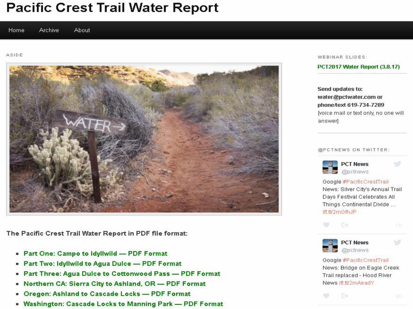
● Removed HTML format due to Google format changes
● PDF format available
● Facebook page created PCT Water & Fire Update Group
● https://www.facebook.com/groups/1601705620156833/
● Stricter standards for reports about water caches.
● @pctwater Twitter account for 2017.

Water Caches
● Should not be relied on.
● With increased numbers of hikers, water caches will be even less reliable in 2017 than previous years.
● The Water Report uses a stricter standard for reporting of water cache info this year.
● Unmaintained water caches are strongly discouraged.

3rd Gate Water Cache
• Mile 91.2 (1/4 mile east of PCT)• No other cache on the PCT as reliable as the 3rd gate cache — don’t
expect to find any other caches like this one!• Take the minimum amount needed• No campfires• Barrel Spring is only 9.9 miles north on the PCT
Source: Jan
3rd Gate Water Cache Usage (gallons)
Year 2012 2013 2014 2015 2016 2017
Use before Feb 25 100 54 62 118
Use by March 31 80 86 172 162 179
Use by April 30 399 486 628 756 971
Use by May 31 737 716 882 1090 1435
Use by Summer 1136 1605
Total Water Used in Gallons 737 716 882 1136 1605
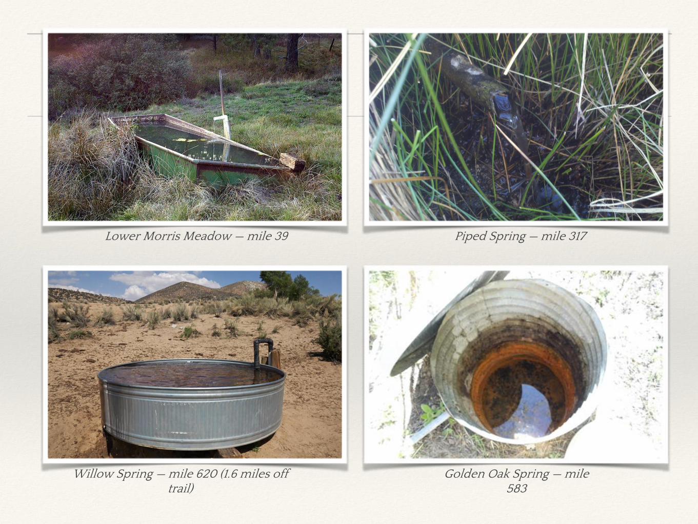
Lower Morris Meadow — mile 39 Piped Spring — mile 317
Willow Spring — mile 620 (1.6 miles off trail)
Golden Oak Spring — mile 583
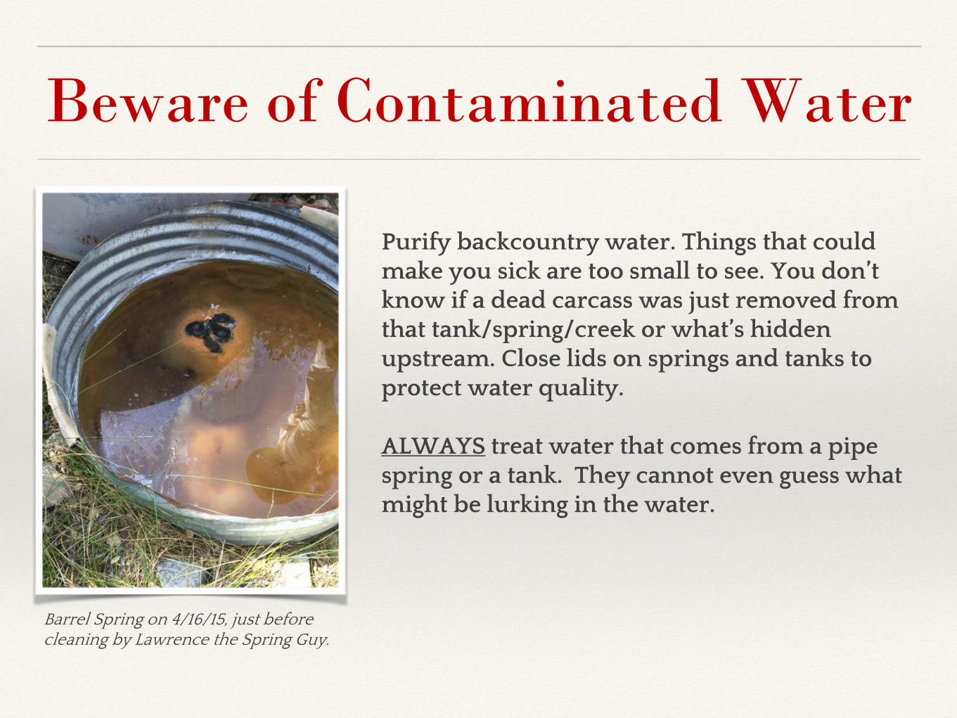
Beware of Contaminated Water
Purify backcountry water. Things that could make you sick are too small to see. You don’t know if a dead carcass was just removed from that tank/spring/creek or what’s hidden upstream. Close lids on springs and tanks to protect water quality.
ALWAYS treat water that comes from a pipe spring or a tank. They cannot even guess what might be lurking in the water.
Barrel Spring on 4/16/15, just before cleaning by Lawrence the Spring Guy.

Dry Sections Of The PCTMile 1 — Campo 19 miles to Lake Morena (CA – Section A)
• Carry plenty of water.
• If you get lost, paved Buckman Springs Road is probably 2 - 3 miles to the east.
• The climb out of Hauser Canyon (mile 15) can be very hot in the late afternoon.
• It’s OK to take two days to do this section.
• If you only carry 1.5 - 3 days of food and resupply in Lake Morena Village (small store) and/or Mt Laguna (small store or mail a package) your pack will be much lighter.
Mile 186 — N Fork San Jacinto 20 miles to Snow Creek (CA – Section B)
• Rescues have occurred in this area from hikers who become lost, dehydrated, sickened by bad food, or difficult snow conditions.
• No water for 20 miles after you pass mile 186.
• PCT descends rapidly from Mt San Jacinto to hot sandy terrain.
Mile 342 — Cajon Pass (Hwy 15) 23 miles to Guffy Spring (CA – Section D)
• Long, usually waterless 6,000 foot climb, limited camping options, often hot weather.
• Guffy Spring went dry multiple times in 2016
Mile 518 — Hikertown 24 miles to Tylerhorse Canyon (CA – Section E)
• Aqueduct roadwalk, often very hot.
Mile 566-653 — California Section F (Tehachapi Pass to Walker Pass)
• Always one of the driest sections of the PCT.
• Hikers usually arrive later in the season when weather is warmer.
• Several 30+ mile waterless sections.
Mile 1375-1404 — Hat Creek Rim (CA – Section N)
• 29 mile waterless section. Side trail to Lost Creek Spring (Mile 1383).
• Hikers usually arrive later in the season when weather is warmer.
• Very little shade.
Mile 1821 - Crater Lake Rim 26 miles to Thielsen Creek (OR – Section C & D)
• 26 mile waterless section.
• Oregon can be surprisingly dry in some sections due to volcanic soil.

California (Section A)Campo to Warner Springs
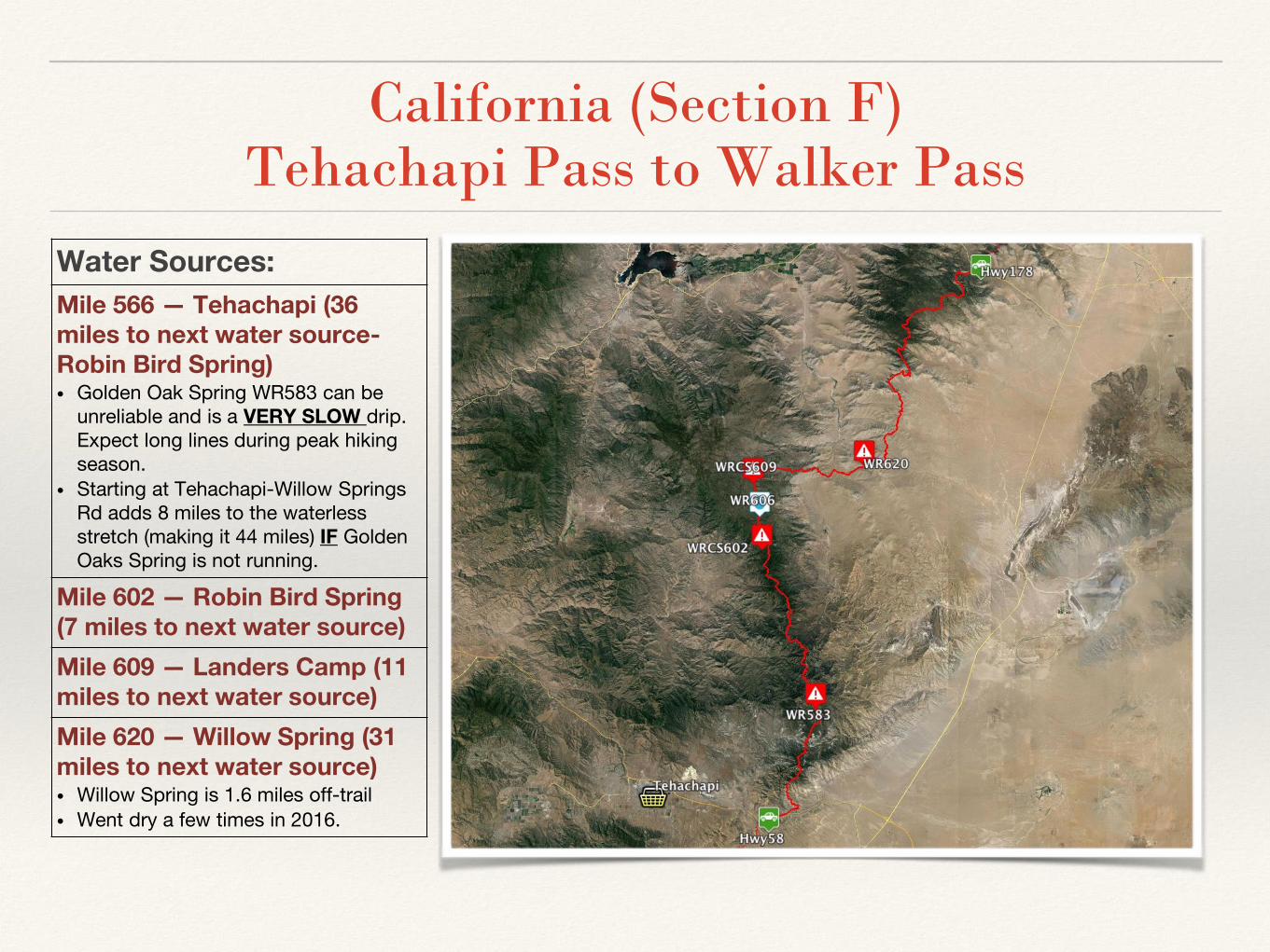
California (Section F)Tehachapi Pass to Walker Pass
Water Sources:
Mile 566 — Tehachapi (36 miles to next water source-Robin Bird Spring)• Golden Oak Spring WR583 can be
unreliable and is a VERY SLOW drip. Expect long lines during peak hiking season.
• Starting at Tehachapi-Willow Springs Rd adds 8 miles to the waterless stretch (making it 44 miles) IF GoldenOaks Spring is not running.
Mile 602 — Robin Bird Spring (7 miles to next water source)
Mile 609 — Landers Camp (11 miles to next water source)
Mile 620 — Willow Spring (31 miles to next water source)• Willow Spring is 1.6 miles off-trail
• Went dry a few times in 2016.
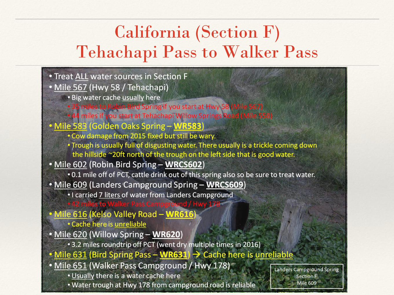
California (Section F)Tehachapi Pass to Walker Pass

Southern California Snow
● It can snow at any place and anytime along the PCT.
● Mt Laguna (mile 42) can get light snow, but it usually melts quickly and not dangerous.
● Mt San Jacinto (mile 170-191) can have steep dangerous snow. A PCT hiker died in this area during a snowstorm in 2005.
● Big Bear area (mile 245 - 275) can have snow. Usually not steep or dangerous along the PCT near Big Bear.
● Mt Baden-Powell (mile 375 - 385) can have steep dangerous snow.

Sierra Snow (2017)● As of early March 2017 Sierra snow
levels are well over 100% of 2016 snow levels.
● Snow can linger on north and east facing mountain slopes or in shade.
● Snow can melt during the day and refreeze at night causing slick dangerous conditions in the morning.
● Hiking on snow be slower than hiking on dry trail even if conditions are not dangerous.
● Snow can completely obscure the trail making navigation difficult.
● Sonora Pass (mile 1,017) can have a lot of snow.
● http://www.climatesignals.org/resources/graph-california-snow-pack-conditions-snow-water-content-february-21-2017
PCT Closures
● Mountain Fire — Mile 166.5 to 177.3: On Mount San Jacinto near Idyllwild. An unofficial 20.4 mile detour bypasses the Mountain Fire closure area and rejoins the PCT at mile 178 near Tahquitz Peak.
• Avoid hiking on Hwy 243 into Idyllwild• https://www.pctmap.net/wp-content/uploads/pct/mountain_file_unofficial_alt_2017.pdf
● Lake Fire (CA-Section C) —PCT is open again but camping is not allowed in the burn area (~4.0 miles of the PCT somewhere near Miles 233 to 252).
● Endangered Species Closure — Mile 386 or 390: After Wrightwood. A 20.5 mile detour that bypasses 7.8 miles of the PCT or the old 4.9 mile detour that bypasses 4 miles of the PCT are possible.
• Closure has been in place for many years to protect the Mountain Yellow-Legged Frog.• Old detour is shorter but requires 2.7 miles of road walking along a potentially
dangerous highway● Sand Fire — Mile 430 to 444: Starts at Angeles Forest Hwy near Mt. Gleason/Messenger
Flats and runs to Soledad Canyon Road.● Powerhouse Fire — Mile 478 to 492: PCT is open again! No closures!
For the latest closure information see:http://www.pcta.org/discover-the-trail/trail-conditions-and-closures/http://www.pctmap.net/updates/
Other Information● Warner Springs Community Center — Mile 109: The Warner Springs Community
Center [near the 1st PCT crossing of Hwy 74] is very hiker-friendly with wi-fi internet access, phone charging, hot meals at reasonable prices, and a small but surprisingly well stocked hiker store. Open 8-4 daily in 2016 (hours may vary in 2017). https://sites.google.com/site/wscrcenter2/home
● Ziggy & The Bear (Whitewater Hiker House) is closed indefinitely! — Mile 211
● The Saufley’s in Agua Dulce is open for 2017! — Mile 454● Hiker Heaven [AKA the Saufley’s]. http://hikerheaven.com/● New Policies http://hikerheaven.com/2017/02/20/hello-world/● Screening for PCTA permits on May 20-21, May 27-29, and June 3-4 ● Hikers are asked to arrive between 7AM-9PM. Outside these hours please camp at
Vazquez Rocks County Park or at the KOA.
● Lassen National Park— Mile 1,344 to 1,363: Bear Canisters are now required by law when camping overnight in Lassen National Park due to an aggressive bear near Lower Twin Lake (Mile 1355.1) in 2016 that harassed multiple hikers for their food. https://www.nps.gov/lavo/learn/news/bear-canisters-required.htm

Poodle Dog Bush (SoCal)
● Multiple fires in 2016 in Southern California Sections C, D, E, and F will probably result in more Poodle Dog Bush than previous years. Do not rub up against this bush as it acts like poison oak and has sent hikers to the hospital in previous hiking years.
● Lake Fire Miles 233 to 252 (California - Section C)● Delamar Fire Miles 275 to 286 (California - Section C)● Blue Cut & Pilot Fires Miles 306 to 370 (California - Sections C & D)● Sand Fire Miles 430 to 444 (California - Section E)● Erskine Fire Miles 604 to 652 (California – Section F)
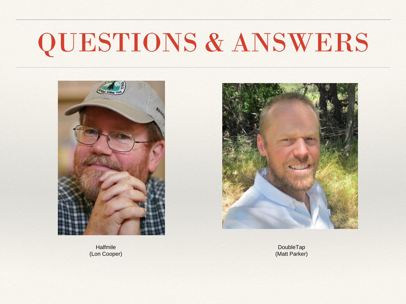
QUESTIONS & ANSWERS
Halfmile
(Lon Cooper)
DoubleTap
(Matt Parker)