padre eusebio kino, - rickbrusca.com reproduction by nicolas de fer circa 1720 based on kino's...
TRANSCRIPT

8 sonorensis | winter 2007
uring the second half of the seventeenth
century, the Spanish, having failed to colonize Lower
California through military expeditions, decided to try
a different approach—using the Catholic Church to
convert the native population. In 1681, due to
circumstances he could not have foreseen, a young
Italian Jesuit novitiate, Eusebio Kino, found himself
sailing from Europe to Mexico to help Spain in this
endeavor. Because of his skills in astronomy and
mathematics, Kino came to be critically important for
Spain’s first missionizing expeditions to Lower
California, and through his early experiences there Kino
became deeply dedicated to the people and geography
of the peninsula. In fact, over the next 30 years, it was
Kino who set Europe straight on the geography of
Lower California, the Sea of Cortez, and the Pimería Alta
(now northern Sonora and southern Arizona).
P a d r e E u s e b i o K i n o ,
R i c h a r d C . B r u s c a , P h . D . ,Executive Program Director, Arizona-Sonora Desert Museum
D

sonorensis | winter 2007 9
Kino attained international fame as acartographer, and his maps provided thefirst-ever accurate delineations of thePimería Alta region. During his years there,Kino established two dozen missions andvisitas (outlying mission stations). He madeclose to 50 exploratory expeditions, gainingthe nickname, “the Padre on horseback.” Hecould equally have been called, “the Padrewho dreamed of crossing the Sea of Cortez,”because throughout his years in the PimeríaAlta he dreamed of a sailing fleet that wouldply the waters of the Gulf to supply a stringof missions he envisioned in LowerCalifornia. However, despite repeatedattempts and continual petitioning of hissuperiors, bureaucracy and circumstanceprevented Kino from living this dream.
When Father Eusebio Francesco Kinodied in 1711, Spain lost one if her mostcourageous explorers and brilliant scholars.Kino died at the age of 66 in a mission hehad founded at Santa María Magdalena deBuquivaba, a town in northern Sonora nowknown as Magdalena de Kino, where hisbones are enshrined today.
Many books and scholarly papers havebeen published about Father Kino, but hereis a look at the good Father that might benew to you. I want to tell you the story ofPadre Kino’s 25-year love affair with the Seaof Cortez and the Baja California peninsula—
a largely unrequited love. But, let’s first placethe good Father in proper historical context.
Not long after Columbus discovered theNew World, the influence of Spain beganspreading throughout Mexico. Belief in asea passage through North America con-necting the Atlantic and Pacific Oceans (thefabled “Strait of Anian”) led Spain to assignHernán Cortés to the first explorations ofwestern Mexico. Cortés made five expedi-tions to the Pacific Coast between 1527 and1539, including a failed attempt to colonizeLower California at Bahía La Paz in 1535.
Although Cortés crossed the Gulf ofCalifornia numerous times, he never sawthe northernmost Gulf. He assigned explo-ration of the north to his deputy, Franciscode Ulloa, who sailed to the uppermost Gulfin 1539. Ulloa was the first European to seteyes on that region and, presumably, to rec-ognize California as a peninsula rather thanan island. He named the Gulf El MarVermejo (the Vermilion Sea) after the colorof the water, but shortly thereafter the namewas changed to Mar de Cortés (Sea ofCortez). A year later, Captain Hernándo deAlarcón also sailed to the upper Gulf in sup-port of a land expedition of Francisco
Vásquez de Coronado. Alarcón actually nav-igated up the Colorado River, perhaps as faras its confluence with the Gila River.However, as fate would have it, news fromUlloa and Alarcón of the peninsular natureof Lower California did not reach mostEuropean cartographers, and it continued tobe depicted as an island on most earlyEuropean maps of North America.
Although Cortés failed to establish a mil-itary colony for Spain in Lower California,he did bring back the first sea pearls fromthe New World. The beautiful pearls wereenough to keep the Spaniards coming backto the peninsula for another 200 years (see“Harvesting the Sea of Cortez,” page 42).
Now, fast-forward nearly 150 years to 1681,when 36-year-old Eusebio Kino landed onthe eastern shore of New Spain and traveledto Mexico City to wait for direction from hissuperiors. The fledgling missionary’s firstassignment—issued by the Viceroy of NewSpain himself, Don Tomás Antonio de laCerda y Aragón, Conde de Paredes—was tojoin an expedition under the command ofAdmiral Isidoro y Atondo, Governor ofSinaloa and the Californias, to cross the Seaof Cortez. Selected because of his mathe-
10 sonorensis | winter 2007
matical and astronomical skills, Kino heldthe official title of “Royal Cosmographerfor the California Expedition”—in otherwords, astronomer, surveyor, and map-maker. They were to explore the south-ern reaches of Lower California, and inApril 1683 the expedition set out, in partto find the fabled pearl beds reported byCortés and other Spanish explorers.
They sailed from Mazatlán andmade landfall near Bahía La Paz, theoriginal site where Cortés had landed,and here Atondo declared authorityover the land in the name of KingCharles II. However, like Cortés, Atondoand Kino found it impossible to estab-lish a colony because of the unfriend-ly Natives, inaccessible freshwatersources, and lack of easily obtainedfood. On a second expedition inOctober 1683, they landed furthernorth, near the stunningly beautifulBahía Concepción, where they foundboth Natives and freshwater sourcesmore amenable. Here, Kino establishedthe first, albeit short-lived, mission inLower California, which he named SanBruno. Here, he also established thefirst vineyard in the Californias.
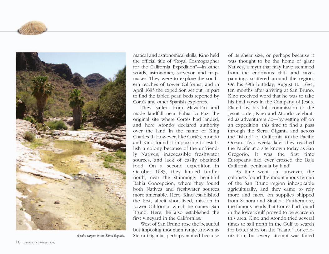
West of San Bruno rose the beautifulbut imposing mountain range known asSierra Giganta, perhaps named because
of its shear size, or perhaps because itwas thought to be the home of giantNatives, a myth that may have stemmedfrom the enormous cliff- and cave-paintings scattered around the region.On his 39th birthday, August 10, 1684,ten months after arriving at San Bruno,Kino received word that he was to takehis final vows in the Company of Jesus.Elated by his full commission to theJesuit order, Kino and Atondo celebrat-ed as adventurers do—by setting off onan expedition, this time to find a passthrough the Sierra Giganta and acrossthe “island” of California to the PacificOcean. Two weeks later they reachedthe Pacific at a site known today as SanGregorio. It was the first timeEuropeans had ever crossed the BajaCalifornia peninsula by land!
As time went on, however, thecolonists found the mountainous terrainof the San Bruno region inhospitableagriculturally, and they came to relymore and more on supplies shippedfrom Sonora and Sinaloa. Furthermore,the famous pearls that Cortés had foundin the lower Gulf proved to be scarce inthis area. Kino and Atondo tried severaltimes to sail north in the Gulf to searchfor better sites on the “island” for colo-nization, but every attempt was foiledA palm canyon in the Sierra Giganta.

sonorensis | winter 2007 11
by circumstances of weather or bureaucra-cy. On one such attempt, winds drove theirship ashore in Sonora in the land of SeriIndians, and thus the site later came to becalled Bahía Kino.
In 1685, due to their faltering successes,the San Bruno colony was ordered to returnto the mainland. However, his brief time inBaja California had given Kino a deeprespect for the land, the Native people, andthe beautiful and bountiful Sea of Cortez.Memories of those times tugged on Kino’sheart for the rest of his life, and he contin-ued to petition to be reassigned back to thatharsh dry peninsula. A longing to returnalso drove him to spend many years explor-ing for a convenient “missionizing route,”either by sea or by land, from the PimeríaAlta to Lower California, and Kino’s mostfamous explorations in the Southwest grewfrom this longing.
When Kino arrived back in Sonora, Spanishsettlements were already scattered amongthe indigenous peoples (e.g., Ópatas,Yaquis, Mayos, Pimas). When he enteredthe Pimería Alta, his attraction to the Sea of
Cortez led him to request permission tobegin establishing missions first along thecoast of Sonora, beginning in the Seri terri-tory he had recently seen. Although hisrequest to return to the Gulf was granted,
circumstances kept him from the sea heloved. The Alcalde Mayor of Sonora,Antonio Barba de Figuera, convinced Kino’ssuperiors in Mexico City to assign him to theinterior, where de Figuera suspected the
A reproduction by Nicolas de Fer circa 1720 based on Kino's 1691 map,"Teatro de los trabajos," shows the early persistent view of the peninsula as
an island. This reproduction from Paris appears in Kino and the Cartography of Northwest New Spain by Ernest J. Burrus.

12 sonorensis | winter 2007
Piman people might be scheming to cut offthe Spanish advance to the north.
Thus it was that Kino established whatcame to be his home for the rest of his lifein the foothills of the Sierra Madre
Occidental at the Piman village of Cosari,which he renamed Nuestra Señora de losDolores del Cosari in honor of “Our Lady ofSorrows.” The first Jesuit missionary to takeup residence in northern Sonora, Kinoworked throughout the area for 24 years,
from 1687 to 1711. Using the mission atDolores as his home base, Kino criss-crossed the Pimería Alta time after time,blazing new supply routes, establishingnew missions, and mapping the area forNew Spain. Many times he traveled a routefrom Sonoyta, across a track that eventual-ly came to be known as the El Camino delDiablo, toward the confluence of the Gilaand Colorado Rivers.
In 1690, Mexico City sent the Jesuit PadreJuan María Salvatierra to inspect Kino’sprogress. Kino and Salvatierra immediatelybecame comrades, both being explorers atheart. During this visit, Kino told Salvatierra ofhis passion to cross the waters of the Gulf andreturn to a missionary life in Lower California.Kino even talked Salvatierra into supportingthe construction of a boat that could deliversupplies from Sonora to the missions heimagined strung along the peninsula.
In 1693, not long after winning overSalvatierra, Kino also met and befriendedthe military commander Juan Mateo Manje.It took Kino no time at all to convinceManje to accompany him on exploratorysojourns to the northwest in search of a pos-sible land passage to Lower California. Healso convinced Manje to help him build theship of his dreams to explore the Sea ofCortez and deliver supplies to future mis-sions across those waters. The followingyear, they actually began building the shipat Caborca, planning to transport it to themouth of the Río Concepción. Then, onceagain, fate intervened to blunt Kino’sdreams. In June 1694, Kino received a letterfrom Father Juan Muñoz de Burgos, a high-ranking Visitor (traveling dignitary) fromSpain, forbidding him from completing theship. It seems the Jesuit Order was deter-mined to keep Kino in the Pimería Alta.
Kino convinced Manje
to help him build the ship
of his dreams to explore the
and deliver supplies
to future missions across
those waters.
La Concepción de Nuestra Señora de Caborca church, in CaborcaSonora, was built on the site of one of Kino's original missions.
It was designed by the same master architect who built San Xavier del Bac in Tucson.
phot
oby
Jesú
sGa
rcía

sonorensis | winter 2007 13
In the meantime, Manje’s own explo-rations to the north brought word to Kino ofa “great river eight day’s ride north of SanXavier del Bac.” Kino and Manje soonmounted a new expedition, following theSanta Cruz River north from Tucson to theGila River, where the Indigenous Peoplelived in large villages. Here, they found theruins of Casa Grande; the first writtendescription of Casa Grande came from thisexpedition. Kino and Manje suspected theruins must be part of the “Seven Cities ofCíbola” for which Coronado and Marcos deNiza had searched in vain.
Despite these wondrous discoveries,Kino continued to be driven by his passionfor Lower California, and late in 1695 (at theage of 50) he rode to Mexico City where heargued once again for re-establishing mis-sions there. Arriving in Mexico City onJanuary 8, 1696, he discovered that Romehad finally agreed to his request and hadrecommended to the new Provincial, FatherJuan de Palacios, that Kino be assigned sixmonths per year in Pimería Alta and sixmonths in Baja California. Kino was elated!Kino and Salvatierra enlisted the aid ofFather Juan de Ugarte, and the three ofthem concocted a plan for the conversion ofLower California and sent it to Rome. Romeaccepted the plan and was so supportivethat in 1697 they assigned Kino full-time to
Lower California. To Kino, it seemed to bea dream come true, and once again hebegan planning for a fleet of ships thatwould sail the Sea of Cortez.
So it was that ten years after the foundingof Dolores, Kino followed the Río Yaqui tothe coast to meet Salvatierra, to begin their
new adventure to the west. However, as Kinoneared the meeting place, a courier appearedon horseback with a message from theViceroy and Provincial in Mexico, a messagethat ordered Kino to cancel his Californiaplans and return to the Pimería Alta immedi-ately. Local authorities had overridden hisassignment from Rome. They needed him
more in Sonora than in Lower California!Kino was heartbroken. Salvatierra made thejourney across the Gulf on his own to founda new mission at Loreto, the first “permanent”mission in Lower California.
Despite these wondrous discoveries,
Kino continued to be
driven by his passion for
and late in 1695 he rode to
Mexico City where he argued
once again for re-establishing
missions there.Pinacate Peak, from which Padre Kino first gained visual evidence thatLower California is a peninsula, not an island.

14 sonorensis | winter 2007
Ever drawn to the west, in 1698 Kinomounted a new expedition to survey thenorthernmost coastline of the Gulf.Upon reaching the Pima village ofSonoyta, he heard of a great river to thenorthwest, even larger than the Gila,which was said to empty directly intothe sea. (This, of course, proved to bethe mighty Colorado River.) The Sonoytavillagers urged him to visit the Pinacate,and to climb to the top of Santa ClaraPeak (now known as Pinacate Peak) toview the upper Gulf. He did that, andfollowing the horizon with his tele-scope, he traced the gigantic BahíaAdaír stretching away to the northwest,sinking into a distant haze at theColorado River delta, and rising again asthe Sierra San Pedro Mártir in northernBaja California. Although he couldn’t becertain, he felt strongly that LowerCalifornia must not be an island at all,but a peninsula. His ambition to find aland route to Lower California greweven stronger.
Kino returned to Dolores and enlist-ed Captain Manje to mount a majorexpedition with some 90 pack animalsand a host of Native scouts and vaque-ros. Early in 1699 the expedition depart-ed, moving up through the Altar Valleytoward Tucson, then cutting westward
along the southern flanks of theBaboquivari Mountains to Sonoyta,from whence the party traversed theinfamous Camino del Diablo. From ahigh peak in the Gila Mountains, nearYuma, Kino saw the junction of the Gilaand Colorado Rivers. Yuman Indiansfrom the Colorado River Valley broughtthem gifts, among which were exqui-site, gigantic, pearlescent-blue shellsthat reverberated in Kino’s memory.
These were the shells of abalone, the same giant snails he had seen 15years earlier when he and Atondo firstcrossed the Baja peninsula to the Pacificshore. Because Kino knew abalone didnot occur in the Sea of Cortez, these
From this trip came
one of Kino’s most famous maps
of the
region and
Lower California.
Kino's 1702 map of the Sea of Cortez and Baja California peninsula. From Kino and the Cartography of Northwest New Spain, by Ernest J. Burrus.
Abalone shell with outer layer removed to expose the nacreous layer.

sonorensis | winter 2007 15
shells reaffirmed his suspicion that the landof Pimería Alta stretched all the way to thePacific shores of Lower California.
Kino made the California approachagain several times from 1699 to 1702, withand without Manje, but circumstances pre-vented them from crossing the ColoradoRiver or tracing it south to the Sea of Cortez.During the first 1701 expedition, the partynearly died of thirst in the sand dunes of theGran Desierto (on this trip, Kino againviewed the upper Gulf from the top ofPinacate Peak). Finally, early in 1702 thepersistent Padre successfully traveled all the way to the Colorado River. Probably the first European to cross that river, Kino followed it to the swamplands of the delta,far enough to be certain that LowerCalifornia was not an island, but a peninsu-la. From this trip came one of Kino’s mostfamous maps of the Pimería Alta region andLower California.
In 1706, two other Italian Jesuits,Fathers Domingo Crescoli and GerónimoMinutuli, joined Kino in a journey towardthe central Sonoran coast. Leaving Crescoliat Caborca, Kino and Minutuli continuedon to explore the coast, and while there,Kino revisited the bay that is now namedin his honor in the land of the Seris. Withhis new Italian friends, Kino cooked upone last scheme to build a fleet of ships
that wouldsail the Sea ofCortez, using IslaTiburón (namedSanta Iñez by Kino) asa stepping stone to movesupplies from the mainlandto the missions being built bySalvatierra in Lower California. Kino neverrealized this dream, but 14 years laterUgarte did build his own famous ship, theTriunfo de la Santa Cruz.
In 1711, Kino left Dolores for what hehoped would be the trek that finally mappedthe entire upper Gulf, providing detailedcartographic proof that Lower California wasa peninsula. During a stop-over at the Pimanvillage of Buquivaba, Kino dedicated a newchapel to his patron saint, St. Francis Xavier.The night of the dedication—just after midnight, March 15, 1711—the good Fatherfell ill and died. However, before departingon this fateful final voyage, Kino had drawn the most accurate map ever of theSea of Cortez, labeling Lower California“Penisla de California” [sic].
After leaving San Bruno in 1685, Kinonever again sailed across the Sea ofCortez. But the region to the west tuggedon his spirit, driving him to make discov-eries and see lands that no European hadever seen before. S
These were the shells of
the same giant snails he had seen
15 years earlier when he and
Atondo first crossed the
Baja peninsula
to the
Pacific shore.
Native American necklace of abalone. In the collection at Mission San Francisco de Asis(also known as Dolores Mission), San Francisco, California.
Abalone shell showing inner, pearlescent layer.