parks and open space master plan open space element 7
TRANSCRIPT
PARKS AND OPEN SPACE MASTER PLAN
OPEN SPACE ELEMENT
7
7-1
This chapter examines current and future needs for open space in Thornton, and identifies and evaluates sites in Thornton and its planned growth area that have high value historical and natural resources. The chapter presents specific recommendations for preserving certain sites as part of an open space or open lands system.
Thornton residents have indicated that open space is one of the important elements of the community’s appeal and quality of life. The value that residents place on open space was confirmed by passage of the Park and Open Space Sales and Use Tax in November 1997 and 2013 extension. The ballot language for this tax measure included a definition of open space that is summarized below:
» Natural areas for the preservation of wildlife, and their habitats that support existing populations of bald eagles, other birds of prey (raptors), deer, beaver, waterfowl, and numerous other native species.
» Wildlife corridors to support the movement and migration of wildlife species currently using undeveloped areas.
» Wetlands that support important wildlife ecosystems and provide hydrologic benefits.
» Areas with significant view corridors and buffers.
(The actual ballot language for the parks and open space sales and use tax is included in the Technical Appendice 2 and 4.)
EXISTING CONDITIONS
For a variety of reasons, much of Thornton has developed in a manner that has left pockets of open land throughout the community. Some of this land is still actively farmed, giving Thornton residents a continual reminder of the agricultural heritage of the area. In addition, the Thornton Planned Growth Area that extends north and east from the urbanized part of the community is mostly undeveloped, with land that is either lying fallow or in active agriculture.
As Thornton grows, these lands are being developed for residential, commercial, and office uses that are a part of an expanding community. Responsible growth and development have benefits for Thornton’s residents: jobs are created, services and shopping opportunities are increased, and tax revenues needed to provide municipal services to residents are generated.
Thornton’s total open lands and designated open space acreage is 1,546.4acres (which includes properties that are currently not open to the public). Based on the City’s 2015 population (131,761), this represents
Several of the larger city-owned designated Open Space and Open Land properties include:
» Big Dry Creek Open Space: 221.3 acres
» Aylor Open Land: 139.2 acres
» Riverdale Open Space & Prairie Dog Habitat and Grandview Ponds Open Space & Prairie Dog Habitat: 119.9 acres
» Eastlake #3 Park & Nature Preserve: 106.8 acres
» West Gravel Lakes Fishing Facility: 104.2 acres
» West Sprat Platte Lake Fishing Facility:102.7 acres
» Thornton Trail Winds Park & Open Space (open lands/designated open space area only): 90.7 acres
» Signal Ditch Park & Open Space (open lands/designated open space area only): 60.5 acres
» Niver Open Space: 63.3 acres
» Niver Tributary L Open Space: 8.8 acres
» Margaret W. Carpenter Park & Open Space (open lands/designated open space area only): 47.4 acres
» Lambertson Lakes Park & Open Space: 31 acres designated open space + 9.8 acre farmstead
» Badding Open Space and Badding Detention: 28.5 Acres
» Eastlake Uplands Open Space: 14 acres
CITY OF THORNTON PARKS & OPEN SPACE MASTER PLAN
7.OPEN SPACE ELEMENT
7-2
approximately 11.8 acres of designated open space and open lands per 1,000 people. If the same level of service were to be maintained for the next 7 years, roughly 1,817.2 total acres of designated open space and open lands would be needed to accommodate the city’s projected 2023 population of 154,000 persons (270.8 additional acres would need to be acquired).
The remainder of this section provides a summary of the important physical and environmental resources within Thornton and its planned growth area. Supporting mapping and analysis is provided in the Technical Appendix 9.
Topography and Views
Some areas of Thornton have substantial topographic relief. A central ridge extending north-south through the city provides a number of opportunities for long distance views, with especially dramatic views of the mountains to the west, the Denver skyline to the south, and the South Platte River valley to the east. This and other ridges also form valleys that have a pleasant sense of enclosure.
Water Features and Floodplains
In addition to its ridgelines, Thornton contains a variety of water features, including ponds, irrigation ditches, reservoirs, creeks, and the South Platte River. A number of natural drainages traverse Thornton and its planned growth area. These drainages collect runoff and channel it to the South Platte River. While larger streams such as Big Dry Creek, Brantner Gulch, Grange Hall Creek, and Niver Creek provide most of the major resource values, a number of smaller tributary drainages add to the amount, diversity, and connectivity of these features within Thornton. Areas subject to flooding along these drainages are indicated by floodplain designations on special maps. Importantly, floodplains provide storage space for excess floodwater, allow for groundwater recharge, and attenuate floodwater surges. Floodplains and riparian areas also support diverse wildlife habitats, serve as wildlife movement corridors, and are appreciated for their aesthetic qualities.
Vegetation
Thornton’s current land cover is mostly agricultural and urban lands, though important remnants of native vegetation communities remain. The dominant vegetation types found across all properties are dryland farmland and introduced grasslands. The highest quality vegetation types for wildlife habitat are riparian or wetland vegetation types and native grasslands.
The most important areas of natural vegetation are the riparian corridors along the South Platte River, Big Dry Creek, Niver Creek, and their tributary drainages. Smaller areas of native plant communities, or of non-native communities that provide similar ecological and visual values, are found in small pockets throughout Thornton.
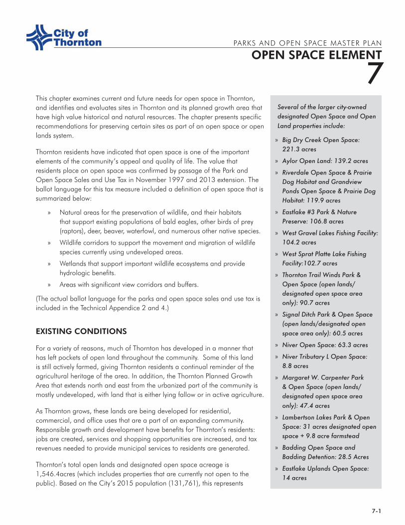
Views from Homestead Hills Park and Open Space
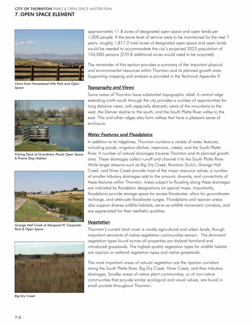
Fishing Deck at Grandview Ponds Open Space & Prairie Dog Habitat
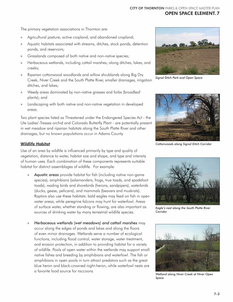
Grange Hall Creek at Margaret W. Carpenter Park & Open Space
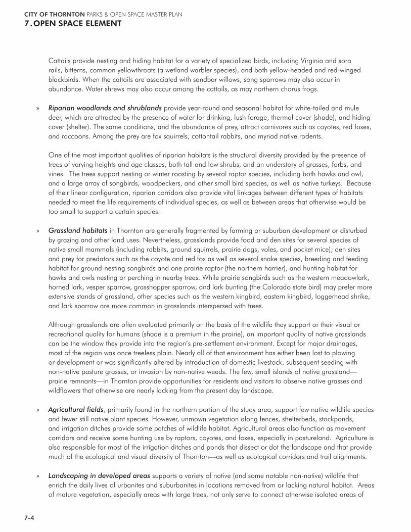
Big Dry Creek
CITY OF THORNTON PARKS & OPEN SPACE MASTER PLAN
OPEN SPACE ELEMENT.7
7-3
The primary vegetation associations in Thornton are:
» Agricultural pasture, active cropland, and abandoned cropland;
» Aquatic habitats associated with streams, ditches, stock ponds, detention ponds, and reservoirs;
» Grasslands composed of both native and non-native species;
» Herbaceous wetlands, including cattail marshes, along ditches, lakes, and creeks;
» Riparian cottonwood woodlands and willow shrublands along Big Dry Creek, Niver Creek and the South Platte River, smaller drainages, irrigation ditches, and lakes;
» Weedy areas dominated by non-native grasses and forbs (broadleaf plants); and
» Landscaping with both native and non-native vegetation in developed areas.
Two plant species listed as Threatened under the Endangered Species Act - the Ute Ladies’-Tresses orchid and Colorado Butterfly Plant - are potentially present in wet meadow and riparian habitats along the South Platte River and other drainages, but no known populations occur in Adams County.
Wildlife Habitat
Use of an area by wildlife is influenced primarily by type and quality of vegetation, distance to water, habitat size and shape, and type and intensity of human uses. Each combination of these components represents suitable habitat for distinct assemblages of wildlife. For example:
» Aquatic areas provide habitat for fish (including native non-game species), amphibians (salamanders, frogs, true toads, and spadefoot toads), wading birds and shorebirds (herons, sandpipers), waterbirds (ducks, geese, pelicans), and mammals (beavers and muskrats). Raptors also use these habitats: bald eagles may feed on fish in open water areas, while peregrine falcons may hunt for waterfowl. Areas of surface water, whether standing or flowing, are also important as sources of drinking water by many terrestrial wildlife species.
» Herbaceous wetlands (wet meadows) and cattail marshes may occur along the edges of ponds and lakes and along the floors of even minor drainages. Wetlands serve a number of ecological functions, including flood control, water storage, water treatment, and erosion protection, in addition to providing habitat for a variety of wildlife. Pools of open water within the wetlands may support small native fishes and breeding by amphibians and waterfowl. The fish or amphibians in open pools in turn attract predators such as the great blue heron and black-crowned night-heron, while waterfowl nests are a favorite food source for raccoons.
Signal Ditch Park and Open Space
Wetland along Niver Creek at Niver Open Space
Eagle’s nest along the South Platte River Corridor
Cottonwoods along Signal Ditch Corridor
CITY OF THORNTON PARKS & OPEN SPACE MASTER PLAN
7.OPEN SPACE ELEMENT
7-4
Cattails provide nesting and hiding habitat for a variety of specialized birds, including Virginia and sora rails, bitterns, common yellowthroats (a wetland warbler species), and both yellow-headed and red-winged blackbirds. When the cattails are associated with sandbar willows, song sparrows may also occur in abundance. Water shrews may also occur among the cattails, as may northern chorus frogs.
» Riparian woodlands and shrublands provide year-round and seasonal habitat for white-tailed and mule deer, which are attracted by the presence of water for drinking, lush forage, thermal cover (shade), and hiding cover (shelter). The same conditions, and the abundance of prey, attract carnivores such as coyotes, red foxes, and raccoons. Among the prey are fox squirrels, cottontail rabbits, and myriad native rodents. One of the most important qualities of riparian habitats is the structural diversity provided by the presence of trees of varying heights and age classes, both tall and low shrubs, and an understory of grasses, forbs, and vines. The trees support nesting or winter roosting by several raptor species, including both hawks and owl, and a large array of songbirds, woodpeckers, and other small bird species, as well as native turkeys. Because of their linear configuration, riparian corridors also provide vital linkages between different types of habitats needed to meet the life requirements of individual species, as well as between areas that otherwise would be too small to support a certain species.
» Grassland habitats in Thornton are generally fragmented by farming or suburban development or disturbed by grazing and other land uses. Nevertheless, grasslands provide food and den sites for several species of native small mammals (including rabbits, ground squirrels, prairie dogs, voles, and pocket mice); den sites and prey for predators such as the coyote and red fox as well as several snake species, breeding and feeding habitat for ground-nesting songbirds and one prairie raptor (the northern harrier), and hunting habitat for hawks and owls nesting or perching in nearby trees. While prairie songbirds such as the western meadowlark, horned lark, vesper sparrow, grasshopper sparrow, and lark bunting (the Colorado state bird) may prefer more extensive stands of grassland, other species such as the western kingbird, eastern kingbird, loggerhead shrike, and lark sparrow are more common in grasslands interspersed with trees. Although grasslands are often evaluated primarily on the basis of the wildlife they support or their visual or recreational quality for humans (shade is a premium in the prairie), an important quality of native grasslands can be the window they provide into the region’s pre-settlement environment. Except for major drainages, most of the region was once treeless plain. Nearly all of that environment has either been lost to plowing or development or was significantly altered by introduction of domestic livestock, subsequent seeding with non-native pasture grasses, or invasion by non-native weeds. The few, small islands of native grassland—prairie remnants—in Thornton provide opportunities for residents and visitors to observe native grasses and wildflowers that otherwise are nearly lacking from the present day landscape.
» Agricultural fields, primarily found in the northern portion of the study area, support few native wildlife species and fewer still native plant species. However, unmown vegetation along fences, shelterbeds, stockponds, and irrigation ditches provide some patches of wildlife habitat. Agricultural areas also function as movement corridors and receive some hunting use by raptors, coyotes, and foxes, especially in pastureland. Agriculture is also responsible for most of the irrigation ditches and ponds that dissect or dot the landscape and that provide much of the ecological and visual diversity of Thornton—as well as ecological corridors and trail alignments.
» Landscaping in developed areas supports a variety of native (and some notable non-native) wildlife that enrich the daily lives of urbanites and suburbanites in locations removed from or lacking natural habitat. Areas of mature vegetation, especially areas with large trees, not only serve to connect otherwise isolated areas of
CITY OF THORNTON PARKS & OPEN SPACE MASTER PLAN
OPEN SPACE ELEMENT.7
7-5
natural habitat, they also attract use by some surprising wildlife species. Great horned owls, eastern screech-owls, Cooper’s hawks, sharp-shinned hawks, and American kestrels are quite at home in parks, cemeteries, and older neighborhoods, as other species such as the northern flicker, downy woodpecker, Say’s phoebe, American crow, blue jay, American robin, black-capped chickadee, house wren, Bullock’s oriole, Brewer’s blackbird, common grackle, yellow warbler, warbling vireo, house finch, American goldfinch, and lesser goldfinch. During spring migration, numerous additional birds pass through these areas. Recently, predators such as the coyote and red fox have joined the raccoon, striped skunk, fox squirrel, and cottontail rabbit as species willing to share the landscaped environment with humans.
Wildlife
» Federally Listed Threatened or Endangered Wildlife: There are no Threatened, Endangered or Candidate wildlife species listed by the U.S. Fish and Wildlife Service (USFWS) under the Endangered Species Act known to occur in Thornton. The bald eagle, formerly listed as Endangered under the Endangered Species Act, was delisted on July 9, 2007, and is protected under the Bald and Golden Eagle Protection Act and the Migratory Bird Treaty Act. Thornton lies in the migration path for a large number of bald eagles that use large cottonwood trees along the South Platte River (and other drainages) and surrounding lakes for perching, and search for their preferred prey—fish and waterfowl—in the open water. During winter, bald eagles use the river and lakes but, wander farther afield in search of prairie dogs, rabbits, or carrion. Bald eagle nesting undoubtedly occurred historically along the South Platte River and Big Dry Creek and this habitat could support nesting in the future. In recent years, bald eagles have nested in nearby areas, including Barr Lake and Standley Lake. The continued presence of bald eagles in Thornton will depend on the availability of perching and hunting habitat in areas relatively free from human disturbance. Preble’s meadow jumping mouse (Zapus hudsonius preblei), listed as Threatened under the Endangered Species Act, has not been found in Thornton. It occurs in nearby areas of the Front Range, and major riparian corridors in Thornton provide potentially suitable habitat. The piping plover (Charadrius melodus circumcinctus), listed as Threatened under the Endangered Species Act, is a potential migrant or nester on sandbars, shorelines, and islands in the South Platte River and associated lakes, although the species is not currently known to occur in or near Thornton.
» State Listed Threatened, Endangered, or Special Concern Species: The Colorado Parks & Wildlife (CPW) maintains a list of species which, while not threatened or endangered at the national level, are given a special designation in Colorado. The only state listed species known to occur in the Thornton area is the burrowing owl, which nests in prairie dog towns. Not given a special statutory status but also considered rare or imperiled in Colorado are a variety of “State Special Concern” species. Among these are several species known to occur or be potentially present in the Thornton area: black-tailed prairie dog, swift fox, Townsend’s big-eared bat, ferruginous hawk, peregrine falcon (previously federally listed as threatened), western snowy plover, common garter snake, and northern leopard frog. Big Dry Creek provides potential habitat for three special-concern non-game fishes—the brassy minnow, common shiner, and plains killifish (also called plains top minnow, but not a member of the minnow family). The black-tailed prairie dog, swift fox, ferruginous hawk, and snowy plover are prairie species, while the other species are associated with aquatic, wetland, or riparian habitats.
CITY OF THORNTON PARKS & OPEN SPACE MASTER PLAN
7.OPEN SPACE ELEMENT
7-6
» Other Sensitive or Locally Important Species: These include species that occur infrequently or in small numbers due to limited habitat availability, are adapted to a narrow range of habitats, or otherwise are of special interest to Thornton residents. Examples include white-tailed and mule deer, predators such as the coyote and red fox; waterbirds such as the American white pelican and great blue heron; raptors such as the golden eagle, red-tailed hawk, Swainson’s hawk, Cooper’s hawk, sharp-shinned hawk, northern harrier, great horned owl, eastern screech-owl, and barn owl; and amphibians such as the tiger salamander, Woodhouse’s toad, Great Plains toad, plains spadefoot toad, and northern chorus frog. Although too numerous to list, several species of arboreal songbirds are essentially limited to areas of mature cottonwoods, which they use for nesting, resting, and feeding. Among these are “Neotropical migrant” songbirds that winter in Central or South America and either nest in riparian forests along the Front Range or pass through on their way north or to higher elevations. These species, along with raptors and waterbirds, are of special interest to “birders” or other nature-lovers. Without Thornton’s riparian cottonwoods and large lakes, opportunities to observe and enjoy these species would be greatly diminished. In 2009, Thornton adopted a Coyote Management Plan to address human-coyote conflicts on city-owned public lands. The plan, which is incorporated as Appendix 15 to this document, provides guidelines for responses to conflicts with coyotes, particularly to resolve and reduce human-coyote conflicts in a consistent and expedient manner. Public safety is the number one concern of the city and coyotes will be managed with human safety as a priority. The city’s Animal Control Division of the Police Department is the primary contact for response and information regarding coyotes. The Colorado Parks and Wildlife (CPW) also provides guidance and education to residents and the city in managing nuisance coyotes. CPW personnel will respond to reports of dangerous coyotes and help make a management decision based on the interest of public safety. Education and awareness are pro-active tools to avoiding human-coyote conflicts. Animal Control Officers, Parks & Open Space and Neighborhood Services staff, the city website, Inside Thornton magazine and Channel 8 are in-house resources to facilitate outreach.
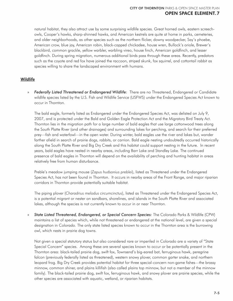
The black-tailed prairie dog is a State Species of Special Concern due to habitat loss, disease, poisoning, and recreational shooting.
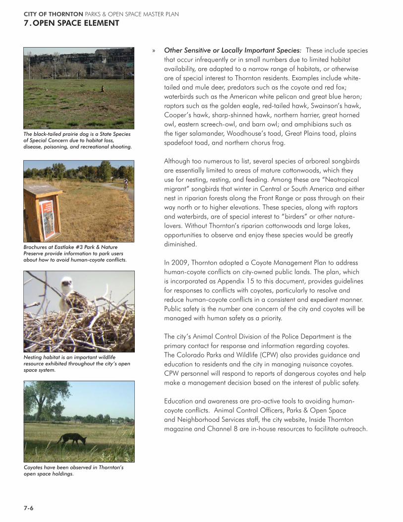
Brochures at Eastlake #3 Park & Nature Preserve provide information to park users about how to avoid human-coyote conflicts.
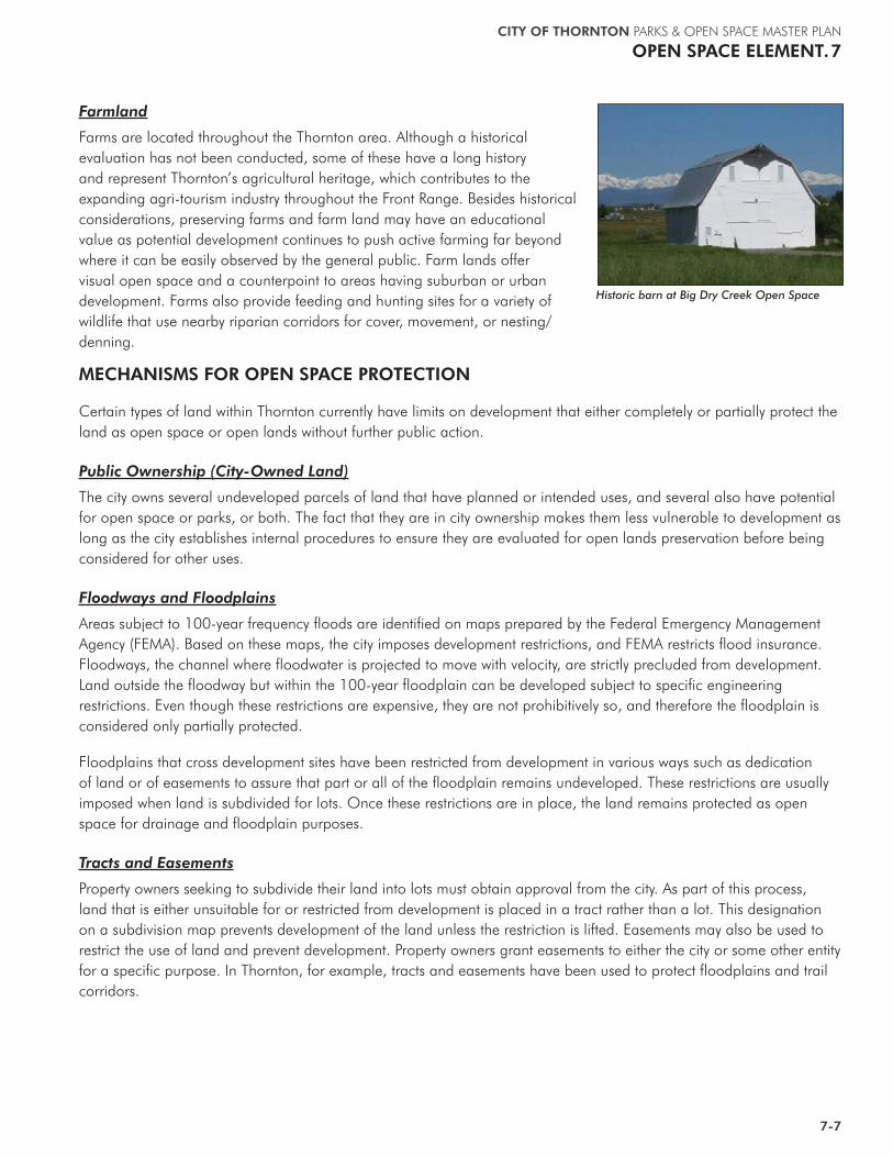
Nesting habitat is an important wildlife resource exhibited throughout the city’s open space system.
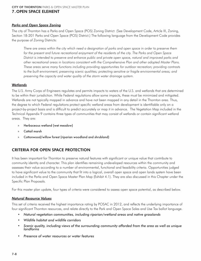
Coyotes have been observed in Thornton’s open space holdings.
CITY OF THORNTON PARKS & OPEN SPACE MASTER PLAN
OPEN SPACE ELEMENT.7
7-7
Farmland
Farms are located throughout the Thornton area. Although a historical evaluation has not been conducted, some of these have a long history and represent Thornton’s agricultural heritage, which contributes to the expanding agri-tourism industry throughout the Front Range. Besides historical considerations, preserving farms and farm land may have an educational value as potential development continues to push active farming far beyond where it can be easily observed by the general public. Farm lands offer visual open space and a counterpoint to areas having suburban or urban development. Farms also provide feeding and hunting sites for a variety of wildlife that use nearby riparian corridors for cover, movement, or nesting/denning.
Historic barn at Big Dry Creek Open Space
MECHANISMS FOR OPEN SPACE PROTECTION
Certain types of land within Thornton currently have limits on development that either completely or partially protect the land as open space or open lands without further public action.
Public Ownership (City-Owned Land)
The city owns several undeveloped parcels of land that have planned or intended uses, and several also have potential for open space or parks, or both. The fact that they are in city ownership makes them less vulnerable to development as long as the city establishes internal procedures to ensure they are evaluated for open lands preservation before being considered for other uses.
Floodways and Floodplains
Areas subject to 100-year frequency floods are identified on maps prepared by the Federal Emergency Management Agency (FEMA). Based on these maps, the city imposes development restrictions, and FEMA restricts flood insurance. Floodways, the channel where floodwater is projected to move with velocity, are strictly precluded from development. Land outside the floodway but within the 100-year floodplain can be developed subject to specific engineering restrictions. Even though these restrictions are expensive, they are not prohibitively so, and therefore the floodplain is considered only partially protected.
Floodplains that cross development sites have been restricted from development in various ways such as dedication of land or of easements to assure that part or all of the floodplain remains undeveloped. These restrictions are usually imposed when land is subdivided for lots. Once these restrictions are in place, the land remains protected as open space for drainage and floodplain purposes.
Tracts and Easements
Property owners seeking to subdivide their land into lots must obtain approval from the city. As part of this process, land that is either unsuitable for or restricted from development is placed in a tract rather than a lot. This designation on a subdivision map prevents development of the land unless the restriction is lifted. Easements may also be used to restrict the use of land and prevent development. Property owners grant easements to either the city or some other entity for a specific purpose. In Thornton, for example, tracts and easements have been used to protect floodplains and trail corridors.
CITY OF THORNTON PARKS & OPEN SPACE MASTER PLAN
7.OPEN SPACE ELEMENT
7-8
Parks and Open Space Zoning
The city of Thornton has a Parks and Open Space (POS) Zoning District. (See Development Code, Article III, Zoning, Section 18-201 Parks and Open Space (POS) District.) The following language from the Development Code provides the purpose of Zoning Districts:
There are areas within the city which need a designation of parks and open space in order to preserve them for the present and future recreational enjoyment of the residents of the city. The Parks and Open Space District is intended to preserve and enhance public and private open space, natural and improved parks and other recreational areas in locations consistent with the Comprehensive Plan and other adopted Master Plans. These areas serve many functions including providing opportunities for outdoor recreation; providing contrasts to the built environment; preserving scenic qualities; protecting sensitive or fragile environmental areas; and preserving the capacity and water quality of the storm water drainage system.
Wetlands
The U.S. Army Corps of Engineers regulates and permits impacts to waters of the U.S. and wetlands that are determined to be within their jurisdiction. While Federal regulations allow some impacts, these must be minimized and mitigated. Wetlands are not typically mapped in advance and have not been mapped in any detail in the Thornton area. Thus, the degree to which Federal regulations protect specific wetland areas from development is identifiable only on a project-by-project basis and is difficult to predict accurately or map it in advance. The Vegetation Map included in the Technical Appendix 9 contains three types of communities that may consist of wetlands or contain significant wetland areas. They are:
» Herbaceous wetland (wet meadow)
» Cattail marsh
» Cottonwood/willow forest (riparian woodland and shrubland)
CRITERIA FOR OPEN SPACE PROTECTION
It has been important for Thornton to preserve natural features with significant or unique value that contribute to community identity and character. This plan identifies remaining undeveloped resources within the community and assesses their value according to a number of environmental, functional and feasibility criteria. Opportunities judged to have significant value to the community that fit into a logical, overall open space and open lands system have been included in the Parks and Open Space Master Plan Map (Exhibit 4.1). They are also discussed in this Chapter under the Specific Plan Proposals.
For this master plan update, four types of criteria were considered to assess open space potential, as described below.
Natural Resource Values
This set of criteria received the highest importance rating by POSAC in 2012, and reflects the underlying importance of four significant Thornton resources, and relate directly to the Park and Open Space Sales and Use Tax ballot language.
�� Natural vegetation communities, including riparian/wetland areas and native grasslands
�� Wildlife habitat and wildlife corridors
�� Scenic quality, including views of the surrounding community afforded from the area as well as unique landforms
�� Presence of water resources or water features
CITY OF THORNTON PARKS & OPEN SPACE MASTER PLAN
OPEN SPACE ELEMENT.7
7-9
Functional Values
This set of criteria was considered the second most important. These criteria reflect attributes that make an area more or less desirable from the standpoint of public use.
�� Visibility: is the area viewable from surrounding locations, and are desirable views presented?
�� Uniqueness: does the area possess a special character not found in other locations within Thornton, or is it one of the last remaining examples of a landscape type?
�� Size: is the area large enough to offer significant opportunities for wildlife or human use?
�� Connectivity: does the area provide important links to other open lands?
�� Recreation value: does the area provide opportunities for public use and enjoyment?
Special Features
This set of attributes includes special site features that are a function of natural or cultural resources or geographic context.
�� Accessibility: is the area accessible via multiple transportation modes (vehicle, bus, multi-purpose trail)?
�� Historic or cultural features: does the area possess significant historic or cultural resources?
�� Floodplain: is the area located in the 100 year floodplain?
�� Buffer: does the area offer the potential to provide a “green buffer” between Thornton and surrounding communities?
Feasibility Of Acquisition
The final set of criteria reflect economic and feasibility considerations. It is assumed that the natural resource, functional values, and special features will all be considered and present, before applying this last set of criteria.
�� Motivated seller
�� Potential to share costs
�� Urgency – area is threatened by development
�� Citizen support
�� Identified on Parks and Open Space Master Plan Map
�� Liability (for example, due to presence of environmental hazards)
This approach reflects the fact that environmental resources create open space and open lands values. These resources exist in context, tied to the geography of the community. The amount of land that should be preserved depends in part on the availability of environmental resources worthy of preservation rather than a fixed ratio of land-to-population. Availability of resources must then be balanced against the means available for preserving them—the financial resources, regulatory tools, philanthropy, volunteer effort, and other means.
CITY OF THORNTON PARKS & OPEN SPACE MASTER PLAN
7.OPEN SPACE ELEMENT
7-10
SPECIAL ECOLOGICAL OPPORTUNITIES
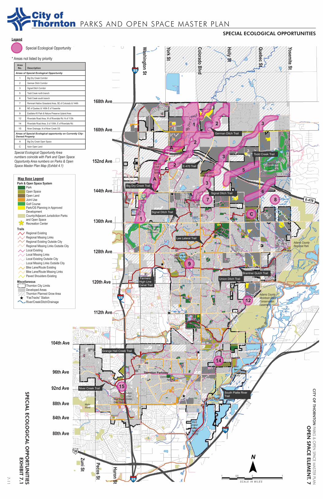
The Open Space Element of this Master Plan is based on an inventory of the existing open lands and environmental resources in Thornton and its planned growth area through fieldwork and map analysis completed by Walsh Environmental in 2012. A number of areas in Thornton were identified that have noteworthy wildlife habitat, quality native vegetation, water resources, floodplain, scenic quality, or ecological uniqueness. These are referred to as “Special Ecological Opportunities” - Exhibit 7.1. Supporting mapping and analysis is found in the Technical Appendices - Appendix 9.
Integrity of habitat, connections to corridors or natural areas, structural diversity, and presence of one or more special ecological features (e.g., such as water, or large trees) are the most important factors influencing the priority value assigned to each parcel. While these factors affect habitat quality and wildlife use in different ways, they all contribute to preserving rare or important species and providing opportunities for nature study and visual aesthetics.
Areas evaluated for their potential as future open space parcels—as well as one recently acquired parcel for which final management and land use decisions have not been made—are described below and shown in the Special Ecological Opportunities Map Exhibit 7.1.
Based on the results of the ecological resource assessment, areas were divided into three broad categories: “Higher Priority”, “Medium Priority”, and “Lower Priority.” This assessment took into account the following characteristics: area size, connectivity, native vegetation presence, quality, structure and diversity, presence of water, habitat or movement corridors capable of supporting a variety of locally or regionally important species, scenic quality, uniqueness, and location adjacent to existing open spaces. The Lower Priority areas offer some of these qualities, but generally are smaller, more isolated, less natural, or less diverse.
It is important to note that the opportunities described in the next section are not the only special ecological areas in Thornton, but instead are areas that may not have yet been acquired and offer one or more high-quality characteristics.
Ê
Ê
Ê
Ê
Ê
Ê
Thornton Parkway
Adams County
Regional Park
Adams County
Mcintosh Dairy
Conservation
Easement
Riverd
ale
Road
PARKS AND OPEN SPACE MASTER PLAN
CITY
OF TH
ORN
TON
PARKS & O
PEN SPAC
E MASTER PLAN
OPEN
SPAC
E ELEMEN
T. 7
SPECIAL ECOLOGICAL OPPORTUNITIES
S C A L E I N M I L E S
1 10.5 0
7-11
SPECIA
L ECO
LOG
ICA
L OPPO
RTU
NITIES
EXH
IBIT 7.1
1
2
2
2 3
3
3
5
67 8
9
12
14
15
C1
A
A
Niver Creek
Horizon Tributary
Lakeview Tributary
Sign
al D
itch
S
igna
l Ditch
Union Ditch
German Ditc
h
25
25
25
76
E-470So
uth Platte R
iver
144th Ave
128th Ave
120th Ave
112th Ave
104th Ave
96th Ave
92nd Ave
88th Ave
84th Ave
80th Ave
Huron St
Pecos St
Zuni St
Washington St
York St
Colorado Blvd
Holly St
Quebec St
Yosemite St
168th Ave
160th Ave
152nd Ave
136th Ave
Sout
h
Platte Ri
ver
Big D
ry C
reek
Big
Dry
Cre
ek
Plai ns Tributary
Map Base Legend
Legend
Park & Open Space SystemParkOpen SpaceOpen LandJoint UseGolf Course
Recreation Center
County/Adjacent Jurisdiction Parks and Open Space
Park/OS Planning in Approved Development
Regional ExistingTrails
Regional Missing LinksRegional Existing Outside CityRegional Missing Links Outside CityLocal ExistingLocal Missing LinksLocal Existing Outside CityLocal Missing Links Outside CityBike Lane/Route ExistingBike Lane/Route Missing LinksPaved Shoulders Existing
MiscellaneousThornton City LimitsDeveloped AreasThornton Planned Grow Area
River/Creek/Ditch/Drainage“FasTracks” Station
Area No. Description
Areas of Special Ecological Opportunity
1 Big Dry Creek Corridor
2 German Ditch Corridor
3 Signal Ditch Corridor
5 Todd Creek north branch
6 Todd Creek south branch
7 Remnant Native Grassland Area, SE of Colorado & 144th
8 NE of Quebec & 140th E of Yosemite
9 Eastlake #3 Park & Nature Preserve Upland Area
12 Riverdale Road Area, W of Riverdale Rd. N of 112th
14 Riverdale Road Area, S of 100th, E of Riverdale Rd.
15 Niver Drainage, N of Niver Creek OS
Areas of Special Ecological opportunity on Currently City-Owned Property
A Big Dry Creek Open Space
C Aylor Open Land
Special Ecological Opportunity
* Areas not listed by priority
Special Ecological Opportunity Area numbers coincide with Park and Open Space Opportunity Area numbers on Parks & Open Space Master Plan Map (Exhibit 4.1)
Niver Creek Trail
Grange Hall Creek Trail
South Platte River Trail
Union Ditch Trail
Todd Creek Trail
Brantner Gulch Trail
Signal Ditch Trail
German Ditch Trail
Lee Lateral Trail
E-470 Trail
Big Dry Creek Trail
Farmers’High LineCanal Trail
Signal Ditch Trail
West
Sprat Platte
Fishing
Facility
Margaret W.
Carpenter
Park & OS
Thorncreek
Golf Course(City Owned)
Todd Creek
Golf Course (Semi Private)
Thornton
Trail Winds
Park & OS
Big Dry
Creek
Open
Space
Aylor
Open Land
Signal Ditch
Park & OS
East Lake #3
Park & Nature
Preserve
Niver Creek
Open Space
Future
Urban
Center
Water
World
Community
Park
West
Gravel
Lakes
Fishing
Facility
CITY OF THORNTON PARKS & OPEN SPACE MASTER PLAN
OPEN SPACE ELEMENT.7
7-13
SPECIFIC PLAN PROPOSALS
Higher Priority Areas
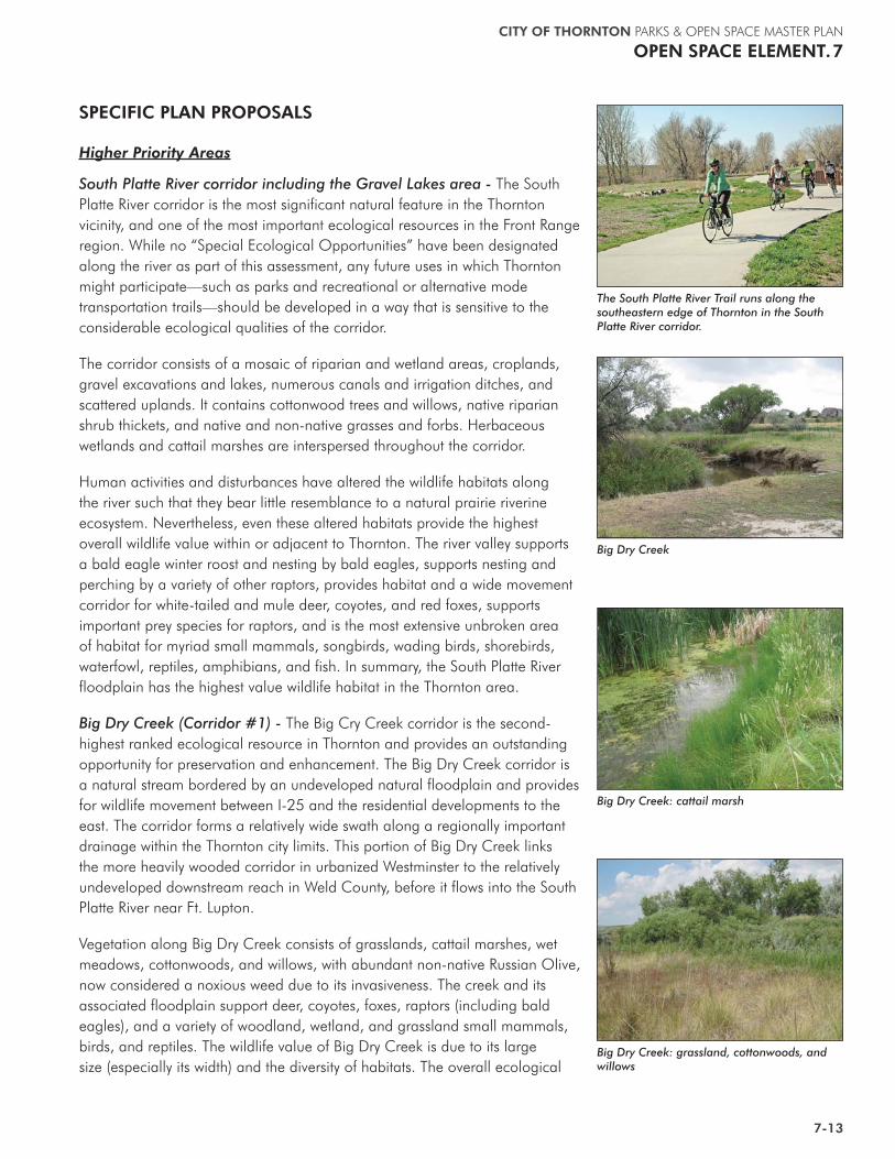
South Platte River corridor including the Gravel Lakes area - The South Platte River corridor is the most significant natural feature in the Thornton vicinity, and one of the most important ecological resources in the Front Range region. While no “Special Ecological Opportunities” have been designated along the river as part of this assessment, any future uses in which Thornton might participate—such as parks and recreational or alternative mode transportation trails—should be developed in a way that is sensitive to the considerable ecological qualities of the corridor.
The corridor consists of a mosaic of riparian and wetland areas, croplands, gravel excavations and lakes, numerous canals and irrigation ditches, and scattered uplands. It contains cottonwood trees and willows, native riparian shrub thickets, and native and non-native grasses and forbs. Herbaceous wetlands and cattail marshes are interspersed throughout the corridor.
Human activities and disturbances have altered the wildlife habitats along the river such that they bear little resemblance to a natural prairie riverine ecosystem. Nevertheless, even these altered habitats provide the highest overall wildlife value within or adjacent to Thornton. The river valley supports a bald eagle winter roost and nesting by bald eagles, supports nesting and perching by a variety of other raptors, provides habitat and a wide movement corridor for white-tailed and mule deer, coyotes, and red foxes, supports important prey species for raptors, and is the most extensive unbroken area of habitat for myriad small mammals, songbirds, wading birds, shorebirds, waterfowl, reptiles, amphibians, and fish. In summary, the South Platte River floodplain has the highest value wildlife habitat in the Thornton area.
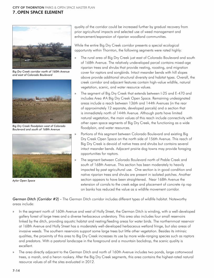
Big Dry Creek (Corridor #1) - The Big Cry Creek corridor is the second-highest ranked ecological resource in Thornton and provides an outstanding opportunity for preservation and enhancement. The Big Dry Creek corridor is a natural stream bordered by an undeveloped natural floodplain and provides for wildlife movement between I-25 and the residential developments to the east. The corridor forms a relatively wide swath along a regionally important drainage within the Thornton city limits. This portion of Big Dry Creek links the more heavily wooded corridor in urbanized Westminster to the relatively undeveloped downstream reach in Weld County, before it flows into the South Platte River near Ft. Lupton.
Vegetation along Big Dry Creek consists of grasslands, cattail marshes, wet meadows, cottonwoods, and willows, with abundant non-native Russian Olive, now considered a noxious weed due to its invasiveness. The creek and its associated floodplain support deer, coyotes, foxes, raptors (including bald eagles), and a variety of woodland, wetland, and grassland small mammals, birds, and reptiles. The wildlife value of Big Dry Creek is due to its large size (especially its width) and the diversity of habitats. The overall ecological
The South Platte River Trail runs along the southeastern edge of Thornton in the South Platte River corridor.
Big Dry Creek: cattail marsh
Big Dry Creek: grassland, cottonwoods, and willows
Big Dry Creek
CITY OF THORNTON PARKS & OPEN SPACE MASTER PLAN
7.OPEN SPACE ELEMENT
7-14
quality of the corridor could be increased further by gradual recovery from prior agricultural impacts and selected use of weed management and enhancement/expansion of riparian woodland communities.
While the entire Big Dry Creek corridor presents a special ecological opportunity within Thornton, the following segments were rated highly:
» The rural area of Big Dry Creek just east of Colorado Boulevard and south of 168th Avenue. The relatively undeveloped parcel contains mixed-age riparian trees and shrubs that provide nesting, roosting, and migration cover for raptors and songbirds. Intact meander bends with hill slopes above provide additional structural diversity and habitat types. Overall, the creek corridor and adjacent features contain high-value wildlife, natural vegetation, scenic, and water resource values.
» The segment of Big Dry Creek that extends between I-25 and E-470 and includes Area #A Big Dry Creek Open Space. Remaining undesignated areas include a reach between 136th and 144th Avenues (in the rear of approximately 12 separate, developed parcels) and a section that is immediately north of 144th Avenue. Although parts have limited natural vegetation, the main values of this reach include connectivity with other open space segments of Big Dry Creek, the functioning as a wide floodplain, and water resources.
» Portions of this segment between Colorado Boulevard and existing Big Dry Creek Open Space on the north side of 156th Avenue. This reach of Big Dry Creek is devoid of native trees and shrubs but contains several intact meander bends. Adjacent prairie dog towns may provide foraging opportunities for raptors.
» The segment between Colorado Boulevard north of Preble Creek and south of 168th Avenue. This section has been moderately to heavily impacted by past agricultural use. One section is in good condition and native riparian trees and shrubs are present in isolated patches. Another section appears to have been straightened. Near 168th Avenue the extension of corrals to the creek edge and placement of concrete rip rap on banks has reduced the value as a wildlife movement corridor.
Big Dry Creek corridor north of 160th Avenue and east of Colorado Boulevard
German Ditch (Corridor #2) - The German Ditch corridor includes different types of wildlife habitat. Noteworthy areas include:
» In the segment north of 160th Avenue and west of Holly Street, the German Ditch is winding, with a well-developed gallery forest of large trees and a diverse herbaceous understory. This area also includes four small reservoirs linked by the ditch, providing aquatic habitat and nesting/feeding areas for water birds. The northernmost reservoir at 168th Avenue and Holly Street has a moderately well-developed herbaceous wetland fringe, but also areas of invasive weeds. The southern reservoirs support some large trees but little other vegetation. Besides its intrinsic qualities, the proximity of this area to Big Dry Creek increases its use by more wide-ranging species such as raptors and predators. With a pastoral landscape in the foreground and a mountain backdrop, the scenic quality is excellent.
» The area directly adjacent to the German Ditch and north of 160th Avenue includes two ponds, large cottonwood trees, a marsh, and a heron rookery. After the Big Dry Creek segments, this area contains the highest-rated natural resource values of all the sites evaluated in 2012.
Big Dry Creek floodplain west of Colorado Boulevard and south of 168th Avenue
Aylor Open Space
CITY OF THORNTON PARKS & OPEN SPACE MASTER PLAN
OPEN SPACE ELEMENT.7
7-15
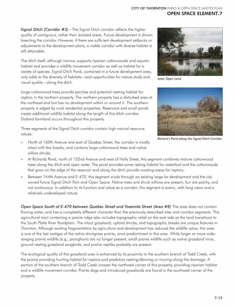
Signal Ditch (Corridor #3) - The Signal Ditch corridor reflects the higher quality of contiguous, rather than isolated areas. Future development is shown bisecting the corridor. However, if there are sufficient development setbacks or adjustments to the development plans, a viable corridor with diverse habitat is still attainable.
The ditch itself, although narrow, supports riparian cottonwoods and aquatic habitat and provides a wildlife movement corridor as well as habitat for a variety of species. Signal Ditch Pond, contained in a future development area, only adds to the diversity of habitats—and opportunities for nature study and visual quality—along the ditch.
Large cottonwood trees provide perches and potential nesting habitat for raptors in the northern property. The northern property has a disturbed area at the northeast end but has no development within or around it. The southern property is edged by rural residential properties. Reservoirs and small ponds create additional wildlife habitat along the length of this ditch corridor. Dryland farmland occurs throughout this property.
Three segments of the Signal Ditch corridor contain high natural resource values:
» North of 160th Avenue and east of Quebec Street, the corridor is mostly intact with few breaks, and contains large cottonwood trees and native willow shrubs.
Richard’s Pond along the Signal Ditch Corridor
Aylor Open Land
» At Richards Pond, north of 152nd Avenue and west of Holly Street, this segment combines mature cottonwood trees along the ditch and open water. The pond provides some resting habitat for waterfowl and the cottonwoods that grow on the edge of the reservoir and along the ditch provide roosting areas for raptors.
» Between 144th Avenue and E-470, this segment winds through an existing large lot development and the city-owned future Signal Ditch Park and Open Space. Native trees and shrub willows are present, but are patchy, and not continuous. In addition to its function and value as a corridor, this segment is scenic, with long views and a relatively undeveloped nature.
Open Space South of E-470 between Quebec Street and Yosemite Street (Area #8) The area does not contain flowing water, and has a completely different character than the previously-described sites and corridor segments. This agricultural tract containing a prairie ridge also includes topographic relief on the east side as the land transitions to the South Platte River floodplain. The intact grassland, upland shrubs, and topographic breaks are unique features in Thornton. Although existing fragmentation by agriculture and development has reduced the wildlife value, this area is one of the last vestiges of the native shortgrass prairie, once predominant in this area. While larger or more wide-ranging prairie wildlife (e.g., pronghorn) are no longer present, small prairie wildlife such as native grassland mice, ground-nesting grassland songbirds, and prairie reptiles probably are present.
The ecological quality of this grassland area is enhanced by its proximity to the southern branch of Todd Creek, with the prairie providing hunting habitat for raptors and predators nesting/denning or moving along the drainage. A portion of the southern branch of Todd Creek crosses the northwest corner of this property, providing riparian habitat and a wildlife movement corridor. Prairie dogs and introduced grasslands are found in the southwest corner of the property.

CITY OF THORNTON PARKS & OPEN SPACE MASTER PLAN
7.OPEN SPACE ELEMENT
7-16
Medium to Lower Priority Areas
These sites include creek and irrigation ditch segments and sites with natural resources of medium to lower quality, yet they have value in their adjacency to existing open space and provision of buffers, their function as corridors, or their potential to provide open space buffers between developed areas.
Aylor Open Land (Area #C) - This area is city-owned and currently closed to the public. Already acquired, this area is included because final decisions about future management and use have not been made. This property has three major ecological qualities: (1) the combination of habitats present, including ponds, wetlands, cottonwoods, and native grassland; (2) its location between the prairie remnants and a northern tributary to Brantner Gulch; and the potential for enhancement that accompanies any area of active agriculture after it is acquired for open space.
The property features a mix of dryland farming and a riparian corridor with several small ponds or reservoirs. The site is within ring-necked pheasant overall range and has suitable habitat. The property is bordered to the east and west by residential development. The large trees within the riparian area provide perches and potential nesting opportunities for raptors.
Remnant Native Grassland (Area #7) - This large area located just north of Homestead Hills Park and Open Space includes a remnant native grassland. The site contains below average wildlife and habitat qualities, but has promontory views of the Front Range backdrop. Similar to The Bluffs Area #8 previously described, the primary values are scenic qualities and uniqueness.
Todd Creek Branches (Corridor #5 and #6). The two branches of Todd Creek flow northeastward from their headwaters south of E-470 to their confluence just east of Yosemite and thence to the South Platte River. Recently, development has occurred in the vicinity of the northern branch; however, riparian and wetland habitat, wildlife movement corridors, and ecological connectors were maintained. The herbaceous margins of the creeks, while currently only partially native, would gradually improve in response to withdrawal of grazing and targeted management. Additional qualities are the outstanding views of the Front Range and open plains.
Riverdale Road (Areas #12 and #14) - Area #12 is on the west side of Riverdale Road. It contains a remnant agricultural ditch, and is in close proximity to the McIntosh Dairy Conservation easement in the South Platte River floodplain. Area #14 combines four small areas on the east side of Riverdale Road. While it does not have high intrinsic natural resource value, it provides connection between existing preserved areas.
Dryland Pasture, Big Dry Creek Corridor (Area #1) - Located on the southwest corner of Colorado Boulevard and 168th Street, this is a large area of open dryland pasture, and it contains an active prairie dog colony, a marsh, and Preble Creek, a tributary to Big Dry Creek. Native vegetation consists as remnant grasslands, and the site does provide potential grassland habitat for burrowing owls. The main values include the old farmstead, large size, adjacency to Big Dry Creek, and some scenic qualities.
Upland Area adjacent to Eastlake #3 Park and Nature Preserve (Area #9) - This small area has few ecological qualities but would provide a buffer that would help ensure continued use by water birds and other aquatic species as well as by wildlife associated with cattails and cottonwoods. Encroachment toward this open space by future development could reduce the current types and levels of wildlife use significantly. Acquisition would also preserve the visual and recreational quality of the site and preserve options for future habitat enhancement.
Niver Drainage (Area #15) - This area is bounded by Thornton Parkway, I-25, and Niver Open Space. Small natural drainages provide some topographic interest, and there are patches of native grasses. The site contains limited ecological values, but its location is important visually as it is adjacent to I-25 and as a buffer to the Niver Open Space.

CITY OF THORNTON PARKS & OPEN SPACE MASTER PLAN
OPEN SPACE ELEMENT.7
7-17
SUMMARY
The Big Dry Creek corridor contains all of the resources identified as important natural resource values to the city, including an historic bald eagle nest and foraging areas, wildlife movement corridors, native vegetation, water, and floodplains. It should be considered a priority for open space acquisition to preserve the natural resource values and maintain the continuity of the wildlife corridor. As the Big Dry Creek properties are acquired, the majority of the sites should be maintained as a natural open space area, and recreational development should be minimized and placed outside the riparian area along Big Dry Creek. With its year-round water flow, the Big Dry Creek corridor also presents an opportunity to protect existing mature cottonwood trees and to also plan and provide for the continued presence of cottonwoods into the future.
The German Ditch north of 160th Avenue contains several features that, in combination, provides high wildlife and other open space value. The ditch and adjacent ponds are important open space opportunities. Other wildlife corridors, including along Todd Creek or Signal Ditch, are important to acquire for open space to maintain an open wildlife travel corridor.
In looking toward the future, Thornton should protect its considerable environmental assets and link them as part of its open lands system. The historic irrigation ditches and reservoirs, natural drainages, and stands of mature cottonwoods should become, to the maximum extent possible, the backbone of the Thornton system. These generally linear areas represent most of the ecological diversity and important wildlife uses (including movement corridors) still available for acquisition. They also provide excellent potential as trail corridors, although trails should be designed and routed to minimize adverse ecological impacts. Finally, they offer opportunities to provide current and future residents with functional natural areas within a rapidly growing urban/suburban environment.
Although less dramatic, the remnants of prairie grassland in the eastern part of the study area have high ecological value and are worthy of preservation. Even casual observers can appreciate the progression of flowers through the summer and the attractive autumn hues of many native grasses. Others may appreciate knowing that native prairie songbirds (e.g., lark bunting, vesper sparrow), small mammals (e.g., prairie vole, plains pocket mouse, silky pocket mouse), and reptiles (e.g., lesser earless lizard, short-horned lizard, and western hognose snake) continue to be part of the natural landscape. Future generations of Thornton residents, and of nature enthusiasts from throughout the region, will applaud steps taken by Thornton to preserve these ecological windows to the past.
It is important to recognize that many, indeed most, of the opportunities described above are in a somewhat degraded condition. Much of this degradation reflects prior heavy use by domestic livestock, which tended to concentrate around water or in areas with shade. Other degradation may have resulted from abandonment of agriculture, cessation of irrigation, or activities related to development. Whatever the reason, these areas often contain pockets or larger concentrations of non-native, invasive weeds. Although natural recovery may occur in a degraded area after the source of the disturbance (e.g., livestock grazing) has stopped, this process can be slow—often requiring several decades to see significant process. This is especially true in drier sites, but less of an issue where water is present.
To hasten this recovery, and thus improve the ecological and visual quality sooner rather than later, some habitat enhancement or restoration is advisable. These measures can include improvement of soil health, management of noxious weeds, and reseeding with native or (where desirable) selected non-native species.
Finally, it is likely that not all of the Special Ecological Opportunities acquired by Thornton will be purchased solely for their ecological qualities. Many of the areas are appropriate for acquisition to meet multiple purposes, such as for preservation and trails, or for preservation and a park site. In these cases, trail or park planners should bear in mind that ecologically important areas, whether because of a particular wildlife use, movement corridor, or undisturbed native vegetation, must be provided with a sufficient buffer to ensure that these functions continue.