pennsylvania geology, v. 47, no. 4, winter 2017 of contents editorial—geology underlies it all...
TRANSCRIPT
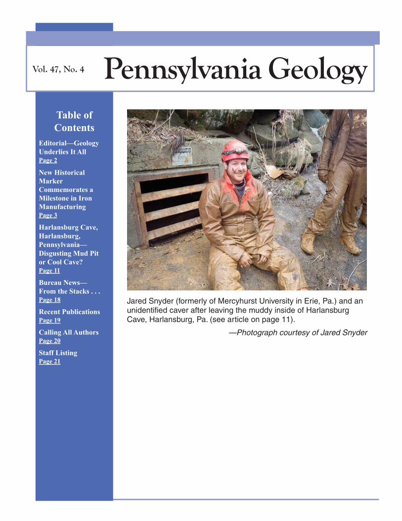
Table of
Contents
Editorial—Geology
Underlies It All
Page 2
New Historical
Marker
Commemorates a
Milestone in Iron
Manufacturing
Page 3
Harlansburg Cave,
Harlansburg,
Pennsylvania—
Disgusting Mud Pit
or Cool Cave?
Page 11
Bureau News—
From the Stacks . . .
Page 18
Recent Publications
Page 19
Calling All Authors
Page 20
Staff Listing
Page 21
Vol. 47, No. 4 Pennsylvania Geology
Jared Snyder (formerly of Mercyhurst University in Erie, Pa.) and anunidentified caver after leaving the muddy inside of HarlansburgCave, Harlansburg, Pa. (see article on page 11).
—Photograph courtesy of Jared Snyder
Pennsylvania Geology Winter 2017
Page 2 of 22
EDITORIAL
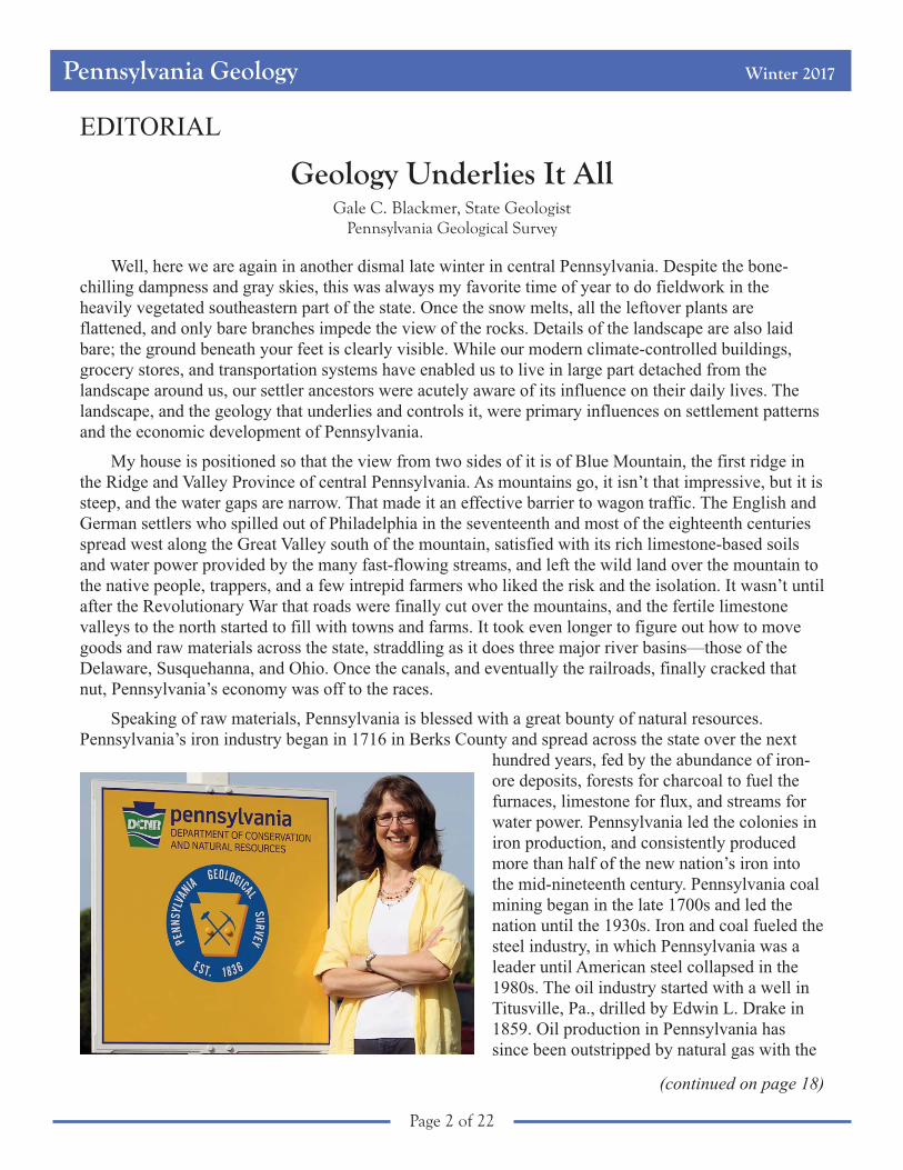
Geology Underlies It AllGale C. Blackmer, State Geologist
Pennsylvania Geological Survey
Well, here we are again in another dismal late winter in central Pennsylvania. Despite the bone-
chilling dampness and gray skies, this was always my favorite time of year to do fieldwork in the
heavily vegetated southeastern part of the state. Once the snow melts, all the leftover plants are
flattened, and only bare branches impede the view of the rocks. Details of the landscape are also laid
bare; the ground beneath your feet is clearly visible. While our modern climate-controlled buildings,
grocery stores, and transportation systems have enabled us to live in large part detached from the
landscape around us, our settler ancestors were acutely aware of its influence on their daily lives. The
landscape, and the geology that underlies and controls it, were primary influences on settlement patterns
and the economic development of Pennsylvania.
My house is positioned so that the view from two sides of it is of Blue Mountain, the first ridge in
the Ridge and Valley Province of central Pennsylvania. As mountains go, it isn’t that impressive, but it is
steep, and the water gaps are narrow. That made it an effective barrier to wagon traffic. The English and
German settlers who spilled out of Philadelphia in the seventeenth and most of the eighteenth centuries
spread west along the Great Valley south of the mountain, satisfied with its rich limestone-based soils
and water power provided by the many fast-flowing streams, and left the wild land over the mountain to
the native people, trappers, and a few intrepid farmers who liked the risk and the isolation. It wasn’t until
after the Revolutionary War that roads were finally cut over the mountains, and the fertile limestone
valleys to the north started to fill with towns and farms. It took even longer to figure out how to move
goods and raw materials across the state, straddling as it does three major river basins—those of the
Delaware, Susquehanna, and Ohio. Once the canals, and eventually the railroads, finally cracked that
nut, Pennsylvania’s economy was off to the races.
Speaking of raw materials, Pennsylvania is blessed with a great bounty of natural resources.
Pennsylvania’s iron industry began in 1716 in Berks County and spread across the state over the next
hundred years, fed by the abundance of iron-
ore deposits, forests for charcoal to fuel the
furnaces, limestone for flux, and streams for
water power. Pennsylvania led the colonies in
iron production, and consistently produced
more than half of the new nation’s iron into
the mid-nineteenth century. Pennsylvania coal
mining began in the late 1700s and led the
nation until the 1930s. Iron and coal fueled the
steel industry, in which Pennsylvania was a
leader until American steel collapsed in the
1980s. The oil industry started with a well in
Titusville, Pa., drilled by Edwin L. Drake in
1859. Oil production in Pennsylvania has
since been outstripped by natural gas with the
(continued on page 18)

Pennsylvania Geology Winter 2017
Page 3 of 22
New Historical Marker Commemorates a Milestone in Iron Manufacturing
John A. HarperPennsylvania Geological Survey, retired
A GOOD DAY TO COMMEMORATE A HISTORICAL EVENT
On a pleasant, sunny Sunday, September 10, 2017, the Pennsylvania Historical and Museum
Commission (PHMC) and the Fayette County Historical Society (FCHS) unveiled a new historical
marker at the side of Pa. Route 51 in Menallen Township, Fayette County (Figure 1), about six miles
northwest of Uniontown. The marker commemorates a new way to manufacture iron that was
introduced to America in 1817. The text of the marker reads:
AMERICA’S FIRST IRON PUDDLING FURNACE—In 1817 ironmaster Isaac Measonand Welshman Thomas Lewis built a puddling furnace and bar rolling mill here using aprocess from Wales that revolutionized the iron industry. It removed carbon from brittlepig iron creating malleable wrought iron in one step, making iron production much moreefficient and less costly. Later, “puddlers” in Pittsburgh formed the first metals union, theSons of Vulcan, forerunner of United Steelworkers.
The historical marker is the result of more than two years of research by Dr. Norman L. Samways1
(Figure 2), a retired Pittsburgh metallurgist and geology enthusiast whose interest in early iron
manufacturing in Pennsylvania led him to rediscover the location of America’s first puddling furnace.
Although “iron puddling” sounds like it must have something to do with molten iron spilling on the
factory floor, it was an important step toward modern steelmaking. Dr. Samways brought the potential
for a historical marker to the attention of the PHMC and the FCHS, who coordinated the marker-
dedication ceremony and an exhibition at the FCHS’s headquarters in the Abel Colley Tavern and
Museum nearby. The story of the furnace and the aftereffects are worth retelling.
FAYETTE COUNTY’S PIONEERING IRONMASTER
Isaac Meason (1743–1818) was a legend in Fayette County. Born in Frederick County, Va., he
moved to Fayette County sometime around 1770. In 1789, he became involved in iron manufacturing
when he built and began operating Union Furnace, one of the first furnaces to produce iron west of the
Allegheny Mountains2 (Heald, 1990), and he eventually became one of the wealthiest men in western
Pennsylvania (Abraham, 1937). Over the years, Meason’s wealth and prosperity allowed him to become
involved in all manner of local commercial, judicial, and political power brokering in the area. He was
an associate judge of Fayette County for many years and a member of the Supreme Executive Council
of Pennsylvania. Besides iron works, he built gristmills and salt works; he was intimately involved in the
construction of the first bridge across the Youghiogheny River at Connellsville; and he had enough
foresight and business sense to provide the iron necessary for the construction of the first iron
1Although Dr. Samways reviewed a penultimate draft of this article, he unfortunately passed away early in February 2018
before seeing it in print.2Whether Union Furnace was the first or second iron furnace to produce iron west of the Alleghenies depends on the
historian. Swank (1878, p. 51; 1892, p. 214) and Ellis (1882, p. 235) both claimed that the first to be put into production
was Alliance Furnace in 1790, followed about 16 months later by Union Furnace. Heald (1990) stated that pig iron was not
produced at Alliance Furnace until 1792.
Pennsylvania Geology Winter 2017
Page 4 of 22
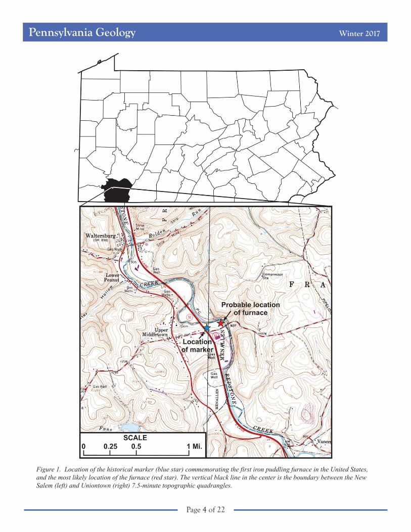
Figure 1. Location of the historical marker (blue star) commemorating the first iron puddling furnace in the United States,and the most likely location of the furnace (red star). The vertical black line in the center is the boundary between the NewSalem (left) and Uniontown (right) 7.5-minute topographic quadrangles.
Pennsylvania Geology Winter 2017
Page 5 of 22
suspension bridge in America, on Jacob’s
Creek near where he lived (Abraham, 1937;
Morrison, 1983).
When Meason arrived in Fayette County,
the area was well poised to become a leader
in iron manufacturing because it had both
abundant natural resources and major lines of
transportation (e.g., the National Highway,
now U.S. Route 40, and the Youghiogheny
and Monongahela Rivers). Iron ore could be
found in many places in the county, especially
on the western side of Chestnut Ridge.
Limestone for flux occurred where streams
flowing down the mountains exposed thick
Mississippian carbonates. Some of those
same streams powered the bellows in the
furnaces. Fireclays necessary for making refractory bricks occurred as underclays associated with
numerous coal seams. Acres of woodlands provided the raw material for making charcoal. Even
secondary resources, such as good-quality sandstones for building furnace stacks, were plentiful (Kollar
and others, 2014). Meason took advantage of all of it and provided both Fayette County and the
Pittsburgh area with an abundance of pig iron that could be made into kettles, firebacks, and other
implements. But pig iron is brittle because of the metal’s high carbon content. The manufacture of many
usable items, such as nails, tools, barrel hoops, shovels, and plows, required the iron to be ductile, which
in turn required multiple reheatings and forgings under large, crude trip hammers to remove the carbon.
Isaac Meason made a fortune manufacturing pig iron, but the process of manufacturing good-quality
iron was unsatisfactory and time consuming.
THE VALUE OF A GOOD WORKING KNOWLEDGE AND PERSEVERANCE
The puddling furnace was invented by an Englishman named Henry Cort in 1783–84 and patented
in 1784 (Landes, 2003), and it soon became very popular in England and Wales. In 1815, Thomas C.
Lewis, who had much experience in puddling furnaces and rolling mills in his native Wales, came to
America to promote interest in these new technologies. He tried to convince ironmasters in New Jersey
and eastern Pennsylvania that iron could be rolled into bars, but they thought his concept was wildly
impractical, if not impossible. So, Lewis moved west to Fayette County, where he encountered Isaac
Meason. Meason immediately saw the viability of the technology Lewis described and entered into an
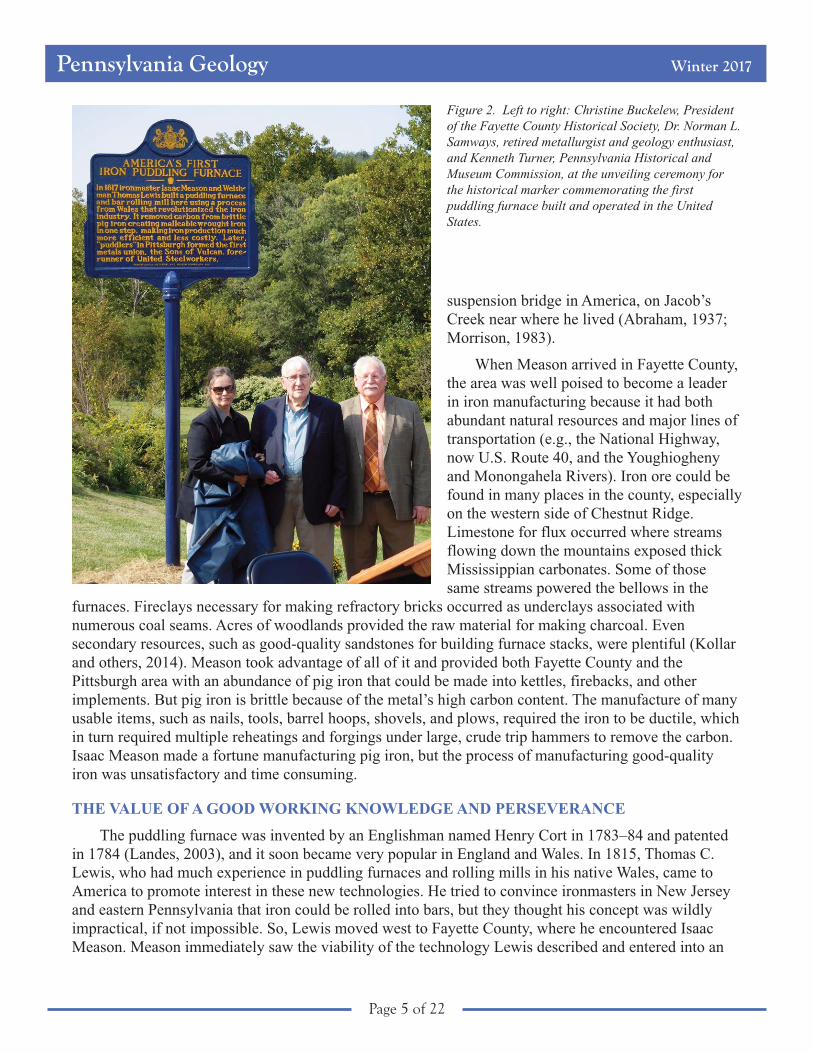
Figure 2. Left to right: Christine Buckelew, Presidentof the Fayette County Historical Society, Dr. Norman L.Samways, retired metallurgist and geology enthusiast,and Kenneth Turner, Pennsylvania Historical andMuseum Commission, at the unveiling ceremony forthe historical marker commemorating the firstpuddling furnace built and operated in the UnitedStates.
Pennsylvania Geology Winter 2017
Page 6 of 22
agreement with him to build and operate the new furnace and rolling mill. Ellis (1882, p. 240) described
an amusing incident that occurred while the new puddling furnace was being built. “Two iron-masters
from Lancaster County, by the names of Hughes and Boyer, rode all the way on horseback, nearly two
hundred miles, went to Mr. Meason, and tried to convince him that it was impossible to roll iron into
bars. Mr. Meason told them to go and talk to Mr. Lewis about it, which they did, and told him it was a
shame for him to impose on Mr. Meason, as it might ruin the old gentleman. Mr. Lewis replied to Mr.
Hughes, ‘You know you can eat?’ ‘Why, yes,’ he knew that. ‘Well, how do you know it?’ He could not
give a reason why, but he knew he could eat. ‘Well,’ said Mr. Lewis, ‘I will tell you how you know it—
you have done it before; and that is why I know I can roll bar iron. I have done it before!’ ‘Very well,’
said Mr. Hughes, ‘go ahead, and when you are ready to start let us know, and we will come and see the
failure.’ According to promise they did come on, but left perfectly satisfied of its success . . .”
AMERICA’S FIRST PUDDLING FURNACE
The mill was built in 1816 and 1817 on Redstone Creek at Plumsock (now Upper Middletown—see
Figure 1) on the site of a forge built by Jeremiah Pears sometime around 1794 (Ellis, 1882). The
property and all its facilities, which included a sawmill, gristmill, slitting mill, and rolling mill (built
before 1800, probably the first rolling mill west of the Alleghenies), as well as the forge (Swank, 1892),
had come into Meason’s possession in 1815 (Ellis, 1882), and this was chosen as the location of the new
furnace. Lewis was appointed the chief engineer in the construction of the new mill. His brother,
George, a first-rate mechanic, came over from Wales after the mill opened to be in charge of the rolling
mill; two other brothers also worked at the furnace (Samways, 2016). The new mill, built for making
bars of all sizes and hoops for cutting into nails, incorporated two puddling furnaces, a refinery, a
heating furnace, a tilt hammer, and a lathe for turning the rolled bars of iron; coal, rather than charcoal,
was used in the puddling and heating furnaces, and coke was used in the refinery. The pig iron, initially
forged in a blast furnace, was puddled (see below). The grooved rolls made for the bar rolling process
were cast at Dunbar Furnace, another Meason property in nearby Dunbar. The mill went into operation
on September 15, 1817, and, although Meason died in 1818, it continued to operate until 1831, when a
flood on Redstone Creek caused the partial destruction of the mill. Following that, the machinery was
disassembled and taken to Brownsville on the Monongahela River (Swank, 1892).
It took a while before the proven success of puddling and rolling found a wider audience. In 1844
and 1845, the manufacture of rails for railroad tracks began in earnest, giving puddling a leading
position in the manufacture of iron in America (Fritz, 1910). Before too long, other puddling and bar
rolling mills were springing up around western Pennsylvania. By 1819, four of them were operating in
Pittsburgh.
BLAST IT ALL! WHERE’S THAT PUDDLE?
The process of puddling iron is significantly different from forging pig iron, which was the practice
in the eighteenth and early nineteenth centuries. In order to produce one ton of pig iron, an early
nineteenth century blast furnace (Figure 3A) required approximately three tons of iron ore, two tons of
limestone for flux to remove impurities (slag), and 2.6 tons of charcoal (later, coal or coke) for fuel
(Samways and others, 2014). These were dumped into the top of the furnace stack. As the materials
descended toward the bottom of the furnace, hot carbon monoxide gas from the combustion of charcoal
transformed the iron ore into liquid iron at temperatures on the order of 1,500 to 2,500°F. A water wheel
powered the bellows that pumped air into the furnace through blowpipes called tuyeres. Approximately
every six hours, the iron workers tapped the furnace (they opened a sealed hole in the hearth) and let the
liquid iron flow into parallel rows of depressions in the casthouse floor. The slag separated and floated

Pennsylvania Geology Winter 2017
Page 7 of 22
on the molten iron and was removed by lowering a dam at the end of the trough. When the iron
solidified in close parallel rows, it looked something like piglets suckling a sow—hence, the name “pig
iron.” Some early blast furnaces created cast-iron products by removing the liquid iron in ladles and
pouring it into molds that resulted in items such as pots and stoves. A typical early nineteenth century
blast furnace could produce two tons of pig iron per day (Samways and other, 2014), but to get the
usable malleable iron, the pigs had to be reheated and forged multiple times.
The biggest advantage of a puddling furnace (Figure 3B) was in keeping carbon in the fuel from
coming into contact with the iron by separating them in the hearth and blowing hot air from the burning
fuel over the iron. In the process, a two-man crew consisting of a puddler and his helper were armed
with long, hooked rods called “puddling bars.” The furnace was charged by placing pig iron or cast iron
Figure 3. A. A typical charcoal blast furnace (from Samways and others, 2014). B. A puddling furnace (modified fromSamways, 2016). See text for explanation of how these furnaces worked. Not to scale. Both illustrations based on drawingsby David J. Vater.

Pennsylvania Geology Winter 2017
Page 8 of 22
in the metal bath area and then heating it until the top began to melt, forming a “puddle” (Samways,
2016), then an oxide such as mill scale was added. This process typically took about half an hour. A
shallow wall separated the metal from the fuel, thus preventing the introduction of additional carbon into
the iron. A strong current of air was blown through, and the puddler or his helper stirred the mixture with
a puddling bar through doors in the furnace. This helped oxygen in the atmosphere to react with any
impurities in the pig iron and to escape as gas or to form a slag. As more fuel was added, the temperature
of the mixture rose from 2,100 to 2,800°F, allowing the iron to melt completely and the carbon to burn
off. Eventually, when most of the carbon had burned off, the metal began forming into a spongy ball of
wrought iron weighing about 75 to 90 pounds. Then the puddler used the hook on the puddling bar, or a
pair of tongs, to pull the large balls out of the furnace where they were taken directly to be rolled into
flat or round bars. Working together, the puddler and his helper could produce about 1.6 tons of
malleable iron in a half-day shift. Unfortunately, the life of a puddler typically was short, about 30 or 40
years, because of the exposure to intense heat and fumes as well as the strenuous labor involved. But
because the puddler had to be highly skilled and able to sense when the iron balls were ready to be
removed from the furnace, the process was never able to be automated (Landes, 2003).
The puddling process dominated iron making for nearly 80 years. The Bessemer process, which
produced steel, began to replace the puddling furnace in the 1850s. It converted pig iron into steel for a
fraction of the cost and time that a puddling furnace required to make wrought iron; an average puddling
furnace used a charge of pig iron of 800 or 900 pounds, whereas a Bessemer converter used a charge of
15 tons (Overman, 1854). Because the puddling process was limited by the amount that a puddling crew
could handle, it was impossible to increase the effectiveness of a puddling furnace. It couldn’t be scaled
up; it could only be expanded by increasing the number of furnaces and puddlers.
LIMESTONE AND FIRECLAYS AND IRON ORES, OH MY!
The primary iron ore available in western Pennsylvania is siderite—iron carbonate (FeCO3). In
Fayette County, the old blast furnaces used siderites from a variety of formations. Isaac Meason’s
furnaces probably used Mercer ores (Pottsville Formation, see Figure 4) from the Dunbar mines in
Dunbar Township where they were well exposed along the western flank of Chestnut Ridge. Moyer (in
Hickok and Moyer, 1940) considered the Mercer ores to have been the most important ores mined in the
county. The iron content of these typically ranged from about 30 to about 40 percent. McCreath (1879)
analyzed the Mercer ores, both the Big Honeycomb and Big Bottom ores, from the Dunbar mines and
found them to have 35.8 and 35.7 percent iron, respectively. Siderite remained the primary source of
iron in western Pennsylvania until Lake Superior hematite (Fe2O3) ores containing more than 50 percent
iron became available as a result of improved rail and water transportation. When that occurred,
Pittsburgh became the focus of the iron and steel industry in the United States (Samways and others,
2014).
Limestone used as flux in Fayette County furnaces came from a variety of formations, including the
Redstone, Fishpot, and Benwood limestones of the Monongahela Formations, and the Wymps Gap
Limestone of the Mauch Chunk Formation on the western flank of Chestnut Ridge (Figure 4). The
Mauch Chunk limestones were the most likely ones used in Meason’s blast furnaces in the Dunbar area.
Up until 1840, all of the pig iron produced in western Pennsylvania was made in charcoal blast
furnaces. This required immense quantities of wood—it took about 15,000 acres of forest to make
enough charcoal to produce 100,000 tons of pig iron per year (Samways and others, 2014). Coal and
coke only came into use as fuel in blast furnaces after 1840, greatly reducing the need for charcoal.
Pennsylvania Geology Winter 2017
Page 9 of 22
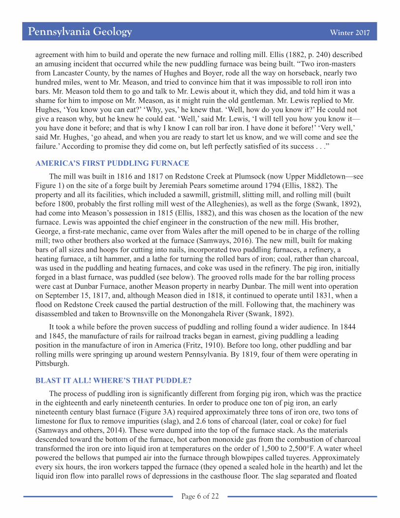
The predominant raw material for refractory bricks
needed to line the insides of western Pennsylvania furnaces
was fireclay, composed of aluminum silicate (Al2O3.2SiO2).
Fireclays are found throughout western Pennsylvania in
association with coal beds, where they are referred to as
underclays. For example, the Bolivar fireclay is a well-
known clay that typically occurs a few feet below the Upper
Freeport coal (Allegheny Formation, see Figure 4).
WRAP-UP
The geology of western Pennsylvania, with its
abundance of raw materials for making iron (ore, limestone,
fireclay, and water) and its vast forests, had resulted in the
area becoming a leading center for iron and, eventually, steel
production in the United States even before the introduction
of new technologies. With the successful introduction of the
puddling and bar rolling processes in Fayette County, there
was a rapid increase in the number of new furnaces built and
operated. In Pittsburgh alone, the number of puddling
furnaces increased from four in 1819 to more than 800 by
1890; the number reached a peak of 5,265 throughout the
country by 1884 (Samways, 2016).
Yes, the construction of the first puddling furnace and
rolling mill in the United States led to a major change in the
way American iron and steel were manufactured, but it also
led to many social changes. After a strike by puddlers in
Pittsburgh in 1849 and 1850 practically shut down the
industry, the companies countered by lowering wages and
hiring new puddlers. In 1858, a group of puddlers met in
downtown Pittsburgh and formed a labor union called The
Iron City Forge of the Sons of Vulcan (Brody, 1960). This
was the first American labor union to represent iron and steel
workers, and it was also the strongest union in the country. It
lasted until 1876 when it merged with two other unions to
form the Amalgamated Association of Iron and Steel
Workers, what we know today as the United Steelworks
(Brody, 1960), currently the largest union in North America.
And to think, it all started with a man from Wales
convincing a man from Fayette County that iron could be
rolled into bars! Thank you, Dr. Samways, for bringing this
to our attention.
REFERENCES
Abraham, Evelyn, 1937, Isaac Meason, the first ironmaster west of the
Alleghenies: Western Pennsylvania Historical Magazine, v. 20,
no. 1, p. 41–49.
Figure 4. Generalized stratigraphic column ofPennsylvanian and Upper Mississippianformations in western Pennsylvania showinglocations of iron ores, limestones, sandstones,coals, and fireclays used in manufacturing ironin the eighteenth and nineteenth centuries (fromSamways and others, 2014).
Pennsylvania Geology Winter 2017
Page 10 of 22
Brody, David, 1960, Steelworkers in America—The nonunion era: Urbana, University of Illinois Press, 361 p.
Ellis, Franklin, ed., 1882, History of Fayette County, Pennsylvania, with biographical sketches of many of its pioneers and
prominent men: Philadelphia, L. H. Everts and Co., 841 p.
Fritz, John, 1910, John Fritz on the growth of the iron industry: The Engineering and Mining Journal, v. 90, no. 3, p. 110.
Heald, S. H., ed., 1990, Fayette County, Pennsylvania—An inventory of historic engineering and industrial sites: Historic
American Buildings Survey/Historic American Engineering Record, America’s Industrial Heritage Project,
Washington, D.C., National Park Service, 260 p.
Hickok, W. O., IV, and Moyer, F. T., 1940, Geology and mineral resources of Fayette County, Pennsylvania: Pennsylvania
Geological Survey, 4th ser., County Report 26, 530 p.
Kollar, A. D., Harper, J. A., and Samways, N. L., 2014, Geology and history of ironmaking in western Pennsylvania:
Carnegie Museum of Natural History, PAlS Publication 19, 31 p.
Landes, D. S., 2003, The unbound Prometheus—Technological change and industrial development in Western Europe from
1750 to the present (2nd ed.): Cambridge University Press, 576 p.
McCreath, A. S., 1879, Second report of progress in the laboratory of the Survey at Harrisburg: Pennsylvania Geological
Survey, 2nd ser., Report MM, 438 p.
Morrison, D. C., 1983, Dunbar 1883 inc. to 1983—The furnace town: Connellsville, Pa., The Centennial Book Committee,
134 p.
Overman, Frederick, 1854, The manufacture of iron, in all its various branches: Philadelphia, H. C. Baird, 492 p.
Samways, N. L., 2016, Welshman installs first revolutionary new process in America—Iron puddling and bar rolling:
NINNAU, The North American Welsh Newspaper, v. 41, no. 1, p. 22.
Samways, N. L., Harper, J. A., Kollar, A. D., and Vater, D. J., 2014, Geology and history of ironmaking in western
Pennsylvania: Carnegie Museum of Natural History, PAlS Publication 16, 5 p.
Swank, J. M., 1878, Introduction to a history of ironmaking and coal mining in Pennsylvania: Philadelphia, published by the
author, 125 p.
_________ 1892, History of the manufacture of iron in all ages, and particularly in the United States from Colonial times to
1891; also a short history of early coal mining in the United States and a full account of the influences which long
delayed the development of all American manufacturing industries (2nd ed.): Philadelphia, The American Iron and Steel
Association, 554 p.
Pennsylvania Geology Winter 2017
Page 11 of 22
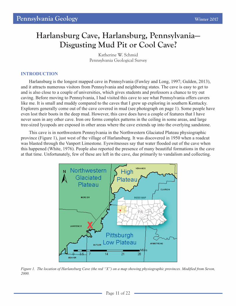
Harlansburg Cave, Harlansburg, Pennsylvania—Disgusting Mud Pit or Cool Cave?
Katherine W. SchmidPennsylvania Geological Survey
INTRODUCTION
Harlansburg is the longest mapped cave in Pennsylvania (Fawley and Long, 1997; Gulden, 2013),
and it attracts numerous visitors from Pennsylvania and neighboring states. The cave is easy to get to
and is also close to a couple of universities, which gives students and professors a chance to try out
caving. Before moving to Pennsylvania, I had visited this cave to see what Pennsylvania offers cavers
like me. It is small and muddy compared to the caves that I grew up exploring in southern Kentucky.
Explorers generally come out of the cave covered in mud (see photograph on page 1). Some people have
even lost their boots in the deep mud. However, this cave does have a couple of features that I have
never seen in any other cave. Iron ore forms complex patterns in the ceiling in some areas, and large
tree-sized lycopods are exposed in other areas where the cave extends up into the overlying sandstone.
This cave is in northwestern Pennsylvania in the Northwestern Glaciated Plateau physiographic
province (Figure 1), just west of the village of Harlansburg. It was discovered in 1950 when a roadcut
was blasted through the Vanport Limestone. Eyewitnesses say that water flooded out of the cave when
this happened (White, 1976). People also reported the presence of many beautiful formations in the cave
at that time. Unfortunately, few of these are left in the cave, due primarily to vandalism and collecting.
Figure 1. The location of Harlansburg Cave (the red “X”) on a map showing physiographic provinces. Modified from Sevon,2000.

Pennsylvania Geology Winter 2017
Page 12 of 22
The cave is a network maze of interconnected passages in which it is very easy to get lost
(Figure 2). In fact, over the years, many people have become lost and have had to be rescued. For safety
and security reasons, the cave is currently gated and managed by the Mid-Atlantic Karst Conservancy.
Multiple attempts have been made to map the cave. The concentrations of iron ore in this cave make
it challenging to create an accurate map using a compass. This is not a common problem; iron and
manganese oxide deposits are rare in caves (Spilde and others, 2005). Fawley and Long (1997) mapped
Harlansburg Cave with the Westminster Student Grotto (a local caving club member of the National
Speleological Society) and reported a length of close to 4 miles (6.5 km). Kim Metzgar, a member of the
Mid-Atlantic Karst Conservancy, has been working on getting a more accurate map of the cave for years
(Opatka-Metzgar, 2004). In helping her, I also became interested in this cave’s unique mineralogy.
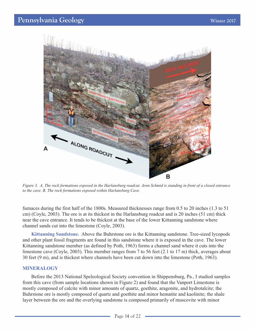
BEDROCK GEOLOGY
Pennsylvanian-aged sediments in this area are marked by repeating cyclothem sequences, where
beds of shale, coal, shale, limestone, shale, and sandstone layers of varying thicknesses make up each
sequence (Bragonier, 2011). These rhythmic sequences are caused by rising and falling sea levels.
Harlansburg Cave formed in the limestone component of one of these sequences. The limestone is about
23 feet (7 m) thick in this area and is overlain by the Buhrstone ore and the Kittanning units of the
Allegheny Formation (Bragonier, 2011). The middle and lower Kittanning members (as defined by Poth,
1963) are composed of coal, shale, coal, shale, and finally, coarse-grained channel sandstones. The
roadcut exposes an almost complete cyclothem sequence. Figure 3 shows this sequence; Figure 3A
shows the rocks exposed in the roadcut, and Figure 3B shows the layers exposed in the cave. The
underlying Scrubgrass Coal is not exposed here.
Vanport Limestone. The Vanport Limestone is a shallow marine limestone (Miller, 1934) and
contains fossils, including echinoderms, that are sometimes exposed within the cave. This limestone was
originally known as the Ferriferous limestone because of its close association with the Buhrstone iron
ore bed. It was first called the Vanport Limestone by I. C. White in 1878 (Lamborn, 1951). White
described the Vanport as the most characteristic stratum in the lower productive coal series. “It is the
largest, purest, and most massive limestone, and always possesses a peculiarity of composition and
organic remains, by which one thoroughly familiar with it can unerringly distinguish it at a single glance
from any other limestone in the group” (White, 1876, p. 60). White also noted that the Vanport was
highly valued as a flux for iron and was extensively quarried in Vanport, Pa., about 25 miles south-
southwest of the cave. The Vanport has been rated as the most valuable limestone in the Carboniferous
strata (Miller, 1934).
The Vanport Limestone is present sporadically throughout northwestern Pennsylvania, and its
thickness is highly variable where it is present. This variability appears to be controlled by two things:
first, by existing topography at the time of deposition, and later, by erosion as sea levels receded after
deposition (Miller, 1934; Bergenback, 1964). The limestone thins to the northwest where clastic deltaic
deposits were deposited at the same time that the upper Vanport Limestone was forming (Weber and
others, 1965). In Lawrence County, the thickness of the limestone ranges from 14 to 23 feet (about 4 to 7
m), which is more constant than thicknesses found in other counties (Miller, 1934). This consistency was
a factor in the development of this cave in the Vanport as the longest cave in Pennsylvania.
Buhrstone Iron Ore. The Buhrstone iron ore overlies the Vanport Limestone. This ore only exists
where the Vanport Limestone is present, but it is not always present at the top of the Vanport (White,
1879; Coyle, 2003). Containing 40 percent iron (White, 1879; Coyle, 2003), it was mined for use in iron

Pennsylvania Geology Winter 2017
Page 13 of 22
Figure 2. Map of Harlansburg Cave showing sample locations for this study (modified from Opatka-Metzgar, 2004). Aphotograph of the joint patterns and boxwork seen in the ceiling of the cave near sample location 2 is shown for comparisonwith the pattern of the cave passages.
Pennsylvania Geology Winter 2017
Page 14 of 22
furnaces during the first half of the 1800s. Measured thicknesses range from 0.5 to 20 inches (1.3 to 51
cm) (Coyle, 2003). The ore is at its thickest in the Harlansburg roadcut and is 20 inches (51 cm) thick
near the cave entrance. It tends to be thickest at the base of the lower Kittanning sandstone where
channel sands cut into the limestone (Coyle, 2003).
Kittanning Sandstone. Above the Buhrstone ore is the Kittanning sandstone. Tree-sized lycopods
and other plant fossil fragments are found in this sandstone where it is exposed in the cave. The lower
Kittanning sandstone member (as defined by Poth, 1963) forms a channel sand where it cuts into the
limestone cave (Coyle, 2003). This member ranges from 7 to 56 feet (2.1 to 17 m) thick, averages about
30 feet (9 m), and is thickest where channels have been cut down into the limestone (Poth, 1963).
MINERALOGY
Before the 2013 National Speleological Society convention in Shippensburg, Pa., I studied samples
from this cave (from sample locations shown in Figure 2) and found that the Vanport Limestone is
mostly composed of calcite with minor amounts of quartz, goethite, aragonite, and hydrotalcite; the
Buhrstone ore is mostly composed of quartz and goethite and minor hematite and kaolinite; the shale
layer between the ore and the overlying sandstone is composed primarily of muscovite with minor
Figure 3. A. The rock formations exposed in the Harlansburg roadcut. Aron Schmid is standing in front of a closed entranceto the cave. B. The rock formations exposed within Harlansburg Cave.
A
B
Pennsylvania Geology Winter 2017
Page 15 of 22
amounts of quartz and kaolinite; and the Kittanning sandstone is composed primarily of quartz with
minor mica and kaolinite.
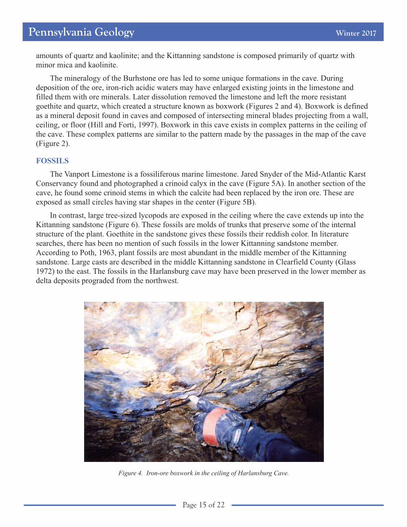
The mineralogy of the Burhstone ore has led to some unique formations in the cave. During
deposition of the ore, iron-rich acidic waters may have enlarged existing joints in the limestone and
filled them with ore minerals. Later dissolution removed the limestone and left the more resistant
goethite and quartz, which created a structure known as boxwork (Figures 2 and 4). Boxwork is defined
as a mineral deposit found in caves and composed of intersecting mineral blades projecting from a wall,
ceiling, or floor (Hill and Forti, 1997). Boxwork in this cave exists in complex patterns in the ceiling of
the cave. These complex patterns are similar to the pattern made by the passages in the map of the cave
(Figure 2).
FOSSILS
The Vanport Limestone is a fossiliferous marine limestone. Jared Snyder of the Mid-Atlantic Karst
Conservancy found and photographed a crinoid calyx in the cave (Figure 5A). In another section of the
cave, he found some crinoid stems in which the calcite had been replaced by the iron ore. These are
exposed as small circles having star shapes in the center (Figure 5B).
In contrast, large tree-sized lycopods are exposed in the ceiling where the cave extends up into the
Kittanning sandstone (Figure 6). These fossils are molds of trunks that preserve some of the internal
structure of the plant. Goethite in the sandstone gives these fossils their reddish color. In literature
searches, there has been no mention of such fossils in the lower Kittanning sandstone member.
According to Poth, 1963, plant fossils are most abundant in the middle member of the Kittanning
sandstone. Large casts are described in the middle Kittanning sandstone in Clearfield County (Glass
1972) to the east. The fossils in the Harlansburg cave may have been preserved in the lower member as
delta deposits prograded from the northwest.
Figure 4. Iron-ore boxwork in the ceiling of Harlansburg Cave.

Pennsylvania Geology Winter 2017
Page 16 of 22
CONCLUSION
I have returned to Harlansburg Cave
many times since my first visit, to help map
the cave and to help lead novice cavers
through the cave. I get covered in mud
when I visit the cave, but I always enjoy
seeing the complex patterns the iron ore
forms on the ceiling and the large lycopod
fossils. This cave is one of the few caves in
the Vanport Limestone that I have had the
privilege to visit.
ACKNOWLEDGMENTS
I am grateful to the Mid-Atlantic Karst
Conservancy for allowing me access to this
cave and granting me permission to initiate
study for the 2013 National Speleological Society convention; to Kim Metzgar for leading trips through
Harlansburg Cave and for sharing her map with me; to Jared Snyder for helping with my study and for
sharing his photographs with me; and to Aron Schmid for caving in Harlansburg Cave with me and for
assisting me with my study and my photographs. I also want to thank Robin Anthony (Pennsylvania
Geological Survey) for helping me with some of the figures for this article.
REFERENCES
Bergenback, R. E., 1964, The geochemistry and petrology of the Vanport Limestone, western Pennsylvania: The
Pennsylvania State University, Ph.D. thesis, 197 p.
Bragonier, W. A., 2011, Adventures in Pennsylvanian stratigraphy: Field Trip sponsored by Rosebud Mining Company,
Guidebook, p. 143.
Coyle, P. R., 2003, Structural and lithologic controls on the distribution of the Buhrstone siliceous iron ore, Allegheny
Plateau, west central Pennsylvania: University of Pittsburgh, M.S. thesis, 148 p.
Figure 5. Crinoid fossils exposed in theHarlansburg Cave. A. Stem (3 to 4 inches long)and partial calyx and arms. B. Crinoid stems. Thepeculiar-looking object beneath the scale bar is amud-covered fingertip of a glove. Photographscourtesy of Jared Snyder, Mid-Atlantic KarstConservancy.
A
B

Pennsylvania Geology Winter 2017
Page 17 of 22
Fawley, J. P., and Long, K. M., 1997, Harlansburg cave—The longest cave in Pennsylvania: Journal of Cave and Karst
Studies, v. 59, no. 3, p. 106–111.
Glass, G. B., 1972, Geology and mineral resources of the Philipsburg 7½-minute quadrangle, Centre and Clearfield Counties,
Pennsylvania: Pennsylvania Geological Survey, 4th ser., Atlas 95a, 241 p.
Gulden, Bob, 2018, USA longest caves: http://www.caverbob.com/usalong.htm (accessed March 8, 2018).
Hill, Carol, and Forti, Paolo, eds., 1997, Cave minerals of the world (2nd ed.): Huntsville, Ala., National Speleological
Society, 463 p.
Lamborn, R. E., 1951, Limestones of eastern Ohio: Ohio Division of Geological Survey, Bulletin 49, 377 p.
Miller, B. L., 1934, Limestones of Pennsylvania: Pennsylvania Geological Survey, 4th ser., Mineral Resource Report 20,
729 p.
Opatka-Metzgar, Kim, 2004, Harlansburg Cave—Lawrence County, Pennsylvania: Mid-Atlantic Karst Conservancy [map].
Poth, C. P., 1963, Geology and hydrology of the Mercer quadrangle, Mercer, Lawrence, and Butler Counties, Pennsylvania:
Pennsylvania Geological Survey, 4th ser., Water Resource Report 16, 149 p.
Sevon, W. D., 2000, Physiographic provinces of Pennsylvania: Pennsylvania Geological Survey, 4th ser., Map 13.
Spilde, M. N., Northup, D. E., Boston, P. J., and others, 2005, Geomicrobiology of cave ferromanganese deposits—A field
and laboratory investigation: Geomicrobiology Journal, v. 22, no. 3/4, p. 99–116.
Weber, J. N., Bergenback, R. E., Williams, E. G., and Keith, M. L., 1965, Reconstruction of depositional environments in the
Pennsylvanian Vanport basin by carbon isotope ratios: Journal of Sedimentary Petrology, v. 35, no. 1, p. 36–48.
White, I. C., 1876, Report of progress in the Beaver River district of the bituminous coal-fields of western Pennsylvania:
Pennsylvania Geological Survey, 2nd ser., Report Q, 337 p.
_________ 1879, The geology of Lawrence County: Pennsylvania Geological Survey, 2nd ser., Report QQ, 336 p.
White, W. B., compiler, 1976, Caves of western Pennsylvania: Pennsylvania Geological Survey, 4th ser., General Geology
Report 67, 97 p.
Figure 6. Plant fossils in the cave ceiling in Kittanning sandstone. Those on the left and in the center are Sigillaria, and theone on the right next to the pencil is Lepidodendron (Mitch Blake, 2013, personal communication).

Pennsylvania Geology Winter 2017
Page 18 of 22
BUREAU NEWS
From the Stacks . . .Jody Smale, Librarian
The Bureau library houses a large collection of geologic texts and journals. Most books and journals
found at the Bureau library may be checked out for up to four weeks. To borrow materials, you must
visit the library in person and provide identification that shows a permanent address (e.g., a driver’s
license). If you are not able to visit the library in person, you can contact your local library to arrange for
an interlibrary loan.
Below are some of the titles recently added to the library’s collection:
• Cartographic grounds—Projecting the landscape imaginary, by Jill Desimini and Charles
Waldheim, Princeton Architectural Press, 2016.
• Directory of geoscience departments (52nd ed.), edited by Carolyn Wilson, American
Geosciences Institute, 2017.
• Foundations of engineering geology, 3rd ed., by Tony Waltham, Spon Press, 2009.
• Geology for civil engineers, by A. C. McLean and C. D. Gribble, Taylor and Francis, 2008.
• Minerals—A very short introduction, by David J. Vaughan, Oxford University Press, 2014.
• Pursuing sustainability—A guide to the science and practice, by Pamela Matson, William C.
Clark, and Krister Andersson, Princeton University Press, 2016.
Editorial (continued from page 2)
recent advent of new technologies to extract gas from shale. All of these resources, along with less sexy
but still necessary commodities such as aggregate, sand and gravel, lime, cement, and clay, are here to
fuel Pennsylvania’s economy because of the state’s underlying geology. Likewise with the rich soils that
feed the agricultural industry, the ecosystems that support the forests, and the scenic features that form
the core of many parks.
Perhaps on the next dismal late winter day, when it’s just too nasty to be outside, you can curl up
with your favorite hot beverage, gaze out the window in wonder at the geologically controlled
landscape, and ponder all you owe to the geology beneath your feet.
Gale C. Blackmer,
State Geologist
Pennsylvania Geology Winter 2017
Page 19 of 22
A Look Back in Time
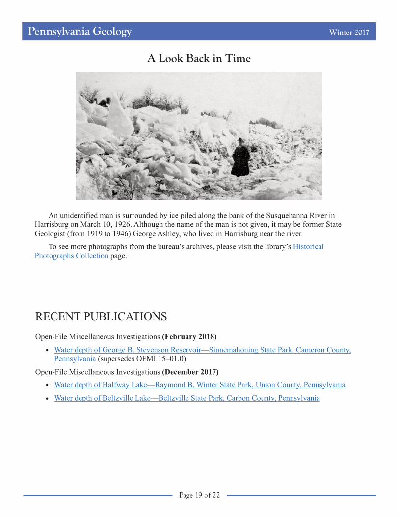
An unidentified man is surrounded by ice piled along the bank of the Susquehanna River in
Harrisburg on March 10, 1926. Although the name of the man is not given, it may be former State
Geologist (from 1919 to 1946) George Ashley, who lived in Harrisburg near the river.
To see more photographs from the bureau’s archives, please visit the library’s Historical
Photographs Collection page.
RECENT PUBLICATIONS
Open-File Miscellaneous Investigations (February 2018)
Water depth of George B. Stevenson Reservoir—Sinnemahoning State Park, Cameron County,
Pennsylvania (supersedes OFMI 15–01.0)
Open-File Miscellaneous Investigations (December 2017)
Water depth of Halfway Lake—Raymond B. Winter State Park, Union County, Pennsylvania
Water depth of Beltzville Lake—Beltzville State Park, Carbon County, Pennsylvania
•
•
•

Pennsylvania Geology Winter 2017
Page 20 of 22
Calling All Authors
Articles pertaining to the geology of Pennsylvania are enthusiastically invited.
Pennsylvania Geology is a journal intended for a wide audience, primarily within Pennsylvania, but
including many out-of-state readers interested in Pennsylvania’s geology, topography, and associated
earth science topics. Authors should keep this type of audience in mind when preparing articles.
Feature Articles: All feature articles should be timely, lively, interesting, and well illustrated. The
length of a feature article is ideally 5 to 7 pages, including illustrations. Line drawings should be
submitted as CorelDraw (v. 9 or above) or Adobe Illustrator (v. 8 or above) files.
Earth Science Teachers’ Corner: Articles pertaining to available educational materials, classroom
exercises, book reviews, and other geologic topics of interest to earth science educators should be 1 to 2
pages in length and should include illustrations where possible.
Announcements: Announcements of major meetings and conferences pertaining to the geology of
Pennsylvania, significant awards received by Pennsylvania geologists, and other pertinent news items
may be published in each issue. These announcements should be as brief as possible.
Photographs: Photographs should be submitted as separate files
and not embedded in the text of the article.
Submittal: Authors may send their article and illustrations as
email attachments to [email protected] if the file sizes are
less than 6 MB. For larger sizes, please submit the files on CD–ROM
to the address given below. All submittals should include the author’s
name, mailing address, telephone number, email address, and the date
of submittal.
Director
Bureau of Topographic and Geologic Survey
3240 Schoolhouse Road
Middletown, PA 17057
Telephone: 717–702–2017
This old house (now a business) was built with aserpentinite facade (see article on page 14). It is locatedat the corner of Clay and North Duke streets inLancaster and was built in 1890.
—Photograph by Stephen Shank
Table of Contents
Editorial—A Hint of The Breadthof GeologyPage 2
Reflections onWorthenia Tabulata(Conrad),Pennsylvania’s VeryElegant Fossil SnailPage 3
Contributions to theMeeting of theNortheastern Sectionof the GeologicalSociety of AmericaPage 10
The State ofPennsylvania’sCoalbed MethaneResourcesPage 12
Mining History ofSerpentinites inPennsylvania andMarylandPage 14
Report on Uraniumand Thorium of theReading ProngReleasedPage 16
Earth ScienceTeacher’s CornerPage 18
Recent PublicationsPage 18
Staff ListingPage 19
Vol. 44, No. 1 Pennsylvania Geology
Pennsylvania Geology Winter 2017
Page 21 of 22
Department of Conservation and Natural ResourcesBureau of Topographic and Geologic Survey
Main Headquarters3240 Schoolhouse Road
Middletown, PA 17057–3534
Phone: 717–702–2017
Pittsburgh Office400 Waterfront Drive
Pittsburgh, PA 15222–4745
Phone: 412–442–4235
DIRECTOR’S OFFICE
Director and State Geologist
Gale C. Blackmer 717–702–2017
Administrative Services
Connie F. Cross 717–702–2054
Elizabeth C. Lyon 717–702–2063
Jody R. Zipperer 717–702–2073
GEOLOGIC AND GEOGRAPHIC INFORMATION SERVICES
Michael E. Moore, 717–702–2024
GIS Services
Caron E. O’Neil 717–702–2042
Thomas G. Whitfield 717–702–2023
Core-Library Services
John C. Neubaum 717–702–2039
IT and Database Services
Sandipkumar P. Patel 717–702–4277
Mark A. Dornes 717–702–4278
David F. Fletcher 412–442–5826
Library Services
Jody L. Smale 717–702–2020
GEOLOGIC MAPPING
Stuart O. Reese, 717–702–2028
Stratigraphic Studies
Gary M. Fleeger 717–702–2045
Rose-Anna Behr 717–702–2035
Aaron D. Bierly 717–702–2034
Clifford H. Dodge 717–702–2036
James R. Shaulis 717–702–2037
Groundwater and Environmental Geology
Simeon B. Suter 717–702–2047
Kristen L. Hand 717–702–2046
William E. Kochanov 717–702–2033
Victoria V. Neboga 717–702–2026
PAMAP and Public Outreach
Helen L. Delano 717–702–2031
ECONOMIC GEOLOGY
Kristin M. Carter, 412–442–4234
Mineral Resource Analysis
Stephen G. Shank 717–702–2021
Leonard J. Lentz 717–702–2040
Antonette K. Markowski 717–702–2038
Petroleum and Subsurface Geology
Brian J. Dunst 412–442–4230
Robin V. Anthony 412–442–4295
Lynn J. Levino 412–442–4299
Katherine W. Schmid 412–442–4232
Renee H. Speicher 412–442–4236

Pennsylvania Geology Winter 2017
Page 22 of 22
PENNSYLVANIA GEOLOGY is published quarterly by the
Bureau of Topographic and Geologic Survey
Department of Conservation and Natural Resources
3240 Schoolhouse Road, Middletown, PA 17057–3534.
This edition’s editor: Anne Lutz.
Links to websites were valid as of the date of release of this issue.
Contributed articles are welcome.
To subscribe, send an email to [email protected].
COMMONWEALTH OF PENNSYLVANIA
Tom Wolf, Governor
DEPARTMENT OF CONSERVATION AND NATURAL RESOURCES
Cindy Adams Dunn, Secretary
OFFICE OF CONSERVATION AND TECHNICAL SERVICES
Lauren S. Imgrund, Deputy Secretary
BUREAU OF TOPOGRAPHIC AND GEOLOGIC SURVEY
Gale C. Blackmer, Director
Bureau website: www.dcnr.state.pa.us/topogeo/index.aspx
Bureau Facebook page: www.facebook.com/PennsylvaniaGeology
DCNR website: www.dcnr.state.pa.us/index.aspx
Pennsylvania home page: www.pa.gov
PEN
NS
YLVAN
IAGEOLOGICA
LS
UR
VEY
E S T. 1 8 3 6