physical geography tidbits: oceania. formation of oceania islands
TRANSCRIPT

Physical Geography Tidbits: Oceania

Formation of Oceania Islands

Reason for Movement
Excess heat from radioactive decay creates liquid outer core (and magnetic field), and forces mantle to have convection
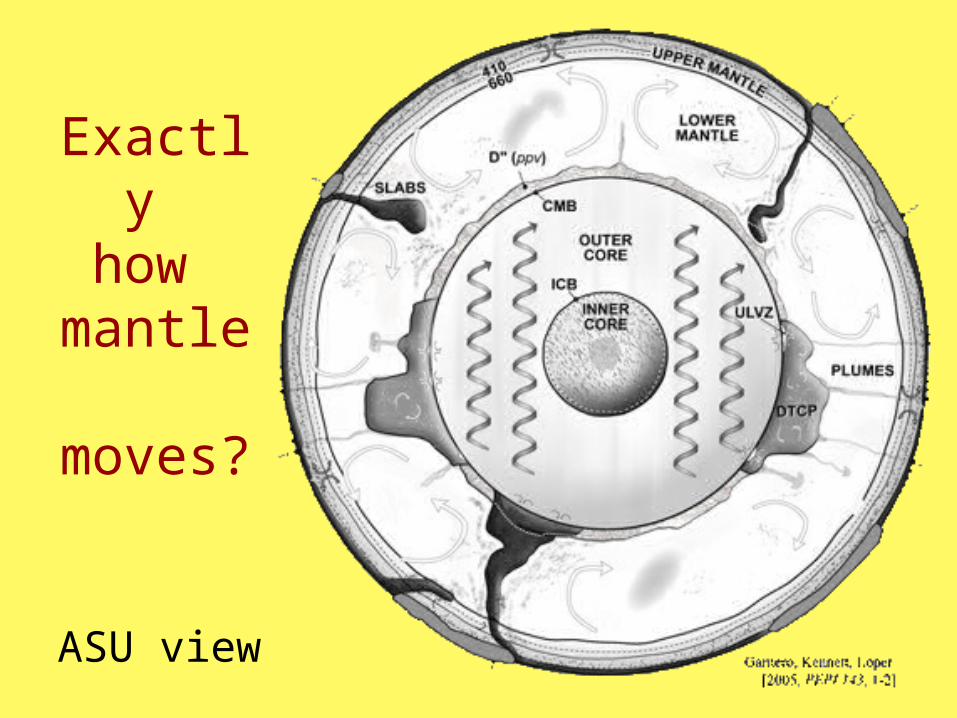
Exactly how
mantle moves?
ASU view

3 TYPES OF PLATE INTERACTION
Stream Systems on
Dynamic Earth

New Zealand - 2 of the 3

East
Pacific
Rise
Mid
Atlantic
Ridge
Mid Indian
Ridge
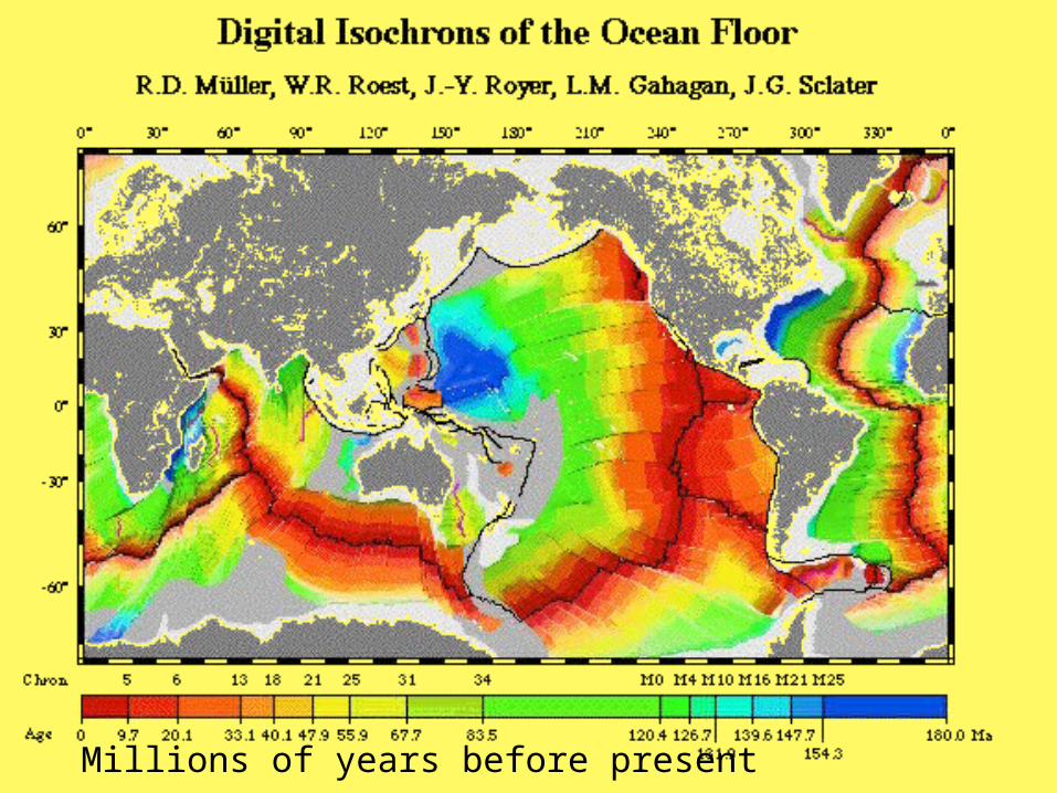
Millions of years before present

Island Arcs from Ocean-Ocean Convergence

Trench
Island arc
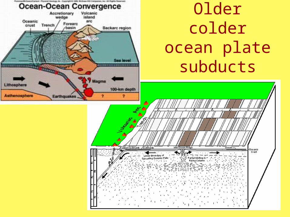
Older colder ocean plate
subducts
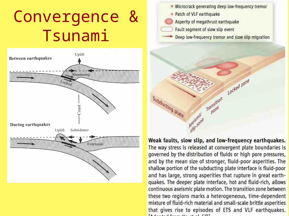
Convergence & Tsunami

Effects Of Plate Locking
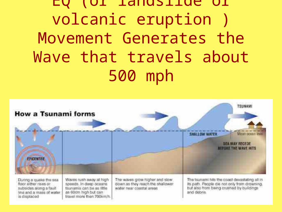
EQ (or landslide or volcanic eruption ) Movement Generates the Wave that travels about 500 mph

Animated gif

Mega-Quake Set off 2004 Tsunami & will happen
again
Energy ripple

Sri Lanka Sumatra Uplift

Indonesia

Indonesia

Has Happened, Will Happen Again
Hilo, 1960
Chile EQ generated Tsunami that destroyed Hilo in 1960

Hot Spots
Often in the middle of a plate
Focus here on Hawaii & Oceania

Hawaiian Hotspot
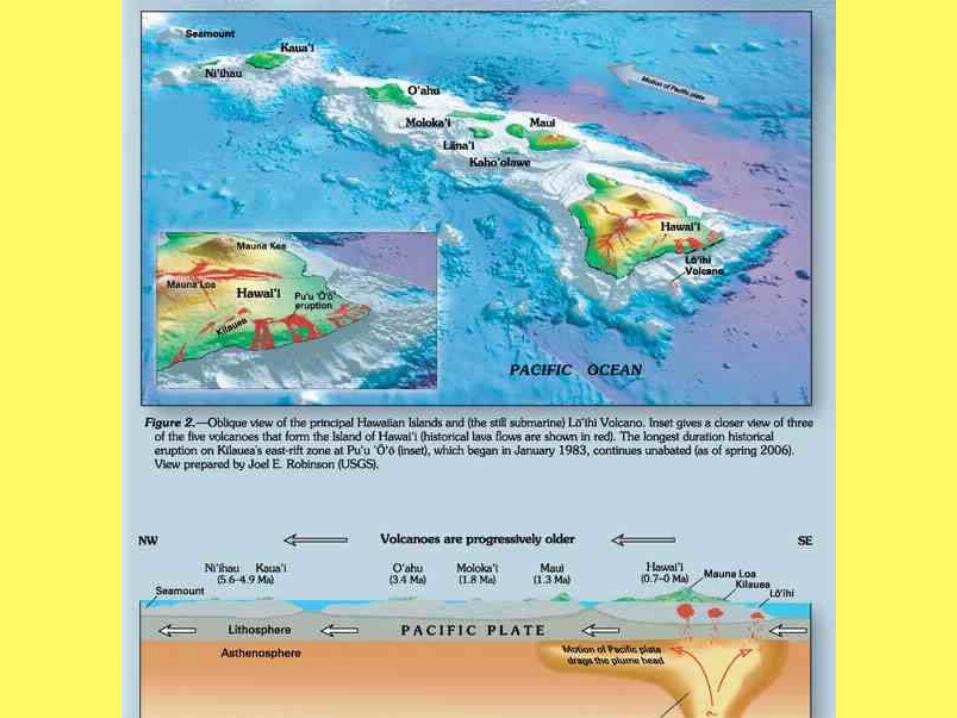


Hawaii - also example of isostacy

Trail of the Hot Spot
Note change in direction 43 myr agoChange in direction 43 myr ago

Are plumes real?

Alternative Hypothesis

After Formed … Sink

This NOAA animation shows the dynamic process of how a coral atoll forms. Corals (represented in tan and purple) begin to settle and grow around an oceanic island forming a fringing reef. It can take as long as 10,000 years for a fringing reef to form. Over the next 100,000 years, if conditions are favorable, the reef will continue to expand. As the reef expands, the interior island usually begins to subside and the fringing reef turns into a barrier reef. When the island completely subsides beneath the water leaving a ring of growing coral with an open lagoon in its center, it is called an atoll. The process of atoll formation may take as long as 30,000,000 years to occur.
http://www.oceanservice.noaa.gov/education/kits/corals/media/supp_coral04a.html

Fringing Reef
Holand Island
Grand Cayman Is.


Tureia, Coral Atoll Oeno, Fringing Reef

Bora Bora Atoll

Climate: What would you expect?
Realm of the Intertropical Convergence Zone

Hadley Cell
Ascending
moist air
condenses
& rains
ITCZ
Equatorial & Tropical
Latitudes influenced by
ITCZ
0º
Descendingwarms & driesIn subtropics
Desertzone
Descendingair warms& dries insubtropics
Desert Zone
Trade winds Trade winds

Global CirculationPatterns
Hadley Cell


Little Seasonal Change in Temp

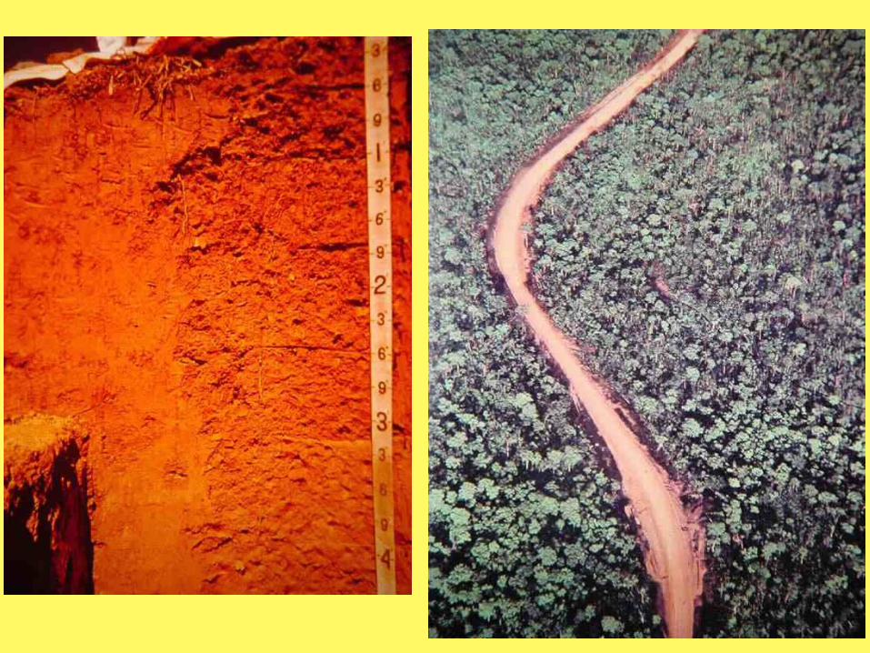
Soils of the Tropics
Soils form over tens of thousands of years
Gives you a “map” of the “average” location of rainforests & savanna
Synonym: Oxisol Soils

Process ofLatosol or Oxisol Soils

Laterization soil development
Oberlander & Muller, 1984
Soil Name
OxisolLatosol(synonyms indifferentclassifications)
Clay type(kaolinite)Not holdnutrients

Oxisol Profiles
• Little organic matter
• Red from iron oxides
• Loose & friable texture

Paradox: Poor soils because few nutrients, yet great rainforests
Why? Natural nutrient recycling

With Deforestation
• organic matter leached• nutrients lost• Gradual loss of fertility

With deforestation• soil structure hardened by desiccation and
compaction into laterite
• Can make “laterite” by drying out the soil

Deforestation has always occurred: traditional swidden (slash and burn)
agriculture – burn to release nutrients and move to another plot

Feral relief
Steep landscapes
made by landsliding
from intense rains
in places like Hawaii
Andes where a lot
of relief exists

Steep slopes made possible by vegetation holding soil to steep faces

Intense rains saturates slopes and landslides rush down slopes

Flat valleys eroded by torrential floods
Landslides strip
trees

Net effect is relief gone wild (feral)
Kauai(GoogleEarth)

Mt Rotui, Moorea
Rarotonga, Cook Islands