pittsburgh's inclines: case studies in industrial adaptation
DESCRIPTION
This project is a study of Pittsburgh's industrial and infrastructural history completed as the initial portion of an architecture thesis at Carnegie Mellon University in Pittsburgh, PA.TRANSCRIPT


Pittsburgh’s Inclines: Case Studies in Industrial Adaptation
Concerning the Relationship of
Landscapeto
Industry in Pittsburgh, Pennsylvania
A Study by Liam Lowe
as the initial phase of his Thesis at
Carnegie Mellon University
School of Architecture
Class of 2013

© 2012 by Liam Lowe
Pittsburgh, PA

Table of Contents
Acknowledgements
Introduction
Abstract
Topography & Natural Resources
Industry & Infrastructure
Land Manipulation & City Steps
Maps & Methods
Inclines of Pittsburgh
Case Studies: Primary Inclines of Pittsburgh
Conclusions
Looking Forward
Bibliography
5
7
9
11
15
19
23
33
37
81
83
85

/ Pittsburgh’s Inclines: Case Studies in Industrial Adaptation4

Thanks to Mary-‐Lou Arscott for guiding me through the thesis process.
To Martin Aurand for inspiration in writing and access to resources.
To my professors who have provided direction on my academic journey.
To my parents who raised me to be inquisitive and perceptive.
And special thanks to my grandparents for making sure I had all the opportunities I needed. This project is dedicated to them.
/Acknowledgements 5

/ Pittsburgh’s Inclines: Case Studies in Industrial Adaptation6

Growing up in the country taught me to be attentive to the land on which my family lived while simultaneously making me envious of urbanites.
interest in cities, but my time here has continued to blur the distinction between urban and rural. Its varied terrain gives Pittsburgh a unique
cities and also from the traditional cities of Europe. The land has much to do with Pittsburgh’s historical importance as coal can still be found in its hills and transported by river to shipping and industrial centers. This topographical connection is manifest in a wide variety of ways, creating a special relationship between residents and their land as well as a
structured this relationship but today’s society seems to have lost interest in understanding its landscape. Our apathy towards the terrain we inhabit is related to many contemporary global crises. A return to a more thorough understanding of the terrain we inhabit is one way to shift this paradigm.
In our modern network society where one’s connection to the landscape is more tenuous than ever, how do we continue to relate to our terrain?
/Introduction 7

/ Pittsburgh’s Inclines: Case Studies in Industrial Adaptation8
Pittsburgh’s urban form has been shaped over time by topographic, technological, and economic forces. The valleys and rivers of the city were the original impetus for settlement and access to natural resources brought the city its initial economic power. Industrial production
growth of the nation, helping to build and strengthen the infrastructural network that is the backbone of the country. All these economic forces shaped Pittsburgh into a dense, connected, and important metropolis in the national (and later, international) economy. But it was globalization
the region. Around the middle of the century, industry began to leave the city and by the 1990s Pittsburgh’s population was cut in half. The contemporary city is thus structured on a defunct economic and development model: a post-industrial landscape.
(or was marked by) its projection onto the landscape and how these topographical and industrial artifacts have survived or changed over time. Inclines provide a series of cases to focus this study due to their relationship to topography, transit, industry, and society. By beginning to understand the history of industry and infrastructure in the region, one can speculate about possible futures and new ways to capitalize on the city’s unique terrain.
/Abstract 9

/ Pittsburgh’s Inclines: Case Studies in Industrial Adaptation
(Engineer’s Society of Western Pennsylvania)
10

Pittsburgh is commonly referred to as a city of hills but it is more accurately described as a city of valleys. The region is carved from the Allegheny Plateau, a subdivision of the Appalachians stretching through Western New York and Pennsylvania, Ohio, and West Virginia. Erosion by the Allegheny, Monongahela, and Ohio Rivers and their tributaries created the unique geomorphic conditions of the Pittsburgh area. It is
resources of Western Pennsylvania and contributed to the initial economic success of the city.
strategic position and defensibility; both the French and British had forts here to control access to points west. Pittsburgh was an essential
and became a “gateway to the West.” To this day, the rivers provide an
The city itself developed a unique character in response to its varied
largely by the varied topography as evidenced by their names
their geomorphic condition. Travelling throughout the city, one often encounters cliffs, steep hillsides, retaining walls, bridges, and tunnels.
But it was the discovery of coal in Mt. Washington (formerly Coal Hill) that would bring sweeping change and rapid economic growth to the region. Pittsburgh sits on the edge of a coal bed with which it shares its name, deposited centuries ago by an inland sea and one of the most
through parts of Ohio and West Virginia and remains a major economic driver in the region. This resource provided a necessary source of energy for the development of industry on the East Coast and in Pittsburgh in particular. The iron and steel industry both required intense heat to forge products, something coal and coke (a form of distilled coal produced by ‘cooking’ it in large ovens) could provide.
Topography & Natural Resources
/Topography & Natural Resources 11

As the value of these resources and their associated industries became clear, humans began to take greater advantage of the land from which their newfound wealth was derived. In many cases the landscape was
the region had a distinct connection to their landscape. Engineers were the heroes of the day, those with the skill and mathematical prowess to take on the untamed terrain. Mines, railroads, blast furnaces, factories,
Pittsburgh’s industrial terrain.
Despite the efforts of the engineers and their employers, the industrial marks on the landscape have faded over time. Today, the terrain of
Some of the city’s greatest assets today are its hillsides, areas where
a unique system of density and development. With some investment and a greater understanding of these conditions, new opportunities for interaction with the city’s terrain could be found.
/ Pittsburgh’s Inclines: Case Studies in Industrial Adaptation12

/Topography & Natural Resources
A coal miner takes a break. (Shorpy.com)
13

/ Pittsburgh’s Inclines: Case Studies in Industrial Adaptation
Steps linked neighborhoods to industry. (Shorpy.com)
14

The combination of access to natural resources and river trade routes
the development of modern steel. Iron and glass were historically produced here but the innovation of the Bessemer process in 1858, an
alloy), allowed industrialists to capitalize on a new market. Steel rapidly became the material on which the nation was built, a critical element in the infrastructure projects that supported American Manifest Destiny. Companies manufacturing goods here play a prominent role in history and often in contemporary industry as well. The US Steel Corporation, Pittsburgh Plate Glass, and Alcoa as well as Mellon Bank (now BNY Mellon) are all remnants of Pittsburgh’s former industrial might.
Industry required a massive labor force to undertake the incredible amount of work implicit in its modern manufacturing methods. This drove Allegheny County’s population to its peak of 2,000,000 around 1950 before the decline of industry caused it to fall again. Such a great population created a dense city, very different from conditions today. Pittsburgh thus developed a strong network of working class neighborhoods, and the upward mobility provided by unionized labor offered people the opportunity to build quality housing in such places. Many members of these families remain in the city today, a genealogical legacy of the industrial era. Social mobility coupled with the work which
in the work done in Pittsburgh. Fierce pride in the city remains today, though it is more often channelled into the realm of sports rather than manufacturing prowess.
build a wealthy upper class. Their legacy remains in the form of a few
in public resources such as libraries, museums, and schools. Andrew
public library system to the city as well as a cultural hub at the Carnegie Museum and Performance Hall in Oakland. In addition, he founded Carnegie Tech (now Carnegie Mellon University) to educate engineers who would go on to innovate industrial techniques and methods. Other
Industry & Infrastructure
/Industry & Infrastructure 15

industrialists such as Henry Clay Frick (a coke magnate) donated land to the city to build city parks, assets seen as vital to the development of a modern city. These public investments set the stage for modern
Investment in infrastructure is another form of development for the public good but is generally funded by the government rather than benevolent private investors. Infrastructure itself is both an industrial product and necessary to the success of industry, wrapped in a
Bessemer process in Pittsburgh (at the Edgar Thompson Works starting
railroad network. Infrastructure such as roads, railroads, bridges and
supported the lives of workers by providing sewers, electricity, and transit in the form of street cars and inclines.
During Pittsburgh’s period of peak industrial production, such shared resources were widely regarded as integral to material and human
industry wreaked havoc on these networks. As automobiles became more affordable, many upwardly mobile families invested in these status symbols representative of freedom and the American dream. Investment shifted to road infrastructure which led to the demise of the robust public transit system, and inclines and streetcars were replaced
production to move out of America and much of Pittsburgh’s industry left its home. These changing global economic patterns would lead to massive population decline and a dark era in the city’s history.
As the principal device by which society mediates its terrain, infrastructure frames the way we interact with our landscape. Pittsburgh
contemporary America. Our ability to alter and adapt this historical
relationship to the post-‐industrial landscape.
/ Pittsburgh’s Inclines: Case Studies in Industrial Adaptation16

/Industry & Infrastructure
Transportation Infrastructure in the Turtle Creek Valley. (Historic Pittsburgh)
17

/ Pittsburgh’s Inclines: Case Studies in Industrial Adaptation
Steps from the Bluff (Uptown) to industry on the Monongahela. (Historic PIttsburgh)
18

Land Manipulation & City Steps
Pittsburgh’s unique topography of river valleys required taming to support commerce soon after it was settled by Europeans. One method of dealing with the terrain was to directly manipulate it
cut” undertaken during the beginning of the 20th century. Following drawings created by Frederick Law Olmsted Jr. (son of the preeminent
them to a more manageable slope. This was seen as necessary to support the growth of commerce in the area around the Golden Triangle and to improve access, especially from the Hill to the east.
Another approach to providing access is the network of city-‐owned steps throughout the city. Pittsburgh is home to over 700 sets of steps comprising over 24,000 feet of elevation change. Historically, these steps provided access for people from residential neighborhoods on the hillsides to industrial jobs on the river banks. As the city grew and other options became available, the steps were used only by those who could not afford to drive or ride public transit. Some sets, such as the Indian Trail Steps (following pages) climbing Mt. Washington, provided a similar function to the inclines for those who couldn’t afford transit. For
stairs could mean the difference between a convenient connection and a much longer route. Although many have fallen into disrepair, steps in
related to the city’s varied terrain.
/Land Manipulation & City Steps 19

/ Pittsburgh’s Inclines: Case Studies in Industrial Adaptation
Indian Trail Steps ascending Mt. Washington.
20

/Land Manipulation & City Steps
(Historic Pittsburgh)
21
/ Pittsburgh’s Inclines: Case Studies in Industrial Adaptation
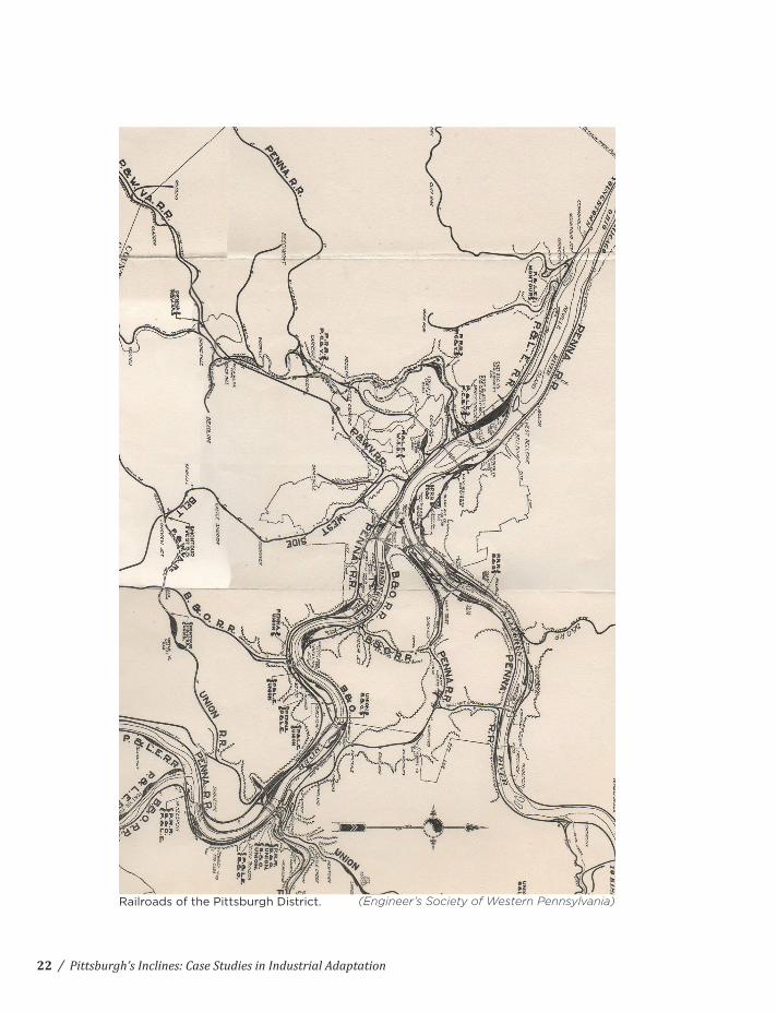
Railroads of the Pittsburgh District. (Engineer’s Society of Western Pennsylvania)
22
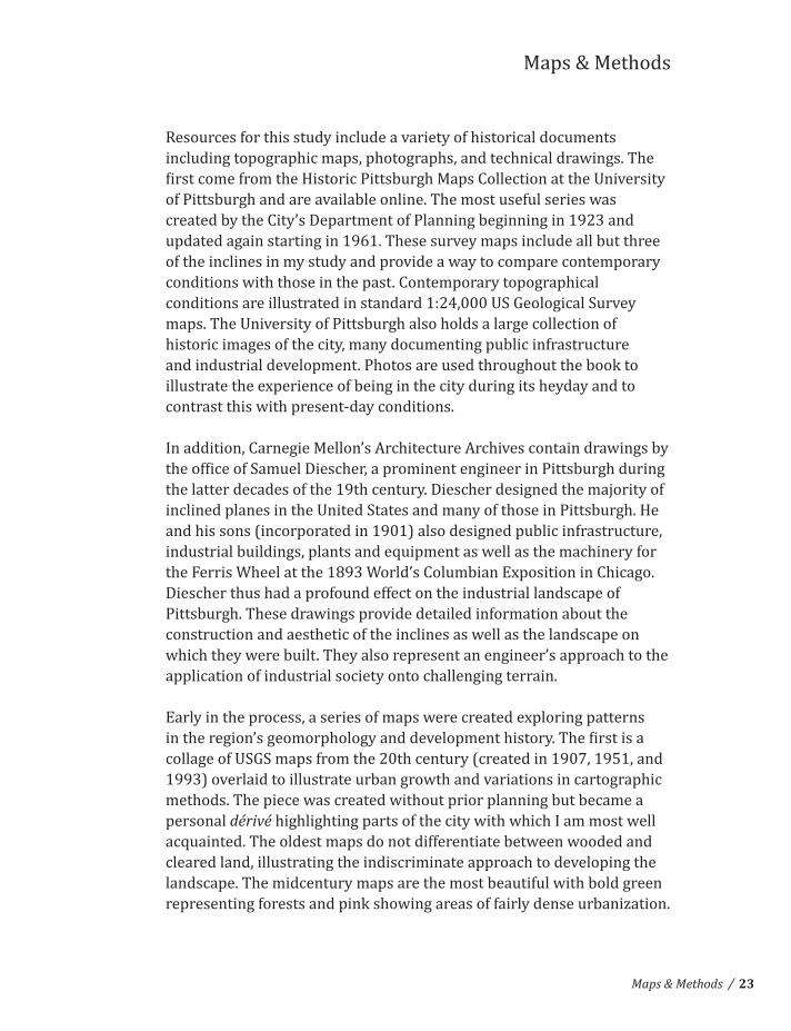
Resources for this study include a variety of historical documents including topographic maps, photographs, and technical drawings. The
of Pittsburgh and are available online. The most useful series was created by the City’s Department of Planning beginning in 1923 and updated again starting in 1961. These survey maps include all but three of the inclines in my study and provide a way to compare contemporary conditions with those in the past. Contemporary topographical conditions are illustrated in standard 1:24,000 US Geological Survey maps. The University of Pittsburgh also holds a large collection of historic images of the city, many documenting public infrastructure and industrial development. Photos are used throughout the book to
contrast this with present-‐day conditions.
In addition, Carnegie Mellon’s Architecture Archives contain drawings by
the latter decades of the 19th century. Diescher designed the majority of inclined planes in the United States and many of those in Pittsburgh. He and his sons (incorporated in 1901) also designed public infrastructure, industrial buildings, plants and equipment as well as the machinery for
Diescher thus had a profound effect on the industrial landscape of Pittsburgh. These drawings provide detailed information about the construction and aesthetic of the inclines as well as the landscape on which they were built. They also represent an engineer’s approach to the application of industrial society onto challenging terrain.
collage of USGS maps from the 20th century (created in 1907, 1951, and 1993) overlaid to illustrate urban growth and variations in cartographic methods. The piece was created without prior planning but became a personal dérivé highlighting parts of the city with which I am most well acquainted. The oldest maps do not differentiate between wooded and cleared land, illustrating the indiscriminate approach to developing the landscape. The midcentury maps are the most beautiful with bold green representing forests and pink showing areas of fairly dense urbanization.
Maps & Methods
/Maps & Methods 23

areas and light green for wooded areas. To differentiate between the urban and natural environments seems less important at this point, but a dynamic reading of the landscape is lost. The collage served as a
techniques.
variety of sources. Information presented includes the rivers, railroads, city parks, and various shades to represent slopes. The order and variety of layers can be changed to illustrate different relationships between
approach to bold, graphic map-‐making.
of the inclines to illustrate their relationship to the landscape and other infrastructural development. These were constructed using data from the historic topographic maps and methods of projection. The
dimensional representation. Two-‐dimensional historical survey maps were created through a process of surveying (itself a technique for taking control of the landscape) and represented via contours. This rational understanding is conducive to designing infrastructure and
used to illustrate the topography on paper, representing a combination of historical surveying methods and contemporary digital techniques. This information is intended to be used as an analytical tool but its
/ Pittsburgh’s Inclines: Case Studies in Industrial Adaptation24

Inclines & Additional Information
Projected Grid Surface
Contours
Topographical Survey Map, 1923
/Maps & Methods 25

/ Pittsburgh’s Inclines: Case Studies in Industrial Adaptation
Study #1: USGS Map Collage.
26

/Maps & Methods 27

/ Pittsburgh’s Inclines: Case Studies in Industrial Adaptation
Study #2: layered stencil maps.
28

/Maps & Methods 29

/ Pittsburgh’s Inclines: Case Studies in Industrial Adaptation
Topographical Survey Maps, 1923
30

/Maps & Methods 31

Primary Inclines of Pittsburgh
DuquesneMonongahelaCastle ShannonCastle Shannon South (#2)
Mt. OliverSt. Clair (22nd St)Fort PittPenn (17th St)Nunnery HillTroy Hill
400’ 370’ 445’-‐170’ 365’ 370’ 375’ 110’ 315’ 210’ 130’
South Shore -‐ Duquesne HeightsSouth Shore -‐ Mt. WashingtonSouthside Flats -‐ Allentown
Southside Flats -‐ Mt. OliverSouthside Flats -‐ Southside SlopesMonongahela River -‐ The BluffStrip District -‐ Hill DistrictCentral Northside -‐ FineviewAllegheny River -‐ Troy Hill
1234567891011
1
2 3
45
6
7
8
9
10
11
/ Pittsburgh’s Inclines: Case Studies in Industrial Adaptation32

The most distinctive response to the city’s terrain is the inclined plane
used to ferry coal from Mt. Washington down to the river banks for trade and later to fuel mills and other industry located there. Once the local coal mines became obsolete and resources came in by other means, passenger and freight inclines became predominant. Over its history Pittsburgh has been home to at least 23 inclines (including coal hoists) with two still in operation today. The peak period for passenger inclines was around the turn of the century and many are visible on the Topographic Survey Maps from the 1920s. Although the Monongahela and Duquesne Inclines are largely treated as tourist destinations today, they were once integral parts of the multimodal transportation network.
Inclined planes are both marvels of construction and based on simple physical principles. The cars travel in opposite directions and act as counterweights for each other so that the car travelling downhill helps
accomplished with a steam engine, but the inclines were later converted to diesel or electric engines. Like the passenger elevator, sophisticated braking systems were needed to limit accidents and assuage riders’ fear. Friction braking systems were integral to the cable drums at the top station and had straps that could be tightened around the drums to stop the car. A secondary safety cable was also connected to each car should the primary drive cable fail.
The majority of the inclines in America were designed by the engineering
were designed by John J. Endres with help from his daughter Caroline.
marry Diescher. Diescher and Endres were associated but it is not clear if they directly shared design responsibilities on any incline. John M. McRoberts also designed two inclines in the South Side.
The Inclined Plane
/The Inclined Plane 33
/ Pittsburgh’s Inclines: Case Studies in Industrial Adaptation
Penn Incline. (Historic Pittsburgh)
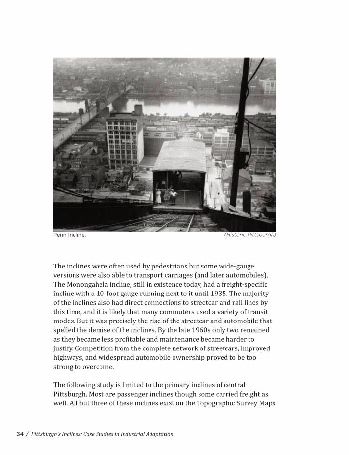
The inclines were often used by pedestrians but some wide-‐gauge versions were also able to transport carriages (and later automobiles).
of the inclines also had direct connections to streetcar and rail lines by this time, and it is likely that many commuters used a variety of transit modes. But it was precisely the rise of the streetcar and automobile that spelled the demise of the inclines. By the late 1960s only two remained
justify. Competition from the complete network of streetcars, improved highways, and widespread automobile ownership proved to be too strong to overcome.
The following study is limited to the primary inclines of central Pittsburgh. Most are passenger inclines though some carried freight as
34

/The Inclined Plane
Castle Shannon Incline. (Historic Pittsburgh)
from the 1920s, and the others can be easily located on other maps or through engineering drawings although the same maps will be used to
located on Mt. Washington and the South Side Slopes. Other inclines
to Pittsburgh in 1907). Each incline will be represented on a map and
noted. Basic statistics concerning size and dates of operation are included as well as historic photos and/or technical drawings to provide
unique pieces of Pittsburgh’s public transit history.
35
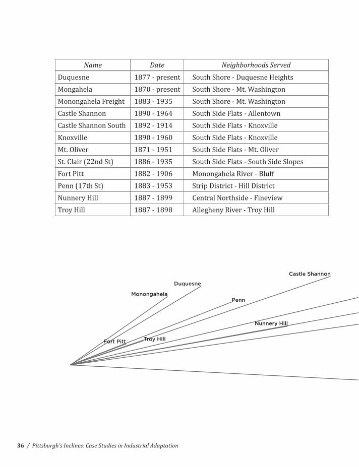
Name Date Neighborhoods Served
Duquesne 1877 -‐ present South Shore -‐ Duquesne HeightsMongahela 1870 -‐ present South Shore -‐ Mt. WashingtonMonongahela Freight 1883 -‐ 1935 South Shore -‐ Mt. WashingtonCastle Shannon 1890 -‐ 1964 South Side Flats -‐ AllentownCastle Shannon South 1892 -‐ 1914
1890 -‐ 1960Mt. Oliver 1871 -‐ 1951 South Side Flats -‐ Mt. OliverSt. Clair (22nd St) 1886 -‐ 1935 South Side Flats -‐ South Side SlopesFort Pitt 1882 -‐ 1906 Monongahela River -‐ BluffPenn (17th St) 1883 -‐ 1953 Strip District -‐ Hill DistrictNunnery Hill 1887 -‐ 1899 Central Northside -‐ FineviewTroy Hill 1887 -‐ 1898 Allegheny River -‐ Troy Hill
/ Pittsburgh’s Inclines: Case Studies in Industrial Adaptation
Castle Shannon #2
Castle Shannon
Monongahela
Duquesne
Penn
Fort Pitt Troy Hill
Nunnery Hill
St. ClairKnoxville
Mt. Oliver
36

Elevation Length Slope Engineer
400’ 800’ 30 Samuel Diescher370’ 650’ 38 John J. Endres370’ 650’ 38 Samuel Diescher445’ 1,400’ 21 Samuel Diescher-‐170’ 2,150’ -‐5 Samuel Diescher365’ 2,750’ 8 John M. McRoberts370’ 1,600’ 14 John J. & Caroline Endres375’ 2,050’ 11 John M. McRoberts110’ 350’ 24 Samuel Diescher315’ 900’ 24 Samuel Diescher210’ 1,200’ 11 Samuel Diescher130’ 450’ 21 Samuel Diescher
/
Castle Shannon #2
Castle Shannon
Monongahela
Duquesne
Penn
Fort Pitt Troy Hill
Nunnery Hill
St. ClairKnoxville
Mt. Oliver
Case Studies: Primary Inclines of Pittsburgh
Primary Inclines of Pittsburgh 37

/ Pittsburgh’s Inclines: Case Studies in Industrial Adaptation38

Area:
Elevation:
Length:
Slope:
Dates in Operation:
Engineer:
Duquesne Incline
South Shore -‐ Duquesne Heights
400’
800’
30°
1877-‐present
Samuel Diescher
/Primary Inclines of Pittsburgh
Duquesne Incline and South Shore from Point Bridge abutment. (Shorpy.com)
39

/ Pittsburgh’s Inclines: Case Studies in Industrial Adaptation40

Indian Trail Steps
Grandview Ave. Streetcar
Carson St. Streetcar
Pittsburgh & Lake Erie R.R.
Ohio River
Duquesne
Pittsburgh, Cincinatti, Chicago & St Louis R.R.
/Primary Inclines of Pittsburgh
Steel structure from the office of Samuel Diescher. (CMU Architecture Archives)
41

/ Pittsburgh’s Inclines: Case Studies in Industrial Adaptation42

Area:
Elevation:
Length:
Slope:
Dates in Operation:
Engineer:
Monongahela Incline
South Shore -‐ Mt. Washington
370’
650’
38°
1870-‐present
John J. Endres
/Primary Inclines of Pittsburgh
Monongahela Incline from Pittsburgh & Lake Erie station. (Historic Pittsburgh)
43

/ Pittsburgh’s Inclines: Case Studies in Industrial Adaptation44

Area:
Elevation:
Length:
Slope:
Dates in Operation:
Engineer:
Monongahela Freight Incline
South Shore -‐ Mt. Washington
370’
650’
38°
1883-‐1935
Samuel Diescher
/Primary Inclines of Pittsburgh
Monongahela Freight cars pass each other. (Historic Pittsburgh)
45

/ Pittsburgh’s Inclines: Case Studies in Industrial Adaptation46

Carson St. Streetcar
Grandview Ave. Streetcar
Monongahela FreightMonongahela
Pittsburgh Railway Co. Pittsburgh, Cincinatti, Chicago & St Louis R.R.
Pittsburgh & Lake Erie R.R.Yard and Passenger Station
/Primary Inclines of Pittsburgh
Monongahela Freight Incline under construction. (Historic Pittsburgh)
47

/ Pittsburgh’s Inclines: Case Studies in Industrial Adaptation48

Area:
Elevation:
Length:
Slope:
Dates in Operation:
Engineer:
Castle Shannon Incline
South Side Flats -‐ Allentown
445’
1400’
21°
1890-‐1964
Samuel Diescher
/Primary Inclines of Pittsburgh
Castle Shannon Incline, Civic Arena, and Downtown. (Historic Pittsburgh)
49

/ Pittsburgh’s Inclines: Case Studies in Industrial Adaptation50

Castle Shannon South Incline (#2)
Area:
Elevation:
Length:
Slope:
Dates in Operation:
Engineer:
-‐170’
2,150’
-‐5°
1892-‐1914
Samuel Diescher
/Primary Inclines of Pittsburgh
Castle Shannon car from the office of Samuel Diescher. (CMU Architecture Archives)
51

/ Pittsburgh’s Inclines: Case Studies in Industrial Adaptation52

Warrington Ave Streetcar & Yard
Pittsburgh & Castle Shannon R.R.
Pittsburgh, Cincinatti, Chicago & St Louis R.R.
Pittsburgh, Virginia, & Charleston R.R.
Liberty Tunnels
Liberty Bridge
Mt. Washington Roadway Bridge
Castle Shannon
Mt. Washington Railway Tunnel
Bailey Ave StreetcarCastle Shannon #2
/Primary Inclines of Pittsburgh
Profile from the office of Samuel Diescher. (CMU Architecture Archives)
53
/ Pittsburgh’s Inclines: Case Studies in Industrial Adaptation54
Area:
Elevation:
Length:
Slope:
Dates in Operation:
Engineer:
365’
2,750’
8°
1890-‐1960
John M. McRoberts
/Primary Inclines of Pittsburgh
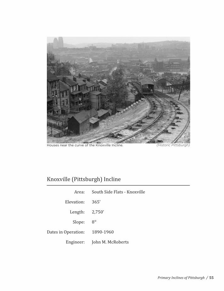
Houses near the curve of the Knoxville Incline. (Historic Pittsburgh)
55

/ Pittsburgh’s Inclines: Case Studies in Industrial Adaptation56

Area:
Elevation:
Length:
Slope:
Dates in Operation:
Engineer:
Mt. Oliver Incline
South Side Flats -‐ Mt. Oliver
370’
1,600’
14°
1871-‐1951
John J. & Caroline Endres
/Primary Inclines of Pittsburgh
South Side Flats from top of the Mt. Oliver Incline. (Historic Pittsburgh)
57

/ Pittsburgh’s Inclines: Case Studies in Industrial Adaptation58
Pittsburgh, Virginia, & Charleston R.R.
South 18th St. Streetcar
East Warrington Ave. Streetcar
Knoxville
Arlington Ave. Streetcar
East Carson St. StreetcarMt. Oliver
/Primary Inclines of Pittsburgh
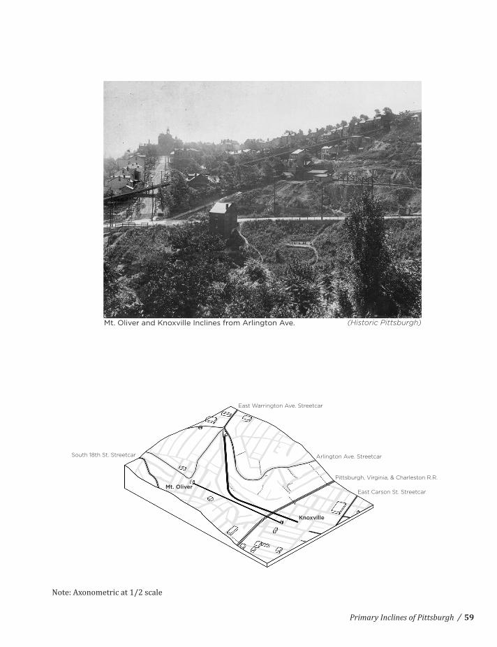
Mt. Oliver and Knoxville Inclines from Arlington Ave. (Historic Pittsburgh)
59

/ Pittsburgh’s Inclines: Case Studies in Industrial Adaptation60

Area:
Elevation:
Length:
Slope:
Dates in Operation:
Engineer:
St. Clair (22nd Street) Incline
South Side Flats -‐ South Side Slopes
375’
2,050’
11°
1886-‐1935
John M. McRoberts
/Primary Inclines of Pittsburgh
Mission St. Bridge over the former site of the St. Clair Incline. (Historic Pittsburgh)
61

/ Pittsburgh’s Inclines: Case Studies in Industrial Adaptation62
Pittsburgh, Virginia, & Charleston R.R.
Mission St. Pumping Station
St. Clair
/Primary Inclines of Pittsburgh
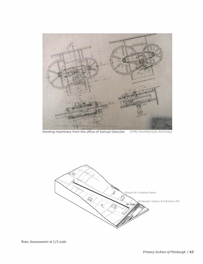
Hoisting machinery from the office of Samuel Diescher. (CMU Architecture Archives)
63

/ Pittsburgh’s Inclines: Case Studies in Industrial Adaptation64

Area:
Elevation:
Length:
Slope:
Dates in Operation:
Engineer:
Fort Pitt Incline
Monongahela River -‐ Bluff
110’
350’
24°
1883-‐1906
Samuel Diescher
/Primary Inclines of Pittsburgh
Steps that replaced the Fort Pitt Incline. (Historic Pittsburgh)
65

/ Pittsburgh’s Inclines: Case Studies in Industrial Adaptation66

10th St Bridge
Baltimore & Ohio R.R.
Monongahela River
Armstrong Tunnel
Fort Pitt
Future Site of Blvd. of the Allies
Second Ave Streetcar
/Primary Inclines of Pittsburgh
Hoisting Machinery from the office of Samuel Diescher. (CMU Architecture Archives)
67

/ Pittsburgh’s Inclines: Case Studies in Industrial Adaptation68

Area:
Elevation:
Length:
Slope:
Dates in Operation:
Engineer:
Penn (17th Street) Incline
Strip District -‐ Hill District
315’
900’
24°
1883-‐1953
Samuel Diescher
/Primary Inclines of Pittsburgh
(Brookline Connection)
69

/ Pittsburgh’s Inclines: Case Studies in Industrial Adaptation70

PennLiberty Ave Streetcar
Pennsylvania R.R. Company Yard
Bigelow Blvd.
/Primary Inclines of Pittsburgh
Profile from the office of Samuel Diescher. (CMU Architecture Archives)
71

/ Pittsburgh’s Inclines: Case Studies in Industrial Adaptation72
Area:
Elevation:
Length:
Slope:
Dates in Operation:
Engineer:
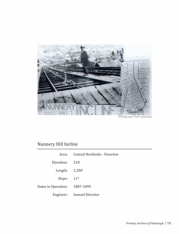
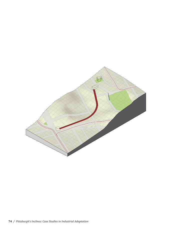
Nunnery Hill Incline
Central Northside -‐ Fineview
210’
1,200’
11°
1887-‐1899
Samuel Diescher
/Primary Inclines of Pittsburgh
(Pittsburgh Post-Gazette)
73
/ Pittsburgh’s Inclines: Case Studies in Industrial Adaptation74

Nunnery Hill
Catoma St. Streetcar
Henderson St. StreetcarFederal St. Streetcar
/Primary Inclines of Pittsburgh
Plan and Profile from the office of Samuel Diescher. (CMU Architecture Archives)
75

/ Pittsburgh’s Inclines: Case Studies in Industrial Adaptation76

Area:
Elevation:
Length:
Slope:
Dates in Operation:
Engineer:
Troy Hill Incline
Allegheny River -‐ Troy Hill
130’
450’
21°
1887-‐1898
Samuel Diescher
/Primary Inclines of Pittsburgh
(Pittsburgh Post-Gazette)
77

/ Pittsburgh’s Inclines: Case Studies in Industrial Adaptation78

Allegheny River
30th St. Bridge (to Herr’s Island)
Pittsburgh & Western R.R.
Pennsylvania R.R. Company
Troy Hill
Lowrie St. Streetcar
East Ohio St. Streetcar
/Primary Inclines of Pittsburgh
View of Rialto St. parallel to Troy Hill Incline. (Historic Pittsburgh)
79
/ Pittsburgh’s Inclines: Case Studies in Industrial Adaptation
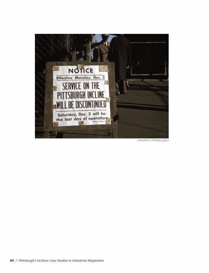
(Historic Pittsburgh)
80
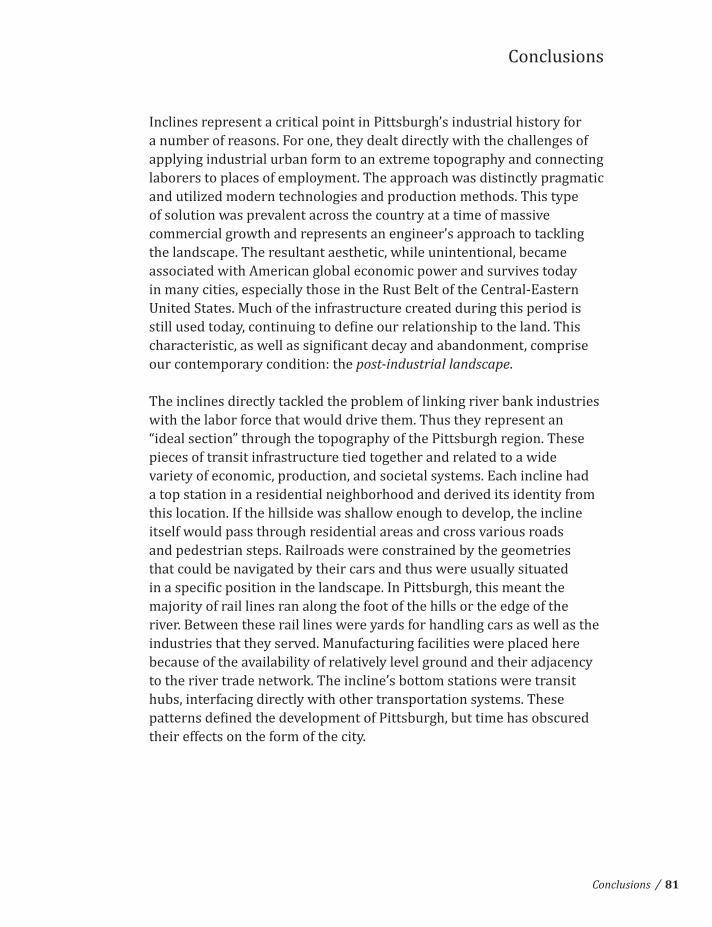
Conclusions
Inclines represent a critical point in Pittsburgh’s industrial history for a number of reasons. For one, they dealt directly with the challenges of
laborers to places of employment. The approach was distinctly pragmatic and utilized modern technologies and production methods. This type of solution was prevalent across the country at a time of massive commercial growth and represents an engineer’s approach to tackling the landscape. The resultant aesthetic, while unintentional, became associated with American global economic power and survives today in many cities, especially those in the Rust Belt of the Central-‐Eastern United States. Much of the infrastructure created during this period is
our contemporary condition: the post-industrial landscape.
The inclines directly tackled the problem of linking river bank industries with the labor force that would drive them. Thus they represent an “ideal section” through the topography of the Pittsburgh region. These pieces of transit infrastructure tied together and related to a wide variety of economic, production, and societal systems. Each incline had a top station in a residential neighborhood and derived its identity from this location. If the hillside was shallow enough to develop, the incline itself would pass through residential areas and cross various roads and pedestrian steps. Railroads were constrained by the geometries that could be navigated by their cars and thus were usually situated
majority of rail lines ran along the foot of the hills or the edge of the river. Between these rail lines were yards for handling cars as well as the industries that they served. Manufacturing facilities were placed here because of the availability of relatively level ground and their adjacency to the river trade network. The incline’s bottom stations were transit hubs, interfacing directly with other transportation systems. These
their effects on the form of the city.
/Conclusions 81
Finally, inclines represent a unity of all the above factors in a single industrial artifact. These landscape machines mediated between the
landscape through a uniquely engineered solution to topographical constraints. They responded to local conditions as a way to move
aesthetic that survives to this day. They represent investment by the government to serve the public good, a missing link in the development of contemporary America.
this is not the only grouping that could be developed. It is primarily based on an understanding of the role these inclines played in the neighborhoods they served and is as follows:
Limited Effect:
Nunnery HillTroy HillFort PittMonongahela FreightSt. ClairPenn
Lasting Effect:
Castle Shannon (1 & 2)
Mt. Oliver
Tourist Attractions:
DuquesneMonongahela
Note that the longest-‐lasting inclines (besides those remaining on Mt. Washington) serve the South Side Slopes in the area of densest working-‐class housing, an area that survives primarily as a blue-‐collar neighborhood. These were also the longest inclines (requiring a transfer to a different line in the case of Castle Shannon) serving residents fairly far from employment centers on the Monongahela River. Of course, the local effects of any of these inclines should not be deemphasized, as all contributed to the development of the neighborhoods they served. The response to some of these inclines is limited because they were removed fairly early in the industrial period to make way for other forms of infrastructure. The removal of the majority of the inclines was a
and as a unique characteristic of Pittsburgh’s industrial identity.
/ Pittsburgh’s Inclines: Case Studies in Industrial Adaptation82

Looking Forward
This volume represents the beginning of continuing study through the development of a design proposal in the coming semester. The variety of reading as well as the development of a case-‐study analysis has served
some guidelines laid out here.
relationship of Pittsburgh residents to the post-‐industrial landscape in which they live. America today is home to a ubiquitous urban form due to our automobile-‐ and consumer-‐centric culture. This ubiquity, while somewhat comforting in its lack of differentiation, is largely responsible for our current environmental, economic, and societal crises due to the implicit dissociation between people and the land on which they live. I believe to attack and alter this paradigm is to tackle problems central to being a conscious citizen today.
1. A designer must gain insight through history and avoid repeating mistakes in pursuit of nostalgia.
2. The product must be a unique response to the local landscape, history, society, and economy.
3. The product must be inclusive and provide a relevant and desired public asset, improving Pittsburgh’s status as a contemporary city.
Further development of the project can be followed at my blog:
/Looking Forward 83

/ Pittsburgh’s Inclines: Case Studies in Industrial Adaptation84

Annotated Bibliography
Inspiration for Study:
Aurand, Martin. The Spectator and the Topographical City. Pittsburgh: University of Pittsburgh Press, 2006.
Aurand studies the development of Pittsburgh through the eyes of ‘the spectator’, describing various regions of the city through
on development of the city including the founding of the city and development as a commercial hub, the growth of industry, and philanthropy and investment by wealthy industrialists that contributed to cultural growth and amenities.
Lipsky, Florence. San Francisco: Where the Grid Meets the Hills. Marseille: Editions Parentheses, 1999.
representation are drawn from a wide variety of sources and creative
McHarg, Ian. Design with Nature. Garden City: The Natural History Press, 1969.
mankind’s relationship to landscape. He describes large-‐scale ecological and urban systems as well as developing a framework for
Morrish, William R. Civilizing Terrains: Mountains, Mounds, Mesas. San Francisco: William K Stout Publishers, 2005.
how and why various landscapes contribute to man’s worldview and how this affects urban development. The series of analytical
understanding the relevance of landscape.
/Annotated Bibliography 85

Shepheard, Paul. What is Architecture? An Essay on Landscapes, Buildings, and Machines. Boston: MIT Press, 1994. Shepheard, Paul. The Cultivated Wilderness, or What is Landscape? Boston: The MIT Press, 1997.Shepheard, Paul. . Boston: MIT Press, 2003.
All three describe the author’s approach to understanding the relationship between landscape and architecture. The framework is described through stories yet is both broad and clear, laying out
Steenbergen, Clemens, and Wouter Reh. Architecture and Landscape: The Design Experiment of the Great European Gardens and Landscapes. Basel: Birkhäuser, 2003.
An academic study of the European landscape tradition as a lineage
researched, the authors of this volume also draw on a wide variety of
Pittsburgh Resources:
Arnold, Bion J. Report on the Pittsburgh Transportation Problem. Pittsburgh: 1910.
Citizens Committee on City Plan of Pittsburgh. Railroads of the Pittsburgh District, a part of the Pittsburgh Plan. Pittsburgh: 1923.
Horne, Murray. On the Waterfront: Projects for Three Rivers. Pittsburgh: Pittsburgh Center for the Arts, 1991.
Horsbrugh, Patrick. Pittsburgh Perceived; a critical review of form, features and feasibilities of the prodigious city. Pittsburgh: Department of City Planning, 1963.
Mitchell & Ritchey. Pittsburgh in Progress. Pittsburgh: Kaufmann’s, 1947.
Ohler, Samuel R. Pittsburgh’s Inclines. Pittsburgh: Pickwick-‐Morcraft, 1972.
/ Pittsburgh’s Inclines: Case Studies in Industrial Adaptation86

Samuel Diescher Collection [technical drawings], CMU Architecture Archives, Carnegie Mellon University, Pittsburgh, PA.
anniversary of the Engineers’ Society of Western Pennsylvania. Pittsburgh: Cramer Printing & Publishing Company, 1930.
Youngner, Rina. The power and the glory : Pittsburgh industrial landscapes by Aaron Harry Gorson, 1872-1933. New York: Spanierman Gallery, 1989.
Web Resources:
Bell, Jon. “Pittsburgh, Pennsylvania: Incline Railways.” http://web.presby.edu/~jtbell/transit/Pittsburgh/Inclines/ (accessed December 16, 2012).
Burton, Clint. “Pittsburgh’s Old Inclines.” Brookline Connection (blog), http://www.brooklineconnection.com/history/Facts/Inclines.html (accessed December 16, 2012).
“City of Pittsburgh Geodetic and Topographic Survey Maps, 1923-‐1961.” Historic Pittsburgh, http://images.library.pitt.edu/g/geotopo/ (accessed December 16, 2012).
pghbridges.com (blog), http://pghbridges.com/articles/inclines/inc_builders_trib.htm. Dec 03, 2001.
“Historic Pittsburgh Image Collections.” Historic Pittsburgh, http://digital.library.pitt.edu/images/pittsburgh/ (accessed December 16, 2012).
“Inclines Listed by Location.” pghbridges.com (blog), http://pghbridges.com/inclinelist.htm. Jun 27, 2000.
“Pittsburgh’s Incline History.” Old Pittsburgh Maps – Pittviewer (blog), http://oldpittmaps.wordpress.com/2012/05/02/pittsburghs-‐incline-‐history/ (accessed December 16, 2012).
“Shorpy Historical Photo Archive.” Shorpy (blog), http://www.shorpy.com/ (accessed December 16, 2012).
/Annotated Bibliography 87
