planet earth autumn 2011
DESCRIPTION
Planet Earth is a free magazine aimed at non-specialists with an interest in environmental science.TRANSCRIPT

www.planetearth.nerc.ac.uk Autumn 2011
The new
Peat: core blimey! • Rip currents • Anglesey • Radioactive waste • Marine renewables
green revolution

FEATURES
06 Peat: core blimey! What peat bogs can tell us about ancient climates.
08 FORGEing a safe future for radioactive waste How to dispose of nuclear waste so it stays
disposed of.
12 Ocean acidification and life on the sea floor A new study of ‘the other CO2 problem’.
14 Green light for marine renewables? Why tidal turbines are like roadworks.
16 Ripped & torn The life-saving science of rip currents.
18 Anglesey (Ynys Môn) – 600 million years of Welsh history How glaciers, volcanoes and ancient oceans created
the island’s unique landscape.
24 No place like home Volcano risk and the most remote population
on Earth.
26 The new green revolution How a bug-killing fungus is helping keep pests
under control.
In this issue
16
1824
06
Autumn 2011

PLANET EARTH Autumn 2011 01
elcome to the Autumn edition of Planet Earth.
Thank you to everyone who responded
to our recent postcard survey, asking whether you’d like to see Planet Earth back in print. The overwhelming majority of you told us you did, so from the next edition, Planet Earth will be returning as a printed magazine as well as online.
We’re pleased to be able to bring you Planet Earth free of charge, but we need your help to keep costs down and make sure every copy we send out is wanted.
We know some of you are happy with the online version, so if you’d prefer not to receive a paper copy of Planet Earth please send us your name and full address so we can take you off the subscription list. You can email us at [email protected], or write to us at Planet Earth Editors, NERC, Polaris House, North Star Avenue, Swindon SN2 1EU.
In future there’ll be a subscription
Editors Adele Rackley, 01793 411604 [email protected] Marshall, 01793 442593 [email protected]
Science writerTamera Jones, 01793 411561 [email protected]
Design and productionCandy Sorrell, 01793 [email protected]
ISSN: 1479-2605
NERC scientists: we want to hear from you
Planet Earth is always looking for interesting NERC-funded science for articles and news stories. If you want to see your research in the magazine, contact the editors to discuss. Please don’t send in unsolicited articles as we can’t promise to publish them. We look forward to hearing from you.
Planet Earth is the quarterly magazine of the Natural Environment Research Council. It aims to interest a broad readership in the work of NERC. It describes new research programmes, work in progress and completed projects funded by NERC or carried out by NERC staff. Some of this work may not yet have been peer-reviewed. The views expressed in the articles are those of the authors and not necessarily those of NERC unless explicitly stated. Let us know what you think about Planet Earth. Contact the editors for details.
Front cover: Black vine weevil David J. Green – animals/Alamy
Wlimit of one copy per person or household. We’ve tried to take duplicate addresses off our database but if two copies drop through your letterbox, please let us know.
We don’t send out emails when a new edition is published, but our Monday-morning news alert will tell you about all our new online content, including the arrival of the quarterly e-magazine. You can sign up under Tools, at the top right of the Planet Earth Online homepage: www.planetearth.nerc.ac.uk
Planet Earth editions will be available online at the start of December, March, June and September each year.
We hope you enjoy this edition of Planet Earth; don’t forget to follow Planet Earth Online for the latest news, podcasts and more.
Best wishes,The Editors
Editorial

www.planetearth.nerc.ac.uk
NEWS
02 PLANET EARTH Autumn 2011
Forests could lose the carbon that’s stored in their soil more quickly as the climate
warms, new research suggests.The Earth’s forests play a vital role in
regulating the global carbon cycle and climate. They are important carbon sinks, absorbing CO2 from the air and locking it up for long periods in wood and rotting organic matter in the soil.
But these findings suggest that climate change may reduce this role. That is, it could damage the natural processes that are at the moment helping keep it in check.
Until now the expectation has been that as the world gets warmer and carbon dioxide levels rise, plants would grow more quickly and absorb more carbon, locking it up – for the time being, at least – in their leaves and stems and in forest-floor litter.
Scientists thought this would help moderate the effects of human CO2 emissions by making forests absorb more CO2. But the
Decaying leaf litter could boost forest carbon emissions
new results suggest this may not happen, since warmer conditions will make forest leaf litter decay more quickly, releasing the CO2 it contains back into the atmosphere and offsetting the gain from faster growth.
‘Soils are thought to be a long-term store for carbon but we have shown that these stores could be diminished if elevated carbon dioxide levels and nitrogen deposition boost plant growth,’ says lead author Dr Emma Sayer from the Centre for Ecology & Hydrology.
She adds that most estimates of how much carbon tropical forests can absorb and store are based only on measurements on tree growth, and don’t take into account the effects of the interactions between plants and soil. ‘Models of climate change must take these feedbacks into account to predict future atmospheric carbon dioxide levels,’ she says.
The findings come from a six-year experiment in a rainforest at the Smithsonian
Tropical Research Centre in Panama. The study looked at how an increase in the amount of litter – dead leaves, bark and twigs – might affect the amount of carbon stored in the soil.
It revealed an effect the researchers call ‘priming’, in which fresh plant litter provides soil microbes with the energy they need to break down carbon more quickly, returning it to the atmosphere.
‘This priming effect essentially means that older, relatively stable soil carbon is being replaced by fresh carbon from dead plant matter, which is easily decomposed,’ explains co-author Dr Edmund Tanner from the University of Cambridge. ‘We still don’t know what consequences this will have for carbon cycling in the long term.’
The research is published in Nature Climate Change.
Wong S
ze Yuen/Shutterstock

Daily updated news @ www.planetearth.nerc.ac.uk
PLANET EARTH Autumn 2011 03
Hikers may be inadvertently helping spread invasive plants across the largest national
park in Australia’s New South Wales.Scientists analysed how seeds from five
different invasive plants get scattered by hikers around Kosciuszko National Park. They calculated that during just one hiking season up to 1.9 million plant seeds could be carried on walkers’ socks, while 2.4 million seeds could attach themselves to their trousers.
Unsurprisingly, all the seeds attached to socks better than to trousers. Some were still stuck at the end of a five-kilometre walk.
‘Around 33,000 visitors go through the alpine area of Kosciuszko National Park each season. Half go for short walks, half go for much longer walks, which means there’s a lot of potential for accidental seed dispersal,’ says Professor James Bullock from the Centre for Ecology & Hydrology, one of the authors of the study, published in Biological Invasions.
Scientists call plants and animals invasive if they spread so much they cause problems for local biodiversity. Invasive species can be native or non-native. Non-native species have got into a country from abroad, but they don’t always cause trouble.
Invasive species are now recognised as a threat to biodiversity around the world. Japanese knotweed, grey squirrels and harlequin ladybirds have all been brought into the UK and are now spreading so much that
hikers spread invasive plant seeds accidentally
T he ancestors of modern humans almost certainly walked upright like we do, nearly four million years ago – two million years earlier
than previously thought, say researchers.They analysed a track of ancient footprints at Laetoli in Tanzania and
concluded that whoever made them already had most of the features considered essential for an upright gait.
The footprints’ maker could push off the ground using the forefoot, instead of using the middle of the foot as today’s great apes do.
‘They show a type of walking that was fully upright and that was driven by the front of the foot, particularly the big toe,’ says Professor Robin Crompton from the University of Liverpool, who led the study.
This means the way the likely printmaker walked was closer to our own gait than that of chimpanzees or gorillas.
Researchers think that being able to walk upright and push off the big toe would ultimately have helped our ancestors expand out of Africa and colonise the world. Until now, most thought these characteristics emerged only in early Homo species around 1.9 million years ago.
The site at Laetoli contains 11 footprints, which are 3.66 million years
Our ancestors walked upright four million years ago
they’ve become a problem. Scientists know that infrastructure like
roads and footpaths helps spread weeds around. But until now, few studies have looked at the contribution of clothing. So, with colleagues from CEH and Griffith University in Australia, Bullock decided to find out how seeds get inadvertently moved around Kosciuszko National Park.
They found that the type of clothing hikers
wear affects how many seeds are dispersed. For example, bidgee-widgee seeds have spines, so get carried much further than the smoother cocksfoot seeds.
‘We recommend that people are careful when going from car parks to more wild areas. They should take care to pull seeds off their socks before they leave the car park,’ says Bullock. ‘It’s simply an education problem.’
old. Despite being the earliest known trail made by human ancestors, they are in good condition. But scientists haven’t been able to work out what gait made them.
To settle the longstanding argument, Crompton and his colleagues used a new statistical technique, based on methods used in MRI brain imaging, to get a 3D average.
They then compared this with data from experimental studies of footprint formation and underfoot pressures generated by modern humans and other great apes while walking. Computer simulation helped them predict the footprints that would have been formed by different types of gait.
Now Crompton and his team say the most likely printmaker was a species called Australopithecus afarensis, which, until now, most scientists thought walked with a crouched posture, and had a foot which worked more like an ape’s than a human’s.
‘This is the strongest evidence yet to support the idea that the footprints point to a surprisingly modern foot function,’ he adds.
The research is described in Interface, a Royal Society journal.
Mona D
ennis

www.planetearth.nerc.ac.uk
NEWS
04 PLANET EARTH Autumn 2011
Scientists have found concrete evidence that recent outbreaks of bluetongue
disease across Europe are linked to climate change. As the climate keeps changing, the risks are likely to keep rising.
The researchers also linked a devastating outbreak of bluetongue disease that hit northern Europe in 2006 to recent changes in our climate.
The bluetongue virus affects animals like sheep, cattle and goats and is spread by midges from animal to animal, just as mosquitoes spread malaria. It doesn’t infect people. The disease spreads fastest when it’s warm and wet, so scientists are concerned that climate change could make outbreaks more common.
Until recently, bluetongue was restricted to Africa, Asia, Australia and the Americas. But it spread to southern Europe from Africa in 1998, before moving north. Since then, more than 80,000 European bluetongue outbreaks have been reported, with millions of farm animals dying as a result.
Several diseases are thought to be climate-related, including malaria, Rift Valley fever and even seasonal flu. But whether or not they’re really driven by changes in our climate is more controversial.
‘Bluetongue is often cited as an example of climate’s impact on the emergence of disease, but, until now, there was no study
Bluetongue risks will rise with climate change
that supported this,’ says Dr Andy Morse from the University of Liverpool, co-author of the study published in Interface, a Royal Society journal.
He and European colleagues tackled the question by developing a mathematical model of how it would spread in different climate conditions.
They looked at the effect of past climate on the changing risk of outbreaks over the last 50 years, to get a handle on what triggers these outbreaks. They then combined their model
with 11 climate models to project forward to the year 2050. This let them see how the disease might react to climate change.
They found a definite connection between the climate and the emergence of the disease. ‘A clear climate signal in northern Europe has allowed the virus to replicate,’ says Morse. He adds that because northern Europe is likely to warm relatively more than the south in the coming decades, it will experience a bigger increase in bluetongue outbreaks.
Britain’s natural environment is worth billions of pounds a year, according to a
groundbreaking new study.The UK National Ecosystem Assessment
(NEA) shows that nature gives us many benefits that we’d soon miss if they disappeared, and that many of them are more valuable than you might think.
For example, inland wetlands provide benefits like water purification that are worth as much as £1.5 billion a year, while in 2002 woodlands provided social and environmental benefits estimated at £1.2 billion.
But many of these ‘ecosystem services’ are under threat. Thirty per cent of those that researchers examined are declining, with just 20 per cent improving. Broadening our focus from things with an explicit price tag could improve many people’s lives.
nature gives uk free services worth billionsThe NEA draws on the knowledge of more
than 500 experts in ecology, economics and social sciences to study all the UK’s major ecosystem types. The first comprehensive, independent study to put a precise figure on many of the natural environment’s benefits, it will help policy-makers work out how to invest limited resources most effectively.
‘The UK National Ecosystem Assessment is a vital step forward in our ability to understand the true value of nature and how to sustain the benefits it gives us,’ says Environment Secretary Caroline Spelman, noting that the NEA has helped shape the government’s forthcoming Natural Environment White Paper.
‘There are many fruit and vegetable crops that we simply wouldn’t have if it wasn’t for insect pollinators, but we tend to assume they
are just available automatically,’ comments Professor Mark Bailey, director of the Centre for Ecology & Hydrology, more than 20 of whose scientists took part in the NEA. ‘This isn’t true; they depend on a whole range of ecosystem services that most people never give a thought to,’ he adds. ‘We hope that with better information and communication that will start to change, and people will have more understanding of the benefits they get from the natural environment.’
Continued population growth and climate change will put ecosystems under growing pressure in coming decades, so it’s vital we spend our resources where they will do most good.
Aliza S
chlabach/istockp
hoto.com

Daily updated news @ www.planetearth.nerc.ac.uk
PLANET EARTH Autumn 2011 05
Scientists have learned where Atlantic salmon spend their time at sea by analysing the chemistry of their scales – a breakthrough
that may help preserve dwindling populations.It turns out that fish from different parts of the UK migrate to very
different stretches of ocean. Salmon spend much of their adult lives at sea, before returning to breed in the rivers where they were spawned. But until now we haven’t known where they go at sea.
It’s an important question, because their numbers have been falling since the early 1970s, mostly because of losses at sea. In that decade, around 70 per cent of each generation died at sea, whereas in 2005 the mortality rate had risen to 90 per cent. This suggests it might be a good idea to protect them at sea. But where, exactly?
Now researchers have found the answer, by analysing the ratios between different forms of carbon, known as isotopes, in salmon scales. These form a distinctive chemical signature linking each salmon to the feeding grounds of its youth.
The scientists looked at collections of preserved salmon scales taken from two salmon populations – one returning to rivers on the UK’s north-east coast, the other coming back to the River Frome in Dorset.
Scales reveal salmon feeding grounds
Bumblebees, solitary bees and other wild pollinating insects are much more important for pollinating UK crops than previously
thought, say researchers.They found that honeybee populations have nose-dived so
dramatically in recent years that they can only do half as much pollination as they did in the early 1980s.
Where honeybees used to provide around 70 per cent of the UK’s pollination needs they now only pollinate a third. At worst, that figure could be more like 10 to 15 per cent.
Paradoxically over the last 20 years, the proportion of UK crops that rely on insects for pollination has risen from just under 8 per cent in the early 1980s to 20 per cent in 2007. Over the same period yields of insect-pollinated crops, including oil seed rape and field bean, have increased 54 per cent.
This means honeybees aren’t the only important pollinators. So if they aren’t pollinating all the crops, what is? The researchers think other insects like bumblebees, hoverflies and solitary bees must be making up the shortfall.
‘Our finding suggests that wild insect pollinators make a much bigger contribution to UK crop pollination than previously thought,’ says Tom Breeze from the University of Reading, lead author of the study, which appears in Agriculture, Ecosystems and Environment.
Insect pollination is worth an estimated £400 million a year to UK agriculture. Many have assumed honeybees are the most important pollinators, with a figure of around 90 per cent of pollination services coming from honeybees bandied around.
‘We had an inclination that this wasn’t an accurate figure at all,’ says Breeze. ‘Honeybees have been in decline for years, so it didn’t make sense.’
So the team set out to learn how important insect-pollinated crops are to UK agriculture and – using data from an earlier study – how much of their pollination comes from honeybees.
‘Bumblebees, hoverflies and red mason bees are key wild pollinators, but there are at least 250 bee species alone in the UK, which we thought almost certainly contribute more than honeybees do,’ Breeze says.
Although the researchers found honeybees don’t provide the same level of service that other species do, they note that both kinds of pollinator are crucial.
‘There was a seminal study in 2006 which found that you get the best pollination, best yields and best fruit when you have both wild pollinators and honeybees,’ says Breeze.
wild pollinators contribute more than honeybees
They compared changes in the scales’ isotopic signatures over time with satellite records of sea-surface temperatures from across the north Atlantic. Areas where changes in the records match up show where each population is feeding.
‘As every single salmon contains the natural chemical tag, we can now see where fish from individual rivers go to feed in the Atlantic,’ says Dr Kirsteen MacKenzie of the University of Southampton, lead author of the study, published in Scientific Reports. ‘Interestingly, we found that salmon born in two areas of the British Isles swim to feeding grounds that are far apart, and experience very different conditions at sea.’
Salmon returning to rivers in the north-east face more variable ocean conditions, suggesting they feed in the Norwegian sea – roughly what was expected. But salmon returning to the Frome seem, surprisingly, to feed further to the west, around the Faroe Islands and Iceland.
‘This research will help protect small, vulnerable populations of fish,’ says co-author Dr Clive Trueman, also from the University of Southampton. ‘If we know where they’re going, we can look out for any changes in fishing practice that might be affecting their numbers.’
Ed P
hillips/S
hutterstock
Lee Sutterby/istockp
hoto.com

06 PLANET EARTH Autumn 2011
Peat bogs hold evidence of past climate change, and scientists are using this archive to track changes in North Atlantic climate systems stretching back many thousands of years. Matt Amesbury describes some of the insights he and his colleagues are gaining from them.
Peat: core blimey!
The testate amoeba Nebela carinata.

PLANET EARTH Autumn 2011 07
Which brings us nicely back to my sinking wellies.
In the cores we retrieve, we study the plants that make up the peat (mainly mosses of the genus Sphagnum) and microscopic, single-celled organisms called testate amoebae. These amoebae grow a shell, or test, that is readily preserved in the peat sediments, and we can use it to identify different species.
The real work – the hours, days and months of painstaking analysis – begins when we get the cores back to the lab. We take samples at regular intervals down the core, stretching further into the past the deeper we go. We can then examine the fine details of moss leaves, other plants and testate amoebae under a microscope and build up a picture of how conditions on the bog have changed over time. We know this relates to past climate because we study ombrotrophic, or ‘rain-fed’, bogs, which receive all their water and nutrients from the atmosphere.
We can also look at changes in the ratios between different oxygen and carbon isotopes (lighter and heavier versions of these atoms) preserved in the cellulose of the moss leaves. In an ombrotrophic bog, we know that the water used by the moss to construct the cellulose must have come from precipitation, and because Sphagnum mosses have a very simple biology, there is a direct link back to past climate.
What have we found so far? We have just completed our second field season and are flush with material to work on. The records of past climate change that we will end up with each contain hundreds of samples and each one may take up to a few hours to analyse. Multiply that by three methods – looking at the plants, testate amoebae and the isotopes – and you have one very busy research team!
So far, both plant and testate
am slowly sinking into a bog in far northern Newfoundland, and the slushy peat threatens to overtop my wellies a little
more with every hard-fought drive of the corer. We have spent several days touring this remote region searching for bogs deep enough and old enough to tell us about the dramatic changes that occurred here some 8200 years ago.
Around then, part of the final remnants of the vast Laurentide Ice Sheet which covered much of North America during the last ice age burst dramatically into the Labrador Sea, near the bogs we are studying. This caused an abrupt freshening of sea water that had a major effect on ocean circulation and the transport of heat from the equator into the North Atlantic. We’re very interested to see how terrestrial environments responded to this, because there’s a chance something similar might happen in the future if the ice sheet over Greenland continues melting at its current rate.
Important surface and deep ocean currents pass through this area, and we’re also interested in how these, and the atmospheric and climate systems associated with them, have changed since the influence of the ice sheet waned around 7000 years ago. These ocean currents include the North Atlantic Drift – part of the Gulf Stream. This brings heat from the equator and keeps the UK’s climate much warmer than equivalent latitudes in Canada, which are chilled by the Labrador current flowing from the frigid north alongside Greenland.
Crossing the Cabot Strait to Newfoundland after a hard week of coring in the heat of Nova Scotia, that distinct drop in temperature was very welcome, but with the heat transfer of these ocean currents predicted to decline in response to increasing greenhouse gas concentrations in the atmosphere, the future impact on our climate is uncertain.
So how do peat bogs help? The bogs we study are acidic, largely oxygen-free environments that grow upwards over time because dead plant remains do not decay fully, and are gradually overgrown by new plant communities. The growth of plants and animals on the surface is highly sensitive to changes in precipitation and temperature, which cause the position of the water table, at or near the bog surface, to fluctuate over time.
So if the climate gets wetter or cooler, the plants change in response. If it gets drier or warmer, they change again. As the bog grows upwards, it preserves a record of all of these changes and we can now stand on the surface and take a core back through all the accumulated layers to reconstruct the history of the climate.
Coring under way in Nova Scotia (left) and the highly magnified cells of Sphagnum austinii.
I
MORE INFORMATIONDr Matt Amesbury is an associate research fellow in geography at the University of Exeter. Email: [email protected].
The lead researcher on this project is Dr Paul Hughes at the University of Southampton.
amoebae records from Nova Scotia and Newfoundland suggest a series of coherent shifts in climate. The base of our 865cm core from Petite Bog in Nova Scotia has also just been dated to around 13,500 years, much older than we expected – but more work is needed before we fully appreciate what these results are telling us.
One exciting early result has been the discovery of tiny (about 0.02mm wide) shards of volcanic ash from as far away as Alaska in our cores. These tephra shards are common in north-west Europe but are rarely found in the western North Atlantic, up to 6000km from their source. By analysing their chemical make-up, we can tell not only which volcanic region they came from, but the exact volcano and eruption event. This helps us to build a chronology for the shifts in climate we identify.
So what’s next? We’ll continue to build up more detailed records of past climate change that will allow us to address our research questions on climate variability in this region over the past 10,000 years or so, and about how terrestrial environments responded. An important part of the project is to develop good chronologies, so that we can be as confident as possible that we know when the shifts we’re seeing actually occurred, so hunting down those tephra layers and dating our cores by other methods will be a priority. Check back in a future issue of Planet Earth to see how we got on! n

08 PLANET EARTH Autumn 2011
FORGEing a safe future for radioactive waste
Fifty years of nuclear power generation in the UK have
produced a significant amount of waste, and storing it is not
straightforward. Radiation isn’t the only problem – the waste produces
potentially dangerous gases too. Emma Ward, Rob Cuss, Andy
Kingdon and Richard Shaw are part of an international project working
out what to do about it.
orking out what to do with nuclear waste is a complex problem. The use of nuclear power has always been an
emotive subject and disposing of what’s left over is no less so.
Many countries, including the UK, have decided that burial deep underground is the best way to make sure waste is disposed of safely, without causing a long-term hazard to humans and the environment. But burial isn’t the end of the story. Once in its underground repository, the waste won’t sit around quietly emitting radiation; it continues to be affected by a number of physical and chemical processes that generate problems of their own. Metal corrosion and radiolysis (the breakdown of water by radiation) produce hydrogen, for example, and some wastes contain organic material that generates methane and carbon dioxide as it decomposes. The best location for a repository is one where gases can’t flow too freely and dissolve slowly, so that gas pressure doesn’t build up and fracture the host rock. So understanding where and how these gases form and how they move through the repository and surrounding rocks is crucial, and this is the focus of the FORGE (fate of repository gases) project.
FORGE helps the national organisations responsible for safe radioactive waste
disposal to understand how gas will flow around and out of the proposed repository once it is closed, so that everyone can be sure the process is safe.
The four-year project, funded by the European Commission under the Framework 7 Euratom Program, has 24 partners from 12 European countries, including national radioactive waste management organisations, regulators, research institutes and universities at the forefront of research in this area.
But how do you find out what’s going to happen to radioactive waste buried hundreds of metres underground? We’re approaching this question through a combination of laboratory experiments, large-scale field tests at a number of underground research laboratories across Europe, and detailed numerical modelling.
Underground disposal is based on the ‘multiple barrier concept’, which means the waste is sealed inside a series of man-made and natural barriers. Across Europe a number of options are being considered which use different types of rock to build the repository, including plastic clays, mudstones and crystalline formations. In most of these, either a type of clay called bentonite or cement-based materials are used to backfill the spaces between the waste containers and the walls of the excavation.
W
Flow apparatus which can simulate pressure conditions found in deep geological environments.

PLANET EARTH Autumn 2011 09
FORGEing a safe future for radioactive waste
The waste will need to be buried for between 100,000 and one million years: it’s a long time, and it’s important to get it right. But an experimental approach alone can’t give us all the answers. Most experiments can only be successfully operated for a few years at a time, so FORGE uses mathematical modelling of potential future conditions to get a more complete picture.
Modelling is always a difficult process. It uses mathematical algorithms to replicate natural processes, but to do this we have to simplify complex natural systems down to just a few variables to represent the properties of features such as the host rocks, groundwater flow and gas generation. If we choose the wrong ones, our model won’t replicate the natural environment accurately enough, and it won’t be much use.
To get the best possible results, FORGE’s approach is to fully integrate laboratory and field experiment data with mathematical modelling. Our modellers and experimentalists exchange data and collaborate closely, and as a result our models represent the geological information better than ever before.
Ground breakingOne of our full-scale in situ experiments is LASGIT (large-scale gas injection test).
MORE INFORMATION
The British Geological Survey (BGS) is one of two UK partners in FORGE. Emma Ward is based at BGS Keyworth. E-mail: [email protected]
The large-scale gas injection test at the -420m level.
It studies the movement of gas through bentonite clay in a mock deposition hole, 420m down in the Äspö Hard Rock Laboratory in Sweden.
LASGIT has two stages, each of which lasts about a year. In the hydration phase the bentonite is saturated with water and we monitor the suction (swelling) and pressure. In the second phase gas is injected into the clay, and we watch how it flows through the rock. So we get data on the movement of both water and gas through the bentonite buffer and the relationship between gas flow and pressure within the clay.
Another crucial part of the field test involves critical stress theory. Essentially this tells us that fractures or faults at certain orientations to stresses in the surrounding rock will act as barriers to gas flow, while those at other orientations will act as conduits – something we’ve seen in natural gas reservoirs. So this part of the experimental programme looks at the relationship between fractures and stresses in the repository. We’re interested in two distinct areas; close to the repository, where the construction process will have created a complex local stress field with lots of fractures of different orientations; and farther away where the natural fractures in the rock are undisturbed by construction.
Thanks to some new British Geological Survey equipment we’ve been able to test critical stress theory in repository conditions for the first time. By injecting gas (or fluid) into the plane of the fracture at an angle to the applied stresses we can see how the gas flows and so work out which stresses will help the gas move and which will seal the fault and stop the gas flowing.
This work is important because building a repository changes the stresses in the surrounding rocks. Construction methods that cause the least fluid and gas flow are going to minimise the release of repository gas, so this knowledge helps us determine the best design and orientation for a repository.
FORGE is playing a key role in enhancing and developing European expertise in gas migration, helping to ensure that the partners are global leaders in this fast-developing and important area of science. n

www.planetearth.nerc.ac.uk
NEWS
10 PLANET EARTH Autumn 2011
Examining the chemistry of pyrite has helped geoscientists understand how our
planet’s environment changed in the wake of what’s known as the Great Oxygenation Event.
This was a vital episode around 2.4 billion years ago, during which the activities of bacteria caused levels of oxygen in the Earth’s oceans and atmosphere to rise sharply. Without it, the history of life on the planet would have been radically different.
Scientists knew that this great oxygenation event caused major changes in the oceans’ chemistry involving the deposition of substantial quantities of iron in sediments. But they weren’t certain exactly how to interpret the different forms of iron found in pyrite.
There were two competing theories. One was that bacteria were involved in creating the pyrite iron signatures; the other was that this was down only to changes in the oceans’ oxygen levels.
The new research shows that bacteria weren’t needed to produce these minerals, suggesting that the second hypothesis is closer to the truth.
The scientists managed to make minerals of identical composition to what’s found in
Fool’s gold illuminates earth’s early history
nature in the lab, without any involvement from microbes.
‘This research is important for our understanding of how oxygen accumulated in the atmosphere and oceans,’ says Dr Romain Guilbaud, a geochemist at Newcastle
University, and lead author of the paper, which is based on research he carried out during his doctorate at the University of Edinburgh. ‘Our discovery gives us a better idea of how information on the Earth’s evolution, recorded in ancient minerals, can be interpreted.’
Pyrite is also known as fool’s gold; it is not valuable, but its shiny, golden appearance has often tricked the unwary into mistaking it for the precious metal.
The researchers recreated the formation of these pyrite sediments in the lab and compared the results to the range of chemical compositions found in natural pyrite, looking in particular at the ratio between two different forms (or ‘isotopes’) of iron. This ratio provides a snapshot of the conditions in which the minerals formed. Pyrite that was produced as a byproduct of the activities of microbes invariably has a different ratio to those that formed in the absence of life.
‘Our results show that you don’t need bacteria to produce the full range of pyrite signatures that we see in nature,’ says Guilbaud. ‘The experiments had no involvement from bacteria, and we ended up with a set of different pyrite compositions that ranges from what you saw before the Great Oxygenation Event right up to modern pyrite.’
‘This new information about pyrite gives us a much sharper tool with which to analyse the early evolution of the Earth, telling us more about how our planet formed,’ adds co-author Dr Ian Butler of the University of Edinburgh.
The research appears in Science.
Our discovery gives us a better idea of how information on the Earth’s evolution, recorded in ancient minerals, can be interpreted.Dr Romain Guilbaud, Newcastle University
Shutterstock.com

Daily updated news @ www.planetearth.nerc.ac.uk
PLANET EARTH Autumn 2011 11
Scientists have built the most complete timeline yet of geological and archaeological events in Britain over the last three million years.
And they’ve done it using fossilised snails.The mammoth 11-year project, published in Nature, is the most
comprehensive of its kind. It should put an end to any debate over the timing of human occupation in Britain or past geological events.
It shows our ancestors lived in Britain during most warm periods of the last few million years, although they were absent in the last warm period – or interglacial – 125,000 years ago. At this time the climate was so warm that hippos roamed the British Isles.
The timeline also suggests that before the Holocene – the warm period we’re in now – there were four major interglacials in Britain in the last half million years. Until this study, nobody had been able to use just one dating technique to figure out the order of events so long ago.
Ice cores from Antarctica and cores from deep-sea sediments provide continuous climate records. But it’s difficult to relate the fragmentary records from land to these master sequences.
To answer these questions, the researchers used a method called amino-acid dating. Amino acids, the building blocks of proteins, exist in two versions which are mirror images of each other. Only the ‘left-hand’ version exists in living bodies. But after death the proteins fossilise, and the amino acids slowly degrade into the ‘right-hand’ version until long afterwards there are equal numbers of each. So the higher the ratio of left-hand to right-hand versions, the older the fossil.
The proteins in snail shells themselves turn out to start breaking down after about 300,000 years, so it’s hard to use them to date events older than that. So, the researchers turned their attention to the tiny trapdoors called opercula that some snails, like Bithynia, use to close off the outside world. Opercula are made of a different material to shells, and are much more stable.
‘Opercula work like a dream, because the protein within them is protected so well,’ explains Dr Kirsty Penkman from the University of York, lead author of the Nature study.
They analysed opercula from across Britain and the Netherlands, and ranked them in order of relative age based on amino-acid degradation. They then tested their method by comparing its results with geological and archaeological sites of known age.
Snails help date Britain’s last three million years
Scientists have released a digital map that shows in unprecedented detail the mosaic of vegetation and land-cover types that makes up
the British landscape.The map will improve our understanding of how we are using the
land, and how we can manage it sustainably in the future.The new UK Land Cover Map (LCM) is the product of several years’
work. It’s based on 70 satellite images collected between 2005 and 2008, and shows the distribution of different habitats around the UK to a resolution of just 25 metres.
‘At a time when our land surface is under increasing pressure, reliable information on land cover is essential,’ says Dr Dan Morton of the Centre for Ecology & Hydrology (CEH), who led the project. ‘The demands that we place on our land are often conflicting and need to be balanced to maintain and enhance our quality of life. To address these issues and plan for the future, we need to know what we have on our land surface and where it is. The new map provides that information.’
He suggests it will be helpful to scientists in many fields, from researchers trying to understand how water drains off the land to those working on how carbon moves through particular ecosystems, or how to manage our natural resources most efficiently.
The results show that the main categories of land use, ‘arable and horticulture’ and ‘improved grassland’ habitats, both take up a quarter of the UK’s land area. ‘Semi-natural grassland’ takes up 13 per cent; ‘mountain, heath and bog’ accounts for another 16 per cent. ‘Urban areas’, ‘coniferous woodland’ and ‘broadleaved woodland’ each make up a further 6 per cent, while ‘coastal’ and ‘freshwater’ habitats account for the rest.
new map shows make-up of British landscape
Land cover map of north Wales and Anglesey.

12 PLANET EARTH Autumn 2011
cean acidification (OA) sounds like the stuff of nightmares but it’s happening now – since the start of the Industrial
Revolution, the hydrogen ion concentration of the surface ocean – the variable that determines how acidic it is – is estimated to have increased by nearly 30 per cent. How? The chemistry is straightforward. As human activities produce more CO2, more of the gas enters the ocean and reacts with sea water. This releases negatively-charged (acidic) hydrogen ions and reduces pH. It’s that simple.
What isn’t simple is demonstrating the consequences; just how OA may affect marine organisms and ecosystems, including not only seaweed, sea urchins and fish, but also bacteria and plankton. There is growing evidence that some organisms, such as coral reefs, are being affected in some parts of the world, but what of the life around our own shores?
What we do know is that if we keep emitting CO2 at today’s rates, by 2100 average surface ocean pH will have fallen from 8.1 to around 7.8 – average levels the Earth has probably not experienced
Ocean acidification and life on the sea floor
You might not have heard of ‘the other CO2 problem’ but
it may already be affecting the seas around Britain.
Kelvin Boot looks at a new research programme that aims
to understand the possible impacts of ocean acidification
on our precious coastal ecosystems.
for more than 20 million years. This would have wide implications for ocean life, especially, but not exclusively, for organisms that need calcium carbonate to build shells or skeletons. Not only do increased hydrogen ion concentrations inhibit calcium carbonate formation, but they can slowly dissolve calcium carbonate structures, even if pH is greater than the ‘neutral’ value of 7.0.
Any change that affects our important marine ecosystems could have a big effect on the environment and human societies. Though not yet as widely reported as other effects of CO2 emissions, OA has been dubbed ‘the other CO2 problem’. It is now the subject of a major national research programme, bringing together over 120 researchers from 26 of the UK’s top scientific institutions; the UK Ocean Acidification Research Programme (UKOA).
One of the programme’s largest consortia is examining the effects on benthic (seabed) ecosystems, communities, habitats and species. This involves 12 UK institutions and is led by Steve Widdicombe of Plymouth Marine
Laboratory (PML).‘The really big thing about this work
is that for the first time we are bringing together people from different disciplines to work on the same creatures in order to establish the whole organism effect and how that in turn might affect the ecosystems in which they live,’ says Widdicombe. ‘With benthic, sediment and behavioural ecologists, evolutionary biologists, geneticists, chemists and many other disciplines coming together, we should get the best possible picture of how atmospheric CO2 is affecting our marine life.’
It’s a great example of how the diversity of UK marine science can be marshalled to investigate a phenomenon of increasing global concern.
Forty per cent of the world’s population lives within 100km of the coast, so coastal seas are important for food, prosperity and well-being around the world. They also harbour incredibly high levels of biodiversity.
Until now, studies of OA’s effects have been largely restricted to short-term experiments, exposing single species
O
Sea urchins.

PLANET EARTH Autumn 2011 13
to varying sea water pH according to projections of future atmospheric CO2 levels. These experiments have produced apparently contradictory results, with some organisms seeming to thrive in lower ocean pH while others show apparently negative effects. We need to know much more about what these effects might be, when they might happen and how they might be balanced by the organisms.
Steve Widdicombe sums up the challenge: ‘We need to understand how animals divide their energy between things like shell growth, reproduction and other activities when faced with environmental stresses like ocean acidification and rising temperatures. Different animals will do it differently – some might be able to access the energy they need to adapt; many more might not.’
The problem calls for longer-term studies that can overlap experiments on a number of generations of animals, and look across a whole community or habitat.
The consortium has developed a series of unique experimental environments which closely reflect conditions in three coastal seafloor habitats: soft sediments; calcareous biogenic habitats – areas like cold-water coral reefs and coral-like algae called maerl; and the rocky intertidal zone.
Whilst collecting material for most of the experiments was relatively straightforward, the cold water coral studies could not begin until the first UKOA research cruise in 2011, led by the National Oceanography Centre. One of its first tasks was to visit the cold-water coral reefs off north west Scotland.
The aim is to understand the impact of ocean acidification and warming on the biogeochemistry of benthic habitats, and on the health of their organisms, and to assess how much those organisms can adapt to change. Rather than look at isolated species, the results will help predict the impact of future CO2 changes on whole communities, and on the biodiversity and functioning of coastal habitats.
Time and tideFor these experiments to be worth their salt, they must be consistent across the consortium. So, each institute observes its particular marine environment under the same variations in CO2 levels – 380 parts per million (ppm), 750ppm and 1000ppm – and under the same changes in temperatures, which follow seasonal variation as well as simulating a possible future increase of 4°C, following IPCC projected scenarios.
They must also reproduce real-world conditions as closely as possible. So PML keeps rocky shore species – including dog whelk, top shell, barnacle, sea urchin and seaweed – in a temperature-controlled room where light levels parallel those of the outside world.
Because the tides are a major influence on the behaviour of rocky shore animals, the researchers have built large cantilevered tanks that gradually fill with water so their occupants emerge and submerge as the local tides fall and rise.
MORE INFORMATIONUKOA is funded jointly by NERC, the Department for Environment, Food and Rural Affairs (Defra) and the Department of Energy and Climate Change (DECC). www.oceanacidification.org.ukEmail: Kelvin Boot – [email protected]
The main partners in the benthic consortium include: Plymouth Marine Laboratory, Marine Biological Association of the UK, Scottish Association for Marine Science, Centre for Environment, Fisheries & Aquaculture Science, and the Universities of Aberdeen, St Andrews, Bangor, Heriot-Watt (with Glasgow), Hull, Plymouth and Southampton.
Near-empty tanks at simulated ‘high tide’, seabed submerged.
Attention to detail is crucial. Mirroring the real world as closely as possible makes it more likely that any changes seen in these experiments are down to the variations in CO2 and temperature alone.
One experiment at Oceanlab at the University of Aberdeen will look for changes in the behaviour of cockles, brittlestars and ragworms by observing bioturbation – the way these creatures mix sediment (for example, by burrowing in or ingesting it) and how this affects the exchange of chemicals between sediment and water. By using brightly-coloured sediment particles and putting a bromide tracer in the sea water, the researchers can follow how the particles are being moved around, and measure the amount and rate of sea water moving through the creatures’ burrows.
It’s not just the range of experiments that is unusual. ‘We are all using the same techniques for analysing the calcium-carbonate system in different environments, over a longer period – 18 months – than has been done before – this is a world first!’ Widdecombe explains. ‘Having a coordinated approach means other people can look at our data and relate our experimental responses to theirs.’
He expects the consortium’s experiments to begin producing results within three months, but the real interest will come with longer-term observations of a year and beyond.
Ocean acidification is a relatively new field, and while it is beginning to gain attention from scientists, policy-makers and the public, we still have a great deal to learn. The UKOA programme will clear up many doubts about its consequences. It will begin providing the concrete evidence that we need to mitigate and adapt to the changes, before it’s too late. n
Water tanks at Aberdeen.

14 PLANET EARTH Autumn 2011
Green light for marine renewables?
Why are tidal turbines like roadworks? As a
traffic engineer-turned-oceanographer, Simon Neill should know. He
explains how taking energy from the tides on a large scale with farms
of ‘underwater windmills’ could affect how sand
moves around our coastal seas, affecting beaches,
sand banks and ultimately the risk of flooding.
idal currents flood and ebb, mainly due to the gravitational force of the moon, combined with the Earth’s rotation. When
these currents are fast enough, they pick up grains of sand from the seabed, which are then transported with the flow. This is like cars picking up passengers en route to their destination.
In the middle of the day, on a typical road, there is no particular pattern to the flow of traffic, so the number of passengers will flow equally in both directions. It’s the same in the shelf seas – the shallow waters around our coastlines – where symmetrical tidal currents transport sand equally in both directions. This symmetry means that in the long term there is no significant net movement of sand.
Yet something interesting happens on the roads during the morning rush hour. There is a large net flow of passengers towards the cities, so the number of passengers transported is strongly asymmetrical. In the sea, this kind of
Alexand
r Mitiuc/123R
F
asymmetry in the tidal currents leads to a net large-scale movement of sand in either the flood or ebb direction.
Throughout the world’s shelf seas, interactions between the sweep of the tide and friction at the seabed generate a complex distribution of regions of symmetry, and regions of asymmetry. We can use computer models to make detailed maps of such processes, and these have been widely applied over the past few decades to understand large-scale sand movements.
Flooding and ebbing tidal currents, transporting sand either equally in both directions or with a net transport in one direction or the other, are responsible for the distribution of sand around our shelf seas. These large-scale sand movements feed into coastal systems like beaches and offshore sandbanks. Such systems remove the energy from storm waves, and so are vital natural forms of coastal protection.
Coastal engineers must understand these systems to manage flood risk, just as traffic engineers and town planners need
T

PLANET EARTH Autumn 2011 15
to understand the volume of traffic and passenger numbers travelling through each section of the road network. However, what would happen if we were to exploit tidal energy to generate electricity on a significant scale? How would this affect the large-scale movement of sand, and so ultimately affect this natural form of coastal protection?
Impact of energy extractionExtracting energy from a tidal system, for example by installing a farm of tidal stream turbines or ‘underwater windmills’, will reduce the strength of tidal flows. This is like the impact of roadworks, which lead to a reduced flow of traffic. A reduced flow of traffic means fewer passengers can be transported. In the sea, tidal energy extraction will similarly reduce the volume of sand transported.
The amount of sand transported is proportional to the cube of the speed of the current that’s carrying it, so small changes to the current speed could translate into large changes in sand transport. Of course, tidal-energy projects are only economically viable in regions of strong tidal flow, and the impact will be magnified in these regions, compared to areas with weaker tides.
Now, something interesting happens if we contrast the impact of extracting energy from a region of tidal symmetry (traffic in the middle of the day) with extracting energy from a region of tidal asymmetry (traffic during the rush hour). We first assume that turbines will be designed to extract energy equally efficiently during both flood and ebb phases of the tide. This could be achieved, for example, by turning the devices when the tide changes – technology similar to that used in wind turbines.
In a region of tidal symmetry, although the dampened flow speeds will reduce the overall volume of sand transport, the transport will still be symmetrical. This is what would happen if roadworks were set up during the middle of the day on both the city-bound and country-bound carriageways. Although slightly less traffic would flow, the impact on passenger transport would be minimal. During the morning rush hour, though, roadworks simultaneously placed on the city-bound and country-bound carriageways would have a considerable impact on net passenger transport.
If the roadworks resulted in particularly long city-bound delays, they could actually lead to a situation where equal numbers of passengers are transported into and out of the city during the morning rush hour – although in reality, one would hope that the traffic management scheme would not be so inefficient! Similarly, in the shelf
Sand transport in the oceans is like the flow of traffic.
The impact of tidal-energy extraction on sand transport is like the impact roadworks have on passenger transport.
seas, a very large tidal energy scheme in an area of tidal asymmetry could disrupt the natural movement of sand considerably.
This could have severe consequences for coastal protection and flooding, by disrupting the supply of sand feeding into the natural systems which protect our coastlines from storms, such as beaches and offshore sandbanks. There have been many instances where human activities like offshore dredging of sandbanks (to provide aggregate for the construction industry) have been blamed for a reduction of sand in neighbouring beaches. For example, in Pakiri Beach, just north of Auckland, New Zealand, offshore dredging has been linked to poor beach recovery following large storms.
Before developers decide on the scale and location of any large-scale tidal energy scheme, it is important that they consider tidal asymmetry and the impact of the scheme on sand transport, and how this compares to how we expect conditions to vary naturally from year to
year and season to season.Finally, we should note that artificial
interventions by tidal-energy farms could actually lead to positive effects. Strategic placement of tidal-energy farms could even be used to create a natural form of coastal flood protection by artificially manipulating offshore sand deposits. However, such state-of-the-art geoengineering would have to be based on a sound understanding of the underlying oceanographic processes. n
MORE INFORMATIONSimon Neill is a research lecturer in sediment dynamics and oceanographic modelling at the School of Ocean Sciences, Bangor University. Before returning to higher education to seek a career in oceanography, he worked for four years as a traffic and highway engineer with the Northern Ireland Roads Service. Many details of this and other research projects can be found at www.bangor.ac.uk/~ucsa03Email: [email protected]

16 PLANET EARTH Autumn 2011
Ripped & tornRip currents are a major hazard for swimmers and surfers. While they don’t pull you under, people can drown simply by wearing themselves out trying to swim against the fast-moving water.
Sue Nelson met oceanographer and former European surfing champion Paul Russell and his colleague Tim Scott from the University of Plymouth, and lifeguard Dickon Berriman from the RNLI, on blustery Perranporth beach in Cornwall. She asked them about a new research project that will keep people safer in the sea.
n WHAT IS A RIP CURRENT?
Dickon: Put simply a rip current is a body of water trying to find its own level. Right now there’s maybe five-foot of surf breaking – that’s lots of water forcing its way onto the beach. That water’s got to get back out again, so it’ll look for the path of least resistance. Here at Perranporth it’ll be a break in the sandbanks, but it could also be a pier or jetty, or some rocks. The water will follow the edge of those man-made structures or physical hazards and flow back out to sea.
n WHAT PRObLEMS DO RIP CURRENTS CAUSE FOR yOU AS A LIFEGUARD?
Dickon: They account for at least two thirds of our rescues, so a lot. We’re always advising people to avoid them and swim between our red and yellow flags. The UK’s large tidal ranges mean the water’s moving on and off the sandbanks quickly and rip currents can turn on and off very quickly too, so they’re a major hazard.
n TELL ME AbOUT yOUR PROjECT.
Paul: We’ll spend three years looking at what causes rip currents to vary – so we’ll measure the incoming waves which drive the whole system, the rip currents themselves and the shape of the beach.
n HOW WILL yOU MEASURE THE CURRENTS – ISN’T IT DANGEROUS?
Tim: We’ll use these ‘drifters’ which effectively mimic the movements of someone trapped in the surf zone. They’re about a metre tall, with a floatation cylinder and a mast, and they float upright. A damping plate on the bottom stops them surfing on the waves. Each drifter has a GPS which takes a position every second and we can accurately plot their speed and position in the surf zone.
Paul: We’ve also got fixed instruments measuring the current at one point, while the drifters will follow the current just like a surfer. In big waves like this a surfer will get washed along the shore a bit and then taken out in a rip current. Then you’ll be riding waves – that’s the water being dragged back in over the bar. Then you’re washed along shore again. This is exactly the sort of circulation that our drifters follow when they’re out in the waves.
n WHAT ARE THESE DEvICES ACTUALLy LOOkING FOR IN THE WATER?
Paul: We’re looking for the changes in the system, so we’re not just measuring it once, but continually – as the tide changes, as the waves change and as the sandbars change. We’ve just done a six-week experiment here and we’re coming back in October when the beach, the waves and the rip currents will be different.As keen surfers, do you notice when the rip currents are stronger?

PLANET EARTH Autumn 2011 17
Tim: Surfers see rip currents all the time – we’re constantly moving around in them. Many surfers might not know the physics behind what’s happening, but they have a good intuitive knowledge of how rip currents work. And the fact is, they do change all the time – with the seasons, and even over seconds with different groups of waves. You get different kinds of rips on different beaches.
n HAvE yOU EvER bEEN TEMPTED TO GET IN WITH THE DRIFTERS AND SEE IF THEy WORk?
Paul: Absolutely – in fact we’ve spent the last six weeks doing just that. We’ve been drifting with GPSs on our heads to make sure humans and drifters track similar directions at similar speeds – which they do. That means whole groups of us being swept out in rip currents and then swimming back in. Plus drifters continually get washed in and we’re continually taking them back out. It’s incredibly hard work!
n HOW ARE yOU GOING TO USE THIS RESEARCH?
Dickon: It will help in several areas, firstly with risk assessment – helping us work out how to use the lifeguards and equipment we have, and what level of training we need on every beach in the UK. The research is providing base data – a scale of relative danger for each beach – that will combine with the observations to determine what we need. It will also help us improve the safety advice we give to schools and on the beach, as well as the
training we give our lifeguards. These young men and women have potentially grown up in the surf, but this will back up their knowledge and teach them how to watch the surf for rip currents. So it’s really, really useful. And, of course, it’ll be relevant wherever there are rip currents around the world.
n FINALLy, WHAT SHOULD PEOPLE DO IF THEy GET CAUGHT IN A RIP CURRENT?
Dickon: The important thing is to conserve energy and not to panic – the rip current will carry you quickly away from the beach but it won’t pull you under the water. So swim parallel to the beach until you’re outside the current, and then swim diagonally towards the shore. If the rip is really strong and you can’t swim out of it, float or tread water until it loses strength. Never try to swim against the flow of water to get back to the beach – you’ll never out-pace the current and you’ll quickly get worn out; that’s when people drown.
MORE INFORMATIONProfessor Paul Russell. Email: [email protected]
Royal National Lifeboat Institution: www.rnli.org.uk
Dynamics of Rip Currents and Implications for Beach Safety (DRIBS): www.ripcurrents.co.uk
This Q&A is adapted from the Planet Earth Podcast 12 July 2011. The full podcast and transcript can be found on Planet Earth Online: http://planetearth.nerc.ac.uk/multimedia/story.aspx?id=1021

18 PLANET EARTH Autumn 2011
Anglesey (Ynys Môn) 600 million years of Welsh history
o many people the island of Anglesey, with its rocky headlands and sandy beaches, is a favourite holiday destination. To others, it’s simply a place to pass through on the way to or from the ferry port at
Holyhead, en route to Ireland, or perhaps known only from news articles covering the recent patronage by the Duke and Duchess of Cambridge. However, among the geological community it is widely known as a hotbed of geological controversy.
Although it is widely accepted that Anglesey holds the key to understanding many of the fundamental processes that have shaped the British Isles, for the last hundred years Earth scientists have been locked in a sometimes-intense debate about precisely how to interpret the rocks preserved there, and the relationships between them.
Hidden beneath the rolling hills of this relatively small island is evidence of the major geological processes which have helped create the Welsh landscape. It tells of the opening and closing of ancient oceans, the growth and eventual death of volcanoes, the blossoming of life in shallow tropical seas, through to the formation of huge ice sheets that grew and then eventually melted away in response to recent changes in our climate. Together, these have left behind a complex collage of different rock types, geological structures and landforms that have fascinated geologists for at least the last 150 years.
One of our teams of scientists has been carrying out a careful survey of a region of Ordovician rocks, formed between about
Earth scientists from the British Geological Survey (BGS) are applying new techniques to advance our understanding
of the geological evolution of Anglesey, North Wales,
unravelling over 600 million years of Earth history. Now into their third year of study,
they have already made some startling new discoveries about processes at opposite ends of
the geological time scale. David Schofield, Emrys Phillips and David Beamish tell us more.
A deep, narrow valley near Carmel Head which was cut into the bedrock by pressurised meltwater flowing beneath the ice.
T

PLANET EARTH Autumn 2011 19
470 and 450 million years ago, that crop out in the central part of the island. These ancient sedimentary rocks were deposited in a depression that formed during the closure of an ancient ocean as one tectonic plate overrode an adjacent one, forcing it to bend. Unravelling their evolution is providing new insights on the ancient plate collisions that led to the final assembly of Anglesey.
Geologists have interpreted the origins of the ancient sandstones, mudstones and conglomerates (made of small fragments of stone cemented together by softer rock) on Anglesey by comparing them to sediments being laid down on modern seabeds. For instance, the sandstones exposed across central Anglesey preserve sedimentary structures, such as ripples, and fossil shells similar to those found in shallow marine shelf environments or beaches. Yet along the north-east coast of the island, black, thinly-layered mudstones are like those found in the deepest parts of modern ocean basins.
The planktonic flora – made up of microscopic marine algae – that is preserved in these rocks include many species that are known to have evolved rapidly, so that their populations can be shown to change through successive geological layers and effectively give us a way of comparing the relative ages of the Ordovician rocks in different places.
All this new information has let us build up a detailed picture of what was once a deep marine sedimentary basin that is now preserved in a very narrow tract, no wider than 10km across. It clearly shows how the different parts of this once much wider
Helen Burke using a tablet PC to record data in the field.

20 planet earth Autumn 2011
basin were telescoped and squeezed together as the ocean closed around 400 million years ago.
While one group of geologists has been plumbing the depths of ancient ocean basins, another team has been examining the landscape left behind after the last glaciers swept across Anglesey some 24,000 years ago. Digital elevation models and high-resolution geophysical data, including measurements of magnetism, natural radioactivity and electrical conductivity, are helping to reveal a changing pattern of ice movement across the island when Anglesey was buried beneath the margin of a fast-flowing ‘corridor’ of ice.
This fast-flowing ‘ice stream’ filled the Irish Sea and fed ice from its source in central and south-west Scotland as far south as the Isles of Scilly. We already know that ice streams play an important role in regulating the size, shape and behaviour of modern ice sheets including those in Greenland and Antarctica.
The Irish Sea ice stream helped drain a major ice sheet that once covered a large
part of the British Isles. The low-lying, gently rolling hills of Anglesey preserve the unique ‘fingerprint’ left by this fast-moving corridor of ice. Changes in the size, shape and distribution of the glacial landforms, such as the egg-shaped or elongated hills known as drumlins, show that the speed of the overriding ice was highly variable.
The changes in the shape of the land have been shown to have been locally controlled by large-scale faults and major boundaries between different types of stone within the bedrock. Less durable rocks, such as the Carboniferous sandstones that underlie the lowland area of Malltraeth Marsh, control the location of relatively faster flowing portions of the ice stream.
Over the next two years we intend to integrate the results of our research on Anglesey, developing a new, updated geological map and creating 3D computer models of this complex island. The first of these products, the interactive web-based Anglesey ‘i-map’, is bringing geological maps into the 21st century and provides an
exciting new way of presenting geological and environmental information to users ranging from members of the public, school teachers and academics to regional and local government bodies.
For example, teachers can use the i-map as an interactive teaching resource during physical geography lessons to show how the landscape can be used to reconstruct ancient glaciers and ice sheets, so it will help inspire the next generation of Earth scientists. Together, the studies on Anglesey form part of a wider effort to provide modern geological information for Wales which will help us understand some of the processes which shaped its dramatic landscape. n
A screenshot of part of the Anglesey interactive digital map or i-map.
MORE INFORMATIONDr David Schofield is Chief Geologist for Wales at BGS. Dr Emrys Phillips is a geologist based at the BGS Edinburgh office. Dr David Beamish is a BGS geophysicist. Email: [email protected]

PLANET EARTH Autumn 2011 21
Daily updated news @ www.planetearth.nerc.ac.uk
NEWSApart from its long, elegant beak, the
great snipe looks just like any other wading bird. But researchers have found that this ordinary-looking creature could well be the fastest bird on Earth – over long distances at least.
After following the birds’ migration south from Sweden to central Africa using tiny tracking devices, Swedish scientists found that the birds fly non-stop over a distance of around 4200 miles (6760km) at a phenomenal 60mph (97kmh).
A lot of birds fly either far or fast, but few can do both. The peregrine falcon is possibly the fastest bird on the planet: it reaches a startling 200mph (322kmh), but only while diving to catch its prey. The Arctic tern migrates further than any other bird – around 50,000 miles (80,500km) from the Arctic to the Antarctic and back again. It’s an incredible feat for such a small bird, but it doesn’t fly particularly fast.
‘We know of no other animal that travels this rapidly over such a long distance,’ write the authors in their report, published in Biology Letters.
Also unusual is that the great snipe’s migration route takes it over land that is perfectly suitable for a stopover.
‘We never expected record-breaking flights for this ordinary bird. Along its routes, the snipes have plenty of opportunity to stop over and feed on earthworms, insects and other invertebrates and this is exactly what land birds normally do,’ says Dr Raymond
Scientists have discovered a major branch on the fungal tree of life they didn’t know
existed until now.The finding reveals that there are nearly
twice as many species of fungi around as previously thought and changes scientists’ understanding of how this diverse group of organisms evolved.
The fungi in the new group don’t fit the standard fungal body plan at all. Nearly all previously-known fungi have a cell wall, which scientists thought was an essential feature, critical for their success.
The only exception was a fungus called Rozella, thought to be one of the earliest types to evolve and an evolutionary enigma due to its lack of a cell wall.
new group of hidden fungi found in pond
Great snipe is the fastest migratory bird ever discovered
Klaassen from Lund University in Sweden, lead author of the study.
Migratory birds almost always choose to stop over during their migrations if they can, so they can rest and refuel before continuing their epic journeys.
Even though Arctic terns fly over the Atlantic, they still stop to fish on the way. On the other hand, the bar-tailed godwit flies from Alaska to New Zealand with no stopover, ‘because it has no choice’, says Klaassen.
After the breeding season, but before the annual migration, the researchers fitted ten male great snipes in Sweden with tracking devices. A year later, they managed to retrieve the geolocators from three birds when they returned to Sweden.
One bird flew 4225 miles (6800km) from Sweden to central Africa in just 3.5 days. The other two birds flew 3833 miles (6169km) in three days, and 2870 miles (4619km) in two days.
Logger on the leg of a great snipe.
Now it turns out that Rozella is a typical member of the new group, for which having just a cell membrane and no cell wall seems to be quite normal.
‘To think that we’ve studied fungi in great detail for 150 years, it’s a surprise we’ve missed nearly half of the kingdom,’ says Dr Thomas Richards, a member of the research team from the University of Exeter and the Natural History Museum, London. ‘It seems that plenty of fungi thrive without using a cell wall.’
Rather than secreting enzymes to break down dead plants, trees or animals, like other fungi, members of the new group may feed by engulfing their target just as a white blood cell in your body might devour a bacterium.
For the moment, the new branch is known as cryptomycota – Greek for ‘hidden fungi’.
‘We probably know about one to ten per cent of the microbes actually out there. We’ve missed a minimum of 90 per cent,’ Richards says. ‘It’s a similar situation with the insects we’ve classified. There are many we know nothing about.’
Together with colleagues from the Natural History Museum, the University of Cambridge, Harvard Medical School and the Institut de Ciències del Mar in Barcelona, Richards made his finding after analysing samples from a pond at the University of Exeter. The study is published in Nature.
Raym
ond Klaassen

www.planetearth.nerc.ac.uk
NEWS
22 PLANET EARTH Autumn 2011
A study of food remains from ancient settlement sites along the lower Ica
valley in Peru confirms earlier suggestions that farming undermined natural vegetation so badly that eventually much of the area had to be abandoned.
A research team led by the University of Cambridge looked for evidence of wild and domesticated foods from settlement sites spanning roughly 750 BC to 1000 AD. They found that, in less than 2000 years, the valley inhabitants went from gathering their food, through a period of intense agriculture, and back again to a largely subsistence diet.
This confirms earlier evidence that by clearing too much of the natural vegetation to make way for crops, the farmers exposed the land to flooding and erosion that eventually made it impossible for them to farm at all.
‘The farmers inadvertently crossed an
plant remains link farming to landscape damage in peruecological threshold and the changes became irreversible,’ says Dr David Beresford-Jones of the University of Cambridge.
Though the area looks barren today, the remains of native huarango trees, and patches of buried soil, show this wasn’t always the case. A new study in Vegetation History and Archaeobotany describes how the researchers took samples from the rubbish, or midden, mounds of ancient settlements along the valley.
The earliest samples had no domesticated crops. Instead people lived on snails, together with sea urchins and mussels gathered from the Pacific coast, eight hours to the west.
By the last century BC, finds of pumpkin seeds, manioc tubers and maize cobs suggest that people were now growing much of their food, and a few hundred years later there is evidence for more intensive
agriculture, with a wide range of crops including maize, beans, pumpkins, peanuts and chillies.
By 500 years on, things had turned full circle. The middens are again full of marine and land-snail remains, with wild plants but no domesticated crops.
Farming wouldn’t have been possible without the huarango woodland, which literally held the floodplain together, physically anchoring the soils, protecting the ground from erosion, and maintaining fertility by fixing nitrogen and moisture into the soil.
But as more land was needed for crops, farmers cleared so much woodland that they upset this balance. The cleared ground would have been exposed to flooding, erosion and strong winds.
Bees, butterflies and other pollinating insects are declining worldwide. So
what better way to help than by installing a bumblebee nestbox in your garden? The only trouble is they don’t work.
Researchers from the University of Stirling and the Game and Wildlife Conservation Trust tried out six different boxes. Some are available on the internet and from garden centres; another one they designed themselves.
Over their four-year study, they found that not a single commercial nestbox ‘became occupied or showed any sign of inhabitation’ by bumblebees. The only box that showed
Bumblebee nestboxes don’t worksome success at attracting bumblebees was their own Heath Robinson-style underground box.
But even this home-made box was unreliable – at best it attracted nesting bees seven per cent of the time, but at other times the insects shunned it entirely. Instead, mice, ants or wasps often took up residence.
‘We had an inkling that bees don’t tend to use the boxes available in garden centres and the like, but we wondered if – with a bit of
tweaking – we could get them to work,’ says bee expert Professor Dave Goulson from the University of Stirling.
During their study, the scientists deployed 736 nestboxes in gardens, on university grounds and on farms in southern England and central Scotland.
On average only 23 were actively used by bumblebees – a paltry 3.1 per cent.
If you bought a car and it didn’t go, you’d certainly have a right to complain...Professor Dave Goulson, University of Stirling
Mark E
asey/istockphoto.com
‘If you bought a car and it didn’t go, you’d certainly have a right to complain,’ says Goulson. ‘If people buy these nestboxes and they don’t work, we don’t want them to become disillusioned. It might be better for people to spend their money on planting a lavender bush or buying and sowing wildflower seeds. If they did, they’d soon see bees foraging on them and know they have done their bit to help.’
Intensive farming has led to huge losses in bumblebees’ favourite habitat throughout the UK. In an attempt to tackle the decline in bumblebees over the last 50 years, the UK government has invested in projects to help restore habitats and support native wildlife.

Daily updated news @ www.planetearth.nerc.ac.uk
PLANET EARTH Autumn 2011 23
in brief . . . Solar panels to be installed at RotheraThe latest solar-panel technology will be put through its paces when two solar arrays are installed on the British Antarctic Survey’s Rothera Research Station this Antarctic summer.
Temperatures rarely get above 5°C even in summer, but the long days mean the 66 panels should be able to produce around 8000 kilowatt hours of electricity – more than enough to keep an average three-person household going for a year.
Rothera has also installed cavity-wall insulation, LED lighting and an inverter-driven pump to save power.
Underwater volcanoes found near AntarcticaScientists have found a string of huge volcanoes beneath the seas around the South Sandwich Islands near Antarctica.
Of 12 newly-discovered volcanoes, seven appear still to be active, while some reach three kilometres above the ocean floor and are visible as a chain of islands above the sea. The researchers, from the British Antarctic Survey, also found craters 5km across, left behind by collapsing volcanoes.
They made their discovery using sea floor mapping technology during research cruises on the RRS James Clark Ross. The findings will be important for understanding underwater volcanoes and their potential for creating tsunamis.
New CryoSat-2 satellite redraws Arctic sea-ice mapScientists have produced the most extensive map of Arctic sea-ice thickness yet using just two months’ worth of data from the European Space Agency’s ice mission, CryoSat-2.
Data from the satellite has also helped them create an updated map of ocean circulation in the Arctic, and a topographical relief map of Antarctica.
All three maps demonstrate that CryoSat-2 is working well and, in some cases, is exceeding expectations.
‘This is the first time we’ve been able to measure sea-ice thickness over almost the entire Arctic ice pack,’ says Dr Seymour Laxon from University College London.
pigment remains found in ancient fossilsResearchers have found traces of pigments in exceptionally well-preserved
fossils, including a 120-million-year-old bird, for the very first time. The team, led by scientists at the University of Manchester, used X-rays to reveal metals like copper in residues of a type of melanin pigment called eumelanin that gives skin, hair and feathers their dark colour.
The researchers scanned whole fossils, including the oldest beaked bird yet found – the 120-million-year-old Confuciusornis sanctus – and the 110-million-year-old Gansus yumenensis, which looks similar to a modern grebe and is the oldest example of a modern bird.
The way the X-rays bounced off individual copper atoms in the chemical residues revealed that the original compound would almost certainly have been eumelanin.
This let the researchers work out that Confuciusornis would have had a dark neck and body, although its wings would have been patchy.
The finding means these compounds can be used as markers for pigments in other fossils, giving scientists insights into the colour patterns of extinct animals. They will also provide clues about what kind of things extinct creatures ate, and what sorts of environments they lived in.
‘For me, learning that copper can be mapped to reveal astonishing details about colour in animals that are over 100 million years old is simply amazing,’ says Dr Roy Wogelius from the University of Manchester, lead author of the study, published in Science.
Previous studies have focused on structures called melanosomes, which are like biological paint pots. But these structures don’t survive as well as the pigment residues they once contained, and scientists have had to infer colour from their individual shapes.
‘Metal zoning patterns can be preserved long after melanosome structures have been destroyed,’ say the authors.
Draw
ing by Richard H
artley, University of M
anchester. Photo by T. Larson, courtesy of the B
lack Hills Institute.
Image created by G
regory Stew
art, SL
AC
National A
ccelerator Laboratory.

24 PLANET EARTH Autumn 2011
isk comes in many forms, and for the 264-strong community of Tristan da Cunha – a remote volcanic
island in the South Atlantic – an eruption could mean the stark choice between camping in a small field surrounded by a large ocean, and making a week-long boat journey to the nearest temporary refuge, leaving everything you own and your whole way of life behind.
The evacuation of people from Tristan, near or far, would be governed by the style and location of the next eruption. Knowing where and when that will be is a major challenge. Like many other ocean island volcanoes, Tristan does not erupt only from the top; magma can spew from vents on the slopes, near the shore or even under the ocean.
Fifty years ago this month, the volcano re-activated and lava erupted just a few hundred metres from the island’s only village, Edinburgh of the Seven Seas. The whole population was forced out
No place like homeBeing part of the most remote population on Earth should protect
you from the chaos and disruption some light
volcanic ashing brings to our crowded European
countries. Far from it. Anna Hicks explains how her research is bringing us closer to
understanding the risks that go with living in
the shadow of one of nature’s deadliest forces.
by the encroaching lava and endured several uncomfortable nights in the vegetable patches to the west and on nearby Nightingale Island – normally inhabited only by penguins, seals and albatross. Eventually the islanders were picked up by a Dutch liner and evacuated to the UK.
Islander Lars Repetto clearly remembers the moment that they left Tristan. ‘Everybody was taken off at the beach,’ he says. ‘It was so frightening because the volcano was coming down; red hot lava flowing down right where we had to get off and we tried to get off as quick as possible. Everybody got off and nobody got hurt.’
The islanders lived and worked in England for two years, but in 1963 they voted to return. For them, life in the UK could never match the freedom, independence and security that Tristan offered. ‘We decided there’s no place like home, sweet home so we came back to this island. We love this island,’ Harold
R
Tristan da Cunha, as photographed from space by NASA.
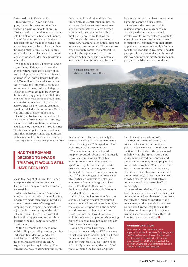
PLANET EARTH Autumn 2011 25
Green told me in February 2011.In recent years Tristan has been
quiet, but a submarine eruption that washed up pumice onto its shores in 2004 showed that the islanders remain at risk. Complacency is their worst enemy. One of the most useful contributions that scientists can make is to reduce the uncertainty about when, where and how the island might erupt. To help do this, we aimed to determine ages of the most recent eruptions to identify any patterns in activity.
We applied a method known as argon-argon dating. This approach uses the known natural radioactive decay of an isotope of potassium (40K) to an isotope of argon (40Ar), with a known half-life of 1,250 million years, to determine the age of rocks and minerals. Despite the robustness of the technique, dating the Tristan rocks was going to be tricky as the island is very young. If too little time had elapsed for the rocks to accumulate measurable amounts of 40Ar, then the derived ages for the volcanic eruptions could be riddled with uncertainty. But this was only one of many difficulties...
Getting to Tristan was the first hurdle. The island, a British Overseas Territory, is more than 2800km from the nearest mainland city, Cape Town in South Africa. This is also the point of embarkation for ships that transport visitors and islanders to Tristan about ten times a year. Entry by air is impossible. Rising abruptly out of the
ocean to a height of 2060m, the island’s precipitous flanks are furrowed with deep ravines, many of which are virtually inaccessible.
Although Tristan is only 12km (seven miles) across at its widest, the undulating topography made traversing it incredibly arduous. After weeks of hiking and sampling rocks, stopping occasionally to enjoy the fearsome beauty of the wild volcanic terrain, I left Tristan with half the island in my pockets, and set about preparing the rock samples for argon-argon dating.
Within six months, the rocks were individually prepared by crushing, sieving and separating identical sand-sized particles by hand. We then delivered the prepared samples to the NERC Argon Isotope Facility for dating. The conventional way of extracting the argon
HAD THE ROMANS DECIDED TO INvADE TRISTAN, IT WOULD STILL HAvE bEEN HOT!
MORE INFORMATIONAnna Hicks is a PhD candidate, with supervisors at the University of East Anglia and the British Geological Survey. She is carrying out the research described in this article in collaboration with Dr Darren Mark at the Scottish Universities Environmental Research Centre. Email: [email protected]
from the rocks and minerals is to heat the samples in a small vacuum furnace. However, the furnace itself contributes a background amount of argon; when working with young samples, this can mask the argon we are looking for.
To combat this, we commissioned a brand-new scanning laser system designed to heat samples uniformly. This meant we could precisely control the temperature at which the argon was extracted to assess whether there was any potential for contamination from atmospheric and
mantle sources. Without the ability to remove the effect of these contaminants from the radiogenic 40Ar signal, our hard work would have been worthless.
The results were astonishing. All 16 samples produced robust data (statistically reproducible measurements of key argon isotope ratios). What about the ages? Not only did we manage to date precisely some of the youngest lavas on the island, but we also broke a laboratory record for the youngest basalt ever dated! This particular rock was sampled just a kilometre from Edinburgh. The lava flow is less than 2700 years old. Had the Romans decided to invade Tristan, it would still have been hot!
What about the last eruption from the summit? Previous researchers assumed activity here had ceased more than 15,000 years ago. An eruption from the summit would pose very different risks from eruptions from the flanks lower down, with Tristan’s steep slopes and channelling canyons directing lava, hot gases and ash down towards the village.
Dating the summit was wise – it had been active as recently as 5000 years ago. In fact, contrary to popular belief, all three ‘zones’ on the island – summit, flanks and low-lying coastal areas – have been volcanically active during the last 16,000 years. Although the last two eruptions
have occurred near sea level, an eruption higher up cannot be discounted.
So when is the next one due? It is almost impossible to say with any certainty – the next strategy should involve monitoring the volcano closely for signs of reactivation, and scientists need to support the community in their efforts to prepare. I reported our study’s findings back to the islanders in real time. The data prompted immediate review, revision and improvement of their disaster management plan, and the islanders also conducted
their first ever evacuation drill!During this period of repose, it is
critical that scientists, decision- and policy-makers work with the islanders to continue to learn about the volcano and its behaviour. The argon-argon dating results have justified our concern, and the Tristan community has to prepare for an inevitable eruption. When, where and how is uncertain. Given the frequency of eruptions since Tristan emerged from the sea over 100,000 years ago, we need to watch closely for unusual activity and focus our future research efforts accordingly.
Improved knowledge of the system and basic monitoring is essential, but scientists and decision-makers also need to confront the volcano’s inherent uncertainty and create an open dialogue about what we do and don’t know. Only then can the islanders continue to plan for different eruption scenarios and reduce their risk from future volcanic activity. n
The main settlement of Edinburgh of the Seven Seas.
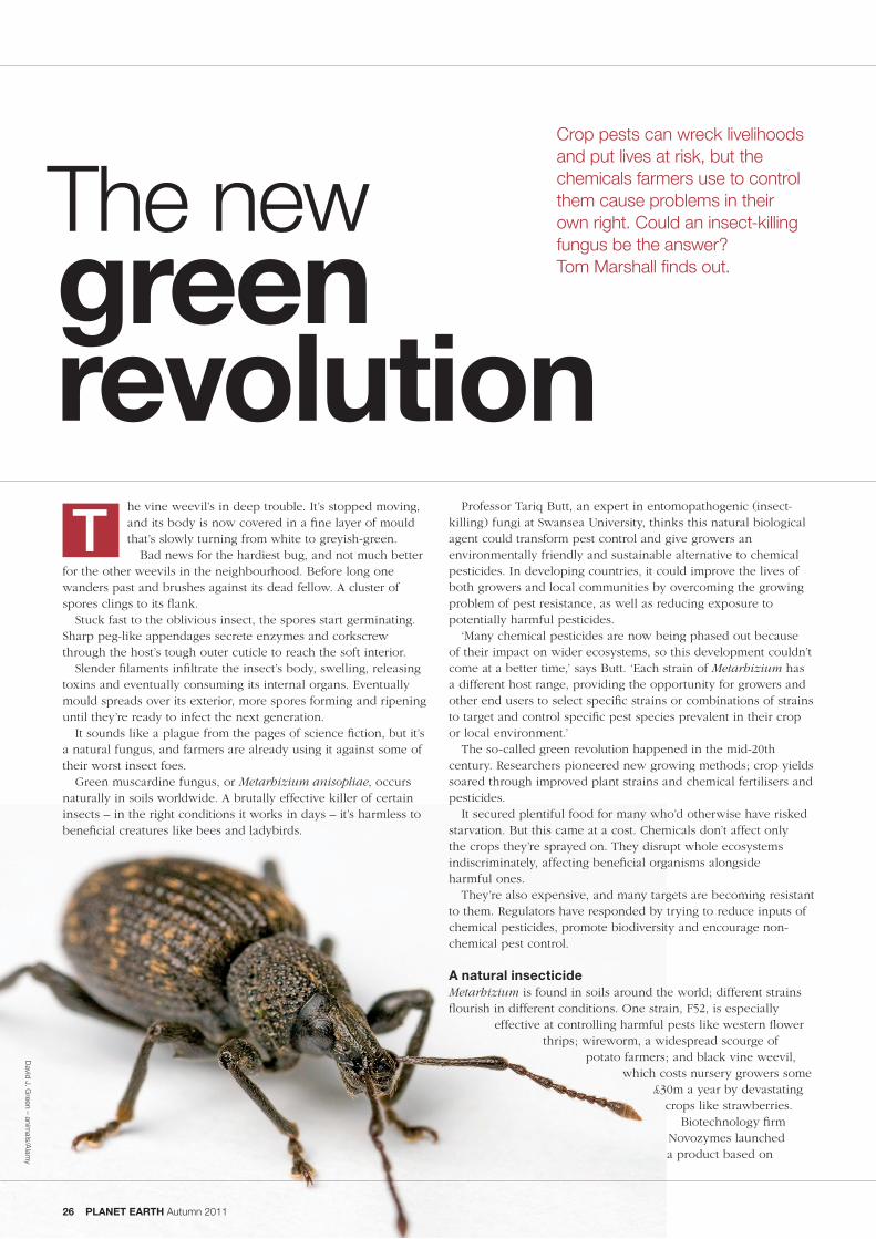
green revolution
Crop pests can wreck livelihoods and put lives at risk, but the chemicals farmers use to control them cause problems in their own right. Could an insect-killing fungus be the answer? Tom Marshall finds out.
he vine weevil’s in deep trouble. It’s stopped moving, and its body is now covered in a fine layer of mould that’s slowly turning from white to greyish-green.
Bad news for the hardiest bug, and not much better for the other weevils in the neighbourhood. Before long one wanders past and brushes against its dead fellow. A cluster of spores clings to its flank.
Stuck fast to the oblivious insect, the spores start germinating. Sharp peg-like appendages secrete enzymes and corkscrew through the host’s tough outer cuticle to reach the soft interior.
Slender filaments infiltrate the insect’s body, swelling, releasing toxins and eventually consuming its internal organs. Eventually mould spreads over its exterior, more spores forming and ripening until they’re ready to infect the next generation.
It sounds like a plague from the pages of science fiction, but it’s a natural fungus, and farmers are already using it against some of their worst insect foes.
Green muscardine fungus, or Metarhizium anisopliae, occurs naturally in soils worldwide. A brutally effective killer of certain insects – in the right conditions it works in days – it’s harmless to beneficial creatures like bees and ladybirds.
Professor Tariq Butt, an expert in entomopathogenic (insect-killing) fungi at Swansea University, thinks this natural biological agent could transform pest control and give growers an environmentally friendly and sustainable alternative to chemical pesticides. In developing countries, it could improve the lives of both growers and local communities by overcoming the growing problem of pest resistance, as well as reducing exposure to potentially harmful pesticides.
‘Many chemical pesticides are now being phased out because of their impact on wider ecosystems, so this development couldn’t come at a better time,’ says Butt. ‘Each strain of Metarhizium has a different host range, providing the opportunity for growers and other end users to select specific strains or combinations of strains to target and control specific pest species prevalent in their crop or local environment.’
The so-called green revolution happened in the mid-20th century. Researchers pioneered new growing methods; crop yields soared through improved plant strains and chemical fertilisers and pesticides.
It secured plentiful food for many who’d otherwise have risked starvation. But this came at a cost. Chemicals don’t affect only the crops they’re sprayed on. They disrupt whole ecosystems indiscriminately, affecting beneficial organisms alongside harmful ones.
They’re also expensive, and many targets are becoming resistant to them. Regulators have responded by trying to reduce inputs of chemical pesticides, promote biodiversity and encourage non-chemical pest control.
A natural insecticideMetarhizium is found in soils around the world; different strains flourish in different conditions. One strain, F52, is especially
effective at controlling harmful pests like western flower thrips; wireworm, a widespread scourge of
potato farmers; and black vine weevil, which costs nursery growers some
£30m a year by devastating crops like strawberries.
Biotechnology firm Novozymes launched a product based on
T
David J. G
reen – animals/A
lamy
The new
26 PLANET EARTH Autumn 2011

PLANET EARTH Autumn 2011 27
the work of Butt’s team at Swansea in early 2011. Horticultural products company Fargro is selling it in the UK and Ireland as Met52. It’s deadly to target species but leaves others alone, minimising the impact on insect-eating birds, mammals, amphibians and fish.
‘Met52 contains the optimum F52 strain of the Metarhizium fungus,’ says Hugh Frost, an agronomist in Novozymes’ crop protection business. ‘Other strains also perform well in certain niches, but this one is reliably effective in a range of situations, can be produced readily and is stable for a long time.’
The fungus is part of a new generation of ‘biocontrols’ – living things that naturally keep undesirable organisms in check. The idea isn’t new, but its time may now have come.
‘People have been looking at fungal pest control since the 1980s, but it tended to be unreliable, difficult to produce and of mostly academic interest,’ says Dr Paul Sopp, of Met52 distributor
Fargro. ‘But there’s been a significant shift in attitudes in the last few years, and now the time is right.’
In theory, Metarhizium can be sprayed over plants as they grow – Novozymes is working on such a product. At the moment, though, Met52 is mixed into their compost. It stays underground, killing pests before they get a foothold.
‘We’ve mostly targeted the subterranean stages, as it’s very hard to get at insects here normally – you need high doses of organophosphate,’ Butt explains. These chemicals are widely used but will be phased out in the coming years.
beyond the green revolutionButt believes Metarhizium could eventually help with many other problems. Strains exist which kill agricultural pests, like corn rootworm and chafers, which cause billions of pounds of damage annually to everything from root vegetables to turf and ornamental plants.
Gardeners and farmers aren’t the only possible users, though. Foresters could control Christmas tree weevils with Metarhizium; wine-makers could unleash it on the sap-sucking Phylloxera bugs that can quickly ruin once-productive vineyards.
Beekeepers are testing a strain that kills the honeybee parasite varroa. Even the sports industry could benefit – leatherjackets and chafers wreak havoc on playing fields and golf courses as well as pasture.
Other susceptible pests include major vectors of plant, animal and human diseases. One transmits cotton leaf curl virus, which causes a billion dollars (£610m) of harm a year in Pakistan alone.
Metarhizium could be a powerful weapon against mosquitoes, midges and ticks, controlling the spread of pathogens from Lyme disease and bluetongue to malaria, which kills more than a million people a year according to the World Health Organization.
Alongside mosquito nets, better drugs and managing breeding habitats, the fungus could form part of a new, integrated approach to fighting malaria. This is sorely needed; more than half the world’s population is already at risk, and this will increase with climate change.
Swansea University has already conducted small-scale trials to show that applying a particular strain of Metarhizium’s spores to a body of water can cut its population of mosquito larvae by more than 80 per cent.
Protecting crops, one flower at a time
For Metarhizium to work, enough of it has to come into contact with the target insect. But it can be applied with amazing precision, if you know how.
One novel approach the team has shown to work is using honeybees to take fungal spores to individual flowers in oilseed rape fields to control pests like pollen beetle.
As the bees leave their hive, they pass through a temperature-controlled structure that forces them to walk over a bed of spores, which cling to their body.
When a bee reaches its target flower, they move into position to collect pollen, which displaces the fungal spores from its body and leaves them stuck to the flower.
Job done, the bee flies back to the hive, oblivious and unharmed. Meanwhile the next beetle that tries to attack the plant is set for a nasty surprise.
Rhipicephalus nymph showing the green conidia of Metarhizium.
Pine weevil infected with Metarhizium.

28 PLANET EARTH Autumn 2011
The future of biocontrolButt’s team has also conducted trials with growers and the biocontrol industry to show Metarhizium’s efficacy in various crops. For example, it proved to be far better at controlling thrips pupae than conventional chemicals.
It won’t replace pesticides entirely; it needs a humid environment to spread. But the team’s research shows that some of these limitations can be overcome by combining the fungus with nematode worms or low doses of chemicals. The former offers totally organic pest control,
while the latter lets farmers cut pesticide use by 90 to 99 per cent while maintaining good control.
Growers are increasingly aware of Metarhizium. ‘Vine weevil is the major pest for the plants we grow, and at the moment we have to use a conventional insecticide incorporated into the compost to control it,’ explains Bill Godfrey of W. Godfrey and Sons Ltd, a grower and wholesale supplier of herbaceous plants. Some form of pest control is vital to the business – he estimates that around a quarter of the crops it grows wouldn’t be viable if the weevils were given free rein. Pesticides aren’t cheap.
‘On top of that you have the environmental and ethical issues – where do these chemicals disappear to after we’ve used them here, and what effect do they have?’ adds Godfrey. ‘And there are major doubts about how effective these insecticides are, anyway – they provide good control in the first season, but by the second year this has pretty much worn off, so often if you haven’t sold the plants by then you’ll have to throw them away.’ Metarhizium should help address these problems.
Sharing scienceButt hopes it will also improve the lives of some of the world’s poorest people. Through knowledge transfer, cultivating Metarhizium could become an important cottage industry, creating jobs and wealth in impoverished areas.
He is currently working with researchers in developing countries through initiatives like a British Council-funded project with
Black vine weevil at various stages of infection with Metarhizium.
Bauchi University in Nigeria to show that Metarhizium can be produced sustainably. Initial findings are due to be published later this year.
In the meantime, the fungus is enjoying its first year on the market. It’ll be a while before we know exactly how it’s performing, but those behind it believe its future is bright.
‘Without a doubt, Metarhizium will be one of the most significant biocontrols,’ says Sopp at Fargro. Other candidates have looked promising, but have fallen before making it to market because of practical difficulties – they don’t keep well, for example, or work only in ideal conditions.
‘People come along all the time with brilliant ideas of using a particular organism to kill this or that pest, but they haven’t thought about how it’s going to be made and distributed,’ he says. ‘If something is hard to produce in bulk or it has no shelf life, it’s commercially not viable. Metarhizium has already overcome these hurdles.’
Godfrey agrees that Metarhizium’s future looks bright. He’s talking to suppliers about getting it added to the compost his plants grow in. He hopes it will keep killing weevils for much longer than chemicals, and will save him money to boot.
With pressure growing to cut pesticide use, it’s a good thing alternatives are appearing. Godfrey says Metarhizium ‘will give us a more sustainable and environmentally acceptable alternative to chemical insecticides – hopefully it’ll help me sleep a little better at night!’ n
Damage to conifers caused by pine weevils.
Province of B
ritish Colum
bia

Daily updated news @ www.planetearth.nerc.ac.uk
PLANET EARTH Autumn 2011 29
in brief . . .
NEWS
Ash cloud experts must work more closely with civil aviationWeather experts, volcanologists, ash cloud modellers and civil aviation authorities need to work more closely together if they are to get better at forecasting how ash clouds are likely to spread.
That’s the conclusion 52 researchers from 12 countries reached after a workshop on how to avoid a repeat of the 2010 Eyjafjallajökull debacle.
The workshop aimed to find out the needs of the ash-dispersal modelling community, look into new ways of collecting data and work out how to improve communication between scientists and civil aviation authorities. They say getting better at assessing uncertainties is an urgent requirement.
Scientists prepare to map Scottish seabedScientists are preparing to create a 3D image of the seabed off the north coast of Scotland to identify marine habitats of high conservation value.
They’ve settled on two regions: one could be important for minke whales; the other may be home to the largest bed of horse mussels in Scottish waters. The researchers, including scientists from the British Geological Survey, plan to use acoustic multi-beam survey techniques.
‘These surveys will help us meet our international commitments to designate a network of marine-protected areas in Scottish waters,’ says Laura Clark from Scottish National Heritage.
Arctic sea-ice information service in developmentEuropean scientists are set to work together to establish a sea-ice information service for ships sailing through the Arctic Ocean in summer.
The service will provide accurate, up-to-date information on ice conditions in the region, including the probable location and movements of icebergs.
The €2m project, which British Antarctic Survey remote-sensing expert Andrew Fleming is helping with, is part of Europe’s Global Monitoring system for Environment and Security (GMES). The service should help ships sailing from Europe to China through the Arctic Ocean cut their journey by some 6000km.
One of Antarctica’s largest glaciers is melting more than 50 per cent faster than it was just over 15 years ago, a major study has revealed.
The research found that in 1994, the ice shelf that floats on the ocean in front of Pine Island Glacier in West Antarctica was already melting into the sea at a rate of just over 50 cubic kilometres per year. But by 2009, that rate had risen to a worrying 80 cubic kilometres of ice a year.
Some scientists predict that if Pine Island Glacier melted entirely, it could raise sea levels by around 25cm.
The researchers behind the latest study, published in Nature Geoscience, say that while some of the melting they detected can be blamed on rising sea temperatures, the real problem is that more warm water is reaching a cavity beneath the ice shelf. This is making the ice shelf much more vulnerable to melting.
‘The rate at which the ice shelf is melting has increased significantly, because more warm water is circulating in the cavity beneath it,’ explains Dr Adrian Jenkins from the British Antarctic Survey (BAS), one of the study’s co-authors.
The study revealed that the ocean temperature in Pine Island Bay has gone up by just 0.2° Celsius over the same period. ‘This isn’t enough to account for the increased melting,’ says Jenkins.
It wasn’t until the scientists sent an autonomous submarine, dubbed Autosub, underneath the ice shelf that they realised why it’s melting so quickly.
The sub, built and operated by the National Oceanography Centre, revealed an underwater ridge on the sea floor beneath the ice shelf. Jenkins and colleagues from BAS and Columbia University concluded that the ridge must have once slowed the glacier like a giant retaining wall.
But as soon as the receding glacier broke free from the ridge, at some point before the 1970s, warmer water could get to the ice shelf’s ‘underbelly’. This would have made the cavity grow, allowing more warm water to flow in and meltwater to flow out, making the glacier accelerate towards the sea.
‘The inner cavity didn’t exist at all before, so this is the most likely explanation for why a subtle change in temperature can have a huge effect,’ Jenkins says.
Major antarctic glacier melting speeds up
A seismic survey on Pine Island Glacier.

Natural Environment Research Council, Polaris House, North Star Avenue, Swindon,
SN2 1EU, UK. Tel: 01793 411500
www.nerc.ac.uk
To download copies of these and other publications, go to our website at www.nerc.ac.uk/publications
or email: [email protected]