plate tectonics - msnucleus.org
TRANSCRIPT
Math/Science Nucleus© 2001 1
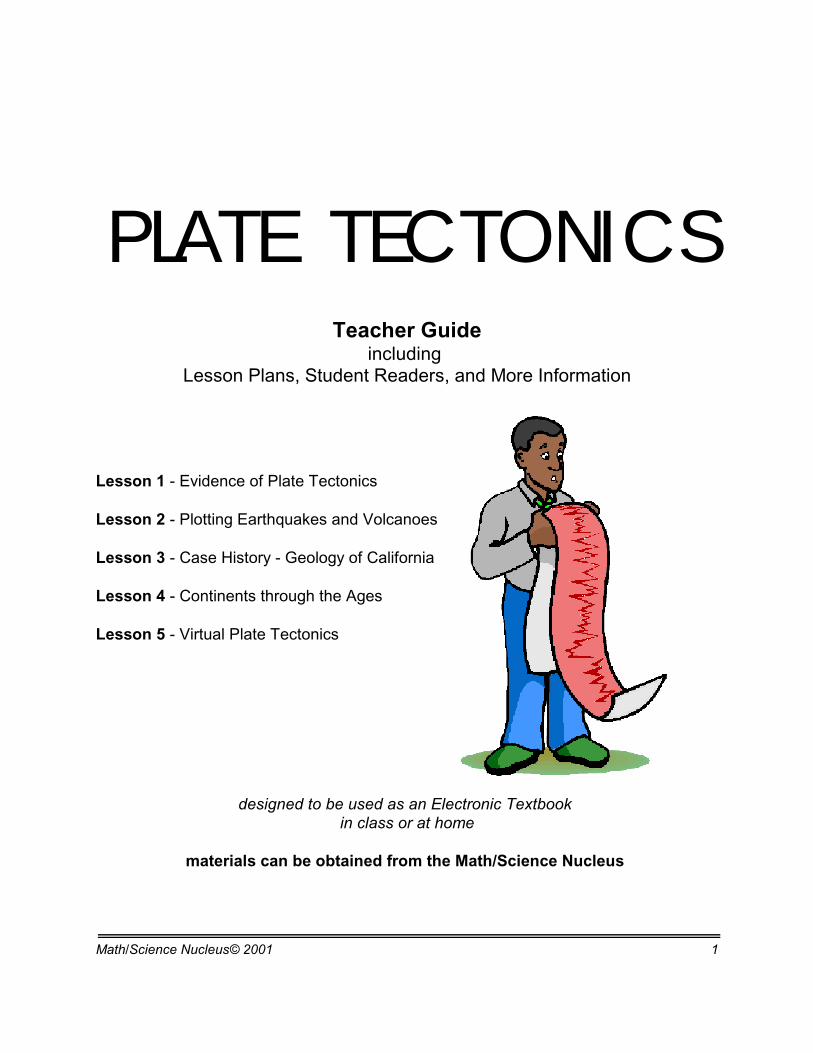
PLATE TECTONICSTeacher Guide
including Lesson Plans, Student Readers, and More Information
Lesson 1 - Evidence of Plate Tectonics
Lesson 2 - Plotting Earthquakes and Volcanoes
Lesson 3 - Case History - Geology of California
Lesson 4 - Continents through the Ages
Lesson 5 - Virtual Plate Tectonics
designed to be used as an Electronic Textbook in class or at home
materials can be obtained from the Math/Science Nucleus
Math/Science Nucleus© 2001 2
Objective: Students learn about thetheory of plate tectonics evolved.
Teacher noteShow students a map of the world and illustrate how the Atlantic coastlines
of Africa/Europe line up with the Atlantic coastlines of North and South America. Ifyou use a hydrographic globe you can show students trenches and underwatermountain ranges that have helped us understand the mechanism of plate tectonics.
Students should have learned about earthquakes and volcanoes in previousunits, now we put the information together so they understand how the piecesevolved in a working model of Plate Tectonics.
EARTH SCIENCES - PLATE TECTONICS
Lesson 1 - EVIDENCE OF PLATE TECTONICS MATERIALS:
hydrographic globephysiographic globereadermaps
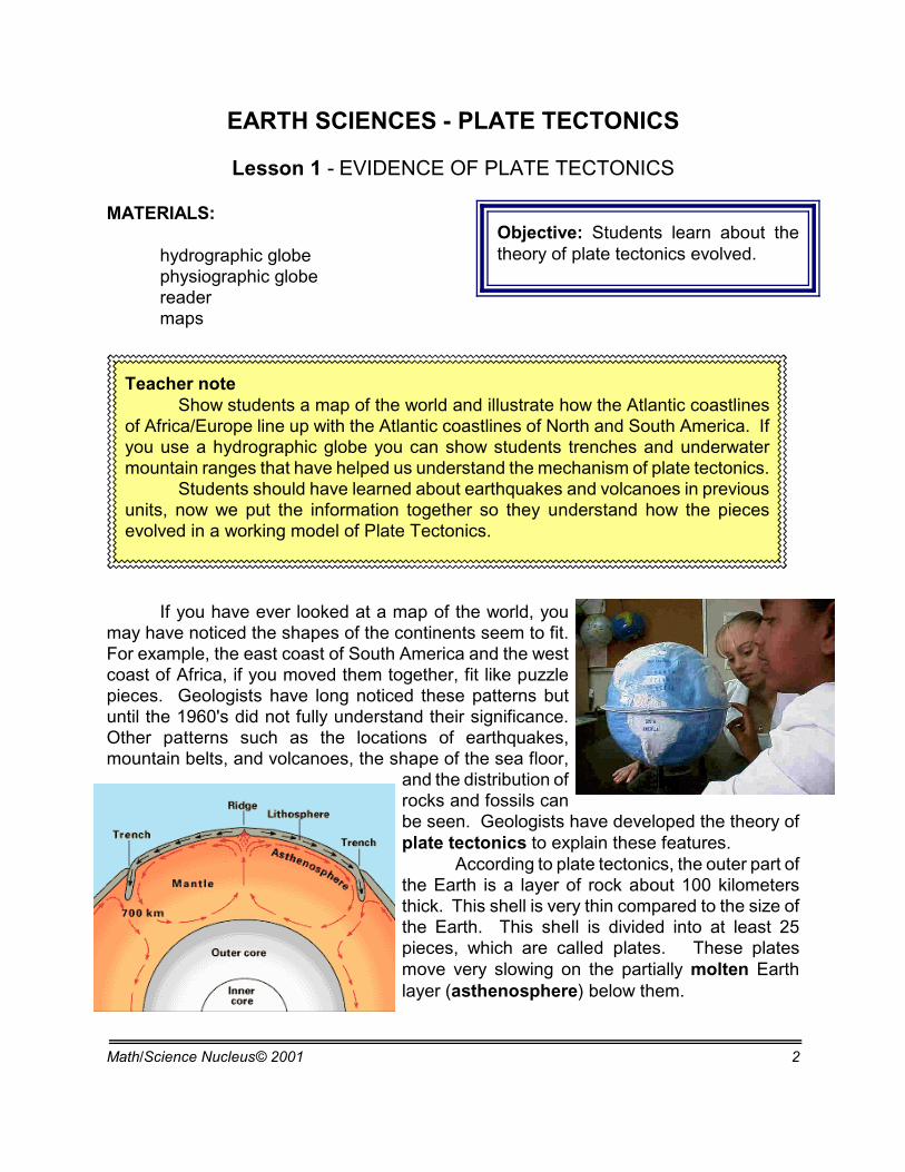
If you have ever looked at a map of the world, youmay have noticed the shapes of the continents seem to fit.For example, the east coast of South America and the westcoast of Africa, if you moved them together, fit like puzzlepieces. Geologists have long noticed these patterns butuntil the 1960's did not fully understand their significance.Other patterns such as the locations of earthquakes,mountain belts, and volcanoes, the shape of the sea floor,
and the distribution ofrocks and fossils canbe seen. Geologists have developed the theory ofplate tectonics to explain these features.
According to plate tectonics, the outer part ofthe Earth is a layer of rock about 100 kilometersthick. This shell is very thin compared to the size ofthe Earth. This shell is divided into at least 25pieces, which are called plates. These platesmove very slowing on the partially molten Earthlayer (asthenosphere) below them.
Math/Science Nucleus© 2001 3
Oceanic-continental convergence
Oceanic-oceanic convergence Continental-continental convergence
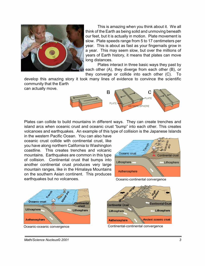
This is amazing when you think about it. We allthink of the Earth as being solid and unmoving beneathour feet, but it is actually in motion. Plate movement isslow. Plate speeds range from 5 to 17 centimeters peryear. This is about as fast as your fingernails grow ina year. This may seem slow, but over the millions ofyears of Earth history, it means that plates can movelong distances.
Plates interact in three basic ways they past byeach other (A), they diverge from each other (B), orthey converge or collide into each other (C). To
develop this amazing story it took many lines of evidence to convince the scientificcommunity that the Earthcan actually move.
Plates can collide to build mountains in different ways. They can create trenches andisland arcs when oceanic crust and oceanic crust “bump” into each other. This createsvolcanoes and earthquakes. An example of this type of collision is the Japanese Islandsin the western Pacific Ocean. You can also haveoceanic crust collide with continental crust, likeyou have along northern California to Washingtoncoastline. This creates trenches and volcanicmountains. Earthquakes are common in this typeof collision. Continental crust that bumps intoanother continental crust produces very largemountain ranges, like in the Himalaya Mountainson the southern Asian continent. This producesearthquakes but no volcanoes.
Math/Science Nucleus© 2001 4
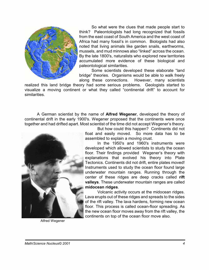
Alfred Wegener
So what were the clues that made people start tothink? Paleontologists had long recognized that fossilsfrom the east coast of South America and the west coast ofAfrica had many fossil’s in common. Biologists had alsonoted that living animals like garden snails, earthworms,mussels, and mud minnows also “linked” across the ocean.By the late 1800's, naturalists who explored new territoriesaccumulated more evidence of these biological andpaleontological similarities.
Some scientists developed these elaborate “landbridge” theories. Organisms would be able to walk freelyalong these connections. However, many scientists
realized this land bridge theory had some serious problems. Geologists started tovisualize a moving continent or what they called “continental drift” to account forsimilarities.
A German scientist by the name of Alfred Wegener, developed the theory ofcontinental drift in the early 1900's. Wegener proposed that the continents were oncetogether and had drifted apart. Most scientist of the time did not accept Wegener’s theory.
But how could this happen? Continents did notfloat and easily moved. So more data has to beassembled to explain a moving crust.
In the 1950's and 1960's instruments weredeveloped which allowed scientists to study the oceanfloor. Their findings provided Wegener’s theory withexplanations that evolved his theory into PlateTectonics. Continents did not drift, entire plates moved!Instruments used to study the ocean floor found largeunderwater mountain ranges. Running through thecenter of these ridges are deep cracks called riftvalleys. These underwater mountain ranges are calledmidocean ridges.
Volcanic activity occurs at the midocean ridges.Lava erupts out of these ridges and spreads to the sidesof the rift valley. The lava hardens, forming new oceanfloor. This process is called ocean-floor spreading. Asthe new ocean floor moves away from the rift valley, thecontinents on top of the ocean floor move also.
Math/Science Nucleus© 2001 5
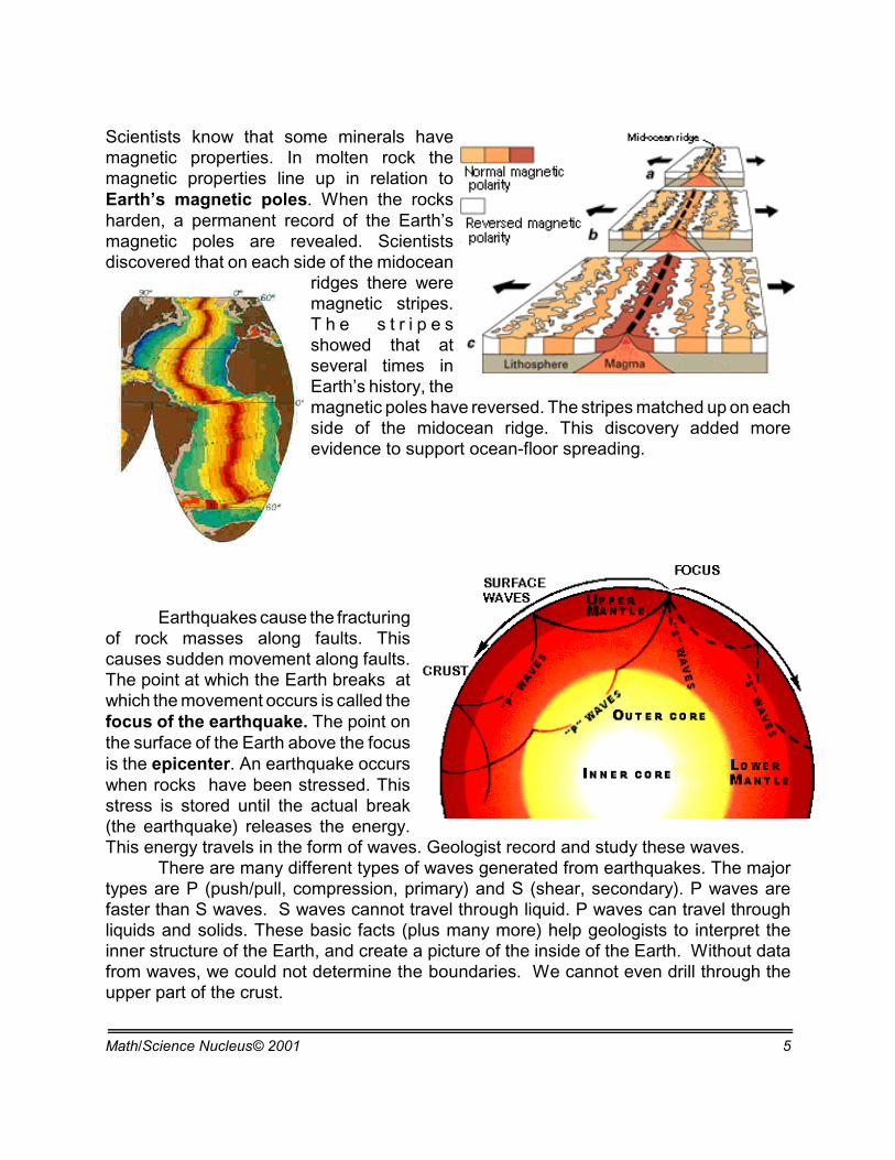
Scientists know that some minerals havemagnetic properties. In molten rock themagnetic properties line up in relation toEarth’s magnetic poles. When the rocksharden, a permanent record of the Earth’smagnetic poles are revealed. Scientistsdiscovered that on each side of the midocean
ridges there weremagnetic stripes.T h e s t r i p e sshowed that atseveral times inEarth’s history, themagnetic poles have reversed. The stripes matched up on eachside of the midocean ridge. This discovery added moreevidence to support ocean-floor spreading.
Earthquakes cause the fracturingof rock masses along faults. Thiscauses sudden movement along faults.The point at which the Earth breaks atwhich the movement occurs is called thefocus of the earthquake. The point onthe surface of the Earth above the focusis the epicenter. An earthquake occurswhen rocks have been stressed. Thisstress is stored until the actual break(the earthquake) releases the energy.This energy travels in the form of waves. Geologist record and study these waves.
There are many different types of waves generated from earthquakes. The majortypes are P (push/pull, compression, primary) and S (shear, secondary). P waves arefaster than S waves. S waves cannot travel through liquid. P waves can travel throughliquids and solids. These basic facts (plus many more) help geologists to interpret theinner structure of the Earth, and create a picture of the inside of the Earth. Without datafrom waves, we could not determine the boundaries. We cannot even drill through theupper part of the crust.
Math/Science Nucleus© 2001 6
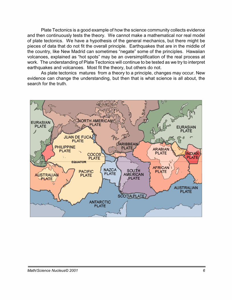
Plate Tectonics is a good example of how the science community collects evidenceand then continuously tests the theory. We cannot make a mathematical nor real modelof plate tectonics. We have a hypothesis of the general mechanics, but there might bepieces of data that do not fit the overall principle. Earthquakes that are in the middle ofthe country, like New Madrid can sometimes “negate” some of the principles. Hawaiianvolcanoes, explained as “hot spots” may be an oversimplification of the real process atwork. The understanding of Plate Tectonics will continue to be tested as we try to interpretearthquakes and volcanoes. Most fit the theory, but others do not.
As plate tectonics matures from a theory to a principle, changes may occur. Newevidence can change the understanding, but then that is what science is all about, thesearch for the truth.
Math/Science Nucleus© 2001 7
Objective: To research and plotearthquakes and volcanoes using
Teacher noteIn this lab, students will put their research skills to work. They are to use
reference materials in order to find the locations of selected earthquakes andvolcanoes. They should find 5 volcanoes and 5 earthquakes that occurred outsideof the U.S. Ask the students to not use the same earthquakes and volcanoes astheir partners. Students should record the number of people killed and themagnitude of the disasters, if this information is available, in the comments box.
Students can use encyclopedias, the Guiness Book of World Records, andany other books that contain all the necessary information. Websites will contain themost up to date information available. Use a search engine to find earthquakes andvolcanoes. If you want the students to use one site to help direct their research goto the U.S. Geological Survey site (www.usgs.gov).
After each student has found 10 data points on their own, have them sharethe information with the rest of the lab group. Each group should collect about 40data points so that each student ends up with at least 35 data points. Each studentrecords their information on the "Earthquakes and Volcanoes" lab sheet.
After they record the data, plot the volcanoes and earthquakes on aninflatable globe and wall map. You may want them use stick-on dots, map pins, orpost-its to locate data points on the globe. Students can use 2 different coloredpencils to record the volcanoes and earthquakes on the map provided.
Using the wall map for full class viewing, discuss the findings. Point outpatterns where there are large concentrations of earthquakes and volcanoes. Pointout on the map where the Earth’s plates are located. Help the students make theconnection that many earthquakes and volcanoes occur along the plate boundaries.
As an extension, ask each student to pick one earthquake or one volcano tofurther research. The students should find out as much as they can about theirdisaster and prepare a one to two page report.
EARTH SCIENCES - PLATE TECTONICS
Lesson 2 - PLOTTING EARTHQUAKES AND VOLCANOES MATERIALS:
reader
Math/Science Nucleus© 2001 8
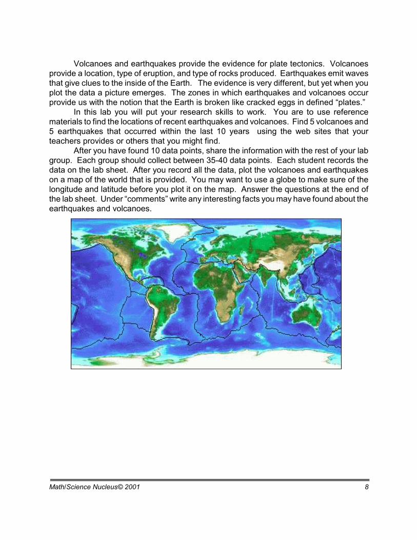
Volcanoes and earthquakes provide the evidence for plate tectonics. Volcanoesprovide a location, type of eruption, and type of rocks produced. Earthquakes emit wavesthat give clues to the inside of the Earth. The evidence is very different, but yet when youplot the data a picture emerges. The zones in which earthquakes and volcanoes occurprovide us with the notion that the Earth is broken like cracked eggs in defined “plates.”
In this lab you will put your research skills to work. You are to use referencematerials to find the locations of recent earthquakes and volcanoes. Find 5 volcanoes and5 earthquakes that occurred within the last 10 years using the web sites that yourteachers provides or others that you might find.
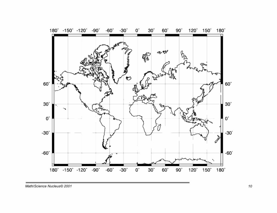
After you have found 10 data points, share the information with the rest of your labgroup. Each group should collect between 35-40 data points. Each student records thedata on the lab sheet. After you record all the data, plot the volcanoes and earthquakeson a map of the world that is provided. You may want to use a globe to make sure of thelongitude and latitude before you plot it on the map. Answer the questions at the end ofthe lab sheet. Under “comments” write any interesting facts you may have found about theearthquakes and volcanoes.
Math/Science Nucleus© 2001 9
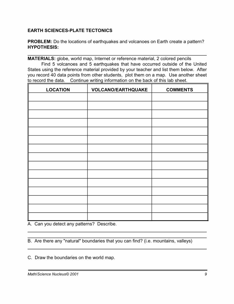
EARTH SCIENCES-PLATE TECTONICS PROBLEM: Do the locations of earthquakes and volcanoes on Earth create a pattern? HYPOTHESIS: MATERIALS: globe, world map, Internet or reference material, 2 colored pencils
Find 5 volcanoes and 5 earthquakes that have occurred outside of the UnitedStates using the reference material provided by your teacher and list them below. Afteryou record 40 data points from other students, plot them on a map. Use another sheetto record the data. Continue writing information on the back of this lab sheet.
LOCATION VOLCANO/EARTHQUAKE COMMENTS
A. Can you detect any patterns? Describe.
B. Are there any "natural" boundaries that you can find? (i.e. mountains, valleys)
C. Draw the boundaries on the world map.
Math/Science Nucleus© 2001 10
Math/Science Nucleus© 2001 11
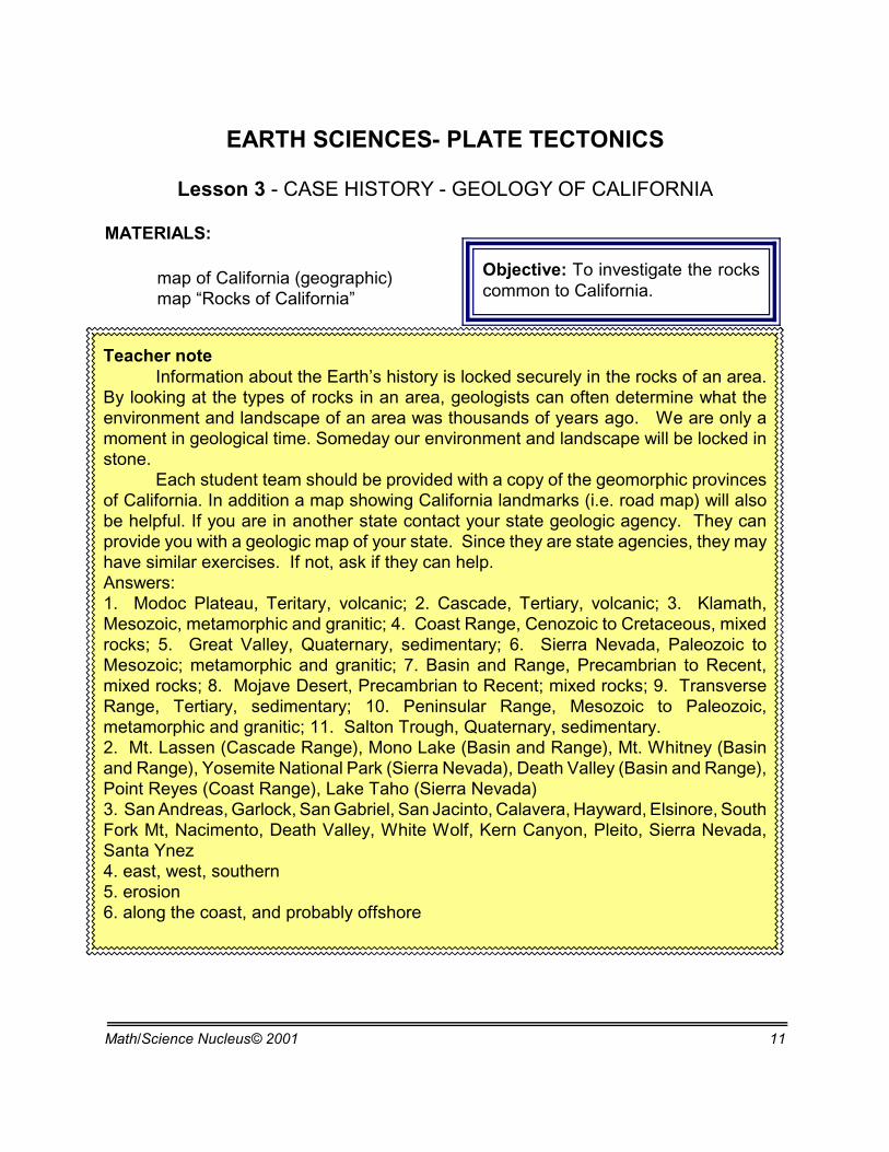
Objective: To investigate the rockscommon to California.
Teacher noteInformation about the Earth’s history is locked securely in the rocks of an area.
By looking at the types of rocks in an area, geologists can often determine what theenvironment and landscape of an area was thousands of years ago. We are only amoment in geological time. Someday our environment and landscape will be locked instone.
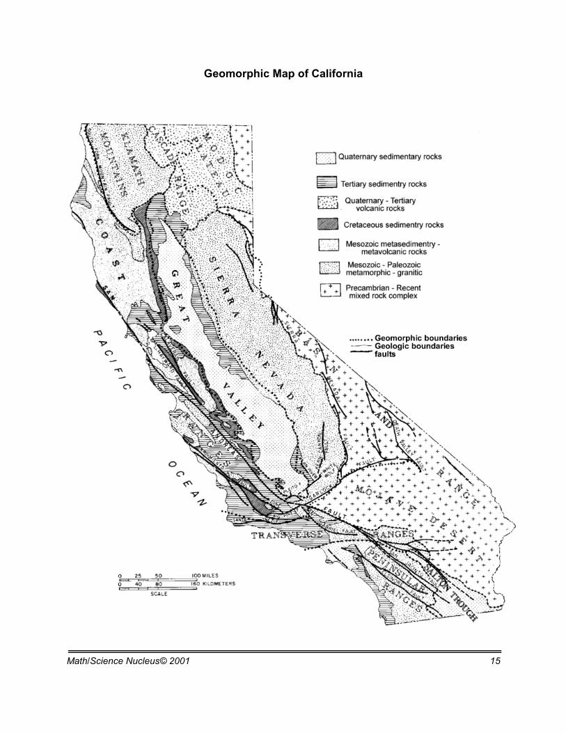
Each student team should be provided with a copy of the geomorphic provincesof California. In addition a map showing California landmarks (i.e. road map) will alsobe helpful. If you are in another state contact your state geologic agency. They canprovide you with a geologic map of your state. Since they are state agencies, they mayhave similar exercises. If not, ask if they can help.Answers: 1. Modoc Plateau, Teritary, volcanic; 2. Cascade, Tertiary, volcanic; 3. Klamath,Mesozoic, metamorphic and granitic; 4. Coast Range, Cenozoic to Cretaceous, mixedrocks; 5. Great Valley, Quaternary, sedimentary; 6. Sierra Nevada, Paleozoic toMesozoic; metamorphic and granitic; 7. Basin and Range, Precambrian to Recent,mixed rocks; 8. Mojave Desert, Precambrian to Recent; mixed rocks; 9. TransverseRange, Tertiary, sedimentary; 10. Peninsular Range, Mesozoic to Paleozoic,metamorphic and granitic; 11. Salton Trough, Quaternary, sedimentary.2. Mt. Lassen (Cascade Range), Mono Lake (Basin and Range), Mt. Whitney (Basinand Range), Yosemite National Park (Sierra Nevada), Death Valley (Basin and Range),Point Reyes (Coast Range), Lake Taho (Sierra Nevada)3. San Andreas, Garlock, San Gabriel, San Jacinto, Calavera, Hayward, Elsinore, SouthFork Mt, Nacimento, Death Valley, White Wolf, Kern Canyon, Pleito, Sierra Nevada,Santa Ynez4. east, west, southern5. erosion6. along the coast, and probably offshore
EARTH SCIENCES- PLATE TECTONICS
Lesson 3 - CASE HISTORY - GEOLOGY OF CALIFORNIA
MATERIALS:
map of California (geographic)map “Rocks of California”

Math/Science Nucleus© 2001 12
Yosemite, Sierra Nevada, California
The Earth is basically one large"rock." The surface rocks give us clues as tohow the surface moved through time. Theclues in the rocks include the type of rockand fossils found. For instance, if you finddeposits of basalt, that means an ancientvolcano produced it. If you found trilobites,that means the area was in shallow marinewater at one time.
The land we live on now recordsbillions of years of rock "action." It is thegeologist’s job to use rocks and fossils tointerpret the area we live near.
California is a very beautiful state,mainly because of its geologic history. Yosemite Valley was carved by glaciers; the SierraNevada was once a pluton deep inside the crust; and the high sea cliffs of the PacificCoast have been pushed up by active faults.
California was created by a verycomplex geological evolution. It has allthree types of rocks, igneous, sedimentary,and metamorphic, in different combinationsall around the state. Many of these rocksare mined, either to extract their mineralwealth, or as ingredients of buildingmaterials. On the map of California you cansee the areas and the overall rocks of theseareas.
On the map provide in yourworksheet, California is divided into timeareas. Quaternary is up to 10 thousandyears ago; Tertiary is up to 65 million yearsago; Mesozoic is up to 225 million yearsago; Paleozoic is up to 600 million yearsago; and Pre-Cambrian is anything olderthan Paleozoic. The state can also bedivided into geomorphic provinces, whichrefer to areas that have a similar landscape,representing different types of rocks.
Math/Science Nucleus© 2001 13
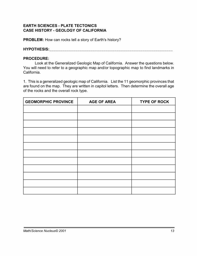
EARTH SCIENCES - PLATE TECTONICSCASE HISTORY - GEOLOGY OF CALIFORNIA
PROBLEM: How can rocks tell a story of Earth's history?
HYPOTHESIS:_________________________________________________________
PROCEDURE:Look at the Generalized Geologic Map of California. Answer the questions below.
You will need to refer to a geographic map and/or topographic map to find landmarks inCalifornia.
1. This is a generalized geologic map of California. List the 11 geomorphic provinces thatare found on the map. They are written in capitol letters. Then determine the overall ageof the rocks and the overall rock type.
GEOMORPHIC PROVINCE AGE OF AREA TYPE OF ROCK
Math/Science Nucleus© 2001 14
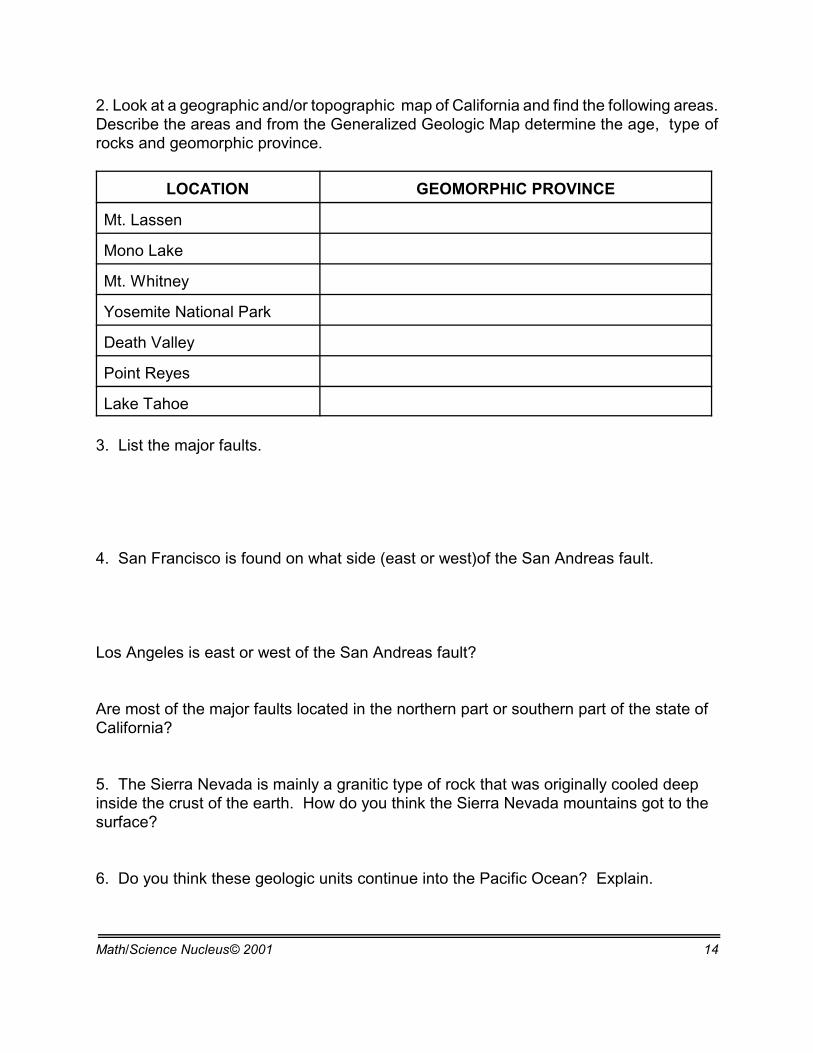
2. Look at a geographic and/or topographic map of California and find the following areas.Describe the areas and from the Generalized Geologic Map determine the age, type ofrocks and geomorphic province.
LOCATION GEOMORPHIC PROVINCE
Mt. Lassen
Mono Lake
Mt. Whitney
Yosemite National Park
Death Valley
Point Reyes
Lake Tahoe
3. List the major faults.
4. San Francisco is found on what side (east or west)of the San Andreas fault.
Los Angeles is east or west of the San Andreas fault?
Are most of the major faults located in the northern part or southern part of the state ofCalifornia?
5. The Sierra Nevada is mainly a granitic type of rock that was originally cooled deepinside the crust of the earth. How do you think the Sierra Nevada mountains got to thesurface?
6. Do you think these geologic units continue into the Pacific Ocean? Explain.
Math/Science Nucleus© 2001 15
Geomorphic Map of California
Math/Science Nucleus© 2001 16
Objective: Students observe themovement of the Earth’s crust.
Teacher noteThe crust of the Earth has been moving for at least 1 billion years, if not
longer. The further we go back in time, the more difficult it is to determine theexact movement.
This section helps students to visualize the motion and to illustrate whatthe Earth may have looked like through time.
EARTH SCIENCES - PLATE TECTONICS
Lesson 4 - CONTINENTS THROUGH THE AGES MATERIALS:
reader
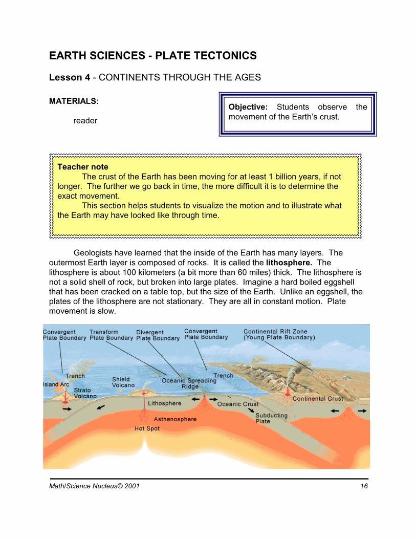
Geologists have learned that the inside of the Earth has many layers. Theoutermost Earth layer is composed of rocks. It is called the lithosphere. Thelithosphere is about 100 kilometers (a bit more than 60 miles) thick. The lithosphere isnot a solid shell of rock, but broken into large plates. Imagine a hard boiled eggshellthat has been cracked on a table top, but the size of the Earth. Unlike an eggshell, theplates of the lithosphere are not stationary. They are all in constant motion. Platemovement is slow.

Math/Science Nucleus© 2001 17
Today
Cretaceous 65 million years
Jurassic 180 million years Triassic 225 million years Permian 280 million years
Geologists use clues from earthquakesand volcanoes to explore how the Earth’slithosphere is moving today. However, clues fromfossils, paleomagnetism, and rocks can helpreconstruct how the Earth’s surface looked in thepast.
When the Earth first formed 4.5 billionyears ago, there was probably no water. So theland masses included the entire crust of theEarth. Evidence of an atmosphere and basins ofwater did not reveal itself until 3.5 billion yearsago. Determining what the surface of the land
looked like back then is almost impossible. The continents are embedded into the plates. The rocks that compose the
continents are less dense than the rocks that make up the ocean basin. The majority ofcontinental crust seems to remain on the top of the lithosphere. The continental rocksprovide clues of how the Earth formed over the last 3.5 billion years (the oldest rocksfound on continents). The older the rock the unclearer the clues are. It is like anancient murder mystery, the clues are long gone to the investigator.
Therefore, as the plates move, the continents move. For example, North America and Europe are getting furtheraway from each other because the plates they areembedded in are moving apart. Plates can also cometogether. This may cause continents to collide. TheHimalaya Mountains are forming from the collisionbetween the continents of Asia and India. This movementof India into Asia started in the Jurassic, with the impactinto the Cenozoic.
There have been times in the Earth’s past when many plates carrying continentscame together at the same time. This formed one huge plate that contained a singlesupercontinent.
Math/Science Nucleus© 2001 18
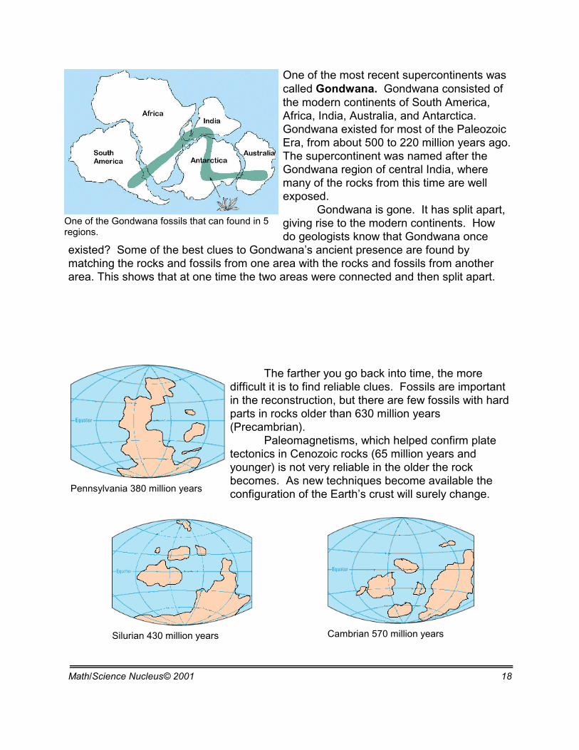
One of the Gondwana fossils that can found in 5regions.
Pennsylvania 380 million years
Cambrian 570 million yearsSilurian 430 million years
One of the most recent supercontinents wascalled Gondwana. Gondwana consisted ofthe modern continents of South America,Africa, India, Australia, and Antarctica. Gondwana existed for most of the PaleozoicEra, from about 500 to 220 million years ago. The supercontinent was named after theGondwana region of central India, wheremany of the rocks from this time are wellexposed.
Gondwana is gone. It has split apart,giving rise to the modern continents. Howdo geologists know that Gondwana once
existed? Some of the best clues to Gondwana’s ancient presence are found bymatching the rocks and fossils from one area with the rocks and fossils from anotherarea. This shows that at one time the two areas were connected and then split apart.
The farther you go back into time, the moredifficult it is to find reliable clues. Fossils are importantin the reconstruction, but there are few fossils with hardparts in rocks older than 630 million years(Precambrian).
Paleomagnetisms, which helped confirm platetectonics in Cenozoic rocks (65 million years andyounger) is not very reliable in the older the rockbecomes. As new techniques become available theconfiguration of the Earth’s crust will surely change.
Math/Science Nucleus© 2001 19
Objective: Students explore the internet toreconstruct plate positions through time.
Teacher notePlate Tectonics is sometimes difficult for students to understand because of
geologic time. Over millions of years, even the smallest movement every year canaccumulate into thousands of kilometers in offset.
Search engineers are important to use, in order to learn new information thatis posted on the web. Remember the Internet was developed for scientists to sharedata. Most students do not realize that the Internet is now a commercial reality ofscientists’ urge to conduct group collaboration.
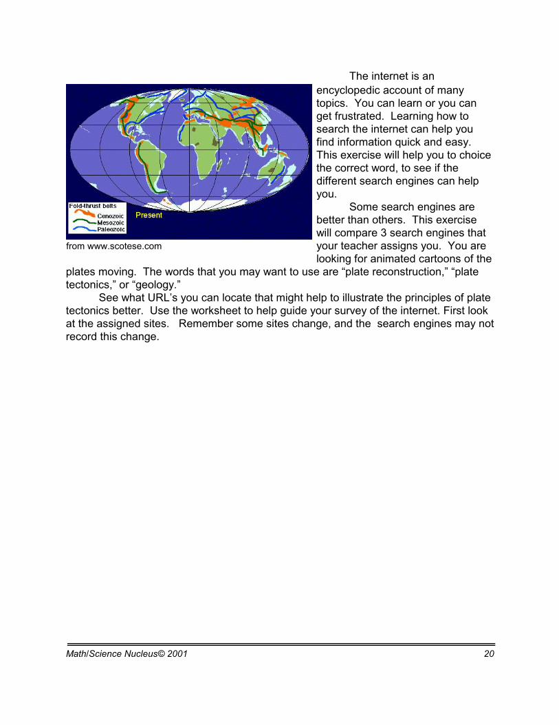
The internet can show some of this movement in a small time using differentgraphical representations. Students in this exercise use the internet to compare themotion mainly using constructions as far back as 1100 million years. We suggestthe following sites to help students compare and contrast movement.
http://www.odsn.de/odsn/services/paleomap/paleomap.htmlreconstruction back to 150 my
http://www.ucmp.berkeley.edu/geology/tectonics.htmlAnimations of plate reconstructions from 510 million years.
http://www.scotese.com/Reconstruction of the plates in the last 1100 million years.
EARTH SCIENCES - PLATE TECTONICS
Lesson 5 - Virtual Plate Tectonics MATERIALS:
readerInternet
Math/Science Nucleus© 2001 20
from www.scotese.com
The internet is anencyclopedic account of manytopics. You can learn or you canget frustrated. Learning how tosearch the internet can help youfind information quick and easy. This exercise will help you to choicethe correct word, to see if thedifferent search engines can helpyou.
Some search engines arebetter than others. This exercisewill compare 3 search engines thatyour teacher assigns you. You arelooking for animated cartoons of the
plates moving. The words that you may want to use are “plate reconstruction,” “platetectonics,” or “geology.”
See what URL’s you can locate that might help to illustrate the principles of platetectonics better. Use the worksheet to help guide your survey of the internet. First lookat the assigned sites. Remember some sites change, and the search engines may notrecord this change.
Math/Science Nucleus© 2001 21
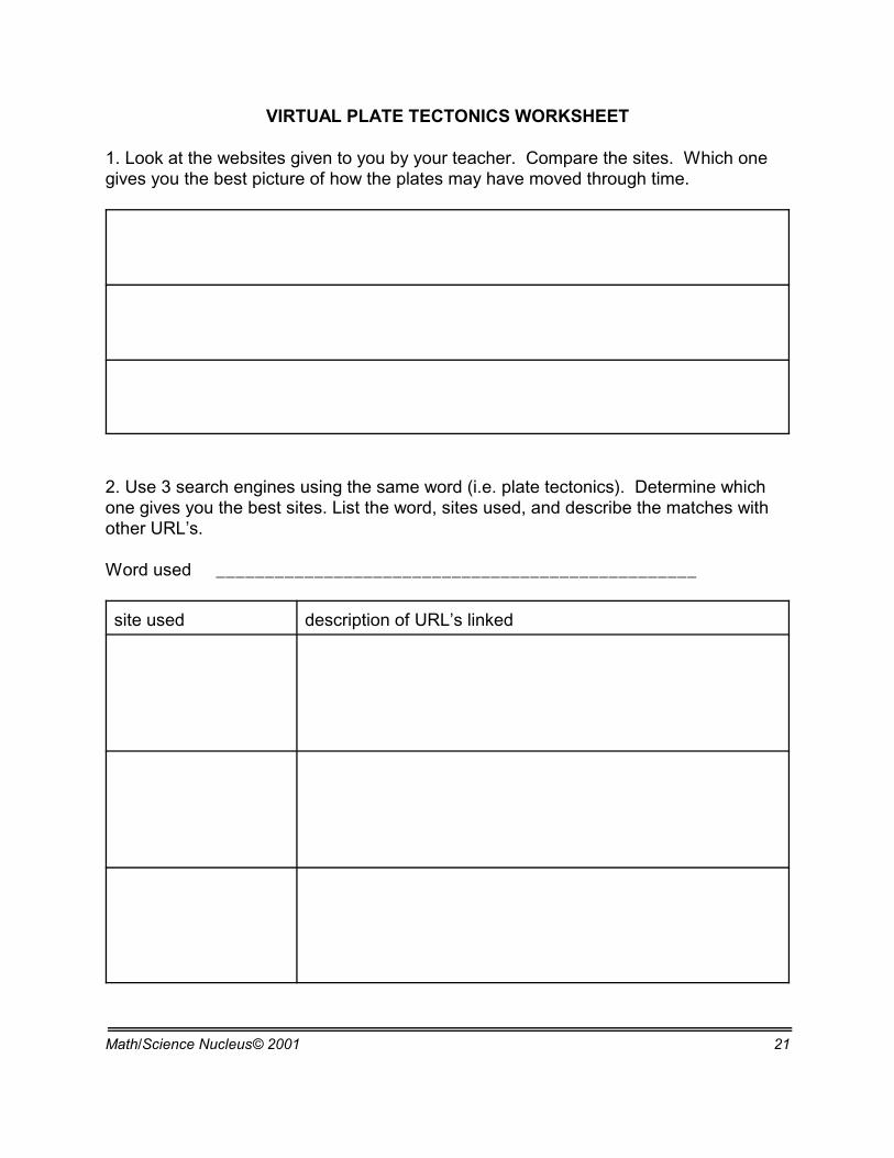
VIRTUAL PLATE TECTONICS WORKSHEET
1. Look at the websites given to you by your teacher. Compare the sites. Which onegives you the best picture of how the plates may have moved through time.
2. Use 3 search engines using the same word (i.e. plate tectonics). Determine whichone gives you the best sites. List the word, sites used, and describe the matches withother URL’s.
Word used _________________________________________________
site used description of URL’s linked
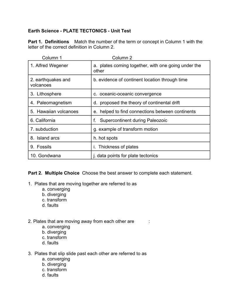
Earth Science - PLATE TECTONICS - Unit Test
Part 1. Definitions Match the number of the term or concept in Column 1 with theletter of the correct definition in Column 2.
Column 1 Column 21. Alfred Wegener a. plates coming together, with one going under the
other
2. earthquakes andvolcanoes
b. evidence of continent location through time
3. Lithosphere c. oceanic-oceanic convergence
4. Paleomagnetism d. proposed the theory of continental drift
5. Hawaiian volcanoes e. helped to find connections between continents
6. California f. Supercontinent during Paleozoic
7. subduction g. example of transform motion
8. Island arcs h. hot spots
9. Fossils i. Thickness of plates
10. Gondwana j. data points for plate tectonics
Part 2. Multiple Choice Choose the best answer to complete each statement.
1. Plates that are moving together are referred to as a. convergingb. divergingc. transformd. faults
2. Plates that are moving away from each other are :a. convergingb. divergingc. transformd. faults
3. Plates that slip slide past each other are referred to as a. convergingb. divergingc. transformd. faults
4. The asthenosphere is a. a molten part of the inner coreb. is a partially molten part of the upper mantlec. is a molten part of the upper mantled. is a partially molten part of the lower mantle
5. Earthquakes are found when platesa. divergeb. convergec. slip slide past each otherd. all of these
6. Himalayan Mountains are being formed bya. continental-oceanic collisionb. oceanic collisionc. continental- continental collisiond. none of these
7. Diverging plates producea. ridge valleysb. plate valleyc. diverging valleyd. rift valley
8. The point on the surface of the Earth above the focus is calleda. epicenterb. epicyclesc. faultd. earthquake
9. “S” waves a. can go through liquid rockb. can go through solid and molten rockc. can only go through solid rockd. none of the above
10.“P” waves a. can go through liquid rockb. can go through solid and molten rockc. can only go through solid rockd. none of the above
ANSWERS:
PART I.1. D2. J3. I4. B5. H6. G7. A8. C9. E10. F
PART II.1. A2. B3. C4. B5. D6. C7. D8. A9. C10. B