practical solution of some forward and inverse problems … · practical solution of some forward...
TRANSCRIPT

12
PRACTICAl SOLUTION OF SOME FORWARD AND INVERSE PROBLEMS IN HYDROLOGY
A J Jakeman1, c R Dietrich1· 2 , F Ghassemi1, I G Littlewood3, P G Whitehead3
1. INTRODUCTION
What is the need for solving inverse problems in hydrology? The basic
answer to this question is that many laws in hydrology invoke parameters
that are not easily measured or even observed. This means that modelling
will require at the very least a calibration of parameters from observation
of other variables, often termed indirect observations. For example the
transmissivity or rate at which water is transmitted through an aquifer
depends on the physical properties of the medium and these properties are
reflected partly in the observations of aquifer water level. Often
hydrologic models require additional knowledge of the specific functional
forms of system dependent terms within the general model structure. For
example, the functional approximation of hydraulic conductivity in Richards
equation for transport in unsaturated soil depends on the soil properties.
These model structure identification and parameter estimation problems from
indirect observations and other prior knowledge represent fundamental
inverse problems.
Why in the title of the paper, qualify the solution of inverse
problems with the word 'practical' and why include 'forward' with 'inverse'
problems? Practical solution implies that the forward modelling task has a
specific purpose, perhaps ranging through simple investigatory analysis,
on-line operational or off-line management and planning to improved
scientific understanding of natural processes. The inclusion of forward
with inverse problems is necessary because solving an inverse problem
requires awareness of the forward modelling aspects. In practice, the
motivation for solving an inverse problem, and the formulation eventually
selected, is dependent on the forward problem of interest.
13
An indicative but by no means comprehensive range of examples of
forward modelling problems in hydrology, which require inversion treatment,
can be given by a citation of some of the research carried out separately
at the Centre for Resource and Environmental Studies and in collaboration
with the Centre for Mathematical Analysis at the Australian National
University and the Institute of Hydrology in the United Kingdom. The recent
research output includes treatment of the following flow and transport
problems. In the atmospheric component of the hydrological cycle, the
research program includes prediction of the global distribution of trace
gases in the troposphere [ 25] and simulation of weather variables such as
rainfall [13] and cloud [3]. In humid catchments, attention has been given
to simulation of streamflow from rainfall [ 16] and prediction of the
distribution of surface soil water content in response to topography and
other factors [22]. Within streams, Dietrich et al. [6, 8] have considered
forecasting the downstream concentration of conservative pollutants from
upstream concentration and discharge measurements and predicting the
transport of salinity in streams subject to groundwater interaction.
Another water quality problem being addressed is predicting the extremes of
stream acidity variables [ 17]. Subsurface problems for which simulation
models were constructed involve control of groundwater behaviour in
aquifers by interception pumping and irrigation reductions [ 9, 10] and
assessment of saline intrusion in coastal aquifers [11].
Partial differential equations (PDEs) are recognised as the basic
model descriptions of flow and transport in hydrology and more generally
for natural environmental processes. Steffen and Denmead [24] for example
contains state-of-the- art surveys of the mathematical formulations
associated with many of these processes. Despite increasing
knowledge from experiments (often incorporated in the form of
improved and more specialised physical theories and recognition
process
PDEs),
of and
attention to the stochastic nature of some of the associated variables,
large uncertainty continues to surround the modelling of many hydrological
systems. While our process-based knowledge can be very detailed and
sophisticated, the amount of irreducible or inherent uncertainty can be and
may remain quite large.

14
The reasons for having to accept a minimum amount of uncertainty as
the norm are discussed in the next section. These include: the idealised
nature of process-based models such as PDE equation formulations which are
only applicable at scales where underlying assumptions about the system
properties apply; the ill-posed character of certain aspects of the
modelling exercise; the sampling and measurement errors associated with
observations; and the amount of information in or representativeness of the
available observations both in space and time.
This said, the paper illustrates that in hydrology practically useful
solution of forward and inverse problems associated with flow and transport
is still often very possible despite high levels of uncertainties. With two
representative examples, it is demonstrated how useful information was
extracted from the modelling exercise. This extraction requires a
systematic and contextual approach, addressing carefully and perhaps
iteratively all steps in the model construction procedure in relation to
the specific problem of interest and its setting. Emphasis is given to
deciding what are achievable objectives and to specification of a
comprehensive range of prior information that can be imposed and/or tested.
It is also illustrated how it can be crucially important to select an
estimation procedure and numerical algorithm with desirable mathematical
and statistical properties.
Section 2 attempts to explain the major features of problems
requiring solution in hydrology and the mathematical implications. Section
3 indicates the partial differential equation nature of flow and other mass
transport problems in hydrology. In particular, it deals with problems of
advection- diffusion type, characterises associated ill-posed problems and
the ensuing difficulties created in a hydrological problem context where
indirect observations and prior knowledge of solution values are limited
and models contain their own errors.
Section 4 introduces the major considerations in practice for
obtaining (inverse) solutions to such problems. The next two sections
discuss the first two of these with section 5 emphasising that what can be
accomplished by modelling is very much a function of the level of prior

15
knowledge and the objective. Section 6 categorises the form that prior
knowledge can take.
Sections 7 - 8 illustrate the application of these considerations to
two problems. The first, presented in section 7, involves rainfall-runoff
modelling at catchment scale. Here the objectives and prior information
allow simplification of the formulation to one which remains dynamic but
dispenses with the added dimensionality required by use of spatially
distributed parameters. The second problem, presented in section 8,
involves use of the groundwater flow equation in a confined aquifer so that
the standard PDE is retained as the formulation for which an inverse
solution is required. In this case, most attention is paid to the
imposition of prior assumptions and constraints on model simulation
performance to obtain the range and covariation of parameter values which
sield acceptable performance. For the inverse problems in sections 7 - 8,
the numerical techniques used are important contributors to the success of
both modelling exercises, although for different reasons.
2. FEATURES Of HYDROlOGIC SYSTEMS
2.1 Coupled subsystems of storages and pathways
Figure 1 from Chapman [ 2] is a typical conceptual framework used to
represent the hydrologic system of a catchment. Such a system consists of a
set of storages (subsystems) linked by flow pathways (inputs and outputs)
and the precise detail and configuration of the subsystems depend on the
problem of interest. Conservation of mass, known as the water or material
balance, can be applied to each of the storages or over a group of
storages.
2.2 Time and space scales
There is no single common time or space scale for modelling
hydrologic systems. The time taken to turnover mass within a storage can
vary from a few minutes for overland flow to years for groundwater systems
while travel distances of interest can range from metres to hundreds of
kilometres [2]. Therefore, it very often occurs that a modelling problem in
hydrology involves interconnected systems of different scales.

16
PERMANENT GROUNDWATER
liquid/solid flow essentially vertical movement
within storage
~ - - vapour flow essentially horizontal movement within storage
Figure 1: Hydrological system for a catchment [2]
2.3 Processes - multidimensional and dynamic
The phenomena (inputs, outputs and internal states) in hydrology
evolve in three-dimensional space, although sometimes vertical or
horizontal flows dominate. Generally, the processes need to be modelled
dynamically but some components may be modelled in steady state. In other
words, hydrologic phenomena can be non-steady and driven by
multi-dimensional velocity fields.

17
2.4 Processes - physical, chemical and biological
Many processes such as the flow of water in an aquifer are merely
physical. Other processes such as the transport of reactive pollutants are
chemical or biological as well. One of the most difficult problems in
hydrology is manifested in the current inability to incorporate biochemical
processes in descriptions of flow and transport in soils. Plants and their
associated soil flora and fauna often critically control mass transport in
surface soil [5].
2.5 Phenomena essentially episodic and uncontrollable
There can be long periods of quiescence between some of the storages,
particularly in semi-arid to arid environments. Chapman [2] points out that
most of the transport of surface and near-surface water occurs during
hydrological events. The range of excitations over which a subsystem is
perturbed is dictated mainly by climatic events so that planned experiments
cannot be performed to improve the information content in indirect
observations from which models
implications for the design of
observational data.
are constructed. These features have
monitoring schemes to obtain indirect
2.6 Heterogeneity of transport media
The storages or media which provide transport of mass are
heterogeneous at many scales. This causes problems for the characterisation
of effectively homogeneous scales for modelling and for measurement of
parameters. Some of the more acute problems in flow variability relate to
preferential transport pathways such as is caused by macropores and
fissures.
2.7 Expense and sampling and measurement errors of monitoring
It is often too impractical and costly to obtain a good spatial and
temporal coverage of indirect observations and especially of point
parameters. To compound this sampling error problem, much instrumentation
is not precise and associated data are therefore prone to measurement
error.
2.8 Implications for mathematical modelling
The foregoing characterisation of the features of modelling
hydrologic systems can be summarised from a mathematical modelling point of

18
view in the following way. First, the basic formulations, which include
PDEs, tend to be highly idealised. Typical among these PDEs are
advection-diffusion descriptions. It is now recognised that even in
homogeneous media diffusion approximations are 'only asymptotically true,
being valid only if the time and length scales of the transport process are
large enough for a typical tracer particle to have experienced the full
range of variations in the velocity field' [20]. Stochastic process
descriptions can be helpful, but these do not obviate the need for
measurements and determining relationships between major forcing functions
and behavioural outputs. Second, some aspects of modelling represent ill
posed problems and these need to be translated into well-posed formulations
by the imposition of sufficient prior information. Third, the information
content associated with indirect observations and direct parameter values
is rarely adequate on its own to counteract the ill-posedness. Observations
contain measurement and sampling error and the observation period may not
span all conditions under which the model is intended to be used. In the
next section, these points are given an expanded treatment.
3. SOME ASPECTS OF MASS TRANSPORT IN THE ENVIRONMENT
Mass transport phenomena represent an important class of problems
associated with understanding and managing the natural environment. Indeed,
from the small scale movement of pollutant in underground porous media to
large scale atmospheric circulation of gases, the environment offers a
variety of challenges to modellers keen to use PDEs to describe transport
phenomena. However, as indicated in the previous section, the physics of
the environment deals with interconnected and complex processes that may
take place at vastly different spatial and time scales. This means that the
associated mathematics can be expected to be tricky if not intractable. To
illustrate some of the difficulties that environmental modellers may face,
we shall consider here solute transport in a groundwater system.
At a sufficiently small scale, solute transport depends on the
microscopic properties of the supporting porous medium and the flow
equations usually invoke mass, momentum and energy conservation principles.

19
To simplify the exposition, we shall assume that some suitable averaging
has taken place so that essentially transport will be the result of a mass
balance between the time and spatial rate of changes of relevant solute
attributes. Such a simplification yields an equation of the form
(1) -s
where c is the solute concentration; j is the solute mass flux; and s is a
source term. We shall assume that j is caused by the presence of an
advective velocity field and a concentration gradient. In other words j =
cu + KVc where u is the advective velocity and K is a diffusivity tensor.
If the fluid is incompressible, u is divergence free, and (1) becomes the
classical advection-diffusion equation
(2) ~~ + u · Vc + V · J(i/c = -s
Associated with the solute transport equation ( 2) is the transport
equation for the fluid, here water. In its simplest form it is given by
(3) S Bh + V · T'ilh at -q
where h is the water potential; S is the storativity; T the transmissivity;
and q a source term. The link between (3) and (2) is provided by Darcy's
law, i.e.
(4) u T'ilh
20
With this, equations (2) to (4) yield an uncoupled system of partial
differential equations that can be used to model, for example, the movement
of a pollutant plume in a groundwater system.
A first point to note is that the advective velocity u required in
( 2) is going to be obtained from ( 3) and ( 4) via differentiation of the
water potential h. This means that the forward problem (3) will need to be
solved with sufficient accuracy to avoid large error magnification
associated with numerical differentiation.
An additional point is that in most practical cases, only partial
information will be available on the physical parameters, sinks, boundary
and initial conditions appearing in the transport equations. In the
particular example of a groundwater system, it is very likely that
essentially the available data will be point measurements of the solute
concentration c and the water pressure potential h since such data are
relatively easy and inexpensive to gather. On the other hand, data on the
physical parameters will be scarce, comprising only few scattered and noisy
measurements.
This indicates that prior to solving the forward problems (2) and
(3), some (possibly non-linear) inverse procedures are to be used so as to
recover information on parameters from measurements of the dependent
variables. For example, consider (3) with the potential h being the
dependent variable. Use of the PDE with measurements of the potential h to
recover information of the sink term q is going to involve two
differentiations of data and thus be quite ill- posed. The situation is
even worse for transmissivity T. In this case, the inverse problem is
non-linear while its degree of ill-posedness can be expected to be
equivalent to two differentiations of the measurements of h. This can be
seen by noting that transmissivity values in the neighbourhood of a point P
with t7h(P) = 0 will depend on t7h(P) [7].
The well-known difficulties associated with such inversions are
compounded when available data are likely to be noisy and made on a scale
that is not truly that of the hypothesised mathematical model. Under those
circumstances, one may wonder if it is practically feasible to model such a
poorly defined system. The answer is a cautious and qualified 'yes'. As

21
discussed in the next section, environmental modelling is an iterative
procedure through which a balance among the modelling objectives, the
degree of resolution in the available prior knowledge, and the complexity
of the hypothesised mathematical model needs to be found. Thus given some
modelling objectives, lack of prior knowledge at a degree of resolution
commensurate with the mathematical model hypothesised requires that
additional prior information be sought and/or some form of aggregation be
imposed on the model. Alternatively, or in addition, the modeller may have
to pursue a less demanding objective.
4. MAJOR CONSIDERATIONS FOR PRACTICAl MODELliNG
A quantitative model construction exercise in
consideration of the forward problem with associated
While the major steps in such an exercise tend to
hydrology involves
inverse problems.
be iterative and
interconnected, they bear explicit recognition here. They can be of crucial
importance tvhen dealing with the solution of practical problems where: the
underlying representations are idealised and (with respect to the inverse
component of the exercise) are ill-posed; and indirect observations are of
limited availability and contain errors. These steps are:
L Define ·the range of useful objectives for ·the forward modelling
component (including general purposes and model response properties
and scales of interest).
ii. Specify and obtain prior knowledge for the forward and inverse
components (including basic physical laws, observational data,
parameter values, errors); assume more if necessary and test validity
as far as possible for the inverse component.
iii. Incorporate (i) and (ii) in selection of a model family (level of
determinism and stochasticity, spatial dimensionality, static or
dynamic formulation).
iv. Discriminate among alternative parameterisations, identify order of
parameterisation, estimate parameters and uncertainty,
diagnostic checks on models.
perform

22
The examples in sections 7 and 8 of the paper are used to indicate
the importance of all these steps, although there is no attention given to
discrimination among alternative parameterisations. Suffice it to say here
that one should be eclectic with respect to the breadth of models tested
and discrimination should involve evaluation of as wide a range of criteria
as is necessary.
5. DEFINITION OF OBJECTIVES
In this and the following section, it is worth some attempt at
qualitative elucidation of the sorts of decisions that need to be made in
steps (i) and (ii) of a model construction exercise for problems associated
with mass transport in the natural environment. The main emphasis is given
to step (i). The importance of and considerations in this step are seldom
stressed. The considerations developed will also be helpful in presenting
the examples. Jakeman [14] contains more detail on the other steps.
Figure 2 aims to convey the degree of difficulty with respect to
objectives in solving the class of inverse problems which relates to model
calibration of mass transport phenomena. While the focus here is on the
three axes shown, other factors may influence the degree of difficulty.
These other factors include the level of discretisation sought, the spatial
dimensionality and the transport medium or storage zone(s) of interest. In
the latter case, for example, the unsaturated zone tends to be more
difficult to model than the saturated, while root zone processes are even
more complex.
In the following discussion, it is simpler to restrict attention to
one medium. Each axis in Figure 2 represents an element of the
specification to be made in step (i). Each annotation on an axis represents
the marginal degree of difficulty imposed by that element. A coordinate in
3-space can be plotted for a given modelling problem which has a
characteristic value or position on each of the three axes. The joint
degree of difficulty is notionally some function of distance of the
coordinate from the origin. However, it must be appreciated that the degree
of difficulty is conditional on the level of prior knowledge. If two

23
P-AXIS
Detailed understanding
Optimal control
Simulation
Adaptive control
Prediction/ forecasting
Summarising data
"'---,.------,----~-------...~ R-AXIS Integrated
flux Mean Probability Time/spatial
distribution senes
Response property of modelling interest at a fixed spatial and temporal discretisation
Figure 2: Degree of difficulty with respect to objectives in calibration of a model is some (increasing) non-linear function of distance from the origin.
24
modelling problems occupy the same point in the space, the one with a
superior level of indirect observations, prior parameter estimates and
representative observation period will generally yield a more certain
solution. Thus the degree of difficulty can be considered as a marginal or
inherent uncertainty.
The axes have been labelled A-, P- and R- axes, with axes for D
(dimensionality), I (interval of discretisation) and M (medium) not shown.
The A- or Attribute-axis can be used to locate the attribute or variable of
modelling interest, the one the model is being constructed to summarise,
simulate, forecast or control. Thus for a specific medium, the forward
modelling of a flow attribute is easier than that of concentration of a
conservative solute and this in turn is less difficult than modelling the
concentration of a reactive fluid in that medium. In addition to knowledge
of the physics of conservative fluids, the modelling of reactive fluids
requires some description of the chemical processes, while for the
modelling of any solute concentration, knowledge of the flow field is
required.
The D- or Dimensionality-axis (not shown in Figure 2) indicates the
most obvious point that a higher dimensional problem is usually more
difficult to model than a lower dimensional one. However, a point to note
is that if the problem in hand is difficult only because it requires
solution of an inverse problem, then the degree of ill-posedness and the
degree of difficulty associated with it, may be less in higher dimensions.
For example, under appropriate assumptions the eigenvalues of the inverse
of the Laplace operator V decay essentially like k-Z!d where d is the
dimension of the problem. Inversion of V in two or higher dimensions is
therefore less ill-posed than in one dimension. This said, in practical
environmental problems data are more scarce in higher dimensions, and this
may be the feature that eventually dominates the degree of difficulty in
the modelling exercise.
The P- or Purpose-axis says that it is easier to construct a model
for summarising data, where many abstract formalisms may suffice for the
model representation than it is to forecast a few time steps ahead or to
extrapolate spatially. Like adaptive control the latter requires at least

25
constructing some stochastic formalism which holds the recent memory of the
historical observations of the attribute of interest or relates the
attribute to other causal variables. Simulation and optimal control are
even more difficult since these objectives require the model to be able to
reproduce the system behaviour in response to changes in model inputs and
boundary conditions, perhaps beyond those experienced in the observation
period used to calibrate the model.
The R-axis represents the response property of forward modelling
interest. Thus, at a fixed spatial and temporal discretisation, an
integrated flux of some mass transport phenomena, a zeroth moment, tends to
be less demanding a response property than the mean, the first moment. The
probability distribution of a response variable requires further
information[ usually at least the second moment. Finally, reproduction of
the individual time series and/or spatial series realisations of the
response variable may require still more demanding model construction.
In order to obtain a modelling result with an acceptable level of
uncertainty, a balance has to be struck among the modelling objectives and
the level of prior knowledge. The further the objectives place the
modelling problem from our origin (in the context of our experience or
literature appreciation), the more prior knowledge that must be sought or
imposed as an assumption. An alternative or additional approach to reduce
the uncertainty is to seek a less demanding objective and hence degree of
difficulty. This .can be achieved by locating one or more of the
characteristics on the axes of our conceptual diagram closer to the origin.
6. PRIOR KNOWLEDGE
The term 'prior' knowledge is used in this paper to. denote knowledge
or information about ·the model structure, parameter values, direct and
indirect observational data. This knowledge may be derived from theory,
empirical analysis, or it may be assumed and only partly tested.
Knowledge about parameter values may come in one of several forms,
for example, point estimates (as obtained from measurements), constraints

26
such as bounds (from literature values or physical arguments), or
probability distributions.
Knowledge about the data may also come in the form of constraints or
probability distributions. Other knowledge about the properties of the
measurement and sampling errors in the data may also be available and can
be helpful in selecting discretisation intervals, parameter estimation
technique and model performance evaluation.
Knowledge about model structure can be determined in different ways.
Take the two examples to follow. For the groundwater flow example, a
bottom-up approach is taken in the sense that the well known idealised PDE
is invoked as the basic formulation. The classical PDE for flow in a
confined aquifer is used and the ill-posedness of its inversion is
controlled by imposing a wealth of prior information on unknown parameters.
For the rainfall-streamflow example, a top-down approach is used in the
sense that few physically-based assumptions are invoked. A spatially lumped
representation of the convolution integral is proposed. It is found to be
an adequate basic model structure provided a low parameterisation is used
to approximate the solution of the inverse problem.
7. RAINFAll-STREAMFlOW MODELliNG
One of the most considered problems in the hydrological literature
continues to be the estimation of streamflow or discharge at some point in
a catchment. Such a discharge represents the final output of a myriad of
flow processes following the fall of precipitation on the surface of a
catchment. Models of streamflow are constructed in practice to satisfy one
or more of a number of purposes including:
Pl: Interpolation or real-time forecasting of streamflow levels at a
particular location (e.g. to fill in missing records or for
operational decisions).
P2: Simulation of streamflow in response to weather inputs such as
rainfall and temperature (e;g. for water quality modelling).
P3: Understanding of catchment-scale dynamics of streamflow response in
response to rainfall events and in particular baseflow component

27
separation (e.g. to assess the effect of future climatic scenarios on
streamflow or the effect of past and present land use on hydrology).
P4: Understanding of hydrological response in different parts of a
catchment (e.g. to simulate streamflow in response to land use and
catchment management options and weather inputs).
There is certain general prior knowledge which is available for
tackling these forward problems. This knowledge is critical in the design
of the inverse procedure to construct a model of streamflow. Model types
used and their information requirements are considered below.
Differential equations discretised in time and space have been
employed to represent subsystems of a catchment. These express
conservation of mass and momentum for each subsystem. The subsystems
are linked by matching mutual boundary conditions at each time step
[26]. Large amounts of observational data and prior parameter
estimates are required to calibrate and run these models. The few
well-documented accounts of the performance of these models reveal
large uncertainties.
Aggregated conceptual models of catchment behaviour predict runoff by
accounting for the processing of moisture through the soil column and
channel system. They tend to be distributed in time but may be lumped
in space. Several storage zones are hypothesised to account for the
various storage mechanisms on an aggregated basis. The functions
describing exchange of storage contents can be highly nonlinear [21].
Observational data and prior parameter values associated with storage
zones in the above conceptual models are usually scant. Optimisation
of parameters is required leading generally to dependence of the
calibration on only a few key parameters, most others being
insensitive.
The unit hydrograph concept assumes ·there is a linear convolution
integral relating rainfall excess u(t) and streamflow x(t) (e.g.
[4]). The kernel or impulse response function k(t-s) in the integrand
is known as the instantaneous unit hydrograph and is the function
sought in the model calibration exercise. Rainfall excess is that

28
rainfall not lost to evapotranspiration and able to contribute to
streamflow. Thus
x(t) = L: k(t-s) u(s)ds
Identification and calibration of the convolution integral requires
rainfall and streamflow time series data. Finite representations of
the kernel use approximations and/or smoothness constraints on the
unit hydrograph. Modelling efforts using a rational polynomial
approximation of the unit hydrograph, at least on humid catchments,
appear very promising [16]. The non-linear relationship between
rainfall and rainfall excess can also be modelled in a lumped
fashion. While this problem can itse.lf be very difficult, simple
parameterisations can work very well (e.g. [27], [16]).
Purely stochastic time series models, for example of
autoregressive-moving average type, have been used to characterise
streamflow (e.g. [18]). The only prior knowledge needed for these
models, which do not postulate a causal relationship, is streamflow
measurements. However, stationarity of the latter is required.
Which modelling approach is taken to estimate streamflow depends on
the objective and prior knowledge. It may also depend on the input data
available in practice to run a model forward as well as a good numerical
algorithm. If the purpose is real-time forecasting or streamflow
interpolation (Pl), then little prior knowledge may be needed. If the
attribute of interest is just a mean prediction over a long enough time
step, an assumption of stationarity in the historical streamflow data may
be sufficiently valid. A stochastic model may then be capable of
identifying predictably regular statistical patterns in the observations.
However, if simulation under changing rainfall conditions is the
purpose (P2) or forecasting is required in a situation where stationarity
does not apply, additional prior knowledge must be injected to deal with
the relationship between key variables, such as rainfall and streamflow.

29
This is where the unit hydrograph concept can be useful. Note that, like
the purely stochastic approach, it also keeps the degree of difficulty low
by not using a spatial distribution of parameter values. Most unit
hydrograph approaches simplify the problem further by intuitively removing
the base flow component of streamflow observations so that the convolution
integral represents only the short term dynamic relationship between
rainfall excess and streamflow.
If the purpose is more demanding, such as understanding hydrological
response to land use or climate change (P3 or P4), then more prior
knowledge must be injected. If only aggregate catchment scale understanding
is required, then the dimensionality can be kept down. An approach that has
proven successful is to hypothesise a configuration of linear reservoirs,
usually in parallel, in order to parameterise the unit hydrograph
efficiently, and to allow part of the configuration to represent the slower
baseflow processes. In mathematical terms, this configuration is equivalent
to postulating approximation of the unit hydrograph by a sum of exponential
decays. Associated tools are then required to identify the number of terms
in the summation and to estimate the parameters.
Jakeman et al. [ 16] stress the importance of selecting a numerical
algorithm which is robust to even very small model and data errors. This
was demonstrated for rainfall-streamflow data from a catchment in Wales.
The model identified between rainfall rk, at hour k, rainfall excess, uk
and streamflow xk for this particular catchment is
sk sk-l + (Ik - sk-1)/86, So 0
(5) uk = const. rk sk
xk = 18.8796 uk +
1.5521 uk
1-0.7947 z-1 1-0. 989oz-1
where z-1 is the backward shift operator. Note that the term const. is
estimated independently but its value is not required. It can be
incorporated in estimation of the parameters in the numerator of ( 5) . The

30
two transfer functions in (5) are the identifiable components of a rational
polynomial approximation of a discretised version of the convolution
integral.
The need for careful selection of an estimation algorithm may be
appreciated from recognising the possibility that one of the transfer
functions may possess a polynomial denominator with a root near the unit
circle, as is the value of 0.9890 in (5). Values close to unity occur when
streamflow has a slowly decaying baseflow component following the cessation
of rainfall. Another factor influencing selection of the estimation
algorithm is the closeness of baseflow to zero. The closer baseflow is to
zero the more difficult the estimation of the associated polynomial root.
To minimise both estimation problems, a simple refined instrumental
variable (SRIV) algorithm was applied in Jakeman et al. [16]. It has the
properties of being consistent and relatively efficient statistically. It
also applies a linear filter to the rainfall excess and streamflow series,
which has the effect of increasing low baseflow (and rainfall excess)
values. Such a linear transformation does not affect the relationship
between rainfall excess and streamflow. SRIV estimation is also optimal in
that it minimises the sum of squared errors between xk and the model
estimate of xk.
These points are stressed because the usual algorithms prove
inadequate for this problem. Both a so-called least squares (LS), used for
example by Rao and Mao [23], and a basic instrumental variable (BIV)
algorithm, usually adequate for most engineering modelling purposes, fail
to extract the second component from the transfer function representation.
Figures 3 and 4 illustrate the performance of the BIV and SRIV algorithms
on 400 hours of data from the catchment in Wales. The LS performance is
visually similar to that of BIV. Table 1 gives the parameter values
estimated by the three algorithms when a second order approximation is
assumed. Notice that LS and BIV estimate that the denominator parameter of
the second order component is close to zero.
When the purpose of the modelling exercise is to simulate streamflow
in relation to postulated land use and land cover characteristics (P4),

200
100
50
0
Figure 3:
31
Observed Model fit
50 100 150 200 250 300 350 400
·Hours from 1200 1st September 1987
Fit of model using BIV estimation to 400 hours of streamflow from a catchment in Wales.
Table 1: Estimation results using LS, BIV and SRIV.
Denominator parameters Numerator parameters R2 fit
LS -0.8804 0.0424 15.3466 6.9673 0.7916
BIV -0.7733 -0.0381 15.2651 8.7720 0.7947
SRIV -0.7947 -0.9890 18.8796 1.5521 0.9455

Observed Model fit
32
0~~~~~~--~~~~~~~~~~~~~~~~~~ . 0
Figure 4:
possibly
50 100 150 200 250 300 350 400
Hours "from 1200 1st September 1987
Fit of model (5) obtained using SRIV estimation to same streamflow data as in Figure 3.
different in various parts of the catchment, so-called
physically-based models have been promoted. The argument is that only by
discretising the catchment into effectively homogeneous elements and using
the appropriate conservation equations, with separate parameter values for
each element, can such simulation be successful Unfortunately, progress in
this area is slow. Satisfactory results will require model structure
simplifications which are consistent with the level of observational
information available to calibrate parameters.
It can be argued that the previous desire of hydrologists to make
point measurements of 'physical' parameters (such as infiltration,
33
transmissivity) and insert them in finely discretised physically-based
models for simulation purposes was always ill-fated. This is now recognised
in many quarters so that the basic paradigm has shifted from one based
almost entirely upon physical determinism to recognition of uncertainty and
the need for model calibration of parameters (e.g. [21]). However, it has
not shifted far enough. Calls continue to be made for validation of models
and characterisation of uncertainty [ 19] and this will eventually become
the next operational paradigm. More revolutionary is the call, for example,
by Beven [1], for a new paradigm involving "a macroscale theory that deals
explicitly with the problems posed by spatial integration of heterogeneous,
non- linear interacting processes Such a theory will be inherently
stochastic and will deal with the value of observations and qualitative
knowledge in reducing predictive uncertainty; the interactions between
parameterisations and uncertainty; and the changes in hydrological response
to be expected as spatial scale increases".
8. GROUNDWATER EXAMPLE
The problem here relates to groundwater flow in an area near Mildura
in Australia. The area of interest is shown in Figure 5. It is subject to
different forms of land use as indicated. In particular, commercial crops
are irrigated in part of the area and over several decades this has
resulted in a rise in the underlying water table which is saline.
Consequently, the increased gradient of groundwater has caused larger
fluxes of salt to the river on the northern boundary. An interception
scheme was installed to pump groundwater away from the river to evaporation
basins. The scheme lowers this gradient and reduces the accessions of salt
to the river in order to afford protection to downstream uses. The location
of present pump sites is also shown in Figure 5.
The purpose of the associated modelling exercise [9, 10] was:
Pl: Simulate salt load to the river boundary to assess the efficiency of
the interception scheme and to recommend improvements.
P2: Quantify the contribution of irrigation to groundwater levels.
The prior knowledge available for these purposes was the following:

34
Basic model structures available are the relevant PDEs of soil
infiltration, groundwater flow and conservative solute transport.
Point estimates of aquifer parameters, adjacent to the river only.
Monthly irrigation in relation to land use and rainfall data.
Daily aquifer pumping rate data for the interception bores.
Point estimates of monthly groundwater levels.
River height measured daily as a boundary condition along a portion
of the aquifer.
12 14 16 18
SCHEMATIC LAND USE MAP
Q VINE IIJI VEGETABLE
l!ll!!!!!!J CITRUS ~ URBAN
!EJ PASTURE
INTERNAl NODE
FIXED HEAD BOUNDARY
.tLLL..L/ NON-flOW BOUNDARY
-t.....1...i: INFLOW BOUNDARY
LAKE
HAWTHORN
20 21 24 26
Figure 5: Land use map of Mildura study area, interception pumps, discretisation conditions adopted.
36 38 1.0
also showing location of of aquifer and boundary
10
12
14
16
18
20
22
24
26
28
30

35
Other assumptions were also necessary to simplify the task. These
were:
The aquifer is isotropic, confined and two-dimensional.
Aquifer salinity is temporally constant at river nodes (point
estimates in space are available at two points in time three years
apart).
Groundwater level (piezometric) contours were hand-drawn by reference
to the hydrogeologic data.
Simple no-flow boundary conditions were adopted.
There were insufficient prior parameter estimates and observational
data to warrant calibration of a model of soil infiltration. In its place a
simple assumption was made that:
Monthly accessions to the aquifer from rainfall and irrigation were a
proportion of rainfall and irrigation applied.
Only two constants of proportionality, one for rainfall and one for
irrigation, were calibrated for each land use zone.
The assumption that aquifer salinity is temporally constant at river
nodes also allowed us to dispense with modelling solute transport
throughout the aquifer. Since one major purpose was to simulate salt load
to the river boundary, a (two- dimensional) model of groundwater flow (in a
confined aquifer) with attendant assumptions about aquifer salinities at
the river boundary was considered a useful simplification. The model used
is therefore
(6) v. T'Vh q + 8 ah at
where T represents transmissivity, s storativity, h the groundwater levels
and q source terms.
Since the purposes of our modelling (Pl and P2) are fixed, they
cannot be narrowed further to obviate the need for a distributed parameter
model. The A-axis characteristic value has been reduced to flow while the
D-axis characteristic has been lowered to a value associated with
36
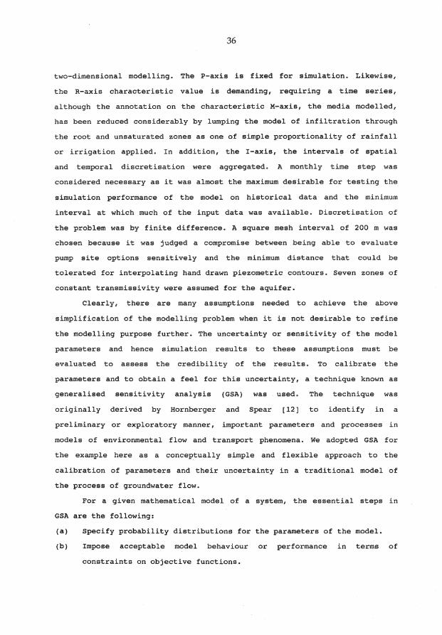
two-dimensional modelling. The P-axis is fixed for simulation. Likewise,
the R-axis characteristic value is demanding, requiring a time series,
although the annotation on the characteristic M-axis, the media modelled,
has been reduced considerably by lumping the model of infiltration through
the root and unsaturated zones as one of simple proportionality of rainfall
or irrigation applied. In addition, the I-axis, the intervals of spatial
and temporal discretisation were aggregated. A monthly time step was
considered necessary as it was almost the maximum desirable for testing the
simulation performance of the model on historical data and the minimum
interval at which much of the input data was available. Discretisation of
the problem was by finite difference. A square mesh interval of 200 m was
chosen because it was judged a compromise between being able to evaluate
pump site options sensitively and the minimum distance that could be
tolerated for interpolating hand drawn piezometric contours. Seven zones of
constant transmissivity were assumed for the aquifer.
Clearly, there are many assumptions needed to achieve the above
simplification of the modelling problem when it is not desirable to refine
the modelling purpose further. The uncertainty or sensitivity of the model
parameters and hence simulation results
evaluated to assess the credibility of
to
the
these assumptions must be
results. To calibrate the
parameters and to obtain a feel for this uncertainty, a technique known as
generalised sensitivity analysis (GSA) was used. The technique was
originally derived by Hornberger and Spear [12] to identify in a
preliminary or exploratory manner, important parameters and processes in
models of environmental flow and transport phenomena. We adopted GSA for
the example here as a conceptually simple and flexible approach to the
calibration of parameters and their uncertainty in a traditional model of
the process of groundwater flow.
For a given mathematical model of a system, the essential steps in
GSA are the following:
(a) Specify probability distributions for the parameters of the model.
(b) Impose acceptable model behaviour or performance in terms of
constraints on objective functions.

37
(c) Perform Monte Carlo simulation runs, each run taking a random sample
from the parameter distributions and driving the model to yield model
behaviours.
(d) Classify each simulation run in terms of acceptable or unacceptable
behaviour.
(e) Analyse statistical relationships between the parameters in both
acceptable and unacceptable classes to obtain a sensitivity ranking
and the covariation of parameters responsible for the acceptable
model behaviour.
The application of this procedure was demonstrated for a steady state model
of the system (S 0 in equation 6) in Jakeman et al. [15]. The uncertainty
of the model in terms of mean error of groundwater levels throughout the
aquifer and salt load to the river was calculated. The variability in both
quantities suggests the model is a useful tool to investigate the effects
of groundwater interception options. For example, almost all the
variability in salt load is contained within bounds about 10 per cent
either side of the simulated mean. Ghassemi et al. [9] have demonstrated
that this variability is about one-fifth the deterministic reduction in
salt load simulated from improvements to practicable pump placements and
rates.
Whether or not the model needs improvement requires further analysis
since the variability above was assessed for the aquifer transmissivity
parameters only. All boundary conditions, including accession parameters
from rainfall and irrigation, were kept at fixed values. Sensitivity of
simulations to these conditions is also required. On the one hand, this
means that the salt load variability calculated already is the minimum that
could be expected. On the other hand, it is quite probable that
uncertainties in parameter estimates could be reduced further by performing
generalised sensitivity analysis on a transient form of the model for which
appropriate indirect observational data (i.e. groundwater levels) are
available. In this way, the parameter space of acceptable solutions could
be further constrained (by imposing that model behaviour conform to
observations over the transient period) to reduce uncertainty.

38
This example illustrates that there are several potential advantages
of using GSA for general model calibration. As indicated and referred to
above, uncertainty estimates are a byproduct of the analysis. In addition,
there is no need to use mathematical methods of calculus and algebra to
derive an optimisation algorithm as the power of the computer is used to
sample the parameter space for optima. Traditional algebraic approaches
minimise an objective function, such as a least squares criterion, perhaps
subject to bounds or smoothing constraints on parameter values. The GSA
technique allows straightforward incorporation of prior knowledge and
hypothesis testing in almost any form without significant addition to the
level of computational complexity. The procedure is robust in the sense
that numerical problems such as stability and convergence that are
associated with the algebraic optimisation approach to the solution of
inverse problems are avoided. In summary, the approach seems well suited to
the practitioner without a strong mathematical or computational background.
Assumptions can be tested in a direct way by specifying diffuse probability
distributions for model parameters and fine-tuning these by imposing any
behaviour criteria deemed important and calculating the parameter
covariation which yields this behaviour. The approach can be built around
forward simulation models of model behaviour, which are available as
computer packages for many physical modelling problems. The main constraint
to its use is that sufficient computer time and resources can be obtained
to generate a large number of forward model runs.
ACKNOWLEDGMENTS
Part of this work was supported by a Research Fellowship granted to
the second author by the Australian Water Research Advisory Council.
REFERENCES
[l] K. BEVEN, Towards a new paradigm in hydrology. In Water for the Future: hydrology in Perspective (Proceedings of the Rome Symposium, 1987). IAHS publication No. 164(1987), 393-403.
[2] T.G. CHAPMAN, Construction of hydrological models for natural systems management. Mathematics and Computers in Simulation, 32(1990), 13-38.

39
( 3] E-H. CHIA, Some fundamental questions in stochastic simulation of weather sequences, with applications to ANUCLOUD. Mathematics and Computers in Simulation. 32(1990), 101-106.
[4] V.T. CHOW, Handbook of Applied Hydrology. McGraw - Hill, New York. 1964.
[5] B.E. CLOTHIER, Root zone processes and water quality: the impact of management. Proc. International Symposium on Water Quality Modelling of Agricultural Non-point Sources, Part 2, United States Department of Agriculture, Agricultural Research Service, ARS-81(1990), 659-683.
[6] C.R. DIETRICH, A.J. JAKEMAN and G.A. THOMAS, Statistical models for solute travel time under unsteady flow conditions. J. Hydrology. 88(1986), 253-274.
[7] C.R. DIETRICH, G.N. and NEWSAM, Sufficient conditions for identifying transmissivity in a confined aquifer, Inverse Problems, 6(1990), L21-L28.
[8] C.R. DIETRICH, A.J. JAKEMAN and G.A. THOMAS, Solute transport in a stream-aquifer system: Derivation of a dynamic model, Water Resour. Res., (25) 10(1989), 2171-2177.
(9] F. GHASSEMI, A.J. JAKEMAN and G.A. THOMAS, Groundwater modelling for salinity management: an Australian case study. Ground Water. 27(1989), 384-392.
[10] F. GHASSEMI, G.A. THOMAS and A.J. JAKEMAN, Estimation of vertical recharge via mathematical models of groundwater flow. In Groundwater Recharge, Proc. Symposium on Groundwater Recharge, Mandurah, 6 - 9 July 1987, A.A. Balkema, Rotterdam, (1989), 139-154.
[11] F. GHASSEMI, A.J. JAKEMAN and G. JACOBSON, Simulation of sea water intrusion. Mathematics and Computers in Simulation 32(1990), 71-76.
[12] G.M. HORNBERGER and R.C. SPEAR, An approach to the preliminary analysis of environmental systems. J. Environmental Management, 12(1981), 7-18.
[13] M.F. HUTCHINSON, A point rainfall model based on a continuous Markov occurrence process. J. Hydrology. 125-148.
three-state 114(1990),
[14] A.J. JAKEMAN, Features and principles of a systems approach to environmental modelling. In Modelling and Simulation of Systems, P. Breedveld et al. (eds), J.G. Balzer AG, Scientific Publishing Company, (1989) 229-234
[15] A.J. JAKEMAN, F.G. GHASSEMI, C.R. DIETRICH, T.J. MUSGROVE and P.G. WHITEHEAD, Calibration and reliability of an aquifer system model using generalised sensitivity analysis. ModelCARE 90: Int. Conf. on Calibration and Reliability in Groundwater Modelling, The Hague, 3 -6 September 1990. IAHS Publication No. 195(1990), 43-51.
[16] A.J. JAKEMAN, I.G. LITTLEWOOD and P.G. and WHITEHEAD, P.G. Computation of the instantaneous unit hydrograph and identifiable component flows with application to two small upland catchments. J. Hydrology 117(1990) 275-300.
[17] A.J. JAKEMAN, P.G. WHITEHEAD, A. ROBSON, A. JENKINS and J.A. TAYLOR, A method for predicting the extremes of stream acidity and other water quality variables. J. Hydrology. 116(1990), 375-390.
[18] R.L. KASHYAP and A.R. RAO, Dynamic Stochastic Models from Empirical Data. Academic Press, New York, 1976.
[19] v. KLEMES, Dilettantism in hydrology, transition or destiny. Water Resources Research, 22(9),(1986), 177S-188S.
[20] J.H. KNIGHT, Solute transport and dispersion: commentary. In Flow and Transport in the Natural Environment: Advances and Applications, W.L. Steffen and D.T. Denmead (eds), Springer Verlag: Heidelberg, (1988), 17-29.

40
[21] D.P. LETTENMAIER, Rainfall-runoff modelling. In Systems and Control Encyclopaedia. Pergamon Press, Oxford, (1987) 3940-3944.
[22] I.D. MOORE, G.J. BURCH and D.H. MACKENZIE, Topographic effects on the distribution of the surface soil water content and the location of ephemeral gullies. Trans. Amer. Soc. Agric. Engineers. 31(1988), 1098-1107.
[23] A.R. RAO and L.T. MAO, An investigation of the instrumental variableapproximate maximum likelihood method of modeling and forecasting daily flows. Water Resources Management. 1(1987), 79-106.
[24] STEFFEN and DENMEAD (eds), Flow and Transport in the Natural Environment: Advances and Applications, Springer-Verlag: Heidelberg, 1988.
[25] J.A. TAYLOR, New approaches to modelling the global distribution of trace gases in the troposphere. Mathematics and Computers in Simulation 32(1990) 59-64.
[26] E. TODINI, Rainfall-runoff modelling - past, present and future. J. Hydrology. 100(1988) 341-352.
[27] P.G WHITEHEAD, P.C. YOUNG and G.M. HORNBERGER, A systems model of stream flow and water quality in the Bedford-Ouse River - 1. Stream flow modelling. Water Research. 13(1989) 1155 - 1169.
1. Centre for Resource and Environmental Studies, Australian National University.
2. Centre for Mathematical Analysis, Australian National University.
3. Institute of Hydrology, Wallingford, United Kingdom.