preliminary ecological survey for the proposed truck stop
TRANSCRIPT

Volksrust Truck Stop Development -Preliminary Ecological Habitat Assessment
1
PRELIMINARY ECOLOGICAL SURVEY FOR THE PROPOSED TRUCK STOP & FILLING STATION;
VOLKSRUST; MPUMALANGA PROVINCE
Compiled for SSI Engineers & Environmental Consultants (Pty) Ltd by: Mr. C.L.COOK (MSc. Zool.) Pr.Sci.Nat. 400084/08 Specialist Faunal/Ecological Consultant Cell No. 082 688 9585 [email protected] ___________________________________________________________________
SUBMITTED: 24th APRIL 2012

Volksrust Truck Stop Development -Preliminary Ecological Habitat Assessment
2
1. INTRODUCTION Background SSI Engineers and Environmental Consultants were appointed to undertake the Basic Assessment Application for a proposed service station and truck stop on portion 9 of the farm Smalkloof 122. SSI Engineers and Environmental Consultants as an Independent Environmental Practitioner appointed Mr C. L. Cook to provide a basic description of the current ecological habitat integrity or sensitivity with emphasis of the verification of any sensitive habitats within the proposed Volksrust Truck Stop and filling station and filling station site and to provide appropriate management recommendations for the proposed development; if approved by the relevant authorities. The site is situated approximately 3.5 km from Volksrust adjacent to the R23 withinthe Mpumalanga Province. The proposed Volksrust Truck Stop and filling station is situated within the Pixley Ka Seme Local Municipality and the Gert Sibande District Municipality. The assignment is interpreted as follows: Determine the current ecological status of the proposed Volksrust Truck Stop and filling station site and the ecological impacts of the development on the immediate environment and provide appropriate mitigatory measures for the potential disturbances on the site and immediately adjacent area. In order to compile the report the following had to be done:
Initial preparations:
Obtain all relevant maps including aerial photographs (Google images) of the proposed Volksrust Truck Stop and filling station site and information on the natural environment around the proposed site.
Preliminary site investigation (14th April 2012) to assess the current environmental status of the proposed site with special emphasis on the remaining natural habitats within and immediately adjacent to the proposed site.
Identify problematic areas which require immediate attention as well as management, e.g. stormwater management, erosion, degraded areas, reclamation areas, alien vegetation.
Make management recommendations for the current impacts as well as the proposed development especially pertaining to any remaining natural habitats.
Volksrust Truck Stop Development -Preliminary Ecological Habitat Assessment
3
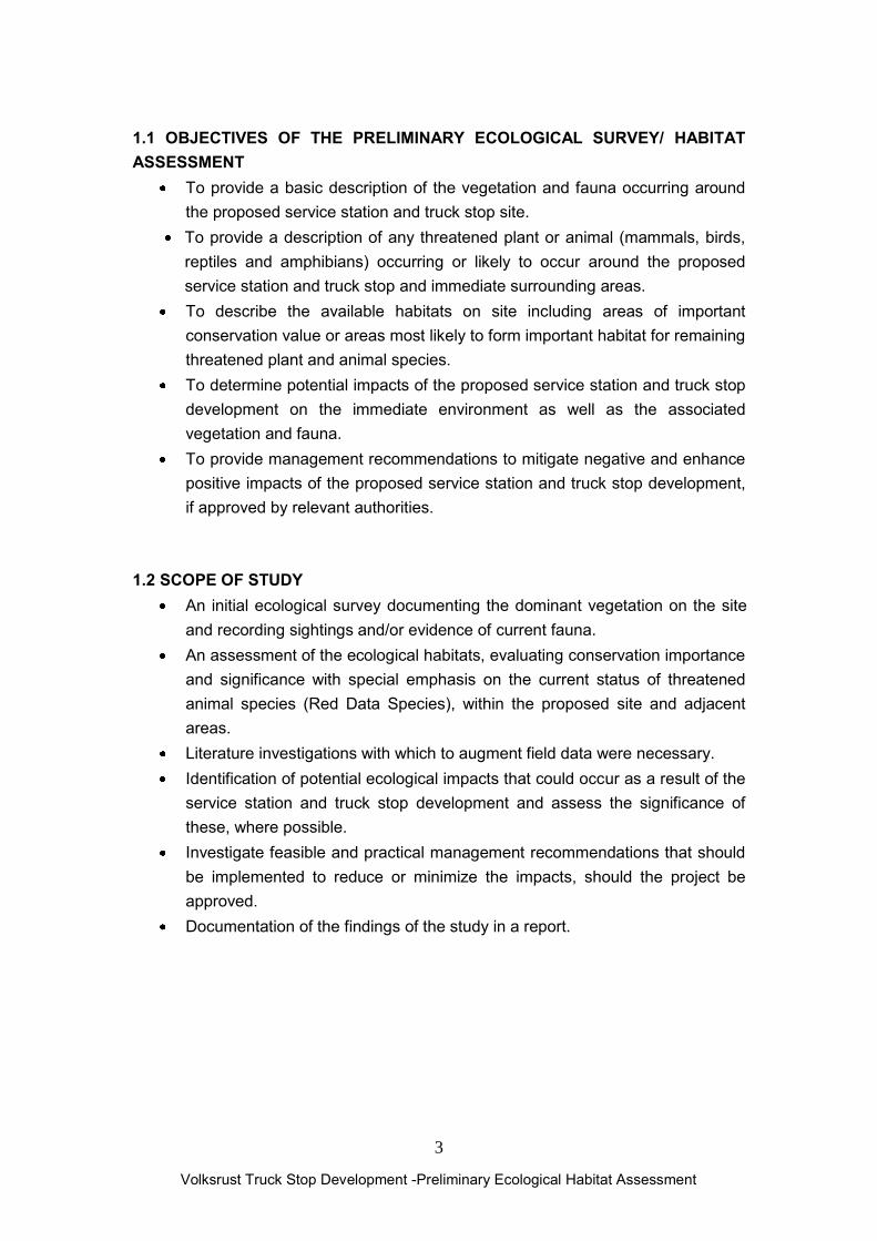
1.1 OBJECTIVES OF THE PRELIMINARY ECOLOGICAL SURVEY/ HABITAT ASSESSMENT
To provide a basic description of the vegetation and fauna occurring around the proposed service station and truck stop site.
To provide a description of any threatened plant or animal (mammals, birds, reptiles and amphibians) occurring or likely to occur around the proposed service station and truck stop and immediate surrounding areas.
To describe the available habitats on site including areas of important conservation value or areas most likely to form important habitat for remaining threatened plant and animal species.
To determine potential impacts of the proposed service station and truck stop development on the immediate environment as well as the associated vegetation and fauna.
To provide management recommendations to mitigate negative and enhance positive impacts of the proposed service station and truck stop development, if approved by relevant authorities.
1.2 SCOPE OF STUDY
An initial ecological survey documenting the dominant vegetation on the site and recording sightings and/or evidence of current fauna.
An assessment of the ecological habitats, evaluating conservation importance and significance with special emphasis on the current status of threatened animal species (Red Data Species), within the proposed site and adjacent areas.
Literature investigations with which to augment field data were necessary. Identification of potential ecological impacts that could occur as a result of the
service station and truck stop development and assess the significance of these, where possible.
Investigate feasible and practical management recommendations that should be implemented to reduce or minimize the impacts, should the project be approved.
Documentation of the findings of the study in a report.

Volksrust Truck Stop Development -Preliminary Ecological Habitat Assessment
4
1.3 CONSTRAINTS AND LIMITATIONS OF SHORT DURATION ECOLOGICAL AND FAUNAL SURVEYS
Limitation to a base-line ecological survey for only 6 hours during the late summer months (April 2012).
The majority of habitats on and surrounding the site have already been completely transformed. The site is currently vacant and utilised for wood harvesting activities from the Eucalyptus invaded stands as well as previous high intensity cattle grazing activities/livestock enclosures.
The majority of grassland vegetation on the site has been completely transformed or severely degraded during previous as well as current agricultural activities.
The majority of animal species are extremely seasonal only emerging after sufficient heavy early summer rainfall (October-November).
Limitation of historic data and available databases for the Volksrust area. The presence of threatened species on site is assessed mainly on habitat
availability and suitability as well as desk research (literature, personal records) and previous surveys conducted in similar habitats between 1999-2012).
Access is restricted on privately owned lands.
2. METHODOLOGY A survey of the proposed Volksrust Truck Stop and filling station site and immediate surrounding areas was carried out by driving around the surrounding areas by car and closer inspection of the actual sites carried out on foot. The proposed site is situated adjacent to existing primary access road (D382) as well as extensive agricultural areas and the majority of natural vegetation consisting of Amersfoort Highveld Clay Grassland (Gm 13) (Mucina et al. 2006) has already been completely transformed during previous and current agricultural activities (planted Teff pastures and cattle grazing) or heavily degraded through alien vegetation invasion especially by Acacia mearnsii and Eucalyptus grandis. The site was visited during daylight hours on the 14th of April 2012.

Volksrust Truck Stop Development -Preliminary Ecological Habitat Assessment
5
It must be stressed that due to time and financial constraints no comprehensive vegetation, faunal surveys were undertaken during the brief ecological/sensitivity scan. Data was heavily supplemented by literature investigations; personal records, historic data and previous surveys conducted in the Volksrust-Amersfoort area. Different habitats were explored to identify any sensitive or specialised species which could possibly occur on the site. Habitats explored included the rank grasslands and recently cut Eucalyptus stands which dominate the majority of the site. The vegetation literature search was undertaken utilising The Vegetation of South Africa, Lesotho and Swaziland (Mucina & Rutherford 2006) for the vegetation description as well as National Red List of Threatened Plants of South Africa (Raimondo et al, 2009). Mammal names are as used by Skinner and Chimimba (2005), Bird names by Hockey, Dean & Ryan (2006); Reptile names by Branch (1998) and Amphibian names by Carruthers & Du Preez (2009).
3. BACKROUND INFORMATION
3.1 Location and Description
The proposed Volksrust Truck Stop and filling station site is situated immediately adjacent to the R23 approximately 3.5km from Volksrust within the Mpumalanga Province (see Figure 1 locality map). The site is situated in a rural context where agricultural land use dominates. This area is utilised mainly for crop cultivation and grazing of livestock. The area is located on the Mpumalanga Highveld (the site is located at an altitude of approximately 1173m above sea level). The study area falls within the Grassland Biome described by Mucina et al. (2006) where it is further divided into the Amersfoort Highveld Clay Grassland (Gm 13) vegetation unit (Mucina & Rutherford 2006).

Volksrust Truck Stop Development -Preliminary Ecological Habitat Assessment
6
Figure1. Locality map of the proposed Volksrust Truck Stop and filling station Site (GPS Locality: 27 20‟ 15.0”S 29 51‟ 43.0”E)

Volksrust Truck Stop Development -Preliminary Ecological Habitat Assessment
7
3.2 Vegetation Amersfoort Highveld Clay Grassland (Gm 13) was previously classified as (VT 54) Themeda Veld to Highveld Sourveld Transition (43%); (VT 57) North-Eastern Sandy Highveld (29%) (Acocks 1953; 1988); (LR 41) Wet Cold Highveld Grassland (30%), (LR 38) Moist Sandy Highveld Grassland (29%) (Low & Rebelo 1996).
Figure2. The proposed Volksrust Truck Stop and filling station is situated with Amersfoort Highveld Clay Grassland (Gm 13) vegetation unit (Mucina & Rutherford 2006) Distribution Occurs within Mpumalnaga and Kwazulu-Natal Provinces. This unit extends in a north-south band from just south of Ermelo, down through Amersfoort to the Memel area in the south.

Volksrust Truck Stop Development -Preliminary Ecological Habitat Assessment
8
3.3 Vegetation and Landscape Features This vegetation type comprises undulating grassland plains, with small scattered patches of dolerite outcrops in areas. The vegetation is comprised of a short closed grassland, largely dominated by a dense Themeda triandra sward, often severely grazed to form a short lawn. Overgrazing or poor grassland management result in the invasion of the dwarf shrub Seriphium plumosum/Stoebe vulgaris. Parts of this unit were once cultivated and now lie fallow and have been left to re-vegetate with pioneer grass species. These transformed areas are not picked up by satellite for transformation coverage and the percentage of grasslands still in a natural state may be underestimated. The natural grassland of the study areas are characterised by a short, low cover of herbaceous species, physiognomically dominated by grasses. The floristic status of these areas is largely determined by the intensity of grazing by cattle and sheep. In areas where high grazing pressure predominate the vegetation is dominated by the grasses Eragrostis plana, E. chloromelas, Cynodon dactylon and the forbs Cirsium vulgare, Berkheya carlinopsis, Alternanthera pungens and Crepis hypochoeridea. The forb and herb species diversity in these parts is frequently low. Areas that are subjected to lower grazing pressure comprises vegetation with a higher floristic status, species diversity consisting of the grasses Themeda triandra, Brachiaria eruciformis, Eragrostis racemosa, Setaria species, S. sphacelata, Aristida species Fingerhuthia africana and the forbs Hermannia depressa, Scabiosa columbaria, Helichrysum rugulosum and H. aureonitens. These areas are more likely to be associated with shallow soils and localised dolomite rocky outcrops. The species diversity in these parts is more diverse, comprising a high degree of forbs and geophytic herbs or geophytes in particular, including Boophone disticha, Gladiolus crassifolius, Gladiolus robertsoniae, Hypoxis iridifolia, H. obtusa and H. rigidula. The floristic status of these areas are frequently not as well-defined as indicated in the description, but more often represent a gradient of grazing pressure. However, even areas that were subjected to high grazing pressure are different to transformed areas by the simple distinction that these areas are able to recover to a natural status under correct management.

Volksrust Truck Stop Development -Preliminary Ecological Habitat Assessment
9
Prominent species that occur within this vegetation unit include the following: Graminoids Aristida aequiglumis, A. congesta, A. junciformis, Brachiaria serrata, Cynodon dactylon, Digitaria monodactyla, D. tricholaenoides, Elionurus muticus, Eragrostis chloromelas, E. curvula, E. plana, E. racemosa, E. sclerantha, Heteropogon contortus, Loudetia simplex, Microchloa caffra, Monocymbium cerisiiforme, Setaria sphacelata, Sporobolus africanus, S. pectinatus, Themeda triandra, Trachypogon spicatus, Tristachya leucothrix, T. rehmannii, Alloteropsis semialata, Andropogon appendiculatus, E. schirensis, Bewsia biflora, Ctenium concinnum, Diheteropogon amplectens, Eragrostis, capensis, E. gummiflua, E. patentissima, Harpochloa falx, Panicum natalense, Rendlia altera, Schizachyrium sanguineum, Setaria nigrirostris and Urelytrum agropyroides. Herbs Berkheya setifera, Haplocarpha scaposa, Justicia anagalloides, Pelargonium luridum, Acalypha angustata, Chamaecrista mimosoides, Dicoma anomala, Euryops gilfillanii, E. transvaalensis, Helichrysum aureonitens, H. callicomum, H. oreophilum, H. rugulosum, Ipomoea crassipes, Pentanisia prunelloides, Selago densiflora, Senecio coronatus, Vernonia oligocephala, Wahlenbergia undulata, Gladiolus crassifolius, Haemanthus humilis, Hypoxis rigidula, Aloe ecklonis and Ledebouria ovatifolia. Geophytic Herbs Boophone distichta, Eucomis autumnalis subsp. clavata, Hypoxis villosa var. oblqiua, Zantedeshia albomaculata subsp. macrocarpa Low Shrubs Anthospermum rigidum and Stoebe plumosa. 3.4 Geology The geological makeup of the area is important as it affects the geomorphological make-up of the landscape. This relates to the relative erodibility of the igneous (dolerite) rock as opposed to the sedimentary rock; dolerite is much more resistant to weathering than the sedimentary sandstones and weathers much more slowly. This has affected the landscape of the area in that the landscapes in the doleritic areas are slightly different from those in the areas of sedimentary geology. Where rivers and streams have to cross dolerite, in particular dolerite sills, the drainage has often cut relatively deep, narrow valleys into the landscape. The study site is primarily underlain by shale with a small dolerite outcrop situated on the north-western boundary of the site. Dolerite is an intrusive igneous rock which originates from lava that significantly intrudes into the sedimentary Karoo Supergroup sediments that cover much of the interior of South Africa (including the south-eastern Highveld in

Volksrust Truck Stop Development -Preliminary Ecological Habitat Assessment
10
which the study site is located) in the Jurassic period. Dolerite intruded extensively into the older sedimentary geology in this area to the degree that it dominates the geological make-up of the area.
3.5 Soils and Land Types Geology has a very important influence of soils, as areas underlain by dolerite geology are typically characterised by highly vertic clay soils which are not suitable for crop cultivation as well as extensive areas of bedrock outcropping, crop cultivation does not typically occur in these areas. Soils derived from sedimentary geology are more suitable for crop cultivation, hence in these areas the catchments of any of these wetlands have been transformed from natural grasslands to areas of dryland crop cultivation, whereas in areas underlain by dolerite geology the catchments of wetlands are typically natural grasslands. Vertic soils are characterised by the presence of swelling and shrinking clays. They typically form where there is a distinct wet and dry period that affects the soils. These soils swell when they become saturated, and shrink again when they dry out, leading to characteristic „cracking‟ on the surface of the ground. There are two main formation processes for vertic soils: the first is in low lying positions where vertic soils form due to the accumulation of base rich weathering products, and requiring a distinct period of seasonal (winter in this case) drying to form the swelling clays. The second is on varying, but mainly flat, topography due to the weathering of basic igneous parent materials. The Soil Classification Working Group lists two soil forms that are characterised by a vertic A; the Arcadia soil form – a vertic A horizon over unspecified material and the Rensburg soil form which is characterised by a vertic A horizon underlain by a G horizon. The Rensburg Soil Form is listed as a wetland soil form by the DWA wetland delineation guidelines, while the Arcadia form is not. Dominant land type Ca while Ea land type is of subordinate importance. No geotechnical survey detailed mapping of soil forms has not been undertaken by this study so soil forms were not considered during the field surveys 3.5 Conservation Status The conservation status is regarded as Vulnerable, with a target of 27%. None is however formally protected. The study area is situated within a part of the African Grasslands/ Ekengela Initiative Transition Zone, rendering all areas of natural grassland sensitive (ENPAT, National Database, Biosphere). Some 25% of this vegetation type is transformed, predominantly by cultivation (22%). The area is not suited to forestation. Silver Wattle (Acacia dealbata*) and Black Wattle (Acacia mearnsii*) and Weeping Willow (Salix babylonica ) invade drainage areas. Erosion is potential is low except along the valley bottom wetlands which are extensively utilised for livestock grazing and drinking areas.
alien invasive vegetation

Volksrust Truck Stop Development -Preliminary Ecological Habitat Assessment
11
4. VEGETATION UNIT OBSERVED ON SITE 4.1 TRANSFORMED OR SECONDARY SUCCESSION GRASSLANDS
Vegetation Type
Amersfoort Highveld Clay Grassland (Gm 13)
Tree cover
< 10%
Soil Vertic clay soils derived from dolerite from the Volksrust Formation
Shrub cover <5 %
Topography Undulating Hillslopes (foot-slope)
Herb cover 5-10 %
Land use Agriculture ( dryland planted pastures for hay production)
Grass cover 0-80%
Dominant spp.
Aristida sp., ,Hyparrhenia hirta, Hyparrhenia tamba, Andropogon eucomus, Elionorus muticus, Cymbopogon plurinodis, Digitaria sp., Digitaria sanguinalis, Chloris virgata, Hyparthelia dissoluta, Panicum natalense, Imperata cylindrica, Seriphium plumosum, Berkheya sp., Typha capensis, Melinis repens, Helichrysum
pilosellum, Helichrysum rugulosum, Eragrostis curvula, Felicia muricata, Senecio madagacascriensis, Gymnocarpus fruticosus, Sesbania bispinosa, Tagetes minuta, Bidens pilosa, Verbena bonariensis, Cynodon dactylon; Conyza albida
Alien Invasive
Eucalyptus grandis*, Cirsium vulgare*, Solanum elaeagnifolium*, Solanum mauritianum* , Datura stramonium*
Volksrust Truck Stop Development -Preliminary Ecological Habitat Assessment
12
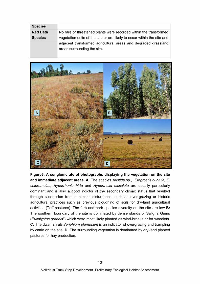
Species Red Data Species
No rare or threatened plants were recorded within the transformed vegetation units of the site or are likely to occur within the site and adjacent transformed agricultural areas and degraded grassland areas surrounding the site.
Figure3. A conglomerate of photographs displaying the vegetation on the site and immediate adjacent areas. A: The species Aristida sp., Eragrostis curvula, E. chloromelas, Hyparrhenia hirta and Hyperthelia dissoluta are usually particularly dominant and is also a good indictor of the secondary climax status that resulted through succession from a historic disturbance, such as over-grazing or historic agricultural practices such as previous ploughing of soils for dry-land agricultural activities (Teff pastures). The forb and herb species diversity on the site are low B: The southern boundary of the site is dominated by dense stands of Saligna Gums (Eucalyptus grandis*) which were most likely planted as wind-breaks or for woodlots. C: The dwarf shrub Seriphium plumosum is an indicator of overgrazing and trampling by cattle on the site. D: The surrounding vegetation is dominated by dry-land planted pastures for hay production.

Volksrust Truck Stop Development -Preliminary Ecological Habitat Assessment
13
EXISTING IMPACTS ON THE VEGETATION ON THE VOLKSRUST TRUCK STOP AND FILLING STATION INCLUDED:
Remaining open grasslands surrounding the site are mainly transformed (ploughed) planted pastures or are relic fragmented patches of grassland which are heavily impacted from surrounding human activities. Overgrazing by livestock (cattle), frequent fires, grass and medicinal plant harvesting, alien vegetation invasion especially by Acacia mearnsii*, Solanum mauritianum*, and Eucalyptus grandis as well as illegal hunting and poaching activities.
The site has been historically ploughed and is dominated by secondary succession grass species.
The central portions adjacent to the site have been historically ploughed for dry land agricultural activities including Eragrostis tef pastures for hay production.
The site is dominated by transformed grassland patches as well as heavily degraded by extensive cattle grazing activities. Overgrazing and trampling has resulted in the dominance of the dwarf shrub Seriphium plumosum.
Trampling and overgrazing has resulted in soil compaction and soil surface erosion.
An extensive Eucalyptus stands occur adjacent to the R23. The trees were possibly planted for wind-breaks for the adjacent agricultural lands.
The Eucalyptus have been previously as well as currently harvested and have coppiced.
The site is fenced which restricts access from the R23. No rare or threatened plants were recorded within the transformed vegetation units of the site or are likely to occur within the adjacent transformed agricultural areas and degraded grassland areas surrounding the site.

Volksrust Truck Stop Development -Preliminary Ecological Habitat Assessment
14
4. PRELIMINARY FAUNAL SURVEY The preliminary faunal survey focused mainly on mammals, birds, reptiles and amphibians of the proposed office park site. The survey focused on the current status of threatened animal species occurring, or likely to occur within the study area, describing the available and sensitive habitats, identifying potential impacts resulting from the Volksrust Truck Stop and filling station development and providing mitigation measures for the identified impacts. Faunal data was obtained during a two day site visit of the proposed development site carried out on foot on the 14th of April 2012. All animals (mammals (larger), birds, reptiles and amphibians) seen or heard; were recorded. Use was also made of indirect evidence such as nests, feathers and animal tracks (footprints, droppings) to identify animals. Previous surveys conducted in Volksrust-Amersfoort area, literature investigations; personal records and historic data heavily supplemented the initial survey. The literature search was undertaken utilising The Vegetation of South Africa, Lesotho and Swaziland (Mucina & Rutherford 2006) for the vegetation description. The Mammals of the Southern African Subregion (Skinner & Chimiba 2005) and The Red Data Book of the Mammals of South Africa: A Conservation Assessment (Friedmann and Daly (editors) 2004) for mammals. Roberts-Birds of Southern Africa VIIth ed. (Hockey, Dean and Ryan (editors) 2005) and The Escom Red Data Book of Birds of South Africa (Barnes 2000) for avifauna (birds). A Complete Guide to the Frogs of Southern Africa (du Preez & Carruthers 2009) and the The Atlas and Red Data Book of the frogs of South Africa, Lesotho and Swaziland (Minter et al. 2004) for amphibians. The Field Guide to the Snakes and other Reptiles of Southern Africa (Branch 2001) and South African Red Data Book- Reptiles and Amphibians (Branch 1988) for reptiles. The vegetation within and immediately adjacent to the Volksrust Truck Stop and filling station site has been completely transformed during previous ploughing of the soils and vegetation or severely degraded due to alien vegetation invasion (Eucalyptus grandis*) and offers limited habitat diversity for remaining faunal species.

Volksrust Truck Stop Development -Preliminary Ecological Habitat Assessment
15
Existing Impacts on the fauna on and surrounding the site included: Previous agricultural activities (oldlands) have transformed the majority of habitat on site. Agricultural activities place pressure on the environment in the following ways:
Change in land use: natural grasslands containing a diversity of vertebrate and invertebrate fauna are converted to monocultures of one particular crop leading to considerable loss of faunal biodiversity.
Small tracts of indigenous grassland become surrounded by monocultures causing fragmentation of previously intact natural habitats.
The remaining remnants of natural grassland are more susceptible to exotic invasion (Black Wattle and Blue Gum) and degradation due to increased edge effects of agricultural and mining activities as well as established residential areas.
Habitat fragmentation also eliminates corridors between similar undisturbed habitats. The R23 is a major access road with high vehicular traffic especially large trucks.
The fragmentation of interconnected valley bottom wetlands and pans from each other and their surrounding terrestrial grassland environment threatens species that move between nearby wetlands and those that require intact terrestrial habitats in close proximity to valley bottoms or pans (African Grass Owl, Giant Bullfrog).
Agricultural lands pollute nearby aquatic habitats through sediment loads and contamination caused by pesticides and fertilizers that reach the water through run-off or seepage. This causes a decline of indigenous species populations and increases the chance of exotic invasion (Bass, Carp, Mosquito Fish).
Increased human presence and human disturbances surrounding the site results in increased disturbances on the site such as illegal dumping, hunting and poaching, harvesting of traditional medicinal plants and grass harvesting.
Quarry and mining activities adjacent and in the wetland areas alters the natural hydrological regime of the wetlands as well as deterioration of water quality.
Numerous paths and an informal roads and off road tracks transverse the open grasslands and result in deterioration of water quality through increased siltation and from leaking oils, petrol, hydrocarbons as well as toxic exhaust fumes; compaction of the hydric soils which leads to alteration of the hydrological patterns as well as possible road fatalities.
Extensive littering occurs on the site especially adjacent to the informal access roads. Dumped material includes building rubble, organic material as well as several plastic bags, tins and bottles.
Frequent burning of remaining grasslands results in the transformation of the natural vegetation as well as severely impacting on remaining fauna.
Evidence of hunting (dogs and cartridges) and poaching (wire snares).

Volksrust Truck Stop Development -Preliminary Ecological Habitat Assessment
16
Removal of certain plant species (bulbous geophytes); thatch harvesting, wood harvesting and collecting
Introduction of exotic and alien vegetation throughout the site. Eucalyptus trees have been planted as windbreaks for the adjacent agricultural lands. However, these species pose a threat to ecosystem functioning since they reduce the amount of run-off that reaches valley bottom wetlands, pans, rivers and streams and they out-compete many indigenous species, causing displacement of indigenous species.
4.1 AMPHIBIANS Amphibians are an important component of South Africa‟s exceptional biodiversity (Siegfried 1989) and are such worthy of both research and conservation effort. This is made additionally relevant by international concern over globally declining amphibian populations, a phenomenon currently undergoing intensive investigation but as yet is poorly understood (Wyman 1990; Wake 1991). Amphibians have declined dramatically in many areas of the world. These declines seem to have worsened over the past 25 years and amphibians are now more threatened than either mammals or birds, though comparisons with other taxa are confounded by a shortage of reliable data. Most frogs have a biphasic life cycle, where eggs laid in water develop into tadpoles and these live in the water until they metamorphose into juvenile fogs living on the land. This fact, coupled with being covered by a semi-permeable skin makes frogs particularly vulnerable to pollutants and other environmental stresses. Consequently frogs are useful environmental bio-monitors (bio-indicators) and may acts as an early warning system for the quality of the environment. Breeding in African frogs is strongly dependent on rain, especially in the drier parts of the country where surface water only remains for a short duration. The majority of frog species in the Mpumalanga Province can be classified as explosive breeders. Explosive breeding frogs utilise ephemeral pans or inundated grasslands for their short duration reproductive cycles. As the survey was undertaken for less than a day during the late summer months (April), only a small proportion of species are present. Ideally, a herpetological survey should be undertaken throughout the duration of the wet season (November-Mach). It is only during this period that accurate frog species lists can be compiled. During this survey; fieldwork was augmented with species lists compiled from personal records; data from the South African Frog Atlas Project (SAFAP)(1999-2003) and published data, and the list provided below is therefore regarded as likely to be fairly comprehensive. No frog species were recorded during the brief site visit. Due to

Volksrust Truck Stop Development -Preliminary Ecological Habitat Assessment
17
extensive habitat transformation on and surrounding the site low frog diversity is expected. No natural wetlands occur on the site or immediately adjacent to the site. Table1. Frog species recorded on the actual site or are likely to occur on the site. Common Name
Scientific Name
Status/ Distribution
Habitat
Guttural Toad
Amietophrynus (Bufo) gutturalis
Common in southern Africa north of Gariep.
Permanent and semi-permanent ponds and backwaters in open grassland.
Tremelo Sand Frog
Tompoterna cryptotis
Common species in Mpumalanga, Gauteng.
Streams, rivers or other places where water flows slowly but also in lothic or standing water
Figure4. The site offers limited suitable habitat for frogs. The Guttural Toad (Amietophrynus gutturalis) is an urban exploiter and could possibly occur on the site.

Volksrust Truck Stop Development -Preliminary Ecological Habitat Assessment
18
Threatened species
Giant Bullfrog (Pyxicephalus adspersus)
The Giant Bullfrog is currently assigned as a near-threatened species (IUCN Red List category). Giant Bullfrogs have been not been recorded from the Volksrust area during previous surveys as well as during the South African Frog Atlas Project (SAFAP). No suitable breeding habitat occurs around the site for Giant Bullfrogs. Bullfrog density commonly varies within certain habitats (open grassland habitat). High densities are often associated with specific microhabitats or patches (hygrophytic or aquatic ephemerophytic grass and sedge dominated temporary pans) that can be identified and randomly sampled. Loskopdam Nature Reserve is the only provincial protected reserve in Mpumalanga where the Giant Bullfrog was recorded (Jacobsen et al 1986). For this reason the species is considered vulnerable in the Province (Theron 2002). The majority of the records are of migrating adult males including several road fatalities. Limited knowledge exists on the viable (>500 breeding adults) populations and breeding areas within the Mpumalanga Province. The site offers no suitable habitat for Giant Bullfrogs and amphibians in general. 4.2 REPTILES Reptile lists require intensive surveys conducted for several years. Reptiles are extremely secretive and difficult to observe during field surveys. The majority reptile species are sensitive to severe habitat alteration and fragmentation. Due to the high levels of habitat destruction and degradation within the study area due to agricultural and residential activities coupled with increased levels of disturbances are all causal factors in the alteration of reptile species occurring on the site and surrounding areas. As a result of human presence in the area as well as on the site; coupled with extensive habitat destruction from agricultural activities and high levels of disturbances, alterations to the original reptilian fauna are expected to have already occurred. Removal of Eucalyptus during the clearing of stands and dead trunks for firewood collection destroys numerous habitats for remaining reptile species. Clearing of rock material from agricultural lands and for building materials destroys vital habitat for numerous rupicolous reptile species including the Agamids, Cordylids, Geckonids and Skinks. The majority of snake species hibernate in old tree trunks, termite mounds or under suitable rocks. No major rocky outcrops or rock piles are found on the site. Indiscriminate killing of snake species occur all around human settlements. The indiscriminate killing of all snake species results in the alteration of species composition, with the disappearance of the larger and the more sluggish snake species. The frequent cutting and ploughing of the planted pastures on the adjacent property has a high impact on remaining reptiles.

Volksrust Truck Stop Development -Preliminary Ecological Habitat Assessment
19
One reptile species namely the Variable Skink (Trachylepis varia) was observed on the proposed site. Low reptile diversity is expected from the transformed areas on the site. A probable species list is provided in Table2 below. Table2: Reptile species that occur or are likely to occur in the study area due to suitable habitat, and may therefore be present. Actual species lists will most likely contain far fewer species due to high levels of habitat transformation.
COMMON NAME SCIENTIFIC NAME
Cape Skink Trachylepis (Mabuya) capensis
Striped Skink Trachylepis (Mabuya) punctatissima
*Variable Skink Trachylepis (Mabuya) varia
Yellow-throated Plated Lizard Gerrhosaurus flavigularis
Flap-Necked Chameleon Chamaeleo dilepis
Herald or Red-lipped Snake Crotaphopeltis hotamboeia
Common or Rhombic Night Adder
Causus rhombeatus
Common or Rhombic Egg Eater
Dasypeltis scabra
Bibron‟s Blind Snake
Typhlops bibronii
Cape and Eastern Thread Snake
Leptotyphlops conjunctus
Peters‟ Thread Snake
Leptotyphlops scutifrons
* recorded during brief field survey

Volksrust Truck Stop Development -Preliminary Ecological Habitat Assessment
20
Threatened Species
Figure5. One red liasted reptile species is known from the Volksrust-Amersfoort area namely the Giant Girdled Lizard or Sungazer (Smaug giganteus), listed in the SA Red Data book as “Vulnerable” and a CITES II species. Sungazers are strongly heliothermic, basking in exposed situations such as termitaria or on open ground near their burrow entrance. Sungazers are considered to be an excellent grassland flagship or indicator species as they show high site fidelity. Photograph taken by R. Midtgard. Distribution The Sungazer is endemic to the Highveld grasslands of the northern Free State and south-western Mpumalanga. According to the recent SARCA Database there are 216 records from 54 Quarter Degree grid cells. Sungazers were previously thought to have occurred within the western parts of Kwazulu-Natal, however no verified records of S. giganteus as indigenous to KwaZulu-Natal appear to exist. Most records are of S. giganteus that have been released or that have escaped at the sites where they were recorded. Therefore it is proposed that S. giganteus is removed from the list of reptiles indigenous to KwaZulu-Natal until verified records of S. giganteus colonies native to KwaZulu-Natal are obtained (Armstrong 2011).
Volksrust Truck Stop Development -Preliminary Ecological Habitat Assessment
21
HABITAT AND ECOLOGY Sungazers are diurnal, terrestrial lizards which may from loose colonies of several individuals and are restricted exclusively to natural flat or sloping highveld grasslands in South Africa. The veld types represent true Themeda triandra grassland and transitional zones. When active Sungazers are strongly heliothermic, basking in exposed situations such as termitaria or on open ground near their burrow entrance (Alexander & Marais 2007). Sungazers live in self-excavated burrows, dug to an average depth of 420mm below the soil surface and an average length of 1.8m (Van Wyk 1988) and often exceeds 2m. Burrows are single chambered and are usually blind-ended with no terminal chamber (Alexander & Marais 2007). Soil types in which burrows are formed include sand, loams, black clays and solonetzic types. No accurate representative estimates of burrow distribution and densities are available within the current distribution range of Sungazers. Reported burrow densities range from 4-19 burrows per hectare. However, large open grassland areas were found without any burrows present. Usually a single adult will occupy a burrow although up to seven individuals have been recorded in a burrow and juveniles may share burrows with adults. Burrows serve as retreats at night, and to avoid predation, low winter temperatures and high midday temperatures during summer. The burrow has an important thermoregulatory function, both in summer and winter. A typical bimodal activity pattern has been recorded throughout the year. During winter, two species of frog as well as insects share the burrows with the sungazers to avoid the subzero surface temperatures. Individual lizards appear to move between burrows regularly, but adults may defend particular burrows. The majority of burrows are situated within undulating grassland. Slopes are preferred since this reduces the potential for the flooding of burrows during heavy precipitation/rains (Alexander & Marais 2007). Sungazers may temporarily occupy other animal burrows such as those of the Yellow Mongoose, Springhare, Suricate as well as Antbear. Sungazers are slow-growing and have long life-spans often over 10 years. REPRODUCTION Sungazers are live-bearing giving birth to 1-4 young in late summer. Research indicates that not all adult females breed annually. Preliminary evidence suggests that the majority of the adult females breed biannually. At the same time, field observations indicate that not all adult males take part in mating activities. The age at maturity is not yet determined, however evidence seems to suggest late maturities. The operational sex ratio (OSR) (males to females) in a population averages 1:1.75. Males are distinguished by enlarged femoral pores and a patch of glandular scales anterior to the femoral pores. Several swollen glandular scales are present on the front legs of males. Although females have femoral pores on the back legs, they lack the other glandular scales on the front and back legs (Van Wyk 1988).

Volksrust Truck Stop Development -Preliminary Ecological Habitat Assessment
22
DIET Van Wyk (2000) found that S. giganteus fed during eight months of the year, with foraging success peaking during warm spring and early summer months. He considered them to be partially opportunistic insectivores, preferring beetles, especially scarabaeids, curculionids and tenebrionids. In order of importance, prey consists of beetles, millipedes, true bugs (Hemiptera), ants, grasshoppers and butterflies. They occasionally consume vertebrates such as small rodents or lizards and there are reports of adults cannabalizing young. Rather than been opportunistic feeders there appears to be a levels of prey selections, especially during times when prey is plentiful (Alexander and Marais 2007). CONSERVATION STATUS The highveld grasslands which sungazers occur in are undergoing irreversible transformation as a result of crop (mainly maize) and livestock agriculture, mining (coal and gold), and urban development. Coupled with the pressure resulting from of the illegal removal of Sungazers from the wild for the pet and „muti‟ or traditional medicine trades and a low fecundity, the species is facing a potentially rapid decline if conservation measures are not put in place. The species is listed on CITES Appendix II, and was first recognized as Vulnerable in the IUCN Red List in 1994 (Groombridge, 1994), however this classification is based on out-dated survey data from De Waal (1978). The conservation status of the species has recently been re-evaluated as Vulnerable (Bates et al., In Press) however this assessment was also based on limited information. The listing of S. giganteus as vulnerable by the IUCN has been criticised in the past for not being well substantiated and apparently being based on charisma and unsubstantiated claims of overexploitation for the pet trade (Branch 2001). The listing has, however, not changed recently, mainly because the population viability of this species has not been investigated. In addition, there is little information on the impact of changing land-use practices on the status of S. giganteus. Thus, the current conservation status of the lizard is simply not known. However, it is likely to be affected by the following parameters: (1) habitat destruction (van Wyk 1992; Jacobsen et al. 1990); (2) disturbance and contamination from mining and accumulating abnormally high concentrations of Li, Na, Al, S, Ca, P, Si, Cr, Mn, Fe, Ni, Cu, W and Bi (Weiersbye et al. 2003, McIntyre 2006); and (3) illegal collecting for the pet and muti trade (Van Wyk 1988, Alexander & Marais 2007). The true conservation status of the species thus remains poorly understood. Conservation concerns for the species have led to the initiation of a Sungazer conservation project co-ordinated by the Endangered Wildlife Trust‟s Threatened Grassland Species Programme. The project is being undertaken by Shivan Parusnath, an MSc student at the University of the Witwatersrand, and aims to

Volksrust Truck Stop Development -Preliminary Ecological Habitat Assessment
23
assess the Sungazer‟s current global population size, extent of distribution, changes in population densities at previously surveyed sites, and re-evaluate the conservation status of the species with the resultant information. The project also aims to identify areas where the species would most benefit from formal protection. In addition, the University of the Witwatersrand and EWT are collaborating with Prof. Antoinette Kotze at the National Zoological Gardens to examine genetic variation within the species (Parunash 2011).
Figure6. Four active Sungazer burrow systems were observed within the short primary Amersfoort Highveld Clay Grassland around the Majuba Power station to the south-west of the site. The burrows were formed in fine, sandy soils which were heavily compacted. Burrow entrances were orientated towards the north and north-east. The grassland areas adjacent to the burrows were extensively grazed by cattle to the ground and poorly vegetated adjacent to the burrow entrances. The burrows were situated within primary Amersfoort Highveld Clay grassland within the current fire break which was dominated by an extremely short regularly grazed grassland (<10cm). Dominant grass species observed around the burrows included Microchloa caffra, Themeda triandra, Brachiaria eruciformis, Eragrostis racemosa, Eragrsotsis species, Eragrostis pseudosclerantha, Lolium perenne, Panicum species, Setaria species, S. sphacelata var. sphacelata, Sporobolus species, Aristida species, Tragus berteronianus, Trichoneura grandiglumis, Fingerhuthia africana, Urochloa species and the forbs Hermannia depressa, Scabiosa columbaria, Helichrysum rugulosum and H. aureonitens. The burrow entrances were orientated towards the north.

Volksrust Truck Stop Development -Preliminary Ecological Habitat Assessment
24
No Sungazer burrows were observed on the site and the secondary succession grasslands and Eucalyptus stands provide no suitable habitat for the species. No threatened reptile species are likely to occur on the site or the immediate open areas surrounding the site due to extensive habitat transformation and degradation. 4.3 AVIFAUNA/BIRDS Twenty two (22) bird species were recorded during the brief field survey (total 6 hours). Species recorded during the field survey are common, widespread and typical of a degraded grassland and rural-agricultural environment. Table 3: Bird species recorded during brief field survey (6hrs).
Roberts’ Number
Common name
Scientific Name
94 Hadedah Ibis Bostrychia hagedash
119 Amur Falcon
Falco amurensis
297 Spotted Thick-Knee Burhinus capensis
352 Red-Eyed Dove Stretopelia semitorquata
354 Cape Turtle Dove Streptopelia capicola
355 Laughing Dove Streptopelia senegalensis
383 White-rumped Swift
Apus caffer
424 Speckled Mousebird Colius striatus
435 Brown-Hooded Kingfisher Halycon albiventris

Volksrust Truck Stop Development -Preliminary Ecological Habitat Assessment
25
464 Blackcollared Barbet Lybius torquatus
473 Crested Barbet Tracchyphonus vailantii
523 Cape Crow
Corvus capensis
545 Black-Headed Oriole Oriolus larvatus
548 Pied Crow Corvus albus
646 Levaillant's Cisticola
Cisticola tinniens
568 Dark-capped (Black-eyed) Bulbul Pycnonotus barbatus
576 African Stonechat
Saxicola torquatus
707 Common Fiscal
Lanius collaris
746 Pied Starling
Spreo bicolor
758 Common Myna Acridothermes tristis
796 Cape White-Eye Zosterops pallidus
801 House Sparrow Passer domesticus

Volksrust Truck Stop Development -Preliminary Ecological Habitat Assessment
26
Threatened species
Due to time constraints no comprehensive bird lists could be compiled. According to the second South African Bird Atlas Project (SABAP2) 61 bird species have been recorded in the pentad (2720_2950) in which the site is situated. The majority of species recorded during field survey are common, widespread and typical highveld species. Numbers of bird species in the Volksrust-Amersfoort area have declined mainly due to extensive habitat transformation due to increased urban sprawl and agricultural and mining activities; as well as severe habitat degradation of the wetlands as well as rivers. Increased levels of human disturbances (quad and off-road bikes) have resulted in the disappearance of the more secretive species. Human activity has transformed grasslands in South Africa to a point where few pristine examples exist (Low & Rebelo 1996; Barnes 1998). Factors such as agricultural intensification, increased pasture management (overgrazing), decrease in grassland management due to frequent fires and land-use alteration (urbanisation). Continuing pressure on sensitive wetland and surrounding open grassland habitat are largely responsible for the decline of the threatened avifaunal species. Bird Atlas Data Bird distribution data of the Southern African Bird Atlas Project 1 (SABAP1 – Harrison et al, 1997) and its successor, Southern African Bird Atlas Project 2, (SABAP2) was obtained from the Avian Demography Unit of the University of Cape Town (http://sabap2.adu.org.za accessed on the 24th April 2012, as a means to ascertain which species occur within the study area. A data set was obtained for this Quarter-Degree Grid Cell (1:50 000 map unit). However, this data is now out-dated as it only covers up to 1997, and bird distribution patterns change all the time due to variables such as climatic changes and habitat transformation and degradation. It is therefore likely that the SABAP1 data for the area where the study area is located is not accurate anymore. In view of this, the SABAP1 data was supplemented with SABAP2 data. This data is much more recent, as SABAP2 was only launched in May 2007, and should therefore be more accurate. For SABAP1, Quarter-Degree Grid Cells (QDGCs) were the geographical sampling units. QDGCs are grid cells that cover 15 minutes of latitude by 15 minutes of longitude (15 × 15), which correspond to the area shown on a 1:50 000 map. For SABAP2 the sampling unit has been reduced to pentad grid cells (or pentads); these cover 5 minutes of latitude by 5 minutes of longitude (5 × 5). Each pentad is approximately 8 × 7.6 km. This finer scale has been selected for SABAP2 to obtain more detailed information on the occurrence of species and to give a clearer and better understanding of bird distributions. There are nine pentads in a QDGC. Over 100 checklists have been completed for the pentad where the study area is located, namely 2720_2950

Volksrust Truck Stop Development -Preliminary Ecological Habitat Assessment
27
Table3: Red List species recorded in Volksrust 2720_2950 pentad (sabap2.adu.org.za).
SPECIES CONSERVATION STATUS (BARNES 2000)
REPORTING RATE SABAP2 (2600_2815)
HABITAT REQUIREMENTS (BARNES 2000; HOCKEY ET
AL 2005; HARRISON ET AL
1997; PERSONAL OBSERVATIONS)
Southern Bald Ibis Geronticus calvus
Vulnerable (A2c; C1; C2b)
50 % High rainfall (>700mm) sour and alpine grassland. It occurs mainly within the mountain grasslands in Mpumalanga. It forages preferentially on recently burned ground and areas of older burns with short, post fire re-growth is emerging. It also feeds within large expansive lawns (pers. obs. University of Limpopo campus)
Southern Bald Ibis may utilise the site during certain times of the year for foraging purposes especially after fires. Lesser Kestrels may utilise the large stands of Eucalyptus for temporary roosting areas as well as foraging on grasshoppers within the secondary succession grasslands. No threatened bird species were recorded during the brief survey. It is highly unlikely that the site consisting of transformed and severely degraded grassland vegetation forms critical habitat for any threatened bird species. 4.4 MAMMALS No small mammal trapping was conducted. Fieldwork was augmented with previous surveys in similar habitats as well as published data. The area was initially traversed on foot to ascertain the presence of available refuges. Limited suitable refuges such as burrows, artificially created wood piles, stumps were observed. Porcupine burrows as well as Natal Multimammate Mice were observed on the site as well as evidence of Common Duiker. Several mounds of the African Molerat were observed within the sandier sections of the site. Mammal species recorded within the study area as well as those that may occur within the study area, on the basis of available distribution records and known habitat requirement, are included in the Table 4 below.

Volksrust Truck Stop Development -Preliminary Ecological Habitat Assessment
28
Figure7. A conglomerate of photographs displaying animal burrows observed on the site. A: Larger burrows of the Cape Porcupine were observed in the old Eucalyptus stands. Several of the larger burrows were unoccupied. B & C: Smaller rodent burrows were observed in the sandier sections adjacent to the recently felled trees. The burrows are possibly used by Natal Multimmmamte Mouse or Highveld Gerbils. D: Several fresh African Molerat mounds were observed on the site. As a precautionary measure the area around the burrows should be carefully excavated and the animals removed or allowed to move away from the site. If any Sungazers are discovered the relevant conservation authorities should be notified as well as the consultant with 24 hours of the discovery so that appropriate mitigatory measures can be recommended.

Volksrust Truck Stop Development -Preliminary Ecological Habitat Assessment
29
Table 4: Mammal species recorded during field survey. Species in bold were recorded during the brief survey Identification was determined by visual observations and animal tracks (footprints and droppings). Actual species lists will most likely contain fewer species due to high levels of habitat destruction surrounding the site.
COMMON NAME SCIENTIFIC NAME
African Molerat Cryptomys hottentotus
Natal Multimammate Mouse
Mastomys natalensis
Striped Mouse
Rhabdomys pumilio
Common Duiker
Sylvicapra grimmia
Slender Mongoose Galarella sanguinea
Striped Polecat
Ictonyx striatus
Large-spotted Genet
Genetta tigrina
Porcupine
Hystrix africaeaustralis
Threatened species
No sensitive or endangered mammals were recorded within the study area. The majority of larger mammal species are likely to have been eradicated or have moved away from the area during the previous agricultural and residential developments. This is mainly a result of increased development pressure and human disturbances such as hunting and poaching (wire snares), as well as habitat alteration and degradation by vegetation clearance and frequent fires. Smaller mammal species are extremely vulnerable to snares and poaching activities as well as feral cats. It is highly unlikely that the proposed site constitutes significant habitat for any species of threatened mammal species.

Volksrust Truck Stop Development -Preliminary Ecological Habitat Assessment
30
CONCLUSION At a local Volksrust scale the proposed Truck Stop site comprising mainly of transformed or secondary succession grassland vegetation provides extremely limited suitable habitat for remaining animal species and no suitable habitat for any threatened faunal species. Due to high levels of human disturbance on the site and surrounding areas the majority of sensitive or rare species have disappeared or found suitable habitat away from the site. The proposed Volksrust Truck Stop and filling station site will have an impact of medium-low; short-long term significance on the remaining fauna (albeit extremely limited). It is imperative that runoff from the proposed service station and truck stop is adequately managed and the sewerage and waste water do not result in deterioration of water quality to adjacent wetlands to the south of the site.

Volksrust Truck Stop Development -Preliminary Ecological Habitat Assessment
31
5. PRELIMINARY SENSITIVITY MAP
Figure8. Preliminary sensitivity map for the proposed Volksrust Truck Stop and filling station site.

Volksrust Truck Stop Development -Preliminary Ecological Habitat Assessment
32
5: ENVIRONMENTAL MANAGEMENT RECOMMENDATIONS The proposed Volksrust Truck Stop and filling station and service station (if approved) and associated increased vehicular traffic as well as human presence may impact on the terrestrial fauna in various ways. The major impacts occurring during the construction phase involve the loss and fragmentation of habitats, with a consequent loss of biodiversity and possibly loss of remnant faunal species. This may result from direct land clearance, or occur indirectly via loss or changes in habitats due to consequent changes in drainage patterns, or secondary impacts associated with socio-economic factors resulting from changes in surrounding land use. During the operational life of the Volksrust Truck Stop and filling station and service station, small accumulative impacts also occur, including ongoing road mortalities, increased disturbance (noise and light), chemical contamination from petroleum and rubber products from parking areas and road, increased litter, changes in the incidence of fire, and the introduction of alien vegetation. All of these factors may impact the surrounding fauna and ecological processes in different ways. As the majority of the site and adjacent habitat surrounding the site comprised transformed habitats the potential impacts to remaining fauna is significantly reduced. 6.1 HABITAT DESTRUCTION AND ASSOCIATED DISTURBANCES TO REMAINING FAUNAL SPECIES During the construction phase of the Volksrust Truck Stop and filling station and service station development some habitat destruction and alteration inevitably takes place. This happens with the construction of access roads, and the clearing of the development platforms. As the majority of the site occurs within secondary succession grasslands extremely limited vegetation clearance will be required during the construction and operational phase of the project. No large indigenous tree species occur on the site. The proposed impact will be medium-low-negligible; short-long term impact on remaining (albeit) limited faunal species occurring within these transformed habitats.
MITIGATION AND RECOMMENDATIONS
The following general recommendations are made to minimise the impacts of proposed Volksrust Truck Stop and filling station and service station development construction on the immediate environment and remaining fauna: Close site supervision must be maintained during construction. During the CONSTRUCTION phase workers must be limited to areas under
construction within the site and access to the undeveloped areas, especially the adjacent hillslopes to the north must be strictly regulated (“no-go” areas during construction as well as operational activities).
Volksrust Truck Stop Development -Preliminary Ecological Habitat Assessment
33
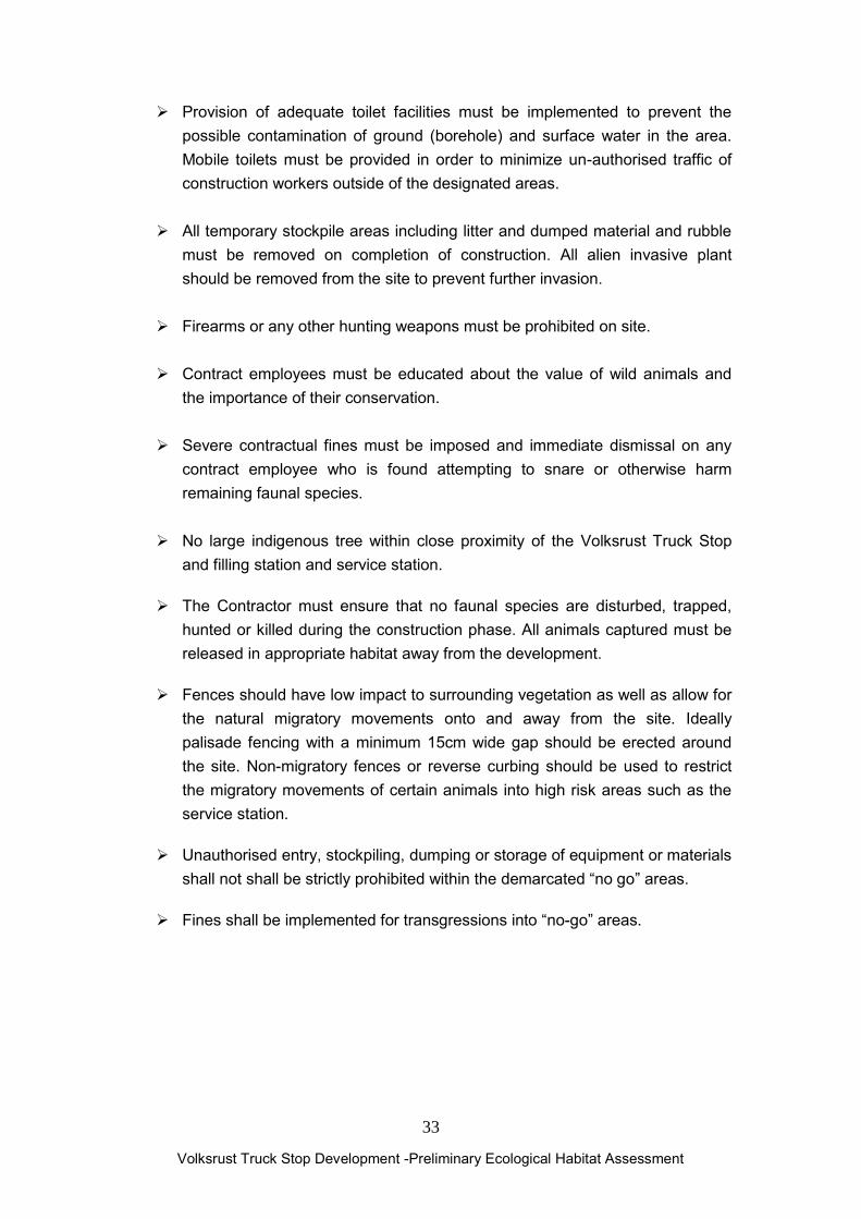
Provision of adequate toilet facilities must be implemented to prevent the possible contamination of ground (borehole) and surface water in the area. Mobile toilets must be provided in order to minimize un-authorised traffic of construction workers outside of the designated areas.
All temporary stockpile areas including litter and dumped material and rubble
must be removed on completion of construction. All alien invasive plant should be removed from the site to prevent further invasion.
Firearms or any other hunting weapons must be prohibited on site. Contract employees must be educated about the value of wild animals and
the importance of their conservation. Severe contractual fines must be imposed and immediate dismissal on any
contract employee who is found attempting to snare or otherwise harm remaining faunal species.
No large indigenous tree within close proximity of the Volksrust Truck Stop
and filling station and service station.
The Contractor must ensure that no faunal species are disturbed, trapped, hunted or killed during the construction phase. All animals captured must be released in appropriate habitat away from the development.
Fences should have low impact to surrounding vegetation as well as allow for the natural migratory movements onto and away from the site. Ideally palisade fencing with a minimum 15cm wide gap should be erected around the site. Non-migratory fences or reverse curbing should be used to restrict the migratory movements of certain animals into high risk areas such as the service station.
Unauthorised entry, stockpiling, dumping or storage of equipment or materials shall not shall be strictly prohibited within the demarcated “no go” areas.
Fines shall be implemented for transgressions into “no-go” areas.

Volksrust Truck Stop Development -Preliminary Ecological Habitat Assessment
34
5.2 CONSTRUCTION PHASE General
All construction activities should be strictly limited to the construction area. Vegetation clearance should be phased and restricted to the area under construction and not the entire site to prevent further soil erosion. It will also ensure that the remaining faunal can move into adjacent vegetated areas during the construction phase of the project.
Sufficient chemical toilets and waste bins must be provided in all areas where construction is taking place. These toilets and bins must furthermore be emptied regularly.
Sanitation facilities shall be located within 100m from any point of work. It is recommended that the construction programme preferably commence
during the dry winter months, when the risk of soil erosion is lowest. All earthworks shall be undertaken in such a manner so as to minimize the extent of any impacts.
Construction activities are to be restricted to business hours in order to limit disturbance of surrounding land owners in terms of inter alia noise.
All vehicles associated with the construction activities should be in a serviced condition to prevent oil leaks etc and the possible contamination of the adjacent wetlands to the south of the site.
Building of temporary access roads should be kept to a minimum to prevent unnecessary impact on the surrounding vegetation.
Reasonable speeds will be maintained at al times in order to prevent accidents, excessive noise and dust and road fatalities of migrating animals.
The temporary access roads and construction sites should be properly rehabilitated (ripped, re-vegetated etc.) after completion of construction
The Contractor shall take all reasonable measures to minimize the generation of dust as a result of construction activities.
Where possible, soil stockpiles shall be located in sheltered areas where they are not exposed to the erosive effects of the wind.
All exposed surfaces shall be re-vegetated or stabilized as soon as is practically possible.
Volksrust Truck Stop Development -Preliminary Ecological Habitat Assessment
35
5.3 SOILS Soil removed from the site is to be appropriately stored for later use in back-
filling. Sub-soil and topsoil (the top +/- 30-50 cm of the soil) should be stored separately.
Soil stockpiles are to be protected from possible erosion, e.g. through covering of the stockpiles with tarpaulin, and limiting the height and angle of the stockpile. Soil stockpiles should not exceed 2 m in height.
Soil stockpiling areas must be sufficiently situated away from the drainage areas.
Any erosion channels developed during the construction period or during the vegetation establishment period should be backfilled and compacted, and the areas restored to a proper condition. The Contractor should ensure that cleared areas are effectively stabilised to prevent and control erosion.
5.4 HORTICULTURAL ACTIVITIES Landscape architects, and the developer, have an opportunity to conserve certain faunal biodiversity present on the site and possibly increase the biodiversity of certain animal species (birds). Vegetation has been reported to be the single most important habitat component for all species of animals. Linked to this, is the preservation, maintenance and creation of tracts of natural and ornamental vegetation in all stages of ecological succession, interconnected by corridors or green belts for escape, foraging, breeding and exploratory movements. Landscaping projects are all too frequently characterized by exotic or indigenous (not to the area) trees, planted at the same time, at the same size and are spaced at regular centred settings. The resulting pattern and structure is one of limited vegetation diversity, trees of uniform size, even age stands and little or no under-story planting. Only a few species of animals (urban exploiters) will occupy these limited niches, leading to decreased faunal biodiversity.
Mitigation and recommendation
Gardens or landscaped areas around the proposed Volksrust Truck Stop and filling station and service station should be planted with indigenous (preferably using endemic or local species from the area) grasses, forbs, shrubs and trees, which are water wise and require minimal horticultural practices. A Re-vegetation and Rehabilitation Manual should be prepared for the use of contractors, landscape architects and groundsmen. Where herbicides are used to clear vegetation, specimen-specific chemicals should be applied to individual plants only. General spraying should be prohibited. All alien vegetation should be eradicated over a five-year period. Invasive species recorded in the immediate area included Eucalyptus grandis, Cirsium vulgare, Ipomoea purpurea, Ricinus communis,

Volksrust Truck Stop Development -Preliminary Ecological Habitat Assessment
36
Rubus cuneifolius, Solanum mauritianum. The Contractor shall remove all weeds and alien vegetation during the construction phase. The use of topsoil for rehabilitation, contaminated with the seed of alien vegetation, will not be permitted unless a program to germinate the seed and eradicate the seedlings is implemented.
Where the removal of alien tree species may leave spoil exposed, alternative indigenous species should be established before eradication takes place. The attention of property owner must be drawn to the most recent Declared Weeds List (2001) in the Conservation of Agricultural Resources Act 43 of 1983 and the associated penalties and prohibitions. Horticultural activities such as fertilisers, herbicide and pesticide runoff, increase in alien vegetation and weedy species, dumping of refuge and building material must be strictly managed and be environmentally sensitive and should meet the following requirements:
Limited to building environs and limited areas of proposed Volksrust Truck Stop and filling station and service station development.
Limited irrigation by water-wise gardening (use local plants adapted to local conditions).
Strict fertiliser, pesticide and herbicide control (limited usage) Invertebrate pests on the site should be controlled in the following manner: The least environmentally damaging insecticides must be applied.
Pyrethroids and Phenylpyrazoles are preferable to Acetylcholines. Use insecticides that are specific to the pest (species specific) in question. The lowest effective dosages must be applied. The suppliers advice should always be sought. Do not irrigate for 24 hours after applying insecticides in areas where there is a chance of contaminating water-courses, fungal pathogens should be used in preference to chemical insecticides.
Reduction of weed and erosion by minimum tillage gardening practices (groundcovers and mulching better in all respects).
No dumping of any materials in undeveloped open areas and neighbouring properties. Activities in the surrounding open undeveloped areas must be strictly regulated and managed.

Volksrust Truck Stop Development -Preliminary Ecological Habitat Assessment
37
5.5 EROSION AND SURFACE RUNOFF Urban development is characterised by large areas of sealed surfaces such as roads, houses etc. Impermeable surface cover ranges from 15% to 60% of suburban areas to almost 100% in central business districts. Infiltration is considerable reduced with an increase in surface run-off. Run-off is generally discharged to surface water systems and often contains pollutants. Pollutants range from organic matter, including sediments, plant materials and sewage, to toxic substances such as heavy metals, oils and hydrocarbons. Construction activities associated with urban development can lead to massive short term erosion unless adequate measures are implemented to control surface run-off. Sheet erosion occurs when run-off surface water carries away successive thin layers of soil over large patches of bare earth. This type of erosion is most severe on sloping soils, which are weakly structured with low infiltration, which promotes rapid run-off. It occurs on the site where vegetation has been destroyed. Continual erosion in sheet-eroded slopes is a common cause of gully erosion. Gully erosion results from increased flow along a drainage line, especially where protective vegetation has been removed and soils are readily transported. A gully has steep, bare sides and is often narrow and deep. Once formed, a gully usually spreads upstream through continual slumping of soil at the gully head. Gully erosion can be associated with salting as the saline sub-soils are readily eroded. Mitigation and recommendations Vegetation plays a critical role in the hydrological cycle by influencing both the quantity and quality of surface run-off. It influences the quantity of run-off by intercepting rainfall, promoting infiltration and thus decreasing run-off. Vegetation can influence water quality in two ways: by binding soils thus protecting the surface layer, and by intercepting surface run-off thus buffering the adjacent wetland habitats against suspended and dissolved substances. When the speed of the run-off is reduced, suspended particles can settle out and dissolve substances, such as nutrients, can be assimilated by plants. The vegetation has a filtering effect. Storm-water and runoff from the Volksrust Truck Stop and filling station and service station development and car parks should be channelled towards a stormwatwer attenuation pond. Oil sumps and traps/filters should be installed and regularly maintained around the petrol pump area as well as in the truck parking areas
Volksrust Truck Stop Development -Preliminary Ecological Habitat Assessment
38
5.6 ARTIFICIAL LIGHTING Artificial lighting will most likely result in a moderate to high negative short, medium and long- term impact on all nocturnal animal species. Numerous species will be attracted towards the light sources and this will result in the disruption of natural cycles, such as the reproductive cycle and foraging behaviour. The lights may destabilise insect populations, which may alter the prey base, diet and ultimately the well-being of nocturnal insectivorous fauna. The lights may attract certain nocturnal species to the area, which would not normally occur there, leading to competition between sensitive and the more common species.
Mitigation and recommendations
During the construction phase, artificial lighting must be restricted to areas under construction and not directed towards the drainage furrow in order to minimize the potential negative effects of the lights on the natural nocturnal activities. Where lighting is required for safety or security reasons, this should be targeted at the areas requiring attention. Yellow sodium lights should be prescribed as they do not attract as many invertebrates (insects) at night and will not disturb the existing wildlife. Sodium lamps require a third less energy than conventional light bulbs.
5.7 RE-VEGETATION
Exposed areas especially adjacent to the proposed Volksrust Truck Stop and filling station and service station development should be rehabilitated with a grass mix that blends in with the surrounding vegetation. The grass mix should consist of indigenous grasses adapted to the local environmental conditions.
The use of the exotic invader Kikuyu Grass (Pennisetum clandestinum) is not recommended and should be prohibited. The use of an indigenous species such as Couch Grass Cynodon dactylon or Buffalo Turf Grass Stenotaphrum secundatum is recommended; it occurs naturally in the area as well as being non-invasive and requiring less water than exotic species.
The grass mix should consist of a mix of quick covering grasses (pioneer species), mat-forming grasses (e.g. Digitaria eriantha, Chloris gayana) and tufted grasses (e.g. Eragrostis curvula) to ensure prompt and adequate coverage of the exposed soil while long term stability of the grass sward is also achieved. Re-vegetated areas should be monitored every 3 months for the first 12 months and twice a year thereafter.
Re-vegetated areas showing inadequate surface coverage (less than 30% within 9 months after re-vegetation) should be prepared and re-vegetated from scratch.
Damage to re-vegetated areas should be repaired promptly.
Volksrust Truck Stop Development -Preliminary Ecological Habitat Assessment
39
Shaping of remaining and exposed soil profile to blend in with the gradients of the surrounding landscape.
Exotic weeds and invaders that might establish on the re-vegetated areas should be controlled to allow the grasses to properly establish.
Disturbed areas around the Volksrust Truck Stop and filling station and service station parking areas should be re-vegetated using a specified seed mix and/or appropriate indigenous grasses, forbs, shrubs or trees.
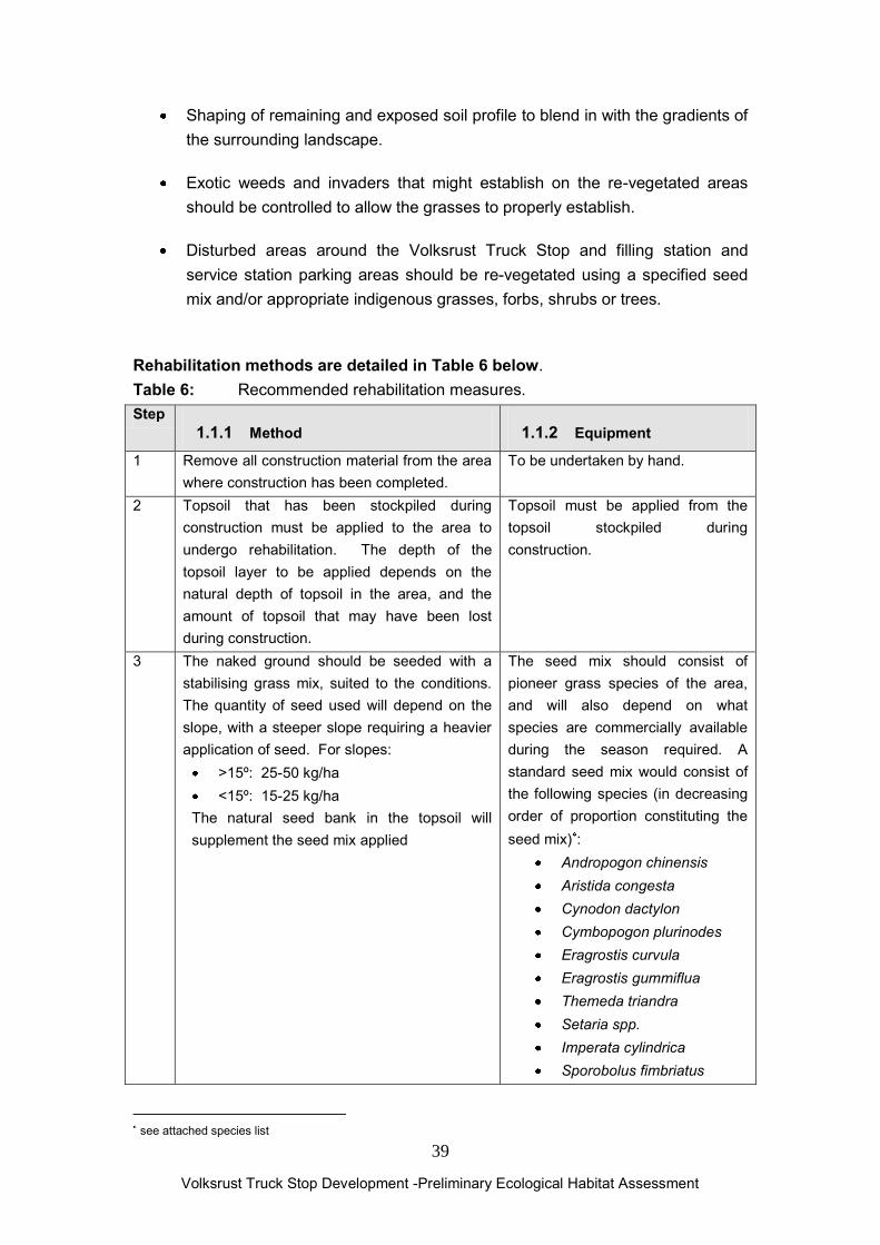
Rehabilitation methods are detailed in Table 6 below. Table 6: Recommended rehabilitation measures. Step
1.1.1 Method 1.1.2 Equipment
1 Remove all construction material from the area where construction has been completed.
To be undertaken by hand.
2 Topsoil that has been stockpiled during construction must be applied to the area to undergo rehabilitation. The depth of the topsoil layer to be applied depends on the natural depth of topsoil in the area, and the amount of topsoil that may have been lost during construction.
Topsoil must be applied from the topsoil stockpiled during construction.
3 The naked ground should be seeded with a stabilising grass mix, suited to the conditions. The quantity of seed used will depend on the slope, with a steeper slope requiring a heavier application of seed. For slopes:
>15º: 25-50 kg/ha <15º: 15-25 kg/ha
The natural seed bank in the topsoil will supplement the seed mix applied
The seed mix should consist of pioneer grass species of the area, and will also depend on what species are commercially available during the season required. A standard seed mix would consist of the following species (in decreasing order of proportion constituting the seed mix) :
Andropogon chinensis Aristida congesta Cynodon dactylon Cymbopogon plurinodes Eragrostis curvula Eragrostis gummiflua Themeda triandra Setaria spp. Imperata cylindrica Sporobolus fimbriatus
see attached species list

Volksrust Truck Stop Development -Preliminary Ecological Habitat Assessment
40
4 The areas which have been seeded must be
regularly watered directly after seeding until the grass cover becomes established. Watering is to be done in a manner that ensures that no erosion of the topsoil and seed mix takes place.
A hosepipe must be available on site.
5 If the grasses have not established after a period of two months after seeding, the areas should be reseeded. If necessary, another dressing of topsoil should be applied prior to seeding.
As above.
6 All alien vegetation is to be appropriately removed and disposed of. Alien species that have been encountered in the area included: Saligna Gum (Eucalytpus grandis), Syringa Melia azedarach, Scotch Thistle (Cirsium vulgare) Castor-Oil Plant (Ricinus communis), Lantana (Lantana camara) Bugweed (Solanum mauritianum), Morning Glory (Ipomoea purpurea)
Removal will to a large extent be done by hand. Saws may be necessary in certain cases and specific herbicides may be required (if used, the use of these must be strictly controlled)

Volksrust Truck Stop Development -Preliminary Ecological Habitat Assessment
41
6. REFERENCES ACOCKS, J.P.H. (1988). Veld Types of South Africa. Memoirs of the Botanical Survey of South Africa, No.57: 1-146. Botanical Research Institute, Pretoria.
BARNES, K.N. (ed.) (2000). The Escom Red Data Book of Birds of South Africa, Lesotho and Swaziland. Birdlife South Africa, Johannesburg.
BATES, M. F., BRANCH, W. R., BAUER, A. M., BURGER, M., MARAIS, J., ALEXANDER, G. J. & DE VILLIERS, M. S. (Eds). In Press. Atlas and Red List of the Reptiles of South Africa, Lesotho and Swaziland. SANBI Biodiversity Series. South African National Biodiversity Institute, Pretoria, South Africa. BOON, R. (2010). Pooley’s Trees of Eastern South Africa: A complete guide. Flora and Fauna Publications Trust. BRANCH, W.R. (1988). Field Guide to the Snakes and other Reptiles of Southern Africa. Struik Publishers, Cape Town. BRANCH, W.R. 2001. The conservation status of South Africa‟s threatened reptiles. In: Endangered Wildlife Trust. The State of South Africa’s Species: Proceedings of a Conference held at Rosebank Hotel in Johannesburg, 4-7 September 2001. BROMILOW, C. (2001). Problem Plants of South Africa. Briza Publications, Pretoria South Africa. CARRUTHERS, V.C. (2001). Frogs and Frogging in South Africa. Struik Publishers, Cape Town. DE GRAAF, G. (1981). The rodents of southern Africa. Butterworth Press, Pretoria. JACOBSEN, N.H.G., NEWBERY, R.E. & PETERSEN, W. 1990. On the ecology and conservation status of Cordylus giganteus A.Smith in the Transvaal. South African Journal of Zoology 25:1, 61-66. LOW, A.B. and REBELO, A.G. (1998). Vegetation of South Africa, Lesotho and Swaziland. D.E.A.&T., Pretoria. MINTER, L.R., BURGER, M., HARRISON, J.A., BRAAK, H.H, BISHOP, P.J, AND KLOEPFER, D. 2004. Atlas and Red Data Book of the frogs of South Africa, Lesotho and Swaziland. SI/MAB Series 9. Smithsonian Institution, Washington, DC.

Volksrust Truck Stop Development -Preliminary Ecological Habitat Assessment
42
MUCINA, L AND RUTHERFORD, M.C. (eds) 2006. The vegetation of South Africa, Lesotho and Swaziland. Strelitzia 19. SANBI, Pretoria. NEWBERY, R.E. 1992. Cordylus giganteus: relocation 8-10/12/92. Majuba ashing area. Chief Directorate of Nature & Environmental Conservation. NEWBERY, R.E., RAUCH, C. & WEST, S. 1992. Cordylus giganteus: relocation 21-26/4/92. RandMines – Majuba. Chief Directorate of Nature & Environmental Conservation. PASSMORE, N.I. and CARRUTHERS, V.C. (1995). Frogs of South Africa. A Complete Guide. Wits University Press, Witwatersrand. ROBERTS, A. (1951). The mammals of South Africa. Central News Agency, Cape Town. SIEGFIED, W.R. (1989). Preservation of species in southern African nature reserves. In: Huntley, B.J. (Ed). Biotic Diversity in Southern Africa, 186-201. Cape Town: Oxford University Press. SKINNER, J.D. and SMITHERS, R.H.N. (1990). The Mammals of the Southern African Subregion. University of Pretoria, Pretoria. SKINNER, J.D., and CHIMIMBA, C.T. (2005). The Mammals of the Southern African Subregion 3rd ed. Cambridge University Press. SKINNER, J.D. and SMITHERS, R.H.N. (1990). The Mammals of the Southern African Subregion. University of Pretoria, Pretoria.
SMITHERS, R.H.N. (1986). South African Red Data Book-Terrestrial Mammals. South African National Scientific Programmes Report No.125: 1-214.
VAN WYK, J.H. 1988. Sungazer or giant girdled lizard Cordylus giganteus: species account. Pp. 77-80, in BRANCH, W.R. (ed.), South African Red Data Book –Reptiles and Amphibians. S. Afr. Nat. Sci. Prog. Rpt. 151. Foundation for Research Develop-ment, CSIR, Pretoria. VAN WYK, J.H. 1991. Biennial reproduction in the female viviparous lizard Cordylus giganteus. Amphibia-Reptilia 12, 329-342.

Volksrust Truck Stop Development -Preliminary Ecological Habitat Assessment
43
VAN WYK, J.H. 1992. Life history and physiological ecology of the lizard, Cordylus giganteus. Phd thesis. University of Cape Town. VAN WYK, J.H. 1994. Physiological changes during the female reproductive cycle of the viviparous lizard, Cordylus giganteus (Sauria: Cordylidae). Herpetologica 50: 480-493. VAN WYK, J.H. 2000. Seasonal variation in stomach contents and diet composition in the large girdled lizard, Cordylus giganteus (Reptilia: Cordylidae) in the Highveld grasslands of the north-eastern Free State, South Africa. African Zoology 35:1, 9-27.

Volksrust Truck Stop Development -Preliminary Ecological Habitat Assessment
44
8. APPENDIX Table7. Grass species list for rehabilitation (ideally grass species endemic to the area should be used)
Alloteropsis semialata ssp. eckloniana Alloteropsis semialata ssp. semialata Andropogon appendiculatus Andropogon chinensis Anthephora pubescens Aristida adscensionis Aristida canescens ssp. Canescens Aristida congesta ssp. Congesta Aristida diffusa ssp. Burkei Aristida scabrivalvis ssp. scabrivalvis Aristida transvaalensis Arundinella nepalensis Avena sp. Bewsia biflora Brachiaria brizantha Brachiaria eruciformis Brachiaria serrata Bromus leptoclados Bromus sp. Cenchrus ciliaris Cymbopogon caesius Cymbopogon pospischilii Cyperus esculentus Digitaria debilis Digitaria diagonalis var. diagonalis Digitaria eriantha Digitaria monodactyla Digitaria sp. Digitaria ternate Digitaria tricholaenoides Diheteropogon amplectens var. amplectens Ehrharta erecta var. erecta Elionurus muticus Enneapogon cenchroides Enneapogon scoparius Eragrostis chloromelas Eragrostis curvula

Volksrust Truck Stop Development -Preliminary Ecological Habitat Assessment
45
Eragrostis planiculmis Eragrostis racemosa Eragrostis sp. Eustachys paspaloides Helictotrichon turgidulum (Stapf) Schweick. Hemarthria altissima Heteropogon contortus. Hyparrhenia anamesa Hyparrhenia cymbaria Hyparrhenia filipendula var. pilosa Hyparrhenia hirta Hyparrhenia quarrei Hyparrhenia tamba Imperata cylindrical Koeleria capensis Leersia hexandra Lolium multiflorum Lolium temulentum Loudetia simplex Melinis nerviglumis Melinis repens ssp. Repens Monocymbium ceresiiforme Panicum maximum Panicum miliaceum Panicum natalense. Paspalum dilatatum Paspalum notatum Paspalum scrobiculatum Pennisetum thunbergii Pennisetum villosum Perotis sp. Poa annua Poa pratensis Pogonarthria sp. Potamogeton pusillus Schizachyrium sanguineum Setaria lindenbergiana Setaria megaphylla Setaria nigrirostris Setaria sp. Setaria sphacelata var. sphacelata Setaria sphacelata var. torta

Volksrust Truck Stop Development -Preliminary Ecological Habitat Assessment
46
Sorghum bicolor ssp. Arundinaceum Sorghum halepense Sorghum versicolor Sporobolus africanus Sporobolus discosporus Sporobolus fimbriatus Sporobolus natalensis Sporobolus nitens Sporobolus sp. Sporobolus stapfianus Stipagrostis uniplumis var. neesii Stipagrostis zeyheri ssp. Sericans Themeda triandra Forssk. Trachypogon spicatus Tragus berteronianus Triraphis andropogonoides Tristachya rehmannii Typha capensis Urelytrum agropyroides Urochloa mosambicensis Urochloa panicoides P.Beauv.

Volksrust Truck Stop Development -Preliminary Ecological Habitat Assessment
47
Table8. Suggested indigenous trees for rehabilitation and horticultural activities around the Truck Stop development (species indigenous to the area are indicated with an . It is strongly recommended that only these are planted as far as possible)
Botanical Name Common Name Acacia karroo Sweet Thorn Acacia natalitia Pale-bark Sweet Thorn Acacia caffra Common Hook Thorn Acacia robusta Robust Acacia Acacia tortilis Umbrella Thorn Apodytes dimidiate White Pear Calodendron capense Cape Chestnut Celtis africana White stinkwood Combretum erythrophylum River Bushwillow Cussonia paniculata Highveld cabbage Diospyros lycoides Blue bush Dombeya rotundifolia Wild pear Ekenbergia capensis Cape ash Erythrina lysistemon Corral Tree Ficus natalensis Natal Fig Ficus sycomorus Sycamore fig Grewia occidentalis Cross berry Gymnosporia buxifolia Common Spikw-Thorn Halleria lucida Tree fuschia Harpephyllum caffrum Wild plum Kiggelaria africana Wild peach Leucosidea serricea Ouhout Olea europaea subsp. africana Wild olive Pappea capenis Jacket plum Pittosporum viridiflorum Cheesewood Podocarpus henkelli Henkell‟s yellowwood Pterocarpus rotundifolius Round leaved kiaat Searsia/Rhus chiridensis Red Currant Searsia/Rhus prinoides Dogwood Searsia/Rhus leptodictya Mountain karee Searsia/Rhus lancea Karee Searsia/Rhus pyroides Common wild currant Salix mucronata Safsaf willow Scotia brachypetala Weeping boer-bean Syzigium cordatum Water berry Trichilia emetica Natal mahogany

Volksrust Truck Stop Development -Preliminary Ecological Habitat Assessment
48
Vepris lanceolata White ironwood Ziziphus mucronata Buffalo thorn
Table9. Indigenous shrub species marked with should be used for re-vegetation and horticultural activities around the Volksrust Truck Stop and filling station site.
Botanical Name Common Name
Aloe arborescens Aloe greatheadii Aloe marlothii Bauhinia species Pride-of de-Kaap Buddleja salinga False olive Buddleja salvifolia Sagewood Burchellia bubaline Wild pomegranate Carissa macrocarpa Bird num-num Dietes species Wild iris Dovyalis caffra Kei apple Ehretia rigida Puzzle bush Erica species Heaths Euryops species Golden daisies Felicia species Wild daisy Grewia flava Wild currant Helichrysum kraussii Everlastings Leonotis leonorus Wild dagga Leucospernum species Pincushions Mackaya bella Forest bell bush Pavetta lanceolata Forest‟s pride bush Plectranthus species Spur flowers Plumbago auriculata Cape leadwort Protea caffra Sugarbush Psychotria capensis Black birdberry Rhamnus prinoides Dogwood Strelitzia nicolai Strelitzea reginae Crane flower Tecoma capensis Cape honeysuckle Thunbergia natalensis Natal bluebell