prince william sound area plan -...
TRANSCRIPT

PRINCE WILLIAM SOUND AREA PLAN
Land OwnershipFederal Land
Native, Municipal,Private or University Land
State Land(See proposed Land Use Designations below)
State land includes state-owned and selected landand landproposed for selection. The state owns al-most all tkjelands and submerged lands in PrinceWilliam Sound.
The map shows land ownership in the Prince Wil-liam Sound planning area. Most parcels that aresmaller than 640 acres do not show on this map.For more detailed information, see the officialstatus plats at the Alaska Department of NaturalResources and federal Bureau of Land Manage-ment
Proposed Land Use Designations
This map shows generalized land use designations. Only the primary surface designations areshown. The primary uses are not the only uses that will be permitted: most lands retained in stateownership are multiple use areas where a variety of other uses, including mining, are allowed.
The map includes designations for land selected by both the state and Native corporationsThese land use designations apply if the land is conveyed to the stale. The plan does not apply toprivate or federal land.
State tidefands not showing a designation are designated general use areas. Here, uses areallowed if they conform to the management intent and guidelines of the plan. See the plan formanagement intent information.
Settlement Areas1. Billings Cove2. Poe Bay7. Esther Bay {potential)10. Robe Lake West11. Wortmanns Creek12. Brown's Creek13. Shipyard Bay15. Bos we 11 Bay17. Flag Point (comm./ind. lease)18. Bering River Rd. Jet. (comm./ind.)19. Katalta (comm./lnd.)
Settlement/Public Recreation3. Head ol Passage Canal4. Shotgun Cove and vicinity14. Heney Creek
Public Recreation/Habitat andHarvest
jn| Existing State Marine Park
ir~1i Proposed State Marine Park
H Proposed Site for CommercialRecreation Facilities
Shoreline Development/PublicRecreation/Habitat and Harvest
Mining/Public Recreation
Forestry/Public Recreation/Habitatand Harvest
(I) Possible Log -Transfer Site(M) Possible Mineral - Transfer Site
Resource Management, High Value
Resource Management, Low Value
Transportation
Areas Closed to New Mineral EntryMost state lands are open to new mineral entry. Portions of 27streams and 143 estuaries and tidelands next to four fishhatcheries will be closed to new mineral entry to protect themost productive state-owned stream and estuarine salmonhabitats. Most of the areas to be closed are too small to beshown on this map. See the plan for a map and listing of areasto be closed. A map showing the mineral closures is on displayat the Department of Natural Resources public information officein Anchorage.
June 19885 0 5 ; miles
scale e
PRINCE WILLIAMSOUND AREA PLANFOR STATE LANDS
SUMMARY OF LAND MANAGEMENT
June 1988 NATURALRESOURCES
WHAT IS THE PRINCE WILLIAMSOUND AREA PLAN?State lands in Prince William Sound can be used for recreation,fish and wildlife, places to live, access for mineral and timberdevelopment, and mariculture. Although some uses conflict witheach other, many uses can occur in the planning area, providedthe uses are carefully managed.
To decide how state land should be managed, the Alaska Depart-ment of Natural Resources (DNR) prepared a land use plan forstate lands. The plan identifies areas for sale and establishesguidelines fnr managing state lancU and tidelands for the next 20years. Some of the state-selected land is also selected by Nativecorporations and may not become state land. The plan will applyonly to the use of land the state eventually owns.
The plan does not direct the use of federal, Native, or privatelands; nor does it change fish and game regulations.
LAND OWNERSHIPMost uplands in the planning area are within Chugach NationalForest and are managed by the U.S. Forest Service, or are privatelands managed by Native corporations. The state owns ap-proximately 984,000 acres of uplands. Most of this land is locatedin the Chugach Mountains, some is found along the coast. Thestate also owns all submerged lands three miles seaward and alltidelands. There are four million acres of state-owned tidelandsand submerged lands.
MEAN HIGH TIDE
MEAN LOW TIDE
SUBMERGED LANDSTIDELANDS
:UPLANDS-0°
Tidelands include the land between mean high ride and mean lowtide. Submerged lands are seaward of mean low tide. In this plan,the word "tidelands" is used to include both tidelands and submergedlands.
RecreationState tidelands adjacent to proposed U.S. Forest Service wilder-ness areas will be managed for recreation, fish and wildlife habitatand harvest, and wilderness values. These areas include CollegeFiord, Blackstone Bay, Cochrane Bay, Culross Passage, Port Nel-lie Juan, Icy Bay, and Port Bainbridge. Recreation is a primaryuse in other areas including commonly used fishing and wildlifeharvest sites and frequently used recreation areas. Except for set-tlement areas, recreation is a primary use for most coastal stateuplands in the planning area. The plan contains guidelines toprotect me capacity and natural appearance of most anchoragesand regionally important campsites, and to provide design andsiting cr,teria for recreation facilities.
Commercial Recreation Facilities. Commercial recreationfacilities are concentrated along commonly used recreationroutes, so that most of the Sound will retain its current naturalqualities. These facilities may be located along the Whittier toValdez Marine Route, the Whittier to Seward Marine Route,and in o:her areas where existing recreation and fish and wildlifeharvest uses are not displaced. Floatlodges and similar facilitiesare prohibited from state lands adjacent to U.S. Forest Serviceproposed wilderness areas, and on most of Hinchinbrook Islandbecause they would be incompatible with existing public use andfederal management for these lands. Public notice of a proposedpermit cr lease for commercial recreation facilities will he sent toaffected parties.
Public Recreation Facilities. Public recreation facilities suchas public use cabins, cleared tent sites, and mooring buoys areappropriate on state uplands within Passage Canal, SurpriseCove, Siwash Bay, Shoup Bay, Bosweil Bay, Canoe Passage, nearcommercial recreation facilities, and near or within state settle-ment areas.
Proposed Legislative DesignationsMarine Parks. Nine locations are recommended for considera-tion by the legislature for designation as state marine parks.These areas have outstanding scenic and recreation values, andgenerall-/ receive a high level of public use. In some cases, activerecreation management is also required.
Potent al Marine ParksMap No. Name________Location Acreage
5.........................Decision Pt........................Passage Canal.....................4606.........................Entry Cove.........................Passage Canal.....................3708........................Granite Bay.......................Port Wells ........................2,0159........................Jack Bay North..................No. Valdez Arm.................81115.......................Boswel] Bay .......................Hinchinbrook Is.................79916.......................Canoe Passage ..................Hawkins Is....................... 1,45520......................Kayak Island ......................Katalla ..............................1,42721......................Safety Cove........................Day Harbor ........................66022.......................Driftwood Bay...................Day Harbor ........................840
TOTAL.......................................................................................9^37 acres
The marine park number corresponds to the number on thebrochure map.By referring to the map, you can find the location of the proposed park.
Other. The plan also recommends legislative consideration ofthe Thompson Pass - Keystone Canyon area because of the area'sspectacular alpine scenery and frequent recreation use. Thisrecommendation was also made in the Copper River Basin AreaPlan.
The area surrounding Lake George is recommended to be con-sidered for addition to Chugach State Park because of its uniquescenic, geologic, and glacial features. This addition was recom-mended by the 1981 Chugach State Park Master Plan. Finally.the Mount Eccles - Heney Creek area near Cordova is recom-mended for legislative designation to support the recreation andtourism needs of the City of Cordova. The exact type of legisla-tive designation, whether park or other category, will be deter-mined in coordination with the City.
Cultural and Historic ResourcesAll DNR authorizations of land use activities are reviewed by theOffice cf History and Archaeology (within DNR). The Officedetermines if there may be an adverse effect on cultural resour-ces and makes recommendations to mitigate those effects.Guidelines in the plan also give direction for cultural resourcesurveys; review of authorizations; and cooperation with otheragencies, Native Corporations, nonprofit groups, and individuals.
Land Disposals
Policies and guidelines for the management of each resource are summarized in the following sec-tions. The map on the other side of this brochure shows the land use designations for state lands.
Subsurface ResourcesThe Prince William Sound Area Plan determines what state landwill be offered for private ownership over the next 20 years. Inaddition, the plan establishes guidelines to protect sensitivehabitats and scenic features, reserve recreation resources withinsettlement areas, and ensure adequate public access, especiallyto tidelands and stream corridors.
Residential settlement is concentrated near Valdez, Cordova,and Whittier. This provides enough land for settlement while al-lowing most of the Sound to remain in its natural state. Allresidential settlement areas included in the plan meet criteria thataddress the quality of land, accessibility, ownership, potentialconflicts with other uses, and public support.
Fourteen settlement areas totalling over 1,970 acres will be of-fered for sale or lease over the next twenty years. Also, there area few small parcels of state land surrounded by private land nearthe developed areas of Valdez and Cordova. These small parcelsmay be offered for sale if compatible with adjacent land uses.They are not shown in the table below.
Esther Bay is designated resource management in the plan. Ifafter other settlement areas have been offered there is a need foradditional settlement in western Prince William Sound, EstherBay can be offered for sale. Interim management will notforeclose potential use for either a land sale or public recreation.
Some state land at Shotgun Cove (including Neptune Point) maybe appropriate for settlement. If so, land offerings will be coor-dinated with proposed municipal and private development there.Similarly, state land at Heney Creek near Cordova and Poe Bayin Passage Canal will be coordinated with the adjacent landowner, the University of Alaska.
State land at Katalla, Flag Point, and Bering River Road Junctionis reserved for commercial or industrial settlement. At Katalla,land may be used for port development as required to supportnearby resource development projects. At the road junction,state land is reserved for commercial development related to thetwo roads.
Settlement Areas Net Acreage
1. Billings Cove..................................................................................5002. Poe Bay**.................................................................................... *3. Head of Passage Canal........................................-...-.-—.............. "4. Shotgun Cove & vicinity.................................................................. *7. Esther Bay........................................... *(possible settlement area)10. Robe Lake West..........................................................................25011. Wortmanns Creek ........................................................................12012. Brown's Creek.......................—...................................................30013. Shipyard Bay .................................................................................40014. Heney Creek** ................................—............................. ..............*15. Boswell Bay ................................................................................. .40017. Flag Point (commercial/industrial lease).......................—............ *18. Bering River Rd. Jcln. (commercial/industrial) .......................... *19. Katalla (commercial/industrial)........-...............———.................. *
SUBTOTAL............................................ Approximately 1,970 acres
'Net acreage undetermined. See final plan."Most of Poe Bay and Heney Cree/c are managed by the University ofAlaska. Thestateis the minoritylandownerinthcse areas. State land saleswill be coordinated with University land management.
Remote Cabins, Trapping Cabins, and Floathomes. Becausethe state owns only a limited amount of uplands and there is sig-nificant competition for its use, the state will not issue remotecabin or trapping cabin permits within the Prince William Soundplanning area. Floathomes are allowed only within the municipalboundaries of Cordova, Whittier, and Valdez because of conflictswith existing public uses and strong objections by the uplandowners. Within these municipalities, fioathomes must be sitedaccording to the regulations of the municipality, where public ser-vices and facilities can be efficiently extended, and where consis-tent with the fish and wildlife and other guidelines of the plan.
MaricultureEach type of mariculture has its own set of environmental andprocessing requirements and creates its own unique impacts,problems, and opportunities. Because of the difficulty in identify-ing areas suitable for the variety of mariculture types, the plandoes not designate areas for mariculture. Rather, the plan indi-cates the management intent for each area. Mariculture is al-lowed on state tidelands if it can be made consistent with themanagement intent of that area. In this way, mariculture is al-lowed in most of Prince William Sound, though it sometimes mustmeet strict guidelines.
Approximately 94%, or 1.4 million acres, of state lands are opento mineral entry. While a few active mining operations exist onstate lands, most known economically valuable subsurface resour-ces are located on private or federal land. Approximately 42,000acres of uplands in the Day Harbor area previously closed tomineral entry are re-opened. The area re-opened does not in-clude land staked for settlement under the Blying Sound remotedisposal program.
Approximately 17,900 acres of uplands and 70,800 acres oftidelands are closed to new mineral entry. Upland mineralclosures include 4,100 acres of the most important salmonhabitats in state-owned streams, and 13,800 acres in settlementareas, to be closed prior to sale. Tideland closures encompass themost important salmon habitats in 143 estuaries and adjacent toexisting fish hatcheries, in the Copper River Delta State CriticalHabitat Area, and in Shotgun Cove. Mineral closures do not af-fect valid existing claims, nor apply to private or federal lands.
Mineral Transfer Sites. Access across state-owned tidelandsfor mineral transfer sites is protected at five locations where min-ing exploration on private or federal land is likely to occur: PoeBay, Granite Mine, Drier Bay, Cliff Mine, and Katalla.
Additional transfer facilities may be sited at other locations onstate land where needed and consistent with the plan.
Oil & Gas. All state uplands, tidelands, and submerged lands areavailable for oil and gas exploration. The plan defers any deci-sions concerning leasing for oil and gas to DNR's Five-Year Oiland Gas Leasing Program. No areas in Prince William Sound arecurrently proposed for lease.
Leases for other leasable subsurface resources such as coal willbe offered on a case-by-case basis consistent with the manage-ment intent and guidelines of the unit.
Fish and Wildlife___________The most important habitat and harvest areas will be retained inpublic ownership and managed to mainla in fish and wildlifeproduction and related public uses.
Fish and wildlife habitat and harvest are identified as a primaryuse of state tidelands adjacent to the U.S. Forest Serviceproposed wilderness areas, in important fishing and harvestareas, and in other sensitive habitats. In areas identified for landofferings, buffers are required along streams and wetlands toprotect fish and wildlife resources and public use.
To protect important salmon spawning habitat, certain streamsand estuaries will be closed to new mineral entry. In other areas,permit stipulations will be used to protect species and habitatproductivity. Mineral closures do not apply to valid existingclaims.
The plan contains guidelines to protect the continued commer-cial fishing use of set-net, gill-net, purse-seine and herring har-vest areas; and hatchery harvest areas. The plan does not changefish and game regulations that govern commercial fishing or otherharvest activities.
ForestryForestry on State Uplands. Almost all the high value forestresources in Prince William Sound are located on private land orland managed by the U.S. Forest Service. The state owns onehigh-value forest area, about 7,700 acres, which will be a long-term source of timber resources for the commercial forest in-dustry.
Small commercial and personal-use timber sales are allowed onstate lands near communities and within land disposal areas tosupply local needs for firewood, houselogs and other products.
Log Transfer Sites. Harvests on U.S. Forest Service and privatelands require state tidelands for log-transfer sites. Opportunitiesto site fu ture log-transfer facilities on state tidelands areprotected at the locations shown on the summary map: on KnightIsland (Eastern Drier, Marsha, and Lower Herring Bays); in PortFidalgo (Two Moon Bay, Snug Harbor, and Landlocked Bay); inPort Gravina (St. Matthews and Olson Bays); on Montague Is-land (MacLeod Harbor and Box Point); and near Katalla (Katal-la and Okalee Spit).
Additional sites will be required adjacent to private land betweenTatitlek and Cordova, along the northern shore of Hawkins Is-land, and adjacent to federal land on north Montague Island(most likely in Rocky or Zaikof Bays). These and other log trans-fer facilities will be sited where consistent with the plan.
HOW WAS THE PLAN DEVELOPED?DNR began working on this plan in 1985. In that year, publicmeetings were held to learn about important issues in the PrinceWilliam Sound and to gather ideas on how state lands should bemanaged. Data on each resource type was inventoried andmapped. From all this information, the Prince William Soundplanning team developed alternative uses for state lands. Theplanning team consisted of representatives from state agenciesand the U.S. Forest Service. These alternatives were reviewed atpublic meetings held in 1986 in each of the Sound's communitiesand in Anchorage. Based on comments from these meetings anda public survey also conducted in 1986, the planning teamdeveloped proposals for a draft plan. The draft plan was reviewedin another round of public meetings in November 1987 andJanuary 1988. The resulting comments were used to make finalchanges to the plan. The plan was adopted by the Commissionersof Natural Resources and Fish and Game in June of 1988.
HOW THE PLAN IS MODIFIEDThe plan must be flexible to respond to changes in information,technology, economics, and public opinion. After the plan isadopted, it may be amended upon approval by the Commissionerof DNR, with public review and consultation with affected agen-cies. The plan will be reviewed approximately every five years tosee if it needs to be updated.
Minor changes to the plan, such as clarifications or corrections,do not require public review. Special exceptions to the plan arealso possible, in cases where it is impossible or impractical to com-ply with the plan, and when an alternative course of action canmeet the plan's purpose.
SELECTIONS ANDRELINQUISHMENTS__________Selections. The state can choose more land for stale ownershipfrom federal lands. The plan nominated 37 parcels total l ing 7,867acres from the Chugach National Forest. Most of the selectionsare within 25 miles of an existing community in the Sound. Theselection recommendations are prioritized and will be comparedwith recommendations in other regions of the state.
Relinquishments. The plan recommends relinquishing pre-viously made selections: 22,240 acres in 21 parcels. These par-cels are either ineligible for selection or can be managed as wellby the U.S. Forest Service.
WHERE TO GET A COPY OF THEPLAN__________________Copies of the complete plan have been sent to municipal offices,libraries, village councils, and interest groups in the Prince Wil-liam Sound area. Additional copies can be purchased for $5.00 atthe following address:
Alaska Dept. of Natural ResourcesResource Allocation SectionP.O. Box 107005Anchorage, Alaska 99510.
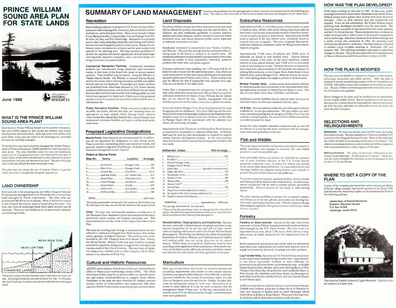
JThe church at Tatitlek, in front of Copper Mountain. Tatitlek is nearthe entrance to Valdez Ann.