property rights, restrictions and responsibilities - a ... · property rights, restrictions and...
TRANSCRIPT

1
Property Rights, Restrictions and Responsibilities- A Global Land Management Perspective
Prof. Stig Enemark
President Aalborg University, Denmark
QUEBEC 2007 INTERNATIONAL GEOCONFERENCEQUEBEC, CANADA, 2 - 5 OCTOBER 2007
Greetings from Denmark
43,000 sq km
5 mill inhabitants
One third lives inthe capital area
Flat country70 % agriculture10 % urban
7000 km coastline
Copenhagen
Aalborg
Wonderful CopenhagenGreetings from the Home Base
Aalborg – my home town
32

2
32 32
32 32
You do not own land itself, but the right to use the land - in conformity with community laws, practices and expectations
Responsibilities:Cultural traditions and conditions
Rights: Tenure positions
Restrictions:Land use options
Interests in land
• Property Rights- Are concerned with ownership and tenure- Are normally available in the Land Registry
• Property Restrictions - Are concerned with controlling use and activities on land- Are normally available through planning documents
or general land use provisions
• Property Responsibilities- Relate a more social, ethical commitment or attitude to
environmental sustainability and good husbandry.- The human kind to land relationship is dynamic.
The RRR´s

3
Land Registration Systems around the World
Deeds System (French): A register of owners; the transaction is recorded – not the title.Title System (German, English, Torrens): A register of properties; the title is recorded and guarantied.
Language Zones and Geographic Regions in Africa
Source: Lincoln Institute of Land Policy, Land Lines, April 2007
A worldwide Comparison of Cadastral Systems
www.cadastraltemplate.org
www.cadstraltemplate.org
• Rights to land also include the rights of use, however:
- The right of use is limited through public land use planning regulationsand restrictions, sectoral land use provisions, and private land useregulations
- Many land use rights are in fact restrictions that control the future use of land. The number and kind of land use restrictions is huge.
- Land Use restrictions will normally not appear in the Land registry,may available through planning documents and general land useprovisions
Land Use Restrictions
• The free market approach (current debate in the US)- Land owners should be obligated to no one and should have complete
domain over their land. - The role og government to take over, restrict, or even regulate its use
should be non-existent or highly limited. - Planning restrictions should only be imposed after compensation
for lost land development opportunities
• The central planning approach (European perspective)- The role of democratic government include planning and regulating
land systematically for public good purposes. - A move from every kind of land use being allowed unless it was
forbidden to every change of land use is forbidden unless it is permitted and consistent with adopted planning regulations and restrictions.
Property Restrictions- two conflicting approaches Integrated land-use management

4
Responsibilities:A cultural map of the world
Uncertainty avoidance:The preference of structured situations over unstructured or flexible ones
Power distance:The degree of inequality among people accepted by the population
Geert Hofstede (2001).
Understanding the Land Management Paradigm
Land Management includes all activities associated with the management of land and natural resources that are required to fulfill political objectives and achieve sustainable development.
Services toBusiness &
Citizens
Services toBusiness &
Citizens
Country ContextInstitutional Arrangements
Capacity BuildingEducation & Research
Country ContextInstitutional Arrangements
Capacity BuildingEducation & Research
FacilitatingSustainable Development
Economic, Social, Environmental, GovernanceEnhancing Quality of Life
FacilitatingSustainable Development
Economic, Social, Environmental, GovernanceEnhancing Quality of Life
Land PolicyFrameworkLand PolicyFramework
Spatially EnabledSpatially EnabledLand AdministrationLand Administration
Land Tenure, Land Value, Land Use, Land Development
A Land Management VisionSpatially Enabled Government
Spatially enabled government is achieved when governments use place as the key means of organising their activities in addition to information, and when location and spatial information are available to citizens and businesses to encourage creativity.
Centre for Spatial Data Infrastructure and Land AdministrationDepartment of Geomatics, University of Melbourne, 2006.
emergency response, taxation assessment, environmental monitoring and conservation, economic planning and assessment, social services planning, infrastructure planning, etc, etc
Sustainability: balancing social, economic and environmental needs while being responsive to the present and future needs of society.
Subsidiarity: allocation of authority at the closest appropriate level consistent with efficient and cost-effective services
Equity: Women and men must participate as equals in all decision making,priority setting, and resource allocation processes
Efficiency: Public services and local economic development must be financially sound and cost-effective.
Transparency and Accountablity: Decisions taken and their enforcement follows rules and regulations. Information must be freely available and directly accessible.
Civic Engagement and Citizenship: Citizens must be empowered to participate effectively in decision-making processes.
Security: All stakeholders must strive for prevention of crime and disasters. Security alsoimplies freedom from persecution, forced evictions and provision of land tenure security.
Good Governance
Adapted from UN-Habitat 2002
All kind of government includes a spatial component
It is about designing and implementing a suitable IT-architecture (Service Oriented IT Architecturefor organising spatial information that can improve the communication between administrativesystems and also establish more reliable data due to the use of the original data instead of copiesSpatial enablement offers opportunities for visualisation, scalability, and user functionalities.
Attachment of information to images of the parcel and propertyIdentification of “the place” in ways that are understandable by non-technical people (Google Earth)Capacity of businesses and citizens to manipulate the information through service oriented IT- architecture. Integration of government information systems Provision of seamless information to institutions and governmentUltimately managing information through spatially enabled systems rather than databases.
Spatial Enablement

5
Institutional Challenges
• There are a range of stakeholder interests This includes Ministries/Departments such as:Justice; Taxation; Planning; Environment; Transport;Agriculture; Housing; Interior (regional and local authorities); Utilities; and civil society interests such as businesses and citizens.
• Creating awareness of the benefits of developing a shared platform for Integrated Land Information Management takes time and patience.
• Mapping/Cadastral Agencies have a key role to play
Western Australia: Integrated Land Information Management
Spatially Enabled Government
A spatially enabled government organises its business and processes around “place” based technologies, as distinct from using maps, visuals, and web-enablement.
The technical core of Spatially Enabling Governmentis the spatially enabled cadastre.
The role of FIG
What is the role of in this regard?
101 FIG Member Associations from 85 Countries20 affiliates, 15 corresponding, 85 academic, 35 corporate members
Full member
Affiliate
Correspondent
Annual General Assembly101member associations (85 countries)
CouncilPresident and 4 Vice-Presidents
FIG OfficeDirector
Office ManagerAssistant
Com1Practice Com2
Education
Com3Spat.Inf.Man Com4
Hydrography
Com5Posit.&Map Com6
Eng.Surveys
Com7Cad&LandMan.Com8
Spat.Plan.&Dev.
Com9Valuation Com10
Quantity Surv..
Chairman, vice-chairs, national delegates, work plan, working groups, seminars etc
Organizational Structure
ACCOAdvisory Committee
of Commission Officers
www.FIG.net

6
• Professional Development- Global forum for professional discussions and interactions- Conferences, symposia, commission working groups, …..
• Institutional Development - Institutional support for educational and professionaldevelopment at national and international level
• Global Development- Cooperation with international NGO´s such as the UN agencies, World Bank, and sister organisations
- Joint activities and common policy-making to reduce poverty and enforce sustainable development
The Role of FIG FIG publications
WWW.FIG.NET
The role of FIG
Is strongly committed to the MDGs and the UN-Habitat agenda on the GLTN
The UN Millennium Development Goals
Goal 1: Eradicate extreme poverty and hunger Goal 1: Eradicate extreme poverty and hunger Goal 2: Achieve universal primary education Goal 2: Achieve universal primary education Goal 3: Promote gender equality and empower women Goal 3: Promote gender equality and empower women Goal 4: Reduce child mortality Goal 4: Reduce child mortality Goal 5: Improve maternal health Goal 5: Improve maternal health Goal 6: Combat HIV/AIDS, malaria and other diseases Goal 6: Combat HIV/AIDS, malaria and other diseases Goal 7: Ensure environmental sustainability Goal 7: Ensure environmental sustainability Goal 8: Develop a Global Partnership for DevelopmentGoal 8: Develop a Global Partnership for Development
The framework includes 18 targets and The framework includes 18 targets and 48 indicators enabling the ongoing 48 indicators enabling the ongoing
monitoring of annual progressmonitoring of annual progress
32
The role of the surveying profession
The MDGs is a powerful concept towards development, security and human rights for all. The surveying profession plays is key role by providing:
• Geographic information in terms of mapping and databases on the natural and built environment
• Secure tenure systems• Systems for land valuation, land use management
and land development• Systems for transparency and good governance
7
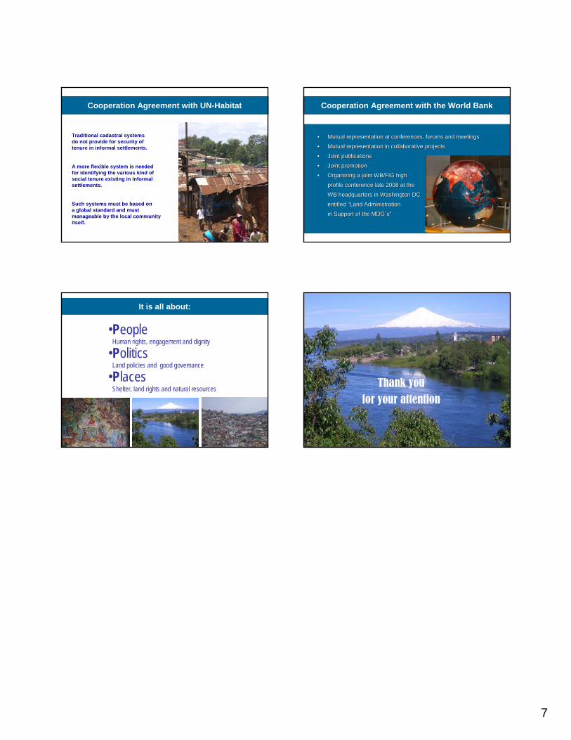
Cooperation Agreement with UN-Habitat
Traditional cadastral systemsdo not provide for security oftenure in informal settlements.
A more flexible system is needed for identifying the various kind ofsocial tenure existing in informalsettlements.
Such systems must be based on a global standard and must manageable by the local communityitself.
•• Mutual representation at conferences, forums and meetings Mutual representation at conferences, forums and meetings
•• Mutual representation in collaborative projectsMutual representation in collaborative projects
•• Joint publications Joint publications
•• Joint promotion Joint promotion
•• Organizing a joint WB/FIG high Organizing a joint WB/FIG high
profile conference late 2008 at the profile conference late 2008 at the
WB headquarters in Washington DC WB headquarters in Washington DC
entitled entitled ““Land Administration Land Administration
in Support of the in Support of the MDGMDG´́ss””
Cooperation Agreement with the World Bank
It is all about:
•People Human rights, engagement and dignity
•PoliticsLand policies and good governance
•PlacesShelter, land rights and natural resources
The future belongs to our children
Thank you for your attention