pub. 123 southwest coast of africa 10ed 2007
TRANSCRIPT

PUB.
(ENROUTE)SAILING DIRECTIONS
★
★
123
SOUTHWEST COASTOF AFRICA
Prepared and published by theNATIONAL GEOSPATIAL-INTELLIGENCE AGENCY
Bethesda, Maryland
© COPYRIGHT 2007 BY THE UNITED STATES GOVERNMENTNO COPYRIGHT CLAIMED UNDER TITLE 17 U.S.C.
For sale by the Superintendent of Documents, U.S. Government Printing Office
Internet: http://bookstore.gpo.gov Phone: toll free (866) 512-1800; DC area (202) 512-1800Fax: (202) 512-2250 Mail Stop: SSOP, Washington, DC 20402-0001
TENTH EDITION
2007
Pub. 123 III
Preface
0.0 Pub. 123, Sailing Directions (Enroute) Southwest Coast ofAfrica, Tenth Edition, 2007, is issued for use in conjunctionwith Pub. 160, Sailing Directions (Planning Guide) South At-lantic Ocean and Indian Ocean. The companion volume is Pub.124.0.0 Digital Nautical Chart 1 provides electronic chart coveragefor the area covered by this publication. 0.0 This publication has been corrected to 11 August 2007,including Notice to Mariners No. 32 of 2007.
Explanatory Remarks
0.0 Sailing Directions are published by the National Geospatial-Intelligence Agency (NGA), under the authority of Departmentof Defense Directive 5105.40, dated 12 December 1988, andpursuant to the authority contained in U. S. Code Title 10,Sections 2791 and 2792 and Title 44, Section 1336. SailingDirections, covering the harbors, coasts, and waters of theworld, provide information that cannot be shown graphicallyon nautical charts and is not readily available elsewhere.0.0 Sailing Directions (Enroute) include detailed coastal andport approach information which supplements the largest scalechart produced by the National Geospatial-IntelligenceAgency. This publication is divided into geographic areascalled “Sectors.”0.0 Bearings.—Bearings are true, and are expressed in degreesfrom 000° (north) to 360°, measured clockwise. Generalbearings are expressed by initial letters of points of the com-pass (e.g. N, NNE, NE, etc.). Adjective and adverb endingshave been discarded. Wherever precise bearings are intendeddegrees are used.0.0 Charts.—Reference to charts made throughout this publi-cation refer to both the paper chart and the Digital NauticalChart (DNC).0.0 Coastal Features.—It is assumed that the majority of shipshave radar. Available coastal descriptions and views, useful forradar and visual piloting are included in geographic sequencein each Sector.0.0 Corrective Information.—Users should refer corrections,additions, and comments to NGA’s Maritime Operations Desk,as follows: 0.0 1. Toll free: 1-800-362-62890.0 2. Commercial: 301-227-31470.0 3. DSN: 287-31470.0 4. DNC web site: http://www.nga.mil/portal/site/dnc0.0 5. Maritime Divi-0.0 sion web site: http://www.nga.mil/portal/site/mari0.0 time0.0 6. E-mail: [email protected] 7. Mailing address: Maritime Domain0.0 National Geospatial-Intelligence0.0 Agency
Mail Stop D-440.0 4600 Sangamore Road0.0 Bethesda MD 20816-50030.0 New editions of Sailing Directions are corrected through thedate of the publication shown above. Important information toamend material in the publication is available as a PublicationDigital Update (PDU) from the NGA Maritime Domain web-site.
0.0NGA Maritime Domain Websitehttp://www.nga.mil/portal/site/maritime
0.0
0.0 Courses.—Courses are true, and are expressed in the samemanner as bearings. The directives “steer” and “make good” acourse mean, without exception, to proceed from a point oforigin along a track having the identical meridianal angle as thedesignated course. Vessels following the directives must allowfor every influence tending to cause deviation from such track,and navigate so that the designated course is continuouslybeing made good.0.0 Currents.—Current directions are the true directions towardwhich currents set.0.0 Dangers.—As a rule outer dangers are fully described, butinner dangers which are well-charted are, for the most part,omitted. Numerous offshore dangers, grouped together, arementioned only in general terms. Dangers adjacent to a coastalpassage or fairway are described.0.0 Distances.—Distances are expressed in nautical miles of 1minute of latitude. Distances of less than 1 mile are expressedin meters, or tenths of miles.0.0 Geographic Names.—Geographic names are generallythose used by the nation having sovereignty. Names in paren-theses following another name are alternate names that mayappear on some charts. In general, alternate names are quotedonly in the principal description of the place. Diacritical marks,such as accents, cedillas, and circumflexes, which are related tospecific letters in certain foreign languages, are not used in theinterest of typographical simplicity. Geographic names or theirspellings do not necessarily reflect recognition of the politicalstatus of an area by the United States Government.0.0 Heights.—Heights are referred to the plane of referenceused for that purpose on the charts and are expressed in meters.0.0 Index-Gazetteer.—Navigational features and place-namesare listed alphabetically in the back of the book. The approxi-mate position, along with the Sector and paragraph numbers(e.g. 1.1), facilitate location in the text.0.0 Internet Links.—This publication provides internet links toweb sites concerned with maritime navigational safety, includ-ing but not limited to, Federal government sites, foreign Hy-drographic Offices, and foreign public/private port facilities.NGA makes no claims, promises, or guarantees concerning theaccuracy, completeness, or adequacy of the contents of the websites and expressly disclaims any liability for errors and omis-sions of these web sites.0.0 Light and Fog Signals.—Lights and fog signals are not de-scribed, and light sectors are not usually defined. The LightLists should be consulted for complete information.0.0 Ports.—Directions for entering ports are depicted whereappropriate by means of chartlets, sketches, and photos, whichfacilitate positive identification of landmarks and navigationalaids. These chartlets and sketches are not always to scale, how-ever, and should be used only as a general informational guidein conjunction with the best scale chart. Specific port facilitiesare omitted from the standard format. They are tabulated inPub. 150, World Port Index.0.0 Radio Navigational Aids.—Radio navigational aids are notdescribed in detail. Publication No. 117 Radio NavigationalAids and NOAA Publication, Selected Worldwide MarineBroadcasts, should be consulted.

IV Pub. 123
0.0 Soundings.—Soundings are referred to the datum of thecharts and are expressed in meters.0.0 Special Warnings.—A Special Warning may be in force forthe geographic area covered by this publication. SpecialWarnings are printed in the weekly Notice to Mariners uponpromulgation and are reprinted annually in Notice to MarinersNo. 1. A listing of Special Warnings currently in force isprinted in each weekly Notice to Mariners, Section III, Broad-cast Warnings, along with the notice number of promulgation.Special Warnings are also available on the Maritime Divisionwebsite.0.0 Wind Directions.—Wind directions are the true directionsfrom which winds blow.
Reference List
0.0 The principal sources examined in the preparation of thispublication were:0.0 British Hydrographic Department Sailing Directions.0.0 South African Sailing Directions.0.0 Various port handbooks.0.0 Reports from United States Naval and merchant vessels andvarious shipping companies.0.0 Other U.S. Government publications, reports, and docu-ments.0.0 Charts, light lists, tide and current tables, and other docu-ments in possession of the Agency.0.0 Internet Web site:0.0 Simon Baillie-Cooper and the Lighthouses of South
Africa Home Page:0.0 http://www.lighthouses.co.za

Pub. 123 V
Contents
How to Keep this Book Corrected . . . . . . . . . . . . . . . . . . . . . . . . . . . . . . . . . . . . . . . . . . . . . . . . . . . . . . . . . . . . . . . . . . . . . . . . . . . IIPreface. . . . . . . . . . . . . . . . . . . . . . . . . . . . . . . . . . . . . . . . . . . . . . . . . . . . . . . . . . . . . . . . . . . . . . . . . . . . . . . . . . . . . . . . . . . . . . . . IIIChartlet—Sector Limits . . . . . . . . . . . . . . . . . . . . . . . . . . . . . . . . . . . . . . . . . . . . . . . . . . . . . . . . . . . . . . . . . . . . . . . . . . . . . . . . . VIIConversion Tables. . . . . . . . . . . . . . . . . . . . . . . . . . . . . . . . . . . . . . . . . . . . . . . . . . . . . . . . . . . . . . . . . . . . . . . . . . . . . . . . . . . . . VIIISailing Directions Information and Suggestion Sheet . . . . . . . . . . . . . . . . . . . . . . . . . . . . . . . . . . . . . . . . . . . . . . . . . . . . . . . . . . . IXAbbreviations . . . . . . . . . . . . . . . . . . . . . . . . . . . . . . . . . . . . . . . . . . . . . . . . . . . . . . . . . . . . . . . . . . . . . . . . . . . . . . . . . . . . . . . . . . XI
Sector 1
Ivory Coast and Ghana—Cape Palmas to Cape Saint Paul . . . . . . . . . . . . . . . . . . . . . . . . . . . . . . . . . . . . . . . . . . . . . . . . . . . . . . . . 1
Sector 2
Togo, Benin, and Nigeria—Cape Saint Paul to Cape Formoso . . . . . . . . . . . . . . . . . . . . . . . . . . . . . . . . . . . . . . . . . . . . . . . . . . . . 17
Sector 3
Nigeria to Gabon—Cape Formoso to Cap Lopez . . . . . . . . . . . . . . . . . . . . . . . . . . . . . . . . . . . . . . . . . . . . . . . . . . . . . . . . . . . . . . 33
Sector 4
Gabon to Angola—Cap Lopez to Ponta Albina . . . . . . . . . . . . . . . . . . . . . . . . . . . . . . . . . . . . . . . . . . . . . . . . . . . . . . . . . . . . . . . . 67
Sector 5
Angola, Namibia, and South Africa—Ponta Albina to the Cape of Good Hope . . . . . . . . . . . . . . . . . . . . . . . . . . . . . . . . . . . . . . . 99
Sector 6
Islands and Seamounts in the South Atlantic Ocean . . . . . . . . . . . . . . . . . . . . . . . . . . . . . . . . . . . . . . . . . . . . . . . . . . . . . . . . . . . 129
Glossaries . . . . . . . . . . . . . . . . . . . . . . . . . . . . . . . . . . . . . . . . . . . . . . . . . . . . . . . . . . . . . . . . . . . . . . . . . . . . . . . . . . . . . . . . . . . . 145

Pub. 123 VII
0.0SECTOR LIMITS — PUB. 123

VIII Pub.
Conversion Tables
Feet to MetersFeet 0 1 2 3 4 5 6 7 8 9 0 0.00 0.30 0.61 0.91 1.22 1.52 1.83 2.13 2.44 2.74 10 3.05 3.35 3.66 3.96 4.27 4.57 4.88 5.18 5.49 5.79 20 6.10 6.40 6.71 7.01 7.32 7.62 7.92 8.23 8.53 8.84 30 9.14 9.45 9.75 10.06 10.36 10.67 10.97 11.28 11.58 11.89 40 12.19 12.50 12.80 13.11 13.41 13.72 14.02 14.33 14.63 14.93 50 15.24 15.54 15.85 16.15 16.46 16.76 17.07 17.37 17.68 17.98 60 18.29 18.59 18.90 19.20 19.51 19.81 20.12 20.42 20.73 21.03 70 21.34 21.64 21.95 22.25 22.55 22.86 23.16 23.47 23.77 24.08 80 24.38 24.69 24.99 25.30 25.60 25.91 26.21 26.52 26.82 27.13 90 27.43 27.74 28.04 28.35 28.65 28.96 29.26 29.57 29.87 30.17
Fathoms to MetersFathoms 0 1 2 3 4 5 6 7 8 9
0 0.00 1.83 3.66 5.49 7.32 9.14 10.97 12.80 14.63 16.46 10 18.29 20.12 21.95 23.77 25.60 27.43 29.26 31.09 32.92 34.75 20 36.58 38.40 40.23 42.06 43.89 45.72 47.55 49.38 51.21 53.03 30 54.86 56.69 58.52 60.35 62.18 64.01 65.84 67.67 69.49 71.32 40 73.15 74.98 76.81 78.64 80.47 82.30 84.12 85.95 87.78 89.61 50 91.44 93.27 95.10 96.93 98.75 100.58 102.41 104.24 106.07 107.90 60 109.73 111.56 113.39 115.21 117.04 118.87 120.70 122.53 124.36 126.19 70 128.02 129.85 131.67 133.50 135.33 137.16 138.99 140.82 142.65 144.47 80 146.30 148.13 149.96 151.79 153.62 155.45 157.28 159.11 160.93 162.76 90 164.59 166.42 168.25 170.08 171.91 173.74 175.56 177.39 179.22 181.05
Meters to FeetMeters 0 1 2 3 4 5 6 7 8 9
0 0.00 3.28 6.56 9.84 13.12 16.40 19.68 22.97 26.25 29.53 10 32.81 36.09 39.37 42.65 45.93 49.21 52.49 55.77 59.06 62.34 20 65.62 68.90 72.18 75.46 78.74 82.02 85.30 88.58 91.86 95.14 30 98.42 101.71 104.99 108.27 111.55 114.83 118.11 121.39 124.67 127.95 40 131.23 134.51 137.80 141.08 144.36 147.64 150.92 154.20 157.48 160.76 50 164.04 167.32 170.60 173.88 177.16 180.45 183.73 187.01 190.29 193.57 60 196.85 200.13 203.41 206.69 209.97 213.25 216.54 219.82 223.10 226.38 70 229.66 232.94 236.22 239.50 242.78 246.06 249.34 252.62 255.90 259.19 80 262.47 265.75 269.03 272.31 275.59 278.87 282.15 285.43 288.71 291.99 90 295.28 298.56 301.84 305.12 308.40 311.68 314.96 318.24 321.52 324.80
Meters to FathomsMeters 0 1 2 3 4 5 6 7 8 9
0 0.00 0.55 1.09 1.64 2.19 2.73 3.28 3.83 4.37 4.92 10 5.47 6.01 6.56 7.11 7.66 8.20 8.75 9.30 9.84 10.39 20 10.94 11.48 12.03 12.58 13.12 13.67 14.22 14.76 15.31 15.86 30 16.40 16.95 17.50 18.04 18.59 19.14 19.68 20.23 20.78 21.33 40 21.87 22.42 22.97 23.51 24.06 24.61 25.15 25.70 26.25 26.79 50 27.34 27.89 28.43 28.98 29.53 30.07 30.62 31.17 31.71 32.26 60 32.81 33.36 33.90 34.45 35.00 35.54 36.09 36.64 37.18 37.73 70 38.28 38.82 39.37 39.92 40.46 41.01 41.56 42.10 42.65 43.20 80 43.74 44.29 44.84 45.38 45.93 46.48 47.03 47.57 48.12 48.67 90 49.21 49.76 50.31 50.85 51.40 51.95 52.49 53.04 53.59 54.13

Pub. 123 XI
Abbreviations
The following abbreviations may be used in the text:
Units°C degree(s) Centigrade km kilometer(s)cm centimeter(s) m meter(s)cu.m. cubic meter(s) mb millibarsdwt deadweight tons MHz megahertzFEU forty-foot equivalent units mm millimeter(s)grt gross registered tons nrt net registered tonskHz kilohertz TEU twenty-foot equivalent units
DirectionsN north S southNNE northnortheast SSW southsouthwestNE northeast SW southwestENE eastnortheast WSW westsouthwestE east W westESE eastsoutheast WNW westnorthwestSE southeast NW northwestSSE southsoutheast NNW northnorthwest
Vessel typesLASH Lighter Aboard Ship ro-ro Roll-on Roll-offLNG Liquified Natural Gas ULCC Ultra Large Crude CarrierLPG Liquified Petroleum Gas VLCC Very Large Crude CarrierOBO Ore/Bulk/Oil
TimeETA estimated time of arrival GMT Greenwich Mean TimeETD estimated time of departure UTC Coordinated Universal Time
Water levelMSL mean sea level LWS low water springsHW high water MHWN mean high water neapsLW low water MHWS mean high water springsMHW mean high water MLWN mean low water neapsMLW mean low water MLWS mean low water springsHWN high water neaps HAT highest astronomical tideHWS high water springs LAT lowest astronomical tideLWN low water neaps
CommunicationsD/F direction finder MF medium frequencyR/T radiotelephone HF high frequencyGMDSS Global Maritime Distress and Safety System VHF very high frequencyLF low frequency UHF ultra high frequency
NavigationLANBY Large Automatic Navigation Buoy SPM Single Point MooringNAVSAT Navigation Satellite TSS Traffic Separation SchemeODAS Ocean Data Acquisition System VTC Vessel Traffic CenterSBM Single Buoy Mooring VTS Vessel Traffic Service
MiscellaneousCOLREGS Collision RegulationsIALA International Association of Lighthouse
AuthoritiesNo./Nos.PA
Number/NumbersPosition approximate
IHO International Hydrographic Office PD Position doubtfulIMO International Maritime Organization Pub. Publicationloa length overall St./Ste. Saint/Sainte

1
Pub. 123
1. Ivory Coast and Ghana—Cape Palmas to Cape Saint Paul
1.0Additional chart coverage may be found in NGA/DLIS Catalog of Maps, Charts, and Related Products (Unlimited Distribution).SECTOR 1 — CHART INFORMATION

3
Pub. 123
SECTOR 1
IVORY COAST AND GHANA—CAPE PALMAS TO CAPE SAINT PAUL
1.0 Plan.—This sector describes the coasts of Liberia, IvoryCoast (Cote D’Ivoire), and Ghana between Cape Palmas andCape Saint Paul. The descriptive sequence is from W to E.
General Remarks
1.1 The coast described in this sector is bordered by reefsand relatively elevated as far as the W approaches to CapeThree Points (4°45'N., 2°05'E.), a distance of about 230 miles.It is fronted by a low, sloping, and sandy beach backed by tallvegetation. The W part of the coast, between Cape Palmas(4°22'N., 7°44'W.) and Cape Three Points, is high, rocky, andrises gradually to the interior. The E part of this coast is low,sandy, and backed by a number of lagoons. Several rivers dis-charge through this stretch of the coast, but are of little naviga-tional value. The shoreline, which is subject to a dangeroussurf, consists mostly of a sandy beach backed by tall brush-wood.
1.1 Winds—Weather.—The SE trade wind system is the basicand most extensive wind regime in the area. Between 5°S and30°S, winds blow from the SE quadrant just about all yearround. These trade winds are most strongly developed between10°S and 25°S, where their frequency approaches 85 per cent.The average strength of these winds ranges from force 3 to 4 inthe waters of the N part to force 4 to 5 in the waters lyingbetween 20°S and 30°S.1.1 Within 100 miles of the coast, between Mayumba (3°24'S.,10°39'E.) and Cape Town, the SE trades are deflected and blowparallel to the coast, which results in a predominance of Swinds. To the N of 20°N and to the W of 10°W, in accordancewith the counterclockwise flow around the South AtlanticAnticyclone, the winds take on a more E component.1.1 The Doldrums, which is associated with the equatorialtrough, is a band of light and variable winds. For most of theyear, this band is located in the N part of the area, but from lateFebruary through March, it reaches the portion of the arealying N of the Equator. During these months, winds to the N ofthe Equator are calm for about 40 per cent of the time.1.1 The most significant of the local wind regimes in the area isthe Southwest Monsoon. This large scale sea breeze occurs inthe N sections over the Gulf of Guinea and extends 100 to 200miles inland. It is strongest from June through August, but isprevalent all year round. The monsoon is a deflection of the SEtrade winds toward the heated continental interior. Its influenceis felt up to 10°S and it acts very much like a land-sea breezeregime. At Douala (4°03'N., 9°41'E.), for example, while SWwinds are prevalent during the afternoon, their frequency dropsto 5 per cent in the early morning hours.1.1 The Harmattan, a wind of continental origin, is hot, dry, andblows from the NE quadrant. It reaches the shores of the Gulfof Guinea and extends seaward. This wind is prevalent fromDecember through early March and is usually laden with finedust, which can seriously impair visibility in the form of haze.
The Harmattan is found mainly between Cape Palmas andDouala.1.1 A local wind occurring to the N of the Congo River is knownas a tornado. This should not be confused with the phenome-non, known by the same name, which occurs in the UnitedStates. African tornados are violent wind squalls which oftenaccompany thunderstorms. They are most frequent from Jan-uary to early May and from September to November. Tornadoscan originate either on the land and move seaward or over thewater and move onshore.1.1 The barometer gives no warning, but a dark bank of cumulo-nimbus clouds, with tops reaching 6,000m or more, usually in-dicates the approach of a tornado. At the base of the cloudbank, there is generally a roll of low clouds and the atmospherebecomes still and oppressive as it approaches. A sudden windsquall, with gusts of 50 knots or more, occurs as the roll of lowclouds passes overhead. Then, a few minutes later, rain beginsand is accompanied by thunder and lightning. The rain is oftenvery heavy and may reduce visibility to practically zero. Thewind usually lasts for less than one hour, but the rain maycontinue longer. These tornados may be local or they may havethe characteristics of a squall line, 100 miles or more wide.Occasionally, these tornados occur without any rain and areknown appropriately as dry tornados.1.1 Gales are infrequent over most of the area. Along the coastand to the N of the Equator, they occur on 1 to 6 days annually.From the Equator to Walvis Bay, gales occur on less than 1 dayper year. At Walvis Bay, gales can be expected on 14 daysannually; 7 of these days occur in October while 4 of thesedays occur in July and August. 1.1 To the S and into the subtropics, gale frequencies increase.At Cape Town, gales occur on an annual average of 22 days,with most from December through March. Over the oceanarea, gales are infrequent to the N of 25°S. They occur for anaverage of 3 per cent of the time from April through Septemberbetween 25°S and 30°S. The frequency of the gales increasesrapidly to the S of 30°S and from May through September theyoccur for 10 to 20 per cent of the time between 30°S and 35°S.During this same period, gales occur for 12 to 25 per cent ofthe time between 35°S and 40°S. To the S of 40°S, data is toosparse for an accurate analysis.1.1 All sea areas lying near the shores of the continents andlarger islands are influenced by land and sea breezes. Modi-fication of the prevailing winds by onshore winds during theafternoon and offshore winds during the early morning causescorresponding increases or decreases in sea heights. Gravitywinds usually result when dense cold air, which accumulateson the continental highlands, flows rapidly down the slopesand out over the sea. They can produce high waves for a shortdistance from the shore.
1.1 Tides—Currents.—The Guinea Current is felt in the vici-nity of Cape Palmas and as far E as Pointe Tafou. It disappearsabout 100 miles ENE of this latter point and then resumes

4 Sector 1. Ivory Coast and Ghana—Cape Palmas to Cape Saint Paul
Pub. 123
weakly to the E of Abidjan. The currents generally begin about80 miles E of Abidjan and set inshore between this locationand Cape Three Points. 1.1 The currents in the vicinity of Cape Three Points are variablein both strength and direction. A current setting E, with a rateas high as 3 knots, has been reported. 1.1 Vessels heading W from Cape Saint Paul to Cape ThreePoints are advised to stay as close to the coast as safetypermits. Such vessels usually encounter only a weak currentwith a rate of 0.4 knot. However, vessels taking the direct routegenerally encounter a current, which at times attains a rate of 3knots.1.1 Depths—Limitations.—Depths in the approaches to thiscoast are deep and clear of dangers. The 200m curve lies gen-erally parallel to the coast and between 13 and 23 miles off-shore. The only exception is Le Trou Sans Fond, in theapproaches to Abidjan (see paragraph 1.13), where the 30mcurve lies almost parallel to the coast and between 1 mile and 6miles offshore. There are no known dangers outside of the200m curve.1.1 Caution.—Vessels should not approach within 2.5 miles ofthe coast between Cape Palmas and the Cavalla River (4°22'N.,7°32'W.). The depths lying off the coast are very irregular,particularly in the vicinity of Growa Point (4°21'N., 7°37'W.)and Cavalla Point (4°21'N., 7°36'W.).1.1 Numerous fishing boats may be encountered in the waterslying adjacent to the coasts described in this sector.1.1 When transiting near the coasts described in this sector, asharp lookout should be kept for canoes.1.1 Acts of piracy have occurred in the waters described withinthis sector but they have generally taken place at the anchor-ages or in the approaches to the ports. Vessels should not allowany unauthorized craft to come alongside.1.1 Oil and gas development areas and fields, with associatedrigs, platforms, riser pipes, wellheads, submarine pipelines, ter-minal buoys, and storage vessels, may be encountered off thecoasts described in this sector.1.1 Some of the well heads may protrude more than 5m abovethe sea bed and may be unmarked. Some of the platforms andstructures may be disused, abandoned, and unlit. In manycases, the submarine pipelines are not buried in the sea bed anddepths over them may be reduced by as much as 2m. In addi-tion, many temporary structures and objects associated with oiland gas exploration may not be charted.
Cape Palmas to Abidjan
1.2 Cape Palmas (4°22'N., 7°44'W.), 19m high, is arocky peninsula connected to the mainland by a low and sandyisthmus. Russwurm Island, 8m high, lies close S of the capeand is connected to it by a causeway. This island is coveredwith verdure and is difficult to distinguish against the cape.The town of Harper stands on the isthmus.
For a description of the approaches to the cape; the smallharbor, known as Harper Point; and the nearby roadstead an-chorage, which is used for the export of logs and rubber, seePub. 143, Sailing Directions (Enroute) West Coast of Europeand Northwest Africa.
A light is shown from a prominent tower, 22m high, standingclose to the W extremity of Cape Palmas.
Between the cape and Growa Point, 6.7 miles E, the coastconsists of a high sandy beach. A conspicuous mass of blackrock lies on the beach about 2.5 miles E of the cape.1.2 A shallow lagoon lies close behind the sandy foreshore andextends parallel to it for about 3.5 miles. The village of Budduis situated near the E end of this lagoon. During the rainyseason, the lagoon breaks through to the sea and flows outbetween the groups of houses standing in the village.1.2 Newill Rock, with a least depth of 6m, lies 0.7 mile offshore,about 1.7 miles ESE of Cape Palmas. Athol Rock, with a leastdepth of 6.4m, lies 1.9 miles offshore, about 3 miles WSW ofGrowa Point. Two rocky heads, with depths of 6.4 and 9.1m,lie about midway between Newill Rock and Athol Rock.1.2 A shoal patch, with a depth of 16.5m, was reported (1967) tolie about 4.5 miles SSE of Cape Palmas.1.2 A prominent hill, 70m high, rises 1.2 miles inland, about 3.3miles ENE of Cape Palmas. A conspicuous college building,white with a black roof, stands on this hill.1.2 Growa Point (4°21'N., 7°37'W.) is a long, low, and rockyprojection. Growa Reefs, on which the sea breaks heavily,extend up to about 0.8 mile SW and 0.4 mile S from this point.During good weather, landing is possible in the vicinity of thepoint, but a surf boat is necessary. The town of Growa, alsokown as Whole Graway, stands about 1 mile NW of the point.1.2 Helene Woerman Rock, with a least depth of 3.7m, liesabout 2.5 miles SW of Growa Point. This steep-to rock, whichwas reported not to break in the dry season (November toMarch), forms the outermost danger along this part of thecoast.1.2 A shoal patch, with a depth of 10m, lies about 1.7 milesSSW of Growa Point and another patch, with a least depth of9m, lies between it and Growa Reefs. Harvey Rock, on whichthe sea always breaks, lies 1.3 miles offshore, about 1.2 milesWSW of Growa Point. Several rocky patches, with depths of 5to 10m, lie within 0.5 mile of Harvey Rock.1.2 Cavalla Point (4°21'N., 7°36'W.), fronted by rocks, issituated 1.2 miles E of Growa Point. A village stands amongtrees 0.5 mile NE of the point. 1.2 An isolated shoal patch, with a least depth of 9.1m, liesabout 1 mile SSW of Cavalla Point.1.2 Foul ground, with several above-water rocks, extends up to0.8 mile from the coast between Growa Point and CavallaPoint. Cavalla Ledge, formed by a group of shoals, liescentered 1 mile offshore, about 2.8 miles ESE of Cavalla Point.The shallowest shoal of this group, with a depth of less than2m, breaks and lies at the NW end.
1.3 The Cavally River (4°22'N., 7°32'W.) indents thecoast 4 miles E of Cavalla Point. It is navigable up to about 40miles above the entrance by small power vessels. The firstrapids are located about 80 miles above the mouth.
The boundary between Liberia and the Ivory Coast (CoteD’Ivoire) is situated in the vicinity of the Cavally River.1.3 Two umbrella trees stand close together on the W side of theentrance and a small house, with a tiled roof, is situated closeW of them. The entrance channel, which is about 90m widebetween the sand banks, is constantly changing. Sunken rockslie close offshore at the W side of this channel and the bar,which fronts the entrance, has the reputation of being the mostdangerous along this part of the coast. The village of Blieron is

Sector 1. Ivory Coast and Ghana—Cape Palmas to Cape Saint Paul 5
Pub. 123
situated on the E side of the entrance. The Custom house, aprominent white building with a red roof and a flagstaff, issituated in the village.1.3 Anchorage may be obtained, in a depth of 15m, sand andmud, about 1 mile S of the Customhouse.1.3 Willett Hill, a prominent flat-topped hill, rises 3 miles N ofthe entrance to the river and has a conspicuous knob, 94m high,standing close W of its center. In clear weather, this knob isreported to be visible from up to 18 miles seaward.1.3 Between the Cavally River and Pointe Tafou, 10.5 milesENE, the coast is low, sandy, and backed by a dense forest. It isbroken occasionally by clumps of trees up to 60m high. 1.3 A rounded, sandy point is located 2.7 miles E of the mouthof the Cavally River and is fronted by extensive reefs, whichextend up to about 0.8 mile seaward. Several rocks, up to 3.7mhigh, lie in the vicinity of these reefs. A stranded wreck,reported to be radar conspicuous (1987), lies in the vicinity ofthese rocks.1.3 A hill, with treetops 55m high, rises close N of this sandypoint and is prominent.1.3 Subra Meno Point (4°22'N., 7°27'W.) is located 4.5 milesENE of the mouth of the Cavally River and forms the W en-trance point of the Tahauru River. A stranded wreck, reportedto be radar conspicuous (1968), lies on a group of rocks about0.4 mile S of the river mouth.1.3 An isloated shoal patch, with a depth of 9m, is reported(1966) to lie about 2.7 miles SE of Subra Meno Point.1.3 The village of Biahuin stands 2.5 miles ENE of Subra MenoPoint. A group of rocks, which breaks, lie about 0.7 mile S ofthis village.1.3 Pointe Tafou (4°25'N., 7°22'W.) is a low and rocky pointlocated at the W side of the entrance to the Tafou River. Thisriver is small and used only by canoes. It was reported (1969)that the entrance had silted up and only the beach was in use.1.3 A light is shown from a tower, 14m high, standing on PointeTafou; a radio mast is situated 0.2 mile WSW of it. The town ofTabou is situated close within the entrance on the N bank of theriver. A mission building, with a prominent clock tower, standsin the town.1.3 It is reported (1971) that a vessel grounded about 0.3 mile Sof the light. Therefore, a preferred anchorage lies, in a depth of15m, about 0.8 mile SE of the light.
1.4 Pointe Basha (4°28'N., 7°15'W.), fringed by reefs, islocated 7.5 miles NE of Pointe Tafou. The coast betweenconsists of a sandy beach backed by densely-wooded country.
Point Tabou, low and fronted by foul ground, is located 2.7miles NE of Pointe Tafou. The large village of Segre stands 1.4miles NE of this point. Anchorage may be obtained in a depthof 24m, sand and mud, about 1 mile SE of the villlage. Thebottom is foul in any lesser depths.
Pointe Basha, which shelters a roadstead anchorage, is sur-mounted by a rock resembling the outline of a fort when seenfrom the W. A buoy is moored 1.6 miles ENE of this point.1.4 Grand Basha, a village, stands on the N side of the entranceto the River Houo, 1 mile N of Pointe Basha. It may beidentified by a prominent long and low house with a gray roof.Pointe Boubele, the SW entrance point of the river, is markedby two beacons. A post, with a triangular daymark, stands 0.9mile NNE of Pointe Boubele, but it is situated near the shore
and not easily distinguished. A wharf, used by lighters, frontsthe shore close N of Pointe Boubele and is reported to be radarconspicuous.1.4 Anchorage may be obtained in depths of 12 to 16m about 1mile E of Pointe Boubele. The bottom consists of sand, brokenshells, and gravel, with good holding ground. This roadstead isused for exporting timber. 1.4 The coast continues ENE for 13 miles from Pointe Basha toPointe Poor. A long and narrow lagoon lies close behind thebeach, which fronts the coast for the last 8.2 miles. The sandybeach barrier that separates this lagoon from the sea is coveredwith trees, but occasional bare spots show where the watersburst through in the rainy season.1.4 Pointe Ouappou (Point Wappu), rocky and 20m high, islocated 3.5 miles NE of Pointe Boubele. The village of Wappustands on this point and the mouth of the River Tuhobre liesclose WSW of it. 1.4 Pointe Poor (4°32'N., 7°03'W.) is low, rocky, and fringed byrocks extending up to about 0.3 mile seaward. The mouth ofthe River Nebano lies close N of this point. Pointe Klama,fronted by rocks, is located 1.5 miles ENE of Pointe Poor. Aconspicuous gray rock stands about 0.5 mile N of this point. Ahill, 90m high, rises 2 miles NNW of thsi point.1.4 A stranded wreck, reported (2002) to be no longer con-spicuous, lies close ENE of Pointe Klama.
Poste de Bereby (Point Sagree) (4°34'N., 7°01'W.), located0.7 mile NNE of Pointe Klama, is one of the few places alongthis part of the coast where landing is possible. A village standson the point. Two moderately-high mountains rise 8 and 12miles NNW of this point and provide good landmarks. Anchor-age can be taken in a depth of 22m, sand, about 0.5 mile SE ofthe point.1.4 Pointe Ible, surmounted by a building, is located 1 mile NEof Poste de Bereby. A pinnacle rock. with a depth of 6m, liesabout 0.4 mile S of this point.
1.5 Pointe Kadabou (4°39'N., 6°54'W.) is located 8.5miles NE of Poste de Bereby. The coast between consists of asuccession of sandy bights divided by rocky points. The landbehind the beach consists of an extensive forest, which risesgradually to wooded hills.1.5 From about 1 mile NE of Poste de Bereby, an extensivechain of reefs lies parallel to the coast and extends for about4.5 miles. Ilot Devil, with a black base, lies 2.3 miles SW ofPointe Kadabou. This islet is 13m high and has a flat summitwhich has been whitened by numerous sea birds settling on it.A shoal, which breaks, lies 0.3 mile NNE of this islet.1.5 Pointe Kadabou consists of a bold and rocky cliff, 36m high,which can easily be recognized by a white rock standing nearits summit. The village of Basa (Grande Berebi) is situated onthis point and several reddish houses, with a group of palmtrees, are prominent from seaward. Two hills, rising closetogether, stand 3 miles WNW of the village and are 95m high.1.5 It is reported (1993) that the stranded wreck of a ro-ro ferrylies near Basa (Grande Berebi).1.5 It is reported (1995) that a tug grounded in the vicinoity ofBasa (Grande Berebi) and has been abandoned as a con-structive total loss. 1.5 A roadstead, used mostly for loading timber, lies at the headof the bight entered N of Pointe Kadabou. A river, with a

6 Sector 1. Ivory Coast and Ghana—Cape Palmas to Cape Saint Paul
Pub. 123
lagoon at its entrance, empties into the head of this bight.Anchorage may be obtained in a depth of 11m about 0.5 mile Eof Pointe Kadabou or in a depth of 14m about 1 mile ESE ofthe point.
Gumara Reefs (Turpin Rock), with depths of less than 1m,lie 0.5 mile NNE of Pointe Kadabou. Roche Katoum, a graniterock, lies about 1 mile NE of Pointe Kadabou. It is 11m highand fringed by shoals on its W and NE sides. The top of thisrock is covered with white guano, but it becomes brown duringthe rainy season. Several other shoals and obstructions lie inthe vicinity of this rock and Gumara Reefs.
Pointe Tahu (4°42'N., 6°42'W.), fronted by reefs, is located13 miles ENE of Pointe Kadabou. It is low and wooded. Afactory stands close W of the point. The coast between thispoint and Point Kadabou consists mostly of sandy beaches andis wooded with numerous villages. The River Nema enters thesea through a lagoon about 3.2 miles W of Pointe Tahu. Theshore is rocky and steep-to in places. Numerous rocks, bothabove and below-water, lie off this stretch of coast and itshould be given a wide berth.
A dangerous rock (existence doubtful) is reported to lieabout 2 miles S of Pointe Tahu. 1.5 The coast from Pointe Tahu continues ENE for 6 miles to theharbor of San-Pedro. It is generally sandy, low, and backed bya lagoon. The shore is fronted by numerous shoals and otherdangers and should be given a wide berth.
1.6 San-Pedro (4°44'N., 6°37'W.) (World Port Index No.45963) is a partly-sheltered harbor used mostly for the exportof timber. It is situated in a lagoon about 1 mile SW of themouth of the River San-Pedro.1.6 Winds—Weather.—The harbor is exposed to E and NEwinds and seas. At such times, a heavy swell may also be ex-perienced at the quays.1.6 Tides—Currents.—The tides rise about 1.5m at springs and1.1m at neaps.1.6 The tidal currents attain rates of 0.5 to 1 knot at the entrance,but are less inside the harbor. A strong undertow may be feltwithin the harbor between June and September.1.6 Depths—Limitations.—The harbor is protected by twobreakwaters. It is entered through a channel, 137m wide, whichis dredged to a depth of 12m.1.6 There are three principal quays. The W quay has 586m ofberthage, with a depth of 10.5m alongside. The E quay has1,120m of berthage with depths of 8.5 to 10.5m alongside.Vessels of up to 25,000 dwt, 220m in length, and 9.8m draftcan be accommodated at these quays.1.6 The S quay, 154m long, has a dredged depth of 10.5m along-side. It can be used by vessels up to 150m in length and 8.5mdraft.1.6 Several mooring buoys are situated in depths of 10 to 11mwithin the N part of the harbor. They form berths, which maybe used by vessels of 100 to 200m in length, with drafts of 8.5to 10.5m.1.6 A cement dolphin berth, 200m long, is situated on the NWside of the harbor. It has a depth of 11m alongside and canaccommodate vessels up to 195m in length and 10.5m draft.1.6 A tanker berth is located on the W side of the E quay. It canaccommodate vessels up to 90m in length and 5.5m draft. A
turning basin, 400m in diameter, lies in the center of the harborand is dredged to a depth of 11m. 1.6 Aspect.—Two prominent multi-story buildings, the E ofwhich is taller, stand on the coast close WSW of the harborentrance. A conspicuous telecommunications tower, 59m high,stands 0.6 mile W of the E breakwater head. It is topped by amast and marked by an obstruction light.1.6 San-Pedro Light, is shown from a framework tower, 27mhigh, standing on the E end of the summit of a hill, which rises1 mile NE of the harbor entrance.1.6 A lighted range, which may best be seen on the chart, indi-cates the entrance channel.1.6 A prominent building and a silo stand 0.9 mile and 1.3 mile,respectively, WSW of San-Pedro Light. A conspicuous tankfarm is situated about 0.4 mile SW of San-Pedro Light.1.6 An aeronautical radio beacon, situated in approximate posi-tion 4°46.2'N, 6°39.0'W, is reported (1995) to operate between0700 and 1830 hours daily. Requests for night operation maybe made through Abidjan radio.1.6 Pilotage.—Pilotage is compulsory. Pilots can be contactedon VHF channel 12 and board about 1.5 miles S of the Wbreakwater. Vessels should send their ETA 24 hours in ad-vance, with a confirmation 3 hours before arrival; if the vesselis over 200m in length, the draft should be included in themessages.1.6 Generally, vessels may enter by day only, but can depart byday or at night.1.6 Anchorage.—Vessels may anchor, while awaiting a pilot, ina depth of 18m, sand, good holding ground, about 0.8 mile SSEof the W breakwater head. Anchorage is not recommended tothe W of the meridian passing through the head of the Wbreakwater.1.6 Caution.—It is reported (1996) that the dredged areaswithin the harbor are no longer maintained and depths are lessthan charted in many places.
1.7 Between San-Pedro and Sassandra, 34 miles ENE, thecoast generally consists of cliffs backed by mountains, somepeaks of which are conspicuous. Collines Temple, 158m high,rises 7 miles NE of San-Pedro and marks the W end of acoastal mountainous chain which extends ENE for 27 miles.
The River San-Pedro enters the sea about 0.3 mile NE ofSan-Pedro Light. This river is shallow and its mouth is only15m wide.
Pointe Monoho (Pointe Drewin) (4°48'N., 6°26'W.) islocated 10 miles ENE of San-Pedro Light and 5 miles E of Col-lines Temple. This point, 19m high, is prominent, rocky, andwooded. It is fringed by several rocks on the NE side. A hill,60m high, rises 0.4 mile W of the point. Landing can be madeon the gently sloping beach which lies in a sheltered inlet,close W of the point. Anchorage may be obtained in a depth of11m about 0.3 mile E of the point.1.7 Two small rivers, the mouths of which are obstructed by sandbars, enter the sea 0.7 mile NNE and 1.2 miles NE of pointeMonoho. 1.7 Pointe Enframa (4°52'N., 6°13'W.) is located 14 miles ENEof Pointe Monoho. The coast between is formed by a succes-sion of small rocky points with sandy beaches extending be-tween them. The shore is fringed, in places, by reefs. Pointe

Sector 1. Ivory Coast and Ghana—Cape Palmas to Cape Saint Paul 7
Pub. 123
Abrapa is situated 6.4 miles WSW of Pointe Enframa. It ismarked by a white cliff, but is not easyly identified.1.7 The villages of Basa and Lolieko are situated 6.2 miles and7.5 miles, respectively, ENE of Pointe Enframa.
1.8 Sassandra (4°57'N., 6°05'W.), a small harbor, isdominated on the W side by an abrupt headland which is 53mhigh and covered with luxuriant vegetation. The town standsbetween this headland and the entrance to the River Sassandra,0.8 mile NNE. The headland is fringed by rocks on which thesea breaks. It forms the E end of a chain of hills known asHautes Terres de Drewin. The river is obstructed by a shallowbar and is used only by small boats. It expands close above themouth into a large lagoon, in which lies Ile Fisolagpo.1.8 A light is shown from a tower, 10m high, standing on the topof the cliffs of the headland; however, it is reported that thelights of the town are usually seen before this aid.
It is reported (1983) that the harbor is permanently closed.1.8 A school stands near the coast, 0.7 mile SW of Sassandra. Itis conspicuous, well-lighted, and reported to be visible from upto about 15 miles seaward. A conspicuous hospital, consistingof a large white building with a gray roof, stands on a rockyspur, 45m high, and overlooks the town.
1.9 The coast extending to the E of Sassandra is flat for3.5 miles and fronted by a steep, sandy beach. It is then hillyfor the next 2.5 miles. The hills attain heights of about 110mand are broken by ravines.
Pointe Brouko (Pointe Mortality) (4°59'N., 5°58'W.) islocated 7 miles ENE of Sassandra. Several villages are situ-ated in this vicinity. The point is prominent, bold, and steep-to.1.9 From a point on the shore located about 7 miles ENE ofPointe Brouko, a series of red cliffs begin and extend for 18miles to Fresco. A beach stretches to the E of Fresco and isbordered by a row of trees in the middle of which is a wood.1.9 Between Fresco and Grand-Lahou, 34 miles E, the coast islow and thinly wooded. It is bordered by a sandy beach, onwhich the heavy surf frequently makes communication withthe shore impossible. A narrow lagoon, resembling a canal,runs parallel to the coast close behind the beach.
1.10 Grand-Lahou (5°09'N., 5°00'W.) (World Port IndexNo. 45970) stands on the W side of the entrance to the Ban-dama River. This town can be identified by two prominenthouses, one with a black and the other with a red roof, standingat the W end.
Mont Lahou, 106m high, rises 5 miles N of the town and iscovered by trees.
A light, equipped with a racon, is shown from a tower, 17mhigh, standing in the town.
The entrance to the river is very narrow and is fronted by adangerous bar. It is sheltered by a prominent mole projecting Efrom the W entrance point. The yellowish water from the rivercan be seen to the E of the mouth and up to nearly 2 milesoffshore. 1.10 Anchorage may be taken in a depth of 15m, sand and mud,about 0.5 mile SSE of the light. The holding ground is good,but vessels roll heavily. This roadstead is reported (1989) to beseldom used.
1.10
1.11 Lion Terminal (5°02'N., 4°48'W.), consisting of aFloating Production Storage and Offloading (FPSO) vessel anda CALM buoy, is located about 13.5 miles ESE of Grand-Lahou. It has depths of 64 to 71m alongside and can handletankers up to 140,000 dwt. This terminal, along with four plat-forms, is situated at an oil and gas development facility. A sub-marine pipline extends NNE from this facilty to the shore.
Pilotage is compulsory and is carried out in daylight only.Tankers are berthed in tandem with the FPSO (Red Wing). 1.11 A designated anchorage area is centered about 1.5 miles NWof the terminal.1.11 A restricted area, with a radius of 2 miles, is centered on theterminal. Vessels must receive permission to enter this area.1.11 Tankers moored at the terminal must fly the flag of the Re-public of Ivory Coast.1.11 It is reported (2007) that this terminal is no longer beingused for exports.1.11 Foxtrot Platform (5°02'N., 4°41'W.), an oil and gas plat-form, is situated 20 miles ESE of Grand-Lahou and about 7miles E of Lion Terminal. A submarine pipline extends NNEfrom this platform to the shore.
1.12 Between Grand-Lahou and Abidjan, 61 miles E, thecoast is bordered by a sandy beach. Numerous villages are situ-ated along the shore, but are difficult to identify. Lagune Eerielies behind this stretch of the coast. This lagoon extends in a Wto E direction for about 65 miles and contains numerous is-lands.1.12 Grande Jack (5°11'N., 4°28'W.) is situated 32 miles E ofGrand-Lahou. This village can be identified by the mass of fol-iage in the background and a prominent house, with a whiteroof, standing close E of it.1.12 It is reported (2003) that a light is shown from a tower stand-ing on the coast about 4.5 miles W of Grande Jack.1.12 Jacqueville (5°12'N., 4°23'W.) is situated 37 miles E ofGrand-Lahou and 5 miles E of Grande Jack. It can be identifiedby a group of white houses, two water towers, and a church.The entire length of the village is fronted by palms.1.12 A dangerous wreck lies about 0.7 mile offshore, 5 miles E ofJacqueville.
1.13 Espoir Terminal (5°03'N., 4°27'W.), located about 9miles S of Jacqueville, consists of a platform and a nearbyFloating Production Storage and Offloading (FPSO) Vessel.Oil and gas submarine pipelines extend NW from this facilityto the shore. 1.13 Pilotage is compulsory within 2 miles of the terminal. Thepilot will advise the boarding position after VHF contact hasbeen established with the terminal. Pilots usually board about 3miles ENE of the FPSO. The pilot can be contacted on VHFchannel 14 and the FPSO control room can be contacted onVHF channels 16 and 69. 1.13 Vessels should send their initial ETA to the CNR OffshoreRepresentative on departure from the previous port (or imme-diately on departure if the port is less than 72 hours from theterminal). Vessels must send ETA messages 72 hours, 48hours, and 24 hours prior to arrival.1.13 The first message should contain the following:

8 Sector 1. Ivory Coast and Ghana—Cape Palmas to Cape Saint Paul
Pub. 123
1. Vessel name, call sign, and INMARSAT numbers.2. Cargo requirements.3. Maximum loading rate.4. Arrival draft fore and aft.5. Last port of call.6. Confirmation of clean bill of health.7. Any sickness onboard.8. Distance (in meters) from bow to loading manifold.9. Length.10. A statement to the effect that vessel can perform
closed loading.11. Confirmation that the vessel is equipped with a bow
stopper able to receive 76mm chain.12. Local agent’s name and details.
1.13 Espoir Terminal may be contacted by e-mail, as follows:
1.13 The CNR Offshore Representative must be notified shouldthe vessel’s ETA change by 6 hours or more following the 72-hour and 48-hour notice or by 1 hour or more following the 24-hour notice.1.13 Berthing is available 0600 to 1500 local time. Vessels arriv-ing after 1500 will be berthed the following day. Vessels maydepart at any time.1.13 The terminal has a depth of 110m alongside and can handletankers up to 350,000 dwt. Vessels are berthed in tandem, bowto stern, with the FPSO.1.13 A designated anchorage area for tankers is centered about 4miles NE of the FPSO.1.13 A restricted area, with a radius of 2 miles, is centered on theterminal. Vessels must receive permission to enter this area.1.13 Caution.—A restricted area, which may best be seen on thechart, lies centered about 10 miles S of Jacqueville. Due to theexistence of underwater obstructions, anchoring and fishing areprohibited within this area.
1.14 Baobab Terminal (4°58'N., 4°33'W.) is located about13 miles offshore, 29 miles ESE of Grand-Lahou. It consists ofa Floating Production Storage and Offloading (FPSO) vessel,which is turret-moored in a depth of 970m. The terminal canhandle vessels up to 60,000 dwt. Submarine pipelines extendabout 2.5 miles ENE and SE from the FPSO (Baobab IvoirienMV10) to production manifolds.1.14 Pilotage is compulsory. Pilots can be contacted by VHF andboard about 2 miles from the terminal. Vessels berth duringdaylight hours only but may depart at any time. Tankers moorin tandem, bow to stern, with the FPSO.
1.14 Vessels should send their ETA to the Abidjan Port Authority72 hours, 48 hours, and 24 hours prior to arrival.1.14 A designated anchorage area, with a radius of 1 mile, liescentered about 11.5 miles NE of the terminal.1.14 A restricted area, with a radius of 2 miles, is centered on theterminal. Vessels must receive permission to enter this area.1.14 Tankers moored at the terminal must fly the flag of theRepublic of Ivory Coast.1.14 Caution.—Small craft, with no lights, may be encounteredin the vicinity of the anchorage and FPSO
Abidjan (5°15'N., 4°01'W.)
World Port Index No. 46000
1.15 Abidjan is the capital and principal port of the IvoryCoast. It provides a large sheltered harbor. The city is anindustrial center and also a major railroad terminal.1.15 Winds—Weather.—The wind usually blows from the SWwith frequent calms, especially during the dry seasons. A drywind blows occasionally from ENE between December andFebruary. Hurricanes are frequent, particularly in April, May,October, and November. The weather in this vicinity consistsof four seasons, as follows:
1. A long dry season from December to April.2. A long rainy season from May to the middle of July.3. A short dry season from the middle of July to Sep-
tember or October.4. A short rainy season from September or October to
November,1.15 A swell from the SW, which never quite subsides, generallyattains a height of 0.3m and causes rollers along the beach inthe vicinity of the port. This swell has been reported to occa-sionally attain a height of 1.8m during June, July, and August.1.15 Tides—Currents.—The tides rise about 1.2m at springs and0.9m at neaps.1.15 At springs, the ebb tidal current attains a rate of about 6knots at the seaward end of Canal de Vridi. The flood current isweaker and at neaps and during the rainy season, it is imper-ceptible.1.15 At the entrance of Canal de Vridi, the tidal currents some-times set toward the W bank with strong eddies. At such times,vessels should use care as they may encounter difficulties inmaneuvering, particularly heavily-loaded tankers.
1.15 Depths—Limitations.—Le Trou Sana Fond (5°13'N.,3°58'W.), also known as The Bottomless Pit, is a funnel-shapedsubmarine canyon which penetrates the coastal bank in theapproaches to Abidjan for a distance of about 11 miles. It has awidth of about 3.5 miles and a depth of over 820m at a distanceof 9 miles offshore. This canyon still has a depth of 200mabout 1.3 miles offshore, while at the head, close to the edge ofthe beach, it has is a depth of 40m. The bottom consists mostlyof soft bluish mud but there is some coral rock at depths be-tween 345 and 370m.1.15 The port is entered through Canal de Vridi which is about1.5 miles long. This canal has a width of 370m, except at theseaward end where it is only about 200m wide. The canal has adredged depth of 13.5m (1992).1.15 Vessels can transit through the canal only when the tidal cur-rent is setting at a rate of less than 2 knots. At neaps, thisoccurs anytime. At springs, this occurs from 1 hour before to 1hour after HW and from 1 hour before to 30 minutes after LW.Large vessels are advised to arrive at the entrance to the canalat HW.1.15 Overhead power cables, with a minimum vertical clearanceof 66m, span the canal, 0.6 mile NW of the entrance.1.15 Two tanker berths are situated near the middle of the E bankof the canal. They are equipped with breasting dolphins andmooring buoys and have a depth of 10m alongside. Tankers ofup to 210m in length and 9.1m draft can be accommodated.

Sector 1. Ivory Coast and Ghana—Cape Palmas to Cape Saint Paul 9
Pub. 123
1.15 A fertilizer pier, 90m long, is located close E of the NE endof the canal. It can accommodate vessels of up to 130m inlength and 7.9m draft.1.15 South Quay, 0.8 mile long, extends N from a point located0.5 mile NE of the N end of the canal and includes a containerterminal. It provides ten berths and has depths up to 12.5malongside. A ro-ro pier is situated S of South Quay. It is 200mlong and has a depth of 12.5m alongside.
1.15 A fishing vessel basin is situated N of South Quay. It has1,050m of berthage with depths of 5 to 7m alongside. WestQuay, 0.8 mile long, extends NW from the fishing basin. Itprovides ten berths and has a depth of 10m alongside. NorthQuay, 0.4 mile long, extends NE from West Quay. It providesfive berths and has a depth of 10m alongside.1.15 Banana Wharf, 240m long, lies N of North Quay. It providestwo berths and has a depth of 7m alongside.1.15 There are also several mooring buoy berths located withinthe inner harbor.1.15 There are facilities for general cargo, ro-ro, container, tim-ber, reefer, bulk, tanker, and fishing vessels. Vessels of up to260m in length and 10.37m draft can be accommodated. How-ever, the maximum draft for entry is sometimes reduced to 9mduring periods of heavy swell. The maximum draft for out-bound vessels is 10.67m.1.15 Aspect.—Lighted ranges, which may best be seen on thechart, indicate the approach channel leading into the entranceof Canal de Vridi. The E and W entrance points of the canal aremarked by lights.1.15 Lighted Buoy R (5°12'N., 4°00'W.), equipped with a racon,is moored about 1.5 miles S of the entrance to the canal.Lighted Buoy AN is moored about 1.2 miles SE of the entranceto the canal; vessels should pass E of it.1.15 Port Bouet Light is shown from a conspicuous tower, 30mhigh, standing 2.5 miles E of the entrance to the canal. 1.15 A prominent signal station, with a radio mast, stands on theE entrance point of the canal. A tank farm, several flares, and arefinery, all prominent, are situated about 1 mile NE of thecanal entrance. Two conspicuous chimneys stand near a powerstation on the E side of the canal, about 0.7 mile NW of thesignal station. Pylons, supporting the overhead power cable,stand close S of the power station and are also conspicuous. Aconspicuous crane is reported to stand on the W side of theentrance to the canal.
1.15 Ile Boulet (5°16'N., 4°06'W.) is situated at the W side of theinner harbor. A wall, painted white and bearing 313° ahead, issituated on this island. It is used as a mark by vessels transitingthe canal.1.15 The inner harbor is part of Lagune Ebrie. It is bounded by IleBoulet on the SW side and Ile de Petit-Bassam on the E side.The town stands on a promontory which extends S toward Ilede Petit-Bassam. The government palace, a large prominentbuilding, stands on a small hill in the SW part of the town.1.15 A light is shown from a water tower standing on the NW partof Ile de Petit-Bassam, about 3.5 miles NNW of the entrance toCanal de Vridi. A conspicuous silo, 36m high, is situated about0.4 mile WNW of this light.1.15 Pilotage.—Pilotage is compulsory for vessels of more than150 nrt and is available 24 hours. Pilots can be contacted by
VHF and are reported (2005) to board about 0.7 mile ENE ofLighted Buoy R (5°12'N., 4°00'W.).1.15 Vessels must send an ETA and request for pilotage to thePort Conrol 24 hours, 6 hours, and 1 hour in advance. Themessage must include their draft.1.15 Vessels moored at the outer anchorage must maintain a con-tinuous listening watch on VHF channel 12 or 16. Vesselsmoored at the inner anchorage must maintain a watch from0800 to 0830, 1200 to 1230, and 1700 to 1730 local time.1.15 The port of Abidjan may be contacted by e-mail, as follows:
1.15 Regulations.—A Vessel Traffic Service (VTS) system oper-ates in the approaches to Canal de Vridi. The VTS area (con-trol zone) is formed by a circle, with a radius of 1 mile, cen-tered on Lighted Buoy R (5°12'N., 4°00'W.). The VTS Center(call sign Vigie) can be contacted on VHF channels 12 and 16.1.15 Vessels are prohibited from entering the VTS area withoutauthorization from the VTS Center or to anchor, except incases of force majeure (emergency).1.15 After being identified and given instructions by the VTSCenter, vessels will proceed to embark the pilot. Vesselsdeparting must follow the route determined by the VTS Centerin such a way as not to restrict the approach of inbound vessels.1.15 Anchorage.—Vessels awaiting the pilot should anchor atleast 1.5 miles W of the meridian passing through the Sentrance point of Canal de Vridi. Vessels should anchor indepths of over 20m, sand with good holding ground, at least 1to 2 miles off the coast, depending on their draft.1.15 Large vessels should anchor about 1 mile off the coast, indepths of 40 to 50m.1.15 The inner anchorage berths, within the harbor, lie S, E, andNof Ile Boulet and may best be seen on the chart. They havedepths of 8 to 23m, hard mud, with good holding ground.1.15 Caution.—An area obstructed by wrecks, the limits ofwhich may best be seen on the chart, lies centered about 8miles WSW of the entrance to Canal de Vridi.1.15 A circular area, within which anchoring is prohibited, liescentered about 1.5 miles S of the entrance to Canal de Vridi.This area has a radius of 1 mile and may best be seen on thechart.1.15 A restricted area extends about 15 miles seaward from theshore in the vicinity of Port Bouet Light. Anchoring, fishing,and dredging are prohibited within this area, which may bestbe seen on the chart (see paragraph 1.14).1.15 Several submarine cables, which may best be seen on thechart, lie across Canal de Vridi.1.15 A wreck, with a depth of 15.1m, lies close to the shore about0.5 mile SW of the entrance to Canal de Vridi. It is marked bya lighted buoy and may best be seen on the chart.1.15 Large vessels must comply with certain conditions and entryto the port may be delayed by adverse conditions of swell,current, or tide. The local authorities should be contacted inadvance for the latest information concerning any restrictions.1.15 Lighting of the navigation aids in the approaches to the portwas reported (1998) to be unreliable.1.15 It is reported (2007) that a dangerous wreck lies about 3miles W of Lighted Buoy R (5°12'N., 4°00'W.).

10 Sector 1. Ivory Coast and Ghana—Cape Palmas to Cape Saint Paul
Pub. 123
1.16 Port Bouet Offshore Terminal (5°14'N., 3°58'W.)(World Port Index No. 45990) is situated 2.7 miles E of theentrance to Canal de Vridi and serves the refinery at Abidjan.
An outer lighted buoy (S cardinal) is moored about 1.6 milesSSW of Port Bouet Light (5°14.7'N., 3°57.5'W.). A directionalsector light is shown from a structure standing 0.3 mile NW ofPort Bouet Light.
An airport is situated about 1.5 miles E of Port Bouet Light.Red obstruction lights are shown occasionally from a watertower and a radio mast standing in the vicinity of the airport.1.16 Submarine pipelines extend 0.9 mile SSE and 2.1 miles SSWfrom the shore in the vicinity of the directional light. A berth(SIR I), consisting of several mooring buoys, is situated in adepth of 20m at the seaward end of the W pipeline. It canhandle tankers up to 80,000 dwt, from 170 to 270m in length,and up to 14m draft.1.16 A berth (SIR II), consisting of an SBM, is situated in a depthof 49m at the seaward end of the E pipeline. It can handletankers up to 250,000 dwt and 21m draft, with a minimumlength of 200m. Vessels over 150,000 dwt require specialmooring arrangements. 1.16 The SSW swell in the vicinity of the berths usually attains aheight of 1.5m, but can reach a height of 2.7m during July andAugust. 1.16 Pilotage.—Pilotage is compulsory. Pilots can be contactedby VHF and are reported (2005) to board about 0.7 mile ENEof Lighted Buoy R (5°12'N., 4°00'W.). Tugs are compulsory.1.16 Vessels must send their ETA through their agents 72 hoursand 24 hours in advance. Vessels must also contact the AbidjanPort Master the day before arrival at the Vridi roadstead and atleast 6 hours before arrival to confirm the ETA.1.16 Caution.—The offshore oil terminal is situated within arestricted area, which may best be seen on the chart. Vesselsnot proceeding to or from the terminal are prohibited fromentering this area without prior permission.
Abidjan to Takoradi
1.17 Belier Oil Field (5°05'N., 3°50'W.), consisting of oneproduction platform, lies centered 11 miles SSE of Port BouetLight. A submarine pipeline, which may best be seen on thechart, extends NW between this field and Port Bouet.
Grand Bassam (5°12'N., 3°43'W.), situated 15 miles ESE ofPort Bouet, stands on the narrow and sandy neck whichseparates Lagune Ouladine from the sea. A ruined pier frontsthe shore S of the town and the shallow Komoe River (FlueveComoe) flows into the sea 2 miles E of it. Three radio mastsand a tower are situated 2.7 miles ENE and 0.8 mile E,respectively, of the ruined pier. The yellowish waters of theriver discolor the sea up to about 4 or 5 miles offshore and upto 2 miles W of the mouth. It is reported (1999) that a light isshown from a structure, 32m high, standing in the vicinity ofthe town.1.17 Vessels anchoring at Grand Bassam usually moor in depthsof 11 to 18m, good holding ground, off the ruined pier. Localknowledge is advised.
The Riviere Assinie (Assinic River) (5°07'N., 3°17'W.),which receives water from an extensive area, lies with itsmouth located about 27 miles E of Grand Bassam. The coastbetween is fringed by trees, 30 to 35m high, and numerous huts
are situated along the beach. The bar, which fronts the river, isoften impassable and can only be crossed by small craft. It issituated close S of the town of Assinie. Prior to 1976, themouth of this river was situated about 8 miles W of its presentposition in the vicinity of Assouendi, a large village. Within theentrance of the river, Canal d’Assinie leads W to join theKomoe River (Flueve Comoe).
1.18 The coast extends 62 miles ESE from the entrance tothe Riviere Assinie to the mouth of the Anlobra River. It isformed by a sandy beach, with lagoons and swamps, and isbacked by hills. The interior of the country consists of thickforest.1.18 The boundary between the Ivory Coast (Cote D’Ivoire) andGhana lies 12 miles E of the entrance to the Rivere Assinie.1.18 The Ankobra River (4°54'N., 2°16'W.) is fronted by ashallow bar and boats should not attempt to cross it withoutlocal knowledge. With a heavy swell, the sea breaks in depthsof less than 5m in the vicinity of the river entrance. Severalrocks, above and below-water, lie close outside the mouth ofthe river.1.18 Axim Bay is entered close S of the entrance to the AnkobraRiver. It lies between Akrumasi Point and Pepre Point, 2.5miles SSE. The N shore of this bay is sandy and the E shore isrocky. The shores are backed by densely wooded land whichrises to hills, 60 to 90m high. Round Hill, 77m high, rises 1.2miles E of Akrumasi Point.
1.19 Axim (4°52'N., 2°15'W.) (World Port Index No.46020), an anchorage port for timber, lies at the E side of thebay, 0.7 mile N of Pepre Point.1.19 Bobowasi Island lies 0.4 mile NNW of Pepre Point. It is 14mhigh and is connected to the coast by a reef. Axim Light isshown from a structure, with a signal station, standing on theisland.1.19 Litton Rock, with a least depth of 6.4m, lies about 2.3 milesW of the S extremity of Bobowasi Island. It is surrounded byrocky patches, with depths of 7 to 9m, which extend up to 0.3mile seaward. Watts Rock, with a least depth of 6.7m, lies 0.7mile S of Pepre Point and is surrounded by foul ground.Heaven Rock, with a least depth of 2.1m, lies about 1 mile Wof Bobowasi Island and is also surrounded by foul ground.Depths of less than 9m lie close W, N, and ESE of this rock.Benin Rock, with a least depth of 6.4m, lies 0.4 mile NW ofBobowasi Island.1.19 Anchorage may be obtained in a depth of 9m, good holdingground, about 0.7 mile WNW of Bobowasi Island and midwaybetween Heaven Rock and Benin Rock.1.19 The town of Axim stands on the slopes of the hills behind thecoast. A fort is situated on a small rocky point in front of thetown.
1.20 Cape Three Points (4°45'N., 2°05'W.) is located 12miles SE of Axim; the coast between is indented by severalbays. The name is given to the middle one of three pointswhich form a 3.5-mile long section of the coast. The entire faceof this section, from West Point to East Point, consists of a ser-ies of hills with abrupt sides and rocky points.1.20 A light is shown from a prominent tower, 19m high, standingon the S extremity of the cape.

Sector 1. Ivory Coast and Ghana—Cape Palmas to Cape Saint Paul 11
Pub. 123
1.20 Cape Shoal, a group of dangerous rocks, lies 0.8 mile SSWof Cape Three Points Light and has a least depth of 4.6m. Thesea does not always break on this group and even with heavyrollers, the rocks only break at considerable intervals of time.Vessels are advised to stay in depths of at least 35m in thisvicinity.
Achowa Point (4°46'N., 1°58'W.) is located 6 miles ENE ofCape Three Points. The coast between is bold and rocky fornearly 1 mile. It then becomes an undulating plain fronted by asandy beach. The depths offshore between these points arevery irregular and vessels should not approach the coastwithout local knowledge.1.20 Achowa Point is composed of several rocky projections, withreefs extending a short distance from each of them. Severalabove-water rocks lie close off the W side of the point and maybe seen distinctly from seaward. A rock, with a least depth of5.5m, lies 0.4 mile SSW of the outermost above-water rock. Arock, with a least depth of 18m, lies about 2.5 miles S of thepoint.1.20 Dix Cove lies 2.5 miles NE of Achowa Point. It is encum-bered with reefs but may be used by small craft. A prominentfort, with walls 9m high, stands above the NE entrance point.Mount Swanzy, 119m high, rises about 3 miles NNW of thecove. A low and rocky islet lies about 0.5 mile offshore, 1 mileNE of the entrance to the cove. It is covered with coarse grassand surrounded by reefs.1.20 Butre Point, bold and rocky, is located 2.5 miles NE of DixCove. A river enters the sea close N of this point and the ruinsof a small fort stand on the W bank near the mouth. MountBartensteen, 134m high, rises 2 miles NNW of this point and iscovered with tall trees.1.20 Adoblo Rock (4°50'N., 1°53'W.) lies at the end of a sandyprojection which extends from the coast 1.5 miles ENE ofButre Point. It is large, black, and shaped like a haystack.1.20 Between this rock and Takoradi, 9 miles ENE, the characterof the coast changes and the shore is fronted by reefs, irregulardepths, and rocky shoals.1.20 Pumpuni, a village, stands on a point located 3.5 miles ENEof Adoblo Rock. The point is composed of two hillocks. A bea-con, 18m high, stands on the W most hillock. 1.20 Caution.—An obstruction was reported (1945) to lie about2.8 miles SE of Achowa Point.1.20 An obstruction, with a depth of 5.9m, was reported (1924) tolie (position approximate) about 0.6 mile SE of Dix Cove.1.20 Due to reefs extending up to about 1.3 miles from the shorein places and numerous other dangers, vessels transiting thecoast between Adoblo Rock and Takkoradi are advised to keepin depths of at least 20m.
1.21 Takoradi (4°53'N., 1°44'W.) (World Port Index No.46040), a sheltered harbor, lies in the SW part of Takoradi Bay,which is entered between Takoradi Point and Sekondi Point, 4miles NE.1.21 Winds—Weather.—Squalls occur from the middle ofFebruary to the beginning of June and from the middle ofOctober to the middle of December. They approach frombetween NE and SE, but usually from the former direction. Therainy season is from July to September.1.21 Tides—Currents.—The tidal currents set in and out of theharbor entrance and run parallel to Lee Breakwater. Their
effect is slightly noticeable in the E part of the harbor, but else-where it is nearly imperceptible.1.21 Outside the harbor, a current sets E along the N side of LeeBreakwater and across the entrance. Rollers, which generallybreak W of Takoradi Point, are comparatively slight within thebay.1.21 Depths—Limitations.—The harbor entrance was reported(1995) to have a depth of 10.6m.1.21 The port has 1,400m of principal quayage, which providesseven main berths. These berths are 157 to 225m long and havedepths of 8.6 to 10m alongside. There are facilities for generalcargo, ore, bulk, ro-ro, and tanker vessels. Vessels up to 186min length and 9.2m draft can be accommodated.1.21 In addition, nine mooring buoy berths are situated in the Spart of the harbor. These berths can be used by vessels of 103to 182m in length and up to 9.8m draft.1.21 Clinker Jetty extends 0.2 mile E from the shore, close N ofLee Breakwater. It is reported to be in poor condition and nolonger used.1.21 Aspect.—Takoradi Reef extends about 0.7 mile S and 1.3miles E of Takoradi Point. Several wrecks lie on this reef. Theharbor is formed by two breakwaters. Main Breakwater ex-tends E and NNE along the N side of the reef. Lee Breakwaterextends E from a point lying 0.4 mile N of the root of MainBreakwater. These breakwaters form an entrance, 180m wide,which faces N.1.21 Takoradi Light is shown from a prominent water tower, 50mhigh, with battlements and a turret, standing 1 mile W of thehead of Lee Breakwater. A conspicuous clock tower, 48m high,is situated 0.1 mile SSW of this light. A signal station standsclose ENE of the light.1.21 A conspicuous hotel, over 30m high, stands 0.3 mile WNWof Takoradi Point. Several prominent oil tanks are situated nearthe root of Lee Breakwater.1.21 The town of Takoradi stands on the slopes of the hills to theW of the harbor. An airport is situated 1 mile W of the town. Itis reported (1995) to be used only by the Ghana Air Force. Anaeronautical radiobeacon is situated about 1.5 miles N of theairport.1.21 The town of New Takoradi stands on Poasi Bluffs, 1.2 milesN of the root of Lee Breakwater. Three radio masts, marked byobstruction lights, stand W of New Takoradi, about 1.4 milesNNW of the root of Main Breakwater.1.21 Pilotage.—Pilotage is compulsory and is available 24 hours.Vessels should send their request for pilotage and ETA 24hours and 6 hours in advance. The messages should include thefollowing information:
1. Vessel name.2. Date of arrival.3. Draft fore and aft.4. Length.5. Gross registered tons.6. Net registered tons.7. Time in port.8. Last port of call.9. Next port of call.10. Nationality.11. Port of registry.12. Call sign.13. Agent.
12 Sector 1. Ivory Coast and Ghana—Cape Palmas to Cape Saint Paul
Pub. 123
14. Duty officer.15. IMO number.
1.21 Vessels should confirm their ETA when within 30 miles ofthe port. Pilots can be contacted by VHF and board bout 0.7mile NE of the head of Main Breakwater.1.21 The port of Takoradi may be contacted by e-mail, as follows:
1.21 Anchorage.—Designated anchorage berths, in depths of 9 to 10m, good holding ground, lie 0.6 mile N of Lee Breakwater and may best be seen on the chart. A quarantine anchorage is also located in this vicinty.1.21 Caution.—A dangerous wreck (position approximate) liesabout 0.2 mile E of the head of Main Breakwater.1.21 A wreck, with a depth of 8.5m, lies about 1 mile ENE of thehead of Main Breakwater.1.21 A wreck, with a depth of 0.9m, lies about 2 miles NE of thehead of Main Breakwater.1.21 An obstruction is reported to lie in the vicnity of the E sideof the anchorage area, about 0.5 mile N of the head of MainBreakwater.1.21 An area, within which anchorage is prohibited, extends 0.5mile N of the port entrance and may best be seen on the chart.1.21 At times, a scend is experienced within the harbor andvessels are advised to moor securely alongside.
Takoradi to Tema
1.22 Sekondi Point (4°56'N., 1°42'W.), located 4 milesNE of Takoradi, is formed by a bold, prominent, and rockycliff, 29m high. The coast between is composed of severalsmall bights divided by rocky points. The shore is fronted, inmany places, by foul ground.
Fort Orange, a conspicuous square building, is situated on ahill close N of the point. Fort Orange Light is shown from atower standing on the S corner of the fort.1.22 The town of Sekondi extends W and N from the point andstands between the fort and Sekondi Lagoon.
Sekondi Naval Harbor (4°56'N., 1°42'W.), located close Eof Sekondi Point, is formed by two breakwaters. Main Break-water extends E and NE from the point and forms the S and SEside of the harbor. Lee Breakwater extends ESE from a pointlying 0.4 mile N of the root of Main Breakwater and froms theN side. The entrance faces N and has depths of 9 to 10m. Theharbor basin has general depths of 10 to 11m, deceasing to 4mat the inner end.
Fort Orange Light and a light shown from a tower standingon the head of Main Breakwater form a range, which leadsWSW between the banks lying in the approaches.
Butatel Point, backed by rocky cliffs 12 to 18m high, islocated 0.4 mile N of Fort Orange Light. A prominent build-ing, with twin towers, stands close W of this point.1.22 Tsiakur Bansu Point, fronted by a breakwater, is located 0.7mile NNE of Fort Orange Light. It is surmounted by a con-spicuous boundary pillar standing at an elevation of 13m. Aconspicuous green house, with a dark roof, is situated 0.3 mileSW of this point.
1.22 Sherbro Bank (4°57'N., 1°39'W.), with a least depth of5.6m, lies about 2.5 miles ENE of the harbor entrance andbreaks when the rollers are heavy. Vessels are advised to givethis shoal bank a wide berth.1.22 Roani Bank (4°55'N., 1°38'W.), with a least depth of 12m,lies about 3.5 miles ESE of the harbor entrance.
Sekondi Bay (4°57'N., 1°42'W.) lies between Sekondi NavalHarbor and Suchu Point, 1.5 miles NNE. It is shallow and en-cumbered by numerous rocks. Suchu Reef lies 0.3 mile E ofSuchu Point and extends parallel to the coast.1.22 Caution.—It is reported that numerous fishing craft areoften encountered in the vicinity of Roani Bank.
1.23 Aboadi Point (4°58'N., 1°38'W.), fronted by a reefwith several above-water rocks, is located 3 miles ENE ofSuchu Point. The coast between consists of sandy beachesseparated by rocky points, which are fronted by rocks. Thepoint is low, with a conspicuous clump of palm trees locatednear its extremity.
Aboadi Oil Terminal (4°58'N., 1°38'W.) consists of alighted SPM moored about 2 miles SE of Aboadi Point, in adepth of 18.5m. A submarine pipeline, which may best be seenon the chart, extends NW from the offshore terminal to thecoast. The terminal supplies oil to a thermal power station situ-ated E of Takoradi. Tankers up to 55,000 dwt and 300m inlength can be accommodated.
Pllots are provided by the station in Takoradi. They may becontacted by VHF and board about 4 miles SW of the SPM.1.23 Caution.—A wreck, with a depth of 0.8m, lies near the Eside of Sherbro Bank, about 1.2 miles S of Aboadi Point.
1.24 Bassubu Rocks (4°59'N., 1°38'W.) front the shoreabout 0.7 mile NE of Aboadi Point and are fringed by a reefwhich extends up to 0.5 mile E. The coast in this vicinity isfronted by reefs and foul ground which extend up to 0.8 mileoffshore in places.
Shama Bay (5°01'N., 1°36'W.) lies between Aboadi Pointand Kafodzidzi (Kotobrai), 6.5 miles NE. The bay affordsconsiderable shelter from the swell, even during the rainyseason. A conspicuous fort stands 2.3 miles NNE of AboadiPoint. It is formed by a square building with a wall and issituated on rising ground behind the town of Shama. Theground W of the fort rises considrably above it.1.24 The Pra River discharges into the bay between two lagoons,about 0.5 mile N of Shama. It is fronted by a shallow bar andonly used by small craft. Anchorage may be obtained withinthe bay in a depth of 13m, sand and mud, between 1.5 milesand 2 miles ESE of the fort.1.24 A straight beach, 4.5 miles long, extends from the mouth ofthe Pra River to Kafodzidzi, a point composed of prominentred cliffs. An irregular reef, lying 0.2 mile offshore, com-mences 1 mile W of the red cliffs and fronts their whole length.
1.25 Assay Point (5°03'N., 1°30'W.), located 3 miles ENEof Kafodzidzi, is surmounted by Gold Hill, an isolated hum-mock, which has a remarkable appearance when seen from theW. Foul ground and depths of 5 to 9m extend up to 1.2 milesSE of the point.1.25 Between Assay Point and Komenda, 1 mile ENE, the coast islow and fronted by reefs. A lagoon lies close E of Komenda.

Sector 1. Ivory Coast and Ghana—Cape Palmas to Cape Saint Paul 13
Pub. 123
Ampenyi (Ampeni), a small village, stands 3.5 miles ENE ofKomenda and the town of Brenu-Achinum (Breni-Akyim) issituated on the summit of a small hill, close ENE of it.
Nkwanda (Ankwana) (5°04'N., 1°24'W.), a village, standson the beach, 2.3 miles E of Brenu-Achinum.1.25 Busum Accra Reefs fringe the coast in the vicinity of Nkwanda.These reefs appear in four distinct patches on which the rollersbreak heavily. Depths of less than 8m lie close to the outer edge ofthe reefs which extend up to about 0.5 mile offshore.
Elmina Point (5°05'N., 1°20'W.), formed by the extremityof a low and rocky peninsula, is situated 2.7 miles E ofNkwanda. It is fronted by a reef off which rollers break,depending on the state of the sea and swell. The coast betweenis formed by a hard and sandy beach. Elmina Bay, about 0.5mile wide, is entered close N of the point.
Elmina, a small town, extends around the shores of the bay.A small fort is located on Elmina Point and a prominent fort,30m high, stands on a hill and overlooks the S part of the town.1.25 Anchorage may be obtained off the bay in a depth of 13m,sand and mud, about 1.5 miles SE of the fort on Elmina Point.Anchorage may also be taken in a depth of 9m, black mud,about 0.9 mile E of the fort or in a depth of 5m, fine black sandwith fair holding ground, about 0.3 mile offshore.
1.26 Cape Coast (5°06'N., 1°14'W.) is situated 6.7 miles Eof Elmina. The coast between is bordered by a sandy beachwith regular soundings offshore, with the only exception beingat the W end of the beach where there are two small rivers,each closed by a bar, which have a rocky stretch between them.1.26 Cape Coast Castle, white and conspicuous, stands on a greatmass of red sandstone lying on a projecting point. The town ofCape Coast stands behind this castle. A prominent mast, withan elevation of 210m, is situated 1 mile N of the castle and ismarked by obstruction lights at night. The conspicuousbuilding of a school is located 2 miles W of the town.1.26 During the dry season, vessels can anchor in a depth of 9mabout 0.5 mile SE of the castle. During the rainy season, thereis usually a long swell. Vessels should then anchor in a depth of18m about 1.5 miles SE of the castle.1.26 Between Cape Coast and Queen Ann’s Point (Queen AnnePoint), 2 miles NE, the coast consists of many small bays andpoints which are fronted by rocks. Generally, an almost contin-uous line of breakers appears along these rocks.1.26 Queen Ann’s Point is bold and steep. Its summit is sur-mounted by a village and the ruins of a fort. A small river, themouth of which is closed by a bar, lies on the W side of thepoint. The adjacent land is hilly and covered with trees.1.26 Between Queen Ann’s Point and Moree Point, 1.3 miles NE,the shore is fronted by several rocks. The ruins of a fort, whichare difficult to distinguish against the dark background, aresituated on the heights above Moree Point. A black rock, withtwo heads on which the sea breaks, lies 0.2 mile E of MoreePoint.1.26 The coast between Moree Point and Kromantse, 8.3 miles NE,is foul; rocks extend up to 0.3 mile offshore in places.
1.27 Anashun Point (5°09'N., 1°10'W.), located 1.8 milesNE of Moree Point, is bold and consists partly of sand andpartly of rock. Several prominent hills, covered with largetrees, rise 5 miles NW of this point.
1.27 Biriwa Rock, over which the sea breaks, lies 0.7 mile ENE ofAnashun Point. The village of Biriwa is situated on the coast,0.3 mile NNW of this rock.1.27 Anomabu Fort (5°10'N., 1°07'W.) is conspicuous and standsin front of the town of Anomabu, at the entrance to a cove. An-chorage may be obtained in a depth of 16m, blue mud and sandwith good holding ground, about 2 miles SE of the fort.
Kromantse (Kromanti) (5°12'N., 1°04'W.), a town, stands atthe corner of a ridge of high ground on the E side of a rivervalley. It may be identified by several very tall trees. Aconspicuous fort stands on a bold rocky base, 1 mile SW of thetown. It is a square building, constructed of reddish earth, witha tower, 44m high, rising at the SW side.1.27 Saltpond (5°12'N., 1°03'W.), a principal commercial center,is situated 1.2 miles E of Kromantse. The town can be recog-nized by its numerous white houses, two churches, and a largered earth building standing on a height to the N.1.27 Anchorage may be obtained in a depth of 13m, hard sand,about 1.5 miles S of the town.1.27 AGPI Terminal (5°05'N., 1°00'W.), an offshore oil terminal,lies 7.5 miles SSE of Saltpond, in a depth of 26m. It consists ofa lighted production platform and a storage vessel (Farmer).
1.28 The character of the coast changes in the vicinity ofSaltpond. It extends 14 miles E to the village of Aboana in anunbroken straight line of sandy beach. The shore, most ofwhich is cleared of trees and covered with long grass, is verylow. Several villages, each standing near clumps of coconuttrees, are situated along this stretch and two salt water lagoonslie behind the coast. The approach to this stretch of coast isclear, without any off-lying rocks, and the bottom is composedof fine sand and broken shells, with occasional mud.1.28 Barbara Pow Hill, 97m high and peaked, stands 3 milesinland, 7.8 miles ENE of Saltpond.
Tantamkweri Point (Tantum Point) (5°13'N., 0°48'W.) islocated 2.3 miles E of Aboana. The coast between is composedalternately of rock and sand. The village of Tantum, with theruins of an old fort covered with jungle close NE, stands on thepoint.1.28 Babli Point, located 1.2 miles NE of Tantamkweri Point, isformed by a large black rock fronted by foul ground.
Kwaben Hill (Obusumadi) (5°17'N., 0°47'W.), rising 3.5miles N of Babli Point, is 146m high and table-topped. It formsan excellent landmark for this part of the coast.1.28 Between Babli Point and Winneba Point, 12.5 miles NE, thecoast is formed by several small and sandy bays which areseparated by points fringed with some detached rocks.1.28 Apam Point (5°17'N., 0°44'W.), located 5 miles NE of BabliPoint, is fringed by above and below-water rocks. This pointappears like a small hummock on the E side of a saddle-shapedhill which rises immediately from the sea. A ruined fort standson the hummock.1.28 Abrekum (5°18'N., 0°43'W.), a village, stands 1.5 miles NEof Apam Point. Assakri, consisting of two groups of above andbelow-water rocks, lies about 0.4 mile SSE of this village.1.28 Ejisimanku Hill (5°20'N., 0°41'W.) is a bold and conspic-uous headland with a steep ascent from the sea. Its summit,180m high, is the E of two peaks. When viewed from the SE, itappears as a single conical hill with a flat top.

14 Sector 1. Ivory Coast and Ghana—Cape Palmas to Cape Saint Paul
Pub. 123
1.28 Muni Lagoon, lying 1 mile E of Ejisimanku Hill, is open tothe sea only at the height of the rainy season. A heavily-break-ing reef, about 1 mile long, fringes the shore at the W side ofthe foot of Ejisimanku Hill.
1.29 Winneba (5°20'N., 0°37'W.), a town and resort,stands near the beach of a small inlet. It is situated within ahollow lying between two arms of slightly higher groundwhich extend to the sea. The higher ground, located on eitherside of the town, is about 30m high and mostly covered withtrees of medium size. A white customs shed, situated on thebeach, and a radio mast, standing about 1.7 miles N of it, areconspicuous from seaward. A prominent administrative build-ing, with a flagstaff standing close SW of it, is situated 0.5 mileS of the customs shed. Vessels can anchor in a depth of 7m,sand, about 0.8 mile SE of the customs shed.1.29 Meredith Point (5°23'N., 0°30'W.) is located 7.8 miles ENEof Winneba. The coast between consists of a low and sandybeach. It then turns to the N and becomes rocky. The land risesclose inland to several hills which are generally bare of trees,but covered with low and stunted bushes. The most prominenthill is 114m high and stands 2 miles WNW of the point. Inaddition, several conspicuous hills rise farther inland. Apra,with two hummocks, is 218m high and stands 10 miles N ofMeredith Point. Camels Hump, about 360m high, stands 5.5miles NNW of Apra. It is the central peak of a range whichextends about 6 miles in a NE to SW direction.1.29 Dampa Hill (5°29'N., 0°23'W.), 103m high, stands 9.3 milesNE of Meredith Point. It is conspicuous and forms the SW endof a range of hills which extend NE. Mount Bannerman, 148mhigh, rises 6.5 miles NE of Dampa Hill.1.29 Caution.—It was reported (1994) that a wreck lies 2.3 milesoffshore, about 11.5 miles NE of Meredith Point. The twomasts of the sunken vessel are visible at HW; the wreck ismarked by a buoy.1.29 Oil exploration is being carried out along this coastal areaand vessels are warned that numerous well heads, submergedpipelines, drilling rigs, and platforms may be encountered.Vessels should also exercise care when navigating in thisvicinity, as many of the installations are often moved and arenot charted.
1.30 Accra Point (5°32'N., 0°13'W.), on which stands afort, is located 19 miles NE of Meredith Point. It is fronted byshoals, with depths of less than 5m, and foul ground. KawliLagoon lies close to the coast, 0.5 mile W of the fort. AccraLight is shown from a prominent tower, 28m high, standingclose SW of the fort.1.30 Accra (5°32'N., 0°12'W.), the capital of Ghana, extends NWand NE from Accra Point, but has no docking facilities andlittle protection from heavy seas. Several prominent tall build-ings and churches stand in the town, which is fronted by redcliffs, about 8m high.1.30 An aeronautical light is occasionally shown from the roof ofa hanger standing near the airport, 4.6 miles NE of AccraLight.1.30 Christiansborg Castle, a conspicuous white building, standson a rocky point, 1.9 miles ENE of Accra Light.1.30 An open roadstead lies S of the city, but is encumbered bynumerous foul areas, obstructions, and wrecks. Since the open-
ing of the port of Tema, this roadstead is reported to be nolonger used by cargo vessels. 1.30 Caution.—Due to the existence of submarine cables and ob-structions, areas, within which anchoring and fishing are pro-hibited, front the town and may best be seen on the chart.1.30 A Prohibited Anchorage Area, with a 10-mile radius cen-tered on Christiansborg Castle, fronts the town and may best beseen on the chart. In an emergency, vessels intending to anchorwithin this area must contact the naval base at Tema or theTema port authorities.1.30 The Ghanian Authorities claim a Prohibited Area, with a 5-mile radius centered on Christiansborg Castle, within whichships must not enter. In an emergency, vessels forced to violatethis prohibition must contact the naval base at Tema or theTema port authorities.
1.31 Between Accra and Tema, 14 miles ENE, the coast isgenerally low and featureless. Inland, the country is grassy,partly open, and diversified with groves of trees, bushes, andscrub. A ridge, 24m high to the top of the trees, runs along theshore and is broken at intervals by lagoons and stretches oflow-lying country. These lagoons, which are not open to thesea, flood large areas behind this ridge during the rainy season. 1.31 The Shai Hills rise to a height of 289m and stand 28 milesNE of Accra Point. This picturesque range is very broken andrugged in outline. It is conspicuous in clear weather fromseaward.
Teshe (Teshi) (5°34'N., 0°06'W.), a small town, stands 7miles ENE of Accra. It is situated on the top of a ridge andextends down to the sea, where there are rocky cliffs, about10m high. A number of prominent white buildings stand on theoutskirts close W of the town. A church, with a low white roofand belfry, stands at the W end of the town and is conspicuousfrom S and W. Landing is extremely difficult and dangerous. Itis only practicable in surf boats within a small bay lying nearthe mouth of a lagoon, close NE of the town.
1.31 Between Teshe and Tema, 7 miles NE, the coast consists of asandy beach. Nungwa Point (Nungua Point), located 2 milesENE of Teshe, is the SW of two points, 0.7 mile apart, and isfringed with rocky ledges. A shallow bay, in which canoes maybe landed, lies between these two points. The village ofNungwa (Nungua), almost hidden by trees, stands on risingground, 0.3 mile inland. 1.31 Greenwich Rock (5°37'N., 0°01'W.), 2.1m high, lies closeoffshore, 3.5 miles ENE of Nungwa Point. It can be easilyrecognized against the white background of the beach. Severalother rocky ledges, over which the sea breaks heavily, front theshore in this vicinity.1.31 Caution.—Between Accra and Tema, numerous fishingcanoes may be encountered offshore within the 200m curve.They fish with drift nets, moored nets, and hand lines by dayand at night.
Tema (5°37'N., 0°01'E.)
World Port Index No. 46070
1.32 The port of Tema provides extensive cargo facilitiesand is a major fishing center. The town stands on a ridge close

Sector 1. Ivory Coast and Ghana—Cape Palmas to Cape Saint Paul 15
Pub. 123
N of the main harbor, which is formed by two rubble break-waters.1.32 Winds—Weather.—Winds from the W and SW prevailthroughout the year, except between December and February,when the harmattan prevails from the NE. Dangerous squallsfrom the E occur mostly between May and July. The dry sea-son lasts from December to February while the monsoon sea-son continues from March to November.1.32 Tides—Currents.—The tides rise about 1.5m at springs and1.2m at neaps.1.32 The Guinea Current, at a distance of about 3 miles SE ofTema, sets NE along the coast at a rate of about 0.5 knot.1.32 Depths—Limitations.—The main harbor entrance is 244mwide. It was reported (2001) that the access channel, 125mwide, had been dredged to a depth of 12.5m.1.32 An oil berth, with mooring buoys and dolphins, is situatednear the head of Lee Breakwater. It can accommodate tankersof up to 244m in length and 9.7m draft.1.32 A dredged fairway leads to Volta Wharf, a private aluminumberth, which lies on the inner side of Lee Breakwater, N of theoil berth. It can accommodate vessels of up to 175m in lengthand 9.6m draft.1.32 No. 1 Quay, situated on the NW side of the harbor, has sevenberths. No. 2 Quay, which extends NE from Main Breakwater,is 878m long and provides five berths. These berths providefacilities for general cargo, ro-ro, container, bulk, and timbervessels. Vessels of up to 183m in length and 11.5m draft can beaccommodated alongside. Vessels with drafts of over 9m canonly enter at HW.1.32 Two fishing basins, protected by breakwaters, lie at the Eside of Lee Breakwater.1.32 Aspect.—Main Breakwater, 2,000m long, extends ESE andthen ENE to form the S side of the harbor. Lee Breakwater,1,500m long, extends S from a point on the shore about 1 mileNE of the root of Main Breakwater. It forms the E side of theharbor and the W side of the fishing basins. These breakwatersare composed of rubble and are 4m high.1.32 Chemu Point Light is shown from a prominent tower, 45mhigh, standing 1.2 miles NNE of the head of Main Breakwater. Aconspicuous chimney, 152m high, is situated about 1 mile N ofthis light. A conspicuous hotel, marked by a light, and the portadministration building, 35m high, stand 0.7 mile NNW and 0.5mile N, respectively, of the root of Main Breakwater.1.32 It is reported (2004) that a racon is situated at the lightstructure standing on the head of Main Breakwater.1.32 Pilotage.—Pilotage is compulsory and is available 24 hours.Pilots can be contacted by VHF and board about 1 mile E ofthe head of Main Breakwater.1.32 Vessels should send an ETA 24 hours and 6 hours in ad-vance. The messages should contain the following informa-tion:
1. Vessel name.2. Date of arrival.3. Draft fore and aft.4. Length.5. Gross registered tons.6. Net registered tons.7. Time in port.8. Last port of call.9. Next port of call.
10. Nationality.11. Port of registry.12. Call sign.13. Agent.14. Duty officer.15. IMO number.
1.32 Vessels from Abidjan should also forward a 48-hour ETAmessage.1.32 The port of Tema may be contacted by e-mail, as follows:
1.32 Anchorage.—Anchorage may be obtained off Tema indepths of 28 to 30m, good holding ground. However, vesselsshould avoid anchoring on the rocky ridge, which has depths of17 to 18m, lying 1.5 miles off the port. 1.32 Caution.—An area, within which anchoring and fishing areprohibited, fronts the port entrance and may best be seen on thechart.1.32 The latest information should be requested from the author-ities in advance, as actual depths in the harbor may be less thancharted due to siltation.1.32 The harbor entrance is affected by swell and vessels may ex-perience heavy rolling.1.32 A dangerous wreck, with masts visible, lies about 1.8 milesENE of the harbor and is marked by a buoy. It was reported(1992) that several uncharted wrecks and a number of strandedwrecks lie to the N of this wreck.1.32 It is reported (2002) that piracy has been a problem for ves-sels anchored off the port.1.32 It is reported (2004) that extensive construction is being car-ried out within the port.
Tema to Cape Saint Paul
1.33 Breaker Point (5°39'N., 0°02'E.), located 0.7 mileNE of Tema, is fronted by a coastal bank, with depths of lessthan 5m, which extends up to 0.2 mile SE and 0.5 mile SW ofit.1.33 Grove Point (5°40'N., 0°03'E.) is located 1.5 miles NE ofBreaker Point. The coast between consists of a sandy beach
Chemu Point Light

16 Sector 1. Ivory Coast and Ghana—Cape Palmas to Cape Saint Paul
Pub. 123
interspersed with rocky ledges. Numerous rocks, over whichthe sea breaks heavily, front this point.1.33 Kpone Bay (5°40'N., 0°03'E.) is entered between GrovePoint and Tenpobo Point, 5.5 miles NE. It has depths of 7 to13m over a bottom formed by sand, shell, and coral. The vil-lage of Kpone, obscured by trees, stands on the top of a hillwhich rises close inland, 1.5 miles NNE of Grove Point. Awhite house, situated at the W side of the village, is con-spicuous from the W.
1.33 Prampram (5°43'N., 0°06'E.), a town, stands 3.5 miles ENEof Kpone. The coast between consists of a beach fringed withpalm trees. A lagoon lies in the flat country behind the beach.The town is composed of an upper and a lower part. The upperpart stands on the summit of a ridge, 50m high, but is partlyobscured from seaward by trees. The lower part is not visible,but a white house is situated on the foreshore in front of it.Anchorage can be obtained, in a depth of 11m, about 1 mile Sof this white house.1.33 Vernon Bank (5°42'N., 0°11'E.), a narrow spit, has depths of6 to 9m and extends about 12 miles ENE from the vicinity ofGrove Point. The bottom of this bank is very irregular and iscomposed of rocky ledges and patches of sand, stones, andcoral. There is a pronounced swell over the bank and itsometimes breaks in heavy weather.1.33 Jange Lagoon (River Ningo) enters the sea through a narrowmouth lying between two sandy points, 4.5 miles NE of Pram-pram. It is reported to be always open and navigable by canoeswhenever the heavy surf, which rolls in on the bar, allows.1.33 The large white ruin of a fort is situated in a grove of tall treeson the E entrance point of Jange Lagoon.1.33 Caution.—Numerous stranded wrecks lie along the shorebetween Tema and Prampram.
1.34 The coast extending for about 4 miles E of the mouthof Jange Lagoon is fringed by a broad ledge of rocks, overwhich a small river discharges. The edge of this ledge is nearlysteep-to and heavy surf rolls over it incessantly.1.34 Between the above ledge of rocks and the Volta River, 26miles E, the shore consists of an uninterrupted beach. For 5miles E of the ledge, the coast is formed by a low, clay cliff.Then, for the next 13 miles, it is formed by a sandy ridge, 4 to5m high, which is covered by a few bushes. This ridgeseparates Songaw Lagoon, a large salt-water lagoon, from thesea. The lagoon is caused by the overflow from the Volta River.Its surface is broken by large tracts of swamps, some coveredby grass and others by jungle, with a few high scattered trees.
Ada (5°47'N., 0°38'E.) is situated 2.5 miles W of theentrance to the Volta River. This town may be easily identifiedby a prominent mission house standing near its W end. Thehouse is long, white, and flat-roofed.1.34 Anchorage may be obtained in a depth of 13m, sand, about 1mile SSE of the mission house. Vessels are advised not toanchor any closer to the shore as the depths decrease quicklyand the swell is heavy at times.
1.35 The Volta River (5°46'N., 0°41'E.) empties into thesea between two low and sandy points, about 0.5 mile apart.The trees in the vicinity of the entrance attain an unusualheight. A dark grove stands on the E bank, 1 mile N of the en-trance; from a distance it resembles a bluff headland. Anothergrove, resembling a conical hill, stands 2 miles E. Three grovesof tall trees stand on the W side of the river entrance.1.35 The river is subject to considerable differences in water levelaccording to the season. It begins to rise early in June andcommences to fall about the middle of October. The river isusually at its lowest in March and at its highest in September.1.35 The bar, 0.2 mile wide, lies between the extremities of twolines of very heavy breakers which extend up to over 1 mile SEfrom the river entrance points. It has a least depth of 2.4m andshould only be crossed in good weather.1.35 Within the entrance, the river expands into a wide basin con-taining several islands, most of which are covered with thickbushes and trees. Local knowledge is necessary. Vessels withdrafts up to 1.8m can ascend up to 45 miles from the mouthbetween July and November. During the remainder of the year,vessels with similar drafts would experience difficulty inproceeding only 40 miles above the entrance.1.35 For about 7 miles E of the river entrance, the land is coveredwith dense forest, principally consisting of fan palms.
Cape Saint Paul (5°50'N., 0°58'E.), marked by a light, islocated 18 miles ENE of the mouth of the Volta River. Thecoast between is fronted by a beach. This point is described inSector 2.1.35 Caution.—Depths in the approaches to the Volta River areliable to change. When passing the river entrance, vesselsshould keep in depths of 22m or more in order to avoid gettingwithin the influence of the steep breakers and rollers.1.35 Vessels should also guard against the inward set of the floodtide.1.35 A detached shoal patch, with a depth of 16.1m, is reported(1961) to lie about 13.5 miles SSW of Cape Saint Paul.1.35 A detached shoal patch, with a depth of 27m, is reported(1963) to lie about 11 miles S of Cape Saint Paul.1.35

17
Pub. 123
2. Togo, Benin, and Nigeria—Cape Saint Paul to Cape Formoso
2.0Additional chart coverage may be found in NGA/DLIS Catalog of Maps, Charts, and Related Products (Unlimited Distribution).SECTOR 2 — CHART INFORMATION

19
Pub. 123
SECTOR 2
TOGO, BENIN, AND NIGERIA—CAPE SAINT PAUL TO CAPE FORMOSO
2.0 Plan.—This sector describes the African coast betweenCape Saint Paul and Cape Formoso, 325 miles ESE. The de-scriptive sequence is from W to E.
General Remarks
2.1 The coast of the Bight of Benin, lying between CapeSaint Paul and Cape Formoso, forms a monotonous beach souniformly low and flat that not a single inland landmark is visi-ble from offshore. The elevation of the ground seldom exceeds3m and even the most prominent clumps of trees do not rise toheights of more than 20m. This stretch of coast includes partsof Ghana, Togo, Benin (formerly Dahomey), and Nigeria.2.1 The W shore of the bight is covered with jungle and groupsof trees interspersed with numerous villages and detached huts.Near Keta, 5 miles N of Cape Saint Paul, the trees are high andform large and distinct groups. The trees then extend 45 milesENE in a continuous line to Agoue, where they terminate ex-cept for a few dotted here and there. Throughout the long ex-tent of coast forming the head of the bight, Lagos Harbor is theonly permanent opening or outfall for the water in the lagoons.However, several partial breaks in the sand hills, through whichthe lagoons pour the overflow, form during the wet season(April to October). The SE shore of the bight has a distinctivecharacter. It is no longer fringed by a bright sandy beach, buthas a continuous dense mass of trees growing on a muddy fore-shore. There are very few landmarks along this part of theshore, except for several rivers and creeks forming a delta.2.1 Winds—Weather.—The land is frequently obscured byhaze, locally known as “The Smokes,” which in the dry season(November to May) prevails throughout the entire Bight ofBenin. On the windward or W side of the bight, this haze is notso strong and the bright sandy beach, with its fringe of surf, canusually be distinguished. The haze generally lasts for about 3hours, beginning after sunrise, and is then replaced by a seabreeze.2.1 The harmattan, a wind of continental origin, is a hot,drywind from the NE quadrant. It reaches the shores of the Gulf ofGuinea and extends seaward. This wind is prevalent from De-cember through early March and is usually laden with fine dustwhich can reduce visibility in the form of haze. The harmattangenerally occurs between Cape Palmas (4°22'N., 7°44'W.) andDouala (4°03'N., 9°41'E.).2.1 Tides—Currents.—The beach has a tidal range of about1.5m, but the surf is so heavy and incessant along the shore andthe swell is so constant that actual measurements in the W partof the bight are very difficult. Along the SE side of the bightand in the vicinity of the river bars, where the water is smooth,tidal measurements have been established by the authoritiesand are used by local boats.2.1 The influence of the tidal currents generally extends up tobetween 4 and 9 miles off the mouths of the rivers. The ebbcurrent is increased by the discharge of fresh water and attainsa rate of about 3 knots at the river mouths. The rate of the flood
current is generally much less than that of the ebb. At half ebb,a volume of turbid and brownish water is discharged from therivers and usually carries floating uprooted trees, bushes, andclumps of leaves. This discharge discolors the sea with a brownscum for several miles. During the rainy season, the dis-coloration may extend up to 10 miles from the coast.
2.1 Regulations.—It is reported that all Nigerian ports areclosed from 2000 to 0600. In addition, vessels are prohibitedfrom transiting or anchoring in the approaches to the portsduring this period unless they have been previously cleared forentry and are registered with the local authorities. Due to thecomplicated nature of the regulations, vessels are advised tocommunicate with their local agents well in advance in order toensure compliance.2.1 Two months prior to arrival in Nigerian waters, agents mustregister vessels with the Nigerian Ports Authority (NPA) inorder to obtain a Ship Entry Notice (SEN). This does not applyto vessels carrying petroleum products in bulk or in ballast.Vessels cannot enter the territorial waters of Nigeria without aSEN.2.1 For information concernin the Nigerian Ship Entry Notice(SEN), Nigerian VHF communications regulations, and report-ing requirements for Nigerian oil terminals, see Pub. 160, Sail-ing Directions (Planning Guide) South Atlantic Ocean andIndian Ocean.2.1 Anchorage.—The bight affords excellent holding groundout to a depth of about 30m. The inshore bottom is composedthroughout of stiff black mud and broken shells covered bysand. Outside the 30m curve, the bottom is generally composedof olive-colored mud, broken shells, and decayed vegetablematter. Anchoring anywhere within the bight must be prompt-ed by necessity and not by comfort, as vessels lie more or lessacross the swell and usually experience unceasing heavy roll-ing, according to the strength of the current. In the W part ofthe bight, particularly toward Cape Saint Paul, the swell is notso heavy. Along the SE shore of the bight, vessels shouldanchor, in depths of 18 to 22m, about 9 miles offshore in orderto avoid shoal water and because of the heavy ground swellthat is perpetually rolling in.2.1 Caution.—In the inland waters of Nigeria, rafts formed oftimber and oil drums may be encountered. These rafts usuallyshow a red light at each end at night.2.1 Although the surf may occasionally appear practicable,landing should not be attempted anywhere between Cape SaintPaul and the end of the sandy beach located 60 miles E ofLagos, except in local canoes and surf boats.2.1 Oil and gas development areas and fields, with associatedrigs, platforms, riser pipes, wellheads, submarine pipelines,terminal buoys, and storage vessels, may be encountered up to50 miles off the coasts described in this sector.2.1 Some of the well heads may protrude more than 5m abovethe sea bed and may be unmarked. Some of the platforms andstructures may be disused, abandoned, and unlit. In many cases

20 Sector 2. Togo, Benin, and Nigeria—Cape Saint Paul to Cape Formoso
Pub. 123
the submarine pipelines are not buried in the sea bed anddepths over them may be reduced by as much as 2m. In addi-tion, many temporary structures and objects associated with oiland gas exploration may not be charted.
2.1 Vessels are cautioned that security off the West African coastand within some ports is a serious problem. In recent years(1986-2005), attacks by pirates and thieves have been reported.These have generally taken place at the outer anchorages, butsome have occurred while berthed alongside. In the event of apiracy incident, vessels should not rely on the assistance of thelocal authorities, which are reported in the past to have failed torespond.
Cape Saint Paul to Lome
2.2 Cape Saint Paul (5°50'N., 0°58'E.) is formed by aprominent and rounded section of the coast, but its exactposition is difficult to define. The cape is usually considered tobe located near the village of Woe (Weh).
A light is shown from a pile structure, 25m high, standing onthis cape near the village of Woe. A stranded wreck lies closeto the shore 1.5 miles SW of the light.2.2 The coast between Cape Saint Paul and the town of Keta, 5.5miles N, is formed by a narrow ridge or barrier of sand whichseparates the sea from Keta Lagoon. This lagoon extends N forabout 14 miles and W for about 5 miles. Keta, with a fort, isconspicuous from seaward. A large square bungalow, with aflagstaff at its W side, is situated close to the fort.2.2 Anchorage may be taken in a depth of 9m about 0.6 mile SEof Keta. However, rollers may come in heavily and withoutwarning at this anchorage. Anchorage may also be taken in adepth of 18m about 1.8 miles SE of the fort. Vessels usually liehead to the swell at this anchorage because of the trend of thecoast.
2.2 Between Keta and Lome, 18 miles NE, the coast is low andflat, with an occasional large clump of palms. It is fronted by ayellow sandy beach on which the surf breaks heavily. Denustands 15 miles NE of Keta. This village can be identified by aconspicuous house, situated near the beach, and some factor-ies, standing about 0.5 mile NE of it. Afloao, another village, issituated 0.4 mile NE of Denu.2.2 The border between Ghana and Togo lies about 0.3 mile E ofAfloao village and is indicated by a beacon.2.2 Caution.—It is reported (2002) that a wave-recorder lightedbuoy, with a topmark, is moored about 3 miles E of Keta.
Lome (6°08'N., 1°17'E.)
World Port Index No. 46090
2.3 Lome is situated 23 miles NE of Cape Saint Paul andis the only port of Togo. It is also a port of entry for Niger andBurkina Fasso. The harbor, which is formed by breakwaters,lies 5 miles E of the city.2.3 Winds—Weather.—During January and February, calm Nwinds are to be expected, but at other times W to SW windspredominate. The rainy season is from April to July and the dryseason is from February to March.
2.3 Tides—Currents.—The tide rises about 1.6m at springs and1.3m at neaps.2.3 Depths—Limitations.—The harbor entrance channel isdredged to a depth of 14.5m. However, the dredged fairway,which may best be seen on the chart, acts as a sand trap andless water than charted may be reported to exist at times due tosilting.2.3 There are facilities for general cargo, ro-ro, bulk, container,and tanker vessels.2.3 There are two jetties within the harbor. They provide 1,100mof total berthage, with depths of 11 to 12m alongside. Cargovessels up to 270m in length and 12m draft can be handled.2.3 A bulk berth is situated near the middle of the inner side ofthe E breakwater. It has a depth of 12.2m alongside and can ac-commodate vessels of up to 210m in length and 11.5m draft.2.3 A tanker berth is situated close to the head of the E break-water. It has a depth of 16m alongside and can accommodatevessels of up to 250m in length and 14m draft.2.3 Aspect.—The main breakwater, 0.6 mile long, extends ESEfrom the shore and protects the harbor from S. The E break-water, 0.5 mile long, extends S from a position on the shorelocated 0.6 mile NE of root of the main breakwater.2.3 Lome Light (6°08'N., 1°15'E.) is shown from a structure sur-mounting a prominent water tower, which stands near the shore2.2 miles W of the root of the main breakwater.2.3 Baguida Light is shown from a pylon standing 2.4 miles NEof the head of the main breakwater.2.3 The main breakwater is illuminated along its whole lengthby lights situated 46m apart. A lighted buoy is moored about0.4 mile ESE of the head of the main breakwater.2.3 Several conspicuous warehouses stand close NE of the rootof the main breakwater. A prominent radio (aeronautical bea-con) mast stands near the airport about 2.5 miles NW of theroot of the main breakwater.2.3 A prominent four-story hotel stands in the W part of thetown about 2 miles WNW of Lome Light and a conspicuoushigh-rise hotel, with 25 stories, is situated 0.5 mile NW of it.2.3 Pilotage.—Pilotage is compulsory for all vessels over 300grt and is available 24 hours. Vessels should send an arrivalnotification and a request for pilotage, via the agent, as soon aspossible. The message must include the ETA, vessel length,draft, quantity of cargo to be handled, number of stevedoregangs required, and any dangerous cargo on board.2.3 A tug is compulsory for vessels over 500 grt; two tugs arecompulsory for vessels over 10,000 grt.2.3 Pilots may be contacted by VHF and board about 0.7 mileESE of the head of the main breakwater.2.3 The port of Lome may be contacted by e-mail, as follows:
2.3 Anchorage.—Vessels waiting for a pilot should anchor indepths of 15 to 17m, sand, between 0.5 and 1 mile SSW of themain breakwater.2.3 Caution.—An area, within which anchoring is prohibited,lies E of the harbor entrance and may best be seen on the chart.2.3 A dangerous wreck (position approximate) is reported(1997) to lie about 1.8 miles SSW of the head of the mainbreakwater.

Sector 2. Togo, Benin, and Nigeria—Cape Saint Paul to Cape Formoso 21
Pub. 123
2.3 An obstruction, with a depth of 15.6m, is reported (2004) tolie (position approximate) about 1.4 miles SSE of the head ofthe main breakwater.
Lome to Cotonou
2.4 Between Lome and Kpeme, 15 miles ENE, the coastconsists of small, bushy sand hills with a few isolated palmtrees. The shore is fronted by a sandy beach.2.4 Kpeme (6°12'N., 1°31'E.) (World Port Index No. 46095)consists of a phosphate-loading facility and an offshore tankerberth.2.4 Depths—Limitations.—A jetty, which is reported to beradar conspicuous, extends 0.7 mile S from the coast and has adepth of 13m alongside the head. Two loading islets, 76mapart, lie close SSW of the head of the jetty. These islets, alongwith four dolphins and several mooring buoys, form a loadingberth. Vessels of up to 60,000 dwt, 225m in length, and 33mbeam can be accommodated. A maximum draft of 9.5m is per-mitted for berthing while a maximum draft of 11.6m is per-mitted for departing.
2.4 A submarine pipeline extends 0.4 mile E from the head ofthe jetty to an offshore tanker berth. This berth consists ofseveral mooring buoys and lies in a depth of 9.8m. Tankers ofup to 40,000 dwt can be handled. It was reported (1987) thatswell in the vicinity of the berth had reduced the maximumpermitted draft to 8.2m.2.4 A light is shown from the SW loading islet near the head ofthe jetty.2.4 Pilotage.—Pilotage is compulsory. Pilots can be contactedby VHF and board about 1 mile S of the head of the jetty. Theyremain on board throughout the loading procedure. Vesselsshould send an ETA 72 hours and 24 hours in advance.2.4 Anchorage.—Vessels can anchor in depths of 15 to 20m,mud and sand with good holding ground, between 1.5 and 2miles SE of the head of the jetty.2.4 Caution.—Severe coastal erosion occurs in the vicinity ofKpeme and nine groins have been constructed in order to con-trol it.
2.5 Anecho (Aneho) (6°14'N., 1°35'E.) stands 5 milesENE of Kpeme and is one of the largest towns along this partof the coast. It can easily be identified from offshore by thetower of a prominent yellow church and two large factorieswhich are situated at its E side. The town stands on a strip ofbeach which is almost entirely free of trees, except at its Wpart.
Vessels can anchor in a depth of 15m, fine sand, about 1 mileS of the E end of the town. Local knowledge is advised.2.5 A beacon is situated on the coast, 1 mile ENE of the town. Itwas reported (1995) that a prominent radio mast stands 1 mileNW of this beacon.2.5 The border between Togo and Benin lies about 2 miles E ofAnecho, in the vicinity of a narrow lagoon.2.5 Caution.—Due to severe coastal erosion, a breakwater andfive groins have been constructed in the vicinity of Anecho.
2.6 Agoue (6°15'N., 1°40'E.), consisting of numeroushouses and several factories, is situated 5 miles E of Anecho. A
prominent chapel and a large yellow church stand, respectively,near the W and E ends of this village.2.6 Grand-Popo (6°17'N., 1°50'E.) stands 15 miles E ofAnecho. The shore between is bushy with a few scattered palmtrees. This town may be recognized by several prominent fac-tories and a number of relatively high houses.2.6 Bouche du Roi, lying 3.5 miles E of Grand-Popo, is theoutlet of a lagoon which extends behind the coast. The waterdischarging from this outlet, which is subject to frequentchange, discolors the sea for a considerable distance offshore,particularly during the rainy season (May to July).
Ouidah Plage (6°19'N., 2°06'E.), situated 16 miles E ofGrand-Popo, is conspicuous from seaward. This village con-sists of two groups of buildings with white roofs. An isolatedhouse, with a veranda and a prominent red roof, stands in thespace between the two groups. From E, the prominent whiteclock tower of a church standing in the town of Ouidah, 3 milesinland, can be seen above the trees. Anchorage may be ob-tained, in a depth of 13m, brown sand, about 1 mile S of thehighest storehouse in Ouidah Plage.2.6 Avrekete-Plage is situated 7.5 miles E of Ouidah Plage. Thisvillage can be identified by a rather large, dark house and awhite wall standing at its E end. The coastal bank, with depthsof less than 12m, extends up to about 1 mile seaward in thevicinity of this village.2.6 Godomey Plage is situated 14 miles E of Ouidah Plage. Twoprominent radio masts and the conspicuous control tower of anairfield stand 4 miles ENE and 3 miles ENE, respectively, ofthis village.
Cotonou (6°21'N., 2°26'E.)
World Port Index No. 46110
2.7 Cotonou, a sheltered harbor, lies 6 miles E of Godo-mey Plage and is protected by breakwaters. It is situated closeW of the mouth of Lac Nokoue (Lagune de Cotonou), which isusually silted up.2.7 Winds—Weather.—The prevailing winds are from the SW.From mid-November until late February, N winds sometimescarry sand and dust from the deserts and reduce visibility in thevicinity of the harbor to as little as 0.5 mile.2.7 The rainy season lasts from April until July and again fromSeptember to November. During December and January, nightfog sometimes occurs, but it usually dissipates during the earlymorning hours.2.7 Tides—Currents.—The tides rise about 1.6m at springs and1.3m at neaps.2.7 Tidal currents flow ENE across the harbor at rates of up to 2knots.2.7 Depths—Limitations.—The entrance channel is dredged toa depth of 12m. However, the dredged fairway, which may bestbe seen on the chart, acts as a sand trap and less water thancharted may be reported to exist at times due to silting. Theharbor basin is dredged to a depth of 11m.2.7 The main quay, 1,320m long, is situated along the N side ofthe harbor. It provides eight berths and has depths of 10 to 11malongside. There are facilities for general cargo, ro-ro, con-tainer, and bulk vessels. Vessels of up to 210m in length and10m draft can be accommodated.

22 Sector 2. Togo, Benin, and Nigeria—Cape Saint Paul to Cape Formoso
Pub. 123
2.7 A fuel oil berth, 160m long, is situated at the E end of themain quay and can be used by vessels of up to 150m in lengthand 8m draft.2.7 Two tanker berths, each 200m long, are situated at the innerside of the E breakwater. Tankers of up to 200m in length and9.8m draft can be accommodated.2.7 It is reported (2001) that a new quay, with a depth of 10.5malongside, has been constructed in the S part of the harbor.2.7 Aspect.—The E breakwater extends 0.4 mile SSW from apoint on the shore located 0.7 mile W of the mouth of LacNokoue. The W breakwater, about 0.3 mile long, extends ESEfrom the E extremity of the shore projection forming the S sideof the harbor basin. A groin extends S from the root of thisbreakwater.2.7 Cotonou Light is shown from a framework tower, 25m high,standing on the W side of the mouth of Lac Nokoue.2.7 An outer fairway lighted buoy is moored about 1 mile ESEof the head of the W breakwater.2.7 A prominent white house surmounted by a flagstaff and achurch with a prominent clock tower are situated 1.2 miles NEand 0.3 mie NNW, respectively, of Cotonou Light. A prom-inent radio mast, with obstruction lights, stands 0.7 mile NNEof the head of the W breakwater.2.7 The port control tower, 24m high and surmounted by a radarscanner, stands near the E end of the main quay, 0.4 mile NNWof the head of the W breakwater, and is conspicuous. 2.7 A prominent water tower and a conspicuous bank building,76m high, stand 0.6 mile NNW and 0.7 mile NW, respectively,of the head of the E breakwater. This bank building is reportedto be the tallest landmark in the area.2.7 Pilotage.—Pilotage, available 24 hours, is compulsory forall vessels over 100 nrt. Pilots can be contacted by VHF or byradiotelephone (2182khz) and board within about 1 mile ESEof the harbor entrance.2.7 Regulations.—Vessels should send an ETA 24 hours inadvance; if arriving on a Sunday or public holiday, the ETAshould be sent before noon of the previous day. Vessels areadvised to also send their ETA, via the agent, 72 hours inadvance, with a confirmation 36 hours in advance.2.7 Details of the roadstead anchoring conditions and pilotageare available on request. 2.7 Upon anchoring, vessels should inform the Port Control ofthe following information:
1. Time of anchoring.2. Length.3. Draft.4. Agent.5. Type and tonnage of cargo to be unloaded.
2.7 Vessels should also inform the Port Control of the time ofberthing. 2.7 The port of Cotonuo may be contacted by e-mail, as follows:
2.7 Anchorage.—Vessels can obtain anchorage in a depth of 12to 14m about 0.6 mile SE of the head of the W breakwater.Anchorage is not reccommended in the vicinity of the entranceto Lac Nokoue where the current may attain a rate of 6 knots.
2.7 Caution.—It is reported (1998) that pilots prefer inboundvessels to pass E of the outer fairway lighted buoy2.7 An area, within which anchoring is prohibited, lies in thevicinity of the harbor entrance and may best be seen on thechart.2.7 An unsurveyed area, which may best be seen on the chart,fronts the coast 1.5 miles E of the mouth of Lac Nokoue.2.7 A prohibited area, which may best be seen on the chart, liesclose W of the harbor. It fronts the coast in the vicinity of thepalace and extends up to 3.2 miles offshore.2.7 A pier in ruins, 300m long, is situated 0.3 mile E of the rootof the E breakwater. Several stranded wrecks lie in the vicinityof the root of this pier and may best be seen on the chart.2.7 It is reported (2002) that a dangerous wreck lies about 4miles ESE of Cotonou Light.2.7 It is reported (2005) that lesser depths than charted lie closeW of the outer fairway lighted buoy.
Cotonou to Lagos
2.8 Between Cotonou and Lagos, 58 miles E, the coast isbordered by a narrow strip of sand and covered, for the mostpart, with bushes and a few scattered trees. An extensive seriesof lagoons lies behind this coast.2.8 The seaward end of the border between Benin and Nigerialies about 17 miles E of Cotonou.2.8 Seme Oil Terminal (6°18'N., 2°39'E.) lies about 4 milesoffshore, 13 miles ESE of Cotonou. The loading facility con-sists of an SPM, with four mooring buoys, lying in a depth of18.3m. A submarine pipeline extends NNE from this terminalto the shore. Three production platforms are situated between 4and 7 miles SSE of the terminal and are connected to the shoreby submarine pipelines.
2.8 Tankers of up to 200,000 dwt, 270m in length, and 14.7mdraft can be accommodated to load partial cargoes.2.8 Pilotage.—Pilotage is compulsory and available only duringdaylight hours. Pilots, who act as mooring masters, can becontacted by VHF and board about 8 miles WSW of the SPM.2.8 Regulations.—Vessels should send an ETA through Roga-land Coast Radio Station 7 days, 72 hours, 48 hours, and 24hours in advance; if the ETA changes by more than 12 hoursafter the 24-hour message is sent, the revised ETA should besent every 2 hours. The 72-hour message should include thefollowing:
1. Vessel name.2. ETA (date and local time).3. Quantity of cargo required.4. Estimated draft on arrival.5. Technical details of loading equipment.6. Any special requirements.
2.8 Vessels should maintain a continuous listening watch onVHF channel 16 when within 12 hours of arrival at the term-inal. A continuous listening watch on VHF channels 6 and 9should be maintained when the vessel is at the terminal.2.8 Anchorage.—Temporary anchorage can be obtained withina designated area lying about 5 miles WSW of the SPM. Thisarea has a depth of 24m and good holding ground composed ofsand, mud, and shells.

Sector 2. Togo, Benin, and Nigeria—Cape Saint Paul to Cape Formoso 23
Pub. 123
2.8 Caution.—A restricted area, which may best be seen on thechart, surrounds the oil loading facility and extends up to about11 miles from the coast. All vessels are prohibited fromentering this area without prior permission.
2.9 Badagri (6°25'N., 2°53'E.) stands 1.5 miles inland onthe N side of a creek, 27 miles E of Cotonou. This town ismostly hidden by bushes and palms, but a few white huts maybe seen. Vessels can anchor, in a depth of 14m, mud and shells,about 1 mile offshore, S of the town.2.9 Iworo (6°25'N., 3°01'E.), a village, is situated 8 miles E ofBadagri. The coast between consists of several saltpans and afew villages. This village may be identified by a grove frontingtwo umbrella-shaped palm trees and a conspicuous red house.2.9 The W part of the coast extending between Iworo and Lagosis very flat and bare, with few trees or villages. The E part has adensely-wooded background. A prominent beacon, 14m high,stands on the coast 14 miles E of Iworo. A large wedge-shapedclump of trees is located 2 miles W of the beacon; it standsclose inland and is very conspicuous from seaward.2.9 Caution.—Between Badagri and Lagos, the current hasbeen observed to set toward the shore.
Lagos (6°24'N., 3°24'E.)
World Port Index No. 46130
2.10 Lagos, also known as Abuja, is the largest and mainport of Nigeria. The harbor consists of a passage, about 6 mileslong, which connects Lagos Lagoon with the sea. This passageleads between Lagos Island and Victoria Island, on the E side,and the mainland, on the W side.2.10 The harbor includes two extensive port installations. TheApapa complex is situated on the W side of the main channel;and the Tin Kan Island complex is situated on the NW side ofBadagri Creek, which is entered on the W side of the harbor,about 2.5 miles above the entrance.2.10 Winds—Weather.—The winds are generally SW from mid-morning to evening, being light in January and stronger duringJuly and August. During the night and in the early morning, thewinds are usually light and from the N. Periods of early morn-ing fog and haze sometimes occur, especially in January andFebruary.2.10 Tides—Currents.—The tides at the bar rise about 0.9m atsprings and 0.7m at neaps.2.10 On the bar, the direction and strength of the tidal currentsvary, but generally, the ebb current sets diagonally across thebar. The flood current usually sets NE until within the entrance,when it sets N and up the harbor. The flood current runs duringthe dry season for about 5 hours while the ebb current runs forabout 7 hours. In the rainy season, the flood current is some-times imperceptible as it is almost equaled by the outflow ofthe river.2.10 In the lower part of the harbor, the ebb current frequentlyattains a rate of 4 knots, with the flood current attaining a rateof 3 knots. In the upper part of the harbor, the ebb currentattains a rate of 3 knots, with the flood current attaining a rateof 2 knots.
2.10 During the rainy season, the ebb current has been observedto attain a rate of 5 knots and the river level has been observedto rise by as much as 0.9m.2.10 At about half ebb, a volume of deep-brown surface scumusually pours out of the harbor from the lagoon and extends upto about 3 miles offshore. During the rainy season (June toSeptember), this scum discolors the water up to about 8 milesseaward of the harbor. However, very little discoloration occursduring the dry season.2.10 It was reported (1988) that an almost constant ebb currentsets along the Apapa Quay. This current was observed at timesto attain a rate of as much as 6 knots.2.10 Depths—Limitations.—The bar, which lies across theentrance of the harbor between the moles, was reported (1995)to have a dredged depth of 9.1m at LW.2.10 The complex at Apapa has 2,459m of main quayage, whichprovides 20 berths. These berths are 61 to 250m long and havedepths of 5.8 to 11m alongside. A new container quay, 1,600mlong, provides nine berths, with depths of 8 to 10.5m along-side.2.10 Ijora Wharf, a bulk berth, is 122m long and has a depth of5.8m alongside. There are also six tanker berths, with depths of7.5 to 11m alongside.2.10 There are facilities for general cargo, passenger, ro-ro, con-tainer, tanker, and bulk vessels. Vessels of up to 30,000 dwt,259m in length, and 10.1m draft have been accommodated.2.10 Atlas Cove Oil Terminal is situated at the W side of thechannel about 1 mile within the harbor entrance. It can handletankers up to 259m in length and 11.1m draft.2.10 It is reported (2005) that the above oil terminal is no longerused and a new L-shaped jetty, which can accommodate tank-ers up to 12m draft, has been constructed close N of it.2.10 The complex at Tin Kan Island has 2,300m of main quayage,which provides fourteen berths. These berths are 120 to 200mlong and have depths of 9 to 10m alongside. There are facilitiesfor general cargo, ro-ro, container, and bulk vessels.2.10 In addition, the port provides several mooring-buoy berths,with depths up to 8m.2.10 An SPM is moored about 2.5 miles SSW of Lagos Light. Arestricted area, with a radius of 1,200m, surrounds the SPMand only vessels using this offshore berth may enter. A sub-marine pipeline extends NNE from the SPM to the shore. It isreported (2000) that vessels up to 50,000 dwt and 16.9m draftcan be handled.2.10 It is reported (2005) that an Oil Storage Tanker (Tuma) ismoored about 5 miles SSW of Lagos Light and ship-to-shiptransfers of petroleum take place in its vicinity. Other vesselsshould stay well clear of this area. Vessels intending to carryout a transfer are instructed to anchor within 1 mile of the OilStorage Tanker and await the lightering vessel. However, inorder to reduce the risk of damage, it is reported that inboundvessels prefer to moor the lightering vessel alongside whileunderway at a slow speed, anchoring only when the mooringoperation is completed.2.10 Aspect.—The coastline in the vicinity of the harbor is low.The entrance lies between the E mole, which extends 1.3 milesSSW from the SW extremity of Victoria Island, and the Wmole, which extends 0.4 mile SE from the mainland shore.

24 Sector 2. Togo, Benin, and Nigeria—Cape Saint Paul to Cape Formoso
Pub. 123
2.10 Lagos Light is shown from a prominent tower standing 0.9mile NW of the root of the W mole. A racon is situated at thislight. It was reported (1988) that the light tower is often ob-scured by trees.2.10 It is reported (2005) that Lagos Light is unlit and the racon isinoperative. 2.10 An outer fairway lighted buoy is moored about 1.5 milesSSE of the head of the W mole. The entrance fairway is indi-cated by a lighted range, which may best be seen on the chart,and is marked by buoys. It is reported (2005) that the outerfairway buoy is unlit.2.10 A conspicuous television mast, 71m high, stands 0.3 mile Nof the root of the E mole, with a prominent hotel situated 0.4mile N of it. A prominent radio mast stands 1.4 miles NNW ofthe head of the W mole.2.10 A conspicuous telecommunications building (NECOM),160m high, is situated about 3 miles N of the harbor entrance.
2.10 Pilotage.—Pilotage is compulsory for vessels over 1,016 grtand is only available from 0700 to 1800. Pilots can be con-tacted by VHF and generally board about 2.5 miles S of thehead of the W mole.2.10 Vessels should send an ETA and a request for pilotage viatheir agent 7 days, 4 days, 2 days, and 24 hours prior to arrival.They should provide the following information:
1. Vessel’s name.2. Call sign.3. Agent’s name.4. Length.5. Tonnage, loaded.6. Draft.7. Type of cargo.8. Last port of call.9. Ship Entry Notice (SEN) number and date of issue.
2.10 Vessels should establish contact with the port authorities onVHF channel 16 when within VHF range.2.10 Upon anchoring, vessels should report the following infor-mation to the Harbormaster (call sign: East Mole Signal Sta-tion):
1. Ship Entry Notice (SEN) number and date of issue.2. Agent’s name.3. Cargo details.
2.10 Regulations.—Prior to arrival in Nigerian waters, agentsmust register vessels with the Nigerian Ports Authority (NPA)in order to obtain a Ship Entry Notice (SEN).
2.10 Special regulations, in regard to communications, apply tovessels entering any of the creeks, rivers, or channels in Niger-ian waters.2.10 For further information concerning SEN and communicationregulations, see Pub. 160, Sailing Directions (Planning Guide)South Atlantic Ocean and Indian Ocean.2.10 The Nigerian Ports Authority at Lagos may be contacted bye-mail, as follows:
2.10 Traffic restrictions within the port are, as follows:1. Vessels are prohibited from passing each other in the
main channel, between Lighted Buoy No. 7, moored 0.5 mileSE of the head of the W mole, and the head of the trainingmole, situated 0.8 mile NNW.
2. When two vessels are approaching each other inApapa Channel, off the Apapa complex, from oppositedirections, the vessel stemming the tide shall wait at a safeposition until the other vessel has passed, even though theformer vessel had been accorded the right of way by the portsignal station.
3. Vessels must reduce speed in the vicinity of the float-ing dock located close N of the Apapa complex.
2.10 Anchorage.—Vessels remaining outside the harbor shouldanchor in a depth of 18m, good holding ground, about 2.5miles S of Lagos Light, but clear of the wrecks. A heavy swelloccurs at this roadstead, particularly in July, August, and Sep-tember. Vessels may also obtain anchorage in a depth of 13mabout 1.5 miles S of the Lagos Light.2.10 It was reported (1981-2004) that vessels were anchoring ordrifting up to 20 miles offshore in order to prevent being board-ed by pirates.2.10 Caution.—Several wrecks, some dangerous, lie in the ap-proaches to the port and may best be seen on the chart.2.10 Buoys, which mark the harbor channels, may be frequentlyshifted to conform with changes in the depths. It was reported(1990) that several buoys were unreliable or missing.2.10 It was reported (1990) that depths in the entrance fairwayand within the harbor may be found to be as much as 2m lessthan charted.2.10 It was reported (1993) that less water than charted lies in thevicinity of the head of the E mole.
2.10 Vessels are cautioned that security in the vicinity of this portis a serious problem. In recent years (1986-2005), several at-tacks by pirates and thieves have been reported. These attackshave generally taken place at the outer anchorages, but somehave occurred while berthed alongside. It is reported (2005)that vessels are advised, once their pilot booking has been con-firmed, to stay at least 12 miles seaward of the roadstead atnight, reporting back only during daylight.2.10 An area, within which anchoring is prohibited, lies in thevicinity of the harbor entrance. It extends up to about 3 milesseaward and may best be seen on the chart. 2.10 Due to the existence of submarine cables, an area, withinwhich anchoring is prohibited, fronts the coast at the E side ofthe harbor entrance. It extends up to 15 miles seaward and maybest be seen on the chart.
Lagos Harbor—NECOM Building

Sector 2. Togo, Benin, and Nigeria—Cape Saint Paul to Cape Formoso 25
Pub. 123
2.10 An explosives dumping area, the limits of which may best beseen on the chart, lies centered 32 miles S of the harbor en-trance.
Lagos to the Niger Delta
2.11 Kuramo Island (6°27'N., 3°43'E.) forms the coast for40 miles E of Lagos. The shore is fronted by a steep, sandybeach with heavy surf breaking on it. A prominent beacon,14m high, stands near the coast 11 miles E of Lagos harbor.2.11 Mosherelkawga (Mosere Ikoga) (6°25'N., 3°41'E.), avillage, stands 17 miles E of Lagos. A dangerous wreck,marked by a lighted buoy, lies about 2.7 miles SW of thisvillage.2.11 Orimedu (6°25'N., 3°56'E.), a prominent village, stands onthe coast 16 miles E of Mosherelkawga.2.11 The coast extending E of Orimedu continues as a sandybeach for 36 miles. For the first 21 miles, the undulating anddark bushy foreground stands out sharply against the lighter-colored background of the trees. The remaining part of thisstretch of coast is very flat, though bushy, with no groves in thebackground.2.11 Avon Canyon (Avon’s Deep) (6°16'N., 3°56'E.), asubmarine canyon, lies about 7 miles S of Orimedu andinterrupts the regularity of the coastal depths. It has depths thatincrease suddenly from 40m to over 200m and may best beseen on the chart.2.11 Lekki (6°24'N., 4°07'E.), a village with a town situated closeN of it, stands 11 miles E of Orimedu and 1 mile inland. It issituated W of three remarkable vistas. These vistas or lagoonentrances lie close to, 6 miles E, and 19 miles E of Lekki. Theyare 0.2 mile wide and appear open only when abreast of them.2.11 Ajumo (6°21'N., 4°26'E.), a village, stands 19 miles E ofLekki and near the E of the three vistas. Overfalls occur about9 miles S of this village.2.11 Caution.—It is reported that a fiber optic cable has been laidin a series of loops near to the coast between Lagos and Bon-ney River E Beach (4°23'N., 7°12'E.).
2.12 A village, with two conspicuous palm trees, stands onthe coast 5 miles E of Ajumo. An abrupt and remarkablechange from sand to mud occurs in the nature of the coast closeE of this village. The dry soil, palm trees, and brushwood aresucceeded by swamps and mangroves. The coast also changesits direction to SE and depths of less than 11m are found to lieup to 6 miles offshore.2.12 The termination of the sandy beach is a striking feature inthe Bight of Benin. Vessels approaching from the W may navi-gate along the coast about 1 mile offshore, except in the vici-nity of Lagos. However, after passing Ajumo, numerousmuddy shoals, with depths of 5 to 7m, are then found within 3miles of the shore.2.12 The coast for about 6 miles SE of the termination of the sandis formed by a mud flat. The absence of any background treesmakes those trees scattered along the shore conspicuous andthe surf, which breaks about 2 miles offshore, is no longerheard. At the SE end of this mud flat, the coast assumes asomewhat firmer character and is interspersed with clumps oftrees and scattered huts for about 15 miles. From this positionto the entrance of the Benin River, 26 miles SE, the only distin-
guishable landmarks are two trees, which stand about 11 milesNW of the river entrance, and a few scattered groups of huts.2.12 Caution.—Structures associated with oil and gas field de-velopment may be encountered along this stretch of coast.
The Niger Delta
2.13 The Niger Delta (5°30'N., 5°10'E.) is said to begin atAboh (5°32'N., 6°31'E.), a major trading station, which standsat the head, 130 miles from Forcados. It consists of numerousrivers, the best known being the Benin, Escravos, Forcados,Nun, Brass, New Calabar, and Bonny. All of these rivers unitewith the many streams of the River Niger at or below Ndoni(5°33'N., 6°33'E.).
The Niger River, one of Africa’s most famous rivers, orig-inates in the King Mountains, which extend, about 200 milesinland, parallel to the Guinea coast near the border with SierraLeone. From Bamako (12°40'N., 7°50'W.), the river trends NEfor 450 miles to Timbuktu (16°40'N., 2°40'W.) and then E forabout 155 miles to Buram Island (16°50'N., 0°16'W.), which isknown as The Great Bend of the Niger. The river then flows SEfor 400 miles to Gomba (11°34'N., 3°58'E.), where it is joinedby the Gulbi n’Sokoto River. It then continues S and SE to thevicinity of Aboh, where the delta commences. Small shallow-draft boats, with flat bottoms, navigate the river, subject toseasonal limitations. The Niger River, like many other rivers,has a high level and a low level However, the rise in the upperpart takes almost 1 year to travel down to the lower part due tothe numerous openings into other rivers and creeks.2.13 It is possible to ascend the River Niger from any of themouths of the numerous rivers by utilizing the many tortuouscreeks which connect the rivers and form inland waterways.These creeks are navigable throughout by boats and, in mostcases, small vessels with light drafts can transit between 15 and40 miles inland. However, the creeks and rivers of the deltashould only be used by vessels with local knowledge. Numer-ous oil and gas development installations and structures aresituated throughout the delta area.2.13 When approaching any of the delta entrances, vessels gen-erally first ascertain their proximity to land by the depths andthe discolored appearance of the sea. The low shoreline is onlyindicated by isolated trees. These trees may appear asdisconnected wooded islets because of the mirage distortion.On closer approach, the edge of the coastal forest appears as asolid line, broken only by the river entrance. Once over the barand within the estuary, the river banks are fringed with man-groves fronting masses of inland forest.2.13 Tides—Currents.—The current between the mouths of theForcados River and the Nun River generally sets SE, exceptduring the harmattan season (November to February), when itsets NW. Within depths of 16 to 18m, the current is irregular,with many eddies. Outside of these depths, the current sets at arate of about 0.5 knot.2.13 For the purpose of buoyage within the creeks and riversleading to Koko, Sapele, Burutu, and Warri, the direction of themain flood current is considered as flowing from the Escravosbar toward the ports.2.13 Directions.—Vessels should choose the river entrance wherethe bar offers the most favorable conditions for crossing. Onceinside, the deepest route through the creeks can be chosen for

26 Sector 2. Togo, Benin, and Nigeria—Cape Saint Paul to Cape Formoso
Pub. 123
proceeding to the other parts of the delta. In this way, the dan-gerous and shallow bars are avoided. The entrance to the BeninRiver is difficult to distinguish from seaward. Vessels usuallydo not enter this river through its mouth, but proceed via theEscravos River and Nana Creek.2.13 Caution.—Vessels are warned that numerous well heads,submarine pipelines, flares, oil fields, oil rigs, and productionplatforms, some disused and abandoned, exist within the 200mcurve off the approaches to the rivers. The well heads mayprotrude over 5m above the sea bed and may be unmarked.2.13 Vessels are warned that a ground swell of varying amplitudeusually prevails on all of the bars fronting the river entrances.Adequate underkeel clearances must be ensured.
2.14 The Benin River (5°46'N., 5°03'E.), though joined tothe Niger Delta by Nana Creek and Chanomi Creek, has anorigin entirely distinct from that of the River Niger. Its sourceslie at the head of two small rivers which unite at Sapele, 40miles ENE of North Point. Between the bar and Koko, a portlying 33 miles NE, the river is intersected by several creeks.Nana Creek enters the river through the SE bank and connectsit with the Escravos River.2.14 North Point (5°46'N., 5°01'E.), the N entrance point of theBenin River, is well-defined; breakers and heavy rollers extendup to 2.5 miles SW of it. The shore extending from this pointon the S side of the river entrance forms only a gentle curveand is difficult to identify from the SW. Overfalls are reportedto occur about 10 miles W of the point.2.14 Discolored water may be observed as far as 9 miles seaward ofthe river mouth. The bar, composed of hard sand, is liable tochange. It was reported (1981) to have depths of 2.4 to 2.7m. Thisentire bar frequently breaks heavily and sometimes with over-whelming force. Passage across the bar is not recommended.2.14 The current off the mouth of the Benin River usually sets SE,but after the harmattan has been blowing, it is often reversedand sometimes sets with considerable strength. The tidal cur-rents over the bar usually set ENE on the flood and SW on theebb. In December, the flood current runs for 3 hours and attainsa rate of 3 knots. The ebb current runs for over 9 hours andattains a rate of 5 knots.2.14 Benin Road, lying 3 miles outside the bar and 5.5 miles fromthe river mouth, is the only anchorage available in this vicinity.The holding ground is good, but much rolling and pitchingmust be expected. Vessels may anchor, in a depth of 9m, blackmud, about 5.5 miles SW of North Point.
2.15 Ukpokiti Marine Terminal (5°43'N., 4°50'E.) is lo-cated about 13 miles WSW of the mouth of the Benin River. Itconsists of a Floating Production Storage and Offloading(FPSO) facility (Independence), which is lighted and equippedwith a racon. Vessels are berthed in tandem, bow to stern, withthe FPSO.
Vessels should send the following information via the agent7 days prior to arrival:
1. Vessel’s name.2. Vessel’s ETA.3. Master’s name.4. Arrival draft and dwt.5. Deballasting time, if any.
6. Cargo requirements.2.15 Vessels should then update their ETA 72 hours, 48 hours,and 24 hours prior to arrival. Pilotage is compulsory. Themooring master can be contacted by VHF and boards about 3.5miles SW of the terminal near the N limit of the anchoragearea.2.15 Ukpokiti Marine Terminal may be contacted by e-mail, asfollows:
2.15 The terminal is located in a depth of 26m and can accom-modate tankers up to 150,000 dwt, 337m in length, and 21mdraft. Generally, vessels berth only during daylight hours butthey may depart at any time. An anchorage area, with a radiusof 1.5 miles, lies centered about 5 miles SW of the terminal.Vessels at the anchorage must maintain a continuous listeningwatch on VHF channel 16.
2.16 Abo Marine Terminal (5°42'N., 4°28'E.), locatedabout 36 miles W of the mouth of the Benin River, consists of aFloating Production Storage and Offloading (FPSO) facility.The FPSO (Abo) is moored in a depth of 550m.
Vessels should send an ETA message via the agent on de-parture from the previous port. This initial message should in-clude the following:
1. Vessel’s name, call sign, and INMARSAT numbers.2. ETA.3. Cargo requirements.4. Deballasting time.5. Maximum loading rate.6. Arrival draft fore and aft.7. Last port of call.8. Port of destination.9. Confirmation of clean bill of health.10. Details of any sickness onboard, if any.11. Distance (meters) from the bow to the loading mani-
fold and SWL of crane or derrick at manifold.12. Port and country of registration.13. Name of Master.14. Length.15. Does the vessel comply with the latest Oil Company
International Marine Forum (OCIMF) standards?16. A statement declaring that the vessel can perform
closed loading.17. Confirmation that the vessel is equipped with a bow
stopper which is able to receive 76mm chain.18. Name and particulars of local agent.
2.16 Vessels should then update their ETA 72 hours, 48 hours, 24hours, and 4 hours prior to arrival. Pilotage is compulsorywithin 2 miles of the terminal. The mooring master can be con-tacted by VHF and boards about 3 miles NE of the terminal.Vessels are prohibited from approaching within 2 miles of theterminal without prior permission.2.16 The ABO Marine Terminal may be contacted by e-mail, asfollows:

Sector 2. Togo, Benin, and Nigeria—Cape Saint Paul to Cape Formoso 27
Pub. 123
2.16 Vessels must arrive with clean ballast only, not less than 25per cent of summer dwt, trim not exceeding 3m, and propellerfully immersed.2.16 The terminal can accommodate tankers up to 350,000 dwtwith unrestricted drafts. Generally, vessels berth and departonly during daylight hours, weather permitting.2.16 All export tankers shall fly the Nigerian national flag duringdaylight while berthed at the terminal.
2.17 Escravos Oil and Gas Terminal (5°30'N., 5°00'E.)(World Port Index No. 46135) is situated 11 miles WSW of themouth of the Escravos River. It consists of an OperationsPlatform, two SBMs, and an LPG facility.
The Operations Platform (5°30.5'N., 5°00.3'E.), 26m high,provides a heliport, which is surrounded at night by red lights.No. 2 SBM is moored in a depth of 19.8m, about 1 mile W ofthe Operations Platform. It can handle tankers up to 200,000dwt, with drafts up to 15.8m, and tankers from 200,000 to300,000 dwt, with drafts up to 15.5m.
No. 3 SBM is moored in a depth of 30.5m, about 5 milesWSW of the Operations Platform. It can handle tankers up to350,000 dwt, 365m in length, 61m beam, and 26m draft.Submarine pipelines extend in an ENE direction from theseberths to the shore and may best be seen on the chart.
The LPG facility is situated about 9 miles W of the Opera-tions Platform and consists of a Floating Storage and Offtake(FSO) barge. It is moored in a depth 43m and equipped with aracon. A submarine gas pipeline extends in an E direction fromthe FSO to the shore and may best be seen on the chart.2.17 A fairway lighted buoy is moored about 2 miles SW of theOperations Platform. A designated anchorage area lies about2.5 miles SW of the Operations Platform.2.17 Pilotage is compulsory. Pilots, who act as mooring masters,can be contacted by VHF and board in the vicinity of the an-chorage area. They remain on board throughout the loadingprocedure. Vessels must have their engines ready for immedi-ate use while moored at this terminal.2.17 A restricted area, which may best be seen on the chart, sur-rounds the terminal facilities. All vessels are prohibited fromentering this area without prior permission.2.17 All inbound vessels must send an ETA to the terminal and toChevron Nigeria Limited, Lagos 72 hours, 48 hours, and 24hours prior to arrival. The following information is required:
1. Vessel’s name.2. ETA.3. Master’s name.4. Summer dwt.5. Nrt.6. Last port of call.7. Next port of call.8. Owner’s name and address.9. Quantity of cargo required.10. Destination of cargo.11. Nationality of officers and crew.12. Quantity of cargo on board.13. Maximum draft on arrival and departure.
2.17 Berthing details may be obtained from the terminal on VHFchannel 10 or 16 when within range.2.17 Mooring at or departing from the oil berths is allowed innormal weather conditions at any time. Mooring at the LPG
berth is allowed only during daylight hours. Vessels may de-part this berth at any time.2.17 All export tankers shall fly the Nigerian national flag duringdaylight while berthed at the terminal.2.17 Caution.—The current in the vicinity of the terminal usuallysets NNW, but it sometimes reverses to set SSE. The rate of thecurrent varies between 0.5 knot and 1.5 knots. This current hasbeen observed to reverse direction very quickly and causevessels to swing heavily.2.17 Unfavorable weather is usually expected from May throughNovember.2.17 Several platforms in ruins stand about 3.5 miles S of theOperations Platform. They barely show 5m above sea level andform poor radar targets.2.17 It was reported (1970) that the terminal is somewhat difficultto identify due to the existence of numerous gas flares in thearea. However, the coast and breakwater lying to the S of theriver entrance are radar conspicuous (see paragraph 2.19).
2.18 Erha Oil Terminal (5°21'N., 4°20'E.), a deep-waterfacility, lies in the vicinity of the Erha Oil Field and is situatedwithin an exclusion zone bordered by a line joining the follow-ing positions:
a. 5°21.7'N, 4°17.7'E.b. 5°23.9'N, 4°20.4'E.c. 5°23.9'N, 4°22.5'E.d. 5°21.7'N, 4°23.6'E.e. 5°18.0'N, 4°21.5'E.f. 5°19.0'N, 4°17.7'E.
2.18 The terminal consists of a Floating Production Storage andOffloading (FPSO) vessel and an SBM. The SBM is moored 1mile SE of the FPSO and is connected to it by two steel pipe-lines. The FPSO lies in a depth of 1,100m and is equipped witha racon.
2.18 Tankers may secure to the SBM or berth in tandem, bow tobow, with the FPSO.2.18 Vessels must send an intial ETA message to the terminal 7days in advance. The ETA should then be confirmed 72 hours,48 hours, 24 hours, and 6 hours prior to arrival. 2.18 A designated waiting area, with a radius of 2.5 miles, liescentered about 9 miles SE of the terminal.2.18 Pilotage is compulsory. Pilots, who act as mooring masters,can be contacted by VHF and generally board in the vicinity ofthe waiting area. Tankers may secure to the SBM at any time,weather permitting. Tankers may berth at the FPSO duringdaylight only but may depart at any time.
2.19 The Escravos River (5°34'N., 5°10'E.) is theprincipal entrance of the delta for the ports of Koko, Sapele,Burutu, and Warri. Nana Creek, entered 7 miles within themouth, leads into the Benin River and then to the ports of Kokoand Sapele. Chanomi Creek, entered 12 miles within themouth, leads S to the Forcados River and then to the ports ofBurutu and Warri.2.19 A coastal bank, with depths of less than 5m, fronts the rivermouth and extends up to about 6 miles seaward. The river en-trance is subject to siltation. The channel leading across the barwas reported (1986) to have a dredged depth of 6.4m. It wasreported (1993) that the channel leading across the bar had a

28 Sector 2. Togo, Benin, and Nigeria—Cape Saint Paul to Cape Formoso
Pub. 123
dredged depth of 6.7m and vessels with drafts up to 6.4m couldenter the river.
Tapa Oil Field (5°42'N., 5°00'E.) lies centered 12.5 milesNW of the river mouth.2.19 Delta Oil Field (5°41'N., 5°03'E.) lies centered 10 milesNW of the river mouth.2.19 Delta South Oil Field (5°36'N., 5°06'E.) lies centered 5miles W of the river mouth.2.19 Ejulebe Oil Field (5°35'N., 5°00'E.) lies centered 11.5 milesW of the river mouth.2.19 Okan Oil Field (5°33'N., 5°05'E.) lies centered 7 milesWSW of the river mouth.2.19 Mefa Oil Field (5°31'N., 5°04'E.) lies centered 9 miles SWof the river mouth.2.19 Awodi Oil Field (5°28'N., 5°01'E.) lies centered 12 milesSW of the river mouth.2.19 Sonam Gas Field (5°29'N., 4°50'E.) lies centered 22 milesWSW of the river mouth.2.19 Numerous rigs, platforms, structures, well heads, submarinepipelines, storage vessels, flares, above-water pipes, andobstructions are situated within the above oil and gas fields,which front the river entrance.
2.19 Aspect.—A main breakwater, about 4 miles long, extendsWSW from a point on the coast located 1 mile S of the S en-trance point of the river. A detached breakwater is located withits S end lying about 0.4 mile NNE of the head of the mainbreakwater. It extends NNE and is about 0.5 mile long. Lightsare shown from the head of the main breakwater and from theS end of the detached breakwater. The entrance channel, whichis buoyed, leads between these lights.2.19 A beacon, 9m high, is situated on the N entrance point of theriver and a radio mast, 98m high, stands 1.2 miles NE of it.Escravos Tank Farm is situated close N of the radio mast.2.19 Escravos River Entrance Light (5°33.7'N, 4°11.0'E) is shownfrom a metal framework tower standing on the S side of theentrance, about 2 miles NE of the root of the main breakwater.An outer fairway lighted buoy is moored about 6 miles WSWof the head of the main breakwater. 2.19 Ogidigbe, a prominent village, is situated close S of the light.Ajogbe, another village, is situated 1 mile NE of the light.2.19 Nana Creek is entered 7 miles E of the mouth of the river. Itleads in a N direction for 23 miles, but has many sharp bends.2.19 Pilotage.—Pilotage is compulsory within the river. Pilotscan be contacted by VHF and board about 2 miles SW of theEscravos breakwater. Pilotage is available during daylighthours only and should be arranged through the vessel’s agent inthe port of destination.2.19 The Escravos River Pilot Station requests the following in-formation via VHF channel 16 before the pilot boards:
1. Vessel’s name.2. Call sign.3. Nationality.4. SEN number.5. Crew.6. Length and draft.7. Cargo details.8. Master’s name.
2.19 Escravos River Pilots provide pilotage services from the barto Bennett Island Anchorage and Koko Anchorage. Nigerian
Ports Authority (NPA) Harbor Pilots provide pilotage servicesfrom these anchorages to the berths at Warri, Koko, andSapele. Pilots for Burutu are also available. Escravos RiverPilots also provide pilotage services to the offshore oil and gasindustry.2.19 For security reasons, the movements of vessels are beingmonitored and coordinated by the Nigerian Naval Station(Delta) at Warri through the Nigerian Navy Gun Boat stationedat Escravos Tank Farm, near Lighted Buoy No. 19, whereclearance is usually granted via VHF.2.19 Directions.—Due to numerous marked and unmarked ob-structions associated with the oil and gas fields, vessels shouldavoid taking an inshore route and should approach the pilotboarding area from seaward.2.19 Vessels approaching from N or W should pass W and SW ofthe Escravos Oil and Gas Terminal (see paragraph 2.17). Theyshould then pass S of No. 3 SBM (see paragraph 2.17) andproceed E to a position located about 2.5 miles S of theEscravos Operations Platform (see paragraph 2.17), passing Nof the ruined platforms. Vessels should then continue in anENE direction to the pilot boarding area.2.19 Vessels approaching from S should remain well offshore toavoid Meji Oil Field (see paragraph 2.22). They should thenproceed to a position located about 6 miles S of the EscravosOperations Platform (see paragraph 2.17), taking care to avoidthe ruined platforms standing about 3 miles S of it. Vesselsshould then continue in a NE direction to the pilot boardingarea.2.19 Caution.—Due to piracy activity, vessels are advised to re-main 30 to 40 miles seaward of the breakwater during dark-ness.2.19 The entrance of the river is subject to frequent silting.2.19 During the flood tide, a strong NW current sets across thebar and within the entrance.2.19 It was reported (1995) that the buoys marking the approachand river channels were unreliable. Several were observed tobe unlit and many, including the outer fairway lighted buoy,were missing.2.19 Submarine pipelines extend across the river about 0.7 mileabove and below the tank farm. A submarine pipeline alsoextends across Nana Creek, 4 miles NNE of its junction withthe Escravos River. The depth may be reduced by as much as2m in the vicinity of these pipelines.2.19 Numerous fishing stakes are situated in the shallow depthsfronting the river entrance and along the river banks.2.19 Vessels should approach the mouth of the Escravos Riverwith caution due to several unsurveyed areas lying off the coastin this vicinity.
2.20 Koko (6°00'N., 5°28'E.) (World Port Index No.46140) is situated on the N bank of the river. It is a large settle-ment and extends for about 1 mile along the shore. The mainquay is 137m long and has a depth of 7.3m alongside. Berthingis only carried out during daylight hours. Vessels of up to 140min length and 6.4m draft have been accommodated alongside.
From Koko, the Benin River trends in a general ESEdirection, with two sharp bends, for 16 miles to Sapele. AboveKoko, the banks of the river revert to mangroves for about 3.8miles when they again change to open country with trees andpalms.
Sector 2. Togo, Benin, and Nigeria—Cape Saint Paul to Cape Formoso 29
Pub. 123
2.20 Munro Island (5°55'N., 5°40'E.) divides the river and hasseveral log storage lagoons. The main channel passes SW ofthis island.2.20 Miller’s Point (5°54'N., 5°42'E.) is the NW entrance pointof the Ethiope River. A prominent radio mast stands closeWSW of this point. Another prominent radio mast stands onthe W bank of the Ethiope River, about 0.3 mile SSE of thispoint.2.20 Caution.—Vessels should keep a good lookout for floatinglogs in the river, many of which are nearly submerged.2.20 Vessels passing Koko should reduce speed to avoid damageto the river banks and to small craft moored at the quay.
2.21 Sapele (5°54'N., 5°41'E.) (World Port Index No.46150), a major logging port, stands on the S bank of the BeninRiver, abreast the SE extremity of Munro Island. A conspic-uous church stands in the N part of the town.2.21 Depths—Limitations.—A private timber quay is situatedon the W bank of the Ethiope River, 0.7 mile SE of Miller’sPoint. It provides 267m of berthage, with a depth of 4.9malongside, and 144m of berthage, with a depth of 4.6m along-side.2.21 The principal port installations are situated at Ogorode, 5miles NW of Miller’s Point. There is a total of 1,183m of quay-age, which provides six main berths, with a depth of 10.5malongside. There are facilities for general cargo, container, andro-ro vessels. Vessels of up to 170m in length and 6.4m drafthave been accommodated alongside.2.21 In addition, several mooring buoy berths are situated in theriver. These berths lie in depths of 4.9 to 7.6m and can accom-modate vessels of up to 137m in length.2.21 Anchorage.—Vessels can anchor in a depth of 7m about 0.3mile above the E end of Munro Island.2.21 Caution.—A submarine cable, marked by beacons, extendsacross the river, about 0.2 mile E of the SE end of MunroIsland.2.21 It was reported (1984) that the S bank had extended into theriver in places between Munro Island and Sapele.
2.22 The Forcados River (5°23'N., 5°16'E.) is enteredbetween Hughes Point and South Point, 7 miles SE. Anavigable channel, only about 1 mile wide, leads into the riverbetween the shoalbanks extending from these points.2.22 South Point (5°22'N., 5°19'E.) is steep and wooded. Astranded wreck lies on the beach on the N side of this point. Itis reported to be conspicuous in the afternoon but difficult toidentify in the morning.
2.22 Hughes Point (5°27'N., 5°14'E.) is ill-defined, sandy, andbacked by tall mangroves. Middle Beacon, 18m high, issituated 1.7 miles NW of this point. Yoki Beacon, 12m high, issituated 0.5 mile SE of this point. Norman Beacon, 8m high, issituated 2 miles SE of the point and East Beacon, 17m high, issituated 1.5 miles SE of it. Moore Point, located 9 miles ESEof Hughes Point, is a steep and prominent bluff.2.22 A bar fronts the river entrance, 7 miles seaward of the mouth,and lies between two lines of breakers, which are usuallyvisible, except during the harmattan season. This bar wasreported (1986) to have a least depth of 2.7m on it. Imme-diately within the bar, the water is smooth and the depths in-
crease to over 9m. The channel leading over the bar and intothe river is marked by buoys. It can be used by small craft withlocal knowledge.
Meji Oil Field (5°25'N., 5°10'E.) lies centered 10 milesWNW of the entrance to the Forcados River. A submarine oilpipeline extends in a NW direction from this field.
Afremo Oil Field (5°26'N., 5°10'E.) lies centered 10 milesWNW of the entrance to the Forcados River, close E of MejiOil Field.2.22 Forcados Oil Field (5°23'N., 5°18'E.) extends across theriver mouth within the bar.2.22 Mesan Oil Field (5°21'N., 5°13'E.) lies centered 5.5 milesW of South Point.2.22 Numerous rigs, platforms, structures, wellheads, submarinepipelines, flares, and obstructions are situated within the aboveoil fileds, which front the river entrance and extend up to about10 miles seaward.2.22 Caution.—A submarine gas pipline extends seaward in aSW direction from a point on the shore located about 2 milesSE of Hughes Point.2.22 A submarine oil pipline extends across the river about 2miles E of South Point.2.22 It was reported (1990) that the buoys marking the entrancechannel are not reliable and some may be missing.
2.23 Forcados Oil Terminal (5°10'N., 5°10'E.), situated15 miles SW of South Point, consists of a platform, which isequipped with a racon, and two SBMs. A submarine pipeline,which may best be seen on the chart, extends in a NE directionfrom the terminal to the shore.
No. 1 SBM and No. 2 SBM are located in a depth of 22.8mabout 1 mile WSW and 1 mile W, respectively, of the platform.Vessels of 45,000 to 350,000 dwt, with drafts up to 21m, can beaccommodated. There are no restrictions for length or beam.
Vessels must have their engines ready for immediate usewhile at the terminal. Unfavorable weather is expected at theterminal from June to September, when a heavy swell may beexperienced. Fog may occur in the mornings in December andJanuary.
A designated anchorage area, for vessels waiting to berth,lies about 3 miles NW of the platform.
A restricted area, with a radius of 3 miles, surrounds theterminal and may best be seen on the chart. All vessels areprohibited from entering this area without prior permission.
Pilotage is compulsory and is available 24 hours. Pilots,acting as mooring masters, can be contacted on VHF channel 8and board in the vicinity of the anchorage area. They remain onboard throughout the loading procedure.
Vessels should send their ETA to Shell, Lagos, 7 days, 72hours, 48 hours, and 24 hours in advance. Vessels should thencontact the terminal on VHF channel 8 when within range, onarrival off the terminal, and when anchored.
Vessels at anchor must maintain a continuous listening watchon VHF channel 8.2.23 Caution.—It is reported (2004) that the former anchoragearea, lying about 4 miles W of the platform, is no longer useddue to the presence of a gas submarine pipeline. Vessels areadvised to contact the terminal for the latest information priorto anchoring.

30 Sector 2. Togo, Benin, and Nigeria—Cape Saint Paul to Cape Formoso
Pub. 123
2.24 Chanomi Creek (5°35'N., 5°23'E.), which connectsthe Escaravos River to the Forcados River, leads in a S direc-tion for 14 miles and is narrow and winding. The N entrance ofthis creek lies 12 miles E of the entrance to the Escravos River.The S entrance of the creek lies between Goshawk Point andWarri Point, 2.5 miles WNW. The coastal bank lying off WarriPoint is marked by a lighted buoy. The fairway, which ismarked by buoys and beacons, has general depths of 5 to 25m;the bar at the N end of the creek was reported (1986) to have adepth of 6.2m on it.
2.25 Port Forcados (5°22'N., 5°26'E.) (World Port IndexNo. 46160) lies 7 miles within the S entrance of the ForcadosRiver and S of the S entrance of Chanomi Creek. It also in-cludes the entrance to Muri Creek, lying E of the town of For-cados. The town is situated within Kwarra Point and is pro-tected by a seawall. Vessels can anchor in depths of 7 to 9m,good holding ground, N and E of Kwarra Point. During the tor-nado season (March to April and September to October), ves-sels should not anchor close to the shore.2.25 The government wharf, situated 0.4 mile SE of KwarraPoint, is 58m long and has a depth of 6m lying close off it. Ves-sels with drafts up to 5.2m can berth alongside with lightersmoored between them and the side of the wharf.2.25 Burutu (5°21'N., 5°30'E.) lies on the S bank of the ForcadosRiver, 4 miles E of Forcados. It is approached through BurutuChannel, marked by buoys, which has a least depth of 4m(1991). There is a main wharf, 229m long, and a new wharf,91m long. Both have depths of 6.4m alongside at HWS. Theport is no longer used by ocean-going commercial vessels.However, a local fleet of shallow-draft vessels operates fromthis harbor and carries cargo and passengers throughout theentire area. Vessels can anchor, in a depth of 7m, good holdingground, in the middle of the river, off the town.
2.26 Warri (5°31'N., 5°44'E.) (World Port Index No.46170) lies on the N bank of the Warri River, 21 miles aboveits junction, at Warri Point, with the Forcados River. This junc-tion is located close above the entrance to Chanomi Creek.2.26 Winds—Weather.—The prevailing winds are usually fromthe SSW, but are variable during the harmattan season. Tor-nados are sometimes experienced at the beginning and end ofthe rainy periods (March to April and September to October).2.26 Depths—Limitations.—The river channel is narrow andmarked by buoys.2.26 Four oil jetties, fronting the refinery, provide 121m ofberthage and have a depth of 7m alongside.2.26 A bulk quay, which fronts the Delta Steelworks, is situated atAladja on the S side of the river, about 4 miles above Warri. Itis 750m long and has a depth of 7m alongside.2.26 The old section of the port has 1,500m of main quayage. Itprovides four berths for ocean-going vessels, with depths of6.5m alongside.2.26 The new section of the port has 1,600m of main quayage. Itprovides six berths for ocean-going vessels, with depths of11m alongside. In addition, there are several mooring buoyberths situated in the river.2.26 The port has facilities for general cargo, container, tanker,bulk, and ro-ro vessels. Vessels of up to 250m in length and6.4m draft have been accommodated.
2.26 Caution.—Vessels are restricted by the depth on the bar atthe entrance to the Escravos River. The Nigerian Ports Author-ity (NPA) at Lagos should be contacted in advance for thelatest information.
2.27 The coast extending S from the entrance to the For-cados River to the entrance of the Nun River, 80 miles SSE, hasthe same monotonous features as that to the N. Dense forestand thick jungle rise from a narrow sandy beach which ex-tends along the whole stretch of this coast. The surf breaksheavily in the rainy season on this beach and a heavy swell inthis area generally causes a set toward the shore.2.27 The shoreline is intersected by the mouths of several rivers.The entrances to these rivers are fronted by sandy bars whichusually break completely across. All of the rivers are connectedby creeks and communication by launches is maintained be-tween places along the Forcados River and places along theNun River throughout the entire year.2.27 The Ramos River (Amos River) (5°08'N., 5°22'E.) flowsinto the sea 15 miles S of the entrance to the Forcados River. Itsmouth, which is fronted by a bar, is about 0.5 mile wide andlies between two well-defined entrance points. Breakers extendup to about 3 miles seaward of the entrance and discoloredwater has been observed up to 7 miles seaward. Anchoragemay be taken in a depth of 9m, black mud, outside the bar andabout 5 miles W of the mouth.2.27 The Dodo River (4°53'N., 5°29'E.) enters the sea 15 miles Sof the mouth of the Ramos River. It was reported (1988) thatthe land located on the S side of this river entrance had ex-tended up to about 2 miles NNW. The river entrance facesNNW and is about 0.7 mile wide. It is obstructed by Ivy Islandon the N side. A drying sand bank extends about 3 miles NNWfrom close N of Ivy Island. It extends about 0.5 mile seawardfrom the coast and fronts the entrance to a lagoon. The river en-trance is fronted by breakers and discolored water has been ob-served up to 7 miles seaward of it. Anchorage may be taken, ina depth of 7m, black mud, about 2.5 miles W of the entrance.
2.28 EA Oil Field (4°49'N., 5°21'E.) lies centered about 8miles SW of the entrance to the Dodo River and consists ofnumerous wells, rigs, riser pipes, and platforms, which may ormay not be lighted.2.28 A Development Area, the limits of which may best be seenon the chart, surrounds this oil field. Surface vessels, subseacraft, and divers may be engaged in construction work or theservicing of installations within this area. All other vessels arestrongly advised to reamain outside this area and enter onlywith permission.
2.28 Sea Eagle Terminal (4°48'N., 5°19'E.), consisting of aFloating Production Storage Offloading (FPSO) facility and anSPM, is situated within the EA Oil Field Development Area.The FPSO (Sea Eagle) is secured to a fixed bow-intergratedSoft Yoke Mooring Platform (SYMP) and is moored in a depthof 26.5m. 2.28 The terminal can handle vessels up to 300,000 dwt and 58mbeam. Due to the existence of submerged structures and pipe-lines, vessels are limited to a maximum draft of 17.8m.Berthing is allowed during daylight hours only. Vessels berth intandem with the FPSO.
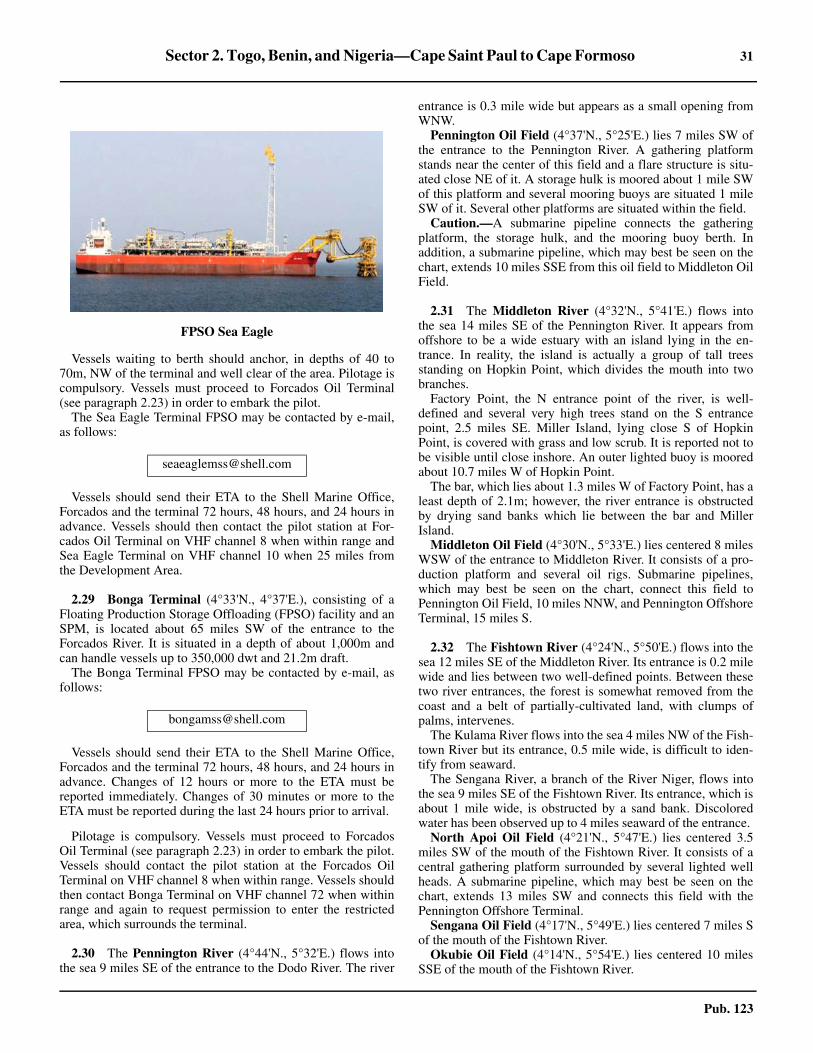
Sector 2. Togo, Benin, and Nigeria—Cape Saint Paul to Cape Formoso 31
Pub. 123
2.28 Vessels waiting to berth should anchor, in depths of 40 to70m, NW of the terminal and well clear of the area. Pilotage iscompulsory. Vessels must proceed to Forcados Oil Terminal(see paragraph 2.23) in order to embark the pilot.2.28 The Sea Eagle Terminal FPSO may be contacted by e-mail,as follows:
2.28 Vessels should send their ETA to the Shell Marine Office,Forcados and the terminal 72 hours, 48 hours, and 24 hours inadvance. Vessels should then contact the pilot station at For-cados Oil Terminal on VHF channel 8 when within range andSea Eagle Terminal on VHF channel 10 when 25 miles fromthe Development Area.
2.29 Bonga Terminal (4°33'N., 4°37'E.), consisting of aFloating Production Storage Offloading (FPSO) facility and anSPM, is located about 65 miles SW of the entrance to theForcados River. It is situated in a depth of about 1,000m andcan handle vessels up to 350,000 dwt and 21.2m draft.2.29 The Bonga Terminal FPSO may be contacted by e-mail, asfollows:
2.29 Vessels should send their ETA to the Shell Marine Office,Forcados and the terminal 72 hours, 48 hours, and 24 hours inadvance. Changes of 12 hours or more to the ETA must bereported immediately. Changes of 30 minutes or more to theETA must be reported during the last 24 hours prior to arrival.
2.29 Pilotage is compulsory. Vessels must proceed to ForcadosOil Terminal (see paragraph 2.23) in order to embark the pilot.Vessels should contact the pilot station at the Forcados OilTerminal on VHF channel 8 when within range. Vessels shouldthen contact Bonga Terminal on VHF channel 72 when withinrange and again to request permission to enter the restrictedarea, which surrounds the terminal.
2.30 The Pennington River (4°44'N., 5°32'E.) flows intothe sea 9 miles SE of the entrance to the Dodo River. The river
entrance is 0.3 mile wide but appears as a small opening fromWNW.2.30 Pennington Oil Field (4°37'N., 5°25'E.) lies 7 miles SW ofthe entrance to the Pennington River. A gathering platformstands near the center of this field and a flare structure is situ-ated close NE of it. A storage hulk is moored about 1 mile SWof this platform and several mooring buoys are situated 1 mileSW of it. Several other platforms are situated within the field.2.30 Caution.—A submarine pipeline connects the gatheringplatform, the storage hulk, and the mooring buoy berth. Inaddition, a submarine pipeline, which may best be seen on thechart, extends 10 miles SSE from this oil field to Middleton OilField.
2.31 The Middleton River (4°32'N., 5°41'E.) flows intothe sea 14 miles SE of the Pennington River. It appears fromoffshore to be a wide estuary with an island lying in the en-trance. In reality, the island is actually a group of tall treesstanding on Hopkin Point, which divides the mouth into twobranches.2.31 Factory Point, the N entrance point of the river, is well-defined and several very high trees stand on the S entrancepoint, 2.5 miles SE. Miller Island, lying close S of HopkinPoint, is covered with grass and low scrub. It is reported not tobe visible until close inshore. An outer lighted buoy is mooredabout 10.7 miles W of Hopkin Point.2.31 The bar, which lies about 1.3 miles W of Factory Point, has aleast depth of 2.1m; however, the river entrance is obstructedby drying sand banks which lie between the bar and MillerIsland.
Middleton Oil Field (4°30'N., 5°33'E.) lies centered 8 milesWSW of the entrance to Middleton River. It consists of a pro-duction platform and several oil rigs. Submarine pipelines,which may best be seen on the chart, connect this field toPennington Oil Field, 10 miles NNW, and Pennington OffshoreTerminal, 15 miles S.
2.32 The Fishtown River (4°24'N., 5°50'E.) flows into thesea 12 miles SE of the Middleton River. Its entrance is 0.2 milewide and lies between two well-defined points. Between thesetwo river entrances, the forest is somewhat removed from thecoast and a belt of partially-cultivated land, with clumps ofpalms, intervenes.
The Kulama River flows into the sea 4 miles NW of the Fish-town River but its entrance, 0.5 mile wide, is difficult to iden-tify from seaward.
The Sengana River, a branch of the River Niger, flows intothe sea 9 miles SE of the Fishtown River. Its entrance, which isabout 1 mile wide, is obstructed by a sand bank. Discoloredwater has been observed up to 4 miles seaward of the entrance.
North Apoi Oil Field (4°21'N., 5°47'E.) lies centered 3.5miles SW of the mouth of the Fishtown River. It consists of acentral gathering platform surrounded by several lighted wellheads. A submarine pipeline, which may best be seen on thechart, extends 13 miles SW and connects this field with thePennington Offshore Terminal.
Sengana Oil Field (4°17'N., 5°49'E.) lies centered 7 miles Sof the mouth of the Fishtown River.
Okubie Oil Field (4°14'N., 5°54'E.) lies centered 10 milesSSE of the mouth of the Fishtown River.
FPSO Sea Eagle

32 Sector 2. Togo, Benin, and Nigeria—Cape Saint Paul to Cape Formoso
Pub. 123
2.33 Pennington Offshore Terminal (4°15'N., 5°37'E.)(World Port Index No. 46200) is situated 16 miles SW of theentrance to the Fishtown River and consists of two SPMs.Submarine pipelines extend NE from the terminal toward theshore and N to Middleton Oil Field.
A floating storage vessel (VLCC Oloibiri) is moored to SPMA. The export loading berth, SPM B, is moored in a depth of26.8m, about 0.7 mile NW of SPM A. It can accommodate ves-sels up to 250,000 dwt and 24.3m draft.2.33 The wind and swell at the terminal are mostly from a SWdirection. The weather is generally good from November toMay, but it may be unfavorable during the wet season (May toNovember). The currents in the vicinity of the terminal are re-ported to be irregular and strong at times.2.33 A designated anchorage area lies 2.3 miles SW of the term-inal. Vessels berth during daylight hours only, but may departat any time. Vessels must have their engines ready for imme-diate use while at the terminal.2.33 Pilotage is compulsory. Pilots, who act as mooring masters,may be contacted by VHF and board about 2 miles W of SPMB or near the anchorage area. They remain on board during theentire loading operation.2.33 Vessels should send an ETA 10 days, 96 hours, and 24 hoursprior to arrival via the oil company (TOPCON) office in Lagos.Vessels should then contact the terminal 2 hours prior to arrivalon VHF channel 16.2.33 A restricted area, with a radius of 3 miles, is centered on theterminal. All vessels are prohibited from entering this areawithout prior permission.
2.34 The Nun River (Branch River) (4°16'N., 6°04'E.)flows into the sea 16 miles SE of the Fishtown River. It isentered between Cape Nun and Palm Point, 1.4 miles SE. Thisriver was formerly used as the principal entrance into the NigerRiver. However, because of shoaling on the bar and continualchanges in the channel above Akassa, 2 miles within theentrance, navigation is only possible by vessels with lightdrafts, even when the river level is high.2.34 The river mouth is imposing when first entered, but, afterreaching Akassa, the channel is almost entirely obstructed bynumerous flats and drying sand banks. It is not until 25 miles Nof Akassa that the river regains a width and depths commen-surate with its importance.2.34 The shores on either side of the river entrance are heavilywooded and form areas of vast swamp as they are at a levelclose to that of the river.
Cape Nun (4°17'N., 6°04'E.), the N entrance point of theriver, is somewhat low, with trees standing close behind it.Between this cape and Barracoon Point, 2 miles N, the W bankof the river is sandy, with trees extending almost to the edge ofthe water. A beacon, 9m high, is situated on Barracoon Point.2.34 Palm Point (4°16'N., 6°05'E.), the S entrance point, is low,sandy, and covered with grass. Several trees stand about 0.3mile N of the point. A square clump of trees, situated 0.5 mileinland and 2.5 miles E of the point, is somewhat conspicuousabove the unbroken line of tree tops.2.34 A light is shown from a metal pile structure standing on thepoint; a beacon is situated 2 miles E of it.2.34 The bar fronting this river is considered to be one of theworst within the Niger Delta. The coast changes directionsharply in this vicinity and renders it fully exposed to the Wand S. There is always a heavy swell on the bar and calm daysare very few. The bar lies between the S extremities of twoshallow spits, which extend up to about 4 miles S from eachentrance point. The sea breaks heavily along the W spit andthere are heavy rollers and surf along the E spit. The bar iscomposed of hard sand, with mud immediately outside of it,and has a least depth of 1.8m (1963).2.34 During the rainy season, the bar frequently breaks all over,but it only breaks after half ebb in the dry season. Local know-ledge is essential for crossing the bar. Discolored water hasbeen observed up to 4 miles seaward of the bar.2.34 Akassa (4°19'N., 6°04'E.), a small town, is situated on the Wbank of the Nun River, 2 miles N of Cape Nun and close NWof Barracoon Point. A small wharf, with a depth of 1.2m, frontsthe town. Vessels may anchor in a depth of 14m, mud, in themiddle of the channel, off Barracoon Point. Local pilots for theinland creeks are available here.2.34 Anchorage may be obtained offshore, free from rolling, in adepth of 11m about 5 miles S of Palm Point. In this vicinity, thecurrent from the river usually keeps the bow of the vesselheading N.2.34 Caution.—During the harmattan season (November to Feb-ruary) or during heavy rains, the river entrance may be oftenobscured for several days.
2.35 Anyala Oil Field (3°55'N., 5°54'E.) lies centered 24miles SSW of the mouth of the Nun River.2.35 Cape Formoso (4°16'N., 6°05'E.) is the low and wooded tractwhich forms the S extension of the Niger Delta. This cape, locatedon the E side of the Nun River, also forms the E extremity of theBight of Benin and is fully described in paragraph 3.2.
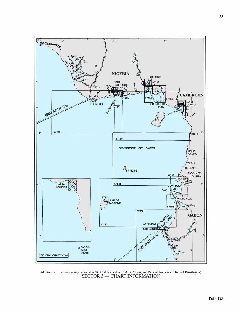
33
Pub. 123
3. Nigeria to Gabon—Cape Formoso to Cap Lopez
3.0Additional chart coverage may be found in NGA/DLIS Catalog of Maps, Charts, and Related Products (Unlimited Distribution).3.0SECTOR 3 — CHART INFORMATION

35
Pub. 123
SECTOR 3
NIGERIA TO GABON—CAPE FORMOSO TO CAP LOPEZ
3.0 Plan.—This sector describes the African coast betweenCape Formoso and Cap Lopez, and includes the islands lyingin the Bight of Biafra. It includes the coasts of Nigeria,Cameroon, Equatorial Guinea, and Gabon. The descriptive se-quence is first from W to E and then from N to S.
General Remarks
3.1 The Bight of Biafra, known to Nigeria as the Bight ofBonny, is an extensive indentation in the African coast. Withinthe limits of this bight, numerous rivers discharge into the sea.The most important of these rivers are the New Calabar River,the Bonny River, and the Calabar River. The N shore of thisbight is almost flat and dark in color. It is intersected by themouths of the numerous rivers, forming the Niger Delta, eachof which is obstructed by bars or shoals at the entrance. Thecoast consists of a belt which is 10 to 60 miles wide andcovered with mangrove forests and swamps. Vast tropicalforests stand inland of this coastal belt beyond which theground becomes more open. There is little vegetation and verylittle rainfall in the extreme N part.3.1 Fako (4°13'N., 9°10'E.), also known as Cameroon Mount-ain, is the highest peak of the mountains which rise abruptlyfrom the land on the NE shore of the bight. This peak attains anelevation of 4,090m and is covered with trees and verdure ofluxuriant growth, except in the vicinity of the rounded summit.It is very conspicuous from seaward but the summit is oftenobscured by clouds. Fako is also a volcano. It last had an erup-tion, with lava flowing from a vent at an elevation of 1,400m,in 1999. Another conspicuous peak, which stands about 9miles SSW of Fako, ascends from the SW slopes of the mount-ain range. Although numerous other peaks rise from the sidesof this range, they appear slight and scarcely break the uni-formity of the slopes.3.1 The more distant mountains, which stand about 30 miles Nof Fako, attain elevations of 1,220 to 1,830m and tower aloft inhuge peaks and rugged masses. A plain, from whose surfaceseveral conical hills rise abruptly, extends between the bases ofthese mountains. Several other nearby peaks, which are extinctvolcanoes, are also visible from seaward.3.1 The islands lying in the Bight of Biafra are evidently of vol-canic origin and, together with the mountain ranges on themainland, are probably the gigantic results of one and the samesubmarine upheaval.3.1 Winds—Weather.—The Southwest Monsoon is the most sig-nificant of the local winds in this area. This large scale sea breeze,which extends up to about 150 miles inland, occurs in the Nsection over the Gulf of Guinea and adjacent coasts. It is strongestduring the summer (June-August), but is prevalent all year. Themonsoon is a deflection of the SE trade winds toward the heatedcontinental interior. It acts very much like a land-sea breezesystem and is felt up to about 10°S. At Douala for example, whileSW winds are prevalent during the afternoon, their frequencydrops to 5 per cent during the early morning hours.
3.1 The harmattan, a wind of continental origin, is a hot, drywind from the NE quadrant. It reaches the shores of the Gulf ofGuinea and extends seaward. This wind is prevalent fromDecember through early March and is usually laden with finedust which can reduce visibility in the form of haze. Theharmattan generally occurs between Cape Palmas (4°22'N.,7°44'W.) and Douala (4°03'N., 9°41'E.).
3.1 Tides—Currents.—The Guinea Current sets E along the Nshore of the Gulf of Guinea. During June through October, alarge part of this current is formed by an extension of theAtlantic Equatorial Countercurrent. During other months, it isconsidered to be an extension of the Canaries Current whichsets S along the NW coast of Africa. The Guinea Currentattains rates of 1 to 2 knots, but generally becomes weaker as itflows E and is very weak in the Bight of Biafra.
3.1 Regulations.—For information concerning Nigerian ShipEntry Notice (SEN), VHF communications regulations, andreporting requirements for Nigerian oil terminals, see Pub. 160,Sailing Directions (Planning Guide) South Atlantic Ocean andIndian Ocean.
3.1 Caution.—Numerous oil and gas fields, with associatedrigs, platforms, obstructions, well heads, riser pipes, submarinepipelines, terminal buoys, and storage vessels, may beencountered up to 30 miles offshore between the approaches tothe Forcados River (5°20'N., 4°50'E.) and the approaches toDebundscha Point (4°06'N., 8°58'E.). It is reported (2005) thatoil and gas development and exploration areas may be foundup to 50 miles seaward of the coast described in this sector.3.1 Some of the well heads may protrude more than 5m abovethe sea bed and may be unmarked. Some of the platforms andstructures may be disused, abandoned, and unlit. In manycases, the submarine pipelines are not buried in the sea bed anddepths over them may be reduced by as much as 2m. In addi-tion, many temporary structures and objects associated with oiland gas exploration may not be charted.3.1 Several restricted areas lie offshore in the vicinity of the oiland gas installations. Vessels not proceeding to or departingfrom these installations should keep clear of the areas.3.1 The constant heavy surf along the coast generally preventslanding by boats and renders the river bars dangerous.3.1 Internal waves, known as Solitons, have been experiencedwithin the waters described in this sector. These waves can re-sult in extremely rapid current changes of 3 to 4 knots within adistance of 300 to 400m. This phenomenon can be very haz-ardous for vessels engaged in offshore operations.3.1 Vessels are cautioned that security off the West African coastand within some ports is a serious problem. In recent years(1986-2005) several attacks by pirates and thieves have beenreported. These have generally taken place at the outer anchor-ages, but some have occurred while berthed alongside ormoored at offshore terminals.

36 Sector 3. Nigeria to Gabon—Cape Formoso to Cap Lopez
Pub. 123
Cape Formoso to the Cameroon River
3.2 Cape Formoso (4°16'N., 6°05'E.) is the general namegiven to the low, wooded tract which forms the S extension ofthe Niger Delta. This tract lies on the E side of the entrance tothe Nun River and Palm Point, which is marked by a light,forms its S extremity.
Between Palm Point and West Point, 8 miles E, the coast isfronted by a flat and sandy shore. The surf breaks heavily onthis shore and trees stand along it, close to the water.3.2 The Brass River (4°17'N., 6°13'E.), formed by the conflu-ence of several branches of the Niger River, is entered betweenWest Point and East Point, about 1 mile ENE. 3.2 West Point is low, sandy, and covered with small bushes. It isreported to be difficult to identify from seaward. The foresttrees extend close up to the HW mark in this vicinity.3.2 East Point is thickly wooded, but the trees on it have theappearance of a steep bluff and do not extend to the water. TheW bank of the river is backed by trees as far as the entrance toAkassa Creek, 2 miles N of West Point. Above the entrance toAkassa Creek, the mangroves and swamps begin. The E bankof the river has some small villages, hidden by trees, situatedwithin 0.5 mile of East Point.3.2 Anchorage may be obtained in a depth of 11m about 6 milesSW of West Point or 7 miles SE of East Point.3.2 Brass (4°19'N., 6°14'E.), a small town, stands on the E bankof the river, about 1 mile NE of East Point. It is fronted byseveral small piers which are used by boats and small craft.3.2 A bar, consisting of shoals, connects the seaward ends of twospits which extend S for 1.5 miles from the entrance points.The outer part of this bar lies 2 to 3 miles S of the river mouth.Breakers mark the spits and the bar. A passage, about 0.5 milewide, leads over the center of the bar, where the breakers areless frequent than elsewhere. The fairway is shallow andmarked by buoys. It is only used by small craft with localknowledge. The approach is dangerous because of the heavyrollers which break at frequent intervals even at HW. The innerpart of the channel may also be obstructed by fishing nets.3.2 Caution.—Two unlit riser pipes, reported to be radar con-spicuous, lie about 7 miles S of West Point.3.2 In the rainy season, the Brass River entrance is oftencompletely obscured.
3.3 Brass Oil Terminal (4°04'N., 6°17'E.), located about14 miles SSE of the mouth of the Brass River, consists of alighted central platform, which is equipped with a racon, andtwo SPMs. Submarine pipelines, which may best be seen onthe chart, extend NNW to the shore and SE to the Agbara OilField from the terminal.
No. 1 SBM and No. 2 SBM are situated 1 mile E and 1 mileW, respectively, of the central platform, in a depth of 27.4m.Vessels of up to 300,000 dwt and 22.8m draft can be handled,with a minimum length of 220m and a maximum length of366m.
Pilotage is compulsory. Pilots can be contacted by VHF andboard in the vicinity of the anchorage. Berthing takes placeonly during daylight hours. Vessels may depart at any time.
A designated anchorage area, with depths of 27 to 29m andfairly good holding ground, lies about 2.8 miles NE of theterminal platform.
3.3 Vessels should send an ETA to the terminal via Lagos Radio5 days, 72 hours, 48 hours, and 24 hours before arrival. Vesselsshould then contact the terminal by VHF before arrival andwhen anchoring.3.3 A restricted area, with a radius of 2.5 miles, is centered onthe terminal. Vessels must receive permission to enter this area.3.3 Agbara Oil Field (3°56'N., 6°24'E.) lies about 10 miles SEof Brass Oil Terminal and has a central platform, with a veryconspicuous flare.
3.4 Between the Brass River and the Bonny River, about50 miles E, the coast is intersected by several rivers. Themouths of these rivers are fronted by bars on which the seagenerally breaks heavily. The rivers are not entered throughtheir main mouths, but through creeks which connect them in-land with other rivers having navigable entrances. Several bea-cons are situated along the shore between the river entrances. 3.4 The River Saint Nicholas (4°18'N., 6°25'E.) lies 12 miles Eof the Brass River and is separated from it by slightly elevatedwooded land. The W entrance point of the river is surmountedby trees, which are taller than elsewhere in the vicinity, and canbe easily identified. Heavy surf fronts the river mouth and barsentry.3.4 The River Santa Barbara (4°19'N., 6°36'E.) lies 11 miles Eof the River Saint Nicholas and is separated from it by lowforest land, fringed by a sandy beach. The entrance points arelow and difficult to recognize from seaward. Heavy surf frontsthe river mouth and bars entry to the river.3.4 The River San Bartholomeo (4°20'N., 6°43'E.) lies 7 milesE of the River Santa Barbara and is separated from it by asandy plain, 0.3 mile wide, which is interspersed with severalshallow lagoons. The entrance points of the river are bold,being covered with tall trees. A shallow bar extends up to 3.5miles S of the mouth.3.4 The River Sambreiro (4°22'N., 6°53'E.) lies 11 miles E ofthe River San Bartholomeo; its entrance does not open whenapproached from the W until bearing less than 334°. The Wentrance point then appears low, sloping, and gradually risingto tall forest trees behind it. When the river mouth is fullyopen, bearing about 314°, both entrance points appear as bold,high bluffs. Heavy surf fronts the river mouth and extends up to3.5 miles offshore.3.4 Fouche Point (4°23'N., 7°01'E.) is located about 8 miles Eof the W entrance point of the River Sambreiro. From thevicinity of the entrance to the River Sambreiro, this pointappears to be the extremity of the land because the E side of theestuary formed by the New Calabar River and the Bonny Riveris not visible until a vessel proceeds farther to the E. Theentrance of Ke (Fouche) Creek, about 0.3 mile wide, lies closeW of Fouche Point. A prominent radio mast, 18m high, standson the SW side of Fouche Point.3.4 Caution.—A dangerous wreck lies about 6 miles S ofFouche Point and is marked on its S side by a buoy.3.4 A stranded wreck, radar conspicuous, lies about 3.2 milesSW of Fouche Point. Another stranded wreck is reported to lieabout 6 miles SW of the point.
3.5 The New Calabar River (4°23'N., 7°02'E.) and theBonny River (4°18'N., 7°04'E.) flow into a common estuarywhich lies between Fouche Point and Field Point, 7 miles E.

Sector 3. Nigeria to Gabon—Cape Formoso to Cap Lopez 37
Pub. 123
The section of the Bonny River as far as Okrika, 25 milesabove Field Point, is more correctly described as an arm of thesea, as it is insignificant and drains only a comparatively smallarea. The estuary is fronted by a bar which is more easilycrossed than those of other rivers in the Niger Delta.3.5 Fouche Point, the W entrance point of the estuary, is low andwooded with tall trees, among which the sea breaks at HW.The W bank of the New Calabar River extends NNW from thispoint. It is lined by mangroves and thick bush and is intersectedby many creeks.3.5 Field Point, the E entrance point of the estuary, is low, sandy,and covered with grass. A prominent beacon, 15m high, is situ-ated in the vicinity of this point.3.5 Bonny River Light (4°25'N., 7°08'E.), equipped with aracon, is shown from a framework tower standing 1 mile N ofField Point.3.5 Rough Corner Spit, an area of drying patches, fronts FieldPoint; its seaward edge is marked by breakers. 3.5 Peter Point is located 2 miles N of Field Point. The E bank ofthe river between these points is lined by mangroves.3.5 Yellow Island lies NE of Fouche Point and forms the E sideof the New Calabar River. It is subject to continual change withislets and sandbanks constantly forming and reforming in thisvicinity.3.5 In the approaches to the estuary, the hard sandy bottom ofthe river is reported to extend seaward into depths of 11 to12m. Off the other river entrances in this vicinity, the bottom atthese depths is invariably formed by soft mud.3.5 An outer fairway lighted buoy (4°12'N., 7°00'E.), equippedwith a racon, is moored about 14 miles SW of Bonny RiverLight.3.5 Inda Oil Field (4°21'N., 7°06'E.), with several platforms,lies centered about 4 miles SW of Field Point.
3.5 Tides—Currents.—Off Bonny, the current setting N begins5 hours 30 minutes before HW and runs for 6 hours. It attains amaximum rate of 2.5 knots at springs. The current setting Sbegins 1 hour after HW and runs for 5 hours. It attains amaximum rate of 3.5 knots at springs. Between Field Point andPeter Point, 1.7 miles N, both currents set toward the entrance.
3.5 Depths—Limitations.—The bar fronting the estuary con-sists of a shoal area which connects the shallow banks extend-ing from the entrance points to an extensive flat extending Sfrom Yellow Island. Breaker Spit, lying 2.3 miles W of FieldPoint, forms the E side of the extensive flat. It dries in placesand breaks heavily at half tide, even in fine weather. WesternBreakers, a shoal, forms the SW part of the flat and its E edgeis steep-to. This shoal breaks continuously in moderateweather, but not in calm weather.
3.5 Baleur Bank, with a least depth of 1.8m, lies centered 6miles S of Field Point. It generally breaks at half tide and at allstages of the tide during rough weather.3.5 Fouche Patches, a cluster of submerged heads, lies within thebar and has a least depth of 1.5m. This cluster lies on a shoalwhich extends about 3.5 miles SE from Fouche Point.3.5 An entrance channel, 200m wide, extends NE across the barand leads to the Bonny River. This channel, which may best beseen on the chart, is marked by lighted buoys and is dredged toa depth of 12.5m (1997). 3.5 Pilotage.—Pilotage is compulsory from the outer fairwaylighted buoy (4°12'N., 7°00'E.) along the Bonny River to PortHarcourt. For further information, see paragraph 3.10.3.5 Caution.—Due to the continual coastal erosion near theentrance of the estuary, the charted aspect of the land shouldnot be relied upon.3.5 When the harmattan is blowing, the land in the vicinity ofFouche Point will generally not be visible to vessels enteringthe river.3.5 The lighted buoys marking the entrance channel should notbe depended upon and are reported to be often unlit at night. Itwas reported (1995) that several of the buoys were missing.3.5 Vessels should contact the port authorities in advance toverify the latest depths in the river channel.
3.5 Several submarine pipelines, which may best be seen on thechart, extend across the river. The depths in the channel may bereduced by as much as 1.8m in the vicinity of these pipelines.3.5 Fishing stakes line the sides of the river in numerous places.3.5 Several spoil ground areas lie in the approaches and withinthe river and may best be seen on the chart.3.5 Several oil fields and offshore terminals, with associatedstructures, lie in the approaches to the estuary and may best beseen on the chart.3.5 It was reported (1986-2005) that several vessels, whileanchored off the entrance channel, had been attacked bypirates. The authorities now advise vessels to drift within radarrange of the outer lighted buoy instead of anchoring. Duringthis same period, serious theft was being carried out from ves-sels berthed at the river ports and precautions should be taken.
3.6 Okwori Oil Terminal (3°51'N., 6°59'E.), locatedabout 33 miles SSW of Field Point, consists of a Floating Pro-duction Storage and Offshore (FPSO) facility. The FPSO(Sendje Berge), alongside which the loading vessel is berthed,is moored in a depth of 138m. Vessels up to 250,000 dwt canbe handled.3.6 Pilotage is compulsory. Pilots, who act as mooring masters,may be contacted by VHF and board about 3 miles ENE of theterminal. Berthing is carried out during daylight hours only.Vessels may depart at any time.
Bonny River Light
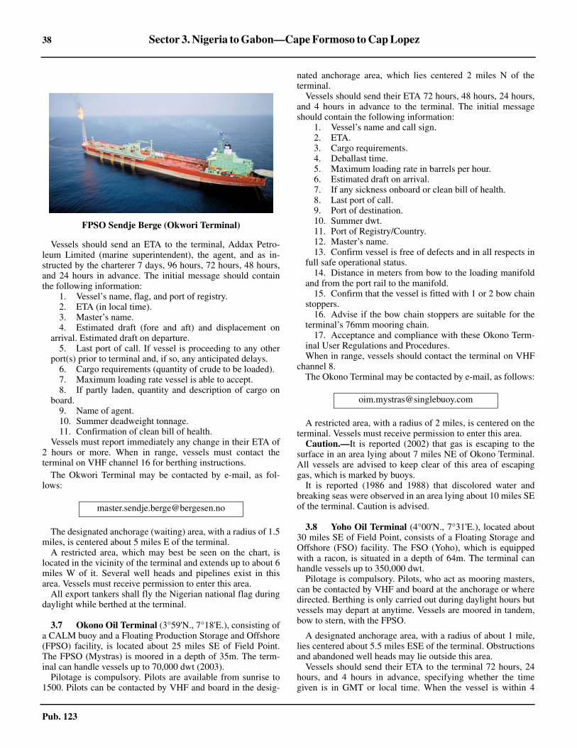
38 Sector 3. Nigeria to Gabon—Cape Formoso to Cap Lopez
Pub. 123
3.6 Vessels should send an ETA to the terminal, Addax Petro-leum Limited (marine superintendent), the agent, and as in-structed by the charterer 7 days, 96 hours, 72 hours, 48 hours,and 24 hours in advance. The initial message should containthe following information:
1. Vessel’s name, flag, and port of registry.2. ETA (in local time).3. Master’s name.4. Estimated draft (fore and aft) and displacement on
arrival. Estimated draft on departure.5. Last port of call. If vessel is proceeding to any other
port(s) prior to terminal and, if so, any anticipated delays. 6. Cargo requirements (quantity of crude to be loaded).7. Maximum loading rate vessel is able to accept.8. If partly laden, quantity and description of cargo on
board.9. Name of agent.10. Summer deadweight tonnage.11. Confirmation of clean bill of health.
3.6 Vessels must report immediately any change in their ETA of2 hours or more. When in range, vessels must contact theterminal on VHF channel 16 for berthing instructions.3.6 The Okwori Terminal may be contacted by e-mail, as fol-lows:
3.6 The designated anchorage (waiting) area, with a radius of 1.5miles, is centered about 5 miles E of the terminal.3.6 A restricted area, which may best be seen on the chart, islocated in the vicinity of the terminal and extends up to about 6miles W of it. Several well heads and pipelines exist in thisarea. Vessels must receive permission to enter this area.3.6 All export tankers shall fly the Nigerian national flag duringdaylight while berthed at the terminal.
3.7 Okono Oil Terminal (3°59'N., 7°18'E.), consisting ofa CALM buoy and a Floating Production Storage and Offshore(FPSO) facility, is located about 25 miles SE of Field Point.The FPSO (Mystras) is moored in a depth of 35m. The term-inal can handle vessels up to 70,000 dwt (2003).3.7 Pilotage is compulsory. Pilots are available from sunrise to1500. Pilots can be contacted by VHF and board in the desig-
nated anchorage area, which lies centered 2 miles N of theterminal.3.7 Vessels should send their ETA 72 hours, 48 hours, 24 hours,and 4 hours in advance to the terminal. The initial messageshould contain the following information:
1. Vessel’s name and call sign.2. ETA.3. Cargo requirements.4. Deballast time.5. Maximum loading rate in barrels per hour.6. Estimated draft on arrival.7. If any sickness onboard or clean bill of health.8. Last port of call.9. Port of destination.10. Summer dwt.11. Port of Registry/Country.12. Master’s name.13. Confirm vessel is free of defects and in all respects in
full safe operational status.14. Distance in meters from bow to the loading manifold
and from the port rail to the manifold.15. Confirm that the vessel is fitted with 1 or 2 bow chain
stoppers.16. Advise if the bow chain stoppers are suitable for the
terminal’s 76mm mooring chain.17. Acceptance and compliance with these Okono Term-
inal User Regulations and Procedures.3.7 When in range, vessels should contact the terminal on VHFchannel 8.3.7 The Okono Terminal may be contacted by e-mail, as follows:
3.7 A restricted area, with a radius of 2 miles, is centered on theterminal. Vessels must receive permission to enter this area.3.7 Caution.—It is reported (2002) that gas is escaping to thesurface in an area lying about 7 miles NE of Okono Terminal.All vessels are advised to keep clear of this area of escapinggas, which is marked by buoys.3.7 It is reported (1986 and 1988) that discolored water andbreaking seas were observed in an area lying about 10 miles SEof the terminal. Caution is advised.
3.8 Yoho Oil Terminal (4°00'N., 7°31'E.), located about30 miles SE of Field Point, consists of a Floating Storage andOffshore (FSO) facility. The FSO (Yoho), which is equippedwith a racon, is situated in a depth of 64m. The terminal canhandle vessels up to 350,000 dwt.3.8 Pilotage is compulsory. Pilots, who act as mooring masters,can be contacted by VHF and board at the anchorage or wheredirected. Berthing is only carried out during daylight hours butvessels may depart at anytime. Vessels are moored in tandem,bow to stern, with the FPSO.
3.8 A designated anchorage area, with a radius of about 1 mile,lies centered about 5.5 miles ESE of the terminal. Obstructionsand abandoned well heads may lie outside this area.3.8 Vessels should send their ETA to the terminal 72 hours, 24hours, and 4 hours in advance, specifying whether the timegiven is in GMT or local time. When the vessel is within 4
FPSO Sendje Berge (Okwori Terminal)

Sector 3. Nigeria to Gabon—Cape Formoso to Cap Lopez 39
Pub. 123
hours of arrival, the terminal should be contacted on VHFchannel 16 or 17. Further communication, including instruc-tions, will be conducted on a working channel. In the event of acommunication difficulty, vesels should contact the Qua IboeTerminal (see paragraph 3.19).3.8 Yoho Oil Terminal, which is operated by Mobil Nigeria,Lagos, may be contacted by e-mail, as follows:
3.8 A restricted area, with a radius of 1.5 miles, is centered onthe terminal. Vessels are prohibited from entering this areawithout prior permission from the terminal.3.8 Caution.—It is reported (2002) that gas is escaping to thesurface in an area lying about 6 miles NW of Yoho Terminal.All vessels are advised to keep clear of this area of escapinggas, which is marked by buoys.3.8 It is reported (1986 and 1988) that discolored water andbreaking seas were observed in an area lying about 5 milesSSW of the terminal. Caution is advised.
3.9 Bonny Offshore Terminal (4°11'N., 7°14'E.),located 13.5 miles SSE of Field Point, consists of a lightedmanifold platform and two SBMs. A submarine pipeline ex-tends NNW from the terminal to the shore. No. 1 SBM ismoored close SSW of the platform and No. 2 SBM is mooredclose SSE of the platform.
The terminal is situated in a depth of 27.4m and can handlevessels between 45,000 dwt and 320,000 dwt, with drafts up to22.8m. There are no maximum limitations on length or beam.
Pilotage is compulsory. Pilots, who act as mooring masters,can be contacted by VHF and board at the anchorage. Theyremain on board throughout the loading operation.
Vessels should send an ETA via Lagos Radio 7 days, 3 days,2 days, and 24 hours prior to arrival. Vessels should reportimmediately if their ETA changes by more than 2 hours. Whenin range or 3 hours prior to arrival, vessels should contact theterminal on VHF channel 10 for berthing information. Vesselsat anchor should maintain a continuous listening watch onVHF channels 8 and 16.3.9 The designated anchorage area, which is reported to havepoor holding ground, lies about 3.5 miles S of the platform.Vessels must not proceed any closer to the terminal without apilot.3.9 Caution.—During the rainy season (June to September),heavy swells may be encountered at the anchorage.3.9 It is reported (2002) that gas is escaping to the surface in anarea lying about 11 miles SE of Bonny Offshore Terminal. Allvessels are advised to keep clear of this area of escaping gas,which is marked by buoys.
3.10 Bonny (4°27'N., 7°10'E.) (World Port Index No.46205) lies at the E side of the river. The town stands on verylow land among mangrove swamps.3.10 Tides—Currents.—The tides rise about 2.9m at springs and1.9m at neaps.3.10 Depths—Limitations.—The maximum draft to which avessel can load is governed by the datum depth in the channel,the height of tide, and the underkeel clearance allowed.
3.10 It is reported (1997) that the approach channel has beendredged to a depth of 12.5m over a width of 200m. The tide isvariable, but the relevant factor is the height at the time oftransit. The underkeel clearance allowed is dependent on thetime of the year and is related to the height of the swell expect-ed to be encountered in the channel. The underkeel clearanceranged from 0.76 to 1.22m (1989). The maximum size ofvessel permitted at the terminal (1989) was 135,000 dwt,subject to review during the rainy season (May throughOctober). The maximum length allowed was 320m and themaximum draft allowed was 11.2m. Vessels must have a min-imum length of 161m, but there is no restriction for beam.3.10 The inshore terminal lies close S of the town, at the E side ofthe river. It consists of three river berths, each formed byseveral mooring buoys.3.10 It is reported (1998) that this inshore terminal has beenclosed to commercial shipping. The mooring buoys have beenremoved, but obstructions and foul ground remain in thevicinity.3.10 Mobil Jetty (Bonny River LNG Terminal) is a T-headedfacility located on Peter Point, 2 miles N of Field Point. Thereis an alongside depth of 12.5m. Vessels of 20,000 to 120,000dwt can be accommodated. The facility is surrounded by anEntry Restricted zone.3.10 The Nigeria LNG Terminal (NLNG Terminal), a T-headedfacility, stands about 1 mile NE of the Mobil Jetty. The term-inal normally accommodates product tankers of 30,000 to60,000 dwt, but partially-loaded vessels up to 100,000 dwt canbe handled. It also handles LNG vessels up to 140,000 cubicmeters. The facility is surrounded by an Entry Restricted zone.3.10 The NPG Jetty, a T-headed pier, is situated between theabove two jetties. It can accommodate LPG vessels with capa-cities between 30,000 and 85,000 cubic meters.3.10 Shell Jetty, located about 1 mile NE of the Nigeria LNGTerminal, is closed to shipping.3.10 A storage tanker (Tuma) is moored in the river, 0.7 mileWNW of Peter Point. Vessels berth alongside this tanker anddepart at the early part of the ebb tide.3.10 Pilotage.—Pilotage is compulsory from the outer fairwaylighted buoy along the Bonny River up to Port Harcourt,including Onne and Okrika. Pilots can be contacted by VHFand board, as follows:
1. Bonny Inshore Terminal:a. Condensate and LNG vessels—2 miles SW of the
outer fairway lighted buoy (4°12'N., 7°00'E.).b. Other vessels—1 mile SW of No. 1 lighted buoy.
2. Port Harcourt, Onne, and Okrika—in the anchorageoff the NPA Jetty.
3.10 Regulations.—Vessels should send their ETA 7 days, 72hours, 48 hours, and 24 hours in advance, giving the followinginformation:
1. Vessel name.2. Flag.3. Port of registry.4. Call sign.5. Official number.6. Length.7. Beam.8. Charterer.9. Owner’s name and address.

40 Sector 3. Nigeria to Gabon—Cape Formoso to Cap Lopez
Pub. 123
10. Agent’s name.11. Voyage number, if used.12. Master’s name.13. Crew number and nationalities.14. Last port of call.15. Next port of call.16. Tonnage and type of cargo.
3.10 Vessels should then contact Bonny Signal Station on VHFchannel 14 to obtain permission to proceed into the entrancechannel. Vessels should also maintain a continuous listeningwatch on VHF channel 8 and 14.3.10 All movements of vessels between the outer fairway lightedbuoy and the gas berths are restricted when gas or condensatesupertankers are maneuvering in the area.3.10 Anchorage.—Vessels proceeding to Bonny may anchor indepths of 17 to 19m within a designated area centered about 4miles W of the outer fairway lighted buoy. When anchored,vessels should report their date and time of arrival to the portauthority by VHF.
3.11 Onne (4°39'N., 7°09'E.), a new port, is situated inOgu Creek and consists of a quay, 1,590m long, whichprovides six berths. The quay has a depth of 13.5m alongsideand can accommodate vessels up to 55,000 dwt. There arefacilities for general cargo, container, ro-ro, and bulk vessels.The entrance channel within the creek is dredged to a depth of9.2m.
3.12 Okrika (4°43'N., 7°05'E.) (World Port Index No.46207), an oil terminal, lies on the NE side of the river channel,about 0.5 mile SSE of the island on which the town of Okrikastands. The oil refinery is fronted by an L-shaped jetty, 259mlong, which has a square dolphin at the outer end. Coastal andocean tankers up to 50,000 dwt and 192m in length can behandled. Berthing is carried out during daylight hours only.The approach river channel has a datum depth of 8.8m (1989).Vessels with drafts up to 7.9m can berth and vessels with draftsup to 9m can depart on the flood tide.
3.13 Port Harcourt (4°46'N., 7°00'E.) (World Port IndexNo. 46210), a railroad terminal, lies on the E side of a bend inthe Bonny River, about 30 miles above the mouth.3.13 Depths—Limitations.—There are eight principal dry cargoberths, which are 128 to 186m long; one palm oil berth; andone tanker berth. In addition, there are several mooring buoyberths, with depths of 8m. Generally, vessels up to 183m inlength and 7.6m draft can be accommodated. At the palm oilberth, which consists of a T-jetty with dolphins, vessels arelimited to a maximum length of 146m. Berthing is carried outduring daylight hours only. The approach river channel has adatum depth of 8.8m (1989).3.13 Signals.—When two black balls are displayed from the sig-nal station of the port, a vessel is known to be proceeding up-river from Bonny and outbound vessels should take necessaryprecautions, especially when navigating the bends.3.13 Caution.—At the river berths, the flood tidal current attainsa rate of 2.5 knots and the ebb current attains a rate of 3 knots.
3.14 Between the Bonny River and the Opobo River, 27miles E, the coast is low and swampy. It is covered with man-
groves and other trees which grow in brackish water. Furtherinland, the country is fertile and more elevated. Severalbeacons, which may best be seen on the chart, stand along thisstretch of the shore.3.14 The Andoni River (4°25'N., 7°20'E.), which is shallow andnot used, enters the sea 11 miles E of Field Point.3.14 Kalaekule Oil Field (4°16'N., 7°19'E.), with several plat-forms, lies centered about 10 miles S of the mouth of the An-doni River.3.14 Caution.—Vessels navigating along this stretch of the coastshould not proceed into depths of less than 15m without localknowledge due to numerous obstructions and dangers. 3.14 Numerous oil wells lying off the this stretch of the NigerDelta have collapsed and created foul areas, which may best beseen on the chart.
3.15 Ima Oil Terminal (4°13'N., 7°23'E.), located about14 miles SSE of the mouth of the Adoni River, consists of aFloating Production Storage and Offshore (FPSO) facility andan SBM. A submarine pipeline extends about 9 miles NWfrom the terminal to a production platform (Cliff Langley). TheFPSO (Ailsa Craig) is moored in a depth of 25m. The terminalcan handle vessels between 25,000 dwt and 150,000 dwt, withdrafts up to 18m.3.15 Pilotage is compulsory. Pilots, who act as mooring masters,can be contacted by VHF and board 2 miles seaward of theterminal or at the anchorage. Berthing is carried out only dur-ing daylight hours. Vessels may depart at any time.3.15 Vessels should send their ETA to the terminal operator 72hours, 48 hours, and 24 hours in advance. Vessels should thencontact the terminal on VHF channel 72 prior to arrival.3.15 A restricted area, with a radius of 2 miles, is centered on theterminal. Vessels must receive permission to enter this area.3.15 All export tankers shall fly the Nigerian National flag duringdaylight while berthed at the terminal.3.15 A designated anchorage area, with a radius of 1.5 miles, liescentered about 3 miles S of the terminal.3.15 Caution.—It is reported (1986 and 1988) that discoloredwater and breaking seas were observed in an area lying about17 miles S of the Ima Terminal. Caution is advised.
3.16 The Opobo River (4°27'N., 7°35'E.) is entered be-tween West Point and East Point, 1.8 miles NE. It is fronted bya bar which is subject to change. West Point is difficult to dis-tinguish from seaward when bearing less than 015°. East Pointis fairly sharp, with forest trees standing near the water.3.16 Opobo (4°35'N., 7°32'E.) (World Port Index No. 46220) issituated on the E bank of the river, 10 miles above the mouth.This town is a principal palm oil center and a number of fac-tories, fronted by quays, stand along the river.3.16 The bar is formed by a horseshoe-shaped shoal connectingthe outer ends of the spits, which extend up to about 2 miles Sfrom each entrance point. The sea always breaks heavily onthese spits. A channel leading across the E part of this bar wasreported (1957) to have a least depth of 2.1m. The bottom ofthe bar is formed by sand, with mud on either side of it. Smallvessels, with local knowledge, use the channel, but no pilotsare available.3.16 Anchorage is available outside the bar, in a depth of 10m,about 4 miles S of West Point. However, because the prevailing

Sector 3. Nigeria to Gabon—Cape Formoso to Cap Lopez 41
Pub. 123
current sets E, vessels nearly always lie broadside to the pre-vailing S swell.3.16 Oso Oil Field (4°18'N., 7°38'E.), with several platforms, liescentered about 10 miles S of the mouth of the Opobo River.3.16 Usari Oil Field (4°14'N., 7°47'E.), with several platforms,lies centered about 18 miles SE of the mouth of the OpoboRiver.3.16 Asabo Oil Field (4°06'N., 7°48'E.), with several platforms,lies centered about 25 miles SE of the mouth of the OpoboRiver.3.16 Adua Oil Field (4°06'N., 7°42'E.), with several platforms,lies centered about 22 miles SSE of the mouth of the OpoboRiver.3.16 Ekpe Oil Field (4°06'N., 7°35'E.), with several platforms,lies centered about 21 miles S of the mouth of the Opobo River.3.16 Caution.—Numerous submarine pipelines, which may bestbe seen on the chart, extend between the above oil fields andthe shore.
3.17 Odudu Oil Terminal (4°00'N., 7°46'E.), located 29miles SSE of the entrance to the Opobo River, consists of aFloating Production Storage and Offshore (FPSO) facility. TheFPSO (Unity), a storage tanker, is moored bow-on to an SBM.A submarine pipeline extends 18 miles NE from the terminal tothe Ofon Oil Field. The terminal is situated in a depth of 64mand can handle vessels of between 80,000 and 280,000 dwt.
Pilotage is compulsory. Pilots, who act as mooring masters,can be contacted by VHF and board in the anchorage area.Berthing or departure may take place at any time. Vessels aregenerally moored to the stern of the storage tanker. Tugs areavailable for berthing; one tug will remain secured to the sternof the tanker for the entire loading operation.
Vessels should send an ETA message to the terminal 72hours, 48 hours, 24 hours, and 4 hours in advance. Vesselsshould then contact the terminal on VHF when within range.The initial message should contain the following information:
1. Vessel’s name and call sign.2. ETA.3. Cargo requirements.4. Deballast time.5. Maximum loading rate in barrels per hour.6. Estimated draft on arrival.7. If any sickness onboard or clean bill of health.8. Last port of call.9. Confirm vessel is free of defects and in all respects in
full safe operational status.10. Distance in meters from bow to the loading manifold
and from the port rail to the manifold.11. Confirm that the vessel is fitted with one or two bow
chain stoppers.12. Advise if the bow chain stoppers are suitable for the
terminal’s 84mm mooring chain.13. Acceptance and compliance with these Okono Term-
inal User Regulations and Procedures.3.17 The Odudu Terminal may be contacted by e-mail, as fol-lows:
Vessels must have the ability to maintain a minimum of 30per cent of their summer dwt throughout the loading operation.Vessels must arrive with a trim of not more than 2m by thestern.
A restricted area, which may best be seen on the chart, lies inthe vicinity of the terminal and extends up to about 8 miles S ofit. Vessels must receive permission to enter this area.
All vessels must fly the Nigerian national ensign duringdaytime when in the vicinity of the terminal.
A designated anchorage area, with a radius of 1.5 miles, liescentered about 5.5 miles NNE of the storage tanker.
3.18 Between the Opobo River and the Kwa Ibo River, 24miles E, the coast consists of a narrow ridge of sand, onlyabout 1m above sea level and, in some places, only about 3mwide. Several mangrove swamps joined by lagoons and creekslie behind this ridge.3.18 Between the Kwa Ibo River and the Calabar River, 18 milesE, the coast is formed by a strip of sand, which is mostly underwater during the rainy season, backed by a dense forest.3.18 The Kwa Ibo River (4°33'N., 7°59'E.) is entered betweenBluff Point and Egerton Point, 0.3 mile E. A bar fronts the rivermouth. A channel leads across the bar and can be used by smallcraft, with drafts up to 2.7m, at HW. The entrance of this rivercan be recognized by a church, with a prominent spire, stand-ing on the E bank, 1.5 miles within the mouth. A pier is situ-ated in the estuary of the river and is used by craft associatedwith the offshore oil and gas facilities. 3.18 A group of storage tanks and a prominent radio mast aresituated about 1 mile E of the river entrance.3.18 Enang Oil Field (4°12'N., 7°55'E.), with several platforms,lies centered about 10 miles SSW of the mouth of the Kwa IboRiver.3.18 Idoho Oil Field (4°22'N., 8°00'E.), with several platforms,lies centered about 11 miles S of the mouth of the Kwa IboRiver.3.18 Inim Oil Field (4°12'N., 8°00'E.), with several platforms,lies centered about 20 miles S of the mouth of the Kwa IboRiver.3.18 Edop Oil Field (4°09'N., 7°58'E.), with several platforms,lies centered about 24 miles S of the mouth of the Kwa IboRiver.3.18 Ofon Oil Field (4°06'N., 8°02'E.), with several platforms,lies centered about 27 miles S of the mouth of the Kwa IboRiver.3.18 Etim Oil Field (4°09'N., 8°03'E.), with several platforms,lies centered about 24 miles S of the mouth of the Kwa IboRiver.3.18 Eku Oil Field (4°16'N., 8°06'E.), with several platforms, liescentered about 18 miles SSE of the mouth of the Kwa IboRiver.3.18 Unam Oil Field (4°17'N., 8°11'E.), with several platforms,lies centered about 20 miles SE of the mouth of the Kwa IboRiver.3.18 Ubit Oil Field (4°14'N., 8°10'E.), with several platforms,lies centered about 21 miles SSE of the mouth of the Kwa IboRiver.3.18 Lyak Oil Field (4°10'N., 8°10'E.), with several platforms,lies centered about 25 miles SE of the mouth of the Kwa [email protected]

42 Sector 3. Nigeria to Gabon—Cape Formoso to Cap Lopez
Pub. 123
3.18 Utue Oil Field (4°11'N., 8°15'E.), with several platforms,lies centered about 27 miles SE of the mouth of the Kwa IboRiver.3.18 Mfem Oil Field (4°16'N., 8°15'E.), with several platforms,lies centered about 23 miles SE of the mouth of the Kwa IboRiver.3.18 Okwok Oil Field (4°07'N., 8°18'E.), with a single well, liescentered about 32 miles SE of the mouth of the Kwa Ibo River.3.18 Caution.—Between the Opobo River and the Calabar River,40 miles E, numerous oil and gas structures, platforms, piperisers, and well heads lie up to 30 miles offshore. Numeroussubmarine pipelines, which may best be seen on the chart, alsoextend between the above-named oil fields and the shore.3.18 A dangerous wreck is reported to lie about 11.2 miles S ofthe entrance to the Kwa Ibo River.
3.19 Qua Iboe (Kwa Ibo) Offshore Terminal (4°14'N.,8°02'E.) is located 19 miles S of the entrance to the Kwa IboRiver. It consists of an operations platform, equipped with aracon, and three SPMs which are moored 1.2 miles SE, 1 mileSSE, and 3.4 miles ESE of it. The terminal is situated in depthsof 25.9 to 27.4m and can handle vessels of up to 312,000 dwt,with drafts up to 21.9m.3.19 Pilotage is compulsory. Pilots, who act as mooring masters,can be contacted by VHF and board at the anchorage or about2.5 miles SE of the operations platform.3.19 Vessels should send an ETA 7 days, 72 hours, 48 hours, 24hours, and 6 hours prior to arrival at the anchorage area.3.19 The pilot requires the following information:
1. ETA at the pilot station.2. Time of notice of readiness.3. Boarding arrangement for officials.4. Propeller immersion.5. Portside derrick or crane to be ready for cargo gear
basket.6. Any defects.
3.19 When communication has been established with Qua IboeControl on VHF channels 16 and 67, vessels must provide thefollowing information:
1. Vessel’s name and call sign.2. ETA at the terminal.3. Last port of call.4. Cargo requirements.
3.19 The Qua Iboe Terminal may be contacted by e-mail, as fol-lows:
3.19 All tankers enroute to the SPMs must switch on their radar toidentify the racon (K) signal on the operations platform as anaid to navigation.3.19 A designated anchorage area, which may be best seen on thechart, lies centered 11 miles SE of the operations platform.3.19 Caution.—Vessels should not anchor outside the designatedanchorage area.3.19 On rare occasions, winds of up to 60 knots have been re-corded at the terminal and are sometimes accompanied byheavy rain, thunder, and lightning. They are unpredictable inboth force and direction.
3.19 Vessels bound for the terminal should proceed with extremecaution and approach from the SE as numerous structures,obstructions, platforms, riser pipes, and submarine pipelinesare situated in the vicinity.
3.20 Zafiro Offshore Oil Terminal (3°51'N., 8°07'E.) islocated about 22 miles SSE of Qua Iboe Offshore Terminal and37 miles W of Punta Europa (3°48'N., 8°43'E.), the NW ex-tremity of Isla de Bioko. It is under the jurisdiction of Equa-torial Guinea.
The terminal consists of a Floating Production Storage andOffshore (FPSO) facility (Zafiro Producer), a production plat-form (Jade), a storage tanker (Magnolia), and an SPM to whichthe export tankers are moored. It is situated in depths of 70 to300m and can handle vessels up to 310,000 dwt.
Pilotage is compulsory. Pilots, who act as mooring masters,can be contacted by VHF and board about 4 miles N of theterminal. Pilots may also board by helicopter. Berthing iscarried out by daylight only but vessels may depart at any time.
Vessels must send an ETA to the terminal 96 hours, 72 hours,48 hours, and 24 hours in advance. Changes of 6 hours or moreto the ETA must be reported immediately. Changes of 1 hour ormore to the ETA following the 24-hour message must bereported immediately. Vessels should contact the FPSO (ZafiroProducer) when within VHF range.
A restricted area, with a radius of 4.3 miles, surrounds theterminal. Vessels must receive permission to enter this area.
Vessels must fly the Equatorial Guinea national ensignduring daylight when moored at the terminal.
A designated anchorage area, with a depth of 64m, lies about6 miles N of the terminal.3.20 Caution.—Thunder and lightning are common during therainy season and may delay cargo operations.3.20 Vessels approaching the terminal from the W must remainclear of the Nigerian offshore terminals and the restricted arealocated in the vicinity of Odudu Oil Terminal (see paragraph3.17) prior to adjusting course for the terminal.
3.21 Serpentina Offshore Terminal (3°48'N., 8°05'E.) islocated about 3.5 miles SW of Zafiro Offshore Terminal and isunder the jurisdiction of Equatorial Guinea.
The terminal consists of a Floating Production Storage andOffshore (FPSO) facility (Serpentina), which is moored to anSPM. It is situated in a depth of 475m and can handle vesselsup to 350,000 dwt.
The terminal is situated within the restricted area surround-ing Zafiro Offshore Oil Terminal (see paragraph 3.20).
Pilotage is compulsory. Pilots, who act as mooring masters,can be contacted by VHF and board about 2 miles W of theterminal or about 4 miles N of Zafiro Offshore Oil Terminal.Pilots may also board by helicopter. Berthing is carried out bydaylight only but vessels may depart at any time. Vessels berthin tandem with the stern of the FPSO.
Vessels must send an ETA to the terminal 72 hours, 48 hours,and 24 hours in advance. Changes of 6 hours or more to theETA must be reported immediately. Changes of 1 hour or moreto the ETA following the 24-hour message must be reportedimmediately. Vessels should contact both the FPSO (ZafiroProducer) and the terminal FPSO (Serpentina) when withinVHF range.

Sector 3. Nigeria to Gabon—Cape Formoso to Cap Lopez 43
Pub. 123
Vessels must fly the Equatorial Guinea national ensignduring daylight when moored at the terminal.
Vessels may anchor in the designated area, with a depth of64m, lying about 6 miles N of Zafiro Offshore Oil Terminal orin a similar depth about 2 miles W of the FPSO (Serpentina).Vessels must not pass through the restricted area when pro-ceeding to the anchorage.3.21 Caution.—Thunder and lightning are common during therainy season and may delay cargo operations.3.21 Vessels approaching the terminal from the W must remainclear of the Nigerian offshore terminals an the restricted arealocated in the vicinity of Odudu Oil Terminal (see paragraph3.17) prior to adjusting course for the terminal.
3.22 The Calabar River (4°33'N., 8°23'E.) has an estuarywhich is entered between West Point (4°32'N., 8°17'E.),located 17.5 miles E of the Kwa Ibo River, and East Point, 13miles ESE. This estuary is formed by the waters of severalrivers including the Cross River, Akpa-Yafe River, and theLittle Kwa River. The Calabar River has no definite bar, but theentrance is obstructed by several shoal flats.3.22 The border between Nigeria and Cameroon (Cameroun) issituated on the E side of the estuary. It lies in the vicinity of theAkpa Yafe River, which is entered about 9 miles N of EastPoint. 3.22 Tides—Currents.—The tides at the entrance to the mainchannel rise about 2.1m at springs and 1.6m at neaps. AtCalabar, the tides rise about 1.5m at springs and 1.3m at neaps.3.22 During the dry season (December to April), the flood currentas far as Calabar begins 4 hours 30 minutes before HW. Thiscurrent runs for 5 hours and attains its greatest rate 2 hours 45minutes before HW. The ebb current begins 1 hour 30 minutesafter HW. This current runs for 5 hours 45 minutes and attainsits greatest rate 4 hours 15 minutes after HW. At springs, theflood current attains a rate of 1.5 to 2 knots. At springs andduring the dry season, the ebb current usually attains a maxi-mum rate of 2 to 2.5 knots. At the outer fairway buoy, this cur-rent has been observed to be less than 2 knots, but at ParrotIsland (4°49'N., 8°17'E.) it has been observed to attain a rate of3.5 knots.3.22 Depths—Limitations.—Tom Shot Bank, with depths of lessthan 5m, is a large shoal area which extends up to about 11miles S from the W side of the river entrance. Depths on thisbank are very irregular and it should not be approached withindepths of less than 7m.3.22 It was reported (1986) that a low and sandy islet, about 0.7mile long, had formed on the W side of Tom Shot Bank, 4miles SE of West Point.3.22 Outer Reef lies in the middle of the E edge of Tom ShotBank. It is marked by breakers, even in the calmest weather,and forms a useful mark for locating the river entrance. Inmisty weather, these breakers are frequently the first distin-guishing feature recognized in the area. The E side of OuterReef is steep-to and may be approached with safety.3.22 A minor channel, used by small craft with local knowledge,leads NE through the NW part of Tom Shot Bank, adjacent toWest Point.3.22 Bakasi Bank, with depths of less than 5m, is a vast shoal areawhich extends up to about 12 miles SW and 8 miles S from theE side of the river entrance. It is composed of soft mud and
usually covered, in many places, by numerous fishing stakes.When the land is not visible, vessels approaching the estuarymay determine which side of the entrance they are on as thereare no fishing stakes on Tom Shot Bank. A secondary channelleads between the W side of Bakasi Bank and the E side ofTom Shot Bank. It is marked by buoys and has a least depth onthe centerline of 3.9m (1990). 3.22 The main entrance channel leads NE through Tom ShotBank and is entered about 13 miles S of West Point. It wasreported (1995) to be 150m wide and to have a dredged depthof 8m. The best time to enter the river channel is 3 hours beforeHW at Calabar. No night transit is allowed.3.22 Aspect.—The W side of the river entrance is low, sandy, andbacked by high trees and large bushes. From the SW, WestPoint appears low and sandy, but Tom Shot Point, a steep blufflocated 4 miles NE, is generally visible behind it. The E side ofthe river entrance is formed by the S shore of the BakasiPeninsula. Between East Point and Sandy Point, 3 miles N, theE bank is sandy and backed by high mangroves.3.22 An outer fairway buoy (4°18.5'N., 8°14.9'E.) is mooredabout 13.5 miles S of West Point. The main channel is markedby buoys.3.22 Caution.—The buoys marking the channels may be movedas conditions change. In addition, the outer buoys are veryexposed and are liable at times to be out of position or missing.3.22 During the rainy season (May to October), the river entranceis often obscured by thick weather from seaward. During theHarmattan season (December through March), the river en-trance is at times enveloped within a dense haze. This hazemay last a week or more and reduce visibility to less than 2miles.3.22 Vessels should use extreme caution when approaching theestuary as, in addition to the offshore banks and shoals, thereare numerous oil development structures, obstructions, plat-forms, riser pipes, well heads, and submarine pipelines situatedin this area. Some of the latter structures and platforms aredensely illuminated.3.22 The coast in the vicinity of the estuary is very low and hasfew distinguishing features.3.22 A restricted area, which may best be seen on the chart, ex-tends S from the S part of Bakasi Bank and is associated withthe oil and gas loading facilities.3.22 Less water than charted was reported (1986) to lie about 4miles NE of the outer fairway buoy.3.22 A dangerous wreck, with masts visible, is reported (1989) tolie about 2 miles W of the S end of Outer Reef and is markedby a lighted buoy. It is reported (2005) that the wreck of a jack-up barge, with three legs visible, also lies in this vicinity.3.22 An isolated depth of 1.5m was reported (1986) to lie about6.7 miles SSE of West Point, on the N side of the main chan-nel.3.22 A spoil ground area, which may best be seen on the chart,lies 4.3 miles NE of the outer fairway buoy.3.22 Several unsurveyed areas lie in the approaches to the riverand may best be seen on the chart.
3.23 Calabar (4°58'N., 8°19'E.) (World Port Index No.46230) is situated in Nigeria on the E bank of the CalabarRiver, about 42 miles above the entrance. The new port lies 5miles above the town and the old port.

44 Sector 3. Nigeria to Gabon—Cape Formoso to Cap Lopez
Pub. 123
3.23 Depths—Limitations.—The old port has a principal cargoberth, 75m long, which can accommodate vessels of up to160m in length and 4m draft. There are two oil berths, with adepth of 8m alongside, which can accommodate vessels of upto 150m in length. In addition, there are 11 mooring buoyberths in the river.
3.23 The new port consists of a quay, 860m long, which providessix berths. It has a depth of 9m alongside and can accommo-date vessels of up to 170m in length and 7m draft. There arefacilities for general cargo, bulk, container, and ro-ro vessels.3.23 Pilotage.—Pilotage is compulsory for vessels over 1,000 grt.Vessels should send an ETA via Port Harcourt or Lagos Radio7 days, 4 days, 3 days, and 1 day prior to arrival. Vesselsshould anchor E of Parrot Island (4°49'N., 8°17'E.) and contactthe port by VHF in order to request pilotage. Movements arecarried out in daylight only.3.23 Anchorage.—Vessels may anchor outside the estuary in adepth of 22m, mud, about 11 miles SSW of West Point, clearof any submarine pipelines or well heads.3.23 Caution.—Several spoil ground areas lie within the riverand may best be seen on the chart.3.23 Large floating tree trunks, partly submerged, may be en-countered within the river.3.23 Several submarine cables extend across the river and maybest be seen on the chart.
3.24 Antan Oil Terminal (4°13'N., 8°20'E.) (World PortIndex No. 46225) is situated about 19 miles SSE of West Point(4°32'N., 8°17'E.). It consists of a Tanker Manifold Platformand a Floating Production Storage Offshore (FPSO) facilitymoored close SE. The FPSO (Knock Taggart) is located in adepth of 38m and can handle vessels of between 60,000 dwtand 150,000 dwt.
Pilotage is compulsory. Pilots, acting as mooring masters,can be contacted by VHF and board in the anchorage area.
Vessels should send an ETA to the terminal 96 hours, 72hours, 48 hours, 24 hours, 12 hours, and 6 hours in advance.Any change to the ETA of 3 hours or more should be reportedimmediately. The initial message should include the followinginformation:
1. Vessel’s name and call sign.2. ETA.3. Cargo requirements.4. Maximum loading rate capabilities (barrels per hour).5. Estimated draft on arrival.6. Any sickness on board or clean bill of health.7. Last port of call.8. Any hull, bulkhead, valve, or pipeline defect which
could negatively affect loading or cause pollution.9. Distance (feet) from the bow to the loading manifold
and distance from the port rail to the manifold.3.24 The terminal loading master may be contacted by e-mail, asfollows:
Vessels should contact the FPSO on VHF channel 15 or 16when in range to obtain berthing details.
3.24 A restricted area, with a radius of 1.5 miles, is centered onthe terminal. Vessels must receive permission to enter this area.
All vessels must fly the Nigerian national ensign when in thevicinity of the terminal.
A designated anchorage area, with a depth of 45m, lies cen-tered about 4 miles S of the terminal and may best be seen onthe chart. Vessels are moored only during daylight hours butmay depart at any time.
3.25 Kita Oil Field (4°05'N., 8°26'E.), consisting of sev-eral platforms, lies about 12 miles SE of West Point (4°32'N.,8°17'E.), the W entrance point of the Calabar estuary.
Ekoundou Oil Field (4°18'N., 8°25'E.), consisting ofseveral platforms, lies about 17 miles SSE of West Point.
Barombi Oil Field (4°15'N., 8°26'E.), consisting of severalplatforms, lies about 19 miles SSE of West Point.
Kombo Oil Field (4°17'N., 8°30'E.), consisting of severalplatforms, lies about 20 miles SE of West Point.
Bavo Oil Field (4°20'N., 8°37'E.), consisting of severalplatforms, lies about 23 miles SE of West Point.
Asoma Oil Field (4°17'N., 8°38'E.), consisting of severalplatforms, lies about 26 miles SE of West Point.
Kole Oil Terminal (4°13'N., 8°33'E.), situated about 14miles S of the Bakasi Peninsula, is an export terminal under theport authority of Douala, Cameroon. It consists of a storagetanker (Serepca 1) and two SBMs.
The main SBM (KLB2 Bluewater), to which export tankersare moored, is situated about 2.5 miles SSW of the storagetanker, in a depth of 30.5m. Vessels between 50,000 dwt and310,000 dwt, with drafts up to 22m, can be handled. The min-imum underkeel clearance permitted is 4.5m.3.25 Vessels should send an ETA 72 hours, 48 hours, and 24hours before arrival. Pilotage is compulsory. Pilots, who act asmooring masters, are provided by the station at Douala. Theycan be contacted on VHF channel 16 and board about 2 miles Sof the main SBM. Berthing is only carried out during daylightbut vessels may depart at any time.
A designated anchorage area, with a depth of 38m, lies cen-tered about 1 mile S of the main SBM.3.25 Caution.—The above-listed oil fields and offshore terminalare situated within an extensive restricted area. This area ex-tends up to about 17 miles seaward of the Bakasi Peninsula andmay best be seen on the chart. Numerous platforms, submarinepipelines, well heads, and riser pipes associated with oil andgas development exist within this area. Vessels are prohibitedfrom entering the area without prior permission.3.25 Visibility at the Kole Terminal is often reduced to 2 miles orless during the harmatten season (December to February) andduring the wet season (June to September).3.25 Very strong E to SSE winds, up to 45 knots, can occur withthe passage of local thunderstorms at the terminal but they areshort lasting. The predominant swell is SSW with an averageheight of 2.5m.
3.26 Moko Abana Oil Field (4°11'N., 8°27'E.), consistingof several platforms, lies centered 23 miles SE of West Point(4°32'N., 8°17'E.).
Moudi Marine Terminal (Victoria Oil Terminal) (4°07'N.,8°28'E.), located 7 miles SW of Kole Oil Terminal, is an exportterminal under the port authority of Douala, Cameroon. It con-

Sector 3. Nigeria to Gabon—Cape Formoso to Cap Lopez 45
Pub. 123
sists of a production platform, a storage tanker (Moudi) and anSBM.3.26 The SBM, to which the export tankers moor, is situated in adepth of 57m. Vessels of between 50,000 dwt and 280,000 dwtcan be handled, with drafts up to 21.3m.3.26 Pilotage is compulsory. Pilots, acting as mooring masters,are provided by the station at Douala. They can be contacted byVHF and board in the vicinity of the anchorage.3.26 Vessels should send an ETA, via Douala, 72 hours, 48 hours,and 24 hours before arrival. Vessels should then contact theterminal on VHF when within 60 miles.3.26 Vessels berthed at the terminal must have their enginesavailable at all times. Berthing is generally only carried outduring daylight but the operation may take place at night withthe agreement of the terminal operator. Vessels may depart atany time.3.26 The terminal is situated within a restricted area, which maybest be seen on the chart. Vessels are prohibited from enteringthe area without prior permission.3.26 A designated anchorage area, with a depth of 60m, lies 2miles ENE of the SBM.3.26 Caution.—Alba Gas Field is centered about 9 miles SSE ofMoudi Marine Terminal.3.26 The average maximum height of the swell at the terminal is1.2m from October to February and 1.9m from March to Sep-tember.
3.27 Rio-del-Rey (4°30'N., 8°45'E.) is an extensive, open,and shallow bay formed by the confluence of several rivers. Itlies between West Point (4°29'N., 8°42'E.), located at the SEend of the Bakasi Peninsula, and Betika Point, 18 miles SE.This latter point forms the termination of a ridge of hills.Several villages stand along the shores of the bay and may beseen from offshore. A sandbank fronts the bay and only smallcraft with local knowledge transit this area.3.27 The Meme River flows into the E side of the bay, about 12miles N of Betika Point. The coast turns abruptly S from themouth of this river and consists principally of low cliffs withmany large caves.3.27 Madale de Coto Point is located 2 miles SSE of Betika Point.Madale Rocks, the largest being 1.2m high, extend up to 1.5miles SW from this point.3.27 A wreck, with a depth of 15m, lies about 9 miles SW ofMadale de Coto Point.3.27 Caution.—Oil exploration and production are being carriedout off the entrance to Rio-del-Rey and numerous associatedplatforms, structures, well heads, riser pipes, and submarinepipelines are situated in this vicinity.
3.28 Bibundi Bay (4°11'N., 8°58'E.) is entered betweenMadale de Coto Point and Debundscha Point, 10 miles S. TheBibundi River empties into this bay, about 4 miles SE ofMadale de Coto Point. The entrance of the river is narrow anddifficult to identify. It lies between a sandy spit, on the N side,and a steep and rocky bank, on the S side. The village ofBibundi stands close within the entrance of the river and is atrading center for numerous large coca plantations. It is mostlyconcealed by trees.3.28 Anchorage may be obtained in a depth of 18m, sand andmud, in the S part of the bay, NNE of Debundscha Point. Ves-
sels with local knowledge can also obtain good anchorage offBibundi in a depth of 11m, mud, about 0.8 miles offshore. Ves-sels entering the bay from the S should not approach closerthan 1.5 miles from the coast and should keep in depths of 10mor more.
Debundscha Point (Debunja Point) (4°06'N., 8°58'E.) con-sists of a bold headland terminating in red limestone cliffs upto 15m high. A light is shown from a tower, 8m high, standingon this point.3.28 Fako (4°13'N., 9°10'E.), a conspicuous peak, is also knownas Cameroon Mountain. It attains an elevation of 4,090m about14 miles NE of Debundscha Light (see paragraph 3.1).
3.29 Izongo Point (4°04'N., 9°01'E.), located 3 miles SEof Debundscha Point, appears as a prominent bluff from theNW or SE. It is fronted by a drying reef and several sunkenrocks. The village of Izongo, with several sheds, stands at thehead of a small bay lying close N of the point. It is fronted by asmall pier with a depth of 1.8m alongside at LW.3.29 Between Izongo Point and Batoki Rock, 6.5 miles SE, theshore is intersected by several small streams and the sea usu-ally breaks heavily on it.
Batoki Rock (Batoke) (4°01'N., 9°06'E.), 15m high, liesclose offshore and is connected to the coast by a rocky reef.Habicht Reef, with a least depth of 1m, lies 0.7 mile SE of thisrock and about 0.4 mile offshore. Foul ground extends betweenthe reef and the coast.
Limboh Point (4°01'N., 9°08'E.) is located 1.3 miles ESE ofBatoki Rock. It is fringed by shoals with depths of less than10m. A refinery (Sonara) is situated 0.3 mile N of the point anda tall chimney, marked by a light, stands close to it.
3.30 Limboh Oil Terminal (4°00'N., 9°08'E.), located atPointe Limboh, consists of an offshore SBM and a jetty. TheSBM is moored in a depth of 21m about 1 mile S of the point.It can handle vessels up to 150,000 dwt, 243m in length, and18m draft.
The jetty extends 915m seward from the point and has adepth of 10m alongside. It can handle vessels up to 130m inlength. A light is shown from the head of this jetty.
Pilotage is compulsory. Pilots can be contacted by VHF andboard about 1 mile S of the SBM. Vessels should send an ETA72 hours, 48 hours, and 24 hours in advance.
Berthing at the SBM is carried out only during daylight butvessels can depart anytime. There are no restrictions at the jettyberth.
A restricted area, which may best be seen on the chart,surround the terminal and extends up to 2 miles S from LimbohPoint. Only vessels proceeding to the terminal may navigatewithin this area.3.30 Caution.—A submerged rock is reported to lie close to thejetty and is marked by a lighted buoy.
3.31 Nyeme Point (4°01'N., 9°09'E.) is located l.5 miles Eof Limboh Point. A small bay lies between these points, but itis foul in many places and should only be approached byvessels with local knowledge.3.31 Ambas Bay (4°00'N., 9°10'E.) is entered between NyemePoint and Cape Nachtigal, 5 miles SE. The NW shore of thebay, up to 1.3 miles E of Nyeme Point, is fairly steep-to. The

46 Sector 3. Nigeria to Gabon—Cape Formoso to Cap Lopez
Pub. 123
NE shore of the bay is bold and overlooked by four hills, 153 to207m high.3.31 Ambas Island, located 2 miles SSE of Nyeme Point, is theouter and westernmost island lying in the bay. It is 51m high,narrow, and covered with trees and brushwood, except at the Nend.
3.31 Mondoleh Island is located 1.4 miles E of Ambas Island. It is98m high and the largest island in the bay. The island iscomposed of volcanic rock and is heavily wooded along itssides.3.31 The Pirate Islands, a group of islands and rocks, lie on ashoal spit which extends 0.8 mile S from the N shore of thebay. Bobia Island, located 1.5 miles N of Ambas Island, is 33mhigh and the largest of the group.
Cape Nachtigal (3°57'N., 9°13'E.), the SE entrance point ofAmbas Bay, forms the S extremity of the Monkey Peninsula. Alight is shown from a tower, 14m high, standing on this cape. Adangerous wreck is reported to lie about 0.5 mile S of the light.
3.32 Limbe (Victoria) (4°01'N., 9°12'E.) (World PortIndex No. 46260), a roadstead port, is situated at the head ofMorton Bay, which lies on the NE side of Ambas Bay. It isoperated by the Douala Port Authority and is the export harborfor Buea, which stands 10 miles inland. The town of Limbefronts the bay; the village of Bota is situated close WNW of it.Bota is fronted by a mole which is used by small craft andlighters.
A range, consisting of lighted beacons, indicates the mainapproach route, which passes between Ambas Island andMondoleh Island. The track leads in a NE direction to theroadstead where cargo is worked. Vessels can moor in depthsof 12 to 16m, good holding ground, within four designated an-chorage berths. Pilotage is not compulsory but local knowledgeis advised.3.32 The flood current sets S and the ebb current sets N betweenAmbas Island and the Pirate Islands. These currents are ofabout equal duration and at times are strong in the vicinity ofAmbras Island and Mondoleh Island.3.32 Caution.—Between May and September, the swell risesquickly in the bay and causes a heavy surf and violentundertow. This swell makes landing very dangerous and attimes impossible. It consists of two principal parts. One ofthese parts sets fairly constantly E between Ambas Island andthe Pirate Islands and varies according to existing conditions.The other part, which arises when the winds are fresh or after alocal thunderstorm, enters from the S or SW between AmbasIsland and Mondoleh Island. This latter part of the swell runsstraight into Morton Bay, turning and combining with the usualswell from the W, and finally breaks on the rocks.3.32 It is reported (2001) that the lighted beacons forming theapproach range may be obscured at times by vessels anchoredin the roadstead.
3.33 Man of War Bay (3°57'N., 9°13'E.), with depths ofless than 5m, lies between Cape Nachtigal and Reef Point, 1.3miles E. Cape Bimbia, located 0.7 mile SE of Reef Point, is theS extremity of the base of the Cameroon Mountains (Fako).The land behind this cape rises gradually and regularly fromthe coast. A shallow wreck fronts the E side of the cape.
3.33 Fish Point is located 0.7 mile NE of Cape Bimbia. A shallowbay lies between this point and Dikulu Point, 1.5 miles NE.Nicol Island, 73m high and thickly wooded, lies in the entranceto this bay. Dikulu Bay lies between Dikulu Point and PegelPoint, 0.8 mile NE. This bay is very shallow, but anchoragemay be obtained close outside it, in a depth of 7m.3.33 Several prominent factories, consisting of large whitebuildings, stand at the Bamba Plantation, which is located onthe coast to the N of Nicol Island. Entrance Point, marked by alight, is situated 0.4 mile NE of Pegel Point.3.33 The Bimbia River (3°58'N., 9°17'E.) is entered betweenEntrance Point and the coast, 0.5 mile E. The approach to themouth is obstructed by a bar which lies SE of Cape Bimbia.This bar was reported (1994) to have a least depths of 2.7 to4.5m, but the depths in this vicinity are subject to frequentchange. A fairway, marked by buoys, leads over the bar to theriver. Above Entrance Point, the river deepens and has depthsof 5 to 9m.3.33 A ground swell is usually encountered on the bar and allow-ance must be made to ensure a minimum underkeel clearanceof 0.3m. Vessels normally cross the bar at half speed. The bot-tom consists of fine sand and mud. It is soft and vessels whichtouch bottom are not damaged.
3.34 Tiko (4°04'N., 9°22'E.) (World Port Index No.46270), a large town, stands on the mainland close W of TikoIsland, about 8.5 miles NE of Entrance Point.3.34 A narrow causeway connects the town with the W end ofTiko Island. Tiko Wharf is situated at the E end of the island. Itlies parallel to the river and has a berth, 137m long, with depthsof 5.8 to 7.6m alongside. Vessels of up to 150m in length and6.1m draft have been accommodated.3.34 Pilotage is compulsory. Pilots can be contacted by VHF andare provided from Douala. They generally board within AmbasBay, close NE of Mondoleh Island.3.34 It is reported (1990) that the port was seldom used and theberth could only be used by small vessels with drafts up to2.5m. 3.34 Caution.—Numerous fishing stakes generally obstruct theentrance bar.3.34 The buoys marking the fairway are moved to conform tofrequent changes in the banks.3.34 The sharp turns in the river must be navigated with greatcaution.
3.35 From the E entrance point of the Bimbia River, thecoast trends 8.5 miles SE and then 4.5 miles ENE to CapCameroun. The shore is low and covered with mangroves, buthas been reported to be visible, in clear weather, from up to 12miles seaward.3.35 Bancs Bimbia (3°50'N., 9°20'E.) fronts this entire portion ofthe coast and the sea breaks heavily on it. This bank extends upto about 5 miles offshore and has depths of less than 5m.Depths of less than 10m lie up to about 8.5 miles offshore. Adrying shoal was reported (1961) to lie on the SE side of thisbank.
Cap Cameroun (3°54'N., 9°28'E.), surmounted by a tower,is a low, but well-defined point which is covered by tall andbare trees. It is reported (1993) that a racon is situated at thetower.

Sector 3. Nigeria to Gabon—Cape Formoso to Cap Lopez 47
Pub. 123
3.36 The Cameroon River (Estuaire Cameroun) (3°50'N.,9°26'E.) has its estuary lying between Cap Cameroun andPointe Souellaba (Pointe Suellaba), 7 miles SE. This estuary isformed by the outlet of several rivers and creeks, the principalone being the River Wouri. The port of Douala lies on the SEside of the River Wouri, about 15 miles NE of the entrance.3.36 Pointe Souellaba, surmounted by a pylon, is a long, low, andnarrow point which is gradually being eroded by the action ofthe sea. The trees standing within 0.2 mile of the point appearthinned out and ragged, while only the trunks remain at theseaward extremity. A racon was reported (1993) to be situatedat the pylon.3.36 Tetes de Chiens, with depths of less than 5m, fronts PointSouellaba. It extends up to about 6 miles W, 4 miles NW, and3.5 miles N from the point. The sea always breaks on thisshoal, except at high water slack, and can be seen from a con-siderable distance.3.36 Winds—Weather.—During the dry season (December toFebruary), the sea breeze may blow from the SW at up to force5. During the ebb current at spring tides, this breeze may pro-duce a very nasty, short sea in the estuary which is dangerousfor small boats.3.36 Tides—Currents.—At Cap Cameroun, the tides rise about2.3m at springs and 1.9m at neaps.3.36 The spring tides are fairly regular, but the neap tides cannotbe relied on. The water has been frequently observed to berising at Douala, although an ebb current has been running atthe time. Generally, the evening tides tend to be higher,especially after a strong afternoon sea breeze. In the rainyseason, the level of the river is usually 0.4m higher than in thedry season.3.36 The flood tidal current attains its maximum strength about 2hours 30 minutes before HW at Bonny. The ebb current attainsits maximum strength about 3 hours 30 minutes after HW atBonny. The maximum strength of both these currents is usuallyabout 2.5 knots at springs. During the rainy season, the ebbtidal current may run for as long as 8 hours and attain a rate of2.7 knots. The flood current may then run for only 4 hours 30minutes and attain a maximum rate of less than 2 knots.3.36 In the estuary S of Cap Cameroun, the ebb tidal current hasbeen observed to attain a rate of about 5 knots at springs.3.36 Vessels are cautioned against getting too close to the E sideof the channel, as the ebb tidal current sets strongly towardTetes de Chiens.3.36 Depths—Limitations.—The estuary is approached througha channel which leads over the outer bar and between BancsBimbia, on the NW side, and Tetes de Chiens, on the SE side.The outer bar lies between the seaward extremities of thesebanks.3.36 The channel leading to Douala has a least dredged depth of6.9m (2001). Generally, vessels of up to 200m in length cantransit the river.3.36 Aspect.—The approach channel is marked by lighted buoysand unlighted buoys. An outer lighted buoy, marking the sea-ward entrance, is moored about 10.5 miles SSW of Cap Cam-eroun. Lighted tide gauges are situated 1.2 miles ENE of CapCameroun and 5.5 miles W of Point Souellaba. Base/B9Lighted Buoy is moored about 3.2 miles E of Cap Cameroun.3.36 Within the entrance, the estuary comprises Baie Mocouchouand Baie Modeaca, on its NW side, and Crique Malimba and
Baie de Manoca, on its SE side. The main river channel ex-tends NE to Douala. 3.36 Anchorage.—If obliged to anchor outside the bar, vesselscan ride easily, out of the strength of the tidal current, in adepth of 11m, about 12.5 miles SW of Cap Cameroun.3.36 Vessels may anchor off this coast during all seasons of theyear, but should never do so in a depth of less than 12m, exceptin cases of emergency. When in depths of less than 12m, theswell begins to assume the character of rollers and causesvessels to ride very uneasily.3.36 Caution.—Several dangerous wrecks lie in the approachesto the river entrance and may best be seen on the chart. 3.36 A local magnetic anomaly exists in an area lying about 7miles ENE of Cap Cameroun.3.36 Vessels should reduce speed when crossing the outer bar inorder to avoid a build up of water under the keel.3.36 The ebb tidal current flows very strongly over Tetes deChiens, especially at springs (see Tides—Currents).3.36 The buoys marking the channel are moved as necessary toconform to frequent changes in the banks. The navigationalaids were reported (1995) to be unreliable. Several of thechannel buoys were observed to be missing or unlit.
3.37 Douala (4°03'N., 9°41'E.) (World Port Index No.46280) stands on the SE bank of the River Wouri whichempties into the estuary of the Cameroon River, 9.8 miles ENEof Cap Cameroun. Bonaberi, situated on the NW bank, is con-nected to Douala by a prominent bridge.3.37 Winds—Weather.—Douala has a hot climate throughoutthe year. Along the coast in this vicinity, the rainy season lastsfrom April to November and the dry season lasts from Novem-ber until March. The prevailing winds are from the W duringthe day and from the E at night. Local thunderstorms from theE occur most frequently between February and April; they gen-erally develop during the night.3.37 Tides—Currents.—The tides at Douala rise 2.6m at springsand 2.2m at neaps.3.37 Off the port, the flood current attains a maximum rate of 2.5knots and the ebb current a maximum rate of 3 knots. Thesetidal currents generally set in the direction of the channel axis.3.37 Depths—Limitations.—There is 2,000m of principal quay-age at Douala, which provides 11 berths. These berths, whichhave depths of 7.6 to 12.9m alongside, provide facilities forhandling general cargo, bulk, timber, and petroleum products.In addition, there is 560m of total quayage, with a depth of6.5m alongside, which is used by fishing vessels and 925m oftotal quayage, with depths of 5.5 to 6m alongside, which isused by vessels associated with offshore oil exploration.
3.37 At Bonaberi, the main facilities include a bulk quay, whichis 300m long, with a depth of 8.5m alongside; a banana quay,which is 150m long, with a depth of 7m alongside; a containerand roro terminal, which has 500m of quayage, with a depth of11m alongside; and a tanker dolphin berth, which has a depthof 7m alongside.3.37 Generally, vessels of up to 30,000 dwt and 230m in lengthcan be handled. It is reported (1994) that vessels up to 8m draftcan transit the river channel and be accommodated in the portat springs. Vessels up to 6.4m draft can be accommodated atneaps.

48 Sector 3. Nigeria to Gabon—Cape Formoso to Cap Lopez
Pub. 123
3.37 It is reported (2004) that the port has three floating repairdocks. The largest dock has a length of 130m and a beam of33m. It can handle vessels up to 30,000 dwt.3.37 A naval base is situated at the SW side of the timber basin.3.37 Pilotage.—Pilotage is compulsory for all vessels of 100 grtand over, except naval ships. Vessels should send an ETAmessage, with a request for pilotage, at least 24 hours beforearrival. This message must include the length and fresh waterdraft (in meters) of the vessel. Pilots can be contacted by VHFand board at the anchorage in the vicinity of Base/B9 LightedBuoy. Vessels are required to maintain a listening watch onVHF channel 16 while transiting the channel.3.37 Anchorage.—Anchorage may be obtained, in depths of 7 to11m, within a designated area lying SSE of Base/B9 LightedBuoy and about 4 miles E of Cap Cameroun. Vessels are re-quired to maintain a listening watch on VHF channel 16 whileat this anchorage. It is reported (2004) that less water thancharted exists within this anchorage area.3.37 Caution.—Heavy pieces of floating driftwood may beencountered throughout the length of the River Wouri.3.37 The navigational aids were reported (1995) to be unreliable.Several of the channel buoys were observed to be missing,unlit, or out of position.3.37 The port authorities should be contacted prior to arrival, asthe minimum depth in the channel is subject to siltation.3.37 Unlit fishing boats may be encountered in the river at night.3.37 Due to numerous armed robberies in the vicinity of the port,it was reported (1990 to 2004) that personnel should use cau-tion and not go ashore at night.
The Cameroon River to Bahia de Corisco
3.38 Between Pointe Souellaba and Cabo San Juan, 120miles S, the hinterland is generally lower in the N part of thearea than in the central and S parts. The coast is uniformly lowand thickly wooded with large prominent forest trees lining theshore. The beaches are generally sandy, with detached rockypatches in places.3.38 At times, a heavy surf breaks along all of this coast andmakes landing dangerous. The coastal waters, up to a depth ofover 20m, have been reasonably well surveyed between theestuary of the Cameroon River and Baie Campo, 90 miles S.However, to the S of the latter bay, they have only been sketch-ily surveyed.
The Riviere Sanaga (3°34'N., 9°36'E.) lies 17 miles SSE ofPointe Souellaba and has two mouths. Bouche Benge, the Nmouth, and Bouche Boungo, the S mouth, are separated by IleMalimba. The island and the banks at the mouths change fre-quently. The mouths are obstructed by a sandy bar with depthsof less than 1m. Depths of 2 to 2.7m lie within 1 mile of theriver entrances and depths of less than 5m lie up to 2 milesoffshore. Edea, an administrative center, is situated on the Sbank of the river, about 45 miles above the entrance. It can onlybe reached by small craft. Lac Ossa, a large expanse of water,lies W of Edea and can be used to land seaplanes. Anchorage isavailable for small craft with local knowledge, in depths of 5 to14m, good holding ground, within Bouche Boungo.
3.39 Baie Panavia (3°10'N., 9°52'E.) lies between BoucheBoungo and Pointe Garajam, 37 miles SSE. This bay has
depths of 9 to 12m lying between 3 and 6 miles offshore.Secure anchorage can be found by vessels, with local know-ledge, in depths of 9 to 11m, mud, anywhere off the shore ofthe bay because along this coast the local thunderstorms blowoffshore.3.39 The Riviere Njong (3°16'N., 9°54'E.) lies 23 miles SE ofBouche Boungo; its mouth is hardly visible from seaward. Asandy bar obstructs the entrance to this river. It has depths of0.6 to 1.8m, but is subject to frequent changes.3.39 The Riviere Lokoundje (3°13'N., 9°56'E.), lying 3.5 miles Sof the Riviere Njong, also has a mouth which is difficult toidentify from seaward. Its entrance is obstructed by a bar, witha depth of 1.5m, and is only used by small craft. Three mooringbuoys are reported to be situated about 1.5 miles W of the riverentrance and are used by barges.3.39 Longji (3°05'N., 9°59'E.) lies 12 miles SSE of the RiviereNjong and is the site of several prominent factories. An anchor-age roadstead, with a depth of 7m, mud, lies off this settlementand is marked by a buoy.3.39 Several factories are situated 4 miles S of Longji. One ofthem, consisting of a white house standing on a hill, is veryprominent from seaward. Several dangerous rocks front thecoast in this vicinity and Roche Plantation, which dries, liesabout 0.5 mile offshore.3.39 Pointe Garajam (3°00'N., 9°56'E.), low and wooded, isrounded in shape and sometimes difficult to distinguish. It isfringed by several rocks which lie on the beach and show updistinctly against the white sand. Two groups of rocks lie about1 mile W of the point. One group consists of above-water rocksand the sea breaks on the other. 3.39 Caution.—Several dangerous wrecks, which may best beseen on the chart, lie up to 4 miles offshore in the vicinity ofthe entrances of the Riviere Njong and the Riviere Lokoundje.
3.40 From Pointe Garajam, the coast trends in a SSWdirection for about 40 miles to the mouth of the RiviereCampo. The shore extending up to 23 miles S of Pointe Gara-jam is fringed by a fine beach without mangroves, but rocks lieup to 0.5 mile seaward in many places.3.40 Further S, the foreshore consists of a long narrow strip ofdensely-wooded lowland which is fronted by a beach of yellowsand. This beach is interrupted in places by what appear to bethe mouths of small rivers. Several plantations, with patches oflighter green, and a number of villages, with groups of brownhuts, show the coast to be inhabited. It is reported that severallanding places front the various villages.3.40 Off this coast, the depths decrease gradually toward theshore. The bottom is generally clean and mostly consists ofsand and mud. It forms a good holding ground, although inplaces there are patches of coral. Vessels are advised toascertain the nature of the bottom before anchoring.3.40 Mont Nisus (2°56'N., 10°07'E.), an isolated hill, rises 12miles SE of Longji. It is conical in shape and may be identifiedeasily from seaward.3.40 Monte Elephant (2°47'N., 10°00'E.) is 519m high. This hillresembles an elephant when seen from the W and has a conicalappearance when seen from the S.3.40 Les Mamelles, rising about 7 miles inland, stand near thecenter of a range of hills which extends S from Monte Ele-phant.

Sector 3. Nigeria to Gabon—Cape Formoso to Cap Lopez 49
Pub. 123
3.40 Pointe Brima (2°57'N., 9°55'E.) is located about 3.5 milesSSW of Pointe Garajam. A rock, which dries 1.5m, lies close Nof the point and is marked by a beacon. A dangerous wreck liesabout 1.2 miles WNW of the point.3.40 Caution.—Numerous oil exploration drilling rigs and struc-tures, the positions of which change frequently, are generallyencountered offshore in many places along this part of thecoast.3.40 Vessel transiting this stretch of coast are advised to keep atleast 2 miles offshore and in depths of at least 20m. Theyshould also avoid all offshore terminal areas.
3.41 Kribi (2°56'N., 9°54'E.) (World Port Index No.46290) is a small roadstead port where cargo is worked byvessels at anchor. The harbor basin is fronted by a bar and canonly be used by small craft. Local knowledge is advised as agroup of detached rocks lie in the middle of the approachchannel, close inside the bar. The fairway is indicated by alighted range. The front light is shown from a tower, 15m high,and the rear light is shown from the prominent spire of achurch. An outer lighted buoy is moored about 1 mile WNW ofthe harbor. Two mooring buoys are reported (1994) to besituated about 0.5 mile W of the harbor.
Good anchorage is available in a depth of 7m, sand and mud,about 0.8 mile WNW of the harbor.
3.41 The surface current in the vicinity of the entrance is muchinfluenced by the Riviere Kienke, which flows into the head ofthe harbor basin. It is constantly setting out at rates of 2 to 5knots, depending on the state of the tide and the level of theriver.3.41 A bridge spans the river at the head of the harbor basin andthe church, with a prominent spire, stands near its S end. Aconspicuous pylon is situated 0.3 mile N of the church.3.41 It is reported (2001) that a prominent radio mast, 200m high,stands about 1. 2 miles ESE of the harbor.
3.42 Kome Kribi 1 Marine Terminal (2°55'N., 9°48'E.),located about 7 miles W of Kribi, consists of an offshore stor-age tanker, which is moored by the stern to an SPM. It is theexport terminal for petroleum extracted in Chad. A submarinepipeline extends from the terminal to the shore.
Vessels moor bow to bow in tandem with the storage tanker,which is moored in a depth of 35m. Vessels up to 320,000 dwtand 23m draft can be handled.
Pilotage is compulsory. Pilots, which are provided by Dou-ala, can be contacted by VHF and board in the vicinity of theanchorage. Boarding by helicopter may be arranged. Berthingtakes place only during daylight hours. Vessels may depart atany time.
A designated anchorage area, with a depth of 40m, lies about4 miles WNW of the terminal.3.42 Vessels should send an ETA to the terminal at the start oftheir sea passage. Confirmation messages should be sent 72hours, 48 hours, and 24 hours before arrival. Additional mess-ages must be sent if the ETA changes by 6 hours or more.Vessels should then contact the terminal by VHF on arrival forberthing instructions.
3.42 Kome Kribi 1 Terminal may be contacted by e-mail, as fol-lows:
3.42 A restricted area, with a radius of 0.8 mile, is centered on theSPM. Vessels must receive permission to enter this area.3.42 Caution.—The wind is generally from the SW at force 3,but squalls, with gusts up to 50 knots, associated with localthunderstorms may occur, especially during the wettest period(between spring and autumn).
3.43 Grand Batanga (2°50'N., 9°53'E.), a village, stands 6miles SSW of Kribi. It has several prominent buildings, fac-tories, and churches. The waterfall of the Riviere Lobe, in theN part of the village, is prominent during the rainy season, butis insignificant during the dry season.
Anchorage can be obtained in depths of 10 to 12m, graysand, off Grand Batanga. Local knowledge is advised. Alanding place lies between two factories, but it is reported to bevery dangerous.
3.43 Baie Banoko (2°48'N., 9°54'E.) is a slight indentation whichextends S for about 5.5 miles from Grand Batanga. The shoresare low, wooded, and fronted by a sandy beach with severalfactories on it. A thick clump of large trees stands near thecenter of this indentation and appears as a dark hillock from adistance. There is always a surf along the shores and landingshould never be attempted.
3.44 Ebome Marine Terminal (2°48'N., 9°49'E.), locatedabout 4 miles W of Baie Banoko, consists of an offshore stor-age tanker (La Lobe) and an SPM. It is situated in the vicinityof the KF Oil Field.
Vessels moor to the SPM, which is located in a depth of30m. Tankers up to 230,000 dwt can be handled.
Pilotage is compulsory. Pilots, which are provided by Dou-ala, can be contacted by VHF and board in the vicinity of theanchorage. Berthing takes place only during daylight hours.Vessels may depart at any time. A designated anchorage arealies about 1.5 miles W of the SPM.3.44 Vessels should send an ETA to the terminal 72 hours, 48hours, and 24 hours before arrival. Vessels should then contactthe terminal by VHF on arrival for berthing instructions.3.44 A restricted area, about 2 miles wide, surrounds the terminal.Vessels must receive permission to enter this area.3.44 Caution.—The wind is generally from the SW at force 3,but squalls, with gusts up to 50 knots, associated with localthunderstorms may occur, especially during the wettest period(between spring and autumn).
3.45 Rocher du Loup (Rocher Wolf) (2°37'N., 9°50'E.),9m high, is a small but prominent rock which lies closeoffshore, 13.5 miles S of Grand Batanga. It is shaped like aregular truncated cone and the summit is surmounted by asmall beacon. This rock forms an excellent mark and issurrounded by rocks and foul ground, on which the sea breaksviolently.

50 Sector 3. Nigeria to Gabon—Cape Formoso to Cap Lopez
Pub. 123
Pointe Nanga Bouda (Pointe Gertrude) (2°30'N., 9°46'E.),located 7 miles S of Rocher du Loup, is low, sandy, and cov-ered with trees. It is surmounted by a beacon, but is generallyhard to distinguish. Rocks extend up to 0.4 mile W of the point.A landing place lies on the N side of the point.
Pointe Weber (2°25'N., 9°49'E.) lies 5.5 miles S of PointeNanga Bouda. A detached patch, with a least depth of 2.7m,lies about 2.3 miles W of this point.3.45 Baie Campo (2°23'N., 9°48'E.) is entered between PointeWeber and Cabo Campo, 6 miles SSE.3.45 Cabo Campo (Punta Campo) (2°19'N., 9°47'E.), althoughlow and wooded with a sandy beach, forms a salient point. It isfronted by a line of rocks and breakers, which extends up toabout 0.7 mile seaward, and should be given a wide berth.3.45 The Riviere Campo (2°21'N., 9°50'E.), also known as theN’Tem River, enters the sea at the head of Baie Campo, 3.5miles NE of Cabo Campo. The mouth is obstructed by a barwhich breaks heavily, especially in the dry season, and hasdepths of 1.5 to 2m on it. Within the entrance, the river is wideand quite deep. A trading station, with several prominentwhite-roofed factories, stands on the N bank of the river en-trance.3.45 The border between Cameroon and Equatorial Guinea issituated in the vicinity of this river.3.45 Anchorage may be obtained, according to draft, ENE of thetrading station, but vessels should not proceed into depths ofless than 5m because of the swell and the cross currents. Dur-ing strong W winds, this anchorage is almost untenable bysmall vessels. 3.45 Caution.—Several dangerous wrecks, some stranded, lieoffshore in the vicinity of Baie Campo and may best be seen onthe chart.3.45 The coast between Cabo Campo and Cabo San Juan(1°10'N., 9°20'E.) is reported to be imperfectly surveyed inparts; vessels are advised to stay at least 6 miles offshore whentransiting this area.
3.46 Islotes Pongue (Islas de Los Pajoras) (2°12'N.,9°45'E.), a group of three rocks, lies about 3 miles offshore, 8miles SSW of Cabo Campo. The central and largest rock,which is 5m high and whitened by guano, assumes theappearance of a sail when viewed from some positions. Theother two rocks, lying close N and S, are generally darker incolor. However, all three rocks have been reported to appearblack at times, which may be accounted for by the absence ofbirds at certain seasons. The sea breaks violently against theserocks and it is not known whether a safe navigable channelleads between them and the mainland.
Cabo Bata (Punta Mbonda) (2°06'N., 9°45'E.), located 13miles S of Cabo Campo, is low, rounded, and wooded. A reefextends up to 1.5 miles seaward of the cape, beyond which thewater suddenly deepens.
Punta Mbonda Light is shown from a prominent brick tower,35m high, standing on the cape and a conspicuous tower issituated 0.8 mile NE of it.3.46 Bahia de Bata (1°51'N., 9°48'E.) lies between Cabo Bataand Cabo Dos Puntas, 26 miles SSW. The depths along theshore of this bay are irregular and it is inadequately surveyed.The bottom is generally formed of mud, but in many placesthere are patches of rock, especially in the S part.
3.46 The shores of the bay are low and wooded. They are frontedby a narrow and sandy beach which is interrupted by themouths of several rivers. The most prominent rivers are the RioMbia, the northernmost, which enters the sea 1.5 miles SSE ofCabo Bata and is used by small craft; the Rio Biadibe, whichenters the sea 3 miles S of the Rio Mbia; and the Rio Utonde,which enters the sea 5 miles S of the mouth of the Rio Biadibe.
3.47 Utonde (1°55'N., 9°48'E.), a village and railroadterminal, stands on the N bank of the Rio Utonde and consistsof a few scattered houses and a factory.
Good anchorage can be found in depths of 7 to 11m, mud,off the mouth of the Rio Utonde, but local knowledge is ad-vised.3.47 Punta Eviando (1°54'N., 9°48'E.) is located 11.5 miles S ofCabo Bata and fronted by a rocky ledge which extends up to0.4 mile seaward. A group of radio masts stands 0.4 mile SE ofthis point, in the vicinity of an airfield. A buoy is reported to bemoored about 4 miles NW of the point.3.47 Colline Selle and Colline Table are two hills which rise 24and 27 miles, respectively, inland from the mouth of theRiviere Campo. Both are very prominent and appear isolatedfrom off this part of the coast. Las Siete Colinas, a mountainrange, stands about 15 miles inland and presents seven distinctheights when viewed from seaward.
3.47 Monte Agudo (1°44'N., 9°54'E.), the central mountain ofthis range, rises to a height of 850m high and is very conspic-uous.3.47 The Ecuco River (Rio Ecuco), with a shallow bar, flows intothe sea about 7 miles SW of Utonde. At the last of the ebb tidalcurrent, the water within the bar is fresh but dark in color andfull of organic matter.3.47 Punta Ngaba (1°45'N., 9°41'E.) is located 6.3 miles SW ofthe mouth of the Ecuco River and 6.7 miles NE of Cabo DosPuntas. A light is shown from a metal tower, 24m high, stand-ing on this point. 3.47 Caution.—It is reported (1991) that shoals are extendingseaward from the mouth of the Ecuco River and several dan-gerous wrecks lie off the entrance.
3.48 Bata (1°52'N., 9°46'E.) (World Port Index No.46305), located 5 miles SSW of Utonde, is a small roadsteadport where cargo is worked by vessels at anchor. A dog-leggedwharf, 370m long, fronts the town and is used by barges andsmall craft. A submarine pipeline, formerly used to dischargeoil, extends about 0.8 mile NW from the shore in the vicinity ofBata. It is reported (1999) that this pipeline is no longer in use.3.48 A conspicuous mission building, with twin domes sur-mounted by an iron cross, stands in the NE part of the town.The government house, which stands on high ground, and acathedral, which is situated close S of the mission building, areprominent. Radio masts stand in the vicinity of an airport, 2.5miles NE of the wharf, and are prominent.3.48 Vessels can anchor in a depth of 11m, sand, about 1.5 milesoffshore, but local knowledge is advisable as several dangerouswrecks lie in the approaches. The holding ground is fairlygood, but the swell can be heavy. Anchorage for small vesselsis also available in depths of 5 to 7m about 0.4 mile WNW ofthe head of the wharf.

Sector 3. Nigeria to Gabon—Cape Formoso to Cap Lopez 51
Pub. 123
Puerto Nuevo (Puerto Macias Ngueema) (1°49'N., 9°44'E.),situated 1 mile S of the mouth of the Ecuco River, isconsidered to be the new part of the port of Bata. The harborconsists of an L-shaped jetty extending about 0.4 mile W fromthe shore. A basin, protected by breakwaters, lies near the rootof the jetty. It has depths of 3 to 4m and is used by fishingvessels and small craft.3.48 The outer leg of the jetty, which is 320m long, provides fourgeneral cargo berths, with depths of 11 to 12m alongside.Several mooring buoys are also available to assist in berthing.Vessels up to 19,300 dwt, 182m in length, and 8m draft can beaccommodated.3.48 Anchorage is available, in a depth of 20m, about 1 mile W ofthe head of the jetty.3.48 A local pilot is available and boards 0.5 to 1 mile off thejetty. Berthing instructions are provided by the harbor author-ities on VHF channel 16.3.48 Caution.—It was reported (1993) that the local pilot atPuerto Nuevo spoke only Spanish.3.48 It is reported (1999) that vessels moored at the inner berthsof the jetty at Puerto Nuevo are frequently subject to a heavyswell. The jetty is constructed of concrete piles and gives littleprotection. 3.48 Numerous oil and gas exploration drilling rigs, platforms,structures, and well heads may be encountered in the ap-proaches to Bata and Puerto Nuevo.
3.49 Cabo Dos Puntas (1°41'N., 9°36'E.), the S entrancepoint of Bahia de Bata, is low, wooded, and fringed by a sandybeach. It is fronted by a rocky reef, which extends up to about 1.5miles offshore, and should be given a wide berth. The sea breaksover the whole of this reef, but more violently at the N end.3.49 Punta Mbode (1°37'N., 9°36'E.) is located 2.3 miles S ofCabo Dos Puntas. A light is shown from a framework tower,12m high, standing on this point. Several shoals, with depths of0.9m and on which the seas break heavily during the ebb tide,extend up to about 0.8 mile seaward of the point.
The Rio Benito (Rio Mbini) (1°36'N., 9°37'E.) is enteredbetween Punta Haybero, located 1.5 miles SE of Punta Mbode,and Punta Joho (Punta Arena), 0.8 mile SSW. It is navigable bysmall craft, with drafts up to 1.8m, for about 12 miles above themouth. The village of Rio Benito extends S from Punta Johoand is fronted by a small pier which can accommodate smallvessels with drafts up to 4.3m.3.49 The town of Bolondo is situated 0.5 mile N of Punta Hay-bero and the American Mission, with a prominent white pigeonhouse, stands in it. A prominent church is situated near PuntaJoho and a light is shown from a framework tower standing 1mile SW of it.3.49 Large vessels can anchor in a depth of 12m about 4 milesNW of the river mouth. Smaller vessels can anchor in a depthof 8m about 2 miles W of Punta Joho, but during the dry sea-son (May to November) there may be considerable swell in thisposition. Cargo handling is carried out at these roadsteads.3.49 Caution.—Several wrecks, some dangerous, lie in the ap-proaches to the Rio Benito and may best be seen on the chart.
3.50 Between the Rio Benito and Cabo San Juan, 30 milesSSW, the coast is low, undulating, and wooded. It is fringed bya narrow and sandy beach which is intersected by the mouths
of several rivers. The shore is fronted in many places by rockyshoals, some of which uncover. Inland the land rises and attainsa height of 585m at Monte Bombouanyoko, which stands 10miles NE of Cabo San Juan.3.50 La Mibia, a remarkable mountain, rises 26 miles SE of PuntaJoho. It is 1,200m high and has a double summit.3.50 Anchorage is available, in a depth of 5m, sand, off the mouthof the Rio Ndote, which flows into the sea 6 miles SE of PuntaJoho. This river may be entered by boats with local knowledge.
Punta Ilende (Dione) (1°23'N., 9°28'E.) is fronted by rockyledges which extend up to about 0.8 mile offshore.3.50 Banco Mitra (1°25'N., 9°19'E.) lies about 10 miles WNWof Punta Ilende. This bank has depths of 29 to 31m, withdepths of 69m close round it. A patch, with a depth of 11.9m(existence doubtful), lies approximately 10 miles SSW of thebank.
The Rio Etembue (1°17'N., 9°26'E.) flows into the sea 7miles SW of Punta Ilende. Several off-lying reefs front thebight, which lies between Punta Ilende and the river mouth.The town of Etembue stands on the N bank of the riverentrance. Punta Uloba, a headland, is located 1.7 miles WSWof the mouth of the river.
Mumunein Bank, a rocky shoal area, lies 2 miles NW ofPunta Uloba and has a least depth of 1.2m. The village ofEgombe-Egombe stands 1.5 miles SSW of Punta Uloba.3.50 Several shoal patches lie up to 2 miles off this part of thecoast, but the whole of this area is inadequately surveyed.3.50 Between Punta Uloba and Cabo San Juan, 6.7 miles SSW,the coast is fringed with reefs and numerous rocks, awash, lieup to 0.7 mile offshore. Islote Ebumya, a small islet, lies on areef, 1.5 miles SW of Punta Uloba. Roca Mumunein, with adepth of 1.5m, lies about 1.3 miles WSW of this islet.
3.51 Ceiba Terminal (1°24'N., 9°13'E.), located 16 milesNW of Cabo San Juan, consists of a Floating ProductionStorage and Offloading (FPSO) facility and a CALM buoy.The FPSO (Sendje Ceiba) is moored in a depth of 40m and theCALM buoy, situated 1 mile SE, is moored in a depth of 67m.Vessels up to 350,000 dwt can be handled at the buoy.
Pilotage is compulsory. Pilots can be contacted by VHF andboard about 3 miles N or 3 miles SW of the FPSO. Berthingand departure may take place at any time..3.51 Vessels should send an initial ETA by fax to the terminalwhen starting their sea passage. They should then send theirETA 72 hours, 48 hours, and 24 hours before arrival. Vesselsmust also report if their ETA changes by 6 hours or more.During the last 24 hours prior to arrival, vessels should report iftheir ETA changes by 1 hour or more. Vessels should thencontact the terminal by VHF when within range but no lessthan 10 miles from the FPSO.3.51 Tankers should proceed to a position located about 5 miles Nof the FPSO and await instructions from the pilot. They shouldmaintain a continuous listening watch on VHF channels 16 and72 while approaching and operating in the terminal area.3.51 A resticted area, with a radius of 3 miles, surrounds theterminal. Vessels must receive permission to enter this area. Areporting zone, with a radius of 10 miles, is centered on theFPSO. Vessels must report by VHF to the terminal prior toentering this zone.

52 Sector 3. Nigeria to Gabon—Cape Formoso to Cap Lopez
Pub. 123
3.51 Caution.—Oil and gas development areas, which may bestbe seen on the chart, lie centered about 5 miles NW and 9 milesNE of Ceiba Terminal. Platforms, well heads, drilling rigs, andother associated installations may be found within these areas.Surface vessels, submarine craft, and divers engaged in ser-vicing the installations may also be encountered. Vessels areadvised to stay clear of these areas.
3.52 Cabo San Juan (1°10'N., 9°20'E.) is covered withtrees and appears as three distinct heads when seen from the N.Its base is rocky and the sea breaks violently up to 0.2 mileoffshore. A light is shown from a framework tower, 18m high,standing on the cape.3.52 A large white mission building stands 2 miles ENE of thecape and is conspicuous from seaward. The Rio Nano entersthe sea between the cape and the mission building. Severalchimneys stand near the river mouth and a stranded wreck liesclose off the entrance. A detached shoal, with a depth of18.9m, lies about 4.8 miles W of Cabo San Juan.3.52 Anchorage is available in a depth of 11m about 2.4 milesNNW of Cabo San Juan. 3.52 Caution.—The shores in the vicinity of the Cabo San Juanare very low and the large trees often have the appearance ofhillocks when approaching from the W. In addition, the trunksof the trees assume a grayish tint and appear elongated. Thisdistortion, which is caused by a strong mirage effect, gives thecoast the appearance of being formed of cliffs intersected bybroad fissures or ravines. This illusion occurs frequently, but itis dispelled when vessels get closer to the land.3.52 The tidal currents near Cabo San Juan are complicated. Thecurrent setting NNE along the coast is influenced by the tidalcurrents running in and out of Bahia de Corisco.3.52 The coast between Cabo San Juan and Cabo Campo(2°19'N., 9°47'E.) is reported to be imperfectly surveyed inparts; vessels are advised to stay at least 6 miles offshore whentransiting this area.
Bahia de Corisco
3.53 Bahia de Corisco (Corisco Bay) (0°54'N., 9°16'E.) isentered between Cabo San Juan and Cap Esterias, 33 miles S(see paragraph 3.62). The name Corisco, derived from thePortuguese, was conferred upon this bay because of thefrequent thunderstorms which are experienced in this locality.The E shore of the bay is known as Costa de Los Mosquitos.
3.53 Punta Corona (1°06'N., 9°23'E.) is located 5 miles SSE ofCabo San Juan. The intervening coast is composed of twoshallow indentations separated by Punta Negra. The NWindentation is fringed with rocks which also extend up to 0.3mile offshore in the vicinity of Punta Negra. The S indentationis fringed by a sandy beach.3.53 Piedra Ugoti and Piedra Biguna, both dangerous rocks, lie1.1 miles W and 0.6 mile SE, respectively, of Punta Corona.Banco Cakulle, with a least depth of 3m, lies about 1 mile SWof Punta Corona and a detached shoal, with a depth of 8.3m,lies 0.8 mile SW of it. 3.53 Banco Lauria (1°05'N., 9°16'E.) lies centered 7 miles WSWof Punta Corona. It consists of a stony patch and has a leastdepth of 3.2m.
3.53 Punta Mosquitos is located 1.5 miles ESE of Punta Coronaand surmounted by several detached clumps of trees. Thispoint, along with the bay lying W of it, is fringed by numerousrocks and the village of Calatrava is situated in its vicinity.3.53 Good anchorage is available in a depth of 6m about 0.5 mileS of Punta Mosquitos.3.53 Between Punta Mosquitos and Punta Yeke, 11.5 miles ESE,the coast forms a shallow bay. A shelf, with depths of less than5m, extends in places up to 4.5 miles seaward from the shore ofthis bay. 3.53 Punta Dambe, Punta Bitimbe, Punta Belekeke, and PuntaBetika are located 1.7 miles, 2.7 miles, 4 miles, and 5.7 milesENE, respectively, of Punta Mosquitos. The Rio Malanchaflows into the bay close W of Punta Belekeke and the RioOdingue flows into the bay close E of Punta Betika.3.53 Punta Eboko is located 1.7 miles E of Punta Betika. Fromthis point, the coast trends 7 miles SSE to Punta Yeke; threesmall rivers discharge into the bay along this stretch. Severalvillages stand along the shore. The main village of Efule issituated 3.7 miles NW of Punta Yeke.3.53 Caution.—Numerous oil and gas exploration drilling rigs,platforms, structures, and well heads may be encountered inthe approaches to Bahia de Corisco.3.53 Transiting the coast between Cabo San Juan and PuntaMosquitos is very dangerous and care should be taken, as thereare no conspicuous landmarks and the seas are high during thedry season (June to August). 3.53 Due to the possibility of undiscovered dangers lying in theapproaches to Bahia de Corisco, vessels navigating in thisvicinity are advised to proceed into the bay from the N. Theyshould exercise great care and keep at least 11 miles offshoreuntil turning to head for the entrance. Vessels should thenfollow the recommended track, which may best be seen on thechart, leading SE between Cabo San Juan and Banco Lauria.
3.54 Isla de Corisco (Isla de Mandyi) (0°56'N., 9°19'E.)lies 14.5 miles S of Cabo San Juan and is administered byEquatorial Guinea. A light is shown from a tower, 3m high,standing on the N extremity of the island.3.54 Isla de Corisco is moderately high and has a diversifiedscenery, on a diminutive scale, consisting of hills, forests,prairies, and lakes. The climate of the island is consideredunhealthy, but it is healthier than that of the neighboring coast.Gobe, the principal village, is situated near the center of the Scoast.3.54 A rocky patch, awash, lies 1.5 miles NNE of Punta Italo, theNE extremity of the island. It is located on Banco Corisco,which extends up to 3.5 miles NNE from Punta Italo and hasdepths of less than 9m. Banco Nengueamegue, which dries inplaces, extends up to 2.3 miles E from Punta Hoco (PuntaYoko), the SE extremity of the island. A small islet lies on thisbank. 3.54 Punta Uguni (Punta Ugoni), the SW extremity of the island,is rocky and bare. The trees standing along the S coast of theisland are thinly scattered as compared with those on the N andE coasts.3.54 Islote Leva, which is uninhabited, lies on a shoal area, 1 mileWSW of Punta Lembue, the S extremity of Isla de Corisco.This islet is of moderate height, covered with trees, andsurrounded by breakers, especially on its N and E sides. The
Sector 3. Nigeria to Gabon—Cape Formoso to Cap Lopez 53
Pub. 123
shoals, which surrounds Isla de Corisco, extend up to 0.5 mileW and 2 miles S of the islet.3.54 The W coast of Isla de Corisco is rocky; the rocks, especiallyon their S sides, are covered with patches of white which areprominent from a distance. The mirage effect of the trees liningthe coast is similar to that in the vicinity of Cabo San Juan.3.54 Punta Gueliba (Punta Cucliva) is the NW extremity of theisland. The coastal bank, with a least depth of 3m, extends upto 1.3 miles NW from this point. A detached shoal, with a leastdepth of 7.9m, was reported (1959) to lie with its SW endabout 3.1 miles NNW of the point. Another detached shoal,with a least depth of 8m, was reported (1962) to lie 1.7 milesNNW of the point.3.54 Caution.—Vessels should not depend entirely on the chartin this vicinity, as the banks and shoals may shift from time totime.3.54 In order to clear the banks extending from the island, vesselsare advised to stay at least 2.5 miles from the N and W coastsof Isla de Corisco or in depths of more than 12m. In addition,vessels are advised to stay at least 4 miles from the NE side ofthe island or in depths of more than 22m. 3.54 The passages lying S of the island should only be used withlocal knowledge.
3.55 Banco Bane (Banco Mbane) (0°46'N., 9°21'E.) lies atthe S end of the coastal bank which has depths of less than 5mand extends up to about 10 miles S from Isla de Corisco.3.55 Banco Laval, a dangerous drying bank with several rocks,lies about 4.5 miles S of the SW extremity of the island. Astranded wreck lies 2 miles S of this bank.3.55 Islote Conga, a rock, lies almost at the center of BancoBane, with another above-water rock close SW of it. IslotaBane (Islote Mbane) is located 1 mile NE of Islote Conga. Thisislet, although low, is conspicuous, as it is covered with hightrees.3.55 Bancos del Este, an area of drying sands, extends nearly 2.8miles ENE from Islota Bane. Islote Cocotier, a rock, lies on asmall drying patch, about 2 miles E of Islota Bane. A lightedbuoy is moored about 2.5 miles E of this rock.
3.55 Although Banco Bane lies about 8 miles from the S shore ofBahia de Corisco, the only available passage leads NE alongthe SE side of this bank. A least depth of 6.5m lies in thispassage near the time of HW, but local knowledge is essential.3.55 Tides—Currents.—Between the banks which encumberBahia de Corisco, the currents often attain rates of 1 to 2 knots;their directions vary in accordance with the state of the tides.To seaward of Isla de Corisco, the current generally sets in aNNE direction at a rate of less than 1 knot. Within the bay, thetidal currents generally flow E on the flood and W on the ebb.In the S part of the bay, the current setting W sometimes attainsa rate of more than 3 knots during the rainy season although, inthe dry season, this current normally does not attain a rate ofmore than 2 knots.3.55 Tidal currents in the bay can be greatly affected by the out-going river currents.
3.56 Islas Elobey (1°00'N., 9°30'E.), administered by Equa-torial Guinea, lies 11 miles ENE of Isla de Corisco, on the S sideof the approach to the Rio Muni. It consists of a group of islands,
islets, rocks, and shoal patches. Isla Elobey Grande and IslaElobey Chico are the principal islands.3.56 Bancos de Elobey, with depths of less than 5m, extend up toabout 4 miles WNW from the NW extremity of the group.Several detached shoals, with depths of 5 to 7m, lie up to about6.5 miles W of the group.3.56 Isla Elobey Grande, inhabited by fishermen, is wooded.Islote Belobi, a small islet, lies close off Punta Belobi, the Nextremity of Isla Elobey Grande. The coast is formed of smalland steep cliffs, 10 to 12m high. Bancos de Bene, with severalrocks awash, lies 1 mile E of this island.3.56 Isla Elobey Chico, lying 1 mile NE of Isla Elobey Grande, iscompletely flat. This island has many coconut palms and fruittrees.
Anchorage.—Between Isla de Corisco and Islas Elobey,anchorage can be found, in depths of 16 to 22m, at a moderatedistance from either.3.56 Good anchorage is available, in a depth of 8m, mud, about1.5 miles NE of Punta Hoco, the SE extremity of Isla de Cor-isco. This roadstead is sheltered from SW winds and the hold-ing ground is so tenacious that local thunderstorms from the Eneed not be feared. Although the water is usually quite smooth,without any surf on the beach, a swell occasionally sets inwithout any apparent cause and rollers break on all sides of theisland.3.56 Anchorage may be obtained S of Banco Nengueamegue. AtLW, the drying portions of this bank afford a guide. Anchor-age, with fair shelter, is also available, in depths of 7m to 8m,mud, inside of Bancos de Elobey, about 1.2 miles NE of IslaElobey Chico.
3.57 The Rio Muni (1°02'N., 9°35'E.) is approached be-tween the coastal bank extending off the N shore of Bahia deCorisco and Bancos de Elobey (see paragraph 3.56). It entersthe bay between Punta Yeke and Pointe Coco Beach, 1.4 milesSSW. Both of these entrance points are low, wooded, andfronted by rocks. A stranded wreck is reported to lie close offPointe Coco Beach.
The river is navigable as far as Isla Ngande, about 9 milesabove the entrance. The channel has a least depth of 6.2m.Pilotage is not compulsory, but pilots are available.
The border between Equatorial Guinea and Gabon is situatedalong the center of the Rio Muni above the mouth.3.57 Caution.—The ebb current in the river can attain a rate of4.5 knots in places during the rainy season (October to May).
3.58 Cogo (Puerto Iradier) (Kogo) (1°05'N., 9°42'E.), lying7.5 miles NE of the river entrance, is situated on the N bank ofthe river and used for the export of logs. It is fronted by a wharfwhich is used by barges. A prominent hospital surmounts thesummit of the hill on which the town is built. Islote Ivelo liesoff the E entrance of the Rio Congue, close SW of the town.3.58 The roadstead, where cargo is worked, lies close SW ofIslote Ivelo. It has depths of up to 11m and can accommodatevessels of up to 9,000 tons and 7.9m draft at HW. A directionallight indicates the channel leading to the anchorage. The tidesrise about 2.5m at springs and 2m at neaps. 3.58 Anchorage is also available in depths of 9 to 18m near atimber loading place at the estuary of the river. Local know-ledge is advised due to strong tidal currents in some places.

54 Sector 3. Nigeria to Gabon—Cape Formoso to Cap Lopez
Pub. 123
3.58 The tributaries of the Rio Muni above Cogo are navigableonly by small craft with local knowledge.3.58 Directions.—A recommended approach route, which maybest be seen on the chart, leads SE between Cabo San Juan andBanco Lauria. It then leads E and ESE to the river mouth. Alighted buoy is moored about 5 miles NW of Isla ElobeyChico.3.58 Caution.—The buoys marking the approach channel are notto be depended upon.3.58 The banks and shoals lying in the approaches to the rivermouth are subject to frequent changes.
3.59 Pointe Ndombo (0°57'N., 9°34'E.) is located 4.5miles SSW of Pointe Coco Beach. The village of Ndombo issituated near the point and is visible from seaward. A light isshown from a tower, 8m high, standing on the point. Smallvessels can anchor off the village, in a depth of 3m, good hold-ing ground, about 0.5 mile offshore.3.59 The mouth of the Crique Massotie lies at the E side of theentrance to Baie de Mondah, 15 miles SSE of Pointe Ndombo.The coast between is wooded and intersected by the mouths ofnumerous small streams. It is also fronted by shoal water, withdepths of less than 5m, which extends up to 3.5 miles seawardin some places. Recif Buyumba, a drying reef on which the seabreaks, extends about 1.5 miles SW from a point on the coast,6.5 miles S of Pointe Ndombo. Another small patch of reef lies1.4 miles offshore, about 2.8 miles SSE of Recif Buyumba.This patch is marked by a beacon; the sea breaks on it.3.59 The S summit of Monts N’Keba, 209m high, rises about 7miles E of Recif Buyumba and is surmounted by a conspicuousround tree.
3.60 Pointe Acanda (0°40'N., 9°30'E.), located 7 milesWSW of the mouth of Crique Massotie, is the W entrancepoint of Baie de Mondah. The S shore of Bahia de Coriscotrends 11 miles in a WSW direction from this point to CapEsterias.3.60 Pointe Moka is located 2 miles WSW of Pointe Acanda andthe Riviere Moka, which connects with Crique N’Tsini, flowsinto the sea close W of it. Pointe Boulokouhoue, a salient rockypoint, is located 3.5 miles W of Pointe Moka. The shoreextending between Point Moka and Cap Esterias is shallow andfoul.3.60 An extensive shoal area, with depths of less than 5m, frontsthe S shore of Bahia de Corisco. It extends up to about 2.5miles N from Cap Esterias, up to about 7.3 miles N fromPointe Boulokouhoue, and up to about 4 miles N from PointeAcanda. Banc Acanda, the SE part of this shoal area, is markedby a small, white beacon tower. Banc de l’Ouest lies close N ofBanc Acanda.
3.61 Baie de Mondah (0°35'N., 9°36'E.) occupies the SEcorner of Bahia de Corisco, but navigation within it is rendereddifficult by numerous banks and rocks. In addition, severalshoals and mud banks extend from the shores of the bay and adrying bank of soft mud lies at the head. Two long, narrowspits extend N and NW from this drying bank and divide thebay into three narrow channels. It is reported that vessels, withlocal knowledge, can enter the bay with a maximum draft of6m at springs and 5m at neaps.
3.61 Pointe Nombo is located on the E shore of the bay, 4.2 milesS of the mouth of Crique Massotie. Banc Marabout, a narrowbank with a least depth of 3m, lies centered about 4 miles NWof the mouth of Crique Massotie. Several rivers flow into thehead of Baie de Mondah.3.61 It was reported (1979) that a depth of 4m lies on the bar atthe S end of Banc Marabout.
3.61 The main channel leading into the bay passes between BancMarabout and Banc de l’Ouest. Another channel leads E ofBanc Marabout, but is impracticable. The recommended routeleading into the bay, which is marked by buoys, may best beseen on the chart.3.61 Anchorage is available in a depth of 5.5m at the E side of thechannel, 0.7 mile SW of Pointe Nombo. Anchorage is alsoavailable in a depth of 10m off Pointe Kendje, which is located6 miles S of Pointe Nombo. During the dry season (Novemberto April), the currents at this roadstead attain rates of 3.5 to 4knots at springs.
Bahia de Corisco to the Estuaire du Gabon
3.62 Cap Esterias (0°37'N., 9°20'E.) is low, rocky, and notvery prominent from seaward. The land rising 2 miles SW ofthe cape is usually sighted first. A rocky shelf, on which the seabreaks heavily, extends up to about 0.5 mile N from the cape. Alight is shown from a beacon tower, 18m high, standing on thecape.3.62 At night, winds from seaward make anchorage off the capeundesirable. Seaward of the cape, the current generally sets Nand attains a rate of up to 2 knots. However, it is influenced bythe tides. At springs, the tidal currents are sometimes strongenough to cause a weak resultant flow to the S for up to 2hours. Rates of up to 3 knots have occasionally been observed.
3.62 Pointe Megombie (0°35'N., 9°18'E.), located 2 miles SSWof Cap Esterias, is wooded and comparatively high. A missionstation is situated at Averoma, close N of the point, and thevillage of Yocogo, with two conspicuous houses, stands 0.5mile S of the point.3.62 Between this point and Cap Santa Clara, 5.5 miles S, thecoast appears as an unbroken line of level trees. It is formed bya succession of cliffs, about 20m high and surmounted by trees,through which flow numerous streams during and immediatelyfollowing the rainy season (November to July). A sandy beach
Cap Esterias

Sector 3. Nigeria to Gabon—Cape Formoso to Cap Lopez 55
Pub. 123
fronts the foot of these cliffs. During the dry season, this beachis continuous and closes the mouths of the streams.3.62 Pointe Mombaliquito (0°31'N., 9°18'E.), located 1 mileNW of Cap Santa Clara, is a slight projection which is noteasily distinguished. Pointe Ouquouea, located 0.5 mile SE ofthe point, is prominent and easily identified as it is very highand covered with tall trees. The village of Maleca, surroundedby plantations, is situated N of Pointe Ouquouea.3.62 A rocky ledge, with numerous below-water rocks anddepths of less than 5m, extends up to about 0.5 mile W and 1.5miles S from Pointe Mombaliquito. During bad weather thereare heavy breakers on this ledge.
The Estuaire du Gabon
3.63 The Estuaire du Gabon (Riviere Gabon) (0°18'N.,9°26'E.), the native name for which is M’Pongo, is formed byseveral tributaries which rise in the mountains in the SE cornerof Equatorial Guinea. It is accessible to deep-draft vessels andaffords anchorage, with good shelter, to a large number of ves-sels. However, numerous and extensive shoals obstruct the en-trance of the estuary and make navigation somewhat difficult.3.63 The estuary is entered between Cap Santa Clara and PointePongara, 9 miles SSE. Its banks are covered with rich vege-tation and intersected by the mouths of numerous creeks. Thegeneral direction of the estuary, from its mouth upstream, is SEfor about 16 miles and then ESE for about 19 miles to PointePungue, a promontory located at the head. This promontoryseparates the mouth of the Riviere Ramboe from that of theRiviere Komo, the two large tributaries of the Estuaire duGabon.
3.63 Cap Santa Clara (0°30'N., 9°19'E.), the N entrance point, isprominent and surmounted by a conical beacon, 5m high. Aline of breakers fringes the cape and lies about 0.5 mile off-shore in quiet weather; during bad weather, this line of break-ers lies about 1 mile from the coast. The cape is reported(1998) to be radar conspicuous.3.63 An extensive shoal area, with depths of less than 9m, pro-jects SSE from a point on the coast located close E of CapSanta Clara. This shoal area extends to within 2.7 miles ofPointe Pongara and may best be seen on the chart.3.63 Pointe Pongara (0°21'N., 9°21'E.), the S entrance point, isthe N extremity of a low peninsula which is covered by tufts ofgrass. This peninsula is composed of alluvial deposits whichthe action of the sea has covered with sand. The ruins of abeacon stand on the point.
3.64 Pointe Ngombe (Pointe Gombe) (0°18'N., 9°19'E.),located 4.5 miles SW of Pointe Pongara, is 45m high. It hassome reddish patches and distinctive trees on the landwardside. A light is shown from a prominent tower, 12m high,standing on the point.3.64 The E side of the estuary, extending 20 miles SE from CapSanta Clara, is high and dominated by chalky hills, but most ofthe various summits are not easy to distinguish. Mont Bouet,125m high, rises about 2.5 miles inland, 9.5 miles SE of CapSanta Clara. This hill is wooded and it is the easiest to identifyin the area. Mont Baudin rises 1.7 miles SE of Mont Bouet andhas numerous trees with a ragged appearance. L’Ombrelle,
another hill, rises close SE of Mont Baudin. It is 117m highand has an umbrella-shaped tree standing on the summit.3.64 Several corrugated iron buildings standing 2 miles NW ofLibreville (see paragraph 3.65) are prominent from offshore. 3.64 Baie d’Acquengo lies close E of Cap Santa Clara; its W sideis fringed with rocks. The Riviere Otande flows into the headof this bay. Between the mouth of this river and Pointe desNormands, 7 miles SE, the coast is low and bordered by largetrees. The shore consists of a sandy beach on which the seabreaks heavily in bad weather. Several radio masts stand 1.5miles SSE of Pointe des Normands, with a conspicuous watertower situated 0.5 mile ENE of them. Another radio maststands 5.5 miles ESE of the point.3.64 Pointe Pandinou, located 3 miles NW of Pointe des Nor-mands, is fronted by a rocky spit and by Banc de l’Adourwhich has depths of less than 3m and extends up to 1.4 milesseaward. An airfield is situated 1 mile SSE of this point.3.64 Banc de la Themis (0°27'N., 9°15'E.), an extensive shoalarea, lies in the center of the seaward approach to the estuary, 5miles SW of Cap Santa Clara, and has a least depth of 5.8m.3.64 Several shallow wrecks lie centered about 5.5 miles NW ofPointe Pongara, near the NW end of Banc da la Mouche.
Winds—Weather.—Strong winds are rare in the estuary,except during the thunderstorm season (about October to May).The rainy season lasts from the middle of November to themiddle of July. There is no swell in the estuary, but the sea maybecome extremely choppy during high winds.3.64 Tides—Currents.—The tidal currents in Estuaire du Gabonare strong and are influenced by the outgoing river current. Theflood tidal current sets N outside the estuary. When entering,this current alters its direction clockwise, until on approachingBancs du Sud-Est, when it sets SE. It is strong in the vicinity ofCap Santa Clara and it sets NE near Banc du Caraibe, while inPasse de la Penelope it sets toward the E shoals. The flood tidalcurrent attains a rate of 1.5 to 2 knots at springs.3.64 The ebb tidal current sets through the approach channel,except in Passe de la Penelope where it sets toward the Wshoals. Outside the estuary, this current sets S. Within theestuary, the ebb tidal current often continues for 10 hours andfrequently attains a rate of 4 to 5 knots. At such times, thestrength and duration of the flood tidal current are correspond-ingly reduced.
Pointe Ngombe Light

56 Sector 3. Nigeria to Gabon—Cape Formoso to Cap Lopez
Pub. 123
3.64 Freshets occur in the Estuaire du Gabon, principally at thebeginning of the rainy season (November). However, they areoccasionally experienced at other times and are sometimessufficiently violent to interrupt river traffic for several days.During these floods, a foul smell pervades the whole estuary.3.64 Rollers occur during the dry season, at which times the outershoals break and a heavy swell sets into the estuary. The shorein the vicinity of Libreville is then rendered difficult toapproach.3.64 Pilotage.—It is reported that pilots are not available forentering the estuary, but local fishermen, who are acquaintedwith the approach channel and the shoal banks, may be ob-tained from the villages situated in the vicinity of Cap Esterias.3.64 Anchorage.—During the dry season (June to September),vessels may anchor in a depth of 12m, mud, off the S shore ofthe estuary between Pointe Pongara and Crique Rogolay, 3miles SSE. The holding ground is excellent, but this roadsteadis dangerous during the thunderstorm season. Crique Rogolayis infested with crocodiles.
Directions.—Passe de la Penelope (0°24'N., 9°20'E.) is themain channel leading into Estuaire du Gabon. It is enteredclose SW of Banc da la Themis and has a least depth of 11m.This channel passes between several extensive banks and shoalareas and is marked by buoys. An outer lighted buoy, mooredabout 7.2 miles SW of Cap Santa Clara, marks the seawardentrance of this channel. The recommended route through thechannel is indicated on the chart.3.64 When approaching the estuary from seaward, the soundingsgive a good indication of the distance from the land, as depthsof 180m run in a line which lies parallel to and about 25 milesfrom the coast. The depths increase rapidly to seaward of thisline, but decrease gradually and regularly toward the land. Itshould also be noted that the land to the N of the estuary is highwhen compared with that to the S, which is very low.3.64 On opening the mouth of the estuary, the hills and spires inthe vicinity of Libreville may be easily identified. During fogor at night, vessels are advised to anchor in a suitable depthoutside the estuary if the channel buoys or landmarks are notvisible.3.64 Caution.—Numerous oil and gas exploration drilling rigs,platforms, structures, and well heads may be encountered inthe approaches to Estuaire du Gabon.3.64 The banks and shoals in the approaches are continuouslyacted upon by the strong currents. They may shift from time totime and too much dependence should not be placed on thechart. Banc de la Themis was reported (1986) to be extendingfurther to the S than charted. 3.64 Buoys marking the approach channel leading into the Estu-aire du Gabon are frequently reported to be out of theirassigned positions and cannot be depended upon. It is reported(2003) that many of these buoys were missing. 3.64 The lights marking the estuary are unreliable, especially theone shown from Pointe Ngombe, which is frequently reportedto be unlit.3.64 It was reported that Pointe Pongara is being eroded by theaction of the currents and is liable to be of a different shapefrom that shown on the charts.
3.65 Libreville (0°23'N., 9°27'E.) (World Port Index No.46430), the capital of Gabon, stands along the edge of a small
hill, 2.5 miles SSE of Pointe des Normands. The shore isfringed with reefs and cargo is worked by barges from vesselsat anchor.3.65 A church, with a spire, stands in the town. When the sunshines on this spire, it appears as a white obelisk and can beseen from a considerable distance.3.65 A wharf, which extends about 250m SW from the shore,fronts the town and has depths of less than 3m alongside. It isused by small coasters, local ferries, barges, yachts, and fishingvessels. The wharf is protected by a detached breakwater,300m long. Vessels may anchor in depths of 8 to 9m, mud andclay with good holding ground, about 1 mile SW of the wharf.3.65 It is reported (1990) that all cargo is being worked at PortOwendo.3.65 Caution.—A disused submarine pipeline extends about 0.9mile WSW from a point on the shore located close SE of thewharf. Several obstructions lie on the seabed in the vicinity ofthe outer end of this pipeline.3.65 A restricted area, within which anchoring and fishing areprohibited, lies close NW of the wharf. It extends up to 3 milesseaward from the shore and may best be seen on the chart.3.65 It is reported (2006) that a dangerous wreck lies about 0.7mile W of the SSE end of the breakwater.
3.66 Port Owendo (Port Ovendo) (0°17'N., 9°30'E.) lieson the SW side of Pointe Owendo, 6 miles SE of the S end ofLibreville.3.66 Tides—Currents.—The tides rise about 2.4m at springs and1.9m at neaps.3.66 Depths—Limitations.—The port is approached throughEstuaire du Gabon. The entrance channel has a least depth of11m (2003).3.66 The facilities include a main cargo quay, 455m long, whichis situated on the SW side of Pointe Owendo. It provides threeberths, with depths of 4.5 to 11m alongside. Dolphins extend150m from the W end of this quay and form another berth.There are facilities for general cargo, container, and ro-ro ves-sels. Vessels up to 220m in length and 9m draft can be accom-modated.3.66 A cement pier, 60m long, is situated on the E side of thepoint. It has additional mooring buoys and can handle vesselsup to 130m in length and 5.8m draft.3.66 There is also a bitumen berth, consisting of head and sternmooring buoys, lying off the SE extremity of the point. It canhandle vessels up to 100m in length and 5.8m draft.3.66 A manganese ore pier, with a dolphin berth at the head,extends 0.5 mile SSW from the shore, close NW of the mainquay. It has a depth of 12m alongside and can handle vesselsup to 220m in length and 10.4m draft, depending upon the tide.3.66 Vessels are usually berthed within the port at slack water,day or night.3.66 Aspect.—Pointe Owendo, 24m high, is the S extremity of awedge-shaped projection on which stand Montagnes deConicoue. These latter hills attain heights of 50 to 80m. A lightis shown from a lattice tower, 10m high, standing on the point.It is reported (2003) that the light structure is surrounded byvegetation.3.66 Several rivers enter the estuary ESE of Pointe Owendo. Mostof these are navigable only by small craft with local know-ledge.

Sector 3. Nigeria to Gabon—Cape Formoso to Cap Lopez 57
Pub. 123
3.66 Pilotage.—Pilotage is compulsory for vessels over 500 grtand is available 24 hours. Vessels should send an ETA andrequest for pilotage, through their agent, 24 hours in advance.A confirmation message should be sent 12 hours in advance.All vessels must announce their ETA at the pilot station by faxor via the agent. Vessels must contact the pilot station on VHFchannel 12 upon arrival at the Themis Lighted Buoy(0°25.6'N., 9°13.6'E.) and maintain a continuous listeningwatch for further instructions. Pilots may be contacted on VHFchannel 12 or 16 and board in the vicinity of the Pilot LightedBuoy (0°17.9'N., 9°26.6'E.).3.66 Information concerning the buoys marking the approachchannel is given by VHF. Vessels must announce their arrivalby early morning, if intending to enter in the afternoon, or by1800 local time, if intending to enter at night or the next morn-ing.3.66 Anchorage.—Anchorage for vessels loading timber isavailable, in a depth of 10m, about 1 to 2 miles SW of PointeOwendo or, in depths of 7.5 to 8.5m, mud and sand, about 1mile SSE of Pointe Owendo. The latter berth has good holdingground and is sheltered from the swell. Other vessels may alsoanchor, in a depth of 8.5m, about 2 miles SSE of PointeOwendo. An outer waiting anchorage lies about 3.5 miles W ofPointe Owendo and has a depth of 11m, mud.3.66 Caution.—The local authorities or agent should be con-tacted in advance, as silting may often reduce the depths along-side the berths.3.66 Large drifting logs may be encountered in the anchoragesand alongside the berths. 3.66 The river tidal currents run strongly at times and can attainrates of up to 6 knots after heavy rains.
The Estuaire du Gabon to Baie du Cap Lopez
3.67 Between Pointe Ngombe and Cap Lopez, 67 milesSW, the coast forms a large bight the S part of which is knownas Baie du Cap Lopez. The coast in the N part of this bight,between Pointe Ngombe and the equator, is moderately highand level. It is fringed by a narrow, sandy beach which isintersected in several places by creeks.3.67 Near the Equator, a chain of hills and dunes, about 31m high,rises and extends S, parallel to the coast. A white sandy hill,covered with scrub, stands about 23 miles S of Pointe Ngombe.It is conspicuous from seaward and appears, over the treeswhich line the coast, with a reddish tint.
Pointe Ognone (Pointe Nyonie) (0°03'S., 9°20'E.) is located21 miles S of Pointe Ngombe and a small river flows into thebight close N of it. The position of this point may bedetermined by a sudden break in the trees. The mouth of theriver occasionally shifts by up to 0.5 mile in a short amount oftime. A small airfield is situated close N of the point.
3.67 Pointe Ekoueta Niliani (0°13'S., 9°18'E.) is located 6.5miles S of Pointe Ognone. Les Mamelles, two conspicuoushills, rise to heights of 160m and 108m, about 3 miles SE ofthis point. A conspicuous building is reported (1990) to standabout 0.5 mile NE of the point.3.67 Batanga (0°21'S., 9°18'E.) lies 8.5 miles S of PointeEkoueta Niliani and is fronted by a small pier. A small airfieldis situated in the vicinity of this village.
3.67 Konzi Oil Field (0°16'S., 9°13'E.), consisting of two plat-forms, lies centered 7 miles WNW of Batanga.3.67 Caution.—A submarine pipeline, which may best be seenon the chart, extends NW from Batanga to Konzi Oil Field andthen SW to Cap Lopez. A prohibited area, the limits of whichare shown on the chart, lies in the vicinity of the oil field. Arestricted area, within which anchoring and fishing areprohibited, lies in the vicinity of the NE part of the submarinepipeline and may best be seen on the chart.
3.68 Aloumbe (0°26'S., 9°17'E.), marked by a beacon, lies13 miles S of Pointe Ekoueta Niliani and is a timber-loadingsite. Rafts of logs, consisting of 50 to 70 logs each, are towedto a roadstead anchorage by tugs.3.68 Ilots Fanaes (Roche Fanaes), consisting of several smallabove-water rocks, lies near the seaward end of a shallow shoalwhich extends up to about 1.3 miles offshore in the vicinity ofAloumbe.3.68 Three large grassy plains lie N of the town of Sangatanga,which stands 3.5 miles SSW of Aloumbe. These plains areseparated by dense woods and are conspicuous from up to 10miles offshore. Gongoue, lying 8.5 miles SSW of Aloumbe, isanother timber-loading site.3.68 Baie de Nazare is entered between Pointe Weze, located 17.5miles SW of Aloumbe, and Pointe Apoumanda, 5.7 miles W. Itis completely obstructed by shallow banks which have beenformed by the mud carried down by several rivers.3.68 The current off this part of the coast generally sets NNE andattains a rate of not more than 0.5 knot, except after a series offresh SW winds.3.68 Caution.—Oil and gas exploration is being carried out alongthis stretch of coast and offshore drilling structures, withassociated objects, are likely to be encountered in the waterslying S of the Equator and E of 9°E. Vessels should exercisecare when navigating off this coast, as many of these structuresand objects frequently move and are not charted.
Baie du Cap Lopez
3.69 Baie du Cap Lopez (0°38'S., 8°49'E.) lies betweenPointe Apoumanda, the W entrance of Baie de Nazare, andCap Lopez, 18 miles W. The shores of the bay are very low andcovered with mangroves. The Riviere d’Oranga empties intothe head of the bay while the Riviere Yombe and the RiviereKondjo empty into the SE part. The S and E parts of the bay areobstructed by extensive shoals.3.69 Cap Lopez Oil Terminal lies on the N side of Baie de Prince,at the SE side of the cape. The harbor of Port-Gentil extendsSE from Pointe Clairette and fronts the E side of Ile Lopez.3.69 Ile Aparia lies on the W side of the entrance to the RiviereKondjo, at the SE side of the bay. This island may be easilyidentified as it is covered with coconut trees and is slightlyhigher than the nearby coast.3.69 The Ogooue River (Fleuve Ogooue), the delta of whichforms the promontory of Cap Lopez, is one of the great riversof Africa. It rises 550 miles from the sea in the Congo, nearZanaga (2°50'S., 13°50'E.). The river has an extensive deltawhich begins at Lambarene (0°42'S., 10°14'E.). The region isdamp and oppressive. The entire countryside and the area fromEstuaire du Gabon to Sette Cama, 130 miles SSE of Cap

58 Sector 3. Nigeria to Gabon—Cape Formoso to Cap Lopez
Pub. 123
Lopez, is under water during the long wet season, except forthe mountain region. The inhabitants of the area frequentlyabandon their villages.
3.70 Cap Lopez (0°37'S., 8°43'E.), which forms the Slimit of the Bight of Biafra, is the N extremity of Ile Lopez.This latter island is low, wooded, and formed by the twomouths of the Ogooue River. The cape consists of a low plain,but is easy to identify because of its salient position. From theN, the cape itself appears as an island, with large mangrovestowering above the scrubby vegetation.
Capitaines Light is shown from a framework pylon standingon the NE side of the cape. Several prominent chimneys aresituated close W of the light. A former disused light tower,30m high, stands on the W side of the cape, 0.8 mile WSW ofCapitaines Light, and is prominent.
3.70 It has been observed that from 7 miles N to 4 miles S of thecape, the edge of the grayish-green water flowing from theOgooue River appears in marked contrast to the color of theocean. This edge is also marked by tide rips.3.70 Banc du Loiret is the former submerged extremity of CapLopez. It has a least depth of 3.1m and extends up to about 0.9mile NW from the cape.
Banc du Prince (0°37'S., 8°48'E.), with depths of less than10m, extends up to about 4.7 miles NE from Pointe du Prince,which is located 3 miles SE of the cape. This bank has a leastdepth of 2.6m, is steep-to, and is marked by a lighted buoy atthe NE end.
For a description of the waters and coast lying S of CapLopez, see paragraph 4.2.
3.71 Pointe Clairette (0°41'S., 8°47'E.) is located 5 milesSE of the cape. A refinery, with a prominent flare, and a con-spicuous group of oil tanks are situated in the vicinity of thispoint.3.71 Prominent water towers stand 1.5 miles SSW and 3.2 miles Sof the point. An aeronautical radiobeacon is situated 1.4 milesSW of the point. A large and prominent factory building stands1 mile S of the point.
3.71 Banc de l’Alcyon, with depths of less than 5m, extends up toabout 1.3 miles ENE from a point on the shore, 1 mile S ofPointe Clairette. Banc du Talisman, with depths of less than5m, extends up to about 1 mile NE from a point on the shoreclose S of Banc de l’Alcyon.3.71 Pointe Akosso is located 3 miles SSE of Pointe Clairette andBanc Rousselot, with depths of less than 5m, extends up toabout 1 mile E from it.3.71 A prominent television tower, 124m high, stands about 0.9mile SSW of Pointe Akosso.3.71 Tides—Currents.—The tides at Cap Lopez rise about 2m atsprings and 1.6m at neaps.3.71 In the vicinity of Cap Lopez, an eddy current has been ob-served to set toward Banc du Loiret or into Baie du Prince. Theebb tidal current in the bay generally sets NNW at a distance ofup to 1 mile from the shore. It usually attains a rate of less thanl knot, but may reach 3 knots during the rainy season.3.71 Caution.—Strong eddies and discolored water may beencountered in the vicinity of Banc de Loiret. Vessels areadvised to give Cap Lopez and this bank a wide berth.3.71 Oil and gas exploration and production are being carried outwithin the bay and in the waters lying off the W coast of IleLopez. Vessels should exercise care when navigating in thevicinity of the cape as numerous platforms, submarine pipe-lines, and associated structures are situated in this area.3.71 Several wrecks, some of which are dangerous, lie in theapproaches to the cape and may best be seen on the chart.
3.72 Cap Lopez Terminal (ELF Gabon Oil Terminal)(0°38'S., 8°43'E.) (World Port Index No. 46445) lies in Baie duPrince, on the SE side of Cape Lopez. An abandoned whalingstation is situated at the head of the bay and several oil tanksstand close N of it.3.72 Depths—Limitations.—The terminal, which should beapproached from the NE, consists of a loading platform withdolphins which is connected to the shore by an L-shaped pier,340m long. The berth has a depth of 25m alongside and canaccommodate vessels of between 35,000 dwt and 250,000 dwt,between 215m and 340m in length, and up to 20.5m draft.3.72 Pilotage.—Pilotage is compulsory. Vessels berth duringdaylight hours only but may depart at any time. Pilots can becontacted by VHF and board about 1.5 miles ENE of theterminal pier. Vessels should send an ETA 72 hours, 48 hours,and 24 hours in advance via Libreville.3.72 Regulations.—A restricted area, which may best be seen onthe chart, extends up to 0.3 mile seaward from the N shore ofBaie du Prince and from the E side of Cape Lopez. Onlyvessels proceeding to the terminal may enter this area.3.72 Vessels must maintain a listening watch on VHF channel 16when approaching the terminal. During mooring and loadingoperations, vessels must maintain a listening watch on VHFchannel 72.3.72 Anchorage.—Anchorage is available in depths of 62 to70m, sand and mud, about 1 mile ENE of the terminal pier.3.72 Caution.—A submarine pipeline, which may best be seenon the chart, extends E and NE from within Baie du Prince tothe Konzi Oil Field (0°16'S., 9°13'E.).3.72 A risk of local thunderstorms exists between January andApril.
Cap Lopez Disused Lighthouse

Sector 3. Nigeria to Gabon—Cape Formoso to Cap Lopez 59
Pub. 123
3.73 Port-Gentil (0°43'S., 8°48'E.) extends S from PointeClairette. It is sheltered from the E, W, and S, but is open towinds from the N.3.73 Depths—Limitations.—Commercial Quay, the main wharf,fronts the shore, 0.6 mile SSW of Pointe Clairette. It is 375mlong and has depths of 9 to 11m alongside, with facilities forro-ro and container cargo. Vessels of up to 35,000 dwt and10.5m draft can be accommodated.3.73 A basin, 250m wide, lies at the N end of Commercial Quay.The quay on the S side of this basin is 285m long. It has depthsof 6 to 7m alongside and is mainly used by fishing vessels. TheN side of the basin is used by barges and small craft associatedwith the exploration and production of oil and gas. 3.73 Pointe Clairette (SER) Oil Terminal lies close SE of PointClairette and consists of two large dolphins and two mooringbuoys. It has a depth of 13m alongside and can accommodatetankers up to 80,000 dwt, 183m in length, and 10.1m draft.3.73 It is reported (2005) that a naval base, with depths alongsideof up to 5m and a ro-ro berth for small vessels, has been con-structed in the vicinity of Pointe Akosso (see paragraph 3.71).3.73 Pilotage.—Pilotage is compulsory for vessels over 150 grt.3.73 Vessels should send an ETA to the Port Captain 48 hours and24 hours in advance. Vessels should send a request for pilotage12 hours prior to arrival. The initial contact with Port Controlshould include the grt, the master’s name, and the last port ofcall.3.73 After contacting Port Control on VHF channel 16, vesselsshould maintain a listening watch on VHF channel 12. Pilotsgenerally board about 2 miles NE of Pointe Clairette.3.73 Pilots for Pointe Clairette (SER) Oil Terminal are providedby the station at Cap Lopez Oil Terminal.3.73 Regulations.—A restricted area, which may best be seen onthe chart, extends up to 2 miles seaward in the vicinity of Port-Gentil. Only vessels proceeding under pilotage to the harborfacilities may enter this area.3.73 Anchorage.—Anchorage may be obtained in a depth of18m, mud, about 0.3 mile SE of Pointe Clairette, but vesselsmust proceed to this roadstead only under pilotage.3.73 Anchorage may also be obtained in a depth of 12m, mud,within the bay lying S of Banc du Talisman.3.73 Caution.—A restricted area, within which anchoring andfishing are prohibited, lies centered 3 miles ENE of PointeClairette. This area, the limits of which may best be seen on thechart, has gas and oil development activity and contains numer-ous obstructions.3.73 Floating logs, up to 1.2m in diameter, may be encounteredadrift in the approaches to the harbor.3.73 Vessels should only turn S towards the port when well clearof Banc du Prince.3.73 Several wrecks, some of which are dangerous, lie in theapproaches to the port and may best be seen on the chart.3.73 It was reported (1994) that the navigation aids in the vicinityof the port are unreliable.
Islands in the Bight of Biafra
3.74 The islands located in the Bight of Biafra, four innumber, lie nearly equidistant from each other along a lineextending SW from the head of the bight. The NE and largest
island is Isla de Bioko (Masie Nguema Biyogo) (FernandoPoo); next is Ilha do Principe, then Ilha de Sao Tome, andfinally Pagalu (Annobon), the outer and SW island. 3.74 These islands and the Cameroun Mountains, on the main-land, are of volcanic origin. All of these features are in line andwere probably formed by the same submarine upheaval. Thebasaltic and ferruginous rocks, of which the islands are com-posed, and the black sand found along the shores, are allevidences of volcanic activity.3.74 Isla de Bioko (Masie Nguema Biyogo) (Fernando Poo) andPagalu (Annobon) form a province of Equatorial Guinea.3.74 Ilha do Principe and Ilha de Sao Tome are an independentrepublic.3.74 Caution.—Magnetic disturbances have been observed in theapproaches to the islands lying within the Bight of Biafra.
Isla de Bioko
3.75 Isla de Bioko (Masie Nguema Biyogo) (FernandoPoo) (3°30'N., 8°40'E.) is the most important of the fourislands lying in the Bight of Biafra. A ridge of mountainstraverses nearly the entire length of this island and culminatesin the magnificent cone of Pico de Santa Isabel (3°35'N.,8°46'E.), the summit of which is 3,008m high and almostconstantly enveloped in clouds. It has been considered doubtfulwhether this volcanic cone can yet be considered extinct, assmoke is occasionally observed issuing from it.3.75 Winds—Weather.—On a clear day, the peak of Pico deSanta Isabel is sometimes visible from the W up to 100 milesseaward. However, the weather is sometimes so thick and hazythat the land cannot be seen. Due to the strong current settingE, vessels may even pass the island without sighting it.3.75 The rainy season lasts from April to October and the dryseason lasts from December to February. The prevailing windsare generally from the W. Mosquitoes, tsetse flies, and phalariaflies are prevalent in the cultivated areas of the island up to aheight of 600m, but only sand flies and mosquitoes are en-countered in the towns and villages.3.75 Tides—Currents.—The currents in the vicinity of Isla deBioko are variable. The Guinea Current, which sets so continu-ously toward the Bight of Biafra, impinges upon the shores ofIsla de Bioko and the island is therefore, to a certain extent,within its influence. During the winter months, the currentgenerally appears to set N off the W coast, E off the S coast,and S off the E coast of the island. It usually attains a rate of 1to 2 knots. During the summer, the current generally appears toset N off the W and E coasts and W off the S coast of theisland. However, the currents are variable in this locality andcannot be relied on.3.75 The general direction of the current setting along the N coastof the island is E. It is variable, but has been observed to attaina rate of 1.5 knots. When approaching the island, particularlyat night, this current should be given consideration.3.75 Caution.—It is reported (1993-2005) that the lights on Islade Bioka are unreliable and may be extinguished.3.75 Navigation in the claimed territorial waters, within 12 milesof the island, is also reported (1993) to be inadvisable.3.75 Vessels should keep a lookout for pirates while in the waterslying off the coasts of Isla de Bioka.

60 Sector 3. Nigeria to Gabon—Cape Formoso to Cap Lopez
Pub. 123
3.76 Punta Europa (3°47'N., 8°43'E.), the NW extremityof Isla de Bioko, is a salient point surrounded by numerous talltrees. It is fronted by numerous above-water rocks which lieclose offshore. A light is shown from a framework tower stand-ing on the point, but both the light and the structure are ob-scured by trees on certain bearings. A prominent flare isreported (1990) to be situated close SW of the light.3.76 An aeronautical light is occasionally shown from a structurestanding in the vicinity of an airport, which is situated 2 milesS of Punta Europa.
Alba Gas Field (3°58'N., 8°33'E.), with three productionplatforms, is situated in an area centered about 16 miles NW ofPunta Europa. A submarine gas pipeline extends SE and Sfrom this area to a terminal standing close E of Punta Europa.It is marked in the vicinity of the shore by buoys. Anchoringnear this pipeline is prohibited.3.76 Caution.—Zafiro Offshore Oil Terminal (3°51'N., 8°07'E.)is situated about 37 miles W of Punta Europa (see paragraph3.20).
3.77 Punta Europa Marine Terminal (3°47'N., 8°43'E.),an oil loading facility, serves a refinery and lies close offshore,0.7 mile ENE of Punta Europa. It consists of four mooringbuoys situated in a depth of 37m. A submarine pipeline extendsWSW from the berth to the shore. Tankers up to 60,000 dwtand 213m in length can be accommodated.3.77 During the rainy season (April to October), the currentusually sets NW at a rate of up to 2.5 knots in the vicinity ofthe terminal. It is usually weak and variable during the dryseason.
3.77 Vessels should send an ETA via their agent 7 days in advanceor on departure from the last port. They should then send anETA via e-mail 72 hours, 48 hours, and 24 hours in advance.Vessels should contact the terminal on VHF channel 16 or bye-mail when within 20 miles. The terminal will then designatethe method or working frequency for further communications.3.77 Pilotage is compulsory. Pilots, acting as mooring masters,usually board about 1.5 miles N of the terminal and remain onboard the vessels throughout the loading operations. Vesselsberth and depart during daylight hours only.
3.77 The Punta Europa Marine Terminal operator may be con-tacted by e-mail, as follows:
3.77 No designated anchorage berths exist and due to the pre-sence of the gas pipeline in the vicinity of the berth and reportsof shoal water in the bay lying between the terminal andMalabo. Vessels are advised to anchor to the N of 3°47'N andto the E of 8°44'E. There are depths of 35 to 40m; the bottomconsists of mud and sand, good holding ground.
3.78 Punta Plana Terminal (3°46'N., 8°43'E.), locatedabout 0.8 mile SE of Punta Europa, consists of a jetty whichextends seaward for 265m and then E for 100m. It is used todischarge cargo associated with the construction of an LNGfacility.3.78 Vessels should send an ETA via their agent 10 days, 5 days,72 hours, 48 hours, and 24 hours in advance.3.78 Pilotage is compulsory and available 0700 to 1700 hoursMonday to Saturday. Pilotage is available by prior request onSunday. Pilots can be contacted by VHF and board in position3°47.9'N, 8°44.7'E. 3.78 Punta Plana Terminal may be contacted by e-mail, as fol-lows:
3.78 The terminal is operated by Bechtel International, Malaboand can handle vessels up to 8,000 dwt, 105m in length, and8m draft.
K5 Oil Center Terminal (3°46'N., 8°45'E.) is located about2 miles SE of Punta Europa, close W of the mouth of the RioSampaca. It is used as a supply base for the offshore oil and gasfields. The coast adjacent to the terminal is undeveloped andconsists of dense vegetation. The harbor consists of a jetty,which extends 400m N. The main berth at the head is 130mlong and has a depth of 8.5m alongside.3.78 Caution.—Due to insufficient information concerning thedepths in the approaches to these facilities and the aids to
Isla de Bioko (Masie Nguema Biyogo) (Fernando Poo) from E
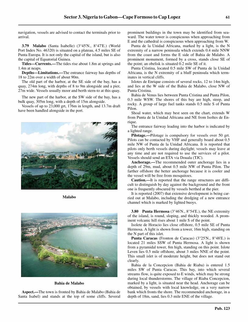
Sector 3. Nigeria to Gabon—Cape Formoso to Cap Lopez 61
Pub. 123
navigation, vessels are advised to contact the terminals prior toarrival.
3.79 Malabo (Santa Isabelle) (3°45'N., 8°47'E.) (WorldPort Index No. 46320) is situated on a plateau, 4.5 miles SE ofPunta Europa. It is not only the capital of the island, but is alsothe capital of Equatorial Guinea.3.79 Tides—Currents.—The tides rise about 1.8m at springs and1.4m at neaps.3.79 Depths—Limitations.—The entrance fairway has depths of18 to 22m over a width of about 90m.3.79 The old part of the harbor, at the SE side of the bay, has aquay, 274m long, with depths of 8 to 9m alongside and a pier,27m wide. Vessels usually moor and berth stern-to at this quay.
3.79 The new part of the harbor, at the SW side of the bay, has abulk quay, 305m long, with a depth of 15m alongside.3.79 Vessels of up to 23,000 grt, 176m in length, and 13.7m drafthave been handled alongside in the port.
3.79 Aspect.—The town is fronted by Bahia de Malabo (Bahia deSanta Isabel) and stands at the top of some cliffs. Several
prominent buildings in the town may be identified from sea-ward. The water tower is conspicuous when approaching fromE and the cathedral is conspicuous when approaching from W. 3.79 Punta de la Unidad Africana, marked by a light, is the Nextremity of a narrow peninsula which extends 0.4 mile NNWfrom the coast and forms the E side of Bahia de Malabo. Aprominent monument, formed by a cross, stands close SE ofthe point; an obelisk is situated 0.2 mile SE of it.3.79 Punta Cristina, located 0.5 mile SW of Punta de la UnidadAfricana, is the N extremity of a bluff peninsula which term-inates in vertical cliffs.3.79 Islotes de Enrique consists of several rocks, 12 to 14m high,and lies at the W side of the Bahia de Malabo, close NW ofPunta Cristina. 3.79 Bahia de Venus lies between Punta Cristina and Punta Pilon,0.3 mile WSW. The shores of this bay are high, steep, androcky. A group of large fuel tanks stands 0.5 mile S of PuntaPilon.3.79 Shoal water, which may best seen on the chart, extends Wfrom Punta de la Unidad Africana and NE from Isoltes de En-rique.3.79 The entrance fairway leading into the harbor is indicated bya lighted range.3.79 Pilotage.—Pilotage is compulsory for vessels over 50 grt.Pilots can be contacted by VHF and generally board about 0.5mile NW of Punta de la Unidad Africana. It is reported thatpilots only berth vessels during daylight; vessels may leave atany time and are not required to use the services of a pilot.Vessels should send an ETA via Douala (TJC).3.79 Anchorage.—The recommended outer anchorage lies in adepth of 29m, mud, about 0.5 mile NW of Punta Pilon. Thefarther offshore the better anchorage because it is cooler andthe vessel will be free from mosquitoes.3.79 Caution.—It is reported that the range structures are diffi-cult to distinguish by day against the background and the frontone is frequently obscured by vessels berthed at the pier.3.79 It is reported (2007) that extensive development is being car-ried out at Malabo, including the dredging of a new entrancechannel which is marked by lighted buoys.
3.80 Punta Hermosa (3°46'N., 8°54'E.), the NE extremityof the island, is round, sloping, and thickly wooded. A prom-inent volcanic hill rises about 1 mile S of the point.3.80 Isolete de Horacio lies close offshore, 0.5 mile SE of PuntaHermosa. A light is shown from a tower, 16m high, standing onthe N part of this islet.
Punta Caracas (Fronton de Caracas) (3°25'N., 8°48'E.) islocated 21 miles SSW of Punta Hermosa. A light is shownfrom a pyramidal tower, 8m high, standing on this point. IsloteLeven lies 0.5 mile offshore, about 3 miles NNE of the point.This small islet is of moderate height, but does not stand outclearly.3.80 Bahia de la Concepcion (Bahia de Riaba) is entered 1.5miles SW of Punta Caracas. This bay, into which severalstreams flow, is quite exposed to E winds, which may be strongduring local thunderstorms. The village of Riaba Concepcion,marked by a light, is situated near the head. Anchorage can beobtained, by vessels with local knowledge, on a very narrowbank which fronts the shore. The recommended anchorage, in adepth of 18m, sand, lies 0.3 mile ENE of the village.
Malabo
Bahia de Malabo

62 Sector 3. Nigeria to Gabon—Cape Formoso to Cap Lopez
Pub. 123
3.80 Between Punta Hermosa and Punta Santiago, the S extremityof the island, the E coast of Isla de Bioko is abrupt, rocky, andindented. It consists of a succession of points, generallycovered with thick vegetation and fringed by rocks, and smallcoves fronted by sandy beaches.3.80 The mouth of the Rio Iledyl, an important river, lies 3.5miles NE of Punta Santiago, but the entrance is not visiblefrom seaward.3.80 Punta Santiago (3°13'N., 8°41'E.), the SE extremity of theisland, is very high, rocky, and covered with trees. Severalconspicuous large rocks, over which the sea breaks, lie at thebase of this point. A light is shown from a metal tower, 25mhigh, standing on the point.3.80 Between Punta Santiago and Punta Oscura, 14.5 milesWNW, the S coast of Isla de Bioko is quite similar to that of theE side of the island, but the land rises more steeply behind theshore.3.80 Caution.—At night or in thick weather, vessels should usecare when passing Punta Hermosa, as the depths give nowarning of its proximity and the high land behind the pointmakes it difficult to judge the distance off.
3.81 Punta Oscura (3°16'N., 8°27'E.), the SW extremityof the island, is formed by a high promontory with verticalsides and a level top. It is covered with tall trees and thickvegetation. Several waterfalls are located near the point and areprominent from seaward.3.81 Punta Arjelejos (3°28'N., 8°29'E.) is located about 13 milesN of Punta Oscura. Between these points, the coast extends Nfor about 5 miles and is precipitous with numerous cliffs. Itthen continues NNE for about 8 miles and is moderately high,covered with vegetation, and fringed by black rocks.3.81 Bahia de San Carlos lies between Punta Arjelejos and PuntaCabras, a rocky and steep-to point located 6.5 miles NE.3.81 Punta Barcelonesa (3°28'N., 8°32'E.), located 4 miles E ofPunta Arjelejos, is fronted by a rocky spit which extends up to0.3 mile seaward. The shore between is indented by severalsmall bays which are fringed with black sand. A light is shownfrom a tower, 16m high, standing on Punta Barcelonesa.
3.82 Luba (3°30'N., 8°34'E.) (World Port Index No.46330), a small port, lies 0.8 mile SE of Punta Barcelonesa inthe S part of a bay. It is used for the export of bananas and isalso a supply base for the oil and gas industry.
A jetty, 123m long, extends N from the town. It provides aberth at the head, 50m long, with a depth of 7.3m alongside.Small vessels up to 6.7m draft can be handled.
Large vessels work cargo from lighters in the roadstead. Thisroadstead is sheltered from the predominate winds, butoccasional squalls come down from the mountain sides.Vessels can anchor in a depth of 31m about 1.7 miles S ofPunta Cabras. Several radio masts stand close E of the jetty.
A supply base pier is situated 0.2 mile SE of Punta Barce-lonesa. It is 100m long and has a depth of about 6.6m along-side.
It is reported (2006) that construction of additional marinefacilities is being carried out within the port.
3.83 Islotes Loros (3°33'N., 8°34'E.) lies about 1.3 milesNNW of Punta Cabras and consists of three islets surrounded
by breakers. The area lying between these islets and the coast isfoul. A light is shown from a metal tower standing on thewesternmost islet.3.83 Punta Achada is located 8 miles NNE of Islotes Loros. BajoVazquz de Castro, an extensive shoal, lies about 1.7 miles W ofthis point and has a least depth of 3.7m.3.83 Rocas Primos (3°38'N., 8°34'E.) lies 2 miles offshore, about3 miles SW of Punta Achada. It consists of three above-waterrocks lying on a very narrow and steep-to reef.3.83 Between Punta Achada and Punta Europa, 9 miles NE, thecoast is moderately high and covered with vegetation. Itconsists of several rocky points, which are fringed by shoals,and a number of small, white sandy beaches.
Ilha do Principe
3.84 Ilha do Principe (1°37'N., 7°24'E.) lies 116 milesSW of Isla de Bioko. It has an extremely picturesque ap-pearance formed by needle-shaped peaks and leaning mountainmasses which rise abruptly from the high land of the interior.3.84 The heavy rainfall and the great fertility of the soil haveproduced a growth of vegetation so rank as to render the islandunhealthy. There are traces of extinct volcanoes in many partsof the island and large areas are covered with volcanic stones.3.84 The N part of the island, although high, is not so grand inappearance as the S part, which consists of a series of steep andrugged mountains, surrounded by several gigantic and fan-tastically shaped natural obelisks. The whole of this latter massculminates in Pico do Principe (1°35'N., 7°24'E.), a prominentpeak which rises to a height of 947m.3.84 The current in the vicinity of the island is variable, but isreported to usually set N or NE at a rate of 1 to 2 knots.3.84 Caution.—Strong magnetic anomalies have been reportedclose off Ilha do Principe, especially in the vicinity of Baia deSanto Antonio.
3.85 Ilheu Bombom (1°42'N., 7°24'E.) forms, in reality,the N extremity of Ilha do Principe. This islet, which is 59mhigh, is connected to the main island by a sandy spit, on the Wside of which lie two small and rocky islets. Ilheu Bombom isdensely wooded and steep-to on its seaward side, against whichthe sea frequently breaks. A light is shown from a tower, 4mhigh, standing on the summit of the islet. A conspicuous radiomast is reported (1995) to be situated 0.5 mile S of the light.3.85 Pedra de Gale, 2.7m high, lies 2 miles NW of Ilheu Bombomand is a small black rock on which the sea always breaks.
3.85 Ponta Banana (1°42'N., 7°26'E.), located 2.3 miles ESE ofIlheu Bombom, is high, rocky, and steep-to. A low neck lies onthe inshore side of this point and it has the appearance of beingdetached when viewed from a distance to seaward. BetweenIlheu Bombom and this point, the coast recedes to form a baywith wooded and rocky shores. Good anchorage can be takenby small vessels, with local knowledge, in a depth of 15mwithin this bay.3.85 Ponta dos Mosteiros (1°41'N., 7°28'E.), located 1.5 milesESE of Ponta Banana, is the NE extremity of Ilha do Principe.It consists of moderately high cliffs against which the sea oftenbreaks with violence. A black rock lies close off this point anda spit, with foul ground and several rocks awash, extends up to

Sector 3. Nigeria to Gabon—Cape Formoso to Cap Lopez 63
Pub. 123
0.7 mile ENE from it. Vessels are advised to stay well clear ofthe outer end of this spit.3.85 Ilheus dos Mosteiros, 20m high, lies close within the sea-ward end of the spit. A light is shown from a tower, 5m high,standing on this islet.3.85 Ponta Capitao, formed by a steep-to tongue of land, islocated 0.8 mile S of Ponta dos Mosteiros.
3.86 Baia de Santo Antonio (1°39'N., 7°27'E.) (WorldPort Index No. 46375) is entered between Ponta Capitao andPonta da Garca, 2.5 miles S. The inner part of this bay is noteasily distinguished from seaward and the shores are rockywith numerous sandy coves. The town of Santo Antonio standsnear the head and is fronted by a small wharf, which is used bysmall craft. It is situated on a plain, sheltered by wooded hills,and is sometimes inundated by the sea. The houses are builtmainly of wood and stand on piles. The climate is hot andhumid.3.86 Vessels anchor in depths of 10 to 18m, good holding ground,off the town and work cargo from lighters. The tidal currentsare weak, but the principal objection to this bay is that theanchorage is exposed to the prevailing winds, from the E andSE, during the thunderstorm season. Pilotage is not available.3.86 Ponta de Mina, marked by a light, is located 2 miles NW ofPonta da Garca. This point is prominent and fringed by severalrocks, with an ancient fortress standing on its summit.3.86 Ponta da Garca (1°38'N., 7°28'E.) is the S entrance point ofBaia de Santo Antonio. The coast extends SSW for 5 milesfrom this point and forms a wide bay with high cliffy shores. 3.86 Ponta do Pico Negro (1°32'N., 7°24'E.), the S extremity ofthe island, is formed by a long and narrow tongue of land, withsteep cliffs on both sides.3.86 llheu Caroco (1°31'N., 7°26'E.), lying 1.5 miles SE of Pontado Pico Negro, is 305m high, rocky, steep, and wooded. It iscovered with trees and brushwood. Due to the shape of thisislet, which resembles a pointed cap, it is also known locally asBone do Joqueri. A low rock lying close off the S side of thisislet is prominent when seen from E or W. A light is shownfrom a tower, 5m high, standing on this rock.3.86 The channel leading between this islet and Ponta do PicoNegro has depths of 18 to 36m, with a bottom of fine blacksand. The currents in this channel are variable and caution isrequired.3.86 Pedras Tinhosas (1°21'N., 7°18'E.) consists of two isletswhich lie 13 and 11.5 miles SW of Ponta do Pico Negro.Tinhosa Grande, the S and larger islet, is 55m high. TinhosaPequena, the N islet, is 64m high. Both islets are covered with
brushwood and are marked by white patches of guano. A lightis shown from a tower, 5m high, standing on the summit ofTinhosa Grande.3.86 Ponta do Grosso (1°33'N., 7°21'E.), the SW extremity of theisland, is a rocky and steep-to headland located 4 miles WNWof Ponta do Pico Negro. It is dominated by a mountain, 622mhigh, which appears to have two peaks when seen from the SW.Several rocky points divide this stretch of coast into three bays.These bays are backed by high peaks and the sea usuallybreaks along their shores, which are high, rocky, and wooded.3.86 Ponta do Focinho de Cao (1°36'N., 7°20'E.), located 3.2miles NNW of Ponta do Grosso, is a salient headland which isfronted by rocks on its NW side and marked by a light. A peak,263m high, stands 0.5 mile inland of this point.
3.87 Baia das Agulhas (1°37'N., 7°22'E.), providing thesafest and best anchorage in the island, lies between Ponta doFocinho de Cao and Ponta Iola, 3 miles NE. This bay, which issheltered from the SE winds of the thunderstorm season, is freefrom off-lying dangers; the depths decrease regularly towardthe shore.3.87 Five hills stand close to the shore of the bay and are con-nected by low land. They give the appearance of being separateconical islets when seen from the W. The higher peaks of theisland can be seen in the background. The shore is mostlyfringed by reefs and numerous streams flow into the baythrough the valleys which separate the lower hills. 3.87 Good anchorage for large vessels can be found in a depth of22m within the bay and E of the N extremity of Ponta do Fo-cinho de Cao. Local thunderstorms blow from the E, but careshould be taken, as they may be squally after coming over thehigh land.
Ilha do Principe from W
Ilheu Caroco

64 Sector 3. Nigeria to Gabon—Cape Formoso to Cap Lopez
Pub. 123
3.87 Ponta Hora (1°42'N., 7°24'E.) is located 2.5 miles N ofPonta Iola and 2 miles SW of Ilheu Bombom. A few smallbays lie along this stretch of the coast and afford anchorage tosmall vessels. They are sheltered from the prevailing wind, butare subject to violent squalls occasioned by the proximity ofthe mountains.
Ilha de Sao Tome
3.88 Ilha de Sao Tome (0°15'N., 6°37'E.) lies 82 milesSSW of Ilha do Principe. It is larger and of greater commercialimportance than Ilha do Principe, but has a lack of shelteredanchorages. Calms, variable winds, and strong currents prevailin the vicinity of this island.3.88 Ilha de Sao Tome is very mountainous and Pico de SaoTome, its summit, rises at the W side of the central part. Thissummit attains a height of 2,024m, but is often hidden byclouds. The sides of the peak are covered with dense forestsand numerous streams flow down them. The island is reportedto present three conspicuous peaks when seen from the NE at adistance of about 60 miles.3.88 The water in the vicinity of the island is very clear and thebottom can be seen distinctly in depths of 10m. During themonths of October and November, sperm whales are found offthe S end of the island.3.88 Tides—Currents.—When approaching Ilha de Sao Tomefrom the W, it is advisable, in order to take full advantage ofthe Guinea Current, for vessels to keep N of 1°30'N until thelongitude of 6°E has been attained. Vessels will thereby avoidthe South Equatorial Current, which is found in that latitude tothe W of the above meridian and, at times, even farther N. Thislatter current sometimes surrounds Ilha de Sao Tome and to theN of the island, in a longitude of about 6°E, has been found toset to the W. The current usually sets between NNE and NNWat the E side of the island.3.88 Caution.—It is reported (2004) that the navigation lights onIlha de Sao Tome are unreliable and may be missing orextinguished.3.88 It was reported (1995) that several fish havens had beenestablished up to 5 miles off the coasts of Ilha de Sao Tome.They are marked by red buoys which have bamboo masts andred or yellow flags.
3.89 Ponta Cruzeiro (0°25'N., 6°40'E.) is the N extremityof Ilha de Sao Tome. Between this point and Ponta Praiao, 9.2miles SE, the NE coast of the island is fronted by an extensiveshoal with depths of less than 10m.3.89 Porto de Ferao Dias lies 0.8 mile ESE of Ponta Cruzeiro andis fronted by a concrete pier. Large vessels can obtainanchorage in a depth of 13m, sand, about 1 mile NE of PontaCruzeiro. 3.89 Ilheu das Cabras (0°25'N., 6°43'E.) lies 3.3 miles E ofPonta Cruzeiro, near the edge of the coastal shoal bank. Thisisland consists of two hills, about 90m high. A light is shownfrom a tower, 5m high, standing on the summit of the NE hill.
Baia de Ana Chaves (0°21'N., 6°44'E.) is entered betweenPonta Okedelrey, located 5 miles SE of Ponta Cruzeiro, andPonta Sao Sebastiao, 1 mile SE. A hospital is situated on PontaOkedelrey and four radio masts, 30m high, stand close SW ofit. A conspicuous barracks building stands 0.3 mile SSW of the
hospital. Range lights, indicating the approach to the anchor-ages, are shown from Ponta Okedelrey.3.89 A prominent fort, with white sides, stands on Ponta SaoSebastiao. A light is shown from a tower, 6m high, standing onthe fort.3.89 An area of reclaimed land projects 0.2 mile NNW from thispoint; its N end forms a quay, 200m long, with a depth of 3malongside.3.89 Although open to E and NE winds, the bay offers a con-venient anchorage to small vessels, except during the thunder-storm season. Depths of less than 2m front the head of the bayand extend up to 0.3 mile seaward.3.89 Three detached banks, with depths of less than 5m, lie about2.7 miles NNE, 2 miles NNE, and 1.8 miles NE of Ponta SaoSebastio.3.89 Caution.—Unexploded ordnance is located in an area, witha depth of 7.5m, lying about 1.2 miles NE of Ponta Sao Sebas-tiao Light.3.89 A stranded wreck, which may best be seen on the chart, liesabout 0.7 mile E of Ponta Okedelrey.
3.90 Sao Tome (0°21'N., 6°44'E.) (World Port Index No.46380), the capital and main port of the island, stands along asandy beach at the head of Baia de Ana Chaves. This townincludes several good buildings of modern construction. Acathedral and several churches are also prominent.3.90 Vessels moor within and off the bay and work cargo vialighters. Vessels of moderate to deep draft should anchor, in anappropriate depth for their draft, on the alignment of thelighted range shown from Ponta Okedelrey. It is reported(1986) that a vessel anchored, in a depth of 10m, mud and softsand, about 0.7 mile NNE of Ponta Sao Sebastiao. There wasgood holding ground, but poor protection from the open sea.3.90 Small vessels may anchor, in depths of less than 5m, withinthe inner part, but the sea breaks right across the bay afterthunderstorms or when the swell sets in. Pilotage is not com-pulsory and there are no official pilots. However, the Port Cap-tain can be contacted by VHF and will act as a pilot if re-quested.3.90 Caution.—The transit of the lighted range situated on PontaOkedelrey is not very restrictive and the structures are easilyconcealed by the afternoon shadows.3.90 The long swell can often make lighterage operations diffi-cult.3.90 Vessels approaching from SE or S are advised to stay indepths of more than 35m and at least 1.5 miles offshore untilthey reach the lighted range leading to the anchorage.
3.91 Ponta Praiao (0°18'N., 6°46'E.), located 3.2 milesSSE of Ponta Sao Sebastiao, is the E extremity of Ilha de SaoTome. It is a salient point of moderate height and is surroundedby drying rocks. The point is located near the SE end of a plain,which constitutes the N part of the island, and the land risessteeply to the S of it. A number of radio masts, 33m high, standclose W of the point and a church, with a prominent tower, issituated 4.5 miles W of them.3.91 Ilheu de Santana (0°14'N., 6°46'E.) lies about 0.7 mileoffshore, 3.2 miles S of Ponta Praiao. It is 50m high, rocky, andcovered with bushes. A light is shown from from a tower, 5mhigh, standing on this islet. The passage leading between this

Sector 3. Nigeria to Gabon—Cape Formoso to Cap Lopez 65
Pub. 123
islet and the coast has no known dangers, but vessels areadvised to keep outside in order to avoid squalls which prevailinshore.3.91 Ponta do Io (Ponta Juntabudo) (0°07'N., 6°40'E.),prominent and cliffy, is located 13 miles SSW of Ponta Praiao.The coast betwen is irregular, with rocky heads and sandybays. The land rises regularly from the shore and is intersectedby several rivers. A light is shown from from a tower, 5m high,standing on this point.
Sete Pedras (0°02'N., 6°38'E.) lies about 2.5 miles offshore,4.7 miles SSW of Ponta do Io. It consists of a group of rocks,the largest being 42m high. When seen from N, these rockshave the appearance of a vessel under sail. By day, these rocksdo not constitute a danger as they are steep-to, but they shouldnot be approached at night.
3.92 Ponta Homem da Capa (0°01'N., 6°31'E.), the Sextremity of Ilha de Sao Tome, is located 10 miles SW of Pontado Io. The coast between is indented by several bays. 3.92 Ilheu Gago Coutinho (0°00', 6°32'E.), known locally asIlheu das Rolas, lies 1.2 miles S of Ponta Homem da Capa. It is96m high, covered with large trees, and is the largest of theislets lying off Ilha de Sao Tome. Two summits rise from thisislet; the N summit is a conical hill. A light is shown from atower with a dwelling, 9m high, standing near the center of theislet.3.92 Canal das Rolas separates llheu Gago Coutinho from the Sextremity of Sao Tome and should be used with great caution.
3.92 Ponta Furada (0°14'N., 6°28'E.), the W extremity of theisland, is located 14 miles NNW of Ponta Homem da Capa.The coast between is mostly rocky and cliffy, with a fewbeaches. It is fringed by several small islets. The action of thesea has eroded an opening in the cliff face at the point. A lightis shown from a tower, 5m high, standing on the point.3.92 Ponta Diogo Vaz (0°19'N., 6°30'E.), located 4.6 miles NNEof Ponta Furada, is rounded and steep-to. Enseada da Rosema,an indentation in the coast, lies between Ponta Figo, located 4miles NE of Ponta Diogo Vaz, and Morro Carregado, 4.7 milesNE. A small bay, which lies at the S end of this indentation, isreported to offer excellent anchorage with deep water. 3.92 Morro Carregado (0°25'N., 6°37'E.), rising 4.8 miles W ofPonta Cruzeiro, is high and peaked. The point on which itstands is faced by steep, rocky cliffs. Lagoa Azul Light isshown from a tower, 5m high, standing on the point.3.92 Caution.—Magnetic anomalies have been reported to existin areas up to 10 miles SW of Ponta Praiao.
Pagalu
3.93 Pagalu (Annobon) (1°26'S., 5°37'E.) lies 105 milesSSW of Ilha de Sao Tome and is the smallest island lying in theBight of Biafra. It is mountainous and rises in varied and pic-turesque forms to a considerable elevation in the central part,which is formed by three main peaks.3.93 Pico del Fuego (Pico do Figo), the northernmost of thesepeaks, is in the form of a truncated cone. It is 454m high andhas sides which are heavily wooded to within a short distanceof the summit. A small fresh water lake lies close to the foot ofthis peak, on its SW side.3.93 Pico del Centro, 630m high, rises 1 mile S of the lake; PicoSurcado, 655m high, rises 1 mile farther SE.3.93 The prevailing winds, which are from the S and SW, blowwith moderate force and little variation throughout the year,enabling vessels under the shelter of the land to ride at anchorin a smooth sea. Only during the period from March to Sep-tember, when thunderstorms occur and strong E winds blowdirectly into the anchorages, is any danger to be apprehended.The gloominess of the sky and the heavy thunder and lightningby which they are preceded always gives timely notice ofstorms.3.93 In the vicinity of the island, the current normally sets NWfrom November to April and NE from April to August. Thestrength varies and the current attains a rate of 0.5 knot to 1.8knots. The tidal currents are always very weak.3.93 Caution.—The present charted position of Pagula is basedon a 1991 ship’s report, which placed the island 1 mile E of itspreviously-charted position. Charted depths are also based onold surveys. Mariners should exercise caution when navigatingin the vicinity of Pagala.
3.94 Punta del Palmar (1°24'S., 5°37'E.) is the N extrem-ity of Pagalu. A light (Mision de Santo Antonio) is shown froma tower, 7m high, standing near this point.3.94 Punta Piramide, located 0.2 mile SE of Punta del Palmar, islow, sandy, and fronted by numerous rocks. Islote Piramide, thehighest and most conspicuous of these rocks, is bare and conical.3.94 San Antonio (1°24'S., 5°37'E.), the largest town on the is-land, stands close S of Punta del Palmar. It is also known asPale. When approaching from seaward, the land in this vicinityis difficult to identify, as the mountains are nearly alwayscovered by clouds and the town is not easily distinguished. Atsuch times, Islote Piramide is a useful landmark.3.94 Punta del Paso is located 1.2 miles SE of Punta del Palmar.The coast between is fronted by a shoal with depths of less than
Ilha de Sao Tome from NE

66 Sector 3. Nigeria to Gabon—Cape Formoso to Cap Lopez
Pub. 123
5m. This point rises almost perpendicularly to a bluff and hasneedle-shaped rocks on its seaward face.3.94 Islote Tortuga (1°24'S., 5°38'E.), 50m high, lies 0.8 mileNNE of Punta del Paso. This islet is steep-to and two rocks lieclose off its NE extremity. Islote del Paso, a small and flat islet,lies 0.3 mile SW of the S extremity of Islote Tortuga.3.94 The anchorages lying between Punta del Palmar and Puntadel Paso should be approached with caution, as this area hasnot been thoroughly surveyed and patches of coral evidentlyexist. The best anchorage lies in depths of 22 to 27m, sand withgood holding ground, 0.7 mile NE of San Antonio.
3.95 From Punta del Paso, the coast trends SSE for 0.8mile to Punta Dudjiguele (Punta Budjiguele). Bahia de SanPedro, at the head of which stands the village of San Pedro, liesbetween this point and Punta Jasgania (Punta Jasmangania),0.3 mile SSE.3.95 Punta Dologany (Punta Olonganchi), located l.3 miles S ofPunta Jasgania, is a rocky and moderately high point. PicoSurcado, 655m high, rises 0.7 mile NW of this point.3.95 Between Punta Dologany and Punta Mofina, 0.4 mile SSW,the coast is indented by two small bays. 3.95 Punta de San Antonio (Punta Manjob) (1°28'S., 5°37'E.) islocated 1 mile W of Punta Mofina. The S coast of Pagaluextending between these points is dominated by high landwhich rises inland. Punta de San Antonio, which is marked bya light, is fronted by several rocks on which the sea generally
breaks. Three conspicuous high and conical rocks lie centeredabout 1 mile S of this point.3.95 Islote Adams, small and rocky, lies 0.4 mile S of PuntaMofina. This islet presents two distinct peaks when seen fromE or W.3.95 Caution.—It is reported (1999) that the light shown fromPunta de San Antonio is often extinguished.
3.96 Punta Alvaro (Punta Penvadu) (1°27'S., 5°37'E.),located 0.7 mile NW of Punta de San Antonio, is surmountedby a moderately high peak, the summit and sides of which aremarked by numerous pinnacle rocks.3.96 Punta Jatupa is located 1.5 miles NNW of Punta Alvaro. Thestretch of coast extending between these points is indented andBahia de Santa Cruz is formed at the S end. The town of SantaCruz stands at the head of this bay. The sea breaks heavilyalong the shore extending between Santa Cruz and PuntaJatupa.
3.96 Punta Jiscoy (Punta Dyiscoj) (1°25'S., 5°37'E.), located 0.5mile NNW of Punta Jatupa, is the W extremity of Pagalu. Asection of steep and rocky cliffs, 0.4 mile wide, is centered 0.4mile NE of this point.3.96 Islote Yebatelu, a small and detached islet, lies closeoffshore, 0.6 mile NNE of Punta Jiscoy.3.96 The sandy shore of Pagalu extends 0.5 mile NE from abreastIslote Yebatelu to Punta del Palmar and is fringed with rocks.

67
Pub. 123
4. Gabon to Angola—Cap Lopez to Ponta Albina
4.0Additional chart coverage may be found in NGA/DLIS Catalog of Maps, Charts, and Related Products (Unlimited Distribution).4.0SECTOR 4 — CHART INFORMATION

69
Pub. 123
SECTOR 4
GABON TO ANGOLA—CAP LOPEZ TO PONTA ALBINA
4.0 Plan.—This sector describes the SW coast of Africa fromCap Lopez to Ponta Albina, including the Congo River. Itincludes the coasts of Gabon, The Congo (Republic of theCongo), Angola (Cabinda), the Democratic Republic of theCongo (formerly Zaire), and Angola. The descriptive sequenceis from N to S.
General Remarks
4.1 The coast extending between Cap Lopez (0°37'S.,8°43'E.) and the Congo River, about 390 miles SE, is borderedby a narrow sandy beach on which the heavy surf breaks,particularly during the dry season. The landing of boats is im-possible on this coast, except in a few places, and then only onexceptionally fine days.
The lagoon entrances lying along this stretch of coast changeposition from year to year. These river mouths, which can beoften easily identified on radar, are marked by a discolorationof the water which extends, in places, up to more than 1 mileoffshore during the rainy season.
All of the small coastal indentations located S of the Equatorrecede in a SE direction and are protected on their W sides bylow tongues of land which are prolonged by shoals or spits.This peculiarity of form is probably caused by the combinedaction of the SW swell and the prevailing current. Most ofthese indentations are difficult to identify from seaward be-cause their low entrance points cannot be distinguished fromthe background.
Between Cap Lopez and the Congo River, the 200m curvelies nearly parallel with the coast at a distance of about 35miles offshore. Depths of 9 to 13m are found about 2 miles off-shore. The bottom consists of mud in depths of over 100m, butconsists of sand closer inshore.
At Ponta das Palmerinhas, 185 miles SSE of the CongoRiver, the 200m curve approaches to within 5 miles of thecoast.
The coast between the Congo River and Ponta das Salinas(12°50'S., 12°56'E.) provides several anchorages, the principalones being at Luanda, Porto Amboim (Benguela Velha),Lobito, and Baia de Benguela. Between Benguela and Tombua(Porto Alexandre), 210 miles SSW, great depths lie close to thecoast and anchorage is impossible, except in a few shelteredbays.4.1 At a distance of 9 miles off the mouth of the Congo River,the surface water is still quite fresh. It is only partially mixedwith salt water at a distance of about 40 miles offshore. Theresulting discoloration caused by the fresh water has, at times,been observed up to 300 miles from the coast.
Winds—Weather.—Along most of this coast, a SW or Wbreeze (sea breeze) is prevalent from late morning until 2100hours. At about midnight, a SE or E breeze (land breeze) be-gins and becomes light and variable by morning.4.1 Intense tropical rain storms (thunderstorms), which areknown locally as tornadoes, develop in the region between
Cameroon and the River Congo. They mostly occur at thebeginning (April and May) and end (October and November)of the rainy season. These storms generally last less than onehour but may have wind gusts of 50 knots or more. The localname, tornado, should not be confused with the turbulent phe-nomena common in the United States.
Tides—Currents.—The range of tide is comparativelysmall along this coast, only exceeding 1.8m at springs in a fewof the river estuaries. The tidal currents are weak except in thevicinity of the few main rivers.
The Benguela Current flows N along the W coast of Africafrom the vicinity of the Cape of Good Hope to the Gulf ofGuinea. It attains rates of 1 knot within about 40 miles of thecoast and 0.4 to 0.8 knot farther offshore. This current isusually stronger in December and January, when the SE tradewinds are well established.
Between Cap Lopez and the Congo River, a current gen-erally sets steadily in a NW direction, sometimes attaining arate of up to about 2 knots. It is formed by the Benguela Cur-rent and the current which flows out of the Congo River. Thisresultant current then turns W off Cap Lopez and becomes partof the South Equatorial Current. Inshore, the direction and rateof the current are largely influenced by the formation of theland and the winds. During steady N winds, which are veryrare, the direction of the current is sometimes reversed.
Caution.—During the rainy season, debris of all kinds maybe encountered at considerable distances from the coast and asfar N as Pagalu (1°26'S., 5°37'E.).
The light sandy color of the coast, as well as the extremehaziness of the atmosphere that generally prevails, may tend tocause mariners to overestimate the distance from the shore.Therefore, vessels are advised to maintain a prudent distancefrom the coast. This applies particularly in the area lyingbetween Ponta das Salinas and Ponta de Sao Jose, 22 miles NE.
Oil and gas development areas and fields, with associatedrigs, platforms, well heads, submarine pipelines, terminalbuoys, and storage vessels (FPSO), may be encountered off thecoasts described in this sector.
Vessels are cautioned that security off the West African coastand within some ports is a serious problem. In recent years(1986-2005), attacks by pirates and thieves have been reported.These have generally taken place at the outer anchorages, butsome have occurred while berthed alongside. In the event of apiracy incident, vessels should not rely on the assistance of thelocal authorities, which are reported in the past to have failed torespond.
Cap Lopez to Pointe Banda
4.2 Cap Lopez (0°37'S., 8°43'E.), the N extremity of IleLopez (Ile Mandji), has been previously described in paragraph3.70. Several flares are situated in the vicinity of the cape and aconspicuous flare, position approximate, stands on the shoreabout 57 miles SSE of them.

70 Sector 4. Gabon to Angola—Cap Lopez to Ponta Albina
Pub. 123
The coast between Cap Lopez and Ombue, 66 miles SSE, isuniformly thickly-wooded, while between Ombue and SetteCama, 64 miles SSE, it consists of large patches of bare groundalternating with thick jungle.
The mouth of the Animba River, which is an arm of the deltaof the Ogoove, lies 24 miles S of Cap Lopez. The river is notnavigable; its entrance is bordered on the W side by a long nar-row tongue of sand. During the rainy season, enormousamounts of fresh water discharge from the river mouth and ex-tend up to 4 or 5 miles offshore.
Grondin Oil Drilling Area (1°10'S., 8°40'E.), which maybest be seen on the chart, lies between 7 and 60 miles S of CapLopez. It extends up to 28 miles offshore and is marked bylighted buoys. A light shown from a structure standing (posi-tion approximate) 66 miles SSE of Cap Lopez indicates the SEend of this area.
Numerous wells, production platforms, drilling rigs, flares,submarine pipelines, and associated obstructions lie within thisdrilling area.
Caution.—A restricted area, which may best be seen on thechart, surrounds the Grondin Oil Drilling Area. Only vesselsemployed by the oil installations and tankers proceeding to andfrom the terminals may navigate within this area.
Drilling rigs and associated structures and obstructions,which may be unlit and not charted, are reported to be situatedwithin the restricted area.
A coastal fairway route, which may be used only by vesselsof less than 7 tons, and an area reserved for fishing are situatedadjacent to the shore within the Grondin Oil Drilling Area andmay best be seen on the chart.
4.3 Gombe-Beta Marine Terminal (1°12'S., 8°56'E.)lies within the Grondin Oil Drilling Area, 37 miles SSE of CapLopez. It consists of a storage tanker moored in a depth of15.2m. Vessels of up to 150,000 dwt and 280m in length can behandled. Vessels are moored to the bow of the storage tankerand their sterns are made fast to mooring buoys.
It is reported (2004) that the storage tanker has been re-moved and the terminal is no longer in use.
4.4 Oguendjo Oil Terminal (1°28'S., 8°55'E.) lies withinthe Grondin Oil Drilling Area, 51 miles SSE of Cap Lopez. Itconsists of an SBM to which a storage tanker (Bon Bateau) ispermanently moored. Production platforms are situated about 2miles ENE and 1.5 miles SW of the terminal.
An access lane, 1.7 miles wide, leads in a NW direction tothe terminal and may best be seen on the chart. It has a leastdepth of 21.9m and extends about 11 miles from the anchoragearea. The terminal is located in a depth of 27.4m and canhandle vessels up to 170,000 dwt and 18.2m draft. Vessels areberthed only during daylight but they may depart at any time.They are moored bow to bow with the storage tanker.
A designated anchorage area, which may best be seen on thechart, lies centered 12 miles SE of the SBM.
Pilotage is compulsory. Pilots, who act as mooring masters,can be contacted by on VHF channel 8 and board about 3.5miles SSW of the SBM, in the access lane.
Vessels should send an ETA 72 hours, 48 hours, and 24hours prior to arrival, stating any special requirements and thequantity to be loaded.
The Oguendjo Terminal, which is operated by Perenco,Gabon, may be contacted by e-mail, as follows:
All tankers shall fly the Gabon national flag during daylightwhile berthed at the terminal.
4.5 Pointe Sainte-Catherine (1°53'S., 9°16'E.), a slightprojection, is fronted by a reef on which the sea breaks heavily.From the N, this point appears as an isolated clump of tall treesresembling an island, but from the S, the coast appears craggy.Some hills rising close S of the point give it a bold appearance.The land behind the shore, which is fringed by a beach, risesgently with clearings here and there.
Pointe Guega is located 4.5 miles N of Pointe Sainte-Catherine and fringed by rocks.
The village of Iguela, situated 4.5 miles SE of Pointe Sainte-Catherine, stands on a narrow strip of land which separatesLagune Ngobe from the sea. An airfield is situated near thisvillage.
Anchorage may be obtained in a depth of 9m SW of thevillage and about 1.5 miles offshore. Two beacons, eachsurmounted by a square, form a range which leads, clear ofdangers, in a NE direction toward the anchorage. From thisanchorage, the flagstaffs of some factories can be seen over thetops of the trees.
Lagune Ngobe, also known as Lagune d’Iguela, is an exten-sive lagoon which extends 20 miles SE to the mouth of theRiver Rembo Ngobe. The lagoon is used by small craft but theriver is encumbered with weeds.
Caution.—This part of the coast should not be approachedwithin a distance of about 4 miles by vessels without localknowledge.
4.6 Tchatamba Terminal (2°04'S., 9°10'E.), located 14miles SW of Pointe Sainte-Catherine, consists of a FloatingStorage and Offloading facility (FSO), which is permanentlymoored in a depth of 46m. A submarine pipeline extendsbetween the FSO (Madiela) and a production platform located0.3 mile ESE. This terminal can accommodate tankers up to135,900 dwt. Tankers are moored bow to bow with the FSO.
Pilotage is compulsory. Pilots, who also act as mooringmasters, can be contacted by VHF and board vessels about 3miles NW of the terminal. Berthing is carried out only duringdaylight hours but vessels may depart at any time.
Vessels should send their ETA 5 days, 72 hours, 48 hours,and 24 hours in advance. If a vessel departs from a port within12 hours of the terminal, the ETA should be sent immediatelyupon departure from that port and confirmed 6 hours prior toarrival.
A designated anchorage area lies about 5 miles N of theterminal. It has a depth of 40m with a bottom of sand or clay.4.6 A restricted area, with a radius of 3 miles, is centered on theterminal. Vessels are prohibited from entering this area withoutprior permission from the terminal.4.6 All tankers shall fly the Gabon national flag during daylightwhile berthed at the terminal.

Sector 4. Gabon to Angola—Cap Lopez to Ponta Albina 71
Pub. 123
4.7 Pointe Komandji (2°19'S., 9°36'E.) is located 34miles SE of Pointe Sainte-Catherine. The coast between re-cedes slightly and its aspect becomes more varied. A narrowbeach fronts the shore in some places and trees grow down tothe water in other places. In the S part of this stretch, themouths of rivers are indicated by narrow gaps in the trees.Inland, the country is more elevated and a few hills form achain which runs parallel with the coast. The surf breaksheavily along this entire stretch of coast, except in a few placeswhere landing may be effected in fine weather.
4.7 Pointe Komandji is rounded and difficult to identify from theW. However, several large green patches are located at theextremity of Pointe de Gaca, 3 miles S, which help to dis-tinguish this locality. The neighboring coast is slightly elevatedand covered with brushwood, through which several streamswind. The large mouths of these streams form a succession oflagoons and marshes.
Drying rocks front the coast and the sea breaks about 1 mileoffshore. Several villages stand between Pointe Komandji andtwo points named Pointe Magamba and Pointe Milango, whichare located 4 miles and 7 miles, respectively, SSE.
Caution.—Oil and gas exploration is being carried out alongthis coastal area and vessels are warned that numerous wellheads, submerged pipelines, drilling rigs, and platforms may beencountered. Vessels should also exercise care when nav-igating in this vicinity, as many of the associated structures andinstallations are often moved and are not charted. In addition,some of the platforms and structures may be disused, aban-doned, and unlit.
4.8 Sette Cama (2°31'S., 9°45'E.), situated 15 miles SEof Pointe Komandji, stands at the root of a tongue of landwhich separates the channel leading to Lagune Ndogo from thesea. The seaward entrance of this channel lies 9 miles SE ofPointe Komandji. Several buildings, including a factory with aflagstaff, stand in the vicinity of Sette Cama. In addition, asmall airfield is situated nearby. Communication with thefactory can be carried out by the International Code of Signals.
Lagune Ndogo, an extensive water area, extends 30 milesESE and is encumbered by numerous islets. Small craft asso-ciated with oil and gas development navigate within this largelagoon.
Several rocky shoals front the coast and lie up to 1 mileoffshore. They have depths of less than 5m and are usuallymarked by breakers. A range, formed by two white beacons,indicates a passage which leads in a NE direction between theshoals to an anchorage. This passage is about 0.3 mile wideand provides access to vessels with drafts up to 5.8m. Vesselsare advised to stay at least 2 miles offshore until the rangebeacons have been identified. When approaching the anchor-age, vessels are advised to keep the front beacon open a little Nof the rear beacon. Large vessels can anchor, in a depth of 11m,on the range. Smaller vessels may proceed between the shoalsand anchor, in a depth of 6.7m, about 0.5 mile offshore. Thereis usually a heavy swell at the anchorage and the bottom is veryuneven with a rocky bottom. Landing should not be attempted.4.8 The N end of a chain of coastal hills, known as Monts SantoEspirito, rises to the S of Sette Cama and forms a good
landmark. Several large clearings are located S of these hillsand give the land a cultivated appearance.
Caution.—A dangerous wreck is reported (2000) to lieabout 9 miles SW of Sette Cama.
4.9 Pointe Pedras (2°40'S., 9°53'E.), located 12 miles SEof Sette Cama, projects 1 mile from the line of the coast andshows up well from the S. Several isolated sand hills stand onthis point and slope S to the banks of the Riviere Massetche,which is the outlet of Lagune Massetche. A shoal patch, with adepth of 3.7m, lies about 3.5 miles SW of the point and severalrocks, some of which dry, lie up to about 2 miles NW of thepoint.
Between Pointe Pedras and Pointe Banda, 97 miles SE, the200m curve lies parallel with the coast and about 35 to 38miles offshore. The regularity of this depth curve may be ofassistance to vessels during June, July, and August, when fogmay conceal the land.
The coast between Pointe Pedras and Pointe Matouti, 65miles SE, is low and wooded, with high flat ranges inland.Between the latter point and Pointe Banda, 32 miles SE, itconsists of a sandy beach backed by forests with inland rangesof hills.
4.10 Gamba Oil Terminal (2°50'S., 10°00'E.) (World PortIndex No. 46453) is situated 10 miles SE of Pointe Pedras. Thetank farm stands 0.5 mile inland. A light is shown from aframework tower, 40m high, standing close SW of the tankfarm and several conspicuous flares are situated in its vicinity.It is reported (2007) that this light has been extinguished.
The offshore loading facility, consisting of an SBM, lies 5miles SW of the terminal and is connected to the shore by asubmarine pipeline. It is situated in a depth of 22m and canhandle vessels up to 150,000 dwt and 17.25m draft.
Pilotage is compulsory. Pilots, who act as mooring masters,can be contacted by VHF and board in the anchorage area.Berthing can be undertaken by day or at night.
Vessels should send an ETA by fax or e-mail 4 days, 72hours, 48 hours, and 24 hours in advance. 4.10 The Gamba Terminal, which is operated by Gamba Marine,Shell Gabon, Gabon, may be contacted by e-mail, as follows:
Vessels should then contact the terminal on VHF channel 12when within range.
A restricted area, 4 miles wide, extends up to 7.5 miles SWfrom the coast and encloses the offshore loading facility. Ves-sels are prohibited from entering this area without prior per-mission from the terminal. Fishing is prohibited within thisarea.
The designated anchorage area, with a depth of 25m, liesabout 2 miles NW of the SBM.
It is reported (2004) that a jetty situated 0.5 mile S of themain terminal light is radar conspicuous.
Caution.—The offshore loading facility is subject to heavyS to SW swells and operations are sometimes delayed. Localstorms, with violent winds, may be experienced between Octo-ber and May.

72 Sector 4. Gabon to Angola—Cap Lopez to Ponta Albina
Pub. 123
4.11 The Riviere Nyanga (2°58'S., 10°15'E.) lies with itsmouth located 29 miles SE of Pointe Pedras and runs parallelto the coast, behind a narrow spit of sand, for the last 2.5 miles.The entrance, which is fronted by a large and shallow bar, wasreported (1980) to be about 200m wide and radar conspicuous.It is reported to be dangerous as strong currents and a heavysea run across the bar. Within the bar there is a depth of 7m.
A light is shown from a structure standing 1.2 miles NW ofthe river entrance when a vessel is expected. A shoal, with aleast depth of 6m, is reported (1976) to lie about 4.5 miles SWof the light.
Vessels loading timber can anchor in depths of 12 to 13m,soft mud, about 1.5 miles SW of the light. It is reported (1980)that vessels up to 33,000 dwt and 176m in length can moor inthis roadstead. However, they may roll heavily due to a com-bination of the NW current and the onshore SW wind.
Mayonami, a settlement located 5 miles above the rivermouth, is reported (2004) to be used as a base for oil field oper-ations.
Pointe Panga (3°15'S., 10°32'E.) is located 24 miles SE ofthe mouth of the Riviere Nyanga. The coast between consistsof a sandy beach backed by marshy and brush-covered land. Itis featureless and has no prominent landmarks.
When seen from the N, Pointe Panga presents three or foursaddle-shaped summits and a conspicuous dark red cliff whichis surmounted by dense woods. It is one of the most prominentlandmarks along this part of the coast and cannot be mistaken.A rocky reef extends up to about 1 mile W of the point and asmall cove indents the shore close N of it. A pillar stands 2miles N of the point.
Baie de Mayumba is entered between Pointe Panga andPointe Matouti (Pointe Kouango), 12 miles SSE. It affordsgood shelter during S and SE winds. The shore consists of afine sandy beach which is fronted by breakers throughoutalmost its entire length and is backed by wooded hills. LaguneMbanio empties via the Riviere Mayumba into the SE part ofthis bay.
4.12 Pointe Matouti (Pointe Kouango) (3°26'S., 10°38'E.)consists of several low hills which slope seaward. It terminatesin a low point which is surmounted by some huts. A prominentradio mast stands near the village of Mayumba about 1 mileNE of the point.
Rocks, some of which dry, fringe the point and extend up toabout 0.2 mile seaward. A reef extends up to about 0.6 mileNNW from the point and an islet, just showing above thewater, lies on it.
A hill rises E of Pointe Matouti and is surmounted by severalhouses which are conspicuous from the NW, but are not visiblefrom the S. The residency building, with a flagstaff, and somefactories are situated at Mayumba, 1 mile NE of Pointe Ma-touti. These buildings and the road leading to them are prom-inent. A small airfield is also situated in the vicinity.
Vessels loading timber can anchor in depths of 13 to 14m,sand and mud, about 1 mile offshore, 3.8 miles N of PointeMatouti. It is reported (1995) that vessels up to 19,500 dwt and156m in length can moor in this roadstead.
The coast between Pointe Matouti and Pointe Banda, 30miles SE, consists of a sandy beach which is backed by forests.
Inland, the countryside rises to three ranges of hills. LaguneMbanio lies parallel to the coast, between 16 and 37 miles SWof Baie de Mayumba.
Rocher Noir, 1.5m high, lies close offshore, 5 miles SE ofPointe Matouti. Roche Massanga, a large black rock, lies about0.2 mile offshore, 3 miles SE of Rocher Noir. Both of theserocks are located on a coastal bank which extends up to 0.5mile seaward.
4.13 Lucina Oil Terminal (3°38'S., 10°45'E.) (World PortIndex No. 46454), an offshore loading facility, is situated about6 miles offshore, 17 miles SSE of Pointe Matouti. The terminalincludes seven production platforms which are connected bysubmarine pipelines. Several prominent flares are situated onthese platforms. The loading facility consists of an SBM and aFloating Storage and Offloading (FSO) tanker, moored 0.5mile SW. The SBM, to which the tankers moor, and the FSO(Banio) are situated in a depth of 32m. Vessels up to 130,000dwt can be handled at the terminal.
Pilotage is compulsory. Pilots, who act as mooring masters,can be contacted by VHF and board in the vicinity of the an-chorage area. These pilots are stationed at Gamba Oil Terminaland are transferred to the storage tanker by helicopter. Theyboard from launches and remain on board during the entirestay.
Vessels should send an ETA 7 days, 72 hours, 48 hours, and24 hours prior to arrival, stating any special requirements andthe quantity to be loaded. Vessels should then contact theterminal by VHF when within range.4.13 The Lucinda Terminal, which is operated by Perenco,Gabon, may be contacted by e-mail, as follows:
A designated anchorage area, with a depth of 34m, lies about2 miles NW of the SBM.
A restricted area, which may best be seen on the chart,surrounds the SBM and the FSO. Vessels are prohibited fromentering this area without prior permission from the terminal.
Pointe Banda to Pointe-Noire
4.14 Pointe Banda (3°49'S., 11°00'E.), located 30 milesSE of Pointe Matouti, is low, rounded, and difficult to dis-tinguish. It may be identified by Colline de la Table, 75m high,standing near the coast. This hill is surmounted by a clump ofpalm trees and a village. The village of Sainte-Marie, situated1.5 miles SSE of the point, is built on a hill, 20m high, and issomewhat prominent.
Anchorage may be taken by vessels, with local knowledge,in a depth of 11m, mud with good holding ground, about 1mile NNW of Pointe Banda.
Pointe Tshibobo (3°51'S., 11°01'E.), located 2.5 miles SSEof Pointe Banda, is surmounted by a round hill which is clearlyvisible from the S.
The border between Gabon and The Congo (Republic of theCongo) is situated in the vicinity of the entrance to the LaguneMekoundgi, about 9 miles SE of Pointe Tshibobo. The Congo(Republic of the Congo) is often referred to as Congo-Brazza-

Sector 4. Gabon to Angola—Cap Lopez to Ponta Albina 73
Pub. 123
ville in order to distinguish it from the Democratic Republic ofthe Congo, formerly Zaire.
Caution.—Offshore drilling operations, including seismicsurveys, are in progress inshore of the 200m curve betweenPointe Banda and the mouth of the Riviere Massabi (5°02'S.,12°01'E.). Within this area, drilling rigs, platforms, wellheads,and submarine pipelines may be encountered. Vessels shouldexercise care when navigating in this vicinity as many of theassociated structures and installations are often moved and arenot charted. In addition, some of the platforms and structuresmay be disused, abandoned, and unlit.
4.15 Etame Terminal (3°45'S., 10°31'E.) is situated about29 miles WNW of Pointe Banco and consists of a FloatingProduction Storage and Offshore (FPSO) facility. The FPSO(Petroleo Nautipa) is moored in a depth of 76m and tankersberth bow-to-bow with it. Vessels up to 150,000 dwt can behandled.
Pilotage is compulsory. Pilots, who act as mooring masters,can be contacted by VHF and board about 2 miles ENE of theFPSO. Berthing is carried out only during daylight hours. Ves-sels may depart at any time but daylight is preferred.
Vessels should send an initial ETA on departure from theprevious port. Vessels should confirm the ETA 72 hours, 48hours, and 24 hours prior to arrival. Changes of 6 hours ormore to the ETA must be reported immediately. Changes of 1hour or more to the ETA following the 24-hour message mustbe reported immediately. Vessels should then contact the FPSOby VHF 2 hours prior to arrival and report their draft, trim,capacity for loading, details of ballast and time required fordischarge, maximum freeboard, quality of inert gas, and anyother relevant information.4.15 The Etame Terminal, which is operated by Vaalco, Gabon,may be contacted by e-mail, as follows:
A restricted area, with a radius of 2 miles, is centered on theFPSO. Vessels are prohibited from entering this area withoutprior permission from the terminal.
There is no designated anchorage area. Vessels may anchoror drift at their discretion. The predominent current in the vici-nity of the terminal sets ENE at a rate of 0.5 to 2 knots.
Caution.—Vessels approaching the terminal from the NWor SE are advised to stay well offshore to avoid the oil and gasdevelopment activities, most of which take place in depths ofless than 200m.
M’bya Terminal (3°53'S., 10°56'E.), an offshore loadingfacility, is situated 5 miles WSW of Pointe Tshibobo. It con-sists of an SBM and a mooring buoy, which is for the use of astorage tanker. The terminal is situated in a depth 30m and canhandle vessels up to 150,000 dwt and 18m draft.
It is reported (2005) that the storage tanker has been re-moved and the loading facility is no longer in use.
4.16 The coast extending between Pointe Tshibobo andPointe Tchitembo, 29 miles SE, provides no shelter and is
moderately high. It rises from a thick belt of trees to one or tworanges of hills which are less elevated than those farther to theN. Depths of less than 10m lie up to 4 miles seaward of theshore in places.
The Riviere Conkouati (4°00'S., 11°14'E.) lies with its en-trance located about 15.5 miles SE of Pointe Tshibobo. The seabreaks heavily about 0.4 mile off the mouth of this river, whichis reported to be about 45m wide and radar conspicuous.Depths of less than 5m are reported to lie up to about 1.8 milesWSW of the mouth. The village of Conkouati is situated on atongue of sand at the S side of the river entrance.
The mouth of the Numbi River, lying 10 miles SE of theRiviere Conkouati, is also reported to be radar conspicuous. Itis narrow, discharges black water, and is encumbered withnumerous black rocks. The village of Madingo is situated closeinside the river mouth, on the E side.
Banc du Haoussa, with a least depth 8.8m, lies about 3.5miles W of the mouth of the Numbi River, in the approaches toBaie de Lekonde. This latter bay is a slight indentation in thecoast lying between the mouth of the Numbi River and PointeTchitembo (4°12'S., 11°23'E.), 4.5 miles S. The bay can onlybe entered by vessels with light drafts and local knowledge. Aheavy swell sometimes sets into the bay and landing is oftenvery difficult because of the surf.
Pointe Lekonde, located 1 mile N of Pointe Tchitembo, canbe identified by a small bare hill, with a flat top, which risesclose N of it. A conspicuous road descends from this hill. Anisolated shoal, with a depth of 6.4m, lies about 2.5 miles NWof this point.
Banc du Promethee extends up to about 3 miles W from thecoast between Pointe Lekonde and Pointe Tchitembo. It hasdepths of less than 5m, but does not break in calm weather.4.16 An isolated shoal (existence doubtful), with a depth of 4m,lies about 4.2 miles W of Pointe Tchitembo.
4.17 The Kouilou River (4°29'S., 11°42'E.) lies 25 milesSE of Pointe Tchitembo (4°12'S., 11°23'E.). The coast betweenconsists of a sandy beach backed by forests. Several streamsflow into the sea along this stretch and a few small and land-locked lagoons lie close inland.
A line of low, bare hills stands behind the forests and isbroken, 11.5 miles SE of Pointe Tchitembo, by a river. Thevillage of Longobonda is situated in the vicinity of this river.The coast between this village and the mouth of the KouilouRiver consists of sand dunes which appear white from seawardand are surmounted in a few places by palm trees.
Banc du Mulet (4°28'S., 11°33'E.), with a least depth of5.8m, lies centered about 8 miles W of the entrance to theKouilou River. It is a narrow ridge of hard sand and rock whichlies parallel to the coast. An obstruction is reported to lie about5 miles S of the N end of this bank.
The entrance to the Kouilou River is encumbered withshifting sand banks and a dangerous bar, on which the seabreaks heavily. During the rainy season, discolored waterextends up to 7 miles seaward of the river mouth. The villageof Bas Kouilou, a small wood-loading terminal, is situatedclose within the mouth of the river. Ocean-going vessels cananchor in a depth of 9m about 2 miles W of the river mouth,but cargo operations are frequently interrupted by winds,swells, and the condition of the bar.

74 Sector 4. Gabon to Angola—Cap Lopez to Ponta Albina
Pub. 123
Loango Oil Field (4°30'S., 11°16'E.), with several plat-forms, lies centered 26 miles W of the mouth of the KouilouRiver.
Ikalou Oil Field (4°33'S., 11°21'E.), with several wellheads, lies centered 22 miles WSW of the mouth of theKouilou River.
Kombi Oil Field (4°37'S., 11°21'E.), with several wellheads, lies centered 23 miles WSW of the mouth of theKouilou River.
Zatchi Oil Field (4°31'S., 11°25'E.), with several platforms,lies centered 17 miles W of the mouth of the Kouilou River.
Marine XI Oil Field (4°45'S., 11°34'E.), with several wellheads, lies centered 18 miles SSW of the mouth of the KouilouRiver.
Marine VI Oil Field (4°41'S., 11°24'E.), with several wellheads, lies centered 22 miles SW of the mouth of the KouilouRiver and close N of Yanga Oil Field.
Caution.—Several platforms, some of which have prom-inent flares, and numerous well heads are situated betweenabout 15 and 26 miles W of the mouth of the Kouilou River.These structures are connected by submarine pipelines whichmay best be seen on the chart.
4.18 Yombo Oil Terminal (4°27'S., 11°06'E.), situatedabout 30 miles W of the mouth of the Kouilou River, consistsof a Floating Production Storage and Offshore (FPSO) facility.The FPSO (Conkouati) is moored in a depth of 100m and con-nected by submarine pipelines to production platforms whichare situated 1.5 miles SSW and 1.5 miles SW of it. The ter-minal can handle vessels up to 155,000 dwt, 280m in length,53m beam, and 15m draft.
Pilotage is compulsory. Pilots, who act as mooring masters,can be contacted by VHF and board in the vicinity of theanchorage area or close outside the restricted area. Berthing iscarried out only during daylight hours but vessels may departat any time. Tankers berth starboard side-to alongside the portside of the FPSO.
Vessels should send an ETA 72 hours, 48 hours, and 24hours in advance. The terminal should also be notified if theETA changes by more than 2 hours. Vessels should thenmaintain a listening watch on VHF channel 16 and 2182 kHzbeginning 12 hours before arrival and contact the terminalwhen within range.
A designated anchorage area, with a radius of 1 mile, is cen-tered about 12 miles NE of the FPSO, in a deph of 38m.
A restricted area, about 6 miles wide, surrounds the terminaland may best be seen on the chart. Vessels are prohibited fromentering this area without prior permission from the terminal.All tankers shall fly the Republic of Congo national flag duringdaylight while berthed at the terminal.
Caution.—Vessels approaching the terminal from the NWor SE are advised to stay well offshore to avoid the oil and gasdevelopment activities, most of which take place in depths ofless than 200m.4.18 Local storms, with violent winds for brief periods, may beexperienced between November and March, with Januarybeing the month of greatest frequency.
4.19 Baie de Loango (4°38'S., 11°49'E.) is easilyidentified and lies between the entrance of the Kouilou River
and Pointe Indienne, 12 miles SSW. The head of the bay, whenseen from a distance of about 3 miles, appears as a thick line oftrees of uniform height surmounting the beach. A flat-toppedhill with precipitous shoulders shows above the treetops to theN and close inland of the head. A continuous chain of hillsextends S from the vicinity of the head and decreases inelevation. Two prominent groups of hills, with bare summits,stand close S of the bay. The vegetation on these hills grows inlines and forms the appearance of cultivated fields separated byhedges.
Pointe Indienne (4°39'S., 11°47'E.) is low, wooded, andsurmounted by the ruins of a lighthouse. It is easily identifiedfrom the N or S. Low cliffs, covered with vegetation, rise closeinland of the point and are surmounted by several bare hillswith a reddish tinge. A conspicuous white building stands l.5miles E of the point and a flare is situated 0.7 mile SSE of it.The town of Loango is built on two bluffs, 1.8 miles ENE ofthe point.
A rocky spit, with depths of less than 10m, extends up toabout 3 miles NW of Pointe Indienne and the sea breaks vio-lently over it. A strong current, setting NNE, may be exper-ienced off this spit. Another spit, narrow and sandy, extends upto about 3 miles NE of the point and encloses a salt waterlagoon.
Good anchorage can be obtained in a depth of 8m, excellentholding ground, about 2.5 miles N of Pointe Indienne. How-ever, vessels should guard against E squalls, which are some-times violent during the rainy season.
A conspicuous stranded wreck lies 1.3 miles S of PointeIndienne.
Banc du Conflict (4°42'S., 11°45'E.), with a least depth of8.4m, lies centered about 3 miles SSW of Pointe Indienne.
A prominent tank farm stands 4.8 miles SE of PointeIndienne and a refinery, with a prominent flare, is situated 1.2miles SE of it.
Caution.—A submarine pipeline extends 1.3 miles SW froma point on the shore located in the vicinity of the tank farm.
Pointe-Noire (4°47'S., 11°50'E.)
World Port Index No. 46470
4.20 The Port of Pointe-Noire lies within Baie de Pointe-Noire, which is entered between Pointe Indienne and PointeNoire, 8 mile SSE. The port is the principal harbor of theRepublic of the Congo and includes several factories, sawmills, and palm oil production facilities.
Tides—Currents.—The tides rise about 1.6m at springs and1.3m at neaps.
The current within Baie de Pointe-Noire usually sets NNEunder the influence of the prevailing winds. It generally attainsa rate of less than 1 knot, but may attain a rate of 1.1 knotsduring the month of May. The tidal currents within the harborare weak.
Depths—Limitations.—Digue Exterieure, the main outerbreakwater, extends 1 mile N in a curve from Pointe-Noire andforms the W side of the harbor. Digue Interieure, the innerbreakwater, extends 0.5 mile E from near the head of DigueExterieure and forms the N side of the harbor. A detached

Sector 4. Gabon to Angola—Cap Lopez to Ponta Albina 75
Pub. 123
breakwater, 0.4 mile long, forms the E side of the harbor andmay best be seen on the chart.
The main harbor entrance lies between the NW head of thedetached breakwater and the E head of Digue Interieure.
Banc de l’Astrolabe lies about 1.7 miles NNE of the head ofthe outer breakwater. It has a least depth of 5.8m and liesparallel to the coast.
Banc Songolo, with a least depth of 6.4m, lies about 1.5miles NE of the head of the outer breakwater.
Banc des Anglais, with a least depth of 13m, lies about 1.5miles WNW of the head of the outer breakwater.
Banc du Sagittaire, with a least depth of 10m, and Banc de laSyzygie, with a least depth of 9.8m, lie about 1 mile WSW and0.7 mile SW, respectively, of the head of the outer breakwater.
Banc de la Pointe, with depths of less than 5m, extends up toabout 0.3 mile W of Pointe-Noire.
There is a minimum depth of 10.2m in the approach to theharbor. It is reported (2004) that the minimum depth is 9.8m.
Quay G, situated at the N side of the harbor basin, is 520mlong. It provides three berths for general cargo and ore and hasdepths of 10 to 11.7m alongside.
Quay D, situated at the W side of the harbor basin, is 720mlong. It provides five berths for general cargo and has depths of7.9 to 9m alongside.
Mole Quay No.1, situated at the S side of the harbor, is 350mlong. It provides two berths for general cargo, containers, andro-ro vessels and has depths of 5.1 to 9.4m alongside.
An oil and gas tanker berth, with a depth of 10m alongside,is situated on the N side of Mole Quay No.1.
A quay, 600m long, fronts the shore 1 mile E of the harborentrance. It has depths of 5 to 6.8m alongside and is used by oilinstallation service vessels.
Tankers up to 230m in length and 10.2m draft and bulk orevessels of up to 200m in length and 10.4m draft can usually beaccommodated within the port.
Aspect.—Two conspicuous silos, 28m high, stand 0.5 mile Sof the head of the outer breakwater. Another silo, 50m high,stands near the root of the inner breakwater. A conspicuousspherical tank is situated 1.3 miles SSE of the head of the outerbreakwater.4.20 Pointe-Noire Light (4°48'S., 11°50'E.) is shown from aprominent tower, 20m high, standing 0.4 mile E of the spher-ical tank. A prominent building, 54m high, and two radiomasts, each 66m high, are situated 0.7 mile ESE and 1.6 milesENE, respectively, of the light. A conspicuous cathedral, sur-mounted by two red lights, stands 0.6 mile SE of Pointe-NoireLight. An aeronautical radiobeacon is situated about 4 milesSE of Pointe-Noire Light.
A disused potash pier, 0.8 mile long, extends SW from apoint on the shore located 2 miles SE of Pointe-Noire. It isreported to be radar conspicuous.
A lighted buoy, which marks the edge of the coastal bank, ismoored about 0.2 mile N of the head of the inner breakwater.An outer lighted buoy is moored about 0.4 mile NE of the headof the outer breakwater. Two pylons, standing in the S part ofthe harbor, form a range which indicates the passage throughthe main entrance.
Pilotage.—Pilotage is compulsory for all vessels over 100grt. Cargo vessels may enter at any time but tankers may onlyberth during daylight hours. Pilots can be contacted by VHF
and board about 0.5 mile NNE of the head of the outer break-water. Vessels should send an ETA 24 hours and 12 hours inadvance.4.20 The port of Pointe-Noire may be contacted by e-mail, as fol-lows:
Anchorage.—Vessels generally anchor in a depth of 14mabout 0.8 mile N of the head of the outer breakwater. Therollers at this anchorage are heavy and vessels are advised tokeep an underkeel clearance of at least 3m.
An anchorage area, which may best be seen on the chart, liesclose NE of the N head of the detached breakwater. It is usedby vessels loading timber and has depths of 5.9 to 8.5m.
A designated anchorage (waiting area) lies about 4.5 milesNW of the head of the outer breakwater. It has a depth of 25mand is generally used by large vessels proceeding to DjenoOffshore Terminal (see paragraph 4.23).
Caution.—It is reported (1995-2004) that the authorizedmaximum draft for entry is reduced at times due to silting. Ves-sels are advised to contact the port authority for the latest infor-mation in regard to depths within the harbor.
A number of dangerous wrecks lie in the approaches to theharbor and may best be seen on the chart.
It is reported (2004) that a disused (unlit) oil platform is situ-ated in the N part of the bay, about 2 miles N of the head of theouter breakwater.
The sandy shoals and drying banks lying NE and E of the Npart of the outer breakwater are reported (1994) to be ex-tending seaward.
A spoil ground area lies 1.5 miles NE of the head of the outerbreakwater, between Banc de l’Astrolabe and Banc Songolo.
A log pond area, with several mooring buoys, lies adjacent tothe E side of detached breakwater.
Vessels approaching from the N should use care to avoidBanc du Conflict. Vessels approaching from the S should usecare to avoid the dangers lying up to 2 miles W of Pointe-Noire.
Pointe-Noire Light

76 Sector 4. Gabon to Angola—Cap Lopez to Ponta Albina
Pub. 123
The head of the outer breakwater should be given a wideberth, as the swell forms heavy rollers, especially between Mayand October.
An anchorage prohibited area, which may best be seen onthe chart, extends up to 0.5 mile N of the main harbor entrance.
Offshore oil drilling and production operations are in pro-gress within the approaches to the port. Drilling rigs, plat-forms, well heads, and submarine pipelines may be encount-ered. Vessels should exercise care when navigating in theapproaches, as many of the associated structures and instal-lations are often moved and are not charted. In addition, ves-sels are prohibited from anchoring or fishing in the vicinity ofthe submarine pipelines.
Oil production platforms may often be anchored within Baiede Pointe-Noire.
Pointe-Noire to the Riviere Massabi
4.21 The coast between Pointe-Noire and Pointe Mvasa, 7miles SE, consists of a narrow beach backed by a ridge, about12m high. The shore is exposed to the prevailing wind andswell and the surf breaks very heavily along it.
Pointe Mvasa (Fausse Pointe Noire) (4°53'S., 11°54'E.) is7m high, rocky, and steep. The mouth of Lagune M’Vassa liesclose N of this point.
The N end of Lagune Malonda lies about 11 miles SE ofPointe-Noire. This lagoon lies close inland and extends parallelto the coast for about 4 miles.
The Riviere Massabi (5°02'S., 12°01'E.) lies 19 miles SE ofPointe-Noire. Its mouth, which forms a common entrance withthe Riviere Loeme, is only about 60m wide and has a leastdepth of 0.5m. Anchorage can be taken, by vessels with localknowledge, in a depth of 10m, fairly good holding ground,about 1 mile offshore. This stretch of coast has very few prom-inent landmarks.
The border between The Congo (Republic of Congo) andAngola (Cabinda) is situated in the vicinity of the mouth of theRiviere Massabi and is marked by beacons.
4.22 Djeno (4°55'S., 11°56'E.), a submarine pipelinelanding terminal, is situated 10 miles SE of Pointe-Noire. Alight, which indicates the offshore oil installations, is shownfrom a framework pylon structure, 17m high, standing on theshore. A prominent radio mast, with an elevaton of 110m high,is situated close to the light.
Djeno Offshore Terminal (4°56'S., 11°54'E.) (World PortIndex No. 46472) consists of a loading SBM, which is mooredabout 2 miles SW of Djeno, in a depth of 23m. The terminalcan handle vessels of between 40,000 and 140,000 dwt, up to320m in length, and up to 16m draft. Partially-loaded vesselsup to 240,000 dwt can also be handled.
The terminal is approached from the NW via Baie de Pointe-Noire. The prevailing current in the vicinity of the terminalruns strongly NW.
Pilotage is compulsory. Pilots, who act as mooring masters,are provided by the station at the Port of Pointe-Noire. Theycan be contacted by VHF and board about 2.3 miles W of thehead of the outer main breakwater. Vessels should send an ETA72 hours, 48 hours, and 24 hours in advance.
An outer designated anchorage area (waiting area) is situatedabout 4.5 miles NW of the head of the Pointe-Noire outerbreakwater (see paragraph 4.20).
A restricted area, with a radius of 1 mile, is centered on theSBMs. Vessels are prohibited from entering this area withoutprior permission from the terminal.
Caution.—If weather conditions are poor, the maximumauthorized draft allowable for entry may be reduced.
4.23 Yango Oil Field (4°44'S., 11°24'E.) lies centered 33miles WNW of Djeno. A prominent flare is located at thecentral platform.
Kitina Oil Field (4°55'S., 11°23'E.) lies centered 9 milesSSW of Yango Oil Field.
Sendji Oil Field (4°47'S., 11°28'E.) lies centered 5 miles SEof Yango Oil Field.
Tchibouela Oil Field (4°54'S., 11°40'E.) lies centered 17miles W of Djeno.
Tchendo Oil Field (5°02'S., 11°39'E.) lies centered 18 milesWSW of Djeno.
Emeraude Oil Field (5°03'S., 11°47'E.), an extensive fieldwith several platforms, lies centered 11 miles SW of Djeno.
Likouala Oil Field (5°13'S., 11°43'E.), an extensive field,lies centered 22 miles SW of Djeno.
Caution.—Restricted areas, the limits of which may be seenon the chart, enclose some of the above oil fields. Vesselswithout permission are prohibited from navigating within theseareas.
Numerous submarine pipelines and submarine cables lie inthe vicinity of the above oil fields and may best be seen on thechart. Vessels are prohibited from anchoring or fishing in theirvicinity.
Oil and gas exploration and production operations are inprogress in the vicinity of the above offshore fields. Numerousdrilling rigs, platforms, and well heads may be encountered.Vessels should exercise care when navigating in this area asmany of the associated structures and installations are oftenmoved and may be unlit or not charted.
4.24 N’Kossa Oil Field (5°15'S., 11°34'E.) lies 30 milesSW of Djeno. It consists of two production platforms and alarge production barge, which displays a conspicuous flare atan elevation of 83m.
N’Kossa Terminal (5°15'S., 11°36'E.), operated by ElfCongo, consists of two Floating Storage and Offloading (FSO)vessels. One FSO (N’Kossa 1), is used for crude oil storage;the second FSO (N’Kossa 2), which is moored 2 miles NW, isused for LPG storage. Vessels up to 280,000 dwt can behandled at N’Kossa 1, which is moored with a bow turret in adepth of 126m.4.24 Pilotage is compulsory. Pilots, who act as mooring masters,can be contacted by VHF and board about 3 miles N of theterminal. Berthing is done only during daylight hours butvessels may depart at any time. Tankers moor bow to stern intandem with the FSO. Vessels should send an ETA 72 hours,48 hours, and 24 hours in advance.4.24 A designated tanker (waiting area) anchorage, with a radiusof 1.5 miles, is situated 11 miles W of Djeno. A designatedapproach channel leads through the oil fields from thisanchorage area to the terminal. The channel, which is 2.5 miles

Sector 4. Gabon to Angola—Cap Lopez to Ponta Albina 77
Pub. 123
wide, extends SSW for 14 miles. This anchorage is also usedby vessels proceeding to Djeno Terminal (see paragraph 4.23).
4.24 An outer designated waiting area, with a radius of 3 miles, issituated about 13 miles NW of the terminal. Vessels waiting inthis area must not allow themselves to drift E of 11°27.5'E.There is no designated outer anchorage area due to the depth ofwater.4.24 A restricted area, which may best be seen on the chart,surrounds the oil field and the terminal. Vessels are prohibitedfrom entering this area without prior permission from theterminal.
The Riviere Massabi to the Congo River
4.25 Between the Riviere Massabi (5°02'S., 12°01'E.) andthe mouth of the Congo River, 62 miles SSE, the prevailingnature of the bottom near the coast and in depths of up to 20mis mud. Farther offshore, the bottom consists of gray muddysand, sand and gravel, and sand mixed with coral. The latter ismore general in the mouth of the Congo River.
A dangerous wreck, consisting of a former drilling platform,lies 11.5 miles SW of the mouth of the Riviere Massabi
Caution.—An extensive area, where oil and gas explorationand production operations are in progress, extends up to about40 miles offshore between the mouth of the Riviere Massabiand the mouth of the Congo River. Numerous drilling rigs,platforms, submarine pipelines, and wellheads may be en-countered. Vessels should exercise care when navigating in thisarea as many of the associated structures and installations areoften moved and may be unlit or not charted.
4.26 Kuito Oil Field (5°28'S., 11°32'E.) lies centered 40miles SW of the mouth of the Riviere Massabi and about 10miles S of N’Kossa Oil Field.
Kuito Oil Terminal (5°28'S., 11°30'E.), operated byGabinda Gulf Oil Company Angola, consists of a FloatingProduction Storage and Offshore (FPSO) facility and an SBM.The FPSO (Kuito) and the SBM, to which the tankers moor,are situated in a depth of 414m. Vessels up to 320,000 dwt and350m in length can be handled.
Pilotage is compulsory. Pilots, who also act as mooringmasters, can be contacted by VHF and board about 3 milesNW of the SBM. Berthing is carried out only during daylighthours but vessels may depart at any time. Vessels should sendan ETA 72 hours, 48 hours, and 24 hours in advance. Theyshould then contact the terminal by VHF when within range. Alight (Morse code U), with a range of 10 miles, is shown fromthe SBM.
A designated waiting area, with a radius of 3 miles, liescentered about 10 miles SW of the terminal. There is nodesignated anchorage area due to the depth of water.4.26 A restricted area, which may best be seen on the chart,surrounds the oil field and the terminal. Vessels are prohibitedfrom entering this area without prior permission from theterminal.
4.27 Takula Oil Field (5°15'S., 11°50'E.) lies centered 17miles SW of the mouth of the Riviere Massabi and consists ofseveral platforms, some with prominent flares.
Wamba Oil Field (5°12'S., 11°50'E.) lies centered 15 milesSW of the mouth of the Riviere Massabi and adjacent to the Nside of Takula Oil Field.
Banzala Oil Field (5°11'S., 11°55'E.) lies centered 10 milesSW of the mouth of the Riviere Massabi and 6 miles NE ofTakula Oil Field.
Numbi Oil Field (5°19'S., 11°57'E.) lies centered 17 milesSSW of the mouth of the Riviere Massabi and 6 miles SE ofTakula Oil Field.
Nemba Oil Field (5°24'S., 11°40'E.) lies centered 31 milesSW of the mouth of the Riviere Massabi and 13 miles SW ofTakula Oil Field.
Lomba Oil Field (5°21'S., 11°38'E.) lies centered 30 milesSW of the mouth of the Riviere Massabi and 4 miles NNW ofNemba Oil Field.4.27 Caution.—Restricted areas, the limits of which may be seenon the chart, enclose some of the above oil fields. Vesselswithout permission are prohibited from navigating within theseareas.
Several production platforms are situated within the aboveoil fields. In addition, numerous submarine pipelines, sub-marine cables, and well heads lie in the vicinity of the above oilfields and may best be seen on the chart. Vessels are prohibitedfrom anchoring or fishing in their vicinity.
4.28 Takula Oil Terminal (5°13'S., 11°47'E.) is situated16 miles W of the mouth of the Riviere Massabi and at the NWside of the Takula Oil Field. The terminal, which can handlevessels up to 300,000 dwt, consists of an SBM moored in adepth of 69m. Pilotage is compulsory. Pilots, who act mooringmasters, can be contacted by VHF and board about 1.5 milesNW of the SBM. Berthing is carried out only during daylighthours but vessels may depart at any time.
A designated anchorage area about 1.5 miles NW of theSBM.
A restricted area, which may best be seen on the chart,encloses the oil field and terminal. Vessels are prohibited fromentering this area without prior permission.
It is reported (2004) that Takula Terminal is only used in anemergency as oil is presently stored and exported via theMalongo Terminal.
4.29 The Rio Chiloango (5°12'S., 12°08'E.), with itsmouth lying 12 miles SSE of the the Riviere Massabi, isindicated by several red hills which fall steeply to the beach.Discoloration of the sea has been observed up to about 7 milesseaward of the entrance to this river. The bar fronting the riverentrance can be crossed by small vessels with local knowledge,but it is dangerous because of the surf.4.29 The coast between the Riviere Massabi and the Rio Chilo-ango rises to moderately high hills. A ridge of hills extends Sfrom the vicinity of the Rio Chiloango to the mouth of theCongo River. It stands between 5 and 8 miles inland and attainsheights of 120 to 156m.
Ponta Cacongo (Ponta de Landana) (5°14'S., 12°07'E.) islocated 2.5 miles S of the mouth of the Rio Chiloango. It isconspicuous and presents a bold and bluff appearance. PontaCacongo Light is shown from a square tower with a dwelling,9m high, standing on the point. A prominent hospital, with ared roof, is situated 0.5 mile NNE of the light.
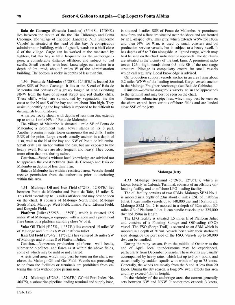
78 Sector 4. Gabon to Angola—Cap Lopez to Ponta Albina
Pub. 123
Baia de Cacongo (Enseada Landana) (5°14'S., 12°09'E.)lies between the mouth of the the Rio Chiloango and PontaCacongo. The village of Cacongo (Landana) (Vila GuilhermeCapelo) is situated at the head of this bay. A conspicuousadministration building, with a flagstaff, stands on a bluff closeS of the village. Cargo can be worked at the roadstead bylighters, but this bay is little frequented as the anchorage ispoor, a considerable distance offshore, and subject to badswells. Small vessels, with local knowledge, can anchor in adepth of 9m, mud, about 3 miles W of the administrationbuilding. The bottom is rocky in depths of less than 5m.
4.30 Ponta de Malembo (5°20'S., 12°10'E.) is located 5.6miles SSE of Ponta Cacongo. It lies at the S end of Baia deMalembo and consists of a grassy tongue of land extendingNNW from the base of several abrupt and red chalky cliffs.These cliffs, which are surmounted by vegetation, line thecoast to the N and S of the bay and are about 30m high. Theyassist in identifying the bay, which is reported to be difficult todistinguish from offshore.
A narrow rocky shoal, with depths of less than 5m, extendsup to about 1 mile NW of Ponta de Malembo.
The village of Malembo is situated 1 mile SE of Ponta deMalembo; a prominent water tower stands in its S part.Another prominent water tower surmounts the red cliffs, 1 mileENE of the point. Large vessels usually anchor, in a depth of11m, well to the N of the bay and NW of Ponta de Malembo.Small craft can anchor within the bay, but are exposed to theheavy swell. Rollers are also frequent and heavy. They occur,more often than not, during calms.
Caution.—Vessels without local knowledge are advised notto approach the coast between Baia de Cacongo and Baia deMalembo in depths of less than 11m.
Baia de Malembo lies within a restricted area. Vessels shouldreceive permission from the authorities prior to anchoringwithin this area.
4.31 Malongo Oil and Gas Field (5°24'S., 12°04'E.) liesbetween Ponta de Malembo and Ponta de Tafe, 15 miles S.This field extends up to 13 miles offshore and may best be seenon the chart. It consists of Malongo North Field, MalongoSouth Field, Malongo West Field, Limba Field, Lifuma Field,and Kungulo Field.
Platform Juliet (5°25'S., 11°59'E.), which is situated 12.5miles W of Malongo, is equipped with a racon and a prominentflare burns on a platform standing close W of it.
Vuko Oil Field (5°23'S., 11°57'E.) lies centered 15 miles Wof Malongo and 3 miles NW of Platform Juliet.
Kali Oil Field (5°34'S., 11°59'E.) lies centered 16 miles SWof Malongo and 9 miles S of Platform Juliet.
Caution.—Numerous production platforms, well heads,submarine pipelines, and flares exist within the above fields,some of which may be unlit or not charted.
A restricted area, which may best be seen on the chart, en-closes the Malongo Oil and Gas Field. Vessels not proceedingto or from the facilities or terminals are prohibited from en-tering this area without prior permission.
4.32 Malongo (5°26'S., 12°05'E.) (World Port Index No.46475), a submarine pipeline landing terminal and supply base,
is situated 4 miles SSE of Ponta de Malembo. A prominenttank farm and a flare are situated near the shore and are frontedby an L-shaped jetty. This jetty, which extends WSW for 183mand then NW for 91m, is used by small coasters and oilproduction service vessels, but is subject to a heavy swell. Ithas depths of 5 to 7.6m alongside. A lighted range, which maybest be seen on the chart, indicates the approach. The structuresare situated in the vicinity of the tank farm. A prominent radiotower, 125m high, stands about 0.5 mile SE of the rear rangestructure. Pilotage is compulsory except for small vesselswhich call regularly. Local knowledge is advised.
Oil production support vessels anchor in an area lying about3.2 miles WNW of the landing terminal. Cargo vessels anchorin the Malongo Freighter Anchorage (see Baia de Cabinda).
Caution.—Several dangerous wrecks lie in the approachesto the terminal and may best be seen on the chart.
Numerous submarine pipelines, which may best be seen onthe chart, extend from various offshore fields and are landedclose SSE of the jetty.
4.33 Malongo Terminal (5°26'S., 12°05'E.), which isknown locally as Cabinda Terminal, consists of an offshore oil-loading facility and an offshore LPG-loading facility.
The oil facility consists of two SBMs. Malongo SBM No. 1is moored in a depth of 23m about 6 miles ESE of PlatformJuliet. It can handle vessels up to 140,000 dwt and 16.8m draft.Malongo SBM No. 2 is moored in a depth of 32m about 3.5miles SE of Platform Juliet. It can handle vessels up to 325,000dwt and 350m in length.
The LPG facility is situated 1.5 miles E of Platform Julietand consists of a Floating Storage and Offloading (FSO)vessel. The FSO (Berge Troll) is secured to an SBM which ismoored in a depth of 30.5m. Vessels berth with their starboardside alongside the port side of the FSO. Vessels up to 50,000dwt can be handled.
During the rainy season, from the middle of October to theend of April, local thunderstorms may be experienced,particularly from December onwards. These storms are usuallyaccompanied by heavy rains, which last up to 3 or 4 hours, andoccasionally by sudden squalls with winds of up to 75 knots.Generally, the winds are mostly from the S and at less than 20knots. During the dry season, a long SW swell affects this areaand may exceed 4.5m in height.
In the vicinity of the anchorage area, the current generallysets between NW and NNW. It sometimes exceeds 3 knots,
Malongo Jetty

Sector 4. Gabon to Angola—Cap Lopez to Ponta Albina 79
Pub. 123
being affected by the outflow from the Congo River. In the dryseason, a SSW current can be experienced.
Pilotage is compulsory. Pilots, who act as mooring masters,can be contacted by VHF and board in the vicinity of the desig-nated anchorage area. Berthing is carried out only during day-light hours but vessels may depart at any time.
Vessels should send an ETA via the agent in Cabinda 7 days,72 hours, 48 hours, and 24 hours in advance. The messageshould state their name, ETA, master’s name, and any specialinformation as requested. Vessels should contact the terminaland the security patrol boat by VHF when within range.4.33 The Malongo Terminal may be contacted by e-mail, asfollows:
A designated anchorage (waiting area), with a radius of 1mile, lies centered about 4 miles SSW of Platform Juliet andhas depths of 38 to 40m.
Restricted areas, which may best be seen on the chart,enclose the various loading facilities and terminals. Vessels areprohibited from entering these areas without prior permission.
Vessels must fly the national flag of Angola during daylightand at night when moored at the terminal.
Caution.—Numerous production platforms and submarinepipelines are situated in the approaches to the terminal. Vesselsare advised to approach the terminal during daylight hours. Atnight, the lights and flares of the various structures may beconfusing and some obstructions may be unlit.
4.34 Praia de Futila (5°26'S., 12°13'E.), a village, stands3.5 miles SSE of Malongo. The coast in this vicinity is formedby a broad, low plain which is studded with palm trees. TheRiver Lulondo flows into the sea 1.5 miles S of this village.4.34 A bank of sand and rock, with depths of less than 5m, frontsthis village and extends up to about 1.5 miles offshore. Thisbank also fronts the coast to the S and extends up to about 3miles seaward from the head of Baia de Cabinda. Shoal depthsof less than 5m lie on the outer edge of this bank, but the seadoes not usually break on it. Vessels without local knowledgeare advised to give this stretch of coast a wide berth.
Ponta de Tafe (5°33'S., 12°11'E.), low and covered bybushes, is located 9.5 mile S of Malongo and forms the SWentrance point of Baia da Cabinda. Ponta de Tafe Lght isshown from a tower with a hut, 20m high, standing on thepoint. A prominent monument surmounts a cliff about 0.5 mileSSW of the point. A radio mast, 57m high, stands 1 mile SE ofthe point. An aeronautical light is occasionally shown from astructure standing in the vicinity of the airfield, about 2.5 milesSSE of Ponta de Tafe.
Several rocks, on which the sea breaks, front Ponta de Tafeand the coastal bank, with depths of less than 5m, extends up toabout 2 miles WSW of it.
4.35 Futila Oil Terminal (5°27'S., 12°11'E.), an offshorefacility, is located 2.3 miles SW of Praia de Futila. It consistsof four mooring buoys which are situated in a depth of 6.8m. Asubmarine pipeline extends NE from the berth to the shore.Vessels up to 6,500 dwt and 4.5m draft can be handled.
Vessels must send an ETA via the agent in Cabinda 72 hours,48 hours, and 24 hours in advance. The message must state thevessel’s name, ETA, master’s name, arrival draft (fore and aft),time to discharge ballast, quantity of segregated ballast onboard, and quantity of cargo to load or discharge. Vesselsshould then contact the terminal when within VHF range. Theyshould approach the terminal from the S.
Pilotage is compulsory. Berthing is carried out only duringdaylight hours but vessels may depart at any time. The pilot(mooring master) can be contacted by VHF and boards in theMalongo Freighter Anchorage (see paragraph 4.36).
The terminal is situated within the restricted area which sur-rounds the Malongo Oil and Gas Fields. Vessels are prohibitedfrom entering this area without prior permission.
4.36 Baia de Cabinda (5°32'S., 12°12'E.) (World PortIndex No. 46490) lies E of Ponta de Tafe and is mostlyencumbered by the coastal bank. Baixo do Bele, a rocky shoal,lies in the middle of the bay. It has a least depth of 2.5m and islocated 2 miles NNE of Ponta de Tafe (see paragraph 4.34).
The head of the bay consists of a sandy beach backed bylofty cliffs, green hills, and deep valleys. The town of Cabindais situated 0.7 mile E of Ponta de Tafe and is hidden by thetrees which stand on the sides and summit of an area ofelevated land. A prominent three-story structure stands in thetown, 1 mile SE of Ponta de Tafe. It was originally used as alighthouse, but is now a clock tower. An airfield is situated onthe S side of the town.
Several factories stand along the bay and an L-shaped pier,100m long, fronts the shore, 0.5 mile E of Ponta de Tafe.
Vessels may anchor, to discharge or load cargo from barges,in a depth of 9m, mud, about 2.3 miles WNW of Ponta de Tafeor closer inshore according to their draft. Small vessels withlight drafts may anchor in a depth of 4.6m about 0.4 mile N ofthe head of the L-shaped pier. A lighted range, which may bestbe seen on the chart, indicates this inner roadstead. Pilotage isnot available.
Malongo Freighter Anchorage, a designated anchorage area,lies centered about 3.5 miles NW of Ponta de Tafe Light andhas depths of 10 to 11m.
Caution.—Several dangerous wrecks lie in the approachesto Baia de Cabinda and may best be seen on the chart.
4.37 Between Ponta de Tafe and the entrance to the CongoRiver, 30 miles SSE, the country is particularly fertile andwell-populated.
A prominent radio tower stands close to the shore, 5 milesSSW of Ponta de Tafe.
The coast between Ponta de Tafe and Ponta Vermelha, 7miles SSW, is fronted by a shoal bank which extends up toabout 1.5 miles offshore and is generally indicated in places bybreakers. Vessels should not approach this stretch of the coastin depths of less than 22m, as rollers have been known to breakin depths of 13m and up to about 5 miles offshore.
The shore extending to 4 miles SSE of Ponta Vermelha islow and fringed with forests. A chain of reddish-colored hills,with nearly uniform height, rises close inland 3 miles S ofCabinda and extends almost to the N bank of the Congo River.

80 Sector 4. Gabon to Angola—Cap Lopez to Ponta Albina
Pub. 123
The border between Angola (Cabinda) and the DemocraticRepublic of the Congo (formerly Zaire) is situated about 8miles SSE of Pointe Vermelha and is marked by three beacons.4.37 Pointe Kipundji (Kupundji) (5°53'S., 12°18'E.) is located17 miles SE of Pointe Vermelha. The shore between is fringedby a narrow sandy beach. Pointe Kipundji Light is shown froma metal tower, 9m high, standing on this point and the con-spicuous village of Vista (Nsiamfumu), consisting of 30houses, stands 1 mile NW of it. The village of Muanda (Mo-anda), with an airfield, is situated 4 miles SE of Pointe Kip-undji.
Mona Mazea Bank (Banc Mona Mazea), an extensive shoal,fronts the coast between a point located 5 miles SSE of PontaVermelha and the entrance to the Congo River. This shoal hasdepths of less than 5m and extends up to about 5.5 milesoffshore in places. Vessels are advised to avoid this shoal bankand remain in depths of over 10m, as a constant swell, frequentrollers, and a strong current from the river are frequentlyexperienced in this vicinity. The bank is also reported to beextending in a W direction.
Caution.—Numerous fishing canoes may be encounteredclose off the coast between Ponta de Tafe and the Congo River.
4.38 Kokonga Oil Field (5°36'S., 11°42'E.), with severalproduction platforms, lies centered 30 miles WSW of Ponta deTafe.
Bomboco Oil Field (5°33'S., 11°43'E.), consisting of severalwell heads, lies centered 29 miles W of Ponta de Tafe.
Landana Oil Field (5°39'S., 11°32'E.), consisting of severalwell heads, lies centered 39 miles WSW of Ponta de Tafe.
N’Dola North Oil Field (5°41'S., 11°46'E.), with severalplatforms, lies centered 26 miles SW of Ponta de Tafe.
South Sanha Oil Field (5°41'S., 11°49'E.), with severalplatforms, lies centered 24 miles SW of Ponta de Tafe.
N’Dola Oil Field (5°45'S., 11°49'E.), consisting of severalwellheads, lies centered 25 miles SW of Ponta de Tafe.
Minzu Oil Field (5°45'S., 11°41'E.), consisting of severalwell heads, lies 32 miles SW of Ponta de Tafe.
N’Kassa Oil Field (5°49'S., 11°42'E.), consisting of severalwell heads, lies centered 33 miles SW of Ponta de Tafe.
M’Bili Oil Field (5°49'S., 11°52'E.), consisting of severalwell heads, lies centered 24 miles SW of Ponta de Tafe.
N’Tene Oil Field (5°52'S., 11°51'E.), consisting of severalwell heads, lies centered 27 miles SW of Ponta de Tafe.
Kambala Oil Field (5°43'S., 12°05'E.), with several pro-duction platforms, lies centered 12 miles SSW of Ponta deTafe.
Livuite Oil Field (5°47'S., 12°04'E.), with several platforms,lies centered 15 miles SW of Ponta de Tafe and 3 miles SSW ofKambala Oil Field.
Livuita Gas Field (5°45'S., 12°01'E.), consisting of severalwellheads, lies centered 16 miles SW of Ponta de Tafe and 5miles W of Kambala Oil Field.
Caution.—Numerous platforms, well heads, submarinepipelines, and flares exist within the above fields, some ofwhich may be unlit or not charted.
Restricted areas, which may best be seen on the chart,surround several of the above fields. Vessels not proceeding toor from the facilities or terminals are prohibited from enteringthese areas without prior permission.
4.39 Sanha LPG Terminal (5°38'S., 11°51'E.) is situated20 miles WSW of Ponta de Tafe and about 2 miles NE of theSouth Sanha Oil Field. It consists of a Floating ProductionStorage and Offshore (FPSO) facility, which is moored in adepth of 62m. Vessels berth either in tandem or alongside theFPSO.
Pilotage is compulsory. Pilots, who act as mooring masters,can be contacted by VHF and board about 3.5 miles NE of theFPSO. Berthing and departing are carried out only during day-light hours.
Vessels should send an ETA via the agent in Cabinda 7 days,72 hours, 48 hours, and 24 hours in advance. The messageshould state their name, ETA, master’s name, and any specialinformation as requested. Vessels should contact the terminaland the security patrol boat by VHF when within range.
Vessels should approach the terminal from the NW or SW.There is a least depth of 53m in the NW approach and 47m inthe SW approach. Vessels should avoid passing between thevarious restricted areas surronding the oil fields lying up to 30miles NW of the terminal.
A retricted area, which may best be seen on the chart, sur-rounds the terminal, the South Sanha Oil Field, and the N’DolaNorth Oil Field. Vessels are prohibited from entering this areawithout prior permission.
4.40 Lukami Oil Field (5°51'S., 12°08'E.), with severalplatforms, lies centered 10 miles WNW of Pointe Kipundji.
Motoba Oil Field (5°51'S., 12°10'E.), with several plat-forms, lies centered 8 miles WNW of Pointe Kipundji.
Mibale Oil Field (5°50'S., 12°12'E.), with several plat-forms, lies centered 5 miles NW of Pointe Kipundji.
Mwambe Oil Field (5°51'S., 12°14'E.), with several plat-forms, lies centered 4 miles NW of Pointe Kipundji.
Moko Oil Field (5°53'S., 12°07'E.), with several platforms,lies 10 miles W of Pointe Kipundji.
Libwa Oil Field (5°56'S., 12°15'E.), with several platforms,lies centered 3.5 miles SW of Pointe Kipundji.
GCO Oil Field (5°57'S., 12°10'E.), with several platforms,lies centered 8 miles SW of Pointe Kipundji.
Caution.—A restricted area, which may best be seen on thechart, encloses the above fields and extends up to about 12miles offshore. Vessels not proceeding to or from the facilitiesor terminals are prohibited from entering or anchoring in thisarea without prior permission.
4.41 Moanda Terminal (Muanda Terminal) (5°58'S.,12°09'E.), located 10 miles SW of Pointe Kipundji, consists ofa Floating Storage and Offshore (FSO) faciIty and an SBM.The FSO (Bellatrix Voyager) and the SBM, to which thetankers moor, are situated in a depth of 22.9m. Vessels up to160,000 dwt and 16.76m draft can be handled.4.41 The current at the terminal usually sets NW direction andattains a rate of to 2 to 3.5 knots. It is modified by the tidalcurrents and greatly affected by the flow of water from theCongo River. When the water level in the river is high, thecurrent experienced at the terminal may attain a rate of 5 to 7knots. A heavy swell is also often experienced at the terminalbetween March and September.4.41 Pilotage is compulsory. Pilots, who act as mooring masters,can be contacted by VHF and board 3 miles W of the SBM or

Sector 4. Gabon to Angola—Cap Lopez to Ponta Albina 81
Pub. 123
in the vicinity of the anchorage area. Berthing is carried outonly during daylight hours but vessels may depart at any time.4.41 Vessels should send an ETA, preferably via e-mail, to theterminal or the agent in Kinshasa as soon as possible. Con-firmation messages should be sent 72 hours, 48 hours, and 24hours before arrival. The messages must state the vessel’sname, ETA, Master’s name, arrival draft (fore and aft), arrivaldisplacement, time to discharge ballast, any anticipated delays,cargo requirements, and name of agent. Vessels should thencontact the terminal when within VHF range.4.41 The Moanda Terminal may be contacted by e-mail, asfollows:
4.41 A designated anchorage area is situated about 2 miles NW ofthe SBM. It has a depth of 28m over a bottom of soft mud.4.41 Moanda Terminal is situated within a restricted area whichextends up to 12 miles offshore and may best be seen on thechart (see paragraph 4.40).
The Congo River (Flueve Zaire)
4.42 The Congo River (Flueve Zaire), the second largestriver in Africa, is over 2,700 miles long and is the fifth longestriver in the world. However, in volume of water, depending onthe season, it is second only to that of the Amazon. The CongoRiver is navigable by ocean-going vessels as far as Matadi,about 80 miles from the sea.
Above Matadi, the Congo River runs at rates of up to 10knots between the cliffs. The water is generally deep, butwhirlpools render navigation difficult. Rapids are located about3.5 miles and 6.5 miles upriver from Matadi.
The Inga Dam (5°30'S., 13°37'E.) is situated about 21 milesabove Matadi. It was built across a once dry valley. Rapids arelocated at regular intervals upriver between the Inga Dam andKinshasa (4°20'S., 15°19'E.). This latter town stands on the Sside of the river, at the SW end of Pool Malebo, an extensivelake. Brazzaville is situated on the N bank, opposite Kinshasa.Pool Malebo is about 14 miles long and 11 miles wide.
The river between Pool Malebo and the town of Kisangani(0°31'N., 25°12'E.), about 940 miles upstream, is navigable byriver craft of up to 800 dwt. Stanley Falls are located oppositethe E end of Kisangani. Between Kisangani and Bukama(9°13'S., 25°51'E.), there are many areas of rapids, rivers, andswamp. The river source lies about 382 miles upstream fromBukama. Two dams have been built on this stretch of the riverand it is not used as a means of transportation.
The border between the Democratic Republic of the Congo(formerly Zaire) and Angola is situated, in the lower part, inthe vicinity of the middle of the river.
Tides—Currents.—The lower part of the Congo River iswell-supplied with water throughout the year, since thetributaries of this river are distributed on both sides of theEquator. The levels of the river system are usually either risingor falling and seldom remain at their mean level for any lengthof time. The tributaries of the left bank, on the S side, have twoperiods of high level and two periods of low level during theyear. Those of the right bank, on the N side, have only one
period of high level and one period of low level in the course ofthe year. The river is low in March and July, and high in Mayand December. The July low level is usually lower than that inMarch. The mean river level at Matadi is about 26m abovemean sea level.
The difference between the high river level and the low riverlevel at the following places are, as follows:
1. Banana (6°02'S., 12°25'E.)—0.6m.2. Mateba (25 miles above Banana)—1.5m.3. Pedra do Feitico (10 miles above Mateba)—2.1m.4. Boma (7 miles above Pedra do Feitico)—2.7m.5. Matadi—7m.
At Boma, the tidal influence is perceptible, but the range isless than 0.3m. At Matadi, the tidal influence is reported to bealmost not perceptible, being about 0.1m.
The river current always runs seaward. During the rainyseason, this current is very rapid and usually carries along withit floating islands of papyrus and water hyacinths which havebeen torn away from the banks. Some of these floating islandsmay be more than 100m long and may be dangerous to vesselsunderway or at anchor. In addition, they frequently sweep awaythe buoys marking the channels. These floating islands mayalso be encountered during the low river season, but they areusually not of sufficient size to be dangerous.
Observations indicate that the fresh water of the river,extending from the surface to the bottom, is found until justbelow Quissanga (6°02'S., 12°39'E.), where a body of saltwater is encountered in a deep gully. The fresh water thenflows over the denser water with decreasing depth and increas-ing velocity. It also decreases in depth as the estuary widens,but is deeper on the ebb current than on the flood current.
About 5 miles below Quissanga, the layer of fresh waterextends from 5.5 to 9.1m below the surface, whereas afterpassing Pointe Bulabemba (6°03'S., 12°26'E.), it is only about1m in depth. The deep body of salt water is reported to beeither perfectly still or to have a very slight tidal flow.
In the Congo River, the nature of the bottom is invariablysand, but hard clay may be found in a few places. The excep-tion is within the deep gully lying at the mouth of the river,where deposits of soft mud and decayed vegetable matter arefound. The latter is proof of the tranquillity of the water nearthe bottom.
Mud is found within the small creeks in the upper part of theriver and also on the mangrove-covered banks extending down-river from Quissanga. The water of the river is heavily chargedwith sand and it would appear that a very large proportion ofthe mud found in the deep gully at the mouth is from thewashings of the immediate neighborhood.
Currents in the Congo River
Location High River Level Low River Level
Banana to Boma 3 to 4.7 knots 2 to 3.5 knots
Boma to Matadi 7 knots 6 knots
Chaudron d’Enfer 10 to 11 knots 6 knots
Rade de Matadi 7.5 knots —

82 Sector 4. Gabon to Angola—Cap Lopez to Ponta Albina
Pub. 123
Depths—Limitations.—Depths of over 100m extend intothe mouth of the river and may be found in the channel up tothe vicinity of Lighted Buoy No. 16 (6°02'S., 12°34'E.). Theauthorities endeavor to maintain a depth of 9.1m throughoutthe year by surveying and dredging in the sandy passes of thewandering portion of the river below Boma. However,sometimes this depth cannot be maintained due to the break-upof banks or intensive shifting of sands. These periods arerelatively short and every effort is made to re-establish a depthof 9.1m as soon as possible.4.42 The controlling depths in the river vary. It was reported(1995) that, due to the sandbanks lying between Banana andBoma, vessels with drafts of 6.4 to 8.5m were permitted tomake the river transit, depending on the season. It was reported(1998) that, after the civil war, the maximum draft for rivertransit was reduced to 5.5m.
Consequently, the authorities should be contacted in advancefor the latest depth information.
Aspect.—The estuary of the Congo River, which extendsabout 50 miles inland to Boma, is entered between PontaVermelha (5°39'S., 12°08'E.) and Ponta da Moita Seca, 29miles SSE.
The continental shelf, with depths of less than 200m, extendsup to about 40 miles W of this estuary. It is cut by a remarkabledeep gully, 2 to 8 miles wide, which has depths of over 1,400mat the outer end. This gully, which has steep and irregular sides,leads directly into the entrance of the Congo River. It is usefulwhen approaching the entrance in foul weather, as depths ofover 200m extend into the river mouth.
Presqu’ile de Banana (6°01'S., 12°24'E.), located 26 milesSE of Ponta Vermelha, is a low and narrow peninsula. Thissandy peninsula extends 2.5 miles S to Pointe Francaise, its Sextremity. Several prominent white buildings of the town ofBanana are situated on the peninsula and two conspicuousradio masts stand 1.2 miles N of Pointe Francaise. Theprominent flare of an oil refinery is situated about 2.5 milesNNE of the radio masts. When rollers occur along this part ofthe coast at the time of the equinoctial tides, the greater part ofthis peninsula is submerged.
This part of the coast is fronted by a continuation of MonaMazea Bank and depths of less than 5m lie up to 2 miles off-shore. Banc Stella, a sandbank, extends up to about 0.5 mile Sof Pointe Francaise. Its S edge is steep-to, but depths of lessthan 5m lie up to 1.5 miles W of the point. This bank was re-ported (1990) to be extending to the W and vessels shouldexercise caution when navigating in its vicinity.
Stella Lighted Buoy No. 2 is moored about 1.8 miles WSWof Pointe Francaise and marks the edge of the coastal bank.
Pointe Bulabemba (6°03'S., 12°26'E.), a low point, is lo-cated 2.7 miles SE of Pointe Francaise. A light is shown from ametal tripod standing on this point.
Ponta da Moita Seca (6°07'S., 12°17'E.) is of moderateheight and appears as a steep cliff when seen from the N at adistance of about 7 miles. It is surmounted by a mound whichis covered by stunted bushes. Ponta da Moita Seca Light isshown from a metal framework tower, 21m high, standing onthe point.4.42 A stranded wreck is reported (2000) to lie about 1 mile NEof the point.
Ponta Padrao (Ponta do Padrao) (6°04'S., 12°20'E.), located4 miles ENE of Ponta da Moita Seca, is the NE extremity of along and low peninsula. A light is shown from a frameworktower, 7m high, standing on this point. The framework tower ismounted on a carriage which enables it, when necessary, to bemoved away from the heavy erosions of the river.
A village stands on Ponta Padrao and an old cemetery issituated about 0.3 mile within the point. A prominent marblecolumn, 5m high, stands near the extremity of the point. It wasset up by the famous Portuguese navigator Diego Cam in 1486.
Baia de Diogo Cao lies on the S side of the entrance to theCongo River and is entered E of Ponta Padrao. This bay ismostly shallow and not recommended as an anchorage.
A lighted buoy (Soyo) is moored about 2.5 miles ESE ofPonta Padrao and anchorage can be taken in depths of 7 to 9mabout 0.2 mile N of it.
Kwanda (6°07'S., 12°19'E.), an oil industry support base, issituated at the head of Baia de Diogo Cao. A channel leadsSSW for 3 miles along the W side of the bay to the town. It hasa dredged depth of 6m over a width of 80m and is marked bybuoys. The town is fronted by two quays, each 200m long, withdepths of 5 to 6m alongside. They are mostly used by vesselsservicing the offshore oil and gas installations and by fishingcraft.
Soyo (Santo Antonio do Zaire) (6°07'S., 12°22'E.), a smalltown, stands 2.5 miles E of Kwanda on the SW side of theentrance to Canal de Soyo, a creek. A short channel, which isindicated by a lighted range, leads SSE into the creek and ismarked by buoys and beacons. A conspicuous radio tower,45m high, stands in the town and is the tallest of four towers. Asmall wharf fronts the town and can accommodate smallvessels and ferries with drafts up to 4m. Small craft with draftsup to 1.2m can ascend the creek.
It is reported (2004) that Soyo is closed to all commercialvessels.
Sazaire Oil Terminal (6°06'S., 12°23'E.), consisting of alighted platform, is situated about 1 mile offshore, 3.7 milesESE of Ponta Padrao. A submarine pipeline extends SSE fromthe platform to the shore. This terminal is used by small localtankers and barges which transfer oil to larger vessels anchoredin the vicinity of Ponta Padrao.
Pilotage.—Pilotage is compulsory for all vessels over 500grt. Pilots for the river, Boma, Ango-Ango, and Matadi areprovided from the station at Banana. They can be contacted byVHF and board between Stella Lighted Buoy No. 2 and PointeBulabemba or about 8 miles above Pointe Bulabemba.
Vessels should send an ETA 5 days in advance, if possible,and a confirmation message 24 hours before arrival throughBanana (9PA) radio station. Pilotage is available by day only;this may result in vessels having to anchor at Boma or Ango-Ango overnight if there is insufficient time for them to reachMatadi during daylight.
Regulations.—For the safety of navigation, vessels pro-ceeding to Matadi must be capable of speeds of 10.5 to 11knots, and sometimes of speeds greater than 12 knots, depend-ing on the season and prevailing local conditions.
The buoyage in the river is placed in accordance with IALASystem A.

Sector 4. Gabon to Angola—Cap Lopez to Ponta Albina 83
Pub. 123
Anchorage.—Vessels awaiting daylight to enter the rivercan find good anchorage, out of the current, in depths of 13 to17m between 1 and 5 miles W of Ponta da Moita Seca.Another anchorage frequently used is in depths of 8 to 18m, onthe edge of the bank, between 2 and 2.8 miles WSW of PointeFrancaise.
Good anchorage may also be obtained in a depth of 14mabout 1 mile WSW of Ponta Padrao. The surface current at thisanchorage has been reported to set continually W, slackeningonly on the flood tide.
Caution.—Offshore oil and gas exploration and productionoperations are being carried out in the vicinity of theapproaches to the river. Drilling rigs, platforms, submarinepipelines, FSOs, and well heads may be encountered up to 80miles seaward of the river mouth. Vessels should exercise carewhen navigating in the approaches as many of the associatedstructures and installations are often moved and are notcharted.
The great difference between the rates of the surface currentsand undercurrents in the estuary of the Congo River accountsfor the often reported difficulties in steering. Vessels pro-ceeding with good speed, either directly with or against the sur-face current are not so much affected. However, vessels pro-ceeding at a slow speed and broadside to the current may, attimes, become almost unmanageable.
Vessels grounding on the banks where the current is stronghave observed the sand to pile up against one side nearly to thesurface of the water in a few hours. However, a sudden swirl ofthe current has then washed all the sand away and the vesselhas been left in deep water.
It is stated by one local authority that, on grounding, theanchor should never be dropped, as sooner or later, the currentwill wash the vessel, along with part of the bank, down theriver and into deep water. However, another local opinion isthat the above statement is open to question, depending uponthe position of the grounded vessel in relation to the bank.Consideration of the action to be taken is therefore necessary ineach case.
The charts of the river should be used with care, as con-siderable changes in the configuration of the islands and riverbanks may have taken place since the last surveys. The chan-nels are constantly changing, especially during the wet season,and at times new islands are formed and old ones swept awayby the violence of the current.
Navigation aids are reported to be frequently moved, dam-aged, unlit, or missing. Local knowledge is necessary. Thechannel buoys are often towed under by the current or areswept away altogether by the floating islands and debris whichflow down the river during the wet season.
Vessels are advised to give Ponta Padrao a berth of at least 1mil,e as depths in its vicinity have been reported to be less thancharted.
Vessels should head E to approach the river entrance, butallowance must be made for the strong current which sets N orNW. In addition, vessels should exercise care in order not to beset onto the shoal bank extending W from Pointe Francaise.
Crocodiles, which grow up to 9m long, are numerous in thepart of the river above Quissanga Beacon (6°02'S., 12°37'E.).
4.43 Banana to Boma.—Banana (6°01'S., 12°24'E.)(World Port Index No. 46510), the site of the pilot station, lieswithin Crique de Banana, which is entered between PointeFrancaise and Pointe des Pecheurs, 0.4 mile E. An oil refinery,with a prominent flare, is situated close NE of the town whichstands on Presqu’ile de Banana. A channel, marked by buoys,leads N into the creek. The bar at the entrance to this channelhas a depth of 5.5m at LW. The town is fronted by a quay, 75mlong, which has a depth of 5.2m alongside. Vessels can anchorin the middle of the creek, about 0.5 mile N of Pointe Fran-caise. The creek is subject to strong tidal currents, but boatscan ascend up to about 15 miles within it.
Vessels with drafts too deep to enter this creek can anchor tothe E of Pointe Bulabemba and work cargo from barges.Tankers of up to 220m in length and 11m fresh water draft cananchor E of Pointe Bulabemba. Cargo operations are carriedout continuously by large tanker barges. The current in thevicinity of this roadstead sets seaward at 4 to 5 knots.
Pilots are not always available for this anchorage, butexperienced officers from the oil refinery will assist vessels inberthing, if requested. Vessels generally depart without theservices of a pilot.
A detailed description of the islands and banks of the rivercannot be provided, as the channels are constantly changing,especially during the wet season which starts in October.
4.44 Between Pointe Bulabemba (6°03'S., 12°26'E.) andPonta da Quissanga, 13 miles ENE, the banks of the river areformed by alluvial deposits and are covered with a densegrowth of palms and giant mangroves. Some of the lattervegetation grows to considerable size. One species reachesheights of over 30m and has a straight stem which is supportedby an arch of roots rising up to 6m from the ground. The spacesbetween these giant mangroves are usually filled by varioussmaller trees.
The countryside near the river is low and swampy, but lowranges of hills rise some distance inland on either side. Thehills are 60 to 150m high and are covered with grass and occa-sional patches of trees.4.44 Canal do Porto Rico, entered 4 miles SE of Pointe Bula-bemba, is obstructed by sandbanks and a shallow bar fronts itsentrance. The settlement of Cafumbila is situated 1.5 milesENE of the entrance.
Quissanga Light (6°02'S., 12°37'E.) is shown from a struc-ture, 8m high, standing on the N side of Ilha da Quissanga, 1.5miles NE of the W end of the island. Ponta da Quissanga islocated at the NE end of Ilha da Quissanga. The countryside inthis vicinity consists of one huge swamp which is intersectedby numerous creeks. Giant mangroves stand on the banks ofthese creeks. Above Ponta Quissanga, this dense vegetationtends to disappear and its place is taken by low banks of coarsehippopotamus grass.
Anchorage.—Anchorage can be taken, in a depth of 11m, tothe W of the entrance to Canal do Porto Rico. However, careshould be taken as depths of 9m lie close inshore of thisroadstead and the bottom shoals very rapidly. A strong currentsets at this anchorage and rough water is often experiencedwhen the afternoon sea breeze is blowing, but not as much ason the N side of the river. Anchorage can also be taken, in a

84 Sector 4. Gabon to Angola—Cap Lopez to Ponta Albina
Pub. 123
depth of 11m, off the settlement of Cafumbila. It was reported(1973) that these two anchorages were unsatisfactory.
Above Ponta da Quissanga, the Congo River widens and isobstructed by numerous islands and banks. Several channelslead between these obstructions, but only one main fairway iskept open for shipping by dredging. The islands are low andcovered with grass and bushes which are almost level with thewater. They are intersected by creeks and fringed by dryingbanks. Crocodiles are particularly numerous in this part of theriver and grow up to 9m in length.
4.45 Pedra do Feitco (5°55'S., 12°58'E.), formed by thetermination of a ridge of ironstone, projects boldly into theriver from the edge of a grassy plain and is 35m high. Ashallow rock lies about 200m N of the point. The village ofQuissacala, with an airfield, is situated about 1 mile S of thepoint. It is reported (1999) that a military observation towerstands on the point.
Between Pedra do Feitco and Ile des Princes, 9 miles ENE, thecharacter of the countryside changes. The low, swampy land isreplaced by hills, some of which rise to heights of over 150m.4.45 After passing Pedra do Feitco, a very strong current, withnumerous eddies and whirlpools, is often experienced. Vesselstend to be set away from the S side of the river due to the vol-ume of water flowing W through the channel leading S of IleSelonga.
Several lighted ranges indicate the fairway in this part of theriver. Ile Selonga (5°53'N., 13°02'E.) is low and grassy. IleSacra Ambaka (Mebaca), lying close E of Ile Selonga, is onlyjust above the level of the river, except near its NE end, whichis surmounted by a wooded hill, 74m high. A 2,000m measureddistance lies N of these two islands and is indicated by threepairs of beacons. It was reported (1982) that most of thesebeacons were missing.
Fingal’s Shield, a conspicuous granite monolith, stands nearthe summit of a hill, 150m high, which rises 2.3 miles NW ofthe W end of Ile Selonga.
Fort Shinkakasa, situated 2 miles E of Fingal’s Shield, stands41m above the river. Large pythons are frequently found in thisvicinity. The town of Boma stands 1 mile E of this fort.
4.46 Boma (5°51'S., 13°03'E.) (World Port Index No.46520) lies on the N side of the Congo River, 50 miles abovethe river mouth. The town stands in the center of a semicircleof hills and consists of two sections. The business section issituated on the flat ground, close to the river. The residentialsection is situated about 60m above the river and includesofficial residences, hospitals, and barrack buildings, etc.
A main quay, 480m long, provides three general cargo andbulk berths and has depths of 7.9 to 9.8m alongside. A current,with a maximum rate of 3 knots, is normally experienced atthis quay.
The controlling depths in the river vary and vessels shouldascertain the latest information from the authorities. Vesselswith drafts of 6.4 to 8.5m draft can transit the river to this port,depending on the season.
Vessels can also anchor off the N side of Ile Sacra Ambaka(Mebaca) in good holding ground. Vessels can load or dis-charge cargo if necessary with the use of barges.
4.47 Boma to Matadi.—Ile Rocca (5°53'S., 13°05'E.),lying E of Ile Sacra Ambaka (Mebaca), rises near its E end to arocky and wooded hill, 87m high. A shoal extends N from thisisland and is the only danger lying between Boma and Ile desPrinces (5°53'S., 13°07'E.). Several lighted ranges indicate thefairway in this part of the river channel.
Above Ile des Princes, the character of the scenery under-goes a change. The river, previously broad and uninteresting, isnow confined within narrower limits by high hills on eitherside. These hills are covered with luxuriant vegetation for somedistance.
Although the currents and eddies are stronger in this part ofthe river than in the lower part, vessels with good speed canreach Matadi without much difficulty.
The S bank of the river between Ponta Bumbu (5°53'S.,13°10'E.) and Sango-Bongo rises steeply to hills, 60 to 90mhigh. Vegetation lies at the foot of these hills, which are gen-erally bare, but a few trees may be seen on the skyline.
Binda (5°51'S., 13°14'E.), a town, stands on the N bank ofthe river, close W of the mouth of the Riviere Belizi. PontaSenga is located on the S side of the river, about 2 miles ESE ofthe town.
Ilot Oscar (5°53'S., 13°18'E.) lies in the middle of the river, 2miles ESE of Ponta Senga. It is wooded and marked by a light.The main channel passes to the S of this islet. It was reported(1982) that the islet was below-water, but the light structureremained visible.
Sango-Bongo (5°54'S., 13°19'E.) lies in the middle of theriver, about 1.7 miles ESE of Ilot Oscar. This rock is marked bya light and dries 0.6m during the dry season. The main channelpasses to the N of it.
Ponta Tridente (5°54'S., 13°20'E.), marked by a light,projects from the S side of the river, 1 mile ESE of Sango-Bongo. Les Trois Soeurs, a group of three islets, lies on the Nside of the river, opposite this point, and narrows the channel toa width of about 600m. It was reported (1982) that thesouthernmost islet of the group was below-water.
4.48 Pointe Muzuku (5°54'S., 13°22'E.) is located on the Nbank of the river, 1.5 miles E of Ponta Tridente. On the S sideof the river, opposite this point, the land rises to several hillswhich stand 2 to 3 miles inland. These hills are about 300mhigh and covered with dense vegetation. The interveningcountryside is very rough with isolated hills and ridges.
Three small islets lie in the center of the river, E and NE ofPointe Muzuku; a light is shown from the middle islet. Shoalwater lies between these islets and the NW bank of the river.Ilot Kongolo lies about 0.2 mile offshore, 1 mile NNE ofPointe Muzuku. A shelf, with depths of less than 5m, extendsalong the NW bank of the river in the vicinity of this islet.
Ponta Diamants (5°52'S., 13°23'E.) is fronted by RochaDiamants, a dangerous rocky shoal, which covers at HW. Alighted beacon is situated 0.2 mile NW of this point.
Pointe Luze is located on the N bank of the river, 0.7 mileNE of Ponta Diamants; the town of Ikungulu stands 1 mile E ofit.
The town of Noqui is situated on the S side of the river, 2.6miles E of Pointa Diamants. A light is shown from an ellipticaltower on rocks, 2m high, standing on a point near this town.River ferries link Noqui with Soyo and Boma.
Sector 4. Gabon to Angola—Cap Lopez to Ponta Albina 85
Pub. 123
The border between the Democratic Republic of the Congo(formerly Zaire) and Angola lies close N of Noqui.
4.49 Ango-Ango (5°51'S., 13°26'E.) is situated on the SEside of the Congo River, 1.2 miles N of Noqui and 2.5 milesbelow Matadi. It is used for the discharge of dangerous goodsand by vessels not powerful enough to pass through Chaudrond’Enfer (Devil’s Cauldron).
A floating pontoon, 61m long, fronts the SE side of the river.It is connected to the shore by two bridges and forms a berthwith a depth of 9.1m alongside. Vessels of up to 8,000 dwt and195m in length can be accommodated. A strong current isnormally experienced at this berth. It has rates of 3 to 7 knots,depending on the height of the river. Palm oil can also beloaded at this berth, but oil tankers have priority for berthing. Aquay, 123m long, is situated 0.7 mile S of the pontoon and isused for the discharge of dangerous cargo. It is reported thatberthing at these facilities is permitted only during daylighthours and vessels must keep their engines available forimmediate use.
4.50 Pointe Underhill (5°50'S., 13°26'E.) is located on theSE side of the river, about 1 mile W of Matadi. An overheadtelephone cable, with a minimum vertical clearance of 40m,spans the river in the vicinity of this point.
A road bridge spans the river close E of Pointe Underhill. Ithas a vertical clearance of 52.7m, which allows for a maximumrise of 8m in the river level, during the rainy season.
The high hills standing on the NW bank of the river, oppositePointe Underhill, fall 183 to 244m in sheer precipices to thedark and gloomy basin below, which is known as Chaudrond’Enfer (Devil’s Cauldron). The river in this vicinity is verydeep and the currents are violent. Numerous eddies and heavywhirlpools necessitate special care in steering and a fast speed.Although the current is not very formidable during the dryseason, it generally attains rates of 10 to 13 knots, in places,during the wet season.
The river pilots advise that steering for vessels of over 170min length is extremely difficult within Chaudron d’Enfer andsuch vessels are almost unmanageable.
Anchorage.—Anchorage is reported to be possible inseveral places lying between Boma and Matadi. These placesare known to the river pilots and local knowledge is necessary.The anchorages are, as follows:
1. Kinlele (5°52'S., 13°06'E.), lying on the N side of theriver, 2.5 miles above Boma.
2. Iles des Princes (5°50'S., 13°26'E.), lying off the SEside of the island.
3. Bumbu (5°53'S., 13°09'E.), lying between PontaKimongoa and Ponta Bumbu.
4. Binda (5°51'S., 13°14'E.).5. To the N of Ilot Oscar (5°53'S., 13°18'E.).6. Muzuku (5°54'S., 13°21'E.), lying on the N side of the
river, 1 mile ESE of Les Trois Soeurs.7. Diamants (5°52'S., 13°23'E.), lying on the N side of
the river, opposite Ponta Diamants.8. Ikungulu (5°52'S., 13°25'E.), lying on the N side of
the river, 1.5 miles W of Noqui. This anchorage is for vesselswaiting to berth at Matadi.
9. Off Ango-Ango (5°51'S., 13°26'E.), in a depth of15m.Caution.—Between Sango-Bongo and Pointe Muzuku,
exceptionally strong currents have been experienced.In the past, vessels generally encountered no whirlpools of
sufficient size to render steering difficult below Les TroisSoeurs. However, severe whirlpools were often encounteredbetween Les Trois Soeurs and Matadi. A vessel of 1,320 dwtand 86m in length reported (1947) that it was best to use fullhelm at once to counteract the slightest tendency to swing, as,if even a small sheer were taken, the current tended to turn thevessel rapidly broadside to the channel.
A vessel of 25,000 dwt and 170m in length reported (1982)that while it was necessary to use the helm at once tocounteract the slightest swing, full helm was neither necessarynor desirable, as this tended to overcorrect very quickly beforethe helm could be removed. The vessels also reported that thepilots preferred to use 10° or less helm in order to maintain asteady course.
4.51 Matadi (5°49'S., 13°27'E.) (World Port Index No.46530) lies along the S bank of the Congo River, at the limit ofnavigation for ocean-going vessels, about 80 miles from thesea. The town is built on the steep and rocky slope of the riverbank and is shut in on all sides by high mountains. It isextremely unhealthy in the hot season, although there are nowfew cases of malarial fever.
Winds—Weather.—Heavy thunderstorms and torrentialrains occur during the wet season. The prevailing winds arefrom the W.
Tides—Currents.—Matadi has no perceptible tidal rise, buta seasonal difference of 7m occurs between the high riverwater level andthe low river water level.
In the dry season, the current close inshore is weak. How-ever, it runs strongly during the wet season and sometimes ves-sels experience considerable difficulty when berthing along-side. The rate of this current varies between 1 knot and 9 knots.At the most downstream part of the quay, the current is particu-larly strong and sets towards the berths. The current is felt theleast at the center berths.
Depths—Limitations.—The port has 1,610m of total mainquayage, which provides ten berths. These berths are 143 to188m long and have depths of 6 to 10m alongside. Vessels upto 24,800 dwt, 179m in length, and 8.2m draft can beaccommodated. There are facilities for general cargo, bulk,container, and ro-ro vessels.
The controlling depths in the river vary and vessels shouldascertain the latest information from the authorities. Vesselswith drafts of 6.4 to 8.2m can transit the river, depending onthe season.
Caution.—At the most downstream part of the quay, vesselsmust use care when dropping the anchor to assist in berthing,as deep water lies close alongside.
The Congo River to Luanda
4.52 The coast extending S for many miles from a pointlocated 3 miles S of Ponta da Moita Seca Light (6°07'S.,12°16'E.) consists of red cliffs. Inland of these cliffs, a table-land runs parallel to the coast in a continuous double line. This

86 Sector 4. Gabon to Angola—Cap Lopez to Ponta Albina
Pub. 123
tableland is visible in places from offshore, but has no definitelandmarks which can be identified.
An aeronautical light beacon (Soyo-Quinfruquena) is shownfrom a conspicuous mast standing about 9 miles SSE of Pontada Moita Seca.
The Rio Lombo (6°23'S., 12°26'E.) enters the sea 19 milesSSE of Ponta da Moita Secca.
A small local oil terminal, consisting of a lighted platform, issituated 1.5 miles offshore, about 6.5 miles SSE of the mouthof this river. A submarine pipeline extends NE between theterminal and the coast.
Cabeca da Cobra (6°33'S., 12°30'E.), a rounded headlandwith a rocky base, is located 10 miles SE of the mouth of theRio Lombo and is surmounted by a moderately high hill. Acabeca da Cobra Light is shown from a tower with a dwelling,13m high, standing on this headland. The village of Lubombeis situated about 1 mile E of the light.
A bank, with depths of less than 5m, extends up to about 2.3miles W from Cabeca da Cobra. Baixo de Dentro, a group ofshallow rocks, lies on this bank, about 0.7 mile W of theheadland. Baixo de Fora, a rocky shoal with a least depth of4.4m, lies about 3.5 miles WSW of the headland.
Ponta do Quipai, located 8 miles SSE of Cabeca da Cobra,consists of lofty cliffs which are surmounted by shrubs andoverlooked by a hill with a round, bare summit. A conspicuousclump of mangroves stands within this point and is visiblefrom a considerable distance offshore.
The mouths of the Rio Lukulo and the Rio Sange lie 1.8 and4.5 miles, respectively, SE of Ponta do Quipai.
Ponta do Quinzau (6°54'S., 12°45'E.) is located 18 milesSE of Ponta do Quipai. The coast between is fringed by anuninterrupted sandy beach which is backed by rocky cliffs andsurmounted by bare, rounded hills. The cliffs in the vicinity ofPonta do Quinzau are about 40m high. Ponta do Quinzau Lightis shown from a tower with a dwelling, 15m high, standingabout 0.5 mile N of the point. A prominent tower, 50m high,stands about 4 miles inland, 6.5 miles N of the light.
Caution.—Depths of less than 10m extend up to about 6miles offshore between Ponta da Moita Seca and Nzeto(Ambrizete), 76 miles SSE. Vessels should exercise care whennavigating in this area and keep in depths of over 15m. Rollersoften form without warning and frequently break in depths ofup to 9m.
An artificial reef area, which may best be seen on the chart,lies centered about 22 miles WSW of Cabeca da Cobra Light.
Oil exploration and production are being carried out alongthis coastal area and vessels are warned that numerous plat-forms, submerged pipelines, drilling rigs, and FSO facilitiesmay be encountered up to 60 miles offshore. Vessels shouldexercise care when navigating in this vicinity as many of theassociated structures and installations are often moved and arenot charted. In addition, numerous well heads lie within the100m curve, but are not considered to be a danger to surfacenavigation.
4.53 Safueiro Oil Field (6°07'S., 12°04'.), with a singleplatform, lies centered 13 miles W of Ponta da Moita Seca.
Essungo Oil Field (6°015'S., 12°10'.), with several wellsand platforms, lies centered 10 miles SW of Ponta da MoitaSeca.
Cuntala Oil Field (6°18'S., 12°19'E.), with several wellsand platforms, lies centered 9 miles NW of the mouth of theRio Lombo.
Raia Oil Field (6°21'S., 12°18'E.), with several wells andplatforms, lies centered 9 miles WNW of the mouth of the RioLombo.
Estrela Oil Field (6°26'S., 12°21'E.), with several platforms,lies centered 6 miles WSW of the mouth of the Rio Lombo.
Bagre Oil Field (6°26'S., 12°16'E.), with several platforms,lies centered 10 miles WSW of the mouth of the Rio Lombo.
Lombo East Oil Field (6°51'S., 12°24'E.), with severalplatforms, lies centered 22 miles W of Ponta do Quinzau Light.
Sulele Oil Field (6°51'S., 12°26'E.), with several platforms,lies centered 20 miles W of Ponta do Quinzau Light.
Tubarao Oil Field (6°54'S., 12°24'E.), with one platform,lies centered 21miles W of Ponta do Quinzau Light.
Tamboril Oil Field (6°54'S., 12°26'E.), with one platform,lies centered 19 miles W of Ponta do Quinzau Light.
Palanca Oil Field (6°58'S., 12°23'E.), with severalplatforms, lies centered 23 miles WSW of Ponta do Quinzau.
Impala Oil Field (7°00'S., 12°23'E.), with several platforms,lies centered 24 miles WSW of Ponta do Quinzau Light.
Pacassa Oil Field (7°08'S., 12°26'E.), with several platformsand wells, lies centered 28 miles SW of Ponta do QuinzauLight.
Caution.—Numerous wellheads and submarine pipelinesexist within the above fields.
Restricted areas, which may best be seen on the chart,surround several of the above fields. Vessels not proceeding toor from the facilities are prohibited from entering these areaswithout prior permission.
4.54 Xikomba Terminal (6°03'S., 11°01'E.) is situatedabout 75 miles W of Ponta da Moita Seca in the vicinity of anoil field. It onsists of a Floating Production Storage andOffshore (FPSO) facility, which is equipped with a racon. TheFPSO (Xikomba) is moored, by means of an SPM turret at thebow, in a depth of 1,300m. Vessels berth in tandem to the sternof the FPSO. The terminal can handle vessels up to 350,000dwt.
A designated waiting area lies centered 3 miles N of theFPSO.
Local thunderstorms, which occur in the vicinity of theterminal, are usually preceded by a dense cloud belt and can beaccompanied at times by wind gusts exceeding 50 knots.
Pilotage is compulsory except when arriving at the waitingarea. Pilots, who act as mooring maters, can be contacted byVHF and board in the waiting area. Berthing is carried out onlyduring daylight hours but vessels may depart at any time.
Vessels should send an ETA by e-mail or fax to the terminalat the start of their voyage. They should send a confirmationmessage 72 hours, 48 hours, 24 hours, and 4 hours prior toarrival. Vessels should then contact the terminal when withinVHF range. Changes to the ETA of more than 6 hours andchanges of more than 1 hour during the last 24 hours should bereported immediately.
A restricted area, with a radius of 2.5m, surrounds the ter-minal. Vessels are prohibited from entering this area withoutprior permission from the terminal.

Sector 4. Gabon to Angola—Cap Lopez to Ponta Albina 87
Pub. 123
4.55 Kizomba A Terminal (6°19'S., 11°03'E.) is situatedabout 75 miles WSW of Ponta da Moita Seca in the vicinity ofan oil field. It consists of a Floating Production Storage andOffshore (FPSO) facility, a drilling platform, and a CALMbuoy. The FPSO (Kizomba A), which is equipped with a racon,is moored in a depth of 1,180m and the CALM buoy is situated1 mile NNW of it.
A designated waiting area, with a radius of 1.5 miles, liescentered 5 miles NW of the FPSO.
Local thunderstorms, which occur in the vicinity of theterminal, are usually preceded by a dense cloud belt and can beaccompanied at times by wind gusts exceeding 50 knots.
Pilotage is compulsory. Pilots, who act as mooring maters,can be contacted by VHF and board in the waiting area.Berthing is carried out only during daylight hours but vesselsmay depart at any time.
Vessels should send an ETA 72 hours, 48 hours, 24 hours,and 4 hours prior to arrival. Vessels should then contact theterminal when within VHF range. Changes to the ETA of morethan 1 hour during the last 24 hours should be reported im-mediately.4.55 The Kizomba A Terminal, which is operated by EssoExploration Angola, may be contacted by e-mail, as follows:
A restricted area, with a radius of 4 miles, surrounds theFPSO. Vessels are prohibited from entering this area withoutprior permission from the terminal.
4.56 Kizomba B Terminal (6°21'S., 11°09'E.) is situatedabout 70 miles WSW of Ponta da Moita Seca in the vicinity ofan oil field. It consists of a Floating Production Storage andOffshore (FPSO) facility, a wellhead platform, and a CALMbuoy. The FPSO (Kizomba B), which is equipped with a racon,is moored in a depth of 1,163m and the CALM buoy is situated1.2 miles NNW of it.
A designated waiting area, with a radius of 1.5 miles, liescentered about 9 miles N of the FPSO.
Local thunderstorms, which occur in the vicinity of theterminal, are usually preceded by a dense cloud belt and can beaccompanied at times by wind gusts exceeding 50 knots.
Pilotage is compulsory. Pilots, who act as mooring maters,can be contacted by VHF and board about 4.5 miles NNW ofthe terminal. Berthing is carried out only during daylight hoursbut vessels may depart at any time.
Vessels should send an ETA 72 hours, 48 hours, 24 hours,and 4 hours prior to arrival. Vessels should then contact theterminal when within VHF range. Extensive changes to theETA should be reported immediately.4.56 The Kizomba A Terminal, which is operated by Esso Ex-ploration Angola, may be contacted by e-mail, as follows:
A restricted area, with a radius of 4 miles, surrounds theFPSO. Vessels are prohibited from entering this area withoutprior permission from the terminal. This area overlaps the re-stricted area surrounding the Kizomba A Terminal (see para-graph 4.55) and vessels may not pass between them withoutprior permission.
4.57 Lombo East Oil Terminal (6°50'S., 12°22'E.) issituated about 23 miles WNW of Ponta do Quinzau Light andconsists of an SBM. The terminal is located in a depth of36.5m and can handle vessels up to 175,000 dwt.
It is reported (2005) that this terminal is no longer used andthe SBM has been removed.
4.58 Palanca Terminal (6°57'S., 12°24'E.), situated about22 miles WSW of Ponta do Quinzau Light, consists of severalproduction platforms, an SBM (CALM), and a FloatingProduction Storage and Offshore (FPSO) facility. The FPSO(Palanca) is moored to an SBM in a depth of 44m. Tankers aremoored bow to bow with the FPSO and vessels up to 150,000dwt can be handled. The SBM (CALM) is moored in a depth of42m. It is used as an auxilary loading buoy and can handlevessels up to 300,000 dwt.
A designated anchorage area, in depths of 40 to 43m and abottom of sand with good holding ground, lies about 5 milesNW of the SBM. The swells in the vicinity of the terminal arepredominantly from the SSW, with heights of 1.5 to 2.5m.They are strongest from May to October and reach a maximum2 to 3 days before spring tides.
Pilotage is compulsory. Pilots, who act as mooring maters,can be contacted by VHF and board about 2 miles N of theSBM. Berthing is carried out only during daylight hours butvessels may depart at any time.
Vessels should send an ETA 72 hours, 48 hours, and 24hours in advance and then contact the terminal when withinVHF range.4.58 The Palanca Terminal, which is operated by Sonangol P&P,may be contacted by e-mail, as follows:
4.58 A restricted area surrounds the terminal and may best beseen on the chart. Vessels are prohibited from entering this areawithout prior permission from the terminal.
Kizomba B FPSO

88 Sector 4. Gabon to Angola—Cap Lopez to Ponta Albina
Pub. 123
4.59 Canuku Terminal (7°06'S., 12°28'E.), situated 22miles SW of Ponta do Quinzau Light in the vicinity on an oilfield, consists of a Floating Production Storage and Offloading(FPSO) facility. The FPSO (Ocean Producer) is moored in adepth of 83m and vessels berth in tandem bow to bow with it.The terminal can handle vessels up to 150,000 dwt.
Pilotage is compulsory. Pilots, who act as mooring masters,can be contacted by VHF and board about 2.5 miles NE of theterminal. Berthing is carried out only during daylight hours butvessels may depart at any time, subject to agreement.
Vessels are requested to report their ETA 48 hours inadvance and send a confirmation message 24 hours prior toarrival. Changes to the ETA of more than 1 hour must bereported immediately. Vessels should then contact the terminalwhen within VHF range.4.59 The Canuku Terminal, which is operated by Sonangol P&P,may be contacted by e-mail, as follows:
A designated waiting anchorage area lies centered 3 milesNE of the FPSO.
A retricted area, with a radius of 500m, surrounds the FPSO.Vessels are prohibited from entering this area without priorpermission from the terminal.
4.60 The Rio Lucunga (6°57'S., 12°48'E.) flows into thesea 4.5 miles SE of Ponta do Quinzau Light (see paragraph4.52). The mouth of this river is indicated by several clumps oftrees standing close to the beach. A number of prominent whitefactory buildings are situated at Mucula, 0.5 mile SE of themouth.
A bank, with depths of less than 8m, lies about 3 milesoffshore, SW of the river mouth. Enseada de Mucula, a slightindentation, lies S of the mouth of the river. Vessels with localknowledge can approach this indentation and obtain anchor-age in a depth of 6m off the factory buildings.
The coast extending up to about 7 miles S from the mouth ofthe Rio Lucunga is bordered by a sandy beach. Between the Send of this beach and the Rio M’bridge, 8 miles S, it consists oflow, rocky cliffs which are intersected by ravines. Theseravines are of a yellowish color and contrast with the blue tintof the sea and the green tint of the inland countryside.
The Rio M’bridge (Rio Mebridege) (7°12'S., 12°51'E.),which is used only by local craft, can easily be recognized byPonta Palmas, its N entrance point. This point is wooded andthe dark hue of the trees contrasts strongly with the yellowishtint of the cliffs on the S bank of the river. The river mouth isfronted by breakers which extend up to 0.3 mile seaward. Theland to the S of the entrance is formed by low cliffs, which aresurmounted in a few places by thick clumps of trees. A rangeof hills stands inland of the river mouth.
Baia de Ambrizete (Baia de N’zeto) (7°14'S., 12°51'E.), aslight indentation, lies between the Rio M’bridge and a bluff,3.5 miles S. This latter bluff rises in a high and almost sheercliff which is covered with herbage. From the S, the bluffappears as a projecting point and is very prominent. Within thebluff stands, a range of hills. The S and highest hill of this
range has a conspicuous flat top which can be easily recog-nized from a considerable distance.
Ambrizete Light (N’zeto Light) (7°15'S., 12°51'E.) isshown from a prominent tower, 20m high, standing on thebluff. A disused light structure and a small white dwelling aresituated close N and close W, respectively, of the light.
4.61 N’zeto (Ambrizete) (7°14'S., 12°51'E.), a small town,stands at the head of the indentation, 1.5 miles S of the mouthof the Rio M’bridge. It is situated on the rising ground, whichstretches toward the bluff, and is fronted by a small breakwater.Two prominent radio masts stand close together in the town.
Depths of less than 5m lie up to about 1 mile offshorebetween the town and the bluff and vessels should give thisarea a wide berth.
Anchorage can be taken in a depth of 9m, sand and mud,about 2.5 miles SW of the mouth of the Rio M’bridge, but onlyvessels with local knowledge should use this roadstead. Thebottom changes to rocks and stones to the S of the anchorageand the depths shoal rapidly. A constant swell is experienced atthe anchorage and rollers are reported to frequently break in adepth of 9m off the town.
Baia de Juma (7°20'S., 12°54'E.), a slight indentation in thecoast, extends SE for 5 miles from the S entrance point of Baiade Ambrizete. The Rio Ambrizete, with a mouth barred bysand, flows into the N part of this indentation, about 3 miles SEof Nzeto. The S part of the indentation is fronted for about 3miles by a sandy beach. Anchorage, with local knowledge, canbe taken in this indentation, but the bottom is very foul andthere is a heavy swell.
The coast extending SSE from Baia de Juma is bold andcliffy with occasional sandy coves. The high white cliffs aresurmounted by trees.
4.62 Kiame Terminal (7°21'S., 12°24'E.) is situated about28 miles WSW of Ambrizete Light in the vicinity of an oilfield. The terminal consists of a Floating Production Storageand Offloading (FPSO) facility, which is moored in a depth of142m. Vessels berth in tandem bow to bow with the FPSO(Petroleo Nautipa). The terminal can handle vessels up to150,000 dwt.
It is reported (2006) that this terminal is no longer in use.
4.63 Ponta da Musserra (7°36'S., 13°00'E.), located 22miles SSE of N’zeto (Ambrizete), forms the S entrance pointof a small bay. The shores of the bay are low, but high cliffsrise abruptly at the S entrance point and are surmounted by aprominent cross. Several factories are situated at Musserra,near this bay.
The bottom fronting the bay is rocky and foul in places.Vessels without local knowledge should not anchor in depthsof less than 16m or less than about 2 miles offshore.
The Ararat Hills rise inland, close S of Ponta da Musserra,and stand parallel to the coast for 5 to 6 miles. They attainheights of up to 200m and are the highest peaks between theCongo River and Luanda. These hills are of basaltic formation,steep, and mostly bare except for a little brushwood. They arebrown and arid in appearance and are covered with superbmasses of pink-colored granite, which rise in picturesqueforms.

Sector 4. Gabon to Angola—Cap Lopez to Ponta Albina 89
Pub. 123
A very conspicuous mass of granite surmounts the summit ofone of these hills, which rises about 5 miles inland, 28 milesSSE of Nzeto (Ambrizete). This mass is about 18m high and isin the form of a pillar.
The mouth of the Rio Sembo (Rio Quicembo) lies 8.7 milesSSE of Ponta da Musserra. This river is insignificant and,except between January and June, its entrance is obstructed bya barrier of sand. Two villages are situated on the S slope ofArarat Hills. The southernmost village stands abreast a sandybeach, 2 miles NNW of the mouth of the Rio Sembo. It isconspicuous from seaward, as the conical huts are much lighterin color than the dark trees which form the background.
Ponta Two Trees, located 2 miles NNW of the Rio Sembo, isa low, sloping, and grassy point. Two conspicuous isolatedpalm trees are reported to stand on this point.
The N entrance point of the Rio Sembo is low and wooded.The bluff, which forms the S entrance point, consists of aperpendicular whitish cliff, about 1 mile long. A sandy coastextends from this cliff to the mouth of the Rio Loge, 5 milesSSE. Vessels with local knowledge can obtain good anchorageoff the Rio Sembo.
4.64 Girassol Terminal (7°39'S., 11°41'E.) is situatedabout 80 miles W of Ponta da Musserrais in a depth of 1,360.This terminal consists of a Floating Production Storage andOffloading (FPSO) facility and an SBM moored 1 mile NNEof it. The FPSO (Girassol) is equipped with a racon and sur-mounted by a conspicuous flare. Vessels up to 400,000 dwt canmoor to the SBM, which is the primary berth. Vessels up to250,000 dwt can moor in tandem bow-to-bow with the FPSO,which is the secondary berth.
Pilotage is compulsory. Pilots, who act as mooring masters,can be contacted by VHF and board in the waiting area. Berth-ing is carried out only during daylight hours but vessels maydepart at any time.
Vessels should send an ETA 72 hours, 48 hours, and 24hours in advance. They should then contact the terminal byVHF 4 hours prior to arrival.
A designated waiting area, with a radius of 2 miles, lies cen-tered about 4 miles WSW of the FPSO.
A restricted area, with a radius of 10 miles, lies centered onthe FPSO. Vessels are prohibited from entering this area with-out prior permission from the terminal.
4.65 Dalia Terminal (7°41'S., 11°46'E.) is situated about75 miles W of Ponta da Musserrais and about 5 miles ESE ofGirassol Terminal, in a depth of 1,260m. The terminal consistsof a Floating Production Storage and Offloading (FPSO) facil-ity and an SBM moored about 1 mile ENE of it. The FPSO(Dalia) is equipped with a racon and surmounted at the bow bya conspicuous flare. Vessels up to 400,000 dwt can moor to theSBM or berth in tandem bow-to-bow with the FPSO.
Pilotage is compulsory. Pilots, who act as mooring masters,can be contacted by VHF and board about 3 miles N of theFPSO. Berthing is carried out only during daylight hours.Vessels should send an ETA 72 hours, 48 hours, and 24 hoursin advance. They should then contact the terminal by VHF 4hours prior to arrival.
A designated waiting area, with a radius of 2 miles and adepth of 1,100m, lies centered about 6 miles N of the FPSO.Vessels should approach this area from the N.
The FPSO is located within the restricted area, with a radiusof 10 miles, which is centered on Girassol Terminal. Vesselsare prohibited from entering this area without prior permission.
4.66 Ponta do Ambriz (7°50'S., 13°06'E.), located 15miles SSE of Ponta da Musserra, is formed by a high, white,and perpendicular cliff. This point, which is fringed by foulground, assumes the appearance of being detached, especiallyin misty weather, as the land extending to the N of it is low.
Ambriz Light is shown from a square tower, 14m high,standing 0.3 mile ENE of the point and a disused light structureis situated near it. Two radio masts, about 50m high, standclose SSE of the light.
A narrow and rocky bank, with a least depth of 3m, extendsup to about 1 mile NNW of Ponta do Ambriz and is marked bya lighted buoy.
Baia do Ambriz, a slight indentation in the coast, lies be-tween Ponta do Ambriz and Ponta Loge, 3 miles NNW. Thelatter point is low, sandy, and fringed by a bank on which thesea always breaks. It was reported (1989) that a light wasshown from a tank standing on Ponta Loge.
The Rio Loge flows into the head of this indentation, 1.5miles N of Ponta do Ambriz. The mouth of the river, which ismarked by several unusually light-green lofty trees, is blockedby a bar; only small boats can cross it. Within the entrance,there are depths of over 3m and the river is reported to be navi-gable by small craft almost to its source, about 180 miles up-
Girassol FPSO
Dalia FPSO

90 Sector 4. Gabon to Angola—Cap Lopez to Ponta Albina
Pub. 123
stream. A rock, awash, lies about 0.3 mile off the head of theindentation.
Porto do Ambriz (7°50'S., 13°06'E.) lies at the S end ofBaia do Ambriz. This small harbor consists of a basin, whichhas a dredged depth of 5m and a quay along its W side. It isapproached through a channel 0.5 mile long and about 90mwide. This channel, which has a least depth of 3.3m, is markedby buoys and indicated by a lighted range. The tides rise about1.7m at springs and 1.4m at neaps. Pilotage is compulsory.Pilots can be contacted by VHF and are available only duringdaylight hours. Vessels must not enter the approach channelwithout prior permission.
The harbor is mostly used by fishing boats and vesselssupporting the offshore oil and gas installations.
Good anchorage may befound off the harbor in a depth of10m about 1.2 miles NE of Ponta do Ambriz.
Caution.—Passage through the approach channel is re-ported to be difficult when the swell, which usually runs atright angles to the fairway, is accompanied by a cross wind.
4.67 Enseado do Capulo (7°59'S., 13°11'E.), lying 9.5miles SSE of Ponta do Ambriz, is 1.5 miles wide between itsrocky entrance points. The village of Capulo stands at the headof this bay near the Rio Uezo, a small stream. Monte Bamba,with a rounded summit and sloping sides, rises 2 miles inland,E of the bay. This hill appears detached from the others in thevicinity when seen from the W.4.67 The coast in this vicinity presents an arid appearance, withan occasional clump of trees. A rocky shoal, with a least depthof 7m, lies about 0.5 mile off the N entrance point of the bay. Arocky bank, with depths of less than 11m, extends up to about0.5 mile WNW from the S entrance point. Vessels with localknowledge can anchor in a depth of 11m, sand and shells,about 0.7 mile NNW of the S entrance point.
The coast between Enseada do Capulo and Enseada doMussulo, 16 miles SSE, consists of steep white cliffs and isbordered by a reef which extends up to about 1 mile offshore.The Rio Onzo flows into Enseado do Mussulo; its mouth isindicated by a deep fissure in the cliffs which forms a valleyfilled with a mass of dark verdure. A range of hills, irregular inoutline, runs parallel with this stretch of coast, a short distanceinland. In addition, the peaks of the Mussulo Hills rise 10 to 11miles inland and are conspicuous.
The village of Mussulo Grande, with some factories near it,is situated on the shore of Enseada do Mussulo and is visiblefrom seaward. Anchorage can be taken by vessels, with localknowledge, in a depth of 15m within this bay.
The coast extending SSE for 8 miles from Enseada doMussulo is cliffy. The mouth of the Rio Lifune lies 13 milesSSE of the bay and can be distinguished by masses of loftytrees which line the coast in this vicinity and appear in contrastto the red color of the land.
4.68 Ponta do Dande (8°28'S., 13°21'E.) is located 4 milesSW of Ponta do Catumbo, the S entrance point of the RioLifune. This point is formed by the sloping base of some steepcliffs which front a bold headland. These cliffs, which appearvertical from the SW, extend E for 1.5 miles from the point andend in a sheer bluff at the mouth of the Rio Dande.
A light is shown from a prominent square tower standing onPonta do Dande; a radio mast, 49m high, is situated 1.2 miles Eof it.
Baia do Dande lies between Ponta do Catumbo and Ponta doDande. A rocky shoal, with a least depth of 4m, lies about 1.7miles NNE of Ponta do Dande. The coastal bank, with depthsof less than 5m, extends up to about 1 mile offshore at the headand in the N part of the bay. Anchorage can be taken in a depthof 10m about 0.5 mile N of Ponta do Dande Light.
Baia do Bengo is entered between Ponta Spilimberta, located7.2 miles SSE of Ponta do Dande, and Ponta das Lagostas, 11miles SSW. The coast between Ponta do Dande and PontaSpilimberta consists of high, red and white cliffs. The town andfort of Cacuaco are situated on the S shore of the bay. Theystand at the termination of some red and white cliffs, whichcontrast with the low land at the head of the bay.
4.68 Ponta das Lagostas (Morro das Lagostas) (8°45'S.,13°18'E.) is formed by a perpendicular cliff of yellowish tintwhich is surmounted by trees. A light is shown from a tower,14m high, standing on this point but it is reported to be partlyhidden by trees. A prominent chimney is situated 1 mile ESEof the light.
A T-shaped jetty is located about 0.8 mile ESE of Ponta dasLagostas.
Caution.—The navigation light shown from Ponta das La-gostas has been reported to be difficult to distinguish fromother lights in the vicinity.
Luanda (8°48'S., 13°15'E.)
World Port Index No. 46560
4.69 The port of Luanda, one of the finest harbors on the Wcoast of Africa, is entered between Ponta das Lagostas andPonta da Ilha, 2.4 miles WSW. The latter point is the NE ex-tremity of Ilha de Luanda (Ilha do Cabo), a low and narrowisland which shelters the seaward side of the port. This island,
Ponta do Dande Light

Sector 4. Gabon to Angola—Cap Lopez to Ponta Albina 91
Pub. 123
which is about 3.5 miles long, is connected to the mainland bya causeway at its SW end.4.69 Luanda, the capital of Angola, stands along the S part of theharbor and extends toward the interior on the adjacent plateau.4.69 Winds—Weather.—Winds from the WNW, WSW, and SEusually predominate. Winds occasionally blow from the N, butvery rarely from the NE quadrant. During the day, the windgenerally effects a complete rotation of direction. In the morn-ing, the wind is weak and usually from the S and E quadrants.In the afternoon, it then blows from the N and W, becomingfresh. At nightfall, the wind weakens and blows from the Wand S quadrants.4.69 During the period between December and May, tropicaldisturbances of short duration may occur, although rarely.These disturbances may consist of gusts from NNE and ESE,with velocities of up to about 50 knots.
4.69 Precipitation occurs from September to May in the form ofshowers. March and April are the hottest months and also themonths with the greatest rainfall. These showers are generallypreceded by gusty winds from the E. Thunderstorms occurfrequently in March and April, but are not very frequent duringthe remaining months. During the dry season, no rain occurs,but morning fog may appear. The fog forms particularly duringJune, July, and August, but rarely causes any difficulty.4.69 Tides—Currents.—The tide rises about 1.8m at springs and1.4m at neaps.4.69 In the vicinity of Luanda, the current has been reported to setE, or directly onto the coast, at a rate of about 0.7 knot. Al-though this current is not constant, it is by no means infre-quent.4.69 Off Luanda, the characteristic West African swell is feltthroughout the year, but it is usually strongest from April toSeptember. The interior of the harbor is well-protected andalways calm.4.69 Depths—Limitations.—A shoal bank, with depths of lessthan 10m, extends up to about 0.3 mile seaward from the NWside of Ilha de Luanda. This bank, which is steep-to at its NEend, also extends up to about 0.6 mile NE from the NE
extremity of the island. The harbor entrance has depths of 15 to30m.4.69 The principal commercial pier and wharf are situated in theSW part of the harbor. They provide 2,020m of main quayage,with depths of 8.5 to 11m alongside, which affords ten berthsfor ocean-going vessels. The port has facilities for generalcargo, ro-ro, bulk, tanker, and container vessels. Vessels of upto 305m in length and 10.3m draft can be accommodatedalongside.4.69 An offshore oil and gas berth, consisting of several mooringbuoys, is situated in the E part of the harbor. A submarinepipeline leads ESE and connects this berth to the shore. Vesselsof up to 230m in length and 13m draft can be accommodated.4.69 A naval installation is situated at the SW side of the harbor. Itis fronted by a wharf, 295m long, which is reported to have adepth of 11m alongside.4.69 Aspect.—A light is shown from a ftower on a building, 11mhigh, standing at the NE end of Ilha de Luanda (Ilha do Cabo).A lighted buoy is moored about 0.9 mile NE of this light. It hasbeen reported (1998) that the light has been extinguished. 4.69 An aeronautical radiobeacon is situated 2 miles S of Pontadas Lagostas.4.69 A prominent oil refinery and a cement factory are situated l.3miles SSW and 1 mile ESE, respectively, of Ponta das Lagos-tas. Chestnut-yellow smoke can normally be sighted from sea-ward rising in the vicinity of the cement factory.4.69 Fortaleza de Sao Miguel stands in the SW part of the harbor.This fort is conspicuous, yellow in color, and floodlit at night.An observatory, with a square tower, and a yellow-colored con-spicuous hospital stand about 0.4 mile S of the fort. An airportis situated 2.7 miles SSE of the fort.4.69 A bank building, one of the highest buildings of the city,stands 0.6 mile ESE of the fort. Its sign, which is illuminateduntil about 0100, forms an excellent landmark and has been re-ported to be visible from more than 25 miles.4.69 Fortaleza de Sao Pedro do Barra stands on the E side of theharbor, 1.4 miles SW of Ponta das Lagostas. This fort is low,formed by a cutting in the solid cliffs, and has a double tier ofgun ports. A prominent monument is situated near the shore,0.6 mile NNE of the fort. A prominent chimney stands 0.8 mileS of the fort.4.69 Several stranded wrecks lie along the shores of the harborand may best be seen on the chart.4.69 Pilotage.—Pilotage is compulsory for vessels over 300 grtand is available from 0800 to 2200. Pilots can be contacted byVHF and generally board about 1 mile S of Lighted Buoy No.1. Vessels should Vessels should send an ETA 72 hours and 6hours in advance.4.69 It was reported (1995) that vessels are berthed during day-light hours only.4.69 Anchorage.—A designated anchorage area for waitingvessels, about 1 mile square, has been established. It has depthsof 24 to 31m and lies centered 1.3 miles NNW of Ponta dasLagostas.4.69 Caution.—Due to some unknown cause, large quantities ofdead fish are occasionally washed up on the shoal bank whichextends NE from the NE end of Ilha de Luanda.4.69 With high SW winds, the sea breaks over part of Ilha deLuanda and drives quantities of sand into the harbor. Inaddition, quantities of soil are washed down from the heights
Ponta das Lagostas Light

92 Sector 4. Gabon to Angola—Cap Lopez to Ponta Albina
Pub. 123
during the rainy season. Both of these actions have resulted inthe SW part of the harbor becoming very shallow and drying inplaces at LW.4.69 Prohibited anchorage areas, which may best be seen on thechart, lie in the SW and NE parts of the harbor.4.69 A measured distance (1,833.2m), which may best be seen onthe chart, lies on the seaward side of the N part of Ilha deLuanda and is marked by beacons.4.69 Oil and gas exploration is being carried out along this coastand vessels are warned that numerous wellheads, submergedpipelines, drilling rigs, and platforms may be encountered inthe approaches to the port. Vessels should exercise care whennavigating in this vicinity as many of the associated structuresand installations are often moved and are not charted.4.69 It is reported (2007) that an unlit stranded derrick, 33m high,stands about 3 miles NW of Ponta das Lagostas.
Luanda to Lobito
4.70 The coast between Ilha de Luanda and Ponta dasPalmeirinhas, 22 miles SW, consists of a low, sandy spit whichencloses an extensive, but mostly shallow lagoon.4.70 Ponta do Mussulo (8°52'S., 13°09'E.), located about 5 milesSW of Luanda, is the S entrance point of Barra da Corimba, themouth of the lagoon. A group of prominent radio masts issituated 3 miles SE of this point. Morro da Cruz rises on themainland, 6.5 miles SSW of the point. This hill is 54m highand prominent.4.70 Ponta das Palmeirinhas (9°06'S., 13°00'E.) derives itsname from the clump of palm trees standing on it. A light isshow from a prominent square tower, 38m high, standing 1.7miles N of this point.4.70 Enseada do Buraco is entered 4.5 miles NNE of Ponta dasPalmeirinhas. This small bay provides anchorage, in a depth of11m, about 0.6 mile offshore.4.70 The Rio Cuanza (9°21'S., 13°09'E.) flows into the sea 16miles SE of Ponta das Palmeirinhas. This shallow river is ofconsiderable importance and its muddy waters discolor the seafor up to about 10 miles offshore. The river mouth lies close Nof a long and sandy spit and is fronted by a bar which iscontinually changing. The sea frequently breaks right acrossthe bar and it is extremely dangerous for boats. However, smallcraft, with drafts of 2.4 to 2.7m, can cross the bar at HW andascend the river for many miles. A smooth sea and localknowledge are necessary.4.70 A conspicuous monument stands on the coast, 2.5 milesNNW of the mouth of the Rio Cuanza. Anchorage can be takenoff the river entrance by vessels with local knowledge. Vesselsare advised to anchor, in depths of 22 to 27m, about 9 milesoffshore, or, in a depth of 16m, about 3 miles offshore.4.70 The land extending inland for 40 miles between the RioCuanza and the Rio Longa, 58 miles SSE, is a national park. Itis reserved for wild animals and has few inhabitants.4.70 The coast between the Rio Cuanza and Cabo Ledo, 20 milesS, is bordered by red cliffs of moderate height.4.70 Caution.—Oil and gas exploration is being carried out alongthis stretch of the coast and vessels are warned that numerouswell heads, submerged pipelines, drilling rigs, and platformsmay be encountered up to about 10 miles offshore. Vesselsshould exercise care when navigating in this vicinity as many
of the associated structures and installations are often movedand are not charted.
4.71 Baia do Suto (Enseada de Suto) (9°38'S., 13°13'E.) isentered between Ponta do Sangano and Cabo Ledo, 7 miles S.A rock, awash, lies about 1.2 miles WNW of Ponta do Sanganoand Baixo do Suto, with a least depth of 5.3m, lies about 2.7miles NNE of Cabo Ledo.4.71 A small and sandy cove lies in the S part of the bay;the RioSuto flows into its head. This river has a good flow in the rainyseason, but its mouth is often choked with sand. Vessels withlocal knowledge may obtain anchorage, sheltered from SWwinds, in a depth of 10m, about 0.9 mile NE of Cabo Ledo.However, a strong swell sets around the cape at times andcauses vessels to roll heavily.
4.72 Cabo Ledo (9°41'S., 13°12'E.), a high and blackpromontory, is rugged and covered with trees. This cape iseasily recognized from seaward as it is a salient point and pre-sents the appearance of a truncated cone. A light is shown froma stone tower with dwellings, 12m high, standing on the sum-mit of the cape. A radio tower, 50m high, stands 7 miles ENEof the light.4.72 The coast between Cabo Ledo and Cabo de Sao Braz, 19miles SSE, is bordered by remarkable white cliffs. The lattercape is steep-to and Enseada Sao Braz (Baia de Sao Braz) liesclose N of it. A sandy spit encloses a salt water lagoon in the Spart of this bay and a large swamp lies at the foot of the hillsrising close S of the bay. Anchorage can be taken by vesselswith local knowledge, in depths of 6 to 14m, within the bay.4.72 The coast between Cabo de Sao Braz and Ponta do Longa,15 miles SE, is backed by a high tableland. The latter point isformed by a bluff headland which is covered with brushwood.4.72 Cabo das Tres Pontas (10°23'S., 13°32'E.), a projectingheadland, is located 13.5 miles SSE of Ponta do Longa. A lightis shown from a tower with a dwelling, 14m high, standing onthis cape.4.72 A bay lies between Ponta do Longa and the cape; the RioLonga empties into the head. Except at the mouth of the river,which is thickly wooded, the shores of the bay consist of high,unbroken cliffs.
4.73 Ponta do Morro (10°45'S., 13°43'E.), located 25miles SSE of Cabo das Tres Pontas, is very high, withperpendicular cliffs on its seaward side. This point forms oneof the most remarkable headlands along this part of the coastand its summit is covered with tall cactus trees.4.73 Morro Cambiri, a headland, is located 2.3 miles NE of Pontado Morro. It is 65m high and marked by a light. A monumentstands on the coast, 0.3 mile NNE of the headland. An airfieldlies 1 mile NE of the headland; an aeronautical radiobeacon issituated in its vicinity.
Porto Amboim (Benguela Velha) (10°44'S., 13°45'E.)(World Port Index No. 46570) lies close NE of Morro Cambiri.Vessels anchor and work cargo in the roadstead. A jetty, 123mlong, fronts the town and is used by lighters.4.73 Anchorage can be taken in convenient depths, but the road-stead is somewhat exposed to the SW swell. Good anchoragecan be taken, in a depth of 18m, about 0.3 mile NNW of thelight on Morro Cambiri. Good anchorage can also be taken, in

Sector 4. Gabon to Angola—Cap Lopez to Ponta Albina 93
Pub. 123
a depth of 22m, mud, WNW of Morro Cambiri. Local know-ledge is advised.4.73 Caution.—A wreck, with a least depth of 3m, lies about 0.4mile WSW of Morro Cambiri.4.73 Several piers, which carry suction pipes, extend seawardfrom the shore between 0.5 mile and 2 miles NE of MorroCambiri. The pipes convey fish from vessels moored at thepierheads to several fishmeal factories situated on the shore.
4.74 The Rio Cuvo (10°52'S., 13°48'E.) flows into the seathrough a low, wooded plain, 8 miles SE of Ponta do Morro.The cliffy nature of the coast along this stretch disappears inthe vicinity of the river mouth. However, the cliffs reappear tothe S of the river entrance and continue, almost withoutinterruption, for 90 miles to Porto do Lobito. Several yellowpatches, the result of landslides, can be seen in these cliffs.4.74 The summits of several high mountains, which rise inland,may be observed during clear weather, especially in December,January, and February.
Novo Redondo (Gunza-Kabolo) (Sumbe) (11°12'S.,13°50'E.) (World Port Index No. 46580) lies 27 miles SSE ofPonta do Morro. The town is partially obscured by heightswhich extend from the beach and on which two conspicuouswater tanks stand. A light is shown from a column, 7m high,standing near a white dwelling on the N corner of a prominentfort. An airfield lies 2 miles NNE of the light and an aero-nautical radiobeacon is situated in its vicinity. Two radio mastsstand 0.5 mile SSE of the fort.4.74 The Rio Gunza empties into the sea close N of the town. For5 or 6 months of the year, this river is absorbed by the poroussand through which it flows.4.74 A pier, used by lighters, fronts the shore near the light.Vessels anchor and work cargo in the roadstead. Depths of lessthan 5m extend up to about 1 mile offshore and Baixo do In-concon, with a least depth of 0.6m, lies about 0.2 mile off-shore, between 0.5 and 0.9 mile SSW of the light. Anchoragecan be taken, in depths of 7 to 13m, sand, about 1.8 miles W ofthe fort, but this roadstead is exposed to a predominant SWswell.
4.75 Enseada do Quicombo (Baia de Quicombo)(11°18'S., 13°49'E.), into which the Rio Cubai flows, lies 7.5miles S of Novo Redondo. The small town of Quicombo,which stands along the S part of the bay, may be recognizedfrom the N and W by a remarkable zigzag road. This conspic-uous road ascends from the back of the town and leads over themountains behind it.4.75 The S entrance point of the bay is formed by a red bluff.Baixo de Salvador Correia, a rocky shoal, extends up to about0.7 mile NW of the point. This shoal has a least depth of 3.8mand the sea frequently breaks on it.4.75 The town is fronted by a small wharf and anchorage can betaken, in a depth of 9m, sand and mud, NW of it. The bayaffords good anchorage, except during the time of the heaviestrollers (December to August).4.75 Ponta Vermelha, located 2.5 miles SSW of the S entrancepoint of the bay, may be recognized by patches of red markingits SW face. A light is shown from a tower, 14m high, standingon this point.
4.75 An isolated depth of 18m was reported (1984) to lie about17.5 miles W of the light.
4.76 Cabeca da Baleia (11°35'S., 13°46'E.), located 15.5miles S of Enseada do Quicombo, is a dark-colored pointwhich projects about 1 mile from the coast. It may be identifiedby a tableland which rises near the beach, 2 miles to the N.4.76 The coast between Cabeca da Baleia and the mouth of theRio Balombo, 23 miles S, consists of high and perpendicularchalky cliffs, which may be seen from a considerable distanceto seaward in the rays of the afternoon sun.4.76 Baia dos Pombos, lying close S of Cabeca da Baleia, is a slightindentation in the coast. It has a fine sandy beach and terminates tothe S in a rocky point. This indentation is about 5 miles wide andthe sea breaks with considerable violence along its shores.4.76 The mouth of the Rio Eval (Rio Tapado) lies 12 miles S ofCabeca da Baleia and may be identified by some vegetationrising in a somewhat steep ravine. Anchorage can be taken byvessels with local knowledge, in a depth of 15m, about 1 mileW of the river mouth.4.76 Egito Praia (11°58'S., 13°46'E.) stands at the mouth of theRio Balombo, 11 miles SSW of the mouth of the Rio Eval.This small town may be identified by a large white house,which stands half way up the cliff of a deep gorge. In addition,a conspicuous cliff, in the shape of a wedge, rises close S of theriver entrance. Several houses are situated close to the beach atthe bottom of the gorge and some factories stand in the town.Good anchorage can be taken by vessels with local knowledge,in a depth of 12m, about 1.5 miles offshore.4.76 Ponta do Egito (12°00'S., 13°43'E.) is located 3 miles SWof Egito Praia. A light is shown from a tower, 9m high,standing on this point.4.76 Enseada do Binge, an indentation in the coast, lies between apoint, located 5 miles SSW of Ponta do Egito, and Ponta doBinge, 5 miles SSW. A large village, fronted by a sandy beach,is situated in the middle of this indentation. Landing can beeffected along the shore of the indentation by boats, eventhough the sea breaks on the beach with considerable force. 4.76 Caution.—In some places along this stretch of coast, depthsof less than 13m have been found lying up to 3 miles offshore.
Lobito (12°20'S., 13°34'E.)
World Port Index No. 46590
4.77 The port of Lobito, which resembles by its configura-tion the port of Luanda, is an excellent and secure natural har-bor. It is also the terminus of the railway which connects withZaire and Zambia.4.77 The harbor is sheltered on its NW side by a narrow andsandy spit which extends NE for about 3 miles to Ponta da Res-tinga, its NE extremity. Numerous bungalows and buildings aresituated along this spit.4.77 Winds—Weather.—Throughout the year, sea breezespredominate during the afternoon and vary between SW andNW. At other hours of the day, the winds are variable and it isgenerally calm at night. Precipitation, usually in the form ofshowers, occurs from November to April, with the months ofMarch and April having the most rainfall. Precipitation is weak

94 Sector 4. Gabon to Angola—Cap Lopez to Ponta Albina
Pub. 123
from November to January and there is practically no rain fromMay to October. Thunderstorms are rare and fog is infrequent.4.77 Tides—Currents.—The tides rise about 1.7m at springs and1.3m at neaps.4.77 The tidal currents in the vicinity of the harbor are negligible.A swell from the WSW predominates outside the port, but theharbor is always calm. 4.77 Depths—Limitations.—The main commercial berthageconsists of Quay No. 1, which extends along the SE side of thesandy spit, in the SW part of the harbor and Quay No. 2, whichextends along the head of the harbor.4.77 Quay No. 1 is 570m long and has a depth of 10.4malongside. Quay No. 2 is 552m long and has depths of 10.3 to10.6m alongside.4.77 There are facilities for general cargo, bulk, tanker, passenger,and container vessels. Vessels of up to 275m in length and10.3m draft can be accommodated.4.77 Aspect.—Lobito Light is shown from a tower with a dwell-ing, 15m high, standing on Ponta da Restinga, the NE extrem-ity of the sandy spit. A prominent radio mast is situated 1 mileSW of this light. The government residence, with a large con-spicuous tower, and a conspicuous church tower are situated 1mile SW of the radio mast.
4.77 Buoys, which mark the entrance to the fairway, are mooredabout 300m E and 0.3 mile E of Ponta da Restinga. LobitoLight is shown from a tower with a dwelling, 15m high, stand-ing on the top of the mainland cliffs, 0.7 mile E of Ponta daRestinga.4.77 A cement factory, with a prominent chimney, is situated 1.5miles SW of the light and a radio tower stands 0.4 mile S of it.It has been reported that the yellowish-brown smoke risingfrom this chimney can be seen from a considerable distance.4.77 Several prominent oil tanks stand on a small area ofreclaimed land lying 0.4 mile SW of the cement factory.Several conspicuous port installations, including silos, stand inthe SW part of the harbor. The head of the harbor is occupiedby an extensive bank which dries at LW and gives off anoffensive odor.4.77 Pilotage.—Pilotage is compulsory within the harbor en-trance and is only available during daylight hours. Vesselsshould send an ETA by radio 24 hours before arrival on week-days and 48 hours before arrival on weekends. The port canusually be contacted by VHF during daylight hours. The pilotboards between Lighted Buoy No. 4 and Lighted Buoy No. 6.
4.77 The maximum speed permitted in the harbor is 8 knots.4.77 Anchorage.—The harbor provides sheltered and calm an-chorage with good holding ground. The designated anchoragearea, which may best be seen on the chart, lies in the middle ofthe harbor. It has depths of 14 to 31m and is marked by buoys.4.77 Caution.—The sand spit at the NW side of the harbor isreported to be extending NE at a rate of about 30m a year. Itwas reported (1988) that shoaling extended up to about 200mESE from Ponta da Restinga and vessels should give this pointa wide berth.4.77 Anchorage is prohibited within the harbor between the Nside of the designated anchorage area and the sandy spit inorder to provide free passage for vessels proceeding to thequays. 4.77 Several wrecks lie within the harbor and may best be seen onthe chart.4.77 It was reported (1994) that numerous fishing vessels may bemoored in the N part of the designated anchorage area.4.77 A measured 1 mile distance, which may best be seen on thechart, lies on the seaward side of the N part of the sandy spit,and is marked by beacons.4.77 The buoys marking the seaward entrance of the harbor fair-way are often moved and should not be relied upon.
Lobito to Namibe (Mocamedes)
4.78 The coast between Ponta da Restinga and Baia deBenguela, 18 miles SSW, is low and wooded with few land-marks.4.78 The Rio Catumbela (12°27'S., 13°29'E.) flows into the sea10 miles SW of Ponta da Restinga. Its mouth may be identifiedfrom the W by a remarkable niche in the hills, located 4 milesinland, through which the river flows. The town of Catumbelastands close W of this niche. Two hills, each 150m high, rise onthe S bank of the river, about 0.3 mile E of the town and 3.5miles inland. They are both surmounted by old forts, whichconsist of a long building, with a red roof, surrounded by astone wall. When approaching the river, these forts are prom-inent, but they would probably be mistaken for ordinary dwel-lings from farther seaward.
4.78 Several factories, with tall chimneys, are situated on the Nbank of the river, 0.5 mile W of the town, but they are mostlyhidden by vegetation.4.78 The river overflows its banks during the rainy season andinundates a large area, but it is no more than a large stream inthe dry season.
4.79 Baia de Benguela (12°35'S., 13°24'E.) lies betweenthe mouth of the Rio Cavaco, located 8 miles SW of the RioCatumbela, and Ponta do Sombreiro, 6.3 miles WSW. Theshore of this bay is chiefly composed of a sandy beach. Thecity of Benguela stands in the NE part of the bay on a marshyplain which is almost inundated during the rainy season(March and April). A lighted range is shown from the vicinityof the city and indicates the anchorage. The front light is shownfrom a tower, 7m high, standing in front of an old fort; the rearlight is shown from the N tower, 12m high, of a church. Vesselscan anchor, in a depth of 13m, on this range. Local knowledgeis advised as the bay is reported to be obstructed by numerous
Lobito Light

Sector 4. Gabon to Angola—Cap Lopez to Ponta Albina 95
Pub. 123
fish traps. The roadstead is only used by fishing craft and localcoasters, as ocean-going vessels now proceed to Lobito.
4.79 Ponta do Sombreiro (12°35'S., 13°18'E.) is the N extremityof a promontory. Morro do Sombreiro, a very conspicuous hill,rises close within this point. It is 124m high and has a hat-likeappearance. A light is shown from a column, 7m high, standingon this hill.4.79 Caution.—Between Ponta do Sombreiro and Ponto doPorto (15°47'S., 11°51'E.), 225 miles SSW, great depths arefound close to the coast and anchorage is rendered almostimpossible, except within a few sheltered bays. Vessels are ad-vised to maintain a good distance from the shore, as the swellsets toward the coast.4.79 Caution is necessary along this stretch of coast in order toavoid overestimating the distance from the land due to the lightsandy nature of the low-lying foreshore and the extreme hazi-ness of the atmosphere which generally prevails.4.79 The current along the coast to the NE of Ponta das Salinassets offshore, but between this point and Baia de Equimina, 23miles SSW, the current sets toward the land and caution shouldbe exercised.
4.80 The coast between Ponta do Sombreiro and Ponta dasVacas, 5 miles WSW, is cliffy and forms several snug coveswhere boats and small craft can shelter. A prominent watertower stands 1 mile SW of Ponta das Vacas.4.80 Baia Farta lies between Ponta das Vacas and Ponta de SaoJose, 1.8 miles NW. This latter point is formed by a rounded,sandy tongue. The head of the bay consists of a sandy beach.The village of Baia Farta stands in the SW corner of the bay,near the mouth of a small stream. It is fronted by several smallpiers which are used by fishing craft. Vessels with localknowledge can obtain excellent anchorage, in a depth of 25m,about 0.6 mile S of Ponta de Sao Jose and about 0.3 mileoffshore.4.80 The coast between Ponta de Sao Jose and Ponta das Salinas,22 miles SW, is steep-to and consists of white, sandy beaches.The shore is difficult to distinguish until very close as itprojects far from the hills inland.4.80 Baia Tenda Grande, a slight indentation, lies 2 miles NE ofPonta das Salinas. A prominent water tower stands in thesettlement, which is situated at the head of this indentation.
4.81 Ponta das Salinas (12°50'S., 12°56'E.) is a low,rounded, and sandy point which extends up to about 6 miles Wof the hills inland. A light is shown from a conspicuous squaretower, 38m high, standing on this point. A dwelling surmountsa sand dune which rises close E of the light.4.81 Ponta Bongue, located 9 miles SSE of Ponta das Salinas, isfringed with rocks; depths of less than 5m lie up to about 0.4mile N and NW of it. A prominent stone beacon, 2m high,stands on this point.4.81 Ponta Norte and Ponta Sul, each surmounted by a beacon,are located 200m and 400m, respectively, E of Ponta Bongue.4.81 Enseada do Cuio is entered close E of Ponta Bongue. Thevillage of Cuio, fronted by a small pier, stands at the head ofthis bay; two range beacons are situated on the SE shore.Anchorage within the bay is considered bad as it is exposed tothe SW wind and swell.
4.81 The coast between Ponta Bongue and Baia da Equimina, 15miles SW, is steep-to and high. The land is broken at intervalsby ravines which run down to the sea and form small bays.Streams flow through these ravines. Generally, the small baysafford temporary shelter in fine weather, but only for vesselswith local knowledge.4.81 Baia da Equimina (13°11'S., 12°47'E.) lies between Pontados Papeis and Ponta Equimina, 2.5 miles SW. Ponta dosPapeis is fronted by a conspicuous white cliff, 90m high, whichextends 2 miles NE. The remains of a sugar plantation aresituated at the center of the bay and several of the partiallyruined buildings are prominent. A fish factory, with twoconspicuous chimneys, stands in the SW corner of the bay.Small vessels with local knowledge can anchor, in a depth of25m, about 0.3 mile NE of Ponta Equimina. This anchorage isnot recommended as it is exposed to the sea breeze and thebottom shoals rapidly.
4.82 Ponta dos Frades (13°13'S., 12°43'E.) is located 6.2miles SW of Ponta dos Papeis. A light is shown from a towerwith dwellings, 9m high, standing 0.4 mile SSE of this point.4.82 Rochas dos Frades, consisting of three rocks, lies on a rockyshelf which extends up to about 0.2 mile NW of Ponta dosFrades. These rocks are 4m high and steep-to.4.82 Baia dos Elefantes (13°13'S., 12°44'E.) is entered betweenPonta dos Frades and Ponta do Leste, 2.5 miles ENE. The bayprovides the best anchorage along this part of the coast, as it issheltered from the prevailing winds and from the rollers, whichoccasionally set in. It is reported that sharks often frequent thisbay.4.82 The current off the bay generally sets NNW, but occasionallyit sets E and attains a rate of 1.5 knots.4.82 The buildings of an abandoned whaling station, a few huts,and an observatory are situated in the SW corner of the bay. Aconspicuous tableland, 233m high, rises near the SW corner ofthe bay. The names of many British naval vessels, outlined instone and whitewashed, are situated near the summit on the Eside of the tableland and are visible from a considerabledistance to seaward. The land rises to a height of 350m closeinland of this tableland.4.82 Although the bay is deep, the depths decrease graduallytoward the shore. Good anchorage can be taken, in a depth of29m, about 0.7 mile NNE of the old whaling station.
4.83 The coast between Ponta dos Frades and Cabo deSanta Maria, 16 miles SW, is backed by granite mountains. Thegranite is interspersed with patches of alabaster, mica, andquartz, which reflect the rays of the sun like a vast mirror andare visible from a considerable distance.4.83 An indentation, with steep cliffs rising from its shores, liesbetween Ponta dos Frades and Ponta Choca, 4 miles SW. Baiado Limagem, entered between Ponta Choca and Ponta Lima-gem, 2.5 miles SSW, is a sandy bay lying at the mouth of aravine. This bay affords sheltered anchorage to small vesselswith local knowledge.4.83 The coast between Ponta Limagem and Ponta Juliana, 3.8miles SSW, consists of high cliffs which are broken at intervalsby ravines. Sandy beaches front the mouths of most of theravines.

96 Sector 4. Gabon to Angola—Cap Lopez to Ponta Albina
Pub. 123
4.83 Baia das Tainhas, lying 5 miles SW of Ponta Juliana, has anentrance 0.7 mile wide. It is surrounded by steep cliffs, exceptfor a ravine located at the S end. Good anchorage, shelteredfrom the prevailing wind and swell, may be taken by large ves-sels, in a depth of 30m, about 0.3 mile off the sandy beachfronting the head of this bay.
4.84 Cabo de Santa Maria (13°25'S., 12°32'E.), located16 miles SW of Ponta dos Frades, is of moderate height and issurmounted by a small pillar. This pillar replaces the originalone which was placed there by Diego Cam in 1486. A light isshown from a tower with dwellings, 12m high, standing on thecape.
4.84 A high and isolated hill, with a flat top, stands 2.5 miles E ofthe cape and can be seen above it from the S.4.84 Baia de Santa Maria is entered between Cabo de Santa Mariaand Arranca Ferro (Ponta Leste), the NW extremity of apromontory, 0.8 mile ENE. Ilheu Liesse (Ilheu dos Passaros),58m high, lies near the center of the bay. Depths of less than4m lie between this small island and the head, but elsewherethe bay is deep. Anchorage can be taken, in a depth of 24m,sand and decayed coral, midway between Ilheu Liesse and theW shore of the bay. This anchorage, although sheltered, is onlysuitable for small vessels.
4.85 The coast between Cabo de Santa Maria and Cabo deSanta Marta, 28 miles SSW, consists mostly of granite cliffswhich rise steeply from the sea. These cliffs are intersected in afew places by valleys which terminate in broad sandy beaches.4.85 Ilheus do Pina (13°27'S., 12°31'E.), a group of rocks, liesabout 2 miles S of Cabo de Santa Maria. The largest rock,which is black and 35m high, lies about 1 mile offshore.4.85 A small islet lies 0.3 mile SW of a point located 4.3 miles Sof Cabo de Santa Maria.4.85 The Rio Catara flows into the head of a small bay, 6.5 milesS of Ilheus do Pina. Landing can be effected by surfboats at theS end of this bay. Anchorage can be obtained by vessels withlocal knowledge, in a depth of 18m, about 450m off this rivermouth, but the change from considerable depths to thosesuitable for anchoring is very sudden.4.85 Enseada do Bonfim (13°49'S., 12°32'E.) is entered 15 milesS of the mouth of the Rio Catara. This bay affords anchorage,in a depth of 29m, about 300m from the shore.
4.85 Baia de Santa Marta (13°51'S., 12°30'E.), a largeindentation, is entered between Ponta da Bissonga, located 1.5miles S of Enseada do Bonfim, and Cabo de Santa Marta, 6miles WSW. Several small bays lie along the shore of thisindentation and may be used for shelter by small vessels withlocal knowledge.
4.86 Cabo de Santa Marta (13°53'S., 12°25'E.) is ofmoderate elevation and forms a salient feature on this part ofthe coast. It marks the termination of the high, cliffy coast. Alight is shown from a tower with a dwelling, 14m high, stand-ing on this cape.4.86 The mouth of the Rio Carunjamba lies 4.5 miles S of thecape. Ponta do Inamagando, located 7 miles SSW of the river,is the S entrance point of Baia das Matilhas. The Rio Inama-gando flows into the head of this bay.
4.86 Ponta das Salinas is located 7.8 mile SSW of Ponta doInamagando and Baia das Salinas is entered close E of it. An-chorage, sheltered from the predominant winds and swell, maybe obtained by vessels with local knowledge, in a depth of 16mwithin this bay.4.86 Ponta Grossa (14°13'S., 12°20'E.), located 2 miles S ofPonta das Salinas, can be identified by the prominent red andyellow composition of the cliffs. A light is shown from a tower,14m high, standing on this point.
4.87 Ponta dos Mocuandos (14°18'S., 12°22'E.), the SWentrance point of Baia Velho, is located 5 miles SSE of PontaGrossa. The Rio de Sao Nicolau (Rio Bentiaba) discharges intothe bay and a reef, with a least depth of 3m, extends up to about1.5 miles seaward from the S side of its mouth. Temporaryanchorage can be obtained by vessels with local knowledge, ina depth of 9m, within this bay, but it is exposed and offers noshelter.4.87 Monte Velho, 229m high, rises on the S side of Baia Velho, 6miles from the mouth of the Rio de Sao Nicolau. This hillforms a good landmark as it has a truncated shape and is of adarker color than the coast in the vicinity.4.87 Lageas (14°24'S., 12°21'E.), consisting of two rocks, liesabout 1 mile offshore, 6 miles S of Ponta dos Mocuandos. Thetallest rock is 2.7m high.
4.88 Ponta Piambo (14°41'S., 12°17'E.) is located 19miles SSW of Lageas. Except for Enseada do Chapeu, whichlies 3 miles S of Lageas, the coast is devoid of landmarksbetween these rocks and the point. A light is shown from atower, 18m high, standing on Ponta Piambo.4.88 Ponta de Santa Gertrudes, marked by a beacon, is located 9miles SSW of Ponta Piambo. Baia do Baba lies close E of thispoint, but provides no shelter. However, anchorage can beobtained, in a depth of 27m, within this bay.4.88 Baia do Mucuio lies 3.5 miles SSW of Ponta de Santa Ger-trudes. Vertical cliffs separate this bay from Baia das Pipas,which is entered close E of Ponta do Gigante and 6.8 milesSSW of Ponta de Santa Gertrudes. Good anchorage can betaken by vessels with local knowledge, in depths of 18 to 24m,within Baia das Pipas.4.88 Enseada do Cherungo, lying 4 miles SSW of Ponta doGigante, has depths of up to 13m lying 0.5 mile offshore. The
Cabo de Santa Maria Light

Sector 4. Gabon to Angola—Cap Lopez to Ponta Albina 97
Pub. 123
Rio Giraul flows into the sea 6.8 miles SSW of Ponta doGigante.4.88 Ponta do Giraul (15°08'S., 12°07'E.), located 11 miles SSWof Ponta do Gigante, lies on the N side of Baia de Namibe. Thispoint is rounded, rocky, and steep-to. A light is shown from aprominent tower with a dwelling, 24m high, standing on thispoint.
Namibe (Mocamedes) (15°12'S., 12°09'E.)
World Port Index No. 46610
4.89 Baia de Namibe (Baia de Mocamedes) lies betweenPonta do Giraul and Ponta das Barreiras, 4 miles SSW.Namibe, an important fishing harbor, lies in the SE corner ofthe bay and Porto Saco (Porto Salazar), an ore and tankerterminal, lies in the NE corner of the bay4.89 Winds—Weather.—Sea breezes predominate and are weakduring the morning, but fresh in the afternoon. During thenight, the wind is usually weak or moderate and from betweenS and SW. During the dry season, especially from June toAugust, winds from the E sometimes blow. They are hot, dry,and carry sand which causes uncomfortable weather. Thewinds are strongest in February and March. Throughout theyear, the winds rarely exceed a velocity of 10 knots and neverattain a velocity of 30 knots. There is little rain and it is limitedto showers. Thunderstorms are rare, but may occur duringMarch and April. Fog is frequent from May to August andoccurs principally at dawn and in the morning. A mist maysometimes remain throughout the day.4.89 Tides—Currents.—The tides rise about 1.7m at springs and1.4m at neaps.4.89 The tidal currents are variable and weak, but sometimesattain a rate of 1 knot. Strong SW swells are frequent and canoccur during any month of the year. They sometimes causestrong surging at Namibe.4.89 Depths—Limitations.—The entrance and middle part ofBaia de Namibe have great depths.4.89 Baixo Amelia, with depths of less than 5m, extends up toabout 1.3 miles N from Ponta das Barreiras. It consists of sand,stones, and rock and is steep-to at the N end. This shoal is verydangerous and the sea breaks heavily over it at times.4.89 Baixo do Diabo, with depths of less than 5m, extends up toabout 0.5 mile W from the S side of the entrance to the RioBerio, at the head of the bay.
4.89 At Porto Saco, the bulk ore quay is 325m long and has adepth of 18m alongside. It is equipped with a conveyor systemfor loading iron ore and can handle vessels of up to 200,000dwt and 16.4m draft. The tanker quay is 480m long and has adepth of 18.8m alongside. It can handle vessels of up to 18.5mdraft.
4.89 At Namibe, the main quay is 875m long. It has 480m ofberthage for ocean-going cargo vessels, with a depth of 10.5malongside; 130m of berthage for coasters, with a depth of 6.1malongside; and 265m of berthage for fishing vessels, with adepth of 3m alongside. Cargo vessels of up to 10.3m draft canbe accommodated.4.89 It was reported (1995) that the quay at Namibe is in poorcondition and only has a depth of 8m alongside.4.89 Aspect.—The bay is backed by some ranges of hills whichappear very white from seaward when the sun is shining onthem. From Ponta do Giraul, the N entrance point, cliffs, 15 to30m high, extend E and NE for about 1.8 miles.4.89 A conspicuous white water tower stands at the head of PortoSaco, 1.5 miles NE of Ponta do Giraul and several oil tanks,also conspicuous, are situated 0.4 mile NE of it.4.89 The E shore of the bay consists of a sandy beach, near themiddle of which is the mouth of the Rio Berio. This river isalmost absorbed into the ground before reaching the bay.
4.89 Ponta das Barreiras, the S entrance point, is low and sandy.Several prominent fishing installations are situated close E ofthis point.4.89 Ponta do Noronha is located in the S part of the bay, 3 milesSSE of Ponta do Giraul. It is faced with a perpendicular sand-stone cliff, 38m high. Several conspicuous fish oil tanks andbuildings stand on the top of the cliff. A light is shown from asquare tower standing on this point. A prominent radio maststands 1.5 miles SE of the light.
4.89 The city of Namibe stands in the SE corner of Baia deNamibe and an airport is situated 1 mile SE of it. An aero-nautical radiobeacon is reported to be situated in the vicinity ofthis airport. Fortaleza de Sao Fernando, marked by a light, issituated l.2 miles ESE of Ponta do Noronha. It stands near theshore in the middle of the city and is conspicuous. The Gov-ernor’s Palace, a large pink building, is situated close SW ofthe fort and a church, with two domes, stands close SW of it.4.89 Two prominent radio masts, 30m high, stand 0.6 mile NE ofthe fort.
Ponta do Giraul Light
Ponta do Noronha Light

98 Sector 4. Gabon to Angola—Cap Lopez to Ponta Albina
Pub. 123
4.89 A lighted range, which may best be seen on the chart, leadsin a NE direction and indicates the approach to Porto Saco.4.89 Pilotage.—Pilotage is compulsory but is only available from0600 to 2100. Pilots board at the entrance to the bay. Vesselsare not berthed after 2000. Unberthing may be done at anytime, but must be previously arranged through the pilot.4.89 Regulations.—Vessels proceeding to Porto Saco and whichare carrying inflammable cargo must send an ETA with pro-duct details at least 48 hours in advance via Luanda (D3E).4.89 Anchorage.—Baia de Namibe provides good anchorage andis sheltered from all winds except from those between N andNW. Good anchorage, out of the swell, may be obtained, in adepth of 13m, mud and sand, in the SE part of the bay, about0.5 mile NW of Fortaleza de Sao Fernando.4.89 Tankers and bulk ore vessels normally moor off Porto Saco;the anchorages are assigned by the port authorities. 4.89 Caution.—A fishing fleet is often encountered off BaixaAmelia at night.4.89 It is reported that the navigation lights in the vicinity of thebay cannot be relied upon.
Namibe (Mocamedes) to Ponta Albina
4.90 Ponta da Anunciacao (15°14'S., 12°03'E.), located 3miles SW of Ponta das Barreiras, is low, sandy, andindistinctive. A spit, on which the sea breaks heavily at times,extends up to about 0.3 mile N from this point. To the S of thepoint, the coast becomes cliffy and is backed by hills.
4.90 The Rio dos Flamingos (15°33'S., 12°01'E.) enters the sea,19 miles S of Ponta da Anunciacao, from a gorge lying S ofMorro Columbi, which is 117m high. A light is shown from atower with dwellings, 11m high, standing 1 mile SSE of theriver mouth. A stranded wreck lies on the foreshore about 8miles N of the river mouth.
4.90 Cabo Negro (15°40'S., 11°56'E.), located 9.5 miles SSW ofthe mouth of the Rio dos Flamengos, is a remarkable headland.It is formed by a precipitous mass, about 65m high, which risesat the extremity of a low point and resembles an island. Thecape has a round and rugged black face, which is encrusted bydifferent colored earths and sands abounding in fossilizedshells. The summit of the cape is surmounted by a pillar whichis the remains of a marble cross erected there by Diego Cam in1486.4.90 The Rio Curoca (Rio Coroca) enters the sea 3 miles SSW ofCabo Negro. A bridge spans this river about 1 mile within itsmouth.
4.91 Tombua (Porto Alexandre) (15°48'S., 11°50'E.) isentered between Ponta do Pinda, located 2 miles SSW of theRio Curoca, and Ponta do Porto, 3 miles SW. The latter pointlies at the NE extremity of a low, narrow, and sandy peninsulawhich forms the N and W sides of the harbor. The town standsalong the S shore of the bay, which is low and sandy. Theharbor is sheltered and frequented by fishing vessels andcoasters with local knowledge.4.91 Ponta do Pinda, the N entrance point, is 38m high. It isprominent and projects from the interior like an immense wall.Ponta do Porto, the S entrance point, is low. A light is shownfrom a structure, 8m high, standing on this point. Both theharbor and the town can usually be seen over the peninsula. Asmall airport is situated 1 mile E of the town.
4.91 Banco do Pinda, with a least depth of 8m, lies about 1.2miles NNE of Ponta do Porto, in the N approach to the harbor.Baixo da Ponta Brava, with depths of less than 10m, extends upto about 1 mile N from the N side of the peninsula.4.91 The town is fronted by a small jetty. Vessels can moor withinthe bay, in depths of 20 to 30m, sand and mud with good hold-ing ground. The best anchorage lies, in a depth of 29m, mud,about 0.2 mile off the town.4.91 Regulations.—Vessels may not berth at night after 2000.Vessels may leave at night if prior arrangements have beenmade with the pilot.4.91 Caution.—It has been reported (1998) that all aids tonavigation may be missing, unlit, out of position, or otherwiseunreliable.
4.92 Banco Grande (15°45'S., 11°48'E.), with depths ofless than 13m, extends up to about 3.5 miles N of a point on theshore located 4 miles W of Ponta do Porto.
Ponta Albina (15°53'S., 11°44'E.), a low point, is located 9miles SW of Ponta do Porto. A light is shown from a tower, 38mhigh, standing on this point and another tower, 7m high, issituated close to it.4.92 Caution.—Ponta Albina is reported to be extending to theW. The coast in this vicinity is formed by a low and sandybeach on which there are heavy breakers.4.92 The sea in this area is always in a state of disturbance due tothe currents running past this point in a violent and irregularmanner, generally in a N or NW direction.
Ponta Albina Light from NW

99
Pub. 123
5. Angola, Namibia, and South Africa—Ponta Albina to the Cape of Good Hope
5.0Additional chart coverage may be found in NGA/DLIS Catalog of Maps, Charts, and Related Products (Unlimited Distribution).5.0SECTOR 5 — CHART INFORMATION

101
Pub. 123
SECTOR 5
ANGOLA, NAMIBIA, AND SOUTH AFRICA—PONTA ALBINA TO THE CAPE OF GOOD HOPE
5.0 Plan.—This sector describes the SW coast of Africa fromPonta Albina to the Cape of Good Hope, and includes the portof Cape Town. The descriptive sequence is from N to S.
General Remarks
5.1 The coast from Cabo Negro (15°40'S., 11°56'E.),previously described in paragraph 4.90, to beyond IchaboIsland (26°17'S., 14°56'E.), N of Luderitz Bay, is a desertregion of arid sands. The sandy coastal belt slowly rises to ahigh plateau about 60 to 100 miles from the coast.5.1 The country S of the Orange River (28°38'S., 16°28'E.)consists of a series of three terraces, divided by mountainranges varying in elevations from 1,200 to 2,438m, and risesgradually in a series of open sterile plains from the river as faras 32°00'S. It gradually declines from N to S. The passagesfrom one plateau to another are through narrow and difficultgorges.5.1 Caution.—The seamounts lying W of the SW coast ofAfrica are described in paragraph 6.8 and paragraph 6.24.
Baia dos Tigres
5.2 Baia dos Tigre (16°35'S., 11°46'E.), the most spa-cious bay in Angola, is entered about 38 miles S of Ponta Al-bina. The bay is bounded on its W side by the Peninsula dosTigres, a low, sandy spit, with Ponta da Marca (16°31'S.,11°43'E.) at its N extremity. The land on the E side of the bayconsists of a succession of high sand hills which rise abruptlyfrom the coastline and extend far inland in broken and irregularridges, with no trace of vegetation. The bay, about 18 mileslong in a N-S direction, is about 6 miles wide at its entrance,narrowing to a width of about 2 miles at its head. The S end ofthe bay is called Saco dos Tigres. In 1963, the sea brokethrough the peninsula at Saco dos Tigres, separating it from themainland and transforming it into an island.5.2 The bay provides good shelter from the prevailing winds (Wand SW), in spite of the low height of the peninsula, as thedepths and nature of the bottom allow ships to anchor close tothe peninsula. The bay is frequented principally by fishing ves-sels and coasters.5.2 Winds—Weather.—The prevailing wind is from the SW,with less intensity from June to September. Strong W winds,known as “garroas,” sometimes occur, but are usually of shortduration. Strong winds from the E, known as “lestadas,” some-times occur from May to July. Small swells and seas form withfresh winds, due to the large size of the bay and the low altitudeof the peninsula. Rain is practically nil throughout the year.Fog is frequent from May to July, occurring with greater fre-quency at dawn and in the morning, and sometimes persistingall day.5.2 Depths—Limitations.—Depths of over 50m lie about 0.5mile from Ponta da Marca, then extend N from the meridian ofthe light. Depths of over 20m lie about 0.2 mile off the major
part of the E side of the peninsula, gradually shoaling towardthe mainland, where depths of over 10m parallel the coast at adistance of about 1 mile. Enseada das Pedras, close N of SaoMartinho dos Tigres, is shoal, forming Baixo da Capalanca,with depths of less than 3m, extending about 0.7 mile from thecoast N of the town. 5.2 Aspect.—Ponta da Marca Light, equipped with a radarreflector, is shown from the NE extremity of the Peninsula dosTigres. Another radar reflector is situated about 0.5 mile SW ofthe light. The town of Sao Martinho dos Tigres lies on the Eside of the peninsula, about 5 miles S of Ponta da Marca. LeaoLight is shown close E of the town.5.2 There is a small airport and a conspicuous church in thetown, and fish warehouses can be seen N of the town. Fishwarehouses can also be seen near Ponta do Castigo, about 1.5miles N of the town.5.2 Pilotage.—Pilots are not available. The port administrationcomes under the port captain of the Port of Namibe.5.2 Anchorage.—Anchorage may be obtained in convenientdepths, good holding ground of mud, sand, and ground shells,in any part of Baia dos Tigres.5.2 Anchorage and fishing are prohibited in the charted area, theN limit of which is delimited by a line drawn in a 120° direc-tion from a marker in position 16°44'S, 11°44'E, extending tothe opposite shore. 5.2 When seeking a sheltered anchorage, the direction andstrength of the wind are factors to be considered. Therefore,anchorage should be taken on the W side of the bay with Wwinds, and on the E side of the bay with E winds.5.2 Anchorage is recommended in the following positions:
1. In Enseada das Barracas, in about 29m, about 0.3 mileoffshore, with Ponta da Marca Light bearing 320°, distantabout 0.9 mile.
2. In Fundeadouro do Leao, off Sao Martinho dosTigres, in about 20m, with Leao Light bearing 270°, distantabout 0.4 mile. This is the anchorage most commonly used.
3. In Enseada do Pau, about 4 miles farther S, in 19m,about 0.3 mile offshore, with Casa do Pau, at the S end of thesmall bay, bearing 195°, distant about 0.5 mile.
4. In Enseada dos Morrinhos, about 7.5 miles S of SaoMartinho dos Tigres, in 17m, about 0.4 mile offshore, withthe beacon, at the NW end of the prohibited area, bearing210°, distant about 0.7 mile.
5.2 Directions.—The Peninsula dos Tigres is difficult to identifyfrom offshore. By day, the light at the N end of the peninsula,the water tank at Sao Martinho dos Tigres, and some chimneysof the fishing installations are only visible at a distance ofabout 6 miles. Great caution is necessary when approachingthe coast in the vicinity of the bay, due to the frequent mist,making it difficult to judge distances. The first things then seenare the breakers off the coast. Vessels approaching from Sshould give the peninsula a berth of at least 5 miles to keep indepths of over 20m, then gradually diminishing to a berth of 1mile off the NW and N sides of the peninsula. In approaching

102 Sector 5. Angola, Namibia, and South Africa—Ponta Albina to the Cape of Good Hope
Pub. 123
Fundeadouro do Leao, Leao Light should be kept bearinggreater than 225°, in order to avoid Baixo do Capalanca. 5.2 Caution.—A local magnetic anomaly has been reported toexist on the E side of Baia dos Tigres.
Baia dos Tigres to Rocky Point
5.3 The coast between the S end of Baia dos Tigres andthe mouth of the Rio Cunene, about 25 miles S, consists en-tirely of sand crowned with dark tinted dunes, which are visi-ble from seaward at a distance of 15 or 16 miles. There are noknown off-lying dangers along this coast.5.3 The Rio Cunene (17°15'S., 11°45'E.), known as the KuneneRiver in Namibia, only reaches the sea during the rainy season.During the dry season, its mouth is barred by a bank of sand onwhich the sea breaks furiously, especially in its S part. Amarker lies on the S bank of the river mouth. Foz do Cunene, avillage, lies on the N bank of the Rio Cunene, about 2 mileswithin its mouth. An airstrip is situated 1.5 miles N of thevillage. A conspicuous water tower stands 4.5 miles NNE ofthe river entrance.
5.3 The coast between the Rio Cunene and Walvisbaai (WalvisBay) (22°57'S., 14°30'E.) is known as the Skeleton Coast,having been the scene of innumerable wrecks, not only fromthe imperfect nature of the surveys, but because onshore setsby the current are frequently experienced. A further cause isthe prevalence of fog, especially during the winter. Vessels aretherefore advised not to approach within 10 miles of the coast,and in fog or thick weather to keep outside depths of 200m asfar as Cape Cross (21°46'S., 13°57'E.), thereafter, if makingfor Walvisbaai, outside of depths of 50m until Pelican PointLight is observed. If by-passing Walvisbaai, ships should staywell to seaward.5.3 Caution.—The coast between the Rio Cunene and CapeCross may lie up to 2 miles farther SSW than charted.
5.4 The coast between the Rio Cunene and Cape Fria, 75miles SSE, is backed by high shifting sand dunes in its N part,and by high land for about 18 miles in its S part. The HartmannMountains, attaining elevations of up to 1,106m, lie about 30 to40 miles inland, and form a prominent landmark in clearweather. A depth of 5.3m lies about 6 miles SSW of the mouthof the Rio Cunene and about 1.5 miles offshore; breakers havebeen reported seaward of this shoal. Bosluis Bay is an inden-tation lying 8 miles S of the mouth of the Rio Cunene. For adistance of 26 miles S of Bosluis Bay, foul ground consistingof rocky shoals, some of which have depths of less than 4.5m,exists up to 1.2 miles offshore. A rock, 3m high, the existenceand position of which is doubtful, lies about 20 miles S of themouth of the Rio Cunene. 5.4 A shoal, lying about 15.5 miles farther S and about 2 milesoffshore, has a charted depth of 9.1m, and is marked by break-ers, but probably has lesser depths.
5.5 Cape Fria (18°26'S., 12°01'E.) is low, sandy, andfringed by rocks. There are some conspicuous black hillsinland of it. Depths NW of the cape are probably less thancharted as, during a moderate SSW gale with a high sea,breakers were observed about 2 miles WNW of the cape.
Breakers were reported (1962) about 7 miles WSW of CapeFria.5.5 False Cape Fria is a slight projection about 3 miles SSE ofCape Fria and is radar prominent.5.5 Anchorage may be obtained, in fair weather, in 12 to 13m,sand and mud, midway between Cape Fria and False CapeFria.5.5 The coast between False Cape Fria and Rocky Point, 41miles SE, presents an unbroken line of surf. An extensive bankof shallow water extends from a point 5 miles SSE of FalseCape Fria for a further 12 miles in the same direction.5.5 The shoals are about 1 mile wide and have least depths of 6mon the inner side and 10m on the outer side. They lie as muchas 3.2 miles offshore. Breakers occasionally occur along thewhole length of this bank.
5.6 Rocky Point (19°01'S., 12°29'E.) is a conspicuousrocky spit extending about 0.3 mile seaward. A large roundedboulder, whitened by guano, lies at the end of the spit. There isa patch of foul ground 4 miles N of Rocky Point, which isreported to extend 1 mile offshore. 5.6 Temporary anchorage can be taken, in 14m, about 1 mileNW of Rocky Point, by vessels with local knowledge. There isno landing place.5.6 Caution.—Oil and gas exploration has been reported (1993)in the area between Rocky Point and Dune Point (20°03'S.,13°03'E.) for a distance of up to 80 miles offshore. Vessels areadvised to exercise caution in this area.
Rocky Point to Cape Cross
5.7 The coast from Rocky Point to Cape Cross, 185 milesSSE, is flat, rocky, and backed by sand hills extending as far asthe eye can see. These hills continue for mile after mile, andare varied occasionally by signs of vegetation.5.7 The mouth of the Hoarusib River (19°05'S., 12°34'E.), 6miles SE of Rocky Point, is reported to be closed during thedry season. The Sentinaal, a sandstone cliff, 155m high, locat-ed 2 miles NNE of the mouth of the Hoarusib River, is a con-spicuous mark. Black Sand Hill (Black Sand Castle), 4 milesSE of the river mouth, and Little Castle, 2 miles further SSE,are the last black sand dunes on the coast. 5.7 A shoal, which only breaks occasionally and has a depth of7.6m, was reported (1979) to lie about 7 miles SSW of BlackSand Hill and 2.2 miles offshore.5.7 Mowe Point (19°23'S., 12°43'E.), 16 miles SSE of BlackSand Hill, lies at the S end of a slight indentation. A pole mast,at an elevation of 50m and on which a light was previouslydisplayed, can be seen in good visibility. Heavy breakers wereobserved (1971) about 5 mile NW of Mowe Point, and about2.5 miles offshore.5.7 The mouth of the Hoanib River is generally inconspicuous,but the gap in the sand hills through which it runs can be seenon bearings between 060° and 100°. Breakers have been re-ported 3 miles SW of the mouth of the river. A fertile valleyexists in the vicinity of the gap, showing up as a patch of green.
5.8 Sand Table Hill (19°44'S., 12°55'E.) is a low tabularsand dune located 24 miles SSE of Mowe Point and 0.5 mileinland. There is a sharp sand cone located 7 miles NNW of it

Sector 5. Angola, Namibia, and South Africa—Ponta Albina to the Cape of Good Hope 103
Pub. 123
and a striped sand hummock is located about 2 miles SSE of it.Sand Table Hill is most prominent when viewed from the NW,but it cannot easily be identified from more than 5 milesoffshore.5.8 Terrace Bay (19°59'S., 13°02'E.) lies about 17 miles SSE ofSand Table Hill. A visually and radar conspicuous mine dumplies 0.5 mile inland. Dune Point, a slight headland, lies about2.5 miles SSE of Terrace Bay.5.8 Caution.—Offshore oil and gas exploration has beenreported (1993) in the vicinity of position 20°00'S, 11°40'E,about 80 miles W of Dune Point.
5.9 Swallow Rocks is a dangerous reef, with a depth ofless than 2m, lying 4 miles SSE of Dune Point. This reef isabout 0.5 mile long in a NW-SE direction and lies 0.8 mileoffshore. Shoal water within the 10m curve extends for 1 milein the same direction either side of the reef; soundings of 8.4mare found up to 1 mile offshore. The sea usually breaks heavilyover the whole area. Ships navigating in the vicinity areadvised to keep well to seaward as soundings outside the 10mcurve give little indication of danger.
5.10 The coast between Swallow Rocks and Palgrave Pointis radar conspicuous. The Uniab River, about 9 miles SE ofSwallow Rocks, can be recognized by the moderately highcliffs on either side of its mouth.5.10 Palgrave Point (20°28'S., 13°17'E.), about 15 miles SSE ofthe Uniab River, is a slight projection, with a line of breakersextending about 0.7 mile NW of it. The point is difficult toidentify visually. Anchorage can be taken by vessels with localknowledge, in 18m, sand and mud, immediately N of PalgravePoint, with the outer breaker bearing 178°. This anchorage isprotected from the rollers to a certain extent, and with a S windis considered safe, but a vessel should be ready to put to sea ina SW gale. In 1980, conspicuous stranded wrecks lay closeoffshore, 8 miles SSE and 2 miles N of Palgrave Point. 5.10 Caution.—A dangerous shoal, with a least depth of 8m, lies3 miles S of Palgrave Point and about 1 mile offshore. The seausually, but not always, breaks heavily over this shoal.
5.11 Great Table Mountain, rocky and prominent, liesabout 26 miles NE of Palgrave Point. Sugar Loaf Hill liesabout 14 miles E of the same point. 5.11 The mouth of the Huab River, about 4 miles SSE, is usuallydry, and the foreshore in the vicinity is marked by dunes whichare sickle-shaped and convex to the prevailing S winds.
5.11 Hogden Hafen (Ambrose Bay) is a small indentation about10 miles SSE of the the Huab River. Ogden Rocks extendabout 1.5 miles W of the point marking the S side of the bay.They are marked by breakers and should be given a wide berth.5.11 A dangerous wreck lies 15 miles W of Hogden Hafen.5.11 Anchorage, unsheltered and poor, may be taken by vesselswith local knowledge, in a depth of 6.5m, about 0.5 mileoffshore, with a prominent cone-shaped hillock bearing 056°.5.11 Durissa Bay, 14 miles SE of Hogden Hafen, lies W of thesalt pans lying 6 miles S of the the Ugab River. The bay pro-vides no safe anchorage or landing. Heavy surf is experiencedalong this section of the coast.
5.12 Cape Cross (21°46'S., 13°57'E.), 47 miles SSE ofOgden Rocks, is a barren spit extending 3 miles SW from thegeneral direction of the coast, with low black cliffs at itsseaward end, off which a reef extends about 100m. A 21m highblack tower, surmounted by a black diamond, stands on thecape.5.12 Inland from Cape Cross, flat, sandy, and rocky plainscontinue for several miles, rising to barren hills and mountains.A conspicuous peak, 714m high, about 21 miles NE of thecape, is the highest and most conspicuous of the mountainrange that runs parallel with the coast. The peak has a nearbyperpendicular fall on its S side with abrupt faces E and W.Brandberg, about 30 miles farther NE, rises to an elevation of2,621m about 45 miles from the coast.5.12 Shoal water, with a depth of 9m, is reported to lie 8 miles Nof Cape Cross, with a depth of 18m, lies 2.5 miles offshore.5.12 A shoal, with a depth of 15m, lies 4.5 miles SW of the cape.Cape Cross Bay, N of Cape Cross, has a village on its shore, inwhich there is a sealing factory. A building with two chimneyslies about 1.5 miles NE of Cape Cross. 5.12 Anchorage can be taken, over a sandy bottom, about 1 mileoffshore in Cape Cross Bay. Landing is usually rather difficult,and is sometimes impossible in adverse weather.
Cape Cross to Walvisbaai
5.13 The coast between Cape Cross and Swakopmund, 63miles SSE, is generally clear, with depths of less than 20mextending up to 3 miles offshore.5.13 Due to the low nature of the coast, the irregularity of thesoundings, and the possible existence of uncharted rocks orshoals within 6 miles of the coast, the greatest caution must beexercised when approaching the coast in misty or foggyweather, or at night. 5.13 A beacon stands on Lunenberg (Lagunenberg), a coastalrange of hills about 8 miles ESE of Cape Cross, at an elevationof 185m. The hill on which this beacon stands is reported to beradar conspicuous. 5.13 Farilhao Point (22°10'S., 14°17'E.), low and sandy, projects1 mile seaward, and lies 30 miles SE of Cape Cross. A watertower, standing 2.5 miles N of the point, is radar conspicuous.Great Spitzkop, 1,758m high, and Little Spitzkop, rise 54 and47 miles, respectively, ENE of Farilhao Point, and can be iden-tified on clear days. Woltzka’sbaken, a village of small scat-tered houses, is located 17 miles SSE of Farilhao Point.
5.14 Swakopmund (22°41'S., 14°31'E.), a comparativelylarge resort town, is located 34 miles SSE of Farilhao Point. Itis fronted by an open roadstead but is not a port. An airport issituated about 3 miles ENE of the town. The Swakop River,which discharges close S of the town, is dry except for one ortwo months during the summer. Its entrance, which is blockedby a sand bar, is indicated by thick green foliage and a roadbridge.
Swakopmund Light is shown from a prominent tower, 28mhigh, standing in the town. Two radio masts, 30m and 70mhigh, are situated close to this light.5.14 Swakop Reef, with depths of less than 6m, extends about 0.5mile seaward from the S part of the town.

104 Sector 5. Angola, Namibia, and South Africa—Ponta Albina to the Cape of Good Hope
Pub. 123
5.14 Anchorage may be taken in a depth of 12m, sand and mud,about 0.8 mile WSW of Swakopmund Light. This anchorage isnot recommended in S winds and vessels are advised to keep indepths of over 15m. 5.14 Caution Reef (22°45'S., 14°31'E.) extends about 0.3 mileseaward from a point on the coast located 4.5 miles S of Swa-kopmund. A beacon stands on the extremity of the point. Arailroad station is situated on the coast 5 miles S of this beacon.
Walvisbaai (22°57'S., 14°30'E.)
World Port Index No. 46640
5.15 Walvisbaai (Walvis Bay), 12 miles S of Swakopmund,is entered between Pelican Point (22°53'S., 14°27'E.), the Nextremity of the Walvis Peninsula, and Bird Rock, 5 miles E.The port is the center of a large fishing industry, and theexports are fishmeal and fish products, copper, lead, vanadiumores, and guano.5.15 Sovereignty of Walvis Bay was transferred to the Namibiangovernment from South Africa in 1994.5.15 Hospital facilities are available at Walvis Bay. The airport issituated about 9 miles from the center of town. Rail service tothe interior is conducted by the Namibian government andserves Windhoek, the capital of Namibia, as well as othertowns, and links with the railroad of the Republic of SouthAfrica. 5.15 The Walvis Peninsula, consisting entirely of sand, forms theW side of Walvisbaai. It has a general height of 0.6 to 1.2m,with a few scattered dunes which are constantly changing inshape, height, and position by the strong SW winds. Duringexceptionally high spring tides, extensive areas on the E side ofthe peninsula are awash.5.15 The head of the bay consists of a shallow lagoon and a mudflat, which is also awash, at exceptionally high tides. BirdRock, a low flat islet, resembles a pier from seaward; a line ofpylons extends between the islet and the shore. A woodenplatform stands on the islet from which guano is collected.5.15 A dredged channel leads to the harbor facilities at the head ofthe harbor.
5.15 Winds—Weather.—The swell off the coast in the vicinityof Walvisbaai is normally moderate and SW, becoming heavyfrom that direction after the passage of a deep depression at theCape of Good Hope. A NW swell is rare and seldom enoughnot to interfere with fueling or watering vessels at anchor. Withthe strong E winds of winter, there may be considerable searunning out in the bay; the strong afternoon sea breeze mayalso cause a lively sea, especially after several consecutivedays in summer.5.15 Sea fogs are frequent off this coast at all seasons, but aremore so, near the shore, in autumn and winter (April toSeptember). They may appear at any time of the day, with aSW wind, even of force 5, and in winter with a NW wind. Thefog may persist over the sea for several days. Normally, fogcovers only the bay and the buoyed approach channel to thewharf during the night and early morning, receding seawardbefore noon, so that it is possible to enter the port on mostafternoons, even in foggy spells. An exception to this is thefog, brought by NW winds, which may approach and cover thebay at any time of the day, remaining until the followingmorning. During winter, land fogs frequently form after a cleardawn and drift over the bay, but these are usually short induration and usually disperse by noon. However, the incidenceof fog in the harbor area and buoyed channel has decreasedappreciably in recent years. 5.15 Tides—Currents.—The tidal rise at Walvisbaai is 1.6m atsprings and l.2m at neaps. During periods of strong SSWwinds, a current runs in the opposite direction alongside themain wharf and has been felt strongly within a distance of300m of the wharf. At times, this current is so strong thatvessels berthing or unberthing require tugs to counteract it.Observations have shown that the stronger the wind from thisdirection, the stronger will be the current experienced. There isno perceptible current with winds from any other direction, orduring periods of calm.
5.15 During N winds, a surge, seldom more than 0.6m in height,is sometimes experienced along the main wharf. Berth l toBerth 3 are generally tolerable under these conditions, whereasBerth 4 and Berth 8 are by far the worst. The tanker berth isalso subject to surge.5.15 On the flood, a tidal current of 0.5 to 1 knot sets SW acrossthe dredged approach channel, and past the tanker berth andHofmeyer Wharf. The ebb current sets NE out of the lagoon,and when this is flooded, the current may attain a rate of 4knots at springs. 5.15 Depths—Limitations.—The dredged channel leading to themain wharf is maintained at a depth of 12.8m over a width of134m. Ships in the dredged channel must have an underkeelclearance of 1.2m. 5.15 Hofmeyer Wharf fronts the main part of town. With itsextension (known as New Wharf), it is 1,400m long. Berth 1,Berth 2, and Berth 3 have a total length of 504m and a depth of10.6m alongside. Vessels with a maximum length of 224m anda maximum draft of 10.4m can be accommodated.5.15 New Wharf (Berths 4-8) has a length of 926m and depths of10.6m alongside. At Berth 4 through Berth 8, a draft of 10m isacceptable, but ships must have an underkeel clearance of 0.6mat all times while alongside. A mechanized ore-loading plant issituated at Berth 3. Ro-ro vessels use Berth 4 and Berth 6 whilecontainer vessels use Berth 7 and Berth 8.
Swakopmund Light

Sector 5. Angola, Namibia, and South Africa—Ponta Albina to the Cape of Good Hope 105
Pub. 123
5.15 A dolphin-type concrete tanker berth, 235m long and con-nected to the shore by a catwalk, lies on the E side of the innerend of the dredged entrance channel. A light is exhibited ateach end of the tanker berth. Tankers 128m to 192m in length,with a maximum draft of 9.9m and not exceeding 25,000 tonsdisplacement, can berth at the tanker berth.
5.15 A sea wall, extending about 1.5 miles NE of the tanker berth,has fish factories, with their own jetties, on it. A channel,dredged to 6.5m over a width of 100m, leads to the basin N ofthe sea wall. The basin is dredged to depths of 6 to 7m.5.15 A shiplift, at the SW end of the fishing harbor wharf, canaccept vessels of 2,000 tons displacement, 79m in length, and6m draft. 5.15 Aspect.—The coast between the Swakop River and Walvis-baai consists of shifting sand dunes, 90 to 115m high, behindthe coastal sand dunes, which are 3 to 25m high and coveredwith sparse vegetation.5.15 Spit Buoy is moored l.2 miles N of Pelican Point. FairwayLighted Buoy is moored about 3 miles E of Pelican Point, 0.6mile N of the entrance to the main dredged channel.5.15 Pelican Point Light is shown from a black round tower, 34mhigh with white bands, about 1 mile SSW of Pelican Point; aracon is situated at the light. Radar reflectors around the towerprovide good radar contact in the form of a star. A trellis-workbeacon, 13m high, is situated about 0.5 mile SSW of the light. 5.15 The main channel is marked by lighted and unlighted buoys,however, the odd-numbered buoys are painted white. All buoyssoon assume a white appearance due to being covered withguano by the teeming bird life in the area.5.15 Lights, in range 183°, lead through the main channel. Thefront light is shown from a warehouse on Hofmeyer Wharf.The rear light is shown from a tower on a railway buildingabout 0.3 mile S. 5.15 Lights, in range 246°, are situated close SW of the dredgedbasin. The sheds and cranes on the main wharf are prominent.The Fisheries Research Station, about 0.5 mile NE of the mainwharf, is conspicuous, and is brilliantly lighted at night.5.15 The Roman Catholic Church tower, 37m high, and sur-mounted by an illuminated cross, 5m in height, is also con-spicuous about 0.7 mile farther S. Two radio masts; the taller,with an elevation of 70m and marked by red obstruction lights,stands about 0.2 mile NE of the Roman Catholic Church. Awater tower is conspicuous about 0.7 mile SE of the samechurch.5.15 Pilotage.—Pilotage is compulsory. Pilots board in the area 1mile NW of Fairway Lighted Buoy and will conduct vesselsthrough the dredged channel between 0600 and 2000. Depart-ing vessels must leave the wharf not later than 2145. Vesselsarriving at the night should anchor NW of Fairway LightedBuoy.5.15 Vessels wishing to proceed up the dredged channel should,between 0600 and 2200, contact Walvis Bay Port Control byVHF, giving at least 1 hour notice; when Port Control is closed,vessels should contact Pelican Point Light on VHF channel 14or 16. In addition, vessels should contact Harbor Control onVHF channel 16, giving their ETA, when 12 miles N or S ofPelican Point Light, depending on their direction of approach.Port traffic is directed by VHF via the assistant port captainbetween 0600 and 2000. Radio reporting points have been es-
tablished 11.5 miles NNW and 12.5 miles SSW of PelicanPoint Light. There is a port radio station at Walvisbaai.5.15 Anchorage.—Good anchorage, in mud, can be taken any-where in the bay according to draft, remaining clear of thespoil grounds. Anchoring is prohibited within 0.6 mile of Fair-way Lighted Buoy.5.15 Caution.—When a ship is approaching from the S, it shouldbe noted that the cranes on Hofmeyer Wharf give good radarreturns which usually appear first on the screen. These shouldnot be confused with the light pattern.5.15 Great caution must be exercised when approaching Walvis-baai in thick or foggy weather, or at night, due to the low natureof the coast. Pelican Point is reported to be extending NE andvessels should not pass between the point and Spit Buoy.Depths in the bay outside the dredged areas are reported to beup to 2.5m less than charted. It has been reported (1997) thatPelican Point has extended up to 500m to the N and to lesseramounts to the E and W. 5.15 On June 1, 1900, an islet of mud and clay was formed byvolcanic action, off the NE extremity of Pelican Point, close offthe shore, where depths of 14.6m previously existed. Steamwas observed rising from the N side of the islet, and a verystrong odor of sulphuretted hydrogen prevailed. On June 7, theentire island disappeared and soundings indicated that theoriginal depth of 14.6m was restored. In January, 1949,numerous bubbles were observed coming to the surface inWalvisbaai, followed by clouds of mud. These disintegrated,and a smell of sulphuretted hydrogen was noted. On March 6,1951, three small islands appeared above the surface of the seaW of Pelican Point. The first island appeared shortly beforesunset, and arose from a bubbling sea. It remained for about 1hour and then subsided beneath the surface. The other two is-lands were farther out to seaward and appeared about the sametime. They remained until daylight faded, and by morning haddisappeared.5.15 The concentration of sulphuretted hydrogen in the vicinity ofPelican Point is at times such that pale-colored lead paints andbrasswork on ships are affected.5.15 Directions.—The entrance to Walvisbaai is difficult to makeout from seaward, even when approaching from S.5.15 Approaching from N or NW, it is recommended to sightSwakopmund first, the town of which is conspicuous,especially when the sun is shining on the roofs of its buildings,making them visible in misty weather long before the land issighted. 5.15 Approaching from S, the buildings of the town of Walvisbaaiwill first be seen over the Walvis Peninsula and will give agood radar echo, and if the weather is clear, no difficulty willbe experienced in entering the bay. After passing Spit Buoy,course should not be altered for the main dredged channel untilthe Roman Catholic Church bears 160°. At night, lights, inrange 183°, lead through the main channel. To avoid delay inentering due to mist, it is advantageous, when possible, forvessels to arrange their arrival time off the entrance to the bayto be not earlier than noon.5.15 As the fog is at its maximum in the early morning andforenoon, and as the early part of the night is for the most partclear, vessels can nearly always enter the bay during the night,and can proceed alongside the wharf after daybreak, even inthick weather.

106 Sector 5. Angola, Namibia, and South Africa—Ponta Albina to the Cape of Good Hope
Pub. 123
Walvisbaai to Luderitz Bay
5.16 The coast between Walvisbaai and the mouth of theOrange River, 375 miles SSE, presents a most uninviting ap-pearance. It consists of a long range of sand hills, except be-tween Spencer Bay and Hottentot Bay, where there is a rangeof barren, desolate hills, 150 to 180m high, even more for-bidding in aspect than the rest of the coast. Most of this coast isdesignated as a restricted area, being in the diamond workingarea. 5.16 About 3 miles SSW of Pelican Point, a coastal bank, withdepths of 11m, extends W from the Walvis Peninsula for about0.8 mile. In 1953, less water than charted was reported to existin this area. 5.16 A wreck is charted in a depth of 34m in position 23°00'S,14°22'E. A dangerous wreck, 11 miles offshore, is charted 17.2miles SE of the light at Pelican Point and its position is approx-imate.
5.17 Sandwich Harbor (23°22'S., 14°29'E.), 27 miles S ofPelican Point, is no longer a harbor, but rather a lagoon inter-mittently closed to the sea. It is a proclaimed bird sanctuary.Discolored water, very light in color and extending 2 to 3 milesseaward, has been observed in the vicinity of Sandwich Harborand for a few miles S of it. The line of demarcation between itand the blue water seaward is clear and distinct. Depths 0.2mile inside this line were found to be about 25m, sand. 5.17 The coast between Sandwich Harbor and Conception Bay,31 miles S, is backed by shifting sand dunes, 100 to 150mhigh. Depths of less than 10m extend about 1 mile offshore.Conception Bay is a slight indentation affording no shelter. It isvisited only by small vessels with provisions for a diamondmining settlement situated 9 miles inland.5.17 The coast in this vicinity appears to be extending seaward. Astranded wreck (24°00'S., 14°27'E.), lying S of ConceptionBay and some distance inland, is a conspicuous radar target.For many years, the wreck had the appearance of a shipsteaming through the desert.5.17 North Rocks lie about 30 miles SSE of the stranded wreck,off a sandy point. Black Kop, a 25m high hill, rises 5 miles Nof North Rocks. Meob Bay, a small indentation, lies close S ofNorth Rocks. A small settlement and a meteorological stationare situated close S of the bay.5.17 Black Reef lies 2.5 miles SSW of North Rocks. A 30m hilland a 25m hill stand close ESE and 2 miles ENE, respectively,of Black Reef. An 18m depth and a 9.8m depth, lie about 3miles W and 3.5 miles SSW, respectively, of Black Reef.
5.18 Hollandsbird Island (Hollams Bird Island)(24°38'S., 14°32'E.), a 12m high rock, lies 6 miles offshore andlies 7 miles SSW of Black Reef.5.18 Depths of less than 20m extend about 4 miles N and 6 milesSSW, respectively, of the island. Breakers were reported (1939)about 6 miles SSW of the island. A pair of heavylift shearlegs,on the N side of the island, is conspicuous from seaward. Thereef is frequented by whales during July and August, and theplace is the resort of seal and cormorants.5.18 Anchorage can be obtained, in 23m, at a distance of 0.5 to 1mile N of the island.
5.18 A shoal, with a depth of 25.6m, the position of which isapproximate, lies 5 miles W of Hollandsbird Island.
5.19 An indentation, with a low sandy beach marked bypatches of black rocks, is formed between the point S of BlackReef and some conspicuous white sand patches on the coast,about 25 miles farther SSE. This part of the coast is lower thanthe coast S of it, and is difficult to distinguish due to the heavysurf and spray which envelop it. The above-mentioned whitesand patches are very conspicuous in the afternoon when thesun shines on them. The country in the vicinity is sand of agenerally yellowish appearance, but the sand patches are quitewhite, coming to a point at the base of the hills, and spreadingabove in a fan shape. A flat-topped black rock (24°57'S.,14°49'E.) is conspicuous close off the coast, about 2 miles S ofthe white sand patches. 5.19 Sylvia Hill (25°09'S., 14°51'E.), 250m high, rises 12 milesfarther S and is sharp and double-peaked. It is higher than thesurrounding country and conspicuous from SW.5.19 Easter Point (25°18'S., 14°48'E.) lies about 8.5 miles SSWof Sylvia Hill. East Hill, a rocky summit, lies about 2.5 milesESE of the point. Easter Cliffs (Oyster Cliffs), 3 miles S ofEaster Point, are high, rugged sandcliffs extending to blackcliffs about 3 miles farther S. Breakers extend some distanceoff the coast N of these cliffs, and vessels should not approachthis coast within 2.5 miles. The Uri Hauchab Mountains rise toan elevation of 723m, about 21 miles ESE of Easter Point.5.19 Knoll Point (25°28'S., 14°50'E.), rocky, but inconspicuous,lies 11 miles S of Easter Point. The coast S of Knoll Pointforms an open bay about 8 miles wide. High cliffs, with arugged coastal range of hills behind them, lie at the S end ofthe bay, and extend about 5 miles S to North Point (25°41'S.,14°51'E.). North Head rises to an elevation of 262m, about 0.7mile NE of North Point.
5.20 Spencer Bay (25°43'S., 14°50'E.) is entered betweenNorth Point and Dolphin Head, about 3 miles S. These pointsare the most remarkable features on this part of the coast.During bad weather, the sea breaks heavily on the beach in thebay for a considerable distance, forming several lagoons in thehollows behind it. Whales visit the bay in July and August.5.20 Dolphin Head, the N extremity of South Head (Sudhuk),rises steeply from the sea to an elevation of 185m. It has theappearance of an island when seen from a few miles N. Astranded wreck lies in a sandy bay close E of Dolphin Head. 5.20 Mecury Island (Mercury Island), a bleak guano-coveredisland, 38m high, lies on the W side of Spencer Bay, about 0.4mile N of Dolphin Head. The settlement consists of a fewwooden houses built on concrete pillars.5.20 The rocky N part of the island is separated from the mainpart of the island by a chasm through which the surf surges andwhich is crossed by a planked bridge. Waves at times beatagainst the shores of the island with indescribable fury. Ashoal, with a depth of 6.7m, rock, extends from the NE side ofthe island, about 0.2 mile E of the N end of Mecury Island.5.20 The other sides of the island are fairly steep-to. A bank, withdepths of less than 9.1m, extends 0.5 mile from the mainland Eof Mecury Island, leaving a channel about 275m wide, withdepths of 10.5m, between it and the shoal extending from the

Sector 5. Angola, Namibia, and South Africa—Ponta Albina to the Cape of Good Hope 107
Pub. 123
island. Depths of over 7.5m lie about 0.2 mile off the mainlandE and S of Mecury Island.5.20 The sea has been observed to break heavily about 0.5 mileNE of Mecury Island, but only in bad weather with a veryheavy swell, although there is a charted depth of 14.6m in thisposition.5.20 Anchorage.—Spencer Bay is sheltered from SSW winds byDolphin Head, though these winds may prevail during violentgales. The bay can be entered N or S of Mecury Island. Thebest anchorage, in 11m, lies about 0.3 mile E of the N extrem-ity of the island, care being taken to avoid the 6.7m shoal. Ves-sels loading guano lie at a distance of a little over 0.2 mile offthe coast of the island. It is inadvisable for vessels to anchor onthe S side of the bay due to the heavy W swell. 5.20 Caution.—Due to the possible existence of uncharted shoalsand rocks, vessels should exercise extreme caution whennavigating within 6 miles of the coast between Easter Point andDolphin Head.
5.21 The coast for a distance of 2 miles S of Dolphin Headconsists of rugged cliffs, terminating in a point which, whenseen from S, is in the form of a rocky pyramid, but from Wappears flat-topped. 5.21 Saddle Hill (25°54'S., 14°55'E.), about 11 miles SSE ofDolphin Head, is sharp-peaked and rises immediately over thecoast. It can easily be seen in clear weather from IchaboeIsland, about 23 miles farther S. Saddle Hill has two peaks,North Peak and South Peak, but appears as one from N, and isthe highest land in the vicinity.
The coast between Saddle Hill and the entrance to HottentotBay, about 14 miles S, consists of a sandy beach, rising a shortdistance inland to a level range of sand hills, 150 to 200m high.North Rocks lie about 8 miles SSE of Saddle Hill, and aconspicuous rock lies about 4 miles farther SSE. 5.21 Hottentot Bay lies E of Hottentot Point (26°08'S.,14°56'E.). The latter point is the W extremity of the HottentotPeninsula, which is joined to the mainland by a low, sandyneck.5.21 The peninsula, partly rocky and cliffy, appears as a succes-sion of sand hills of about equal height. From W, it shows upwell and is visible at a distance of 10 to 12 miles. From S, itappears as two low, bare, and isolated rocks, the N of which isslightly higher. A pyramidal, framework beacon, 12m high,stands at an elevation of 34m on the higher of the two darksummits of the peninsula.5.21 Anchorage.—There are depths of less than 5.5m within 0.5mile of the shore in the SW part of Hottentot Bay, but secureanchorage can be obtained, in 7m, good holding ground, sandand mud, about 1.1 miles ENE of the beacon.5.21 Caution.—The shores of Hottentot Bay are a prohibited areabecause obouysf diamond deposits located there.5.21 Between Hottentot Point and the Orange River are manyMarine Mining Vessels (MMV). Diamond mining barges areusually moored to four anchors, which may or may not bemarked by unlit buoys. Vessels should keep at least 1,500maway from them.5.21 A shoal, with a least known depth of 7.7m, lies about 1.2miles N of the beacon on the Hottentot Peninsula. The seabreaks over the shoal with a heavy swell. There are tide ripsover the shoal and between it and the peninsula.
5.21 A shoal, with a depth of 8.8m, lies about 0.5 mile N ofHottentot Point. It breaks in a heavy swell.5.21 Mooring buoys, designated B1, B2, and B3, are situated 1.5,2, and 2.7 miles NE, respectively, of Hottentot Point.
5.22 The coast between Hottentot Point and Danger Point,about 8 miles S, is generally rocky, with occasional sandybeaches. Breakers extend about 0.3 mile offshore in an un-broken line. Some of the points are marked by rocks and areprolonged by submerged reefs which extend a considerabledistance offshore in places. 5.22 Gallovidia Reef (26°10'S., 14°56'E.), with several partsawash and others above water, extends about 1.5 miles S froma point 1.2 miles SSE of Hottentot Point. A rocky islet lies atthe S end of the reef. The reef lies nearly in the direct trackfrom Hottentot Bay to Douglas Bay, and care should be takento keep in depths of not less than 30m, as the sea has beenobserved to break heavily in depths of 14.6m.5.22 A shoal, with a least depth of 10m and on which the seabreaks in a heavy swell, lies 1.5 miles SSW of the rocky islet,at the S end of Gallovidia Reef. 5.22 Danger Point (26°16'S., 14°57'E.) is cliffy; a broken andcliffy coast extends 0.6 mile SSW to Wreck Point, and then 0.8mile farther SSE to another cliffy projection. The sea breaksheavily all along this stretch of coast. 5.22 A shoal, with depths of less than 5.5m, extends 0.1 mile fromWreck Point; a detached shoal with a depth of 4.5m, lies 0.3mile NW of the point. There is a depth of 6.4m, rock, 0.3 mileWSW of Wreck Point. Good radar returns have been reportedfrom Wreck Point.
5.23 Ichaboe Island (26°17'S., 14°56'E.), about 0.7 mileSW of Wreck Point, is flat and mainly composed of granite. Itshighest point, at its SW end, is 12m high, and marked by a polebeacon, which is difficult to distinguish from a distance. Asettlement with a jetty is situated on the NE side of the island.There is a flagstaff at the settlement.5.23 Foul ground and reefs, upon which the sea usually breaks,extend 0.3 mile N and W, and 0.1 mile S of the island. A rockyoutcrop, called Little Ichaboe, lies 0.3 mile off the W side ofthe island.5.23 Depths of less than 5.5m extend about 100m off the E side ofthe island. There is a depth of 6.4m about 0.2 mile NE of thesettlement.5.23 A channel, 275m wide, with depths of 10m, lies between theabove depth and the rock WSW of Wreck Point. Ichaboe Is-land is the home of a colony of cormorants. The guano collect-ing season is in April and May when all the birds have de-parted.
5.24 Douglas Bay (26°18'S., 14°57'E.) is entered betweenWreck Point and Douglas Point, 1.5 miles farther S. RockyPoint, 0.4 mile NE of Douglas Point, divides the S part of thebay into two smaller bays. The S bay is surfbound, and a goodlanding place is located E of Rocky Point. Breakers extend 0.3mile N from Douglas Point, and 0.1 mile NW of Rocky Point.5.24 An isolated shoal, with a depth of 12.8m, lies about 0.7 mileWSW of Douglas Point.5.24 Anchorage.—Anchorage, consisting of sandy patchesamong rocks, can be obtained, in 10m, about 0.2 mile E of the

108 Sector 5. Angola, Namibia, and South Africa—Ponta Albina to the Cape of Good Hope
Pub. 123
settlement, or in about 13m, about 0.3 mile ENE of the S endof Ichaboe Island. In the first location, vessels are well-shel-tered from the heavy swell which sets in, but NE of the islandthe rollers are dangerously heavy. Rollers come in withoutgiving any previous warning, and it is not usual for the ap-proaches on either side of the island to break across, leavingcomparatively smooth water at the anchorage. A current usu-ally sets N through the anchorage at a velocity of about 1 knot. 5.24 Directions.—Vessels approaching Douglas Bay between26°15'S and 26°25'S should be able to make out the mountainsinland, which should be steered for on a SE bearing. Vesselscan pass either N or S of Ichaboe Island, giving it a berth of atleast 0.4 mile. The S passage is preferable, as the N passage isnarrower and the sea breaks in adverse weather for severalmiles N of the island.
5.25 Kegelberg (26°25'S., 15°06'E.), a conspicuous coni-cal hill, 39m high, and consisting of white quartz, lies 10.5miles SE of Douglas Point. The hill lies 0.5 mile N of the Npoint of Boat Bay, at the S end of a low chain of hills. Nearlyall of the intervening coast is fringed by breakers. 5.25 Marshall Rocks, composed of dangerous and extensive reefsmarked by heavy breakers, lie up to 3 miles S of Douglas Point,and extend up to 1.5 miles offshore. Breakers extend in a SEdirection for about 2.5 miles from the SE end of MarshallRocks, and a bank, with depths of 13 to 17m, extends in thesame direction for another 2 miles. Staple Rocks lie with thehighest rock, 9m high, about 1 mile E of the SE end of Mar-shall Rocks. 5.25 Anichab Rocks, about 3.5 miles ESE of Staple Rocks, arelow and break 0.5 mile offshore.5.25 Boat Bay Rocks, marked by breakers, extend about 1 mile Wof the N entrance point (26°25'S., 15°05'E.) of Boat Bay. 5.25 Boat Bay lies between the above-mentioned point and arocky headland, 67m high, nearly 2.5 miles SSE. Some huts, inruins, lie E of the headland.5.25 The bay is clear of dangers and anchorage can be taken, in 7to 11m, in the S part of the bay, but vessels should proceed tosea when W or N winds threaten. 5.25 Dumfudgeon Rocks, two low islets, lie about 2.2 miles S ofBoat Bay; the outer islet lies about 0.7 mile offshore. DaggerRocks, about 2.5 miles farther SSE, extend 0.2 mile offshore.An 18m patch lies 1.5 miles W of Dagger Rocks.
Luderitz Bay (26°39'S., 15°09'E.)
World Port Index No. 46650
5.26 Luderitz Bay is entered between North East Point(26°35'S., 15°09'E.) and Diaz Point, 4.5 miles SW. There areseveral anchorages in the bay, but they are exposed to theswell, which, being deflected by the contour of the land, entersthe bay from NW. Seal Island, Penguin Island, and Shark Is-land lie off the E side of the bay, from N to S, respectively. 5.26 Robert Harbor is entered between Penguin Island and SharkIsland. The latter island is connected to the mainland by acauseway. Menai Creek, in the S part of Robert Harbor, is shal-low, but a dredged channel leads to the two jetties at the townof Luderitz, at the head of the creek.
5.26 Shearwater Bay, in the S part of Luderitz Bay, is entered be-tween Diaz Point and Angra Point, 2 miles ENE; landing canbe made in it in three places. 5.26 Winds—Weather.—Strong SSW to SW winds are almostcontinuous for 10 months of the year. It is usually calm in theearly morning. Morning fog often occurs outside the harborarea and is most frequent between January and April. At times,desert sand is blown about in large quantities, filling the airwith minute particles which take a long time to subside. 5.26 Tides—Currents.—The tidal rise at Luderitz is 1.4m atMHWS and 1m at MHWN. Currents are negligible in MenaiCreek, but a tidal current sometimes occurs during the flood,running down the E side of Shark Island, and may cause diffi-culty to vessels berthing.5.26 Depths—Limitations.—A channel, 60m wide, leading tothe jetties off Luderitz, and a turning basin off the jetties, weredredged to 8.05m. The main jetty at Luderitz has a dredgeddepth of 6m alongside its W side for a distance of about 180mfrom its head, and alongside its E side for a distance of about140m. Vessels with lengths of less than 105m and drafts of lessthan 6m can be accommodated at the main jetty.5.26 The Timber Jetty, close E of the main jetty, is 168m long andhas a depth of 3.5m alongside.5.26 A new General Purpose Quay has been constructed in theharbor. The quay is 500m long. It has three berths, with depthsalongside ranging from 4.6 to 8.6m.5.26 A boat jetty extends into the S part of Robert Harbor, 0.6mile NNE of the main jetty, in Menai Creek.
5.26 North Reef, 2.7m high, lies 0.2 mile SSW of North EastPoint. There is a depth of 3.7m about 0.2 mile S of North Reef.5.26 A shoal, with a depth of 6.4m, extends 0.2 mile seawardbetween Diaz Point and the NW extremity of this peninsula.5.26 Angra Rock lies on a reef which extends 0.5 mile N of AngraPoint. The sea breaks between the rock and the point. A rock,awash, and a rock, with a depth of less than 1.8m, lie 0.3 mileand 0.4 mile, respectively, N of Angra Point. Vessels shouldnot pass between Angra Point and the lighted buoy moored 0.6mile NNW of the point. 5.26 Seal Island, 43m high, round-topped, and dark, lies about 0.5mile S of North East Point. A mussel culture area extends 0.3mile E of the E coast of Seal Island. Vessels should keep well-clear of the area due to the presence of unlit floating platformsand booms. A stranded wreck lies at the SE end of Seal Island. 5.26 Penguin Island, 49m high and rocky, lies 0.5 mile S of SealIsland. Penguin Island is fringed by a reef which extends 150mfrom its N, W, and S ends. Tiger Reef, awash, lies between theN end of Penguin Island and the mainland E. A lighted buoy ismoored off the NE side of the reef. A rock, with a depth of lessthan 1.8m, lies 0.1 mile N of the N end of Shark Island. 5.26 Aspect.—North East Point (26°35'S., 15°09'E.), bold androcky, lies about 3 miles S of Dagger Rock. 5.26 Nautilus Hill, 130rn high, lies 0.7 mile E of the S end ofPenguin Island and appears to be the highest land in the vici-nity. A radio mast is situated 0.2 mile NW of the hill.5.26 Diaz Point (26°38'S., 15°06'E.) is the N extremity of a rockypeninsula. A light is shown 0.2 mile S of the point; a signalmast stands close N of the light. A beacon, consisting of amarble cross, stands about 0.2 mile WNW of the light, but it isdifficult to distinguish.

Sector 5. Angola, Namibia, and South Africa—Ponta Albina to the Cape of Good Hope 109
Pub. 123
5.26 A beacon, consisting of white tripod with framework top-mark, stands on the 38m high summit 0.2 mile SSE of AngraPoint. A lighted buoy lies 0.6 mile NNW of Angra Point.Beacons are situated 0.1 mile ENE and 0.1 mile ESE of AngraPoint Beacon. The area within 0.1 mile offshore between thesebeacons is foul.5.26 Shark Island, 0.5 mile S of Penguin Island, is marked by alight near its center. A lighted buoy is moored 0.2 mile N ofShark Island. A conspicuous church spire, nearly 1 mile S ofShark Island Light, is a useful mark in approaching the anchor-age in Luderitz Bay. 5.26 Lights, in range 120°, about 0.6 mile E of the N end of SharkIsland, lead into Robert Harbor. The dredged channel andturning basin in Menai Creek are marked by buoys.5.26 Pilotage.—Pilotage is compulsory. Pilots board 1 mileNNW of Angra Point and are available between 0400 and1600. The pilot will board 0.7 mile NE of Angra Point in poorweather. In an emergency, vessels will be accepted at any time.A tug and launch operate as pilot vessels; both have black hullsand yellow funnels. 5.26 Regulations.—A Port Information Service is maintained atLuderitz Bay. Vessels equipped with VHF are requested toestablish contact with the harbormaster not less than 1 hourbefore arrival. Vessels arriving after hours should report theirETA by VHF to the signal station at Diaz Point Light. 5.26 Vessels in the outer anchorage should keep a listening watchon VHF channel 16. 5.26 Anchorage.—Luderitz Harbor is a narrow inlet E of AngraPoint, but only the outer part is suitable for anchoring. 5.26 Shearwater Bay provides good shelter from all but N andNW winds, but vessels must be prepared to get underway atshort notice due to sudden squalls. There is good anchoragebetween Angra Point and Shark Island. Anchorage can betaken, in 10.7m, with Shark Island Light bearing 136° and withAngra Point bearing 266° . Anchorage according to draft canbe taken farther inside Luderitz Harbor.5.26 The holding ground in Robert Harbor is poor in places, andvessels have dragged anchor there, but a berth reported safe forvessels, with a draft of up to 7.3m, good holding ground, clay,with a swinging radius of about 0.2 mile, lies on the range line,with Shark Island Light bearing 214°, distant about 0.5 mile. 5.26 Anchorage can also be taken on the range line, with SharkIsland Light bearing 225°, distant 0.5 mile. Another anchoragelies 0.2 mile WSW of Angra Peguena Jetty, which is situatedabout 0.5 mile E of the S end of Penguin Island. 5.26 A considerable NW swell is felt at times. With a swellsetting into the bay, anchorage at the N end of Robert Harbor isrecommended. Shark Island Light is obscured in Robert Har-bor.5.26 North Harbor, entered N of Seal Island, provides anchorage,in 7m. Vessels of light draft can anchor leeward of Seal Island.5.26 Directions.—Luderitz Bay may be entered without diffi-culty. Diaz Point can be rounded at a distance of 0.4 mile. Ves-sels must pass N of the lighted buoy moored off Angra Rock,and a course set for Robert Harbor or the anchorage in LuderitzHarbor. At night, Angra Rock and the reef off Penguin Islandmay be cleared by keeping in the white sector of Shark IslandLight. 5.26 Vessels proceeding to the anchorage in Luderitz Harbor,after passing the lighted buoy moored off Angra Point, can
steer to pass 0.5 mile NE of the point, and, when Angra Pointbeacon bears 246° in range with the beacon ENE of it, altercourse to about 170°, and anchor when Angra Point beaconbears 290°, in range with the beacon ESE of it. 5.26 Vessels bound for Robert Harbor enter with the range lightsin line, bearing 120°. 5.26 Caution.—A foul ground area, containing anchored floatingropes and unlighted buoys, lies centered 4 miles WSW of DiazPoint amd may best be seen on the chart.
Luderitz Bay to the Orange River
5.27 The coast between Diaz Point (26°38'S., 15°06'E.)and Chameis Baai, 81 miles SSE, is indented with many smallbays enclosed by rocky headlands. The interior is desertcountry, consisting of sandy valleys with sparse scrub vege-tation lying between ranges of sandstone and quartzite hills.
Caution.—Numerous mining vessels operate off the coastbetween Luderitz Bay and the Orange River. They moor with aspread of five anchors; unlit anchor buoys extend up to 1,500mfrom the vessels. The approximate positions of these vesselsare broadcast daily over NAVTEX. These vessels, whichshould be given a wide berth, move constantly within theiranchor spread.
5.28 Guano Bay, close SW of Diaz Point, is sheltered fromS and SW winds by Halifax Island, 37m high, and HalifaxReef, parts of which are above water, extending about 0.5 mileNNW of the island. Halifax Island appears as a range of blackhummocks from S and has been mistaken for Diaz Point. 5.28 Anchorage can be taken, in a depth of 9m, about 0.3 mile NEof the flagstaff on the NE end of Halifax Island. Depthsdecrease rapidly within 0.3 mile of the shore of the bay.5.28 Grosse Bay (26°45'S., 15°06'E.), 6 miles S of HalifaxIsland, has a sandy coastline alternating with rocks. It affordsno shelter, except to small vessels in a N wind, as the bottom isfoul. 5.28 Albatross Peak, a double-headed peak, 180m high andreddish in color, rises 2.5 miles E of Grosse Bay. It forms agood mark from S.5.28 Wolf Bay, providing no protection, lies 4 miles SSE ofGrosse Bay. North Long Island, low-lying and almost dividedinto two parts, lies 0.5 mile offshore, close S of the entrance toWolf Bay. South Long Island, 0.5 mile farther S, lies 0.1 mileoff a small point on the coast.
Zwei Point (Zwei Spitz) (26°52'S., 15°09'E.), 2 miles SE ofSouth Long Island, is a prominent table-topped hill. A sub-merged reef lies 0.4 mile offshore, 1.3 miles S of Zwei Point.The cliffs in this vicinity are composed of cream-colored rock,in contrast to the prevailing gray granite.
Elizabeth Point (26°55'S., 15°11'E.), low and rocky, lies 4.5miles SSE of Zwei Point. A dangerous reef and heavy breakersextend some distance S of the point, and the ruins of an oldmining town, situated N of the point, are conspicuous whenviewed from the W.
Zweikuppen (Saddle Mount) (26°56'S., 15°20'E.) rises to anelevation of 358m about 8 miles E of Elizabeth Point. DreizackBerg, 463m high, lies 6 miles SE of Zweikuppen. Two peaks,known as The Paps, behind these hills, are conspicuous in clearweather, and when in range bear 053°.

110 Sector 5. Angola, Namibia, and South Africa—Ponta Albina to the Cape of Good Hope
Pub. 123
5.28 Elizabeth Bay is 3.5 miles wide between Elizabeth Point andthe reefs extending N of Possession Island. The bay is backedby a low plain with shifting sand hills, behind which thecountry is hilly.
5.29 Possession Road (27°01'S., 15°13'E.) lies betweenPossession Island and the mainland. Possession Island, 5 milesS of Elizabeth Point, rises to an elevation of 20m in its S part.The coast of the island is rocky and nearly perpendicular. Theisland is easily identified when approached from either N or S.When seen from a short distance S, it appears as a group ofislets, as it has several summits joined by low land. 5.29 There is a small settlement on the E side of the island, 0.5mile from its N end. There is a flagstaff and small pier at thesettlement. Three islets lie close off the N end of PossessionIsland, and North Reef, submerged and marked by breakers,extends 1 mile NNW of the island.5.29 Kreuz Shoals consists of two groups. One group, with a leastdepth of 3.6m, lies 1.3 miles NE of the N end of PossessionIsland. The other group has a least depth of 2.7m at its S head,about 0.7 mile NE of the N end of the island, and extends 0.5mile farther N, with the remaining depths not less than 7.3m.Possession Rock, with a depth of 0.9m, lies 0.7 mile SE of theN end of Possession Island, and 0.3 mile E of the shore.5.29 South Reef, marked by breakers and incompletely surveyed,extends 1.5 miles S of the S end of Possession Island andshould be given a berth of at least 2 miles.5.29 Anchorage.—Good anchorage, in smooth water, can betaken by small vessels, in 8m, about 0.5 mile NNE of the flag-staff at the settlement. It is reported that the seabed in approx-imate position 27°00'S, 15°13'E is covered in kelp and does notprovide good holding ground.5.29 Directions.—The best approach to the anchorage is from S,giving the S end of Possession Island a berth of at least 2 miles,until the N extremity of the island is open E of the SE end ofthe island. Then the anchorage can be steered for, care beingtaken to pass E of Possession Rock. If approaching from N,give the islets off the N end of Possession Island a berth of atleast 1 mile, and when clear of the 3.6m patch the anchoragecan be approached with the flagstaff bearing 225°. Anotherapproach would be with the flagstaff bearing 210°, which leadsbetween the 2.7m and 3.6m shoals. These directions werewritten from scant detail and should he used with caution.
5.30 Prinzenbaai (Prince of Wales Bay) (27°05'S.,15°15'E.) lies 5 miles SSE of Possession Island. Foul groundextends 0.4 mile NNW of the SW entrance point of the bay,and a rock, with a depth of less than 1.8m, lies 0.5 mile NW ofthe same point.5.30 Anchorage, in depths of 8 to 12m, can be obtained by smallcraft 0.3 mile NE of the N edge of foul ground. 5.30 Albatross Rocks (27°07'S., 15°14'E.), a ridge of volcanicislets and above-water rocks, lies about 0.8 mile off the coast.The S and largest islet is prominent against the lighter-coloredmainland when viewed from seaward. Foul ground extendsabout 0.3 mile N and 1.5 miles S of the rocks. The foul groundextending S from the rocks is marked by breakers.5.30 Albatross Channel, lying between Albatross Rocks and themainland, appears to be clear, but has a depth of 6.7m in its Nentrance.
5.30 Jammerbaai, 4 miles S of Prinzenbaai, has a conspicuousmining building, in ruins, in its S part. Pomona Island, 15mhigh, lies 1 mile farther SSW. A submerged rock lies betweenthe island and the mainland. Anchorage can be taken by smallvessels, in a depth of 10m, good holding ground, off the N endof the island.5.30 The coast from abreast of Pomona Island to Bakers Bay, 31miles SSE, is most desolate in appearance, without the leastsign of vegetation. It is bordered about 0.5 mile offshore bynumerous islets and reefs. There are no known dangers beyond1 mile offshore, but it is prudent to remain at least 2 miles offthe coast.5.30 Tafelberg (27°16'S., 15°23'E.) rises to an elevation of 214mabout 8 miles SE of Pomona Island.5.30 Black Point lies 6 miles SW of Tafelberg. A dangerouswreck lies 1.8 mile W of Black Point. Black Rock, 10m high,about 5 miles SSE of Black Point, lies close S of the N en-trance point of Van Reenan Bay. The bay affords no shelter.
5.31 Bogenfels (Arch Rock) (27°28'S., 15°24'E.) is a largerock, 50m high, projecting from the coast, in the shape of anarchway. It is one of the most remarkable features on the coastof Namibia. From W through N, it is not at all distinct, butwhen bearing about 010° it shows up well against the light-colored coast. Driemasterbaai is entered between Driemas-tergrat, 6 miles SSE of Bogenfels, and Driemaster Huk, 1.5miles farther SSE. The shore of the bay is foul and breakersextend 0.2 mile offshore. The recommended anchorage is in11m in the S part of Driemasterbaai. 5.31 False Plum Pudding is a rocky projection 3 miles SSE ofDriemaster Huk. Rocks, partly visible at LW, extend 1 mile offthe shore of the bay close NW of False Plum Pudding.5.31 Plum Pudding Island, 13m high, lies 0.3 mile offshore, 2miles SSE of False Plum Pudding.5.31 Black Sophie Rock, 3m high, lies 0.4 mile farther SSE. Foulground and breakers surround these islands and extend to thecoast.
5.32 Bakers Bay (27°40'S., 15°31'E.) is entered betweenBlack Sophie Rock and Sinclair Island, 15m high, 0.9 mile S.The latter island is almost joined SE to Lion’s Head, the Sentrance point of Bakers Bay. The depths in the bay decreasefrom 14.6 to 7.3m, sand, the latter depth being found outsidethe breakers, about 0.3 mile offshore.5.32 Anchorage can be taken by small vessels. in about 12m, inthe middle of the bay, with fair shelter from S winds. SparrowHawk Islet lies in the middle of a small bay between Lion’sHead and Needle Point, about 0.5 mile S. Durnburg Bay isentered between Vohsenberg, 30m high, about 0.5 mile S ofNeedle Point and Kapp Durnburg, about 1.5 miles farther S.The bay appears to be full of breakers, and there are severalrocks and islets in it, including the Little Roast Beef Islets.5.32 Copper Mount rises to an elevation of 50m about 1 mile E ofKapp Durnburg. Dunkle Wand Spitze, 2.5 miles SSE of KappDurnburg, is fringed with breakers, and a small islet lies in thebight on its N side. It has the appearance of a dark wall. Agreen precipice is charted 2.2 miles farther SE. 5.32 Nordfels is one of a group of rocks lying 0.2 mile offshore, 4miles SE of Dunkle Wand Spitze. Sudfels, another group ofrocks, lies close offshore, 2.5 miles farther SE.

Sector 5. Angola, Namibia, and South Africa—Ponta Albina to the Cape of Good Hope 111
Pub. 123
5.32 A 5.5m patch lies 1 mile offshore, about 1.5 miles W ofSudfels; an 18m depth lies nearly 2 miles SW of Sudfels. 5.32 Chameisbaai lies between Chameis Head (27°52'S.,15°39'E.), 3 miles SE of Sudfels, and Panther Huk, nearly 4miles SSE. Schlangen Mount rises to an elevation of 81mabout 1 mile E of Panther Huk. Chameis Reefs, consisting ofNorth Reef and South Reef, lie in the approach to Chameis-baai. North Reef, which breaks and has a least depth of 7.9m,lies 1.7 miles SW of Chameis Head. South Reef, which some-times breaks, has a least depth of 14m about 2 miles SSE ofNorth Reef. Panther Reef, which dries 0.5m and is steep-to,lies 0.7 mile N of Panther Huk. Stranded wrecks lie close N ofChameis Head and at the SE end of Chameis Bay.
5.33 The coast between Panther Huk (27°56'S., 15°40'E.)and the mouth of the Orange River, about 60 miles SE, is analmost unbroken line of sand, in contrast to the coast farther N.With few exceptions, the coastal hills are low and incon-spicuous. Intense diamond mining is under way in this area,with mine dumps, mine headgear, and pump houses along thecoast. A shoal, with a depth of 57m, was reported (1956) to lie14 miles SW of Panther Huk.5.33 Boegoeberge (27°54'S., 15°56'E.), 578m high, has a radiomast on its summit,and rises about 14 miles E of Panther Huk.Nordlicher-Tafelberg, 67m high; Grosse Tafelberg, 79m high;and Tafelberg-Suid, 84m high, stand close to the coast, be-tween 4 and 8 miles SE of Panther Huk.
5.33 Kerbe Huk (28°14'S., 16°00'E.), 54m high and off whichthere is a stranded wreck, lies 25 miles SE of Panther Huk. Atower, with an elevation of 16m, stands 5 miles SE of KerbeHuk. A lighted buoy (wave rider) is moored 8 miles offshore,12 miles S of the same point. A conspicuous sandhill, 100mhigh, rises near the coast, 8 miles SE of Kerbe Huk.5.33 Schakalberg (28°09'S., 16°35'E.), rising to an elevation of598m, can be seen rising about 28 miles inland from thevicinity of the sandhill.
5.34 Oranjemund Oil Terminal (28°34'S., 16°22'E.) issituated 6 miles NW of the mouth of the Orange River andabout 3 miles WSW of the town of Oranjemund (OrangeMouth). The town of Oranjemund is a well laid out town, withexcellent amenities despite the surrounding desert. The inhab-itants of the town are nearly all connected with the diamond-mining industry. There is a small airfield close SE of Oranje-mund.5.34 It is reported (2006) that Oranjemund Terminal is no longerin use. The buoys and submarine pipeline have been removed.
The Orange River to Port Nolloth
5.35 The Orange River (28°38'S., 16°28'E.), one of thelargest rivers in Africa, crosses nearly the whole of the S partof the continent, flowing W for about 1,000 miles. The mouthof the Orange River is closed during dry periods by a sandbank, nearly 0.7 mile long which is breached at varying pointswhen the river is in flood. The banks on both sides of the riverare fertile. Off the mouth of the Orange River, silt from theriver has covered the rock bottom and formed an even gradientout to depths of 100m. Discolored water of a light green hue
occurs frequently off the mouth of the Orange River for dis-tances of up to 50 miles.
Caution.—Numerous mining vessels operate off the coastbetween the Orange River and Port Nolloth. They moor with aspread of five anchors; unlit anchor buoys extend up to 1,500mfrom the vessels. The approximate positions of these vesselsare broadcast daily over NAVTEX. These vessels, whichshould be given a wide berth, move constantly within their an-chor spread.
Between the Orange River and Port Nolloth are numerousprospecting trenches dug at right angles to the coast. There arealso many fairly-high mine dumps and well-lit mine structures.In some places, the coastline has been pushed out to sea for aconsiderable distance by dikes; the enclosed area is thenpumped out and the seabed is cleared to the bedrock to recoveralluvial diamonds.
Alexander Bay (28°40'S., 16°31'E.) lies 3.5 miles SE of themouth of the Orange River. Alexander Bay Peak rises to asummit of dark rock, 122m high, 1 mile E of the head of thebay, and is a good landmark.5.35 Tripp Shoal, a rock with a depth of 5.5m, lies 1 mile WSWof the N entrance point of Alexander Bay. It usually breaks. Adepth of 6.7m, which seldom breaks, lies 0.5 mile WNW ofTripp Shoal. 5.35 Anchorage off Alexander Bay is not safe, as the coast isexposed to the prevailing S wind. There is occasionally a S setoff the bay, but it is easily detected by the presence ofdiscolored water from the Orange River. 5.35 Kaap Voltas (28°43'S., 16°33'E.), low and rocky, lies about3.5 miles SE of Alexander Bay. The intervening coast is low,sandy, and desolate. Peacock Bank, with a least depth of16.7m, lies 3.5 miles WSW of Kaap Voltas. Peacock Road-stead lies in the bight, 2.5 miles wide, S of Kaap Voltas. Theshores of the bay are backed by hills sparsely-covered with lowscrub, and by mountains farther inland. The shore in the S partof the bight is a sloping, rocky cliff which affords a certainamount of shelter from the prevailing S wind and swell. Thereis a long sandy beach, N of the cliffs. 5.35 Peacock Roadstead can be easily recognized by The Twins.Boegoeberg-Noord, 131m high, and Boegoeberg-Suid, 161mhigh, are conspicuous about 1 and 2 miles, respectively, SE ofthe S entrance point of the bight, and rise abruptly from thelevel ground close within the S entrance point. During the sur-vey of the coast in 1955-56, it was often found that with the Swind blowing normally, at about force 4 to 5 a few miles fromthe coast, inside Peacock Roadstead it would be force 6 to 7,apparently due to local conditions. It has been stated thatrollers sometimes break as far out as the line joining AlexanderBay and Harrison Cove, an indentation in the SE part of thebight.5.35 The depths in Peacock Roadstead are regular, deepeningfrom 7.3m close under the cliffs to 26m at a convenient dis-tance for larger vessels to anchor. The bottom is sandy mud.The best anchorage, for small vessels of up to 76m in length, isin the small indentation S of Harrison Cove.
5.36 Homewood Cove (28°46'S., 16°34'E.), close inside ofand W of Boegoeberg-Noord, is nearly circular, with recedingsides rising to heights of 18 to 24m. Small craft with localknowledge may find shelter, in 3.7m, on the S side of the cove.

112 Sector 5. Angola, Namibia, and South Africa—Ponta Albina to the Cape of Good Hope
Pub. 123
Collins Reef, with a depth of 5.4m, and on which the seabreaks, lies 0.8 mile SSW of the entrance to Homewood Cove. 5.36 A reef, with a depth of 6.6m in its outer part and on whichbreaks in a heavy swell, extends 1 mile offshore, and 2 milesSW of Boegoeberg-Suid. Another similar reef, with a depth of6.7m near its outer end, 4 miles S of Boegoeberg-Suid, extends1 mile SW from the white sand dunes. 5.36 Wreck Point (28°52'S., 16°36'E.), backed by sand dunes,lies 7 miles SSE of Homewood Cove. Soco Reefs, which breakheavily, extend 1.5 miles offshore, 2 miles SE of Wreck Point.5.36 Holgatrivier, generally dry, empties into the sea 9 miles SEof Wreck Point. Rocks extend 0.5 mile SW from the N en-trance point of the river. The river valley is fairly conspicuouswhen viewed from the SW. 5.36 The coast between Holgatpunt and Port Nolloth, 17 milesSSE, is fringed by rocks from 0.2 to 1 mile offshore. A rock,with a least depth of 8.5m and which breaks in a heavy swell,lies 2 miles offshore, midway between Holgatpunt and JackalsPit, a small cove, 7 miles SE. 5.36 Cliff Point (29°07'S., 16°49'E.) lies 1 mile S of Jackals Pit.A dangerous rock, with a least depth of 3.6m and which breaksin a heavy swell, lies 2.5 miles SW of Cliff Point, 1.8 milesoffshore. 5.36 Caution.—The shore between Cliff Point and Port Nolloth,9 miles SSE, should not be approached closely.
5.37 Port Nolloth (29°15'S., 16°52'E.) (World Port IndexNo. 46730) lies between North Point and South Point, 1.7miles SSE. North Point, 10m high, is easily recognized by theprominent buildings of the fisheries factory near its extremity.Owen Island, 3m high and bordered by rocky ledges, lies closeS of South Point. North Point and South Point are both markedby heavy breakers and fringed by reefs.5.37 The port limits are enclosed by lines extending for a distanceof 3 miles 245° from North Point, then for 4.2 miles on a lineof bearing 155°, then a bearing of 065° to Gooapunt. The latterpoint lies 2.5 miles SSE of South Point. The coast for 1 mileNW of Gooapunt consists of rocky ledges.5.37 The port is shallow and suitable only for light-draft coasters.It is formed by a reef, which dries in places, and extends 0.8mile NNW of Owen Island. The town of Port Nolloth is builton the low-lying land E of the harbor and is fairly prominent. 5.37 Winds—Weather.—The prevailing winds are from the SE.5.37 Tides—Currents.—The tidal rise at Port Nolloth is 1.6m atMHWS, and 1.1m at MHWN. The current outside the reefsusually sets N at a velocity of 0.5 to 1 knot. Fresh and sustainedN winds check the current, and will reverse the current ifpersisting for several days. The reversed current normallyattains a velocity of no more than 0.5 knot, but a velocity of 3knots has been reported. The current in the port attains avelocity of 0.5 knot to 3 knots, depending on the strength of theSW wind. It enters through the reefs close NW of South Reef,and after passing through the inner anchorage, runs out acrossThe Bar and the S part of the N reef in a NW direction, losingsome of its strength as it crosses them. It is reported that thestrength of the current depends on the size of the swell, andthat during a heavy swell, the current may run strongly Nthrough the harbor, meeting a weaker S current from the N partof the harbor. Both currents then unite and flow seaward overThe Bar.
5.37 Depths—Limitations.—A depth of 2.1m lies close withindepths of 15m, 1 mile NW of North Point. North Ledge, 3mhigh, 0.4 mile SSE of North Point, lies on a reef extending 0.5mile SSE of the point. North Blinder, a shoal with a depth of3.3m and which breaks heavily, lies 0.3 mile SSE of NorthLedge. Black Jacob Rock, 2.3m high, lies 0.3 mile within the Nextremity of the reef extending 0.8 mile NNW of Owen Island. 5.37 Robbe Islet, 275m ENE of Black Jacob Rock, is 2m high andsurrounded by drying rocky ledges, and forms good protectionto the anchorage off the town. South Blinder, a shoal whichbreaks and has a depth of 2.1m, lies 0.2 mile N of Black JacobRock. Inner Blinder, a dangerous rocky shoal, which dries1.2m, lies 275m N of Robbe Islet.5.37 The entrance to Port Nolloth lies between North and SouthBlinders, but the passage, which is 300m wide, is obstructed byThe Bar, a rocky shoal having a least depth of 3.1m. The seabreaks heavily on both sides of the channel with a swell, andfrequently breakers extend across the passage, preventing ves-sels from entering or leaving for as long as three consecutivedays.5.37 The channel, which leads S to the quay and anchorage, wasreported (1990) to be dredged to a depth of 3.3m. A long andnarrow shoal, with a depth of 1.2m, lies between Inner Blinderand the dredged channel. The head of the L-shaped pier is 66mlong, with a depth of 3.6m alongside. Vessels of up to 1,100dwt, having a maximum length of 61m and maximum draft of3.6m, can be accommodated. It has been reported (1999) thatthere is less water than charted alongside the pier and thenorthernmost 25m of the pier is unusable.5.37 There are two private wharves, one of which accommodatesfishing vessels and the other used for the berthing of diamond-prospecting vessels.5.37 Aspect.—The Bar Light is situated 1 mile SE of NorthPoint. Port signals are shown from the light when the bar isclosed.5.37 Port Nolloth Light, about 100m distant, bearing 066° fromThe Bar Light, is shown from a triangular daymark, pointdown, surmounted on a framework tower. A radiobeacon andracon are situated at the tower. A radio mast, 30m high, standsclose S.5.37 “F” Beacon, conical and black, with a triangular topmark ofred and white stripes, lies 0.3 mile, 066° from Port NollothLight. The two lights and the beacon, in range 066°, lead overThe Bar.5.37 The square tower of the Roman Catholic Church stands closeSSE of Port Nolloth Light; and an oil tank is conspicuous nearthe L-shaped pier, about 0.4 mile, farther S.5.37 A range of red sand hills, 183m high, rises 5 miles E of theport, and forms a background for the entrance range.5.37 The Augrabis Mountains rise to an elevation of 493m about14 miles inland.5.37 Fairway Lighted Buoy is moored slightly N of the range line,about 100m inside The Bar. The channel leading to the L-shaped pier is marked by buoys. Two piers, about 61m longwith shoal depths alongside, are conspicuous about 0.2 mileNE of South Point. 5.37 Pilotage.—Vessels unfamiliar with the port should notattempt to enter it without first contacting the Port Officer forinstructions. No pilot is available, but the Port Officer will givedirections for entering the harbor and for berthing on VHF

Sector 5. Angola, Namibia, and South Africa—Ponta Albina to the Cape of Good Hope 113
Pub. 123
channel 16. Entry and departure from the port are done only byday. Vessels should give an advance notice of 72 hours.5.37 Regulations.—Port Nolloth is not a port of entry. Vesselsarriving from non-South African ports must obtain permissionfrom Cape Town or other South African ports.5.37 Signals.—There is a signal station at Port Nolloth Light.Vessels can communicate by the International Code of Signals,by Morse code, and by VHF or radiotelephone. 5.37 The following signals are displayed by day:
1. A black and yellow basket at the dip indicates that thebar is dangerous.
2. A black and yellow basket close up indicates that thebar is impassable.
3. One black ball indicates that vessels must keep clearof an incoming vessel.
4. Two black balls indicate that vessels must keep clearof an outgoing vessel.
5.37 The following signals are displayed at night from the BarLight:
1. A fixed white light indicates that the bar is passable.2. A fixed red light indicates that the bar is impassable. 3. Both white and red fixed lights indicate that the bar is
dangerous, but not impassable.5.37 Anchorage.—The best anchorage outside the reefs, in 42m,sand, lies nearly 1 mile outside The Bar. The bottom is rocky Eof this. This is a favorable position for communicating with theshore, but vessels at anchor here frequently roll heavily. Land-ing should not be attempted in ships’ boats. 5.37 The inner anchorage lies between Robbe Islet and the town.Vessels may lie there in safety, for, although the sea may breakheavily on the reefs and across the entrance, no heavy seascome far within them. There are depths of 2.1 to 3.7m in theanchorage. The best position is W of the pier, in about 3m. Thelighter anchorage is farther S. The N end of the harbor is use-less, as with a moderate SW swell the sea breaks over the Nreef and onto the beach at high tide. 5.37 Directions.—The range line must be closely followed cross-ing The Bar. After reaching Fairway Lighted Buoy, course cangradually be altered to pass through the buoyed channel to thepier and inner anchorage.
Port Nolloth to Hondeklipbaai
5.38 John Owen Bay (29°16'S., 16°53'E.), lying E ofOwen Island, is a small indentation open to the SW. Breakersextend across the entrance to the bay with a moderate swellfrom the S. The whole bay is a mass of broken water with aheavy swell. The bay should not be entered without localknowledge.
Caution.—Numerous mining vessels operate off the coastbetween Port Nolloth and Saldanha Bay. They moor with aspread of five anchors; unlit anchor buoys extend up to 1,500mfrom the vessels. The approximate positions of these vesselsare broadcast daily. These vessels, which should be given awide berth, move constantly within their anchor spread.
5.39 MacDougalls Bay is a slight indentation 1 mile S ofPort Nolloth. Reefs, with several rocks and islets, extend N andS of the entrance point.
5.39 Gooappunt (29°17'S., 16°53'E.) is located 1.5 miles SSE ofMacDougalls Bay. 5.39 Oubeepbaai (29°20'S., 16°54'E.), rockbound and providingno shelter, lies 1.5 miles SE of Gooappunt. A conspicuous sandhill, 25m high, lies close S of the bay.5.39 Penguin Rocks (29°36'S., 17°01'E.), 2m high, lie about 0.5mile offshore, about 18 miles SSE of Oubeep Cove. Rocks,which break with a heavy swell, extend about 1 mile W and 2miles S of Penguin Rocks.5.39 The coast S of the rocks is foul for nearly 1 mile offshore tothe mouth of Buffelsrivier. Wolfberg rises to an elevation of203m, with a large cairn of stones at its summit, 4 miles NE ofPenguin Rocks. Buffelskop, 3.5 miles E of Penguin Rocks,rises to 214m and has a trigonometrical beacon on its summit.Both hills are good landmarks. The headgear of a diamondmine, with its associated buildings, is conspicuous 3.5 milesSSE of Penguin Rocks.
5.39 The mouth of Buffelsrivier, with its 0.7 mile long sandybeach, lies 1 mile SSE of the mine headgear. A stranded wrecklies off the mouth of the river. The bed of the river is usuallydry for a considerable distance inland.5.39 The mining town of Kleinsee, 1 mile inland, on the S bank ofthe river, is prominent from seaward on bearings between 040°and 100°. A sand cliff, 102m high, on the steep S side of an oldmine dump is prominent when viewed from a bearing of lessthan 115°. 5.39 The coast between the mouth of Buffelsrivier and Hondek-lipbaai, about 40 miles SSE, is bordered by dangerous sub-merged rocks, some awash, extending up to 1.5 miles offshore.Gorab, 1.5 miles inland and 5.5 miles SSE of the mouth ofBuffelsrivier, rises to an elevation of 189m, and has a beaconon its summit. It is the highest point of a flat range of hills.
5.40 Melkbospunt (29°49'S., 17°05'E.), 8 miles S of themouth of Buffelsrivier, is low-lying and fringed with rock.Numerous white mining dumps lie close inland of the point.Swartklip, a rock, lies 6.5 miles SSE of Melkbospunt. It is adark-colored rock, 2.5m high, lying close inshore off an incon-spicuous rocky point.
Naganas Point (Naas Naaspunt) (29°56'S., 17°07'E.) can berecognized by a conspicuous rock near its extremity. A prom-inent wreck lies 0.8 mile SSE of Naganas Point. In 1977, astranded wreck lay 6.7 miles SSE of Naganas Point. Anotherstranded wreck lies 2.5 miles farther SSE.5.40 Swartkop, 287m high, 6 miles ESE of Naganas Point, is thehighest of the coastal hills in the vicinity.5.40 Caution.—The coast between Melkbospunt and Skulp-fonteinpunt (30°06'S., 17°11'E.), 18 miles SSE, is fringedwith dangerous submerged rocks. The area has not beenclosely examined and vessels are cautioned to stay at least 4miles offshore. During fog or low visibility and at night thisdistance should be increased to 10 miles. A conspicuous ruinlies close to the point.
5.41 Somnaasbaai, 4 miles SSE of Skulpfonteinpunt, has asandy beach where landing may be effected on a calm day.Wolfkop, 3.5 miles farther SSE, and 1.2 miles inland, is 74mhigh, and is a mine dump. A beacon is situated on its summit.The mining settlement of Koingnaas, 2 miles NE of Wolfkop,

114 Sector 5. Angola, Namibia, and South Africa—Ponta Albina to the Cape of Good Hope
Pub. 123
is conspicuous because of its white buildings which have brightgreen roofs.5.41 Swartlintjiesrivier (30°16'S., 17°16'E.), 3 miles S of Koing-naas, is entirely barred by sand; rocks extend 0.5 mile from it.
Hondeklipbaai
5.42 Hondeklipbaai (30°19'S., 17°16'E.) receives its namefrom an isolated block of granite, 5m high, called Hondeklip orDogstone. The stone lies 0.2 mile inland and 0.4 mile S of thehead of the bay. The bay, suitable only for small vessels, is 0.3mile wide, but its entrance is narrowed to 100m by rocks andfoul ground extending from both entrance points. It is shelteredfrom all but W winds, which seldom occur. There is a beach inthe S part of the head of the bay.5.42 A jetty, with a large building at its extremity, extends NWfrom the S end of the beach. Hondeklip Bay Light is shown 0.2mile N of the bay. A directional light is shown at the head ofthe bay, although it has been reported (1998) that the direction-al light is unreliable and should not be used to navigate into thebay.5.42 Spitfire Reef, with a depth of 5.5m and on which heavyrollers occasionally break, lies 0.5 mile WSW of the S entrancepoint of the bay. Spitfire Rock, on which the sea breaks, lies0.8 mile E of Spitfire Reef. These dangers should be given awide berth.5.42 The current off the coast in the vicinity of Hondeklipbaaiusually runs N, but after a long continuation of N winds, it setsin the opposite direction.5.42 The best anchorage outside the bay is in 10 to 15m, withHondeklipbaai Light bearing 095°, rock bottom, but goodholding ground.
Hondeklipbaai to the Olifants River
5.43 Plaatklippunt (30°20'S., 17°17'E.), 1 mile S of Hon-deklipbaai, has a stone cairn upon it. A stranded wreck lies on arocky point 0.8 mile SSE of Plaatklippunt. The coast betweenPlaatklippunt and Rooiwalbaai, 8 miles SSE, is bordered bysubmerged rocks and breakers extending 0.5 mile offshore andpossesses few features that can be distinguished at any dis-tance, the hills being long ridges without definite summits. 5.43 Rooiwalbaai (30°27'S., 17°21'E.), 8.5 miles SSE of Plaat-klippunt, has a vertical cliff of red sandstone, 11m high, at itshead. The almost level summit of the cliff is surmounted by asloping bank of white sand of about the same height. The redcliff with its white crest is easily identified when bearing about065°. The bay affords no shelter.5.43 Extending for nearly 1 mile NW from the N point of Rooi-walbaai, is a reef of above-water and submerged rocks, term-inating in a rock, 1.5m high, 0.3 mile from shore. 5.43 Spoegrivier, the mouth of which is closed, empties into asandy bay, 1 mile wide, approximately 1 mile S of Rooiwal-baai. A group of rocks, which breaks, lies 0.5 mile off the Sentrance point of the bay.5.43 Spugmond (Kanoepkop), rising to 179m, 2.7 miles ENE ofthe river mouth, is the most prominent of the ill-defined coastalhills in the vicinity. It may be recognized by brown patchesappearing on the N side.
5.43 The coast between the mouth of Spoegrivier and the OlifantsRiver, 86 miles ESE, has few features that can be distinguishedat a distance.5.43 Caution.—Great care should be exercised along this coastdue incomplete surveys of the area.
5.44 Strandfonteinpunt (30°34'S., 17°25'E.), 6 miles SSEof the mouth of Spoegrivier, has a submerged reef, on whichthe sea breaks heavily, extending about 0.7 mile WSW from it.Roodewal (Toringkop) rises to an elevation of 193m, about 2.5miles ENE of the point. A conspicuous ruined signal towerstands on its summit, with a trigonometrical beacon close to it.Farther inland, a range of mountains, rising to elevations ex-ceeding 1,500m, lies about 40 miles inland and parallel to thecoast, between Spoegrivier and the Olifants River. The Twins,rocks, which usually break, lie about 0.7 mile offshore, 15miles SSE of Strandfonteinpunt. They should be given a wideberth.5.44 Groenrivier (30°50'S., 17°35'E.) lies 4.5 miles SE of TheTwins. The mouth of the river is usually closed by sandbanks.A conspicuous building stands 1 mile NNE of the riverentrance. A light, at which a radiobeacon is situated, is shown 1mile S of the river mouth. Island Point, 3 miles farther SSE, hasa conspicuous wreck on it. A conspicuous boulder lies 1.2miles N of Island Point. The mouth of the Brak River lies 13miles SSE of Island Point. Ruitersvlei, a swampy area which isflooded at HWS, lies at the closed mouth of the river. Sub-merged rocks, which break, extend about 1 mile seaward fromthe coast in this vicinity. 5.44 Toringberg (31°02'S., 18°00'E.) rises to an elevation of550m about 15 miles ENE of the entrance to the Brak River.When viewed from the vicinity of the river entrance, it hassteep N and S sides. The mouth of the Sout River, which isclosed, lies 10.5 miles SSE of the Brak River. A large rock, 4mhigh, lies 100m offshore, close N of the mouth of the SoutRiver. Krakeelklip, 350m high, lies 16 miles ESE of the riverand is the best landmark in the vicinity.
5.45 Jakkalshok (31°21'S., 17°54'E.), 7 miles SSE of themouth of the Sout River, may be recognized by the derelictmining machinery near the coast. Breakers have been observedextending seaward for some distance off Jakkalshok. Rocksextend 0.3 mile off a small unnamed point 6.2 miles farther SE,and two isolated drying rocks are charted 2.2 and 3 miles SE ofJakkalshok. Vessels are advised to stay well offshore.5.45 Between Jakkalshok and Cliff Point, 18.5 miles SSE,several conspicuous buildings stand within 2 miles of the coast. 5.45 Cliff Point (31°36'S., 18°07'E.) is a remarkable double pointof rugged formation, on which there are numerous mine work-ings and dumps. Graafwaterkop, a rounded hill, 130m high, 1.7miles N of Cliff Point, has a beacon on its summit and is con-spicuous. 5.45 Elephant Rock, 15m high, lies 3 miles SSE of Cliff Point,and 0.4 mile off the coast, to which it is almost connected by areef of above-water rocks. A rocky reef extends about 0.1 milefrom its W extremity.5.45 The mouth of the Olifants River (31°42'S., 18°11'E.), 7miles SSE of Cliff Point, is obstructed by a bar with a depth of0.6m. The bar usually breaks. The town of Papendorp stands 1

Sector 5. Angola, Namibia, and South Africa—Ponta Albina to the Cape of Good Hope 115
Pub. 123
mile E of the entrance, on the shore of a lagoon. A conspicuousschool stands 1.5 miles NE of the river mouth.5.45 From the Olifants River to Lambert’s Bay between Jakkal-shok and Cliff Point, 18.5 miles SSE, several conspicuousbuildings stand within 2 miles of the coast. of Lambert’s Bay
5.46 The coast between the Olifants River and CapeDeseada, 37 miles SSE, in contrast to the coast N of the Oli-fants River, has long and sandy stretches interspersed withrocky headlands. In general, the farther S one proceeds, thecoast becomes greener and more cultivated, and the coastal andinland ranges of hills provide more distinctive landmarks.5.46 Strandfontein (31°45'S., 18°14'E.), 4 miles SSE of themouth of the Olifants River, is a holiday resort, and its whitebuildings are conspicuous when bearing ESE. A white hotelstands on high ground behind the village. A radio mast, with anelevation of 226m and marked by a red light, and another radiomast, with an elevation of 107m, and also marked by a redlight, are situated 8 miles NE and 1.2 miles S, respectively, ofStrandfontein. A light, at which a radiobeacon is situated, isshown from the S entrance point of Doringbaai, 3.5 miles S ofStrandfontein. The bay is accessible to small fishing vesselswith local knowledge. The coast between Strandfontein and thebay is generally rocky.5.46 Cape Donkin (31°56'S., 18°16'E.), 7.5 miles S of Doring-baai, forms the S entrance point of Donkins Bay.
5.47 Lambert’s Bay (32°05'S., 18°18'E.) (World PortIndex No. 46740), 9 miles S of Cape Donkin, is 0.5 mile wide,with Bird Islet (Penguin Island), 12m high, lying off its SWpoint. The bay is backed by scrub-covered sand dunes, 6 to20m high, one of which, Meidjies Sand Dune, is conspicuous 1mile NE of Bird Islet. It is a fishing harbor and seaside resort;the town of Lambert’s Bay stands in the SE part of the bay.5.47 The bay is open NW, but is partially sheltered from SWwinds by Bird Islet. The SW swell, though slight outside,frequently enters the bay, rounding the reefs extending fromthe islet and making the anchorage uncomfortable.
East Breakwater extends 0.2 mile NE of Bird Islet; a dredgedchannel leads from the vicinity of the head of this breakwaterto Inner Harbor, which lies S of Bird Islet. West Breakwaterand South Breakwater, which join Bird Islet to the mainland,form the W side of Inner Harbor. Random Mole extends 0.1mile N from the mainland, on the E side of the dredged chan-nel. 5.47 The limits of the port extend from a point on the shore about0.5 mile NE of the directional light, then NW for 0.5 mile, thenSW for 0.6 mile, and S to the shore.5.47 Depths—Limitations.—The SE side of East Breakwater,near the outer end, is dredged to 5m for coasters. The dredgedchannel, leading to Inner Harbor, was dredged to 3m in 1975.The basin in Inner Harbor was also dredged to 3m and a wharf,150m long, lies on the S side of the basin. It has been reported(1999) that there is less water than charted in the dredgedchannel and in Inner Harbor.
5.47 Fisherman’s Ledge, with a least depth of 4.2m, lies 0.8 mileNNE of the NW end of Bird Islet, and extends 0.6 mile off-shore. Die Mond se Blinder, a rock with a depth of 5.4m, lies0.2 mile ENE of the head of East Breakwater. Ewartsklip, a
rock, 4.2m high, lies 0.1 mile NW of Bird Islet. Koppies, adangerous submerged rock, over which the sea breaks heavily,lies 0.1 mile N of Ewartsklip; a depth of 4.2m lies about 100mfarther N. 5.47 Spence se Klip, a group of pinnacle rocks, has a least depthof 8.2m, about 0.5 mile NW of Bird Islet. Depths of less than11m extend about 0.2 mile farther W, and depths of 12.1m lie0.5 mile farther NW. Depths of less than 5m and dangerousrocks extend up to 0.3 mile SW of Bird Islet. 5.47 Aspect.—A light is shown from the head of East Break-water. A directional light is shown 0.3 mile S of East Break-water Light. Conspicuous chimneys stand 100m and 0.2 mile,respectively, SW of the directional light. The spire of a churchis conspicuous 0.2 mile ESE of the same structure. 5.47 Anchorage.—Vessels with local knowledge and with draftsof up to 4m can anchor, in 11m, about 250m N of the head ofEast Breakwater. This anchorage is well-sheltered from theprevailing SW swell, but vessels should be prepared to sail asthe sea can become troublesome with little or no warning, fill-ing the whole bay with breakers. Vessels at anchor in Lam-bert’s Bay should proceed to sea immediately when the windgets N of W.5.47 Directions.—Vessels should approach from NW with EastBreakwater Light bearing 130°. When about 0.3 mile off, altercourse to 090°.
Lambert’s Bay to Cape Deseada
5.48 Langvlei (32°13'S., 18°21'E.), a shallow lagoon andbird sanctuary, extends inland from the coast, 7 miles S ofLambert’s Bay. A radio mast, 94m high and marked by a redlight, stands at the W end of the lagoon.5.48 Cape Deseada (32°19'S., 18°19'E.), 7 miles farther S, ap-pears bold and cliffy from a distance of about 9 miles, as itrises steeply from the sea to the summit of a flat range of hills,192m high. The cape ends in a low sandy point which is noteasily seen from seaward. A radio mast, with an elevation of160m and marked by a red light, stands close within the cape.A sandy patch is conspicuous immediately N of the cape. A14.3m patch, which breaks occasionally, lies about 2 milesNNW of Cape Deseada.5.48 Caution.—Due to the possible existence of uncharted rocksand shoals, vessels should exercise extreme caution when navi-gating within 6 miles of the coast.
Saint Helena Bay
5.49 Saint Helena Bay lies between Cape Deseada andStompneuspunt (32°42'S., 17°59'E.), 29 miles SW. The en-trance of Great Berg (32°46'S., 18°09'E.), at the head of thebay, consists of a cutting through the sand, protected by abreakwater on each side. 5.49 In the N part of Saint Helena Bay the shore is fairly steep-to,with a depth of 20m lying within 1 mile of the beach. In the SEpart of the bay, depths of less than 20m extend 4 to 5 milesoffshore, and the depths appear to be decreasing. The bottomof the bay is mostly sand and mud, but a great part of the SWside of the bay, from the mouth of Great Berg to a point 0.5mile S of Stompneuspunt, is fringed with rocks, some of whichlie about 0.5 mile offshore.

116 Sector 5. Angola, Namibia, and South Africa—Ponta Albina to the Cape of Good Hope
Pub. 123
5.49 About 5 or 6 miles SSE of Cape Deseada, the country risesto abrupt crags and broken ridges of lofty hills, which extend30 miles in the same direction and terminate in Piketberg, arange of mountains.5.49 An isolated depth of 4.6m lies 4 miles N of the entrance tothe Berg River. Varkvlei Farm, a cluster of white farm build-ings, is conspicuous nearly 3 miles WSW of the entrance ofGreat Berg and help to identify Doctor Reef.
5.49 The entrance to Great Berg and the channel leading to thewharves at Laaiplek have been dredged to 3m, although lesserdepths have been reported (1999). The tidal rise is 1.6m atMHWS.5.49 Lights are exhibited at the head and inner end of each break-water at the entrance of Great Berg. A racon is situated at theInner East Breakwater Light.5.49 The fishing town of Laaiplek, close within the river entrance,and the town of Velddrif, close E, are situated on the N bank ofGreat Berg. Several fish factories with their jetties lie along theSW shore of the bay. A conspicuous water tower stands inLaaiplek.5.49 Port Owen, a yacht harbor, is situated on a tongue of landbetween Laaiplek and Velddrif, 1.5 miles within the harborentrance. The port accommodates vessels having drafts of up to2.2m.5.49 Caution.—Shallower depths than charted have been re-ported (1993) 5 miles NE of the entrance to Great Berg.
5.50 Kleintafelberg (32°33'S., 18°28'E.), 16 miles SSE ofCape Deseada, rises to an elevation of 367m and appears to bemuch closer to the coast than it actually is. It is a conspicuousdark hill with a plateau, but its summit is rather uneven. Someof the mountains of the higher land behind are table-topped.5.50 Kapteinskloof (32°43'S., 18°35'E.), 1,055m high, is a veryconspicuous and well-defined summit of the Piketberg Range.This peak and range, from 10 miles offshore, appears as if situ-ated close over the coast and must not be mistaken for thehigher range farther inland.5.50 The highest part of the range farther inland is bold, with its Nface appearing precipitous. On a SW bearing, this part of Piket-berg Range appears as two sharp peaks close to one another,with the E peak being the lower. 5.50 A water tower, with an elevation of 27m, is conspicuous atthe village of Dwarskersbos (32°42'S., 18°14'E.), 12.5 miles Eof Stompneuspunt. A radio mast, 98m high and marked by ared light, stands 5 miles NE of the village.5.50 Caution.—An area of foul ground, 3 miles long, extends upto 1.2 miles off the coast close SW of Dwarskersbos.
5.51 Doctor Reef (32°46'S., 18°06'E.) extends about 2.5miles offshore; at its extremity is a 1.5m patch that breaks atlow tide and during rough weather.5.51 Sandy Bay (32°45'S., 18°01'E.), 4.5 miles WNW of DoctorReef, is the main harbor of the bay and is sheltered N by abreakwater extending E from Sandy Point. Considerablereclamation has taken place in the port. Two oil tanks areconspicuous 0.4 mile W of Sandy Point. A light is exhibitedfrom the head of the breakwater at Sandy Point. A buoy marksa foul area near the breakwater head. A dangerous wreck lieswithin the harbor and is charted.
5.51 A berth, 74m long, with a depth of 6.1m alongside for coast-ers, lies on the S side of the breakwater extending W of SandyPoint. A pier, with an alongside depth of 4.5m at its head,extends 200m E of the coast 0.4 mile SSW of Sandy Point.5.51 Drying reefs, with off-lying submerged rocks, extend 2 milesfrom Sandy Point to the S end of Stompneusbaai. Three smallinlets penetrate the reefs, the NW of which is Jaloersbaai, lying0.8 mile SSE of Sandy Point.5.51 Simpson’s Rock, which dries 0.5m, lies near the middle ofStompneusbaai. A cluster of above-water rocks, 7m high, lies0.1 mile N of Simpson’s Rock.
5.52 Stompneuspunt is the NE extremity of a sandypeninsula, which projects 1.5 miles from the coast and formsthe W side of St. Helena Bay. Range lights lead into Stomp-neusbaai. There is a conspicuous white tower at the head of thebay.5.52 Vessels can anchor in convenient depths in St. Helena Bay.However, N winds in winter may cause a sudden increase insea and swell.
North Blinder (Martin Rock) (32°38'S., 17°58'E.), a rockyledge with a least depth of 5.8m, lies 4.5 miles N of Stomp-neuspunt. It rises from depths of 40m and breaks with a heavyswell.5.52 A reef extends about 0.2 mile NE of Stompneuspunt; thewreck of a trawler, with a depth of 0.6m, lies 0.5 mile SE of thepoint. A rocky ledge, swept to a depth of 9.4m, lies 2.2 milesESE of Stompneuspunt and 1.5 miles offshore. A rock, with adepth of 7.8m, lies 1.5 miles ESE of Stompneuspunt.
Saint Helena Bay to Saldanhabaai
5.53 Cape Saint Martin (32°43'S., 17°55'E.), a low, sandypoint marked by a light, lies 3 miles WSW of Stompneuspunt.An isolated rock, visible at LW, lies 0.5 mile NNW of CapeSaint Martin. A current meter is moored 12.5 miles WNW ofCape Saint Martin.5.53 Brittania Blinder, a steep-to reef with a least depth of 3.3m,lies 3 miles WNW of Cape Saint Martin. The sea breaks on itwith a moderate swell. 5.53 Groot Paternosterpunt, 2 miles SW of Cape Saint Martin, hasa reef and several islets extending about 1.5 miles WNW of it.Seal Island, 12m high and marked by a light, is the outermostislet. A light, at which a racon is situated, is shown from a maston Seal Island. A dangerous submerged rock lies 1 mile S ofSeal Island.5.53 Klein Paternosterbaai, 4 miles S of Groot Paternosterpunt, isan important fishing station, and consists of a long sandy beachbacked by sand dunes. The white houses of the village ofPaternoster, on the S shore of the bay, are conspicuous. Rocksextend 0.5 mile NNW of the W entrance point of Klein Pater-nosterbaai. A dangerous rock lies about 0.3 mile ENE of thesame point.5.53 Tambourine Rock, 1.6m high, is conspicuous 3 miles S ofGroot Paternoster, and 0.4 mile offshore.5.53 Kasteelberg, 3 miles E of Paternoster, rises to a conspicuoussummit, 184m high.5.53 Anchorage can be taken by vessels with local knowledge, in9m, well-sheltered from the prevailing swell, with the factorysituated close S of the W entrance point of Klein Paternos-

Sector 5. Angola, Namibia, and South Africa—Ponta Albina to the Cape of Good Hope 117
Pub. 123
terbaai, bearing 222°, distant 0.5 mile. This anchorage shouldnot be used with wind or swell between N and W. 5.53 Jim Crow Rock, which dries 0.5m, lies 2.2 miles N of CapeColumbine, at the NW end of a rocky ledge on which the seabreaks in heavy weather. Vessels entering Paternosterbaai areadvised to pass N of Jim Crow Rock as a dangerous 8m rockpinnacle lies between Jim Crow Rock and the mainland SE.
5.54 Cape Columbine (32°50'S., 17°51'E.), 6 miles SSWof Groot Paternosterpunt, is surmounted by Castle Rock, aconspicuous boulder. The cape is bordered by rocky reefs andan area of foul ground lies 1 mile NNW of the cape. A rock,with a depth of 1.8m, lies 1.5 miles SW of Cape Columbine. 5.54 A light is shown from a white, square, concrete tower, 15mhigh, on the cape; a radiobeacon is situated at the light. 5.54 A conspicuous sand patch lies 2.5 miles SE of Cape Colum-bine. Cape Columbine is radar conspicuous. 5.54 Caution.—The coast between Cape Columbine and NorthHead, 14 mile S, is rugged and much indented, with numerousoff-lying rocks, many of which rise almost perpendicularlyfrom depths of 46m, making it one of the most dangerous onthe coast of South Africa. The greatest care must therefore beexercised when navigating in this area. At night, or in thickweather, vessels should not attempt to navigate in depths ofless than 100m, which will be found 4 to 5 miles off the coast.Depths of less than those charted have been reported up to 30miles from the coast. 5.54 In 1976, a local magnetic anomaly, with deviations of up to5°E, was reported between 70 and 130 miles NW of CapeColumbine.
5.55 Duminypunt (32°55'S., 17°51'E.) lies 5 miles S ofCape Columbine, with exposed Noord-Wesbaai in between. Aconspicuous water tower, 205m high, stands on the summit of ahill, 6.5 miles E of Duminypunt.5.55 Two rocks, with depths of less than 1.8m, and Soldiers Reef,awash, lie 2 miles NW and 1.2 miles N, respectively of Dum-inypunt.
5.55 Voeleiland, the westernmost and larger of two islets, lies 1.5miles NNE of Duminypunt, and 0.3 mile offshore. A reef, partsof which are awash and about 0.8 mile long, lies with its SWextremity 1.5 miles WSW of Duminypunt. A pinnacle rock,which seldom breaks and has a depth of 2.4m, lies 0.6 mileWSW of Duminypunt, and 0.2 mile E of the N end of the pre-viously-described reef.
5.55 Wesbaai lies between Duminypunt and Hospitalpunt(32°57'S., 17°53'E.), 3 miles SE. A detached reef, awash, liesin the S part of the bay 1.2 miles NW of Hospitalpunt. There isa 10.3m patch 2 miles WNW of the point. A conspicuous sandpatch lies 1.5 miles SE of Duminypunt. 5.55 Hospital Rock, 7m high, lies at the outer end of a reef whichextends about 0.4 mile W of Hospitalpunt. Jacobs Reef, onwhich there is an islet, 3.2m high, extends 1 mile W of Hos-pitalpunt. Dangerous reefs, some awash at HW, lie within 0.7mile N and 0.5 mile S of Jacobs Reef. 5.55 Temporary anchorage, in fair weather, can be taken, in 18m,about 0.8 mile S of Duminypunt. 5.55 The Sisters is a group of above-water rocks, extending 0.5mile offshore, 2 miles SSW of Hospitalpunt.5.55 Tooth Rock (33°00'S., 17°52'E.), 0.2m high, lies 1 milefarther SSW, nearly 1 mile WNW of Morrisons Point. A shoalpatch, with a depth of 6.5m, lies 0.2 mile SW of Tooth Rock.5.55 Caution.—Tooth Rock is the target point for a militarymissile and gunnery exercise range.
5.56 The entrance to Danger Bay, between Morrisons Pointand Long Point, l.2 miles SSE, is reduced to a width of about0.6 mile by rocks extending from both entrance points. The bayis open W and dangerous for strangers to approach. 5.56 Bay Rock, awash, lies 0.6 mile SW of Morrisons Point; CapRock, which dries, lies 1 mile W of Long Point. A rock, with aleast depth of 2.4m, lies 0.5 mile WNW of Long Point.
Saldanha Bay (33°02'S., 17°58'E.)
World Port Index No. 46750
5.57 Saldanha Bay (Saldanhabaai) is entered betweenNorth Head (33°03'S., 17°55'E.), lying l.2 miles SE of LongPoint, and South Head, 3.7 miles SSE. It is an ore-loading port,capable of accommodating deep-draft vessels. It is easy toaccess and is probably the safest harbor in southern Africa.5.57 The town of Saldanha, in the NW part of Saldanha Bay, is awell known yachting center and holiday resort. Fishing is alsoan important industry.5.57 Winds—Weather.—The climate is temperate. The averagehigh temperature year round is 20°C while the average lowtemperature is in the region of 11°C. Sea water temperatureaverages 16°C.5.57 The prevailing winds are from SSW in the summer and theNNE in the winter. Rainfall figures are about 30cm per year.Saldanha Bay is a winter rainfall area.5.57 Fog occurs generally in the March to August period.5.57 Tides—Currents.—The tidal rise at Saldanha Bay may beas much as 2m. The tidal currents appear to set fairly in and outof the entrance to Saldanha Bay, at a velocity of 0.2 to 0.5 knot.At a short distance outside the bay, the current sets in a Ndirection at a velocity of 0.5 to l knot. Strong tidal currents set
Cape Columbine Light

118 Sector 5. Angola, Namibia, and South Africa—Ponta Albina to the Cape of Good Hope
Pub. 123
in and out of Langebaan Lagoon, with the outgoing currentattaining a velocity of 3 knots at springs.5.57 Depths—Limitations.—Langebaan Lagoon, the SE arm ofSaldanha Bay, lies S of Skaapeiland (33°05'S., 18°01'E.) andextends 8 miles SE. It is encumbered by sandbanks near theentrance and has drying sandbanks and saltbeds near its head.Navigation is feasible only for shallow-draft vessels with localknowledge.5.57 The harbor has been developed to accommodate vessels of350,000 dwt, loaded, with a maximum draft of 21.5m. Thedredged channel has swept depths of 23.2 to 23.7m. 5.57 An ore-loading jetty, 650m long, lengthened by an oil jetty310m in length, lies at the outer end of a causeway whichextends 1.7 miles SSW from the N side of Saldanha Bay.Berths alongside the ore and oil jetties are swept to 23m. Ves-sel draft is limited to 20.5m. Although there are berths oneither side of the ore quay, only one vessel can be loaded at atime. The ore/oil jetty is approached through Navigation Chan-nel, which is swept to a minimum depth of 23.2m. A turningcircle, 0.3 mile in diameter and swept to a depth of 23.2m, liesat the seaward end of the ore/oil jetty.5.57 Multipurpose Terminal, 250m long, is situated on the W sideof the breakwater, about 0.5 mile SW of a conspicuous controltower. It is approached through a buoyed channel, with a main-tained depth of 14.9m over a width of 150m. The quay has adepth of 12m alongside and can accommodate vessels with amaximum length of 200m and maximum draft of 11.5m. Ro-rovessels can be berthed at the general cargo quay provided thevessel’s length is less than 200m.5.57 Off the quay there is a turning circle, 275m in diameter, thathas been dredged to a depth of 14.9m. Severe surging canoccur at this quay.5.57 Maintenance Terminal, 110m long, and Rock Quay, 85mlong, are situated on the W side of the root of the breakwaterand have depths of 7.7m alongside. They are protected by aspur extending 0.2 mile WNW. A drying rock lies nearly 50mWSW of the head of the spur. The quays are approached by achannel, 130m wide, that is dredged to a depth of 7.7m.5.57 Government Jetty, 0.7 mile NW of Hoedjiespunt, is a woodand concrete structure, 343m long, projecting NE into the bay,with depths of 6.5m alongside. A surge, particularly along theS side, often makes it impracticable for vessels to berth. 5.57 Sea Harvest Factory Quay, 540m long, with depths of 6malongside, extends ESE from the root of the Government Jetty.5.57 Aspect.—Hoedjiespunt (33°02'S., 17°58'E.), 3 miles ENEof North Head, lies at the extremity of a narrow rocky penin-sula extending about 1 mile ESE from the W shore of SaldanhaBay. It is connected to Marcus Island, 1 mile SSE, by a break-water. The ore-loading jetty lies at the outer end of a causewaywhich extends SSW from the reclaimed area in the NE part ofSaldanha Bay. 5.57 North Head (33°03'S., 17°55'E.) is low and marked by alight. Schooner Rock, 7.5m high, is the outermost and highestof a group of above-water rocks extending about 0.2 mile SSWof the point. A rock, with a depth of 23.5m, lies 0.7 mile SSWof Schooner Rock. 5.57 Baviaansberg attains an elevation of 72m a distance of 0.5mile N of North Head. Malgaskop rises to an elevation of111m about 1 mile farther ENE, and has a large building nearits summit.
5.57 Malgas Island, 7m high, lies 0.7 mile E of North Head and issurrounded by shoals and rocks extending up to 0.3 mile off-shore. Needle Rock, 5m high and surrounded by above-waterrocks and reefs, lies 0.2 mile NNE of Malgas Island. 5.57 Marcus Island, 9m high, lies 3 miles E of North Head. It ismarked by a light equipped with a racon at its S extremity.There is a conspicuous black rock, 6.7m high, at the S tip of theisland. Hospital Rock, 6.1m high, lies 100m S of the island.5.57 Marcus Island is no longer an island, but is connected toHoedjiespunt, nearly 1 mile N, by a breakwater which has abeach on its seaward side so constructed as to absorb the vio-lence of the seas breaking upon it.5.57 The conspicuous three-story Port Control Center buildingand a flagstaff are situated on the summit of the 37m hilllocated 2 miles NW of Hoedjiespunt. Another hill, 41m high,lies 0.9 mile farther NW.5.57 South Head (33°06'S., 17°57'E.), the S entrance point ofSaldanha Bay, is low, rocky, and marked by a light. It has asteep, cliffy summit, 113m high, close behind it.5.57 There are shoals, with depths of 20m, 1 mile WSW and W ofSouth Head. Jutten Island, 1.2 miles N of South Head, has a34m high cone-like summit toward its S end, which is coveredwith guano and gleams white in the sunshine. Rocks extendabout 0.2 mile N of the island, the N rock drying at very lowspring tides. 5.57 Wasserfall Bank lies 0.8 mile NW of Jutten Island and has aleast depth of 17.5m. About midway between the bank andJutten Island is a shoal with a depth of 10.5m.5.57 Lloyd Bank, with a least depth of 11.5m, extends 0.8 mile Wof Jutten Island. During strong winds and heavy SW swells, thesea breaks over the two banks and the area between them andthe island.5.57 Elandspunt, 1 mile NE of Jutten Island and 1.2 miles S ofMarcus Island, is rocky, comparatively steep-to, and marked bya light.5.57 Vlaberg, 193m high, is conspicuous 2.7 miles E of SouthHead, on the W side of Langebaan Lagoon. Constable Hill,189m high and 1.5 miles farther SE, is also conspicuous, andthe factory building of an aluminum phosphate works is con-spicuous on its N face.5.57 Salamanderpunt, 1.2 miles ESE of Elandspunt, has theprominent buildings of a disused whaling station on it. A pro-hibited area, extending 0.3 mile offshore, surrounds the penin-sula from the middle of Plankiesbaai, 1.5 miles SE of SouthHead, to a position 0.5 mile SW of Meeueisland. Juttenbaai,Stormbaai, Salamanderbaai, and Donkergatbaai are within theprohibited area.5.57 Lynch Point, on the E shore of Saldanha Bay, 3.2 miles E ofMarcus Island, is a rocky promontory surmounted by a scrub-covered sand hill, 40m high, with a trigonometric beacon on itssummit. A yacht basin lies close SE of the point.5.57 Lights, in range 056°, lead between Malgas Island andWasserfall Bank. The front light, which is only exhibited whenvessels are expected, is situated 0.3 mile NE of Marcus IslandLight; the rear light is shown from the head of the ore loadingjetty. Lights, in range 080°, close S of Lynch Point, leadthrough the entrance channel to Saldanha Bay.5.57 The entrance to Navigation Channel, 0.7 mile SE of MarcusIsland, which leads to the ore-loading jetty, is marked bylighted buoys.

Sector 5. Angola, Namibia, and South Africa—Ponta Albina to the Cape of Good Hope 119
Pub. 123
5.57 North Lighted Buoy, North East Lighted Buoy, and EastLighted Buoy in Saldanha Bay indicate the position of the“safety line,” to seaward of which ore carriers and tankersshould keep when in light condition. 5.57 Lighted buoys mark the dredged approach channel leading tothe general cargo quay on the W side of the causeway. The ore-loading jetty and causeway are lighted at night.5.57 A stockpiling area lies at the root of the causeway; thecontrol tower is conspicuous in the SW part of the stockpilingarea. A conspicuous chimney stands N of the stockpiling area.5.57 Lynch Blinder, a rock which uncovers during swells and overwhich the sea nearly always breaks, lies nearly 1 mile W ofLynch Point. It is marked by a lighted buoy. Inner Lynch, witha depth of 4.2m, lies 0.4 mile ENE of Lynch Blinder. RomanBank, with a least depth of 7.6m, lies 1.5 miles NW of LynchPoint.5.57 Hoedjieskop, 72m high, with a remarkable rock pillar andbeacon on its summit, is conspicuous 1.2 miles NW of the PortOffice. Seven Blinders, a small group of rocks with depths ofless than 2m, lie 1.5 miles NNE of Hoedjiespunt. They aremarked by a lighted buoy.5.57 Pilotage.—Pilotage is compulsory, and vessels are warnednot to cross the line joining North Head Light and South HeadLight, known as the Arrival Line, without a pilot. The pilotboards 5 miles SW of North Head.5.57 The pilots and the Port Office can be contacted by VHF andradiotelephone. Vessels calling at Saldanha Bay to load are re-quired to send their ETA 4 days, 48 hours, and 24 hours priorto arrival. The 24-hour message should state the following:
1. Cargo required.2. Arrival draft, fore and aft.3. Deballasting time.4. Other vessel details, as requested by the Port Captain.
5.57 Any changes to the ETA after the 24-hour message should bereported as soon as possible.5.57 Vessels should contact Port Control on VHF channel 16 assoon as possible and request berthing instructions 6 hours priorto ETA.5.57 Radio reporting stations are situated 11.5 miles NW and 14.5miles SSW of North Head. Vessels requesting free pratiqueshould cable Port Health, Cape Town via Cape Town Radio(ZSC) at least 24 hours before arrival. 5.57 Regulations.—A Vessel Traffic Service (VTS) is in oper-ation to ensure the safe and efficient entry and exit for deep-
draft ore vessels to the Port of Saldanha Bay. Radar and VHFradio stations are installed at the PORTNET Office and onMalgaskop (33°02'S., 18°56'E.) to improve navigation safetywithin the Port Control limits. The radars cover a radius ofabout 20 miles offshore. The VTS System is mandatory for thefollowing vessels:
1. Vessels with an loa of 15m and over.2. Towing vessels, where the length of the tow is 15m or
greater, or the overall length of the tow is 30m or greater.3. All passenger-carrying vessels.4. All vessels carrying polluting or dangerous cargo.
5.57 The VTS Control Center is situated in the Port Office atHoedjes Point (33°01.7'S., 17°57.8'E.). It operates 24 hoursand can be contacted on VHF channel 12 using call sign“Saldanha Bay Port Control.”5.57 Vessels must contact Saldanha Bay Port Control on VHFchannel 12, as follows:
1. Fifteen (15) minutes before arrival at the TSS.2. Fifteen (15) minutes before departure from its berth.3. At the designated Reporting Points (RP).
5.57 Further information on VTS reporting requirements can befound in Pub. 160, Sailing Directions (Planning Guide) SouthAtlantic Ocean and Indian Ocean. 5.57 The following information relating to vessels entering theharbor will be transmitted to the VTS Control Center:
1. Particulars of cargo on board.2. Last and next port of call.3. Draft, grt, loa, or any other information as required.
5.57 The VTS Control Center will provide the vessel with moreaccurate information of other vessel’s positions and the densityof traffic converging on the same positions.5.57 The VTS System is linked to the Cape Town VTS Center, theMaritime Rescue Coordination Center, the Port Control Office,the Pilot Offices, and the local Coast Radio Station.5.57 Signals.—Traffic control signal lights are displayed belowthe Port Control Building on Hoedjiespunt. A green light indi-cates that vessels are allowed to enter the port and a red lightindicates prohibited entry. Signal lights have also been estab-lished at the head of the ore loading jetty. There are two similarbanks, each having red and green lights. The bank facingseaward controls vessels entering the harbor, while the bankfacing the shore controls vessels leaving the harbor: A greenlight indicates that the channel is clear and a red light indicatesthat passage through the channel is prohibited.
Saldanha Bay Vessel Traffic Service—Reporting Points (RP)
Inbound vessels Outbound vessels Inshore Traffic Zone
RP Position RP Position RP Position
Approaching from the S Departing to the S Inbound vessels from the N
1B 33°21.0'S, 17°53.9'E 5 33°03.3'S, 17°58.3'E 1D 32°53.7'S, 17°45.9'E
2B 33°10.6'S, 17°49.3'E 4 33°04.1'S, 17°55.5'E 2D 33°02.2'S, 17°50.1'E
3 33°06.7'S, 17°50.1'E 3 33°06.7'S, 17°50.1'E 4 33°04.1'S, 17°55.5'E
4 33°04.1'S, 17°55.5'E 2B 33°11.3'S, 17°47.1'E 5 33°03.3'S, 17°58.3'E
5 33°03.3'S, 17°58.3'E 1B 33°21.7'S, 17°51.6'E

120 Sector 5. Angola, Namibia, and South Africa—Ponta Albina to the Cape of Good Hope
Pub. 123
5.57 Anchorage.—Saldanha Bay opens out into an extensivebasin, E of a line joining Marcus Island and Elandspunt, pro-viding good and sheltered anchorage. The basin is divided intotwo parts by the causeway and ore-loading jetty. The NW partis Saldanha Bay Harbor.5.57 Smitswinkelbaai is contained between the curved breakwaterextending NE of Hoedjiespunt and Baviaanspunt, about 1 mileNW.5.57 Good anchorage, in mud and sand, may be taken anywherein Smitswinkelbaai, keeping clear of the sunken wreck 300mNW of the end of the curved breakwater and the prohibitedarea extending 250m from Government Jetty. 5.57 The best anchorage in the SE part of Saldanha Bay is in 11m,about 1 mile ENE of Salamander Point. This is not as wellsheltered as Saldanha Bay Harbor and is exposed to the fre-quent swells which set in, even during SW winds. Duringstrong NW winds, the swell becomes very heavy and a nastysea can be experienced when the ebb tidal current from Lange-baan Lagoon is strong. On these occasions, vessels at anchoroften lie broadside to the swell. Vessels should exercise cautionwhen approaching the two mooring buoys anchored 0.5 mileESE of Salamandar Point, as they are close to the limit of theprohibited area.5.57 Directions.—In making the approach to Saldanha Bay, as inapproaching all other places on the W coast of South Africa,the accuracy of the vessel’s latitude is very important beforeapproaching the land. In approaching Saldanha Bay at night, orin thick weather, care should be taken to avoid approaching theland N of the bay entrance due to the numerous rocks that lieoff this coast.5.57 After embarking the pilot, the vessel should enter the baybetween Malgas Island and Jutten Island, passing N of Wasser-fall Bank, following the previously-described entrance ranges.
5.57 Caution.—Submarines exercise frequently in the ap-proaches to Saldanha Bay; a good lookout should be kept whenpassing through these waters. Extensive cray fishing is carriedout in the approaches to Saldanha Bay. Numerous unlit buoysmark the nets and their mooring lines. Vessels are warned notto approach too closely to the coast at the entrance to SaldanhaBay. The foul ground off Malgas Island and Wasserfall Bankare unmarked hazards.5.57 The harbor is occasionally subjected to severe swell con-ditions associated with weather depressions passing the Capeof Good Hope from W to E. Every depression does not pro-duce a high swell. Conditions in the harbor are influenced byboth the height and the direction of the swell outside. Surgingcan be expected even in the innermost parts of the harbor. Awave monitoring buoy, moored alongside the entrance chan-nel, gives a read out in the port control building.
Saldanha Bay to Cape Town
5.58 The coast from Saldanha Bay to Cape Town and TableBay, 50 miles SE, consists of sandy beaches lying betweenrocky headlands. Few of the bays so formed provide goodshelter, with the exception of Table Bay itself, although thiscoastline is not so rugged as that to the N of Saldanha Bay.There are several off-lying rocks and shoals; a heavy surf gen-erally makes landing difficult.
An eddy current sets S at a distance of 5 miles offshore be-tween Saldanha Bay and Table Bay during the winter monthsof June, July, and August. At a short distance outside this eddy,the current is almost constant throughout the year. Its generaldirection is between N and NW, or parallel with the coast, andit attains a velocity of 0.5 to 1 knot, although between TableBay and Dasseneiland it sometimes exceeds 2 knots. This
Approaching from the N Departing to the N Outbound vessels to the N
1A 32°59.1'S, 17°38.2'E 5 33°03.3'S, 17°58.3'E 5 33°03.3'S, 17°58.3'E
2A 33°05.9'S, 17°45.0'E 4 33°04.1'S, 17°55.5'E 4 33°04.1'S, 17°55.5'E
3 33°06.7'S, 17°50.1'E 3 33°06.7'S, 17°50.1'E 1D 32°53.7'S, 17°45.9'E
4 33°04.1'S, 17°55.5'E 2A 33°04.6'S, 17°46.8'E
5 33°03.3'S, 17°58.3'E 1A 32°57.8'S, 17°40.1'E
Approaching from the W Departing to the W Inbound vessels from the S
1C(N) 33°06.8'S, 17°34.8'E 5 33°03.3'S, 17°58.3'E 1E 33°20.8'S, 18°01.8'E
1C(M) 33°13.4'S, 17°36.3'E 4 33°04.1'S, 17°55.5'E 2E 33°09.1'S, 17°54.3'E
1C(S) 33°19.5'S, 17°43.0'E 3 33°06.7'S, 17°50.1'E 4 33°04.1'S, 17°55.5'E
2C 33°09.0'S, 17°45.3'E 2C 33°09.0'S, 17°45.3'E 5 33°03.3'S, 17°58.3'E
3 33°06.7'S, 17°50.1'E Outbound vessels to the S
4 33°04.1'S, 17°55.5'E 5 33°03.3'S, 17°58.3'E
5 33°03.3'S, 17°58.3'E 4 33°04.1'S, 17°55.5'E
1E 33°20.8'S, 18°01.8'E
Saldanha Bay Vessel Traffic Service—Reporting Points (RP)
Inbound vessels Outbound vessels Inshore Traffic Zone
RP Position RP Position RP Position

Sector 5. Angola, Namibia, and South Africa—Ponta Albina to the Cape of Good Hope 121
Pub. 123
current should be carefully taken into account, as it has a tend-ency to set vessels toward the coast, especially during or afterstrong onshore winds. Reports received from vessels approach-ing from N indicate that they have not experienced the usual Nset when abreast the coast between Saldanha Bay and TableBay, but a S set, sometimes away from and sometimes towardthe coast, has been experienced.
5.59 Stony Head (33°08'S., 17°58'E.), 83m high andconspicuous, lies 2 miles SSE of South Head. A reef of rocks,over which the sea breaks heavily, extends 0.5 mile seaward ofStony Head. 5.59 Vondelingeiland, 7m high, lies 0.5 mile offshore, l mile SSEof Stony Head. The island is fringed by reefs; rocks extend 0.2mile from its W end. A 10.9m patch, which breaks in badweather, lies 0.5 mile WNW of the W end of the island.5.59 Black Rock, 0.6m high, lies 1.7 miles ESE of Vondeling-eiland, and is the outermost rock of a reef extending 0.2 mileoffshore. A bulk carrier became stranded on this reef in 1978and is conspicuous.5.59 The coast from abreast Vondelingeiland to Ysterfonteinpunt,14 miles SSE, consists of a sandy beach, backed by sand dunesrising to an elevation of 60m in places. These dunes, which areconspicuous, extend inland to a distance of over 1 mile. Theyare formed by drifting sand, and are extending E over the land.5.59 Caution.—In 1985, a shoal was reported to lie 8 miles SSEof Vondelingeiland and about 5 miles offshore. Vessels areadvised to give this position a berth of at least 2 miles.
5.60 Ysterfonteinpunt (33°21'S., 18°09'E.) has three dis-tinct rocky ledges or points. The N point has a breakwater,100m long, extending from it. Ysterfontein Hill, a flat conicalhill, rises to an elevation of 84m about 1 mile E of the point andis marked by a beacon. A dangerous wreck, marked by alighted buoy, lies in position 33°40.3'S, 18°19.9'E. Meeuwrots(Meeuw Rock), 10m high and whitened with guano, lies 0.3mile N of Ysterfonteinpunt.5.60 Swartberg, 286m high and surmounted by a beacon, withBetjieskop, 226m high, close by, stands 9 miles NNE of Yster-fonteinpunt, and is easily recognized. Ratelberg, 215m high, islocated midway between Swartberg and Slangkop, which is257m high.
5.61 Dasseneiland (33°25'S., 18°05'E.), 5 miles SW ofYsterfonteinpunt, rises to an elevation of 19m and consists of afine grained, granite outcrop overlaid with sand which, in win-ter, supports luxuriant vegetation. Dangerous reefs, extendingup to l.5 miles offshore, border its N, W, and S sides.
A light is shown from a round metal tower, 24m high, andpainted in red and white bands standing near the S end of theisland. Dasseneiland is radar conspicuous.5.61 Depths—Limitations.—House Bay lies between Boompunt(Boon Point), the NW extremity of the island, and the NEextremity, 0.7 mile E. Breakers and foul ground extend about0.2 mile N of both points. A stranded wreck lies off the NEpoint. There is a flagstaff and jetty at the head of the bay.Depths of less than 5m extend up to about 0.2 mile N from thehead of the jetty.5.61 Anchorage.—Small vessels can anchor in House Bay, in adepth 18m, with the flagstaff bearing 173°, and a conspicuous
rock, about 0.2 mile SSE of Boompunt, bearing 247°. Theanchorage is not safe during NW winds. When NW windsprevail, good anchorage can be taken off Waterloo Bay, an in-dentation in the N part of the E side of the island, in 18 to 25m,sand and mud, about 0.5 mile offshore.5.61 Caution.—West Ledge, 1.2 miles WSW of the light, isalways above-water. The Triangles, a group of above-waterrocks lying at the SE extremity of an extensive foul area, islocated midway between West Ledge and the SW end ofDasseneiland. Roaring Sister, a group of rocks with depths ofless than 2m, lies 1.3 miles SSE of the light. South Rock, witha depth of 10.8m, lies 0.2 mile farther S. Between West Ledgeand South Rock, there are numerous shoals and several rockswith depths of less than 2m.
5.62 South West Breakers, two submerged rocks with leastknown depths of 9.7 and 10.9m, lie 3 miles SSW and S,respectively, of the SW end of Dasseneiland. Both rocks aresteep-to. From the W rock, an irregular bottom in depths of lessthan 30m extends in the direction of Dasseneiland for about 1mile. Bad weather causes a confused and dangerous sea in thisarea, which should be given a wide berth.5.62 Protea Rock, with a depth of 10.9m, lies 5 miles SSW ofDasseneiland. A depth of 18.9m lies 1.7 miles farther S.5.62 Great caution should be exercised in the vicinity of Das-seneiland, especially at night, as the reefs are steep-to and thepositions of rocks are not always marked by breakers. Withgood visibility, no difficulty should be experienced when pass-ing between Dasseneiland and Ysterfonteinpunt. However, infog, poor visibility, or heavy weather, vessels should pass W ofthe island, in an area which would be an extension of theSaldanha Bay and Cape Town TSS.
5.63 The coast between Ysterfonteinpunt and the head ofTable Bay is low and sandy, with occasional outcrops, backedby a series of distinctive hill summits. The silhouette of Devil’sPeak, Table Mountain, Lion’s Head, and Signal Hill, which areall described in paragraph 5.66, provides a remarkable com-posite backdrop to the harbor of Cape Town.5.63 Rondeberg Breakers, a shoal with a depth of 8.2m and whichis usually marked by breakers, lies 8 miles SE of Yster-fonteinpunt, and 2 miles offshore. It lies 4 miles SW of Ronde-berg, a coastal hill, 189m high.5.63 The mouth of the the Modder River, 11 miles SE of Yster-fonteinpunt, can be recognized by an extensive sand patchextending N of it. Black Rocks, two small islets, lie close S ofthe river mouth. A dangerous wreck lies about 2.8 miles NW ofBlack Rocks.5.63 Bokpunt (33°34'S., 18°19'E.) is a low rocky projection lying5 miles S of the mouth of the Modder River. A rock, with adepth of less than 1.8m and upon which the sea usually breaks,lies 0.5 mile W of the point. 5.63 An area containing unexploded ordnance lies 140 miles W ofBokpunt.5.63 A range of mountains, roughly parallel to the coast andbetween 6 and 10 miles from it, extends 20 miles SE fromSlangkop (33°19'S., 18°16'E.) to Kanonkop (Katzenberg), awell-defined isolated conical hill, 418m high, 12 miles E ofBokpunt. Kapokberg, 459m high; Contreberg, 479m high,;andDassenberg, 567m high, are prominent peaks rising 10 miles

122 Sector 5. Angola, Namibia, and South Africa—Ponta Albina to the Cape of Good Hope
Pub. 123
NNE, 10.5 miles NE, and 11 miles ENE, respectively, ofBokpunt. Matroospunt, 4 miles SE of Bokpunt, is fringed byrocks and backed by a ridge, 43m high.
5.63 The low and sandy coast between Matroospunt and Melk-bosch Point, 8 miles SSE, is backed by prominent sand dunesin its central part. Robbesteen, a small seal rookery composedof several rocky ledges up to 2.5m high, lies 0.4 mile offshore,in the N part of this coast. 5.63 A patch of submerged rocks lies 0.6 mile NNW of Robbe-steen; submerged rocks extend nearly 1 mile SSE of Robbe-steen Seal Ledge. Koeberg Nuclear Power Station has beenestablished on a site 5 miles SSE of Matroospunt. A break-water extends seaward for almost 0.5 mile and this, togetherwith a shorter breakwater close N, encloses an intake basindesigned to supply cooling water to the power station. It is nota harbor for vessels. Both breakwaters exhibit a flashingyellow light at their extremities. The entire complex provides agood radar target. 5.63 Caution.—There is a prohibited area extending approximately1.7 miles seaward and 1.2 miles NW and SE of this basin. Withinthis area, 0.6 mile offshore, there is a patch of foul groundconsisting of the remains of a demolished wave observation tower.
5.64 The buildings of the seaside village of Melkbosstrand,close E of Melkbosch Point, are conspicuous from NW. Aradio tower, 61m high and marked by red obstruction lights,stands close NE of the village. A submarine cable extends Wfrom Melkbosstrand for 80 miles and then turns in a NWdirection. Anchoring or trawling is prohibited within 1 mile ofeither side of the cable.5.64 Koeberg (Olifantskop), a conspicuous summit, 376m high,lies about 6.5 miles E of Melkbosch Point. Blouberg, a conspic-uous dark, rounded hill, 231m high, lies 2 miles SSE of the samepoint. A large high-rise apartment building is conspicuous atBloubergstrand, a seaside resort, 4 miles SSE of MelkboschPoint. Voelsteen is the seaward of three above-water rockclusters enclosing two shallow bays which front the village.5.64 Submerged rocks and shoals extend about 0.5 mile NW ofVoelsteen. There is heavy surf in the area, except in the calmestof weather.
5.65 Robben Island (33°48'S., 18°22'E.) 4 miles W ofBloubergstrand, is low, flat, and fringed by reefs. It is fairlydensely wooded in parts along the E shore. In winter the morebarren W part is covered in vegetation, and with wild flowersin the spring. Robben Island Light is shown from a white roundtower, 18m high on the summit of Minto Hill. This is thehighest part of the island and closest to its S end. Robben Is-land is radar conspicuous.5.65 The bottom on the E side of Robben Island is rocky and un-even, and it is inadvisable for a vessel to anchor closer than 1.2miles from the shore. There is a prohibited area 1 mile incircumfrence as indicated on the chart. 5.65 Ship Rock, about 1.3 miles SSE of Robben Island, has adepth of less than 2m, and the sea breaks over it in all but thecalmest weather. The currents in the vicinity of this rock aresometimes strong and uncertain in direction. Dangerous sub-merged wrecks lie 0.9 mile NNW and 0.3 mile SE of WhaleRock; the latter wreck is marked close S by a lighted buoy.
5.65 Murray’s Bay Harbor, on the NE side of the island is enclosedby breakwaters. The ferry quay, 244m long on the inner side of theS breakwater, has depths of 0.9m to 1.5m alongside. Elsewhere inthe harbor there are depths of 1.6m to 4m. Lights, in range297°30', lead into the harbor. The white tower of the Anglicanchurch 0.3 mile NE of Robben Island Light and a flagstaffbetween the church and Murray’s Bay Harbor are conspicuous.Local knowledge is necessary to enter the harbor.
Cape Town (33°55'S., 18°25 'E.)
World Port Index No. 46770
5.66 Table Bay (33°52'S., 18°26'E.) is entered on the Nside between Robben Island and Bloubergstrand (33°48'S.,18°28'E.), and from the W side between Robben Island andGreen Point (33°54'S., 18°24'E.), the N extremity of the CapePeninsula. A gently curving sandy coast backed by low sanddunes form the E side of the bay between Bloubergstrand andthe industrial area of Paardeneiland, 7 miles S.
Cape Town Docks and the city of Cape Town lie along theSW shore of the bay. 5.66 There is a helicopter service available for tankers and othervessels not entering the harbor, however vessels wishing to usethese services must comply with special instructions. This maybe used for emergency medical cases, mail, and small items ofstores. There is also a 24-hour launch service available tovessels outside the port limits. This service is restricted tovessels with a draft of less than 12.2m. Vessels requiring heli-copter or supply launch service are required to keep clear of theapproaches to the harbor (W of lines running in a NNW andSW direction as per the TSS on the chart, which indicates the Elimit of the R/A (the nearest point is 6 miles WNW of GreenPoint). Vessels should not spend more than 1 hour in this areawithout anchoring. Arrangements should be made through thevessel’s agent. .5.66 Winds—Weather.—From October to April, the prevailingwinds are from SE. From May to September, the prevailingwinds are from NW. Low fogs occasionally occur in calmweather, particularly in the autumn and winter. High winds
Robben Island Light

Sector 5. Angola, Namibia, and South Africa—Ponta Albina to the Cape of Good Hope 123
Pub. 123
exceeding 60 knots and lasting several hours have occurred inthe harbor during the summer. 5.66 The worst weather and heaviest swell are normally exper-ienced after the wind has backed, and the swell usually con-tinues for some time after the gale has blown itself out. Theheaviest swell comes from the WSW or SW giving rise to thenotorious Cape Rollers which, coming in on the beam, make ituncomfortable for ships entering or leaving the port on eitherSE or NW courses.5.66 Tides—Currents.—The tidal rise at Cape Town is 1.7m atsprings and 1.2m at neaps. There is no apparent tidal current inTable Bay, but a summer current that sets N past Robben Islandhas been known to reach a velocity of 3 knots but usually is 0.5knot or less. During the winter months when NW and W windsoccur, a current sets into the bay from NW and impinges on theshore in the vicinity of Paardeneiland. Here it divides, onecurrent setting N along the coast as far as Bloubergstrand, andthe other W and NW past the entrance to the docks. It thenturns SW along the shore to Green Point, attaining velocities ofup to 2 knots.5.66 Depths—Limitations.—In the vicinity of Green Point asewer outfall extends almost 1 mile NNW.5.66 Whale Rock and the shoals off Robben Island have beenpreviously described in paragraph 5.69.5.66 A 12.5m patch lies 2 miles WNW of Milnerton Light(33°53'S., 18°29'E.). A 13.1m shoal lies 0.2 mile S of theshoal.5.66 An 11.2m rocky shoal lies 0.6 mile ENE of the head of CapeTown Breakwater and is marked W by a lighted buoy. The SEcorner of Table Bay, off Paareneiland, has depths of less than10m extending up to 0.7 mile off the shore.5.66 The approach channel to Cape Town Docks extends in a SSEdirection past the head of Cape Town Breakwater, thencontinues in a S direction. It is dredged continually to maintainthe charted depths. Ben Schoeman Dock is entered from the Send of the approach channel and Duncan Dock, SW of BenSchoeman Dock, is entered from the same channel. 5.66 Ben Schoeman Dock is entered between two small break-waters. The entrance is 200m wide and the main part of thebasin has been dredged to a depth of 14m. The inner face of theNE side of the basin, known as Main Quay, is divided into fiveberths. The outer three berths, each 305m long and having adepth of 13.6m alongside, are container berths. Southeast ofthe container berths are two bulk berths, with a total length of456m and depths of 10.2 to 12.6m alongside. The SE side ofthe basin, known as Cross Quay, contains two container berths,with a total length of 366m and depths of 9.6 to 10.1malongside. At the SW end of Cross Quay is a 201m long ro-ropier, with a depth of 9.6m alongside. 5.66 Duncan Dock is located SW of Ben Schoeman Dock. It isapproximately 1 mile long and 0.4 mile wide, and has over 2.5miles of alongside berthing. The entrance to the dock, situatednear the N end of the dock, is 180m wide. The maximum draftof vessels allowed to enter Duncan Dock is 12m. Such vesselsmay be accepted provided the tide level is 0.9m or more abovechart datum. 5.66 There are 12 lettered berths and eight numbered berths.Berth A lies close NW of the dock entrance; the remaininglettered berths continue in a counterclockwise direction to
Berth M. There are dredged depths of 9.1 of 12.6m alongsideBerth A to Berth L. 5.66 Tanker Basin, in the E corner of Duncan Dock, has twotanker berths. Tankers, with a maximum length of 256m andmaximum draft of 13.1m, are accepted at Berth No. 1 which, ifso occupied, leaves room for a vessel of 204m in length atBerth No. 2. Tankers of up to 350,000 dwt, with a maximumdraft of 10.7m, and in ballast, can be accepted for dry repairs,but they must be gas-free before entering harbor. Tankers arenot berthed at night. 5.66 Alongside Eastern Mole, which has a total length of 518mand maximum depths of 12.7 to 13.7m alongside, Berth No. 1and Berth No. 2 provide bunkering facilities for vessels of upto 350m in length and up to 130,000 tons displacement. Workswere reported in progress in the vicinity of Eastern Mole in1992.5.66 Sturrock Graving Dock, on the SE side of Duncan Dock, is360m long. The width at the entrance is 47.5m at MHWS; thedistance below chart datum of the sill and the block is 15.1m.5.66 Victoria Basin, NW of Duncan Dock, has about 2,500m ofquayage, with depths of 3 to 10m alongside. The NW sides ofVictoria Basin and Alfred Basin are being developed into awaterfront leisure area (1994). There is a shiplift at the SE endof Alfred Basin, for vessels of up to 1,750 dwt, 61m in length,15m beam, and 6m draft.5.66 Collier Jetty, in the S end of Victoria Basin, has depths of 6.4to 9.8m alongside, and is used by vessels loading grain by con-veyors from the tall storage basins of the conspicuous grainelevator SW. 5.66 During the winter months, considerable range action orscend may be experienced at Cape Town Docks.5.66 Aspect.—The silhouette of Table Mountain, as viewed fromN, is probably the best known panorama in South Africa. TheN face, almost perpendicular and extending for a distance of1.5 miles, is interrupted by Platteklip Gorge, a steep stonyravine separating Western Table from Eastern Table. 5.66 Maclear’s Beacon (33°58'S., 18°26'E.), at an elevation of1,085m, is situated on Eastern Table, and is the mountain’s highestpoint. An aerial cableway stretches from a station at an elevationof 500m to the conspicuous Upper Cable Station on the NW edgeof Western Table. A quick flashing green light is shown from theroof of the station, 1,045m high, when the cableway is operating atnight during the summer months. On clear nights, this may be thefirst light to be distinguished from seaward. 5.66 The Twelve Apostles, a high, serrated mountainous ridgepresenting a precipitous face to seaward, extends 4 miles SWfrom Upper Cable Station and forms the NW face of the TableMountain complex.5.66 Devil’s Peak rises to an elevation of 1,001m about 2 miles Eof Upper Cable Station and is connected to the main range by asaddle, 700 to 800m high. 5.66 Lion’s Head, a steep, conical summit, 667m high, lies 1.5miles NNW of Upper Cable Station. A ridge extends fromLion’s Head in a NNE direction for 1.2 miles to the roundedSignal Hill (Lion’s Rump), 350m high.5.66 Devil’s Peak, Table Mountain, Lion’s Head, and Signal Hillprovide a distinctive background to Cape Town Docks and themushrooming high-rise buildings of the city of Cape Town.Table Mountain is radar conspicuous.

124 Sector 5. Angola, Namibia, and South Africa—Ponta Albina to the Cape of Good Hope
Pub. 123
5.66 The Tygerberg (Tierberg) range of hills lies 5 miles inlandand parallel to the E shore of Table Bay. Two groups of radiomasts, each showing flashing red obstruction lights, are estab-lished on the highest summit, 414m high, and the S hill, 398mhigh. A radio microwave tower, 61m high and showing fixedred obstruction lights, is situated near the 455m summit ofKanonberg, 2 miles NE of the highest summit of the Tygerbergrange.5.66 Table View, with several large groups of apartment build-ings, lies close to the coast, 1.5 miles SE of Bloubergstrand.Rietvlei, a marshy area, lies S of Table View, and flows intoMilnerton Lagoon.
5.66 Milnerton Light (33°53'S., 18°29'E.) is shown from awhite, round tower, 23m high, about 3.5 miles S of Table View.By day, on certain bearings, the light is often difficult to dis-tinguish due to the high buildings behind it. Two radio masts,30m high and marked by red obstruction lights, stand 1 mileENE of the light. 5.66 The large complex of Groote Schuur Hospital, with its con-spicuous white, gabled tower, is situated 1.5 miles SSE of BenSchoeman Dock. Three tall circular apartment buildings areconspicuous 1.5 miles W of Groote Schuur Hospital and ap-pear starkly outlined against the vegetation of the lower slopesof Devil’s Peak. Because of the prevalence of industrial hazeduring days of calm or light winds, these buildings can often beseen clearly above the smog when the buildings of the lower-lying parts of the city are obscured.
5.66 Cape Town Dock complex extends 2.8 miles ESE fromMouille Pointe (33°54'S., 18°25'E.). The South African Mer-chant Navy Academy is situated on the point. 5.66 The approach channel leading to Cape Town Docks ismarked by lighted buoys.5.66 The Port Office, 63m high, is conspicuous at the seaward endof South Arm, the wall between Duncan Dock and VictoriaBasin. A grain elevator is conspicuous near the inner end ofSouth Arm. Two sets of range lights, in line 131°30', at the SEend of Ben Schoeman Dock, lead into the dock.5.66 Range lights mark the center of Duncan Dock.
5.66 Green Point (33°54'S., 18°24'E.), 0.7 mile W of MouillePoint, is marked by a light, shown from a square tower, 16mhigh, painted in red and white diagonal bands to make it standout against the predominantly vertical and horizontal lines ofthe adjacent buildings. However in spite of this, it is oftendifficult to distinguish. The light is shown from a red dome.5.66 Granger Bay, E of Mouille Point, has the conspicuous build-ings of a hospital close S of its head. 5.66 Pilotage.—Pilotage is compulsory for merchant vesselswhen entering, leaving, or shifting berth in the docks area. Ves-sels should give advanced notice of their ETA to Port Controlfrom a position 10 miles seaward of the breakwater light, usingthe call sign “Table Bay Port Control” on VHF channel 16 or12. Pilotage is available 24 hours, except for oil tankers andother vessels carrying dangerous cargo, when it is availableduring daylight hours only. 5.66 Pilots should be requested 72 hours in advance and con-firmed 1 hour in advance by contacting Port Control on VHFchannel 16. The pilot boards 1.5 miles SW of the fairwaylighted buoy.
5.66 Table Bay Harbor Control is situated in the control center ontop of the Port Office. A radar scan of the port area operates inthe control center.5.66 Regulations.—A Vessel Traffic Service (VTS) is inoperation to ensure the safe and efficient entry and exit to thePort of Cape Town. Radar and VHF radio stations are installedat the PORTNET Office and on Robbeneiland (33°48'S.,18°22'E.) to improve navigation safety within the Port Controllimits. The radars cover a radius of about 20 miles offshore.The VTS System is mandatory for the following vessels:
1. Vessels with an loa of 15m and over.2. Towing vessels, where the length of the tow is 15m or
greater, or the overall length of the tow is 30m or greater.3. All passenger-carrying vessels.4. All vessels carrying polluting or dangerous cargo.
5.66 The VTS Control Center is situated in the Port Office(33°54.3'S., 18°25.9'E.). It operates 24 hours and can be con-tacted on VHF channel 14 using call sign “Cape Town PortControl.”5.66 Vessels must contact Cape Town Port Control on VHF chan-nel 14, as follows:
1. Fifteen (15) minutes before arrival at the TSS.2. Fifteen (15) minutes before departure from its berth.3. At the designated Reporting Points (RP), which can
best be seen on the chart.4. Pilot boarding and berthing instructions will be given
and vessels will be assigned to an anchorage, if necessary.5.66 Further information on VTS reporting requirements can befound in Pub. 160, Sailing Directions (Planning Guide) SouthAtlantic Ocean and Indian Ocean. 5.66 The following information relating to vessels entering theharbor will be transmitted to the VTS Control Center:
1. Particulars of cargo on board.2. Last and next port of call.3. Draft, grt, loa, or any other information as required.
5.66 The VTS Control Center will provide the vessel with moreaccurate information of other vessel’s positions and the densityof traffic converging on the same positions.5.66 The VTS System is linked to the Saldanha Bay VTS Center,the Maritime Rescue Coordination Center, the Port ControlOffice, the Pilot Offices, and the local Coast Radio Station.
Green Point Light

Sector 5. Angola, Namibia, and South Africa—Ponta Albina to the Cape of Good Hope 125
Pub. 123
5.66 Signals.—Port Control Traffic Signals are shown from thecontrol center on top of the Port Office. A red light controls theBen Schoeman Dock entrance, a green light controls the Dun-can Dock entrance, and an amber light controls the VictoriaDock entrance. When a vessel is granted permission to enterany dock, a flashing light will be shown, and when a vessel isgiven permission to leave, a fixed light will be shown, in theappropriate color. These signals are shown day and night, andmay be shown one at a time, or in combinations. No vessel is toenter the prohibited anchorage area when these signals arebeing exhibited without prior permission from harbor control. 5.66 A time signal, from the Cape Observatory, is fired daily at1000 GMT from a gun battery on Signal Hill. 5.66 Anchorage.—Table Bay provides anchorage in convenientdepths in the authorized anchorage areas and clear of thedisused cable area extending from a point on the shore 0.7 mileN of Milnerton Light.5.66 Anchorage should be avoided in an area of uneven groundand shoals, with depths of 6.7 to 10m, lying between 0.4 mileand nearly 1 mile offshore in the vicinity of Milnerton Light.The bottom is foul.5.66 Vessels at anchor in the bay should at all times keep theirmain engines ready at short notice, and be prepared to put tosea on the approach of winter gales. For the rest of the year,and particularly during the months of December, January, andFebruary, SE winds, which may reach gale force, are to beexpected, and vessels are advised to anchor as far to the E astheir drafts will comfortably allow.5.66 Vessels are cautioned against anchoring or trawling in thedisused explosives dumping area, W of Table Bay, where hulksand explosives exist.5.66 Directions.—Vessels from the N, after passing W of Das-seneiland, previously described in paragraph 5.61, shouldshape their course to pass at least 4 miles within the south-bound lane of the TSS for Table Bay, on a course of 140°.When in the white sector of Milnerton Light, course should bealtered to 090°, remaining within the correct traffic lane to thepilot boarding position 5.66 Transiting from the N by day should provide no problemsprovided that Whale Rock and the shoals W of Robbeneilandare given a wide berth. The passage between Robbeneiland andBloubergstrand is not recommended for large vessels. 5.66 Vessels approaching from the S should pass Slangkoppunt(34°09'S., 18°19'E.) at a distance of 3.5 miles on a course of000°. When Green Point Light bears 045°, vessels shall enterthe northbound traffic lane of the TSS for Table Bay. WhenMilnerton Light bears 090°, alter course for the pilot boardingposition.5.66 Vessels approaching from the W should proceed to TableBay, on a course with Milnerton Light bearing 095°, cross thesouthbound lane of the TSS for Table Bay as close to a rightangle as possible, and proceed to the pilot boarding position.Care should be taken against confusing Green Point Light andMilnerton Light when approaching from the W, as several neardisasters, as well as a vessel’s stranding, have been caused bythis error.5.66 Vessels should keep to seaward in depths exceeding 50muntil Sea Point (33°55'S., 18°23'E.) is passed, then proceedwith caution to the anchorage or pilot boarding area, passing Nof the lighted buoy moored 1 mile NNW of Green Point.
5.66 Caution.—At night or in hazy weather, vessels approachingthe port should always keep their depth sounding and radar setsrunning. For lack of these precautions, vessels have on occa-sion run ashore between Green and Mouille Points.5.66 Fogs in this vicinity are often confined to the low groundwhen Green Point Light becomes obscured, while the elevatedground of Signal Hill and Lion’s Head remains clear. In thesecircumstances, it is advisable to place a masthead lookout, whomay see land when it is not visible from the bridge. Vesselsunderway in Table Bay should, as far as possible, keep clear ofthe prohibited anchorage area extending NNW of the head ofCape Town Breakwater. This area is required for vesselsentering and leaving the docks. Such vessels may have to altercourse in order to embark or disembark pilots. In addition,ships’ navigation lights are often difficult to distinguish againstthe bright shore lighting.5.66 During strong SE winds, care should be taken to avoid beingset toward the breakwater while approaching the entrance toVictoria Basin. A useful visual reference to the centerline ofthe Victoria Basin entrance is a very steep road between twoblocks of high-rise buildings.
Table Bay to the Cape of Good Hope
5.67 The Cape Peninsula extends from Green Point to theCape of Good Hope, about 28 miles S. It is separated from thehigh ground to the N and E by a band of low-lying sandyground, known as Cape Flats, which is 11 miles wide betweenthe head of Table Bay and False Bay.5.67 A series of mountain ranges extends from Table Mountain,past Constantiaberg (34°03'S., 18°23'E.), 928m high, andMuizenberg (34°06'S., 18°28'E.), 507m high, to Swartkop,678m high, S of Simonstown (34°12'S., 18°26'E.). The seriesis broken by a low-lying valley extending ESE from ChapmansBay to Vishoekbaai on the E coast of the peninsula. The valleyis visible only on certain bearings. South of Swartkop, a seriesof lower peaks extends along the E coast as far as the Cape ofGood Hope.
5.67 From W, the Cape Peninsula appears high and rugged fromTable Mountain to within 4 miles of the Cape of Good Hope,where the mountain chain terminates in Paulsberg, 369m highand located close to the W shore of False Bay. From Paulsbergto Cape Point, the SE extremity of the Cape of Good Hope, theland is elevated, except for two peaks at its S end, which appearas a saddle-shaped island when seen from a considerabledistance.
5.68 From Green Point to Bakoven, 4 miles SSW, the landbetween the mountains and the sea is densely built over. 5.68 Sea Point (33°55'S., 18°23'E.), 1.7 miles SW of GreenPoint, is a low, rocky promontory, with a beacon at itsextremity. Sea Point Pavilion, a round tea room with a cupola,about 0.4 mile ENE of the point, provides a good landmark incontrast to the high apartment buildings in the background. 5.68 A rock, with a depth of less than 2m, lies 0.2 mile NE of SeaPoint. A detached rocky patch, with a depth of 16.1m, lies 1mile WNW of Sea Point. Saunders Rocks, extending seawardfor 0.2 mile close S of Sea Point, have a depth of 3.5m at theirextremity.
126 Sector 5. Angola, Namibia, and South Africa—Ponta Albina to the Cape of Good Hope
Pub. 123
5.68 North Lion’s Paw (North Paw), a rock drying 1.5m andsteep-to except on its N side, lies 0.5 mile offshore, 0.8 mileSW of Sea Point.5.68 South Lion’s Paw, which dries 1m, and with a rock awashlying 0.2 mile W of it, lies 0.5 mile S of North Lion’s Paw andabout 0.3 mile off the point at the S end of Clifton Bay. Rockyfoul ground, in which there is an islet, 10m high, extends fromthis point nearly to South Lion’s Paw. Shoal ground extendsabout 0.4 mile W of South Lion’s Paw. A rock, with a depth ofless than 2m, lies in the center of this foul ground. Thepositions of North Lion’s Paw and South Lion’s Paw arenormally indicated by swirls or breaking water, even at HW.
5.69 Camps Bay (33°57'S., 18°23'E.) is the next inden-tation S of Clifton Bay. Whale Rock, a large outcrop, 3m high,lies off the S entrance point of the bay. A depth of 11m lies 0.5mile W of Whale Rock. 5.69 Bakovenbaai, close S of Camps Bay, marks what is virtuallythe S limit of the built-up area stretching from Green Point.Farther SSW the coastline rises comparatively steeply towardthe Twelve Apostles. This vicinity is prone to forest fires insummer. 5.69 Rocky islets, along with above-water, drying, and submergedrocks, extend up to 0.5 mile offshore between Bakovenbaai andHottentotshuisiebaai, a small rocky inlet, 2 miles SW. Theremains of the wreck of a large tanker lie on the rocky coastclose W of Oudekraal. Grootkop, 852m high, 1 mile SE ofOudekraal, is the highest peak of the Twelve Apostles.
5.69 Depths of less than 15m extend up to 0.8 mile off the coastbetween Hottentothuisiebaai and a narrow rocky promontory, alittle over 1 mile SSW, which separates Logiesbaai fromLlandudnobaai. A 6.3m rocky patch lies 0.5 mile off this coast.Logiesrots, which breaks in the calmest weather, lies about250m W of the rocky promontory. A dangerous submergedwreck lies 0.5 mile SSW of Logiesrots. 5.69 Little Lions Head, 436m high, lies 0.5 mile SSE of Llan-dudno Bay and SW of the Twelve Apostles.5.69 Oude Schip (34°02'S., 18°19'E.), 1.7 miles SW of Llandud-nobaai, is a cluster of large boulders, almost surrounded bywater, and surmounted by a beacon with an elevation of 16m.Foul ground, over which the sea nearly always breaks heavily,extends about 0.3 mile N and 0.5 mile W of Oude Schip. DieMiddlemas, a rock 4.5m high, lies 0.2 mile W of Oude Schip.A dangerous wreck lies in the bay, 0.3 mile S of Oude Schip.
5.70 Duikerpunt (34°02'S., 18°18'E.), the W extremity ofthe Cape Peninsula, lies 0.7 mile SSW of Oude Schip. It is abold headland, rising to the 653m summit of Karbonkelberg, 1mile E. Foul ground, with several above-water rocks, extends0.4 mile W and 0.5 mile S of the point. Duikerpunt is radarconspicuous. 5.70 There is a stranded wreck on the S side of the bay 0.2 mile Nof Duikerpunt. A bank, with a depth of 128m, lies 43 miles Wof Duikerpunt.5.70 Vulcan Rock, which dries 0.9m and is always marked bybreakers, lies 1.5 miles S of Duikerpunt. Tafelberg, a rockypatch, with a least depth of 7.6m over it and which breaks inheavy weather, lies 0.4 mile SE of Vulcan Rock. It is possiblethat shallower depths exist.
5.70 Hangberg (The Sentinel), a remarkable hill, rises to an ele-vation of 331m about 1.3 miles SSE of Karbonkelberg and ap-pears to overhang when viewed from E. Badtamboer, the Wentrance point of Houtbaai, lies close S of Hangberg. Dui-kereiland, a flat rock, 2.7m high, lies 0.5 mile W of Hangberg,and close off a small rocky projection of similar formation. 5.70 An area of foul rocky ground with much kelp surroundsDuikereiland, extending 0.4 mile SW of the coast in the vici-nity. A line of breakers extends 0.3 mile SW from the island. Adepth of 7.6m lies 0.6 mile WNW of the island.
Houtbaai
5.71 Houtbaai (34°03'S., 18°21'E.) is entered betweenBadtamboer and Die Josie, a rocky point 1.2 miles SE. Thecoast on each side of the entrance to the bay is high and rug-ged, particularly on the E side, where hills rise precipitouslyand are separated by ravines. The head of the bay is low andsandy. A wreck, with a depth of 13.2m, lies in the entrance tothe bay, 0.4 mile ESE of Badtamboer. A shoal, with a depth of15.2m, lies in position 34°04'S, 18°21'E. 5.71 Constantiaberg (34°03'S., 18°23'E.), 928m high, lies 2.2miles E of Hangberg. A radio mast, 143m high, painted in redand white bands, is conspicuous near the summit of Constan-tiaberg. It is marked by three red air obstruction lights, dis-played vertically. 5.71 York Point, 0.5 mile NE of Badtamboer, is a low-lying point,fringed by boulders. Foul ground, consisting of above-water,drying, and submerged rocks, extends about 0.1 mile SE from apoint close SSW of York Point.5.71 A modern fishing harbor, sheltered by breakwaters, lies close Nof York Point. Fishing factories, lighted at night, lie on the S sideof the harbor. A wharf, extending NW from the inner side of the Sbreakwater, can accommodate trawlers up to 43m in length.Depths alongside are 4.5m on the N side and 5.4m on the S side.5.71 Good sheltered anchorage may be obtained in Houtbaai,with excellent holding ground of soft sand. Anchorage in theharbor entrance should be avoided. Although the bay is openSW, strong winds, apart from occasional short-lived squalls,seldom occur from this quarter. When the Southeaster is blow-ing, squalls, variable in direction, sweep down from off thehigh ground, increasing after a few hours and setting up a veryunpleasant short choppy sea. Under these conditions vessels atanchor should, if possible, enter the harbor where the surfaceof the sea is always unbroken, otherwise they should sail tosea, proceeding S to Chapmans Bay, where the wind will prob-ably be less violent and will become more S in direction. Anyanchorage in Chapmans Bay should be considered temporarybecause of poor holding ground.
5.72 Chapmans Point (34°05'S., 18°21'E.), 1 mile SSWof Die Josie, rises steeply E to Chapmans Peak, 593m high,and the S summit of the range extending from Constantiaberg.Another peak, 547m high, lies 0.3 mile NNE of ChapmansPeak. When viewed from the W, these two peaks present a darkappearance of apparently equal height. 5.72 Ratelklip, a reef lying 0.4 mile S of Chapmans Point, extends0.2 mile seaward. The sea always breaks heavily over this reefand also over the foul ground extending 0.3 mile W of Chap-mans Point.

Sector 5. Angola, Namibia, and South Africa—Ponta Albina to the Cape of Good Hope 127
Pub. 123
5.72 Chapmans Bay, between Chapmans Point and Klein-Slangkoppunt, 2 miles SSW, provides no safe anchorage. Thesandy beach at the head of the bay is backed by swampyground in which there are lagoons and salt pans.
5.73 Slangkoppunt (34°09'S., 18°19'E.), 1.5 miles SW ofKlein-Slangkoppunt, lies at the foot of the high ground whichrises to the S of the low-lying valley extending from ChapmansBay to Vishoekbaai. When seen from the N, the point appearsas a long, flat plateau. Rocks and patches of kelp fringe thepoint, and foul ground between it and Klein-Slangkoppuntextends NW for about 1 mile. 5.73 Slangkoppunt Light (34°05'S., 18°21'E.) is shown from awhite round tower, 33m high, which is conspicuous against thedark background of the hills behind it. The coast from Slang-koppunt to Cape Point, 15.5 miles SSE, is generally rocky,with numerous small indentations and sandy stretches backedat first by high mountain ranges, then by a series of smoothrounded hills, and finally by the steeper peaks at the Cape ofGood Hope. Within depths of less than 50m, which extend upto 4 miles offshore, the bottom is generally uneven with aseries of rocky shoals. 5.73 A wave-measurement buoy is moored 3.8 miles SSW ofSlangoppunt. There is a restricted area around it, which isshown on the chart.5.73 A wreck, with a depth of 12.8m, lies 1 mile W of the light.5.73 The coast between Slangkoppunt and Die Eiland, 2.5 milesSE, is rocky and much encumbered with off-lying kelp. DieEiland is a rocky boulder-strewn point, upon which the brickbuildings of a rock lobster factory stand near the water’s edge.A radio mast, 85m high, stands on the point.5.73 Sandkop, 0.5 mile NNW of Die Eiland, is 121m high, andconspicuous because of a sand patch near its extremity on itsNW side. Another more extensive sand patch extends from theS side of the hill almost to the rocky shore. A range of hillsruns parallel to the bight in the coast between Die Eiland andSchuster’s Bay, 2 miles SE. Platkop, 371m high, and Platberg,308m high, are prominent summits in the range. Rocky shoalslie within depths of 30m in this vicinity. 5.73 A least depth of 13.4m lies a little over 1 mile W of DieEiland; a depth of 18.2m lies about 1.5 miles W of Schuster’sBay. Vessels are advised to keep in depths of over 50m whenpassing these shoals and also off Hoek van Bobbejaan, fartherS.5.73 The Cape of Good Hope Nature Reserve, at the S tip of theCape Peninsula, has a coastline extending from Schuster’s Bay,rounding Cape Point, to Smitswinkelbaai on the E coast of thepeninsula. Bonteberg, 227m high, 1 mile SSE of Schuster’sBay, is the highest hill in the NW part of the reserve, and isconspicuous from SW by virtue of the bluff slope on its Wside.5.73 The low-lying valley of Kromrivier lies S of Bonteberg. Theriver flows into a long narrow lagoon, separated from the seaby a low and sandy strip. Submerged rocks, encumbered withkelp, extend about 0.5 mile seaward of the sandy strip and offthe coast as far as Olifantspunt, 2 miles S. Depths of less than15m extend 1 mile seaward of the S end of the sandy strip,enclosing a least depth of 11m about 0.8 mile offshore.
Olifantsbospunt (Olifantbos Point) (34°16'S., 18°23'E.), arocky promontory, may be readily identified by a wreck, in
three parts, which can be seen against the sandy beach inshoreof the rocks, although the guano covering the wreck makes itappear to be a rock until studied closely.5.73 Albatrosrots (Albatross Rocks), a group of submerged rocksover which the sea occasionally breaks, lies 0.6 mile WSW ofOlifantsbospunt.
5.74 Hoek van Bobbejaan (34°19'S., 18°24'E.), anotherrocky headland, lies 2.5 miles SSE of Olifantspunt. Foulground extends 0.2 mile seaward from the point. An extensiverocky bank, with depths of less than 30m extends about 3.5miles WNW from Hoek van Bobbejaan, then 2 miles S to aposition W of the headland, and then in an ESE directiontowards South West Reefs. There are several shoals withdepths of 15m or less toward the W edge of the bank, the leastdepth being 13m, nearly 3 miles W of Hoek van Bobbejaan. Inbad weather, during S gales, the sea breaks heavily over theseshoals, and a confused sea extends from them to the coast.Vessels passing these shoals are advised to keep in depthsexceeding 50m.5.74 The coast between Hoek van Bobbejaan and Cape Maclear,4.5 miles SE, is generally rocky, with off-lying submergedrocks. The Groot Blouberg range of hills runs parallel to thissection of the coastline, its highest summit being Kommet-jieberg, 116m high, about 0.7 mile SE of Hoek van Bobbejaan.Between this range and the peaks at the extremity of the Capeof Good Hope, the height of the ground is less than 100m.5.74 Platboom Bay lies between Platboom Point, 2.5 miles SE ofHoek van Bobbejaan, and Pegrams Point, 1 mile further ESE. TheIsland, a reef of drying rocks, lies 0.2 mile W of Platboom Point.
The Cape of Good Hope
5.75 The Cape of Good Hope, at the S extremity of theCape Peninsula, resembles a ballet dancer’s foot, with CapePoint (34°21'S., 18°30'E.), the pointed toe, stretching E, andthe rounded Cape Maclear, about 1.2 miles W, as the heel.5.75 There are two peaks on the Cape of Good Hope. Vasco deGama Peak, 262m high, lies 1.2 miles WNW of Cape Point.The SE peak, 243m high, lies 0.4 mile WNW of the samepoint. 5.75 Cape of Good Hope Light is shown from the extremity ofCape Point, at an elevation of 87m from a square masonrytower, 9m high. A fixed red light is shown from the base of thelight structure at an elevation of 77m. A radiobeacon is situatedat the old light, best seen on the chart, and a continuous watchis kept at the signal station situated there. Two radio masts,31m high, are situated in the vicinity.5.75 An extensive rocky bank, with depths of less than 30m, liesoff the Cape of Good Hope, and extends 2 miles W and SW ofCape Maclear, and about 2 miles S and l.5 miles SE of CapePoint. Except during the calmest weather, the sea breaks overthe entire area. South West Reefs are patches on a rocky ledgeextending about 1 mile SW of Maclear Point. The least depthof 4.8m lies 0.6 mile off the point. The sea generally breaksover these reefs. 5.75 Bellows Rock, which dries 1m, lies 2 miles SSW of CapePoint. The sea always breaks over it, and its position can easilybe seen in fine weather. Vessels may pass a distance of 0.5 mileS of it. However, on moonless nights, during foul weather, and

128 Sector 5. Angola, Namibia, and South Africa—Ponta Albina to the Cape of Good Hope
Pub. 123
in poor visibility, vessels should keep well clear. Anvil Rock,with a depth of 3.9m, lies 1.2 miles SE of Cape Point. Close Wof it there is a rocky bank, with a least depth of 8.2m. The seadoes not break over Anvil Rock unless there is a heavy swellrunning, when it will probably do so at LW. 5.75 Dias Rock, 2.5m high, lies 0.1 mile SSE of Cape Point, at theseaward end of a submerged reef. Three patches with pinnaclerocks, with depths of 9.7, 10, and 13.4m, lie between DiasRock and Anvil Rock. These patches, together with the gener-ally irregular nature of the bottom, render passage between theabove rocks hazardous for deep-draft vessels, but small vesselswith local knowledge may use it with advantage, provided theweather is good.5.75 Rocky Bank, an extensive shoal area, lies between 4.5 and6.5 miles SE of Cape Point. It has a least depth of 21.5m, about6 miles SE of the point. 5.75 Directions.—Laden tankers should not approach the coastwithin a distance of 25 miles. See Pub. 160, Sailing Directions(Planning Guide) South Atlantic Ocean and Indian Ocean forfurther information.5.75 In clear weather, a vessel approaching the Cape of GoodHope from NW by day should keep well seaward of the shoalwater off Hoek van Bobbejaan and South West Reefs. Afterpassing these shoal areas, alter course to pass not less than 0.5mile S of Bellows Rock. An E course should then be main-tained, keeping in depths of more than 50m, until Constantia-berg radio tower (34°03'S., 18°23'E.), bearing between 337°and 339°, is well open E of Swartkop (34°13'S., 18°27'E.). Thevessel will then be clear of Anvil Rock and course may bealtered N. When Vasco de Gama Peak, bearing 299°, is open Nof Cape of Good Hope Light, Anvil Rock will have beenpassed abeam. At night a vessel should keep in depths of morethan 50m while in the red sector of Cape of Good Hope Light.
5.75 In clear weather, a vessel approaching from W by night,should sight Cape of Good Hope Light at a distance of not lessthan 23 miles, provided it is not obscured by land on a bearingof 106° or more, in which case Slangkoppunt Light should beseen at a distance of not less than 17 miles. On approachingland by day or night, proceed as described in the previous para-graph.
5.75 In thick weather, by day or night, if the land or lights are notsighted, a vessel should not approach the coast, but shouldkeep in depths of more than 100m until such time as thevessel’s position has been ascertained. If necessary, a vesselshould pass E of Rocky Bank.5.75 A vessel approaching land should, in addition to obtainingsoundings, make full use of its radar and electronic navigationsystems. 5.75 Caution.—Submarines exercise frequently off the S coast ofSouth Africa and in the approaches to False Bay, N of 36°S andbetween 16° and 20°E.5.75 During the season, from November 1 until June 30, intensivecray fishing takes place in the area up to 4 miles offshorebetween Slangkoppunt and Cape Point, and occasionally overRocky Bank, 6 miles SE of Cape Point. Trap buoys are brightlycolored, and the fishing area is marked by buoys with whiteflashing lights. Vessels are strongly advised to keep 5 miles offthe coast in this area and clear of Rocky Bank.
5.75 Explosives dumping grounds are centered 15 and 45 milesSSW of the Cape of Good Hope. Each dumping ground is acircular area with a radius of 5 miles. The N of these areas is nolonger used. 5.75 Explosives have been dumped in an area, with a radius of 1mile, lying centered 6.2 miles SSW of Cape Point Light.5.75

129
Pub. 123
6. Islands and Seamounts in the South Atlantic Ocean
6.0Additional chart coverage may be found in NGA/DLIS Catalog of Maps, Charts, and Related Products (Unlimited Distribution).6.0SECTOR 6 — CHART INFORMATION

131
Pub. 123
SECTOR 6
ISLANDS AND SEAMOUNTS IN THE SOUTH ATLANTIC OCEAN
6.0 Plan.—This sector describes Ascension Island, Saint HelenaIsland, the Tristan da Cunha Group, Gough Island, and Bouve-toya. This sector also describes certain seamounts in the E partof the South Atlantic Ocean. The descriptive sequence is fromN to S.
Ascension Island
6.1 Ascension Island (7°57'S., 14°22'W.), being of vol-canic origin, lies about 700 miles NW of Saint Helena Islandand is a communications center. Georgetown, situated in theNW part of the island, is the only settlement and port, and isthe center of administration. The surface of the island is ex-tremely irregular and presents a rugged and uninviting appear-ance when viewed from seaward.
The Peak (7°57'S., 14°21'W.), forming the summit of GreenMountain, is 859m high and the island’s greatest elevation.6.1 Green Mountain takes its name from the color of the top andis surrounded by numerous other craggy peaks of less ele-vation, with deep gorges and dark ravines between. There areabout 40 cones of various magnitudes on the island, being ex-tinct craters, from many of which the courses of the lavastreams may be traced to the sea. Rain falls more frequently onthe summit of Green Mountain than on the lower parts of theisland. Mist generally obscures the mountain for some part ofthe 24 hours. The only signs of vegetation on the island are onGreen Mountain, where vegetables are successfully cultivated.Water was formerly obtained from the cement rain catchmentson the mountain and conveyed through pipes to covered tanksin Georgetown. The island is now supplied by desalinationfacilities.
Devils Riding School (7°58'S., 14°23'W.), a crater morerugged and remarkable than the rest, is located 2.5 miles WSWof Green Mountain.6.1 Ascension Island, along with Saint Helena, Tristan daCunha, and Gough Island, form a British Overseas Territory.The Governor of this territory resides on Saint Helena. Anairfield is situated on the island but is used only by militaryplanes. The island was the site of a former US space trackingstation. 6.1 Tides—Currents.—The predominant set is W at 0.5 knot.Rollers take the form of either SW or NW rollers and may beexpected about once every two weeks. They can be up to 3m inheight and are strong enough to prevent lighters from mooringalongside the wharf. Locally, the smaller ones are called singlerollers and the larger ones double rollers. When single rollersare running, landing may still be effected, but difficulty is oftenexperienced in getting alongside the steps, and great cautionshould be exercised. The origin of these rollers is attributed tothe swell produced by intense storms thousands of miles awayin the North Atlantic Ocean and the South Atlantic Ocean. 6.1 The depths offshore on the E side of Clarence Bay are suffic-ient to prevent the swell acquiring the character of breakingrollers, except in cases where the undulation arrives from NW
and breaks directly upon the island. The waves are very lowand of such great length that they are not noticeable in deepwater, but on reaching shallow water they become shorter andhigher. Off Clarence Bay, they frequently break on crossing the10m depth curve. Rollers from either direction may occur dur-ing any month of the year, though the frequency of NW rollersis greater during the months of N winter, and of SW rollersduring the S winter.6.1 The shoals lying NW of the wharf appear to subdue the NWrollers and they arrive at the wharf in the form of an ordinaryswell. It then becomes quite possible to use the landing place,and lighters can be taken in and unloaded as long as the swell isnot very heavy. 6.1 A combination of NW and SW rollers seldom occurs, al-though this combination raises a nasty lumpy sea extremelydangerous to boats. On these occasions, a pyramidal mass ofwater, 3.7 to 4.6m high, may rise in the direct track of boatssteering for the wharf from the roadstead and break about 50mNW of Tartar Rock. Neither SW nor NW rollers break in thevicinity of the anchorage, nor in the vicinity of the mooringbuoys for lighters. Rollers cross these areas in the form of aswell, the effect of which diminishes as the distance offshore isincreased. The swell at the anchorage is not nearly so heavy asthat at the mooring buoys for lighters, and lighters can alwaysbe used by vessels lying at the anchorage, although at the sametime communication with the shore may be impossible.
6.2 West Coast—North Point (7°53'S., 14°23'W.), the Nextremity of Ascension Island, is fronted by foul ground and awreck. Shoal depths of less than 10m lie up to about 0.2 mileNNE of this point and it should be given a wide berth. An islet,surmounted by a cairn 11m high, lies close off the NE side ofthe point.6.2 An unnamed headland, located 0.7 mile W of North Point, isfronted by shoals and foul ground and should also be given awide berth.
English Bay Terminal (7°53'S., 14°23'W.), an offshoretanker berth, lies 0.3 mile W of North Point and consists ofthree mooring buoys. It can accommodate tankers up 183m inlength and 12.2m draft. Special arrangements to berth here
Ascension Island from W

132 Sector 6. Islands and Seamounts in the South Atlantic Ocean
Pub. 123
must be made through the Queen’s Harbormaster, AscensionIsland.
A number of oil tanks stand on the shore of the bay about 0.5mile WSW of North Point. A prominent radio mast stands nearthe head of the bay and several others are situated close S ofthe E edge of the bay.
Two beacons, in line bearing 180°, stand on the shore closeW of the oil tanks. Two beacons, in line bearing 090°, stand onthe N part of North Point and form an approach range. Twobeacons, in line bearing 090°, also stand on the S part of thepoint.6.2 Vessels approach from W using the range beacons. The portanchor is let go about 0.5 mile W of the front beacon, whencrossing the 180° transit beacons, and the starboard anchor islet go when 0.3 mile W of the front beacon. Vessels then turnto port and secure their stern to hooks on the shore locatedclose N of the oil tanks. The alignment of the beacons situatedon the S part of North Point indicate the final position of thestern of the vessel when secured.
Clarence Bay (7°55'S., 14°25'W.), forming the mainanchorage and port of the island, lies 2.6 miles SW of NorthPoint.
6.3 Georgetown (7°56'S., 14°25'W.) (World Port IndexNo. 46670) , the only port and settlement on Ascension Island,lies in the S part of Clarence Bay. This bay is entered betweenPyramid Point, located about 2 miles SW of North Point, andCatherine Point, 1.7 miles SW.
6.3 Depths—Limitations.—The main part of the settlement ex-tends between Catherine Point and Fort Thornton, 0.6 mile NE.The coast in this vicinity is fronted by an extensive shoal area,with depths of 0.3 to 9m, which extends up to about 0.6 mileseaward and is marked by two spar buoys. Rollers break heavlyon the outer edge of this area when they set in.6.3 Tartar Rock, 2m high, lies close NW of Fort Thornton and abuoy is moored close WNW of it. Five rocks, 0.5 to 2m high,lie close offshore, N of Fort Thornton.6.3 A wharf, used by passenger boats and lighters, is situatedclose W of Fort Thornton. It is 23m long and has a depth of 3malongside. Caution is required when using this wharf onaccount of the rollers (see Tides and Currents).6.3 A number of mooring buoys, used by island ferries andlighters, are located N of the wharf within the inner part of thebay. Floating hoses may be encountered extending betweenthese buoys and the shore.
6.3 Aspect.—Pyramid Point is 9m high. Pyramid Rock, 15mhigh, stands on the point near the water’s edge. It is a brownpeaked and contrasts in color with the nearby coast. This rockis a useful mark for approaching the anchorage, but it isdifficult to distinguish from some bearings.6.3 A lighted range, which may best be seen on the chart, isshown from structures standing about 0.2 mile E of PyramidPoint and leads in a NE direction. It is reported that this rangeis difficult to see during the day due to numerous mastsstanding in the vicinity. A prominent radar dome is situatedclose NE of the light structures.6.3 Bates Point, formed of lava rock, lies 0.6 mile SSW ofPyramid Point. Bates Rock, above-water, lies close off thepoint and is surmounted by a beacon, which is reported to bedifficult to see until close inshore.
6.3 Catherine Point (7°56'S., 14°25'W.) is low and a number ofconspicuous fuel tanks stand 0.2 mile SE of it.6.3 A light is shown from a column standing about 0.3 mile ENEof Catherine Point when vessels are in the vicinity.6.3 Fort Hayes stands on Hayes Hill, 31m high, which is situated0.4 mile NE of Catherine Point. Fort Thornton stands on a hill,23m high, situated 0.2 mile NNE of Fort Hayes. A prominentflagstaff stands about 0.2 mile SSE of Fort Thornton.6.3 Redpole Monument stands 0.3 mile ESE of Fort Thorntonand is conspicuous. It consists of a square pyramidal obelisk,5m high, with an apex, 23m high.6.3 A lighted approach range, which may best be seen on thechart, is shown from structures standing in the vicinity of Red-pole Monument and leads in a SE direction. It is shown whenvessels are approaching the anchorage.6.3 Cross Hill, one of many rounded hills on the island, risesabout 1 mile E of Catherine Point and overlooks the settlement.It is surmounted by a conspicuous tower. A mast, situated closeNW of the tower, stands at an elevation of 283m and is markedby a red light.6.3 Regulations.—There is a port radio station at Georgetown.Vessels should send their ETA 48 hours in advance, via Ascen-sion Island (ZBI), Saint Helena (ZHH), Cape Town (ZSC) orother coast radio station. The port authority may be contactedon VHF channels 16 and 12.6.3 Anchorage.—Several designated anchorage berths, whichmay best be seen on the chart, are situated in Clarence Bay.They have depths of 16 to 62m and can accommodate vesselsup to 75,000 tons. Vessels working cargo from lighters areadvised to use a berth lying near the 30m depth curve. The an-chorage berths are allocated by the port authority. No tugs orpilots are available.
6.3 Vessels should anchor with a good scope of chain as thewind isometimes blows strongly off the high land. Vessels usu-ally lie to a single anchor heading toward the land, but in-stances have occurred when they have swung the stern towardthe shore.6.3 Since vessels roll almost continuously at this anchorage, it isnecessary to keep this possibility in mind when a berth isselected. Anchorage S of the outer buoys marking the N side ofthe shoal area lying off Georgetown is unsafe.6.3 Vessels approaching from S or W should avoid the shoal areaoff Georgetown by keeping Pyramid Point ahead bearing notless than 055°.
Georgetown

Sector 6. Islands and Seamounts in the South Atlantic Ocean 133
Pub. 123
6.3 Caution.—A dangerous wreck was reported (1983) to lieabout 0.3 mile WSW of Catherine Point.6.3 A disused cable area, the limits of which are shown on thechart, lies in the N part of Clarence Bay. Several old mooringsfoul the bottom between this area and the mooring buoyssituated in the inner part of the bay.6.3 It is reported that Catherine Point should not be used forfixing Cat Hillthe vessel’s position as it consists of detachedrocks with no definite extremity.
6.4 Payne Point (7°57'S., 14°25'W.) is located 1.1 milesS of Catherine Point, the S entrace point of Clarence Bay. Aprominent mast, 154m high, stands about 0.6 mile ENE of thepoint and is marked by red obstruction lights.
Cat Hill, surmounted by a conspicuous radar dome and adish aerial, rises 0.3 mile E of the point. South West Bay RedHill, on which stands a mast marked by red obstruction lights,rises 1 mile E of the point.
An aeronautical radiobeacon is situated about 0.5 mile E ofPayne Point and two masts stand close NE of it.6.4 South West Bay is entered between McArthur Point, located0.7 mile SSE of Payne Point, and Portland Point, about 1 mileS. McArthur Point is fronted by shoals. A number of masts andaerials are situated ENE of Portland Point. The bay has a finesandy beach backed by a steep lava cliff, the highest point ofwhich rises to an elevation of 75m. A smooth plain lies 0.5mile inland from the head of the bay and Wideawake Airfieldis situated in its vicinity.6.4 An aeronautical lighted beacon is shown, for 30 minutesbefore and after aircraft movements, from a structure standing1.5 miles NE of Portland Point. This lighted beacon is ob-scured by high land on some bearings. 6.4 Saddle Crater Hill, 116m high, and South Gannet Hil, 228mhigh, rise, respectively, 0.9 mile ENE and 1.4 miles E of Port-land Point. Both of these hills are surmounted by prominentdish aerials. 6.4 South Point (8°00'S., 14°24'W.), the S extremity of Ascen-sion Island, is fringed by several rocks and islets. An islet, witha rock awash lying close E of it, is located about 0.2 mileoffshore, 0.5 mile W ofthe point.
6.4 Caution.—Due to the existence of submarine cables, an-chorage is prohibited within an area, which may best be seenon the chart, lying in the vicinity of Soiuth West Bay and ex-tending up to about 1.5 miles seaward.
6.4 An unsurveyed area, which may best be seen on the chart,lies centered 0.5 mile WNW of Portland Point.6.4 Meteorological rocket firings take place from a position 0.7mile NNE of Portland Point. Lights are shown from the pointwhen the range, with a radius of 8 miles, is in use. The rangeauthority attempts to avoid the known ETA of any approachingvessels.
6.5 Ascension Island—Northeast Coast—PorpoisePoint (7°54'S., 14°21'W.), surmounted by a cairn, is located1.5 miles ESE of North Point and North East Point lies 1.2miles farther SE.
North East Bay lies 0.4 mile W of North East Point and itsentrance points are fringed by foul ground. Anchorage, fairlysheltered from the predominating SE wind, may be obtainedwithin this bay. It is reported that rollers only enter the bayabout six times during the year.
6.5 The coast extending between Hummock Point, located 0.5mile SE of North East Point, and South East Head, 2.7 milesSE, is high, rugged, and inaccessible, with deep water lyingclose off it.6.5 Boatswain Bird Island, 104m high, lies 0.2 mile offshore,about 2 miles SE of North East Head. Boatswain Bird Rocks,with depths of less than 1m, lie 0.2 mile offshore, about 0.3mile SE of this island.
6.5 South East Head (7°57'S., 14°18'W.), the E extremity ofAscension Island, rises to an elevation of 145m. White Hill,525m high, stands 1.3 miles W this headland.6.5 Caution.—A firing practice area extends about 2.5 miles NEfrom the vicinity of Porpoise Point. It lies between positionslocated on shore about 0.6 mile ESE of North Point and about0.4 mile W of North East Point. Although no restrictions are
South Point
Ascension Island from N
Boatswain Bird Islet

134 Sector 6. Islands and Seamounts in the South Atlantic Ocean
Pub. 123
placed on the right to transit the firing practice area at any time,vessels should exercise caution when in the area. Red flags areshown when the area is in use. The area is operated using theclear range procedure; exercises and firing only take placewhen the area is considered to be clear of all shipping.
6.6 Southeast Coast—South Point (8°00'S., 14°24'W.),the S extremity of the island, is located 6.5 miles WSW ofSouth East Head and has previously been described. The coastbetween is high, rugged, and inaccessible. This section ofshore is exposed to the full force of the SE tradewinds and thesea breaks upon it with great violence.
Mountain Red Hill, with an elevation of 547m, rises about 1mile inland, 2.6 miles NW of South Point.
Saint Helena Island
6.7 Saint Helena Island (15°58'S., 5°42'W.) lies 703miles SE of Ascension Island and is most famous for being theplace of Napoleon’s exile from 1815 until his death in 1834.
From a distance of about 60 miles, the island resembles ahuge pyramidal-shaped fortress rising abruptly from the sea.
No signs of vegetation are visible until a nearer approach ismade, when it can be seen in the valleys and on the summits ofthe hills, in striking contrast to the precipitous and almostinaccessible cliffs, which form the coastline. These cliffs, 300to 550m high, are divided by chasms, through which streamsflow from the high lands of the interior and terminate in smallcoves partially exposed to the sea. 6.7 Landing is impracticable except on the NW or leeward sideof the island. In favorable weather, landing may be effected inProsperous Bay and Sandy Bay, on the E and S sides, respect-ively, of the island.
6.7 Saint Helena Island is divided into two unequal parts by aridge of mountains, 600 to 820m high, extending in a curvefrom Castle Rock Point, the S extremity of the island, to StoneTop Point (15°59'S., 5°39'W.), near the SE extremity. Theprincipal peak of the ridge is Mount Actaeon (15°58'S.,5°42'W.), 820m high, which forms the summit of the island.Diana Peak, 794m high, and High Peak, 798m high, rise, re-spectively, close SE and about 2 miles WSW of Mount Act-aeon.
Towering fragments of basalt are located on each side of theSW part of the above ridge. Two of the most remarkable arelocated on the S side of the ridge and are formed of strangely-contorted columnar basalt. Lot (15°59'S., 5°43'W.), 60m high,stands with its top at an elevation of 454m; and Lot’s Wife,49m high, stands about 1.5 miles SW, with its top at an eleva-tion of 462m.
Flagstaff Hill (15°55'S., 5°41'W.) rises to an elevation of693m near the N end of the island and is prominent.
Tides—Currents.—Thhe most singular phenomenon con-nected with this part of the ocean is the setting in of very heavycontinuous swells or rollers from NNW. They are most prev-alent during the months of January and February, when thewaves break on the NW coast of Saint Helena Island withastonishing grandeur. When rollers are setting in, landing inships boats is dangerous and only shore boats should be used.These rollers rise without any apparent cause for, as a rule, theweather is good and the wind light. If a vessel is moored in adepth of 31m there is no danger, as the rollers only commenceto be dangerous within about 200m of the shore.
Southeast Head
Porpoise Point
Saint Helena Island
Stone Top Point
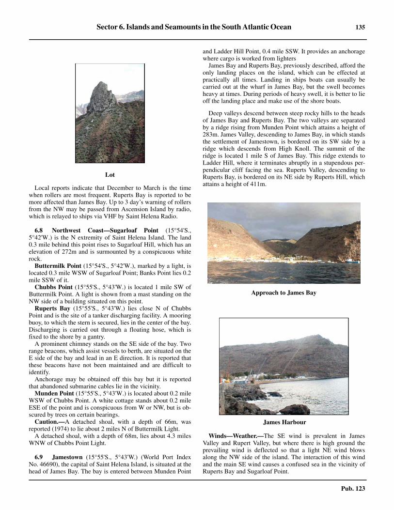
Sector 6. Islands and Seamounts in the South Atlantic Ocean 135
Pub. 123
6.7 Local reports indicate that December to March is the timewhen rollers are most frequent. Ruperts Bay is reported to bemore affected than James Bay. Up to 3 day’s warning of rollersfrom the NW may be passed from Ascension Island by radio,which is relayed to ships via VHF by Saint Helena Radio.
6.8 Northwest Coast—Sugarloaf Point (15°54'S.,5°42'W.) is the N extremity of Saint Helena Island. The land0.3 mile behind this point rises to Sugarloaf Hill, which has anelevation of 272m and is surmounted by a conspicuous whiterock.6.8 Buttermilk Point (15°54'S., 5°42'W.), marked by a light, islocated 0.3 mile WSW of Sugarloaf Point; Banks Point lies 0.2mile SSW of it. 6.8 Chubbs Point (15°55'S., 5°43'W.) is located 1 mile SW ofButtermilk Point. A light is shown from a mast standing on theNW side of a building situated on this point.6.8 Ruperts Bay (15°55'S., 5°43'W.) lies close N of ChubbsPoint and is the site of a tanker discharging facility. A mooringbuoy, to which the stern is secured, lies in the center of the bay.Discharging is carried out through a floating hose, which isfixed to the shore by a gantry.6.8 A prominent chimney stands on the SE side of the bay. Tworange beacons, which assist vessels to berth, are situated on theE side of the bay and lead in an E direction. It is reported thatthese beacons have not been maintained and are difficult toidentify.6.8 Anchorage may be obtained off this bay but it is reportedthat abandoned submarine cables lie in the vicinity.6.8 Munden Point (15°55'S., 5°43'W.) is located about 0.2 mileWSW of Chubbs Point. A white cottage stands about 0.2 mileESE of the point and is conspicuous from W or NW, but is ob-scured by trees on certain bearings. 6.8 Caution.—A detached shoal, with a depth of 66m, wasreported (1974) to lie about 2 miles N of Buttermilk Light.6.8 A detached shoal, with a depth of 68m, lies about 4.3 milesWNW of Chubbs Point Light.
6.9 Jamestown (15°55'S., 5°43'W.) (World Port IndexNo. 46690), the capital of Saint Helena Island, is situated at thehead of James Bay. The bay is entered between Munden Point
and Ladder Hill Point, 0.4 mile SSW. It provides an anchoragewhere cargo is worked from lighters6.9 James Bay and Ruperts Bay, previously described, afford theonly landing places on the island, which can be effected atpractically all times. Landing in ships boats can usually becarried out at the wharf in James Bay, but the swell becomesheavy at times. During periods of heavy swell, it is better to lieoff the landing place and make use of the shore boats.
6.9 Deep valleys descend between steep rocky hills to the headsof James Bay and Ruperts Bay. The two valleys are separatedby a ridge rising from Munden Point which attains a height of283m. James Valley, descending to James Bay, in which standsthe settlement of Jamestown, is bordered on its SW side by aridge which descends from High Knoll. The summit of theridge is located 1 mile S of James Bay. This ridge extends toLadder Hill, where it terminates abruptly in a stupendous per-pendicular cliff facing the sea. Ruperts Valley, descending toRuperts Bay, is bordered on its NE side by Ruperts Hill, whichattains a height of 411m.
6.9 Winds—Weather.—The SE wind is prevalent in JamesValley and Rupert Valley, but where there is high ground theprevailing wind is deflected so that a light NE wind blowsalong the NW side of the island. The interaction of this windand the main SE wind causes a confused sea in the vicinity ofRuperts Bay and Sugarloaf Point.
Lot
Approach to James Bay
James Harbour

136 Sector 6. Islands and Seamounts in the South Atlantic Ocean
Pub. 123
6.9 Tides—Currents.—The tidal rise at Saint Helena Island is0.9m at MHWS and 0.7m at MHWN. The tidal current inJames Bay is reported to set N during the rising tide and SWduring the falling tide, although a vessel reported (1984) exper-iencing no tidal currents while at anchor.6.9 Depths—Limitations.—A concrete wharf, 91m long, issituated on the NE side of James Bay and has a depth of 2.7malongside its outer end. The wharf is equipped with a crane forthe discharge of lighters; steps at its N end are used by harborlaunches to land passengers. 6.9 A number of lighter and small craft moorings are situatedwithin James Bay.6.9 Dangerous wrecks lie within James Bay about 150m and250m NNE of Ladder Hill Point.6.9 A fish haven, which may best be seen on the chart, lies about0.4 mile W of Ladder Hill Point.6.9 A large wreck area, with a least depth of 17.8m, lies about0.4 mile NNW of Ladder Hill Point and a foul area, in whichammunition has been dumped, is located close NE of it.6.9 Anchorage can be taken as convenient, in depths of 27 to51m, between 0.2 mile and 0.4 mile offshore, anywhere alongthe coast between Ladder HIll Point and Lemon Valley Bay,
1.5 miles SW. However, anchorage off James Bay should notbe taken in depths of less than 30m due to the rollers andground swell (see Anchorage).6.9 Aspect.—A lighted range, which may best be seen on thechart, is shown from beacons standing on Ladder Hill. It leadsin a S dirction and indicates the approach into James Bay.6.9 Although these range beacons are clearly visible by day, thevertical difference in height between them reduces their transitaccuracy. Only the lower beacon can be easily identified. Theupper beacon is situated close E of a prominent flagstaff.6.9 An old artillery barracks stands on the summit of LadderHill. The tower of Saint James Church, standing at the head ofJames Bay, is conspicuous. A white monument, conspicuousfrom seaward, is situated on the shore close NW of thischurch.The prominent government office building, known asThe Castle, stands close ENE of the church. 6.9 A white beacon, 2m high, stands on the W extremity ofSampson’s Battery, 0.7 mile SSE of Munden Point.6.9 Pilotage.—Pilotage is not available but the Harbormasterwill give advice to vessels on request.6.9 Regulations.—No boat, except the Health Officer’s boat, ispermitted to go alongside any incoming vessel which intendsto anchor, nor is any contact with other vessels or with theshore permitted until pratique has been granted. Any vesselplaced in quarantine shall continue to show a yellow flag andby night shall exhibit, from the foremast, two white lights in avertical line, at a distance apart of not less than 1.2m or morethan 1.8m. Vessels calling at Saint Helena Island for refuge toland a sick person, or for other reasons, are advised to anchor.6.9 Port officials, including medical staff, will not board unlessthe vessel is at anchor. However, if a vessel is unable to anchor,it should heave-to 1 mile NNW of Ladder Hill Point.
6.9 If anyone is to be landed, a ship’s boat must be used. TheSaint Helena Island port launch will meet the boat in themooring area, about 0.2 mile N of Ladder Hill Point. Duringthe operation, contact should be maintained with the SaintHelena Island coast radio station. If a vessel is likely to arriveoutside the normal operating times of the radio station, arequest should be made in advance to maintain communicationuntil the operation is completed.6.9 Vessels should send an ETA at least 24 hours in advancethrough Saint Helena (ZHH). Vessels intending to use the an-chorage should contact Port Control or Saint Helena on VHFchannel 16 for assistance.6.9 Anchorage.—Anchorage may be taken as convenient offJames Bay, but in depths of not less than 30m due to the rollers.The bottom in the roadstead is coarse sand, gravel, and silt.Three designated anchorage berths lie N, NNW, and NW ofLadder Hill Point and may best be seen on the chart. Theyshould be used by large vessels intending to remain for anylength of time.6.9 Caution.—A local magnetic anomaly, causing variations ofup to 7° greater than charted, was reported (1972) to exist inthe vicinity of Munden Point.
6.10 Northwest Coast (continued).—Lemon Vally Baylies about 1.5 miles SW of Ladder Hill Point.6.10 Long Ledge, a narrow reef, extends about 0.2 mile NW fromthe coast, 0.5 mile SW of the W entrance point of Lemon Val-
Approach to Jamestown
Jamestown

Sector 6. Islands and Seamounts in the South Atlantic Ocean 137
Pub. 123
ley Bay. The Lion, an isolated above-water rock, lies close off-shore, 0.2 mile SW of Long Ledge.6.10 Lighter Rock lies close offshore, 1 mile SW of Long Ledge.Egg Island, 88m high, lies 1 mile SSW of Lighter Rock and isprominent. Peaked Island and Thompson’s Valley Island lie 0.2mile and 0.8 mile, respectively, SW of Egg Island.6.10 Anchorage can be taken in a depth of 37m about 0.2 mileNW of Egg Island.
6.10 South West Point (16°00'S., 5°47'W.) is the W extremity ofSaint Helena Island. This point rises to a flattened peak, knownas Man and Horse, close inland.
6.11 North and East Coasts.—Flagstaff Bay lies betweenSugarloaf Point, the N extremity of the island, and a point 2miles E. It has not been thoroughly examined. The indicationsare that this bay is fairly steep-to and is clear of knowndangers.
Barn Long Point (16°01'S., 5°45'W.), the NE extremity ofSaint Helena Island, is located 3 miles ESE of Sugar LoafPoint. The remains of a vast crater can be traced betweenFlaggstaff Hill, rising 1.6 miles WSW of the point, and TheBarn, a mountain standing at the NE end of the island. Thislatter mountain is 616m high and resembles a building.
Barn Ledge lies about 0.8 mile offshore, 1 mile SE of BarnLong Point. This detached rocky shoal has a least depth of5.9m. The shallow area around this shoal is generally markedby a heavy ground swell.6.11 Prosperous Bay is entered between Black Point, located 1mile SSE of Barn Long Point, and Bay Point, 0.8 mile SE.
Anchorage can be taken witin this bay in a depth of 22m about0.2 mile offshore.
6.11 King and Queen Point (15°57'S., 5°38'W.), the E extremityof the island, lies 0.7 mile SE of Bay Point and is also knownas Saddle Point. The intervening coast is steep-to.
6.12 South Coast.—Gill Point (15°58'S., 5°38'W.) islocated 1.4 miles S of King and Queen Point and is fronted onits S side by Shore Islet. George Islet, a detached rock, liesabout 0.5 mile SSE of this point.
Stone Top Point, 494m high and prominent, rises 1 mile SWof Gill Point.
Rough Rock, a point on this precipitous part of the coast, islocated 1.5 miles SW of Gill Point. Rough Rock Islet and FlatRock lie 0.1 mile E and 0.4 mile WSW, respectively, of RoughRock.
Powell Point is located 3.5 miles SW of Gill Point. Tworocks, known as The Buoys, lie 0.2 mile SE of this point.
Sandy Bay, located 1.3 miles W of Powell Point, is enteredN of Horse’s Head. A landing place lies on the SW shore of thebay and an old battery is situated on the N shore.
Along the S coast of the island to the W of Sandy Bay, ahorizontal stratum of columnar basalt stretches for a consid-erable distance forming a stupendous wall, 15 to 55m high.The Chimney, an isolated portion of this wall, lies close off-shore, 0.8 mile WSW of Sandy Bay. It consists of a remarkablehexagonal column of basalt, 20m high.
Castle Rock Point (16°01'S., 5°45'W.), 165m high, is lo-cated 2.2 miles SW of Sandy Bay and is fronted by rocks. The
Saint Helena—Egg Island (lower right)
South West Point (Man and Horse)
The Barn
Prosperous Bay

138 Sector 6. Islands and Seamounts in the South Atlantic Ocean
Pub. 123
intervening coast is precipitous and apparently steep-to, thoughit has not been thoroughly examined. A number of off-lyingrocks front this section of the coast, including The Chimney,Lot’s Wife Ponds, and White Bird Islet.6.12 From Castle Rock Point, the coast extends 3 miles NW toSouth West Point and is fronted by several rocks and islets.6.12 Robert Rock, an islet, lies 0.2 mile S of Castle Rock Point.Speery Islet lies 0.5 mile SW of Castle Rock Point; Flat Rockand Salt Rock lie close NE and E, respectively, of it.
6.12 An area, with depths of less than 100m, extends up to about5 miles S of Castle Rock Point and may best be seen on thechart. A rocky patch, with a depth of 18.3m, lies about 1.8miles SW of Castle Rock Point.6.12 Speery Ledge, an isolated reef with reported (1977) depthsof 3 to 7.3m, lies about 1.3 miles S of Castle Rock Point.
Off-lying Seamounts
6.13 Grattan Seamount (9°45'S., 12°45'W.), with a depthof 70m, lies 140 miles SE of Ascension Island and a depth of213m lies 40 miles E of it.6.13 Pillsbury Seamount (0°30'N., 17°00'W.), with a depth of881m, lies 530 miles NNW of Ascension Island.
6.13 Cardno Seamount (12°53'S., 6°08'W.), with a depth of77m, lies 180 miles N of Saint Helena Island. A seamount,with a depth of 115m, lies 90 miles NNE of Cardno Seamount.
Another seamount, with a depth of 152m, lies 720 miles NE ofCardno Seamount.6.13 Bonaparte Seamount (15°45'S., 6°52'W.), with a depth of105m, lies 70 miles WNW of Saint Helena Island. 6.13 Dampier Seamount (11°09'S., 0°28'W.), with a depth of594m, lies 430 miles NE of Saint Helena Island.6.13 Kutuzov Seamount, with a depth of 410m, lies 155 milesWNW of Saint Helena Island.6.13 An unnamed seamount, with a depth of 515m, lies 170 milesNW of Saint Helena Island and about midway between CardnoSeamount and Kutuzov Seamount.
An unnamed seamount, with a reported depth of 152m, liesin position 3°02'S, 0°45'E, about 960 miles ENE of AscensionIsland.
The Tristan da Cunha Group
6.14 The Tristan da Cunha Group lies 1,320 miles SW ofSaint Helena Island and consists of five islands.
Tristan Island (37°06'S., 12°17'W.) is the largest withInaccessible Island, the second largest, lying 18 miles SW of it.Nightingale Island, Middle Island, and Stoltenhoff Island lieclose together, about 16 miles SSW of Tristan Island and 10miles SE of Inaccessible Island.
The group is of volcanic origin. There was a volcaniceruption on Tristan Island in 1961 and the entire population ofthe island was temporarily evacuated to the United Kingdom.Most islanders returned in 1963.6.14 The current generally sets NE, but other sets are common. Avelocity of 2 knots may be attained.6.14 At Tristan Island, the rollers may occur at all times duringwinds or calm. They are always heavier in calms. Althoughrollers are more frequent during the winter months, the heavi-est rollers occur in December, January, and February, three ofthe finest months, when they sometimes last 3 or 4 days; thisalso applies to Gough Island and the other islands in theSouthern Hemisphere, according to the account of whalers.6.14 Good radar returns have been reported from the Tristan daCunha Group at a distance of 24 miles. Tristan Island may bedetected by radar at about 95 miles, and Nightingale Island andInaccessible Island at about 80 miles.
6.15 Tristan Island (37°06'S., 12°17'W.), about 6 miles indiameter, takes the form of a truncated cone, with its sidesrising at an angle of about 45° to Queen Mary’s Peak, a centralpeak 2,060m high. The sides of the island consist of walls ofinaccessible cliffs, 300 to 610m high, rising directly from thesea, except on the NW side. On the latter side there is, in frontof the cliffs, a comparatively low and grassy slope, 30 to 60mhigh, which terminates in Herald Point, the NW extremity ofthe island. The sides of the mountain mass as far as the centraldome are covered with brushwood, intermixed with ferns andlong grass. At elevations above 1,500m, which coincides withthe normal upper level of the clouds, the mountain consists ofloose stones and volcanic rubble, with occasional rocks andboulders. 6.15 Winds—Weather.—Wind from a NW direction has beenobserved to eddy around the island and to increase in strengthas it does so, backing to NW again about 2 miles SE of the
Sandy Bay
Speery Islet

Sector 6. Islands and Seamounts in the South Atlantic Ocean 139
Pub. 123
island. According to the islanders, this is a common phenom-enon. 6.15 Thunderstorms are rare, but violent storms occur three orfour times a year. Between June and October, the upper part ofThe Peak is often snow-covered, and sleet, snow, and hail areoccasionally experienced at sea level. Mariners are advised toconsult the islanders concerning the weather, as they arereported to be able to predict changes within a very short timeof their taking place when normal signs give no indication oftheir approach.6.15 Depths—Limitations.—The island is practically surround-ed by a belt of kelp. It was reported (1970) that, at least as farseaward as depths of 36m, the kelp was dense enough to causeblockage of seawater inlets.6.15 The island is steep-to at a distance of more than 1 mile fromthe coast. Rocks and shoals generally front the points on the Spart of the island. Detached shoals lie about 0.7 mile and 1.5miles ENE of Stonyhill Point (37°09'S., 12°16'W.), locatednear the S extremity of the island.
6.16 Edinburgh (37°03'S., 12°18'W.) (World Port IndexNo. 46710), the only permanent settlement of the Tristan daCunha Group, stands on the grassy slope which terminates inHerald Point, the NW extremity of Tristan Island. The Ridge, apoint terminating in a yellow cliff, is situated 1.2 miles E ofHerald Point. During the volcanic eruption on Tristan Island in1961, lava flowed into what was formerly Falmouth Bay andQuest Bay, which lie between Herald Point and The Ridge. By1962, the lava field had extended up to 0.3 mile seaward be-yond the original coastline.
6.16 Depths—Limitations.—The anchorage was surveyed in1972. However, mariners are cautioned that following thevolcanic eruption in 1961, there is a possibility that isolatedpinnacles, undetected by the above survey, may be encounteredoffshore.6.16 Depths of less than 5m extend up to about 0.3 mile seawardoff Herald Point. A rocky shoal, with a depth of 3m, wasreported (1982) to lie 0.2 mile offshore, about 0.4 mile NE ofHerald Point. 6.16 Calshot Harbour, a small boat harbor, is located 0.2 mile E ofHerald Point and is protected by moles. It has depths up to2.4m at HW. The use of this harbor is hazardous due to reefslying inside it and in the approach. In addition, breakers arecontinuous in the vicinity of the entrance during any form ofswell. Local knowledge is necessary. Attempting to enter theharbor by boat is difficult at all times.6.16 A helicopter landing area is situated 0.3 mile E of HeraldPoint. Helicopter operations are possible most days and are thebest way of landing. The landing area is indicated by a circle ofwhite stones and a small “H.” The ground slopes away slightlytowards the shore.6.16 Aspect.—Herald Point is 18m high and steep-to. TheHardies, two rocks, the higher of which is 37m high, lie about2 miles SW of Herald Point.6.16 A prominent mast, 10m high, stands close E of the point. Aconspicuous wind generator is situated on the point. A crayfishcanning factory is situated close SE of the point.6.16 A prominent flagstaff stands near Prince Philip Hall, thesocial center, which is situated 0.3 mile SE of the point. A con-spicuous tank stands 0.5 mile SE of the point.6.16 Range beacons are situated on the grassy slope close S ofHerald Point and lead in a SSW direction. Range beacons arealso situated 1.2 miles E of Herald Point and lead in a SE direc-tion. These ranges, which may best be seen on the chart, maybe of use when approaching and anchoring. It is reported thatthe beacons only become visible from a distance of about 1.5miles.6.16 Anchorage.—Anchorage may be obtained, in depths of 28to 36m, about 0.6 mile NE of Herald Point, but choppy seasmay be experienced here. 6.16 It is reported (1993) that a vessel anchored in a depth of 34mabout 0.7 mile NNE of Herald Point. This anchorage wasfound to be adequate and provided a lee from the SW swell.6.16 Due to the uncertainty of the weather, vessels should keeptheir main engines ready. During strong winds, vessels areadvised to seek shelter in the lee of Inaccessible Island.6.16 Caution.—A local magnetic anomaly, causing compassvariations of up to 14° W, was reported (1968) to exist within 3miles of the coast in the vicinity of Edinburgh.
6.17 Inaccessible Island (37°17'S., 12°40'W.) consists ofa high mass of rock with a table-topped summit. Its tallestpeak, 561m high, rises on the W side of the island and isreported to be a crater with water in it. The irregular slopes ofthe summit terminate on all sides in precipitous cliffs about335m high. The NW coast of the island is low with the cliffsreceding sufficiently to allow the summit to be reached withoutdifficulty. Kelp-covered reefs extend seaward on either side ofthe landing place.
Tristan Island
Edinburgh Settlement and Anchorage

140 Sector 6. Islands and Seamounts in the South Atlantic Ocean
Pub. 123
6.17 The NE coast of the island, also low, has two waterfalls, theE of which is larger and more conspicuous. Kelp was reportedon the NE side of the island in depths of 20m at distances of upto 0.5 mile offshore.6.17 A rock, 0.6m high, lies close offshore, about 0.8 mile ESE ofNorth Point, the N extremity of the island.6.17 Carlisle Bay, a marked indentation, is located on the NE sideof the island. A beach, a waterfall, and the remains of a hut aresituated at its head.6.17 Anchorage can be taken in a depth of 35m about 0.8 mileNNE of the waterfall, but caution should be exercised as thesurvey of the island is incomplete. 6.17 Good landing may be made on the beach near the hut at thehead of the bay. From here a path leads to the top of the cliff.Another landing place is located about 0.2 mile W of the hut.6.17 A rock, 1m high, lies close offshore, close S of East Point,the E extremity of the island.
6.17 South Hill stands on the S point of the island and is aremarkable conical, rocky hill. It is 348m high and rises infront of the cliffs. A similar conical hill, 210m high, standsabout 0.6 mile NW of South Hill.6.17 A detached rock, 70m high, lies close to the shore, 0.5 mileNE of South Hill.6.17 Pyramid Rock, 18m high, lies about 0.2 mile SW of SouthHill and an above-water rock is located close W of it.6.17 Two other rocks, awash, lie off the SW side of the island.The outer rock lies 0.5 mile offshore, about 0.7 mile SSW ofWest Point, the W extremity of the island.6.17 Depths of less than 100m lie up to about 1 mile offshore onall sides of the island except the W side, where they extend upto about 4.5 miles seaward.6.17 Regulationss.—Inaccessible Island was declared a naturereserve in 1994. Landing is prohibited without a permit fromthe Administrator of Tristan da Cunha. Permits are normallyonly granted for scientific visits. The island is of great scien-tific interest to botanists and biologists due to its undisturbedenvironment.
6.18 Nightingale Island (37°24'S., 12°28'W.), with a dia-meter of about 1 mile, has two peaks. The E most peak, 337mhigh, is rugged and precipitous. It appears conical when seenfrom NE or SW. The other peak, 293m high, has gentle slopeson all but its S side. The coasts of the island, with the exception
of the NE side, are precipitous and cut into deep recesses andcaves.6.18 Stoltenhoff Island, lying 0.8 mile N of Nightingale Island, isa precipitous flat-topped rock, 99m high. It consists of onelarge and two smaller sections, separated by narrow chasmswhich can only be distinguished from a particular bearing. 6.18 Middle Island, 46m high, is located between NightingaleIsland and Stoltenhoff Island. Pin Rock, 9m high, lies off itsNW extremity.
6.18 There are apparently no known off-lying dangers in this is-land group. A few submerged rocks border the S coast ofNightingale Island, but their positions show up well. Severalabove-water rocks lie about 0.2 mile S of the SE end ofNightingale Island. Kelp extends 0.3 mile offshore from the Eside of the islands. There is less kelp on the S and W sides,which are the most exposed.6.18 The passage between Stoltenhoff Island and Pin Rock isabout 0.2 mile wide and appears deep. 6.18 The passage between Middle Island and Nightingale Islandis about 275m wide, but it is completely blocked with detachedrocks.6.18 Nightingale Island is visited by the settlers of Tristan Islandseveral times a year for birds, eggs, and guano. Walking on theisland is difficult during the breeding season of the penguinsand Great Shearwaters, except along the old sealers roads andon the plateaus and ridges. Their nests and burrows occupyalmost the entire ground, and tussock grass, 2 to 3m high,overruns the island. 6.18 The water on Nightingale Island tends to be tainted, possiblydue to the number of birds. Drinkable water can be obtained infour large and several small ponds or bogs on the plateau belowthe lower peak, and also in a small bay lying about 0.3 mile Wof the sealers’ road leading from the NE landing place.
Inaccssible Island
Nightingale Island
Middle Island and Stoltenhoff Island

Sector 6. Islands and Seamounts in the South Atlantic Ocean 141
Pub. 123
6.18 Landing may most easily be effected on the rocks at the NEextremity of Nightingale Island. Caution should be exercisedas a small rock, awash, lies about 50m off the point. A numberof huts stand near the NE landing place and a path leads to thethree ponds on the plateau. The old landing place located onthe SE side of the island is seldom used. 6.18 Depths of less than 100m lie up to about 1 mile offshore onall sides of these islands.
Gough Island
6.19 Gough Island (40°19'S., 9°56'W.), lying 230 milesSSE of Tristan Island, is a dependency of Saint Helana. It is 7miles long, well-wooded, and watered. Except for a meteor-ological and scientific station, the island is otherwise unin-habited.
Cliffs rise steeply behind narrow boulder beaches aroundmost of the island. The cliffs at North East Point (40°17'S.,9°56'W.), the NE extremity, are 365m high and sheer. Thoseextending between Reef Point, located 2 miles SSE of NorthEast Point, and Haulround Point, about 2.2 miles SSE, are alsosheer, but not very high. In most other parts of the island,vegetation, chiefly tussock grass, grows on the steep cliffs upwhich routes can often be found.6.19 On the W side of the island, the steep cliffs attain a height of460m in places. At the S end of the island, the land is compara-tively low. The interior of the island consists of an undulatingboggy plateau, with an elevation of 600m or more from whichthe summits rise in easy slopes. The highest summits areEdinburgh Peak, 910m high, and Expedition Peak, 909m high,which stand 2 miles, respectively, SSW and SW of North EastPoint. South Peak, 760m high, rises 2 miles NNW of SouthPoint (40°22'S., 9°53'W.), the S extremity of the island.6.19 In most places, the cliffs around the island rise steeply fromthe sea and numerous waterfalls descend in long cascades.6.19 The sea area in the vicinity of Gough Island has not beenfully surveyed, but it is reported that the island may beapproached safety up to about 1 mile, except off West Point,the W extremity, and North East Point, where reefs extend upto about 0.8 mile W and 0.2 mile N, respectively. The reeffronting West Point is reported to break heavily.6.19 The island is apparently steep-to on all except its E side,where depths of 37m are found lying up to 0.5 mile offshore.Several islets and large rocks lie off the island, but, with theexception of Penguin Islet, they are all located close inshore.6.19 Crawfish are numerous close inshore. Kelp grows aroundmuch of the island.6.19 Winds—Weather.—Scientific expeditions have found that,in the summer, eastward-moving depressions passed mainly tothe S of the island. However, as winter approached, their tracks
moved N. By mid-April, the depressions were passing to the Nof the island, causing many more E winds with consequentdeterioration of landing conditions. The rainfall was heavy andstrong winds and gales were frequent.6.19 Tides—Currents.—Currents are strong at times, but erratic,being mostly wind generated. 6.19 Regulationss.—Gough Island and the waters surrounding itwithin 3 miles have been declared an official nature reserve.Landing is prohibited without a permit from the Administratorof Tristan da Cunha. Permits are normally only granted forscientific visits. Emergency visits must be reported as soon aspracticable to the Administrator and must last no longer than isabsolutely necessary in accordance with safety and healthrequirements.6.19 All visiting vessels, including yachts, must be in possessionof deratting certification and may be required by the Adminis-trator to call at Tristan da Cunha to clear customs, immigration,and health controls before proceeding to Gough Island.
6.20 Reef Point (40°18'S., 9°54'W.) is located 2 miles SEof North East Point; Hawkins Bay lies 0.7 mile NW of it.
Penquin Islet, 117m high, lies 0.5 mile ENE of Reef Point;an above-water rock is located close SE of it. Channel Rock,7m high, lies between Penguin Islet and Reef Point. Passagebetween this rock and the islet is not advisable, except by boat.6.20 Dell Rocks, about 5m high, lie close offshore, 1 mile SSE ofReef Point.6.20 Milford Bay is entered between Reef Point and Dell Rocks.Buttress Rock, 79m high, lies close offshore, about 0.3 mileNW of the outermost of Dell Rocks.
Quest Bay (40°20'S., 9°54'W.) lies in the N part of the bightformed between Dell Rocks and Haulround Point, 1.2 milesSE. Archway Rock, 21m high, lies close SW of Dell Rocks onthe S side of the mouth of The Glen. The Glen, located at the Nend of the bay, gives access to the interior of the island. TheGlen Beach consists of small boulders and shingle. It should beapproached from the SE in order to clear a submerged rock ly-ing in the center of the cove.6.20 Luff Point is situated 0.3 mile SSE of Haulround Point;Number One, an islet, 73m high, lies close N of it.6.20 The Admiral, an islet, 52m high, lies between Luff Point andSouth East Point, 0.4 mile S. The Commodore, an islet, 56mhigh, lies close NNW of The Admiral. Several other islets androcks lie close off this stretch of coast.
Transvaal Bay (40°21'S., 9°53'W.), a small bay with astream at its head, lies between South East Point and CavernHead, 1 mile SSW. A meteorological and scientific station,manned by South African scientists, is situated close inshoreon the N side of this bay. It consists of several white buildings,prominent from E, and is well-lighted at night. The station is inradio contact with South Africa and can be contacted on VHFchannel 16.6.20 South Point (40°22'S., 9°53'W.), the S extremity of the is-land, is located 0.5 mile SSW of Cavern Head; Snug Harbourlies close W of it.6.20 South West Point is located 1.2 miles WNW of South Point.South West Islet, 104m high, lies 0.2 mile SE of South WestPoint; an above-water rock is located close SE of it. SaddleIslet, 119m high, lies close offshore, 0.8 mile NNW of SouthWest Point.
Gough Island

142 Sector 6. Islands and Seamounts in the South Atlantic Ocean
Pub. 123
6.20 Gaggins Point is located 2 miles NW of South West Pointand Sea Elephant Bay lies between it and West Point, 3 milesWNW, which is fronted by a reef.6.20 North Point is located 2.5 miles NNE of West Point and 3miles W of North East Point. The coasts in this vicinity arefronted by several rocks and islets. Tristania Rock, 165m high,and Isolda Rock, 91m high, lie close offshore 0.8 mile and 1.9miles, respectively, NNE of West Point. Round Island, 54mhigh, and Lots Wife, 107m high, lie close offshore 0.7 mile and1.3 miles, respectively, E of North Point. An unnamed islet,134m high, lies between Lots Wife and the shore.6.20 Anchorage.—There are no sheltered bays, but there are anumber of open roadstead anchorages. Those located off the Eside of the island provide the best shelter from the prevailing Wand SW winds. 6.20 Good anchorage may be obtained in a depth of 22m, sandand stones, off the head of Hawkins Bay. Anchorage may alsobe obtained in depths of 18 to 27m within Milford Bay, offCapsize Sands, the beach extending about 0.4 mile NNW fromButtress Rock. 6.20 Anchorage may be obtained in a depth of 27m within QuestBay about 0.4 mile E of Archway Rock. This anchorage, whichis known as The Glen Anchorage, is normally used with windsbetween W and S. The bottom consists of black volcanic sandand shell with good holding ground. Landing on The GlenBeach is made difficult, and even dangerous, by the surf. At thefoot of Archway Rock, there is a place where experiencedboatmen can carry out a landing in almost any weather. At thecorner of the rock nearest the N end of the beach, there is achimney up which an active man carrying a coil of rope canclimb. At the top of the rock there are a few island trees towhich the line can be secured. In this way, landing on, or de-parture from, the island can be effected in any but the worstweather.
6.20 Anchorage can be obtained in a depth of 37m within Trans-vaal Bay during a NW wind. Landing can be made on the NEside of an archway rock, located at the entrance to a cove onthe N side of the bay. Stores may be hoisted by a crane on thecliff, which can safely handle loads up to 0.25 ton. A boat cansecure to an anchor in the rocks.6.20 Anchorage off the W side of the island is not recommended,as it is the weather side and steep-to. The prevailing SW swellrenders anchorage on the W side of the island uncomfortable.6.20 Anchorage can be obtained in a depth of 27m within SnugHarbor, which provides slight protection from N winds.6.20 Landing can be made in calm weather in a number of placesaround the island. The best position for landing will obviouslydepend upon the wind and swell prevailing at the time. Frommost beaches, access to the interior of the island is very diffi-cult due to the cliffy coastline.
Off-lying Seamounts
6.21 An unnamed seamount, with a depth of 185m, hasbeen reported to lie 160 miles WNW of Gough Island. Anotherunnamed seamount, with a depth of 269m, lies 120 miles NWof Gough Island.6.21 Crawford Seamount (38°50'S., 10°30'W.), with a depth of463m, lies 95 miles NNW of Gough Island.
6.21 McNish Seamount (40°10'S., 8°30'W.), with a depth of143m, lies 70 miles ENE of Gough Island and a depth of 90mlies about 20 miles W of it.6.21 R.S.A. Seamount (39°35'S., 6°40'W.), with a depth of176m, lies 160 miles ENE of Gough Island. 6.21 Zenker Seamount (41°00'S., 5°50'W.), with a depth of1,094m, lies 180 miles ESE of Gough Island.6.21 Discovery Seamount (42°05'S., 0°15'E.) has a least knowndepth of 375m. Shannon Seamount (43°00'S., 2°20'E.), with adepth of 586m, lies 120 miles farther SE.6.21 Unnamed seamounts, with depths of 326m and 660m, lie 86and 140 miles, respectively, WSW of Discovery Seamount.Another unnamed seamount, with a depth of 316m, lies 110miles SW of Discovery Seamount, and a seamount, with adepth of 633m, lies 70 miles W of it.6.21 Zapiola Seamount (38°10'S., 26°00'W.) has a depth of1,926m.
Valdivia Bank (26°02'S., 5°30'E.) has a least known depthof 23m and lies near the main shipping route NW of the Capeof Good Hope.6.21 A local deflection of the compass of 6°E was reported(1965) near the SE edge of Valdivia Bank. Anomalies havealso been reported in position 25°10'S, 9°50'E and in position28°03'S, 12°16'E.6.21 A depth of 115m was reported (1966) to lie in position26°08'S, 6°30'E.6.21 Ewing Seamount, with a depth of 791m, lies about 220 milesNE of Valdivia Bank.6.21 Vema Seamount (31°40'S., 8°22'E.) has depths of 7 to 11m(1998) and constitutes a danger to deep-draft vessels. It lies465 miles WSW of the mouth of the Orange River. There issome evidence that the top of the seamount consists of aplateau about 5 miles in diameter, with depths of 45 to 90m,with some shallower peaks. An unconfirmed depth of 11m isreported to lie on the S side of the plateau. 6.21 Tripp Seamount (29°37'S., 14°15'E.), with a depth of150m, lies 125 miles WSW of the mouth of the Orange River.A similar depth was reported (1985) to lie 5 miles SE of the150m depth. 6.21 Wust Seamount (33°50'S., 3°35'W.) has a depth of 775m.Uncomfirmed depths of 218 to 353m lie within 110 miles Eand ENE of this seamount and may best be seen on the chart.
Bouvetoya
6.22 Bouvetoya (54°26'S., 3°25'E.), formerly known asBouvet Island, is a territory of Norway and consists of a singlevolcanic cone with a wide indented crater. Olav Peak attains anelevation of 780m at the center of the island.
Bouvetoya lies about 1,360 miles SW of the Cape of GoodHope and 997 miles SE of Gough Island. Bouvetoya is themost isolated piece of land on the earth's surface. The island isuninhabited.6.22 Winds—Weather.—Bouvetoya lies in the path of strong Wwinds. Thick clouds usually obscure the covering ice cap fromview. Snowfalls are frequent. Temperatures rarely exceed 2°Cin summer and average about 1.5°C in winter.6.22 Ice.—The mean position of the sea ice limit at the time ofgreatest extent (September to October) probably lies close S ofBouvetoya. It is therefore only in worse than average years that

Sector 6. Islands and Seamounts in the South Atlantic Ocean 143
Pub. 123
the island is likely to be engulfed by sea ice and even then, onlyduring the period from about August to November.6.22 Tides—Current.—A slight E current has been observed inthe vicinity of Bouvetoya.6.22 Aspect.—The slopes of the central cone terminate on allsides in precipitous cliffs or glaciers, descending abruptly tosea level. The two largest of these glaciers are PosadowskyGlacier, located W of Cape Valdivia (54°24'S., 3°24'E.), the Nextremity of the island, and Christensen Glacier, located about1 mile E of Cato Point, the SW extremity.6.22 The E side of the island is entirely covered with an ice sheetwhich extends up the crater slopes to an elevation of about425m and reaches the sea as an ice wall, about 100m high. 6.22 The N and W sides of the island are comparatively free fromice, except for isolated glaciers, and are much steeper than theS and E sides of the island.
Cape Circoncision (54°25'S., 3°21'E.), the NW extremity ofthe island, is easily recognized by its dark color, which standsout prominently against the glaciers descending to the sea oneither side of it. Several rocks, partly submerged, lie up toabout 0.3 mile NE of this cape.6.22 A rock, 1.2m high, and Norris Reef lie 0.4 mile W and 0.5mile SW, respectively, of Cape Circoncision.6.22 Norvegia Point, located 2 miles S of Cape Circoncision, issurmounted by a conspicuous knoll. 6.22 Mosby Peak, 671m high, and Lykke Peak, 767m high, rise0.8 mile NE and 1 mile E, respectively, of Norvegia Point.6.22 Benn Skerries and two detached rocks, one submerged andone above-water, lie within 0.5 mile W and 0.5 mile SSW,respectively, of Norvegia Point.
6.22 Larsoya (Lars Islet), 21m high, lies close off Cato Point andsubmerged rocks extend up to about 0.3 mile SW of it.6.22 A pinnacle rock, with a depth of 7.3m, was reported (1964)to lie about 0.8 mile S of Cato Point.
6.22 Williams Reef lies close SSW of Cape Fie, the SE point ofthe island. Lindsay Reef lies close N of Cape Meteor, the Eextremity of the island. 6.22 Spiess Rocks lie up to about 0.3 mile NE of Cape Lollo,which is located 0.8 mile N of Cape Meteor.6.22 Norvegia Rock, with a depth of less than 1.8m, positiondoubtful, is charted 0.5 mile ENE of Cape Valdivia.6.22 Lille Kari, 1.8m high, lies 0.3 mile offshore, 2 miles ESE ofCape Valdivia. Store Kari, 3m high, lies 0.8 mile E of the samecape. 6.22 Anchorage.—Temporary anchorage can be taken in a depthof 40m about 0.4 mile off Christensen Glacier.6.22 Anchorage can also be taken in a depth of 27m about 0.6mile ENE of Cape Meteor. 6.22 Vessels may anchor in a depth of 40m about 0.4 mile ENE ofStore Kari and 0.4 mile N of the landing place located close Wof Posadowsky Glacier.
6.22 Landings, at all times difficult, have been made at a smallcove located close W of Posadowsky Glacier, at a beachlocated 0.2 mile S of Norris Reef, near Norvegia Point, on Lar-soya, and near Cato Point.6.22 Caution.—It has been reported (1994) that Bouvetoya liesabout 2 miles W and 0.8 mile N of its charted position.6.22 Dangers not shown on the chart may exist in the vicinity ofthe island.6.22 The rocks off-lying the coast of the island are generallycovered with ice and may therefore be mistaken for icebergs.
Off-lying Seamounts
6.23 The Meteor Seamounts (48°30'S., 9°00'E.), with aleast depth of 532m, lie 475 miles NE of Bouvetoya.6.23 Spiess Seamount (54°25'S., 0°15'E.), with a least depth of285m, lies 120 miles W of Bouvetoya.6.23 A seamount, with a least depth of 207m, is reported to lieabout 100 miles ENE of Bouvetoya.
6.23 A rock, 46m high, existence doubtful, was reported (1929) tolie in position 56°07'S, 23°39'E, about 720 miles E of Bouve-toya, and 1,277 miles S of Cape Agulhas.
Bouvetoya from NW
Bouvetoya

Pub. 123
Glossaries 145Glossaries
Afrikaans
AFRIKAANS English
A
aanleplek .................................................................... wharf
B
baai .................................................................................baybaaitjie .......................................................................... covebaggerbank ...................................................... spoil groundbaken ........................................................................ beaconbank ..............................................................................bankberg ....................................................................... mountainberge ...........................................mountain, mountain chainblinder ........................................................submerged rockblou ................................................................................blueboei................................................................................buoyboot ...............................................................................boatbranding ........................................................................ surfbranders .................................................................. breakersbreekwater...........................................................breakwaterbuffel ........................................................................ buffalo
D
deurvaart .................................................................. passagediepte ...........................................................................depthdok ................................................................................dockdooiety ...................................................................neap tidedorp ...........................................................................villagedroog .............................................................................. drydrywend ...................................................................... afloatduiker .................................................................. cormorantduin ..............................................................................dune
E
eb ....................................................................................ebbeiland .......................................................................... islandeilandjie .........................................................................isleteskarp ................................................................. escarpment
F
fontein ....................................................................... spring
G
geel ............................................................................yellowgestrand .................................................................. agroundgety ................................................................................ tide
gevaar.........................................................................dangergolf .............................................................................. wavegroen ...........................................................................green
H
hawe .................................................................. harbor, porthawehoof ......................................................................molehawekom ..................................................................... basinheuwel ............................................................................ hillhindernis ............................................................obstructionhoek ............................................................................cornerhoog ..............................................................................highhoogte ....................................................... height, elevationhout .............................................................................wood
J
jakkals ........................................................................ jackal
K
kaai ........................................................... jetty, quay, wharfkaap............................................................... cape, headlandkabellengte .................................................................. cableklip .............................................................................. stonekloof ............................................................................gorgeknoop ............................................................................knotkoers .......................................................................... coursekompas ................................................................... compasskop ................................................................................. hillkoppie .......................................................................hillockkrans .............................................................................. cliffkus .....................................................................coast, shore
L
laag.................................................................................. lowland ................................................................................ landlandteken ...............................................................landmarkleeu ................................................................................ lionleimerk ............................................................leading mark
M
magneties .............................................................. magneticmalgas ....................................................................... gannetmast............................................................................... mastmeer .............................................................................. lakemeerplek ................................................................ mooring
AFRIKAANS English

Pub. 123
146 Glossaries
merk ............................................................................ markmis .................................................................................. fogmodder ......................................................................... mudmoeras ...................................................................... swampmossel ...................................................................... mussel
N
nek .................................................................................passnewel .............................................................................mistnoord ........................................................................... north
O
olifant ..................................................................... elephantondersee berg ....................................................... seamountonderwater .......................................................... submergedoorspoel ......................................................................awashoos .................................................................................. eastop land ....................................................................... ashore
P
peiling ..................................................................... bearingpiek ...............................................................................peakpier ................................................................................ pierpikkewyn .................................................................penguinpelikaan .....................................................................pelicanpunt ............................................................................. point
R
radiobaken ....................................................... radio beaconreen ................................................................................ rainrivier ............................................................................. riverriviermonding ...........................................................estuaryrob ................................................................................. sealrollers ........................................................................ rollersrooi ................................................................................. redrots .................................................................. boulder, rock
S
sand .............................................................................. sandsandbank ........................................................................ barsee .................................................................................. seaseegras ...........................................................................kelpseekaart ....................................................................... chartseemeer .....................................................................lagoon
AFRIKAANS English
seemyl ...........................................................................mileseewarts .................................................................. offshoreskeep ............................................................................. shipskeepswerf ............................................................dockyardskiereiland ............................................................ peninsulasnelheid .......................................................................speedspringty ...............................................................spring tidestad ....................................................................... city, townstilwater ..............................................................slack waterstormwind ..................................................................... galestrand ................................................................beach, shorestroom ...................................................................... currentsuid .............................................................................. southswart ............................................................................ black
T
tafel .............................................................................. tableteken .............................................................................marktoring ...........................................................................tower
V
vaam ......................................................................... fathomvaarwater ..................................................................fairwayvallei .......................................................................... valleyvls ...................................................................................fishvlakwater ..................................................................... shoalvlei .............................................................................marshvloed ........................................................................... floodvloedbos ...............................................................mangrovevoorgebergte ................................................................ bluffvoorstrand ..............................................................foreshorevuurtoring ............................................................ lighthouse
W
wal ................................................................... embankmentwalvis ......................................................................... whalewerweling ..................................................................... eddywes ............................................................................... westwit ................................................................................whitewolk ............................................................................cloudwrak ............................................................................wreck
Y
yster................................................................................ iron
AFRIKAANS English

Pub. 123
Glossaries 147
Dutch
DUTCH English
A
aan....................................................................... at, near, on
B
baak........................................................................... beaconberg ................................................................ mountain, hillbinnen........................................................................... innerblauwe............................................................................bluebocht............................................................. bay, bend, lightbol ...................................................................................ballboom ...............................................................................treebosch ............................................................................forestboschje .................................................... small wood, brushbreed.............................................................................broadbrug ............................................................................ bridgebuiten ........................................................................... outerbult ...............................................................................hump
D
dam............................................................. dam, breakwaterde, den..............................................................................thediep................................................................................ deepdijk .................................................................................dikedorp ............................................................................villagedraaikalk........................................................................eddydrempel ............................................................................bardric ................................................................................threedrichoek ................................................................... triangledroogte ......................................................................... shoalduin ................................................................ dune, sandhilldwars.............................................................across, athwart
E
eiland........................................................................... island
F
friesche....................................................................... frisian
G
gat............................................................................. channelgeul...............................................................narrow channelgroei .............................................................................greengronden ....................................................................groundsgroot ..............................................................................great
H
haven.......................................................................... harborhelft.................................................................................halfhet .................................................................................... theheuvel...............................................................................hillhoek .................................................................... cape, pointhoofd............................................................................. headhoog ...............................................................................highhout ..................................................................wood, timber
K
kaap............................................................... cape, headlandkake............................................................................... quaykegel.............................................................................. conekil ............................................................................. channelklein ............................................................................. smallklip .................................................................................rockkop ................................................................................ headkreek ............................................................................ creekkromme.................................................................... crookedkust ...............................................................................coast
L
laag, lage......................................................................... lowlang ................................................................................longlicht ................................................................................lightloods ..............................................................................pilotloodswezen .............................................................. pilotage
M
meer ......................................................................inland seamiddel, midden ..........................................................middlemodder ...........................................................................mudmolen ............................................................................. mill
N
nauw ........................................................................ narrowsnieuw ............................................................................. newnoord............................................................................ northnoorder.................................................................... northern
O
oost .................................................................................eastoud ...................................................................................old
DUTCH English

Pub. 123
148 Glossaries
P
peilschaal ............................................................... tide gageplaat.............................................................................. shoalplaatje..................................................................small shoalplat .................................................................................. flatpolder ............................................................ reclaimed landpunt .............................................................................. point
R
rak ............................................................................ channelrechthoekig..........................................................rectangularreddingboot .............................................................. lifeboatrede........................................................................ roadsteadrode, rood .........................................................................redrots ............................................................................... rocksrug ................................................................................ ridgeruitvormig .................................................. diamond-shaped
S
schaar ....................................................................... channelscherm........................................................................ screenschor............................................................................. shoalschutsluis................................................................ lock gateseinen .........................................................................signalssluis ................................................................................locksmal........................................................................... narrowspits, spitse ................................................................pointedspoorweg...................................................................railwaystaart.............................................................. tail (of a bank)stad ................................................................................townsteen ............................................................................. stonesteiger.....................................................................jetty, piersteile ............................................................................. steepstrand.................................................................beach, shorestroom ...........................................................current, stream
DUTCH English
T
toegang........................................................................accesstramweg .................................................................. tramway
U
uit .....................................................................................out
V
vaart ............................................................................. canalvaarwater...................................................................fairwayvalsch ............................................................................ falsevan .....................................................................................ofveerboot ........................................................................ ferryverklikker........................................................ warning lightvlckte ....................................................... flat below surfacevliegtuigen ................................................................ aircraft
W
wad.........................................................drying coastal bankwal ......................................................................banks, wallwatergetijden .................................................... tidal currentwaterweg............................................................... waterwayweg................................................................................. waywerk ..............................................................................workwester....................................................................... westernwit, witte ......................................................................whitewrak ............................................................................ wreck
Z
zand................................................................................sandzee....................................................................................seazeegat ........................................................................ estuaryzuid .............................................................................. southzuider ...................................................................... southernzwart ............................................................................ black
DUTCH English

Pub. 123
Glossaries 149
French
FRENCH English
A
anse ..................................................................... bay, creekarchipel .............................................................. archipelagoarriere port ............................................................ inner portavant port .............................................................outer port
B
baie .........................................................................bay, gulfbalise ........................................................................ beaconbanc .............................................................bank, sandbankbarre .................................................................................barbasse............................................................................. shoalbassin .......................................................................... basinblanc.............................................................................whitebois ..............................................................................woodbouche ........................................................mouth (of river)
C
canal ..............................................................channel, canalcap ................................................................cape, headlandchaloupe .................................................................... launchchalutier ................................................................... trawlerchateau .........................................................................castlechaussee .......................................................................bankchenal ....................................................................... channelclocher .......................................................................steeplecolline.............................................................................. hillcouvent .................................................................... conventcrique .......................................................................... creek
D
digue .........................................................mole, breakwater
E
ecluse ............................................. lock of a canal or basineglise .........................................................................churchest .................................................................................. eastetang............................................................................... lake
F
falaise ............................................................................ clifffaux ............................................................................... falsefleuve ........................................................................... riverfosse ................................................................ ditch, a deep
G
golfe .............................................................................. gulfgoulet ......................................................... narrow entrancegrand(e) ........................................................................great
I
ile ............................................................................... islandilot ................................................................................. islet
J
jetee ...............................................................................jetty
L
lac ................................................................................. lakelagune ....................................................................... lagoon
M
maison .........................................................................housemenhir ................................................... a large raised stonemilieu ........................................................................middlemole ...............................................................................piermont ......................................................................mountainmouillage ............................................................ anchoragemoulin ........................................................................... mill
N
noir .............................................................................. blacknord ............................................................................. north
O
occidentale .............................................................. westernorientale ....................................................................easternouest ..............................................................................west
P
passe ....................................................................... channelpertuis ........................................................opening or straitpetit ............................................................................. smallpic ................................................................................ peakplerre............................................................................ stonepiton ............................................................. mountain peakplateau .........................................................tableland or flatpointe ...........................................................................point
FRENCH English

Pub. 123
150 Glossaries
pont ........................................................................... bridgeport ....................................................................port, harborpresquiile .............................................................. peninsula
Q
quai ....................................................................quay, wharf
R
rade ....................................................................... roadsteadrecif ............................................................................... reefreviere .......................................................................... riverroche or rocher ..............................................................rockrouge ...............................................................................red
FRENCH English
S
sable ..............................................................................sandsommet ....................................................................summitsud ............................................................................... south
T
tour .............................................................................. tower
V
vert .............................................................................. greenville .............................................................................. town
FRENCH English

Pub. 123
Glossaries 151
Portuguese
PORTUGUESE English
A
a, as ...................................................................... the (fem.)aldeia .........................................................................hamletalto, s ............................................................ height, heightsaltura, s ......................................................... height, heightsamarclo ......................................................................yellowancordouro .......................................................... anchorageangra .......................................................... inlet, bight, coveaquario ..................................................................aquariumareia .............................................................................. sandarquipelago ........................................................ archipelagoatalaia ...................................................................... lookoutazul ................................................................................blue
B
bacia ............................................................................ basinbaia .................................................................................baybaixio ............................................................ shallow, shoalbaixio, a ......................................................... shallow, shoalbaliza......................................................................... beaconbanco.............................................................................bankbarra ................................................................................barbarrio ............................................district (of a town), wardbasilica .................................................................... basilicabateria .........................................................mouth, entrancebranco, a ......................................................................white
C
cabeco, a ....................................... summit of a hill or shoalcabo .............................................................................. capecais ....................................................................quay, wharfcala .......................................... creek, channel, narrow inletcalheta ...........................................................................inletcanal ........................................................................ channelcapela ........................................................................ chapelcarreira ..........................................narrow channel, slipwaycasa ............................................................................. housecasal ....................................................................farmhousecastelo .........................................................................castlecatedral .................................................................. cathedralcemiterio ............................................................... cemeterychale ........................................................................... chaletcidade .......................................................... city, large towncidadela ..................................................................... citadelcinzento .........................................................................greycolina ................................................................. hill, hillockcolonia .....................................................colony, settlementconcha .......................................................................... cove
comento .................................................................. conventcoroa .................................................................. sandy headcruz ..............................................................................cross
D
de dentro (adj.) .............................................................innerdesembarcadouro ..................................................... landingdoca .............................................................................. dockduna ............................................................................. dune
E
enseada .......................................................bay, bight, coveentrada .....................................................................fairwayermida ..................................................................hermitageespigao ....................................................... projecting pointesporao.......................................................................groyneestacada ................................... pier, projecting wharf, moleestaleiro .................................................................. shipyardeste, leste .......................................................... east, easternesteiro ......................................................................... creekestreito .......................................................... strait, narrowsestuario .................................................................... estuary
F
fabrica .......................................................................factoryfarillhao .................................. stack, steep-sided rocky isletfora ...............................................................................outerfortaleza ................................................................... fortressforte ................................................................................ fortfoz .............................................................. mouth of a riverfundeadouro ........................................................ anchorage
G
grande .......................................................................... largegolfo .............................................................................. gulf
I
greja .......................................................................... churchilha ............................................................................. islandilheu, ilhota ................................................................... isletistmo ........................................................................ isthmus
L
lago ...................................................................... lake, locklagoa ........................................................small lake, marshlaguna ........................................................................ lagoonlaje ............................................................. flat-topped rocklugar ................................................................hamlet, place
PORTUGUESE English

Pub. 123
152 Glossaries
M
mar ..................................................................................seamata .....................................................forest, wood, thicketmeridional ..............................................................southernmoinho .......................................................................... millmolhe .................................................................. mole, piermontanha ...............................................................mountainmonte ........................................................................ mountmorro .................................................................... hill, knoll
N
note .............................................................................. north
O
o, os .................................................................... the (masc.)occidental ................................................................. westernoeste .............................................................................. westoriental ..................................................................... eastern
P
palheiros ........................................................fishing villageparedao ....................................................................sea wallpedra, s ..............................................................rock, stonespena ................................................................... rocky, peakpenedo ............................................................... rocky, peakpeninsula .............................................................. peninsulapequeno ....................................................................... smallpico ............................................................................... peakpinhal ..................................................................pine woodponta ..............................................................point (of land)pontal ......................................................point, promontoryponte .................................................................. bridge, pierponte-cais ............................................................. pier, jettyportinho ................................................small port or harborporto ..................................................................port, harborpovoa ...................................................................large townpovoacao ...................................................................villagepovoado .....................................................................village
PORTUGUESE Englishpraia ............................................................................beachpreto, a ........................................................................ blackpromontorio ....................................................... promontory
Q
quebra-mar ......................................................... breakwaterquebrada .................................................cut, gap, precipice
R
rampa ...........................................................ramp, boat-sliprestinga ..................................................................spit, reefria .........................................estuary, lagoon, sunken valleyribeiro .........................................................................brookrio ................................................................................. riverrocha .............................................................................rockrochedo ............................................................. rocky placerocher ....................................................... rock, rocky place
S
s. santo, a, sao .............................................................. saintsanatorio ............................................................ sanatoriumsepentrional ............................................................ northernserra ............................................................mountain rangeserro ....................................................... rocky reef or ridgesul ............................................................................... south
T
terra ............................................................................... landtorre ............................................................................. tower
V
vale ............................................................................. valleyvaradouro ................................................................. landingverde ........................................................................... greenvermelho, a .....................................................................redvigia .........................................................................lookoutvila ......................................................... town, village, villa
PORTUGUESE English

Pub. 123
Glossaries 153
Spanish
SPANISH English
A
abra........................................... cove, creek, haven, openingacantilados ................................................................... cliffsadentro .................................................... (adj.) inner, insideafuera .................................................... (adj.) outer, outsideaguada ........................................................... watering placeagudo, da.............................................. (adj.) sharp, pointedaguja........................................................................... needlealbufera ............................................................lagoon, pondaldea ...........................................................................villagealto, a.............................................................(adj.) tall, highaltos........................................................................... heightsalturas........................................................................ heightsamarillo, a ..................................................................yellowancho........................................................ (adj.) wide, broadancladero.............................................................. anchorageanclaje .................................................................. anchorageancon................................................. open bay or roadsteadangostura..................................................................narrowsarchipielago........................................................ archipelagoarena.............................................................................. sandarenal................................................. extensive area of sandarrecife ........................................................................... reefarroyito........................................................................ brookarroyo .............................................................. steam, rivuletastillero.................................................................... shipyardatalaya ...................................... watchtower, high viewpointazul.................................................................................blue
B
bahia................................................................................baybajio ............................................................................. shoalbajo......................... (n) shoal (adv.) below, under (adj.) lowbaliza......................................................................... beaconbalneario.......................................................... seaside resortbancha ...........................................................................bankbanco (de arena)......................................... bank (sandbank)barlovento .............................................................windwardbarra .......................................................bar (of a river, etc.)barranco ..................................................... precipice, ravinebarrera ...................................barrier (e.g. mountain barrier)barrio.............................................ward, section (of a town)bateria.........................................................................batteryblanco, a ............................................. (adj.) white (n) targetboca............................................................................ mouthbodega..................................................................storehouseboqueron ..........................wide mouth, opening or entranceboquete................................................ narrow entrance, gapbravo, a............... coast, shore, beach exposed to heavy seasbrazo.....................................................arm (of the sea, etc.)
C
cabeza ..................................................................shoal headcabezo ...................................... shoal head, summit of a hillcabo................................................................................capecadena ..........................................chain (of mountains, etc.)cala............................narrow cove or creek with steep sidescaleta............................................................................. covecaleton...................................................................large covecampo ................................................... any tract of countrycanada ............................................................................ glencanal......................................................................... channelcanalizo........................................................ narrow channelcano.............................................................................. creekcanto ............................................................................. bluffcapilla ........................................................................ chapelcargardero ...........................shore or ship loading appliancecarrera, carreiro.......................... narrow channel or passagecasa ..............................................................................housecascada....................................................................waterfallcaserio............................................ hamlet, group of housescastillo..........................................................................castlecastro....................... headland, hillock surmounted by ruinscayo................................................................................. caycerrito.........................................................................hillockcerro ................................................................... hill, hillockchico, a......................................................................... smallchubasco ..................................................................... squallcima ................................................................ summit, crestciudad ................................................................... city, townciudadela.................................................................... citadelco .............................................................. rocky shoal, rockcolina ................................................................. hill, hillockcollado ...................................................... hillock, elevationcolonia .....................................................colony, settlementcolorado .......................................................reddish in colorcomarca.......................................................................regionconcha................................................................ bay or covecono .............................................................................. coneconvento................................................................... conventcordillera......................................................mountain rangecorona ........................................................... crown, summitcortadura ............cut, cutting, very narrow channel or defilecosta ..............................................................................coastcoto ...........................................................................summitcruz ...............................................................................crosscuartel ..................................................................... barrackscuesta ....................................... sloping ground, hill, hillockcueva ..............................................................................cavecumbre ............................................................ summit, peakcuna................................................................. quoin, wedgecuspide ......................................................................summit
SPANISH English

Pub. 123
154 Glossaries
D
darsena ............................................. basin, dock, backwaterdelta...............................................................................deltadepartamento.......................................................departmentdesembarcadero .............................................. landing placedesembocadura............................................mouth of a riverdesierto........................................................................ desertdique...................................mole, dock, embankment, leveedistrito ........................................................................districtdoble...........................................................................doubleduna...............................................................................dune
E
el........................................................definite article (masc.)embocadura................................................................ mouthensenada..........................................................................bayentrada..................................................................... entranceermita ....................................................................hermitageescollera ..............................................breakwater, wavetrapescollo ........................................... shallow rock, reef awashespigon ........................................................... arm of a moleestacion ...................................................................... stationestancia................................................ ranch, country estateeste ................................................................................. eastestero...................................................................creek, inletestrecho ........................................................ straits, narrowsestuario...................................................................... estuaryexterior ........................................................... outer, exterior
F
farallon ...................... stack, steep sharp-pointed rocky isletfaro ....................................................................... lighthousefondeadero ........................................................... anchoragefortaleza ....................................................................fortressfraile ...............................................................................friarfreo ................................................................................straitfreu ....................narrow strait between island and mainlandfronton.............................................................wall-like clifffuerte ...............................................................................fort
G
garganta.............................narrow restricted passage, soundgarita ................................................sentry box, lookout hutgolfo ............................................................................... gulfgran, grande .................................................large, great, biggris .................................................................................greygrupo ........................................................ group (of islands)
H
hacienda ...................................................... farm, plantationherradura ........................................... horseshoe-shaped bay
SPANISH English
I
iglesia......................................................................... churchinsua......................................................... small islet or rockinterior ..........................................................................innerisla............................................................................... islandislete............................................................................... isletislita .......................................................... small island, isletislote ....................................................... barren islet, skerryislotillo or islotito .......................... small barren islet (dim.)istmo ........................................................................ isthmus
L
la, las...................................................definite article (fem.)lago ................................................................................ lakelaguna .............................................................. lagoon, pondlaja .......................................................................... flat rocklargo, a ...........................................................................longlastra .................................................................. rocky ledgelaxe.................................................................................rocklevante........................................................................easternloma .................................................................hillock, knolllomo..............................................................................ridgelos .....................................................definite article (masc.)lugar .................................................................village, placelugarejo ...................................................................... hamletllana ..............................................................................plainllano, a ......................................................... plain, flat (adj.)llanura ...........................................................................plain
M
malecon............................................................... quay, molemar ...................................................................................seamargen ....................................................... shore, river bankmarisma ...................................................................... marshmedano .......................................................... dune, sandhillmedio .........................................................................middlemeridional............................................................... southernmesa or meseta .........................................tableland, plateaumogote ..................................................................hummockmolino............................................................................ millmonasterio ........................................................... monasterymontana .................................................................mountainmonte .........................................................mountain, mountmonte ................................... forest, group or clump of treesmonticulo ......................................................................knollmoreno........................................................................brownmorro ........................... headland, bluff, head of breakwatermuelle .......................................................... pier, jetty, molemuralla .....................a barrier wall of mountains, cliffs, etc.
N
negro, a ........................................................................ black
SPANISH English

Pub. 123
Glossaries 155
norte ............................................................................. northnuevo, a .......................................................................... new
O
obscuro...........................................................................darkoccidental ................................................................. westernoeste .............................................................................. westoriental ...................................................................... easternoriente ............................................................................ eastorilla ....................................... shore, edge, bank (of a river)oscuro.............................................................................dark
P
palacio........................................................................ palacepan de azucar ........................................................sugar loafpantano...........................................................swamp, marshpardo ..............................................................................greyparque.............................................................................parkpasco ......................................................promenade, avenuepasale ....................................................................... passagepaso ................................................................................passpedregal................................................ stony or rocky patchpena................................................................................rockpenasco...............................................................a large rockpeninsula ............................................................... peninsulapenon........................................................... rocky mountainpequeno, a .................................................................... smallpeton................................................................pinnacle rockpicacho ................................................................ sharp peakpico................................................................................ peakpiedra .................................................................. stone, rockplacer............................................................................ shoalplaya............................................................................ beachpoblacion.......................................................................townpoblado.......................................................................villageponiente.................................................................... westernpozo.................................well, deep hole in river or sea bedpresa .................................................................barrage, weirpromontorio .......................................................promontoryprovincia .................................................................provincepuebla.........................................................................villagepueblecito............................................... small town, villagepueblito ......................................................................hamletpueblo............................................................................townpuente......................................................................... bridgepuerto .................................................................port, harborpunta............................................................................. pointpuntal ............................................................... narrow point
Q
quebrada........................................................... ravine, gully
SPANISH English
R
rada ........................................................................roadsteadredondo, a ....................................................................roundregato .............................................................torrent, streamrestinga ...........................................................................reefreventazones ........................................................... breakersria ..........................................sunken valley forming estuaryriachuelo ................................................................... riverletribera.......................................................... shore, river bankrincon.............................inner angle or corner, a small coverio.................................................................................. riverroca ................................................................................rockrocalloso, a.......................................................pebbly, stonyrochel ................................................................. rocky patchrodal .......................shoal, usually rocky and of some extentrojo, a ...............................................................................redrompeolas ........................................................... breakwaterrompientes .............................................................. breakersroquerio.............................................................. rocky shoal
S
salinas ...................................................................... saltpanssan, santo, a................................................................... saintseco ..................................................................................dryseno................................................................... bight, soundseptentrional ........................................................... northernserrania .........................................................mountain ridgesierra ............................................................mountain rangesilla .............................................................................saddlesotavento .................................................................. leewardsucio, a ........................................................................... foulsud, sur......................................................................... southsurgidero .............................................................. anchorage
T
tenedero .....................................holding ground, anchoragetetas........................................................................... nipplesteton ................................................................... large nippletierra............................................................................... landtorre.............................................................................. towertouza .......................rock (usually lying off a larger feature)
V
vado ............................................................................... fordvalle ............................................................................ valleyvaradero ................................................................... slipwayvega................................................................... plain (noun)ventisquero................................................................. glacierverde ............................................................................ greenviejo, a .............................................................................oldvigia ..........................................................................lookout
SPANISH English

Pub. 123
156 Glossaries
villa ......................................................................town, villavillorio........................................................................hamletvolcan....................................................................... volcanovuelta............................................. bend, turn (of a channel)
SPANISH English
Z
zona............................................................................... zone
SPANISH English

157
Pub. 123
How to use the Index—Gazetteer
Geographic names of navigational features are generally those used by the nation having sovereignty and are listedalphabetically. Diacritical marks, such as accents, cedillas, and circumflexes, which are related to specific letters in certain foreignlanguages, are not used in the interest of typographical simplicity.
Geographic names or their spellings do not necessarily reflect recognition of the political status of an area by the United StatesGovernment. Positions are approximate and are intended merely as locators to facilitate reference to the charts.
To use as a Gazetteer note the position and Sector number of the feature and refer to the Chart Information diagram for theSector. Plot the approximate position of the feature on this diagram and note the approximate chart number.
To use as an Index of features described in the text note the paragraph number at the right. To locate this feature on the bestscale chart use the Gazetteer procedure above.
Index—Gazetteer
Position° ' ° '
Position° ' ° '
Sec.Para
Sec.Para
AABIDJAN 5 15 N 4 01 W 1.15ABO TERMINAL 5 42 N 4 28 E 2.16ABOADI POINT 4 58 N 1 38 W 1.23ABOADI TERMINAL 4 57 N 1 38 W 1.23ABOH 5 32 N 6 31 E 2.13ABREKUM 5 18 N 0 43 W 1.28ACCRA 5 32 N 0 12 W 1.30ACCRA POINT 5 32 N 0 13 W 1.30ACHOWA POINT 4 46 N 1 58 W 1.20ADA 5 47 N 0 38 E 1.34ADOBLO ROCK 4 50 N 1 53 W 1.20ADUA OIL FIELD 4 06 N 7 42 E 3.16AFREMO OIL FIELD 5 26 N 5 10 E 2.22AGBARA OIL FIELD 3 56 N 6 24 E 3.3, 3.5AGOUE 6 15 N 1 40 E 2.6AGPI TERMINAL 5 05 N 1 00 W 1.27AJUMO 6 21 N 4 26 E 2.11ALBA GAS FIELD 3 58 N 8 33 E 3.76ALBATROSS ROCKS 27 07 S 15 14 E 5.30ALEXANDER BAY 28 40 S 16 31 E 5.35ALOUMBE 0 26 S 9 17 E 3.68AMBAS BAY 4 00 N 9 10 E 3.31AMBRIZETE 7 14 S 12 51 E 4.61AMBRIZETE LIGHT 7 15 S 12 51 E 4.60ANASHUN POINT 5 09 N 1 10 W 1.27ANECHO 6 14 N 1 35 E 2.5ANEHO 6 14 N 1 35 E 2.5ANGO-ANGO 5 50 S 13 26 E 4.50ANGO-ANGO 5 51 S 13 26 E 4.49ANKOBRA RIVER 4 54 N 2 16 W 1.18ANKWANA 5 04 N 1 24 W 1.24,
1.25ANNOBON 1 26 N 5 37 E 3.93ANOMABU FORT 5 10 N 1 07 W 1.27ANTAN OIL TERMINAL 4 13 N 8 20 E 3.24ANYALA OIL FIELD 3 55 N 5 54 E 2.35APAM POINT 5 17 N 0 44 W 1.28ARCH ROCK 27 28 S 15 24 E 5.31ASABO OIL FIELD 4 06 N 7 48 E 3.16ASCENSION ISLAND 7 57 S 14 22 W 6.1ASOMA OIL FIELD 4 17 N 8 38 E 3.25ASSAY POINT 5 03 N 1 30 W 1.25ASSINIC RIVER 5 07 N 3 17 W 1.17AVON CANYON 6 16 N 3 56 E 2.11AWODI OIL FIELD 5 28 N 5 01 E 2.19AXIM 4 52 N 2 15 W 1.19
BBADAGRI 6 25 N 2 53 E 2.9BAGRE OIL FIELD 6 26 S 12 16 E 4.53BAHIA DE BATA 1 51 N 9 48 E 3.46BAHIA DE CORISCO 0 54 N 9 16 E 3.53BAIA DA EQUIMINA 13 11 S 12 47 E 4.81BAIA DAS AGULHAS 1 37 N 7 22 E 3.87BAIA DE AMBRIZETE 7 14 S 12 51 E 4.60
BAIA DE ANA CHAVES 0 21 N 6 44 E 3.89BAIA DE BENGUELA 12 35 S 13 24 E 4.79BAIA DE CABINDA 5 32 S 12 12 E 4.36BAIA DE CACONGO 5 14 S 12 09 E 4.29BAIA DE JUMA 7 20 S 12 54 E 4.61BAIA DE NZETO 7 14 S 12 51 E 4.60BAIA DE QUICOMBO 11 18 S 13 49 E 4.75BAIA DE SANTA MARTA 13 51 S 12 30 E 4.85BAIA DE SANTO ANTONIO 1 39 N 7 27 E 3.86BAIA DO SUTO 9 38 S 13 13 E 4.71BAIA DOS ELEFANTES 13 13 S 12 44 E 4.82BAIA DOS TIGRES 16 35 S 11 46 E 5.2BAIE BANOKO 2 48 N 9 54 E 3.43BAIE CAMPO 2 23 N 9 48 E 3.45BAIE DE LOANGO 4 38 S 11 49 E 4.19BAIE DE MONDAH 0 35 N 9 36 E 3.61BAIE DU CAP LOPEZ 0 38 S 8 49 E 3.69BAIE PANAVIA 3 10 N 9 52 E 3.39BAKERS BAY 27 40 S 15 31 E 5.32BANANA 6 01 S 12 24 E 4.43BANC DE LA THEMIS 0 27 N 9 15 E 3.64BANC DU CONFLICT 4 42 S 11 45 E 4.19BANC DU MULET 4 28 S 11 33 E 4.17BANCO BANE 0 46 N 9 21 E 3.55BANCO GRANDE 15 45 S 11 48 E 4.92BANCO LAURIA 1 05 N 9 16 E 3.53BANCO MBANE 0 46 N 9 21 E 3.55BANCO MITRA 1 25 N 9 19 E 3.50BANCS BIMBIA 3 50 N 9 20 E 3.35BARN LONG POINT 15 55 S 5 39 W 6.11BAROMBI OIL FIELD 4 15 N 8 26 E 3.25BASSUBU ROCKS 4 59 N 1 38 W 1.24BATA 1 52 N 9 46 E 3.48BATANGA 0 21 S 9 18 E 3.67BATOKI ROCK 4 01 N 9 06 E 3.29BAVO OIL FIELD 4 20 N 8 37 E 3.25BELIER OIL FIELD 5 05 N 3 50 W 1.17BENGUELA VELHA 10 44 S 13 45 E 4.73BENIN RIVER 5 46 N 5 03 E 2.14BIBUNDI BAY 4 11 N 8 58 E 3.28BIGHT OF BENIN 6 00 N 4 30 E 2.1BIMBIA RIVER 3 58 N 9 17 E 3.33BINDA 5 51 S 13 14 E 4.50BOGENFELS 27 28 S 15 24 E 5.31BOKPUNT 33 34 S 18 19 E 5.63BOMA 5 51 S 13 03 E 4.46BOMBOCO OIL FIELD 5 33 S 11 43 E 4.38BONAPARTE SEAMOUNT 15 45 S 6 52 W 6.13BONE DO JOQUERI 1 31 N 7 26 E 3.86BONGA TERMINAL 4 33 N 4 37 E 2.29BONNY 4 27 N 7 10 E 3.10BONNY OFFSHORE TERMINAL 4 11 N 7 14 E 3.9BONNY RIVER 4 18 N 7 04 E 3.5BOUVETOYA 54 26 S 3 25 E 6.22BRANCH RIVER 4 16 N 6 04 E 2.34BRASS 4 19 N 6 14 E 3.2BRASS OIL TERMINAL 4 04 N 6 17 E 3.3BRASS RIVER 4 17 N 6 13 E 3.2BREAKER POINT 5 39 N 0 02 E 1.33

158 Index—Gazetteer
Pub. 123
Position° ' ° '
Position° ' ° '
Sec.Para
Sec.Para
BUCHU BERGE 27 54 S 15 56 E 5.33BUMBU 5 53 S 13 09 E 4.50BURUTU 5 21 N 5 30 E 2.25BUTTERMILK POINT 15 54 S 5 42 W 6.8
CCABECA DA BALEIA 11 35 S 13 46 E 4.76CABECA DA COBRA 6 33 S 12 30 E 4.52CABINDA 5 32 S 12 12 E 4.36CABINDA TERMINAL 5 26 S 12 05 E 4.33CABO BATA 2 06 N 9 45 E 3.46CABO CAMPO 2 19 N 9 47 E 3.45CABO DAS TRES PONTAS 10 23 S 13 32 E 4.72CABO DE SANTA MARIA 13 25 S 12 32 E 4.84CABO DE SANTA MARTA 13 53 S 12 25 E 4.86CABO DOS PUNTAS 1 41 N 9 36 E 3.49CABO LEDO 9 41 S 13 12 E 4.72CABO NEGRO 15 40 S 11 56 E 4.90CABO SAN JUAN 1 10 N 9 20 E 3.52CALABAR 4 58 N 8 19 E 3.23CALABAR RIVER 4 33 N 8 23 E 3.22CAMEROON MOUNTAIN 4 13 N 9 10 E 3.1CAMEROON RIVER 3 50 N 9 26 E 3.36CAMPS BAY 33 57 S 18 23 E 5.69CANAL D’ASSINIE 5 07 N 3 20 W 1.17CANAL DE SANTO ANTONIO 6 07 S 12 22 E 4.42CANUKU TERMINAL 7 06 S 12 28 E 4.59CAP CAMEROUN 3 54 N 9 28 E 3.35CAP ESTERIAS 0 37 N 9 20 E 3.62CAP LOPEZ 0 37 S 8 43 E 3.70CAP LOPEZ TERMINAL 0 38 S 8 43 E 3.72CAP SANTA CLARA 0 30 N 9 19 E 3.63CAPE CIRCONCISION 54 25 S 3 21 E 6.22CAPE COAST 5 06 N 1 14 W 1.26CAPE COLUMBINE 32 50 S 17 51 E 5.54CAPE CROSS 21 46 S 13 57 E 5.3,
5.12CAPE DESEADA 32 19 S 18 19 E 5.48CAPE DONKIN 31 56 S 18 16 E 5.46CAPE FORMOSO 4 16 N 6 05 E 2.35,
3.2CAPE FRIA 18 26 S 12 01 E 5.5CAPE NACHTIGAL 3 57 N 9 13 E 3.31CAPE NUN 4 17 N 6 04 E 2.34CAPE PALMAS 4 22 N 7 44 W 1.2CAPE POINT 34 21 S 18 30 E 5.75CAPE SAINT MARTIN 32 43 S 17 55 E 5.53CAPE SAINT PAUL 5 50 N 0 58 E 1.35,
2.2CAPE THREE POINTS 4 45 N 2 05 W 1.20CAPE TOWN 33 54 S 18 26 E 5.66CAPE VALDIVIA 54 24 S 3 24 E 6.22CAPITAINES LIGHT 0 37 S 8 43 E 3.70CARDNO SEAMOUNT 12 53 S 6 08 W 6.13CASTLE ROCK POINT 16 01 S 5 45 W 6.12CATHERINE POINT 7 56 S 14 25 W 6.3CAUTION REEF 22 45 S 14 31 E 5.14CAVALLA POINT 4 21 N 7 36 W 1.2CAVALLA RIVER 4 22 N 7 32 W 1.3CEIBA TERMINAL 1 24 N 9 13 E 3.51CHAMEIS HEAD 27 52 S 15 39 E 5.32CHANOMI CREEK 5 35 N 5 23 E 2.24CHAPMANS POINT 34 05 S 18 21 E 5.72CHUBBS POINT 15 55 S 5 43 W 6.8CLARENCE BAY 7 55 S 14 25 W 6.2CLIFF POINT 29 07 S 16 49 E 5.36CLIFF POINT 31 36 S 18 07 E 5.45COGO 1 05 N 9 42 E 3.58CONGO RIVER 6 05 S 12 30 E 4.42CONSTANTIABERG 34 03 S 18 23 E 5.67,
5.71CORISCO BAY 0 54 N 9 16 E 3.53COTONOU 6 21 N 2 26 E 2.7CRAWFORD SEAMOUNT 38 50 S 10 30 W 6.21CUNTALA OIL FIELD 6 18 S 12 19 E 4.53
DDABUNDSCHA POINT 4 06 N 8 58 E 3.28
DALIA TERMINAL 7 41 S 11 46 E 4.65DAMPA HILL 5 29 N 0 23 W 1.29DAMPIER SEAMOUNT 11 09 S 0 28 W 6.13DANGER POINT 26 16 S 14 57 E 5.22DASSENEILAND 33 25 S 18 05 E 5.61DEBUNDSCHA POINT 4 06 N 8 58 E 3.28DELTA OIL FIELD 5 41 N 5 03 E 2.19DELTA SOUTH OIL FIELD 5 36 N 5 06 E 2.19DEVILS RIDING SCHOOL 7 58 S 14 23 W 6.1DIAMANTS 5 52 S 13 23 E 4.50DIAZ POINT 26 38 S 15 06 E 5.26DIONE 1 23 N 9 28 E 3.50DISCOVERY SEAMOUNT 42 05 S 0 15 E 6.21DJENO 4 55 S 11 56 E 4.22DJENO OFFSHORE TERMINAL 4 56 S 11 54 E 4.22DOCTOR REEF 32 46 S 18 06 E 5.51DODO RIVER 4 53 N 5 29 E 2.27DOUALA 4 03 N 9 41 E 3.37DOUGLAS BAY 26 18 S 14 57 E 5.24DUIKERPUNT 34 02 S 18 18 E 5.70DUMINYPUNT 32 55 S 17 51 E 5.55DUNE POINT 20 03 S 13 03 E 5.6DWARSKERSBOS 32 42 S 18 14 E 5.50
EEA OIL FIELD 4 49 N 5 21 E 2.28EASTER POINT 25 18 S 14 48 E 5.19EBOME TERMINAL 2 48 N 9 49 E 3.44EDINBURGH ANCHORAGE 37 03 S 12 18 W 6.16EDOP OIL FIELD 4 09 N 7 58 E 3.18EGITO PRAIA 11 58 S 13 46 E 4.76EJISIMANKU HILL 5 20 N 0 41 W 1.28EJULEBE OIL FIELD 5 35 N 5 00 E 2.19EKOUNDOU OIL FIELD 4 18 N 8 25 E 3.25EKPE OIL FIELD 4 06 N 7 35 E 3.16EKU OIL FIELD 4 16 N 8 06 E 3.18ELF GABON OIL TERMINAL 0 38 S 8 43 E 3.72ELIZABETH POINT 26 55 S 15 11 E 5.28ELMINA POINT 5 05 N 1 20 W 1.25EMERAUDE OIL FIELD 5 03 S 11 47 E 4.23ENANG OIL FIELD 4 12 N 7 55 E 3.18ENGLISH BAY TERMINAL 7 53 S 14 23 W 6.2ENSEADA DE SUTO 9 38 S 13 13 E 4.71ENSEADA DO BONFIM 13 49 S 12 32 E 4.85ENSEADA DO QUICOMBO 11 18 S 13 49 E 4.75ENSEADA LANDANA 5 14 S 12 09 E 4.29ENSEADO DO CAPULO 7 59 S 13 11 E 4.67ERHA OIL TERMINAL 5 21 N 4 20 E 2.18ESCRAVOS OIL & GAS TRML 5 30 N 5 00 E 2.17ESCRAVOS RIVER 5 34 N 5 10 E 2.19ESPOIR TERMINAL 5 03 N 4 27 W 1.13,
1.14ESSUNGO OIL FIELD 6 01 S 12 10 E 4.53ESTRELA OIL FIELD 6 26 S 12 21 E 4.53ESTUAIRE CAMEROUN 3 50 N 9 26 E 3.36ESTUAIRE DU GABON 0 18 N 9 26 E 3.63ETAME TERMINAL 3 45 S 10 31 E 4.15ETIM OIL FIELD 4 09 N 8 03 E 3.18
FFAKO 4 13 N 9 10 E 3.1FARILHAO POINT 22 10 S 14 17 E 5.13FAUSSE POINTE NOIRE 4 53 S 11 54 E 4.21FISHTOWN RIVER 4 24 N 5 50 E 2.32FLAGSTAFF HILL 15 55 S 5 41 W 6.7FORCADOS OIL FIELD 5 23 N 5 18 E 2.22FORCADOS OIL TERMINAL 5 10 N 5 10 E 2.23FORCADOS RIVER 5 23 N 5 16 E 2.22FORT ORANGE LIGHT 4 56 N 1 42 W 1.22FOUCHE POINT 4 23 N 7 01 E 3.4FOXTROT PLATFORM 5 02 N 4 41 W 1.11FRONTON DE CARACAS 3 25 N 8 48 E 3.80FUTILA OIL TERMINAL 5 27 S 12 11 E 4.35
GGALLOVIDIA REEF 26 10 S 14 56 E 5.22

Index—Gazetteer 159
Pub. 123
Position° ' ° '
Position° ' ° '
Sec.Para
Sec.Para
GAMBA OIL TERMINAL 2 50 S 10 00 E 4.10GCO OIL FIELD 5 57 S 12 10 E 4.40GEORGETOWN 7 56 S 14 25 W 6.3GILL POINT 15 58 S 5 38 W 6.12GIRASSOL TERMINAL 7 39 S 11 41 E 4.64GOMBE-BETA MARINE TERMINAL 1 12 S 8 56 E 4.3GOOAPPUNT 29 17 S 16 53 E 5.39GOUGH ISLAND 40 19 S 9 56 W 6.19GRAND BASSAM 5 12 N 3 43 W 1.17GRAND BATANGA 2 50 N 9 53 E 3.43GRANDE BEREBI 4 39 N 6 54 W 1.5GRANDE JACK 5 11 N 4 28 W 1.12GRAND-LAHOU 5 09 N 5 00 W 1.10GRAND-POPO 6 17 N 1 50 E 2.6GRATTAN SEAMOUNT 9 45 S 12 45 W 6.13GREAT BERG 32 46 S 18 09 E 5.49GREEN POINT 33 54 S 18 24 E 5.66GREENWICH ROCK 5 37 N 0 01 W 1.31GROENRIVIER 30 50 S 17 35 E 5.44GRONDIN OIL DRILLING AREA 1 10 S 8 40 E 4.2GROSSE BAY 26 45 S 15 06 E 5.28GROVE POINT 5 40 N 0 03 E 1.33GROWA POINT 4 21 N 7 37 W 1.2GUNZA-KABOLO 11 12 S 13 50 E 4.74
HHOARUSIB RIVER 19 05 S 12 34 E 5.7HOEDJIESPUNT 33 02 S 17 58 E 5.57HOEK VAN BOBBEJAAN 34 19 S 18 24 E 5.74HOLLAMS BIRD ISLAND 24 38 S 14 32 E 5.18HOLLANDSBIRD ISLAND 24 38 S 14 32 E 5.18HOMEWOOD COVE 28 46 S 16 34 E 5.36HONDEKLIPBAAI 30 19 S 17 16 E 5.42HOSPITALPUNT 32 57 S 17 53 E 5.55HOTTENTOT POINT 26 08 S 14 56 E 5.21HOUTBAAI 34 03 S 18 21 E 5.71HUGHES POINT 5 27 N 5 14 E 2.22
IICHABOE ISLAND 26 17 S 14 56 E 5.23IDOHO OIL FIELD 4 22 N 8 00 E 3.18IKALOU OIL FIELD 4 33 S 11 21 E 4.17ILES DES PRINCES 5 54 S 13 08 E 4.50ILHA DE SAO TOME 0 15 N 6 37 E 3.88ILHA DO PRINCIPE 1 37 N 7 24 E 3.84ILHEU BOMBOM 1 42 N 7 24 E 3.85ILHEU DAS CABRAS 0 25 N 6 43 E 3.89ILHEU DE SANTANA 0 14 N 6 46 E 3.91ILHEU GAGO COUTINHO 0 00 6 32 E 3.92ILHEUS DO PINA 13 27 S 12 31 E 4.85ILOT OSCAR 5 53 S 13 18 E 4.50IMA OIL TERMINAL 4 13 N 7 23 E 3.15IMPALA OIL FIELD 7 00 S 12 23 E 4.53INACCESSIBLE ISLAND 37 17 S 12 40 W 6.17INDA OIL FIELD 4 21 N 7 06 E 3.5INIM OIL FIELD 4 12 N 8 00 E 3.18ISLA DE BIOKO 3 30 N 8 40 E 3.75ISLA DE CORISCO 0 56 N 9 19 E 3.54ISLA DE MANDYI 0 56 N 9 19 E 3.54ISLAS ELOBEY 1 00 N 9 30 E 3.56ISLOTE TORTUGA 1 24 S 5 38 E 3.94ISLOTES LOROS 3 33 N 8 34 E 3.83ISLOTES PONGUE 2 12 N 9 45 E 3.46IWORO 6 25 N 3 01 E 2.9IZONGO POINT 4 04 N 9 01 E 3.29
JJACQUEVILLE 5 12 N 4 23 W 1.12JAKKALSHOK 31 21 S 17 54 E 5.45JAMESTOWN 15 55 S 5 43 W 6.9JOHN OWEN BAY 29 16 S 16 53 E 5.38
KK5 OIL CENTER TERMINAL 3 46 N 8 45 E 3.78
KAAP VOLTAS 28 43 S 16 33 E 5.35KALAEKULE OIL FIELD 4 16 N 7 19 E 3.14KALI OIL FIELD 5 34 S 11 59 E 4.31KAMBALA OIL FIELD 5 43 S 12 05 E 4.38KAPTEINSKLOOF 32 43 S 18 35 E 5.50KEGELBERG 26 25 S 15 06 E 5.25KERBE HUK 28 14 S 16 00 E 5.33KIAME TERMINAL 7 21 S 12 24 E 4.62KING AND QUEEN POINT 15 57 S 5 38 W 6.11KINLELE 5 52 S 13 06 E 4.50KITA OIL FIELD 4 05 N 8 26 E 3.25KITINA OIL FIELD 4 55 S 11 23 E 4.23KIZOMBA A TERMINAL 6 19 S 11 03 E 4.55KIZOMBA B TERMINAL 6 21 S 11 09 E 4.56KLEINTAFELBERG 32 33 S 18 28 E 5.50KNOLL POINT 25 28 S 14 50 E 5.19KOGO 1 05 N 9 42 E 3.58KOKO 6 00 N 5 28 E 2.20KOKONGA OIL FIELD 5 36 S 11 42 E 4.38KOLE OIL TERMINAL 4 13 N 8 33 E 3.25KOMBI OIL FIELD 4 37 S 11 21 E 4.17KOMBO OIL FIELD 4 17 N 8 30 E 3.25KOME KRIBI 1 TERMINAL 2 55 N 9 48 E 3.42KONZI OIL FIELD 0 16 S 9 13 E 3.67KOUILOU RIVER 4 29 S 11 42 E 4.17KPEME 6 12 N 1 31 E 2.4KPONE BAY 5 40 N 0 03 E 1.33KRIBI 2 56 N 9 54 E 3.41KROMANTI 5 12 N 1 04 W 1.27KROMANTSE 5 12 N 1 04 W 1.27KUITO OIL FIELD 5 28 S 11 32 E 4.26KUITO OIL TERMINAL 5 28 S 11 30 E 4.26KUPUNDJI 5 53 S 12 18 E 4.37KURAMO ISLAND 6 27 N 3 43 E 2.11KWA IBO RIVER 4 33 N 7 59 E 3.18KWABEN HILL 5 17 N 0 47 W 1.28KWANDA 6 07 S 12 19 E 4.42
LLAGEAS 14 24 S 12 21 E 4.87LAGOS 6 24 N 3 24 E 2.10LAMBERT'S BAY 32 05 S 18 18 E 5.47LANDANA OIL FIELD 5 39 S 11 32 E 4.38LANGVLEI 32 13 S 18 21 E 5.48LE TROU SANS FOND 5 05 N 4 00 W 1.15LEKKI 6 24 N 4 07 E 2.11LIBREVILLE 0 23 N 9 27 E 3.65LIBWA OIL FIELD 5 56 S 12 15 E 4.40LIKOUALA OIL FIELD 5 13 S 11 43 E 4.23LIMBE 4 01 N 9 12 E 3.32LIMBOH OIL TERMINAL 4 00 N 9 08 E 3.30LIMBOH POINT 4 01 N 9 08 E 3.29LION TERMINAL 5 02 N 4 48 W 1.11LIVUITE GAS FIELD 5 45 S 12 01 E 4.38LIVUITE OIL FIELD 5 47 S 12 04 E 4.38LLHEU CAROCO 1 31 N 7 26 E 3.86LOANGO OIL FIELD 4 30 S 11 16 E 4.17LOBITO 12 20 S 13 34 E 4.77LOMBO EAST OIL FIELD 6 51 S 12 24 E 4.53LOMBO EAST OIL TERMINAL 6 50 S 12 22 E 4.57LOME 6 08 N 1 17 E 2.3LONGJI 3 05 N 9 59 E 3.39LOT 15 59 S 5 43 W 6.7LUANDA 8 48 S 13 15 E 4.69LUBA 3 30 N 8 34 E 3.82LUCINA OIL TERMINAL 3 38 S 10 45 E 4.13LUDERITZ BAY 26 39 S 15 09 E 5.26LUKAMI OIL FIELD 5 51 S 12 08 E 4.40LYAK OIL FIELD 4 10 N 8 10 E 3.18
MM'BYA TERMINAL 3 53 S 10 56 E 4.15M’BILI OIL FIELD 5 49 S 11 52 E 4.38MACLEAR'S BEACON 33 58 S 18 26 E 5.66MALABO 3 45 N 8 47 E 3.79MALONGO 5 26 S 12 05 E 4.32MALONGO OIL AND GAS FIELD 5 24 S 12 04 E 4.31MALONGO TERMINAL 5 26 S 12 05 E 4.33
160 Index—Gazetteer
Pub. 123
Position° ' ° '
Position° ' ° '
Sec.Para
Sec.Para
MAN OF WAR BAY 3 57 N 9 13 E 3.33MARINE VI OIL FIELD 4 41 S 11 24 E 4.17MARINE XI OIL FIELD 4 45 S 11 34 E 4.17MARTIN ROCK 32 38 S 17 58 E 5.52MATADI 5 49 S 13 27 E 4.51MAYUMBA TERMINAL 3 53 S 10 56 E 4.15MCNISH SEAMOUNT 40 10 S 8 30 W 6.21MEFA OIL FIELD 5 31 N 5 04 E 2.19MEJI OIL FIELD 5 25 N 5 10 E 2.22MELKBOSPUNT 29 49 S 17 05 E 5.40MEREDITH POINT 5 23 N 0 30 W 1.29MESAN OIL FIELD 5 21 N 5 13 E 2.22METEOR SEAMOUNTS 48 30 S 9 00 E 6.23MFEM OIL FIELD 4 16 N 8 15 E 3.18MIBALE OIL FIELD 5 50 S 12 12 E 4.40MIDDLETON OIL FIELD 4 30 N 5 33 E 2.31MIDDLETON RIVER 4 32 N 5 41 E 2.31MILLER'S POINT 5 54 N 5 42 E 2.20MILNERTON LIGHT 33 53 S 18 29 E 5.66MINZU OIL FIELD 5 45 S 11 41 E 4.38MOANDA TERMINAL 5 58 S 12 09 E 4.41MOKO ABANA OIL FIELD 4 11 N 8 27 E 3.26MOKO OIL FIELD 5 53 S 12 07 E 4.40MONT NISUS 2 56 N 10 07 E 3.40MONTE ELEPHANT 2 47 N 10 00 E 3.40MORRO CARREGADO 0 25 N 6 37 E 3.92MOSHERELKAWGA 6 25 N 3 41 E 2.11MOTOBA OIL FIELD 5 51 S 12 10 E 4.40MOUDI MARINE TERMINAL 4 07 N 8 28 E 3.26MOUILLE POINTE 33 54 S 18 25 E 5.66MOUNT ACTAEON 15 58 S 5 42 W 6.7MOWE POINT 19 23 S 12 43 E 5.7MUANDA TERMINAL 5 58 S 12 09 E 4.41MUIZENBERG 34 06 S 18 28 E 5.67MUNDEN POINT 15 55 S 5 43 W 6.8MUNRO ISLAND 5 55 N 5 40 E 2.20MUZUKU 5 54 S 13 21 E 4.50MWAMBE OIL FIELD 5 51 S 12 14 E 4.40
NN'KOSSA OIL FIELD 5 15 S 11 34 E 4.24N'KOSSA TERMINAL 5 15 S 11 36 E 4.24N’DOLA NORTH OIL FIELD 5 41 S 11 46 E 4.38N’DOLA OIL FIELD 5 45 S 11 49 E 4.38N’KASSA OIL FIELD 5 49 S 11 42 E 4.38N’TENE OIL FIELD 5 52 S 11 51 E 4.38N’ZETO 7 14 S 12 51 E 4.61N’ZETO LIGHT 7 15 S 12 51 E 4.60NAAS NAASPUNT 29 56 S 17 07 E 5.40NAGANAS POINT 29 56 S 17 07 E 5.40NAMIBE 15 12 S 12 09 E 4.89NDONI 5 33 N 6 33 E 2.13NEW CALABAR RIVER 4 23 N 7 02 E 3.5NIGER DELTA 5 30 N 6 31 E 2.13NIGHTINGALE ISLAND 37 24 S 12 28 W 6.18NKWANDA 5 04 N 1 24 W 1.25NORTH APOI OIL FIELD 4 21 N 5 47 E 2.32NORTH BLINDER 32 38 S 17 58 E 5.52NORTH HEAD 33 03 S 17 55 E 5.57NORTH POINT 25 41 S 14 51 E 5.19NORTH POINT 5 46 N 5 01 E 2.14NORTH POINT 7 53 S 14 23 W 6.2NOVO REDONDO 11 12 S 13 50 E 4.74NUN RIVER 4 16 N 6 04 E 2.34NYEME POINT 4 01 N 9 09 E 3.31
OOBUSUMADI 5 17 N 0 47 W 1.28ODUDU OIL TERMINAL 4 00 N 7 46 E 3.17OFON OIL FIELD 4 06 N 8 02 E 3.18OGUENDJO TERMINAL 1 28 S 8 55 E 4.4OKAN OIL FIELD 5 33 N 5 05 E 2.19OKONO OIL TERMINAL 3 59 N 7 18 E 3.7OKRIKA 4 43 N 7 05 E 3.12OKUBIE OIL FIELD 4 14 N 5 54 E 2.32OKWOK OIL FIELD 4 07 N 8 18 E 3.18OKWORI OIL TERMINAL 3 51 N 6 59 E 3.6OLIFANTBOS POINT 34 16 S 18 23 E 5.73
OLIFANTS RIVER 31 42 S 18 11 E 5.45OLIFANTSBOSPUNT 34 16 S 18 23 E 5.73ONNE 4 39 N 7 09 E 3.11OPOBO 4 35 N 7 32 E 3.16OPOBO RIVER 4 27 N 7 35 E 3.16ORANGE RIVER 28 38 S 16 28 E 5.35ORANJEMUND OIL TERMINAL 28 34 S 16 22 E 5.34ORIMEDU 6 25 N 3 56 E 2.11OSO OIL FIELD 4 18 N 7 38 E 3.16OUBEEPBAAI 29 20 S 16 54 E 5.39OUDE SCHIP 34 02 S 18 19 E 5.69OUIDAH PLAGE 6 19 N 2 06 E 2.6
PPACASSA OIL FIELD 7 08 S 12 26 E 4.53PAGALU 1 26 S 5 37 E 3.93PALANCA OIL FIELD 6 58 S 12 23 E 4.53PALANCA TERMINAL 6 57 S 12 24 E 4.58PALGRAVE POINT 20 28 S 13 17 E 5.10PALM POINT 4 16 N 6 05 E 2.34PANTHER HUK 27 56 S 15 40 E 5.33PASSE DE LA PENELOPE 0 24 N 9 20 E 3.64PAYNE POINT 7 57 S 14 25 W 6.4PEDRA DO FEITCO 5 55 S 12 58 E 4.45PEDRAS TINHOSAS 1 21 N 7 18 E 3.86PELICAN POINT 22 53 S 14 27 E 5.15PENGUIN ROCKS 29 36 S 17 01 E 5.39PENNINGTON OFFSHORE TERM. 4 15 N 5 37 E 2.33PENNINGTON OIL FIELD 4 37 N 5 25 E 2.30PENNINGTON RIVER 4 44 N 5 32 E 2.30PICO DE SANTA ISABEL 3 35 N 8 46 E 3.75PICO DO PRINCIPE 1 35 N 7 24 E 3.84PILLSBURY SEAMOUNT 0 30 N 17 00 W 6.13PLAATKLIPPUNT 30 20 S 17 17 E 5.43PLATFORM JULIET 5 25 S 11 59 E 4.31POINT SAGREE 4 34 N 7 01 W 1.4POINTE ACANDA 0 40 N 9 30 E 3.60POINTE BANDA 3 49 S 11 00 E 4.14POINTE BASHA 4 28 N 7 15 W 1.4POINTE BRIMA 2 57 N 9 55 E 3.40POINTE BROUKO 4 59 N 5 58 W 1.9POINTE BULABEMBA 6 03 S 12 26 E 4.42POINTE CLAIRETTE 0 41 S 8 47 E 3.70,
3.71POINTE DREWIN 4 48 N 6 26 W 1.7POINTE EKOUETA NILIANI 0 13 S 9 18 E 3.67POINTE ENFRAMA 4 52 N 6 13 W 1.7POINTE GARAJAM 3 00 N 9 56 E 3.39POINTE GERTRUDE 2 30 N 9 46 E 3.45POINTE GOMBE 0 18 N 9 19 E 3.64POINTE INDIENNE 4 39 S 11 47 E 4.19POINTE KADABOU 4 39 N 6 54 W 1.5POINTE KIPUNDJI 5 53 S 12 18 E 4.37POINTE KOMANDJI 2 19 S 9 36 E 4.7POINTE KOUANGO 3 26 S 10 38 E 4.12POINTE MATOUTI 3 26 S 10 38 E 4.12POINTE MEGOMBIE 0 35 N 9 18 E 3.62POINTE MOMBALIQUITO 0 31 N 9 18 E 3.62POINTE MONOHO 4 48 N 6 26 W 1.7POINTE MORTALITY 4 59 N 5 58 W 1.9POINTE MVASA 4 53 S 11 54 E 4.21POINTE NANGA BOUDA 2 30 N 9 46 E 3.45POINTE NDOMBO 0 57 N 9 34 E 3.59POINTE NGOMBE 0 18 N 9 19 E 3.64POINTE NYONIE 0 03 S 9 20 E 3.67POINTE OGNONE 0 03 S 9 20 E 3.67POINTE PANGA 3 15 S 10 32 E 4.11POINTE PEDRAS 2 40 S 9 53 E 4.9POINTE PONGARA 0 21 N 9 21 E 3.63POINTE POOR 4 32 N 7 03 W 1.4POINTE SAINTE-CATHERINE 1 53 S 9 16 E 4.5POINTE TAFOU 4 25 N 7 22 W 1.3POINTE TAHU 4 42 N 6 42 W 1.5POINTE TCHITEMBO 4 12 S 11 23 E 4.16POINTE TSHIBOBO 3 51 S 11 01 E 4.14POINTE WEBER 2 25 N 9 49 E 3.45POINTE-NOIRE 4 47 S 11 50 E 4.20PONTA BANANA 1 42 N 7 26 E 3.85PONTA CACONGO 5 14 S 12 07 E 4.29PONTA CRUZEIRO 0 25 N 6 40 E 3.89

Index—Gazetteer 161
Pub. 123
Position° ' ° '
Position° ' ° '
Sec.Para
Sec.Para
PONTA DA ANUNCIACAO 15 14 S 12 03 E 4.90PONTA DA GARCA 1 38 N 7 28 E 3.86PONTA DA MARCA 16 31 S 11 43 E 5.2PONTA DA MOITA SECA 6 07 S 12 17 E 4.42PONTA DA MUSSERRA 7 36 S 13 00 E 4.63PONTA DAS LAGOSTAS 8 45 S 13 18 E 4.68PONTA DAS PALMEIRINHAS 9 06 S 13 00 E 4.70PONTA DAS SALINAS 12 50 S 12 56 E 4.81PONTA DE LANDANA 5 14 S 12 07 E 4.29PONTA DE MALEMBO 5 20 S 12 10 E 4.30PONTA DE TAFE 5 33 S 12 11 E 4.34PONTA DIOGO VAZ 0 19 N 6 30 E 3.92PONTA DO AMBRIZ 7 50 S 13 06 E 4.66PONTA DO DANDE 8 28 S 13 21 E 4.68PONTA DO EGITO 12 00 S 13 43 E 4.76PONTA DO FOCINHO DE CAO 1 36 N 7 20 E 3.86PONTA DO GIRAUL 15 08 S 12 07 E 4.88PONTA DO GROSSO 1 33 N 7 21 E 3.86PONTA DO IO 0 07 N 6 40 E 3.91PONTA DO MORRO 10 45 S 13 43 E 4.73PONTA DO MUSSULO 8 52 S 13 09 E 4.70PONTA DO PADRAO 6 04 S 12 20 E 4.42PONTA DO PICO NEGRO 1 32 N 7 24 E 3.86PONTA DO QUINZAU 6 54 S 12 45 E 4.52PONTA DO SOMBREIRO 12 35 S 13 18 E 4.79PONTA DOS FRADES 13 13 S 12 43 E 4.82PONTA DOS MOCUANDOS 14 18 S 12 22 E 4.87PONTA DOS MOSTEIROS 1 41 N 7 28 E 3.85PONTA FURADA 0 14 N 6 28 E 3.92PONTA GROSSA 14 13 S 12 20 E 4.86PONTA HOMEM DA CAPA 0 01 N 6 31 E 3.92PONTA HORA 1 42 N 7 24 E 3.87PONTA JUNTABUDO 0 07 N 6 40 E 3.91PONTA PADRAO 6 04 S 12 20 E 4.42PONTA PIAMBO 14 41 S 12 17 E 4.88PONTA PRAIAO 0 18 N 6 46 E 3.91PONTO DO PORTO 15 47 S 11 51 E 4.79PORPOISE POINT 7 54 S 14 21 W 6.5PORT FORCADOS 5 22 N 5 26 E 2.25PORT HARCOURT 4 46 N 7 00 E 3.13PORT NOLLOTH 29 15 S 16 52 E 5.37PORT OVENDO 0 17 N 9 30 E 3.66PORT OWENDO 0 17 N 9 30 E 3.66PORT-BOUET OFFSHORE TERMINAL 5 14 N 3 58 W 1.16PORT-GENTIL 0 43 S 8 48 E 3.73PORTO ALEXANDRE 15 48 S 11 50 E 4.91PORTO AMBOIM 10 44 S 13 45 E 4.73PORTO DO AMBRIZ 7 50 S 13 06 E 4.66POSSESSION ROAD 27 01 S 15 13 E 5.29POSTE DE BEREBY 4 34 N 7 01 W 1.4PRAIA DE FUTILA 5 26 S 12 13 E 4.34PRAMPRAM 5 43 N 0 06 E 1.33PRESQU'ILE DE BANANA 6 01 S 12 24 E 4.42PRINCE OF WALES BAY 27 05 S 15 15 E 5.30PRINZENBAAI 27 05 S 15 15 E 5.30PUERTO IRADIER 1 05 N 9 42 E 3.58PUERTO MACIAS NGUEEMA 1 49 N 9 44 E 3.48PUERTO NUEVO 1 49 N 9 44 E 3.48PUNTA ALVARO 1 27 S 5 37 E 3.96PUNTA ARJELEJOS 3 28 N 8 29 E 3.81PUNTA BARCELONESA 3 28 N 8 32 E 3.81PUNTA CARACAS 3 25 N 8 48 E 3.80PUNTA CORONA 1 06 N 9 23 E 3.53PUNTA DE SAN ANTONIO 1 28 S 5 37 E 3.95PUNTA DEL PALMAR 1 24 S 5 37 E 3.94PUNTA EUROPA 3 47 N 8 43 E 3.76PUNTA EUROPA MARINE TERMINAL 3 47 N 8 43 E 3.77PUNTA EVIANDO 1 54 N 9 48 E 3.47PUNTA HERMOSA 3 46 N 8 54 E 3.80PUNTA ILENDE 1 23 N 9 28 E 3.50PUNTA JISCOY 1 25 S 5 37 E 3.96PUNTA MBODE 1 37 N 9 36 E 3.49PUNTA MBONDA 2 06 N 9 45 E 3.46PUNTA NGABA 1 45 N 9 41 E 3.47PUNTA OSCURA 3 16 N 8 27 E 3.81PUNTA PLANA TERMINAL 3 46 N 8 43 E 3.78PUNTA SANTIAGO 3 13 N 8 41 E 3.80
QQUA IBOE 4 14 N 8 02 E 3.19
QUA IBOE TERMINAL 4 14 N 8 02 E 3.19QUEST BAY 40 20 S 9 54 W 6.20
RR.S.A. SEAMOUNT 39 35 S 6 40 W 6.21RAIA OIL FIELD 6 21 S 12 18 E 4.53RAMOS RIVER 5 08 N 5 22 E 2.27RIO BENITO 1 36 N 9 37 E 3.49RIO CATUMBELA 12 27 S 13 29 E 4.78RIO CHILOANGO 5 12 S 12 08 E 4.29RIO CUANZA 9 21 S 13 09 E 4.70RIO CUNENE 17 15 S 11 45 E 5.3RIO CUVO 10 52 S 13 48 E 4.74RIO DOS FLAMINGOS 15 33 S 12 01 E 4.90RIO ETEMBUE 1 17 N 9 26 E 3.50RIO LOMBO 6 23 S 12 26 E 4.52RIO LUCUNGA 6 57 S 12 48 E 4.60RIO M’BRIDGE 7 12 S 12 51 E 4.60RIO MBINI 1 36 N 9 37 E 3.49RIO MEBRIDEGE 7 12 S 12 51 E 4.60RIO MUNI 1 02 N 9 35 E 3.57RIO-DEL-REY 4 30 N 8 45 E 3.27RIVER SAINT NICHOLAS 4 18 N 6 25 E 3.4RIVER SAMBREIRO 4 22 N 6 53 E 3.4RIVER SAN BARTHOLOMEO 4 20 N 6 43 E 3.4RIVER SANTA BARBARA 4 19 N 6 36 E 3.4RIVIERE ASSINIE 5 07 N 3 17 W 1.17RIVIERE CAMPO 2 21 N 9 50 E 3.45RIVIERE CONKOUATI 4 00 S 11 14 E 4.16RIVIERE GABON 0 18 N 9 26 E 3.63RIVIERE LOKOUNDJE 3 13 N 9 56 E 3.39RIVIERE MASSABI 5 02 S 12 01 E 4.21RIVIERE NJONG 3 16 N 9 54 E 3.39RIVIERE NYANGA 2 58 S 10 15 E 4.11RIVIERE SANAGA 3 34 N 9 36 E 3.38ROANI BANK 4 55 N 1 38 W 1.22ROCAS PRIMOS 3 38 N 8 34 E 3.83ROCHER DU LOUP 2 37 N 9 50 E 3.45ROCHER WOLF 2 37 N 9 50 E 3.45ROCKY POINT 19 01 S 12 29 E 5.6ROOIWALBAAI 30 27 S 17 21 E 5.43RUPERTS BAY 15 55 S 5 43 W 6.8
SSADDLE HILL 25 54 S 14 55 E 5.21SADDLE MOUNT 26 56 S 15 20 E 5.28SAFUEIRO OIL FIELD 6 07 S 12 04 E 4.53SAINT HELENA ISLAND 15 58 S 5 42 W 6.7SALDANHA BAY 33 02 S 17 58 E 5.57SALTPOND 5 12 N 1 03 W 1.27SAN ANTONIO 1 24 S 5 37 E 3.94SAND TABLE HILL 19 44 S 12 55 E 5.8SANDWICH HARBOR 23 22 S 14 29 E 5.17SANDY BAY 32 45 S 18 01 E 5.51SANHA LPG TERMINAL 5 38 S 11 51 E 4.39SAN-PEDRO 4 44 N 6 37 W 1.6SANTA ISABELLE 3 45 N 8 47 E 3.79SANTO ANTONIO DO ZAIRE 6 07 S 12 22 E 4.42SAO TOME 0 21 N 6 44 E 3.90SAPELE 5 54 N 5 41 E 2.21SASSANDRA 4 57 N 6 05 W 1.8SAZAIRE OIL TERMINAL 6 06 S 12 23 E 4.42SCHAKALBERG 28 09 S 16 35 E 5.33SEA EAGLE TERMINAL 4 48 N 5 19 E 2.28SEA POINT 33 55 S 18 23 E 5.66,
5.68SEKONDI BAY 4 57 N 1 42 W 1.22SEKONDI NAVAL HRB 4 56 N 1 42 W 1.22SEKONDI POINT 4 56 N 1 42 W 1.22SEME OIL TERMINAL 6 18 N 2 39 E 2.8SENDJI OIL FIELD 4 47 S 11 28 E 4.23SENGANA OIL FIELD 4 17 N 5 49 E 2.32SETE PEDRAS 0 02 N 6 38 E 3.91SETTE CAMA 2 31 S 9 45 E 4.8SHAMA BAY 5 01 N 1 36 W 1.24SHANNON SEAMOUNT 43 00 S 2 20 E 6.21SHERBRO BANK 4 57 N 1 39 W 1.22SIMONSTOWN 34 12 S 18 26 E 5.67

162 Index—Gazetteer
Pub. 123
Position° ' ° '
Position° ' ° '
Sec.Para
Sec.Para
SKULPFONTEINPUNT 30 06 S 17 11 E 5.40SLANGKOP 33 19 S 18 16 E 5.63SLANGKOPPUNT 34 09 S 18 19 E 5.66,
5.73SLANGKOPPUNT LIGHT 34 05 S 18 21 E 5.73SONAM GAS FIELD 5 29 N 4 50 E 2.19SOUTH EAST HEAD 7 57 S 14 18 W 6.5SOUTH HEAD 33 06 S 17 57 E 5.57SOUTH POINT 5 22 N 5 19 E 2.22SOUTH POINT 8 00 S 14 24 W 6.4SOUTH SANHA OIL FIELD 5 41 S 11 49 E 4.38SOYO 6 07 S 12 22 E 4.42SPENCER BAY 25 43 S 14 50 E 5.20SPIESS SEAMOUNT 54 25 S 0 15 E 6.23STOMPNEUSPUNT 32 42 S 17 59 E 5.49STONE TOP POINT 15 59 S 5 39 W 6.7STONY HEAD 33 08 S 17 58 E 5.59STRANDFONTEIN 31 45 S 18 14 E 5.46STRANDFONTEINPUNT 30 34 S 17 25 E 5.44SUBRA MENO POINT 4 22 N 7 27 W 1.3SUGARLOAF POINT 15 54 S 5 42 W 6.8SULELE OIL FIELD 6 51 S 12 26 E 4.53SUMBE 11 12 S 13 50 E 4.74SWAKOPMUND ROAD 22 41 S 14 31 E 5.14SWARTKOP 34 13 S 18 27 E 5.75SWARTLINTJIESRIVIER 30 16 S 17 16 E 5.41SYLVIA HILL 25 09 S 14 51 E 5.19
TTABLE BAY 33 51 S 18 26 E 5.66TAFELBERG 27 16 S 15 23 E 5.30TAKORADI 4 53 N 1 44 W 1.21TAKULA OIL FIELD 5 15 S 11 50 E 4.27TAKULA OIL TERMINAL 5 13 S 11 47 E 4.27,
4.28TAMBORIL OIL FIELD 6 54 S 12 26 E 4.53TANTAMKWERI POINT 5 13 N 0 48 W 1.28TANTUM POINT 5 13 N 0 48 W 1.28TAPA OIL FIELD 5 42 N 5 00 E 2.19TCHATAMBA TERMINAL 2 04 S 9 10 E 4.6TCHENDO OIL FIELD 5 02 S 11 39 E 4.23TCHIBOUELA OIL FIELD 4 54 S 11 40 E 4.23TEMA 5 37 N 0 01 E 1.32TERRACE BAY 19 59 S 13 02 E 5.8TESHE 5 34 N 0 06 W 1.31TESHI 5 34 N 0 06 W 1.31THE PEAK 7 57 S 14 21 W 6.1TIKO 4 04 N 9 22 E 3.34TOMBUA 15 48 S 11 50 E 4.91TOOTH ROCK 33 00 S 17 52 E 5.55TORINGBERG 31 02 S 18 00 E 5.44TRANSVAAL BAY 40 21 S 9 53 W 6.20TRIPP SEAMOUNT 29 37 S 14 15 E 6.21TRISTAN ISLAND 37 06 S 12 17 W 6.14,
6.15TUBARAO OIL FIELD 6 54 S 12 24 E 4.53
UUBIT OIL FIELD 4 14 N 8 10 E 3.18UKPOKITI TERMINAL 5 43 N 4 50 E 2.15UNAM OIL FIELD 4 17 N 8 11 E 3.18USARI OIL FIELD 4 14 N 7 47 E 3.16UTONDE 1 55 N 9 48 E 3.47UTUE OIL FIELD 4 11 N 8 15 E 3.18
VVEMA SEAMOUNT 31 40 S 8 22 E 6.21VERNON BANK 5 42 N 0 11 E 1.33VICTORIA 4 01 N 9 12 E 3.32VICTORIA OIL TERMINAL 4 08 N 8 27 E 3.26VOLTA RIVER 5 46 N 0 41 E 1.35VUKO OIL FIELD 5 23 S 11 57 E 4.31
WWALVIS BAY 22 55 S 14 30 E 5.3WALVISBAAI 22 57 S 14 30 E 5.3,
5.15WARRI 5 31 N 5 44 E 2.26WEST POINT 16 00 S 5 47 W 6.10WINNEBA 5 20 N 0 37 W 1.29WRECK POINT 28 52 S 16 36 E 5.36WUST SEAMOUNT 33 50 S 3 35 W 6.21
XXIKOMBA TERMINAL 6 03 S 11 01 E 4.54
YYANGO OIL FIELD 4 44 S 11 24 E 4.23YOHO OIL TERMINAL 4 00 N 7 31 E 3.8YOMBO OIL TERMINAL 4 27 S 11 06 E 4.18YSTERFONTEINPUNT 33 21 S 18 09 E 5.60
ZZAFIRO OFFSHORE TERMINAL 3 51 N 8 07 E 3.20,
3.21ZAPIOLA SEAMOUNT 38 10 S 26 00 W 6.21ZATCHI OIL FIELD 4 31 S 11 25 E 4.17ZENKER SEAMOUNT 41 00 S 5 50 W 6.21ZWEI POINT 26 52 S 15 09 E 5.28ZWEI SPITZ 26 52 S 15 09 E 5.28ZWEIKUPPEN 26 56 S 15 20 E 5.28