purpose - ohio department of natural resources · web viewthe earthen embankment for cracks, earth...
TRANSCRIPT

EMERGENCY ACTION PLAN
FOR
_____________________(insert name of dam)
____________ COUNTY______________ TOWNSHIP
ODNR, DSWR FILE NUMBER: ____________
CLASS __ STRUCTURE
DAM OWNER
________________(insert name and address)
_______________________(insert date that EAP created or modified)
Table of Contents
I. Notification Flowchart
II. Purpose
III. Project Description and Downstream Hazard
IV. Emergency Detection, Evaluation, and Classification
V. Responsibilities
VI. Preparedness
VII. Downstream Hazard Map
VIII. Appendices
Appendix A: Plans for Training, Exercising, and Updating
Appendix B: Distribution of the EAP
Appendix C: Glossary of Terms

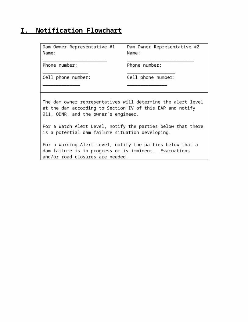
I. Notification Flowchart
Dam Owner Representative #1Name: ________________________ Phone number: _________________Cell phone number: ______________
Dam Owner Representative #2Name: _________________________ Phone number: __________________ Cell phone number: _______________
The dam owner representatives will determine the alert level at the dam according to Section IV of this EAP and notify 911, ODNR, and the owner’s engineer.
For a Watch Alert Level, notify the parties below that there is a potential dam failure situation developing.
For a Warning Alert Level, notify the parties below that a dam failure is in progress or is imminent. Evacuations and/or road closures are needed.
911 Contact or meet w/ the county EMA to determine the correct phone number and for any county-specific information.
Through the emergency dispatch system, the following entities should be contacted:
County EMA office Fire Department Police Department National Weather
Service County or state
highway departments Others as needed
ODNR, Dam Safety Engineering Program24 hour emergency #:614-799-9538
Owner Engineer (if applicable)
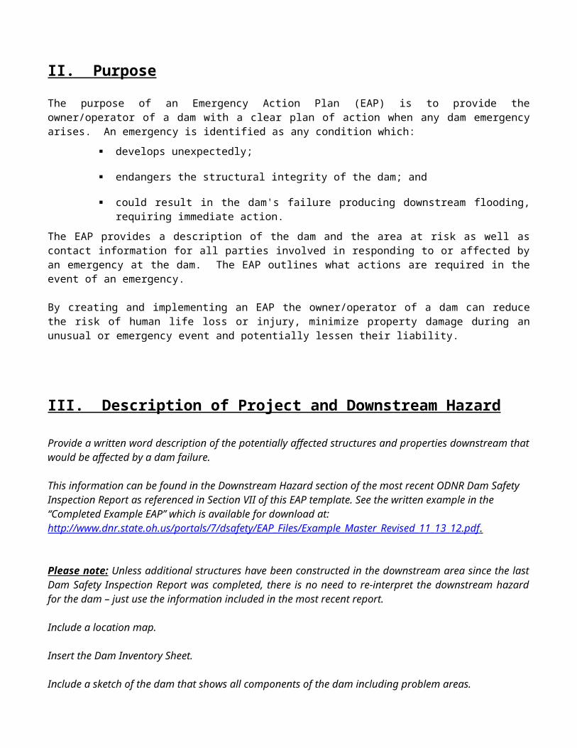
II. PurposeThe purpose of an Emergency Action Plan (EAP) is to provide the owner/operator of a dam with a clear plan of action when any dam emergency arises. An emergency is identified as any condition which:
develops unexpectedly;
endangers the structural integrity of the dam; and
could result in the dam's failure producing downstream flooding, requiring immediate action.
The EAP provides a description of the dam and the area at risk as well as contact information for all parties involved in responding to or affected by an emergency at the dam. The EAP outlines what actions are required in the event of an emergency.
By creating and implementing an EAP the owner/operator of a dam can reduce the risk of human life loss or injury, minimize property damage during an unusual or emergency event and potentially lessen their liability.
III. Description of Project and Downstream Hazard
Provide a written word description of the potentially affected structures and properties downstream that would be affected by a dam failure.
This information can be found in the Downstream Hazard section of the most recent ODNR Dam Safety Inspection Report as referenced in Section VII of this EAP template. See the written example in the “Completed Example EAP” which is available for download at: http://www.dnr.state.oh.us/portals/7/dsafety/EAP_Files/Example_Master_Revised_11_13_12.pdf .
Please note: Unless additional structures have been constructed in the downstream area since the last Dam Safety Inspection Report was completed, there is no need to re-interpret the downstream hazard for the dam – just use the information included in the most recent report.
Include a location map.
Insert the Dam Inventory Sheet.
Include a sketch of the dam that shows all components of the dam including problem areas.
NOTE: The “location map” and “Dam Inventory Sheet” mentioned above can be found in the most recent ODNR, Dam Safety Inspection Report. The report may/may not contain a “sketch” of the dam, but please use the existing sketch if it does exist.
Please develop a sketch if one does not exist.
The sketch can be a drawing or a close-up aerial photo with text boxes added to show the location of pertinent parts of the dam such as: abutments, lake drain system control, and access roads; and also include known problem areas with the dam such as: seepage areas, sinkholes, deteriorated concrete, etc.

IV. Emergency Detection, Evaluation, and Classification
In order to determine whether an emergency condition exists, the dam must be inspected or monitored periodically. Inspect the dam as directed below. Then, use the “Alert Level” table to determine the severity of problems identified from inspecting the dam and the “Classification of Conditions” table to determine the appropriate actions to take.
1. Inspect the dam weekly. This inspection includes walking the entire length of the crest and inspecting the following items:
The spillway inlet for obstructions The earthen embankment for cracks, earth slides, seepage, and sinkholes Include and list here all gates, valves, concrete structures, known seepage areas,
weirs, drain outlets that have been noted as needing weekly attention, and other special features or problem areas of the dam.
_________________________________________________________ _________________________________________________________ _________________________________________________________ _________________________________________________________
2. After significant rainfall, dams are more likely to develop problems such as slides, spillway obstructions, seepage, or structural problems. If more than 2 inches of rain occurs within 24 hours or the pool level rises more than one foot, monitor the dam daily until the pool level begins to decrease. Inspect the dam as described in item 1 above. Record rainfall amount and pool elevation. This information can be used to establish how the dam responds to rainfall. It may be found that there is a correlation between lake level and seepage, which would need to be monitored and addressed.
The following references may be used for additional assistance in understanding specific problems with dams and obtaining rainfall data.
Dam Safety: An Owner’s Guidance Manual (FEMA publication 145) (drawings of dam conditions near the end of the report can be used to identify problems): ftp://ftp.dnr.state.oh.us/water/Public/DCB/EAP/FEMA145/
Division of Soil and Water Resources Facts sheets and other publications: http://www.dnr.state.oh.us/water/dsafety/publications/tabid/3335/Default.aspx
Automated Flood Warning System (current rainfall): http://www.afws.net/states/oh/oh.htm NOAA rainfall maps: http://www.erh.noaa.gov/ohrfc/Observed.html

Alert Level TableEvent Situation Alert Level*
Rainfall Significant rainfall resulting in flooding that raises the flow depth more than 3 feet above the normal flow depth.
Monitor
Abutment Overtopping
Flooding that is expected to be at the abutment height or above WatchMajor flow eroding the abutment Warning
Seepage New seepage areas on the face of the dam or abutment MonitorHeavy seepage with active erosion. Muddy flow and/or sand boils. Visible whirlpool in the upstream pool.
Warning
Dam Cracking
New cracks in the dam greater than ¼ - inch wide without seepage MonitorCracks in the dam with seepage Watch
Dam Movement
Movement of the dam or sections of the dam MonitorNoticeable movement of a section of the dam that concentrates flow WatchNoticeable movement of a section of the dam with predicted flooding conditions
Warning
Instruments Instrumentation readings beyond predetermined values Monitor
EarthquakeMeasurable earthquake felt or reported on or within 50 miles of the dam
Monitor
Earthquake resulting in visible damage to the dam or appurtenances WatchEarthquake resulting in uncontrolled release of water from the dam Warning
SecurityThreat
Verified bomb threat that, if carried out, could result in damage to the dam WatchDetonated bomb that has resulted in damage to the dam or appurtenances
Warning
Sabotage
Damage to dam or appurtenances with no impacts to the functioning of the dam
Monitor
Damage to dam or appurtenances that has resulted in seepage flow WatchDamage to dam or appurtenances that has resulted in uncontrolled water release Warning
* See the “Classification of Conditions” table on the following page for Alert Level description and recommended action.
Review the dam history and previous dam safety inspection reports to include additional dam-specific items to this list. An example may include deterioration of spillways that are in poor condition.

Classification of Conditions Table
Alert Level Description Action
MonitorUnusual event, slowly developing, not an immediate threat to the dam.
Dam owner representative must inspect the dam.
Document the incident and report findings to your engineer and the ODNR, Dam Safety Engineering Program.
Obtain instructions regarding the next course of action from your engineer and/or ODNR.
WatchUnsafe situation that may lead to failure of the dam but not an immediate threat.
Begin notifications according to Section I: Notification Flowchart in this EAP.
Begin constant surveillance of the dam.
Warning
Urgent situation. Failure is occurring or about to occur. Or, areas downstream are flooding due to spillway flow. Evacuation of downstream area necessary.
Begin notifications according to Section I: Notification Flowchart in this EAP.
Begin constant surveillance of the dam.

Examples of Emergency SituationsThe following are examples of conditions that usually constitute an emergency situation that may occur at a low head dam. These examples may or may not apply to this dam. Adverse or unusual conditions that can cause the failure of a dam are typically related to aging or design and construction oversights. However, accidental or intentional damage to the dam may also result in emergency conditions. The conditions have been grouped to identify the most likely emergency-level condition. The groupings are provided as guidance only. Not all emergency conditions may be listed, and the dam operator is urged to use conservative judgment in determining whether a specific condition should be defined as an emergency situation at the dam.
Abutment Overtopping Watch Alert Level—Potential dam failure situation; rapidly developing:
1. Significant flooding has raised the flow depth almost to the top of the dam abutment.
Warning Alert Level—Urgent; dam failure appears imminent or is in progress:1. The flow depth has overtopped the abutment and erosion is occurring around the
end of the dam.
Seepage and Sinkholes Watch Alert Level—Potential dam failure situation; rapidly developing:
1. Cloudy seepage or soil deposits are observed at the downstream toe of the dam or through the face of the dam.
2. Pool level is falling without apparent cause.
Warning Alert Level—Urgent; dam failure appears imminent or is in progress:1. Whirlpools or other evidence exists indicating that the pool is draining rapidly
through the dam or foundation.
2. Rapidly enlarging sinkhole(s) are forming on the abutments to the extent that failure appears imminent or is in progress.
3. Rapidly increasing flow through crack(s) eroding materials to the extent that failure appears imminent or is in progress.
Dam Movement and Cracking Watch Alert Level —Potential dam failure situation; rapidly developing:
1. A portion of the dam has moved such that it is visibly noticeable.
2. New development of or significant increase in length, width, or offset of cracks in the dam or abutments.
Warning Alert Level—Urgent; dam failure appears imminent or is in progress:

1. Movement of a section or sections of the dam in conjunction with predicted flooding.

V. Responsibilities
Dam Owner Performing weekly dam inspections Initiating emergency actions at the dam Terminating emergency actions at the dam
County Emergency Management Agencies (EMA) Coordinates or assists local emergency response
County Sheriff/Local Police/Fire Department Leads evacuation and road closure efforts
ODNR, Dam Safety Engineering Program Provides technical guidance during an emergency Can initiate emergency actions at the dam if the dam owner is not fulfilling their
responsibilities Perform periodic dam safety inspections usually no more frequently than every 5 years
Dam Owner’s Engineer Provides technical guidance Coordinates with ODNR and County EMA for remedial actions

VI. Preparedness
After all the proper notifications have been made according to the Flowchart, the following actions should be taken. If time permits, ODNR and the dam owner’s engineer should be contacted for technical consultation.
Emergency remedial actionsIf time permits, the following emergency remedial actions should be considered for Watch conditions. Immediate implementation of these remedial actions may delay, moderate, or prevent the failure of the dam. Several of the listed adverse or unusual conditions may be apparent at the dam at the same time, requiring implementation of several modes of remedial actions. Close monitoring of the dam must be maintained to confirm the success of any remedial action taken at the dam. See Resources Available (Appendix B–1) for sources of equipment and materials to assist with remedial actions.
Abutment overtopping 1. If the water level is no longer rising and it is safe to do so, place sandbags in the eroded
areas or fill with earth material.
Seepage and sinkholes1. If the entrance to the seepage origination point is observed in the reservoir (possible
whirlpool) and is accessible, attempt to reduce the flow by plugging the entrance with readily available materials such as hay bales, bentonite, soil or rockfill, or plastic sheeting. It should be noted that this may be a very dangerous action to take depending on the situation. Do not attempt if it appears too dangerous.
Earthquake1. Immediately conduct a general overall visual inspection of the dam. 2. Determine if there has been any settlement and movement of the dam or abutments to plan
for required remedial work.

Site-Specific Concerns and Resources Availability
Include contact information for equipment rental such as pumps, lighting, heavy machinery, sand bags, generators, etc.
Include contact information for local sources of sand, gravel, and large stone.
Include contact information for concrete supply
include contact for diving contractor
Include information regarding access to the site such as primary and secondary routes, means for reaching the site under various conditions, or other special instructions.
_____________________________________________________________________
_____________________________________________________________________
_____________________________________________________________________
_____________________________________________________________________
_____________________________________________________________________
_____________________________________________________________________

VII. Downstream Hazard MapInsert aerial photo that shows the dam and downstream areas. The maps should show houses, businesses, and roads downstream of the dam that may be inundated by a dam failure or flooding from spillway releases. Refer to the Hazard Classification Section of the most recent ODNR Dam Safety Inspection report for the dam for information on downstream hazard.

VIII. Appendices
Appendix A: Plans for Training, Exercising, Updating, and Compliant Dam Discount
The purpose of an annual review of the EAP and training for dam owners and operators is to ensure that all contact information listed is accurate and that dam personnel are familiar with the EAP and understand their role in responding to a dam emergency. The annual review of and training for the ____________________________ Dam’s EAP will occur during the month of ______________. The dam owner, ________________________, will be responsible for updating and distributing copies of the EAP. Based on changes identified in the annual review, copies of updated pages will be provided to all holders of the EAP.
A copy of the most current EAP will be kept by the following parties. Dam Owner ODNR, Division of Soil and Water Resources County EMA Others insert names
The dam owner/operator should work with local emergency management to determine what opportunities exist to conduct or participate in dam related EAP exercises.


Appendix B: Distribution of the EAP
This EAP has been distributed to the following:
This EAP has been distributed to those Individuals listed below.
The Distribution list should include: Dam Owner, ODNR Dam Safety, County EMA Office, Person or Consultant Who Prepared EAP, and Others
The “Date” will be completed by ODNR Dam Safety upon approval of the EAP.
Copies of the approved EAP will be sent by ODNR Dam Safety to all listed.
Future updated copies of the EAP are to be sent by the Dam Owner to all listed.
1.__________________________________________________________________________ Name & Title Organization Address Date
2.__________________________________________________________________________ Name & Title Organization Address Date
3.___________________________________________________________________________ Name & Title Organization Address Date
4.___________________________________________________________________________ Name & Title Organization Address Date
5.___________________________________________________________________________ Name & Title Organization Address Date
6.__________________________________________________________________________ Name & Title Organization Address Date

Appendix C: Glossary of Terms
Abutment That part of the valleyside against which the dam is constructed. The left and right abutments of dams are defined with the observer looking downstream from the dam.
Acre-foot A unit of volumetric measure that would cover 1 acre to a depth of 1 foot. One acre-foot is equal to 43,560 cubic feet or 325,850 gallons.
Appurtenant Structures The structures or machinery auxiliary to dams which are built to operate and maintain dams; such as outlet works, spillway, powerhouse, tunnels, etc.
Berm A nearly horizontal step (bench) in the upstream or downstream sloping face of the dam.
Boil A disruption of the soil surface due to water discharging from below the surface. Eroded soil may be deposited in the form of a ring (miniature volcano) around the disruption.
Breach An opening through the dam that allows draining of the reservoir. A controlled breach is an intentionally constructed opening. An uncontrolled breach is an unintended failure of the dam.
Conduit A closed channel (round pipe or rectangular box) that conveys water through, around, or under the dam.
Control section A usually level segment in the profile of an open channel spillway above which water in the reservoir discharges through the spillway.
Crest of Dam The crown of an overflow section of the dam. In the United States, the term "crest of dam" is often used when "top of dam" is intended. To avoid confusion, the terms crest of spillway and top of dam should be used in referring to the overflow section and dam proper, respectively.
Cross section A slice through the dam showing elevation vertically and direction of natural water flow horizontally from left to right. Also, a slice through a spillway showing elevation vertically and left and right sides of the spillway looking downstream.
Cutoff Wall A wall of impervious material (e.g., concrete, asphaltic concrete, steel sheet piling) built into the foundation to reduce seepage under the dam.
Dam An artificial barrier generally constructed across a watercourse for the purpose of impounding or diverting water.
Dam failure The uncontrolled release of a dam’s impounded water.
Dam Operator The person(s) or unit(s) of government with responsibility for the operation and maintenance of dam.
Drain, toe or foundation, or blanket A water collection system of sand and gravel and typically pipes along the downstream portion of the dam to collect seepage and convey it to a safe outlet.
Drainage area (watershed) The geographic area on which rainfall flows into the dam.
Drawdown The lowering or releasing of the water level in a reservoir over time or the volume lowered or released over a particular period of time.
Embankment Fill material, usually earth or rock, placed with sloping sides.
Emergency A condition that develops unexpectedly, endangers the structural integrity of the dam and/or downstream human life and property, and requires immediate action.
Emergency Action Plan(EAP) A formal document identifying potential emergency conditions that may occur at the dam and specifying preplanned actions to minimize potential failure of the dam or minimize failure consequences including loss of life, property damage, and environmental impacts.
Evacuation map A map showing the geographic area downstream of a dam that should be evacuated if it is threatened to be flooded by a breach of the dam or other large discharge.
Failure An incident resulting in the uncontrolled release of water from a dam.

Filter The layers of sand and gravel in a drain that allow seepage through an embankment to discharge into the drain without eroding the embankment soil.
Foundation of Dam The natural material on which the dam structure is placed.
Freeboard Vertical distance between a stated water level in the reservoir and the top of dam.
Gate, slide or sluice, or regulating An operable, watertight valve to manage the discharge of water from the dam.
Groin The area along the intersection of the face of a dam and the abutment.
Hazard classification A system that categorizes dams (high, significant, or low) according to the degree of their potential to create adverse incremental consequences such as loss of life, property damage, or environmental impacts of a failure or misoperation of a dam.
Height, dam The vertical distance between the lowest point along the top of the dam and the lowest point at the downstream toe, which usually occurs in the bed of the outlet channel.
Hydrograph, inflow or outflow, or breach A graphical representation of either the flow rate or flow depth at a specific point above or below the dam over time for a specific flood occurrence.
Incident Commander The highest predetermined official available at the scene of an emergency situation.
Instrumentation An arrangement of devices installed into or near dams that provide measurements to evaluate the structural behavior and other performance parameters of the dam and appurtenant structures.
Notification To immediately inform appropriate individuals, organizations, or agencies about a potentially emergency situation so they can initiate appropriate actions.
Piping The progressive destruction of an embankment or embankment foundation by internal erosion of the soil by seepage flows.
Primary Spillway (Principal Spillway) The principal or first used spillway during flood flows.
Probable Maximum Precipitation (PMP) or Flood (PMF) The theoretically greatest precipitation or resulting flood that is meteorologically feasible for a given duration over a specific drainage area at a particular geographical location.
Reservoir The body of water impounded or potentially impounded by the dam.
Riprap A layer of large rock, precast blocks, bags of cement, or other suitable material, generally placed on an embankment or along a watercourse as protection against wave action, erosion, or scour.
Risk A measure of the likelihood and severity of an adverse consequence.
Scarp The nearly vertical, exposed earth surface created at the upper edge of a slide or a breached area along the upstream slope of an earthen embankment.
Seepage The natural movement of water through the embankment, foundation, or abutments of the dam.
Slide The movement of a mass of earth down a slope on the embankment or abutment of the dam.
Spillway (auxiliary or emergency) The appurtenant structure that provides the controlled conveyance of excess water through, over, or around the dam.
Spillway capacity The maximum discharge the spillway can safely convey with the reservoir at the maximum design elevation.

Spillway crest The lowest level at which reservoir water can flow into the spillway.
Stilling Basin A basin constructed to dissipate the energy of fast-flowing water, eg. from a spillway or bottom outlet, and to protect the river bed from erosion.
Stoplogs Logs or timbers, steel or concrete beams placed on top of each other with their ends held in guides on each side of a channel or conduit.
Storage The retention of water or delay in runoff either by planned operation, as in a reservoir, or by temporarily filling the overflow areas, as in the progression of a flood crest through a natural stream channel.
Tailwater The body of water immediately downstream of the embankment at a specific point in time.
Toe of dam The junction of the upstream or downstream face of an embankment with the ground surface.
Top of dam (crest of dam) The elevation of the uppermost surface of an embankment which can safely impound water behind the dam.
Trash Rack A structure of metal or concrete bars located in the waterway at an intake to prevent the entry of floating or submerged debris.
Valve In general, a device fitted to a pipeline or orifice in which the closure member is either rotated or moved transversely or longitudinally in the waterway so as to control or stop the flow.
Weir A low dam or wall built across a stream to raise the upstream water level. Termed fixed-crest weir when uncontrolled. A structure built across a stream or channel for the purpose of measuring flow. Sometimes described as a measuring weir or gauging weir. Types of weirs include broadcrested weirs, sharpcrested weirs, ogee weirs, and V-notched weirs.