qa-545 matapeake ferry terminal - maryland historical trust
TRANSCRIPT
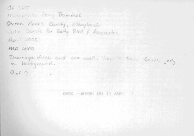
QA-545
Matapeake Ferry Terminal
Architectural Survey File
This is the architectural survey file for this MIHP record. The survey file is organized reverse-
chronological (that is, with the latest material on top). It contains all MIHP inventory forms, National
Register nomination forms, determinations of eligibility (DOE) forms, and accompanying documentation
such as photographs and maps.
Users should be aware that additional undigitized material about this property may be found in on-site
architectural reports, copies of HABS/HAER or other documentation, drawings, and the “vertical files” at
the MHT Library in Crownsville. The vertical files may include newspaper clippings, field notes, draft
versions of forms and architectural reports, photographs, maps, and drawings. Researchers who need a
thorough understanding of this property should plan to visit the MHT Library as part of their research
project; look at the MHT web site (mht.maryland.gov) for details about how to make an appointment.
All material is property of the Maryland Historical Trust.
Last Updated: 01-24-2012
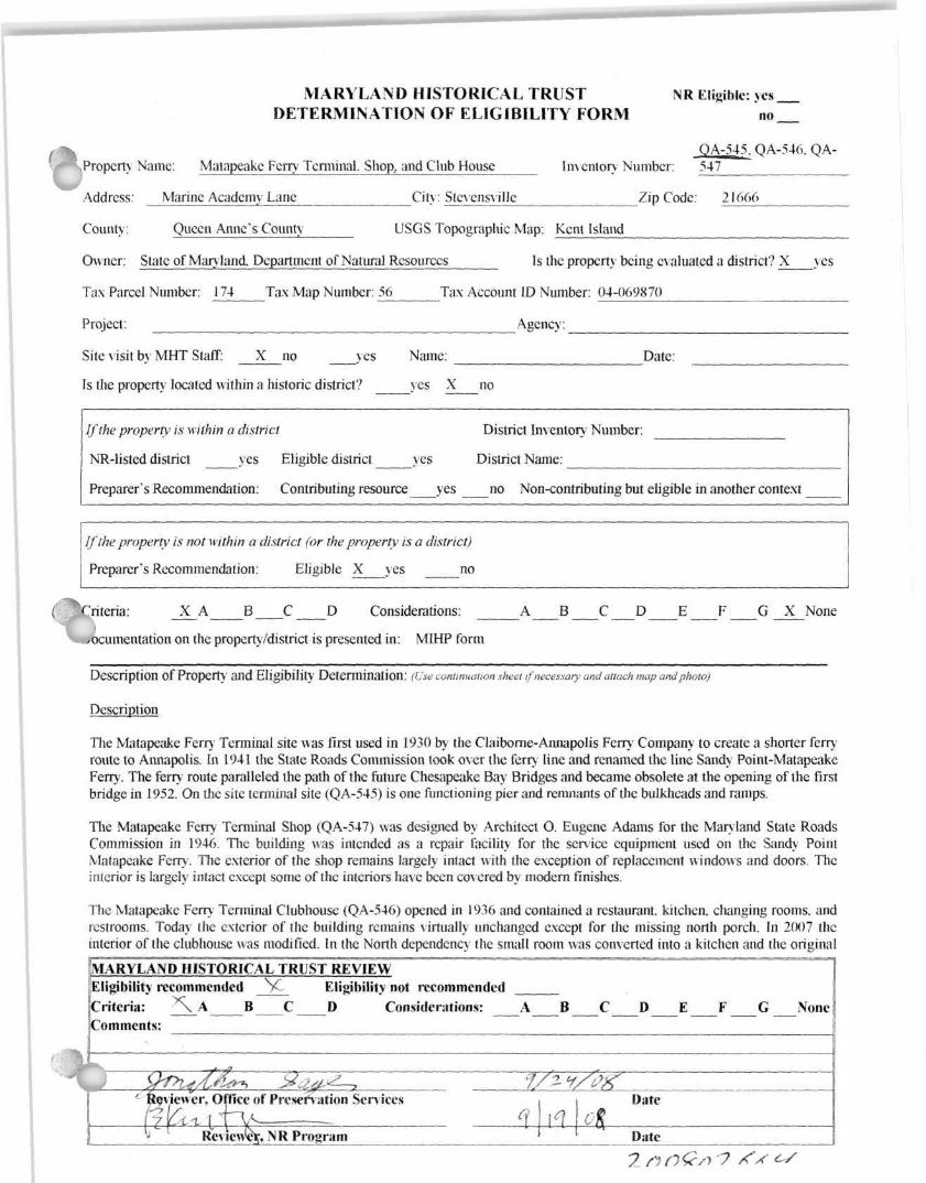
MARYLAND HISTORICAL TRUST NR Eligible: yes DETERMINATION OF ELIGIBILITY FORM no
QA-545. QA-546, QA-\ Property Name: Matapeake Fern Terminal. Shop., and Club House Inventory Number: 547
Address. Marine Academy Lane City: Stcvensvillc Zip Code: 21666
County: Queen Anne's County USGS Topographic Map: Kent Island
Owner: State of Man land. Department of Natural Resources Is the property being evaluated a district? X yes
Tax Parcel Number: 174 Tax Map Number: ^6 Tax Account ID Number: 04-069870
Project: Agency:
Site visit by MHT Staff: X no yes Name: Date:
Is the property located within a historic district? yes X no
If the property is within a district District Inventory Number:
NR-listed district yes Eligible district yes District Name:
Preparers Recommendation: Contributing resource yes no Non-contributing but eligible in another context
If the property is not within a district (or the property is a district)
Preparer's Recommendation: Eligible X yes no
Criteria: _X_A B C D Considerations: A B C D E F G X None
documentation on the property/district is presented in: MIHP form
Description Of Property and Eligibility Determination: (Use continuation sheet if necessary and attach map and photo)
Description
The Matapeake Ferry Terminal site was first used in 1930 by the Claibome-Annapolis Ferry Company to create a shorter ferry route to Annapolis. In 1941 the State Roads Commission took over the fern line and renamed the line Sandy Point-Matapeake Ferry. The ferry route paralleled the path of the future Chesapeake Bay Bridges and became obsolete at the opening of the first bridge in 1952. On the site terminal site (QA-545) is one functioning pier and remnants of the bulkheads and ramps.
The Matapeake Ferry Terminal Shop (QA-547) was designed by Architect O. Eugene Adams for the Man land State Roads Commission in 1946. The building was intended as a repair facility for the sen ice equipment used on the Sandy Point Matapeake Ferry. The exterior of the shop remains largely intact with the exception of replacement windows and doors. The interior is largely intact except some of the interiors have been covered by modern finishes.
The Matapeake Ferry Terminal Clubhouse (QA-546) opened in 1936 and contained a restaurant, kitchen, changing rooms, and rcstrooms. Today the exterior of the building remains virtually unchanged except for the missing north porch. In 2007 the interior of the clubhouse was modified. In the North dependency the small room was converted into a kitchen and the original
MARYLAND HISTORICAL TRUST REVIEW Eligibility recommended V Eligibility not recommended Criteria: * \ A B C D Considerations: A B C D E F G None Comments:
Reviewer, Office of Preservation Services
Reviewed NR Program
Date
Date
200802664
MARYLAND HISTORICAL TRUST NR-ELIBILITY REVIEW FORM
Continuation Sheet No. 1 QA-545, QA-546, QA-547
doorwav which opened into the hall was enclosed. The new doorway to this room was placed where a dumbwaiter had originally been installed on the north wall on the main room. In the main room a bar was built perpendicular to east side of the fireplace. In the South dependency the bathroom was modified to accommodate ADA accessibility. The original doorway was enclosed and the room was divided into two separate bathrooms. The doorways to these bathrooms were relocated along the south wall.
Historically the lawn west of the Clubhouse sloped to a public beach. The recent improvements to the landscape surrounding the Clubhouse include a blue slate patio, off the front portico with a blue heron fountain in the center. The original bell that once rang in the ferries was found and placed near a naval flagpole memorial in the south lawn. The shooting range installed by the Maryland State Police Academy after the clubhouse closed in 1952 was removed, and the ground terraced to reopen access to the beach. A modern shower tower was installed next to the beach at the end of the west end of the old shooting range.
Determination of Eligibility
The Matapeake Ferry Terminal, Shop and Clubhouse are eligible for listing in the National Register under Criterion A on the local level with a period of significance of 1930 to 1952 for its association with the Claiborne-Annapolis Ferry (later the Sandy Point-Matapeake Ferry) and its impact on transportation, recreation, and economic development on die Eastern Shore of Man land predating the construction of the Chesapeake Bay Bridges.
The Matapeake Ferry Terminal buildings are not National Register eligible under Criterion B, as they are not associated with an individual significant on die local, state, or national level.
The Matapeake Ferry Terminal buildings are not National Register eligible under Criterion C as it is not significant in the history of fern- engineering or design, not is it an example of the work of a renowned engineer, craftsman, or contractor. It does not exemplify significant engineering solutions developed in response to conditions characteristic of the locality or region. It is not an example of a rare building type nor does it possess architectural or artistic distinction. While the Matapeake Ferry Terminal Buildings do reflect common construction techniques of the early twentieth century in the United States, they do not demonstrate innovative technical solutions.
National Register eligibility under Criterion D was not investigated as part of this study.
Amanda R. Apple. Historic Preservation Planner
Prepared by: Queen Anne's County Date Prepared: 07/30/2008
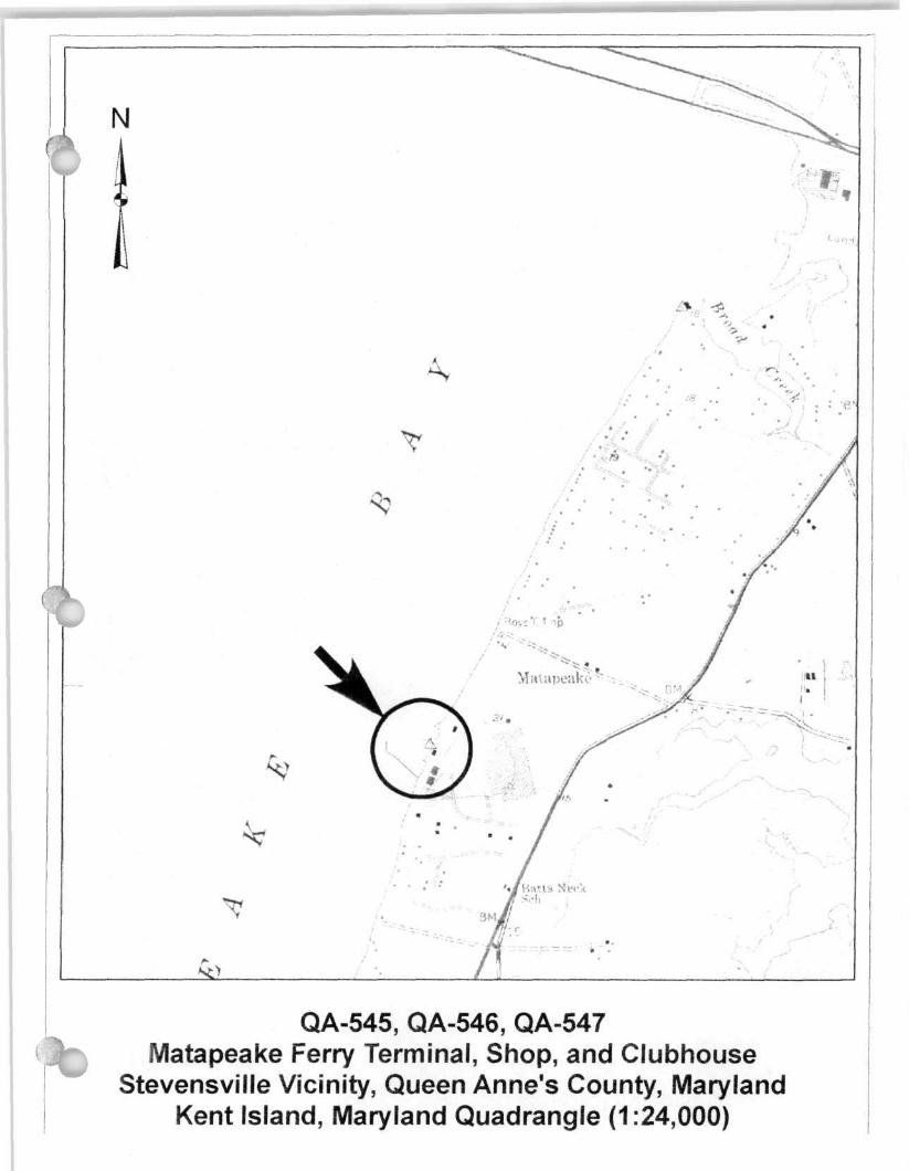
QA-545, QA-546, QA-547 Matapeake Ferry Terminal, Shop, and Clubhouse
Stevensville Vicinity, Queen Anne's County, Maryland Kent Island, Maryland Quadrangle (1:24,000)
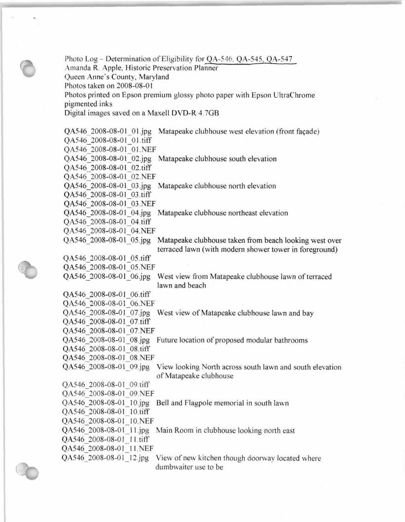
Photo Log - Determination of Eligibility for QA-546. QA-545, QA-547 Amanda R. Apple, Historic Preservation Planner Queen Anne's County, Maryland Photos taken on 2008-08-01 Photos printed on Epson premium glossy photo paper with Epson UltraChrome pigmented inks Digital images saved on a Maxell DVD-R 4.7GB
QA546_2008-08-01_01 Jpg Matapeake clubhouse west elevation (front facade) QA546_2008-08-01_01 .tiff QA546_2008-08-01_01.NEF QA546_2008-08-0 l_02.jpg Matapeake clubhouse south elevation QA546_2008-08-01 _02.tiff Q A546_2008-08-01 _02. NEF QA546_2008-08-01_03.jpg Matapeake clubhouse north elevation Q A546_2008-08-01 _03. tiff Q A546_2008-08-01 _03 .NEF QA546_2008-08-01_04.jpg Matapeake clubhouse northeast elevation Q A546_2008-08-0 l_04.tiff QA546_2008-08-01_04.NEF QA546_2008-08-01_05.jpg Matapeake clubhouse taken from beach looking west over
terraced lawn (with modern shower tower in foreground) QA546_2008-08-01_05.tiff QA546_2008-08-01_05.NEF QA546_2008-08-01_06.jpg West view from Matapeake clubhouse lawn of terraced
lawn and beach QA546_2008-08-0 l_06.tiff QA546_2008-08-01_06.NEF QA546_2008-08-01_07.jpg West view of Matapeake clubhouse lawn and bay QA546_2008-08-01_07.tiff QA546_2008-08-01 07.NEF QA546_2008-08-01 _08.jpg Future location of proposed modular bathrooms QA546_2008-08-01_08.tiff QA546_2008-08-01_08.NEF QA546_2008-08-01_09.jpg View looking North across south lawn and south elevation
of Matapeake clubhouse QA546_2008-08-01_09.tiff QA546_2008-08-01_09.NEF QA546_2008-08-01_10.jpg Bell and Flagpole memorial in south lawn QA546_2008-08-01_10.tiff QA546_2008-08-01_10.NEF QA546_2008-08-01_11 jpg Main Room in clubhouse looking north east QA546_2008-08-01_l l.tiff QA546_2008-08-01_l l.NEF QA546_2008-08-01_12.jpg View of new kitchen though doorway located where
dumbwaiter use to be
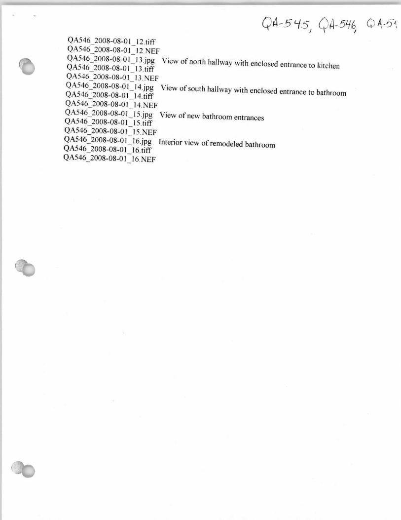
QA-545, QA-546, QA-54 QA546_2008-08-01_ 12.tiff QA546_2008-08-01_12.NEF
QA546_2008-08-01_13.jpg View of north hallwav with enclosed entrance to kitchen QA546_2008-08-01_13.tiff QA546_2008-08-01_13. NEF QA546_2008-08-01_14.jpg View of south hallway with enclosed entrance to bathroom QA546_2008-08-01_I4.tiff Q A546_2008-08-01_14. NEF QA546_2008-08-01_15.jpg View of new bathroom entrances QA546_2008-08-01_15.tifiF QA546_2008-08-01_15.NEF QA546_2008-08-01_16.jpg Interior view of remodeled bathroom QA546_2008-08-01_16.tiff QA546_2008-08-01_16.NEF
QA-545 Matapeake Ferry Terminal Stevensville vicinity, Queen Anne's County
Constructed 1930 to present Publicly owned
DESCRIPTION SUMMARY
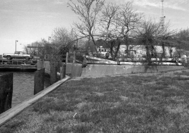
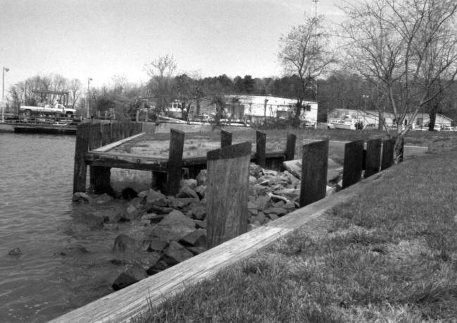
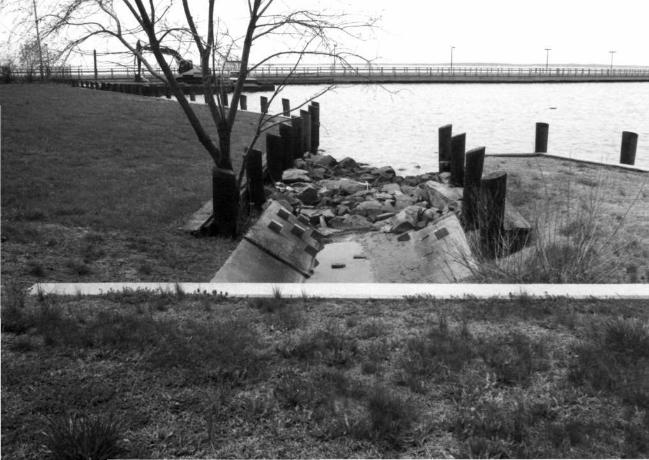
The Matapeake Ferry Terminal is located south of the Chesapeake Bay Bridge and west of Romancoke Road on Kent Island, Queen Anne's County. The earliest elements of the site date to 1930; alterations continue to the present. The present Matapeake Ferry Terminal consists of two jetties, a 1930 wharf remnant, two concrete bulkheads, two ramp remnants, a pier, and a drainage ditch and sea wall.
SUMMARY STA TEMENT OF SIGNIFICANCE
The Matapeake Ferry Terminal site first came into use in 1930 when the Claiborne-Annapolis Ferry Company moved its Eastern Shore terminus from Claiborne (Talbot County) to Kent Island in order to have a shorter route to Annapolis. The State Roads Commission took over the ferry in 1941, renaming it the Sandy Point-Matapeake Ferry. The ferry route paralleled the route of the Chesapeake Bay Bridge and was made obsolete by the opening of the Bridge in 1952. The State retained control of the Matapeake site and opened the Maryland State Marine Police Academy there in 1963.
Maryland Historical Trust Inventory No. QA-545
Maryland Inventory of Historic Properties Form
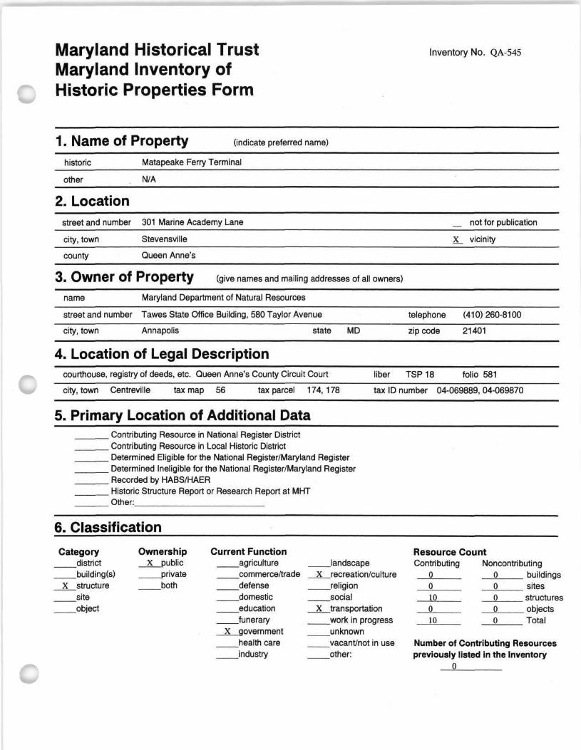
1. Name of Property (indicate preferred name)
historic Matapeake Ferry Terminal
other N/A
2. Location street and number 301 Marine Academy Lane not for publication
city, town Stevensville X_ vicinity
county Queen Anne's
3. Owner of Property (give names and mailing addresses of all owners)
name Maryland Department of Natural Resources
street and number Tawes State Office Building, 580 Taylor Avenue telephone (410) 260-8100
city, town Annapolis state MD zip code 21401
4. Location of Legal Description courthouse, registry of deeds, etc. Queen Anne's County Circuit Court liber TSP 18 folio 581
city, town Centreville tax map 56 tax parcel 174,178 tax ID number 04-069889,04-069870
5. Primary Location of Additional Data Contributing Resource in National Register District Contributing Resource in Local Historic District Determined Eligible for the National Register/Maryland Register Determined Ineligible for the National Register/Maryland Register Recorded by HABS/HAER Historic Structure Report or Research Report at MHT Other:
6. Classification
Category Ownership district X public building(s) private
X structure both site object
Current Function Resource Count agriculture landscape Contributing Noncontributing commerce/trade _J(__recreation/culture o o buildings defense religion 0 0 sites domestic social 10 o structures education X transportation 0 o objects funerary work in progress 10 o Total
X government unknown health care vacant/not in use Number of Contributing Resources industry other: previously listed in the Inventory
0
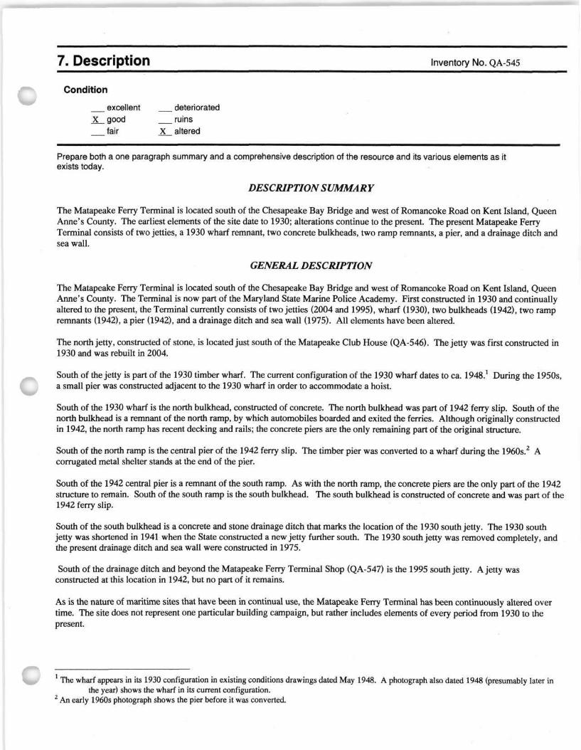
7. Description Inventory No. QA-545
Condition
excellent deteriorated X good ruins
_ fair X altered
Prepare both a one paragraph summary and a comprehensive description of the resource and its various elements as it exists today.
DESCRIPTION SUMMARY
The Matapeake Ferry Terminal is located south of the Chesapeake Bay Bridge and west of Romancoke Road on Kent Island, Queen Anne's County. The earliest elements of the site date to 1930; alterations continue to the present. The present Matapeake Ferry Terminal consists of two jetties, a 1930 wharf remnant, two concrete bulkheads, two ramp remnants, a pier, and a drainage ditch and sea wall.
GENERAL DESCRIPTION
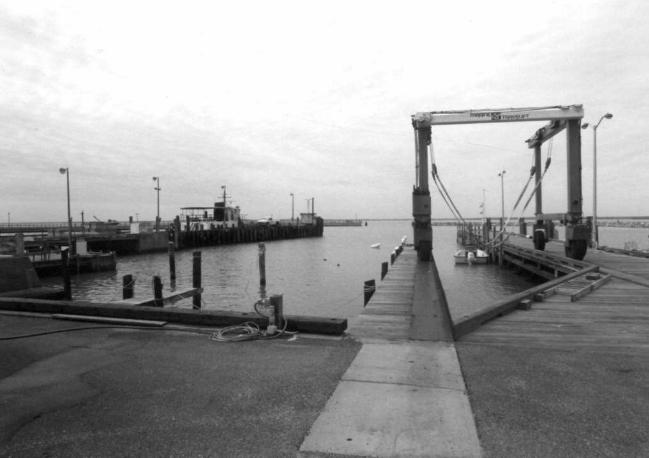
The Matapeake Ferry Terminal is located south of the Chesapeake Bay Bridge and west of Romancoke Road on Kent Island, Queen Anne's County. The Terminal is now part of the Maryland State Marine Police Academy. First constructed in 1930 and continually altered to the present, the Terminal currently consists of two jetties (2004 and 1995), wharf (1930), two bulkheads (1942), two ramp remnants (1942), a pier (1942), and a drainage ditch and sea wall (1975). All elements have been altered.
The north jetty, constructed of stone, is located just south of the Matapeake Club House (QA-546). The jetty was first constructed in 1930 and was rebuilt in 2004.
South of the jetty is part of the 1930 timber wharf. The current configuration of the 1930 wharf dates to ca. 1948.1 During the 1950s, a small pier was constructed adjacent to the 1930 wharf in order to accommodate a hoist.
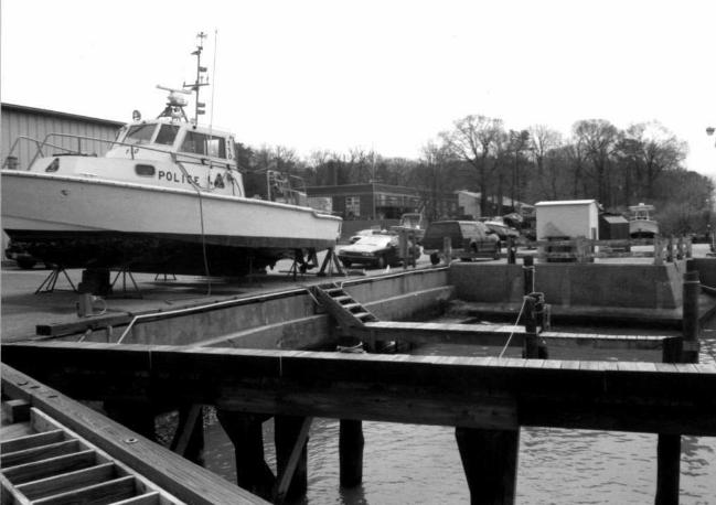
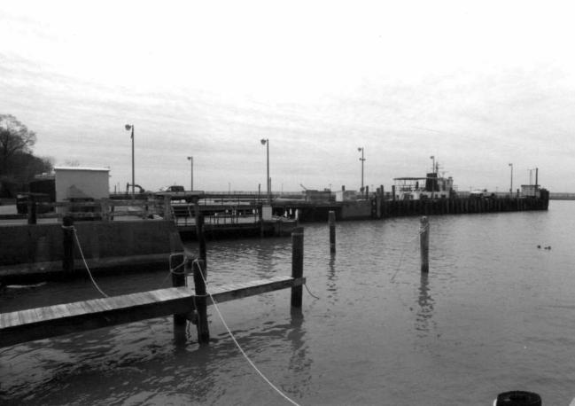
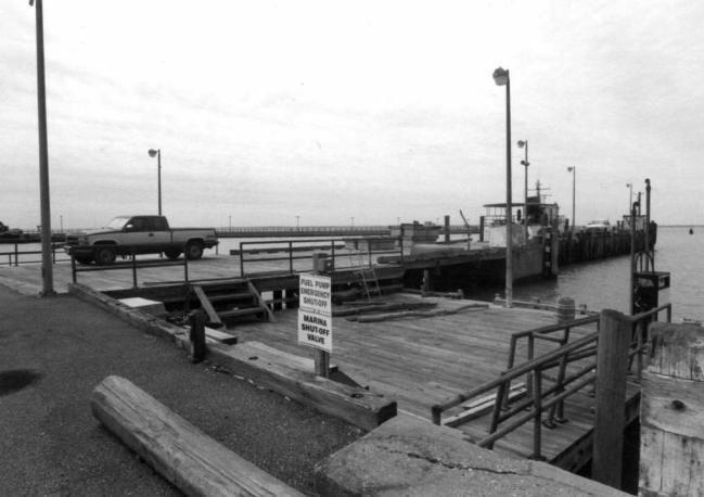
South of the 1930 wharf is the north bulkhead, constructed of concrete. The north bulkhead was part of 1942 ferry slip. South of the north bulkhead is a remnant of the north ramp, by which automobiles boarded and exited the ferries. Although originally constructed in 1942, the north ramp has recent decking and rails; the concrete piers are the only remaining part of the original structure.
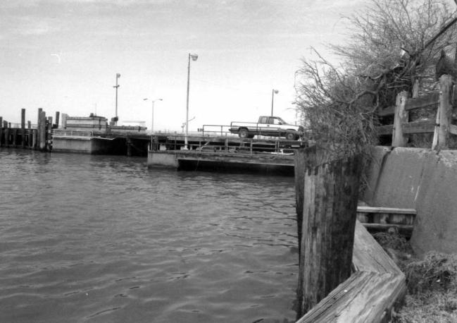
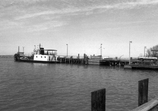
South of the north ramp is the central pier of the 1942 ferry slip. The timber pier was converted to a wharf during the 1960s.2 A corrugated metal shelter stands at the end of the pier.
South of the 1942 central pier is a remnant of the south ramp. As with the north ramp, the concrete piers are the only part of the 1942 structure to remain. South of the south ramp is the south bulkhead. The south bulkhead is constructed of concrete and was part of the 1942 ferry slip.
South of the south bulkhead is a concrete and stone drainage ditch that marks the location of the 1930 south jetty. The 1930 south jetty was shortened in 1941 when the State constructed a new jetty further south. The 1930 south jetty was removed completely, and the present drainage ditch and sea wall were constructed in 1975.
South of the drainage ditch and beyond the Matapeake Ferry Terminal Shop (QA-547) is the 1995 south jetty. A jetty was constructed at this location in 1942, but no part of it remains.
As is the nature of maritime sites that have been in continual use, the Matapeake Ferry Terminal has been continuously altered over time. The site does not represent one particular building campaign, but rather includes elements of every period from 1930 to the present.
The wharf appears in its 1930 configuration in existing conditions drawings dated May 1948. A photograph also dated 1948 (presumably later in the year) shows the wharf in its current configuration.
2 An early 1960s photograph shows the pier before it was converted.
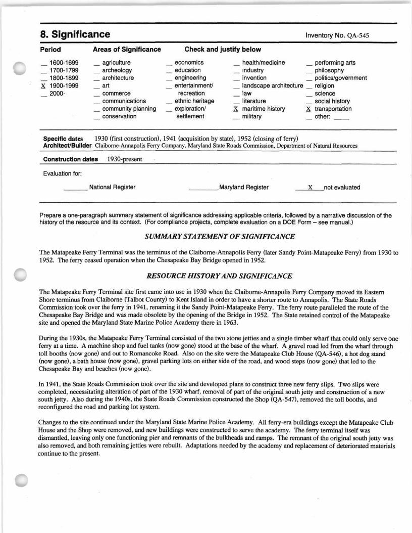
8. Significance Inventory No. QA-545
Period
_ 1600-1699 _ 1700-1799 _ 1800-1899 X 1900-1999
2000-
Areas of Significance
agriculture archeology architecture
_ art commerce communications community planning conservation
Check and justify below
economics health/medicine performing arts education industry philosophy engineering invention politics/government entertainment/ landscape architecture religion
recreation law science ethnic heritage literature social history exploration/ X maritime history x transportation settlement military other:
Specific dates 1930 (first construction), 1941 (acquisition by state), 1952 (closing of ferry) Architect/Builder Claiborne-Annapolis Ferry Company, Maryland State Roads Commission, Department of Natural Resources
Construction dates 1930-present
Evaluation for:
National Register .Maryland Register X not evaluated
Prepare a one-paragraph summary statement of significance addressing applicable criteria, followed by a narrative discussion of the history of the resource and its context. (For compliance projects, complete evaluation on a DOE Form - see manual.)
SUMMARY STA TEMENT OF SIGNIFICANCE
The Matapeake Ferry Terminal was the terminus of the Claiborne-Annapolis Ferry (later Sandy Point-Matapeake Ferry) from 1930 to 1952. The ferry ceased operation when the Chesapeake Bay Bridge opened in 1952.
RESOURCE HISTORY AND SIGNIFICANCE
The Matapeake Ferry Terminal site first came into use in 1930 when the Claiborne-Annapolis Ferry Company moved its Eastern Shore terminus from Claiborne (Talbot County) to Kent Island in order to have a shorter route to Annapolis. The State Roads Commission took over the ferry in 1941, renaming it the Sandy Point-Matapeake Ferry. The ferry route paralleled the route of the Chesapeake Bay Bridge and was made obsolete by the opening of the Bridge in 1952. The State retained control of the Matapeake site and opened the Maryland State Marine Police Academy there in 1963.
During the 1930s, the Matapeake Ferry Terminal consisted of the two stone jetties and a single timber wharf that could only serve one ferry at a time. A machine shop and fuel tanks (now gone) stood at the base of the wharf. A gravel road led from the wharf through toll booths (now gone) and out to Romancoke Road. Also on the site were the Matapeake Club House (QA-546), a hot dog stand (now gone), a bath house (now gone), gravel parking lots on either side of the road, and wood steps (now gone) that led to the Chesapeake Bay and beaches (now gone).
In 1941, the State Roads Commission took over the site and developed plans to construct three new ferry slips. Two slips were completed, necessitating alteration of part of the 1930 wharf, removal of part of the original south jetty and construction of a new south jetty. Also during the 1940s, the State Roads Commission constructed the Shop (QA-547), removed the toll booths, and reconfigured the road and parking lot system.
Changes to the site continued under the Maryland State Marine Police Academy. All ferry-era buildings except the Matapeake Club House and the Shop were removed, and new buildings were constructed to serve the academy. The ferry terminal itself was dismantled, leaving only one functioning pier and remnants of the bulkheads and ramps. The remnant of the original south jetty was also removed, and both remaining jetties were rebuilt. Adaptations needed by the academy and replacement of deteriorated materials continue to the present.
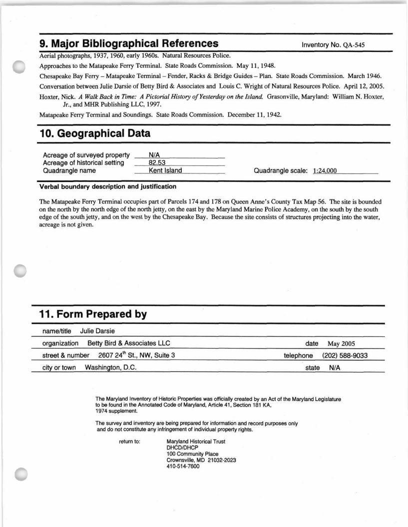
9. Major Bibliographical References Inventory No. QA-545
Aerial photographs, 1937, 1960, early 1960s. Natural Resources Police.
Approaches to the Matapeake Ferry Terminal. State Roads Commission. May 11,1948.
Chesapeake Bay Ferry - Matapeake Terminal - Fender, Racks & Bridge Guides - Plan. State Roads Commission. March 1946.
Conversation between Julie Darsie of Betty Bird & Associates and Louis C. Wright of Natural Resources Police. April 12, 2005.
Hoxter, Nick. A Walk Back in Time: A Pictorial History of Yesterday on the Island. Grasonville, Maryland: William N. Hoxter, Jr., and MHR Publishing LLC, 1997.
Matapeake Ferry Terminal and Soundings. State Roads Commission. December 11, 1942.
10. Geographical Data
Acreage of surveyed property N/A Acreage of historical setting 82.53 Quadrangle name Kent Island Quadrangle scale: 1:24.000
Verbal boundary description and justification
The Matapeake Ferry Terminal occupies part of Parcels 174 and 178 on Queen Anne's County Tax Map 56. The site is bounded on the north by the north edge of the north jetty, on the east by the Maryland Marine Police Academy, on the south by the south edge of the south jetty, and on the west by the Chesapeake Bay. Because the site consists of structures projecting into the water, acreage is not given.
11. Form Prepared by name/title Julie Darsie
organization Betty Bird & Associates LLC
street & number 2607 24th St., NW, Suite 3
city or town Washington, D.C.
date May 2005
telephone (202) 588-9033
state N/A
The Maryland Inventory of Historic Properties was officially created by an Act of the Maryland Legislature to be found in the Annotated Code of Maryland, Article 41, Section 181 KA, 1974 supplement.
The survey and inventory are being prepared for information and record purposes only and do not constitute any infringement of individual property rights.
return to: Maryland Historical Trust DHCD/DHCP 100 Community Place Crownsville, MD 21032-2023 410-514-7600
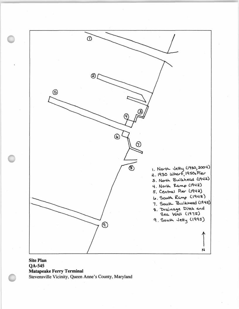
Site Plan QA-545 Matapeake Ferry Terminal Stevensville Vicinity, Queen Anne's County, Maryland
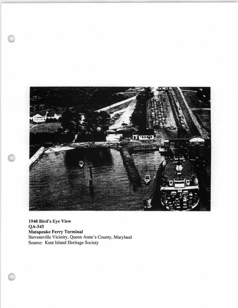
1948 Bird's Eye View QA-545 Matapeake Ferry Terminal Stevensville Vicinity, Queen Anne's County, Maryland Source: Kent Island Heritage Society
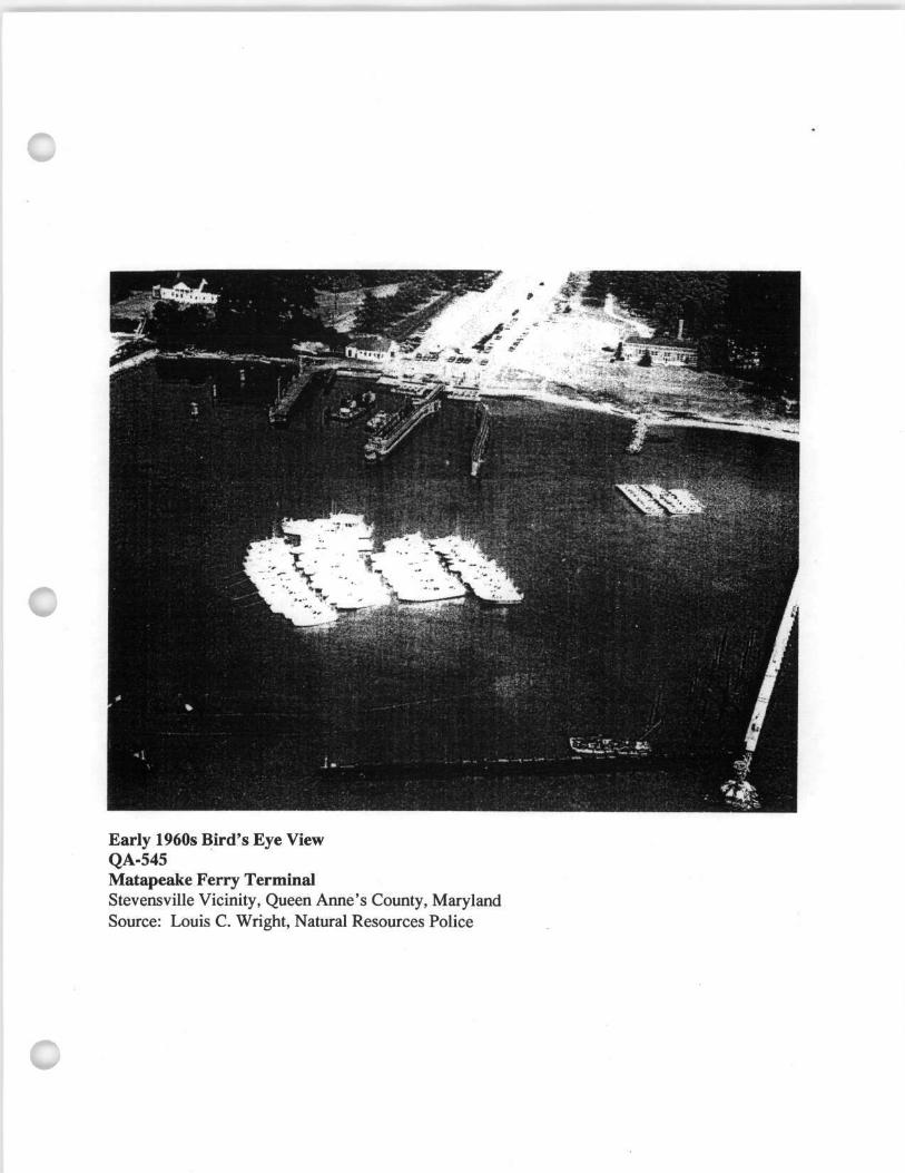
Early 1960s Bird's Eye View QA-545 Matapeake Ferry Terminal Stevensville Vicinity, Queen Anne's County, Maryland Source: Louis C. Wright, Natural Resources Police
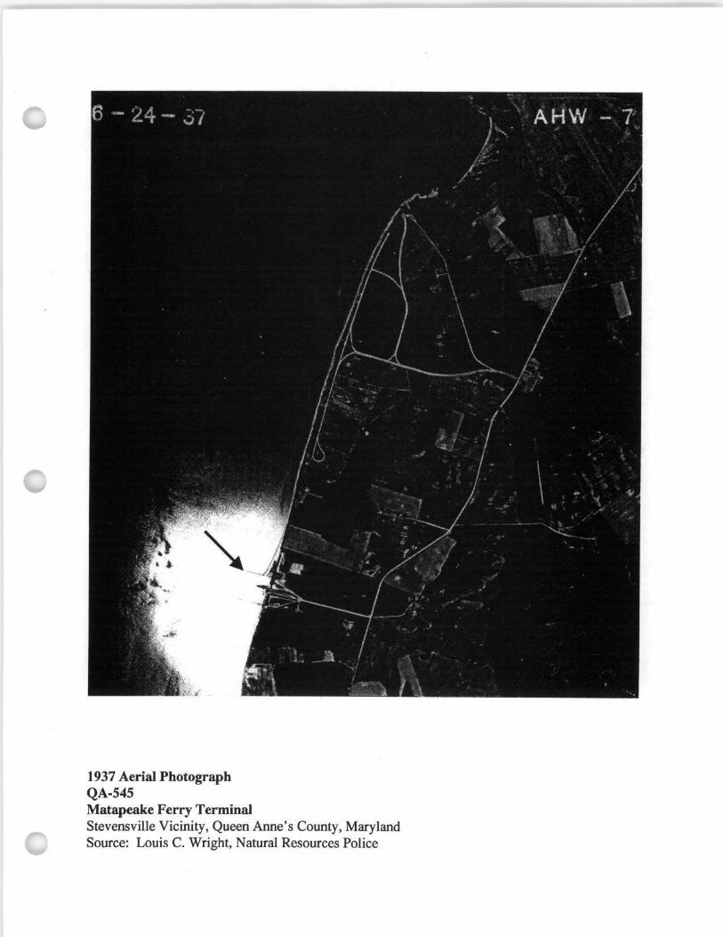
1937 Aerial Photograph QA-545 Matapeake Ferry Terminal Stevensville Vicinity, Queen Anne's County, Maryland Source: Louis C. Wright, Natural Resources Police
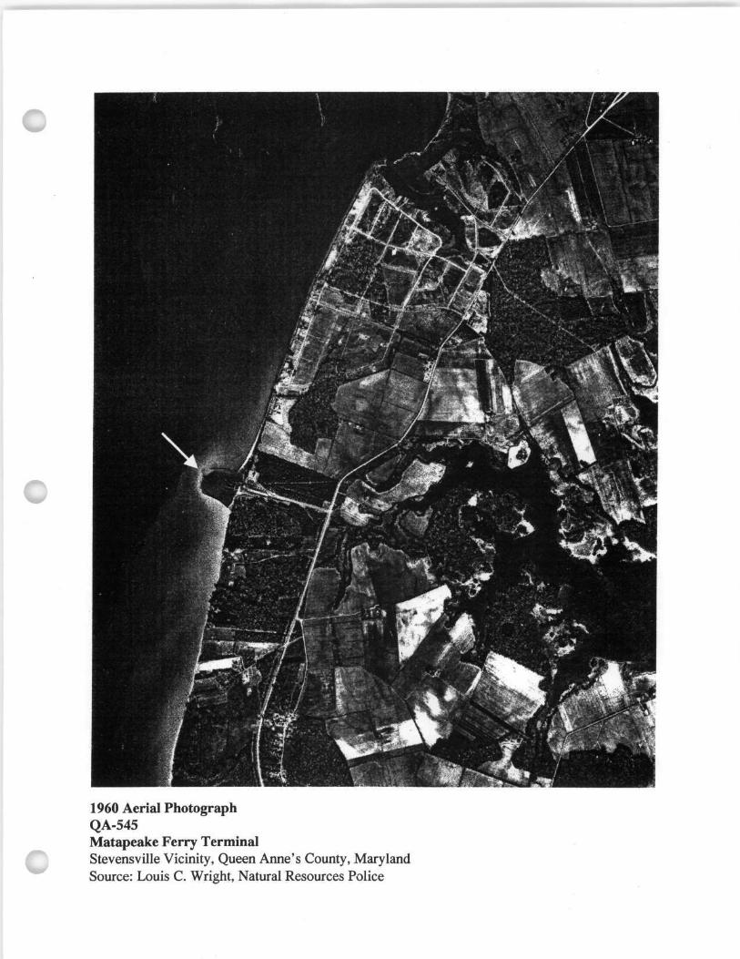
1960 Aerial Photograph QA-545 Matapeake Ferry Terminal Stevensville Vicinity, Queen Anne's County, Maryland Source: Louis C. Wright, Natural Resources Police
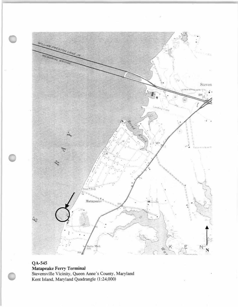
QA-545 Matapeake Ferry Terminal Stevensville Vicinity, Queen Anne's County, Maryland Kent Island, Maryland Quadrangle (1:24,000)