radio communication at towered and non-towered … communication at towered and non-towered...
TRANSCRIPT
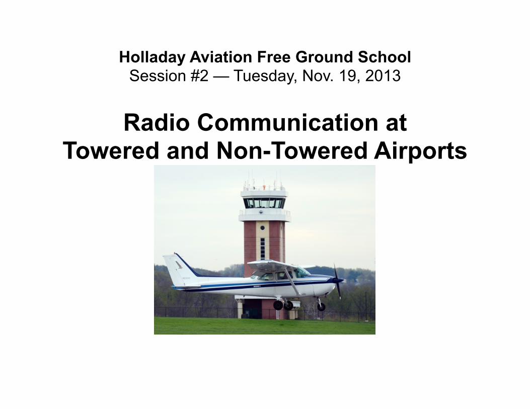
Holladay Aviation Free Ground SchoolSession #2 — Tuesday, Nov. 19, 2013
Radio Communication atTowered and Non-Towered Airports

Agenda
1.Communicating at Towered and Non-Towered Airports
2.Keys To Effective Communication
3.Examples Of Effective and Not-So-Effective Communication
4.Questions?
5.Role-Playing Exercises
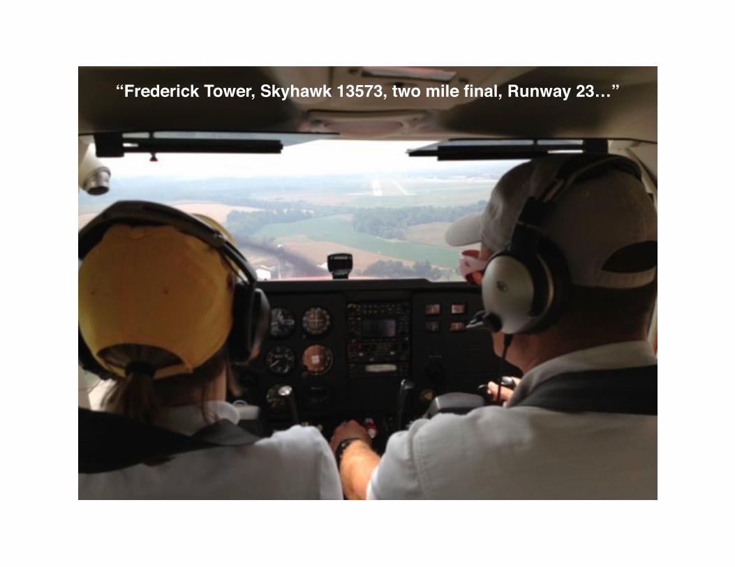
“Frederick Tower, Skyhawk 13573, two mile final, Runway 23…”

Towered Airports
Class D Airspace (Craig) — • Establish & Maintain Two-Way Communication • Clearance to Taxi, Takeoff and Land• No Transponder Required (unless you are within 30
miles of Class B)
Class C Airspace (Jacksonville International) — • Establish and Maintain Two-Way Communication • Clearance to Taxi, Takeoff and Land• Mode C Transponder Required (Unless otherwise
authorized; ex. antique airplane that was not certified with a transponder)
Class B Airspace (Orlando International) — • Establish and Maintain Two-Way Communication • Clearance to Enter Class B Airspace• Clearance to Taxi, Takeoff and Land• Mode C Transponder Required
Automatic Terminal Information Service (ATIS)
Before you begin to taxi at a towered airport, or before you contact the tower when approaching the airport, you need to listen to the ATIS frequency to obtain the following information:
• Identification of the ATIS report (“information Charlie”)• Latest weather conditions (wind, ceiling, visibility,
precipitation, temperature, dew point)• Active runway in use• Any Notices to Airmen (NOTAMs)
* Listen to Craig ATIS on scanner
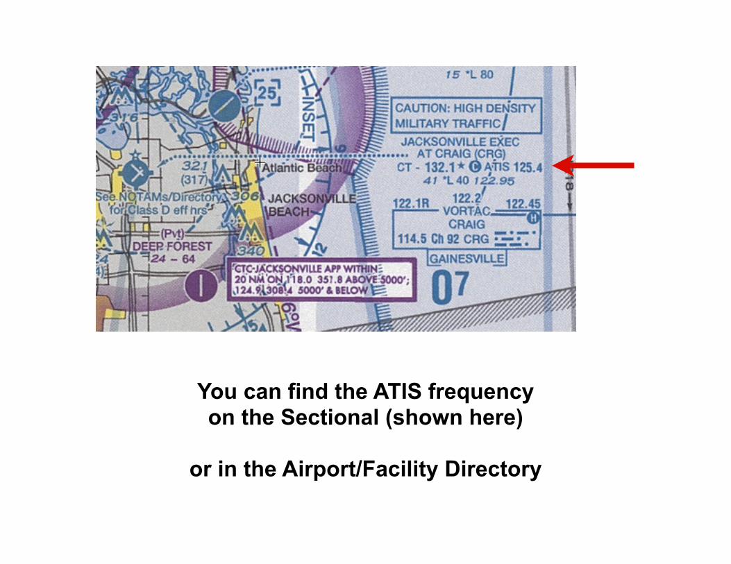
You can find the ATIS frequencyon the Sectional (shown here)
or in the Airport/Facility Directory

Ground Control
After listening to the ATIS, contact Ground to obtain your clearance to taxi.
Remember the format: WHO, WHERE, WHAT
WHO — “Craig Ground, Warrior 141WA,” WHERE — “Craig Air Center,” WHAT — “Ready for taxi, VFR southeast, Lima.”
VFR = visual flight rules (as opposed to IFR or instrument flight rules)southeast = your direction of flight after departureLima = designation of the current ATIS
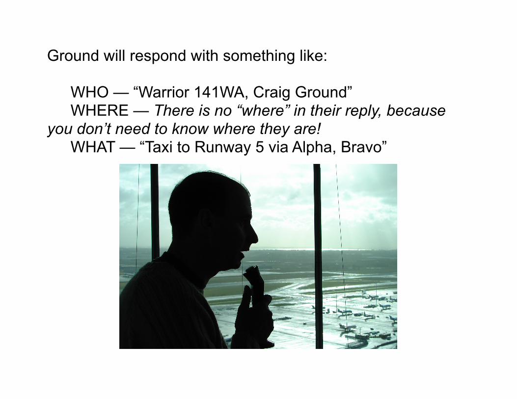
Ground will respond with something like:
WHO — “Warrior 141WA, Craig Ground” WHERE — There is no “where” in their reply, because you don’t need to know where they are! WHAT — “Taxi to Runway 5 via Alpha, Bravo”
Taxi Clearances
It’s a good idea to have a copy of the Airport Diagram handy to help you understand and follow your taxi clearance. It’s also where you’ll find the frequency for Ground Control.
In 2010, the FAA issued a policy change mandating that aircraft receive explicit clearance to cross a runway when taxiing to another runway:
“...an explicit runway crossing clearance [must] be issued for each runway (active/inactive or closed) crossing and requires an aircraft/vehicle to have crossed the previous runway before another runway crossing clearance may be issued.”
Taxi ClearancesExample: You are at Daytona Beach Airport, at the General Aviation Parking on the south side of the airport, holding short of Taxiway Papa.
Runway 16 is in use. You call Ground and receive the following taxi clearance:
“Warrior 141WA, Daytona Ground. Taxi to Runway 16 via Papa, Whiskey, hold short of Runway 25R.”
CAUTION: BE ALERT TO RUNWAY
READBACK OF ALL RUNWAY HOLDINGCROSSING CLEARANCES.
INSTRUCTIONS IS REQUIRED.
VA
R 6.0
W
(DAB)DAYTONA BEACH INTLDAYTONA BEACH, FLORIDA
81 03’W
AIRPORT DIAGRAM
29 10’N
81 04’W
7L
AIRPORT DIAGRAM
29 12’N
29 11’N
28ELEV
071.2
N3
N
N
N
N1
N2
P2
P3
P
10500
X 150
28ELEV
N4
AL-110 (FAA)
CUSTOMS/INS/USDA
TERMINAL
P4 P
7R
N5
N
P5
N6
STATIONFIRE
N7
071.1
32ELEV
34
3195 X 100Rwy 7R-25L
S
W
E
W1E1T
S1T1
W4
NW
16
W
S
W
E
25L
343.2
N8
N9
N
N E
EE
W3
E4
E3
25R
251.2
163.2
6001 X 1
50
DAYTONA BEACH, FLORIDA
S
P8
P
AERO-UNIVEMBRY-RIDDLE
PARKINGAIRCRAFT
ERAUPRIVATE
HANGARS
31ELEV
A
FIELDELEV34
251.1
RAMPCARRIER
AIR
W2
LAHSO
HANGARNASCAR
W5
D
S-75, D-170, 2S-175, 2D-260, 2D/2D2-270 RWY 16-34 S-30RWY 07R-25L S-130, D-210, 2S-175, 2D-420, 2D/2D2-870RWY 07L-25R
0.1 WANNUAL RATE OF CHANGE
JANUARY 2010
149TWR
119.3CLNC DEL
121.9 348.6GND CON
120.7 257.8DAYTONA TOWER
120.05ATIS
HS 1
DAYTONA BEACH INTL(DAB)
230
P
X 150200
BLAST PAD
X 150200
BLAST PAD
T2
M1
M2
M3
M4
R3
R2
R1
A2 A1
PARKINGAVIATIONGENERAL
PARKINGAVIATIONGENERAL
X 150200
BLAST PAD
400 X 200BLAST PAD FBO
PARKINGAVIATIONGENERAL
X E2
Y
B1
B2
HANGAR
FBO
FBO
13234
13234
32ELEV
33ELEVSE-3, 14 N
OV 2013 to 12 D
EC 2013
SE-3
, 14
NO
V 20
13 to
12
DEC
201
3
Tower
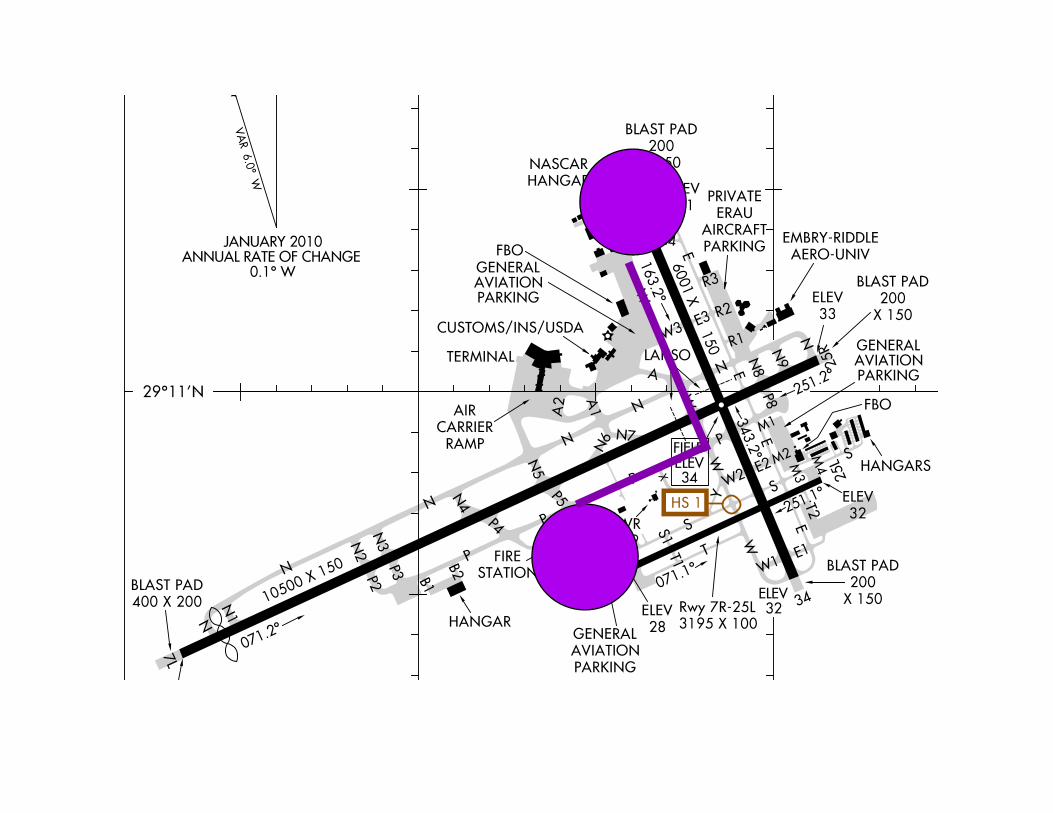
After you’ve taxied to the runway, it’s time to contact Tower.
Example:
WHO — “Craig Tower, Warrior 141WA,”WHERE — “Holding short Runway 5 on Bravo,”WHAT — “Ready for takeoff.”
It’s a good idea to tell the tower exactly where you are, which in this case is on taxiway Bravo. Two aircraft may be cleared for takeoff from different points along the runway.

Example:
One aircraft is holding short of Runway 5 at B, while a second aircraft is holding short of Runway 5 at B2.
JACKSONVILLE, FLORIDAAIRPORT DIAGRAM13066
AIRPORT DIAGRAM13066
(CRG)
81 31.0’W 81 30.5’W
CAUTION: BE ALERT TO RUNWAY CROSSING CLEARANCES.READBACK OF ALL RUNWAY HOLDING INSTRUCTIONS IS REQUIRED.
5B
40ELEV
D
050.9
B B2
4004 X 100
D
S-30RWY 14-32 S-30RWY 05-23
B3
FBO
G
AL-208 (FAA)
A4
A2
A
140.9
A3
A1
FBO
32ELEV14
122TWR
B1
G2
A3
A3
B
B5B4
F
230.9
32
B
B
C
E
320.9 23
40ELEV
A
FIELDELEV41
JACKSONVILLE, FLORIDA(CRG)
0.1 W
4008 X 100
LAHSO
LAHSO
JANUARY 2010
ANNUAL RATE OF CHANGE
A5
30 20.5’N
30 20.0’NV
AR 5.9
W
198
118.35CLNC DEL121.8GND CON132.1 257.625CRAIG TOWER125.4ATIS
JACKSONVILLE EXECUTIVE AT CRAIG
JACKSONVILLE EXECUTIVE AT CRAIG
SE-3, 14 NO
V 2013 to 12 DEC
2013
SE-3
, 14
NO
V 20
13 to
12
DEC
201
3
Tower
If you’re approaching the airport to land, it’s recommended that you contact the tower 10 miles out.
You must establish and maintain two-way communication with the tower before entering the Class D airspace (dashed blue line on the chart). That means using your full tail number on the initial call:
WHO — “Craig Tower, Warrior 141WA,”WHERE — “10 southeast,”WHAT — “Landing, Delta.”
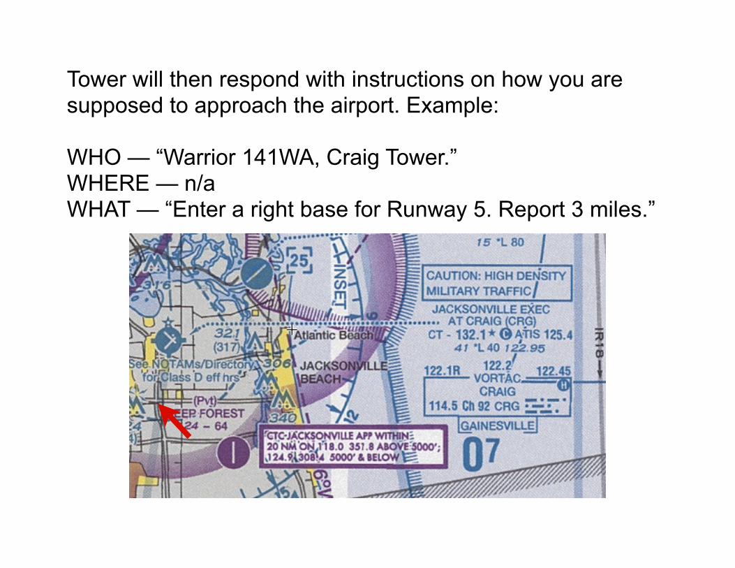
Tower will then respond with instructions on how you are supposed to approach the airport. Example:
WHO — “Warrior 141WA, Craig Tower.”WHERE — n/aWHAT — “Enter a right base for Runway 5. Report 3 miles.”
Landing Clearances
At a towered airport, you must receive a clearance to land before touching down on the runway. Always read back your landing clearance verbatim.
Tower: “Warrior 141WA, cleared to land Runway 5.”You: “Cleared to land Runway 5, Warrior 141WA.”
Note that in this case, we put the WHO at the end of the transmission.
It is possible for multiple runways to be in use at the same time. Reading back your landing clearance helps avoid misunderstandings and prevents one aircraft from accepting another aircraft’s landing clearance!
This is especially important when there are two aircraft with similar call signs on the frequency at the same time:
Example:
Warrior 141WASkyhawk 341WA
Approach Control
You may need to contact Approach Control:• When requesting VFR advisories (“flight following”)• When entering Class C or B airspace, or a TRSA• When flying under Instrument Flight Rules (IFR)
Approach Control is an air traffic control facility that handles inbound and outbound traffic to one or more airports.
Example: Jacksonville Approach (aka Jax Approach)
Radio communication follows a similar protocol as with Tower or Ground: WHO, WHERE, WHAT
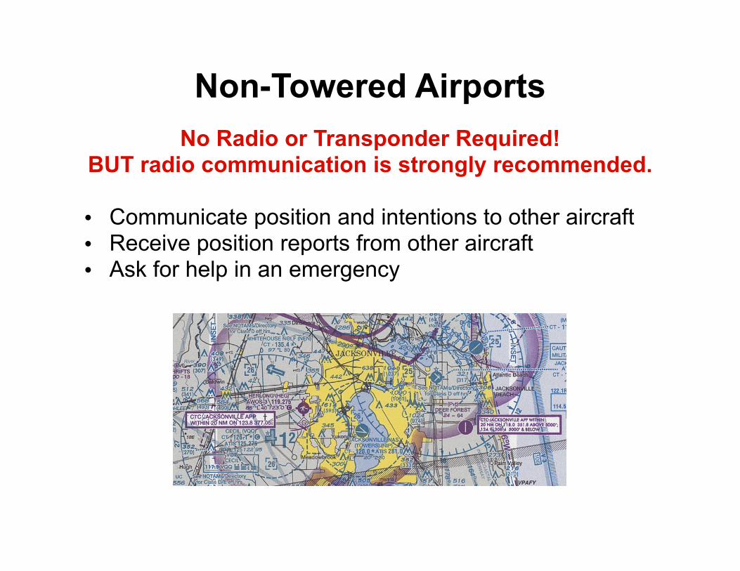
Non-Towered AirportsNo Radio or Transponder Required!
BUT radio communication is strongly recommended.
• Communicate position and intentions to other aircraft• Receive position reports from other aircraft• Ask for help in an emergency
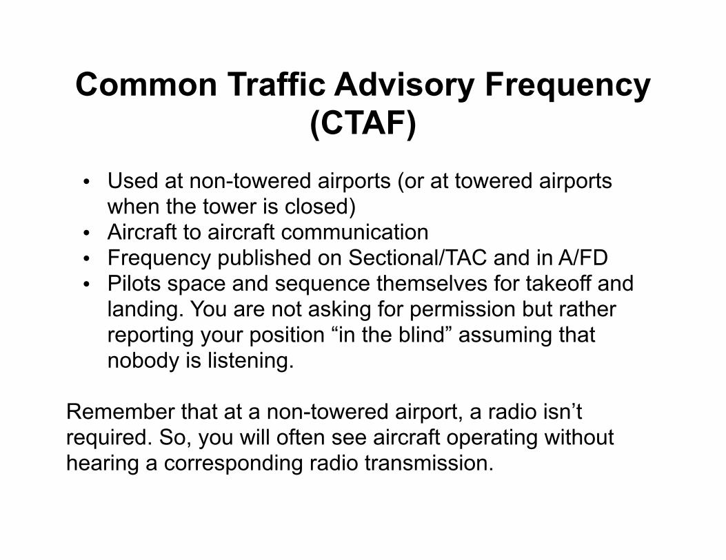
Common Traffic Advisory Frequency (CTAF)
• Used at non-towered airports (or at towered airports when the tower is closed)
• Aircraft to aircraft communication• Frequency published on Sectional/TAC and in A/FD• Pilots space and sequence themselves for takeoff and
landing. You are not asking for permission but rather reporting your position “in the blind” assuming that nobody is listening.
Remember that at a non-towered airport, a radio isn’t required. So, you will often see aircraft operating without hearing a corresponding radio transmission.
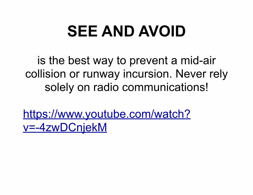
SEE AND AVOID
is the best way to prevent a mid-air collision or runway incursion. Never rely
solely on radio communications!
https://www.youtube.com/watch?v=-4zwDCnjekM
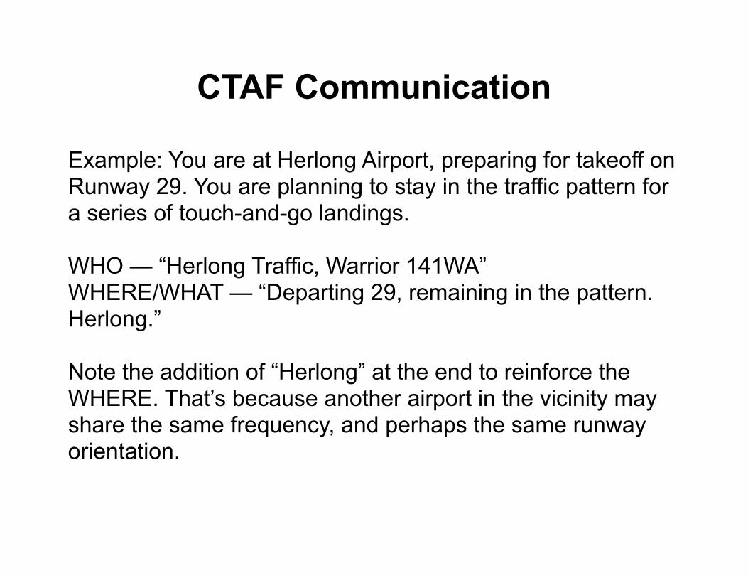
CTAF Communication
Example: You are at Herlong Airport, preparing for takeoff on Runway 29. You are planning to stay in the traffic pattern for a series of touch-and-go landings.
WHO — “Herlong Traffic, Warrior 141WA”WHERE/WHAT — “Departing 29, remaining in the pattern. Herlong.”
Note the addition of “Herlong” at the end to reinforce the WHERE. That’s because another airport in the vicinity may share the same frequency, and perhaps the same runway orientation.
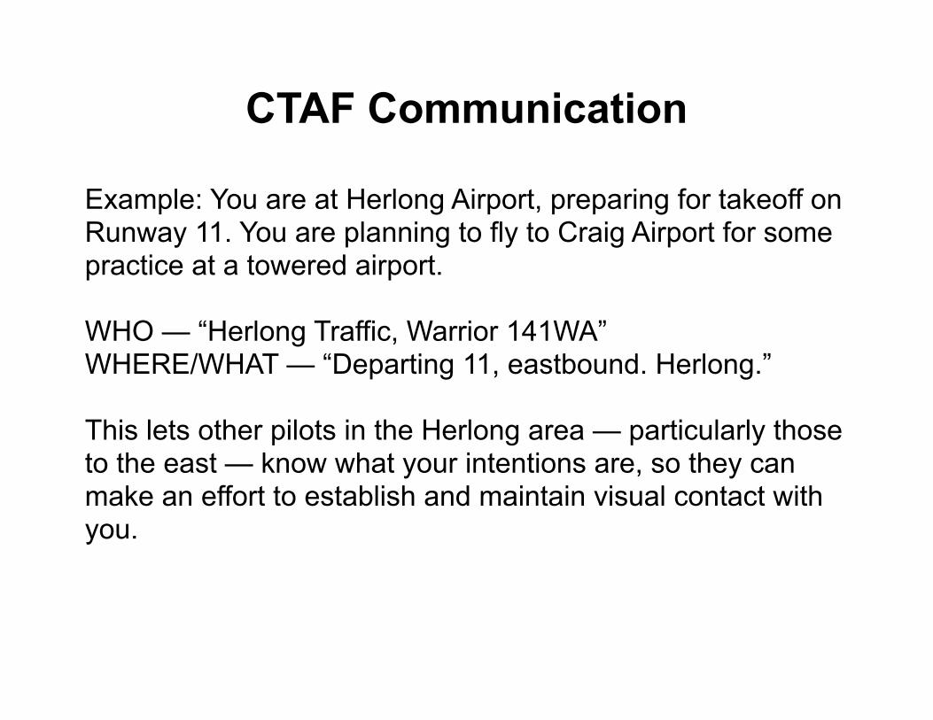
CTAF Communication
Example: You are at Herlong Airport, preparing for takeoff on Runway 11. You are planning to fly to Craig Airport for some practice at a towered airport.
WHO — “Herlong Traffic, Warrior 141WA”WHERE/WHAT — “Departing 11, eastbound. Herlong.”
This lets other pilots in the Herlong area — particularly those to the east — know what your intentions are, so they can make an effort to establish and maintain visual contact with you.
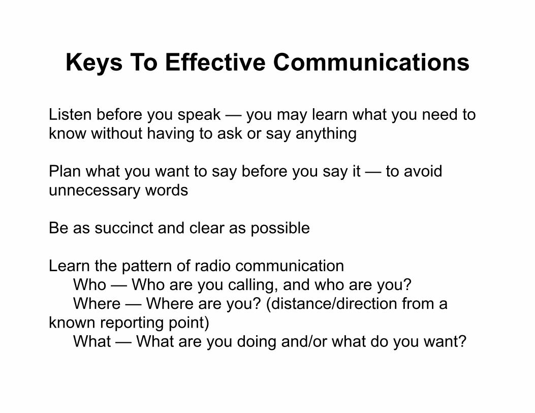
Keys To Effective Communications
Listen before you speak — you may learn what you need to know without having to ask or say anything
Plan what you want to say before you say it — to avoid unnecessary words
Be as succinct and clear as possible
Learn the pattern of radio communication Who — Who are you calling, and who are you? Where — Where are you? (distance/direction from a known reporting point) What — What are you doing and/or what do you want?
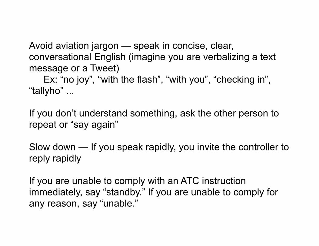
Avoid aviation jargon — speak in concise, clear, conversational English (imagine you are verbalizing a text message or a Tweet) Ex: “no joy”, “with the flash”, “with you”, “checking in”, “tallyho” ...
If you don’t understand something, ask the other person to repeat or “say again”
Slow down — If you speak rapidly, you invite the controller to reply rapidly
If you are unable to comply with an ATC instruction immediately, say “standby.” If you are unable to comply for any reason, say “unable.”
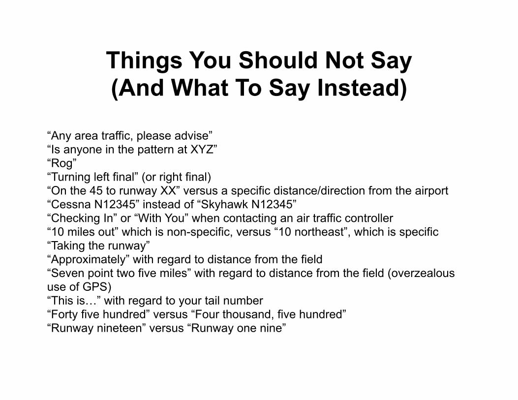
Things You Should Not Say(And What To Say Instead)
“Any area traffic, please advise”“Is anyone in the pattern at XYZ”“Rog” “Turning left final” (or right final)“On the 45 to runway XX” versus a specific distance/direction from the airport“Cessna N12345” instead of “Skyhawk N12345”“Checking In” or “With You” when contacting an air traffic controller“10 miles out” which is non-specific, versus “10 northeast”, which is specific“Taking the runway”“Approximately” with regard to distance from the field“Seven point two five miles” with regard to distance from the field (overzealous use of GPS)“This is…” with regard to your tail number“Forty five hundred” versus “Four thousand, five hundred”“Runway nineteen” versus “Runway one nine”
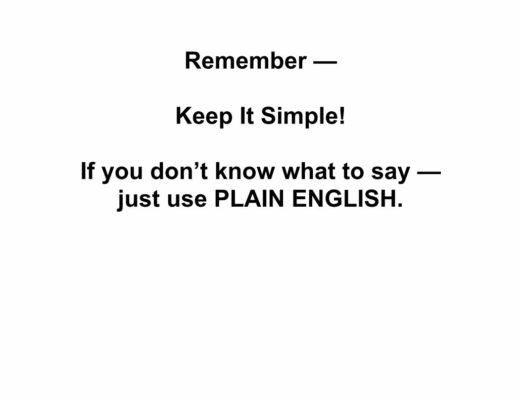
Remember —
Keep It Simple!
If you don’t know what to say — just use PLAIN ENGLISH.

Example #1National Air Traffic Controllers Association (NATCA)
Archie League Awards 2013
On March 1, 2012 air traffic controller Bill Sullivan was directing a Piper Malibu from Tampa Executive Airport to Tampa International Airport. But shortly after takeoff, the pilot declared an emergency due to flight control problems.
Realizing his best plan of action would be redirecting the pilot back to Tampa Executive, Sullivan began giving him the necessary coordinates to return to the airport. The pilot was in clear distress. His breathing became rapid and he was unable to communicate his situation with Sullivan as he attempted to steer the aircraft in response to the turns being issued. Sullivan continued directing the pilot until he finally saw the airport.
http://natca.org/ULWSiteResources/natcaweb/Resources/media/ArchieLeague2013Audio/AUDIOSouthernRegionTPA.mp3
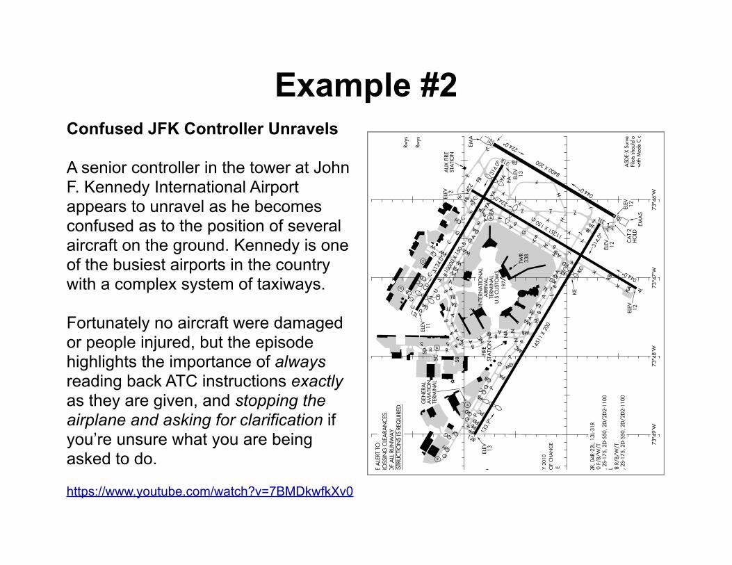
Example #2Confused JFK Controller Unravels
A senior controller in the tower at John F. Kennedy International Airport appears to unravel as he becomes confused as to the position of several aircraft on the ground. Kennedy is one of the busiest airports in the country with a complex system of taxiways.
Fortunately no aircraft were damaged or people injured, but the episode highlights the importance of always reading back ATC instructions exactly as they are given, and stopping the airplane and asking for clarification if you’re unsure what you are being asked to do.
https://www.youtube.com/watch?v=7BMDkwfkXv0
HO
LDIN
G IN
STR
UC
TIO
NS IS R
EQ
UIR
ED.
REA
DB
AC
K O
F A
LL R
UN
WA
YR
UN
WA
Y C
RO
SSIN
G C
LEA
RA
NC
ES.
CA
UTI
ON:
BE A
LERT
TO
H
H
H
H
H
H
AIRPORT DIAGRAM NEW YORK, NEW YORK
TER
MIN
AL
AVIA
TIO
N
GEN
ER
AL
QH
QG QF
13R
PD
PC
PB
P
Q
Q
AB
G
Y
G
H
8400 X
200
224.0
SB
133.9
Q
C
CA
13L
UA
V V
VAW
WA
1000
0 X 15
0
B
RS
SC
SD
S
134.0
R
A
B
U
U
VV
PA
P
P
P
MC
N MB
MA
NA
NB
NC
A
A
A
B
B
LA
L
L
KA
AB
B
H
1135
1 X 15
0
Y
Y
H Z
K
K
KB
4L
044.0
314.0
31L
4R
044.0
1451
1 X 20
0
KE
Q
J
Z
Z
TB
TA
A
T
B A
S
TT
R
B
Z Z
Y
FA F
22L
31R
224.0
314.0
F
ZA
C
C
D
W
CD
CC
CB
DA
B
E
D
B
A
CE
AE
FB22R
ZAE
ECCH
FB C
KA
KC
KE
P
PF
MD
J
JAJB
QB
PE
M
YA
YA
AB
338
TWR
13
ELE
V
HO
LDC
AT 2
12
ELE
V
EM
AS
EM
AS 1
2ELE
V
E
STA
TIO
NA
UX FIR
E12
ELE
V
CB
11
ELE
V
STA
TIO
NFI
RE
QD
EA
197
12
ELE
V
13
ELE
V
FB
AIRPORT DIAGRAM AL-610 (FAA) NEW YORK, NEW YORK
with M
ode
C o
n all tw
ys a
nd r
wys.
Pilots should o
perate tra
nsp
onders
AS
DE-X S
urveillance S
yste
m in use.
W
73 4
9’W
73 4
8’W
73 4
5’W
40 3
8’N
73 4
6’W
40 3
9’N VAR 13
.2 W
73 4
7’W
135.0
5 348.6
CLN
C D
EL
121.9 348.6
GN
D C
ON
123.9 281.5
5R
wys 0
4L-22
R a
nd 1
3R-3
1L
119.1 2
81.5
5R
wys 0
4R-2
2L and 1
3L-31
RKEN
NED
Y T
OW
ER
ARR S
W 1
15.4
ARR N
E 1
17.7
128.7
25
ATI
S D
U.S C
USTO
MS
TER
MIN
AL
ARRIV
AL
INTE
RN
ATI
ON
ALV
LL
QC
AB
Y
J
N
M
YA
KG
JAN
UA
RY 2
010
AN
NU
AL
RA
TE O
F C
HA
NG
E
0.0
E
FIELD
ELE
V14
12
ELE
V
CD
KF
KD
X X
SA
D-2
10
HELIPA
D H
1
D-2
10, 2S-1
75, 2
D-5
50, 2
D/2
D2-1
100
PC
N 9
8 R/B/
W/T
RW
Y 1
3R-3
1L
D-2
10, 2S-1
75, 2
D-5
50, 2
D/2
D2-1
100
PC
N 9
0 F/B/
W/T
RW
YS 0
4L-22
R, 04
R-2
2L, 1
3L-31
R
HB
13290
13290
JOHN F. KENNEDY INTL
JOHN F. KENNEDY INTL(JFK)
(JFK)
NE-2, 14 N
OV 2013 to 12 D
EC 2013
NE-
2, 1
4 N
OV
2013
to 1
2 D
EC 2
013
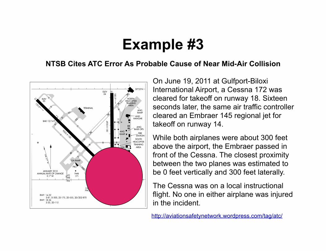
Example #3NTSB Cites ATC Error As Probable Cause of Near Mid-Air Collision
On June 19, 2011 at Gulfport-Biloxi International Airport, a Cessna 172 was cleared for takeoff on runway 18. Sixteen seconds later, the same air traffic controller cleared an Embraer 145 regional jet for takeoff on runway 14.
While both airplanes were about 300 feet above the airport, the Embraer passed in front of the Cessna. The closest proximity between the two planes was estimated to be 0 feet vertically and 300 feet laterally.
The Cessna was on a local instructional flight. No one in either airplane was injured in the incident.
http://aviationsafetynetwork.wordpress.com/tag/atc/
X
X
X
X
CAUTION: BE ALERT TO RUNWAY CROSSING CLEARANCES.
READBACK OF ALL RUNWAY HOLDING INSTRUCTIONS IS REQUIRED.
H
AIRPORT DIAGRAM GULFPORT, MISSISSIPPI
(GPT)
135.6
14
GULFPORT-BILOXI INTL
AIRPORT DIAGRAM
ELEV
C
315.6
32
36
26
ELEV22
E
D
9002 X 150
A
B
ELEV
000.5
C
B
TERMINAL
4935 X 1
50
18
ELEV24
180.5
A
B
A
A
FIRESTATION
HANGAR ANG
BASE OPS ANG
AL-576 (FAA)
GULFPORT-BILOXI INTLGULFPORT, MISSISSIPPI
(GPT)
C
C
ANG RAMP
ANG RAMP
RAMPGA
ANG RAMP
ARMY 890th
H
HH
F
BAK-12/14
BAK-12/14 CARGOFACILITY
120.4 348.6
GND CON
123.7 339.8
GULFPORT TOWER
119.45
ATIS
AREATRAINING
HELICOPTERNORTH
AREA
TRAINING
HELICOPTER
SOUTH
GUARD
NATIONAL
ARMY
0.1 WANNUAL RATE OF CHANGE
JANUARY 2010
VA
R 0.7
W
J
J
D1
D2
FIELDELEV
J
D
FBO
F1
F2F3
F4
F20
89 05’W 89 04’W
30 24’N
30 25’N
S-20, 2D-115RWY 18-36 S-81, D-300, 2S-175, 2D-555, 2D/2D2-870RWY 14-32
13234
13234
GA RAMP
171TWR
29
20
G
SC-4, 14 N
OV 2013 to 12 D
EC 2013
SC-4
, 14
NO
V 20
13 to
12
DEC
201
3
Questions?
www.liveatc.net
Pilot/Controller Glossary
AIM 4-2, Radio Communications, Phraseology and Techniques