randy rhoads airborne geiger mode lidar - latest
TRANSCRIPT
HARRIS.COM | #HARRISCORP
Place image here
(10” x 3.5”)
RANDY RHOADS
AIRBORNE GEIGER MODE LIDAR - LATEST ADVANCEMENTS IN REMOTE SENSING APPLICATIONS
Geospatial Industry Manager
| 2 Airborne Geiger Mode LiDAR Technology to Connect, Inform and Protect TM
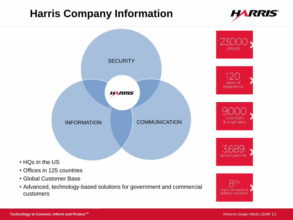
SECURITY
COMMUNICATION INFORMATION
• HQs in the US
• Offices in 125 countries
• Global Customer Base
• Advanced, technology-based solutions for government and commercial
customers
Harris Company Information
| 3 Airborne Geiger Mode LiDAR Technology to Connect, Inform and Protect TM
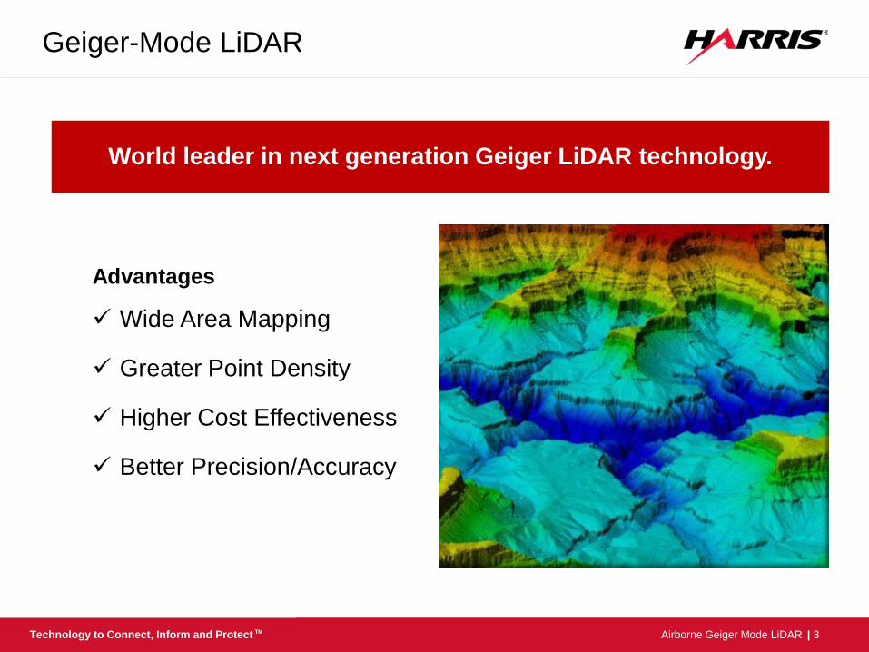
Geiger-Mode LiDAR
World leader in next generation Geiger LiDAR technology.
Advantages
Wide Area Mapping
Greater Point Density
Higher Cost Effectiveness
Better Precision/Accuracy
| 4 Airborne Geiger Mode LiDAR Technology to Connect, Inform and Protect TM
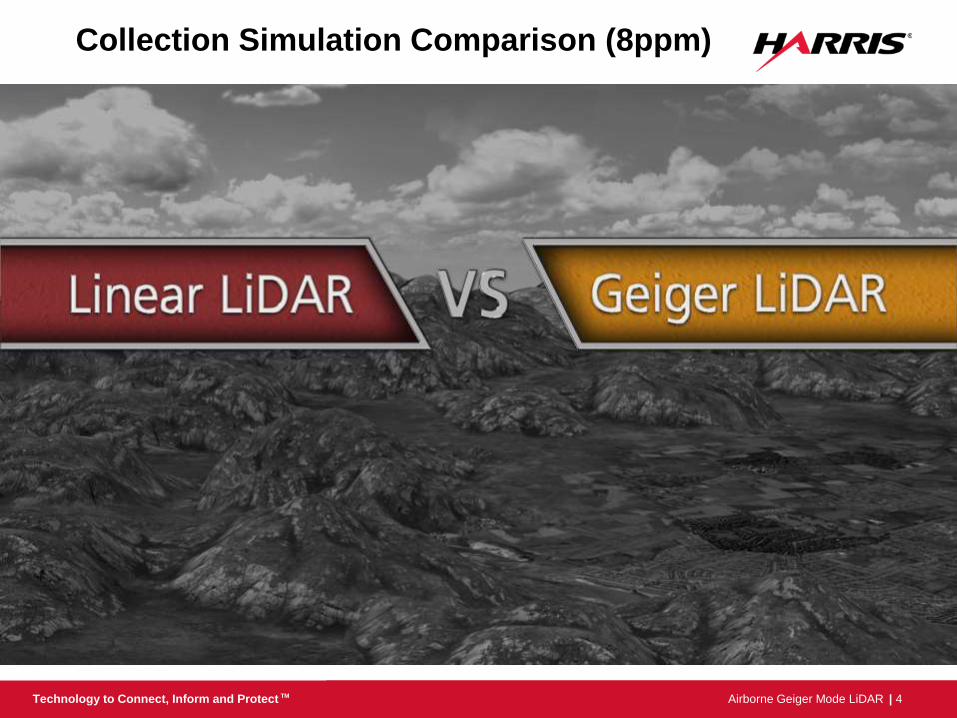
Collection Simulation Comparison (8ppm)
Higher–Faster–Greater Resolution
| 5 Airborne Geiger Mode LiDAR Technology to Connect, Inform and Protect TM
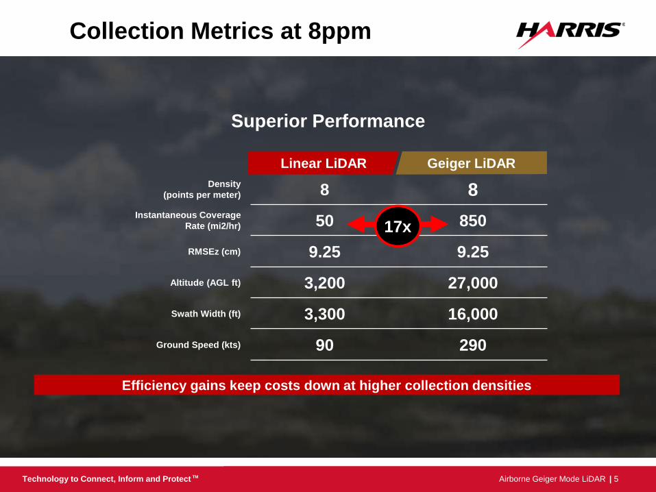
Collection Metrics at 8ppm
Efficiency gains keep costs down at higher collection densities
Superior Performance
Linear LiDAR Geiger LiDAR
Density
(points per meter) 8 8
Instantaneous Coverage
Rate (mi2/hr) 50 850
RMSEz (cm) 9.25 9.25
Altitude (AGL ft) 3,200 27,000
Swath Width (ft) 3,300 16,000
Ground Speed (kts) 90 290
17x

| 6 Airborne Geiger Mode LiDAR Technology to Connect, Inform and Protect TM
1 2 4 6 8 10 12 14 16 18 20 25 30 35 40 45 50 60 70 80 90 100
Higher Efficiencies at Higher Resolutions C
ollecti
on
Co
st
Collection Density (points per square meter)
Linear
Systems
Geiger-mode
Higher the resolution greater the payback
| 7 Airborne Geiger Mode LiDAR Technology to Connect, Inform and Protect TM
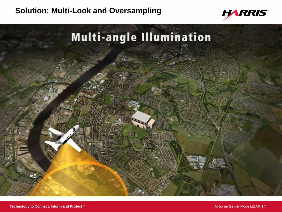
Solution: Multi-Look and Oversampling
| 8 Airborne Geiger Mode LiDAR Technology to Connect, Inform and Protect TM
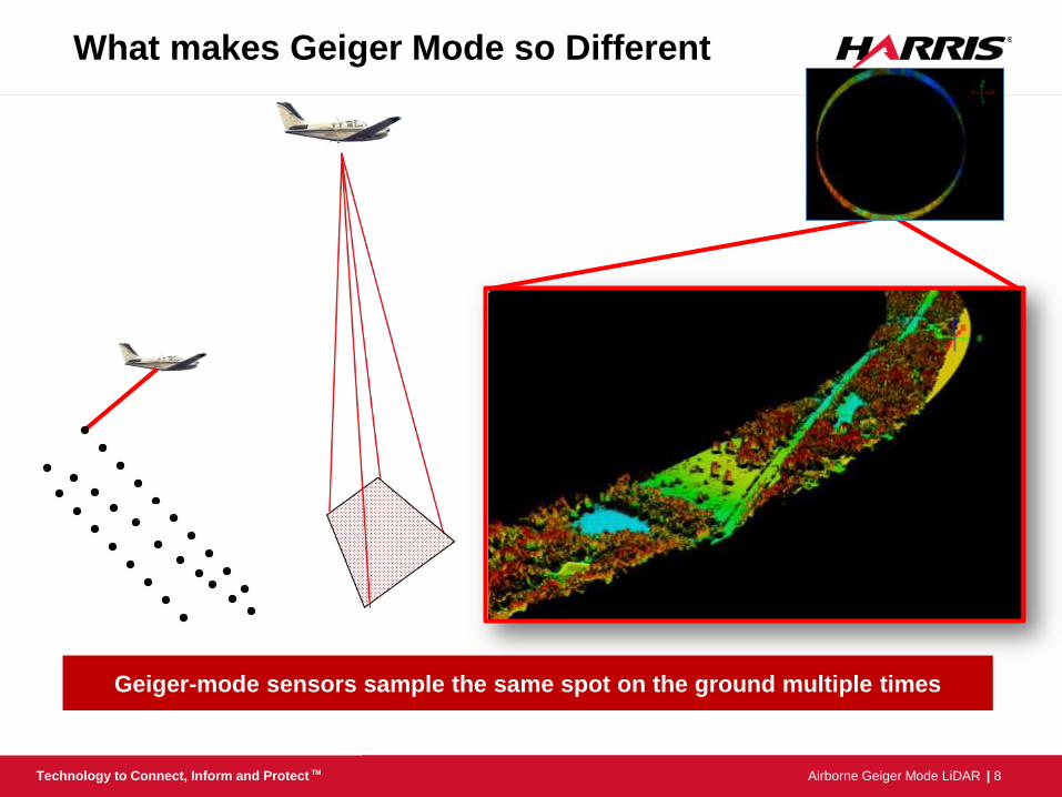
What makes Geiger Mode so Different
Geiger-mode sensors sample the same spot on the ground multiple times
| 9 Airborne Geiger Mode LiDAR Technology to Connect, Inform and Protect TM
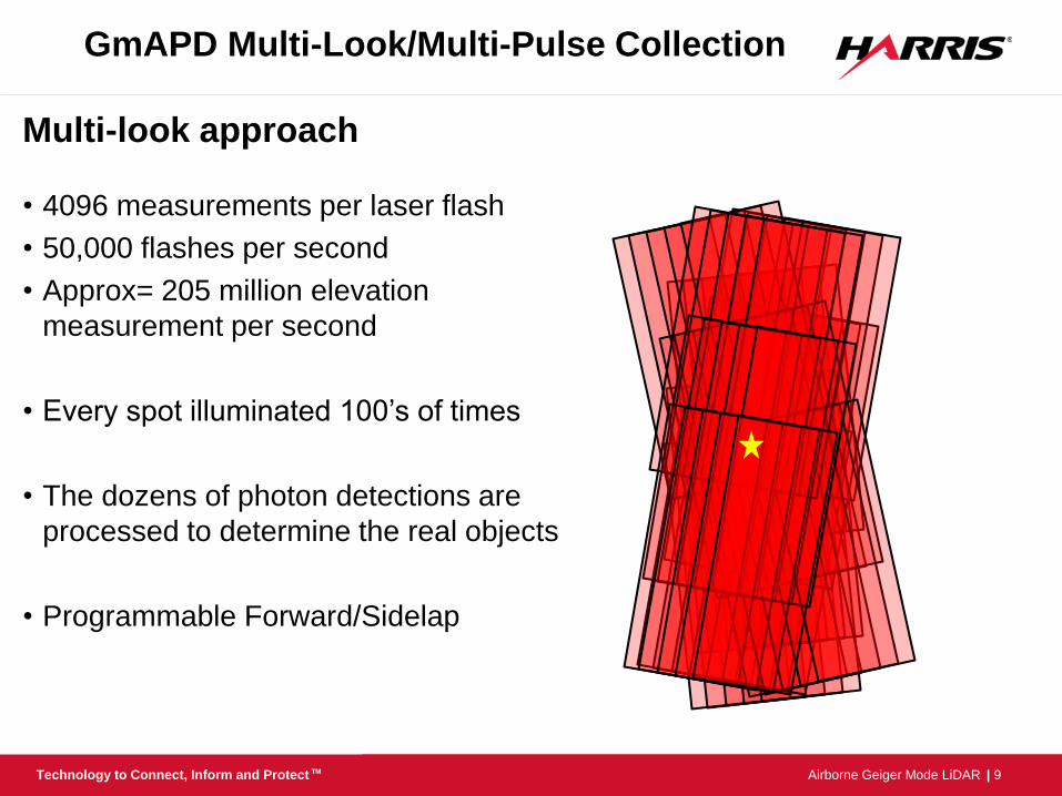
GmAPD Multi-Look/Multi-Pulse Collection
Multi-look approach
• 4096 measurements per laser flash
• 50,000 flashes per second
• Approx= 205 million elevation
measurement per second
• Every spot illuminated 100’s of times
• The dozens of photon detections are
processed to determine the real objects
• Programmable Forward/Sidelap
| 10 Airborne Geiger Mode LiDAR Technology to Connect, Inform and Protect TM
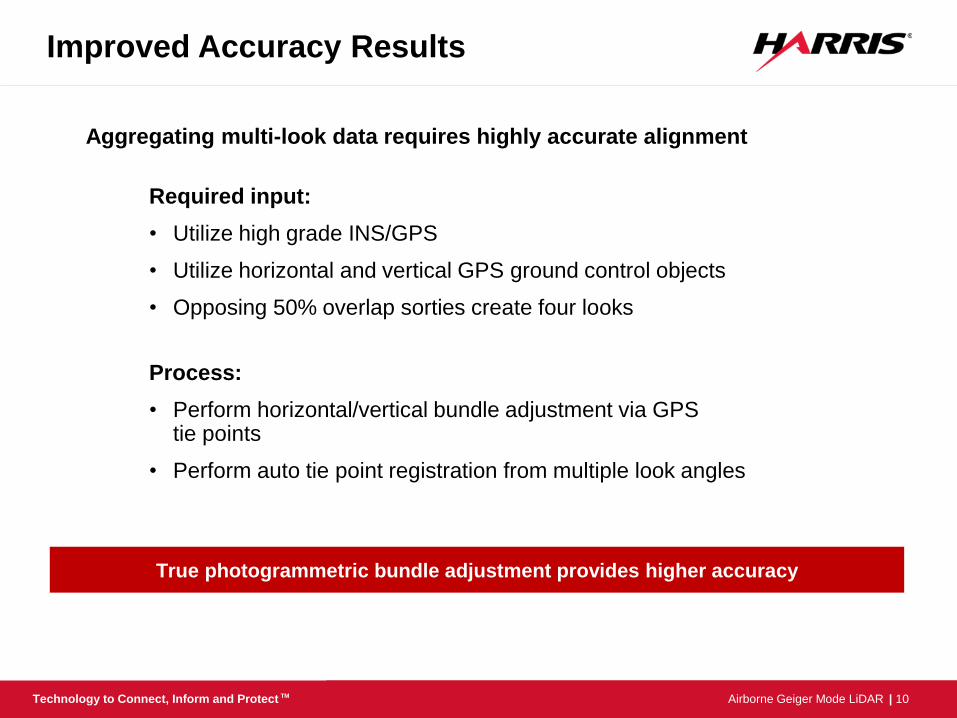
Improved Accuracy Results
Required input:
• Utilize high grade INS/GPS
• Utilize horizontal and vertical GPS ground control objects
• Opposing 50% overlap sorties create four looks
Process:
• Perform horizontal/vertical bundle adjustment via GPS tie points
• Perform auto tie point registration from multiple look angles
True photogrammetric bundle adjustment provides higher accuracy
Aggregating multi-look data requires highly accurate alignment
| 11 Airborne Geiger Mode LiDAR Technology to Connect, Inform and Protect TM
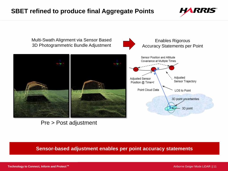
SBET refined to produce final Aggregate Points
Multi-Swath Alignment via Sensor Based
3D Photogrammetric Bundle Adjustment Enables Rigorous
Accuracy Statements per Point
Sensor-based adjustment enables per point accuracy statements
Pre > Post adjustment
| 12 Airborne Geiger Mode LiDAR Technology to Connect, Inform and Protect TM
• Dramatically improves speed of collection
• Higher density (resolution) at lower cost
• Improves foliage penetration (Better terrain information)
• Multi-look reduces shadows and voids (Higher quality)
• Robust bundle adjustment (Higher accuracy)
• Enterprise production (Improved Delivery/Schedule)
Benefits of Geiger-mode LiDAR
Large-area, high-density collection leads to new adopters and opportunities
| 13 Airborne Geiger Mode LiDAR Technology to Connect, Inform and Protect TM harris.com Actual Survey Elevations
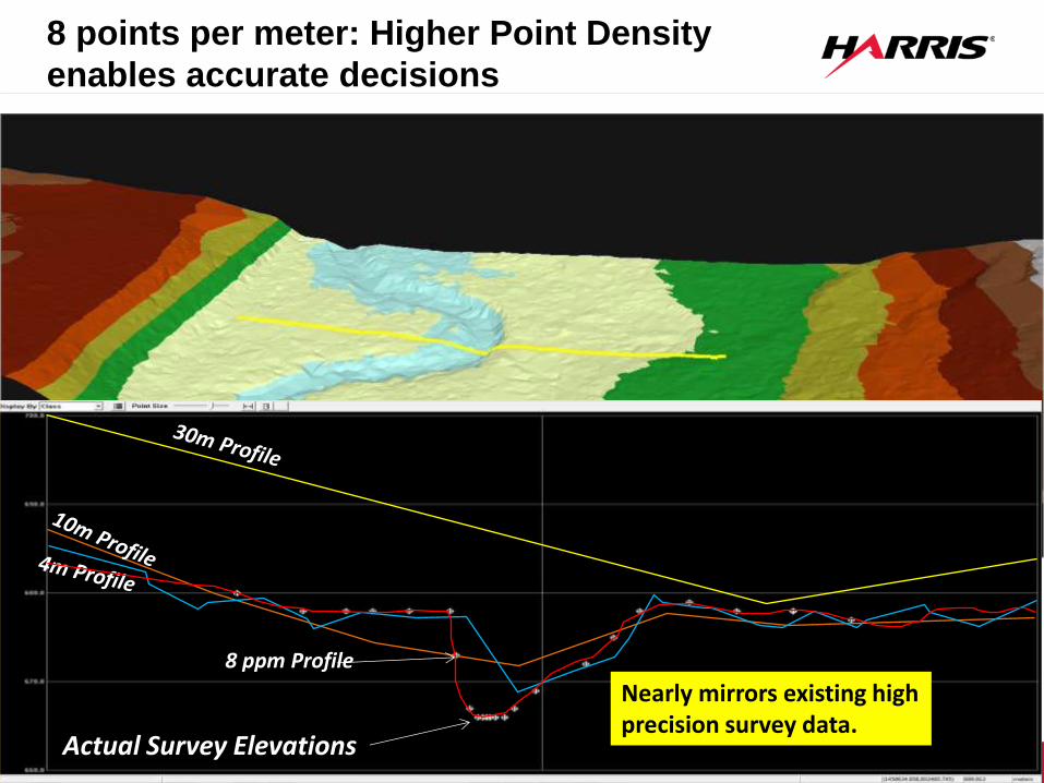
8 points per meter: Higher Point Density
enables accurate decisions
8 ppm Profile
Nearly mirrors existing high precision survey data.
| 14 Airborne Geiger Mode LiDAR Technology to Connect, Inform and Protect TM
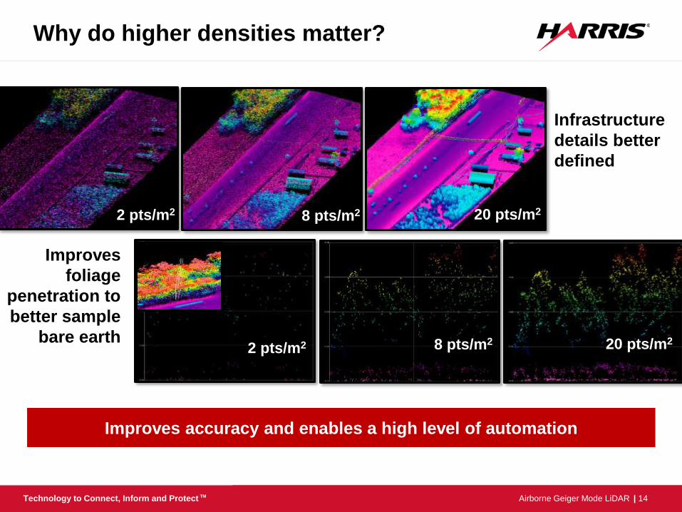
Why do higher densities matter?
Improves accuracy and enables a high level of automation
8 pts/m2
Infrastructure
details better
defined
20 pts/m2 8 pts/m2 2 pts/m2
2 pts/m2
Improves
foliage
penetration to
better sample
bare earth 20 pts/m2 8 pts/m2
| 15 Airborne Geiger Mode LiDAR Technology to Connect, Inform and Protect TM
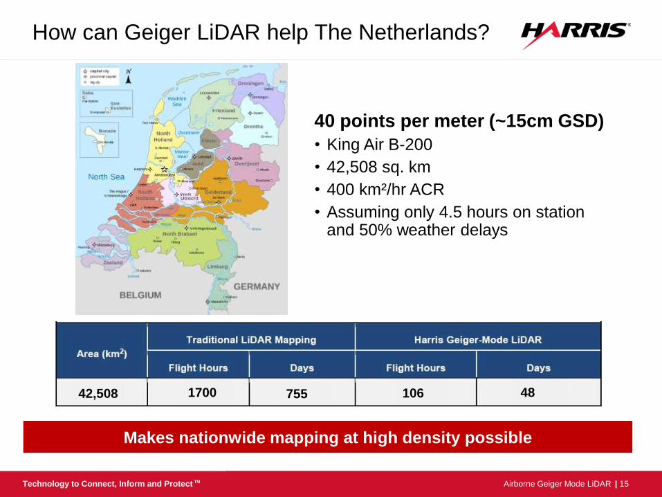
How can Geiger LiDAR help The Netherlands?
40 points per meter (~15cm GSD)
• King Air B-200
• 42,508 sq. km
• 400 km²/hr ACR
• Assuming only 4.5 hours on station and 50% weather delays
Makes nationwide mapping at high density possible
42,508 106 48 1700 755
| 16 Airborne Geiger Mode LiDAR Technology to Connect, Inform and Protect TM
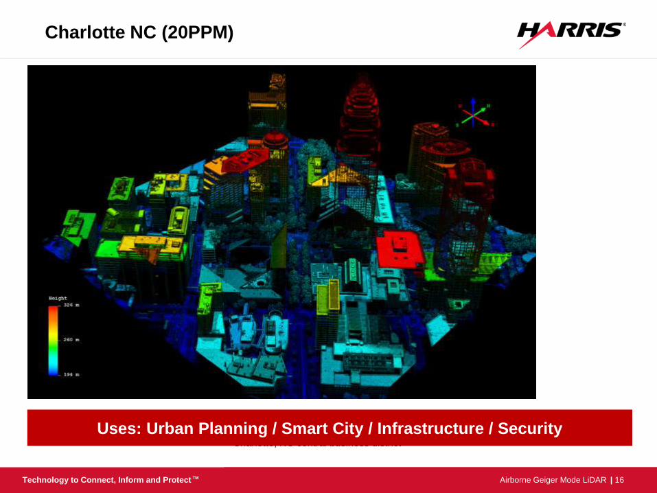
Charlotte, NC central business district
Charlotte NC (20PPM)
Uses: Urban Planning / Smart City / Infrastructure / Security
| 17 Airborne Geiger Mode LiDAR Technology to Connect, Inform and Protect TM
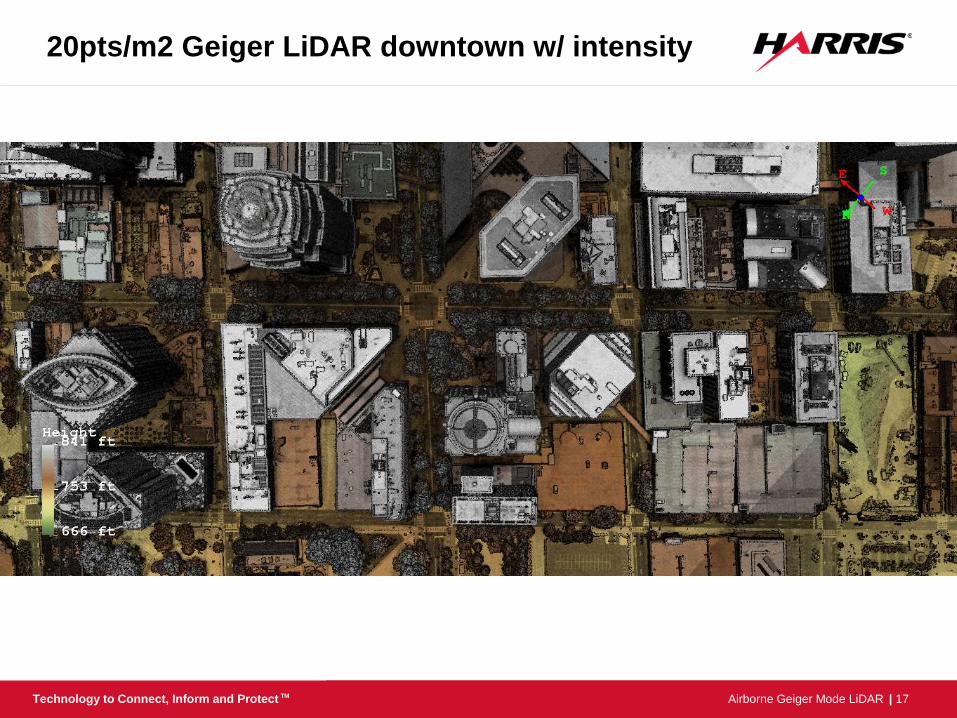
20pts/m2 Geiger LiDAR downtown w/ intensity
| 18 Airborne Geiger Mode LiDAR Technology to Connect, Inform and Protect TM
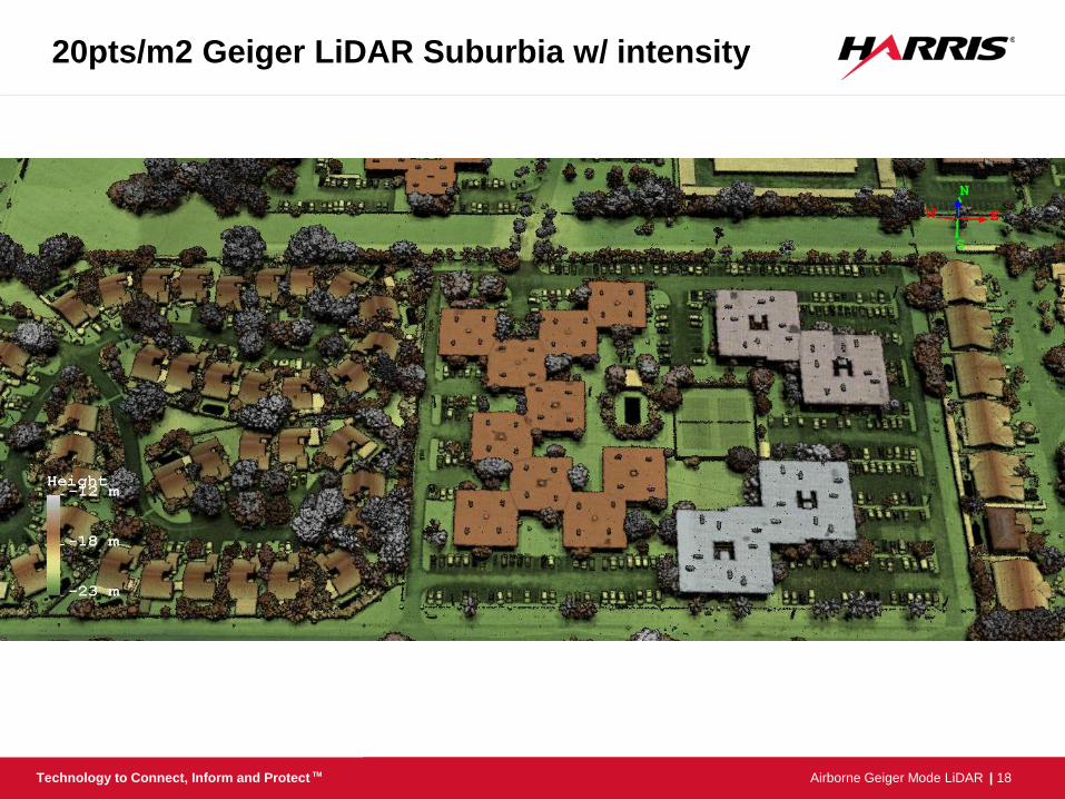
20pts/m2 Geiger LiDAR Suburbia w/ intensity
| 19 Airborne Geiger Mode LiDAR Technology to Connect, Inform and Protect TM
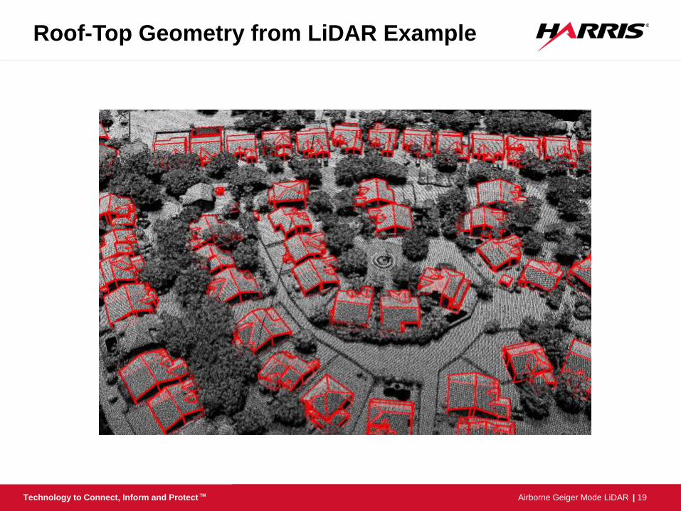
Roof-Top Geometry from LiDAR Example
| 20 Airborne Geiger Mode LiDAR Technology to Connect, Inform and Protect TM
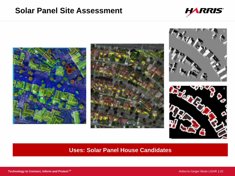
Solar Panel Site Assessment
Uses: Solar Panel House Candidates
| 21 Airborne Geiger Mode LiDAR Technology to Connect, Inform and Protect TM
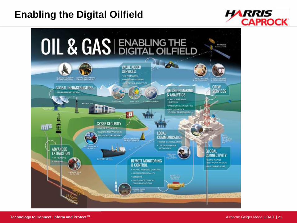
Enabling the Digital Oilfield
| 22 Airborne Geiger Mode LiDAR Technology to Connect, Inform and Protect TM
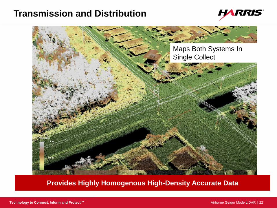
Transmission and Distribution
Provides Highly Homogenous High-Density Accurate Data
Maps Both Systems In
Single Collect
| 23 Airborne Geiger Mode LiDAR Technology to Connect, Inform and Protect TM
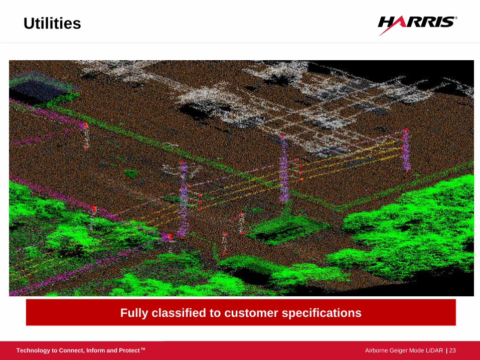
Utilities
Fully classified to customer specifications
| 24 Airborne Geiger Mode LiDAR Technology to Connect, Inform and Protect TM
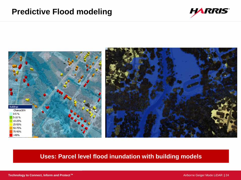
Predictive Flood modeling
Uses: Parcel level flood inundation with building models
| 25 Airborne Geiger Mode LiDAR Technology to Connect, Inform and Protect TM
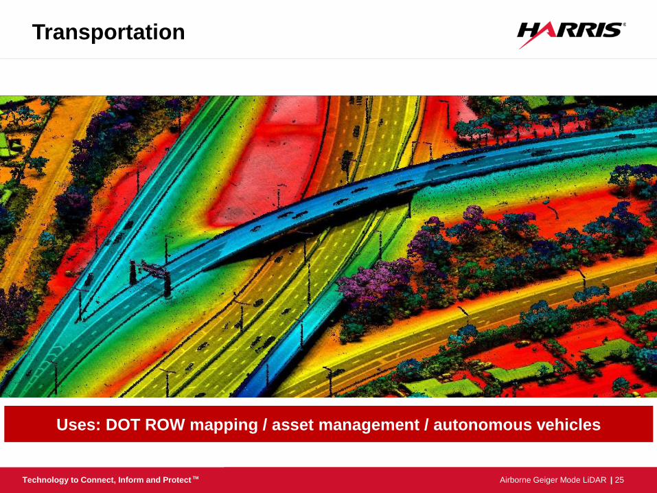
Transportation
Uses: DOT ROW mapping / asset management / autonomous vehicles
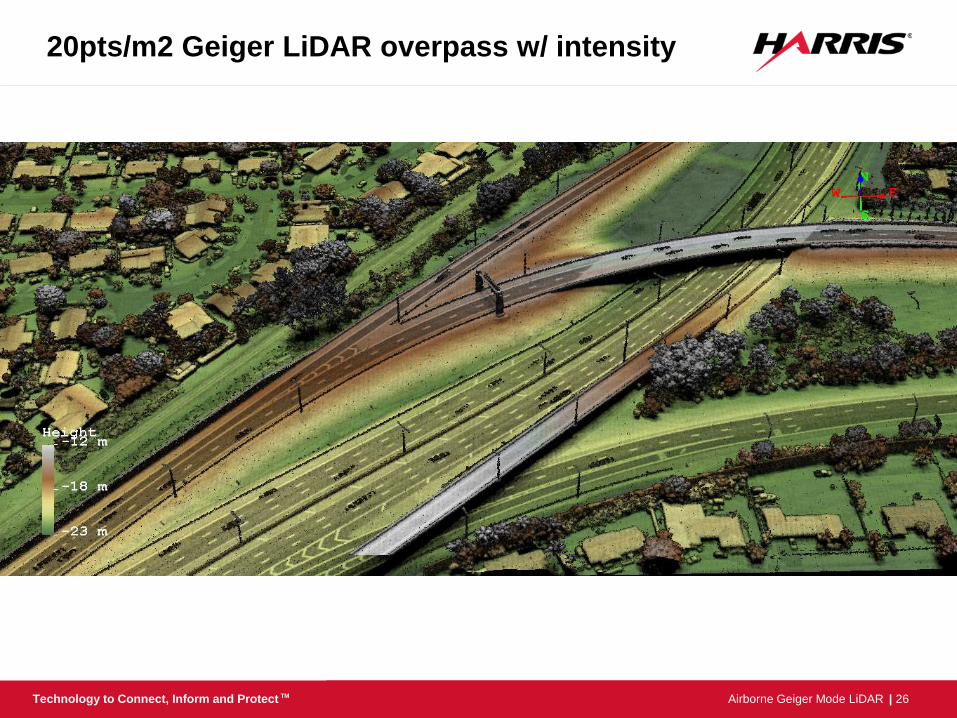
| 26 Airborne Geiger Mode LiDAR Technology to Connect, Inform and Protect TM
20pts/m2 Geiger LiDAR overpass w/ intensity
| 27 Airborne Geiger Mode LiDAR Technology to Connect, Inform and Protect TM
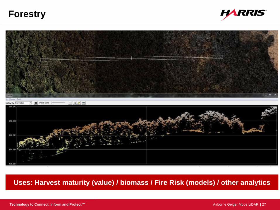
Forestry
Uses: Harvest maturity (value) / biomass / Fire Risk (models) / other analytics
| 28 Airborne Geiger Mode LiDAR Technology to Connect, Inform and Protect TM
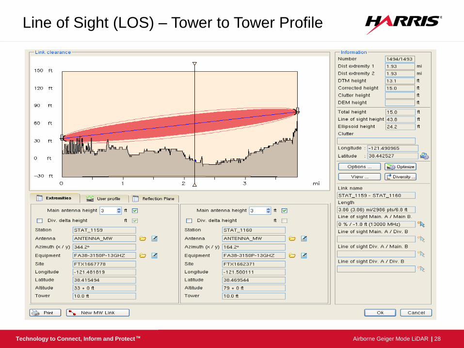
Line of Sight (LOS) – Tower to Tower Profile
| 29 Airborne Geiger Mode LiDAR Technology to Connect, Inform and Protect TM
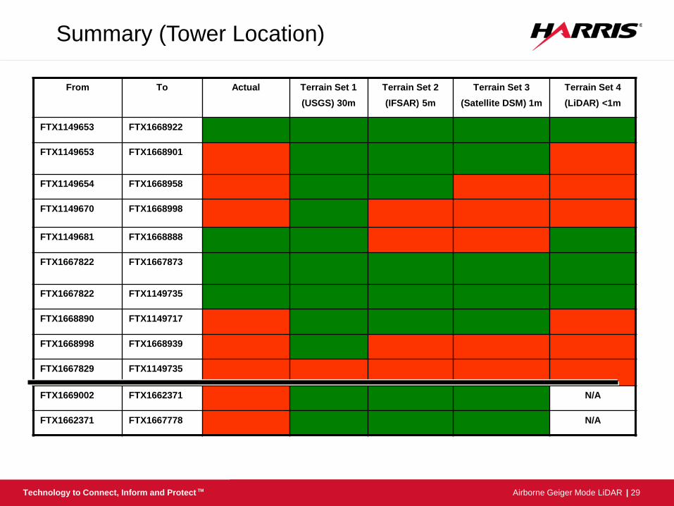
From To Actual Terrain Set 1
(USGS) 30m
Terrain Set 2
(IFSAR) 5m
Terrain Set 3
(Satellite DSM) 1m
Terrain Set 4
(LiDAR) <1m
FTX1149653 FTX1668922
FTX1149653 FTX1668901
FTX1149654 FTX1668958
FTX1149670 FTX1668998
FTX1149681 FTX1668888
FTX1667822 FTX1667873
FTX1667822 FTX1149735
FTX1668890 FTX1149717
FTX1668998 FTX1668939
FTX1667829 FTX1149735
FTX1669002 FTX1662371 N/A
FTX1662371 FTX1667778 N/A
Summary (Tower Location)
| 30 Airborne Geiger Mode LiDAR Technology to Connect, Inform and Protect TM
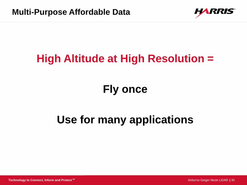
Multi-Purpose Affordable Data
High Altitude at High Resolution =
Fly once
Use for many applications

| 31 Airborne Geiger Mode LiDAR Technology to Connect, Inform and Protect TM
Recently Assessed Accuracies
Results from Independent QAQC Assessment – April 2016
| 32 Airborne Geiger Mode LiDAR Technology to Connect, Inform and Protect TM
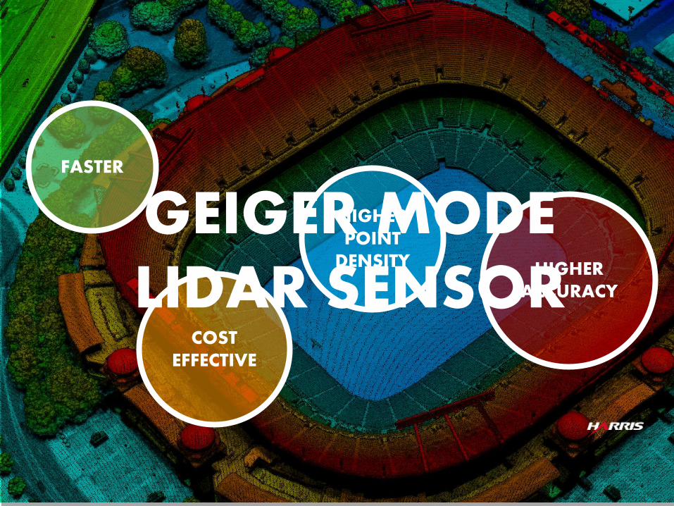
FASTER
COST EFFECTIVE
HIGHER POINT
DENSITY HIGHER ACCURACY
GEIGER MODE LIDAR SENSOR

| 33 Airborne Geiger Mode LiDAR Technology to Connect, Inform and Protect TM
Randy Rhoads Geospatial Industry Manager
[email protected] +1 321-727-4278
Questions?
| 34 Airborne Geiger Mode LiDAR Technology to Connect, Inform and Protect TM
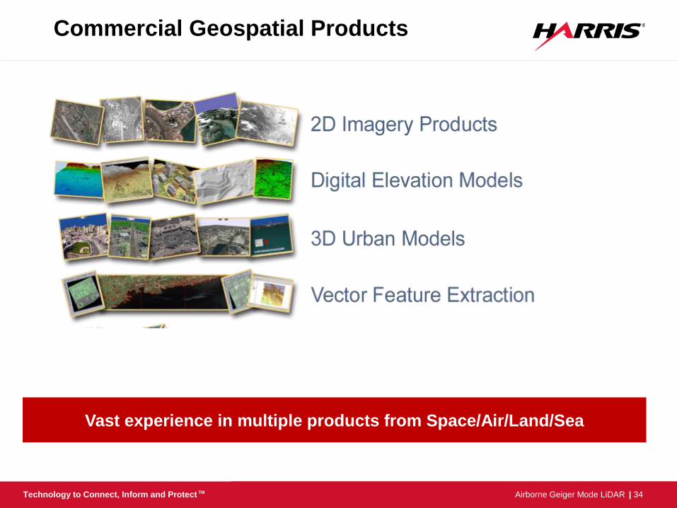
Commercial Geospatial Products
Vast experience in multiple products from Space/Air/Land/Sea
| 35 Airborne Geiger Mode LiDAR Technology to Connect, Inform and Protect TM
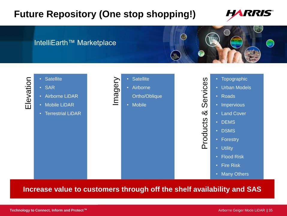
Future Repository (One stop shopping!)
IntelliEarth™ Marketplace
Increase value to customers through off the shelf availability and SAS
Ele
va
tio
n
Pro
ducts
& S
erv
ices
Image
ry
• Satellite
• SAR
• Airborne LiDAR
• Mobile LiDAR
• Terrestrial LiDAR
• Satellite
• Airborne
Ortho/Oblique
• Mobile
• Topographic
• Urban Models
• Roads
• Impervious
• Land Cover
• DEMS
• DSMS
• Forestry
• Utility
• Flood Risk
• Fire Risk
• Many Others