rapideye - usgs · rapideye proprietary information 1 rapideye – a novell approach to space borne...
TRANSCRIPT
RapidEye proprietary information1
RapidEye – A Novell Approach to Space Borne Geo-Information Solutions
Civil Commercial Imagery Evaluation WorkshopMarch 20-22, 2007
F. Jung-Rothenhäusler RapidEye Inc., Germany

RapidEye proprietary information
Contents
> Business Concept
> Customer Demands
> RapidEye Markets
> Realization
> Timetable

RapidEye proprietary information
Business Concept
Global supplier of agricultural, cartographic and geo-information products and services on a worldwide basis
delivering frequent, reliable supply of near real-time, customized information- and data products and services
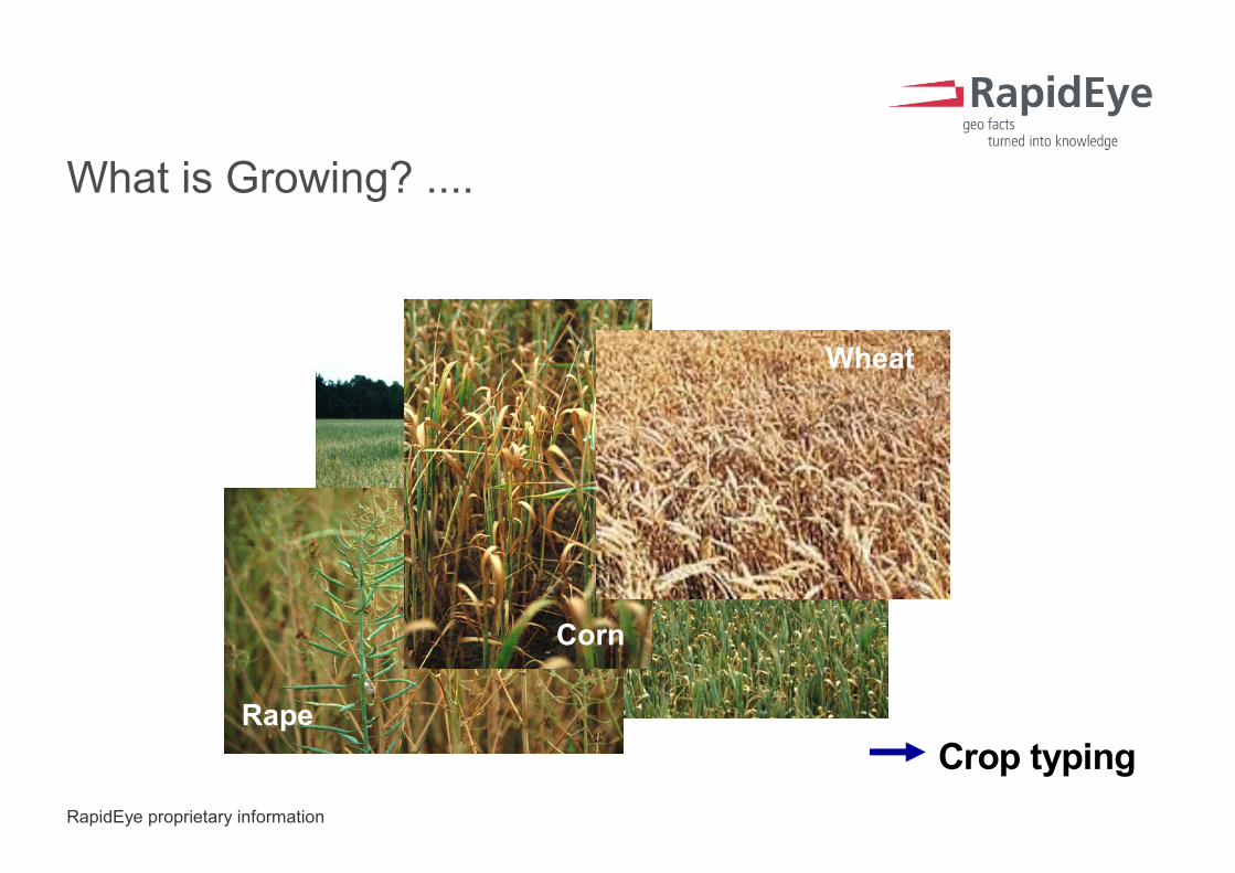
or: What changed where during the last few days? What is growing where, how and how much?
RapidEye proprietary information
Rape
Crop typing
Wheat
Corn
What is Growing? ....

RapidEye proprietary information
everywhere in the world
(shown: main agricultural areas)
....Where?

RapidEye proprietary information
crop vigor and damage assessment
quantification by monitoring large areas
... How and How Much?
RapidEye proprietary information
Customer Demands – RapidEye Provides
> Guaranteed data availability
> daily access of every point on earth possible
> reliability by proven technology and system redundancy
> Rapid response after unforeseen events
> fast acquisition re-scheduling and data processing
> Continuous monitoring of agricultural areas around the world
> large area coverage (~ 4 million sqkm per day)
> multispectral sensor (→ crop determination)
> Customer-specific, low cost information
> customized service/product portfolio
RapidEye proprietary information
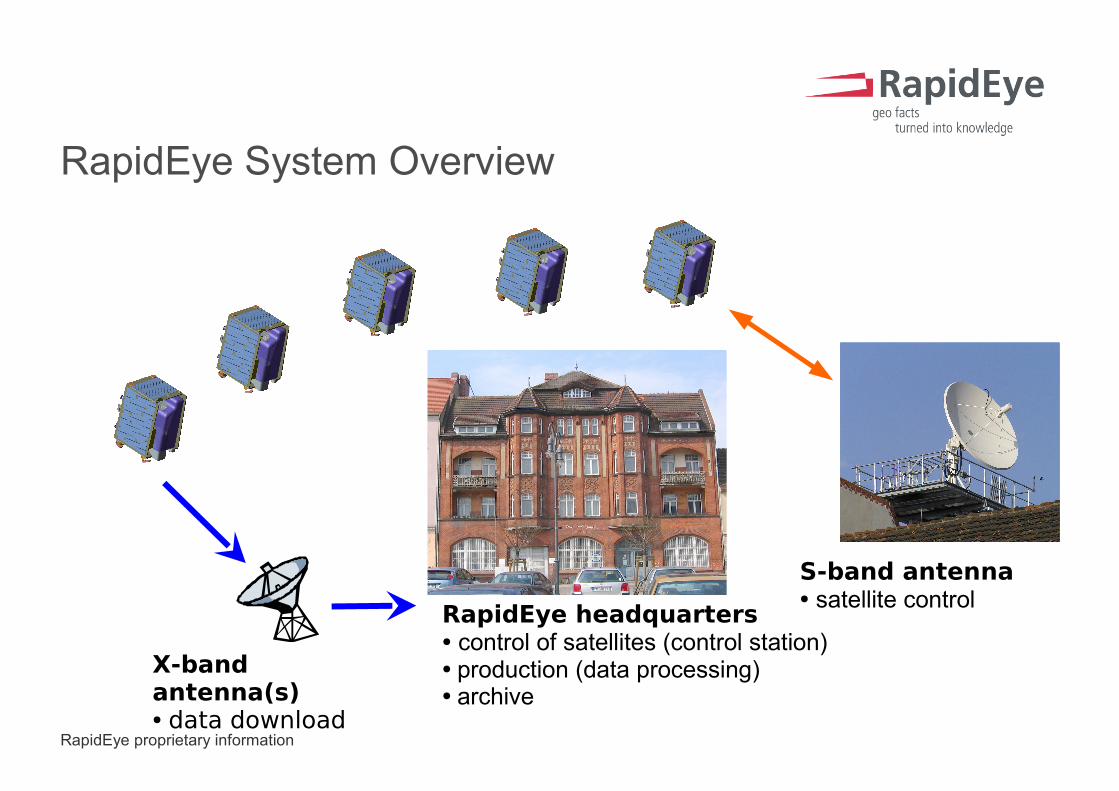
RapidEye System Overview
X-band antenna(s)● data download
S-band antenna● satellite control
RapidEye headquarters● control of satellites (control station)● production (data processing)● archive
RapidEye proprietary information
Technical System Details
> 5 satellites
> one near polar sun-synchronous orbit 630km
> daily access of every point on Earth
> 15 orbits per satellite per day
> swath width 77 km
> length of image take 1500 km
> total imaging capacity of 4,000,000 km² per day
> 6.5 m GSD, 5 m ortho-rectified image data
> 5 bands (blue,green,red,red-edge,NIR)

RapidEye proprietary information
Satellite Technology
1117 mm
769 mm
856 mm
Z(nadir)
X (velocity vector)
Y
Multi-Spectral Imager GaAs Solar Arrays
(3 sides)
RapidEye proprietary information
RapidEye Markets
> Biomass
> agricultural industry
> producers
> forestry
> Geo-Spatial Solutions
> telecommunications
> mapping
> Government and Security
> homeland security
> natural resources
RapidEye proprietary information
RapidEye Core Competencies
> Crop Identification What grows where?
> Crop Monitoring Crop growth assessment over time.
> Damage Assessment Multi-temporal image analysis
> Yield Prediction Weather-, soil- and imagery analysis.
> Change Detection Alert service at regular intervals.
> Ortho-Rectification Data delivery 1 day after image take.
> Management Information Information at your fingertips, utilizecore competencies and deliver.

RapidEye proprietary information
Approach to Market
RapidEye RapidEye & Partners
large customers
joint service development
service
fragmented and restricted markets
form service consortium
joint service development
service
RapidEye proprietary information
Realization
> Experienced Prime Contractor - MacDonald Dettwiler & Associates
> turn-key contract - space and ground segment included
> „in-orbit“ delivery and acceptance
> firm fixed price
> Low Risk, Proven Spacecraft Technology
> flight heritage used extensively
> no deployable parts
> Redundant Design
> constellation level: one redundant satellite
> satellite level: cold redundant sub-systems, graceful degradation

RapidEye proprietary information
A few Schedule Highlights
> Dec 1998 RapidEye incorporated
> Mid 2002 Selection of the general contractor MacDonald Dettwiler & Associates (MDA), Vancouver / Canada
> July 2004 Financing completedcontracts signed and begin of construction
> June 2005 Successful Mission Critical Design
> Sept 2006 Successful Installation of Antenna and Control Center
> Late 2007 Launch of all five spacecrafts
> Early 2008 Fully operational