alexandria 12.14.05e.indd
TRANSCRIPT

Historical Analysis
ALEXANDRIAThe Massachusetts Institute of Technology
SITE OF ALEXANDRIA AND ORIGINS
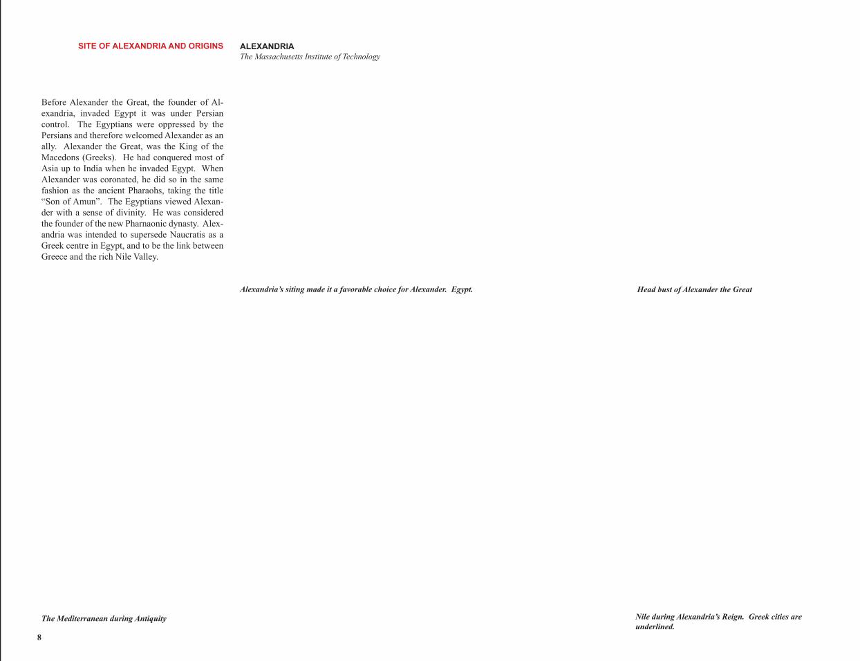
Before Alexander the Great, the founder of Al-exandria, invaded Egypt it was under Persian control. The Egyptians were oppressed by the Persians and therefore welcomed Alexander as an ally. Alexander the Great, was the King of the Macedons (Greeks). He had conquered most of Asia up to India when he invaded Egypt. When Alexander was coronated, he did so in the same fashion as the ancient Pharaohs, taking the title “Son of Amun”. The Egyptians viewed Alexan-der with a sense of divinity. He was considered the founder of the new Pharnaonic dynasty. Alex-andria was intended to supersede Naucratis as a Greek centre in Egypt, and to be the link between Greece and the rich Nile Valley.
Egypt.Alexandria’s siting made it a favorable choice for Alexander. Head bust of Alexander the Great
The Mediterranean during Antiquity Nile during Alexandria’s Reign. Greek cities are underlined.
8
ALEXANDRIA SITE OF ALEXANDRIA AND ORIGINS The Massachusetts Institute of Technology
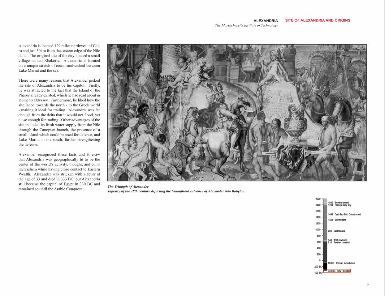
Alexandria is located 129 miles northwest of Cai-ro and just 30km from the eastern edge of the Nile delta. The original site of the city housed a small village named Rhakotis. Alexandria is located on a unique stretch of coast sandwiched between Lake Mariut and the sea.
There were many reasons that Alexander picked the site of Alexandria to be his capitol. Firstly, he was attracted to the fact that the Island of the Pharos already existed, which he had read about in Homer’s Odyssey. Furthermore, he liked how the site faced towards the north - to the Greek world - making it ideal for trading. Alexandria was far enough from the delta that it would not flood, yet close enough for trading. Other advantages of the site included its fresh water supply from the Nile through the Canopian branch, the presence of a small island which could be used for defense, and Lake Mariut to the south, further strengthening the defense.
Alexander recognized these facts and foresaw that Alexandria was geographically fit to be the center of the world’s activity, thought, and com-mercialism while having close contact to Eastern Wealth. Alexander was stricken with a fever at the age of 33 and died in 333 BC, but Alexandria still became the capital of Egypt in 330 BC and
The Triumph of Alexander remained so until the Arabic Conquest.
Tapestry of the 18th centure depicting the triumphant entrance of Alexander into Babylon
9
PTOLEMAIC DYNASTY (323 – 30 BC) ALEXANDRIA The Massachusetts Institute of Technology
When Alexander died in 333 BC, his Empire was split into three kingdoms: Ptolemy I (Rule of Egypt), Antigonids (Macedonia and Greece) and Seleucids (Western Asian and Iran). Ptolemy took the position of satrap, or governor, in the summer of 325 BC. He did not actually assume the position of king until 305 BC. It would be the Ptolemaic dynasty which ruled over Alexandria for the next 300 years.
Following in Alexander’s tradition, Ptolemy became a patron to learning. It was Ptolemy’s friend, Demetrius, that inspired him to start the infamous Alexandrian Library. A Museion, or institute for research in science accompanied the library. The library and Museo attracted scholars from all parts of the Hellenistic World, creating a great diversity within Alexandria. The Ptolemaic dynasty spent more money on institutions than any other ancient dynasty.
After Ptolemy I’s death in 283 BC, Ptolemy II assumes his father’s role and peacefully runs the kingdom. It is interesting to note that the Ptol-emaic kings adopted the customs of the Pharaohs, including marriage between royal brothers and sisters. Ptolemy II took his sister, Arsinoe II, as his second wife. His chief concern, however, was rooted in the internal administration of his king-dom, and the patronage of literature and science. The material and literary brilliance of the Alexan-drian court was at his height during Ptolemy II’s reign (285 – 246 BC). This tradition continued into Ptolemy III reign from 246-221 BC. During his time the library grew rapidly. This was due to a law that ensured that any foreign book entering the country was taken by the library, and owners were given a copy of their original book.
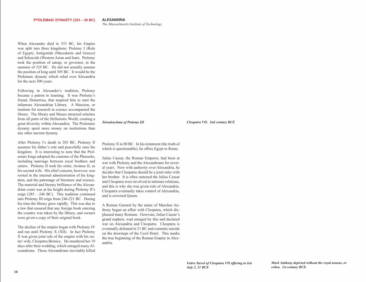
The decline of the empire began with Ptolemy IV and ran until Ptolemy X (XII). In fact Ptolemy X was given joint rule of the empire with his sis-ter/ wife, Cleopatra Bernice. He murdered her 19 days after their wedding, which enraged many Al-exandrians. These Alexandrians inevitably killed
Tetradrachma of Ptolemy III Cleopatra VII. 2nd century BCE
Ptolemy X in 80 BC. In his testament (the truth of which is questionable), he offers Egypt to Rome.
Julius Caesar, the Roman Emperor, had been at war with Ptolemy and the Alexandrians for sever-al years. Now with authority over Alexandria, he decides that Cleopatra should be a joint ruler with her brother. It is often rumored the Julius Ceasar and Cleopatra were involved in intimate relations, and this is why she was given rule of Alexandria. Cleopatra eventually takes control of Alexandria, and is crowned Queen.
A Roman General by the name of Marchus An-thony began an affair with Cleopatra, which dis-pleased many Romans. Octovian, Julius Caesar’s grand nephew, wad enraged by this and declared war on Alexandria and Cleopatra. Cleopatra is eventually defeated in 31 BC and commits suicide on the doorsteps of the Cecil Hotel. This marks the true beginning of the Roman Empire in Alex-andria.
Votive Stevel of Cleopatra VII offering to Isis Mark Anthony depicted without the royal uraeus, or July 2, 51 BCE cobra. 1st century BCE.
10
ALEXANDRIA PTOLEMAIC DYNASTY (323 – 30 BC) The Massachusetts Institute of Technology
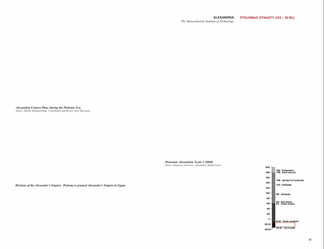
Alexandria Context Plan, during the Ptolemic Era. Source: Elkholy Mohamed Badr. Contribution and the new Town Movement
Ptolemaic Alexandria. Scale 1:50000 Source: Empereur, Jean-Yves. Alexandria: Rediscovered
Division of the Alexander’s Empire. Ptolemy is granted Alexander’s Empire in Egypt.
11
ORIGINS OF CITY PLANNING ALEXANDRIA The Massachusetts Institute of Technology
Despite the fact that the city was made after the death of Alexander, it was designed to be in accor-dance with his vision. This was due in a large part to Cleomenes of Naucratis, Alexander’s collector of revenues. After his death, in accordance with his wish, Cleomenes of Naucratis continually of-fered financial support to the city’s creation. The city planning was carried out by Dinocrates of Rhodes, a Greek architect chosen by Ptolemy I.
Dinocrates had a comprehensive plan for the city that was carried out in the following order; city walls, street grids, the harbor, and a high effiency water supply. From the onset, the planning of Al-exandria was intended to by of grand dimension when compared to other Greek Cities. Dinocrates also designed a bridge to connect the mainland to the Island of the Pharos. The bridge, 1300m in Diagrammatic Plan of Ancient Alexandria
length was called the Hepastadium. The bridge effectively created two ports in the city; the Eas-ter Port (Portus Magnum) and the Western Port (Portus Eunostos).
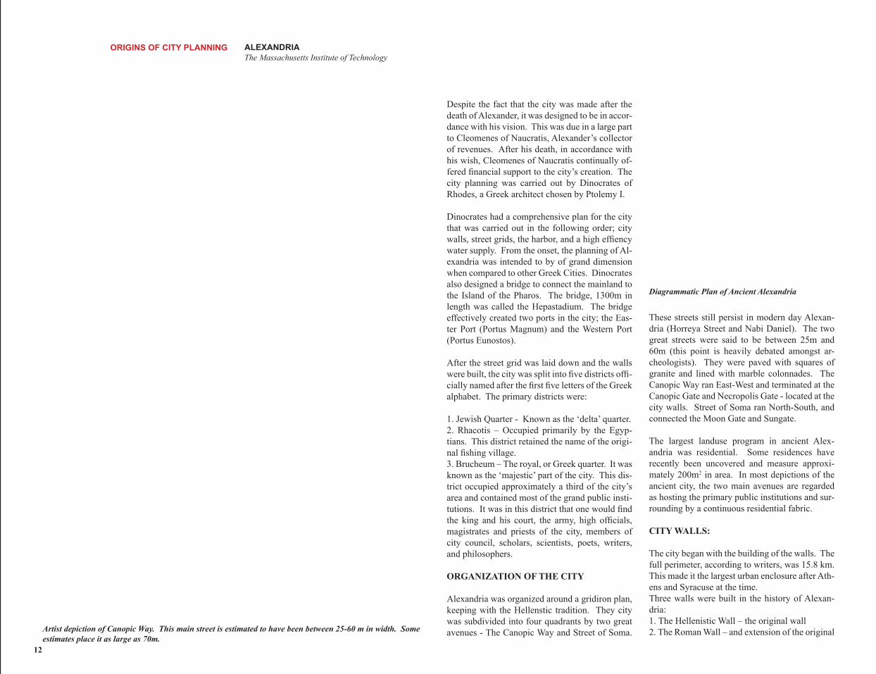
These streets still persist in modern day Alexan-dria (Horreya Street and Nabi Daniel). The two great streets were said to be between 25m and 60m (this point is heavily debated amongst ar-
After the street grid was laid down and the walls were built, the city was split into five districts offi-cially named after the first five letters of the Greek alphabet. The primary districts were:
cheologists). They were paved with squares of granite and lined with marble colonnades. The Canopic Way ran East-West and terminated at the Canopic Gate and Necropolis Gate - located at the city walls. Street of Soma ran North-South, and
1. Jewish Quarter - Known as the ‘delta’ quarter. connected the Moon Gate and Sungate. 2. Rhacotis – Occupied primarily by the Egyp-tians. This district retained the name of the origi-nal fishing village. 3. Brucheum – The royal, or Greek quarter. It was known as the ‘majestic’ part of the city. This dis-trict occupied approximately a third of the city’s area and contained most of the grand public insti-tutions. It was in this district that one would find
The largest landuse program in ancient Alex-andria was residential. Some residences have recently been uncovered and measure approxi-mately 200m2 in area. In most depictions of the ancient city, the two main avenues are regarded as hosting the primary public institutions and sur-rounding by a continuous residential fabric.
the king and his court, the army, high officials, magistrates and priests of the city, members of CITY WALLS: city council, scholars, scientists, poets, writers, and philosophers. The city began with the building of the walls. The
full perimeter, according to writers, was 15.8 km. ORGANIZATION OF THE CITY This made it the largest urban enclosure after Ath-
ens and Syracuse at the time.
Artist depiction of Canopic Way. This main street is estimated to have been between 25-60 m in width. Some estimates place it as large as 70m.
Alexandria was organized around a gridiron plan, keeping with the Hellenstic tradition. They city was subdivided into four quadrants by two great avenues - The Canopic Way and Street of Soma.
Three walls were built in the history of Alexan-dria: 1. The Hellenistic Wall – the original wall 2. The Roman Wall – and extension of the original
12
The only remaining section of the Hellenistic wall. These are found in the Shallat Gardens.
wall towards the east. 3. Supplemented medieval wall in the 9th century by the Sultan Ahmed Ibn Tulun. It is curious to note that the third city wall contracted in size as they neither had the population or army to defend the large city size. This is part of the reason why little of the ancient city still remains.
Today, only a small part of the Hellenistic wall remains, which can be found in the Shallat Gar-dens.
STREETS and BLOCKS
The street grid of Alexandria was derived from the Hippodamian System. According to ancient writers the grid was always part of the original plan. The layout of the streets was towards the Cardinal Axes (or what was believed to be the Cardinal Axes, as the street layout appears to be rotated about 25 degrees from the Cardinal Axes to contemporary archeologists). It is believed that the layout of the grid in line with the Cardinal Axes was to ensure that the city was exposed to the prevailing winds to the north, thereby keeping the city cool in the summer.
Alexandria was built on a level of infrastructure used for Cisterns.
Keeping in line with the majestic quality of the city, the streets were exceptionally wide. The main streets were 20-60 m in width and secondary streets were 12 m in width. This made the street ideal for horseback riding, chariot driving as well as a place for socializing. The two main streets, the Canopic way and Street of Soma were lined with colonnades.
Archeologist Mahumed El Falaki deduced that the block dimension was 167m, about 10 m less than the ‘stade’ used in other Greek cities. It is still unsure how the block was subdivided but in most speculative theories the block was perimeter lined with a courtyard types.
WATER
Alexandria is often referred to as the city of cis-terns. The entire city is fundamentally built over a level of cisterns, similar to Constantinople. This level of infrastructure running under the city brought housed water supplies from the delta as well as the Mahmudiyya Canal. Many of these cisterns have been recently discovered and can be visited.
ALEXANDRIA The Massachusetts Institute of Technology
Artist depiction of Ancient city, including the city walls
MEASUREMENTS
The following measurements give an idea of the grand scale of Alexandria.
City Walls: 15.8 kmLength of the City: 5.09 km.Width of the City: 1.15 km (Western Edge), 1.4 km (Eastern edge)Widest part of the City: 1.7 km (Center)18 Main streets, 7 EW and 11 NS
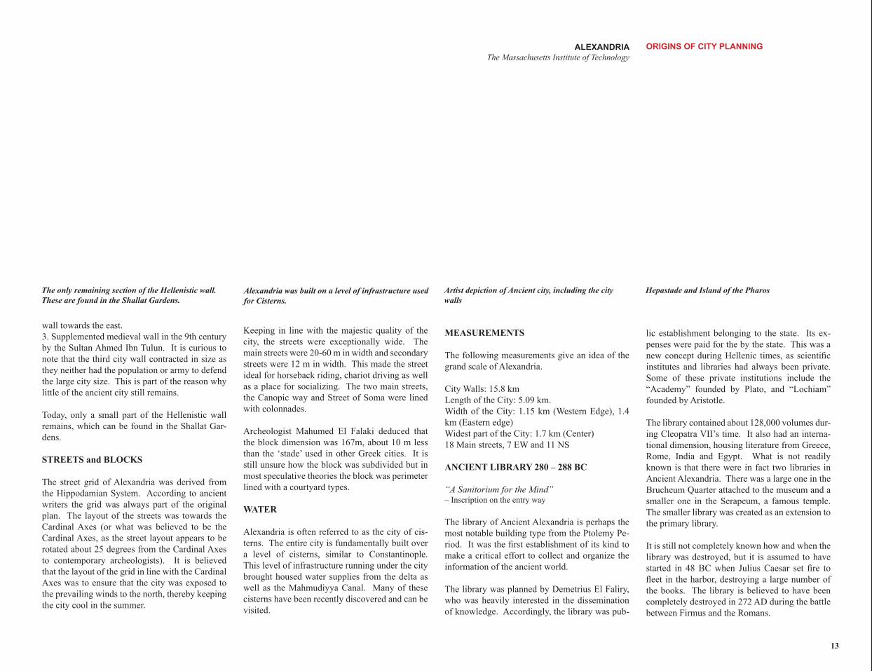
ANCIENT LIBRARY 280 – 288 BC
“A Sanitorium for the Mind” – Inscription on the entry way
The library of Ancient Alexandria is perhaps the most notable building type from the Ptolemy Pe-riod. It was the first establishment of its kind to make a critical effort to collect and organize the information of the ancient world.
The library was planned by Demetrius El Faliry, who was heavily interested in the dissemination of knowledge. Accordingly, the library was pub-
ORIGINS OF CITY PLANNING
Hepastade and Island of the Pharos
lic establishment belonging to the state. Its ex-penses were paid for the by the state. This was a new concept during Hellenic times, as scientific institutes and libraries had always been private. Some of these private institutions include the “Academy” founded by Plato, and “Lochiam” founded by Aristotle.
The library contained about 128,000 volumes dur-ing Cleopatra VII’s time. It also had an interna-tional dimension, housing literature from Greece, Rome, India and Egypt. What is not readily known is that there were in fact two libraries in Ancient Alexandria. There was a large one in the Brucheum Quarter attached to the museum and a smaller one in the Serapeum, a famous temple. The smaller library was created as an extension to the primary library.
It is still not completely known how and when the library was destroyed, but it is assumed to have started in 48 BC when Julius Caesar set fire to fleet in the harbor, destroying a large number of the books. The library is believed to have been completely destroyed in 272 AD during the battle between Firmus and the Romans.
13
ROMAN/ BYZANTINE PERIOD (30 BC – 642 AD)
After defeating Cleopatra, Octovanian takes hold of Egypt and holds it as a piece of personal prop-erty. Octovanian was renamed as Augustus when he takes on the role of king. The Romans often destroyed the cities they took hold of, but Augus-tus did not do so with Alexandria. He pardoned it for sake of Alexander, in admiration of its beauty and grandeur, and in appreciation of his teacher and friend, Aruis. During the reign of Trajen and Hadrian, the Pax Romana (Roman Peace) exist-ed, increasing commerce and industry along the Mediterranean and once again making Alexandria a fairly prosperous city.
Despite the increased commerce, Alexandria was not as prosperous as during the Ptolemic Dynasty. The Romans controlled Alexandria remotely, and were more interested in the wealth of Egypt than the standard of living in Alexandria. They raised the taxes and imposed a lower standard of living. Many contemporary historians believe that the Romans were in fact fearful of Alexandria as a dominant city, and thus paid little attention to it to instigate its demise. It has been discovered that many of the books from Alexandria were taken to Rome in the second century AD. During this period the literacy rate in Alexandria was low, and Christianity increased in popularity.
During the Roman Rule it was a unique time to be an Alexandrian. On one hand, they were the in-tellectual center of the ancient world, and in other respects they were slowly declining as a powerful city. When the Pax Romana ended in 180 AD, Al-exandria lost a large amount of commerce and the population declined. In 215 AD, the Roman Em-peror Caracalla visited Alexandria. Alexandrians were always known for free speech. They had made reference to Caracalla as a cruel murderer of his own brother in their satires. Upon his visit, Caracalla ordered all the youth of the city dead.
In 272 AD, Firmus, a wealthy merchant from Ethi-opia, seizes government of Egypt. This causes the Roman Emperor, Aurelian, to call a war against Firmus. During the battle, the library and museum
ALEXANDRIA The Massachusetts Institute of Technology
Depiction of the Interior of the Ancient Library Illustration of the building of the Pharos Lighthouse Illustration of the Interior of the Library
are believed to have perished. The Romans defeat Firmus, but the notion of Alexandria as the center of knowledge and learning fades. In 296 AD the Emperor Diocletian subjects Alexandria to a siege for 9 months. Despite this, philosophy begins to flourish in the city, and Christianity continues to spread. Alexandria becomes the intellectual cen-ter of the Christian world. Egypt is ruled by the Byzantine Empire in 395 AD, controlled by Con-stantinople. In 400 AD debates on the role of the church and science emerge causing many resi-dents move to Athens or Constantinople. In 616 AD, Khosran II, The King of Persia seizes control of Alexandria. Ten years later, in 626 AD, Rome takes Alexandria back into their possession. The Roman Empire finally loses control of Alexandria in 642 AD to the Arab general Amr Ibn Al-As
During the (remote) Roman rule of Alexandria, very few changes are made to the city. Besides extending the city walls a few blocks to the East and a few unplanned settlements outside the city walls, the Romans made no formal changes to Alexandria. Alexandria was one of the grandest cities in the Ancient world before the Roman rule. Rome continuously felt threatened by Alexandria, and added few elements to the city during their 600 year presence. The Death of Cleopatra Portrait of Octavian. (portrait bust from forum- Arles)
14
Portrait of Octavian. (portrait bust from forum- Arles)
ALEXANDRIA ROMAN/ BYZANTINE PERIOD (30 BC – 642 AD) The Massachusetts Institute of Technology
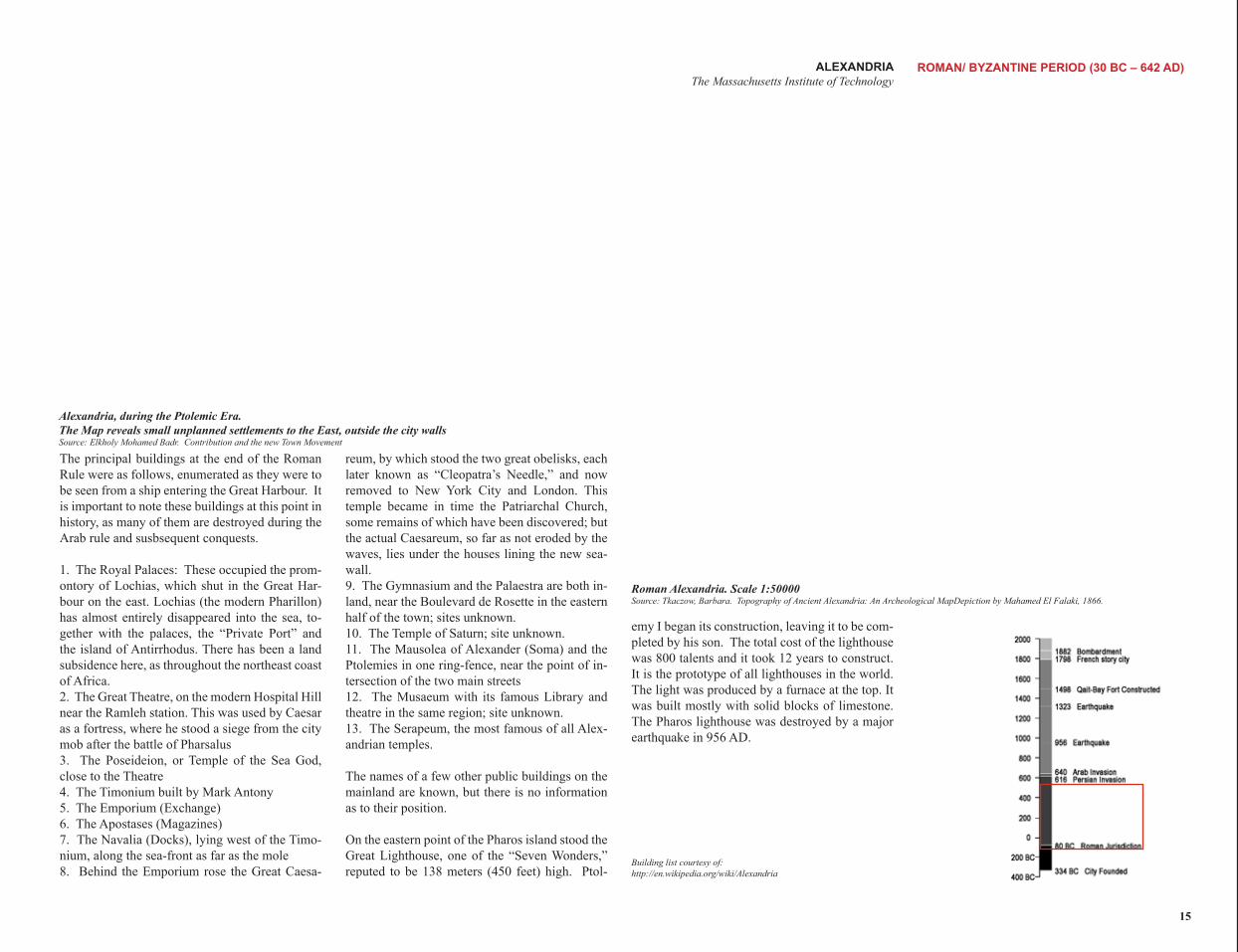
Roman Alexandria. Scale 1:50000 Source: Tkaczow, Barbara. Topography of Ancient Alexandria: An Archeological MapDepiction by Mahamed El Falaki, 1866.
emy I began its construction, leaving it to be com-pleted by his son. The total cost of the lighthouse was 800 talents and it took 12 years to construct. It is the prototype of all lighthouses in the world. The light was produced by a furnace at the top. It was built mostly with solid blocks of limestone. The Pharos lighthouse was destroyed by a major earthquake in 956 AD.
Building list courtesy of: http://en.wikipedia.org/wiki/Alexandria
Alexandria, during the Ptolemic Era. The Map reveals small unplanned settlements to the East, outside the city wallsSource: Elkholy Mohamed Badr. Contribution and the new Town Movement
The principal buildings at the end of the Roman Rule were as follows, enumerated as they were to be seen from a ship entering the Great Harbour. It is important to note these buildings at this point in history, as many of them are destroyed during the Arab rule and susbsequent conquests.
1. The Royal Palaces: These occupied the prom-ontory of Lochias, which shut in the Great Har-bour on the east. Lochias (the modern Pharillon) has almost entirely disappeared into the sea, to-gether with the palaces, the “Private Port” and the island of Antirrhodus. There has been a land subsidence here, as throughout the northeast coast of Africa. 2. The Great Theatre, on the modern Hospital Hill near the Ramleh station. This was used by Caesar as a fortress, where he stood a siege from the city mob after the battle of Pharsalus 3. The Poseideion, or Temple of the Sea God, close to the Theatre 4. The Timonium built by Mark Antony 5. The Emporium (Exchange) 6. The Apostases (Magazines) 7. The Navalia (Docks), lying west of the Timo-nium, along the sea-front as far as the mole 8. Behind the Emporium rose the Great Caesa-
reum, by which stood the two great obelisks, each later known as “Cleopatra’s Needle,” and now removed to New York City and London. This temple became in time the Patriarchal Church, some remains of which have been discovered; but the actual Caesareum, so far as not eroded by the waves, lies under the houses lining the new sea-wall. 9. The Gymnasium and the Palaestra are both in-land, near the Boulevard de Rosette in the eastern half of the town; sites unknown. 10. The Temple of Saturn; site unknown. 11. The Mausolea of Alexander (Soma) and the Ptolemies in one ring-fence, near the point of in-tersection of the two main streets 12. The Musaeum with its famous Library and theatre in the same region; site unknown. 13. The Serapeum, the most famous of all Alex-andrian temples.
The names of a few other public buildings on the mainland are known, but there is no information as to their position.
On the eastern point of the Pharos island stood the Great Lighthouse, one of the “Seven Wonders,” reputed to be 138 meters (450 feet) high. Ptol-
15
ALEXANDRIAThe Massachusetts Institute of Technology
orders the digging of the gulf. The new wall only encompasses half the area of the original Greek
ARAB & TURKISH PERIODS (642-1798 AD)
Illustration of Alexandria, 1550
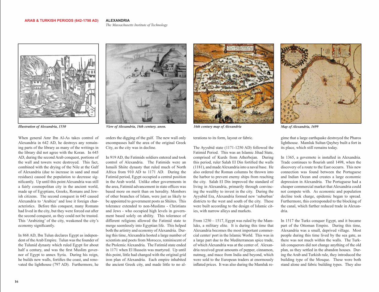
When general Amr Ibn Al-As takes control of Alexandria in 642 AD, he destroys any remain-ing parts of the library as many of the writings in the library did not agree with the Koran. In 645 AD, during the second Arab conquest, portions of the wall and towers were destroyed. This fact, combined with the drying of the Nile at the Gulf of Alexandria (due to increase in sand and mud residues) caused the population to decrease sig-nificantly. Up until this point Alexandria was still a fairly cosmopolitan city in the ancient world, made up of Egyptians, Greeks, Romans and Jew-ish citizens. The second conquest in 645 caused Alexandria to ‘Arabize’ and lose it foreign char-acteristics. Before this conquest, many Romans had lived in the city, but they were forced out after the second conquest, as they could not be trusted. This ‘Arabizing’ of the city, weakened the city’s economy significantly.
In 868 AD, Ibn Tulun declares Egypt as indepen-dent of the Arab Empire. Tulun was the founder of the Tulunid dynasty which ruled Egypt for about half a century, and was the first Muslim gover-nor of Egypt to annex Syria. During his reign, he builds new walls, fortifies the coast, and reno-vated the lighthouse (797 AD). Furthermore, he
View of Alexandria, 16th century. anon.
City, as the city was in decline.
In 919 AD, the Fatimids soldiers entered and took control of Alexandria. The Fatimids were an Ismaili Shiite dynasty that ruled much of North Africa from 910 AD to 1171 AD. During the Fatimid period, Egypt occupied a central position in the Arab world. Unlike other governments in the area, Fatimid advancement in state offices was based more on merit than on heredity. Members of other branches of Islam, were just as likely to be appointed to government posts as Shiites. This tolerance extended to non-Muslims - Christians and Jews - who occupied high levels in govern-ment based solely on ability. This tolerance of different religions allowed the Fatimid state to merge seemlessly into Egyptian life. This helped both the artistry and economy of Alexandria. Dur-ing this time, Alexandria hosted a large number of scientists and poets from Morocco, reminiscent of the Ptolemic Alexandria. The Fatimid state ended in 1171 when El Hussein was martyred. Up until this point, little had changed with the original grid iron plan of Alexandria. Each empire inhabited the ancient Greek city, and made little to no al-
16th century map of Alexandria
terations to its form, layout or fabric.
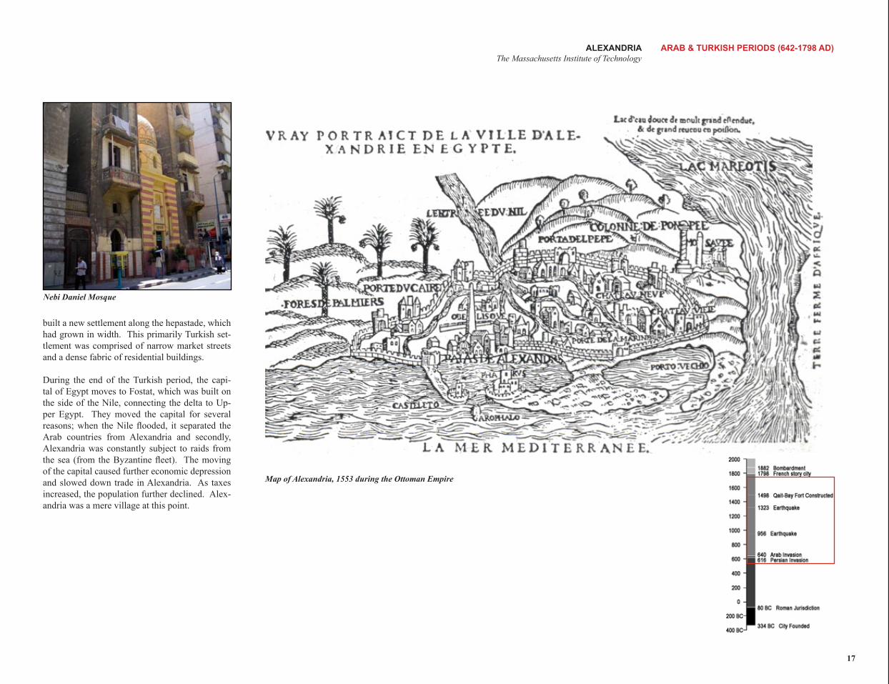
The Ayyubid state (1171-1250 AD) followed the Fatimid Period. This was an Islamic Jihad State, comprised of Kurds from Atherbejan. During this period, ruler Salah El Din fortified the walls (1181), and made Alexandria into a naval base. He also ordered the Roman columns be thrown into the harbor to prevent enemy ships from reaching the city. Salah El Din improved the standard of living in Alexandria, primarily through convinc-ing the wealthy to invest in the city. During the Ayyubid Era, Alexandria formed new ‘suburban’ districts to the west and south of the city. These were built according to the design of Islamic cit-ies, with narrow alleys and markets.
From 1250 – 1517, Egypt was ruled by the Mam-luks, a military elite. It is during this time that Alexandria becomes the most important commer-cial center/ port in the Islamic World. This was in a large part due to the Mediterranean spice trade, of which Alexandria was at the center of. Alexan-dria received great amounts of pepper, cinnamon, nutmeg, and mace from India and beyond, which were sold to the European traders at enormously inflated prices. It was also during the Mamluk re-
Map of Alexandria, 1699
gime that a large earthquake destroyed the Pharos lighthouse. Mamluk Sultan Qaybey built a fort in its place, which still remains today.
In 1365, a governote is installed in Alexandria. Trade continues to flourish until 1498, when the discovery of a route to the East occurrs. This new connection was found between the Portuguese and Indian Ocean and creates a large economic depression in Alexandria. The Portuguese had a cheaper commercial market that Alexandria could not compete with. As economic and population decline took charge, epidemic began to spread. Furthermore, this corresponded to the blocking of the canal, which further reduced trade in Alexan-dria.
In 1517 the Turks conquer Egypt, and it became part of the Ottoman Empire. During this time, Alexandria was a small, deprived village. Most people during this time lived by the sea gate, as there was not much within the walls. The Turk-ish conquerors did not change anything of the old plan, as they settled in the abandon houses. Dur-ing the Arab and Turkish rule, they introduced the building type of the Mosque. These were both stand alone and fabric building types. They also
16
15th century map of Alexandria
ALEXANDRIA ARAB & TURKISH PERIODS (642-1798 AD) The Massachusetts Institute of Technology
Nebi Daniel Mosque
built a new settlement along the hepastade, which had grown in width. This primarily Turkish set-tlement was comprised of narrow market streets and a dense fabric of residential buildings.
During the end of the Turkish period, the capi-tal of Egypt moves to Fostat, which was built on the side of the Nile, connecting the delta to Up-per Egypt. They moved the capital for several reasons; when the Nile flooded, it separated the Arab countries from Alexandria and secondly, Alexandria was constantly subject to raids from the sea (from the Byzantine fleet). The moving of the capital caused further economic depression and slowed down trade in Alexandria. As taxes increased, the population further declined. Alex-andria was a mere village at this point.
Map of Alexandria, 1553 during the Ottoman Empire
17
ALEXANDRIAThe Massachusetts Institute of Technology
18
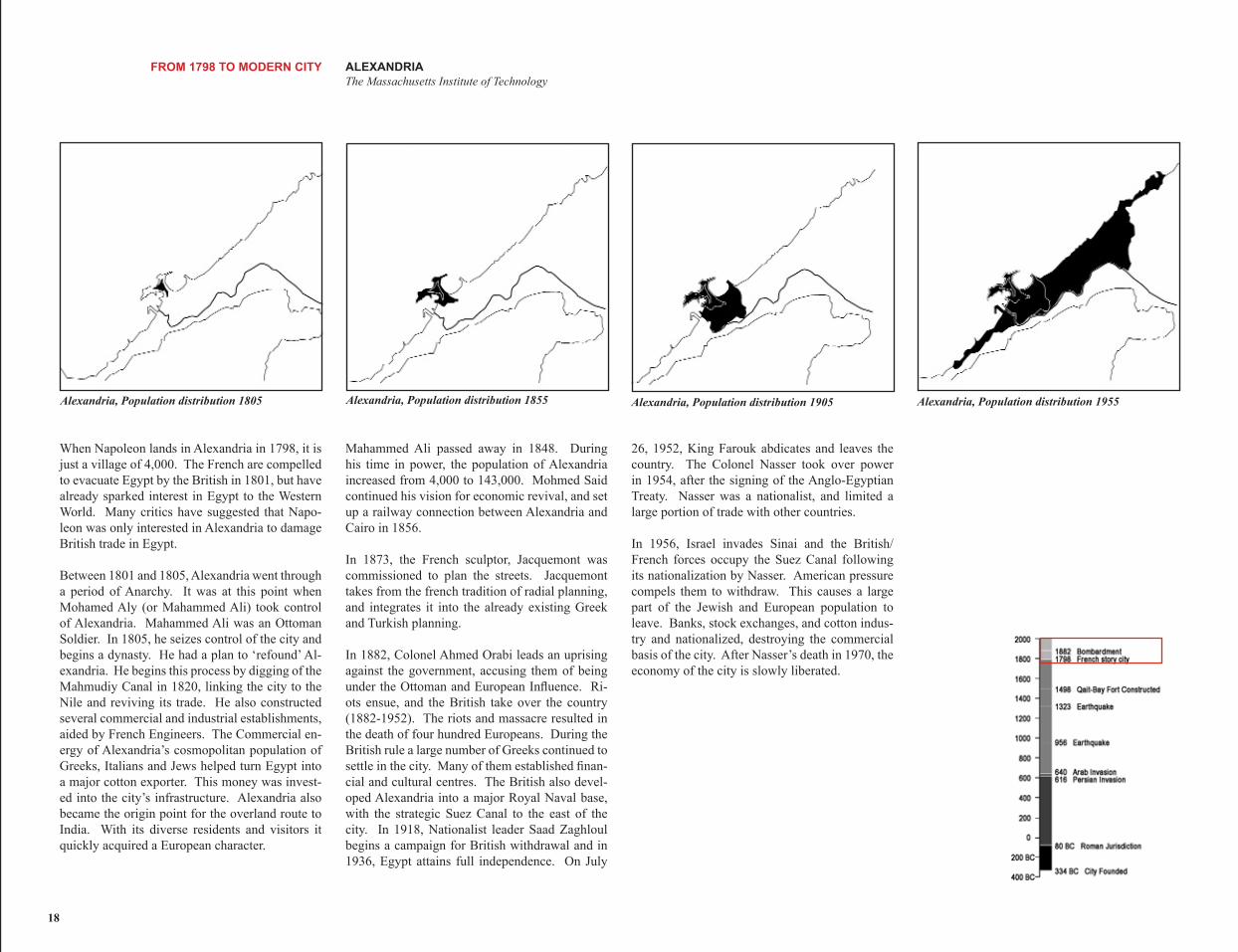
Mahammed Ali passed away in 1848. During his time in power, the population of Alexandria increased from 4,000 to 143,000. Mohmed Said continued his vision for economic revival, and set up a railway connection between Alexandria and Cairo in 1856.
In 1873, the French sculptor, Jacquemont was commissioned to plan the streets. Jacquemont takes from the french tradition of radial planning, and integrates it into the already existing Greek and Turkish planning.
In 1882, Colonel Ahmed Orabi leads an uprising against the government, accusing them of being under the Ottoman and European Influence. Ri-ots ensue, and the British take over the country (1882-1952). The riots and massacre resulted in the death of four hundred Europeans. During the British rule a large number of Greeks continued to settle in the city. Many of them established finan-cial and cultural centres. The British also devel-oped Alexandria into a major Royal Naval base, with the strategic Suez Canal to the east of the city. In 1918, Nationalist leader Saad Zaghloul begins a campaign for British withdrawal and in 1936, Egypt attains full independence. On July
FROM 1798 TO MODERN CITY
Alexandria, Population distribution 1805
When Napoleon lands in Alexandria in 1798, it is just a village of 4,000. The French are compelled to evacuate Egypt by the British in 1801, but have already sparked interest in Egypt to the Western World. Many critics have suggested that Napo-leon was only interested in Alexandria to damage British trade in Egypt.
Between 1801 and 1805, Alexandria went through a period of Anarchy. It was at this point when Mohamed Aly (or Mahammed Ali) took control of Alexandria. Mahammed Ali was an Ottoman Soldier. In 1805, he seizes control of the city and begins a dynasty. He had a plan to ‘refound’ Al-exandria. He begins this process by digging of the Mahmudiy Canal in 1820, linking the city to the Nile and reviving its trade. He also constructed several commercial and industrial establishments, aided by French Engineers. The Commercial en-ergy of Alexandria’s cosmopolitan population of Greeks, Italians and Jews helped turn Egypt into a major cotton exporter. This money was invest-ed into the city’s infrastructure. Alexandria also became the origin point for the overland route to India. With its diverse residents and visitors it quickly acquired a European character.
Alexandria, Population distribution 1855 Alexandria, Population distribution 1905
26, 1952, King Farouk abdicates and leaves the country. The Colonel Nasser took over power in 1954, after the signing of the Anglo-Egyptian Treaty. Nasser was a nationalist, and limited a large portion of trade with other countries.
In 1956, Israel invades Sinai and the British/ French forces occupy the Suez Canal following its nationalization by Nasser. American pressure compels them to withdraw. This causes a large part of the Jewish and European population to leave. Banks, stock exchanges, and cotton indus-try and nationalized, destroying the commercial basis of the city. After Nasser’s death in 1970, the economy of the city is slowly liberated.
Alexandria, Population distribution 1955
ALEXANDRIA FROM 1798 TO MODERN CITY The Massachusetts Institute of Technology
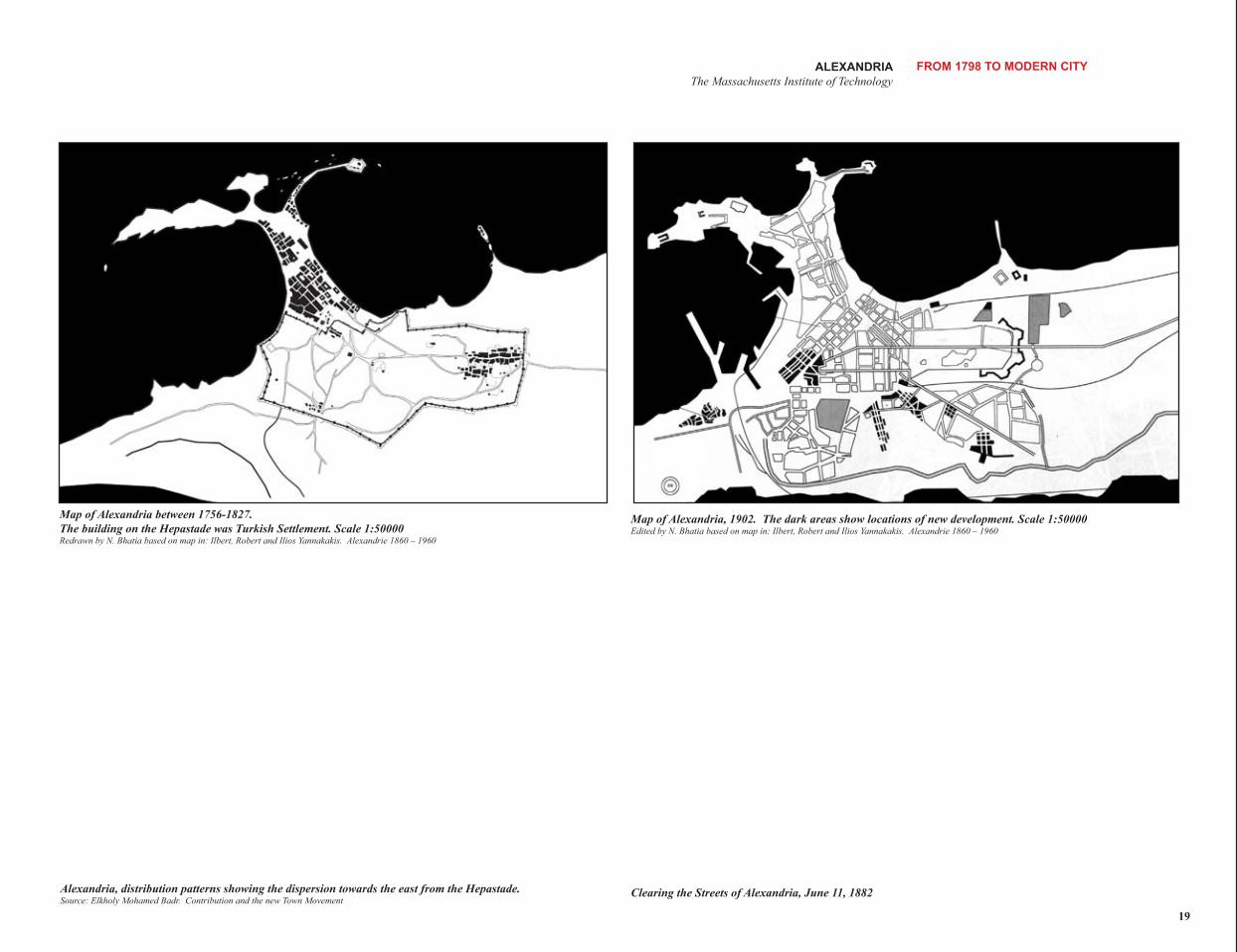
Map of Alexandria between 1756-1827. Map of Alexandria, 1902. The dark areas show locations of new development. Scale 1:50000The building on the Hepastade was Turkish Settlement. Scale 1:50000 Edited by N. Bhatia based on map in: Ilbert, Robert and Ilios Yannakakis. Alexandrie 1860 – 1960 Redrawn by N. Bhatia based on map in: Ilbert, Robert and Ilios Yannakakis. Alexandrie 1860 – 1960
Alexandria, distribution patterns showing the dispersion towards the east from the Hepastade. Clearing the Streets of Alexandria, June 11, 1882 Source: Elkholy Mohamed Badr. Contribution and the new Town Movement
19
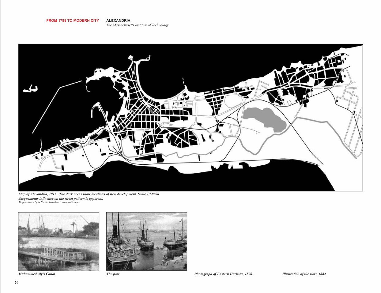
20
Illustration of the riots, 1882.Photograph of Eastern Harbour, 1870.
FROM 1798 TO MODERN CITY ALEXANDRIA The Massachusetts Institute of Technology
The port
The dark areas show locations of new development. Scale 1:50000 Jacquemonts influence on the street pattern is apparent.
Muhammed Aly’s Canal
Map of Alexandria, 1915.
Map redrawn by N.Bhatia based on 3 composite maps
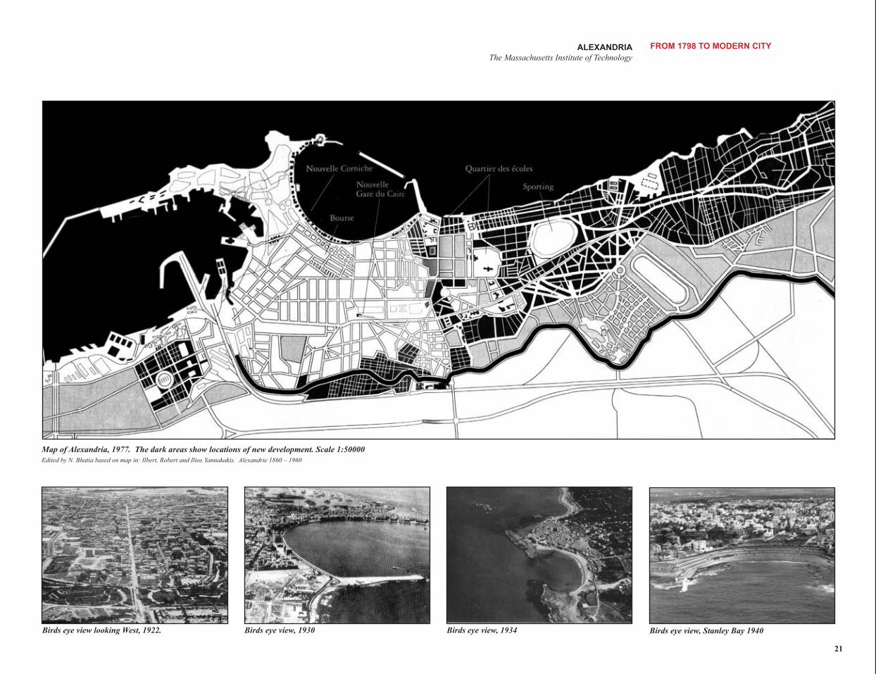
ALEXANDRIA FROM 1798 TO MODERN CITY The Massachusetts Institute of Technology
21
The dark areas show locations of new development. Scale 1:50000 Alexandrie 1860 – 1960
Birds eye view, 1930 Birds eye view looking West, 1922. Birds eye view, 1934
Map of Alexandria, 1977. Edited by N. Bhatia based on map in: Ilbert, Robert and Ilios Yannakakis.
Birds eye view, Stanley Bay 1940