symposium program abstracts - phaselis araştırmaları · symposium program & abstracts . 1 :...
TRANSCRIPT

19th Symposium on Mediterranean Archaeology
“Time, Space and People”
12-14 November 2015 - Kemer/Antalya – TURKEY
Symposium Program &
Abstracts
1

2

SCHEDULE
12th November 2015 (Thursday)
10:00 – 10:30 Opening Remarks
10:30 – 12:40 Oral Presentations
12:40 – 14:00 Lunch Break
14:00 – 17:50 Oral Presentations
17:50 – 18:20 Poster Presentations
19:00 Dinner (Aspava Restaurant, Kemer)
13th November 2015 (Friday)
09:00 – 12:40 Oral Presentations
12:40 – 14:00 Lunch Break
14:00 – 19:05 Oral Presentations
19:05 – 19:20 General Discussion and Closing Remarks
14th November 2015 (Saturday)
11:00 – 12:00 Excursion to Idyros (?)
12:00 – 13:30 Lunch & Snack (Selçuk University, Underwater Research Center)
13:30 – 17:00 Excursion to Phaselis
17:00 – 19:00 Cocktail (Akdeniz University, Phaselis Project Research Center)
3

Symposium Aims and Goals
The nineteenth annual meeting of the Symposium on Mediterranean
Archaeology (SOMA) will be held in Kemer/Antalya (Turkey) from the 12th
to the 14th of November 2015. As it has been in the past, this symposium
will continue to provide an important opportunity for scholars and
researchers to come together and discuss their works in a friendly and
supportive atmosphere. Our spectrum is growing wider due to the
increased importance and knowledge of interdisciplinary works in today’s
scientific era.
4

Scientific Committee
Prof. Dr. Pietro Militello (Catania University)
Prof. Dr. Murat Arslan (Akdeniz University)
Prof. Dr. Asuman Baldıran (Selçuk University)
Prof. Dr. Sławomir Moździoch (Polish Academy of Sciences)
Prof. Dr. Kadir Pektaş (Medeniyet University)
Prof. Dr. Osman Eravşar (Selçuk University)
Dr. Lihi Habas (The Hebrew University of Jerusalem)
Assist. Prof. Dr. Hakan Öniz (Selçuk University)
Assist. Prof. Dr. Nihal Tüner Önen (Akdeniz University)
5
Organizing Committee
Dr. Murat Karademir (Selçuk University)
Dr. Blazej Stanislawski (GAMA)
Dr. Michele Stephanile (GAMA)
Lect. T. Mikail P. Duggan (Akdeniz University)
Dr. Mehmet Kürkçü (Archaeologist)
Res. Assist. Aykan Akçay (Akdeniz University)
Ceyda Öztosun (Selçuk University)
Günay Dönmez (Selçuk University)
Res. Assist. Fatih Yılmaz (Akdeniz University)
Res. Assist. Erkan Kurul (Akdeniz University)
M.A. Betül Gürel (Akdeniz University)
Kamran Kamaei (GAMA)
6

PROGRAM
12th November 2015 (Thursday)
10:00-10:30 Opening Remarks
Hakan ÖNİZ Department of Archaeology, Faculty of Literature, Selçuk University, Konya, Turkey
Blazej STANISLAWSKI Institute of Archaeology and Ethnology of the Polish Academy of Sciences
Mustafa GÜL Mayor of Kemer
Mustafa Cihad FESLİHAN District Governor of Kemer
Melik AYAZ
On behalf of Republic of Turkey Mınıstry of Culture and Tourism, Directory of Cultural Heritage and Museums – The Director of Excavations Department
ORAL PRESENTATIONS
I s t SESSION
12:40-14:00 LUNCH BREAK
Chairman Hakan ÖNİZ
10:30-10:50 Günay DÖNMEZ An Example of the Submerged Prehistoric Settlements of the Marmara Sea: Avşa Island
10:50-11:10 Sebastián Celestino PÉREZ Esther Rodríguez GONZÁLEZ
The Influence of Mediterranean Architecture in Tarteso
11:10-11:30 Alper ZAFER Ahmet ASLAN
Bronze Age Stone Anchors in Cilicia Coast
11:30-11:50 Mateo González-VÁZQUEZ Conditoria Frugum Occulta. A Comparison of Subsistence Strategies in Aboriginal North America and Iron Age Iberia
11:50-12:10 Agata KUBALA Representations of Animals on the So-Called Neo-Hittite Seals
12:10-12:30 Muzaffer DEMİR The Beginning and the Development of Greek-Colchian Relations During the Greek Colonisation Period: A Reconsideration
12:30-12:40 DISCUSSION
7

IIn d SESSION
Chairman Sergey M. FAZLULLIN
14:00-14:20 Hakan ÖNİZ An Ancient Shipyard: Silifke Dana Island
14:20-14:40 Kenan BEŞALTI The Underwater Study of Magydos Harbour
14:40-15:00 Erkan KURUL The Carthaginian Hannon and His Voyage to the West Coast of Africa
15:00-15:20 Jane REMPEL Connectivity, Community and Landscape in the Northern Black Sea Region
15:20-15:30 DISCUSSION
15:30-15:45 BREAK
III r d SESSION
Chairman Lihi HABAS
15:45-16:05 Michele SCALICI A New Way of Drinking. The Distribution of the Krater Shape in the North-Lucanian Area
16:05-16:25 Fatih YILMAZ The Cult of Athena Polias on the Acropolis of Phaselis and within the Eastern Mediterranean
16:25-16:45 Diego Chapinal HERAS Archaeology of Power: The Molossian Kingdom and the Epirote Koinon
16:45-17:05 Romanescu GHEORGHE
The City-Port of Halmyris – The Favourability of Natural Conditions for the Military and Economic Development of the Last Roman Bastion on the Eastern Flank of the Danubian Limes
17:05-17:25 Petra JANOUCHOVA Barbora WEISSOVA
The Use of Writing in a Funerary Context in Classical and Hellenistic Thrace
17:25-17:35 DISCUSSION
17:35-17:50 BREAK
8
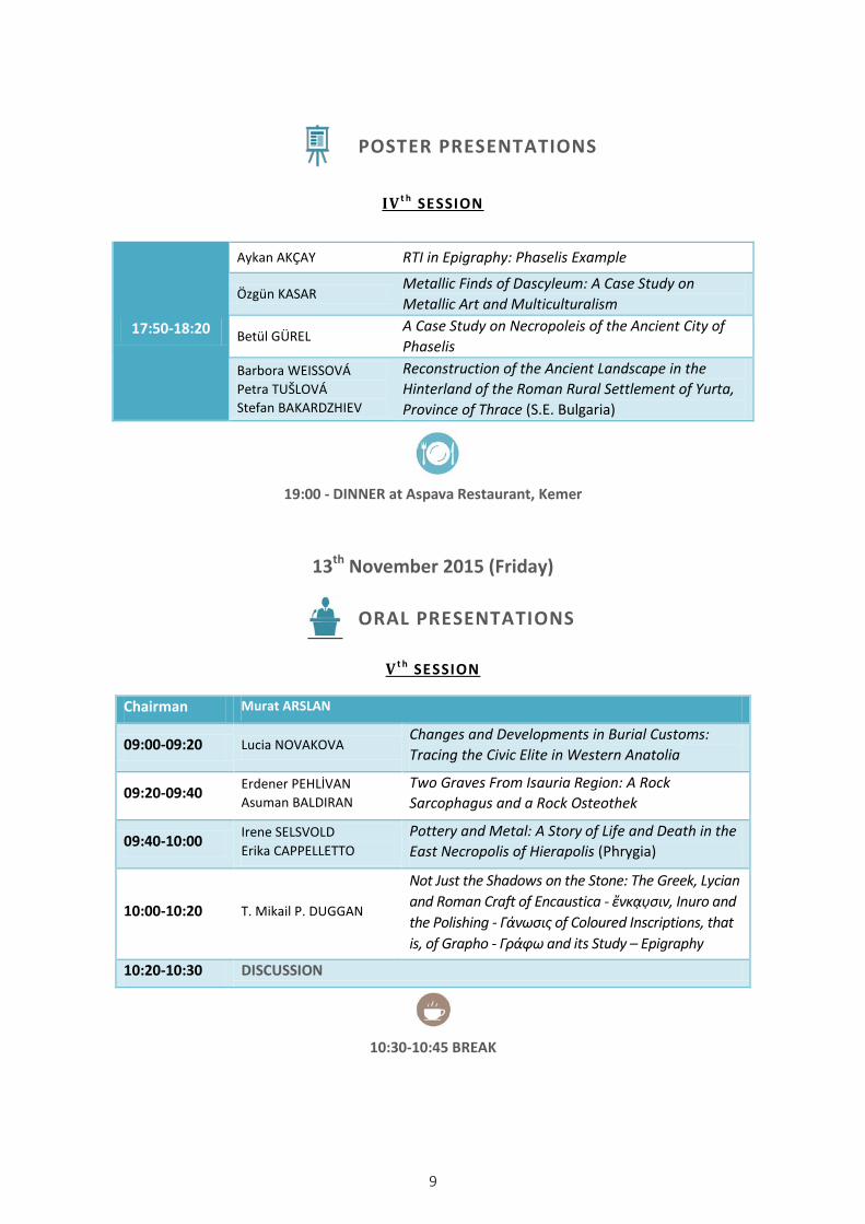
POSTER PRESENTATIONS
IV t h SESSION
19:00 - DINNER at Aspava Restaurant, Kemer
13th November 2015 (Friday)
ORAL PRESENTATIONS
V t h SESSION
10:30-10:45 BREAK
17:50-18:20
Aykan AKÇAY RTI in Epigraphy: Phaselis Example
Özgün KASAR Metallic Finds of Dascyleum: A Case Study on Metallic Art and Multiculturalism
Betül GÜREL A Case Study on Necropoleis of the Ancient City of Phaselis
Barbora WEISSOVÁ Petra TUŠLOVÁ Stefan BAKARDZHIEV
Reconstruction of the Ancient Landscape in the Hinterland of the Roman Rural Settlement of Yurta, Province of Thrace (S.E. Bulgaria)
Chairman Murat ARSLAN
09:00-09:20 Lucia NOVAKOVA Changes and Developments in Burial Customs: Tracing the Civic Elite in Western Anatolia
09:20-09:40 Erdener PEHLİVAN Asuman BALDIRAN
Two Graves From Isauria Region: A Rock Sarcophagus and a Rock Osteothek
09:40-10:00 Irene SELSVOLD Erika CAPPELLETTO
Pottery and Metal: A Story of Life and Death in the East Necropolis of Hierapolis (Phrygia)
10:00-10:20 T. Mikail P. DUGGAN
Not Just the Shadows on the Stone: The Greek, Lycian and Roman Craft of Encaustica - ἔνκα̣υ̣σιν, Inuro and the Polishing - Γάνωσις of Coloured Inscriptions, that is, of Grapho - Γράφω and its Study – Epigraphy
10:20-10:30 DISCUSSION
9
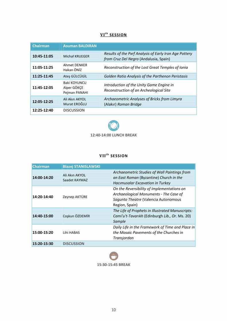
VI t h SESSION
Chairman Asuman BALDIRAN
10:45-11:05 Michał KRUEGER Results of the Pxrf Analysis of Early Iron Age Pottery from Cruz Del Negro (Andalusia, Spain)
11:05-11:25 Ahmet DENKER Hakan ÖNİZ Reconstruction of the Lost Great Temples of Ionia
11:25-11:45 Ateş GÜLCÜGİL Golden Ratio Analysis of the Parthenon Peristasis
11:45-12:05 Baki KOYUNCU Alper GÖKÇE Pejman PANAHI
Introduction of the Unity Game Engine in Reconstruction of an Archeological Site
12:05-12:25 Ali Akın AKYOL Murat EROĞLU
Archaeometric Analyses of Bricks from Limyra (Alakır) Roman Bridge
12:25-12:40 DISCUSSION
12:40-14:00 LUNCH BREAK
VII t h SESSION
Chairman Blazej STANISLAWSKI
14:00-14:20 Ali Akın AKYOL Saadet KAYMAZ
Archaeometric Studies of Wall Paintings from an East Roman (Byzantine) Church in the Hacımusalar Excavation in Turkey
14:20-14:40 Zeynep AKTÜRE
On the Reversibility of Implementations on Archaeological Monuments - The Case of Sagunto Theatre (Valencia Autonomous Region, Spain)
14:40-15:00 Coşkun ÖZDEMİR The Life of Prophets in Illustrated Manuscripts: Cami'u't-Tavarıkh (Edinburgh Lib., Or. Ms. 20) Sample
15:00-15:20 Lihi HABAS Daily Life in the Framework of Time and Place in the Mosaic Pavements of the Churches in Transjordan
15:20-15:30 DISCUSSION
15:30-15:45 BREAK
10

VIII t h SESSION
Chairman Muzaffer DEMİR
15:45-16:05 Osman ERAVŞAR An Essay on Historical Development of Alanya Port
16:05-16:25 Mahmut DEMİR Interaction in the Eastern Mediterranean: The Battle of the Masts
16:25-16:45 Okay SÜTÇÜOĞLU Cedar Transportation in the Finike Region Between Antiquity and the 20th Century
16:45-17:05 Blazej STANISLAWSKI Şengül AYDINGÜN Hakan ÖNİZ
Rus’s Quarter in Constantinople
17:05-17:25 Sergey M. FAZLULLIN Legal and Management Aspects of the Underwater Cultural Heritage Protection in the Russian Federation
17:25-17:35 DISCUSSION
17:35-17:45 BREAK
IX t h SESSION
Chairman Oğuz AYDEMİR
17:45-18:05 Tuğçe ERTABAK Dicle KIRMIZITAŞ
Underwater Archaeological Research in Tisan (Aphrodisias) Area - 2015
18:05-18:25 Murat KARADEMİR A Cultural Heritage in Alanya: Alara (Lower) Bath
18:25-18:45 Krzysztof JAKUBIAK Maria WARDZYŃSKA
Marina El Alamein, A Highly Enigmatic and Multi-Cultural Town?
18:45-19:05 Ezgin YETİŞ The Wall Paintings in Bafra Ulu Mosque: Assesment of Conservation and Restoration
19:05-19:20 GENERAL DISCUSSION and CLOSING REMARKS by Sergey M. FAZLULLIN & Murat ARSLAN
11
12
19th Symposium on Mediterranean Archaeology (2015) 12 Nov 2015
Ist SESSION: 10:30 – 10:50
AN EXAMPLE OF THE SUBMERGED PREHISTORIC SETTLEMENTS OF THE MARMARA SEA: AVŞA ISLAND
Günay DÖNMEZ Selçuk University, Underwater Research Center, [email protected]
Avsa island in Balıkesir Province is located in the southwest of the Marmara Sea, in the Marmara region, is one of the islands that comprise the archipelago termed the Marmara Islands. The first surviving written information concerning the first indigenous people of the island is recorded by the historian Strabo and the geographer Pliny. In recent years, various shaped flints, bones, tools, spindles, whorls and millstones have been discovered on the coastline of Avşa island, strengthening the idea that settlement was in fact established at an earlier date than is recorded in the ancient literary record.
The first research on the region’s settlement was carried out by Prof. Mehmet Özdoğan in 1994. The settlement area was also investigated by Prof. Dr. Nergis Günsenin in 1995. The materials and ruins discovered through underwater investigation conducted in 2015 by our research team are dated to earlier than has been reported in the studies of settlement mentioned above. These remains, lying at a depth of 1.5-2.00 meters underwater, can be easily seen from the coast. From the fact that the mound has been exposed to wave erosion over the years and one part of the mound is today underwater, the other part is on shore, it is understood that the former shoreline is today under the waves and the present shoreline is further inland.
In studies underwater the ceramic and pithos shaped ceramic pot graves that are thought to belong to the Neolithic, Chalcolithic and especially to the Bronze Age, have been seen in the submerged area of the mound. In addition, various ceramic examples and ruins dating from the Hellenistic period to late antiquity have been also discovered. These finds lead to the suggestion that this island has been a human settlement area from Prehistoric times to the present day.
genama.info
13

19th Symposium on Mediterranean Archaeology (2015) 12 Nov 2015
Ist SESSION: 10:50 – 11:10
THE INFLUENCE OF MEDITERRANEAN ARCHITECTURE IN TARTESO
Sebastián Celestino PÉREZ Esther Rodríguez GONZÁLEZ
Instituto de Arqueología (IAM) Consejo Superior de Investigaciones Científicas (CSIC), [email protected]
The Phoenician colonization of the Iberian Peninsula (s. IX B.C.) led to the introduction of new architectonic techniques and forms that replaced the traditional architecture represented by Late Bronze Age huts. Nevertheless, although in the beginning these new buildings had a strong Mediterranean character, with the development of the Tartesic culture new architectonic forms began to be developed as a consequence of their adaption to the environment in which they are built, the natural resources they could access in the surroundings and the contribution of certain indigenous elements. These factors resulted in the appearance of a hybrid architecture that gives Tarteso its own personality.
To explain the architectonic evolution of this culture we begin with the analysis of the first constructions with a clear Mediterranean character that are located in the Guadalquivir Valley, considered as the nucleus of Tarteso, El Carambolo or Coria del Rio; then center upon the study of the first buildings properly belonging to the Tartesic Culture. Therefore, knowing the characteristic techniques employed in the first buildings allows us to individualize in future studies which elements characterize Mediterranean culture and which elements were the contributions of the local societies, heirs of a culture with a strong Atlantic character. To be able to carry out this task we focus upon the Middle Valley of the Guadiana River, a territory that borders the Tartesic nucleus and that receives a great amount of cultural influence, although it maintains certain features that lead to the development of an architecture with a very strong personality. The most characteristic buildings are located under artificial tumulus, and are one of the main elements that identifies this culture and geographic region, buildings that have provided a great amount of information and data for the interpretation of the development of Tartesic culture.
Until today the best example of this type of site is the Tartesic building of Cancho Roano, which has been a totally excavated, allowing researchers to create a model used as a guide for the study of buildings located under tumulus in this region. Here we present two new buildings that have led to an important breakthrough in our knowledge, concerning not only Tartesic architecture, but also the societies that developed them. The first, Cerro Borreguero, near Cancho Roano, is the precedent for evidence of this kind of construction of Mediterranean influence, since Late Bronze Age occupation has been identified at the site. The second site, the building of El Turuñuelo, is a new example for the study of Tartesic architecture during its final moments, having documented new construction techniques that have not to date been identified in the archaeological record of this period.
genama.info
14

To be able to carry out this study we have developed a new methodology based upon Spatial Archaeology, the starting point of which is the technological analysis of the constructions we will be presenting. We consider that architecture constitutes another of the different elements that are needed to obtain a better understanding of how past societies were structured, adding this new information to all the data already provided through the traditional study of the material culture.
15
19th Symposium on Mediterranean Archaeology (2015) 12 Nov 2015
Ist SESSION: 11:10 – 11:30
BRONZE AGE STONE ANCHORS IN CILICIA COAST
Alper ZAFER Selçuk University, Underwater Research Center,
Ahmet ASLAN Selçuk University, Underwater Research Center,
The problem associated with securing ships in position through the development of ship technology has emerged. It has been shown that a ship in order to be moored in one place would be secured by means of a weight attached to a line from the ship and thrown into the sea. This method can be kept constant and cheap by weight, as rocks of this type can be easily be found in nature and of a type of stone easily processed was preferred.
This process begins with rough stone anchors with one hole, which then becomes a double hole and then the anchor of three holes, in this progression, wooden anchors and iron anchors were added to this development and provides us with continuity from those of antiquity down to the modern steel anchor of today.
Between 2009 and 2011 during the first systematic underwater research conducted along the Mediterranean coastline North-East of Antalya, harbors, anchorages, iron anchors, stone anchors and wrecks dating from different periods were found.
The results of this research show that the single hole, double-hole and three-hole anchors dating from the Bronze Age are important in terms of providing information concerning trade. The subject of the article is the identification of the forms of Bronze Age stone anchors.
genama.info
16

19th Symposium on Mediterranean Archaeology (2015) 12 Nov 2015
Ist SESSION: 11:30 – 11:50
CONDITORIA FRUGUM OCCULTA. A COMPARISON OF SUBSISTENCE STRATEGIES IN ABORIGINAL NORTH AMERICA AND IRON AGE IBERIA
Mateo González-VÁZQUEZ M. Phil (University of Oxford)
PhD Candidate, Universitat de Barcelona, Dept. of Prehistory, Ancient History and Archaeology, [email protected]
Pliny the Elder, Varro and Columella limit their account to stating that grain, under certain climate conditions, could be effectively stored underground for several years. The constant reproduction of these narratives, together with the lack of a thorough survey of both the historical and ethnographic evidence, has distorted most of the modern studies concerning subterranean grain storage. In a paper published in 1988, Warren R. DeBoer criticized the interpretative conventions that in his own words, very often misrepresent the ecological and social functions of subterranean storage. By means of a critical review of the ethno-historic and archaeological sources, DeBoer suggested that the extended use of storage pits should be regarded as a symptom of either, seasonally abandoned settlements, or of resistance to a new and potentially oppressive socio-political order. Deboer’s investigation is, however restricted to aboriginal eastern North America. Similarly, in a geographical area comprising most of the Catalan coastal depression and pre-coastal plains, storage pits are also one of the more common archaeological features dating from between the fourth and first centuries B.C. Nonetheless, no one has yet attempted a historical and macro-economic analysis of grain production in the Western Mediterranean, or has tried to ascertain what was the impact of the Roman presence and how did this new interaction affect grain production and storage in the area. As a result, their interpretation still remains lacunose. In this paper the global implications of the diagnosis developed by DeBoer is explored by looking specifically at the relevant archaeological evidence from Iron Age Iberia.
genama.info
17
19th Symposium on Mediterranean Archaeology (2015) 12 Nov 2015
Ist SESSION: 11:50 – 12:10
REPRESENTATIONS OF ANIMALS ON THE SO-CALLED NEO-HITTITE SEALS
Agata KUBALA PhD, University of Wrocław, Institute of Art History, [email protected]
Among other decorative motifs there are the representations of animals engraved on seals produced within the territory of the so-called Neo-Hittite kingdoms. They are depicted singly or in groups consisting of two or more representations of the same or of different species, accompanied by filling motifs. Images of single animals, horned quadrupeds, lions or a running ostrich are found on stamp seals with hammer-like or fist-shaped handles. In every case there is another object in front of an animal. On the Neo-Hittite seals lions also appear in group scenes of some animals. They are usually accompanied by a recumbent or striding goat, birds of prey or a scorpion. The group scenes depicted on this group of seals also carry images of horned animals with large birds of prey with lowered heads seated on their backs, and representations of erect goats placed to either side of a tree. Another combination of animals appearing on Neo-Hittite seals depicts a cow suckling a calf. Animals are also shown in the company of men, held by them and also in hunting scenes.
Not all iconographic motifs that are depicted on Neo-Hittite seals are a continuation of Hittite traditions of seal engraving or are modeled after scenes decorating Neo-Hittite orthostats. In this paper the attempt is made to identify non-Hittite sources of inspiration for the designs employed by the engravers of Neo-Hittite seals and to answer the question that is raised concerning the reason of the presence on these seals of these decorative motifs.
genama.info
18

19th Symposium on Mediterranean Archaeology (2015) 12 Nov 2015
Ist SESSION: 12:10 – 12:30
THE BEGINNING AND THE DEVELOPMENT OF GREEK-COLCHIAN RELATIONS DURING THE GREEK COLONISATION PERIOD:
A RECONSIDERATION
Muzaffer DEMİR Prof. Dr., University of Muğla Sıtkı Kocman, Department of History, [email protected]
Ancient sources relating the start of Greek relations with Colchis are lacking. Archaeological finds that highlight the manner of life of the Greeks and their relations with the native population when they came to the region mostly consist of ceramic evidence which only provides us with suggestions related to the beginnings of these settlements. The pre-colonial relations in the region were transformed into permanent settlements by the VIth century B.C. To date, four Greek colonies have been recognized in Colchis: Dioskurias-Eshera, Gyenus, Phasis, as well as Pitchvnari whose name in antiquity is unknown. In this paper we discuss the fact that within these Greek colonies the native elements were dominant, especially in terms of population numbers, their experience and access to natural resources, and that cultural interaction was mutual, in other words, a common culture resulted from the use of identical materials.
genama.info
19

19th Symposium on Mediterranean Archaeology (2015) 12 Nov 2015
IInd SESSION: 14:00 – 14:20
AN ANCIENT SHIPYARD: SILIFKE DANA ISLAND
Hakan ÖNİZ Selçuk University, Underwater Research Center, [email protected]
During the underwater survey of the town of Silifke, Mersin-Turkey in the summer of 2015, a previously unknown ancient shipyard was found by Selçuk University Underwater Research Center. The site of this shipyard is on the coast of an island which is termed Dana Island (Pithyussa) in ancient region of Cilicia.
This shipyard contains about 100 slipways, available to construct at least 100 ships within a year. Some of the entrances of the slipways are visible from the bottom of the sea. The main parts of these slipways are cut into the rock of the coastline and some of them contain a special unit to enable the construction/repair of the rams of warships. These warships termed “bireme” and “trireme” were the main naval warships of antiquity employed from about the VIIIth century B.C. into the Vth century A.D. One iron ram was also found in the course of this research at a depth of 35 m. on the west side of the island. These slipways were constructed side by side along approximately 1500 m. of the coastline and some had broken and fallen into the sea due to past seismic activity. Some slipways were constructed extending partly into the sea through the use of special architectural methods. Working on these slipways will enable a greater understanding of ship construction in antiquity and the engineering involved in ram production and of the process of the attachment of the ram to the warship.
genama.info
20

19th Symposium on Mediterranean Archaeology (2015) 12 Nov 2015
IInd SESSION: 14:20 – 14:40
THE UNDERWATER STUDY OF MAGYDOS HARBOUR
Kenan BEŞALTI Adana Kültür Varlıklarını Koruma Bölge Kurulu Müdürlüğü, [email protected]
Ships followed the coastline in the period between antiquity and the invention of compass. This was necessary in respect to both navigation and the safety of the voyage. It can be thought this practice caused an increased density of coastal settlement and use of coastal harbors due to this coastal traffic. The ancient harbor and its staff, which can be evaluated as forming a complex, have often been physically destroyed. Destroyed through the passage of time, through the course of centuries of erosion, through seismic activity-earthquakes, through coastal change and natural interventions and are today often underwater. The harbor of the ancient city of Magydos, one of the most important coastal settlements of Pamphylia, partly remains today underwater due to the problems cited above, while that part of the harbor onshore has been subjected to modern interventions. This paper presents the results of the underwater investigations which were conducted in 2013 to determine the surviving parts of this important harbor as in the course of this survey important discoveries were made.
genama.info
21

19th Symposium on Mediterranean Archaeology (2015) 12 Nov 2015
IInd SESSION: 14:40 – 15:00
THE CARTHAGINIAN HANNON AND HIS VOYAGE TO THE WEST COAST OF AFRICA
Erkan KURUL M.A, Akdeniz University, Mediterranean Civilisations Research Institute, Antalya,
The Phoenicians, and their most important successors, the Carthaginians are frequently mentioned in connection with their maritime activities in the Mediterranean from ca. XV. century B.C. until the end of the Hellenistic Period. In these 1500 years they conducted some significant expeditions connected with their maritime commerce and trade seeking activities. In consequence they reached new destinations and they founded substantial colonies. Within this context they also developed their nautical traditions and gained renown for their experience of Mediterranean coastal geography.
During this period the Carthaginians organized outstanding and familiar voyages to certain regions and they explored terra incognita (the unknown world). Amongst these voyages the Carthaginian sufes Hannon’s is both famed and notable. His voyage is dated to the beginning of the V. c. B.C. (even by some scholars to the end of the VI. c. B.C.) and it explored the North-Western coast of Africa beginning from the city of Carthage. After, or at the same time as his voyage, a sailing account (περίπλους) was written by him or by an accompanying Carthaginian elite mariner and this was dedicated to the temple of Ba’al-Hammon (being the Carthaginian equivalent of Cronus), the chief deity of Carthage. In the Hellenistic Period these accounts were translated from Carthaginian into Greek. In consequence of this translation some parts of this periplus record survived, reaching subsequent generations and ourselves today. Within the scope of this presentation some elements of this periplus are examined, literary observations are made and geographical data explicated.
genama.info
22
19th Symposium on Mediterranean Archaeology (2015) 12 Nov 2015
IInd SESSION: 15:00 – 15:20
CONNECTIVITY, COMMUNITY AND LANDSCAPE IN THE NORTHERN BLACK SEA REGION
Jane REMPEL Department of Archaeology, University of Sheffield, [email protected]
Recent developments in network approaches and community formation in the ancient Greek world have stressed the ways in which individuals of differing status and identity participated in society and of the role of connectivity in defining their interactions. The recognition of interlinked communities and ways in which they were connected allows for a shift away from dichotomous categorization (citizen – non-citizen, Greek – non-Greek), in favor of understanding the mechanisms that connected different communities.
Building on these ideas, this paper explores the ways in which the developing rural landscapes of the Greek settlements on the Black Sea served to structure connections and community formation in the first millennium B.C. From the foundation of the earliest Greek settlements in the later seventh century B.C. through the development of secondary settlements and ‘further choras’ the rural hinterlands of these settlements played a key role in the social, political and economic networks that emerged. With particular attention to the settlements on the north Black Sea coast, where there has been significant extensive and increasing amounts of intensive survey, this paper examines the role of rural settlement, systems of roads and paths and agricultural installations in facilitating connectivity in the rural hinterlands of the Greek settlements in this region. These features played a key role in structuring physical relationships and facilitating the movement of people and goods in the landscape, as well as in establishing the foundation for new agricultural economies and territorial expansion that were driven by the main Greek settlements. The people who lived in these rural hinterlands were members of communities with disparate cultural identities, of differing status and levels of wealth but they were connected through social, political and economic networks that linked them to each other and to the Greek settlements they interacted with. This paper examines the features of the rural landscapes associated with the Greek settlements on the north coast of the Black Sea in order to shed light on the mechanisms of these connections and to better understand the nature of participation of the interlinked communities in this region.
genama.info
23
19th Symposium on Mediterranean Archaeology (2015) 12 Nov 2015
IIIrd SESSION: 15:45 – 16:05
A NEW WAY OF DRINKING. THE DISTRIBUTION OF THE KRATER SHAPE IN THE NORTH-LUCANIAN AREA
Michele SCALICI PhD, Alma Mater Studiorum- Università di Bologna, [email protected]
In the Archaic period depictions of banquet services are widespread in luxurious assemblages in tombs. In the inner side of Southern Italy, the main pot of the set is the so-called cantaroide, probably used for the consumption of a locally produced alcoholic beverage. Unlike in other parts of Italy, in the North-Lucanian area the spread of the krater shape is rare. Furthermore kraters were only produced by local workshops in the Vth century B.C.
This paper aims to analyze the distribution of the krater shape in the North-Lucanian area in order to compare this data with other areas of Southern Italy, trying to shed light on the causes of this phenomenon and to outline the possible places of production of these vessels.
genama.info
24

19th Symposium on Mediterranean Archaeology (2015) 12 Nov 2015
IIIrd SESSION: 16:05 – 16:25
THE CULT OF ATHENA POLIAS ON THE ACROPOLIS OF PHASELIS AND WITHIN THE EASTERN MEDITERRANEAN
Fatih YILMAZ M.A., Akdeniz University, Mediterranean Civilisations Research Institute, Antalya,
From earliest times in the worship of Athena, especially on the Aegean Islands and Hellas, the goddess was worshipped as the protector of cities, institutions and mythological heroes and she manifested these functions in various ways. Particularly during the Archaic and Classical periods, it was this aspect of Athena that, politically placed the goddess, most commonly found with the epithet polias, amongst the most important deities, together with Zeus and Apollo. The cult of the goddess was taken all over the Eastern Mediterranean in the great colonization movements. Myths relate the city of Phaselis was colonized in 691/690 B.C. by a group under the leadership of Lacius from Lindus and it was then that the Athena cult of the mother city was brought to Phaselis. From the founding of the city until the Late Roman period, the cult can be defined through epigraphic, numismatic, as well as from philological evidence that Athena was the chief goddess of the city and her temple was located on the acropolis of Phaselis. Further, the temple of Athena in the city obtained great renown after the spear of the Trojan hero Achilles was dedicated there.
In this presentation, after the goddess’ position within the pantheon of Phaselis has been examined, the possible location of the temple of Athena is suggested. Then the relationship of the local origin of Athena Polias in Lycia to that of Phaselis is addressed. Finally, an attempt is made to describe the diffusion and interaction of this cult in Eastern Mediterranean coastal cities, particularly during the Archaic and Classical periods.
genama.info
25
19th Symposium on Mediterranean Archaeology (2015) 12 Nov 2015
IIIrd SESSION: 16:25 – 16:45
ARCHAEOLOGY OF POWER: THE MOLOSSIAN KINGDOM AND THE EPIROTE KOINON
Diego Chapinal HERAS PhD, Dep. of Ancient History, Complutense University of Madrid, Spain, [email protected]
Epirus was the territory where firstly the Molossian kingdom, and later the Epirote Koinon, developed during the end of the Classical period and in the Hellenistic period. Both of these entities provide us with information concerning how they indicated their growing power, about how they displayed their importance. In the case of the former, the dynasty of the Aeacids directed this effort and they were presented as the great rulers. On the other hand, the koinon tried to underscore the unity of the different ethne that formed the confederation, instead of highlighting only one ethnos.
In this paper the different mechanisms employed by the Molossian kingdom and by the Epirote Koinon are analyzed in order to show this. Therefore, the presentation addresses all the materials connected to the management of power. It is possible to obtain information from archaeological material, as well as from both epigraphy and numismatics. Moreover, Landscape Archaeology is also very useful; the distribution and organization of space are paramount to correctly display power. This can be seen at the sanctuary of Dodona, where some political buildings were constructed near to the cultic area. The sacred landscape of the shrine was altered, forming a part of this message.
genama.info
26
19th Symposium on Mediterranean Archaeology (2015) 12 Nov 2015
IIIrd SESSION: 16:45 – 17:05
THE CITY-PORT OF HALMYRIS – THE FAVOURABILITY OF NATURAL CONDITIONS FOR THE MILITARY AND ECONOMIC DEVELOPMENT OF THE
LAST ROMAN BASTION ON THE EASTERN FLANK OF THE DANUBIAN LIMES
Romanescu GHEORGHE PhD, Alexandru Ioan Cuza University of Iasi, Faculty of Geography and Geology,
Most Roman cities are situated on the Danubian limes of Dobrudja. The last Roman city on the eastern side is Halmyris, situated at the mouth of the St. George arm. It is a city-port with primarily a military role, situated at the point of contact between the fluvial and the marine environment, at the foot of Peuce Island and at the northern extremity of the Beibugeac corridor (the former small gulf belonging to the great gulf of Halmyris). Around it, the Greek cities of Istria (Histria) and Argamum (Orgame) were founded. The city is also famous for its location at the foot of the legendary Peuce Island. The city primarily played a military and strategic role, as well as secondarily, an economic role. The city of Halmyris benefited from important natural resources from two environments with distinct characteristics: marine (Halmyris gulf and Razim lagoon) and freshwater (Danube Delta and the St. George arm). Resources on the continental mainland are limited to construction materials (limestone and clay). When the city was founded, the St. George’s arm was the most important navigational artery of the Danube. Therefore, penetration upstream was strictly monitored by the city-port of Halmyris (customs). For the marine environment, an observation camp was built at Dunavatu de Jos, a few kilometres to the southeast. This study emphasizes the existence of favorable premises for the city of Halmyris and it attempts to revitalize thematic tourism (Halmyris is a unique city within the eastern extremity of the Roman Empire). Religious tourism may also be revived, because in this city a crypt was discovered bearing the remains of the earliest Christian martyrs on Romanian territory (Epictetus and Astion, martyred at Almyridensium civitas in 290 A.D.).
genama.info
27

19th Symposium on Mediterranean Archaeology (2015) 12 Nov 2015
IIIrd SESSION: 17:05 – 17:25
THE USE OF WRITING IN A FUNERARY CONTEXT IN CLASSICAL AND HELLENISTIC THRACE
Petra JANOUCHOVA Barbora WEISSOVA PhD, Charles University in Prague, Institute for Greek
and Latin Studies, [email protected] PhD, Institute of Classical Archaeology, Charles
University in Prague, [email protected]
This presentation bings together known epigraphic evidence from funerary contexts in coastal and inland Thrace from the Classical and Hellenistic period. It presents various types of inscriptions from funerary contexts and discusses the main differences in their character. Moreover, we discuss the possible underlying motives for the existence of epigraphy in the context of burial and its broader significance in the society of the respective period.
Coastal Thrace was already colonised by Greeks during the archaic period and not surprisingly, the colonisers brought with them not only their language but also their funerary habits. Thus, we can see the spread of inscribed funerary stelae in the vicinity of Greek colonies all over the Black Sea coast and on the Northern Aegean coast. Did some of these habits penetrate into inland Thrace, either via mutual contacts with the local population or via internal colonisation? How did the Thracian population adopt and adapt the typical Greek habit of inscribing the funerary stelae and/or the deposited grave goods?
We present the epigraphic material accordingly divided by the nature of the inscribed object and its position in the funerary context: the resultant three groups encompass: ‘inscriptions on grave markers’, ‘inscriptions on grave goods’ and ‘inscriptions inside the grave’. The analysed material reveals rather diverse approaches to the use of writing in the funeral habit according to the geographic position, when comparing coastal and inland Thrace. This diversity might be explained as a result of the different socio-economic structures of these areas.
genama.info
28

19th Symposium on Mediterranean Archaeology (2015) 12 Nov 2015
IVth SESSION: 17:50 – 18:20
RTI IN EPIGRAPHY: PHASELIS EXAMPLE
(Poster)
Aykan AKÇAY M.A, Akdeniz University, Mediterranean Civilisations Research Institute, Antalya, [email protected]
One of the fundamental issues facing epigraphic studies is the fact that the analysis of epigraphic documents is becoming more difficult due to both the natural and the human caused erosion of the surface carrying an inscription which has been exposed to the elements for many years. Reflectance Transformation Imaging (RTI), which has recently begun to be employed in areas such as prehistory, numismatics and conservation, has also been applied to the inscriptions which have been found at Phaselis. RTI is a method of digital photography which provides an object with a 3D surface by capturing the surface form, pattern and color values of the object and allowing the light to be applied to the object interactively from various perspectives. In this presentation, epigraphic material found in the ancient city of Phaselis, has been observed through the RTI method, with the new techniques of analysis which modern technology offers science, and evaluations have been made concerning the processes of documentation and synthesis. The main objectives have been determining the success criteria in the light of the data obtained through these studies and constituting a leading model for future studies. As a result of this research, the methodologies employed here are also intended to provide a new point of view and a new approach for traditional epigraphic studies.
genama.info
29

19th Symposium on Mediterranean Archaeology (2015) 12 Nov 2015
IVth SESSION: 17:50 – 18:20
METALLIC FINDS OF DASCYLEUM: A CASE STUDY ON METALLIC ART AND MULTICULTURALISM
(Poster)
Özgün KASAR Muğla Sıtkı Koçman University, Faculty of Literature, Department of Archaeology, [email protected]
Dascyleum is located in the Balıkesir Province of Turkey, 2 km. west of Ergili village in the District of Bandırma, south of Lake Manyas. The settlement, a strategic, religious and political key point, is situated within the access network formed predominantly by Hellespontine Phrygia and also by Mysia, Bithynia, Paphlagonia, Phrygia and Lydia. In addition, Dascyleum has significance due to its position as host to Mysian, Phrygian, Lydian, Persian and Greek cultures; the pivotal cultures of Anatolian history. Numerous metallic finds, approx. 1000 pieces, including weapons, weights, architectural fittings, furniture fittings, locks and keys, jewelry and ornaments, religious objects etc., have been recovered from different areas of the settlement. However, these artifacts that serve so many different purposes have as yet to be comprehensively researched in detail.
The present study presents an archaeological and archaeometric examination of the metallic finds uncovered in the settlement in the period from 1953 to the present day and offers an evaluation of these finds from the socio-political, economic and religious perspectives. Identifying and appropriately classifying these metallic finds will make it possible to conduct a collective and comparative evaluation of the artifacts and gather knowledge about the technologies, commerce, art and economy prevailing in the period to which they belong. Moreover, this study also investigates the metallic art and technology of Hellespontine Phrygia and Mysia and their relationships with the surrounding regions.
genama.info
30

19th Symposium on Mediterranean Archaeology (2015) 12 Nov 2015
IVth SESSION: 17:50 – 18:20
A CASE STUDY ON NECROPOLEIS OF THE ANCIENT CITY OF PHASELIS
(Poster)
Betül GÜREL M.A., Akdeniz University, Mediterranean Civilisations Research Institute, Antalya, [email protected]
Located at the point where Lycia and Pamphylia meet, the ancient city of Phaselis stands with its three harbors, forming a significant commercial hub in the Mediterranean of antiquity. Considering the archaeological data, epigraphic material, numismatic finds to date and from ancient sources, this city can be said to have been settled from the Archaic Period until the East Roman Period. The research in the city began with F. Beaufort’s discovery in the years 1811-1812 and continued with intervals to 2000. Although these studies presented some information on the history and settlement of the city, no research on the Necropoleis of Phaselis has been conducted to date. Within the survey conducted at the ancient city of Phaselis and its territory led by Prof. Dr. Murat Arslan since 2011, the necropoleis of the city were surveyed. The objective of this poster presentation is to present the data gained through exploratory /identification studies carried out in the North-Eastern, North-Western and in the Western Necropoleis; the rate of expansion of the necropoleis areas of the city; the identification, categorization and the frequency of use of particular grave forms; and consequently the finds made concerning the burial customs of the city within the framework of this research data. A distribution map of the graves within the topographical map of Phaselis employing digital data obtained from field studies, according to the GIS (Geographic Information Systems) standards is also presented in this poster presentation.
genama.info
31

19th Symposium on Mediterranean Archaeology (2015) 12 Nov 2015
IVth SESSION: 17:50 – 18:20
RECONSTRUCTION OF THE ANCIENT LANDSCAPE IN THE HINTERLAND OF THE ROMAN RURAL SETTLEMENT OF YURTA, PROVINCE OF THRACE
(S.E. BULGARIA)
(Poster)
Barbora WEISSOVÁ Petra TUŠLOVÁ Stefan BAKARDZHIEV
PhD, Institute of Classical Archaeology, Charles University in
Prague, [email protected]
PhD, Institute of Classical Archaeology, Charles University in
Prague, [email protected]
PhD, Historical Museum in Yambol
This poster is a micro-regional analysis of habitation patterns in the hinterland of Yurta (Yambol District, Bulgaria), a Roman rural settlement recently excavated by the authors. Yurta is situated along the Dereorman River, 12 km east of the Tundzha River. The Tundzha River was navigable in antiquity and served as the main fluvial trading route between the (Northern) Aegean and the Roman province of Thrace.
We brought together all available data concerning flat settlements and burial mounds in the territory (defined by municipalities of three modern villages Borisovo, Stroyno and Boyanovo), covering 69 sq. km. The data come from diverse sources, obtained through different means of documentation.
The first assemblage originates from the systematic surface survey (conducted by Tundzha Regional Archaeological Project in 2009), the second concerns legacy data published by Dimitrova & Popov in 1978, as well as scattered throughout the annual excavation reports published by Bulgarian Academy of Sciences (AOR). The last we obtained from the Yurta excavations in 2006-2007 and in 2014-2015. This data enabled the reconstruction of the ancient landscape, to be as complete as is currently possible. Regarding the time span, the study focused on the Hellenistic and Roman periods.
The territory revealed six surface concentrations contemporary with Yurta and 60 burial mounds dispersed across the area. For the chronology of the flat settlements, data from the surface material is used, whereas only excavated mounds (13 of 60) were considered to complete the corresponding timeframe. The remaining ones have a question-mark, possibly dating from this time span.
genama.info
32

19th Symposium on Mediterranean Archaeology (2015) 13 Nov 2015
Vth SESSION: 09:00 – 09:20
CHANGES AND DEVELOPMENTS IN BURIAL CUSTOMS: TRACING THE CIVIC ELITE IN WESTERN ANATOLIA
Lucia NOVAKOVA PhD, Trnava University, Faculty of Philosophy and Arts, Department of Classical Archaeology,
Trnava, [email protected]
This paper address the matter of the worship of heroised ancestors, manifested through magnificent funerary monuments, visible in the dynastic building programmes in western Anatolia in the fourth century B.C. Hellenistic Caria from the point of view of funerary architecture is characterized by the presence of representative built and rock-cut tombs or burial temenoi having a markedly sacral character and appearing separate from the profane country. The practice of the private heroization of the deceased within Greek speaking communities is partially to be understood as being a reaction to the decreasing importance of public life, with the focus moving in consequence to the individual. Epigraphic evidence can be closely correlated with the archaeological finds, providing further detailed information.
genama.info
33
19th Symposium on Mediterranean Archaeology (2015) 13 Nov 2015
Vth SESSION: 09:20 – 09:40
TWO GRAVES FROM ISAURIA REGION: A ROCK SARCOPHAGUS AND A ROCK OSTEOTHEK
Erdener PEHLİVAN Asuman BALDIRAN [email protected] [email protected]
Konya Selçuk University, Faculty of Literature
Isauria Region limited by the adjacent regions of Cilicia, Pamphylia, Lycia, Pisidia and Lycaonia draws attention from the role it played in north-south and east-west interaction. Due to its intermediary role in this interaction, the presence in Isaurian necropolis of elements possessing different cultural features is observed. The first subject investigated in this study is a multiple-stage rock osteothek found in 2013 in the antique settlement at Dibektaşı located to the south of Suğla Lake (Trogitis) during our surface surveys conducted in this region since 2008. The second subject that is investigated is a multiple-stage rock sarcophagus discovered in 2015 in the course of this same surface survey work. When a review of the literature was made related to this osteothek, it was found fit to be described as a Phrygian multiple-stage sacred place. However, new data are continued to be collected, leading towards evaluating this structure as a sarcophagus following a different argument. A rock sarcophagus found on the border of Karacaardıc village supports this hypothesis, having a multiple-stage form.
genama.info
34

19th Symposium on Mediterranean Archaeology (2015) 13 Nov 2015
Vth SESSION: 09:40 – 10:00
POTTERY AND METAL: A STORY OF LIFE AND DEATH IN THE EAST NECROPOLIS OF HIERAPOLIS (PHRYGIA)
Irene SELSVOLD Erika CAPPELLETTO M.A., Department of historical studies,
Gothenburg University (Sweden), Independent researcher [email protected]
PhD, Department of historical studies, Gothenburg University (Sweden), Independent researcher
Since 2007 a team of archaeologists from the University of Oslo have investigated the East necropolis of Hierapolis in Phrygia. This popular pilgrim destination was famous first for its pagan sanctuaries of Pluto and oracular Apollo, and later for the Christian cult of Saint Philip. The excavations concentrated on a house tomb complex situated near the sanctuary of Saint Philip. Built from the Ist to the IIIrd century A.D. the tombs bear evidence of reuse until the XIVth century A.D.
The mixed/disturbed contexts have been difficult to date on the basis of C14 as a consequence of the badly preserved skeletal material. We have therefore depended upon the small finds and pottery for the identification of the different periods of use, keeping in mind the question of what belongs to the Roman funerary context and what can be understood as secondary residual deposition, or providing evidence of a later period of use. In this paper we discuss our efforts to identify and to distinguish the original Roman context from the later East Roman secondary deposits, employing metal and pottery finds, as examples of how we have interpreted the evidence of the use and reuse of these tombs over the course of 1000 years.
genama.info
35
19th Symposium on Mediterranean Archaeology (2015) 13 Nov 2015
Vth SESSION: 10:00 – 10:20
NOT JUST THE SHADOWS ON THE STONE: THE GREEK, LYCIAN AND ROMAN CRAFT OF ENCAUSTICA - EΝΚΑ̣Υ̣ΣΙΝ, INURO AND THE POLISHING - ΓAΝΩΣΙΣ OF COLOURED INSCRIPTIONS, THAT IS, OF GRAPHO - ΓΡAΦΩ
AND ITS STUDY – EPIGRAPHY
T. Mikail P. DUGGAN Akdeniz University, Mediterranean Civilisations Research Institute, Antalya, [email protected]
This paper addresses the matter of the colouring which was applied to carved inscriptions in antiquity and of the importance of this colouring in terms of the Messenger Goddess Iris and her rainbow of colours, as distinct from Hermes and texts of black on white. It notes that the ancient Greeks knew the sacred texts, ta hiera grammata, were coloured and it describes some of the associations made with particular colours and employs surviving examples of coloured inscriptions from Anatolia and of the support for colour applied within the cuttings of an inscription, to draw attention to this applied colour, not only for the appearance of the finished inscription in antiquity, and for its legibility, but also to suggest that emphasis, recognition and rhetorical relationships were established through the use of certain colours and colour combinations which together formed an integral part of the reading of the text in antiquity. It seems evident the colouring of inscriptions was renewed on occasion to ensure the legibility of the text.
genama.info
36
19th Symposium on Mediterranean Archaeology (2015) 13 Nov 2015
VIth SESSION: 10:45 – 11:05
RESULTS OF THE PXRF ANALYSIS OF EARLY IRON AGE POTTERY FROM CRUZ DEL NEGRO (ANDALUSIA, SPAIN)
Michał KRUEGER PhD, Uniwersytet im. Adama Mickiewicza w Poznaniu, Instytut Prahistorii, [email protected]
The aim of this paper is to present the results of portable X-ray fluorescence analysis of Tartessian pottery from Cruz del Negro which is located in western Andalusia. It is argued that through investigating the Tartessian pottery it is possible to establish chemical markers that allow a distinction to be drawn between local artifacts and new Early Iron Age products. The results obtained add to our understanding of the phenomenon of imitative pottery in Proto-history.
genama.info
37

19th Symposium on Mediterranean Archaeology (2015) 13 Nov 2015
VIth SESSION: 11:05 – 11:25
RECONSTRUCTION OF THE LOST GREAT TEMPLES OF IONIA
Ahmet DENKER Faculty of Engineering
İstanbul Bilgi University, Santral Campus, İstanbul, [email protected]
Hakan ÖNİZ Department of Archaeology
Faculty of Literature, Konya Selçuk University, Konya [email protected]
Cultural heritage which holds a significant part of the intellectual wealth of our information society has always been a target for demolition. These acts of destruction stem not only from natural disasters, but even more from local and international dissent and conflict. The damage to, and the looting of the historical cities of Samos, Ephesus, Didyma and Sardis are just four examples of cultural loss. With their destruction and the disappearance of the great temples of Ionia, irreplaceable evidence concerning ancient life and societies was lost to posterity.
3D Computer Graphics, through technological innovation, offers the possibility of ‘reconstructing the past’ beyond those previously imagined. Considering that the loss of heritage is an impoverishment of the intellectual wealth of humanity and of all nations, the use of 3D computer graphics in archaeology and cultural heritage reconstruction attracts careful consideration.
From the start of the 1990’s, 3D computer graphics have been a focus of attention for scholars in multi-disciplinary fields concerned with archaeology and cultural heritage. An abundance of publications have emerged in the last two decades which have presented photo-realistic reconstructions of the past. This tide of images makes its own contribution to the creation of a new legacy of cultural heritage. 3D computer graphics and high resolution rendering of reconstructions of the past are increasingly produced and maintained in digital form, creating a legacy of digital cultural heritage.
Digital cultural heritage requires serious attention and forms the subject of this paper, with the reconstruction of the lost edifices of the eastern shores of Aegean Sea forming the main focus of this paper. The Ionic order of architecture reached its apogee with the building of four great Ionic temples on the Eastern coast of the Aegean Sea, the fruits of the great temple-building epoch which began with the building of the Great Temple of Hera at Samos in the first half of the VIth century B.C. This period passed by the end of the Vth century B.C., but the recurrence of fires caused by arsonists, rioters and invaders demanded their rebuilding. In this paper, the history of their construction, reconstruction and destruction are traced. The exceptional architects who originated the style and the principles of construction and the structures they created are studied with the aid of the accounts of the ancient writers, the fragments in museums and the surviving evidence. Finally, their 3D reconstruction is realized so far as has been possible.
genama.info
38

19th Symposium on Mediterranean Archaeology (2015) 13 Nov 2015
VIth SESSION: 11:25 – 11:45
GOLDEN RATIO ANALYSIS OF THE PARTHENON PERISTASIS
Ateş GÜLCÜGİL [email protected]
It is not known today to which standard of length the Parthenon was constructed, because, in Stecchini’s words, ‘whether the Parthenon is measured in geographic feet or in Roman feet, it is not possible to express the dimensions of its several parts in round figures’. Some texts point out that the ancient methods of construction did not include linear measurement standards, as lengths to be used in a building were produced on-site through geometric procedures from a ‘master’ length specific to that building, a method which allowed later generations of stone masons to continue an unfinished work without the need for written records (Appx 4, 5, 6). Employing a golden ratio peristasis model, this paper attempts to support this view through showing the golden ratio relations among the dimensions of the Parthenon peristasis. The analysis will progress as follows: 1- The Parthenon stylobate and peristasis will be explained. 2- The three distinct dimensions of the Parthenon peristasis will be introduced, and employing the measurements made by Anastasios Orlandos, 1887-1979, Professor of Architecture at Athens Polytechnic, their average lengths will be determined. 3- Lengths (related to each other by the powers of the golden ratio) necessary for the construction of the golden ratio peristasis model will be geometrically produced. 4- The golden ratio peristasis model will be constructed. 5- Employing the standard (Appx 1) set by George Markowsky, Professor of Computer Science, University of Maine, it will be shown that the golden ratio model dimensions can be considered the same as their corresponding measured dimensions, indicating the possibility of the employment of the golden ratio in the temple. 6- Finally, the belief.
genama.info
39

19th Symposium on Mediterranean Archaeology (2015) 13 Nov 2015
VIth SESSION: 11:45 – 12:05
INTRODUCTION OF THE UNITY GAME ENGINE IN THE RECONSTRUCTION OF AN ARCHEOLOGICAL SITE
Baki KOYUNCU Alper GÖKÇE Pejman PANAHI [email protected] [email protected] [email protected]
Computer Engineering department, Ankara University, Ankara, Turkey
A Roman temple, the Temple of Augustus, is reconstructed in real time by using virtual reality techniques and programming. The temple which is in ruins in its present state is the subject of this reconstruction. Animation techniques are introduced during this reconstruction. The temple is raised to its ancient form in slow speed in the virtual world on a computer monitor. Special animation effects of movements together with lighting and rendering are introduced during the reconstruction. The unity game engine and advanced motion characteristics are applied in this animation to provide movement in and around the virtual temple.
genama.info
40

19th Symposium on Mediterranean Archaeology (2015) 13 Nov 2015
VIth SESSION: 12:05 – 12:25
ARCHAEOMETRIC ANALYSES OF BRICKS FROM LIMYRA (ALAKIR) ROMAN BRIDGE
Ali Akın AKYOL Assist. Prof., Gazi University, Faculty of Fine Arts,
Department of Conservation & Restoration of Cultural Properties, [email protected]
Murat EROĞLU Gazi University, Faculty of Fine Arts, Department of Conservation & Restoration of Cultural Properties
Brick is a construction material obtained from baked or sundried adobe. Adobe has been used since the Neolithic period and brick was used in historical buildings for walls through securing these bricks together with mortar. The major characteristics of bricks are their raw material, durability, thermal capacity and water vapor permeability.
The oldest written information concerning bricks in the Roman period can be obtained from Vitruvius an architect of the period who provides us with detailed information about the production of brick employed in Roman buildings.
In this study the bricks from Limyra (Alakır) Roman Bridge were analyzed employing a variety of archaeometric methods. Limyra (Alakır) Bridge was constructed over the Alakır River (Finike, Antalya) in the ancient Lycian city of Limyra.
The analyses conducted to reveal characteristics of the bricks were basic physical tests (dry-wet unit weight, water absorption by volume, porosity, hardness, uniaxial compression strength, point load strength, tension tests, etc.), petrographic thin section optical microscopy and XRF analysis.
As a result of the petrographic analysis, the bricks were understood to be similar in terms of their rock fragments and mineral contents, mineral types, size and distributions in the matrix. The firing temperature of the samples should be about 800ºC in respect to their matrix compositions. The clay type was mainly Illite. Through the XRF analysis of the chemical composition of the samples it was found that their major and trace element compositions were mainly of similar values. According to their Sr and Zr content, it is obvious that these examples must have been manufactured mainly through employing terrestrial origin clay as the raw material.
genama.info
41
19th Symposium on Mediterranean Archaeology (2015) 13 Nov 2015
VIIth SESSION: 14:00 – 14:20
ARCHAEOMETRIC STUDIES OF WALL PAINTINGS FROM AN EAST ROMAN (BYZANTINE) CHURCH IN THE HACIMUSALAR EXCAVATION IN TURKEY
Ali Akın AKYOL Assist. Prof., Gazi University, Faculty of Fine Arts,
Department of Conservation & Restoration of Cultural Properties, [email protected]
Saadet KAYMAZ M.A., Gazi University, Faculty of Fine Arts,
Department of Conservation & Restoration of Cultural Properties
In this study examples of wall painting from the East Roman Church in the Hacımusalar Excavation were analyzed using various archaeometric methods and techniques. Hacımusalar höyük is located on the Elmalı Plain in the Lycian plateau of Turkey. These fragments of mural painting were collected in the course of the 1999-2012 excavation seasons. In general, the samples were analyzed to determine the material characterization of the wall paintings, including plaster layers and pigments. These mural paintings mainly consist of three layers: the pigment layer on the top, the intonaco layer beneath and below this the arriccio layer. After the standard preliminary documentation studies, chromametric analysis was applied to precisely define the colors of the pigment layers with color codes using the CEI L'a'b colour system. For the intonaco and arricio layers, the ratio of aggregate/binder compositions and their particle size distribution of aggregate parts were determined separately, employing acidic methods. Moreover, thin sections of the mural painting samples were prepared and then analyzed through optical microscopy to indicate the petrographic properties of these layers. XRF and Raman Confocal Spectroscopy methods were applied to determine the chemical compositions of the plaster layers of the samples and of the pigments on top of them.
genama.info
42

19th Symposium on Mediterranean Archaeology (2015) 13 Nov 2015
VIIth SESSION: 14:20 – 14:40
ON THE REVERSIBILITY OF IMPLEMENTATIONS ON ARCHAEOLOGICAL MONUMENTS - THE CASE OF SAGUNTO THEATRE (VALENCIA
AUTONOMOUS REGION, SPAIN)
Zeynep AKTÜRE PhD, İzmir Institute of Technology, Department of Architecture, [email protected]
Reversibility without damage to authentic remains is an internationally approved principle for modern implementations at archaeological sites. In the past decade, the technical applicability of the principle was tested and attested in three interventions by Franco Minissi in Sicily. Minissi had implemented Cesare Brandi’s restoration theory that paved the way for the ICOMOS Charter for the Conservation and Restoration of Monuments and Sites (1964), popularly known as the Venice Charter. The Charter importantly recommends, in addition to their reversibility, the limitation to the absolute minimum of new constructions in historic buildings under protection, to ensure the maintenance of the integrity of the authentic material. Yet, the Sagunto Theatre case reveals that technical applicability is not a sufficient condition to legitimize the reversal of an implementation even when excess of new construction is attested by court decision.
Located in the Valencia Autonomous Region, the Theatre of Sagunto is among the best known and that which has undergone the most interventions of the Roman theatres in Spain. In 1991, the latest intervention after a 1985 project by Giorgio Grassi and Manuel Portaceli was carried to the court for overruling the legal ban on new constructions in historic buildings. In 1993, the court decided for the reversal of the implementation. However, objections by the local and autonomous governments, backed by the local inhabitants and NGOs including the Chamber of Architects, resulted in a final decision in 2009 not to implement the court order for reversal. This decision was based on expert reports underlining the impossibility of going back to an authentic state through the reversal of the latest implementation, due to the mostly undocumented interventions preceding it.
After outlining earlier interventions in and the Grassi-Portaceli project for the Theatre of Sagunto, this paper highlights the political, economic, institutional, legal and social aspects of reversing the latest intervention after the Grassi-Portaceli project, as it provides an exemplary case concerning the reversibility of implementations made to archaeological monuments.
genama.info
43
19th Symposium on Mediterranean Archaeology (2015) 13 Nov 2015
VIIth SESSION: 14:40 – 15:00
THE LIFE OF PROPHETS IN ILLUSTRATED MANUSCRIPTS: CAMI'U'T-TAVARIKH (EDINBURGH LIB., OR. MS. 20) SAMPLE
Coşkun ÖZDEMİR Konya Selçuk University, Faculty of Literature, [email protected]
The "Cami'ü't Tevarih" was written and illustrated as World History, in Tabriz which was the center of Iran and Azerbaijan during the reign of Mahmud Ghazan Khan (1271-1304), the seventh Ilkhanid ruler (1256-1335). It is an extensive work of scholarship divided into parts including: Mongol history, the Prophets’ history and the history of various cultures. The Jami 'al-tawarikh is a valuable book illustrated with miniatures, written by the physician, writer and historian Reşid üd din Hamedani (1247 - 1318) under the patronage of Ghazan Khan (1271-1304), containing all the records that could be brought together including contemporary record. It can be seen that various pictorial styles were employed in the copy of this work today in the Edinburgh University Library (ed. In. Lib. Or. ms 20) prepared in the Arabic text by the calligrapher and the artists brought from various regions.
In this paper, the Ilkhanid period’s illustrated book (Cami'ü't Tevarih) due to Reşidüddin Fazlullah Hamedani, was written in the year M. 1306 and its miniatures associated with the Prophets History are investigated. Further, answers are provided to questions such as: What happened in Ilkhanid miniatures? What are the main lines of early Islamic miniatures? What are the sources for the miniature style employed in the History of Prophets section of the Cami'ü't Tevarih?
genama.info
44

19th Symposium on Mediterranean Archaeology (2015) 13 Nov 2015
VIIth SESSION: 15:00 – 15:20
DAILY LIFE IN THE FRAMEWORK OF TIME AND PLACE IN THE MOSAIC PAVEMENTS OF THE CHURCHES IN TRANSJORDAN
Lihi HABAS PhD, Institute of Archaeology. The Hebrew University of Jerusalem, Israel, [email protected]
The unique feature of the mosaics of Transjordan is the combination of narrative depictions of daily life and personifications symbolizing the dimension of time and place. The personifications are depicted according to the Hellenistic-Roman tradition in anthropomorphic female or male form. The dimension of place is represented by Ge (the earth), Thalassa (the sea), Abyssos (the abyss), Ketos (the sea monster) and personification of the river. The dimension of time is represented by the seasons and the months of the year. A rare additional personification is that of wisdom, holding a book and crowned by a halo.
These personifications derive from a classical model of late antiquity, which continues in a variety of forms into the East Roman (Byzantine) period and is characterized by a frontal, severe depiction. The mythological context of the personifications gradually faded in favor of allegories with symbolic significance. The introduction of genre scenes into the church may be explained in terms of their decorative value, together with the fact that they reflected the agricultural activities common in the region. However, they convey an additional hidden message: the abundance of fish, fruits, vegetables and animals expresses the bounty and generosity of God. The genre scenes in the church were understood as an image of the world or the cosmos. The use of personifications reflects Christian ideas about the universe. These ideas were expressed by the Church Fathers and by Christian authors, and during the East Roman period craftsmen gave these personified concepts visual expression in these mosaic pavements.
genama.info
45
19th Symposium on Mediterranean Archaeology (2015) 13 Nov 2015
VIIIth SESSION: 15:45 – 16:05
AN ESSAY ON HISTORICAL DEVELOPMENT OF ALANYA PORT
Osman ERAVŞAR Konya Selçuk University, Faculty of Literature, [email protected]
The port of Alanya has been established on the craggy cliffs that it is providing an almost natural protection from different conditions in the middle of the Mediterranean. It has protected this feature which its status of port city texture has maintained from Bronz Age to the present day. The port of Alanya and its shaping of the urban texture has important place during the medieval times. In this paper focus on that cultural urban texture near the settlement of port and its arround is development and changing in the historical context with archaeological findings.
What the beginning date of Alanya Port was not exactly known. Also how Alanya Port was building structure. However, if we are look some archaeological evidence, firstly the the settlements in and its around in the port was developed in bronze age. Alanya Port is considered that it was used as natural shelter for trader. First Archaeological evidence belonged to Hellenistic Period. In this period, coastal settlement located in the shaping of defense walls is believed to continue to function as a commercial port. During the recent excavations some archaeological evidence which related Roman Period was found near to port. Beside, all these data correspond to the best development of the port is monitored in the Middle Ages.
This period is considered to begin in the harbor and around a particular structuring. East Roman, Seljuk and Ottoman period will be considered together with the walls and reveal the physical texture of urban development began in Alanya. In this paper will be evaluated some historical buildings such as shipyard with historical events and factors that have an impact on the shaping of the port. Through the ages the urbanization process of Alanya must have been effect on the Alanya Port. But so far this effect doesn’t evaluate with archaeological evidences.
genama.info
46
19th Symposium on Mediterranean Archaeology (2015) 13 Nov 2015
VIIIth SESSION: 16:05 – 16:25
INTERACTION IN THE EASTERN MEDITERRANEAN: THE BATTLE OF THE MASTS
Mahmut DEMİR M.A., Mediterranean Civilisations Research Institute , Akdeniz University, Antalya,
The Battle of the Masts (in Arabic sources termed “Zatü’s-Savari”), was named from the multitude of masts of the warships engaged, and was perhaps the most important naval battle in respect to its consequences in the Eastern Mediterranean region in the early Middle Ages. In the VII. century A.D. important developments took place in Mediterranean and Near East and the Muslim Arabs emerged as a political power of the Near East and in the Mediterranean. The Sassanid Empire was overthrown and East Roman Syria and Egypt were taken, together with North Africa. A consequence of the rise of this superpower in the Eastern Mediterranean was the emergence of a Muslim maritime arm, initially formed largely of Copts and Syrians, with great experience brought from East Roman naval affairs. The Muslim Arabs approached maritime activity from Syria and Egypt through the leadership of Muaviye b. Ebu Süfyan (governor of Syria) and Abdullah b. Sa’d (governor of Egypt) during the caliphate of Hz. Osman. Moreover, in 649 A.D. a Muslim naval expedition to Cyprus was a success.
The actions of the Muslim naval forces in the Eastern Mediterranean were of concern to the East Roman Empire resulting in this battle. The East Roman fleet led by Emperor Constans II and the Muslim fleet led by Abdullah b. Sa’d and Büsr b. Ebu Ertat met by the Lycian shore, near Phoenix (Finike) in 655 A.D. the East Roman fleet being badly defeated and ending East Roman domination over the Eastern Mediterranean for centuries. The battle and its consequences form the substance of this paper.
genama.info
47
19th Symposium on Mediterranean Archaeology (2015) 13 Nov 2015
VIIIth SESSION: 16:25 – 16:45
CEDAR TRANSPORTATION IN THE FINIKE REGION BETWEEN ANTIQUITY AND THE 20th CENTURY
Okay SÜTÇÜOĞLU Selçuk University, Underwater Research Center, [email protected]
The district of Finike is home to high plateaus full of valuable quality cedar forests. From the period of antiquity until the 20th century the maritime trade in cedar timber was conducted in this region. The timber, harvested from the high mountains of this region, was transported to the Mediterranean Sea in part via mountain roads and for the most part by the Arykhandos Stream. We know the Turkish people residing in the Lycian region, worked in this trade at least as early as the 16th century. In our day, the people living and working as lumbermen in this area are known as Woodsmen Turkmen (Tahtacı Türkmen). According to the elders of these communities, it is clear the woodsmen in this region continued to systematically transport lumber to the Mediterranean until the 1940’s. According to the stories, it took approximately one week to harvest and transport trees via land or flowing water to the Mediterranean. In the last stage of transport, motor operated wooden boats were employed to transport timber from the mouth of the river to the waiting cargo ship. In 2015, during an underwater scuba diving expedition carried out by our team, we discovered a sunken wooden vessel that we believe was one of the boats which were used to transport timber out to the cargo ships. The harvesting and trade in cedar timber from the region of Finike was a topic for writers in antiquity and for travelers in recent years. Consequently, the testimony of the last generation of people living in the Finike region for this reason, together with a comprehensive assessment should aid in casting a light on the past.
genama.info
48

19th Symposium on Mediterranean Archaeology (2015) 13 Nov 2015
VIIIth SESSION: 16:45 – 17:05
RUS’S QUARTER IN CONSTANTINOPLE
Blazej STANISLAWSKI Şengül AYDINGÜN Hakan ÖNİZ
Wroclaw Archaeology and Ethnology Institute, Poland,
Kocaeli University, Department of Archaeology,
Konya Selçuk University, Faculty of Literature, [email protected]
The aim of this paper is the presentation of the assumptions and the results of the project: Constantinople/Stambul-Küçükçekmece – the destination port of the route from the Varangians to the Greek’s, a center of “Byzantinization’ of the Rus’ community.
The aims of the project are: 1 to locate the place of stay of the Rus’ at the gate of the capital of the Byzantine empire based on archaeological and Greek and Latin written sources; 2 reconstruction of the cultural environment – based on archaeological data and historical texts – in which directly lived newcomers from Eastern Europe in Miklagard; and 3 determination of the impact of this environment on the Rus’ culture. 4 The important aim is to study the cultural identity of the Rus community based on archaeological sources from Küçükçekmece.
genama.info
49

19th Symposium on Mediterranean Archaeology (2015) 13 Nov 2015
VIIIth SESSION: 17:05 – 17:25
LEGAL AND MANAGEMENT ASPECTS OF THE UNDERWATER CULTURAL HERITAGE PROTECTION IN THE RUSSIAN FEDERATION
Sergey M. FAZLULLIN Russian State University of Humanity, Chair of Museology,
P. P. Shirshov’s Institute of Oceanology RAS, [email protected]
It is known that the accession to the UNESCO Convention of 2001 unifies the national legislation of the participating countries and allows them to resolve many legal contradictions in their national legislation on the issue of UCH protection. For most countries, where the problems of UCH protection have not been dealt with before, it is very efficient. However, a number of countries with a rich maritime history have not yet acceded to the 2001 Convention.
The reason for this attitude to the 2001 Convention lies in the unwillingness of these countries to share their sovereignty in favor of international rules. The Russian Federation is one of these counties. In the late 17th century Russia broke into the ranks of the leading maritime nations, and at present its naval fleet is second only to the United States. The main reason why Russia has not signed the 2001 Convention - is a concern that military and economic intelligence operations can be carried out under the pretext of underwater archaeological research in the Russian economic zone.
At the moment for Russia there is a prospect of creating its national system for the UCH research and management from the ground. Several problems should be solved for this purpose:
-The legal field of the Russian legislation does not contain the term "underwater cultural heritage". This leads to the situation when the approaches developed by the international scientific community can not be directly applied in the Russian legislation.
-All the area of marine waters falls within the jurisdiction of the federal authorities. Due to this fact, the problems of UCH can be solved only centrally, which requires more time and resource costs. -The National Law on the protection of cultural heritage specifies the protection of objects by the following wording "...in the territory as well as under water ...”. Such references can not solve the problem, because in the territory the decisions can only be taken by the regional authorities, and in the water area only by the federal authorities.
-Several millions of archaeological monuments in the Russian territory have been registered by the federal government. Not a single one in the water areas. Individual attempts by the regional bodies of Culture preservation to make an inventory of UCH objects have never had an official standing and are purely advisory in their nature.
-The reunification of Crimea with Russia has led to legal uncertainties with regard to the UCH objects, which had been previously registered by Ukraine.
-In Russia there is no government body responsible for the protection of UCH. Owing to that, extensive research in underwater archeology carried out in Russia is not given the status of UCH. Recommendations on how to address the current problems in the sphere of UCH protection have been considered in the report.
genama.info
50
19th Symposium on Mediterranean Archaeology (2015) 13 Nov 2015
IXth SESSION: 17:45 – 18:05
UNDERWATER ARCHAEOLOGICAL RESEARCH IN TISAN (APHRODISIAS) AREA - 2015
Tuğçe ERTABAK Dicle KIRMIZITAŞ Selçuk University, Underwater Research Center
[email protected] Selçuk University, Underwater Research Center
In ancient times the southern coast of Anatolia where was the cradle of civilization, was at the situation of looking the Levant and Egypt. These regions which border the East Mediterranean were in a very intense cultural and commercial interaction among themselves. One of the evidences for this ancient relationship via maritime traffic are finds from underwater research today in the region, an example being the Rhodes amphora. The amphora detected in underwater research around Aphrodisias of Cilicia offers clues concerning the history of maritime trade in the region.
genama.info
51
19th Symposium on Mediterranean Archaeology (2015) 13 Nov 2015
IXth SESSION: 18:05 – 18:25
A CULTURAL HERITAGE IN ALANYA: ALARA (LOWER) BATH
Murat KARADEMİR Arş. Gör. Dr. Selçuk Universty, Department of Art History, Faculty of Literature,
Alara Castle and Medieval Settlement, which is located in the boundaries of Antalya province, Alanya district and Okurcalar town, began to devolop soon after Sultan Alaeddin I conquered the region. The region consists of a down city is located on out skirt of sleep sloped castle and Alara Valley.
Down city primarily consists of structural units such as khan, bridge, mosque and bath. On the edge of creek, lower bath is located outside of expanding fortress walls, losts in plants and its remains are almost entirely below ground. Because of its location, the bath building had damaged badly during the overflow of the Alara stream, also a part of building is able to survive.
In this paper, a general evaluation will be done about architectural features of the building which was named “Lower Bath” and had been unearthed by excavation during Alara Archeological Excavations.
genama.info
52

19th Symposium on Mediterranean Archaeology (2015) 13 Nov 2015
IXth SESSION: 18:25 – 18:45
MARINA EL ALAMEIN, A HIGHLY ENIGMATIC AND MULTI-CULTURAL TOWN?
Krzysztof JAKUBIAK Maria WARDZYŃSKA Institute of Archaeology, University of Warsaw
[email protected] Institute of Archaeology, University of Warsaw
Marina el Alamein, a small town that flourished in the I. century A.D., was situated one hundred kilometers west from Alexandria. That part of the Mediterranean coast was a crossroads and a point where different traditions met. The city, established near the road leading from Alexandria to Marsa Martuh, was also in regular contact with Mediterranean centers, due to maritime connections and trade exchange, which can be observed from the already excavated material and the architectonic remains. A unique way of urban planning, not applied to the other cities in the region, is doubtlessly worthy of special attention. Moreover, burial practices seem to be a reflection or reminiscence of the old customs brought to Marina el Alamein by new settlers who had chosen this part of Egypt as their new homeland.
The basic questions are: who those settlers originally were, when did they come to the region and whether their immigration was a long lasting process or should it be considered as a single action.
On the basis of the observations made it can be postulated that the architecture of Marina el Alamein was the reflection of traditions brought to Egypt from other parts of the Eastern Mediterranean.
All of the material discovered in Marina el Alamein doubtlessly indicates that on the northern coast of Egypt, around one hundred kilometers west from Alexandria, the multi-cultural - multi-ethnic character of Marina el Alamein’s community can be assumed.
genama.info
53
19th Symposium on Mediterranean Archaeology (2015) 13 Nov 2015
IXth SESSION: 18:45 – 19:05
THE WALL PAINTINGS IN BAFRA ULU MOSQUE: ASSESMENT OF CONSERVATION AND RESTORATION
Ezgin YETİŞ M.A., Ondokuz Mayıs University, Vocational School Handcrafts Department, Samsun,
Bafra Ulu Mosque, located in the Bafra province of Samsun, was built in the 17th century. The construction has a hipped roof and is of rectangular plan. It has a hipped roof narthex and a minaret with a single balcony. Both shaped and rubble stone were used in this construction. Inside this mosque there are mural paintings, especially on the walls and on the ceiling.
It was thought that the mural paintings in the sanctuary were made in the 19th century. Although paintings are spread over the sanctuary, from archive documentation and photographs it is known that there used to be landscape pictures on the section facing the narthex but these paintings no longer survive. In these paintings the colors red, green and yellow predominate and were mainly used to depict baroque leaves, plant patterns and naturalistic flowers.
The changes that the Bafra Ulu Mosque underwent through time were recorded. Genuine pieces of the mihrab were stored, and then the mihrab was rebuilt. As is understood from the archive photographs, the position of the wooden mihrab was changed. Not only a great variety of changes are recorded, but the most important ones were to the wall paintings. In addition, as a result of investigation a few color layers belonging to different periods were found.
There are basically two elements causing wall paintings to deteriorate; one of them is employing the wrong protection-restoration approach, the other, natural external factors. The evidence of deterioration was examined under two headings: material deterioration and deterioration due to unqualified restoration interventions.
In this study the former conservation-restoration condition of Bafra Ulu Mosque's wall paintings on plaster (stucco-work) was investigated and the attempt is made to define and to explain the reasons for the deterioration of these wall paintings.
19:05 - 19:20 GENERAL DISCUSSION and CLOSING REMARKS
by Sergey M. FAZLULLIN & Murat ARSLAN
genama.info
54

NOTES
55
56