reconnecting fort wayne: transportation - center for … · increasing citilink bus routes and...
TRANSCRIPT

RECONNECTING FORT WAYNE: TransportationHousing + Transportation Affordability
Prepared forCity of Fort Wayne, Indiana
By Harley Cooper & Stephen Perkins, Ph.D. Center for Neighborhood Technology
December 2007

Reconnecting FoRt Wayne: transportation Housing + Transportat ion
Reconnecting Fort Wayne: Transportation
Housing + TransportationReconnecting Fort Wayne: Transportation is a six part report designed to promote sustainable transportation planning in Fort Wayne. The first five reports, published in December of 2007, are innovative approaches or tools for analyzing current conditions and offering more transportation choice and lower household transportation cost. These reports include:
Car SharingHousing + TransportationStreetcarsTransportation Management AssociationsUPASS: Unlimited Transit Pass
A sixth report, on transportation funding in Fort Wayne, will be produced in early 2008 to complete the series.
AcknowledgementsThe Center for Neighborhood Technology would like to thank Mayor Graham Richard for his vision in initiating a multi-faceted review of opportunities for Fort Wayne to become a more sustainable city. We also thank Wendy Barrott for her energetic and thoughtful oversight of this and many other facets of the Reconnecting Fort Wayne consultation.
About the Center for Neighborhood Technology
CNT serves as the umbrella for a number of projects and affiliate organizations, all of which help the organization fulfill its mission: to promote the development of more livable and sustainable urban communities. CNT’s transportation work is focused on using transportation assets to serve both the environmental and economic development goals of regions and communities. CNT works to boost demand for clean, efficient and affordable mass transit; increase the supply of traditional and non-traditional mass transit services; disclose the linkages between transportation costs and housing affordability; create model value-capture mechanisms that take advantage of the intersection of efficient transportation networks with community economic development programs; and promote policy initiatives that increase public participation in investment decisions and make more resources available for sustainable investments.
More information about CNT is available at www.cnt.org.
The Center for Neighborhood Technology (CNT) was founded in 1978 to research, adapt and test new community revitalization strategies relevant to urban communities, especially strategies that harnessed the environmental and economic value of the more efficient use of naturalresources. Over the years, CNT has worked to disclose the hidden assets of the Chicagoland economy and urban areas more broadly; demonstrate the multi-bottom line benefits of more resource-efficient policies and practices; and show how the value of what we demonstrated could be captured to benefit communities and their residents inclusively. CNT’s work, especially in the areas of energy, transportation, materials conservation and housing preservation, helped fuel a generation of community development institutions and learning, garnering us a reputation as an economic innovator and leader in the field of creative sustainable development.

Reconnecting FoRt Wayne: transportation Housing + Transportat ion
Introduction
SummaryIn a sustainable Fort Wayne, residents have the opportunity to reduce the cost and impacts of travel. This report provides information on housing and transportation (H + T) costs in Fort Wayne. It shows that these two household expenses are closely linked. In Fort Wayne both housing and transportation costs are higher away from the city center. While housing developments on the urban fringe take advantage of low land costs, the homes tend to be newer and larger and transportation infrastructure makes car ownership a necessity. In contrast, both housing and transportation costs are lower in the compact neighborhoods closer to downtown. Housing in these communities is older and smaller and residents can more easily get to jobs, shopping and amenities by transit and walking.
The Fort Wayne metropolitan statistical area (MSA) median income is $42,817 for a median household size of 2.57 members. Housing in Fort Wayne is broadly affordable using a federal standard that housing is affordable if it consumes 30% or less of household income.
In contrast to the relative affordability of housing, Fort Wayne residents generally spend far above the national average for transportation. In the Fort Wayne region residents spend as little as $537/month for transportation in the West Central neighborhood and as much as $1,046/month in Tri-Lakes. As a percent of income, most households in Fort Wayne spend between 25 and 54 percent of their income on transportation. In fact, only in the wealthiest areas do households spend less than the national average of 19 percent on transportation.
Housing and transportation costs together are a useful measure of the relative affordability of different locations in the Fort Wayne region; a standard measure of H+T affordability is 49% of income (housing, 30% + transportation, 19%). The H+T maps in this report show that H+T is affordable almost anywhere in the City of Fort Wayne for a family at the median income, but that a working family at 80% of the median income has substantially fewer options.
High housing + transportation costs have a direct effect on individual household budgets. They restrict the opportunity to save and to build assets. And, since high H+T is heavily correlated with high rates of car ownership, families often find themselves investing in automobiles that depreciate rapidly, rather than in investments that build wealth, like homeownership, savings, or education.
Low combined housing + transportation costs in Fort Wayne correspond to specific neighborhood characteristics: they are more compact (with higher households per acre) and tend to be walkable (with a range of stores and amenities accessible on foot). And, importantly, they have access to bus service through Citilink. Low H+T scores and expanded mobility options go together.
As Fort Wayne plans for the future, maintaining low housing + transportation costs should be a strategic objective. This can be accomplished by focusing development near downtown, as is already underway, especially mixed use, transit oriented development that encourages and supports vital neighborhoods. Expanding public transportation options is also essential, both increasing Citilink bus routes and ridership and establishing new options such as car sharing and streetcars, which are addressed in separate reports. These changes will not only build interesting, affordable neighborhoods, but also keep existing residents in the city as their income rises, rather than moving to new developments on the city fringe.
1

Reconnecting FoRt Wayne: transportation Housing + Transportat ion
Fort Wayne Mobility AssetsThe design of Fort Wayne’s street network and land use encourages a dependence on the auto throughout the city. In the City of Fort Wayne, close to 94 percent of workers commute to work by auto and Fort Wayne households own an average of 1.6 cars per household. Very few workers take advantage of other options; in 2000, only 2.29 percent of Fort Wayne workers walked and biked to work and approximately 1 percent took transit. This is not only less than the national average, but also a 19 percent decrease in the number of workers who walked or biked to work in 1990 and a 50 percent decrease in the number of transit riders. However, it is also important to note that 13 percent of workers who drove to work did so in a car carpool. This suggests a willingness and an interest on the part of residents to look for an alternative to a single occupancy vehicle commute, whether for reasons of economics or convenience.
2
Reconnecting FoRt Wayne: transportation Housing + Transportat ion
Affordability of the Fort Wayne Region
Housing and Transportation Affordability: A New UnderstandingFor years, the real estate market has known how to incorporate the value of land into the price of a home—based on its location and proximity to jobs and amenities—but there is less clarity about the accompanying transportation costs associated with an efficient or inefficient location. In most cases, the very same features that make the land and home more attractive, and likely more valuable per square foot, also decrease transportation costs. Being close to jobs and commuter transit options reduces the expenses associated with daily commuting; this is a cornerstone of transit-oriented development (TOD). In fact, being within walking distance of a downtown or neighborhood shopping district allows a household to replace some of the typical five to eight daily auto trips with one or more walking trips, and may even allow a family to get by with one less automobile.
By contrast, in many places where single-family homes are more “affordable,” or offer “more house for your money”, usually in outlying areas, costs are lower in part because land is cheaper. However, the transportation costs can be much higher. In 2003, while the average transportation expenditures for a median income household in the U.S. was 19 income of income, second only to housing expenditures; for some communities where households benefit from costs, transportation can represent as little as 13 income of median household income.
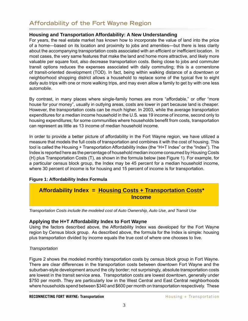
In order to provide a better picture of affordability in the Fort Wayne region, we have utilized a measure that models the full costs of transportation and combines it with the cost of housing. This tool is called the Housing + Transportation Affordability Index (the “H+T Index” or the “Index”). The Index is reported here as the percentage of household median income consumed by Housing Costs (H) plus Transportation Costs (T), as shown in the formula below (see Figure 1). For example, for a particular census block group, the Index may be 45 percent for a median household income, where 30 percent of income is for housing and 15 percent of income is for transportation.
Figure 1: Affordability Index Formula
*Transportation Costs include the modeled cost of Auto Ownership, Auto Use, and Transit Use
Applying the H+T Affordability Index to Fort WayneUsing the factors described above, the Affordability Index was developed for the Fort Wayne region by Census block group. As described above, the formula for the Index is simple: housing plus transportation divided by income equals the true cost of where one chooses to live.
Transportation
Figure 2 shows the modeled monthly transportation costs by census block group in Fort Wayne. There are clear differences in the transportation costs between downtown Fort Wayne and the suburban-style development around the city border; not surprisingly, absolute transportation costs are lowest in the transit service area. Transportation costs are lowest downtown, generally under $750 per month. They are particularly low in the West Central and East Central neighborhoods where households spend between $340 and $600 per month on transportation respectively. These
Affordability Index = Housing Costs + Transportation Costs* Income
3

Reconnecting FoRt Wayne: transportation Housing + Transportat ion
locations are close to several proposed mixed-use development sites – Harrison Square, the Barr Street Corridor and the Old Canal District. These lower transportation costs are due to the higher densities and access to employment centers, and some, albeit limited, proximity to amenities and services. Transportation costs climb to more than $1,000 per month on the outskirts of the Citilink service area and beyond. This is partly a function of lower density and the absence of other key elements that contribute to lower transportation costs within Fort Wayne’s downtown core.
Figure 3 shows modeled monthly transportation costs as a percent of household income by census block group. Household transportation expenditures in Fort Wayne are striking. Nationally, most households spend around 19 percent of their household budget on transportation. In the City of Fort Wayne, most households spend between 25 and 54 percent of their income on transportation. In fact, households that spend less than 19 percent of their income on transportation do so only because they live in the same census block groups that earn the highest household income, between $60,000 and $115,000.
Figures 7 and 9 illustrate the percentage of a household’s monthly budget devoted to transportation for a family earning the metropolitan statistical area median income (AMI), $42,817, and for a working family earning 80 percent of the AMI for the metropolitan statistical area, $34,253. The only two neighborhoods where a family earning the AMI can find affordable transportation – 19 percent or less of household income, a national standard – are near downtown in the East Central and West Central neighborhoods. Working families earning 80 percent of the AMI, in contrast, find transportation in Fort Wayne unaffordable throughout the city.
Housing
Housing is significantly more affordable than transportation in Fort Wayne. Figure 4 shows that housing costs are significantly less in the downtown and central neighborhoods than around the city border and outlying neighborhoods. Figure 5 shows that most households still pay less than the national standard of 30 percent of their income on housing and that most can afford their location largely because households choose to live where they can afford the housing.
Housing + Transportation
The combined H+T Affordability Index maps (Figures 6, 8 and 10) illustrate the current market driven conditions for Fort Wayne and help to demonstrate the need for a strong, integrated housing and transportation strategy. Figure 6 illustrates H+T costs as a percent of a household’s budget based on existing market conditions. Families with lower household incomes tend to locate where housing is more affordable, in the city’s central and southern neighborhoods; families with high incomes tend to locate where housing is more expensive and houses are larger around the Fort Wayne’s edge.
Figures 2 and 4 show that downtown Fort Wayne offers the most affordable options for both housing and transportation costs as an absolute monthly expense. Transportation costs are lowest within the Citilink service area and near downtown; they increase toward the outskirts of Fort Wayne and beyond. However, Figure 6 shows that, as a percent of income, households who live in downtown Fort Wayne pay a higher percentage of their income than they can afford for combined H+T costs. Even in the most affordable neighborhoods, the combined cost of living is unaffordable for many families.
4
Reconnecting FoRt Wayne: transportation Housing + Transportat ion
Figures 8 and 10 show H+T expenditures for both the AMI and the working family median income, respectively. While a family earning $42,817 can afford to live almost anywhere in the City of Fort Wayne and still pay less than 49 percent of their income on combined housing and transportation costs, a working family earning $34,253 has significantly fewer options.
High Housing + Transportation costs affect not only individual household savings and their potential for wealth creation, but also the overall economic well being of the city. City government, however, has the ability to influence high transportation costs and such policies are already included in the comprehensive plan. City government can encourage and implement multimodal transportation options for residents, create streetscapes that encourage walking, bring back the historic streetcar to enable circulation downtown without driving. The City can also adopt an aggressive policy to market the benefits of riding Citilink and promote mix-use development with restaurants and shopping downtown to provide Fort Wayne residents an alternative to driving to outlying shopping centers to meet their household needs.
5

Reconnecting FoRt Wayne: transportation Housing + Transportat ion
Figu
re 2
: Mon
thly
Hou
seho
ld T
rans
port
atio
n C
osts
—M
odel
ed L
ocat
ion
Effic
ienc
y
6

Reconnecting FoRt Wayne: transportation Housing + Transportat ion
Figu
re 3
: Tra
nspo
rtat
ion
Cos
ts a
s a
Perc
ent o
f Hou
seho
ld In
com
e—M
odel
ed L
ocat
ion
Effic
ienc
y
7

Reconnecting FoRt Wayne: transportation Housing + Transportat ion
Figu
re 4
: Mon
thly
Hou
seho
ld H
ousi
ng C
osts
—M
odel
ed L
ocat
ion
Effic
ienc
y
8

Reconnecting FoRt Wayne: transportation Housing + Transportat ion
Figu
re 5
: Hou
sing
Cos
t as
a Pe
rcen
t of H
ouse
hold
Inco
me—
Mod
eled
Loc
atio
n Ef
ficie
ncy
9

Reconnecting FoRt Wayne: transportation Housing + Transportat ion
Figu
re 6
: H +
T a
s a
Perc
ent o
f Hou
seho
ld In
com
e—M
odel
ed L
ocat
ion
Effic
ienc
y
10

Reconnecting FoRt Wayne: transportation Housing + Transportat ion
Figu
re 7
: Tra
nspo
rtat
ion
Cos
ts a
s a
Perc
ent o
f Hou
seho
ld A
rea
Med
ian
Inco
me—
Mod
eled
Loc
atio
n Ef
ficie
ncy
11

Reconnecting FoRt Wayne: transportation Housing + Transportat ion
Figu
re 8
: H +
T a
s a
Perc
ent o
f Are
a M
edia
n In
com
e—M
odel
ed L
ocat
ion
Effic
ienc
y
12

Reconnecting FoRt Wayne: transportation Housing + Transportat ion
Figu
re 9
: Tra
nspo
rtat
ion
Cos
t as
a Pe
rcen
t of W
orki
ng F
amily
Med
ian
Inco
me—
Mod
eled
Loc
atio
n Ef
ficie
ncy
13

Reconnecting FoRt Wayne: transportation Housing + Transportat ion
Figu
re 1
0: H
+ T
as
a Pe
rcen
t of W
orki
ng F
amily
Med
ian
Inco
me—
Mod
eled
Loc
atio
n Ef
ficie
ncy
14

Reconnecting FoRt Wayne: transportation Housing + Transportat ion
Summary of Affordability Index ResultsIn Fort Wayne housing costs are in the affordable range for most households; most are spending less than 30 percent of their income on housing. But the majority of households are paying greater than the 19 percent national average of their income on transportation costs.
The Housing + Transportation Index allows us to examine transportation costs for different income levels and household characteristics—and in relation to characteristics of the local environment. Figure 11, the map of household density, for example, shows that areas with higher densities also tend to have lower total monthly transportation costs.
The map in Figure 12 shows the Median Household Income distribution for greater Fort Wayne. The lowest income areas tend to correspond to those areas (in Figure 6) where the highest percent of income is spent on H+T. Although these neighborhoods have some of the lowest monthly household transportation costs as a result of transit access and pedestrian amenities, many households pay more for housing and transportation than is affordable for many households.
15

Reconnecting FoRt Wayne: transportation Housing + Transportat ion
Figu
re 1
1: R
esid
entia
l Den
sity
16

Reconnecting FoRt Wayne: transportation Housing + Transportat ion
Figu
re 1
2: M
edia
n H
ouse
hold
Inco
me
17

Reconnecting FoRt Wayne: transportation Housing + Transportat ion
Profiles of Transportation Costs for Sample CommunitiesTable 1 below shows the average transportation costs for neighboring cities and communities in the Fort Wayne metropolitan area and indicates how two Index variables, households per acre and average vehicles per household, influence the average household transportation costs. In the City of Fort Wayne, the average transportation cost is $819 per month and, in Allen County, $877 per month. The average transportation costs are slightly higher for surrounding towns, ranging between $952 and $1,064 per month. However, variations in the average density from 0.08 and 1.80 households per acre and in the average number of vehicles per household can result in differences in the average transportation costs.
Table 1: Transportation Costs for Neighboring Places and Sample Communities in Fort WaynePlace Households Households per
Acre Average Vehicles per Household
Average Transportation Costs
City of Fort Wayne
92,214 0.75 1.6 $819
Allen County 128,745 0.30 1.7 $877Leo-Cedarville 612 0.25 2.1 $1,046Tri-Lakes 1,834 0.08 2.1 $1,046Fort Wayne NeighborhoodsChapel Oaks 72 2.28 0.7 $449West Central 2,104 3.41 1.1 $537Cherry Hill 421 0.91 2.1 $1,056Source: US Census Bureau, 2000. Transportation costs are modeled based on Affordability Index.
There are also significant differences in transportation costs within Fort Wayne. Transportation costs reach a low of $449 in Chapel Oaks and a high of $1,056 in Cherry Hill, reflecting the differences in density and auto ownership between these two communities. Chapel Oaks and West Central are more compact and have services and amenities within walking distance, have fewer vehicles per household, and benefit from more transit options. Research tells us that households living in these more compact neighborhoods will own fewer vehicles and drive fewer miles – resulting in lower monthly transportation expenditures.
18
Reconnecting FoRt Wayne: transportation Housing + Transportat ion
APPENDIX 1: Brief Overview of H+T Affordability Index Methodology
The H+T Affordability Index was created for the Fort Wayne region at the census block group level. Information specific to Fort Wayne on residential density, commercial services, infrastructure, transit service, and job access were used to predict auto ownership, auto use (vehicle miles traveled per year per vehicle), and transit use. Because the Index is specific to both household size and income, analysis was done for a number of household sizes and income levels
The results from the Index highlight areas where development patterns, jobs access, and land use patterns are especially conducive to transit use, walking, biking, and lower auto use. The results also indicate areas where new development patterns likely necessitate higher auto ownership, multiple daily trips by auto, long distances to work, and are difficult to serve by fixed-route transit.
The Index can be used to provide two types of valuable information: 1) a single number to score each neighborhood’s affordability, represented by an estimated monthly household transportation cost; and 2) as an unbundled set of indicators (e.g. transit connectivity, block size, distance to employment, housing density) used to determine which of these factors are contributing to the cost of the area, e.g. large block sizes, low job access, low density, few nearby services.
One variable that is used to calculate the H+T Index is the Transit Connectivity Index (TCI). The TCI measures the service levels of fixed route bus service. Transit service levels for the purposes of the TCI is based on access, intensity and frequency of transit service in a given census block group. Access is captured by a quarter mile buffer around each bus routes, intensity is based on the number of weekly bus route trips that serve the census block, and frequency is the sum of total weekly trips for all routes in both directions within the buffered area. This combined measure results in an index. For a given census block group, the index accounts for the percentage of land area within walking access to a bus route, the number of bus lines, and the frequency of the buses. Based on natural breaks, classification of bus access and level of service for the Citilink service area identified the following ranges to the TCI: 0 to 14 = Low, 15 to 197 = Medium, 198 to 587 = High, 588 to 2,387 = Extended. A score of 2,000 represents approximately one bus every 10 minutes in each direction for a given census block group. However, it is important to note this figure is not meant to be interpreted literally, a score of 2,000 could also represent three bus routes running through the same census block group at 30 minute headways. TCI is not descriptive but rather a calculated prediction of transit service levels.
19

Reconnecting FoRt Wayne: transportation Housing + Transportat ion
Figu
re 1
3: T
rans
it C
onne
ctiv
ity In
dex
20

Reconnecting FoRt Wayne: transportation Housing + Transportat ion
Figu
re 1
4: V
ehic
les
per H
ouse
hold
21

Reconnecting FoRt Wayne: transportation Housing + Transportat ion
Figure 13 shows the results of the TCI application within the Citilink service area. Not surprisingly, the highest level of bus service runs north/south through the downtown core and down to the southern city boundary. The areas with high levels of bus service follow major arterials, US Route 27/33 and IN Route 14, from this core area. Residential areas in proximity to these high access areas still fall within the medium level of service and only the outskirts of the city boundary have a low level of bus service. The table below shows the number of households within each of the TCI categories. The bus covers most of the city. In 2000, there were 83,333 households in the City of Fort Wayne; nearly half have high or better access to transit.
Table 2: Transit Connectivity Index Results in Fort WayneTCI Score Number of households Major sections of the
service area Low 12,208 Low density housingMedium 29,049 ResidentialHigh 41,952 Major corridorsExtended 9,182 Downtown core
The Affordability Index was calculated using the nine variables shown in the figure below (“Model Inputs”). Seven of these variables are specific to the local environment; these variables include household density (HH per residential acre and per total acre), average block size (to indicate the walkability of the area), Transit Connectivity Index (TCI), distance to employment centers, job density, and access to amenities. These Local Environment Variables are then measured alongside household income and household size to predict how many autos a household is likely to own, how many miles they are likely to drive, and how much transit they are likely to use. These factors were predicted for each of the 178 census block groups in the Fort Wayne region in two ways:
First, the Affordability Index was calculated for the average household income and household size of each census block group. Second, the Affordability Index was calculated using the average household size earning a combined median income for the Fort Wayne metropolitan statistical area, $42,817.Third, the Affordability Index was calculated using the average household size and earning 80 percent of the combined median income for the Fort Wayne metropolitan statistical area, $34,253. The results of these calculations reveal the affordability of place for a working family.
The costs resulting from each of these calculations provide a picture of the affordability of the region (in-cluding transportation costs) for households earning the median income and for working families in addition to describing the market conditions for current residents. In other words, these calculations allow us to see where a current or potential household could afford to live in Fort Wayne.
1.
2.
3.
MODEL INPUTS9 Independent Variables
7 Local Environment VariablesHouseholds/residential acreHouseholds/total acreAvg. block size in acresTransit Connectivity IndexDistance to employment centersJob density (jobs/square mile)Access to amenities
2 Household VariablesHousehold incomeHousehold size
•••••••
••
22