regeneration and new 3 development areas · contain important sites which would benefit from ......
TRANSCRIPT

3REGENERATION AND NEWDEVELOPMENT AREAS

Vision
To promote the renewal and regeneration of areas basedon the consolidation of the built-up area and to ensurethat development in new ‘greenfield’ areas creates itsown sense of place, is attractive and functions well.
Context
1. The National Spatial Strategy 2002-2020 People, Places and Potential, DOELG, November 2002.
2. Architectural Heritage Protection – Draft Guidelines for Planning Authorities, DOELG, December 2001.
3. Retail Planning - Guidelines for Planning Authorities, DOELG, December 2000.
4. Residential Density – Guidelines for Planning Authorities,DOELG, September 1999.
5. Retail Planning Strategy for the Greater Dublin Area, November 2001.
6. A Platform for Change, Strategy 2000-2016 - Final Report, Dublin Transportation Office, November 2001.
7. Strategic Planning Guidelines for the Greater Dublin Area, March 1999 and Annual Review and Update for 2000, 2001 and 2002.
8. Local Coastal Plan Booterstown to Sandycove, Dun Laoghaire-Rathdown Economic Development and Planning Department, June 2002.
9. Wicklow County Development Plan, 1999. 10. Bray Development Plan, 1999. 11. Enniskerry Local Area Plan, 2002.
Strategy
The Planning and Development Act, 2000 states that adevelopment plan shall include objectives for thedevelopment and renewal of areas in need of regeneration.A development plan may also indicate that specifieddevelopment in a particular area will be subject to themaking of a local area plan.
It is considered that many local planning issues cannot begiven the detailed treatment that they deserve in such abroad ranging document as the County Development Plan.
As such it is proposed to prepare Local Area Plans forCherrywood-Rathmichael, Bray Environs, Kiltiernan/Glenamuck,Glencullen, Deansgrange, Stillorgan, Goatstown and Barnacullia.
The major town centres of Dun Laoghaire and Dundrumcontain important sites which would benefit fromredevelopment or other improvement and this sectionincludes Urban Structure Plans, the aim of which is toprovide a clear and coherent vision to guide the futuredevelopment of the major town centres.
The strategic vision of this Plan is to create vibrant andsustainable communities and to facilitate development tomeet the growing needs of those living, working or visitingthe County. To this end this chapter outlines the policiesand objectives for new development areas and for therenewal of areas in need of regeneration. This will beachieved in part through the urban and village renewalprogramme set out in this chapter.
Good urban design is central to creating vibrant, attractivesettlements in new areas as well as in the renewal of areas inneed of regeneration.
Urban Design
Urban Design is the conscious manipulation of building formand the public realm/public spaces in order to create anattractive and efficient environment, suitable for a full rangeof activities – living, working, socialising and recreation.Good urban design enhances the environment and itsbenefits are manifold – visual, social, economic andpsychological. Run-down environments can betransformed, while new greenfield development areas canbe formed which function well, appear attractive and whichstand the test of time.
The current pressure to provide accommodation imposesupon the Council, as custodians of that rapidly diminishingresource – urban building land – a duty to ensure that thisvaluable and finite resource is used to maximum advantage.This in turn, provides an historic opportunity to improve thebuilt environment through a process of consolidation of the
3 REGENERATION AND NEWDEVELOPMENT AREAS
3.1
28 DLRCOCO - Development Plan 2004-2010

highly fragmented urban structure which characterisedmuch of the County’s development areas.
Of equal importance is the need to ensure that sound urbandesign principles are fully utilised in the design and planningof new development areas such as at Cherrywood, Kiltiernanand Shanganagh/Woodbrook.
The objectives of urban design include:
• Creation of a high quality environment with a clearly defined coherent urban structure.
• Conservation of architectural heritage and townscape. • Promotion of a high standard of design for new
buildings. • Encouragement of the use of natural materials. • Reinforcement of local identity and sense of place. • Resolution of conflict between pedestrians and traffic. • Promotion of sustainable development. • Stimulation of commercial investment and sustainable
economic development through the creation or revitalisation of an attractive and viable urban environment.
The principles of urban design include:
• Catering for the needs and sensibilities of those on foot,where the townscape is viewed at eye level and a rhythmis created which relates to walking pace, providing a sequence of agreeable visual experiences to be enjoyed by the pedestrian.
• Buildings enclosing the public space should have finenessof detail, vertical emphasis, a variety of texture/colourand relate to the human scale, particularly at street level.
• Creating a network of attractive public spaces – varied incharacter, size, and scale but with consistency in surfacefinishes, street furniture, lighting, planting etc.
• Public spaces should be connected, permeable, accessible, legible and diverse in character.
• Public spaces should be safe – as a result of natural surveillance - being overlooked by the maximum number of windows and doors and avoidance of ‘dead’gables.
• Promoting vibrant public spaces by having lively uses at street level which may expand onto the pavement e.g. street cafes.
• The facades of buildings fronting onto public spaces should be carefully designed with good quality, robust materials that will wear well.
• High quality ‘landmark’ buildings should be promoted atstrategic locations, i.e. junctions, within the public spacenetwork.
• Where public space is ill-defined, new buildings should be formed to reinforce sense of enclosure and sense of place.
• Promoting continuity of built form to ensure enclosure ofpublic and private spaces and the physical separation between them.
• Visually reinforcing approaches and entrances into localcentres to emphasise a sense of arrival.
• Encourage development of derelict and underutilised sites, particularly, in key areas.
• Introduce traffic management measures - traffic cells, reduction of carriageway widths, reduce speed limits, traffic calming.
• Awareness of sensitive uses such as pedestrian priority areas and outdoor cafes when locating bus stops.
Policy REG1 : Building Height and Scale
In evaluating the scale and height of proposeddevelopments, it is Council policy to balance the strategicplanning need to make the most efficient use of each sitewith the visual impact of the proposal and its effect onexisting amenities, particularly residential amenities.
Given the underlying problem of falling population levels inthe built-up area, it is crucial that the most efficient use bemade of urban building land. This is particularly the case inlocations close to good quality transport links and other services.
Visual impact is primarily the effect that the proposeddevelopment will have on its immediate vicinity i.e. thestreetscape/townscape adjacent to and surrounding theproposed development – the object being that the proposeddevelopment is either capable of being absorbed into itsphysical context, or alternatively, is clearly demonstrated to
3REGENERATION AND NEWDEVELOPMENT AREAS
3.1.1
29DLRCOCO - Development Plan 2004-2010

be of such a high quality of architectural merit and designthat it makes a positive visual contribution to the existingenvironment.
The above objectives and principles of urban design will beapplied throughout the County in the assessment ofdevelopment proposals, as well as in the preparation of LocalArea Plans and Village and Urban Renewal Schemes.
Policy REG2: Phased Development
No development shall be permitted unless it can bedemonstrated that adequate provisions for specifiedinfrastructural requirements, including: roads; sewers;water mains; community; recreational and sporting facilties(indoor and outdoor); public transport; first and second levelschools and shops are available at completion to supportdevelopment.
Local Area Plans
Cherrywood-Rathmichael Local Area Plan
A Local Area Plan will be prepared for the Cherrywood –Rathmichael area as a matter of priority following the newlegislative procedure for such local plans. The former draftCarrickmines – Cherrywood Action Area Plan was preparedunder earlier legislation. The new Local Area Plan will revisethe earlier local planning process under the new legislationwith its specific time limits.
The Cherrywood – Rathmichael Local Area Plan will cover anarea of circa 307 hectares. A Local Area Plan will beprepared for this Area, which is substantial in scale, andrepresents the largest major potential development area forthe County. It is of strategic importance located as it iswithin the defined Metropolitan Area, on the proposed LUASB1 route, immediately adjoining the N11 and the SouthEastern Motorway, with links to Dun Laoghaire. A coherentand integrated land use zoning and policy framework toaddress the long-term development of the area will be setout in the Local Area Plan.
The potential of this development area has to be planned,taking cognisance of its regional importance andsignificance in providing for the needs of the County’sresidential, commercial and recreational requirements.
The emphasis in this new Local Area Plan will be to designplaces not roads, establishing a sense of place andcommunity. The Local Area Plan will define the principles ofthe layout of spaces, streets, squares, and how movementrelates to them. The Plan should be flexible enough toaccommodate change as the development progresses, yetrobust enough to ensure that these principles areimplemented without changing the original framework.
The Local Area Plan will set out the overall form ofdevelopment, it will create a place of distinction and willharness particular site characteristics – river valleys, highviewpoints, public transport nodes. Attention will be paid tothe physical form of development – routes, spaces, the urbangrain, density, mix of uses, height and massing, the publicrealm, landscape, etc. The Local Area Plan will containspecific objectives, including detailed zonings.
It is proposed to develop a new urban quarter or new urbanextension in the Cherrywood – Rathmichael area. Thedevelopment of this area is dependent on the provision ofhigh quality light rail/bus public transport to serve the area.
The boundaries of the new Cherrywood – Rathmichael Area,which are shown on Maps 7, 9 and 10 of the Plan, willgenerally be as follows:
• On the north - the Carrickmines Valley, • On the east – the Cherrywood Road, into Mullinastill
Road, Stonebridge Road (thereby excluding Falls Road)and along the N11,
• On the west – the South East Motorway • On the south – the junction of the N11 and South East
Motorway at Rathmichael.
3 REGENERATION AND NEWDEVELOPMENT AREAS
3.1.2
3.2
3.2.1
30 DLRCOCO - Development Plan 2004-2010

3REGENERATION AND NEWDEVELOPMENT AREAS
31DLRCOCO - Development Plan 2004-2010
The main transportation infrastructure in the Cherrywood –Rathmichael area will consist of the improved N11, theWyattville Interchange, the South Eastern Motorway, theWyattville Link Road, the improved Stonebridge Road, aSpine Road, internal road layout and the LUAS B1 line withits three stations at Carrickmines, Lehaunstown andCherrywood. A potential LUAS B2 line with its station at StColumcille’s Hospital can be provided across the CherrywoodViaduct and can continue towards Shankill andShanganagh/Woodbrook.
The South Eastern Motorway is nearing completion withinterchanges at Carrickmines, Lehaunstown, a new bridgeover the Brides Glen Road and altered road and junctionarrangements in the Mullinastill/Stonebridge Road area.Design improvements will be necessary at the LehaunstownInterchange on the SEM, with a new crossroads on theWyattville Link.
Water and drainage improvements, in addition to thosealready developed, will be implemented.
Development at Cherrywood will require the provision of thefollowing key infrastructural works –
• LUAS Line B1 from Sandyford • The Lehaunstown Interchange Upgrade • New water supply scheme to serve Cherrywood and
environs • Surface water and foul drainage schemes.
The core of the new Cherrywood – Rathmichael Area will benorth of the Wyattville Link Road, with the first phase builtaround the Cherrywood LUAS stop. The core will containretail development, community and cultural facilities,cinemas, commercial development, offices, leisure facilities,underground car parking, bus interchange, mixed usedevelopments of residential use over commercial uses, healthfacilities, hotel, educational facilities etc. However it isimportant to note that this is predicated on the provision ofthe Cherrywood LUAS terminus.
Photo: Dun Laoghaire Harbour Company

To the north of the core of the Cherrywood – Rathmichaelarea there will be extensive residential areas close to theLUAS line and stations. To the north west, parallel to theSEM, there will be employment areas and business parks. Tothe south there will be the science and technology park.Open spaces will be created in the river valleys, on the highground around Tully Church, on the high ground to the westof the motorway at Ticknick and along the Brides Glen Road.
To the south of the Bride’s Glen Road there will be residentialdevelopment; to the east of Cherrywood Road (outside thelocal area plan boundary), there will be residentialdevelopment near St Columcille’s Hospital centred on aproposed LUAS B2 station.
Broad ranges in respect of the quantum of development areproposed. More detail will be presented for individualdevelopment areas in the Local Area Plan. It is important tonote that there are longer-term projections beyond the year2010.
The potential number of residential units will provide for apopulation of c.20,000 persons. High density residentialdevelopment will be considered where developmentcomplies with the criteria as set out in Residential DensityGuidelines. Net residential densities should be greater than50 units per hectare within the 0.5 – 1km LUAS catchmentarea, and a higher net density of 80 units per hectare within0 – 0.5km catchment area of LUAS stations along LUAS LineB1. Lands formerly proposed for the location of a golfcourse, abutting the SEM to the east, are now partlydesignated for residential development.
The retail function of the Cherrywood – Rathmichael Areawill expand with a floor area of 35,000 sq.m. Growth ofthe retail element will be linked to the population andemployment growth in the area, and permitted on a phasedbasis. The Local Area Plan will also provide forneighbourhood centres appropriate to the retail/communityneeds of the area.
It is envisaged that the number of employees would in thelong term be c10,000 workers. It is envisaged thatdevelopment will be fully integrated and create a sustainable
community that integrates living, working and leisureactivities served by appropriate levels of retail use andcommunity facilities.
Development at the proposed Town Centre will be permittedsubject to the preparation of an Urban Design Master Plan.This Master Plan will provide for a unified town centrelayout, integrated with the adjoining land uses.
Cherrywood – Rathmichael Local Area Plan will be developedwith a strong emphasis on linking areas of public open spaceand development of green corridors as pedestrian and cycleroutes, encouraging maximum permeability and movementthroughout the area.
Development in the new Cherrywood – Rathmichael area willbe subject to the following specific objectives:
• To create a linear riverside park incorporating a pedestrian route and cycleway which will link CabinteelyPark to the sea at Hackett’s land.
• To provide for an adequate open space setting for Tully Church.
• That public sports fields be provided west of Lehaunstown Lane.
• To retain the famine grave on the site adjacent to St. Columcilles Hospital.
• To provide for the Bride’s Glen as a public amenity area. • To upgrade Lehaunstown Interchange and the Wyattville
Link Road. • To relocate the proposed golf course to the south west
side of the South Eastern Motorway. • To provide for a Retail Park. • To prepare an urban design Master Plan to ensure
co-ordinated development of the Town Centre. • To promote upgrading in capacity of water supply/new
water supply/reservoir. • To designate neighbourhood centres to serve the
community, generally located at LUAS stations. • To identify community/recreational and educational
requirements. • To provide for pedestrian and cycleway linkages/routes
linking development either side of the Wyattville Link Road to ensure maximum permeability throughout the
3 REGENERATION AND NEWDEVELOPMENT AREAS
32 DLRCOCO - Development Plan 2004-2010
plan area. • To provide a pedestrian ‘right of way’ from the Brides
Glen Road to the Town Centre to link Cherrywood with Rathmichael.
• To provide a LUAS/metro stop at Rathmichael to the rearof St. Columcilles Hospital with access from both sides ofthe LUAS line i.e. from Falls Road and the N11.(N.B., Thisis outside the local area plan boundary)
• To carry out a study of the biodiversity of the Brides Glen,Loughlinstown River and native forest.
• To develop landmark buildings near the Carrickmines Interchange, the junction of the South Eastern Motorwayand M11 and in the Town Centre at Cherrywood.
• To provide new forms of energy efficient house types andecological house types.
Detailed road layouts within the Cherrywood – Rathmichaelarea will be examined as part of the Local Area Plan process.Road layouts shown are indicative only and may be subjectto amendment during the Local Area Plan process.
It is proposed that development within the Cherrywood –Rathmichael area be subject to a schedule of phasing. Thepurpose of phasing is to ensure infrastructure, services,facilities and amenities are provided together with residentialdevelopment.
Policy REG3: Public Transport Facilities
It is Council policy that only limited developmentshall take place in the Cherrywood - Rathmichael areauntil the light rail/bus public transport facilities whichwill facilitate the development of the area in asustainable manner are advanced.
Policy REG4: Cherrywood Town Centre
It is Council policy that the District Centre zoningremain on the Cherrywood site until such time as it isconfirmed that the area will be serviced by the LUASline. The town centre shall not commence until suchtime as the LUAS contract is signed.
Rathmichael
(1) The Council recognises the value of the buffer zone between the non-development mountain high amenity areas and the suburban areas. It also recognises the special environment and the distinctive character of the Rathmichael, Ballycorus areas and the sense of place that derives from that character. Accordingly a low density zoning is appropriate in the buffer areas. This will ensurea graduation in housing densities up to the high amenityareas. It permits the retention of hedgerow, woodlands,flora and fauna, equestrian activities, walking and otherpassive recreation and access to mountains and forest trails and sites of historical and archaeological interest.
(2) It is a further objective to seek a high level of design, thecareful locating of houses and the use of extensive landscaping and planting so as to protect the existing amenities of the area.
Bray Environs Local Area Plan
There is a need to approach the future requirements of Brayin a more comprehensive way than has been previously doneto ensure more sound and integrated development and tolook at this area as one complete unit in planning andtransportation terms. A Local Area Plan will be prepared forthe Bray environs including Woodbrook and Old Conna inconjunction with residents and adjoining planningauthorities.
This new Local Area Plan will emphasise the need to establisha sense of place and community. It will define the principlesof the layout of spaces, streets, squares, and how movementrelates to them. The Local Area Plan will set out the overallform of development, it will create a place of distinction andwill harness particular site characteristics – trees, hedgerowsand stone walls, public transport nodes and will retain andprotect historic buildings. The intention is to create a villagecore in Old Conna and a new neighbourhood at Woodbrookcentred on a high quality development around a newWoodbrook DART Station with bus and light rail interchangefacilities.
3REGENERATION AND NEWDEVELOPMENT AREAS
3.2.2
3.2.3
3.2.4
3.2.5
33DLRCOCO - Development Plan 2004-2010

Water and drainage improvements, in addition to thosealready developed, will be implemented.
The lands in the Bray environs will have the benefit of accessto the DART Line and will be served by the proposed light railline to the city centre and Dublin Airport. A new QBC isunderway at the Dublin Road linking Bray to Foxrock. TheM11 Motorway leading to the M50 is easily accessible fromthe Wilford roundabout.
Attention will be paid to the physical form of development –routes, spaces, the urban grain, density, mix of uses, heightand massing, the public realm, landscape, etc. The LocalArea Plan will contain specific objectives including detailedzonings.
Development of the Bray environs is based on the followingprinciples:
• The provision of retail development, community and cultural facilities, commercial development, offices, leisure facilities, bus interchange, mixed use developments of residential use over commercial uses, health facilities, educational facilities etc.
• To facilitate the provision of a DART station with bus andlight rail interchange facilities at Woodbrook.
• To reinforce the importance of Bray as a Major Town Centre by facilitating its development in the Bray environs, particularly in the area close to Castle Street.
• To facilitate residential development to assist in achievingthe housing requirements of both Dun Laoghaire-Rathdown and Bray Town Council.
Kiltiernan/Glenamuck-Local Area Plan
This Local Area Plan will be prepared on foot of the Councilobjective to prepare a Local Village Plan for Kiltiernan andwill have regard to the following principles:
• To protect and enhance the community infrastructure of
the Church of Ireland. • To encourage the provision of incubator units for craft
industries in Kiltiernan. • To facilitate the provision of a pitch for Wayside Celtic
Football Club. • To provide a Neighbourhood Centre. • To carry out road improvements on the Enniskerry
Road/Kiltiernan junctions with Ballycorus Road and Bishop’s Lane.
Glencullen
This Local Plan will be prepared on foot of the Councilobjectives to prepare a Local Village Plan for Glencullen thatis in keeping with the unique rural character of Glencullenand to establish an Aquifer Protection Zone at Glencullenand accordingly to prohibit any development which wouldconflict with this objective.
In order to deliver a comprehensive Local Plan for Glencullenit will be based on an understanding of the existingsettlement, its character, the way it functions and the needsof local people.
The detailed nature of the community-based submissionsalready received indicates that much relevant information isavailable and the Council will encourage active communityparticipation in the preparation of the Local Plan, thusensuring extensive public involvement and consultation.
Goatstown
A Local Area Plan will be prepared for the Goatstown areaand development will only be permitted in this area asnecessary infrastructure becomes available.
Stillorgan
A Local Area Plan for Stillorgan shall be prepared within ayear of the new Development Plan to guide the futuredevelopment within the lifetime of the County DevelopmentPlan concentrating on improvements to the public domain,encompassing a variety of zonings and sites. Good quality
3 REGENERATION AND NEWDEVELOPMENT AREAS
3.2.6
34 DLRCOCO - Development Plan 2004-2010
3.2.7
3.2.8
3.2.9

residential developments shall be encouraged and preferablyincorporated into future schemes such as the overflowcarpark, Leisureplex, Blakes and Hamiltons Yard.
Dundrum Urban Structure Plan
Introduction
The aim of this Urban Structure Plan is to provide a clear andcoherent vision to guide the future development ofDundrum.
The Plan area is defined generally as the area between theLUAS line, the Dundrum Relief Road, the Taney Road/UpperChurchtown Road junction and the Wyckham By-Pass Route.It is mainly zoned for Major Town Centre uses, but with someparts zoned residential.
This area is experiencing significant ongoing developmentincluding:-
• Dundrum By-pass • Wyckham By-pass to Sandyford Road (Phase 1) • Wyckham By-pass to Taney Road (Phase 2) • Landmark LUAS Bridge • LUAS line with two stations under construction • Shopping centre under construction • Apartment development
The Framework for the Future Town Centre
The area is framed by a number of physical elements whichhave a strong influence on its shape, growth and extent.These are shown on the accompanying Urban Structure Mapand are:
• The LUAS line with two stations on the east flank of thetown centre
• The Wyckham By-pass on the southern side • The River Slang and Dundrum By-pass on the west • The existing Main Street/Sandyford Road which forms
the heart of the town centre and • The Ballinteer Road/Upper Kilmacud Road which forms
an important cross-roads with the Main Street, the centre of gravity, as it were, of the town centre.
Town Centre Renewal Planning Principles
(1) Adherence to the County Development Plan policies and objectives which have a specific objective to upgradethe Dundrum town centre by:
• The preparation and implementation of an environmental improvement scheme for Dundrum MainStreet.
• The control of advertising and of building facades through the development control process.
• The provision of a Bus/LUAS/Cycle interchange • Encouraging an undercroft development at Taney Bridge.
N.B.The redevelopment of the environs of the LUAS Bridge and LRT Station provides a significant opportunity to createa new focal point and sense of enclosure at the northern endof the Main Street. This shall include new high qualitybuildings set around a civic space incorporating businterchange with setdown facilities.
(2) The provision of a pedestrian-friendly and traffic-calmedenvironment along the Main Street with particular care being paid to paving materials, public lighting, seating and pedestrian priority measures.
(3) The selection of paving materials of appropriate scale and finish to enhance and complement the historic centre of Dundrum in the vicinity of the Protected Structures and the Architectural Conservation Area, whileallowing other areas to develop with a separate style.
(4) The provision of extensive off-street underground car parking facilities accessed from by-pass routes in order toreduce parked and moving vehicles on the Main Street and to serve new uses.
(5) To increase penetration by buses as part of the Quality Bus Network, with particular emphasis on improved orbital routes.
3REGENERATION AND NEWDEVELOPMENT AREAS
3.3.33.3
3.3.1
3.3.2
35DLRCOCO - Development Plan 2004-2010

(6) The provision of cycle facilities including a cycle network and cycle parking.
(7) The provision of a wide range of employment, leisure, entertainment, cultural and restaurant uses in the town centre.
(8) The provision of residential uses in the town centre including ‘living over the shop’, stand alone schemes, schemes for the elderly and hotel uses. In this way theexisting residential use in the town centre will be strengthened.
(9) The conservation, preservation and re-use of historic andinteresting buildings.
(10)The reinstatement and strengthening of the urban fabricalong the Main Street and the Sandyford Road including infilling gap sites. This applies especially to thenorthern part of the town centre where a strong commercial presence is required.
(11) The trees along the edge of the shopping centre carparkat the Main Street shall be retained in any new redevelopment in order to maintain high environmentalstandards in the regenerated town centre.
(12) The provision of high quality landscaped open spaces, especially to the west of the town centre.
(13) The new shopping centre currently under construction (former PYE lands), should provide and retain a wide variety of land uses including shopping, offices, residential, cinemas, bars, supermarkets, departmental store, cultural buildings including a library, crèche, hotel, clinic, leisure uses, multi-purpose meeting rooms/theatre, post office etc. These uses shall be linked along a new main pedestrian route which will connect the two LUAS stations, pedestrian bridges, footpaths and carparks. Lateral pedestrian routes will link to the main pedestrian route providing links betweenthe Main Street/Sandyford Road axis and internal urban squares. Such squares should be sunny, sheltered and
night-time friendly, with good supervision from surrounding buildings.
(14) Pedestrian movement across the Ballinteer Road from the two sides of the town centre shall be safe, easy andconvenient. This crossing should encourage and facilitate ease of pedestrian movement between the northern and southern parts of the town centre.
(15) The Mill Pond and Mill House area will be the focus of one of the main public spaces with new buildings set around it in an attractive manner. The reuse of the MillHouse as a Heritage Centre/Museum will be encouraged.
(16) To produce a stronger streetscape by sensitive infilling ofgaps in the urban fabric, reducing setbacks and encouraging new buildings close to the public footpath.
(17) All new buildings shall respect the scale, materials and character of the town centre, be of attractive appearanceand be visually interesting.
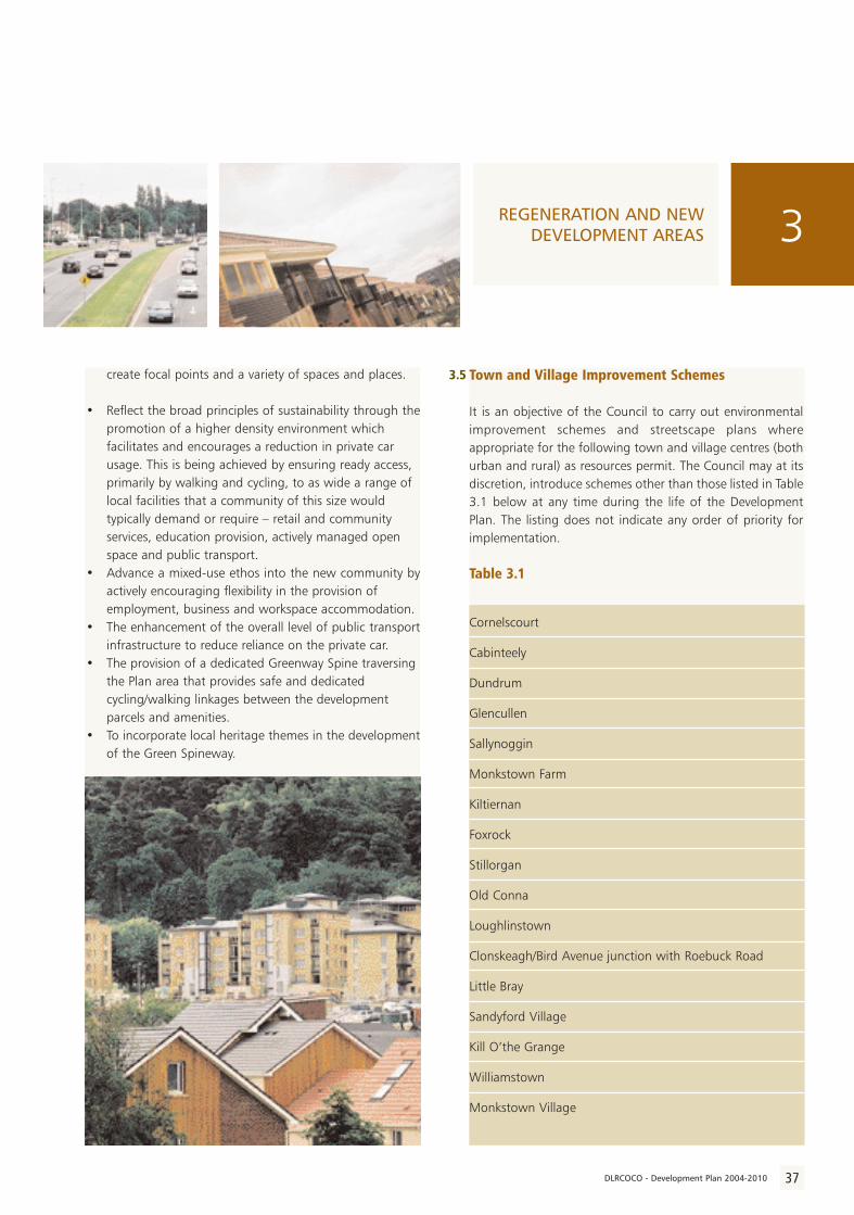
Stepaside
The Stepaside Action Area Plan was prepared in response tothe major rezoning of some 150 hectares of primarilyresidential lands in the 1998 County Development Plan.Significant on-site development activity has commenced. Atthe end of 2002 some 400 residential units were underconstruction but it is anticipated that, over the next 8-10years, some 4,000-4,500 houses and apartments will becompleted in the Action Plan area.
As well as providing an obvious co-ordinating mechanism toconsidered and timely implementation of the newdevelopment area the primary aims and objectives of theAction Plan seek to:
• Facilitate an improved urban design both in site layouts and house types. The traditional low-density suburban estate layout is being actively discouraged in favour of schemes which display individuality and distinctiveness. Wherever possible the opportunity is being taken to
3 REGENERATION AND NEWDEVELOPMENT AREAS
3.4
36 DLRCOCO - Development Plan 2004-2010
create focal points and a variety of spaces and places.
• Reflect the broad principles of sustainability through thepromotion of a higher density environment which facilitates and encourages a reduction in private car usage. This is being achieved by ensuring ready access, primarily by walking and cycling, to as wide a range of local facilities that a community of this size would typically demand or require – retail and community services, education provision, actively managed open space and public transport.
• Advance a mixed-use ethos into the new community byactively encouraging flexibility in the provision of employment, business and workspace accommodation.
• The enhancement of the overall level of public transportinfrastructure to reduce reliance on the private car.
• The provision of a dedicated Greenway Spine traversing the Plan area that provides safe and dedicated cycling/walking linkages between the development parcels and amenities.
• To incorporate local heritage themes in the developmentof the Green Spineway.
Town and Village Improvement Schemes
It is an objective of the Council to carry out environmentalimprovement schemes and streetscape plans whereappropriate for the following town and village centres (bothurban and rural) as resources permit. The Council may at itsdiscretion, introduce schemes other than those listed in Table3.1 below at any time during the life of the DevelopmentPlan. The listing does not indicate any order of priority forimplementation.
Table 3.1
Cornelscourt
Cabinteely
Dundrum
Glencullen
Sallynoggin
Monkstown Farm
Kiltiernan
Foxrock
Stillorgan
Old Conna
Loughlinstown
Clonskeagh/Bird Avenue junction with Roebuck Road
Little Bray
Sandyford Village
Kill O’the Grange
Williamstown
Monkstown Village
3REGENERATION AND NEWDEVELOPMENT AREAS
3.5
37DLRCOCO - Development Plan 2004-2010

3 REGENERATION AND NEWDEVELOPMENT AREAS
DUNDRUM TOWN CENTREURBAN STRUCTURE PLAN
38 DLRCOCO - Development Plan 2004-2010
PL - 03 - 033


IntroductionThis section sets out a StructurePlan, the aim of which is to providea clear and coherent vision toguide the future development ofDun Laoghaire Town Centre wherecurrently significant areas of urbanland are under-utilised and under-developed.