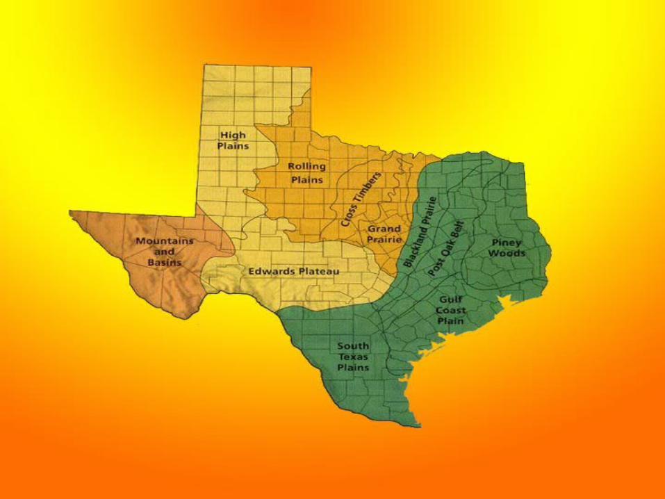
regions of texas. how many regions are in texas ? mountains and basins great plains coastal plains...
TRANSCRIPT

Regions of Texas

How many regions are in Texas?
Mountains and Basins
Great Plains
Coastal Plains
North Central Plains
4
What region is Fort Worth in?

Can you name the 4 Regions of Texas?
Mountains and Basins
Great Plains
Coastal Plains
North Central Plains

4. Mountains and Basins
1.2.
3.
Texas RegionsGreat Plains
12
4 3
North Central Plains
Coastal Plains

• Texas is a vast state made up of many different natural elements and terrains.
The 3 largest states in the United States are:
1st largest is ……………………….2nd largest is ………………………..3rd largest is ………………………..

Texas is the 2nd largest state in the United States.
Traveling across Texas you will see everything from forests to mountains to beaches to plains.
What region do we live in?
North Central Plains Region
The 4 Regions of Texas are
Great PlainsNorth Central Plains
Coastal PlainsMountains and
Basins

Regions of Texas
• Each region has different natural resources.
• This allows Texas to be one of the most self-sufficient states in the country.
Do you know what SELF-SUFFICIENT means?

NORTH CENTRAL PLAINS

NORTH CENTRAL PLAINS
• Location– Center part of the
state– Hill Country in the
southern part– Bordered by the
Cap Rock Escarpment on the west
– Bordered by the Balcones Escarpment on the east
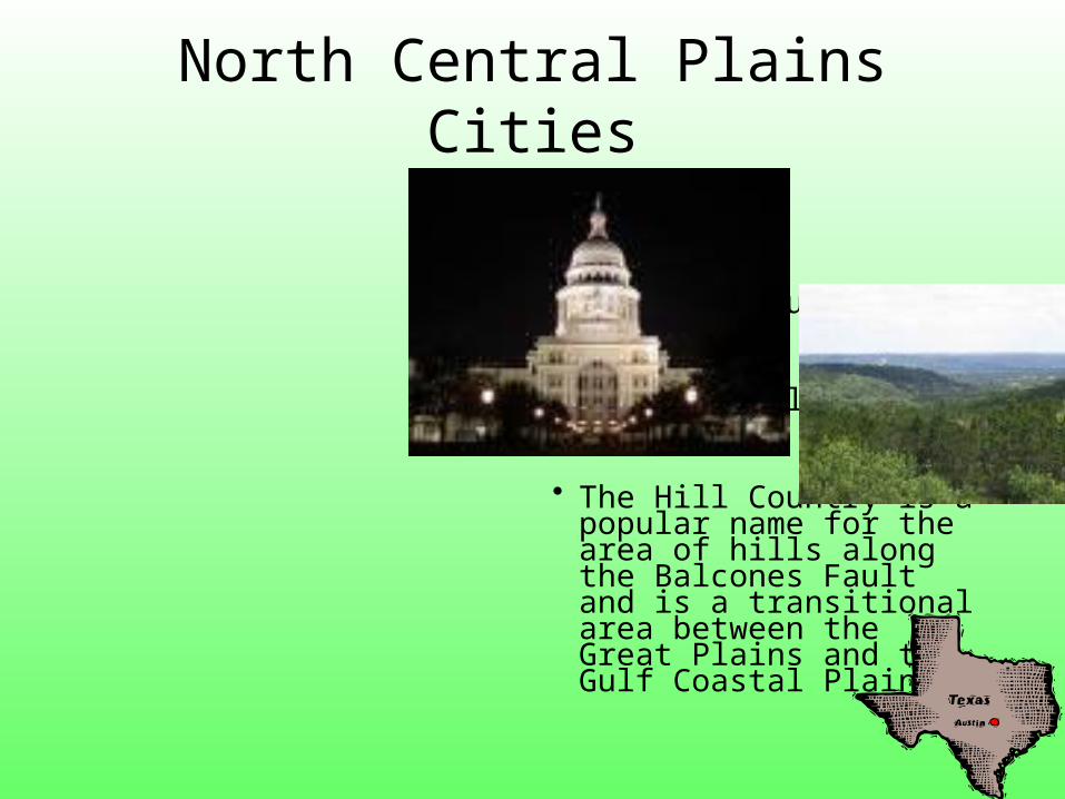
North Central PlainsCities
• Austin• Waco• Fredericksburg
• Llano• Fort Worth• Wichita Falls• Abilene
• The Hill Country is a popular name for the area of hills along the Balcones Fault and is a transitional area between the Great Plains and the Gulf Coastal Plains.

North Central PlainsPhysical Features
–Prairies–Forests in the Cross Timbers–Rolling Plains and Hills–Variety of trees–Small shrubs – Limestone rock- Thick grass

NORTH CENTRAL PLAINS PHYSICAL FEATURES AFFECT
INDUSTRY
• Rich soils support farm industries• Natural resources have spurred other
industries

NORTH CENTRAL PLAINSSUBREGIONS
This region is divided into
3 subregions: Grand Prairie Cross Timbers Rolling Plains

NORTH CENTRAL PLAINS HAS 3 SUBREGIONS
GRAND PRAIRIE – flat and rolling hills, grasslands; suited for livestock
CROSS TIMBERS – sandy soil; good for farming a variety of crops
ROLLING PLAINS – grasslands; hilly terrain; steep valley; rivers; suited for cattle and ranches

GRANDPRAIRIE
flat and rollinghills; grasslands
wet and mildclimate; thin soil
CROSSTIMBERS sandy soil
ROLLINGPLAINS
grasslands; hillyterrain; steepvalleys; rivers
north Central Plainswell suited for cattle, otherlivestock; Fort Worth is a largemeat-processing center
limits crops that can be grownto mainly crops for animal feed;cotton in some areas
well suited for cattle (valleys—shelter; grasslands and rivers—food and water); contains many of the state’s largest ranches
absorbs water well—very good for farming; many crops grown from peanuts to corn, cotton, hay

NORTH CENTRAL PLAINSCLIMATE
– Sub tropical– Cold winters– Hottest summer
temperatures in the state
– 20-30 inches of rainfall a year
– Violent storms and tornadoes

North Central Plains Climate
Central Texas is shaped by its many rivers and hills.In a single year the region can receive up to 48 inches of rain, and flooding is common near rivers and in low lying areas.

• In the summer, one of the favorite activities is floating down a creek or river in an inner tube.
• Spring is a time for residents to drive the winding back roads and take in the rainbow of colors produced by the blooming wildflowers, including Bluebonnets and Indian paintbrush.
• In the fall and winter, hunters visit in hopes of taking home a white-tailed deer.
• Some of the favorite local cuisines are barbecue and a variation on traditional Mexican food affectionately referred to as Tex-Mex.
North Central Plains

NORTH CENTRAL PLAINSPLANTS
-bluebonnets -Indian Paintbrush -Texas Oak Trees -Mesquite Trees
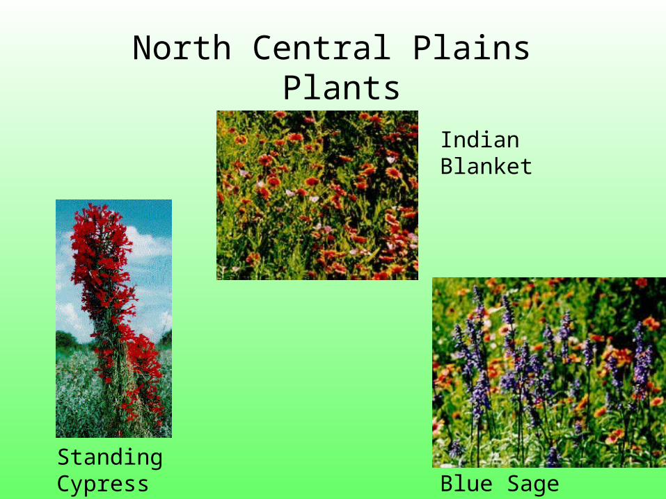
Indian Blanket
Blue SageStanding Cypress
North Central Plains Plants
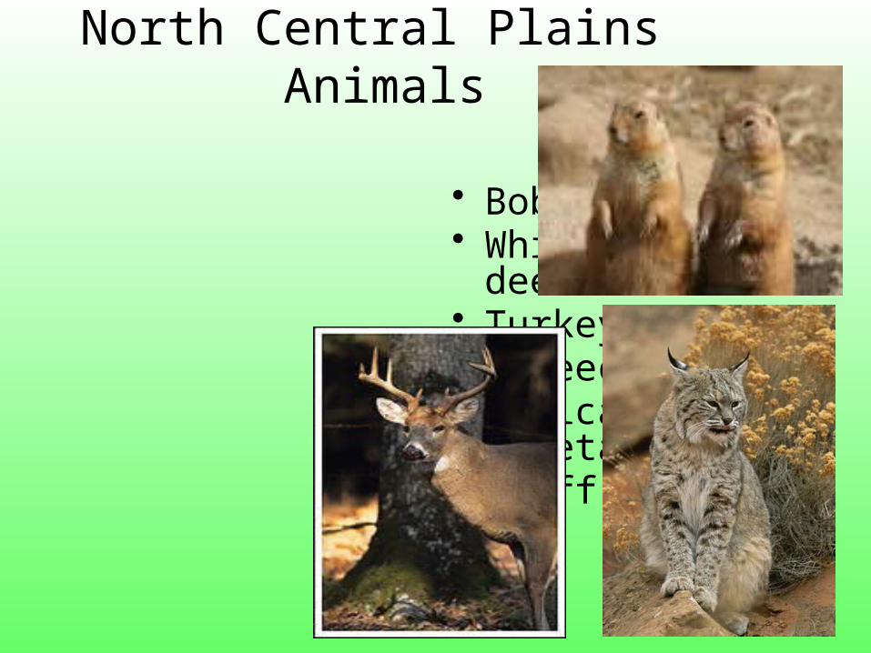
North Central Plains Animals
• Bobcat• White-tailed
deer• Turkeys
• Screech Owl• Mexican Freetail
Bat• Cliff Swallow

And the road runner….

The real road
runner…


NORTH CENTRAL PLAINSANIMALS
-Bobcat -White-tailed deer -Turkeys -Screech Owl
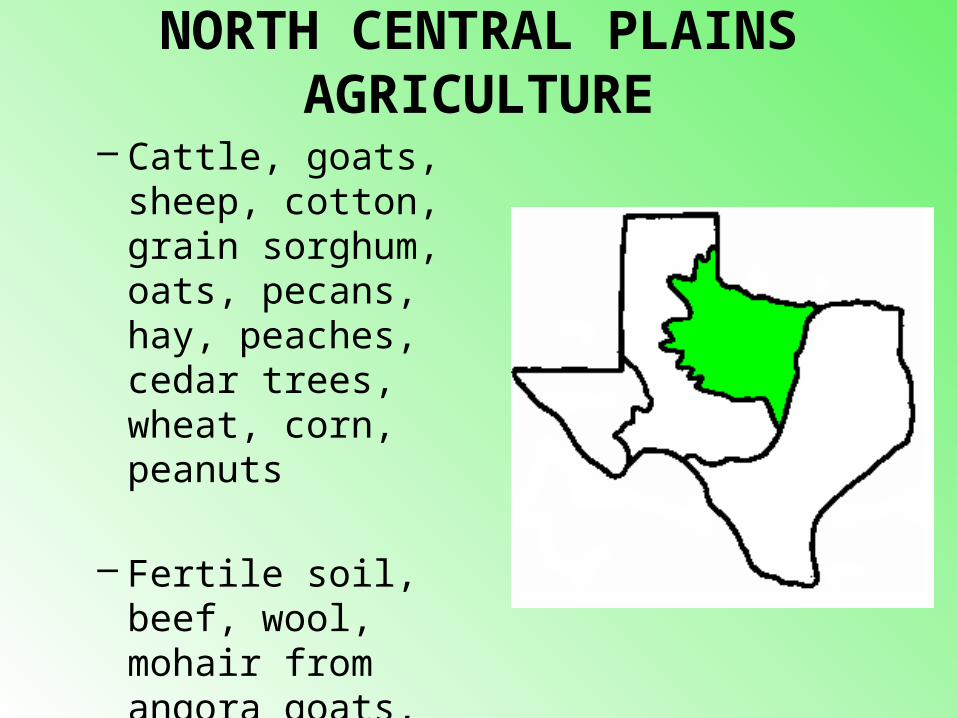
NORTH CENTRAL PLAINS AGRICULTURE
– Cattle, goats, sheep, cotton, grain sorghum, oats, pecans, hay, peaches, cedar trees, wheat, corn, peanuts
– Fertile soil, beef, wool, mohair from angora goats, oil in some areas

NORTH CENTRAL PLAINS ECONOMY
The fertile soil produces crops for a large portion of its industry
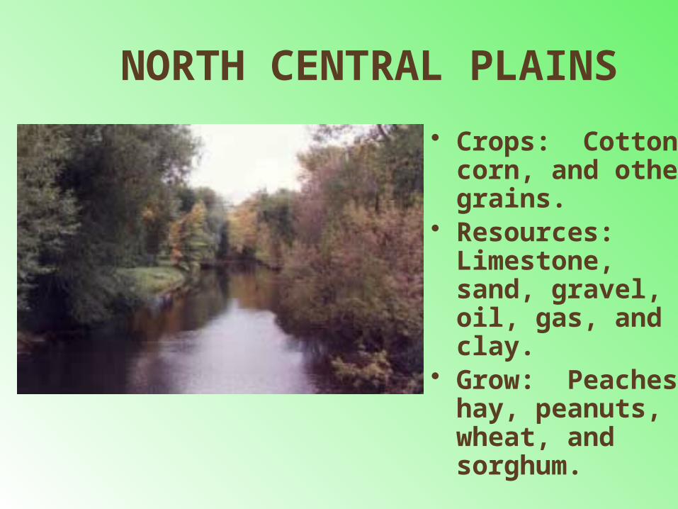
NORTH CENTRAL PLAINS
• Crops: Cotton, corn, and other grains.
• Resources: Limestone, sand, gravel, oil, gas, and clay.
• Grow: Peaches, hay, peanuts, wheat, and sorghum.

North Central Plains
Where are the North Central Plains?

North Central Plains

COASTAL PLAINS

COASTAL PLAINS• largest of the 4
Texas regions

Location of Coastal Plains
• Covers 1/3 of the land of Texas • Northeast border is the Sabine River • Southeast border is the Gulf of
Mexico • West border is the Balcones
Escarpment• The Coastal Plains reaches inland,
away from the coast about 250 miles

COASTAL PLAINS CITIES
– Austin– Brownsville– Dallas– Houston– San Antonio– Tyler – Texarkana– Corpus Christi

Coastal PlainsPhysical Features
– Woods & Forest– Beaches– Grassy Plains and Prairies– Has lots of fishing and shrimping– It is the largest of the four regions in Texas– Gets the most rainfall– Has citrus groves

COASTAL PLAINS
This region is divided into
5 subregions: Piney Woods
Gulf Coastal Plains South Texas Plains
Post Oak Belt Black land Prairie

COASTAL PLAINS SUBREGIONS
• Piney Woods – pine forest, farming, timber• Gulf Coast Plain – prairie, bayous, farming,
ranching, fishing, ports, oil, petrochemicals• South Texas Plains – warm dry climate, year-
round farming, ranches• Post Oak Belt – sandy soils, prairies, farming,
energy resources• Blackland Prairie – rich soil, large population,
manufacturing


The Coastal Plains
Piney Woods
Gulf Coast Plain
South Texas Plains
Post OakBelt
Blackland Prairie
timber, farming (fruits, vegetables), cattle ranching, oil
farming (rice, cotton, grains), livestock, fishing, shrimping, center of oil industry, petrochemicals, ports and shipping
farming (Rio Grande valley: fruit, vegetables, sugar-cane); ranching; retail and international trade; tourism; military bases (San Antonio)
farming (cotton), corn, cattle, hogs); mining (oil,gas, lignite); manufacturing
farming (cotton, grains, vegetables, cattle, chickens, hogs); Dallas/Metroplex: banking, insurance, and oil corporate headquarters, international cotton market,manufacturing, transportation hub
Subregion Main Industrial and Economic Activities

COASTAL PLAINS• The land along the Gulf Coast is very
near sea level. It is hard for water to drain off the land, since there is nowhere lower for the water to go. Much of the coast of Texas is made up of marshes----wetlands where a variety of tall grasses grow.

-Hot and damp, humid -Tornadoes, hurricanes
“More rain and violent stormsthan any other region”
-30-55 inches of rain per year
Warm in the South Cold in the North
COASTAL PLAINS CLIMATE

COASTAL PLAINSPLANTS
• The land along the Gulf Coast is very near sea level. It is hard for water to drain off the land, since there is nowhere lower for the water to go. Much of the coast of Texas is made up of marshes----wetlands where a variety of tall grasses grow.

COASTAL PLAINS ANIMALS
Many kinds of animals live in the coastal plains region…–Quail, Hawks, Owls, Bald Eagles and
hundreds of other birds–White tail deer–Foxes, Bobcats, Skunks–River otters–Alligators in the marshes!!! Some
weigh up to 500 lbs!!!

Coastal Plains Animals….


COASTAL PLAINSAGRICULTURE
– Timber, dairy, cattle, hogs, poultry, grain, sorghum, cotton, corn, peanuts, roses, fruits, hay, fish, sheep, wheat, vegetables, rice, citrus, and shrimp
– People, lots of rain, rivers, lumber and paper mills, chemical plants, ports, and oil

COASTAL PLAINS Economy Way of life:
fishing, timber, oil and gas
The gulf coast is a major center of economic activity. The marshlands provide breeding grounds for ocean life, which make the fish and shrimp businesses very important.
The port of Houston is one of the 10 busiest ports in the world.

COASTAL PLAINS• Oil and Gas Along the coastal region you will find many
oil rigs that are on-shore and off-shore.
The ocean gives easy access to ship the oil and gas to where it needs to go.

THE GULF COAST PLAINS ADAPTS TO ENVIRONMENT
• Houston – petrochemicals, shipping, manufacturing
• Dallas – banking, manufacturing, corporate headquarters
• Laredo – trade, farming • San Antonio – tourism, military, retail

Coastal Plains
Where are the Coastal Plains?

Coastal Plains

GREAT PLAINS

GREAT PLAINS• Region is located mostly in the panhandle
area of Texas.
• This area is very flat with a high elevation that features canyons. It is a barren area with very few trees.

GREAT PLAINSLOCATION
– Texas Panhandle to the north
– Cap Rock Escarpment on the east
-Northeast Texas -Colorado and Red
Rivers are the borders.

GREAT PLAINS CITIES
-Amarillo -Lubbock -Odessa
AbileneMidland
-San Angelo -Wichita Falls

PHYSICAL FEATURES OF THE GREAT PLAINS
• Panhandle area of Texas• Highest Elevation in Texas• High and flat treeless plains and
grasslands• Caprock Escarpments with elevation
rising to the east• Balcones Escarpments along the
eastern and western edges• Red River forms Palo Duro Canyon
Caprock – hard bed of rock below the soil of the High PlainsEscarpment – cliffs

GREAT PLAINSGEOGRAPHIC FEATURES
-Rolling grassy lands -Thick grasses -Cross Timbers area - large areas of
hardwood trees -Limestone rock -Higher elevation because limestone
doesn't wear down easily

GREAT PLAINSThis region is divided into
3 subregions:High PlainsEdwards PlateauLlano Basin

Physical Features
HIGH PLAINS
Physical Features
EDWARDS PLATEAU
The Great Plainshigh flat, Caprock prairie with elevation rising to east; escarpments
on eastern, western edges; Red River forms Palo Duro Canyon;little rainfall; oil and gas
high, hilly limestone plateau rising and getting more rugged to west;Balcones Escarpment and Fault, many springs on southern edge;
many areas rocky with thin soil; prairie grasses; trees; rivers, streamsform deep valleys and canyons

GREAT PLAINS• Climate
– Windy, Dry Air– Tornadoes– Very cold in winter– Very hot in summer– Coldest region of
Texas– 15-20 inches of
rainfall a year– Violent sand, snow,
and rain storms

GREAT PLAINS PLANTS
-Prickly pear -Yucca -Indian Paintbrush -Cactus

GREAT PLAINS ANIMALS
• Pronghorn• Prarie Dog• Snakes• Toads


Great Plains Economy Way of Life
• Cattle ranching and cotton farming are major sources of commerce in this area
• Farming - fruits, vegetables, watermelons, oats
• Ranching - cattle, angora goats (mohair)
• Cedar trees - fenceposts • Oil and gas

TEXANS HAVE ADAPTED TO THE ENVIRONMENT OF THE GREAT PLAINS
• Used grasslands for farming• Pumped water for irrigating crops
• Drilled for oil and gas• Built cities

Great Plains
Where are the Great Plains?

Great Plains

MOUNTAINS AND BASINS

MOUNTAINS AND BASINSLOCATION
• Far west Texas • East border near Pecos
River • South border is the Rio
Grande • North border is
New Mexico

MOUNTAINS AND BASINS CITIES
– Alpine– El Paso– Fort Stockton
- Pecos
-Kermit & Monahans in Permian Basin area -Fort Davis, Marfa, & Alpine in Mountain
area

MOUNTAINS AND BASINSPHYSICAL FEATURES
• Towering Peaks, Rocky Canyons, and flowering cacti.
• Mountains and Basins have dry, rocky soils.
• Places: Big Bend National Park, Guadalupe National Park, and Davis Mountains

MOUNTAINS AND BASINS
• Guadalupe Peak is the highest point in Texas
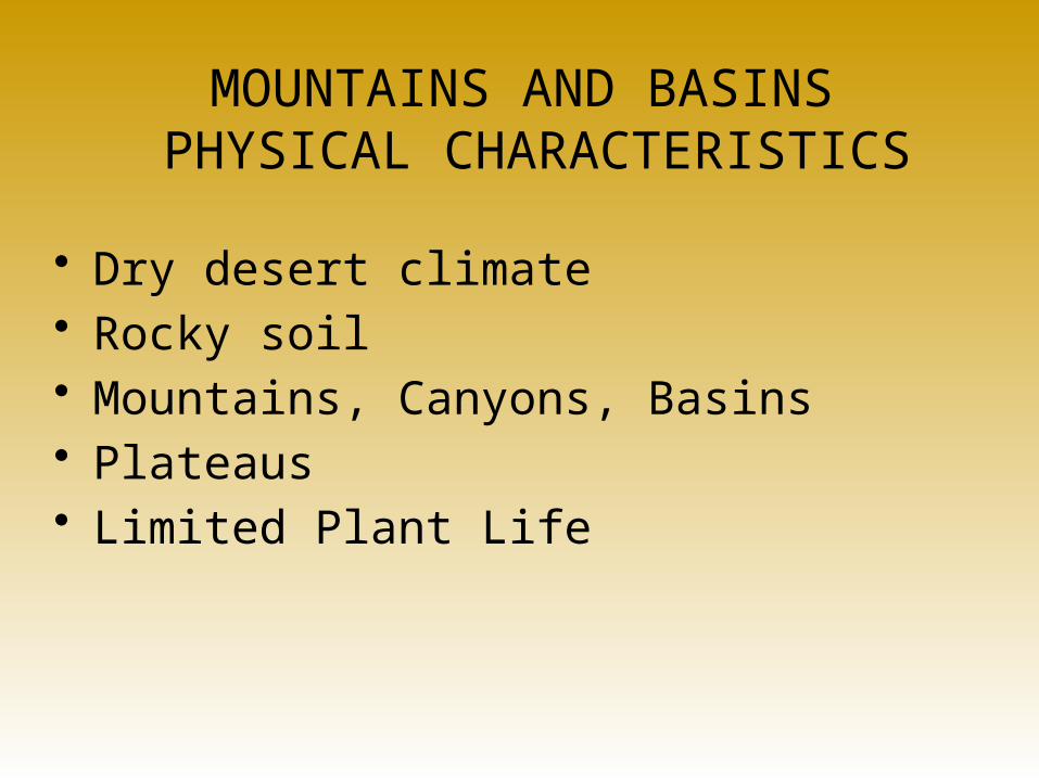
MOUNTAINS AND BASINS PHYSICAL CHARACTERISTICS
• Dry desert climate• Rocky soil• Mountains, Canyons, Basins• Plateaus• Limited Plant Life

Mountains and BasinsPhysical Features
– Mountains ranges, basins & plateaus– Guadalupe Mountains– Big Bend National Park– Guadalupe Peak – highest peak in Texas
(8749 feet)
• Basins are lowlands surrounded by higher land.

MOUNTAINS AND BASINSThis region
has no subregions

Physical Features EconomicActivities
Population/Main Cities
MOUNTAINS AND BASINS
population:
main city:
MOUNTAINS AND Basins
mountains, plateaus,basins, canyons;desert climate withlittle rainfall; dryrocky soil; limitedplant life (desertgrasses, shrubs,cacti)
ranching; somefarming with irriga-tion; oil, sulfur, silver;tourism; El Paso(military bases,Mexican trade, I-10trade route)
small, concentratedin a few small towns
El Paso (one of thelargest Texas cities

-Driest part of state -8 inches of rain per year, 20 in mountains -Hot days, cool nights
MOUNTAINS AND BASINS CLIMATE

-Some sagebrush
MOUNTAINS AND BASINS PLANTS

MOUNTAINS AND BASINS ANIMALS
mountain lionsperegrine falconsrattlesnakes


Ranching-cattle, sheep, goat Farming - cotton, fruits, vegetables, cantaloupes (irrigation in El Paso and Pecos River Valley) Oil and gas - part of Permian Basin
MOUNTAINS AND BASINSWAY OF LIFE

Mountains and Basins
Where are the Mountains and Basins?

Mountains & Basins

Summary of theRegions of
Texas

• Includes about 1/3 of Texas• Home to more people than any other part/region of
Texas• About 2 out of every 3 Texans live in the Coastal Plains• The Coastal Plains is divided into 5 subgroups:
-Piney Woods -Post Oak Belt-Gulf Coast Plain -Blackland Prairie-South Texas Plain
Coastal Plains

1. Piney Woods: -pine forests-rainiest part of Texas -elevation low -growing season (average number of days between the last killing frost of spring and the first killing frost of fall) is 230-265 days
2. Post Oak Belt: -dryer than Piney Woods -west of Piney Woods subregion-oak, hickory trees - growing season 230-280 days
Coastal Plains and its Subregions

3. Blackland Prairie: -long, narrow area-follows the Balcones Escarpment (cliff or abrupt break in the land’s surface) near Oklahoma border, through San Antonio, and down to the Mexico border -growing season 230-280 days soil not good for growing trees -prairie grass
4. Gulf Coastal Plain: -warm temperatures, long growing season 240-309 days, low elevation
5. South Texas Plain: -warm year round vast range of elevations (sea level to 1,000 ft. above) -growing season 265-341 days (long growing season in Brownsville)

North Central Region and its Subregions• Rolling plains lBrush, scattered grasses
• Covered by small oak and mesquite trees
•North Central Region is divided into 3 subregions:
Grand Prairie
Cross Timbers
Rolling Plains

1. Grand Prairie: -near Temple and Killeen-soil NOT good for growing trees-mostly tall grasses
2. Cross Timbers: -post oak, hickory, pecan and elm trees
3. Rolling Plains: -largest subregion in North Central Region -most of this subregion is largely steppe (vast, flat, treeless plain)
North Central Region and its Subregions

Great Plains Region and its Subregions
Great Plains Region is divided into 3 subregions:
1.Edwards Plateau: -primarily of limestone -caves and underwater streams -Edwards Aquifer (San Antonio’s water supply) is in this subregion
2.High Plains: -major farming area -dry climate -elevation ranges from 3,000-4,000 feet

• Tall mountains separated by large basins (closed valleys)
• Forests on mountains• Lower elevations (basins) are deserts with
cactus, short grasses, and shrubs• Very little rain• Contains the HIGHEST POINT IN TEXAS: Guadalupe Peak ~ 8,751 feet
Mountains and Basins Region

Benefits
• Each region contains different natural resources. From the cotton fields of the Mountain and Basin and Great Plains regions to the ports of the Coastal/Gulf Plains, each area is rich with essential resources. This range of resources is a huge benefit as it allows Texas to be one of the most self-sufficient states in the country.

REGIONS OF TEXAS
Label the 4 regions of Texas1
2
34

TRACE PATTERN OF TEXAS
• Draw and label the 4 natural regions (pg 10 in map book) COLOR THE REGIONS
• Draw and label 5 major cities (pg 3 in map book)
• Draw and label 5 rivers (pg 50 in class book)
• Draw a compass rose on your map

• You will be given a region to work on AS A GROUP.
• You will need to find a way to make sure that all topics are somehow shown on your poster. Designate certain people to do certain jobs.
• *This project will be given 2 FULL class days to work on and can be worked on during any extra catch-up time throughout the day.
• *Project is due Friday, Sept 5th at the beginning of the social studies period.

• *The following are requirements for your poster : • Illustration of Texas• Illustration of your given region.• Climate• Major cities• Way of life• Contributions• Plants and animals• Landforms• Any other interesting info you find.• *This is a MAJOR GRADE!!!• *Each group member will have an opportunity to grade the
other members by using the rubric for the project.