report: by
TRANSCRIPT

1
Comprehensive and Professional Solutions for all Heritage Related Matters
CK 2006/014630/23 VAT NO.: 4360226270
A PHASE 1 AIA REPORT FOR THE SALENE MANGANESE EIA/EMP AMENDMENT
LOCATED ON VARIOUS PORTIONS OF THE FARM MACARTHY 559 MAGISTERIAL DISTRICT OF POSTMASBURG, NORTHERN CAPE PROVINCE
For:
Prescali Environmental Consultants (Pty) Ltd
PO Box 2544 Montana Park
0159
REPORT: APAC020/105
by:
A.J. Pelser Accredited member of ASAPA
November 2020
P.O.BOX 73703
LYNNWOOD RIDGE
0040
Tel: 083 459 3091
Fax: 086 695 7247
Email: [email protected]
Member: AJ Pelser BA (UNISA), BA (Hons) (Archaeology), MA (Archaeology) [WITS]
2
©Copyright
APELSER ARCHAEOLOGICAL CONSULTING The information contained in this report is the sole intellectual property of
APELSER Archaeological Consulting. It may only be used for the purposes it was commissioned for by the client.
DISCLAIMER:
Although all efforts are made to identify all sites of cultural heritage (archaeological and historical) significance during an assessment of study areas, the nature of archaeological
and historical sites are as such that it is always possible that hidden or subterranean sites, features or objects could be overlooked during the study. APELSER Archaeological
Consulting can’t be held liable for such oversights or for costs incurred as a result thereof.
Clients & Developers should not continue with any development actions until SAHRA or one of its subsidiary bodies has provided final comments on this report. Submitting the
report to SAHRA is the responsibility of the Client unless required of the Heritage Specialist as part of their appointment and Terms of Reference

3
SUMMARY APelser Archaeological Consulting (APAC) was appointed by Prescali Environmental Consultants (Pty) Ltd to conduct a Phase 1 Archaeological Impact Assessment (AIA) for the Salene Manganese Project. The AIA forms part of the EIA/EMP Amendment process. The project and study area is situated between Kathu and Postmasburg in the Magisterial District of Postmasburg of the Northern Cape. The study area comprises Portions 2, 3, 4 & 5 of the farm Macarthy 559. A number of known cultural heritage (archaeological and historical) sites exist in the larger geographical area within which the study area falls. A number of new sites were identified and recorded in the study area during the November 2020 field assessment. This report will discuss the results of the field assessment and the desktop work and provide recommendations on the way forward at the end of the document. From an Archaeological perspective it is recommended that the proposed activities be allowed to continue once the mitigation measures put forward at the end of the report have been implemented.

4
CONTENTS
1. INTRODUCTION .................................................................................................................. 5
2. TERMS OF REFERENCE ........................................................................................................ 5
3. LEGISLATIVE REQUIREMENTS ............................................................................................. 5
4. METHODOLOGY .................................................................................................................. 8
5. DESCRIPTION OF THE AREA ................................................................................................ 9
6. DISCUSSION ...................................................................................................................... 12
7. CONCLUSIONS AND RECOMMENDATIONS ...................................................................... 14
8. REFERENCES ...................................................................................................................... 31
APPENDIX A: DEFINITION OF TERMS: ...................................................................................... 33
APPENDIX B: DEFINITION/ STATEMENT OF HERITAGE SIGNIFICANCE .................................... 34
APPENDIX C: SIGNIFICANCE AND FIELD RATING: .................................................................... 35
APPENDIX D: PROTECTION OF HERITAGE RESOURCES: ........................................................... 36
APPENDIX E: HERITAGE IMPACT ASSESSMENT PHASES .......................................................... 37
5
1. INTRODUCTION APelser Archaeological Consulting (APAC) was appointed by Prescali Environmental Consultants (Pty) Ltd to conduct a Phase 1 Archaeological Impact Assessment (AIA) for the Salene Manganese Project. The AIA forms part of the EIA/EMP Amendment process. The project and study area is situated between Kathu and Postmasburg in the Magisterial District of Postmasburg of the Northern Cape. The study area comprises Portions 2, 3, 4 & 5 of the farm Macarthy 559. A number of known cultural heritage (archaeological and historical) sites exist in the larger geographical area within which the study area falls. A number of new sites were identified and recorded in the study area during the November 2020 field assessment. The client indicated the location and the boundaries of the study area and the assessment concentrated on this.
2. TERMS OF REFERENCE The Terms of Reference for the study was to:
1. Identify all objects, sites, occurrences and structures of an archaeological or historical nature (cultural heritage sites) located on the portion of land that will be impacted upon by the proposed development;
2. Assess the significance of the cultural resources in terms of their archaeological, historical, scientific, social, religious, aesthetic and tourism value;
3. Describe the possible impact of the proposed development on these cultural remains, according to a standard set of conventions;
4. Propose suitable mitigation measures to minimize possible negative impacts on the cultural resources; and
5. Review applicable legislative requirements.
3. LEGISLATIVE REQUIREMENTS Aspects concerning the conservation of cultural resources are dealt with mainly in two acts. These are the National Heritage Resources Act, 1999 (Act No. 25 of 1999) and the National Environmental Management Act, 1998 (Act No. 107 of 1998), as amended. 3.1. The National Heritage Resources Act
According to the above-mentioned act the following is protected as cultural heritage resources:
6
a. Archaeological artifacts, structures and sites older than 100 years b. Ethnographic art objects (e.g. prehistoric rock art) and ethnography c. Objects of decorative and visual arts d. Military objects, structures and sites older than 75 years e. Historical objects, structures and sites older than 60 years f. Proclaimed heritage sites g. Grave yards and graves older than 60 years h. Meteorites and fossils i. Objects, structures and sites of scientific or technological value.
The National Estate includes the following:
a. Places, buildings, structures and equipment of cultural significance b. Places to which oral traditions are attached or which are associated with
living heritage c. Historical settlements and townscapes d. Landscapes and features of cultural significance e. Geological sites of scientific or cultural importance f. Sites of Archaeological and paleontological importance g. Graves and burial grounds h. Sites of significance relating to the history of slavery i. Movable objects (e.g. archaeological, paleontological, meteorites, geological
specimens, military, ethnographic, books etc.) A Heritage Impact Assessment (HIA) is the process to be followed in order to determine whether any heritage resources are located within the area to be developed as well as the possible impact of the proposed development thereon. An Archaeological Impact Assessment (AIA) only looks at archaeological resources. An HIA must be done under the following circumstances:
a. The construction of a linear development (road, wall, power line, canal etc.) exceeding 300m in length
b. The construction of a bridge or similar structure exceeding 50m in length c. Any development or other activity that will change the character of a site and
exceed 5 000m2 or involve three or more existing erven or subdivisions thereof
d. Re-zoning of a site exceeding 10 000 m2 e. Any other category provided for in the regulations of the South African
Heritage Resources Agency (SAHRA) or a provincial heritage authority Structures Section 34 (1) of the mentioned act states that no person may demolish any structure or part thereof which is older than 60 years without a permit issued by the relevant provincial heritage resources authority. A structure means any building, works, device or other facility made by people and which is fixed to land, and includes any fixtures, fittings and equipment associated therewith.

7
Alter means any action affecting the structure, appearance or physical properties of a place or object, whether by way of structural or other works, by painting, plastering or the decoration or any other means. Archaeology, palaeontology and meteorites Section 35(4) deals with Archaeology, Palaeontology and Meteorites. The act states that no person may, without a permit issued by the responsible heritage resources authority (national or provincial) a. destroy, damage, excavate, alter, deface or otherwise disturb any archaeological or
palaeontological site or any meteorite; b. destroy, damage, excavate, remove from its original position, collect or own any
archaeological or palaeontological material or object or any meteorite; c. trade in, sell for private gain, export or attempt to export from the Republic any
category of archaeological or palaeontological material or object, or any meteorite; or d. bring onto or use at an archaeological or palaeontological site any excavation
equipment or any equipment that assists in the detection or recovery of metals or archaeological and palaeontological material or objects, or use such equipment for the recovery of meteorites.
e. alter or demolish any structure or part of a structure which is older than 60 years as protected.
The above mentioned may only be disturbed or moved by an archaeologist, after receiving a permit from the SAHRA. In order to demolish such a site or structure, a destruction permit from the SAHRA will also be needed. Human remains Graves and burial grounds are divided into the following:
a. ancestral graves b. royal graves and graves of traditional leaders c. graves of victims of conflict d. graves designated by the Minister e. historical graves and cemeteries f. human remains
In terms of Section 36(3) of the National Heritage Resources Act, no person may, without a permit issued by the relevant heritage resources authority:
a. destroy, damage, alter, exhume or remove from its original position or otherwise disturb the grave of a victim of conflict, or any burial ground or part thereof which contains such graves;

8
b. destroy, damage, alter, exhume or remove from its original position or otherwise disturb any grave or burial ground older than 60 years which is situated outside a formal cemetery administered by a local authority; or
c. bring onto or use at a burial ground or grave referred to in paragraph (a) or (b) any excavation, or any equipment which assists in the detection or recovery of metals.
Human remains that are less than 60 years old are subject to provisions of the Human Tissue Act (Act 65 of 1983) and to local regulations. Exhumation of graves must conform to the standards set out in the Ordinance on Excavations (Ordinance no. 12 of 1980) (replacing the old Transvaal Ordinance no. 7 of 1925). Permission must also be gained from the descendants (where known), the National Department of Health, Provincial Department of Health, Premier of the Province and local police. Furthermore, permission must also be gained from the various landowners (i.e. where the graves are located and where they are to be relocated to) before exhumation can take place. Human remains can only be handled by a registered undertaker or an institution declared under the Human Tissues Act, 1983 (Act No. 65 of 1983 as amended). 3.2. The National Environmental Management Act This Act states that a survey and evaluation of cultural resources must be done in areas where development projects, that will change the face of the environment, will be undertaken. The impact of the development on these resources should be determined and proposals for the mitigation thereof are made. Environmental management should also take the cultural and social needs of people into account. Any disturbance of landscapes and sites that constitute the nation’s cultural heritage should be avoided as far as possible and where this is not possible the disturbance should be minimized and remedied.
4. METHODOLOGY 4.1. Survey of literature A survey of available literature was undertaken in order to place the development area in an archaeological and historical context. The sources utilized in this regard are indicated in the bibliography. 4.2. Field survey The field assessment section of the study was conducted according to generally accepted AIA/HIA practices and aimed at locating all possible objects, sites and features of heritage significance in the area of the proposed development. The location/position of all sites,
9
features and objects is determined by means of a Global Positioning System (GPS) where possible, while detail photographs are also taken where needed. 4.3. Oral histories People from local communities are sometimes interviewed in order to obtain information relating to the surveyed area. It needs to be stated that this is not applicable under all circumstances. When applicable, the information is included in the text and referred to in the bibliography. 4.4. Documentation All sites, objects, features and structures identified are documented according to a general set of minimum standards. Co-ordinates of individual localities are determined by means of the Global Positioning System (GPS). The information is added to the description in order to facilitate the identification of each locality.
5. DESCRIPTION OF THE AREA The study area is located on Portions 2, 3, 4 & 5 of the farm Macarthy 559, in the Postmasburg Magisterial District of the Northern Cape and between the towns of Kathu and Postmasburg. The topography of the area is relatively flat and open, although some hills, ridges and rocky outcrops do occur on parts of it. The vegetation is typical Kalahari Thornveld, and large sections are also covered by red Aeolian sands. Impacts on the area include older (recent historical) and ongoing mining activities, as well as infrastructure, roads, powerlines and quarrying. The area would have been used for farming purposes (cattle/livestock mostly) in the past. Although there have been some extensive mining-related impacts, the new proposed activity areas that had to be assessed contained its original natural character. Some sites of cultural heritage origin and significance were identified in the study area during the November 2020 field assessment and will be discussed in detail in the following sections of the report.
10
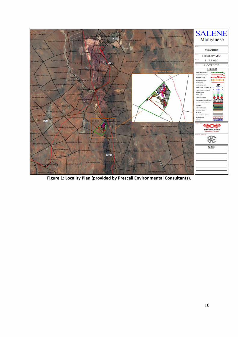
Figure 1: Locality Plan (provided by Prescali Environmental Consultants).
11
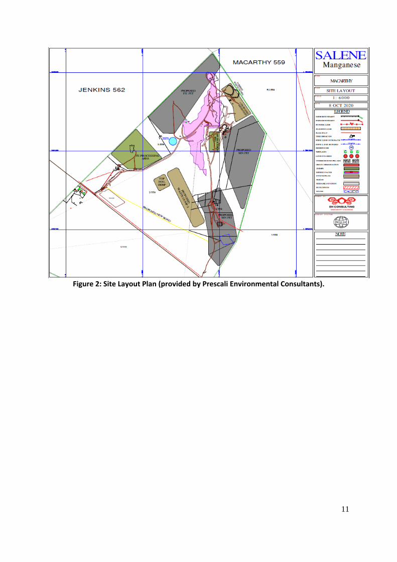
Figure 2: Site Layout Plan (provided by Prescali Environmental Consultants).

12
Figure 3: Closer view of study area location and footprint (Google Earth 2020).
6. DISCUSSION The Stone Age is the period in human history when lithic (stone) material was mainly used to produce tools. In South Africa the Stone Age can basically be divided into three periods. It is however important to note that dates are relative and only provide a broad framework for interpretation. A basic sequence for the South African Stone Age (Lombard et.al 2012) is as follows: Earlier Stone Age (ESA) up to 2 million – more than 200 000 years ago Middle Stone Age (MSA) less than 300 000 – 20 000 years ago Later Stone Age (LSA) 40 000 years ago – 2000 years ago It should also be noted that these dates are not a neat fit because of variability and overlapping ages between sites (Lombard et.al 2012: 125). No known Stone Age sites or artifacts are present in the study area. According to David Morris of the McGregor Museum in Kimberley the archaeology of the Northern Cape is rich and varied, covering long spans of human history. The Karoo is particularly bountiful. Some areas are richer than others, and not all sites are equally significant. The significance of sites encountered in the study area may be assessed against previous research in the region and subcontinent. The region’s remoteness from research institutions accounts for a relative lack of archaeological research in the area. The area has probably been relatively marginal to human settlement for most of its history, yet it is in fact exceptionally rich in terms of

13
Stone Age sites and rock art, as a relatively few but important studies have shown (Morris 2006). Stone Age sites are known to occur in the larger geographical area, including the well-known Wonderwerk Cave in the Kuruman Hills, Tsantsabane, an ancient specularite working on the eastern side of Postmasburg, Doornfontein, another specularite working north of Beeshoek and a cluster of important Stone Age sites near Kathu (including the Kathu Pan sites). Additional specularite workings with associated Ceramic Later Stone Age material and older Fauresmith sites (early Middle Stone Age) are known from Lylyfeld, Demaneng, Mashwening, King, Rust & Vrede, Paling, Gloucester and Mount Huxley to the north. Rock engraving sites are known from Beeshoek and Bruce (Morris 2005: 3). Some Stone Age sites and artifacts were identified and recorded in the study area during the November 2020 assessment. The Iron Age is the name given to the period of human history when metal was mainly used to produce metal artifacts. In South Africa it can be divided in two separate phases (Bergh 1999: 96-98), namely: Early Iron Age (EIA) 200 – 1000 A.D Late Iron Age (LIA) 1000 – 1850 A.D. Huffman (2007: xiii) however indicates that a Middle Iron Age should be included. His dates, which now seem to be widely accepted in archaeological circles, are: Early Iron Age (EIA) 250 – 900 A.D. Middle Iron Age (MIA) 900 – 1300 A.D. Late Iron Age (LIA) 1300 – 1840 A.D. The expansion of early farmers, who, among other things, cultivated crops, raised livestock, made ceramic containers (pots), mined ore and smelted metals, occurred in this area between AD 400 and AD 1100 and brought the Early Iron Age (EIA) to South Africa. They settled in semi-permanent villages (De Jong 2010: 35). While there is some evidence that the EIA continued into the 15th century in the South African Lowveld, on the escarpment it had ended by AD1100. The Highveld became active again from the 15th century onwards due to a gradually warmer and wetter climate. From here communities spread to other parts of the interior. This later phase, termed the Late Iron Age (LIA), was accompanied by extensive stonewalled settlements, such as the Thlaping capital Dithakong, 40 km north of Kuruman (De Jong 2010: 35-36). Sotho-Tswana and Nguni societies, the descendants of the LIA mixed farming communities, found the region already sparsely inhabited by the Late Stone Age (LSA) Khoisan groups, the so-called ‘first people’. Most of them were eventually assimilated by LIA communities and only a few managed to survive, such as the Korana and Griqua. This period of contact is

14
sometimes known as the Ceramic Late Stone Age and is represented by the Blinkklipkop specularite mine near Postmasburg and finds at the Kathu Pan (De Jong 2010: 36). No Iron Age sites, features or objects were found during the recent assessment. Factors such as population expansion, increasing pressure on natural resources, the emergence of power blocs, attempts to control trade and penetration by Griquas, Korana and white communities from the south-west resulted in a period of instability in Southern Africa that began in the late 18th century and effectively ended with the settlement of white farmers in the interior. This period, known as the difaqane or Mfecane, also affected the Northern Cape Province, although at a relatively late stage compared to the rest of Southern Africa. Here, the period of instability, beginning in the mid-1820s, was triggered by the incursion of displaced refugees associated with the Tlokwa, Fokeng, Hlakwana and Phuting tribal groups. The difaqane coincided with the penetration of the interior of South Africa by white traders, hunters, explorers and missionaries. The first was PJ Truter’s and William Somerville’s journey of 1801, which reached Dithakong at Kuruman. They were followed by Cowan, Donovan, Burchell and Campbell and resulted in the establishment of a London Mission Society station near Kuruman in 1817 by James Read. The Great Trek of the Boers from the Cape in 1836 brought large numbers of Voortrekkers up to the borders of large regions known as Bechuanaland and Griqualand West, thereby coming into conflict with many Tswana groups and also the missionaries of the London Mission Society. The conflict between Boer and Tswana communities escalated in the 1860s and 1870s when the Korana and Griqua communities became involved and later also the British government. The conflict mainly centered on land claims by various communities. For decades the western border of the Transvaal Boer republic was not fixed. Only through arbitration (the Keate Arbitration), triggered by the discovery of gold at Tati (1866) and diamonds at Hopetown (1867) was part of the western border finally determined in 1871. Ten years later, the Pretoria Convention fixed the entire western border, thereby finally excluding Bechuanaland and Griqualand West from Boer domination (De Jong 2010: 36). Some recent historical sites and features were identified and recorded in the study area in November 2020. Results of the November 2020 Field Assessment A number of sites and features of cultural heritage (archaeological and/or recent historical) origin and significance were identified and recorded in the area during the assessment. These included sites dating to the Stone Age (open-air surface scatters and single artifacts), recent historical structures and a cemetery.

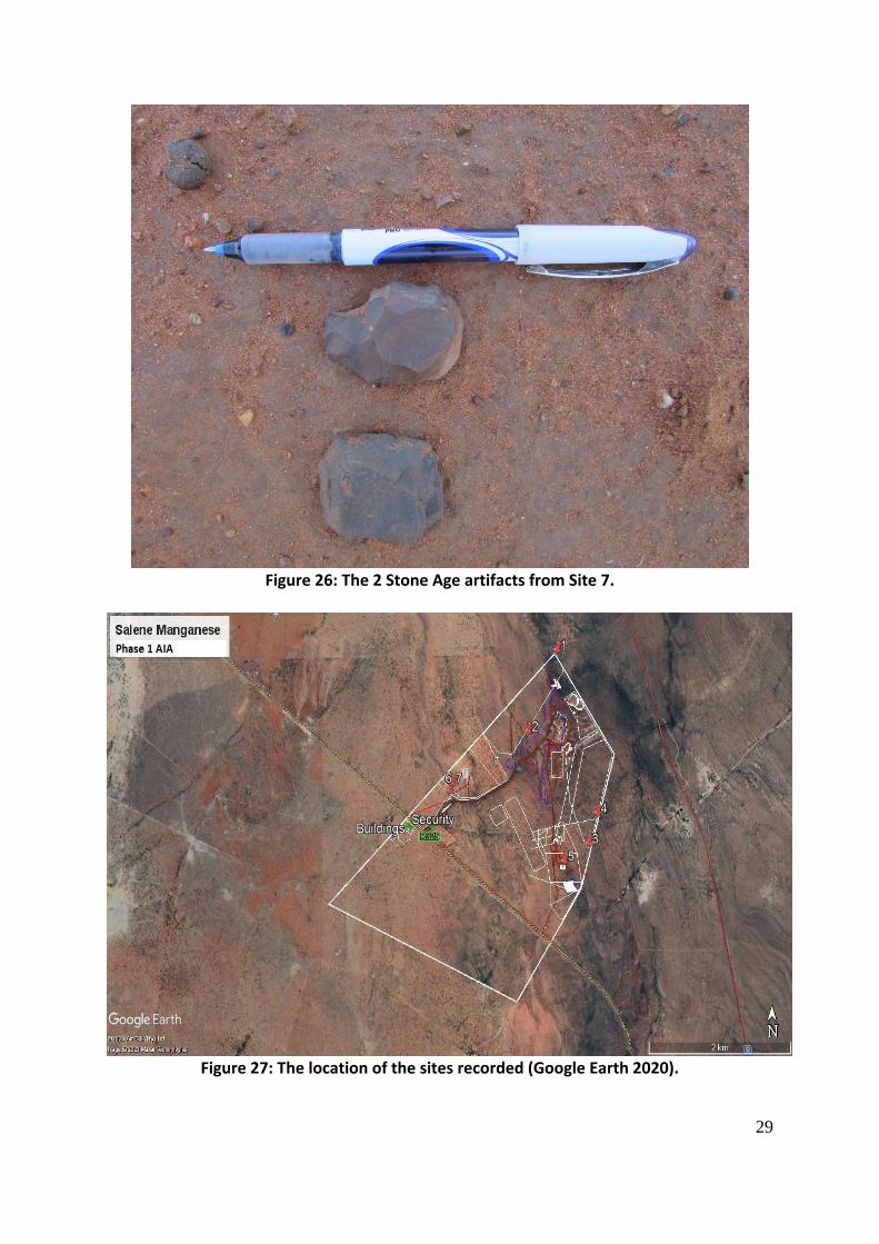
15
Stone Age Sites Four sites (Sites 1, 3, 4 & 7) were recorded. Three of these were either single or small scatters of MSA & LSA stone tools and flakes, while Site 1 contains a dense scatter of formal tools, waste-flakes and flake-tools. Although these were the only visible sites there is a possibility that more could be located in the area – especially in sections covered by red Aeolian (Kalahari) sands. Site 1 is located on top of a hill with large boulders. These large boulders provide some shelter and it seems as if the material found here is the result of stone knapping (manufacture of tools) activities around these boulders and sheltered area. From the hill there is a good view of the entire area below. The amount of artifacts found here warrants further investigation and the site is rated of Medium to High Heritage Significance. The site is located within the proposed iron opencast pit footprint and as a result will be negatively impacted. The following mitigation measures are therefore recommended: 1. Detailed mapping and recording of Site 1 and potentially other sites located around
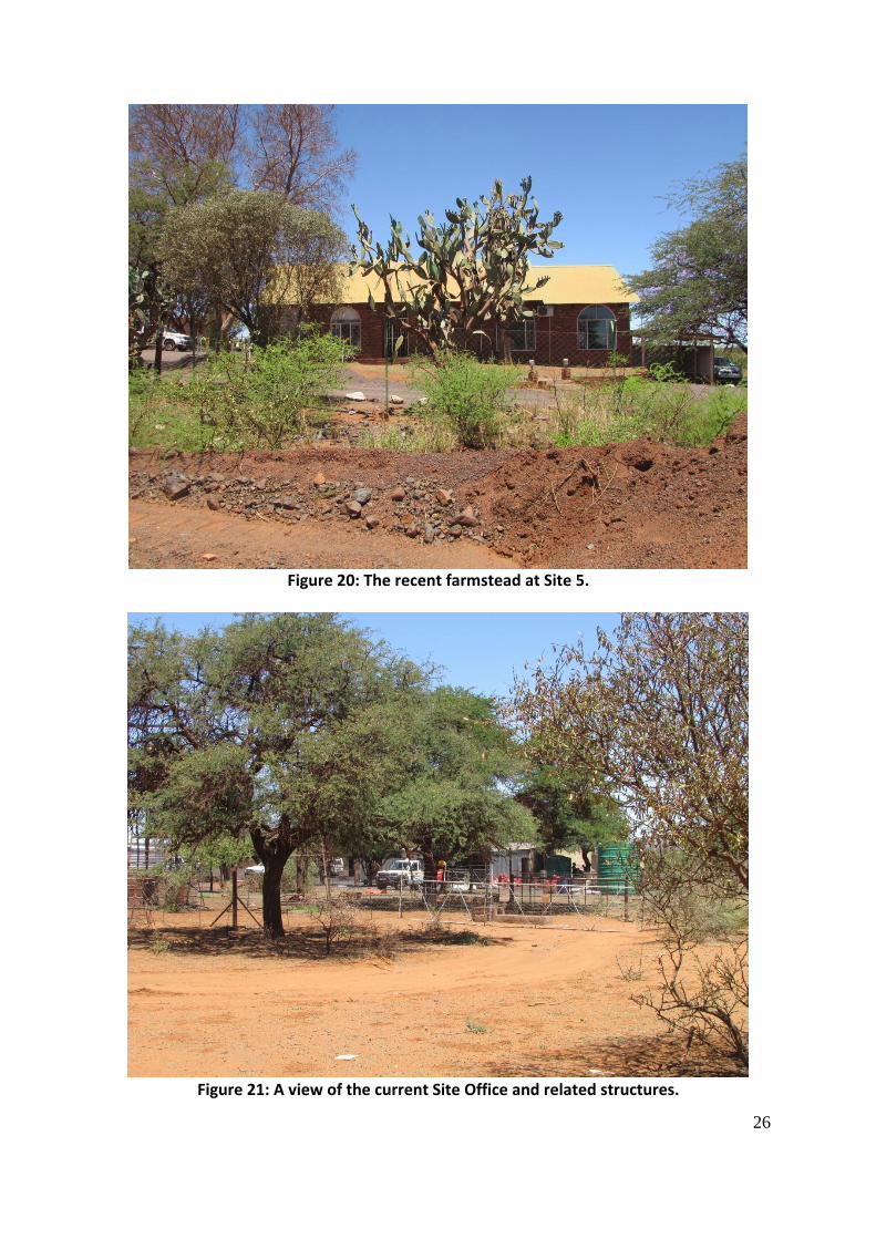
the hill 2. Surface sampling of material from the site and the hill These mitigation measures need to be implemented prior to any mining activities being undertaken in this area. GPS Location of Sites: S27 55 17.10 E23 01 23.90 (Site 1); S27 56 34.20 E23 01 40.20 (Site 3) S27 56 22.10 E23 01 44.80 (Site 4); S27 56 10.20 E23 00 29.80 (Site 7) Cultural Significance: Medium - High Heritage Significance: Grade III: Other heritage resources of local importance and therefore worthy of conservation. Field Ratings: General protection A (IV A): Site should be mitigated before destruction (High/Medium Significance) Mitigation: See Above recommended measures for Site 1. Recent Historical Sites These three sites (Sites 2, 5 & 6) all date to recent (less than 60 years of age) times. Site 2 consists of the remains of recently constructed mining related structures that have been abandoned and Site 5 is an existing farmstead dating to the 1970’s that is currently utilized as offices. Both these sites have no Heritage Significance. Site 6 is a cemetery containing 10 graves of the Kotze (previous farm owner) and Jacobs families. Although the graves are not older than 60 years of age graves always carry a High Significance Rating from a Heritage perspective. The cemetery is located close to the current Site Offices and is properly fenced in and will not be impacted by any mining activities. A 30m buffer zone within which no development will be allowed needs to be adhered to.

16
GPS Location of Sites: S27 55 49.50 E23 01 09.10 (Site 2); S27 56 41.17 E23 01 27.73 (Site 5) S27 56 13.30 E23 00 28.80 (Site 6) Cultural Significance: Low (Sites 2 & 5); High (Site 6) Heritage Significance: Grade III: Other heritage resources of local importance and therefore worthy of conservation. Field Ratings: Local Grade IIIB: should be included in the heritage register and may be mitigated (High/Medium significance) Mitigation: See Above recommended measures for Site 6.
Figure 4: A general view of a part of the study area. Note the current mining activities.

17
Figure 5: A view of the hill where Site 1 is located.

18
Figure 6: Another view of the hill.
19
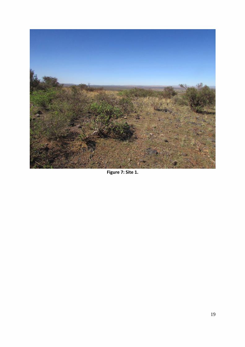
Figure 7: Site 1.

20
Figure 8: Some of the stone tools from Site 1.
Figure 9: Another general view of a part of the study area.

21
Figure 10: Large parts of the study area are very rocky.
Figure 11: Existing mining roads have impacted on the area.

22
Figure 12: Recent mining impacts.
Figure 13: One of the recent mining related structures on Site 2.
23
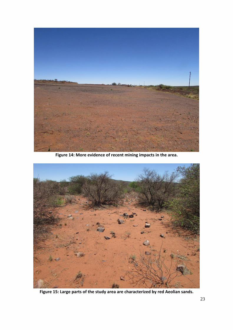
Figure 14: More evidence of recent mining impacts in the area.
Figure 15: Large parts of the study area are characterized by red Aeolian sands.
24
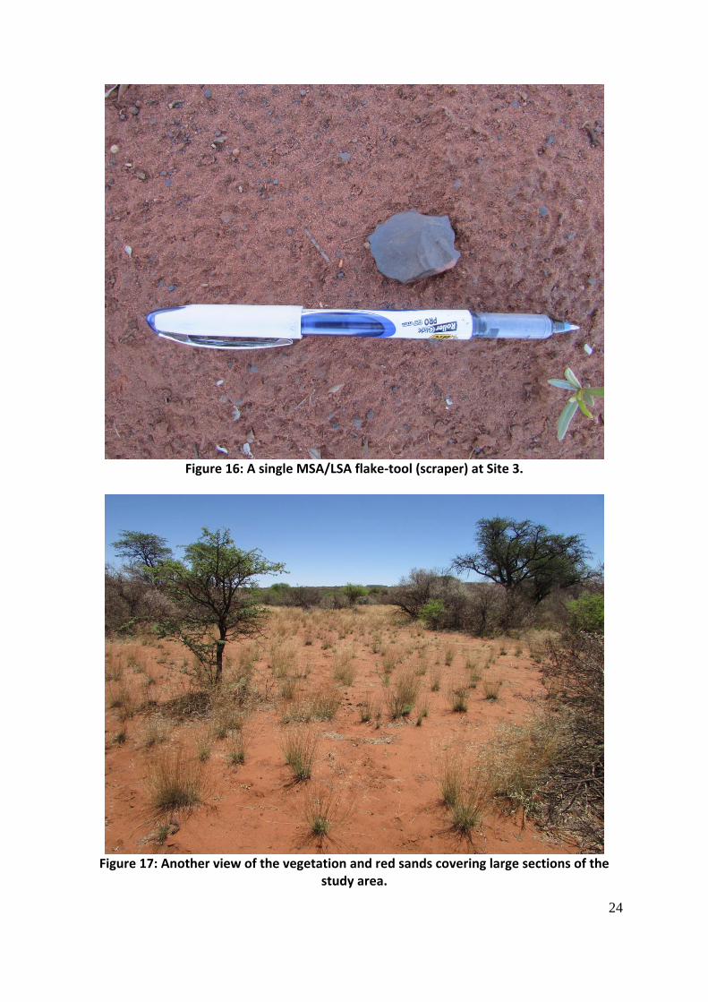
Figure 16: A single MSA/LSA flake-tool (scraper) at Site 3.
Figure 17: Another view of the vegetation and red sands covering large sections of the
study area.

25
Figure 18: The single MSA/LSA artifact from Site 4.
Figure 19: A general view showing the study area.
26
Figure 20: The recent farmstead at Site 5.
Figure 21: A view of the current Site Office and related structures.

27
Figure 22: A view of the Kotze family graves on Site 6.
Figure 23: A view of the Jacobs family graves at Site 6.

28
Figure 24: The Site 6 cemetery is properly fenced.
Figure 25: The location of Site 7.
29
Figure 26: The 2 Stone Age artifacts from Site 7.
Figure 27: The location of the sites recorded (Google Earth 2020).

30
Figure 28: A closer view of Site 1’s location in the study area footprint (Google Earth 2020). It should be noted that although all efforts are made to locate, identify and record all possible cultural heritage sites and features (including archaeological remains) there is always a possibility that some might have been missed as a result of grass cover and other factors. The subterranean nature of these resources (including low stone-packed or unmarked graves) should also be taken into consideration. Should any previously unknown or invisible sites, features or material be uncovered during any development actions then an expert should be contacted to investigate and provide recommendations on the way forward. 7. CONCLUSIONS AND RECOMMENDATIONS APelser Archaeological Consulting (APAC) was appointed by Prescali Environmental Consultants (Pty) Ltd to conduct a Phase 1 Archaeological Impact Assessment (AIA) for the Salene Manganese Project. The AIA forms part of the EIA/EMP Amendment process. The project and study area is situated between Kathu and Postmasburg in the Magisterial District of Postmasburg of the Northern Cape. The study area comprises the Remaining Extent of Portion 2, as well as Portions 3, 4 & 5 of the farm Macarthy 559. A number of sites and features of cultural heritage (archaeological and/or recent historical) origin and significance were identified and recorded in the area during the assessment. These included sites dating to the Stone Age (open-air surface scatters and single artifacts), recent historical structures and a cemetery.

31
Four sites dating to the Stone Age (Sites 1, 3, 4 & 7) were recorded. Three of these were either single or small scatters of MSA & LSA stone tools and flakes, while Site 1 contains a dense scatter of formal tools, waste-flakes and flake-tools. Although these were the only visible sites there is a possibility that more could be located in the area – especially in sections covered by red Aeolian (Kalahari) sands. Site 1 is located on top of a hill with large boulders. These large boulders provide some shelter and it seems as if the material found here is the result of stone knapping (manufacture of tools) activities around these boulders and sheltered area. From the hill there is a good view of the entire area below. The amount of artifacts found here warrants further investigation and the site is rated of Medium to High Heritage Significance. The site is located within the proposed iron opencast pit footprint and as a result will be negatively impacted. The following mitigation measures are therefore recommended: 1. Detailed mapping and recording of Site 1 and potentially other sites located around
the hill 2. Surface sampling of material from the site and the hill Three recent historical sites (Sites 2, 5 & 6) were recorded in the area during the assessment. Site 2 consists of the remains of recently constructed mining related structures that have been abandoned and Site 5 is an existing farmstead dating to the 1970’s that is currently utilized as offices. Both these sites have no Heritage Significance. Site 6 is a cemetery containing 10 graves of the Kotze (previous farm owner) and Jacobs families. Although the graves are not older than 60 years of age graves always carry a High Significance Rating from a Heritage perspective. The cemetery is located close to the current Site Offices and is properly fenced in and will not be impacted by any mining activities. A 30m buffer zone within which no development will be allowed needs to be adhered to. From an Archaeological/Cultural Heritage point of view it is recommended that the proposed development actions should be allowed to continue, but that the recommended mitigation measures for Site 1 should be undertaken before any work here is undertaken Finally, it should be noted that although all efforts are made to locate, identify and record all possible cultural heritage sites and features (including archaeological remains) there is always a possibility that some might have been missed as a result of grass cover and other factors. The subterranean nature of these resources (including low stone-packed or unmarked graves) should also be taken into consideration. Should any previously unknown or invisible sites, features or material be uncovered during any development actions then an expert should be contacted to investigate and provide recommendations on the way forward. 8. REFERENCES Closer View of Study Area Location and Footprint & Sites recorded: Google Earth 2020.

32
Location and Layout Plans: Provided by Prescali Environmental Consultants (Pty) Ltd. Bergh, J.S. (red.). 1999. Geskiedenisatlas van Suid-Afrika. Die vier noordelike provinsies. Pretoria: J.L. van Schaik. De Jong, R.C. 2010. Heritage Impact Assessment report: Proposed Manganese and Iron Ore Mining Right Application in respect of the Remainder of the farm Paling 434, Hay Registration Division, Northern Cape Province. Unpublished Report Cultmatrix Heritage Consultants Project 2010/23 May 2010 for Kai Batla. Huffman, T.N. 2007. Handbook to the Iron Age: The Archaeology of Pre-Colonial Farming Societies in Southern Africa. Scotsville: University of KwaZulu-Natal Press. Knudson, S.J. 1978. Culture in retrospect. Chicago: Rand McNally College Publishing Company. Lombard, M., L. Wadley, J. Deacon, S. Wurz, I. Parsons, M. Mohapi, J. Swart & P. Mitchell. 2012. South African and Lesotho Stone Age Sequence Updated (I). South African Archaeological Bulletin 67 (195): 120–144, 2012. Morris, David. 2005. Report on a Phase 1 Archaeological Impact Assessment of proposed mining areas on the farms Ploegfontein, Klipbankfontein, Welgevonden, Leeuwfontein, Wolhaarkop and Kapstevel, west of Postmasburg, Northern Cape. Kimberley: McGregor Museum. Morris, David. 2006. Archaeological Specialist Input to the EIA Phase for the proposed Aries-Garona ESKOM Transmission Power Line, Northern Cape and Comment on the Garona Substation Extension. Unpublished Report September 2006 for Tswelopele Environmental. Republic of South Africa. 1999. National Heritage Resources Act (No 25 of 1999). Pretoria: the Government Printer. Republic of South Africa. 1998. National Environmental Management Act (no 107 of 1998). Pretoria: The Government Printer.
33
APPENDIX A: DEFINITION OF TERMS: Site: A large place with extensive structures and related cultural objects. It can also be a large assemblage of cultural artifacts, found on a single location. Structure: A permanent building found in isolation or which forms a site in conjunction with other structures. Feature: A coincidental find of movable cultural objects. Object: Artifact (cultural object). (Also see Knudson 1978: 20).

34
APPENDIX B: DEFINITION/ STATEMENT OF HERITAGE SIGNIFICANCE Historic value: Important in the community or pattern of history or has an association with the life or work of a person, group or organization of importance in history. Aesthetic value: Important in exhibiting particular aesthetic characteristics valued by a community or cultural group. Scientific value: Potential to yield information that will contribute to an understanding of natural or cultural history or is important in demonstrating a high degree of creative or technical achievement of a particular period Social value: Have a strong or special association with a particular community or cultural group for social, cultural or spiritual reasons. Rarity: Does it possess uncommon, rare or endangered aspects of natural or cultural heritage. Representivity: Important in demonstrating the principal characteristics of a particular class of natural or cultural places or object or a range of landscapes or environments characteristic of its class or of human activities (including way of life, philosophy, custom, process, land-use, function, design or technique) in the environment of the nation, province region or locality.

35
APPENDIX C: SIGNIFICANCE AND FIELD RATING: Cultural significance: - Low: A cultural object being found out of context, not being part of a site or without any related feature/structure in its surroundings. - Medium: Any site, structure or feature being regarded less important due to a number of factors, such as date and frequency. Also any important object found out of context. - High: Any site, structure or feature regarded as important because of its age or uniqueness. Graves are always categorized as of a high importance. Also any important object found within a specific context. Heritage significance: - Grade I: Heritage resources with exceptional qualities to the extent that they are of national significance - Grade II: Heritage resources with qualities giving it provincial or regional importance although it may form part of the national estate - Grade III: Other heritage resources of local importance and therefore worthy of conservation Field ratings: i. National Grade I significance: should be managed as part of the national estate ii. Provincial Grade II significance: should be managed as part of the provincial estate iii. Local Grade IIIA: should be included in the heritage register and not be mitigated (high significance) iv. Local Grade IIIB: should be included in the heritage register and may be mitigated (high/ medium significance) v. General protection A (IV A): site should be mitigated before destruction (high/medium significance) vi. General protection B (IV B): site should be recorded before destruction (medium significance) vii. General protection C (IV C): phase 1 is seen as sufficient recording and it may be demolished (low significance)

36
APPENDIX D: PROTECTION OF HERITAGE RESOURCES: Formal protection: National heritage sites and Provincial heritage sites – Grade I and II Protected areas - An area surrounding a heritage site Provisional protection – For a maximum period of two years Heritage registers – Listing Grades II and III Heritage areas – Areas with more than one heritage site included Heritage objects – e.g. Archaeological, palaeontological, meteorites, geological specimens, visual art, military, numismatic, books, etc. General protection: Objects protected by the laws of foreign states Structures – Older than 60 years Archaeology, palaeontology and meteorites Burial grounds and graves Public monuments and memorials
37
APPENDIX E: HERITAGE IMPACT ASSESSMENT PHASES 1. Pre-assessment or Scoping Phase – Establishment of the scope of the project and terms of reference. 2. Baseline Assessment – Establishment of a broad framework of the potential heritage of an area. 3. Phase I Impact Assessment – Identifying sites, assess their significance, make comments on the impact of the development and makes recommendations for mitigation or conservation. 4. Letter of recommendation for exemption – If there is no likelihood that any sites will be impacted. 5. Phase II Mitigation or Rescue – Planning for the protection of significant sites or sampling through excavation or collection (after receiving a permit) of sites that may be lost. 6. Phase III Management Plan – For rare cases where sites are so important that development cannot be allowed.