resource conservation sheridan county, wyoming
TRANSCRIPT
M O N T A N A
Big Horn County Johnson County
Campbell County
£¤87
Clearmont
Story
Big Horn
UcrossBanner
Acme
Leiter
Tongue River
Little
Goose C
reek
Prairie Dog Creek
Badger Creek
Soldier Creek
£¤14 £¤16
Sheridan CountyAirport
58
57
54
7677787980818283848586
Beckton
8788899091
B I G H O R NN A T I O N A L F O R E S T
Little B
ig Horn
River
§̈¦90
£¤14
CR 223
56
55
53
Wyarno
Sheridan
CR 116
CR 140A
CR 98CR 74
CR 140
CR 122
CR 157
CR 64
SH 331
CR 11
21
CR 12
31
CR 12
35
CR 255
CR 40
CR 269
CR 273
CR 86
CR 151
CR 87
SH 335
CR 89
CR 42
CR 219
CR 195
Dayton
Powd
er Riv
er
Columbus Creek
Ash Creek
CR 161
SH 19
3
SH 194
SH 33
8
SH 338
Arvada
ParkmanSlack
Burgess Junction£¤14A
£¤14
§̈¦90
Ranchester£¤14
BNSF RR
Clear
Creek
Piney Creek
Rapid Cree
k
Beaver Creek
Big Goose Creek
CR 144
647
City of Sheridan
Soldier Creek
Little Goose Creek
£¤87
Big Goose Rd.
Soldier Creek Rd.Wyarno Rd.
Upper Rd.
Big Horn Ave.
Brundage Ln.
Loucks St.
Fort Rd.
§̈¦90
£¤14
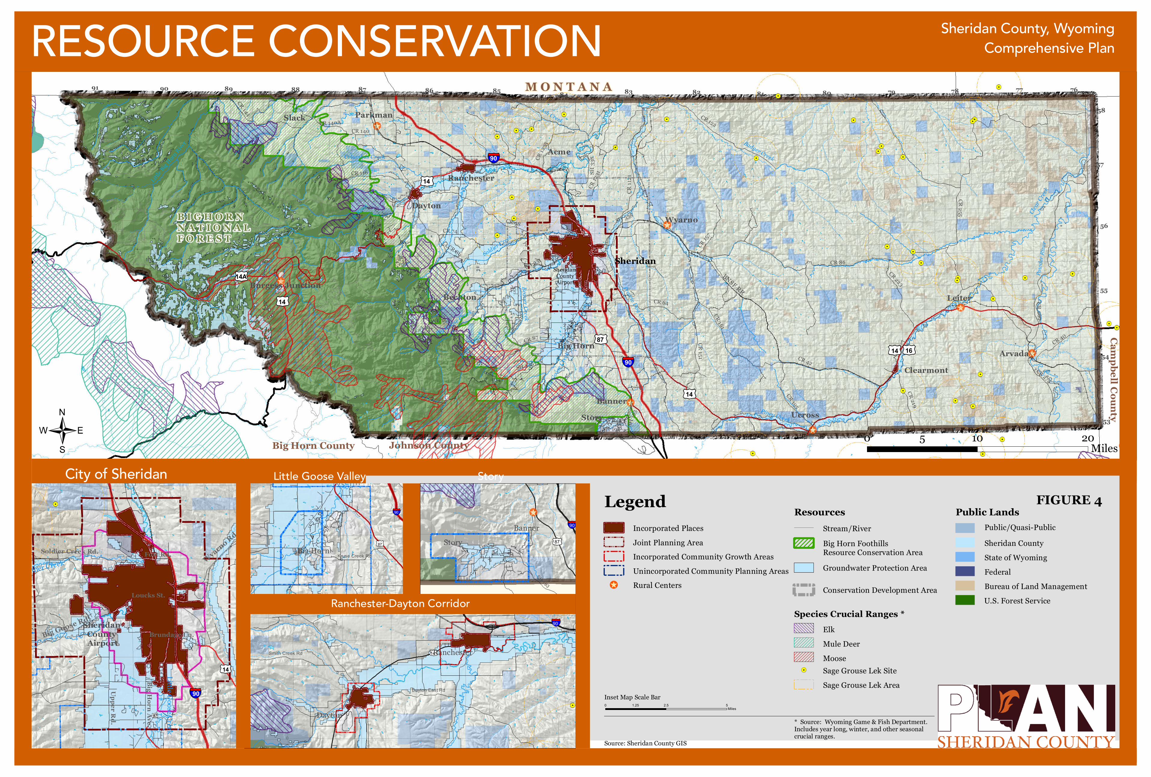
RESOURCE CONSERVATION
Source: Sheridan County GIS
/ 0 10 205 Miles
Sheridan County, WyomingComprehensive Plan
Sheridan County Airport
§̈¦90
£¤87
Bird Farm Rd
Kruse Creek RdBig Horn£¤87
§̈¦90
SH 193
£¤14
Dayton East Rd
Smith Creek Rd
Little Goose Valley Story
Ranchester-Dayton Corridor
StoryBanner
Dayton
Ranchester
§̈¦90
0 2.5 51.25Miles
LegendStream/RiverIncorporated Places
Inset Map Scale Bar
Resources
Bureau of Land ManagementU.S. Forest Service
Sheridan CountyPublic/Quasi-Public
Public Lands
State of WyomingFederal
Big Horn FoothillsResource Conservation AreaIncorporated Community Growth Areas
Unincorporated Community Planning Areas!̂ Rural Centers
Groundwater Protection Area
Conservation Development Area
FIGURE 4
Species Crucial Ranges *
* Source: Wyoming Game & Fish Department. Includes year long, winter, and other seasonal crucial ranges.
!. Sage Grouse Lek SiteSage Grouse Lek Area
ElkMule DeerMoose
Joint Planning Area