rights of way improvement plan - home - east riding of
TRANSCRIPT

Rights of Way Improvement Plan
2011
abcdef
1
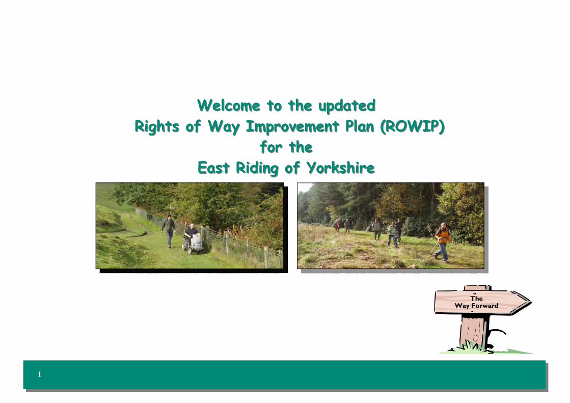
Welcome to the updated Welcome to the updated
Rights of Way Improvement Plan (ROWIP) Rights of Way Improvement Plan (ROWIP)
for the for the
East Riding of YorkshireEast Riding of Yorkshire
The Way Forward

2
Contents Contents
Section 1 - Background
Background to the ROWIP 3
National Context 4
Section 2 - East Riding of Yorkshire
About the East Riding 5
The Council’s Corporate Priorities 6
The Council’s Third Local Transport Plan 7
Section 3 - Accessing the Countryside
Public Rights of Way and the Definitive Map 8
Existing Public Rights of Way Network 9
Horse Riders and Cyclists Rights of Way Network 10
The Yorkshire Wolds Way National Trail / Recreational Routes
11
Permissive Routes / Cycle Paths 12
Areas of Land with Public Access 13
Open Access Land 14
Section 4 - Additional Information
Local Access Forum / Discovering Lost Ways Project 15
BVPI 178 / Local Paths Partnership 16
Section 5 - Consultation
Consultation Process 17
1. General Users and Non Users 18
2. Equestrians and Carriage Drivers 19
3. Landowners and Tenants 20
4. Town and Parish Councils 21
Section 6 - Statement of Action
Statement of Action 22
Monitoring Methods 23
1. Education and Promotion 24
2. Improvement and Connectivity 28
3. Accessibility 32
4. Maintenance and Enforcement 36
5. Definitive Map and Statement 40
Section 7 - Useful Information
Links 44
Definitions 45
Photograph Locations 47
EAST RIDING OF YORKSHIRE COUNCIL RIGHTS OF WAY IMPROVEMENT PLAN 2008-2018 (REFRESH 2011)

Section 60 of the Countryside and Rights of Way Act 2000 requires
every Local Highway Authority to prepare and publish a Rights of Way
Improvement Plan (ROWIP) containing:
a) the Authority’s assessment of:
• the extent to which local rights of way meet present and likely
future needs of the public;
• the opportunities provided by local rights of way (and in
particular by footpaths, cycle tracks, bridleways and restricted
byways) for exercise and other forms of open air recreation
and the enjoyment of their area;
• the accessibility of local rights of way to blind or partially
sighted persons or others with mobility problems;
• such other matters relating to local rights of way as may be
directed by the Secretary of State.
b) a statement of the action the Authority proposes to take for the
management of rights of way, and for securing an improved network
of rights of way, with particular regard to the matters dealt with in
the assessment and such other material as the Secretary of State
may direct.
A Highway Authority is required to make a new assessment and review
their Rights of Way Plan, and decide whether or not to amend it, not
more than ten years after its first publication, and subsequently at
intervals of not more than ten years. On such reviews, the Authority
should, if it decides to amend the plan, publish it as amended. If there are
no amendments, the Authority should publish a report of its decision
and its reasons for it.
In 2010, the East Riding of Yorkshire Council reviewed the 2008
ROWIP as it was considered that the plan would benefit from being
updated.
Statutory Guidance
The following guidance has been used during the preparation of the
ROWIP:
• Department for Environment, Food and Rural Affairs (DEFRA)
document ‘Rights of Way Improvement Plans – Statutory
Guidance to Local Authorities in England’ November 2002.
• Natural England ‘Local Transport Plan (LTP) and ROWIP
Integration’ Good Practice Note, 2009.
Note
The ROWIP is intended to be a mechanism for improving the network
of public rights of way and other non-motorised routes, in line with the
requirements of all types of users. It is not designed to provide
individual detailed solutions to access problems but rather a strategic
approach to managing public access.
3
Section 1: Background to the Rights of Way Improvement PlanSection 1: Background to the Rights of Way Improvement Plan

The current national situation is best explained by outlining the role of
the Government Departments responsible for protecting and promoting
access to the countryside.
“Defra is the rural department in government. Most of what we do, for
example in relation to farming, food, environmental protection,
landscape management, water, flooding, and climate change adaptation,
has a direct bearing on rural England, and it also has a wider role in
promoting the interests of rural people, communities and businesses
across government as a whole.”
In relation to access to the countryside Defra’s view is:
“High-quality, accessible green spaces are highly valued by the public. In
addition to their intrinsic value, they provide considerable benefits to
quality of life, health and wellbeing. People’s needs have changed, and
more provision of accessible green space and high-quality landscapes
closer to where they live are needed to enable them to build more
outdoor recreation into busy, modern lifestyles. Pressures on land use
mean without Government intervention, many of the green
spaces people value and use would be at risk of development. Improving
access will give people an opportunity to increase their understanding of
the natural environment, promote healthy outdoor recreation and
inspire lifestyle choices. The English coast is very popular with people
for beach activities and other recreation but about 30% of it currently
has no right of access. Public rights of way remain the primary means by
which people access the countryside.”
Information quoted from ww2.defra.gov.uk on 18 November 2010
Natural England is a government organisation that advises on rural
issues.
“Natural England is here to conserve and enhance the natural
environment, for its intrinsic value, the wellbeing and enjoyment of
people and the economic prosperity that it brings. Millions of people
already enjoy the outdoor environment; as a recreational resource, as a
healthy environment in which to live, work, visit, play and explore, as a
place of natural beauty and as a source of inspiration. We want to
ensure that everybody has the opportunity to use, understand, engage
with, and be inspired by the natural environment. We also want an
increasing number of people to take action to conserve it.
There are many places where you can enjoy the natural environment,
whether you're looking for healthy exercise, the challenge of a long walk,
a horse or cycle ride, or whether you want to experience nature, or
appreciate its quiet tranquillity and inspiring landscapes. Some might also
want to get involved by helping to look after the natural environment.
Natural England has the responsibility to promote access, recreation and
public well-being for the benefit of today's and future generations.
Growing medical evidence shows that access to the natural environment
improves health and wellbeing, prevents disease and helps people
recover from illness. Experiencing nature in the outdoors can help tackle
obesity, coronary heart disease and mental health problems.”
Information quoted from www.naturalengland.gov.uk 19 November
2010
4
Section 1: National ContextSection 1: National Context
EAST RIDING OF YORKSHIRE COUNCIL RIGHTS OF WAY IMPROVEMENT PLAN 2008-2018 (REFRESH 2011)

East Riding of Yorkshire (East Riding) is located on the
north east coast of England, to the north of the Humber
Estuary. It shares boundaries with North Yorkshire,
South Yorkshire, North Lincolnshire, York and Kingston
upon Hull.
East Riding of Yorkshire Council is one of the largest
Unitary Authorities in England, made up of 168 Parishes
and Towns, covering an area of 2,408 sq km. It is
primarily rural encompassing a wide range of settlement
types and land uses.
The population of the East Riding is approximately 337,000 with over half living in rural communities, many of which are small and geographically isolated. The largest town is Bridlington with 34,700 people; other major settlements include Beverley (30,500), Anlaby/Kirk Ella/West Ella/Cottingham/Willerby/Hessle (collectively termed the Major Haltemprice Settlements) (57,600), Goole (19,900), Driffield (12,200). The East Riding is sparsely populated at approximately 140 people per km sq, compared to England's 378 people per km sq. Yet the area is supported by the populations from adjacent settlements, in particular the urban settlement of Hull, who regularly participate in activities within the East Riding.
The East Riding landscape consists of the gently rolling chalk hills of the Wolds
and low lying flat plains of Holderness and the Vale of York. The north sea
bounds the eastern boundary where the land is affected by a high rate of
coastal erosion. The Humber Estuary to the south is one of the largest tidal
estuaries in England. It is crossed by the Humber Bridge, from Hessle, which
links East Riding to Lincolnshire.
The main source of income for the area is agriculture but diversification has
seen an increase in tourism based development. The area’s character comes
from its rural and coastal location and this is highlighted by its attractions
including; the market towns and their historic buildings, the local farmer’s
markets, rural features like Skidby Mill, natural features like Flamborough Head
with its diverse variety of sea birds and the Wolds which can be seen by
following the long distance footpath the Yorkshire Wolds Way.
5
Section 2: About East Riding of YorkshireSection 2: About East Riding of Yorkshire

Section 2: The Council’s Corporate PrioritiesSection 2: The Council’s Corporate Priorities
To ensure we continue to deliver high quality services which meet the needs of
residents new and old, it is vital that we have a clear vision of how we want the
East Riding to look in the future. In order to secure the best for the people of
the East Riding we need to work closely with everyone that shares an interest
in improving the quality of life in the area. We achieve this through our role as
lead partner in the East Riding Local Strategic Partnership. The Partnership
brings together public bodies such as the Council and the police alongside
community and voluntary groups and local businesses.
Our shared ambition is for an East Riding where:
• Children and young people have a brighter future
• Older people enjoy a healthy independent lifestyle
• Communities are thriving, prosperous and safe
• Regeneration transforms deprived areas and
reduces health and other inequalities
• We value and care for the diverse character of the area
Seven corporate priorities have been developed to reflect the need and
aspirations of local people. Through the ROWIP we seek to build on these
priorities.
Corporate Priority: Safer communities
We will work to ensure the safety of rights of way users by promoting and
developing a non-motorised network in line with the Local Development
Framework (LDF) and planning system. The safety of the public will be
considered in the prioritisation of routine maintenance, the creation of new
routes and when development impacts the current network.
Corporate Priority: Valuing our environment
As part of our day to day work we will consider the Councils Biodiversity
Action Plan and the Eco-Management Audit Scheme (EMAS). EMAS is a
voluntary initiative designed to improve organisations environmental
performance. Its aim is to recognise and reward those organisations that go
beyond minimum legal compliance and continuously improve their
environmental performance.
The management and improvement of the PROW network will where practical
aim to improve the biodiversity of surrounding environment. The PROW
network provides an important link to the natural environment so that
everyone can learn to value and enjoy our countryside.
Corporate Priority: Local problem solving
We aim to promote the Local Parish Partnership (LPP) that involves local
communities in the maintenance of routes in their local area. Consultation of
proposed schemes to divert and create routes will continue to be passed to
local parish or town council.
Corporate Priority: Reducing inequalities
We are working towards opening the network to a greater proportion of the
general public by making the routes easier to use and promoting what is
available to a wider audience. Improvements are also being considered in areas
where the provisions are poor.
Corporate Priority: Revitalising our communities
The integration of providing open space and access to the countryside will be
considered as part of community planning when appropriate. We will ensure
that useful links in and between villages are created where possible to bring
communities together.
Corporate Priority: Retaining the East Riding character
The East Riding’s character can best be preserved by those people living in and
visiting the area having an understanding of what needs to be preserved. We
currently educate the public through walking guides and packs. We aim to
maintain the PROW network whilst preserving the character of the local
landscape and we are also striving to ensure that the most useful historic public
rights are not lost forever.
Corporate Priority: Supporting vulnerable people
We aim to encourage and facilitate the use of rights of way for members of the
public with mobility difficulties or other health problems, the elderly and
people who are on their own.
6 EAST RIDING OF YORKSHIRE COUNCIL RIGHTS OF WAY IMPROVEMENT PLAN 2008-2018 (REFRESH 2011)

Section 2: The Council’s Third Local Transport PlanSection 2: The Council’s Third Local Transport Plan
In November 2002, DEFRA published guidance to say that ROWIP
planning should be incorporated into local transport planning during the
life of the second LTP. The Council’s second Local Transport Plan
(LTP2) runs between 2006 - 2011. LTP2 was developed to contribute
towards the delivery of four shared priorities for transport. The Council
included a progress report on the development of the ROWIP within
Section 2 of LTP2.
In April 2011, LTP2 will be replaced by
the Council’s third Local Transport Plan,
LTP3. Natural England published guidance
on producing LTP3s in July 2009, ‘LTP and
ROWIP Integration: Good Practice Note’.
This guidance outlines the importance of
preparing ROWIPs and local transport
plans that complement each other, in
order to promote more active travel,
reduce congestion on local roads and
reduce harmful vehicle emissions.
The Council’s Transport Policy Team are responsible for preparing
LTP3. The Team has worked closely with Rights of Way Officers both in
the preparation of LTP3 and in refreshing the Council’s ROWIP. This
partnership approach helps to promote PROW and ensure that future
local transport schemes make the most efficient and effective use of the
existing PROW network, ensuring value for money and providing
maximum benefits for local residents and visitors.
A full copy of LTP3 can be seen on the Council’s website.
www.eastriding.gov.uk
The aims of integrating the ROWIP with the LTP are to:
• Establish the shared aims and identify a definite link between the
ROWIP and LTP;
• Ensure that PROW are included in the LTP process and recognised as
a key factor in the development of an integrated transport network;
• Recognise the invaluable role rights of way can play in assisting the
LTP in the delivery of the four transport shared priorities and wider
quality of life issues; and
• Strengthen and facilitate the long-term sustainability of PROW.
The Council’s LTP3 sets out measures and schemes to work towards
meeting four over-arching transport goals for the East Riding.
Maintaining and improving the PROW network will contribute towards
each of these goals. These goals are to:
• Support economic growth
• Reduce carbon emissions
• Improve road safety
• Improve accessibility
It should be noted however, that the links between the ROWIP and
LTP3 will not directly lead to a large-scale funding of ROWIP
programmes through the LTP3. This is because the ROWIP is not a
Government core performance indicator and current funding for new
transport schemes is limited.
The ROWIP will identify priorities for future investment. The Council,
with the Local Access Forum, will seek to prioritise rights of way
improvements to assist in achieving LTP objectives and targets. If no
additional national funding is available, the Council will seek to be
innovative in sourcing funds to support the improvements and ensure
long term maintenance of the PROW network.
7

The Definitive Map is conclusive
proof of the existence of those
routes shown on it, however, if a
route is not shown, it is not proof
that this route does not exist. If
strong evidence is submitted to
prove a route exists, a modification
order is made to add the route to
the Definitive Map. The modifica-
tion process is open to public con-
sultation so that everyone is given
the opportunity to provide evidence for consideration before an order
is confirmed. It is also possible that a route shown on the Definitive
Map is wrongly recorded, however in this instance the Definitive Map
retains its definitive status until an order has been made and confirmed
to reflect the error. Again strong evidence is required to meet the leg-
islative grounds for making an order.
If you would like more information about applying for a modification
order, you will find the booklet 'A guide to definitive maps and changes
to public rights of way' (Ref: NE112) useful. This booklet is produced by
Natural England and can be downloaded free of charge from their web-
site. www.naturalengland.gov.uk The Council also has a definitive map
modification order guidance pack. Please contact the Definitive Map
team for more details, see the back of this document for details or
e-mail: [email protected]
Section 3: Public Rights of Way and the Definitive MapSection 3: Public Rights of Way and the Definitive Map
Public Right’s of Way (PROW) have been in existence for many years
and are part of this country’s heritage. The PROW network consists of:
• footpaths - right on foot
• bridleways - right on foot, horse and bicycle
• restricted byways - right on foot, horse and with a non
motorised vehicle
• byways open to all traffic - right for all traffic
These routes are recorded on the Definitive Map and Statement of
Public Rights of Way (Definitive Map) and this is the legal record of the
existence of the PROW shown on it. This record was created by statute
to protect the network and to inform the public of the rights available.
Public access is protected by legislation, primarily:
• the Highways Act 1980
• the Wildlife and Countryside Act 1981
• the Countryside and Rights of Way Act 2000
• the Natural Environment and Rural Communities Act 2006
8 EAST RIDING OF YORKSHIRE COUNCIL RIGHTS OF WAY IMPROVEMENT PLAN 2008-2018 (REFRESH 2011)

Section 3: Public Rights of Way Network shown on the Definitive Map Section 3: Public Rights of Way Network shown on the Definitive Map
Map 1 shows the PROW network shown on the East Riding of Yorkshire Council’s working Definitive Map.
There are approximately 1592 kilometres of PROW recorded on the Definitive Map.
These include: -
Public Footpaths: 1180 km Public Bridleways: 400 km Byways Open to All Traffic (BOAT): 10 km Restricted Byways: 1.8 km The entire definitive PROW network is available for walkers. Horse riders and cyclists can use 25% of the definitive map network Drivers of horse drawn vehicles and recreational vehicles can use less than 1% of the definitive map network.
9

Section 3: Bridleway, Restricted Byway and BOAT Network shown on the Definitive MapSection 3: Bridleway, Restricted Byway and BOAT Network shown on the Definitive Map
Map 2 shows the network available to horse riders and cyclists shown on East Riding of Yorkshire Council’s working Definitive Map.
For further information on walking, horse riding and cycling in the East Riding of Yorkshire please refer to the relevant Ordnance Survey (Explorer Series) Map or the ‘Walking the Riding’ website.
www.walkingtheriding.co.uk
10 EAST RIDING OF YORKSHIRE COUNCIL RIGHTS OF WAY IMPROVEMENT PLAN 2008-2018 (REFRESH 2011)

Section 3: Recreational RoutesSection 3: Recreational Routes
The Yorkshire Wolds Way National Trail The Yorkshire Wolds Way was established in 1982. It is one of only 15 National Trails in England and Wales, created because of the outstanding landscape through which they run. It runs from Hessle, on the Humber, for 79 miles across the undulating Yorkshire Wolds to Filey on the coast, to link with the Cleveland Way and is one of the less strenuous National Trails. There are 40 miles of trail within the East Riding which are highly valued and enjoyed by East Riding residents and visitors to the area. The trail brings important economic benefits to the villages and market towns near the trail. The Yorkshire Wolds Way partners are currently developing an interpretation programme along the route, and are looking to construct sculptured seats and works of art programme. These projects commenced in 2009 and completion is expected in three years. The Council will continue to work closely with the Yorkshire Wolds Way partners to promote the route, and to maintain the route to National Trail standard. The Yorkshire Wolds Way Project will engage in activities that encourage use by under-represented groups and will seek to attract new audiences. More information can be found on the website:
www.nationaltrail.co.uk/yorkshirewoldsway
Recreational Paths The 11 recreational routes within East Yorkshire are clearly signed with the newer informative signs. These routes are endorsed by the Council and are shown on Ordnance Survey Explorer and Landranger maps with a diamond annotation. Some of these trails are available for cyclists and horse riders.
• Bubwith Rail Trail
• Hornsea Rail Trail
• Hudson Way
• South Holderness Rail Trail
• Beverley 20
• Chalkland Way
• High Hunsley Circuit
• Howden 20
• Minster Way
• Wilberforce Way
• Trans Pennine Trail (www.transpenninetrail.org.uk)
11

Section 3: Additional Linear AccessSection 3: Additional Linear Access
Permissive Routes The PROW network is supplemented by a significant network of 'permissive routes’. These can often plug some of the gaps in the network and provide the public with valuable links to other routes or links to places of interest. There is no single database of these routes, and it is difficult to assess their value in a structured way. Anecdotal evidence suggests that they are a valuable additional access asset. Two problems with these routes are that firstly, they are not often promoted and not shown on any Ordnance Survey Explorer Maps and accordingly the wider public may be unaware that they exist. Secondly, they are used with the knowledge and permission of the landowner and this can be withdrawn at any time. Time limited permissive routes, created under Higher Level Stewardship (HLS), are secure for 10 years. The following are examples of this additional access asset:
• HLS routes
• Environment Agency permissive paths
• British Waterways permissive paths
• East Riding of Yorkshire Council negotiated permissive paths
Cycle Tracks
There are 85km of off road cycle tracks in the East Riding, in addition to bridleways, restricted byways and BOATs. There are also routes which are not recorded as highways, for example the Trans Pennine Trail, that are available for cyclists. Survey results identified the requirement to consider the needs of off road cyclists in more depth, this will be achieved in this document through the aim to improve the bridleway network.
The Council is committed to encouraging more trips using sustainable modes of transport such as walking and cycling. This has proved successful in Beverley by increasing the level of cycling by 41% over the last 8 years.
During LTP2 the Council developed and implemented numerous schemes to improve facilities for cyclists in and around East Riding’s main settlements. This included the construction of new off road cycle routes, the provision of additional cycle parking facilities in local towns and the implementation of 20mph zones in some residential areas to increase road safety for cyclists. It is intended that this work, which supports cyclists, and encourages more people to cycle, will continue throughout LTP3. Following extensive consultation the Council is preparing to commence the implementation of a new coastal cycle route linking Carnaby Industrial Estate to Sewerby Hall. This cycleway will take a route through Bridlington that is convenient for the local residents whilst also providing a scenic coastal ride for tourists. It is anticipated that the work will commence in January 2011, with an expected completion date of April 2011.
12 EAST RIDING OF YORKSHIRE COUNCIL RIGHTS OF WAY IMPROVEMENT PLAN 2008-2018 (REFRESH 2011)

Open Access Land
This is mapped areas of moor, heath, down, mountain,
and registered land where the public may now walk
freely without the need to stick to paths. For more
information visit: www.naturalengland.org.uk
There are several areas of Open Access Land in the East Riding, unfortu-
nately 40% of these are land-locked as no public right exists to access the
land. A Feasibility Study was undertaken by the Council in 2010 to investi-
gate the possibility of creating routes to these land-locked areas. The re-
sults showed that there is currently no interest from landowners in
agreeing to provide routes across their land, even though compensation
would be payable.
Registered Common Land and Village Greens
There are 90 separate areas of registered common land and village greens
in the East Riding, some of which are not accessible by public means. The
register is kept at County Hall in Beverley.
Open Space
Publicly accessible open space is comprised of many types of recreation
space. The list includes parks, ornamental gardens, outdoor sports facili-
ties, provision for children and young people (e.g. play areas), natural and
semi-natural green spaces, amenity green space, allotments, cemeteries
and burial grounds, market squares and hard surfaced areas designed for
civic use such as war memorials. The Council completed an audit of open
space in 2010, and it is anticipated that reports relating to open space and
playing pitch provision will be available in the summer of 2011 following
consultation and the reports being approved by cabinet.
Woodland Trust Woodland
The Woodland Trust owns and manages 9 woods
in the East Riding to which it allows public access.
For more information visit:
www.woodland-trust.org.uk/woods
Coastal Access
The Marine and Coastal Access Act will bring in the creation of a new
National Trail around the coast of England and Wales. This will bring
economic, environmental and wildlife benefits for coastal areas. The
implementation of this new route will be a long term project. There is
currently no proposal for when this work will commence in the East
Riding.
Section 3: Areas of Land with Public AccessSection 3: Areas of Land with Public Access
13

Open Access Land is defined under the Countryside and Rights of Way Act 2000 (CROW), as mapped areas of mountain, moor, heath, down and registered land where the public can now walk freely without the need to stick to paths.
For more information please visit: www.ca-mapping.co.uk/mapping/regional
Section 3: Open Access Land, Commons and Nature ReservesSection 3: Open Access Land, Commons and Nature Reserves
Map 3 shows areas of Open Access Land, Commons and Nature Reserves Nature Reserves 1. Bempton Cliffs 2. Flamborough Outer Headland 3. South Landing 4. Danes Dyke 5. Millington Wood 6. Tophill Low 7. Southorpe 8. Sigglesthorne Station 9. Hudson Way 10. Beverley Parks 11. North Cave Wetlands 12. Eastrington Ponds 13. Howden Marsh 14. Humber Bridge Country Park 15. Paull Holme Sands 16. Mayfield and Broom Park 17. Blacktoft Sands 18. Oakhill 19. Sugar Mill Ponds 20. Spurn National Nature Reserve
14 EAST RIDING OF YORKSHIRE COUNCIL RIGHTS OF WAY IMPROVEMENT PLAN 2008-2018 (REFRESH 2011)

Section 4: Additional InformationSection 4: Additional Information
Local Access Forum
Section 94 of the Countryside
and Rights of Way Act 2000
(CROW) places a duty on Local
Highway Authorities to establish
Local Access Forums (LAF) to
advise the Council on the
improvement of public access to
land in the area for which it is established, for the purpose of open-
air recreation and the enjoyment of the area, and as to such other
matters as may be prescribed. In carrying out its functions, a LAF
will have due regard to the needs of land management, the
conservation of the natural beauty of the area and any guidance
from the Secretary of State.
In accordance with the procedure, and following a formal request
from the Minister for Rural Affairs, East Riding of Yorkshire Council
and Kingston upon Hull City Council established a Joint LAF in June
2004. Although supported by the two Council’s, the forum is an
independent body and operates in an open and transparent manner.
All formal meetings of the full Forum are open to the public and
minutes are available.
More Information can be found:
on the Council’s website: www.eastriding.gov.uk
or by e-mailing: [email protected]
Discovering Lost Ways Project
Since the Definitive Map was created in the 1950s many PROW have been
added to the Definitive Map based on the discovery of historical evidence.
There are however, many routes in existence that are not currently recorded
on the Definitive Map. In an attempt to complete the
process of recording historic routes, the government
introduced legislation that set a cut-off date, of 1st
January 2026, for recording rights of way created
before 1949. The section of the legislation
(Countryside and Rights of Way Act 2000) dealing
with this matter has not yet been brought into force.
The Discovering Lost Ways project was set up to
research historic rights of way so that they could be
recorded on the Definitive Map before the cut off
date. This project was reviewed in 2007 which led to
the project being abandoned due to the financial
implications of the project and the impracticality of
completing the process by 2026. A Stakeholder Working Group (consisting
of representatives from user groups, landowners and local authorities) was
formed to consider the difficulties with the current system and identify a way
of moving forward. This group concluded its discussions in March 2010 with a
report that was passed to the Minister for the Natural and Marine
Environment Wildlife and Rural Affairs. This report is still being considered
by the minister.
The recommendations of legal and procedural improvements in relation to
unrecorded public rights of way are set out in the “Stepping Forward” report
which identifies 32 strategic proposals for reform. A copy of this report can
be downloaded from the Natural England website www.naturalengland.gov.uk
15

Section 4: Additional InformationSection 4: Additional Information
Best Value Performance Indicator (BVPI) 178
The Government uses a number of Performance Indicators to assess
how well a Council is doing and whether or not it is still improving. In
October 2007 the Government announced a new set of National
Performance Indicators as part of the new Performance Framework,
which came into effect in April 2008. The number of indicators has been
substantially reduced from around 1200 to 198.
Previously, BVPI 178 was used to measure how well a Council was
managing its PROW network; what percentage of routes are useable by
the public. BVPI 178 is no longer one of the Government’s Key
Performance Indicators, but most Councils continue to collect the data
which is used for benchmarking and performance management.
In the East Riding, an annual survey of a random 5% of the total length of
PROW is carried out, 2.5% undertaken in May and 2.5% in November.
The indicator, based on data from the survey, is representative of the
condition of the length (not number) of routes that:
• Are sufficiently signposted and waymarked;
• With structures such as gates and bridges in a useable
condition; and
• Are unobstructed with surfaces that are convenient to use.
The Association of Directors of Environment, Economy, Planning and
Transport (ADEPT) (previously the County Surveyors Society) and the
Institute of Public Rights of Way Officers (IPROW) support the
continued collection of the data. In the East Riding this data will continue
to be collected and used to monitor performance and targets for the
ROWIP. Section 6 contains more information on monitoring of ROWIP
targets.
Local Paths Partnership
The local paths partnership is an improved scheme, replacing the former
Parish Paths Partnership (P3) from April 2007. It enables all participating
Town and Parish Councils to apply for grants to carry out work on the
public rights of way network in their area.
The improved scheme includes: -
Grants: these will be awarded on an annual basis and will relate to the
size of the network, community and wider benefits and value for money.
Cutting: this will be the minimum required to keep routes open -
additional cuts will have to be funded through a Parish Precept.
Information: the production of leaflets, promotional material and
interpretation boards is a non-statutory function and will be funded at a
reduced rate. The Town and Parish Councils will have to seek external
funding or use their powers of precept.
Staffing: The Council no longer has a ‘dedicated’ Parish Paths Officer.
Four area based Countryside Access Officers assume responsibility for
the new scheme in addition to their normal maintenance responsibilities.
The Town and Parish Council provide a co-ordinator, or group of
people to liaise with the
Council.
Volunteers: these are very
important to the success of
any project - it is hoped that
voluntary organisations will
be encouraged to apply for
grants in association with the
Town and Parish Council.
16 EAST RIDING OF YORKSHIRE COUNCIL RIGHTS OF WAY IMPROVEMENT PLAN 2008-2018 (REFRESH 2011)

Consultation The East Riding of Yorkshire and Kingston Upon Hull Joint Local Ac-cess Forum formed a sub-group to consider the 2011 Refresh of the ROWIP. The sub group have been consulted throughout preparation of this revised document, through a series of meetings.
The Council’s PROW Joint Liaison Group have also been consulted on the Draft 2011 Refresh.
The original 2006 - 2008 consultation process involved: - • Residents of the East Riding of Yorkshire • Town and Parish Councils • East Riding of Yorkshire and Kingston upon Hull Joint Local Access Forum • Ramblers’ Association (RA) (now The Ramblers) • British Horse Society (BHS) • Cyclists’ Touring Club (CTC) • Byways and Bridleways Trust (BBT) • Country Land and Business Association (CLA) • National Farmers Union (NFU) • Land Access and Recreation Association (LARA) • Trail Riders Fellowship (TRF) • Visitors to the East Riding of Yorkshire
The process included presentations, meetings and customer surveys in order to ascertain the current and future needs of users and potential users of the network. In addition, members of the Joint LAF have com-bined with Officers of the Council to form a ROWIP Working Group. Information was gathered from the public by means of three specifically targeted questionnaires: -
• General Users and Non Users • Equestrians and Carriage Drivers • Landowners and Tenants
Section 5: Creation of the PlanSection 5: Creation of the Plan
Copies of the General Users and Non Users questionnaire were sent to 1500 randomly selected addresses throughout the East Riding.
In addition to being available as paper copies in all the Council’s
Customer Service Centres and Tourist Information Centres it was also
possible to complete them electronically on the Council’s Consultation website. User Groups, who form the Council’s Public Rights of Way
Joint Liaison Group, assisted with the distribution of the questionnaires.
The consultation process was well publicised in the East Riding News, the Council’s own free newspaper, and a number of other newspapers within the East Riding. The Council’s Deputy Leader was interviewed by the East Riding Mail and the officer responsible for the production of the ROWIP was interviewed on Radio Humberside.
A copy of a specific Town and Parish Council questionnaire was sent to
all 168 towns and parishes in the East Riding. The questionnaire and
accompanying letter requested that the information given should reflect the views of the residents of each area and not those of one person. A
number of town and parishes also publicised the consultation process in
their newsletters. The list of Town and Parish Councils that returned
their completed questionnaires is shown in Appendix B of the
Background Information.
The full results of the questionnaires are shown in Appendix A of the Background Information.
The Background Information (Annex A, B and C) is available on the
Council’s website. www.eastriding.gov.uk
17

Section 5: Consultation Section 5: Consultation -- What our Stakeholders said What our Stakeholders said
1. General Users and Non Users This questionnaire attracted an excellent response, with the majority (89%) confirming that that they did use the public rights of way network in the East Riding. Taking into account all the different ways that respondents use PROWs 96% walk or run, 39% cycle, 7% ride a horse and almost 9% use a motor vehicle. A very small minority, less than 1%, drive a horse and carriage. Almost 6% of respondents use some form of aid (e.g. walking stick, guide dog, wheelchair or motorised buggy).
The main reason for using the network was given as general relaxation and enjoyment (82%), closely followed by personal fitness or exercise (71%). Use as ‘transport’ (e.g.
to and from work) and taking children to and from school were low at
12% and 6% respectively. In order to reach the start of the public right of way almost 79% walk but 67% travel by car, van or motorcycle. Disappointingly, only 12% use public transport. On the question of what prevented respondents using the network more frequently 43% confessed to a lack of free time closely followed by overgrown routes (37%), routes in a poor state (34%), lack of circular routes (33%) and routes that are ploughed out or cropped (31%). When asked to prioritise their top three improvements the clear favourite was for ‘improved maintenance’ with ‘more circular routes’ and ‘more/improved signing of routes (e.g. distances, clarity etc.)’ coming a close second and third respectively.
Non users were asked what prevented them from using the public rights of way network; 37% stated that they do not know where the routes are, almost 28% admitted that they have no interest, 28% also felt that there is a lack of information on routes (e.g. maps and leaflets) and 26% stated that they have an illness or disability that limits their mobility and 24% complain of a lack of free time. When asked what would encourage them to use the public rights of way network almost 40% quoted ‘nothing’. However, 31% would like to see more information (e.g. maps and leaflets) and 24% would like to see the signing of routes improved. Surprisingly, only 12% would like to see improvements to the public transport links and a minority of 2% would like to see safer routes to school. There was an almost even split of male and female respondents with 96% living in the East Riding and the majority between the ages of 40 and 64. Only 20% are members of any walking, equestrian, cycling or ‘off road’ vehicle organisations. The full results of all the questionnaires, including individual comments, can be found in Appendix A of the background information.
“I use them 2 or 3 times everyday and appreciate
what a fine facility we have on our doorstep.”
“Winning the lottery, being able to retire and more free
time.”
18 EAST RIDING OF YORKSHIRE COUNCIL RIGHTS OF WAY IMPROVEMENT PLAN 2008-2018 (REFRESH 2011)

Section 5: Consultation Section 5: Consultation -- What our Stakeholders said What our Stakeholders said
2. Equestrians and Carriage Drivers This questionnaire elicited a very good response with the majority, almost 97%, from horse riders. The remaining 3% stated that they used public rights of way on both horseback and with a horse and carriage. Usage of public rights of way was very high with 47% of respondents reporting daily use and almost 40% on a weekly basis. Over 96% of respondents own their own horse(s) and of these, almost 60% are kept at a livery yard, stable or riding school. Establishments of this type were operated by 12% of those who completed a questionnaire. 81% of respondents said that a bridleway was accessible within two miles of where the horses are kept, but 10% reported that they had no direct access to a bridleway. When questioned about hacking almost 97% stated that they did so from where the horses are normally kept and 38% regularly use a trailer or horsebox to transport their horses to hack elsewhere. A further 31% occasionally use a trailer or horsebox to transport their horses to hack elsewhere. The most popular length of time spent on a hack was between one and two hours (62%) with a further 30% spending between two and four hours on their ride. The majority of riders confirmed that a typical hack involved travelling along or across ‘A’ class and other busy roads. On the subject of bridleway and track hazards, 58% were most concerned about the lack of continuity of routes (i.e. those that change status to a footpath or terminate at parish boundaries). This was followed by problems in getting to the start of a route (40%) and routes that were overgrown or poorly maintained (38%).
When it came to the question on road hazards, 78% were most concerned about the speed and type of motor traffic with 51% complaining about the attitude of motorists. Slippery road surfaces were a concern to 62% of equestrians.
Similar problems were highlighted when asked what prevented equestrians from using the PROW network more often; 47% stated that they have
difficulty reaching the start of the routes, mainly because of traffic
problems, and 39% considered routes to be dangerous (i.e. along or across busy roads). An equal number (38%) added that restrictions on the routes (e.g. stiles and gates) and that routes did not go where they wanted to go prevented more frequent use. When asked to prioritise their top three improvements the clear favourite was for ‘safer links between routes (e.g. across/along busy roads)’ with ‘more linear/circular routes’ and ‘more continuity of routes (e.g. status, across Parish boundaries etc.)’ coming a close second and third respectively. The majority of respondents were female (89%), living in the East Riding (96%) and between the ages of 40 and 64 (58%). Almost 55% are members of one or more equestrian organisation. The full results of all the questionnaires, including individual comments, can be found in Appendix A of the Background Information.
“More routes that can be used for horse riding i.e. bridlepaths instead of just
footpaths.”
“I use them a lot and think they are really good. Please don’t let them diminish.”
19

Section 5: Consultation Section 5: Consultation -- What our Stakeholders said What our Stakeholders said
3. Landowners and Tenants In spite of support from both the National Farmers Union (NFU) and the Country Land and Business Association (CLA) there was a rather disappointing response to this questionnaire. Of those who did respond the predominant land use was arable farming (over 80%). The majority were in the 40 – 64 age group and 94% of them owned or tenanted land in the East Riding of Yorkshire. Conservation and recreational use were equal at 6% but there were no responses from any landowners in tourism. A majority (75%) acknowledged the existence of definitive public rights of way on or across their land whilst 12% admitted that they did not know if they had. On the question of usage of public rights of way, a high number of respondents accepted that most users respected the needs of landowners or tenants (88%) and were considerate to farming practices/land use (81%). At the same time problems were being experienced with unauthorised vehicles (69%) and dogs (56%). A high percentage (88%) would also like to see all public rights of way across their land clearly signposted.
Remarkably only a small minority (6%) have already made a declaration under
Section 31(6) of the Highways Act 1980 preventing the establishment of any ‘claimed’ routes across their land. However, over 31% requested
further details on how to make a declaration.
A quarter of the respondents would like to ‘move’ the public rights of way on their land and a smaller number (12%) indicated that they would be prepared to upgrade footpaths across their land to bridleways. Only 12% of respondents stated that they owned or tenanted areas of land that were classed as ‘Open Access’ but in all cases these areas could be accessed from either a public right of way or public highway. On the question of diversification 33% provided self-catering accommodation with a similar figure considering the provision of a farm shop, café or restaurant or some form of accommodation. A higher percentage (67%) was looking at opening a livery stable or riding school. The majority of respondents (81%) agreed to the need to improve access to the countryside for those with sensory and mobility impairments. However, whilst 75% supported stiles being replaced by self-closing gates or boxed accesses and 50% supported removing stiles to leave gaps, only a minority supported the replacement of stiles with gates. All the respondents were male, living in the East Riding (94%) and between the ages of 40 and 64 (63%). Only 12% are members of any walking, equestrian, cycling or ‘off road’ vehicle organisations. The full results of all the questionnaires, including individual comments, can be found in Appendix A of the Background Information.
“I would like to see more bridle-gates implemented to make easier access for
riders.”
“Adequate as it is. Better signing required.”
20 EAST RIDING OF YORKSHIRE COUNCIL RIGHTS OF WAY IMPROVEMENT PLAN 2008-2018 (REFRESH 2011)

Section 5: Consultation Section 5: Consultation -- What our Stakeholders said What our Stakeholders said
4. Town and Parish Councils
Again this questionnaire attracted an excellent response with 142 of the 168 Town and Parish Councils in the East Riding returning their completed forms – this represents a positive return of 84.5%. A number of Parishes (18) stated that they did not wish to complete the survey and, in spite of three reminders, a further 8 failed to respond in any way.
The majority (69%) believed that there was an adequate public rights of way network in their Town or Parish. Almost a third believed that there were routes, not currently shown on the Definitive Map, that may have public rights or routes that a landowner may be prepared to grant
permissive use within their area. These will be investigated as and when resources allow. When asked if they would like to see any of the footpaths in their Parish upgraded
to bridleways a very high percentage (81%) stated that they would
not. Surprisingly, given the amount of publicity the process was given, 27% of the Town and Parish Councils did not know if there were any areas of Open Access Land in their areas.
On the question of the problems on the public rights of way in their parish 46% felt that the routes were unsuitable for the mobility or visually impaired. This was closely followed (45%) by a lack of information on routes (e.g. maps and leaflets) and 41% who believed that the routes are in a poor state (e.g. litter, muddy, dog fouling).
When it came to improvements to the network in their area an equal number (48%) stated that they would like to see both more maintenance and better signing of the routes. This was followed by the provision of more circular routes (40%) and routes being made more accessible for the mobility or visually impaired (37%). Finally, 36% of the Town and Parish Councils indicated that they were willing to assist with the future maintenance of routes and 30% were prepared to encourage landowners to either dedicate new routes or upgrade existing routes. The full results of all the questionnaires, including individual comments, can be found in Appendix A of the Background Information.
“I believe that our PROW network is already well used.”
“Increase public awareness of Rights of Way.”
21

The information and comments obtained from the various user surveys have enabled a number of conclusions to be determined about the current condition of the rights of way network and also identify where action is required to provide a more effective network. The Statement of Action will provide a framework for managing public access, rather than providing solutions to individual cases and will identify priorities for improving the public rights of way network, in line with the requirements of all types of users. The key target areas, formulated in consultation with The East Riding of Yorkshire and Kingston Upon Hull Joint Local Access Forum, are: -
1. Education and Promotion 2. Network Connectivity 3. Accessibility 4. Route Maintenance and Improvement 5. Definitive Map and Statement
Currently, no additional Government funding has been allocated for the implementation of the Rights of Way Improvement Plan (ROWIP) and therefore, the Council will have to be innovative in sourcing funds to support the improvements and ensure long-term maintenance. Any partnerships created will need to demonstrate that they are making improvements to the public rights of way network, for reasons which link into broader policy objectives (for example health, reducing dependence on motor vehicles, tourism, access to work and accessibility for all). The main partners will be Local Access Forum, User Groups, Town and Parish Councils, landowners and voluntary groups.
Section 6: Statement of ActionSection 6: Statement of Action
Guide to Statement of Action tables Resources: Costs: It is difficult to give precise figures for any of the proposals, as they do not relate to specific schemes or items of work. Symbols are therefore used to indicate the level of funding that is likely to be required. If no additional funding is required, then the appropriate box is left blank. The symbols represent: -
: Proposal can be achieved within current staffing and budget resources
: Proposal will require re-prioritisation of resources and/or extra funding either through LTP3 or exter-nal resources
: Proposal will require significant additional resources and/or external funding
£
: Where it is anticipated that the proposal will require less than £10,000 per year
££
: Where it is anticipated that the proposal will require between £10,000 and £25,000 per year
£££
: Where it is anticipated that the proposal will require more than £25,000 per year
22 EAST RIDING OF YORKSHIRE COUNCIL RIGHTS OF WAY IMPROVEMENT PLAN 2008-2018 (REFRESH 2011)

This section outlines how the plan is monitored in relation to BVPI Surveys and National Highways and Transport Public Satisfaction Survey. BVPI Surveys The Council continues to gather the data which informs BVPI 178. This involves undertaking an annual survey of a random 5% of the total length of public rights of way. This BVPI, based on data from the survey, is representative of the condition of the lengths (not number) of routes that: BVPI 178/1 - are sufficiently signposted and waymarked BVPI 178/2 - are free from illegal obstructions or other interference BVPI 178/3 - have a reasonable path surface and required path furniture The survey also monitors: BVPI 178/4 - surface type and condition BVPI 178/5 - visible defects BVPI 178/6 - whether the route is stile free BVPI 178/7 - whether the route is barrier free and allows easy access BVPI 178/8 - whether the route is adversely affected by dog fouling The BVPI 178 survey results are comparable across the country and our aim is to perform above the National average over the life of the ROWIP. Our current performance figure for 2009/2010 shows that 76% of the total length of routes are open and available to use at a basic standard.
In 2006 the Authority completed a survey of all the PROWs recorded
on the Council’s Definitive Map. The data collected is being transferred
to the current asset management database so that it can be used and
updated by officers in their operational duties.
National Highways and Transport Public Satisfaction Survey In addition to this annual monitoring of a random 5% of routes, the East Riding uses information from an annual Ipsos MORI poll, the National Highways and Transport Public Satisfaction Survey. This survey produces the results for each Authority, for the Government’s Key Benchmark Indicator (KBI) numbers 15 and 16, amongst others. KBI 15 is determined through responses to the question:
‘How important, if at all, do you consider a good rights of way network?’
KBI 16 is determined through responses to the question:
‘How satisfied or dissatisfied are you with each of these locally?’
KBI 16/1 - provision of Rights of Way footpaths KBI 16/2 - provision of bridleways for horse riding and/or cycling KBI 16/3 - signposting of Rights of Way KBI 16/4 - condition of Rights of Way KBI 16/5 - ease of use by those with disabilities KBI 16/6 - information about Rights of Way routes’ The responses to these questions can be used to monitor progress of several different actions within the ROWIP. Monitoring the percentage of respondents who answered positively (Very Satisfied or Fairly Satisfied) compared to the percentage who answered negatively (Fairly Dissatisfied or Very Dissatisfied) provides figures against which to assess targets. Where these methods do not fit the action a more appropriate method has been used.
23
Monitoring MethodsMonitoring Methods

Statement 1 Statement 1 -- Education and Promotion Education and Promotion
AimAim : To improve the public’s awareness of the Public Rights of Way Network in the East Riding of Yorkshire
Key Actions Staff resources Costs Monitoring methods
Target
1a Continue to monitor use of the ‘Walking the Riding’ website.
£ Annual monitoring of
website hits. Overall increase in annual hits to the website during the life of the ROWIP.
1b Publicise information on PROW in a
variety of locations. ££
Annual monitoring of responses to KBI 16/6.
Annual increase in positive responses and decrease in negative responses.
1c Promote the use of PROW and associated health benefits to all.
££ Monitor attendance at the ‘Walking the way to Health’ events.
Overall annual increase in people attending the events.
24 EAST RIDING OF YORKSHIRE COUNCIL RIGHTS OF WAY IMPROVEMENT PLAN 2008-2018 (REFRESH 2011)
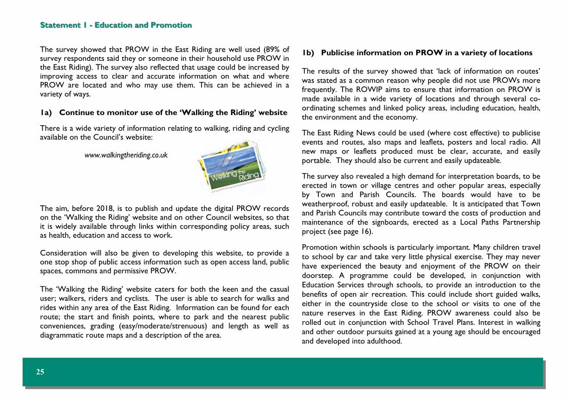
The survey showed that PROW in the East Riding are well used (89% of survey respondents said they or someone in their household use PROW in the East Riding). The survey also reflected that usage could be increased by improving access to clear and accurate information on what and where PROW are located and who may use them. This can be achieved in a variety of ways. 1a) Continue to monitor use of the ‘Walking the Riding’ website There is a wide variety of information relating to walking, riding and cycling available on the Council’s website:
www.walkingtheriding.co.uk The aim, before 2018, is to publish and update the digital PROW records on the ‘Walking the Riding’ website and on other Council websites, so that it is widely available through links within corresponding policy areas, such as health, education and access to work. Consideration will also be given to developing this website, to provide a one stop shop of public access information such as open access land, public spaces, commons and permissive PROW. The ‘Walking the Riding’ website caters for both the keen and the casual user; walkers, riders and cyclists. The user is able to search for walks and rides within any area of the East Riding. Information can be found for each route; the start and finish points, where to park and the nearest public conveniences, grading (easy/moderate/strenuous) and length as well as diagrammatic route maps and a description of the area.
Statement 1 Statement 1 -- Education and Promotion Education and Promotion
1b) Publicise information on PROW in a variety of locations The results of the survey showed that ‘lack of information on routes’ was stated as a common reason why people did not use PROWs more frequently. The ROWIP aims to ensure that information on PROW is made available in a wide variety of locations and through several co-ordinating schemes and linked policy areas, including education, health, the environment and the economy. The East Riding News could be used (where cost effective) to publicise events and routes, also maps and leaflets, posters and local radio. All new maps or leaflets produced must be clear, accurate, and easily portable. They should also be current and easily updateable. The survey also revealed a high demand for interpretation boards, to be erected in town or village centres and other popular areas, especially by Town and Parish Councils. The boards would have to be weatherproof, robust and easily updateable. It is anticipated that Town and Parish Councils may contribute toward the costs of production and maintenance of the signboards, erected as a Local Paths Partnership project (see page 16). Promotion within schools is particularly important. Many children travel to school by car and take very little physical exercise. They may never have experienced the beauty and enjoyment of the PROW on their doorstep. A programme could be developed, in conjunction with Education Services through schools, to provide an introduction to the benefits of open air recreation. This could include short guided walks, either in the countryside close to the school or visits to one of the nature reserves in the East Riding. PROW awareness could also be rolled out in conjunction with School Travel Plans. Interest in walking and other outdoor pursuits gained at a young age should be encouraged and developed into adulthood.
25

‘Tracker Packs’ are available from various Tourist Information Centres around the County. The packs, containing maps, games and challenges can be borrowed free of charge for one day (with a refundable £10 deposit and proof of identify). They are packs which contain information on walking routes, with activities to participate in along the way. They are aimed a families and also at schools and activity groups.
Statement 1 Statement 1 -- Education and Promotion Education and Promotion
There are two main hard copy publications for walkers:
• Open Access Walks brochure (free of charge, available at
Tourist Information Centres) • Walk the Wolds (cost £6 available at Tourist Information
Centres, produced by Visit Hull and East Yorkshire) Promotion of PROW within health establishments and workplaces is also important, to link with shared priorities. The opportunities provided by PROW for exercise and open air recreation need to be promoted. Many people benefit from introductions to PROW and this is undertaken through short walks organised by the Council. Raising awareness of responsible use of PROW, through active citizenship, can also assist with reducing problems of unauthorised use.
26 EAST RIDING OF YORKSHIRE COUNCIL RIGHTS OF WAY IMPROVEMENT PLAN 2008-2018 (REFRESH 2011)

Statement 1 Statement 1 -- Education and Promotion Education and Promotion
1c) Promote the use of PROW and associated health benefits to all The health benefits of exercise and access to the countryside are well documented and widely accepted. Benefits to health include increased feelings of well-being and improved mental health, as well as physical benefits. It is important to provide information about the health benefits of walking and cycling in a wide range of locations, including health centres, shopping centres and educational establishments. The Council’s ‘Walking for Health’ scheme operates from 18 sites and has guided walks every week with a minimum of two 1 hour walks per month, with some sites running both 30 minute and 2 hour walks. More Information can be found on the Council’s website: www.eastriding.gov.uk Walking is an ideal form of exercise, requiring no equipment or expense. Almost anyone can do it, anywhere at any time and it is the best way for people from all walks of life to gradually become more active. Regular walking can also help to improve the confidence, stamina, energy, weight control and life expectancy of those who take part. It can also reduce the risk of coronary heart disease, strokes, diabetes, high blood pressure, anxiety and stress. The future of the scheme relies heavily on volunteers becoming Walk Leaders. Ideally, with the help of these volunteers, the scheme could include more areas of the East Riding over the next few years. It is also feasible that the scheme could be extended to include guided walks for the blind or partially sighted, with volunteers providing assistance and a commentary on the route and surrounding countryside. Everybody should have access to PROW to be able to enjoy them and reap the health benefits. Accessibility for all is discussed further in Statement 3.
2010 UPDATE With regard to education and promotion of the rights of way network within the East Riding, the following key achievements have been reached:
The ‘Walking the Riding’ website has been completely overhauled and now offers over 300 walks, as well as a smaller number of horse riding and mountain biking routes.
A walking publication for tourists and local visitors has been produced by Visit Hull and East Yorkshire entitled 'Walk the Wolds'.
A free 'open access walks' booklet has been produced and is available from Tourist Information Centres.
A digital representation of the PROW network is available in an electronic format on the ‘Walking the Riding’ website.
27

Statement 2 Statement 2 -- Network Connectivity Network Connectivity
AimAim : To extend the network and improve the connectivity of routes
Key Actions Staff resources Costs Monitoring methods
Target
2a Improve connectivity of the network
for horse riders and cyclists. ££
Monitoring of responses to KBI 16/2 and
monitoring of route creation.
Increase in positive responses and an increase in the number and length of routes created over the life of the
ROWIP.
2b
Improve the network by providing circular routes and linear links
between current routes or to a place of public interest.
£££
Monitoring of responses to KBI 16/1 and KBI 16/2 and monitoring of
route creation.
Increase in positive responses and an increase in the number and length of routes created over the life of the
ROWIP.
2c
Seek to provide off road links over land adjacent to the highway or develop the use of wide highway
verges to link routes.
££
Monitoring of route creation and verge maintenance linking
PROW.
Increase in the number of off road links created and planned verge maintenance
linking PROW over the life of the ROWIP.
2d
Work within the planning process to secure PROW improvements associated with development
proposals.
£
Monitor planning applications where the
PROW network benefits.
Increase in the benefits to the PROW network as a result of the planning process
over the life of the ROWIP.
28 EAST RIDING OF YORKSHIRE COUNCIL RIGHTS OF WAY IMPROVEMENT PLAN 2008-2018 (REFRESH 2011)

The survey results contained many comments especially from horse riders, relating to the volume and speed of traffic and the attitude of some motorists on roads that they have to use. These concerns could be highlighted in some of the areas proposed in Statement 1 (Education and Promotion).
2b) Improve the network by providing circular routes and linear links between current routes or to a place of public interest A high number of respondents said that they would welcome more short circular routes, especially on the urban fringes. This would be challenging to achieve but could be pursued with the assistance of Town and Parish Councils and landowners. Success in creating more short circular routes may encourage less confident users to start using PROW, and short circular routes on urban fringes may be more likely to be used for frequent exercise.
Statement 2 Statement 2 -- Network Connectivity Network Connectivity
Walkers have access to 1592 km of PROW in the East Riding but horse riders and cyclists are only entitled to use 25% of this network. The survey results suggested that this 25% was very fragmented making the useable network actually a lot less than 25%. Only 1% is legally available to drivers of horse drawn carriages and recreational vehicles. The density of rights of way in the East Riding is 661m/sq km; less than half of the national average. Several survey respondents referred to the lack of continuity of routes; this response was particularly frequent among equestrians and especially where cul-de-sac bridleways exist. This commonly occurs when a bridleway changes to a footpath at a parish or estate boundary. The majority of these cul-de-sac routes were recorded during the production of the first Definitive Map, under the National Parks and Access to the Countryside Act 1949, as a result of parishes not registering the same status of route as an adjoining parish or a landowner objecting to a route that his neighbour did not object to. Respondents raised concerns over user safety where routes are linked by using busy or narrow roads. At the present time there are sections of key recreational routes and locally important circuits that require the use of busy roads.
2a) Improve connectivity of the network for horse riders and cyclists Several Town and Parish Councils have indicated that they would be willing to assist in seeking to upgrade footpaths to bridleways in their towns and parishes by negotiating with landowners. This has already proved successful in Burton Pidsea. Where a diversion is requested by a landowner the possibility of improving the network for horse riders and cyclists will be considered as part of the initial negotiation.
29

Statement 2 Statement 2 -- Network Connectivity Network Connectivity
There is also a need for linear links, between current routes, that will help avoid busy roads. These links are useful to improve longer circular routes or national trails that are currently linked along the road network. If a diversion is requested by a landowner these links will be considered as part of the initial negotiations. It has previously been highlighted that some of the East Riding open access sites are not accessible, due to the land surrounding them being private. The creation of routes to a place of public interest fits with the aim to make these sites accessible. 2c) Seek to provide off road links over land adjacent to the highway or develop the use of wide highway verges to link routes Additional regular maintenance to specific lengths of highway verges could provide a safe route to link public rights of way and therefore remove the need for users to walk or ride on metalled roads. These particular areas should not be allowed to become obstructed by newly planted trees, public utility apparatus or road signs. The integrity of existing Verge Nature Reserves will be safeguarded, through having regard to biodiversity and the habitat in the identification of such verges. Where verges are unsuitable for this use, and the route is sufficiently important (for example if it provides a missing link as part of a circular route) consideration could be given to creating a linked off road section through a field adjacent to the highway. This would involve the co-operation of the landowner and funding for compensation payments may be required.
2d) Work within the planning process to secure PROW improvements associated with development proposals The opportunities for enhancing PROW within new developments should be maximised to take advantage of the times when changes are occurring, through development or land use alterations. This could involve requests for creation of new routes, provision of linked sections, or safeguarding and upgrading of existing routes. It is important that PROW are given a high priority within planning applications and land allocations within the Local Development Framework (LDF). Provision of short routes for access to services and schools can play a large part in increasing accessibility for communities and creating opportunities for exercise and access to the countryside. This would involve collaboration between several parties, including planning officers, developers and landowners.
30 EAST RIDING OF YORKSHIRE COUNCIL RIGHTS OF WAY IMPROVEMENT PLAN 2008-2018 (REFRESH 2011)

2010 UPDATE With regard to extending the network and improving the connectivity of routes within the East Riding, the following key achievements have been reached since January 2008: Four additional bridleways have been created in Watton, Welton, Beswick and Easington to improve the connectivity of the network for horse riders and cyclists. The bridleway network has also been improved through the diversion of existing bridleways.
In addition to the bridleways that have been created, 11 footpaths have been created. A footpath has been created where the Humber estuary has eroded the existing route.
31
Statement 2 Statement 2 -- Network Connectivity Network Connectivity
These have helped to provide circular routes in the Parishes of North Cave, Elloughton and Snaith and a direct link to Freeport Hornsea Retail Park. The creation of a footpath in the Parish of Rowley has provided a link adjacent to the road between two footpaths that are part of the Yorkshire Wolds Way National Trail. Through a planning application, and through working within the planning process, improvements to the network have been secured in the Parish of Carnaby.

Statement 3 Statement 3 -- Accessibility Accessibility
AimAim : To improve accessibility for all
Key Actions Staff resources Costs Monitoring methods
Target
3a Undertake accessibility audits and grade
routes. ££ Audits of routes.
Increase in the number of audits undertaken over the life of the
ROWIP.
3b Remove physical barriers to routes and
increase easy access. £
Annual monitoring BVPI 178/6 and 7.
Annual increase in stile free routes and routes that are barrier free and easy access routes. Overall target for a stile
free network by 2020.
3c Improve accessibility for those with
restricted mobility or visual impairment. £
Annual monitoring of responses to KBI 16/5.
Increase in positive responses and decrease in negative responses over
the life of the ROWIP.
32 EAST RIDING OF YORKSHIRE COUNCIL RIGHTS OF WAY IMPROVEMENT PLAN 2008-2018 (REFRESH 2011)

Statement 3 Statement 3 -- Accessibility Accessibility
In addition, it would be beneficial to grade routes in a way to enable impaired users to make an informed decision as to their suitability before leaving home. Such information will also assist elderly users and those with prams or young children. Grading will also take account of the terrain, path surface and condition, width restrictions and gradients.
Improving the accessibility of local rights of way is an important area of work for the Council. Accessible does not simply mean ‘available to wheelchair users’. Its meaning is far wider; accessibility should encompass people with impaired vision and/or mobility problems, but also anyone who is unable to access the countryside or the path network. These groups include those from minority ethnic backgrounds, those on low incomes and young people. Where possible the Council will endeavour to meet the requirements of the relevant legislation to enable people with accessibility problems to enjoy the experience of the countryside through PROW.
3a) Undertake accessibility audits and grade routes There is a distinct need to identify and provide easy access routes for people with impaired vision or mobility. A basic survey assessing the ease of use of the PROW network, including surface characteristics, has been completed. With the aid of Countryside Access officers, Town and Parish Councils and volunteers, the next step will be to identify suitable routes. It would also be advantageous to involve representatives from communities across the County, to form part of the target audience. Some routes may be suitable immediately whilst many will require some work, varying from minor to extensive to bring them up to the required standard. It must be appreciated that not all the network will become available to all who may wish to use it.
33

In other locations where users are experiencing difficulty it would be easier and more cost effective to either provide a central refuge, if possible, or erect signs to warn drivers that they may expect to see walkers and horse riders on or adjacent to the carriageway. 3c) Improve accessibility for those with restricted mobility or visual impairment The Council will continue to work towards making routes more accessible to all, and at targeted locations, developing at least one ‘Rolling Route’ as endorsed by the Fieldfare Trust. The removal of stiles and resurfacing of some paths as appropriate will also assist with improving accessibility for those with restricted mobility or visual impairment.
Statement 3 Statement 3 -- Accessibility Accessibility
3b) Remove physical barriers to routes and increase easy access People may encounter difficulty using a PROW; they may be prevented from using a path because of stiles, gates, steps or narrow path width. The Council is working to increase the accessibility of PROW to blind or partially sighted persons and those with mobility problems. The Council has been working towards making routes more accessible for a number of years. This involves working with landowners to replace some stiles with gates, or remove stiles and replace them with gaps where possible. There are a number of stile free routes in the County. Surfacing of paths can also be an issue for mobility impaired users and this needs to be balanced with preventing ‘urbanisation’ of the countryside, through inappropriate hard surfacing in rural areas. Several survey respondents said that they had to wait a considerable length of time in order to cross certain roads during busy periods. At the same time, some respondents praised the installation of the ‘Pegasus’ signal controlled crossing at Ganstead. This type of crossing aids horse riders in addition to other users by having a high level push button control that can be operated without having to dismount.
It would however be unreasonable to expect such crossings at each and every location where a walker, cyclist or horse rider may wish to cross a road. Each potential location would require a full assessment before any measures could be put in place.
34 EAST RIDING OF YORKSHIRE COUNCIL RIGHTS OF WAY IMPROVEMENT PLAN 2008-2018 (REFRESH 2011)

2010 UPDATE With regard to improving the accessibility of the rights of way network, the following key achievements have been reached: All routes on the Walking the Riding website are graded into ease of use, and have more detailed information about the type of structures, gradients and path surfaces, including the presence of livestock. Continued to work towards an informal target of having a stile free network by 2020. Our random sample data for 2009/2010 shows that 73% of the network is stile free. The healthy walking scheme has now expanded and runs from 17 locations, with 801 participants.
35
Statement 2 Statement 2 -- Accessibility Accessibility

Statement 4 Statement 4 -- Route Maintenance and Improvement Route Maintenance and Improvement
AimAim : To ensure a safe and useable network
Key Actions Staff resources Costs Monitoring methods
Target
4a Improve the maintenance programme
in relation to undergrowth and overgrowth.
£ Monitor comments
and complaints.
Reduction in outstanding defects over the life of the ROWIP.
4b Improve signage. ££
Annual monitoring of responses to BVPI 178/1 and KBI 16/3. Monitor ‘informative’
signs.
Increase in the percentage of PROW that are signed correctly, an increase in positive responses and decrease in negative responses. Increase in the quantity of ‘informative’ signs.
4c Reduce unauthorised use of
public rights of way. £
Feedback from the public and police.
Ongoing target to reduce the number of incidents and problem routes.
4d
Promote the benefits of the Local Paths Partnership and Parish and Town Councils to further develop
the use of volunteers.
££ Monitor the number of voluntary sector
Partners.
Maintain the existing level of commitment, with the possibility of increasing this if extra resources are made available.
4e Improve public awareness regarding control of dogs and dog fouling.
£ Annual monitoring of responses to BVPI
178/8.
Reduce the number of paths adversely affected by dog fouling.
36 EAST RIDING OF YORKSHIRE COUNCIL RIGHTS OF WAY IMPROVEMENT PLAN 2008-2018 (REFRESH 2011)

Statement 4 Statement 4 -- Route Maintenance and Improvement Route Maintenance and Improvement
A Highway Authority has a statutory duty to maintain a highway to a
level commensurate with its use. The Council considers that it is
important to continue to monitor performance with regard to the
maintenance of pubic rights of way, despite the abolition of BVPI 178. Improved maintenance was suggested as the top priority by General Users but was only placed 5th by the equestrian users. In order of frequency, the main complaints received by the Countryside Access Team are:
1. Overgrowth 2. Poor or missing signs 3. Defective structures 4. Ploughing or cropping 5. Illegal use by motor vehicles 6. Dogs and dog fouling
4a) Improve the maintenance programme in relation to undergrowth and overgrowth Current resources allow paths that are promoted or locally well used to be cut, usually once or twice a year, the remainder are not cut at all by the Council. Paths in parishes under the Local Paths Partnership may benefit from additional mowing if it is funded through a Parish Precept. A single cut may be insufficient to keep the path clear all summer. It is important to use resources efficiently, and the Council undertakes this through using town and parish volunteers, landowners or employment of an authorised local contractor or farmer to cut verges and pathways where possible.
4b) Improve signage A high number of survey respondents expressed a clear desire for more information on sign posts. These more ’informative’ sign posts could include destination, distance, accessibility grading and the name of the trail/route. The signs should be able to be read by someone who is partially sighted. Such a programme could commence with targeting new signposts as required, in high use areas or where a new circular route has been created, rather than wholesale replacement.
37

Statement 4 Statement 4 -- Route Maintenance and Improvement Route Maintenance and Improvement
4c) Reduce unauthorised use of PROW It is good practice to promote rights alongside responsibilities and this is what the Council is aiming to develop through linked schemes and education within schools. There is confusion about the extent of the new access rights under the Countryside and Rights of Way Act 2000 (sometimes referred to as the ‘Right to Roam’) and also through agricultural grants where strips of land are left as grass around the edges of arable land to promote species diversity. The Council will continue to raise public awareness that it is illegal to ride a bicycle or ride a horse on a public footpath and illegal to drive a vehicle on non-vehicular routes; doing so commits trespass against the landowner. Signs are available for use on the routes which experience the most problems. 4d) Promote the benefits of the Local Paths Partnership and Parish and Town Councils to further develop the use of volunteers The Council operates the Local Paths Partnership scheme. This scheme allocates grants to Parish and Town Councils to help them look after their local paths. Local people as volunteers are given the resources and skills necessary to improve the condition of their PROW and to keep them open and in use. 100% grants are paid to Parishes who join the scheme, and at all times they have the support of a Countryside Access Officer (PROW). The Council would like to see more Parishes in the East Riding join the scheme as there are obvious benefits to all concerned. The public rights of way network would be improved and all types of users would benefit by having easy access to more routes.
4e) Improve public awareness regarding control of dogs and dog fouling The Council will continue to raise awareness that dogs should be kept under control and their faeces removed and disposed of appropriately. Signs are available for use on problematic routes. The PROW team will continue to liaise with dog wardens to promote the responsible use of PROW and the countryside by dog owners.
38 EAST RIDING OF YORKSHIRE COUNCIL RIGHTS OF WAY IMPROVEMENT PLAN 2008-2018 (REFRESH 2011)

2010 UPDATE With regard to maintenance and enforcement of the rights of way network, the following key achievements have been reached: Made minor improvements in the vegetation clearance programme. Removed unnecessary stiles. Working in partnership with 37 parish councils to encourage greater involvement and use of local rights of way through the Local Paths Partnership scheme. Our annual random sample survey for 2009/10 showed that we have 76% of public rights of way open for the public to use and enjoy.
39
Statement 4 Statement 4 -- Route Maintenance and Improvement Route Maintenance and Improvement

Statement 5 Statement 5 -- Definitive Map and Statement Definitive Map and Statement
AimAim : To ensure that the Definitive Map and Statement is accurate and up to date
Key Actions Staff resources Costs Monitoring methods
Target
5a Publish and update the digital PROW records on the Walking the Riding and
the Council’s website.
£ Internal process. Publish quarterly updates of the map and monthly updates of the registers.
5b Process Definitive Map Modification Orders in line with current policy.
£
Monitoring the number of
modification orders completed.
Increase the number of modification orders completed annually.
5c Consolidate and republish the Definitive
Map for the East Riding. £
Monitor the completion of outstanding
legal event orders.
Complete the list of outstanding legal event orders by 2018.
5d
Seek to resolve anomalies and missing links on the Definitive Map through diversion, extinguishment, creation or
modification orders.
££ Monitoring the number of orders
made.
Increase in the number of orders made to resolve anomalies and missing links
completed annually.
40 EAST RIDING OF YORKSHIRE COUNCIL RIGHTS OF WAY IMPROVEMENT PLAN 2008-2018 (REFRESH 2011)

Statement 5 Statement 5 -- Definitive Map and Statement Definitive Map and Statement
The Definitive Map and Statement of Public Rights of Way (Definitive Map) is the legal record of the existence of the public rights of way shown on it. PROW may exist however, but not be currently shown on the map and routes that are currently shown may be incorrect. The Definitive Map can only be changed using a legal procedure. To modify the map because of an omission or error a modification order is required. There are currently five Definitive Map books covering the East Riding area. Current legislation allows for the consolidation of all five maps into one at the next republication. Since the most recent publication of each Definitive Map, numerous legal orders have been made to modify the Maps. Orders have been made due to the discovery of evidence showing that a route should be shown that is not currently shown or that evidence shows the maps are incorrect. In addition to this, modifications have been made to reflect the changes made by diversion, creation, or extinguishment orders. These changes will be incorporated into the Definitive Map when the map is republished. Schedule 14 of the Wildlife and Countryside Act 1981 provides a process that anyone may follow, to apply to the Council for a modification order to be made to amend the Definitive Map. An application can only be made if the applicant has evidence to show that either a public right of way exists, which is not shown on the Definitive Map or that a route shown on the Definitive Map and/or Statement is recorded incorrectly.
5a) Publish and update the digital public PROW records on the Walking the Riding website and the Council’s website
A digital representation of the PROW network is available on the Walking the Riding website and is regularly updated. This is not the legal record of PROW. If you require public right of way information for legal purposes, a copy of the Definitive Map can be viewed at the Treasure House, Beverley. When the Definitive Map is republished, the possibility of making it available on the internet will be considered.
41

Statement 5 Statement 5 -- Definitive Map and Statement Definitive Map and Statement
Legislation requires the Council to keep a register of all applications made to modify the Definitive Map or Statement under Schedule 14 of the Wildlife and Countryside Act 1981. An electronic version is available on the Council’s website and is updated as required. The register helps to increase knowledge among landowners, users of PROW and the public about applications which could result or have resulted in changes to the Definitive Map. It also aims to help avoid the duplication of work where someone has already made an application for a modification order in respect of a particular matter.
Legislation also requires the Council to keep an electronic register of declarations, by landowners, of non-intent to dedicate PROW under Section 31(6) of the Highways Act of 1980, across their land. An electronic version is available on the Council’s website and is updated as required. If the legislation regarding the right to apply for public path orders is brought into force, the Council will also have to maintain a similar register for applications for orders for the diversion or extinguishment of routes by landowners, lessees and occupiers of land used for agriculture, forestry or the breeding or keeping of horses.
5b) Process Definitive Map Modification Orders in line with current policy The Council has received 35 formal Schedule 14 applications for routes to be added to the Definitive Map since 2008 and it also has a backlog of claims that have not been submitted as formal applications.
The Council is also aware that any routes shown on their Highway Maintenance Maps, that are of a status that should be recorded on the Definitive Map, need to be included as part of the modification programme of work. Priority is currently given to those applications made using the Schedule 14 process and those applications are then dealt with in chronological order. Due to the increase in Schedule 14 applications the Council is proposing to review the existing policy, to facilitate prioritisation. It is anticipated that applications for routes that will add value to the existing PROW network will receive higher priority.
42 EAST RIDING OF YORKSHIRE COUNCIL RIGHTS OF WAY IMPROVEMENT PLAN 2008-2018 (REFRESH 2011)

5c) Consolidate and republish the Definitive Map for the East Riding To consolidate and republish the current Definitive Maps for this area, the maps must be up to date with changes that have been made since they were last published. This Council has an outstanding list of Public Path Orders which have legally changed the routes, but do not modify the Definitive Map and Statement. A Legal Event Order is required to modify the Definitive Map and until all these changes have been recorded on the Definitive Map, it cannot be republished. A programme of work to deal with this list is underway. The Council proposes to publish a consolidated map, covering the entire East Riding, showing all routes at a scale of 1:10,000.
5d) Seek to resolve anomalies and missing links on the Definitive Map, through diversion, extinguishment, creation or modification orders. There are a number of anomalies on the Definitive Map. An example of these are where routes have been drafted incorrectly, the Statement and Map differ, a missing link is required to join existing routes or a substantial long standing obstruction or major engineering works affect a route. The Council will seek to resolve these cases by negotiating with landowners. 2010 UPDATE With regard to maintaining an accurate and up to date version of the Definitive Map and Statement, the following key achievements have been reached since January 2008:
Eleven modification orders have been completed.
The outstanding list of legal event orders is 50% complete. Since the last
ROWIP legal event orders have been made to reflect 82 legal changes.
In the parishes of Hornsea and Elloughton drafting errors have been
corrected and additional orders made to rationalise the network.
Diversions have been completed in Easington and Tickton to resolve
longstanding problems. In Beswick a link has been created to join two
cul-de-sac bridleways.
Statement 5 Statement 5 -- Definitive Map and Statement Definitive Map and Statement
43

Section 7: List of Organisations, Publications and External LinksSection 7: List of Organisations, Publications and External Links
Countryside Organisations
The Ramblers www.ramblers.org.uk
British Horse Society www.bhs.org.uk
CTC National Cycling Organisation www.ctc.org.uk
British Driving Society www.britishdrivingsociety.co.uk
Open Spaces Society www.oss.org.uk
Byway and Bridleway Trust www.bbtrust.org.uk
Auto Cycle Union www.acu.org.uk
Land Access and Recreation Association www.laragb.org
Green Lane Association www.glass-uk.org
Long Distance Walkers Association www.ldwa.org.uk
British Walking Federation www.bwf-ivv.org.uk
British Cycling www.britishcycling.org.uk
Ride UK National Bridleway Network www.ride-uk.org.uk
Bridleways Association www.bridleways.co.uk
Yorkshire Wildlife Trust www.ywt.org.uk
National Farmers Union www.nfuonline.com
Country Land and Business Association www.cla.org.uk
Campaign to Protect Rural England www.cpre.org.uk
Visit East Riding of Yorkshire
Walking the Riding www.walkingtheriding.co.uk
Wolds Way National Trail www.nationaltrail.co.uk/YorkshireWoldsWay
Trans Pennine Trail www.transpenninetrail.org.uk
Walkers are Welcome Market Weighton www.weightonwalkers.org.uk
Visit Hull and East Yorkshire www.vhey.co.uk
Welcome to Yorkshire www.yorkshire.com
Government Departments
East Riding of Yorkshire Council www.eastriding.gov.uk
Walking for Health www.wfh.naturalengland.org.uk
Department of Environment, Food and Rural Affairs ww2.defra.gov.uk
Planning Inspectorate www.planning-inspectorate.gov.uk
Useful Natural England Publications www.naturalengland.org.uk
Out in the country CA 9
You and your dog in the countryside CA 205
By all reasonable means CA 215
Managing public access CA 210
A guide to definitive map and changes to public rights of way NE112
Stepping Forward NECR 035
44 EAST RIDING OF YORKSHIRE COUNCIL RIGHTS OF WAY IMPROVEMENT PLAN 2008-2018 (REFRESH 2011)
Note : The Council cannot be held responsible for the content of external websites.

Right of way: A legal right to pass and re-pass over privately owned
land. Highway: A strip of land over which there is a public right of way. Green Lane: A term with no legal meaning - it is a physical description
of an un-surfaced track, often hedged. Such a way may be a footpath, bridleway or carriageway or it may carry no public right of way at all.
DefinitionsDefinitions
Footpath: A highway over which the public have a right on foot
only, not including a “footway”.
Bridleway: A highway over which the public have a right of way on foot and horseback or leading a horse. Pedal cycles also have a right of way but must give way to walkers and horse riders.
A highway over which the public have a right of way on foot, horseback and leading a horse and with non mechanically propelled vehicles (e.g. pedal cycle or horse drawn vehicle) This category excludes mechanically propelled vehicles.
A highway over which the public have a right of way for all users including vehicular traffic, but is used mainly for the purpose that footpaths and bridleways are so used.
The Definitive Map and Statement is the legal record of public rights of way (Footpaths, Bridleways, Restricted Byways and BOAT). An order made by a surveying authority to amend the definitive map and statement. A collective term for creation, diversion or extinguishment orders, that are made by the highway authority to alter a footpath, bridleway or restricted byway.
Byway Open to All Traffic (BOAT):
Restricted Byway:
Definitive Map and Statement:
45
Definitive Map Modification Order:
Public Path Order:

Public Path: A highway that is either a footpath or bridleway. Carriageway: A highway over which there exist footpath and
bridleway rights and a right to pass in or on a vehicle.
Footway: A way set aside at the edge of a carriageway, better known as a “pavement”.
Cycle Track: A highway which the public have the right on a pedal cycle and on foot unless segregated. Also known as a “cycleway”.
Motorway: A highway over which non motorised traffic is prohibited.
The Local Development Framework, or LDF, is the name for the portfolio of documents that together provide the framework for managing development and addressing the key planning issues within an area. When the individual documents known as Development Plan Documents (DPDs) are adopted they guide land-use decisions and are used to determine planning applications.
All local transport authorities in England outside of London have a statutory duty to produce a Local Transport Plan (LTP) under the Transport Act 2000, as amended by the Local Transport Act 2008. The LTP sets out the transport strategy for the East Riding, and the schemes and measures proposed to maintain and improve all aspects of the local transport network. LTP2 is to be replaced by LTP3 in 2011.
Green Infrastructure (GI) is a strategically planned and delivered network of high quality green spaces and other environmental features. It should be designed and managed as a multifunctional resource capable of delivering a wide range of environmental and quality of life benefits for local communities. Green Infrastructure includes parks, open spaces, playing fields, woodlands, allotments and private gardens.
Local Development Framework:
Local Transport Plan:
Green Infrastructure:
46 EAST RIDING OF YORKSHIRE COUNCIL RIGHTS OF WAY IMPROVEMENT PLAN 2008-2018 (REFRESH 2011)

And finally where in the East Riding are we?And finally where in the East Riding are we?
47
Map 4 shows where the photographs are in the East Riding Photographs are listed by page number C. Lockington (front cover) 1a. South Cave (left) 1b. Houghton Woods, South Cliffe (right) 3. Newbald 8. Pocklington 11. South Holderness Trail 12. Pocklington 13. Tunstall 16. North Dalton 21. Walkington 26. Wolds Way, Millington 27. Bridlington 29. Hornsea Rail Trail 30. Bubwith 31. Welton 33. Bishop Wilton 34. South Cave 35. Rudston 37. Newbald 38. Hornsea 39. Airmyn 43. Twin Rivers 45. Flamborough 46. Huggate Sheep Walk 48. Holme on Spalding Moor 49. Ellerker

EAST RIDING OF YORKSHIRE COUNCIL RIGHTS OF WAY IMPROVEMENT PLAN 2008-2018 (REFRESH 2011)
East Riding of Yorkshire Council will, on request, provide this document in Braille, large print or audio.
Please call 0800 849 5060 if you require this.
Jesteśmy tu, by Tobie pomóc. Naszym celem jest udzielenie każdej osobie dostępu do naszych usług. Jeśli życzysz sobie tłumacza, prosimy zadzwonić na ten numer 0121 377 2880
48
If you are not able to read this document ….If you are not able to read this document ….

Definitive Map Team Asset Strategy
Policy, Partnerships and Improvement East Riding of Yorkshire Council
County Hall Beverley