road condition imaging - statens vegvesen – get a more informative view of the road status ... •...
TRANSCRIPT

Road Condition Imaging
Prototype field tests – final report Winter 2013-2014
Patrik Jonsson, Torgeir Vaa

Agenda
• Introduction • Background • Experimental setup • Results • Discussion • Future work

Introduction
• Cooperation project – Statens Vegvesen, Trafikverket, Mid Sweden
University and Combitech • Need
– Get a more informative view of the road status • Why
– Improve road maintenance – Investigate road maintenance results – Issue warnings during severe road conditions

Background
• Current monitoring methods – RWIS – Prognosis – Single point measurements
• Monitoring desires – Remote sensing – Area coverage of road status measurement – Find differences in and between wheel tracks

Current state of the art
• Remote sensing technologies – Vaisala DSC111, Lufft NIRS31, Teconer RCM411,
RoadEye
• No one uses images, only single spot data

Research
• Part of a PhD program at Combitech • NIR imaging research performed at Miun • Utilize water NIR adsorption • Perform tests with a commercial camera unit • Develop advanced computer models for road
condition classification • Develop prototype units for laboratory tests

NIR absorption
Different regions have different adsorption of NIR light

Research at Miun
• Initial tests using commercial equipment • FLIR SC7100 NIR camera mounted on vehicle • Camera price SEK 500 000

Research at Miun
KNN
50 100 150 200 250 300
50
100
150
200
250
Unclassified
Dry
Wet
Snowy
Icy
Conflicting
Research equipment as 320x256 pixel FLIR camera Development of a cost effective 64x64 pixel NIR camera

Research at Miun
SVM
50 100 150 200 250 300
50
100
150
200
250
Unclassified
Dry
Wet
Snowy
Icy
Conflicting

Research at Miun
• Camera electronics prototype developed at Miun • Cost effective NIR sensor --> cost effective camera solution

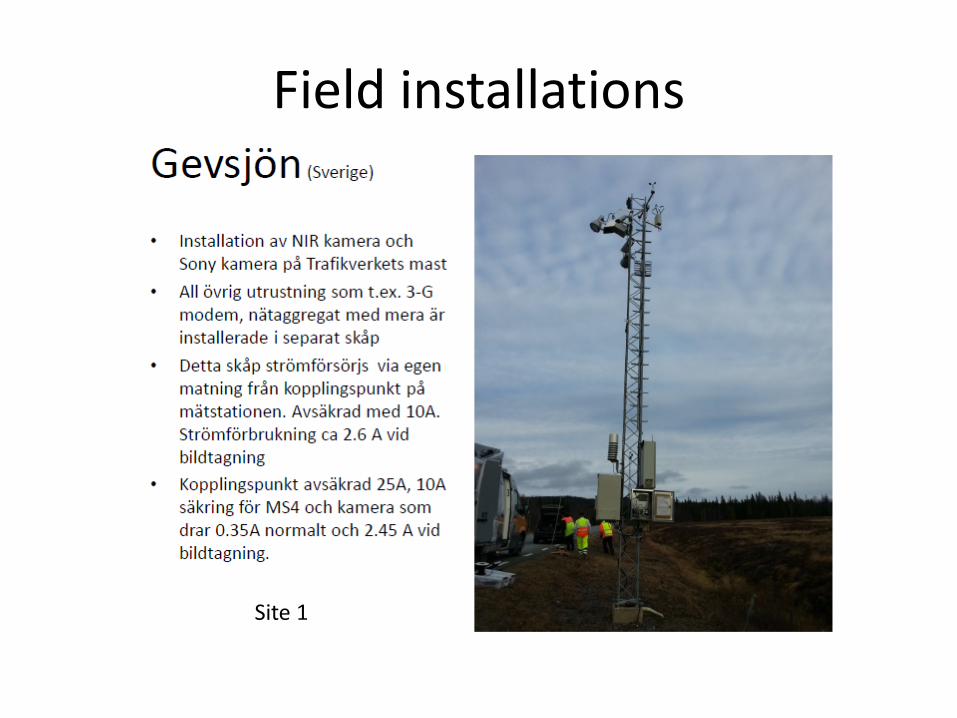
Field installations of protoype units
• Sweden Gevsjön and Norway Teveldalen
Field installations
Site 1

Field installations
Site 2

Results-images
Color image and NIR image

Friction measurements

Results-RWIS data
Gevsjön November December January February March April Air temperature (mean) -2.7 -1.1 -10.8 -2.3 -1.2 1.4
Road surface temperature (mean) -2.3 -3.3 -11.4 -3.8 0.2 6.6 Dew point -3.6 -3.9 -13.6 -5.1 -4.6 -2.3 Precipitation (sum in mm) 159 150 127 63 638 83
Teveldalen November December January February March April Air temperature (mean) -0.5 -0.4 -7.0 -0.3 -0.2 1.2
Road surface temperature (mean) -1.6 -2.2 -8.4 -3.0 -0.6 2.7 Dew point -2.9 -4.0 -12.6 -5.0 -4.8 -3.6 Precipitation (sum in mm) 162 168 130 83 415 74

Results-Road Condition Classes

Results - Output data

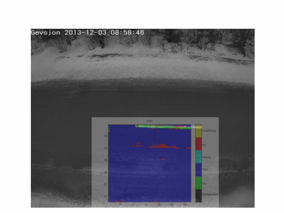

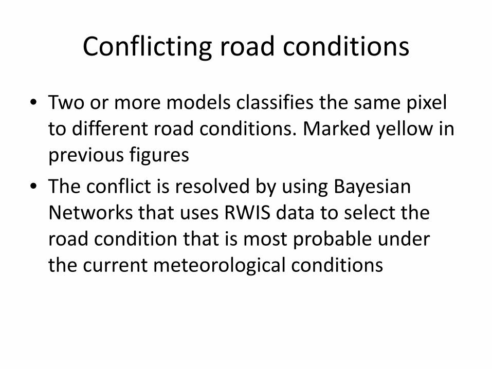
Conflicting road conditions
• Two or more models classifies the same pixel to different road conditions. Marked yellow in previous figures
• The conflict is resolved by using Bayesian Networks that uses RWIS data to select the road condition that is most probable under the current meteorological conditions

Bayesian Network for resolving conflicting classifications
(marked as yellow areas in figures) Road Condition
(RC)
Surft Dewp
Precip

Results Bare road conditions
0
10
20
30
40
50
60
70
80
90
100
November December January February March April
% bare site 1
% bare site 2

Results Snow and Icy road
0
10
20
30
40
50
60
70
80
90
100
November December January February March April
% snow and ice site 1
% snow and ice site 2

Results-wheel track and between Percentage dry or wet
in wheel tracks Percentage ice or snow between wheel tracks
Occasions at site 1
Occasions at site 2
70 40 69 86 70 50 50 62 70 60 35 47 70 70 22 33 70 80 14 24 70 90 2 12 80 40 46 75 80 50 33 52 80 60 21 38 80 70 15 27 80 80 11 19 80 90 1 11 90 40 23 60 90 50 17 41 90 60 10 30 90 70 7 23 90 80 5 16 90 90 0 8
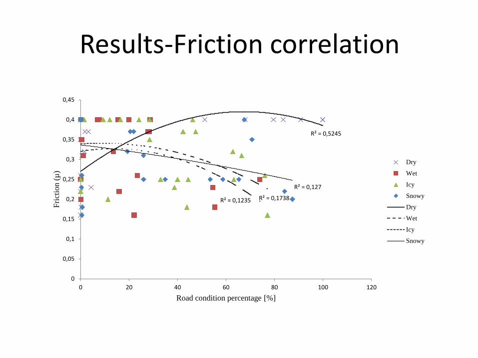
Results-Friction correlation
R² = 0,5245
R² = 0,1235 R² = 0,1738
R² = 0,127
0
0,05
0,1
0,15
0,2
0,25
0,3
0,35
0,4
0,45
0 20 40 60 80 100 120
Fric
tion
(µ)
Road condition percentage [%]
Dry
Wet
Icy
Snowy
Dry
Wet
Icy
Snowy

NIR camera product

Discussion
• System performance – High availability, broken lamps, no frost
• Pros – Area coverage – Product available
• Cons – Over estimation of wet due to dark images – Friction correlation needs more attention
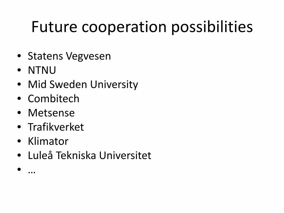
Future cooperation possibilities
• Statens Vegvesen • NTNU • Mid Sweden University • Combitech • Metsense • Trafikverket • Klimator • Luleå Tekniska Universitet • …

Future work
• Tests with the final product • More data –> better models • Examine the many road condition classes
– Laboratory tests
• Tests on different road sites, different environment conditions
• Improve friction correlation • Mobile equipment – new research project