role of natmo in exploring and utilising geospatial...
TRANSCRIPT

NATMO’s Geospatial Technology
NSDI 12 New Delhi
Role of NATMO in Exploring and Utilising Geospatial Technology
Prof . (Dr.) V.C.Jha, Director, NATMO

NATMO’s Geospatial Technology
NSDI 12 New Delhi
NATMO’s Geo-Spatial Technology
Prof. (Dr.) V. C. Jha Director NATMO
Geo-Spatial Technologies for Sustainable Development NSDI-12
New Delhi

NATMO’s Geospatial Technology
NSDI 12 New Delhi
• INFORMATION TECHNOLOGY
• SPATIAL INFORMATION TECHNOLOGY
• GEOSPATIAL INFORMATION TECHNOLOGY

NATMO’s Geospatial Technology
NSDI 12 New Delhi
• MERCATOR PROJECTION
• GIS
• GEOSPATIAL TECHNOLOGY

NATMO’s Geospatial Technology
NSDI 12 New Delhi
• 500 Years of MERCATOR
• Gerardus Mercator ( born 5 March 1512 ) established the Mercator Projection, Thus presenting a realistic map of the WORLD. He made mapmaking a scientific endeavour 500 years hence, today Mercator is revered as a pioneering cartographer and his invention is a major breakthrough in Modern Cartography

NATMO’s Geospatial Technology
NSDI 12 New Delhi
• First Globe was presented in 1541
• Paper Maps have been Created and used since the development of basic principles
• The Foundation of Geographic Analysis was established by Ptolemy
• During 15th and 16th Century Cartography dominated European Map Making
• Aerial Remote Sensing in 19th Century
• Remote Sensing in 20th Century
• 21st Century for Geospatial Space for DIGITAL MAPPING
NATMO’s Geospatial Technology
NSDI 12 New Delhi
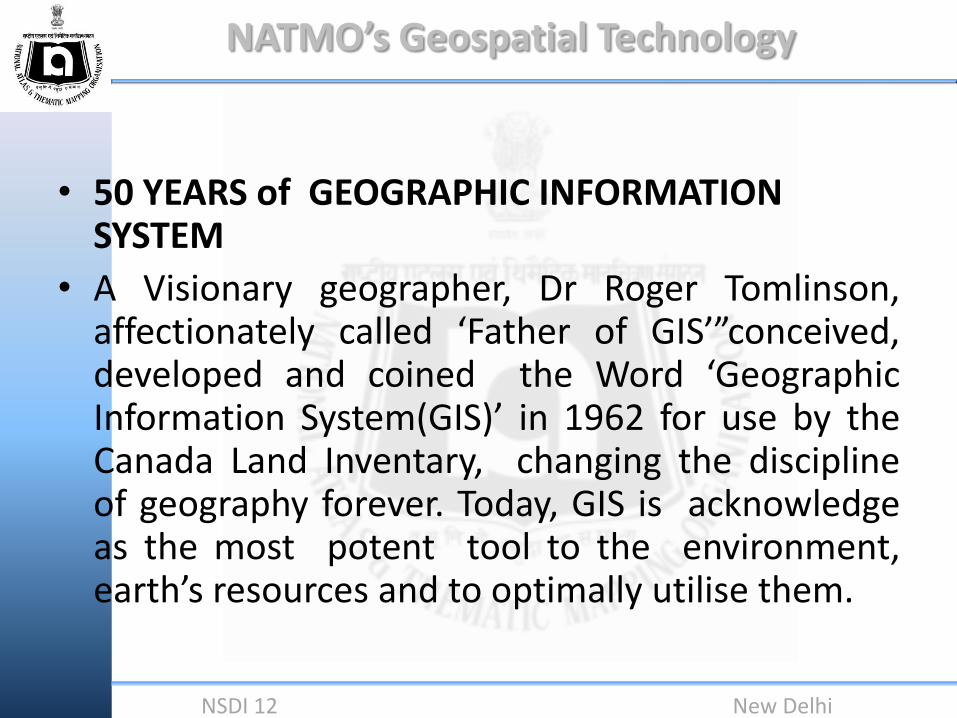
• 50 YEARS of GEOGRAPHIC INFORMATION SYSTEM
• A Visionary geographer, Dr Roger Tomlinson, affectionately called ‘Father of GIS’”conceived, developed and coined the Word ‘Geographic Information System(GIS)’ in 1962 for use by the Canada Land Inventary, changing the discipline of geography forever. Today, GIS is acknowledge as the most potent tool to the environment, earth’s resources and to optimally utilise them.
NATMO’s Geospatial Technology
NSDI 12 New Delhi
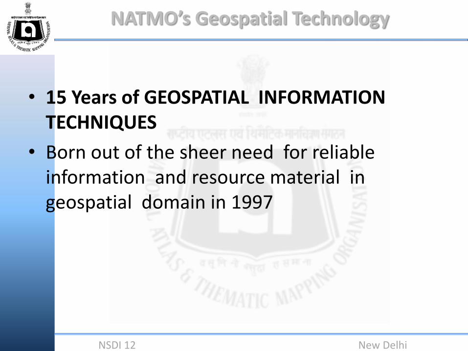
• 15 Years of GEOSPATIAL INFORMATION TECHNIQUES
• Born out of the sheer need for reliable information and resource material in geospatial domain in 1997

NATMO’s Geospatial Technology
NSDI 12 New Delhi
• It is a known fact that no discipline can survive without developing and adopting new strategy and technology in 21stcentury This applies to Sustainable Development and Management also

NATMO’s Geospatial Technology
NSDI 12 New Delhi
• Remote Sensing and G I S Techniques have opened up a new vista for the Scientists by providing multifaceted information at a short notice about the Earth which happen to be the home of Man

NATMO’s Geospatial Technology
NSDI 12 New Delhi
Data Mining
Large
Data Bases Data
Analysis
Human
Computer
Interaction
Machine
Learning
Statistical
Analysis Neural
Networks

NATMO’s Geospatial Technology
NSDI 12 New Delhi
• Education itself is a dynamic notion. Geoinformatics has two basic parts Pure Geoinformatics and Applied Geoinformatics. Pure Geoinformatics is concerned with the fundamentals or Basics of Geoinformation Science which involves subjects on conceptual developments in the National and International context while Applied Geoinformatics is concerned with the Technology. In recent time, technology plays a pivotal role in teaching Cartography. With the advent of cyber technology, Applied Cartography has become the need of the present day Society. It not only helps in solving problems of Pure Sciences and Earth Science, but also helps in solving problems of Social Sciences and the Society at a large

NATMO’s Geospatial Technology
NSDI 12 New Delhi
For example, now INDIA's Population is 121 corer. We can prepare Demographic Structure out of this by using Geospatial Technology. Not only that, the need of food, Infrastructure and other facilities needed for our present day age-group of 10-15 years can also be yielded through Geospatial Techniques. Even after 15 years when this age-group will proceed to youth, what will be their needs that can also be projected using Geospatial Information. Hence, it is very essential to use the Knowledge of GEOSPATIAL TECHNOLOGY to full fill the demands of the Society.

NATMO’s Geospatial Technology
NSDI 12 New Delhi
NATMO IS ESTABLISHED WITH THE MISSION TO
PREPARE THEMATIC MAPS AND ATLASES OF INDIA TO PROPEL SPATIAL PLANNING

NATMO’s Geospatial Technology
NSDI 12 New Delhi
NATMO - A SELF INTRODUCTION • THE MAJOR ARENA OF NATMO IS TO DEAL WITH SPATIAL DATA.
• THERE IS NO OTHER NATIONAL ORGANISATION THAT DEALS WITH
A MULTITUDE OF SPATIAL DATA. (NO DATA IS OUT OF OUR PURVIEW TO BRING SPATIAL A SPATIAL LINK TO IT)
• THEMATIC MAPS AND ATLASES ARE JUST THE PRODUCTS.
• NATMO IS ALWAYS KEEN TO ADOPT EMERGING AND ADVANCED TECHNOLOGIES IN THE FIELD OF GEOSPATIAL SCIENCES, DATABASE MANAGEMENT, MAPPING, AND CARTOGRAPHY.

NATMO’s Geospatial Technology
NSDI 12 New Delhi
• NATMO HAS ITS OWN INNOVATIONS AND CONTRIBUTIONS IN THE FIELD OF CARTOGRAPHY AND PUBLICATION OF MAPS AND ATLASES.
• GEO-SPATIAL COMMUNITY ACROSS THE WORLD RECOGNISES NATMO FOR ITS UNIQUE ROLE IN HANDILING SPATIAL DATA.
• KOLKATA PORTAL IS A UNIQUE EXAMPLE OF NATMO’S ROLE/CONTRIBUTION IN THE FIELD OF SPATIAL DATA PROCESSING AND PRESENTATION.
NATMO’s Geospatial Technology
NSDI 12 New Delhi
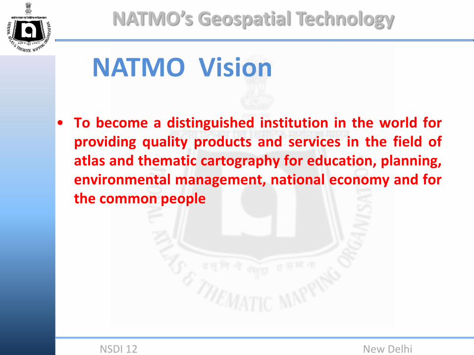
NATMO Vision
• To become a distinguished institution in the world for providing quality products and services in the field of atlas and thematic cartography for education, planning, environmental management, national economy and for the common people

NATMO’s Geospatial Technology
NSDI 12 New Delhi
Technology we are using….
•GIS •Remote Sensing •GPS •Digital Cartography •Web GIS

NATMO’s Geospatial Technology
NSDI 12 New Delhi
HIGHLIGHTS OF SOME MAJOR ACTIVITIES
IN THE GEOSPATIAL DOMAIN.

NATMO’s Geospatial Technology
NSDI 12 New Delhi
DISTRICT PLANNING MAP (DPMS)
A STRONG DATA RESOURCE BASE
FOR SPATIAL INFO

NATMO’s Geospatial Technology
NSDI 12 New Delhi
DPMS DISTRICT PLANNING MAP SERIES
One of the most ambitious projects conceived and executed by the
collaborative effort of NATMO & Survey of India
NATMO’s Geospatial Technology
NSDI 12 New Delhi
(DPMS) DISTRICT PLANNING MAP SERIES
• CURRENTLY THE WHOLE PROJECT IS EXECUTED BY NATMO

NATMO’s Geospatial Technology
NSDI 12 New Delhi
To provide users and planners with
topographic and thematic information To provide a comprehensive picture of the
resource scenario of a district To serve a ready reference to planners &
administrators, researchers and the common public
To augment grass root level planning
THE CORE OBJECTIVES OF DPMS

NATMO’s Geospatial Technology
NSDI 12 New Delhi

NATMO’s Geospatial Technology
NSDI 12 New Delhi
THE APPROACH
Collection of Base Materials Data verification Processing of data Depiction of data for Thematic maps

NATMO’s Geospatial Technology
NSDI 12 New Delhi
Base Materials
• Survey of India topographical maps in
1: 250,000
• Corresponding sheets on
1: 50,000 and 1:25,000
• Satellite imageries and aerial photos

NATMO’s Geospatial Technology
NSDI 12 New Delhi
Base Materials cont…
• Maps / information in the form of tables and write-ups etc also serve as base materials
• Relevant publications by the State Governments/Central Government.
• These information are collected from our own sources or from the field/District Administration

NATMO’s Geospatial Technology
NSDI 12 New Delhi
DATA VERIFICATION
• The source and authenticity of data is examined
• Temporal validity of the data
• Screening and filtering of the data

NATMO’s Geospatial Technology
NSDI 12 New Delhi
PROCESSING OF DATA
• Data processing is one of the major tasks in the preparation of DPMS maps, since it involves both topographical and thematic information.
• Statistical methods are employed in data processing for quantitative visualization of thematic maps.
• For example -Population map is shown with dot density.
NATMO’s Geospatial Technology
NSDI 12 New Delhi
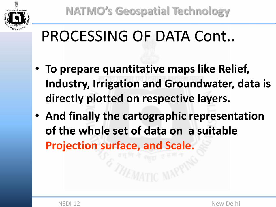
PROCESSING OF DATA Cont..
• To prepare quantitative maps like Relief, Industry, Irrigation and Groundwater, data is directly plotted on respective layers.
• And finally the cartographic representation of the whole set of data on a suitable Projection surface, and Scale.
NATMO’s Geospatial Technology
NSDI 12 New Delhi
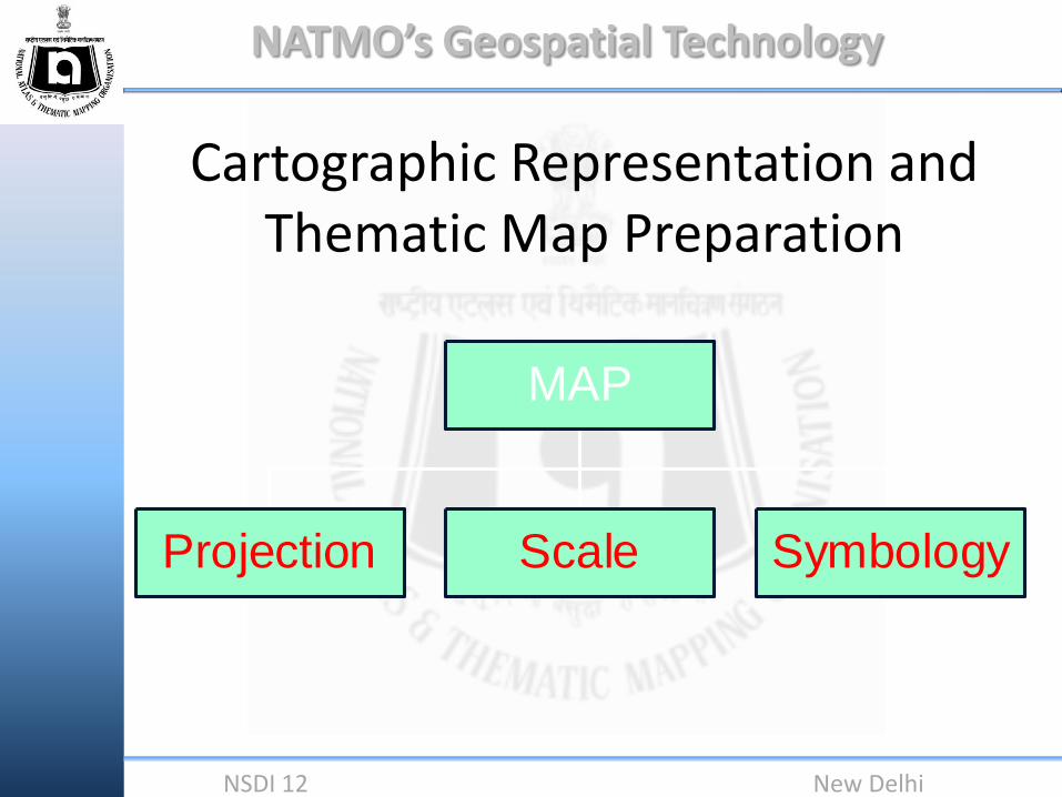
Cartographic Representation and Thematic Map Preparation
Projection Scale Symbology
MAP

NATMO’s Geospatial Technology
NSDI 12 New Delhi
CONTENTS OF DPMS
• Main map in scale 1:250,000 is as good as an administrative map.
• Nine thematic maps in scale 1: 1,000,000 as insets depicts the resource scenario of the district.
• These are ……..

NATMO’s Geospatial Technology
NSDI 12 New Delhi
INSET MAPS AT 1: 1,000,000 SCALE
a) RELIEF AND SLOPE
b) ROCKS AND MINERALS
c) CLIMATIC CONDITIONS
d) SOILS
e) IRRIGATION AND HYDROGEOLOGY
f) POPULATION
g) INDUSTRIES
h) LAND USE AND CROPPING PATTERN.
i) Natural Hazard (Recent addition)

NATMO’s Geospatial Technology
NSDI 12 New Delhi
In addition to these 9 inset maps One Town map is shown in much larger scale
NATMO’s Geospatial Technology
NSDI 12 New Delhi
WORKFLOW OF DPMS cont…
• To day all DPMS maps are prepared completely in a GIS platform.
• A systematic approach is followed to manage the database

NATMO’s Geospatial Technology
NSDI 12 New Delhi
Malappuram District of Kerala The first DPMS map prepared in
digital mode
ACHIEVEMENTS

NATMO’s Geospatial Technology
NSDI 12 New Delhi

NATMO’s Geospatial Technology
NSDI 12 New Delhi

NATMO’s Geospatial Technology
NSDI 12 New Delhi
Status of mapping Completed 250 districts In progress 90 districts
Completed
In progress
Map showing status of DPMS

NATMO’s Geospatial Technology
NSDI 12 New Delhi
TECHNOLOGY CHANGES AND CHALLENGES

NATMO’s Geospatial Technology
NSDI 12 New Delhi
Technology changes and Challenges
• Light tables give way to Desk tops and workstations.
• Delicacy to adopt the emerging technology
• To orient the technology to NATMO’s requirements
• Capacity building
NATMO’s Geospatial Technology
NSDI 12 New Delhi
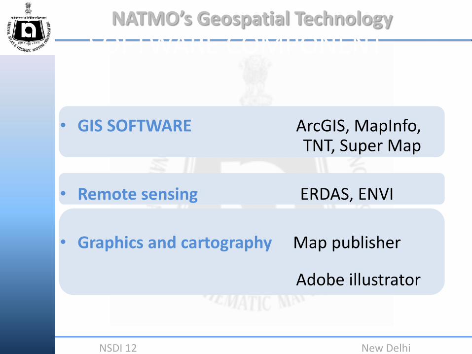
SOFTWARE COMPONENT
• GIS SOFTWARE ArcGIS, MapInfo, TNT, Super Map
• Remote sensing ERDAS, ENVI
• Graphics and cartography Map publisher
Adobe illustrator

NATMO’s Geospatial Technology
NSDI 12 New Delhi
A brief Account of the Digital Technology

NATMO’s Geospatial Technology
NSDI 12 New Delhi
DPMS BALANGIR DISTRICT
ODISHA

NATMO’s Geospatial Technology
NSDI 12 New Delhi

NATMO’s Geospatial Technology
NSDI 12 New Delhi
Database of River network DPMS-Balangir, Odisha

NATMO’s Geospatial Technology
NSDI 12 New Delhi
Road network

NATMO’s Geospatial Technology
NSDI 12 New Delhi
Amenities and Infrastructure

NATMO’s Geospatial Technology
NSDI 12 New Delhi
Locating a required information through query

NATMO’s Geospatial Technology
NSDI 12 New Delhi
Part of Main Map - Balangir
NATMO’s Geospatial Technology
NSDI 12 New Delhi
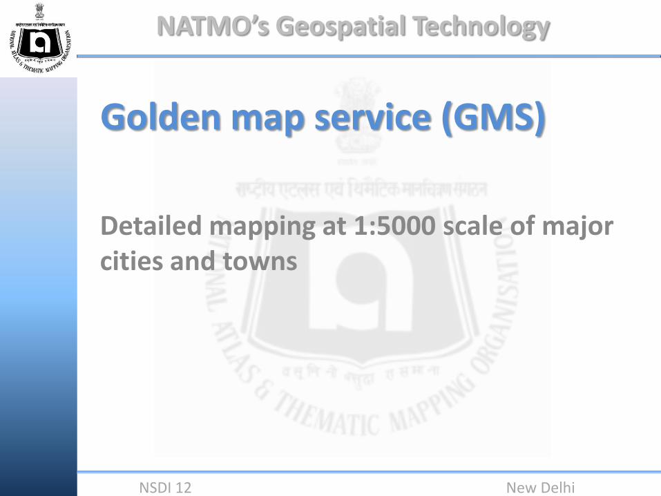
Golden map service (GMS)
Detailed mapping at 1:5000 scale of major cities and towns

NATMO’s Geospatial Technology
NSDI 12 New Delhi
The service will involve all thrust areas of geospatial technologies along with web, internet and communication technologies
Using the latest developments in IT, the National Atlas and Thematic Mapping Organisation (NATMO) would map the entire country down to the village level using spatial technology through its Golden Map Service
Vision

NATMO’s Geospatial Technology
NSDI 12 New Delhi
Procedure •Identification of area •Aquring high resolution satellite data (ikonos, digital globe, geoeye) •Rectification of images •Identifyng gps control points to collect in the field •Database creation and of basic layers •Data collection and field work •Incorporation of field data •Final map composition
NATMO’s Geospatial Technology
NSDI 12 New Delhi
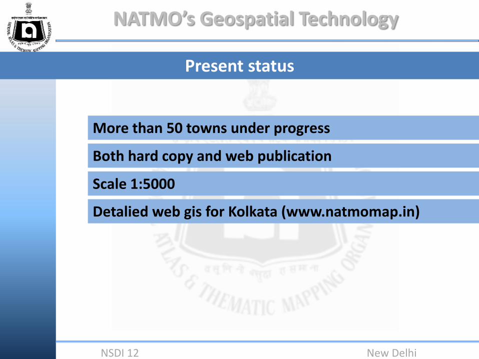
Present status
More than 50 towns under progress
Both hard copy and web publication
Scale 1:5000
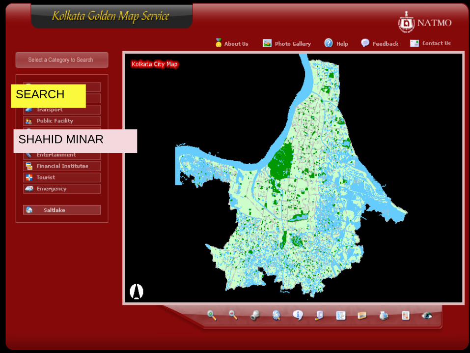
Detalied web gis for Kolkata (www.natmomap.in)

NATMO’s Geospatial Technology
NSDI 12 New Delhi
How we are doing…………….

NATMO’s Geospatial Technology
NSDI 12 New Delhi
Methodology
Data collection from NRSC
Identification of GCP locations
(sub scene wise)
Image rectification using collected GCP’s
Image enhancement
Remote sensing

NATMO’s Geospatial Technology
NSDI 12 New Delhi
Methodology
Calibration (projection, datum, units)
GPS
GCP collection
Down loading and processning

NATMO’s Geospatial Technology
NSDI 12 New Delhi
Methodology
GIS
Creation of basic data layers themewise (roads, buildings, drainage, waterbody, utilities etc.,)
Digitisation
Identification of priority area
Ground survey
Incorporation of ground data
Finalisation of map and scrutiny
Clearence from defence and SOI
Publication
For sub categories for each theme Sub types and domains has to be created. Necessary fields and columns should create for attribute data
Data standards

NATMO’s Geospatial Technology
NSDI 12 New Delhi
Scrutiny and finalisation
Manual of GMS guidelines
Methodology
Map composition
Digital cartography
Creation of standard symbol library

NATMO’s Geospatial Technology
NSDI 12 New Delhi
Clearance from defence and SOI
Methodology
Publication
Modifications and alterations
Hardcopy web
•Book dimension •No. of pages •Layout •Impostion •CMYK seperation •Offset printing
•Layer separation •Attribute data structuring •Web design •Web hosting

NATMO’s Geospatial Technology
NSDI 12 New Delhi
50,000 scale Toposheet grid
Projection: utm
Datum: WGS 84
Bangalore and Mysore

NATMO’s Geospatial Technology
NSDI 12 New Delhi
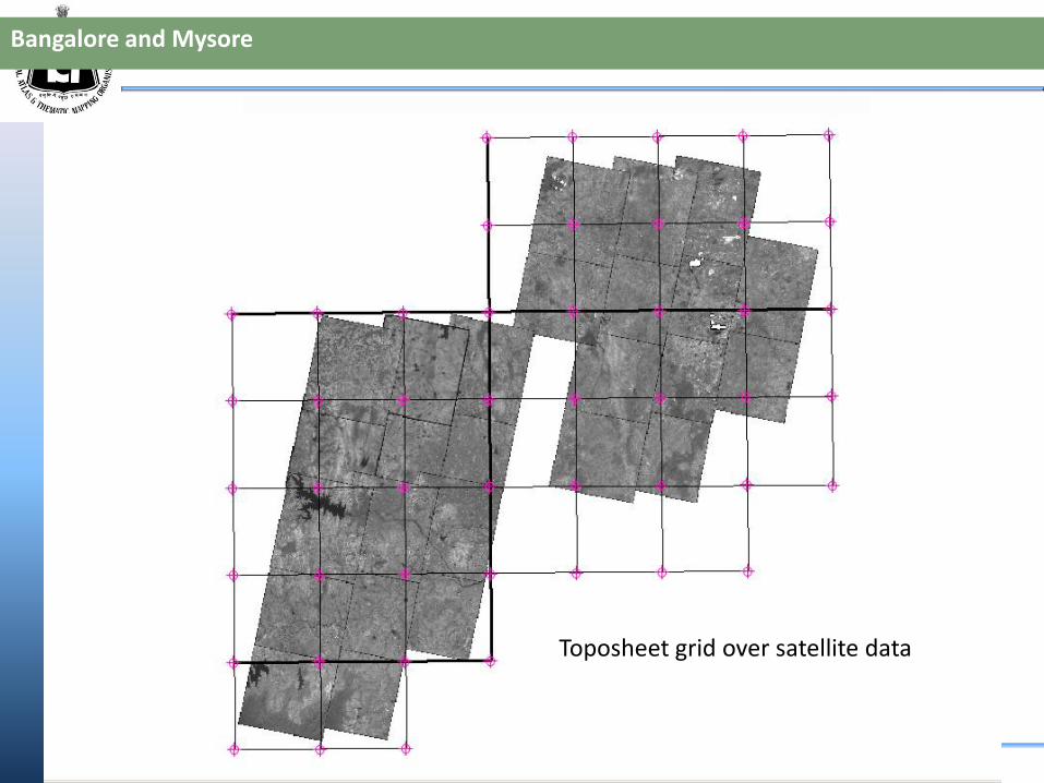
Bangalore and Mysore
26 subscenes of study area
Projection: utm
Datum: WGS 84
Bangalore
Mysore
NATMO’s Geospatial Technology
NSDI 12 New Delhi
Bangalore and Mysore
Toposheet grid over satellite data

NATMO’s Geospatial Technology
NSDI 12 New Delhi
GCP locations for one single subscene
Bangalore and Mysore

NATMO’s Geospatial Technology
NSDI 12 New Delhi
GCP location accuracy
Bangalore and Mysore
NATMO’s Geospatial Technology
NSDI 12 New Delhi
50,000 scale Toposheet grid
Projection: utm
Datum: WGS 84
Bangalore and Mysore
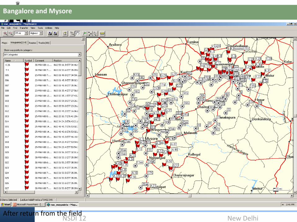
After return from the field

NATMO’s Geospatial Technology
NSDI 12 New Delhi
Bangalore and Mysore
Projected GCP’s
Projection: utm
Datum: wgs84

NATMO’s Geospatial Technology
NSDI 12 New Delhi
Rectification using gcp’s
Bangalore and Mysore

NATMO’s Geospatial Technology
NSDI 12 New Delhi
Bangalore and Mysore
Rectified images
Using 1st order polynominal
Transformations

NATMO’s Geospatial Technology
NSDI 12 New Delhi
After rectification
At 5000 scale
Bangalore and Mysore
Before rectification
At 5000 scale

NATMO’s Geospatial Technology
NSDI 12 New Delhi
Bangalore and Mysore

NATMO’s Geospatial Technology
NSDI 12 New Delhi
WHAT FOLLOWS POST RECTIFICATION?
DATABASE CREATION SOFTWARE USED ARC/GIS 9.3 SUPERMAP EXPRESS
INTIAL TASK IS TO TAKE UP ROAD NETWORK DATABASE WAS CREATED ACCORDINGLY DATA CAPTURING INITIATED

NATMO’s Geospatial Technology
NSDI 12 New Delhi
DETAIL OF LAYERSLayers - GORAKHPUR-
1 Religion 2 Landuse 3 Health
i Temple i Bult up Area i Hospital & Nursing Home 4 i
ii Church ii Park/Garden/Green Field ii Blood Bank ii
iii Mosque iii Water Body & Tank iii Clinic/Dispensary/Medical
Centre 8
iv Gurdwara iv Drain iv Pathological
Laboratory/Diagonostic i
v Jain & Buddhist Shrine v Cultivated Land v Eye Bank
vi Other Religious Centres vi Locality Name 9
vii Idgah vii Important Landmark i
viiiGraveyard ii
5 Telecom 6 Education 7 Entertainment 10
i Post Office i School i Shop & Business
Establishment/Agency i
ii Post & Telegraph Office ii College ii Cinema Hall ii
iii Telegraph Office iii University iii Theatre & Public Hall
iii
11 Public Utilities
iv Other Educational &
Training Institute
iv Club
iv
i Bus Terminal v Library v Hotel/Guest House v
ii Railway Reservation Counter vi Computer Training Centre vi Restaurent vi
iii Air Line Office vii Marriage House/Auditorium vii
iv Newspaper Office viii
v Fire Station 12 Communication 13 Railway
vi Police Station i Television Office i Any Railway Name 14
vii Bank ii Radio Office ii Railway Station Name
viiiMarket iii Mobile Tower
ix Milk Booth
x Public Call Office
FOLLOWING ATTRIBUTES ARE BEING ATTACHED IN DATABASE

NATMO’s Geospatial Technology
NSDI 12 New Delhi
DIGITIZATION IN ARC/GIS

NATMO’s Geospatial Technology
NSDI 12 New Delhi
DATA CAPTURING IN PROGRESS -ROADS ACCORDING TO IMPORTANCE

NATMO’s Geospatial Technology
NSDI 12 New Delhi
WORK PROGRESS IN SUPERMAP

NATMO’s Geospatial Technology
NSDI 12 New Delhi
JAIPUR - A COMPLETER VIEW

NATMO’s Geospatial Technology
NSDI 12 New Delhi
IMAGE REMOVED FROM BACKGROUND

NATMO’s Geospatial Technology
NSDI 12 New Delhi
LEGEND

NATMO’s Geospatial Technology
NSDI 12 New Delhi
JAIPUR CITY MAP - A BY PRODUCT OF GMS

NATMO’s Geospatial Technology
NSDI 12 New Delhi
NATMO’s Geospatial Technology
NSDI 12 New Delhi
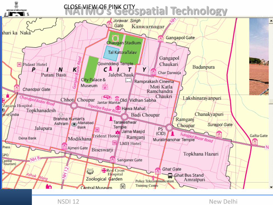
CLOSE VIEW OF PINK CITY

NATMO’s Geospatial Technology
NSDI 12 New Delhi
Mapping status
NATMO’s Geospatial Technology
NSDI 12 New Delhi
SEARCH
SHAHID MINAR

NATMO’s Geospatial Technology
NSDI 12 New Delhi
SHAHID MINAR

NATMO’s Geospatial Technology
NSDI 12 New Delhi
Kolkata Municipal
Corporation
SALT LAKE

NATMO’s Geospatial Technology
NSDI 12 New Delhi
SEARCH
NATMO
HEADQUARTERS

NATMO’s Geospatial Technology
NSDI 12 New Delhi

NATMO’s Geospatial Technology
NSDI 12 New Delhi
CREATE
BUFFER

NATMO’s Geospatial Technology
NSDI 12 New Delhi
Cartography as evident now has a varied field and thematic maps have their basis in geomorphology .All geological,soil,hydrological,vegetation and landuse maps simply serve thematic information in the initial phases.For example,Hydrological maps,besides supplying information on surface and groundwater,geological formations which support the accumulation of water,also include data on the shape of the river basins,density of relief dissection,slope of the land and hence the irrigation requirements of the region can be ascertained.

NATMO’s Geospatial Technology
NSDI 12 New Delhi
With the changing times it is required that constant updating to latest techniques is to be done . This is necessary as the problems challenging us are now manifesting themselves in newer forms also. The emphasis now is how to reduce casualties in times of natural calamities, how to prevent entire croplands from being turned unproductive, how to enhance better crop yields to feed the increasing population, rainwater harvesting in dry areas, preventing runoff and retaining soil moisture. Cartography can be successful if the output not only saves costs but time as well.GIS laboratories are essential now both for land surveys and mapping. Establishment of Digital Image Processing laboratories not only generate credibility and authority to cartographic products but in the long run result in better policy making. The provision for establishment of Geomorphic Informatics Cell with Remote Sensing and Geographic Information System (GIS) Laboratory will help in creation of a Geomorphic Database and National Data can be transferred, described and presented in National Spatial Data Infrastructure(NSDI) format.

NATMO’s Geospatial Technology
NSDI 12 New Delhi
These may be in the form of : i) The concept of Geomorphic Atlas of India beginning from Village Micro-level unit which can be user oriented based. ii)Chronological Development of Geomorphic Zones ( Mapping and Interpretation) Keeping pace with the demands of modern policy makers and planners NATMO has geared itself to use the latest technologies available to bring about improved accuracy and authenticity in its cartographic outputs. With digitisation becoming widespread the incorporation of geospatial techniques are necessary

NATMO’s Geospatial Technology
NSDI 12 New Delhi
With the help of modern state-of-the-art technologies in the field of map making, NATMO has also transitioned itself totally to grab the maximum use of various geo-spatial technologies in its activities. Now, geo-spatial techniques have become the life-line for preparation of micro, meso and macro-level maps in NATMO. Almost in every phase of its activity, geo-spatial data and techniques are the most essential tools to the scientists and researchers in NATMO. NATMO has already moved from paper map to digital map. Hence, NATMO has and will ever have a pivotal role in the path forward into the geo-spatial space of the country. Some important steps towards that are added hereunder;
NATMO’s Geospatial Technology
NSDI 12 New Delhi
Accordingly, NATMO has planned its Path forward into the Geospatial Space as well. With the advent of geo-spatial technologies, now cartographers have the resources to use various geo-spatial data which are at their fingertips electronically. Thematic Mapping has a key role to play in organising geospatial data. Precise location and identification of geo-attributes of a terrain to facilitate their pragmatic utilization in support of utility installations which can be spread over thousands of square kilometere is possible through geospatial data systems. Normally ground observers have to physically travel to collect data and there is a limit to the amount of data that can be collected in a particular time. Geospatial techniques can inspect infrastructures more frequently, with higher density, precision and time.

NATMO’s Geospatial Technology
NSDI 12 New Delhi
NATMO is the largest and most efficient government organisation in the country which is using and still has ample scope to use geo-spatial space in micro, meso and macro-level mapping for effective planning and development of the country. II. Database is the most important source for effective planning towards the development of a country. Framing of National Data Policy, establishment of NSDI are some initiatives taken-up by the Govt. in this regard. But still they are not sufficient to mitigate all the requirements in this arena. As NATMO has been using geo-spatial techniques and has expert knowledge of its use; in the near future, NATMO can become the richest and most reliable provider of geo-spatial data-base.

NATMO’s Geospatial Technology
NSDI 12 New Delhi
. Remote Sensing, GIS, and GPS techniques and their utilities rule the roost in this cyber-age. Our country is still not sufficient, though most capable in this sector, due to lack of proper monitoring only. If NATMO is entrusted and supported with appropriate infrastructure, it can become a vital source for catering geo-spatial data and other utilities which can be used for planning and development by the government bodies as well as the common people of the country. It can also impart training and support to different organisations, researchers, planners in effective use of geo-spatial techniques. IV. Issues related to Disaster-management, loss of fertile crop land due to land degradation and desertification, effective measures for environmental hazards and substantive steps for restricting pollution are the challenges to a developing nation in the present age. Use of geo-spatial technologies is the most effective and precise tool in this regard. Being a government organisation, NATMO can share its responsibility towards the above challenges by using its knowledge and resources in geo-spatial arena.

NATMO’s Geospatial Technology
NSDI 12 New Delhi
In recent times the spurt of interest in the planets of our solar system has opened up a new field of research. The surface morphology of the moon and the Mars are now being brought under scrutiny to determine their genesis. Thus planetary geomorphology is the new area for present day studies where geospatial analysis techniques can be utilized for resource analysis too. NATMO can definitely play a positive role here as a pioneer in our country for further analysis of such prospects using geospatial information of such locations.

NATMO’s Geospatial Technology
NSDI 12 New Delhi
NATMO has already started its journey to turn itself to be the most important source in the field of geo-spatial space of the country and is also executing tire-less research and activities to that effect.

NATMO’s Geospatial Technology
NSDI 12 New Delhi
Thus, Mapping of any region can thus be considered as an important factor to carry out any investigation based upon areal qualities and analysis can be based upon the attributes gathered. Layers of information can be incorporated in a single map or in a particular theme based one that can be brought under scrutiny.

NATMO’s Geospatial Technology
NSDI 12 New Delhi
In the words of Dr.APJ Abdul Kalam, “We need to explore how geospatial technology can help the bottom of the pyramid. Creating a sustainable development model for the 3 billion rural people involves linking data, information exchange and proper dissemination."
NATMO’s Geospatial Technology
NSDI 12 New Delhi
THANK YOU FOR YOUR KIND ATTENTION