romania monitoring station network to support egnos services … · 2018-10-05 ·...
TRANSCRIPT
978-1-5386-5925-0/18/$31.00 ©2018 IEEE
Romania Monitoring Station Network to Support EGNOS Services in Eastern Europe
Corina Nafornita Politehnica University of Timisoara
Timisoara, Romania [email protected]
Marius Otesteanu Politehnica University of Timisoara
Timisoara, Romania [email protected]
Michel Monnerat Thales Alenia Space
Toulouse, France [email protected]
Mercedes Reche Pildo Labs
Barcelona, Spain [email protected]
Monica Borda Technical University of Cluj-Napoca
Cluj-Napoca, Romania [email protected]
Simon Buehler ESA
Toulouse, France [email protected]
Ioan Nafornita Politehnica University of Timisoara
Timisoara, Romania [email protected]
Frédéric Bauer Thales Alenia Space
Toulouse, France [email protected]
Daniel Garcia Pildo Labs
Barcelona, Spain [email protected]
Daniela Tarniceriu Technical University of Iasi
Iasi, Romania [email protected]
Alexandru Isar Politehnica University of Timisoara
Timisoara, Romania [email protected]
Andrei Campeanu Politehnica University of Timisoara
Timisoara, Romania [email protected]
Àlex Ramonjoan Pildo Labs
Barcelona, Spain [email protected]
Vlad-Cosmin Vasile Technical University of Cluj-Napoca
Cluj-Napoca, Romania [email protected]
Abstract—Due to its geographical location, Romania is an ideal candidate for system performance monitoring at the border of EGNOS service area. Service volume simulations were made to assess the theoretical extension of coverage of EGNOS over the Romanian territory and beyond using potential future reference station locations in Romania with whom the Politehnica University of Timisoara has agreements in place. Three monitoring stations were deployed at technical universities from Timisoara, Cluj-Napoca and Iasi with the purpose of setting up an automatic reporting of EGNOS performances over Romania.
Keywords—EGNOS, SBAS, satellite navigation
I. INTRODUCTION
EGNOS (European Geostationary Navigation Overlay Service) is the European satellite-based augmentation system (SBAS) that complements the existing satellite navigation services provided by the US Global Positioning System (GPS). The system achieved certification of safety-of-life service in March 2011 [1], [2], [3]. EGNOS is a major element of the European Satellite Navigation Programme and currently exploited by the European GNSS Agency (GSA) and operated by the European Satellite Services Provider (ESSP) on behalf of the European Commission (EC). The system is based on a network of ground monitoring stations placed in known locations, receiving data from GPS satellites, and on the broadcasting of integrity information and differential corrections to users via geostationary satellites. Its ground segment is composed of reference stations (RIMS, Ranging & Integrity Monitoring Stations) inside and outside Europe which monitor the GPS satellites; control centers (MCCs, Mission Control Centers) and uplink stations (NLES, Navigation Land Earth Stations).
Due to its geographical location, Romania is an ideal
candidate for system performance monitoring at the border of EGNOS service area. Receivers placed in most parts of Romania will be able to track, in addition to EGNOS, also other SBAS, namely the Russian Federation’s System for Differential Corrections and Monitoring (SDCM) and India’s GPS Aided GEO Augmented Navigation system (GAGAN).
In this paper, we describe the activities during the contract “Study for a Monitoring Station for EGNOS to support services in Eastern Europe”, awarded in the frame of the ESA New Member States Industry Incentive Scheme. The aim was to provide valuable input to characterize the EGNOS performance at user level in border areas. We implemented activities related to establishing of an automatic reporting of EGNOS performance over Romania and assessment of other SBAS (co-located and highly off-boresight GEO) visible from Romania. The activities were:
1. Assessment and ranking of potential monitoring sites according to logistical, technical and physical access constraints,
2. Execution of macro-model based performance assessment to evaluate theoretical added value of chosen sites,
3. Establishing of IT infrastructure for automatic collection and merging of data collected by receivers,
4. Deployment of receivers at chosen sites: Politehnica University of Timisoara (UPT), Technical University of Cluj-Napoca (UTCN), Technical University Iasi (TUIASI),
5. Setup of automatic report generation with suitable content for EGNOS performance assessment with existing RIMS network,
6. Collection of additional SBAS data for GEOs in view of monitoring sites, especially from SDCM and GAGAN, for performances comparison with EGNOS data.
This activity has been funded by the European Space Agency through its New Member States Industry Incentive Scheme.

The paper is structured as follows: Section 2 presents the site selection task, Section 3 presents the deployment and validation phase, Section 4 shows the automatic reporting while the last section presents conclusions and future work.
II. SITE SELECTION
Service Volume simulations (SVS) of potential EGNOS performances improvements when using hypothetical additional RIMS sites in Romania were carried out using two different tools. The EGNOS Service Volume Simulator (ESVS) tool, operated by Thales Alenia Space France (TAS-F), was used to generate a baseline scenario (without additional RIMS) and reference performance maps (including additional RIMS) based on a calibrated macro-model allowing to produce preliminary results (keeping in mind well-known limitations of macro-models, such as the apparent improvement for collocated RIMS). On one hand, the SBASSimulator V1 tool [4] was used by UPT to execute the previously defined simulation scenario plan (to assess theoretical performance improvements for candidate locations given in Table 1) and to produce the associated performance results [5] after calibrating the tool against the ESVS baseline scenario and selected reference maps. A comparison with the ESVS reference maps was performed on the APV-1 service level (and the baseline scenario prior to introducing additional stations) for the sake of validation of the generated plots.
TABLE I. CANDIDATE SITES FOR HYPOTHETICAL RIMS LOCATED IN ROMANIA
Location/Code Coordinates
Longitude (°) Latitude (°)
Timisoara/TIM 21.214305 45.749461
Bucharest/BUC 26.117146 44.425232
Cluj-Napoca/CLU 23.641908 46.770604
Iasi/IAS 27.596907 47.174988
In Table 2, the different scenarios used for macro-model performance simulations (availability of EGNOS Service Level SL3/ Approach Procedure with Vertical Guidance APV-1) are presented. The theoretical contribution of the proposed locations as potential future RIMS sites to the extension of coverage of EGNOS over the Romanian territory and beyond is assessed.
Single RIMS scenarios (SCN_1 to SCN_4) were executed first to determine which site offers the best gain of coverage, followed by multiple RIMS scenarios (SCN_5 to SCN_9) in order to find the best trade-off between an optimized number of RIMS and the potential increase in availability. For a single additional RIMS, the highest theoretical gain in availability is observed for Iasi, the eastern-most location.
After execution and assessment of the multiple RIMS scenarios, the largest improvement in terms of availability coverage was obtained as expected using all four locations as RIMS stations: SCN_5 (Reference + Timisoara + Bucharest + Cluj-Napoca + Iasi). In Bucharest, a station was already deployed at ROMATSA, so this location was not considered in the site selection. While the SVS simulations were not a driver in network location definition, they provide
information for potential future studies on mission extensions.
TABLE II. SCENARIOS CONSIDERED: SINGLE RIMS SITES (SCN1-SCN4) AND MULTIPLE RIMS SITES (SCN5-SCN9)
Scenario RIMS Network
RIMS Network Type
SCN_1 Reference + Timisoara
Single RIMS sites
added
SCN_2 Reference + Bucharest
SCN_3 Reference + Cluj-Napoca
SCN_4 Reference + Iasi
SCN_5 Reference + Timisoara + Bucharest + Cluj-Napoca + Iasi
Multiple RIMS sites
added
SCN_6 Reference + Timisoara + Bucharest + Cluj-Napoca
SCN_7 Reference + Bucharest + Iasi
SCN_8 Reference + Cluj-Napoca + Iasi
SCN_9 Reference + Timisoara + Iasi
Selecting the locations of the monitoring stations from various sites has been demonstrated not to be an easy task, especially in a short time (duration of the project). Besides deploying a receiver in UPT, our approach was to focus on sites that are already well known and with which UPT has existing collaboration agreements: Technical Universities of Cluj-Napoca and Iasi. The advantages of using universities sites are summarized below:
1. UPT has agreements in place with these universities,
2. There is no big restriction regarding installation in the respective buildings,
3. The universities have internet access, and network configuration can be done easily,
4. There are on-site personnel to monitor and control the stations.
The main challenges observed was the difficulty to install antennas in places with a clear sky visibility in order to receive all the satellites theoretically in view (in particular SBAS with very low elevation). While in Timisoara and Cluj-Napoca the chosen positions satisfy this requirement, in Iasi the presence of the water tower, a large and very close obstacle, even if it does not affect the visibility of geostationary satellites, diminishes the sky visibility and the number of satellites used to compute the PVT (position, velocity and precise time) solution, leading to a decrease in the availability. The water tower corresponds to masking at azimuth angles between 255º and 285º (W).
The locations of monitoring stations are the following:
Timisoara: Building of UPT in Bd. Mihai Viteazu 1 corner with Bd. Vasile Parvan No. 2. Coordinates: 45°44’50’’N, 21°13’34’’E;
Cluj-Napoca: Building of UTCN in Calea Dorobantilor 93. Coordinates: 46°46’29’’N, 23°36’26’’E;
Iasi: Building of TUIASI in Bd. Carol I 11A. Coordinates: 47°10’27’’N, 27°34’16’’E.

III. STATION DEPLOYMENT
The necessary equipment for the monitoring stations of the EGNOS Romanian network [6] is given below:
• Three (3) multi-frequency GNSS antennas capable of receiving at minimum GPS, Galileo, GLONASS and BeiDou as well as SBAS EGNOS, SDCM and GAGAN.
• Three (3) multi-frequency SBAS-enabled GNSS receivers capable of tracking at minimum GNSS GPS, Galileo, GLONASS and BeiDou as well as SBAS EGNOS, SDCM and GAGAN with raw-data output capabilities.
• All necessary mountings, attachments and connectors (cables etc).
• Three (3) PildoBoxes to collect and merge receiver data and automatically upload files to the server to generate performance reports.
• Data Archival Server to host the web monitoring service and to serve as FTP for on-demand remote access of stored data (provided by Pildo Labs).
The antenna and receiver selected are:
• Antenna Novatel GNSS 850 with the specifications: L1/L2/L5 GPS, L1/L2/L3 GLONASS, B1/B2/B3 BEIDOU, E1/E5/E5a/E5b/E6 GALILEO, L-band, and
• Receiver Novatel Flexpak6, FLEX6-TAS-B0G-TTN, with specifications: GPS+GLONASS+GALILEO, L1/L2/L5/E1/E5a/E5b/AltBOC, SBAS, DGPS, NovAtel CORRECT RT-2 Base, GL1DE, 20 Hz Measurements, 20 Hz Positions, NTRIP.
The deployed monitoring network consists of two main blocks:
1. Remote sites (x3): GNSS antenna (Novatel GNSS 850), GNSS receiver (Novatel Flexpak6) and PildoBox (Linux OS, processor Broadcom BCM2837 ARM7 Quad Core powered Single Board Computer running at 900MHz, 1.0 GB RAM),
2. Central server: Windows Server 2012 R2, processor Intel® Core™ i7-6700 CPU@ 3.40GHz, 32.0 GB RAM, 64-bit Operating System, x64-based processor.
The architecture of the network is schematically shown in Fig. 1. GNSS data is collected by the remote sites and stored in hourly data files. These data files are sent every hour to the central server. Upon their arrival to the server, the files are directly available to be downloaded through the Legal Recording section of the web application The OWL (GNSS monitoring software property of Pildo Labs). The central processing server is in charge of storing data collected by the sites. The data can be downloaded by the user prior user and password identification. The central server is also in charge to automatically process and report about required GNSS performances.
Fig. 1. Network architecture.
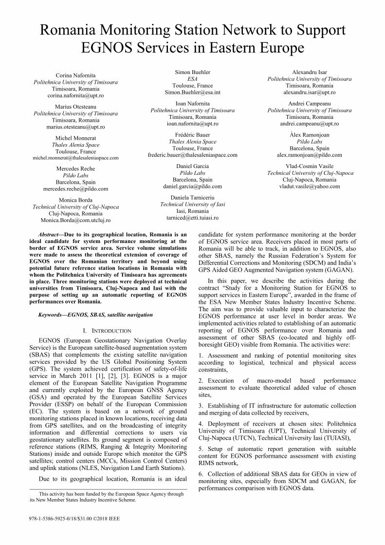
The deployment of the stations was done by Romkatel at the end of 2017 (Timisoara) and early 2018 (Cluj and Iasi), see Fig. 2. After that, the results obtained were analysed (the receiver as well as its deployment environment must be validated with respect to several criteria applicable to each frequency band: L1/E1, E5a/L5). The verification aimed at validating that:
1. There is no masking, or evaluating the masking angle of the site;
2. There is neither attenuation nor interference sources;
3. The level of multipath is low;
4. GEO satellites messages are correctly received all along the day.
For validation purposes, a data collection campaign has been carried out during 27 consecutive hours for each station. For all three monitoring stations, the following diagrams were generated by Pildo Labs: sky plot, visibility plot, multipath and GEO signals reception. The diagrams include all GPS active satellites and four SBAS satellites: EGNOS 120 & 123 and GAGAN 127 & 128.
The performance in terms of GEO signals receptions at the time of first deployment of the three monitoring stations are given in Tables 3, 4 and 5.
In the case of Timisoara, the installation was considered to be successful (see Table 3).
TABLE III. GEO SIGNALS RECEPTION IN TIMISOARA
GEO signals reception
GEO 120 GEO 123 GEO 127 GEO 128
Number of samples (% of total)
97127 (99.92%)
97200 (100.00%)
97197 (99.99%)
97119 (99.92%)
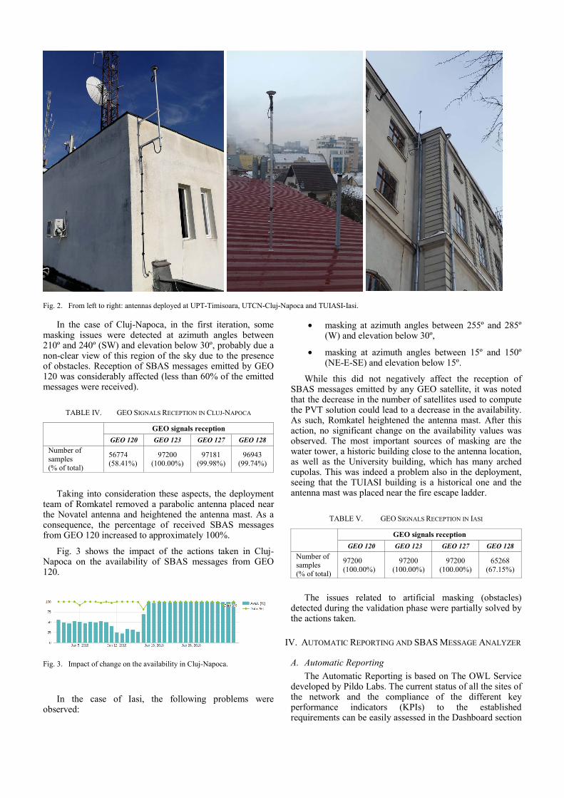
Fig. 2. From left to right: antennas deployed at UPT-Timisoara, UTCN-Cluj-Napoca and TUIASI-Iasi.
In the case of Cluj-Napoca, in the first iteration, some masking issues were detected at azimuth angles between 210º and 240º (SW) and elevation below 30º, probably due a non-clear view of this region of the sky due to the presence of obstacles. Reception of SBAS messages emitted by GEO 120 was considerably affected (less than 60% of the emitted messages were received).
TABLE IV. GEO SIGNALS RECEPTION IN CLUJ-NAPOCA
GEO signals reception
GEO 120 GEO 123 GEO 127 GEO 128
Number of samples (% of total)
56774 (58.41%)
97200 (100.00%)
97181 (99.98%)
96943 (99.74%)
Taking into consideration these aspects, the deployment team of Romkatel removed a parabolic antenna placed near the Novatel antenna and heightened the antenna mast. As a consequence, the percentage of received SBAS messages from GEO 120 increased to approximately 100%.
Fig. 3 shows the impact of the actions taken in Cluj-Napoca on the availability of SBAS messages from GEO 120.
Fig. 3. Impact of change on the availability in Cluj-Napoca.
In the case of Iasi, the following problems were observed:
• masking at azimuth angles between 255º and 285º (W) and elevation below 30º,
• masking at azimuth angles between 15º and 150º (NE-E-SE) and elevation below 15º.
While this did not negatively affect the reception of SBAS messages emitted by any GEO satellite, it was noted that the decrease in the number of satellites used to compute the PVT solution could lead to a decrease in the availability. As such, Romkatel heightened the antenna mast. After this action, no significant change on the availability values was observed. The most important sources of masking are the water tower, a historic building close to the antenna location, as well as the University building, which has many arched cupolas. This was indeed a problem also in the deployment, seeing that the TUIASI building is a historical one and the antenna mast was placed near the fire escape ladder.
TABLE V. GEO SIGNALS RECEPTION IN IASI
GEO signals reception
GEO 120 GEO 123 GEO 127 GEO 128
Number of samples (% of total)
97200 (100.00%)
97200 (100.00%)
97200 (100.00%)
65268 (67.15%)
The issues related to artificial masking (obstacles) detected during the validation phase were partially solved by the actions taken.
IV. AUTOMATIC REPORTING AND SBAS MESSAGE ANALYZER
A. Automatic Reporting
The Automatic Reporting is based on The OWL Service developed by Pildo Labs. The current status of all the sites of the network and the compliance of the different key performance indicators (KPIs) to the established requirements can be easily assessed in the Dashboard section
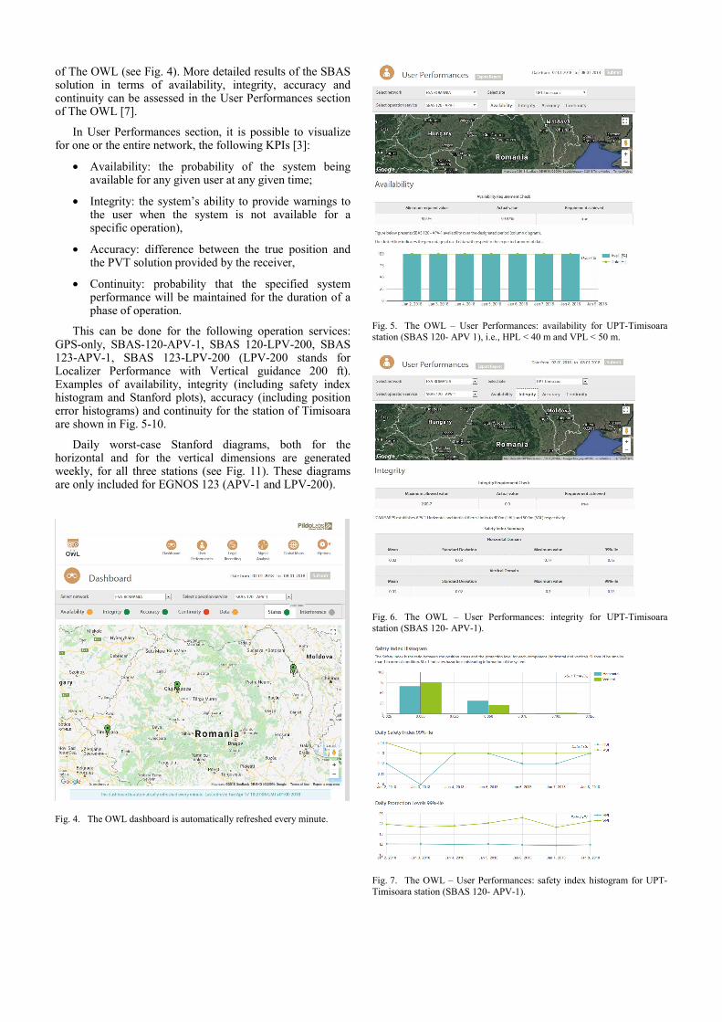
of The OWL (see Fig. 4). More detailed results of the SBAS solution in terms of availability, integrity, accuracy and continuity can be assessed in the User Performances section of The OWL [7].
In User Performances section, it is possible to visualize for one or the entire network, the following KPIs [3]:
• Availability: the probability of the system being available for any given user at any given time;
• Integrity: the system’s ability to provide warnings to the user when the system is not available for a specific operation),
• Accuracy: difference between the true position and the PVT solution provided by the receiver,
• Continuity: probability that the specified system performance will be maintained for the duration of a phase of operation.
This can be done for the following operation services: GPS-only, SBAS-120-APV-1, SBAS 120-LPV-200, SBAS 123-APV-1, SBAS 123-LPV-200 (LPV-200 stands for Localizer Performance with Vertical guidance 200 ft). Examples of availability, integrity (including safety index histogram and Stanford plots), accuracy (including position error histograms) and continuity for the station of Timisoara are shown in Fig. 5-10.
Daily worst-case Stanford diagrams, both for the horizontal and for the vertical dimensions are generated weekly, for all three stations (see Fig. 11). These diagrams are only included for EGNOS 123 (APV-1 and LPV-200).
Fig. 4. The OWL dashboard is automatically refreshed every minute.
Fig. 5. The OWL – User Performances: availability for UPT-Timisoara station (SBAS 120- APV 1), i.e., HPL < 40 m and VPL < 50 m.
Fig. 6. The OWL – User Performances: integrity for UPT-Timisoara station (SBAS 120- APV-1).
Fig. 7. The OWL – User Performances: safety index histogram for UPT-Timisoara station (SBAS 120- APV-1).
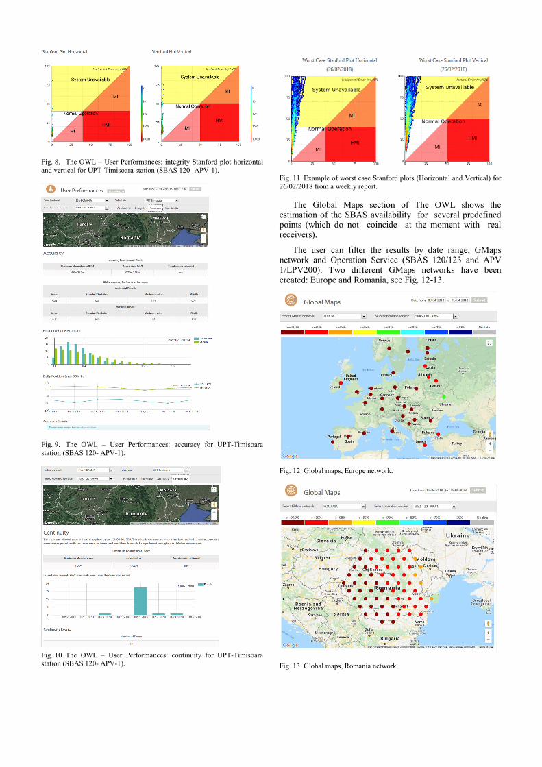
Fig. 8. The OWL – User Performances: integrity Stanford plot horizontal and vertical for UPT-Timisoara station (SBAS 120- APV-1).
Fig. 9. The OWL – User Performances: accuracy for UPT-Timisoara station (SBAS 120- APV-1).
Fig. 10. The OWL – User Performances: continuity for UPT-Timisoara station (SBAS 120- APV-1).
Fig. 11. Example of worst case Stanford plots (Horizontal and Vertical) for 26/02/2018 from a weekly report.
The Global Maps section of The OWL shows the estimation of the SBAS availability for several predefined points (which do not coincide at the moment with real receivers).
The user can filter the results by date range, GMaps network and Operation Service (SBAS 120/123 and APV 1/LPV200). Two different GMaps networks have been created: Europe and Romania, see Fig. 12-13.
Fig. 12. Global maps, Europe network.
Fig. 13. Global maps, Romania network.
B. SBAS Message Analyzer SMAN tool
The SBAS Messages Analyzer (SMAN) [8] is a software developed by Pildo Labs in the frame of this project. It allows to decode, compare and assess information on all RTCA MOPS DO-229D-compliant Message Type (MT), especially MT2-5 fast pseudorange corrections (PRC_FC) and UDREi_FC; MT6 integrity information UDREi_Integrity; MT10 degradation parameters; MT18 Ionospheric Grid Point mask; MT24 mixed fast / long term satellite error corrections pseudorange corrections (PRC), UDREi as well as delta positions; MT25 long term satellite error corrections delta positions and delta velocities, as well as clock correction parameters; MT26 ionospheric delay corrections GIVEi and IGP Vertical Delay Estimate; MT27/28 delta UDRE factors.
All the information contained within the SBAS messages is divided in four main sections:
• Satellite Information: MT1 – PRN Mask Assignments, MT2-5 – Fast Corrections, MT6 – Integrity Information, MT24-25 – Slow Corrections.
• Ionospheric Information: Ionospheric Grid Points
o Grid Ionospheric Vertical Error
o IGP Vertical Delay Estimate
• Other Information: MT10 – Degradation Parameters, MT27 – SBAS Service Message, MT28 – Clock-Ephemeris Covariance Matrix.
• General Information: Carrier to Noise ratio (CNO), Cycle slips, Message Summary for each GEO satellite.
Fig. 14. SMAN – SBAS Messages Categories.
Fig. 15. SMAN – Message summary table for EGNOS 120.
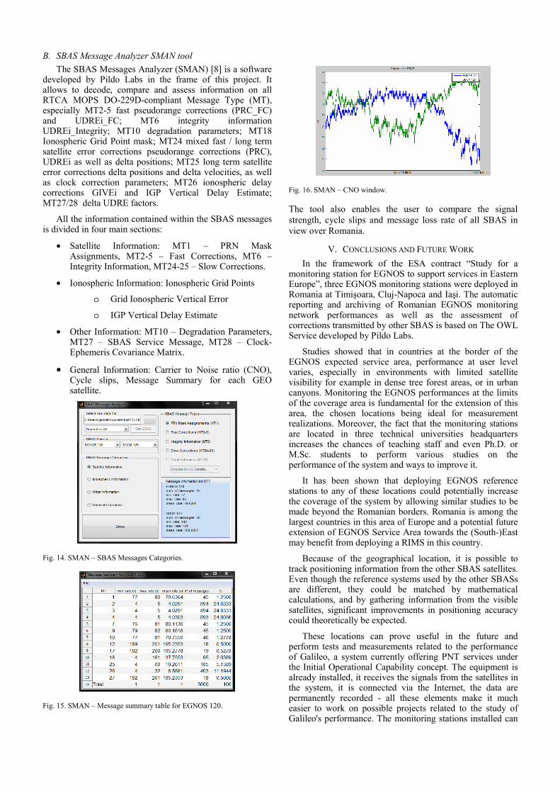
Fig. 16. SMAN – CNO window.
The tool also enables the user to compare the signal strength, cycle slips and message loss rate of all SBAS in view over Romania.
V. CONCLUSIONS AND FUTURE WORK
In the framework of the ESA contract “Study for a monitoring station for EGNOS to support services in Eastern Europe”, three EGNOS monitoring stations were deployed in Romania at Timişoara, Cluj-Napoca and Iaşi. The automatic reporting and archiving of Romanian EGNOS monitoring network performances as well as the assessment of corrections transmitted by other SBAS is based on The OWL Service developed by Pildo Labs.
Studies showed that in countries at the border of the EGNOS expected service area, performance at user level varies, especially in environments with limited satellite visibility for example in dense tree forest areas, or in urban canyons. Monitoring the EGNOS performances at the limits of the coverage area is fundamental for the extension of this area, the chosen locations being ideal for measurement realizations. Moreover, the fact that the monitoring stations are located in three technical universities headquarters increases the chances of teaching staff and even Ph.D. or M.Sc. students to perform various studies on the performance of the system and ways to improve it.
It has been shown that deploying EGNOS reference stations to any of these locations could potentially increase the coverage of the system by allowing similar studies to be made beyond the Romanian borders. Romania is among the largest countries in this area of Europe and a potential future extension of EGNOS Service Area towards the (South-)East may benefit from deploying a RIMS in this country.
Because of the geographical location, it is possible to track positioning information from the other SBAS satellites. Even though the reference systems used by the other SBASs are different, they could be matched by mathematical calculations, and by gathering information from the visible satellites, significant improvements in positioning accuracy could theoretically be expected.
These locations can prove useful in the future and perform tests and measurements related to the performance of Galileo, a system currently offering PNT services under the Initial Operational Capability concept. The equipment is already installed, it receives the signals from the satellites in the system, it is connected via the Internet, the data are permanently recorded - all these elements make it much easier to work on possible projects related to the study of Galileo's performance. The monitoring stations installed can

also be used in various other studies. For example, due to the fact that all are in urban areas, a comparative study could be made between improving GPS navigation using EGNOS on the one hand and improving navigation using the Assisted GPS (A-GPS), a feature supported by virtually all navigation systems built into state-of-the-art mobile phones, which enables improved positioning accuracy by using the geographic information of Wi-Fi hotspots and nearby cellular antennas.
REFERENCES [1] P. Misra, and P. Enge, Global positioning system: Signals,
measurements and performance, 2nd edition, Ganga-Jamune Press, USA, Massachusetts, 2012.
[2] H. Secretan, J. Giraud, R. Kameni, S. Rougerie, L. Ries, M. Monnerat, “SAGAIE, a GNSS Network for investigating ionospheric behavior in sub-Saharan region,” Inside GNSS, 9, 46–58, 2014.
[3] ESA, EGNOS architecture, http://www.navipedia.org/index.php/EGNOS_Architecture.
[4] SBASSimulator V1 manual, http://www.iguassu.cz/sbas-sim.
[5] TAS-F, UPT, Service-Volume Simulation Report, Study for a monitoring station for EGNOS to support services in Eastern Europe, ESA contract, 2017.
[6] UPT, TAS-F, Pildo Labs, Final Report, Study for a monitoring station for EGNOS to support services in Eastern Europe, ESA contract, 2018.
[7] D. Garcia and À. Ramonjoan, The OWL User Manual, Version 1.2, 25/07/2017.
[8] À. Ramonjoan, SBAS Message Analyser Tutorial, Version 1.1, 2018.