rupture, seismic waves, and shaking. earthquake origins and seismic waves –focus point where...
TRANSCRIPT
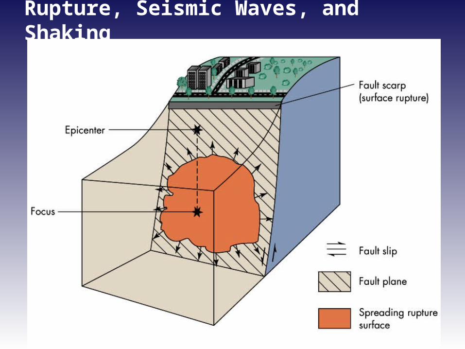
Rupture, Seismic Waves, and Shaking
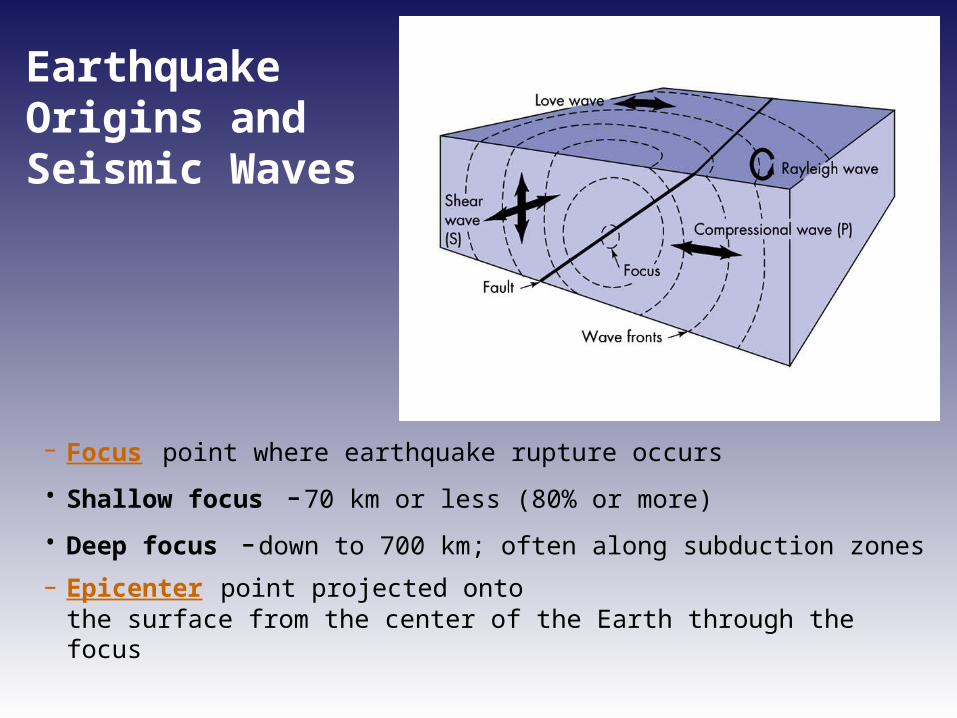
Earthquake Origins and Seismic Waves
– Focus point where earthquake rupture occurs
• Shallow focus -70 km or less (80% or more)
• Deep focus -down to 700 km; often along subduction zones
– Epicenter point projected onto the surface from the center of the Earth through the focus
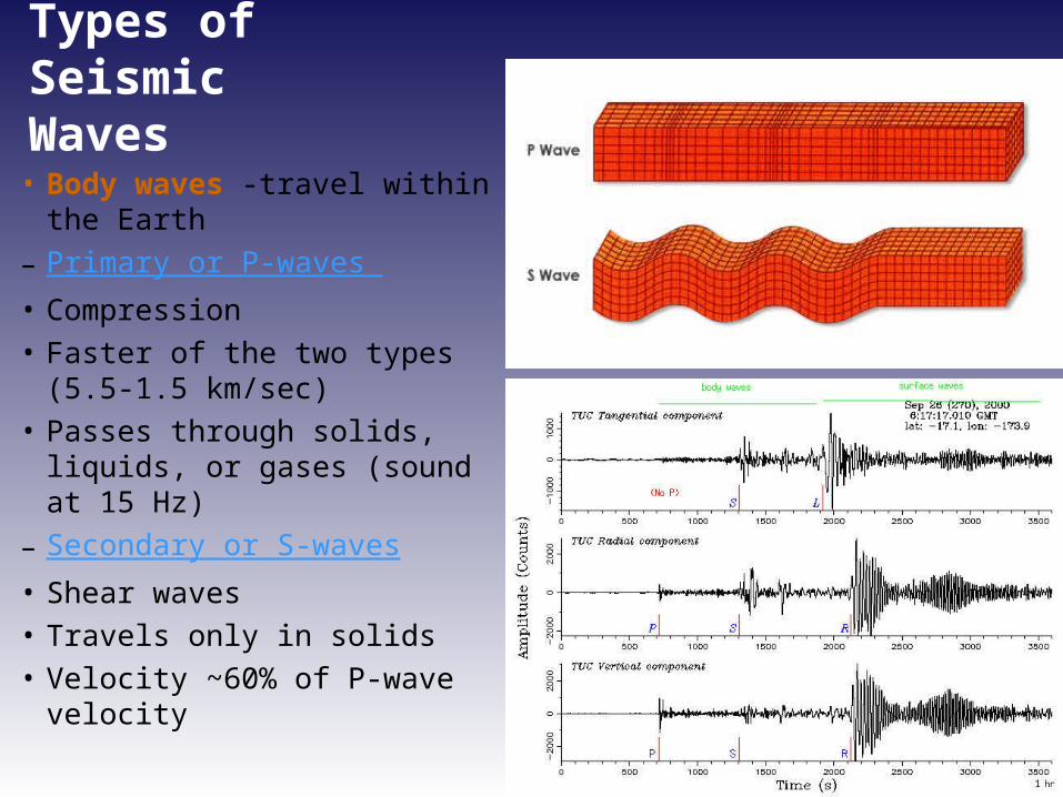
Types of Seismic Waves
• Body waves -travel within the Earth
– Primary or P-waves • Compression • Faster of the two types (5.5-1.5
km/sec)• Passes through solids, liquids, or
gases (sound at 15 Hz)– Secondary or S-waves• Shear waves• Travels only in solids• Velocity ~60% of P-wave velocity
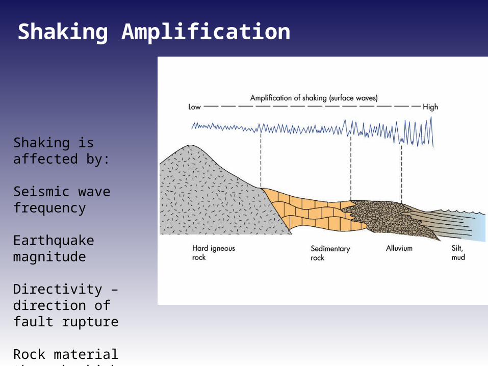
Shaking Amplification
Shaking is affected by:
Seismic wave frequency
Earthquake magnitude
Directivity – direction of fault rupture
Rock material through which seismic wave propagates
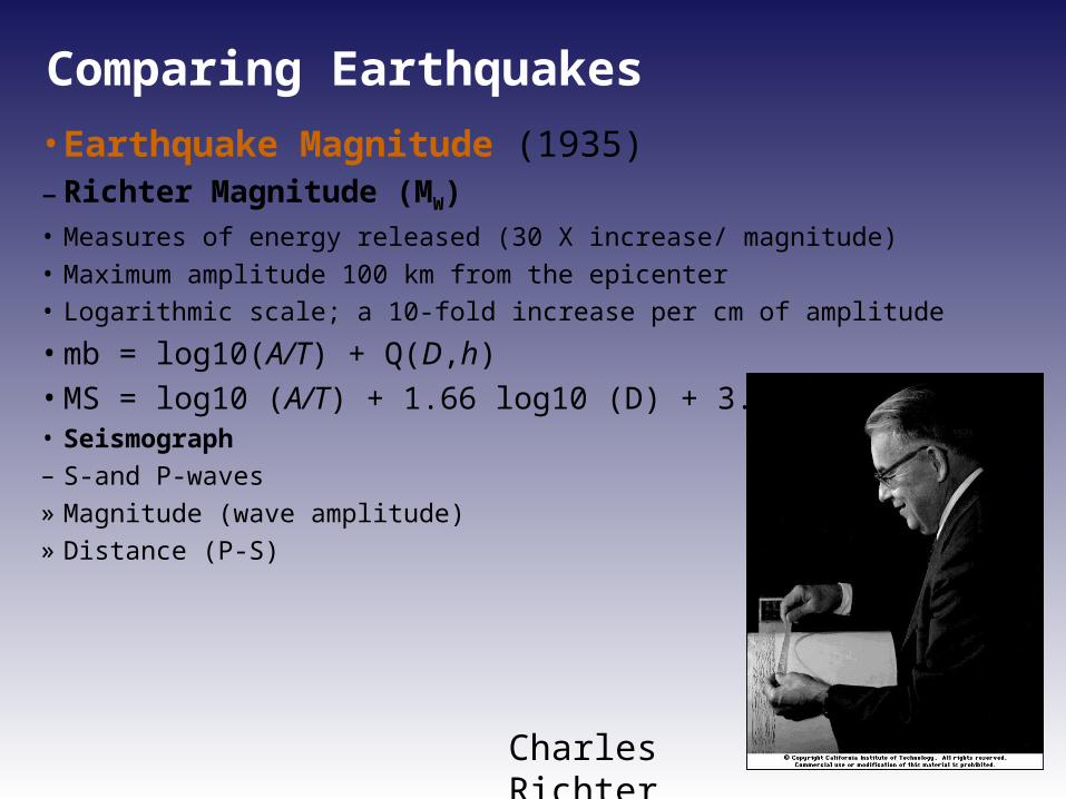
Comparing Earthquakes
• Earthquake Magnitude (1935)– Richter Magnitude (MW) • Measures of energy released (30 X increase/ magnitude)• Maximum amplitude 100 km from the epicenter• Logarithmic scale; a 10-fold increase per cm of amplitude
• mb = log10(A/T) + Q(D,h) • MS = log10 (A/T) + 1.66 log10 (D) + 3.30 • Seismograph – S-and P-waves » Magnitude (wave amplitude)» Distance (P-S)
Charles Richter
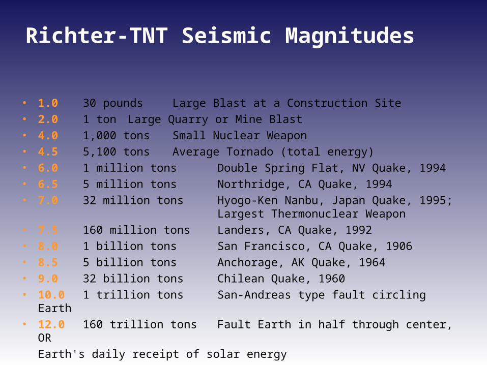
Richter-TNT Seismic Magnitudes
• 1.0 30 pounds Large Blast at a Construction Site
• 2.0 1 ton Large Quarry or Mine Blast
• 4.0 1,000 tons Small Nuclear Weapon
• 4.5 5,100 tons Average Tornado (total energy)
• 6.0 1 million tons Double Spring Flat, NV Quake, 1994
• 6.5 5 million tons Northridge, CA Quake, 1994
• 7.0 32 million tons Hyogo-Ken Nanbu, Japan Quake, 1995; Largest Thermonuclear Weapon
• 7.5 160 million tons Landers, CA Quake, 1992
• 8.0 1 billion tons San Francisco, CA Quake, 1906
• 8.5 5 billion tons Anchorage, AK Quake, 1964
• 9.0 32 billion tons Chilean Quake, 1960
• 10.0 1 trillion tons San-Andreas type fault circling Earth
• 12.0 160 trillion tons Fault Earth in half through center, OR
Earth's daily receipt of solar energy
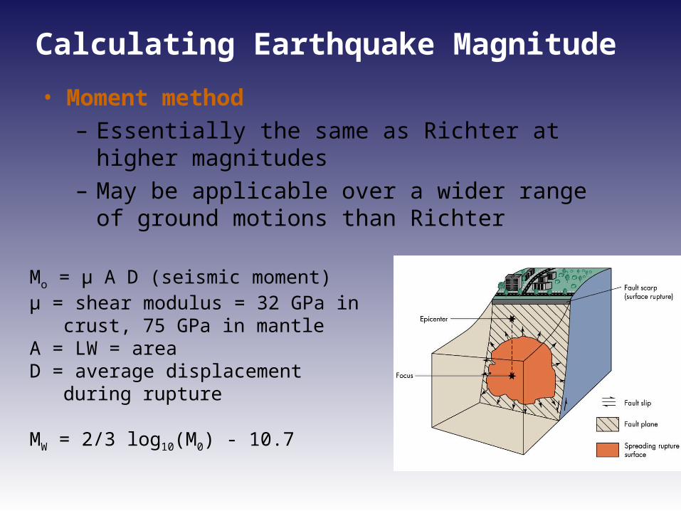
Calculating Earthquake Magnitude
• Moment method– Essentially the same as Richter at higher
magnitudes– May be applicable over a wider range of ground
motions than Richter
Mo = µ A D (seismic moment)µ = shear modulus = 32 GPa in crust, 75
GPa in mantleA = LW = areaD = average displacement during rupture
MW = 2/3 log10(M0) - 10.7
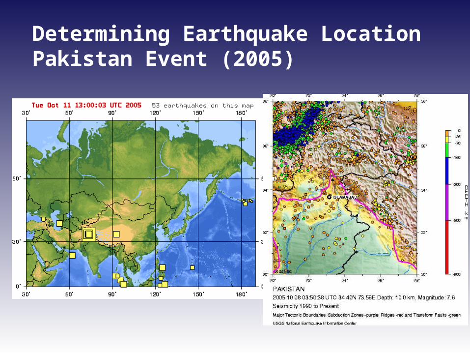
Determining Earthquake LocationPakistan Event (2005)
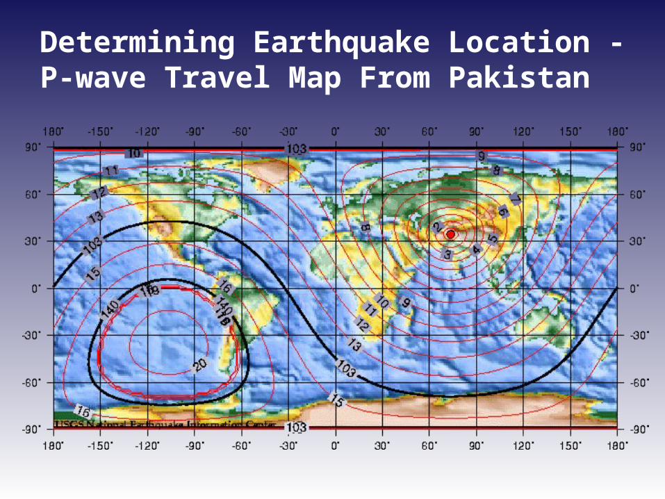
Determining Earthquake Location -P-wave Travel Map From Pakistan

Determining Earthquake Location
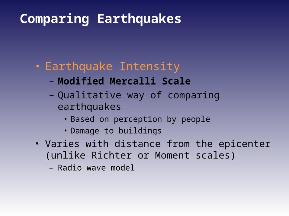
Comparing Earthquakes
• Earthquake Intensity – Modified Mercalli Scale– Qualitative way of comparing earthquakes
• Based on perception by people• Damage to buildings
• Varies with distance from the epicenter (unlike Richter or Moment scales)– Radio wave model
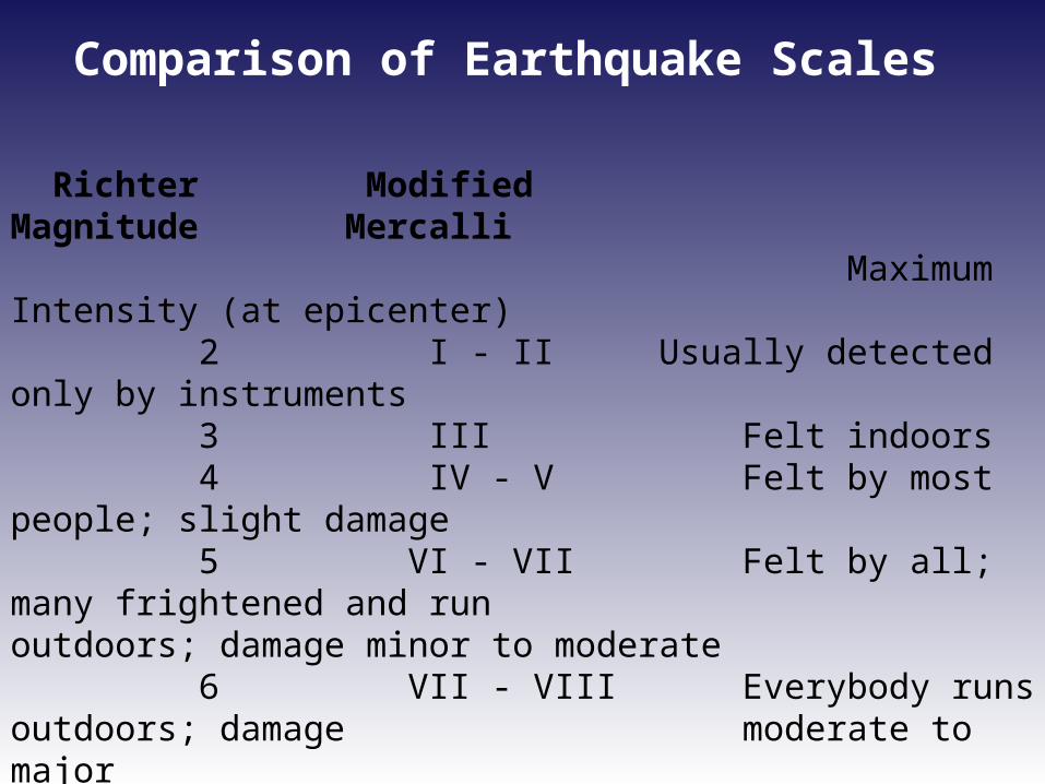
Richter Modified Magnitude Mercalli Maximum Intensity (at epicenter) 2 I - II Usually detected only by instruments 3 III Felt indoors 4 IV - V Felt by most people; slight damage 5 VI - VII Felt by all; many frightened and run
outdoors; damage minor to moderate 6 VII - VIII Everybody runs outdoors; damage
moderate to major 7 IX - X Major damage 8+ X - XII Total and major damage
After Charles F. Richter, 1958, Elementary Seismology.
Comparison of Earthquake Scales
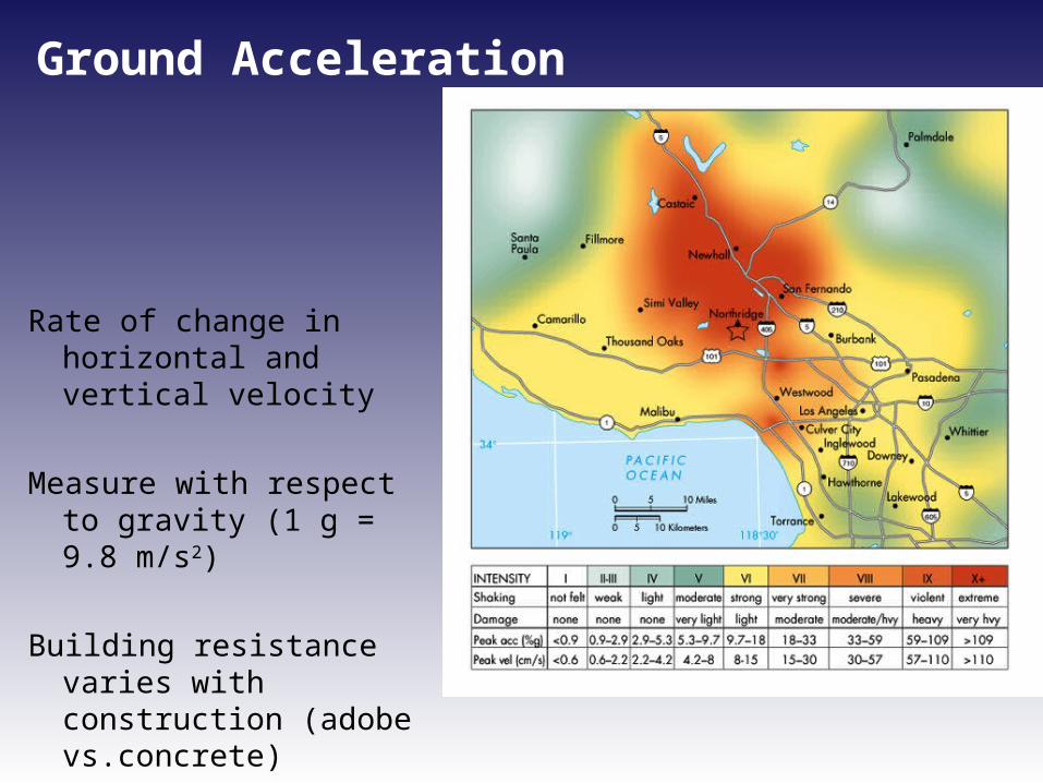
Ground Acceleration
Rate of change in horizontal and vertical velocity
Measure with respect to gravity (1 g = 9.8 m/s2)
Building resistance varies with construction (adobe vs.concrete)
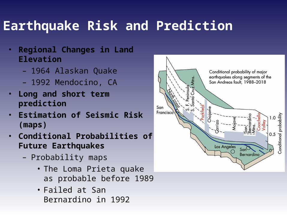
Earthquake Risk and Prediction
• Regional Changes in Land Elevation– 1964 Alaskan Quake – 1992 Mendocino, CA
• Long and short term prediction• Estimation of Seismic Risk (maps)• Conditional Probabilities of Future
Earthquakes– Probability maps
• The Loma Prieta quake as probable before 1989
• Failed at San Bernardino in 1992
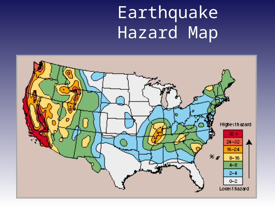
EarthquakeHazard Map
Florida’s Earthquake History
• Basically aseismic (i.e., little activity) since Paleozoic
• Only about 6 "real" earthquakes (until 2006!) – 1879-location unknown; felt in Fla. and Ga. – 1893-Jacksonville – 1933-Palatka – 1945-offshore Miami – 1973-Merritt Island – 1975-Daytona Beach (most recent)
• 1998 Panhandle (Jay fault; epicenter near Brewton,Alabama; MR = 4.5)

2006 Gulf of Mexico Event
More information available at:http://www.clas.ufl.edu/users/rrusso/florida_eq.html