rv poseidon pos530 cruise report - geomar
TRANSCRIPT

Cruise Report POS530, Kiel (Germany) – Kiel (Germany), 1rst
– 21rst
October 2018 Page 1
RV Poseidon POS530
Cruise Report
„MineMoni 2018“ Mine Monitoring in the German Baltic Sea 2018;
Environmental baseline study testing UDEMM Best Practices
01rst – 21rst October 2018,
Kiel (Germany) – Kiel (Germany)
Chief Scientists: Prof. Dr. Jens Greinert & Mareike Kampmeier
GEOMAR Helmholtz Centre for Ocean Research Kiel
Editors: Kampmeier, M.; Greinert, J.; Strehse, J.; Beck, A.J.; Wichert, U.; Diller, N.; Kurbjuhn, T.;
Wenzlaff, E.; Schröder, J.
2018

Cruise Report POS530, Kiel (Germany) – Kiel (Germany), 1rst
– 21rst
October 2018 Page 2
Table of Contents
1 Cruise Summary ........................................................................................................... 3
1.1 Summary ................................................................................................................ 3
1.2 Zusammenfassung .................................................................................................. 3
2 Participants ................................................................................................................... 4
2.1 Principal Investigators ............................................................................................. 4
2.2 Scientific Party ........................................................................................................ 4
2.3 Participating Institutions .......................................................................................... 5
2.4 Crew ....................................................................................................................... 5
3 Research Program ........................................................................................................ 6
3.1 Aims of the Cruise ................................................................................................... 6
3.2 Agenda of the Cruise .............................................................................................. 6
3.3 Methods and devices .............................................................................................. 8
3.4 Descriptions of the Working Areas ........................................................................ 13
4 Narrative of the Cruise ............................................................................................... 15
5 Preliminary Results: Hydroacoustic and optical seafloor mapping ........................ 17
5.1 Gelting Bight ......................................................................................................... 17
5.2 Fehmarn ............................................................................................................... 20
5.3 Lübeck Bight ......................................................................................................... 30
5.4 Rügen ................................................................................................................... 39
6 Preliminary Results: Geochemistry ........................................................................... 41
7 Acknowledgements .................................................................................................... 44
8 References .................................................................................................................. 45
9 Appendix ....................................................................................................................... 1
9.1 Overall Station List .................................................................................................. 1

Cruise Report POS530, Kiel (Germany) – Kiel (Germany), 1rst
– 21rst
October 2018 Page 3
1 Cruise Summary
1.1 Summary
Poseidon cruise POS530 took place within the framework of the BMBF – funded UDEMM project
(Environmental monitoring for the delaboration of munition in the sea). There are two overarching goals
in this cruise: One is to test and verify the best practices developed in the UDEMM project during a large
scale Baltic sampling and mapping cruise (-> blueprint for coming monitoring cruises). The second is to
acquire the first scientifically acquired baseline data set of the contamination by munition contaminants
(incl. TNT) in the vicinity of some of the munition dump sites in the Baltic Sea. Three main sites were
chosen based on historic reconstruction work prior to the survey. The transits to and in between those
sites were planned along former constraint routes during WWII. These routes were main target of the
British Air Force and mines and bombs can be expected along these ways. During transits water samples
were taken with CTD-rosette-mounted Niskin bottles in regular distances in order to get a dense cluster
of TNT measurements across the German Baltic Sea. First action inside the research areas always was
the high-resolution hydroacoustic mapping. Based on the findings, stations for the following program
were planned. This included additional water sampling, the deployment of mussel bags for
biomonitoring, AUV surveys with the GIRONA 500, Subbottom Profiler and ADCP profiles, underwater
video surveys and sediment sampling. By the use of these methods the areas are surveyed and analyzed
in terms of their munition content and distribution (as objects on the seafloor, but also dissolved inside
the water), their sedimentary composition (subseafloor and surficial sediments) and their current
regime.
1.2 Zusammenfassung
Die Poseidon Ausfahrt POS530 erfolgte im Rahmen des BMBF- geförderten UDEMM Projekts
(Umweltmonitoring für die Delaboration von Munition im Meer). Dazu wurden zwei übergreifende Ziele
definiert: Zum Einen sollen in UDEMM entwickelte Methoden in einer groß-skaligen Kartierungs- und
Bepropungsausfahrt in der Ostsee getested und verifiziert werden um in Zukunft als Vorlage für
breitangelegte Monitorings zu fungieren. Zum Anderen geht es darum die ersten wissenschaftlichen
Ausgangsdaten zur Kontamination durch sprengstofftypische Verbindungen (u.a. TNT) in einigen
belasteten Gebieten in der deutschen Ostsee zu generieren. Drei Hauptarbeitsgebiete wurden auf Basis
von historischen Recherchearbeiten vor Beginn der Ausfahrt bestimmt. Die Transitstrecken zu und
zwischen den Untersuchungsgebieten wurden entlang von ehemaligen Zwangswegen geplant. Diese
Routen wurden im zweiten Weltkrieg verstärkt von der Britischen AirForce bombadiert, wodurch hier
mit Bomben und Minen zu rechnen ist. Während der Transits wurden in regelmäßigen Abständen
Wasserproben in Niskin Flaschen genommen, die auf einer CTD-Rosette angebracht sind. So soll ein
dichtes Netz von TNT Messungen für die deutsche Ostsee entstehen. In den Untersuchungsgebieten
begannen die Arbeiten jeweils mit einer hochaufgelösten hydroakustischen Kartierung. Basierend auf
den Ergebnissen wurden dann die Stationen für weitere Wasserproben, Muschelstationen für
Biomonitoring, AUV Tauchgänge mit dem GIRONA 500 AUV, Subbottom Profiler und ADCP Profile,
unterwasser Video Profile, sowie Sedimentproben bestimmt und durchgeführt. Mithilfe der
beschriebenen Methoden werden die einzelnen Gebiete untersucht und in Hinblick auf ihre
Munitionsvorkommen und -Verteilung (als Objekte auf dem Meeresboden, sowie als Lösungen im
Wasser), der sedimentologischen Zusammensetzung (im Untergund und an der
Meeresbodenoberfläche), sowie ihres Strömungsregimes analysiert.

Cruise Report POS530, Kiel (Germany) – Kiel (Germany), 1rst
– 21rst
October 2018 Page 4
2 Participants
2.1 Principal Investigators
Name Institution
Beck, Aaron J., Dr. GEOMAR
Greinert, Jens, Prof. GEOMAR
Kampmeier, Mareike, M.Sc. GEOMAR
Maser, Edmund, Prof. GEOMAR
Schlosser, Christian, Dr. CAU Kiel
Strehse, Jennifer, M.Sc. CAU Kiel
2.2 Scientific Party
Name Discipline Institution
Greinert, Jens Marine Geology / Chief Scientist GEOMAR
Kampmeier, Mareike Marine Geology / Senior Scientist GEOMAR
Gazis, Iason Marine Geology GEOMAR
Leimann, Ilmar Marine Geology GEOMAR
Michaelis, Patrick. Marine Data Science GEOMAR
Gonzalez Avalos, Everardo Marine Data Science GEOMAR
Beck, Aaron J. Marine Geochemistry GEOMAR
Schlosser, Christian Marine Geochemistry GEOMAR
Dietz, Alexandra Marine Geochemistry GEOMAR
Lösel, Christiane Marine Geochemistry GEOMAR
Hamisch, Stephan Marine Geochemistry GEOMAR
Diller, Nicolaj AUV Team GEOMAR
Schröder, Jens AUV Team GEOMAR
Kurbjuhn, Torge AUV Team GEOMAR
Barua, Ayushman AUV Team GEOMAR
Faber, Claas Data Management GEOMAR
Maser, Edmund, Prof. Toxicology CAU Kiel
Strehse, Jennifer Toxicology CAU Kiel
Appel, Daniel Toxicology CAU Kiel
Wichert, Uwe Historic Analysis MELUND
Sternheim, Jens Historic Analysis MELUND
Essen, Frido Yung Jin Film Team Radio Bremen
Rübing, Tobias Film Team Radio Bremen
Wangenheim, Lür Film Team Radio Bremen
Duda, Jan Scientific Diver CAU Kiel
Pagel, Tanja Scientific Diver CAU Kiel
Caskie, Benedikt Scientific Diver CAU Kiel
Weber, Florian Scientific Diver CAU Kiel

Cruise Report POS530, Kiel (Germany) – Kiel (Germany), 1rst
– 21rst
October 2018 Page 5
Ulrich, Jana Scientific Diver CAU Kiel
Jürgens, Fritz Scientific Diver CAU Kiel
2.3 Participating Institutions
GEOMAR Helmholtz-Zentrum für Ozeanforschung Kiel
CAU Christian-Albrechts-Universität zu Kiel
MELUND Ministerium für Energiewende, Landwirtschaft, Umwelt, ländliche Räume und
Digitalisierung Schleswig-Holstein
Figure 1: The scientific crew was frequently exchanged during the survey. According to special scientific needs,
people were brought on board by support of the THW and German Navy.
2.4 Crew
Name Rank
Günther, Matthias Master
von Keller, Magnus Chief Officer
Hannß, Robin 2nd Officer
Kröger, Kurre Klaas Chief Engineer
Pieper, Carsten 2nd Engineer
Neitzel, Gerd Electrician
Meiling, Ralf Motorman
Mischker, Joachim Bosun
Rauh, Bernd SM
Heßelmann, Dirk SM
Schrage, Frank SM
Kuhn, Ronald AB
Heyne, Roland SM

Cruise Report POS530, Kiel (Germany) – Kiel (Germany), 1rst
– 21rst
October 2018 Page 6
Kosanke, Patrick Cook
Gerischewksi, Bernd Steward
3 Research Program
3.1 Aims of the Cruise
This ship proposal aims at testing new best practices for mapping munition contaminated areas, sample
water and sediment and perform bio-indicator monitoring. Those practices have been recently
developed in the BMBF funded project UDEMM (Environmental Monitoring for the Delaboration of
Munition in the Sea; https://udemm.geomar.de/) that investigates the potential contamination (TNT,
ADNT [amino dinitrotoluene], Pb, Hg) from dumped munition of the marine environment. At the same
time, the cruise will be the first scientifically sound baseline study for the state of contamination in the
water, the sediment and fauna within the German Baltic Sea.
3.2 Agenda of the Cruise
The cruise was set up for three weeks with four main areas (Gelting Bight, Fehmarn, Lübeck Bight and
Rügen) and transits in between:
Area Date Program
Transit Kiel-Gelting Bight 01.-02.10.2018 CTD
SVP
MBES (calibration)
Gelting Bight Area 01 02.- 04.10.2018 SVP
MBES
CTD
TV-CTD
Grab
ADCP
Gelting Bight Area 02 03.-04.10.2018 SVP
MBES
CTD
TV-CTD
Grab
AUV
Diver (Mussel bags)
SBP
ADCP
Transit Gelting Bight-Fehmarn 04.-05.10.2018 CTD
GoFlo
Fehmarn Area 01 05.-05.10.2018 MBES
Fehmarn Area 02 05.-10.10.2018 SVP
MBES
CTD
TV-CTD

Cruise Report POS530, Kiel (Germany) – Kiel (Germany), 1rst
– 21rst
October 2018 Page 7
Grab
AUV
Diver (Mussel bags)
SBP
ADCP
Transit Fehmarn – Lübeck Bight 10.-11.10.2018 SVP
MBES
CTD
Lübeck Bight Area 01 11.-17.10.2018 SVP
MBES
CTD
TV-CTD
Grab
AUV
SBP
ADCP
Lübeck Bight Area 02 13.-17.10.2018 SVP
MBES
CTD
GoFlo
TV-CTD
Grab
AUV
Diver (Mussel bags)
SBP
ADCP
Transit Lübeck Bight - Rügen 17.-18.10.2018 CTD
GoFlo
Rügen 18.-20.10.2018 SVP
MBES
CTD
GoFlo
TV-CTD
SBP
Grab
Transit Rügen - Kiel 20.-21.10.2018 CTD
GoFlo
Due to the extensive work program and the limited space on board, several crew exchanges were
required.

Cruise Report POS530, Kiel (Germany) – Kiel (Germany), 1rst
– 21rst
October 2018 Page 8
3.3 Methods and devices
3.3.1 Acoustic mapping by ship based multibeam
Most of the working areas have not been mapped in high resolution before and only single findings or
information in historic documents exist. Working areas are generally deeper than 12m in order to
operate RV POSEIDON. A RESON T50 system was used and installed in the moon pool. If available (close
enough to land) we were able to use RTK correction for the GPS position. Motion compensation will be
done with a SBG Apogee-U INS system (installed next to the moonpool on deck) and an OCTANS motion
unit (inside the lab) as redundant system. Sound velocity profiles were acquired with a Valeport Swift
SVP Profiler. GPS and RTK data was controlled via the Septentrio AsteRx-U Marine Full multi-frequency
(GPS, GLONASS, Galileo, Beidou) GNSS receiver (Figure 2). The two Septentrio GNSS antennas were
mounted on the Back parallel to the vessel with 2m separation. Offsets were measured from shore with
a theodolite, using the SBG INS as zero point inside the coordinate system (Table 1).
Table 1: Measured and calculated offsets of the MBES system.
Device X Stbd + Y Fwd + Z down +
Apogee 0.000 m 0.000 m 0.000 m
AsteRx-U 0.930 m 7.680 m 1.669 m
SeaBat T50-P 7.371 m 5.371 m -5.328 m
Device Pitch Roll Heading
SeaBat T50-P 0.530° -0.268° -5.280°
Data acquisition occured with QPS QINSy (in UTM32/33) and processing was done with QPS Qimera and
QPS FMGT to derive multibeam and backscatter information which is further processed with SAGA and
ArcGIS for supervised and unsupervised object detection. We used the public available Baltic Sea
bathymetric data set emodnet. The time needed to complete each survey is based on a 3.5kn survey
speed; this will guarantee dense soundings in the along-track direction. Profile spacing had to be chosen
as dense as possible, but also in a way that it could be navigated by the vessel crew. Therefore the
spacing had to be 20 m minimum, which did not always give 50% overlap (depending on the water
depth).

Cruise Report POS530, Kiel (Germany) – Kiel (Germany), 1rst
– 21rst
October 2018 Page 9
Figure 2: System overview of the RESON Seabat T50-P system.
3.3.2 Acoustic sub seafloor mapping with ship based subbottom profiler (SBP)
The Edgetech SBP is usually integrated into the GEOMAR AUV ‘Abyss’, but a special mounting frame
enabled us to acquire ship based SBP data. The frame was attached to the sidepole and navigation came
in from a mobile Hemisphere GPS antenna right above the pole (Figure 3). Settings were 4.0-24.0 kHz
and 5 ms pulse length.
Figure 3: Side pole on the aft deck with the Subbottom Profiler attached.

Cruise Report POS530, Kiel (Germany) – Kiel (Germany), 1rst
– 21rst
October 2018 Page 10
3.3.3 Oceanographic determination of contaminants distribution via ADCP
The German Maritime and Hydrographic Agency (BSH) runs a 3D circulation model (BSHcmod) as an
operational ocean prediction model for the Baltic Sea augmented with a multivariate data assimilation
system. The BSH provides 72 hours forecast data via the GeoSeaPortal (https://www.geoseaportal.de).
The knowledge of the oceanographic conditions during time of station work will allow us to adjust
sampling strategies. We used a vessel-mounted ADCP during the cruise.
3.3.4 Optical observations by AUV
The new Autonomous Underwater Vehicle (AUV) Girona500 was recently bought from IQUA Robotics in
Spain. This is the second test cruise of the vehicle after the delivery to Geomar.
The Girona500 is an AUV with a size of 1m x 1m x 1,5m. It consists of three main hulls that are
connected with an aluminum structure. The total weight of up to 200 kg are packed with all necessary
electronics and thrusters to maneuver in five degrees of freedom. It is capable of diving up to 500m
deep and has a battery for a mission duration of up to 8 hours. The payload area with 35l of volume
makes it valuable for scientists, as it can be packed with additional instruments for specialized tasks. The
computer manages all interfaces to the sensors and has additional ports for the payload sensors.
For calculating its current position, the vehicle is equipped with a high precision inertial measurement
system (INS). This sensor also uses additional information about its environment from other sensors and
fuses them to a position: A Doppler velocity log (DVL) is giving the altitude and the relative velocity over
ground, a pressure sensor contributes the depth of the AUV and on the surface GPS is also taken into
account. Via an USBL transceiver on the ship and an USBL transponder on the AUV, it is possible to add
absolute positioning measurements when the vehicle is submerged. In this case, the modems are also
being used for sending basic information between the AUV and the control station or even simple
commands. When on surface, the AUV can be controlled over a WIFI connection.
Furthermore, a CTD is permanently installed to measure pressure, salinity, temperature and
conductivity.
The basic sensors include:
INS: IXblue Phins Combat C3
The internal navigation unit that processes sensor data and provides position
information.
The error of this INS is in range of 0,15° for heading and 0,05° for roll and pitch.
This leads to a 0.3% DT position accuracy.
DVL: Teledyne RDI Explorer 600kHz
This device measures the velocity relative to the sea floor and its altitude.
CTD: Sea-Bird SBE 49 FastCAT
This measurement device acquires the conductivity, temperature and the
pressure of the water and calculates the sound velocity.
Pressure sensor: Valeport ultraP
This sensor measures the pressure and converts it to water depth.
USBL: Evologics S2CR 18/34
The Evologics S2CR 18/34 modem combines underwater acoustics and
positioning.
GPS: Quectel l86 GNSS module
The GPS is used to determine the absolute position at the surface.

Cruise Report POS530, Kiel (Germany) – Kiel (Germany), 1rst
– 21rst
October 2018 Page 11
Additional sensors for this cruise:
Four LED lights: The lights are used to illuminate the sea floor. They will be turned on by the
operator at the start of the mission.
Two Cameras: GoPro cameras
The two GoPro cameras were mounted and configured to take an image every 2
seconds
Multibeam Imagenex 837B DeltaT 4000
The optionally mounted multibeam sonar is used for mapping purposes.
The software is based on the widely used Robot Operating System (ROS) that suits the modular design
perfectly. It offers efficient ways to integrate new software nodes into the system because every
component works independently. The architecture is focused on defining interfaces that every
component in the system can listen and broadcast to.
The AUV is operated with a Graphical User Interface (GUI) that is used for checking the system prior to a
mission, mission planning, execution and mission monitoring. Therefore it needs a connection to the
USBL modem, the GPS of the ship and the WIFI access point of the vehicle.
The main goal of this cruise for the AUV is to prove its value to the scientific community. This new
technology needs to be explored and integrated into the workflows of the scientists as it offers a new
approach with its hovering capability as well as its open architecture regarding hard- and software.
Getting to know the vehicle, its limits and its possibilities is the main focus. Since the system is quite
new, there will be some configuration and errors happening that have to be addressed by the operators.
This experience will be gathered and put into a improved version for future cruises using this AUV.
The missions are described in more detail in the following section.
All data is recorded in a Rosbag-file. This is a standard format in that ROS records data. Each Rosbag-file
consists of binary data and holds sequences of records. The specific format can be found at
http://wiki.ros.org/Bags/Format.
3.3.5 Optical observations by towed camera
The Video-CTD was used to perform video-tows with real-time seafloor annotation using the OFOP
software. All the information will be immediately incorporated into cruise GIS project for further
planning. AUV operations will be during the day, Video-CTD tows will also happen during the night. Both
systems will use USBL navigation (if needed at the same time). Video footage will be stored and
backuped on board and later transferred to GEOMARs Media-Server ProxSys.
3.3.6 Water sampling and pre-concentrating of water for munition compound
analyses
During WW II the constraint routes were main target of the British air force. Accordingly mines and
aerial bombs can be expected along these ways. The transit routes were planned along those former
constraint routes and water samples shall be taken every 10 km, in order to get a dense cluster of TNT
measurement across the German Baltic Sea. Water samples will be collected using either CTD-rosette-
mounted Niskin bottles or an ultraclean pump and tubing system. Dissolved munition compounds (TNT,
Hg, Pb) will be extracted from seawater and preconcentrated onboard with an automated solid-phase
extraction device. The resulting sample cartridges will be stored frozen until the end of the cruise, and
transported to the laboratory at GEOMAR for further processing and analysis. Particulate samples from
the water column will be collected on filters.

Cruise Report POS530, Kiel (Germany) – Kiel (Germany), 1rst
– 21rst
October 2018 Page 12
3.3.7 Sediment sampling with VanVeen grab
Sediment sampling stations were planned based on the backscatter of the certain area. The sediment is
needed as groundtruth to correlate sediment properties (water content and grain size) to backscatter
amplitudes. Therefore sediment was collected inside a plastic bag for grain size analysis and in small pre-
weight container for water content analysis. A small volume of surface sediments (~200 mL) were
collected in plastic bags and stored frozen for further geochemical processing and analysis.
3.3.8 Deployment of bio-monitoring stations
After identification of a larger munition contaminated area with exposed Schiesswolle mussel bags with
5 to 10 mussels will be placed very close to the explosives. Limiting water depth for the mussels is 20 m.
Depending on the size of the investigated areas, 4 mussel bags per area should be deployed. The
recovery is planned after a defined period of time, depending on the amount of open explosives
discovered in the investigated area. In any case one part of the mussel bags will be recovered by divers
during the cruise always at the end of the station work in the respective working area. The other part
will stay in the area to be recovered at a later stage using FK LITTORINA from GEOMAR (3-4 months
later). The analysis of the mussels using GC/MS-MS will be performed at the Institute of Toxicology and
Pharmacology for Natural Scientists - University Medical School SH in Kiel after the cruise. The moorings
were deployed by a dive team of scientific divers from the CAU Kiel. Their boat was stored on deck for
the whole cruise and launched into the water when needed.
Figure 4: Scetch of a mussel mooring. A buoy is attached to a calcearous sandstone. One net is attached at the bottom, the other one in 1 m height above the seafloor. Two passive sampler are attached right below the upper mussel net.

Cruise Report POS530, Kiel (Germany) – Kiel (Germany), 1rst
– 21rst
October 2018 Page 13
3.4 Descriptions of the Working Areas
3.4.1 Gelting Bight
Water depth 13 – 22 m; the Gelting Bight is located at the end of the outer Flensburg Fjord.
The Gelting Bight is a very safe area for ships against bad weather conditions. Nearly the complete three
sides, west-, south- and east leg are protected by coastline, only the northern part is open to Flensburg
Fjord. In end of WW II, beginning in April 1945, the German Navy dislocated all units without battle
order in the Flensburg Fjord, Gelting Bight and Fjord Schlei. The main reason for the dislocation was the
lack of fuel (oil and coal). In beginning of May 1945, 39 submarines different types sunk themselves in
the bight (Operation Regenbogen). All subs were full equipped. After 5th May, 2 flotillas with Fast Patrol
Boats (FPB) and some Guard-ships anchored in Gelting Bight. On 10th May the FPB Support unit “CARL
PETERS” was hit by an UK ground mine and sunk. The westside of Gelting Bight, directly connected with
the Flensburg Fjord is the dumping area of 200 missiles V 1 from 03rd May 1945. The ship “MARIE
LOUISE” loaded 200 of the missiles I Flensburg and dumped the complete cargo between Bokholm and
the bight. Nearly 40 parts of the missiles, complete objects ort parts of the missiles were found in
further time. The central Gelting Bight, “Jürgensflach” was the last place for two redumped ships with a
cargo from more as 1600 to Green Ring III (Tabun) CW artillery shells. All shells were recovered, stored
in containers and redumped in the North Atlantic.
3.4.2 Fehmarn Belt and Fehmarn Sound
Water depth 15 – 35 m; both straits have been important locations in WW II. The Fehmarn Sound and
the approach areas were protected by the island Fehmarn and the continent against weather conditions
and enemy attacks. The Fehmarn Belt, a “deep water way” was the route for bigger ships to the Baltic
Sea. After beginning air mining by the Royal Air Force (RAF) on 13th /14th April 1940, the German Navy
established constraint routes (Figure 5). These straits were secured by guard ships, marked with buoys,
lighthouse ships and fixed guardships with Anti-aircraft weapons.
Figure 5: Historic map from the western German Baltic Sea with the constraint routes (BAMA Freiburg RM 45 I 181 Sperrkmdt w. Ostsee).

Cruise Report POS530, Kiel (Germany) – Kiel (Germany), 1rst
– 21rst
October 2018 Page 14
The constraint routes were numbered and divided in different parts. The route Fehmarn Belt was the
way Nr. 1 and the parts were from red 5 on the westside to red 7 on the east side, the way in Fehmarn
Sound was Nr. 5. For the Royal Navy as Planning Command and the RAF as Operating Command were
both straits one target and was named garden “Radish”. In this target, the RAF dropped at all 450
ground mines. 11 ships sunk or were damaged.
On the other side, the German Navy swept continuously the constraint route and swept nearly 80 % of
the dropped mines. In end of WW II, the area, the air attacks from the Fighter Command with fighter
and intruder hit and destroyed a number of ships. On the East-cape of Fehmarn, Staberhuk, was the
meeting point for nearly 25 ships and submarines, 5 ships sunk, the others were damaged.
3.4.3 Lübeck Bight
Water depth 13-23 m; for the Lübeck Bight, two dumping areas were established.
Figure 6: Historic document, giving coordinates of sea dumping ground for munition after the WW II (National Archive Kew / UK).
A later German document from Civil-EOD descript the area and shows a complete number of dumped
Ammunition with 60 000 tons, 50 000 tons in Pelzerhaken-area and 10 000 tons in Haffkrug-area (Figure
6). In time 1950-1960, a civil company recovered nearly 15 000 tons of different kinds Ammunition
(mostly bombs and heavy artillery shells). But 45 000 tons ore more, are still at sea.
Beginning from 1rst December 1945, the ammunitions were transported by trains to Lübeck Schlutup,
loaded from trains to Hubber-barges and were sent in the dumping areas. The sonar screens with a high
density of contacts show us the dumping points from the barges with dump a cargo of more as 100 tons
in every run.
3.4.4 Rügen
Water depth 35-45 m; along the coastline from Kiel to Kaliningrad (former Königsberg) the main traffic
strait was the “Zwangsweg 1” Two “gardens”, “Sweet Pea” with the Kadet-Rinne and “Willow” the area
of Rügen and Sassnitz were established by Royal Navy and mined by RAF. 671 mines were dropped in
“Sweet Pea” and 341 mines in “Willow” 75 ships were damaged or sunk in these minefields. Nearly the
complete area alongside the coastline were used for military activities as exercise and live firing area for
anti-aircraft artillery, coastal artillery, and the Airforce. North of Rügen, the Navy needed the area for
exercises for all kind of ships, include live firing for Naval guns. On the 20th November 1944 in a
gunnery-exercise, the German “Elbing-destroyer” (Torpedoboat) T 34 sunk after hitting a ground mine.

Cruise Report POS530, Kiel (Germany) – Kiel (Germany), 1rst
– 21rst
October 2018 Page 15
4 Narrative of the Cruise
1st – 7th October 2019
We finalized loading and installing on Monday 1st October at the GEOMAR pier and started the cruise at
16:00 in the afternoon. About 5 minutes later we had the first station at the entrance to the Schwentine
River the first water sampling station of many to come. During the night of 1st to 2nd October, we
sampled 13 CTD profiles between the Schwentine and Gelting Bight in the north. Areas of potential
munition dumps, more specifically the dumping of 167 V1 rockets, were partly mapped by multibeam in
the Geltinger Bight; two suspicious objects were identified to be later observed visually. Unfortunately
the visibility at the respective water depth was very bad, hindering any clear view of the objects. Instead
we performed a number of other visual tows, aiming at habitat studies and ground truth for multibeam
based backscatter analyses. Backscatter here means the intensity of the hydro-acoustic signal of the
multibeam which has been used for seafloor classification and habitat mapping in coastal and deeper
areas. Ground truth data were acquired with a number of VanVeen grabs, and 9 additional CTD profiles
were taken further inside the Flensburg Fjord.
Figure 7: Water samples were taken via CTD and GoFlo along the German Baltic coastline, following the constraint routes from the WW II. In total 249 stations (CTD, GoFlo, Grab samples, MBES, AUV, SBP, divers, ADCP) were accomplished.
The first exchange of personal happened 4th October at 8am. Three people from Radio Bremen and four
divers were transported by the THW from Kappeln towards POSEIDON. The weather was brilliant and
the sea totally calm. The divers deployed two moorings with small bags of mussels next to one of the
suspicious objects, and interviews were given to the film crew. In the evening of the 4th CTD sampling
continued on the way towards Fehmarn. After the last CTD station, multibeam mapping started within
the Fehmarn Belt and later on in the Fehmarn Sound. Bathymetric data from the latter location showed
a handful of objects on the seafloor resembling long, cylindrical artificial bodies, which may be ground
mines.
It is virtually impossible to observe a small object on the seafloor using a ship towed camera system as
wind and waves make it very difficult to manoeuvre the vessel with 1m accuracy. Thus AUV ANTON
could prove that AUVs in such cases are much better suited to such fine scale tasks. Two photo transects
with 1m line spacing and a photo interval of 2 sec and 1 sec acquired good data that will be used to
generate a complete photo mosaic of the two areas (approx. 30m x 30m each). Both surveys
successfully confirmed the existence of strongly overgrown cylindrical objects on the seafloor. By the
7th October at 1:40 pm, gaps inside the MBES data were filled and work continued with grab sampling,
followed by another night of CTD and GoFlo casts. The research site is actually partly located inside a
firing range of the German Navy in Todendorf. During the day we were not allowed to enter the area,

Cruise Report POS530, Kiel (Germany) – Kiel (Germany), 1rst
– 21rst
October 2018 Page 16
due to ongoing shooting tests. But during the night of the 7th and also the 10th October we took the
chance and took N-S and E-W – transects of CTD water sampling- and GoFlo stations. As this is an active
testing site, higher concentrations of explosive compounds within this area are expected
8th – 14th October 2019
After mapping the Fehmarn Sound area, we arranged the field program according to our findings from
the multibeam data. To be able to create a habitat classification it is essential to acquire a good set of
ground truth data. Therefore we did visual ground truthing with the AUV and TV-CTD, as well as grab
samples in different backscatter regimes. After sampling the dark and smelly mud in Geltinger Bight, it
was a relief to sample the sandy area of Fehmarn Sound. The sediment here is mainly composed of fine
to medium sand with worm tubes on the surface (Figure 2). Formed by currents going through the
Fehmarn Sound, we observed fields of sediment ripples in the high-resolution multibeam data. They
reach a crest height of ca 15 cm and lengths of 120 cm. To show the influence of the ripple direction
onto the sonar data, we ran several multibeam lines over the same ripple field from different directions.
Only the ripple-parallel tracks could resolve the characteristic ripple structure, whereas the seafloor
seemed to be homogeneous when driving parallel to the ripple’s aspect.
Furthermore, we used the time for more detailed testing and to evaluate the best settings to gain high
resolution images of mines on the seafloor. Therefore we gave the watch officers a hard time as we
asked them to precisely steer the vessel following a star-like pattern over one mine (Figure 3). With a
narrow swath, low pulse length and high ping rates the effort paid off and resulted in 10 cm resolution
images of a ground mine. This allows us detailed morphological analysis of the mine’s size and shape. On
the 10th of October, scientific divers from CAU Kiel came back for the second time. The shuttle from
Heiligenhafen was done by the THW Ratzeburg and turned out to be a nice boat ride in the sunrise from
Neustadt to the 10 m water line where POSEIDON was waiting. Again we had best weather conditions
for three dives in total. Two mussel moorings were set out and installed next to two suspicious objects
in 13 m water depth. In the evening, the THW boat returned to pick up the divers and brought 3 more
crew members and we left the area after six days. Two of new crew members, Jens Sternheim
(MELUND) and Uwe Wichert (external consultant) work for the German expert panel ‘Expertenkreis
Munition im Meer’ of the BLANO (Bund Länder Ausschuss Nordsee Ostsee) and can provide detailed
historic knowledge about possible munition dumping areas within the Baltic Sea. According to their
expertise, a spontaneous mapping session on the eastern side of Fehmarn Island was fit into the night
schedule. The area from Staberhuk is a special historical point. At the end of April 1945, submarine
school flotilla, auxiliary-ships and merchant ships anchored along the south-east side of the Island of
Fehmarn. A massive air attack with fighters from the Royal Air Force hit the ships with guns, rockets and
bombs. The ships were damaged or sunk, with a high number of seriously and fatally injured
crewmembers. The wrecks were recovered after the war, but ammunition from the attack
contaminated the waters around the fighting area. Misfired ammunition and contaminated areas are
both of interest within this research operation. By the evening of October 14th we had mapped both
dumpsites in Lübeck Bight. Directly on the first multibeam profile we crossed a 75 x 180 m large mound
composed of suspicious elongated objects. A TV-CTD profile across this area revealed several grenades
and ammunition boxes, but due to the poor visibility at 23 m water depth, the total amount could not
be verified.
In addition to the main dump site, another one exists closer to shore. In this more southern site we
were hoping for better water conditions and sent the AUV ‘Anton’ onto his next mission. The footage
that was collected was immediately pre-analyzed by Uwe and also shows grenades, ammunition boxes
and explosive charges. In short, we do not have problems to find good targets for the coming diver

Cruise Report POS530, Kiel (Germany) – Kiel (Germany), 1rst
– 21rst
October 2018 Page 17
missions and the deployment of our mussel bags. We collect water from the Niskin bottles at 3-10
depths at each station for measurement of dissolved explosives compounds. These include such
chemicals as TNT (trinitrotoluene), and a number of other explosives and their degradation products.
Because the Niskin bottles and CTD winch wire include some metal parts, they contaminate the water
with metals, and cannot be used for trace element sampling. At a number of stations on this cruise, we
instead used GoFlo bottles for ultraclean water sampling. These specialized bottles don’t have metal
components, and are deployed on a plastic-protected cable. In these samples, we will measure dissolved
metals and metalloids including lead and mercury, which were used extensively in primary explosives
and are likely to be present at the munitions dumping grounds.
14th – 21st October
During the night from the 14th to 15th October we ran Subbottom Profiler profiles across the area. The
morning was filled with two more CTDs until the AUV was ready for its next two dives. The night was
then again used for MBES profiling and the calm weather during the day was perfectly suited for more
AUV dives. The rest of the day we took grab samples for ground truth and geochemical analyses.
Brought by the German Navy, the scientific diver team came on board for the third time on the 17th of
October. Again the weather was on our side, the sea was perfectly calm and the sun was shining. Two
mussel mooring were installed next to the boxes full of grenades and detailed photos were taken by the
divers. The day continued with more grab samples until the evening. Around 6 pm the THW boat came
for the crew exchange and two students and one staff of the GEOMAR data management team arrived.
With the divers, 6 more scientists left and we felt a little bit lonely, being only 7 people left. It didn’t last
long though, as we started to take CTDs and GoFlos over the night along the eastern shore line of
Lübeck Bight until we reached the north of Ruegen on the evening of the next day. Arriving in our last
working area we directly started with a 12 hours mapping session. After working in maximum water
depths of 25 meters, the 44 meters here, do feel almost like the deep sea. The stations take longer and
the multibeam resolution is slightly decreased. The area north of Rügen was chosen, because a Russian
mine has been found here during offshore cable laying work. But except of two shipwrecks and many
fishing trawl marks, the area is rather uniform with only a few suspicious objects. Due to the poor
visibility close to the bottom, we unfortunately had no chance to identify them. One of the wrecks we
also surveyed with the video CTD and got very nice footage of the 30 m long wooden ship. During the
night of the 19th to 20th October the mapping went on and we closed our program in this area with a
few sub bottom profiler lines and grab samples. Around 5 pm we were ready to head home. At least we
headed in that direction. 10 more CTD and GoFlo stations had to be fulfilled and at 8 am in the morning
it was finally done. The last station (#249) was taken on the 21st October at 6:20 am and we reached
Kiel at noon.
5 Preliminary Results: Hydroacoustic and optical seafloor mapping
5.1 Gelting Bight
Table 2. Overview of the performed work inside the area.
Area 01 Area 02
Mapped area: 0.75 km2 4.60 km2
Water depth: 12.5 – 25.0 m 10.0 – 25.0 m
Acquired data: MBES
2 SVP
MBES
3 SVP

Cruise Report POS530, Kiel (Germany) – Kiel (Germany), 1rst
– 21rst
October 2018 Page 18
2 TV-CTD
5 Grab samples
1 SBP
1 TV-CTD
5 Grab samples
2 CTD
2 mussel moorings
From the coast the seafloor drops to a flat plain in 22 m water depth. The first area (Area 01) contains a
natural ridge structure of ca 100 m lengths and ca 9 m height above the surrounding seafloor.
Multibeam data show that on the ridge top occur rocks and boulders. Underwater water video footage
reveals lumps of mussels, which characterize the ridge as a natural mussel reef. Suspicious objects were
not detected.
The second area (Area 02) is located further to the shore. The flat seafloor is incised by a number of
fishery trawl marks. In the south-east of the area the seafloor is shallower and is characterized by a
more varying bathymetry (Figure 8). Towed TV-CTD missions showed very low visibility inside the water
and rather muddy sediments, often accompanied with bacteria (Figure 11). Grab samples also show
rather fine sediments with H2S smell.
Four suspicious objects were found. Three objects are around 2.5 m long and are most likely ground
mines. One, which is suspected to be part of a V1 rocket is around 4 m long (Figure 9 and Figure 10). Due
to the poor visibility, none of the objects could be validated by underwater video or divers.
Figure 8: Inside the Gelting Bight two areas were surveyed. The water depth ranges from 12 to 25.5 m, whereby the seafloor is mainly flat. Green circles indicate CTD water sampling stations and the yellow stars mark grab sample locations. One video profile was acquired in area 01 and two in area 02.

Cruise Report POS530, Kiel (Germany) – Kiel (Germany), 1rst
– 21rst
October 2018 Page 19
Figure 9: 4 suypicious objects (most likely one torpedo (on the right) and three ground mines werde detected in the MBES data. Their length ranges from 4 – 2 m.
Figure 10: The object of 2.5 m length and 1.3 m width is not clearly identifiable, but could be a half buried V1 rocket. Due to the very low visibility, the finding could not be validated by divers. Next to the object one mussel mooring was installed (9 m distance).

Cruise Report POS530, Kiel (Germany) – Kiel (Germany), 1rst
– 21rst
October 2018 Page 20
Figure 11: Screenshots from towed underwater video of the TV-CTD. A: Lumps of mussels on the top of the ridge. B: A rock overgrown by mussels and covered with starfisch in Area 01 in Gelting Bight. C: Soft sediment with white bacteria mats in area 02 in Gelting Bight. D: Low visibility and muddy sediments with bacteria in area 02.
5.2 Fehmarn
Table 3. Overview of the performed work inside the area.
Area 01 Area 02
Mapped area: 3.1 km2 8.5 km2
Water depth: 14 – 23 m 10 – 16 m
Acquired data: MBES
1 SVP
2 CTD
1 GoFlo
MBES
3 SVP
3 AUV dives
3 TV-CTD
20 Grab samples
ADCP
5 CTD
2 mussel moorings
Inside the Area 01 in the Fehmarn Belt were no mines found. Mega sand ripples occur on the eastern
edge of the mapped area (Figure 14) and indicate a very active seafloor with sediment redistribution.
The ripples reach heights of 1 m and show a westerly shallow and easterly steep incident angle. This
indicates a formation caused by westerly currents.

Cruise Report POS530, Kiel (Germany) – Kiel (Germany), 1rst
– 21rst
October 2018 Page 21
Figure 12: Two areas were surveyed: Area 01 inside Fehmarn Belt and Area 02 inside Fehmarn Sound. The water depth ranges from 10 to 23 m. Green circles indicate CTD water sampling stations and the yellow stars mark grab sample locations.
The second area (inside Fehmarn Sound) is sandy with some outcropping rocky areas. It seems quite
active, as it also shows sediment ripples. However those ripples are much smaller than those in the
Fehmarn Belt. Four possible mine contacts were identified based on the MBES data. One contact was
validated by TV-CTD and divers as ground mine (Figure 13). Around the mine a scour has formed. The
visibility underwater was much better compared to Gelting Bight and the AUV took a photo survey
Figure 13: Underwater targets for the scientific divers: measuring the height and length of sediment ripples and installing a mussel mooring next to a ground mine.

Cruise Report POS530, Kiel (Germany) – Kiel (Germany), 1rst
– 21rst
October 2018 Page 22
Figure 14: Mega sand ripples in the Fehmarn Belt. Crest height is up to 1 m and ripple length varies from 30 to 60 m.
AUV Dive Anton026 / Fehmarn Sound Area 02
Date: 6th October 2018
Launch: 12:30 UTC Survey Time: 0:52 hours
Recovery: 13:22 UTC Distance Traveled: 980 m
This was the first test with the new camera housing. Unfortunately the new camera was not completely
finished. But the new lights for the camera were mounted. The lights were turned on continuously to
illuminate the pictures that were taken with GoPro cameras.
Figure 15: Anton equipped with 4 new LEDs.
The mission was a success. Many images were taken and a quick reconstruction shows that a long object
was found. The object is about 2m long and 40cm wide.

Cruise Report POS530, Kiel (Germany) – Kiel (Germany), 1rst
– 21rst
October 2018 Page 23
Figure 16: First mine found with Anton.
The parameters for the AUV were adjusted according to the lessons learned from the cruise POS 526.
This basically means that timeouts were increased, so that the mission could be executed safely. The
modem timeout and mission timeout were set to the total time of the mission. The other timeouts for
WiFi or DVL were set according to the experiences form the last cruise. These parameter adjustments
were used for all missions.
AUV Dive Anton027 / Fehmarn Sound Area 02
Date: 6th October 2018
Mission Start: 14:32 UTC Survey Time: 0:26 hours
Mission End: 14:58 UTC Distance Traveled: 580 m
This mission was kept quite short. The location of the mine was very well known after a multibeam
survey, so we could target it directly with a photography mission.
Figure 17: Photomosaik of Mine.

Cruise Report POS530, Kiel (Germany) – Kiel (Germany), 1rst
– 21rst
October 2018 Page 24
Figure 18: Track of AUV on mission Anton 027.
AUV Dive Anton028 / Fehmarn Sound Area 02
Date: 8th October 2018
Mission Start: 07:39 UTC Survey Time: 0:57 hours
Mission End: 08:36 UTC Distance Traveled: 860 m
This mission was a first test for a combined mine search mission. The track was planned to combine two
nearby search areas in one mission. Unfortunately the USBL communication is still not good enough to
track the AUV position. But the received messages also hold the current goal waypoint so that the rough
position and state can be determined. The plot of the USBL locations is still of no use.

Cruise Report POS530, Kiel (Germany) – Kiel (Germany), 1rst
– 21rst
October 2018 Page 25
Figure 19: position of Anton during mission 028, USBL is not working correctly.
The photos of this mission showed only a stone where a mine was assumed to be. Also the second part
of the mission was not executed in altitude mode, so that the camera was too far away to make good
images.
Figure 20: Assumed mine object turned out to be a stone on mission Anton028.

Cruise Report POS530, Kiel (Germany) – Kiel (Germany), 1rst
– 21rst
October 2018 Page 26
Figure 21: Track of the mission Anton 032 with GPS and USBL positions.
AUV Dive Anton029 / Fehmarn Sound Area 02
Date: 8th October 2018
Mission Start: 13:33 UTC Survey Time: 1:27 hours
Mission End: 15:00 UTC Distance Traveled: 1,48 km
The lessons learned in the last mission were valuable and used for the afternoon mission. Allthough the
USBL positioning was not improved, the signal was reliable. Many pings were received so that the
progress could be monitored.

Cruise Report POS530, Kiel (Germany) – Kiel (Germany), 1rst
– 21rst
October 2018 Page 27
Figure 22: position of Anton during mission 028, USBL is not working correctly
The first evaluation of the images revealed good results. Anton found a ground-mine shaped object and
a big wooden box.
Figure 23: Found objects on mission 029, (top - first object: mine, bottom - second object - wooden box)
AUV Dive Anton030 / Fehmarn Sound Area 02
Date: 9th October 2018
Mission Start: 06:18 UTC Survey Time: 1:37 hour
Mission End: 07:55 UTC Distance Traveled: 1,36 km

Cruise Report POS530, Kiel (Germany) – Kiel (Germany), 1rst
– 21rst
October 2018 Page 28
This mission targeted a field with a lot of small stones. The goal was to see if maybe there were some
other objects inbetween these stones. Unfortunately it turned out to be all stones.
The track-spacing of the mission is quite close. So naturally the current depth of the vehicle added with
the current altitude will give the current depth of the seafloor. This was added to the basic export script
to show this information to the operator. It can be very useful for designing future missions on the same
area. The graph clearly shows the area with stones and a slight slope in general.
This mission also tested lower waypoint tolerance values. The tolerances are used to determine if the
AUV has reached the goal and can pursue to the next waypoint. The tolerances were set to 1x1m and
0.5m in z orientation. These settings worked quite well, but the AUV did take a little longer for the full
mission. This is obvious, since it has to make more adjustments. But this is only useful if a camera
mission is planned, because of the small linespacing settings used with cameras.
Figure 24: Bathymetry of mission Anton 030
AUV Dive Anton031 / Fehmarn Sound Area 02
Date: 9th October 2018
Mission Start: 08:41 UTC Survey Time: 1:17 hours
Mission End: 09:58 UTC Distance Traveled: 1,88 km
The covered area with stones was also part of a multibeam mission. This was done, in order to improve
to overall map from the area. The mission went as planned. The processing pipeline for the multibeam
data is still not finished, so that it will take some time to have a detailed look into the recorded data.
But with the new export funcionalities for rosbags (which is the fileformat being used to save all of the
parameters), the data can now be imported and plotted with qgis which enables everyone to visualize
the data. Here we have first noticed, that Anton actually slows down before reaching a waypoint.
Cruise Report POS530, Kiel (Germany) – Kiel (Germany), 1rst
– 21rst
October 2018 Page 29
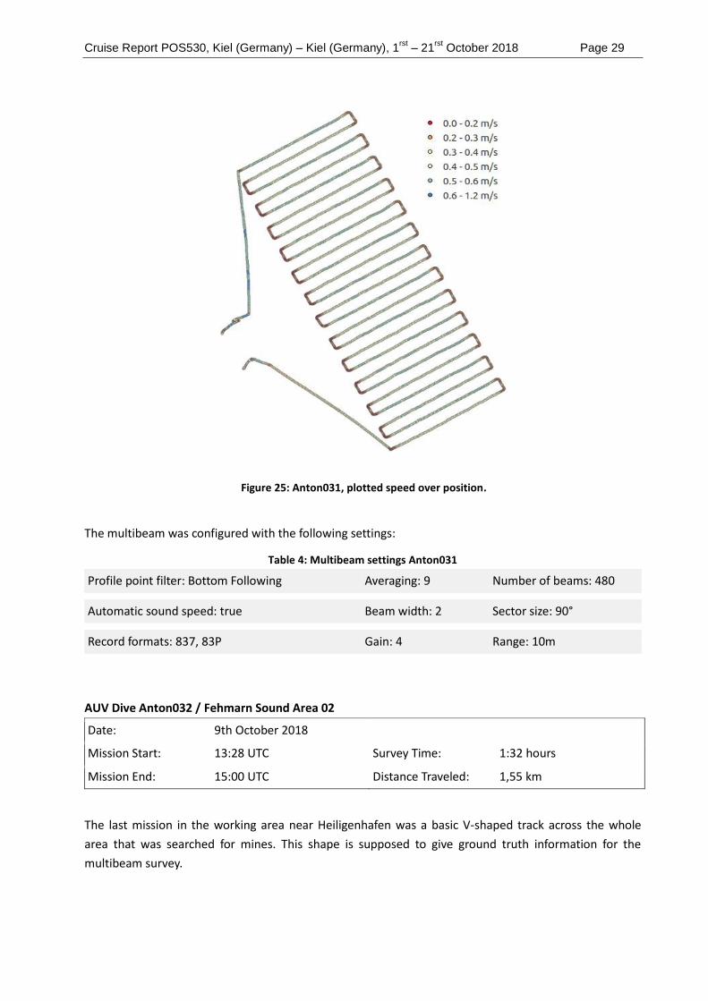
Figure 25: Anton031, plotted speed over position.
The multibeam was configured with the following settings:
Table 4: Multibeam settings Anton031
Profile point filter: Bottom Following Averaging: 9 Number of beams: 480
Automatic sound speed: true Beam width: 2 Sector size: 90°
Record formats: 837, 83P Gain: 4 Range: 10m
AUV Dive Anton032 / Fehmarn Sound Area 02
Date: 9th October 2018
Mission Start: 13:28 UTC Survey Time: 1:32 hours
Mission End: 15:00 UTC Distance Traveled: 1,55 km
The last mission in the working area near Heiligenhafen was a basic V-shaped track across the whole
area that was searched for mines. This shape is supposed to give ground truth information for the
multibeam survey.

Cruise Report POS530, Kiel (Germany) – Kiel (Germany), 1rst
– 21rst
October 2018 Page 30
This was the first time that such a large area was covered with the AUV. The AUV was a little bit faster
than expected and did exactly what was intended. The communication with USBL was not good,
allthough the ship tried to stay alongside the track.
5.3 Lübeck Bight
Table 5: Overview of the performed work inside the area.
Area 01 Area 02
Mapped area: 13.0 km2 5.6 km2
Water depth: 18.0 – 25.0 m 18.0 – 23.0 m
Acquired data: MBES
1 SVP
2 TV-CTD profiles
21 Grab samples
1 SBP
5 CTD
1 GoFlo
2 AUV dives
MBES
4 SVP
2 TV-CTD profiles
6 Grab samples
6 CTD
2 GoFlo
7 AUV dives
2 mussel moorings
The first area in Lübeck Bight is a mainly flat area that shows some special features. In the west occur
several shallow craters, which are 0.5 – 4 m deep (Figure 26). In the east of the area is a sediment-
dumping ground visible. It extends around 3.5 m above the seafloor with terraces of 1 m height (Figure
27). This dump site is also clearly visible inside the backscatter and is characterized by high backscatter
Figure 26: Inside the Lübeck Bight two areas were surveyed. The water depth ranges from 18 to 25m, whereby the seafloor is mainly flat. Green circles indicate CTD water sampling stations and the yellow stars mark grab sample locations. One video profile was acquired in area 01 and two in area 02.

Cruise Report POS530, Kiel (Germany) – Kiel (Germany), 1rst
– 21rst
October 2018 Page 31
amplitudes (Figure 30). Additionally a number of ca 100 suspicious objects was detected and at least
one pile of mines and grenades was validated inside underwater video footage (Figure 28). Due to the
very low visibility exact amounts of objects are difficult to estimate. Grab samples based on the
backscatter map, show that high backscatter amplitudes are mainly correlated with outcropping hard
and stony seafloor, compared to low amplitude silty fine sand and mud.
Figure 27: Shallow craters in the north west of area 01 in Lübeck Bight.
Figure 28: A video transect along a mound, which turned out to be composed of munition boxes and grenades.
Figure 29: Bathymetry of a sediment dump site. Figure 30: Backscatter of a sediment dump site.
White indicates high and black low backscatter amplitudes.
AUV Dive Anton033 / Lübeck Bight Area 01
Date: 13th October 2018
Mission Start: 10:55 UTC Survey Time: 1:30 hours
Mission End: 12:25 UTC Distance Traveled: 1,18 km

Cruise Report POS530, Kiel (Germany) – Kiel (Germany), 1rst
– 21rst
October 2018 Page 32
This mission was the first in the new area at the Bay of Lübeck. The payload of the AUV changed only
marginally: The downlooking Hero3 GoPro could not be charged anymore and was thus replaced with a
Hero4 GoPro. The multibeam stayed mounted on the vehicle until the end of the cruise, although it
wasn’t used in any of the following missions.
The goal of this mission was to investigate strange pearl string like patterns only visible in the multibeam
backscatter data but because of the poor visibility, no useful images could be obtained.
Figure 31: Anton033, pearl string like patterns visible in the multibeam backscatter data.
The second area in Lübeck Bight is dominated by silt to fine sand on top of mud. Towards the east the
sediment becomes coarser and sandier. One grab sample also had stones inside, mixed with mud. In the
MBES data nine mounds of not definable composition could be detected. Diver and AUV footage show
that at least two of these mounds are composed of hundreds of munition boxes, filled with grenades
(Figure 32). Additionally three torpedoes of 8 m length were detected inside MBES data. During a photo
survey with the AUV detailed images were recorded of one torpedo (Figure 33).
Cruise Report POS530, Kiel (Germany) – Kiel (Germany), 1rst
– 21rst
October 2018 Page 33
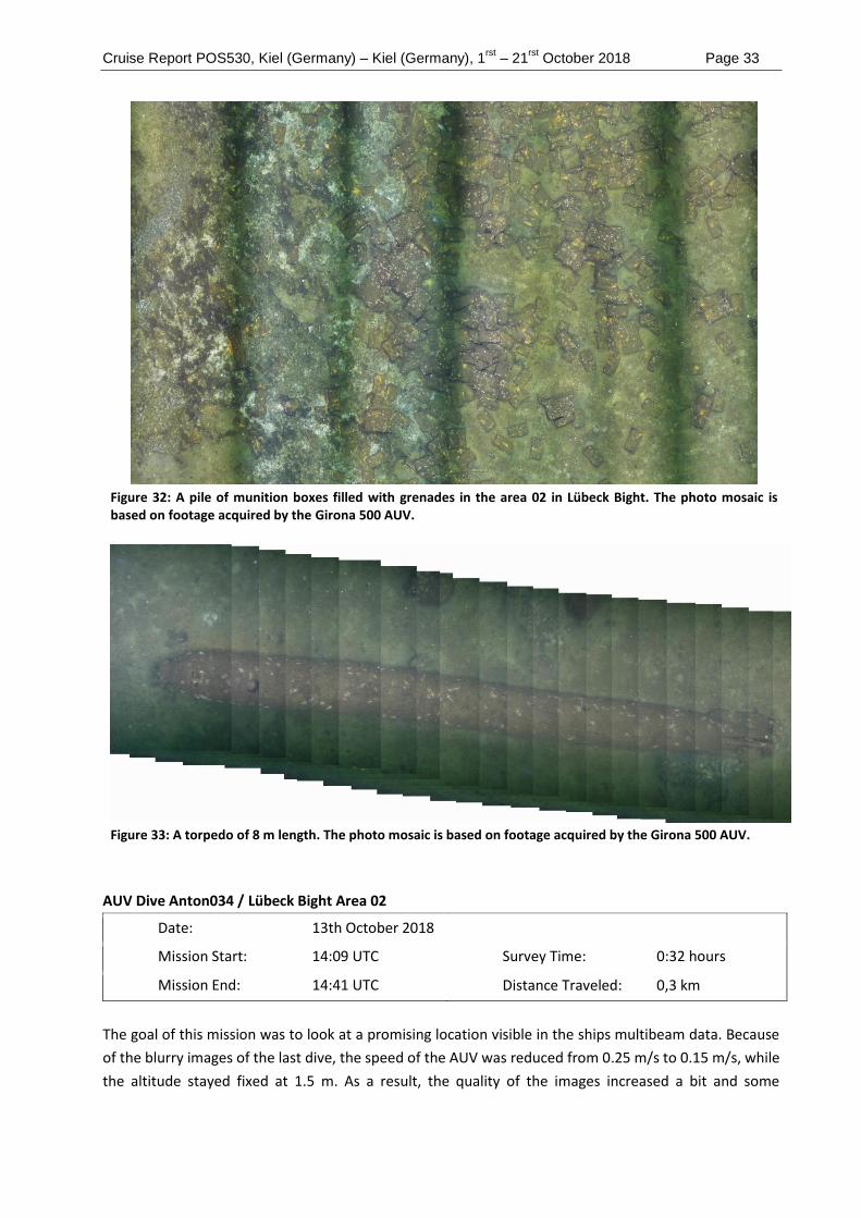
Figure 32: A pile of munition boxes filled with grenades in the area 02 in Lübeck Bight. The photo mosaic is based on footage acquired by the Girona 500 AUV.
Figure 33: A torpedo of 8 m length. The photo mosaic is based on footage acquired by the Girona 500 AUV.
AUV Dive Anton034 / Lübeck Bight Area 02
Date: 13th October 2018
Mission Start: 14:09 UTC Survey Time: 0:32 hours
Mission End: 14:41 UTC Distance Traveled: 0,3 km
The goal of this mission was to look at a promising location visible in the ships multibeam data. Because
of the blurry images of the last dive, the speed of the AUV was reduced from 0.25 m/s to 0.15 m/s, while
the altitude stayed fixed at 1.5 m. As a result, the quality of the images increased a bit and some

Cruise Report POS530, Kiel (Germany) – Kiel (Germany), 1rst
– 21rst
October 2018 Page 34
munition boxes could be spotted, but because of the bad visibility, the images were still extremely
blurry. On this dive, the forward looking GoPro did not record any images (Figure 34).
Figure 34: Anton034, blurry image of an ammunition box.
AUV Dive Anton035 / Lübeck Bight Area 02
Date: 14th October 2018
Mission Start: 07:30 UTC Survey Time: 1:15 hours
Mission End: 08:45 UTC Distance Traveled: 0,87 km
The goal of this mission was to investigate another site with small objects visible in the multibeam data
with a height of around 0.25 m. On this day the visibility was better and thus somewhat good images
with lots of munition crates could be acquired (Figure 35).
Figure 35: Anton035, pile of ammunition crates.

Cruise Report POS530, Kiel (Germany) – Kiel (Germany), 1rst
– 21rst
October 2018 Page 35
AUV Dive Anton036 / Lübeck Bight Area 02
Date: 14th October 2018
Mission Start: 09:40 UTC Survey Time: 0:35 hours
Mission End: 10:15 UTC Distance Traveled: 1,03 km
This mission was made to take images of an explosion crater with a diameter of several meters. About
half an hour after starting the mission (after leg 4 of 24), an error occurred which triggered an abort-
and-surface maneuver. When the vehicle was back on the surface, a short check over the WIFI
connection with the AUV near the Poseidon showed no obvious errors, so the mission was restarted.
However, the error occurred on the second try as well (this time at leg 11 of 24), so the AUV was
recovered after resurfing. After digging though some log files, the reason for the recovery action was
clear: The battery management system was giving one single faulty battery charge measurement. This
was picked up by the software architecture and led to the mission abort. Instead of changing parts of
the code right away, it was decided to just restart the vehicle first and see if the error would happen
frequently in the following missions. As it did not, no changes to the code were made.
As a result of this, only half of the explosion crater was mapped (Figure 36).
Figure 36: Anton036, picture of the crater rim with the center of the crater to the top left and some scrap metal in the lower part of the image
AUV Dive Anton037 / Lübeck Bight Area 02
Date: 15th October 2018
Mission Start: 12:14 UTC Survey Time: 1:10 hours
Mission End: 13:24 UTC Distance Traveled: 0,78 km
The goal of this mission was to investigate another ammunition dump, but unfortunately the lights of
the AUV had not been switched on, resulting in very greenish and blurry images.

Cruise Report POS530, Kiel (Germany) – Kiel (Germany), 1rst
– 21rst
October 2018 Page 36
AUV Dive Anton038 / Lübeck Bight Area 02
Date: 15th October 2018
Mission Start: 14:25 UTC Survey Time: 0:25 hours
Mission End: 14:50 UTC Distance Traveled: 0,33 km
The goal of this mission was to take images of a small ammunition dump. Everything worked as
expected but only very few boxes appeared in the images.
AUV Dive Anton039 / Lübeck Bight Area 02
Date: 16th October 2018
Mission Start: 07:00 UTC Survey Time: 1:22 hours
Mission End: 08:22 UTC Distance Traveled: 0,91 km
This mission was designed to take pictures of three interesting spots, two of them being torpedo shaped
and one ammunition dump (Figure 37). The distance between the spots was in the range of 60m. In
addition to that, some rock like structures were visited at the beginning and at the end of the mission.
The line spacing for each sub area was set to 1 m with a vehicle speed of 0.15 m/s. This resulted in a
mission time of 1:22 hours, which was close to the maximum recording time of one of the GoPro
cameras, especially with the cameras being starting before deployment.
Figure 37: Track of mission Anton039.

Cruise Report POS530, Kiel (Germany) – Kiel (Germany), 1rst
– 21rst
October 2018 Page 37
AUV Dive Anton040 Lübeck Bight Area 02
Date: 16th October 2018
Mission Start: 09:05 UTC Survey Time: 0:28 hours
Mission End: 09:33 UTC Distance Traveled: 0,23 km
This mission was supposed to take pictures of a structure resembling a very small submarine. In the
ships multibeam data it appeared as an object with a length of 6 meters and a height of around 1.70
meters. The mission was executed as planned. After looking at the images, the object turned out to be a
large but thin piece of scrap metal standing upright on the seafloor, possibly a part of a ship’s side
(Figure 38).
Figure 38: Anton040, the "submarine" structure, covered with starfishes.
AUV Dive Anton041 / Lübeck Bight Area 02
Date: 16th October 2018
Mission Start: 10:53 UTC Survey Time: 0:16 hours
Mission End: 11:09 UTC Distance Traveled: 0,12 km
Because there were no particular spots of interest left in this area, and no other stations were planned,
the opportunity was seized to design and execute three small test missions to observe the behavior of
the vehicle in certain conditions. Neither multibeam nor any GoPro camera was used in these missions.
The tested features were mission abort commands, the park type waypoint and what the vehicle would
do, if a negative velocity was entered.

Cruise Report POS530, Kiel (Germany) – Kiel (Germany), 1rst
– 21rst
October 2018 Page 38
AUV Dive Anton042 / Lübeck Bight Area 02
Date: 16th October 2018
Mission Start: 12:00 UTC Survey Time: 0:36 hours
Mission End: 12:36 UTC Distance Traveled: 0,48 km
The last mission of this day was used for some ground truthing. The goal was to verify that rock like
looking objects in the multibeam data were indeed rocks.
AUV Dive Anton043 / Lübeck Bight Area 02
Date: 17th October 2018
Mission Start: 11:23 UTC Survey Time: 0:57 hours
Mission End: 12:20 UTC Distance Traveled: 0,63 km
This mission was designed to take pictures of two ammunition dump sites, approximately 60 m apart.
During the on deck test, the GPS didn’t work correctly, which was solved by a complete restart of the
vehicle. The visibility in the water on that day was very good, so a lot of useful images could be obtained
(Figure 39).
Figure 39: Anton043, dump site with ammunition and grenades

Cruise Report POS530, Kiel (Germany) – Kiel (Germany), 1rst
– 21rst
October 2018 Page 39
5.4 Rügen
Table 6. Overview of the performed work inside the area.
Area 01
Mapped area: 16.3 km2
Water depth: 45.0 – 49.0 m
Acquired data: MBES
3 SVP
2 TV-CTD
4 Grab samples
1 SBP
3 CTD
1 GoFlo
Figure 40: The seafloor of the research area north of Rügen is very flat. Green circles indicate CTD water sampling stations and the yellow stars mark grab sample locations. One video profile was acquired above a wooden shipwreck.
The research area in the north of Rügen is characterized by homogeneous fine sediments and flat
seafloor (Figure 40). No suspicious munition objects were found, but two shipwrecks can be seen inside
the MBES data. The bigger one is 50 m long and 15 m wide, resting on its hull (Figure 41). The sediment
has formed a 1 m deep scour around the wreck. The second shipwreck is made of wood with a length of
around 45 m and width of ca 25 m. The sediment samples do not show major changes throughout the
area.

Cruise Report POS530, Kiel (Germany) – Kiel (Germany), 1rst
– 21rst
October 2018 Page 40
Figure 41: MBES raw data showing a 50 m long wreck in the area north of Rügen.

Cruise Report POS530, Kiel (Germany) – Kiel (Germany), 1rst
– 21rst
October 2018 Page 41
6 Preliminary Results: Geochemistry
Spatial coverage of water sampling was particularly high-resolution at known munitions contamination
sites (e.g., Fehmarn Sound, Lübeck Bight), which had not been previously investigated during the
UDEMM project. During the current cruise, 114 stations were occupied and 552 individual samples were
taken. The samples were processed on board as described above and analyzed in land-based
laboratories. The new methods developed during the UDEMM project enabled us to achieve exceptional
spatial and depth resolution.
The preliminary spatial distribution of TNT is shown in Figure 42. TNT concentrations were highest near
the shore, especially in Kiel Bay and Fehmarn Sound, although some high concentrations were also
found near Gelting Bight and Lübeck Bight. Increased values corresponded to generally known
ammunition contamination, although some sites, such as the Fehmarn Belt, have a higher water flow
and may reflect transport from other sites. The lowest concentrations were found off Rostock and in the
Arkona Basin.
Depending on the water depth, vertical profiles included between three and nine depths. The vertical
distribution of munition compounds generally showed the highest concentrations near the seabed
(Figure 43). Significant spatial differences were observed between the different munition compounds
analyzed. The munition compounds shown in Figure 24 were all derived from primary explosives (TNT =
trinitrotoluene, RDX = 1,3,5- Trinitro-1,3,5-triazinane, DNB = dinitrobenzene, TNB = trinitrobenzene), but
not all of these compounds showed enrichment at the same sites. For example, TNT and TNB
concentrations were highest in Kolberger Heide, while RDX and DNB were highest in Lübeck Bight.
Relatively high DNB concentrations were also found in Gelting Bight (not evident in Figure 43 to scaling).
Figure 42: Spatial distribution of dissolved TNT in bottom water. Symbol size and color indicates concentration.

Cruise Report POS530, Kiel (Germany) – Kiel (Germany), 1rst
– 21rst
October 2018 Page 42
Figure 43: Sections showing depth profiles of munitions compounds along the nearshore cruise track. Particularly high explosives contamination is evident at Kolberger Heide (~75 km) and Lübeck Bight (~250 km). Black points indicate positions of individual samples used for contouring. TNT = trinitrotoluene, RDX = 1,3,5-Trinitro-1,3,5-triazinane, DNB = dinitrobenzene, TNB = trinitrobenzene.
Concentrations of munitions compounds found during the current cruise were generally similar to the
levels we have previously observed in the Baltic Sea. However, RDX and DNB were far higher in Lübeck
Bight than previous measurements at any other location (Figure 43). This strongly indicates a high
degree of variability in the type of munitions and explosives present at different dumpsites. It also
highlights the importance of measuring a suite of munitions compounds in order to capture munitions
signatures from diverse explosive sources.
High-resolution water sample profiles collected adjacent to munition surfaces in Fehmarn Sound and
Lübeck Bight showed concentrations that declined sharply away from the surface (Figure 44). This is
consistent with our previous results in Kolberger Heide (Beck et al., 2019), and reflects the explosive
dissolution and release of munitions compounds from breaches in the munition housing.

Cruise Report POS530, Kiel (Germany) – Kiel (Germany), 1rst
– 21rst
October 2018 Page 43
Figure 44: High-resolution water samples directly adjacent to underwater munition surfaces. Station 109: Fehmarn Sound; Station 197: Lübeck Bight. Concentrations are μg/L.
Experiments conducted on-board during the cruise showed no evidence of munition compound
degradation (Figure 45). This is consistent with our previous results, and is likely due to the low
incubation temperature (5°C). The length of the experiments may also have been insufficient to capture
slow degradation. These results imply that munition compounds released into deep waters of the Baltic
Sea are likely to persist long enough to be transported away from the munition point source.
Taken together, the preliminary geochemical results provide a clear picture of munition compound
release from relic munitions in the Baltic Sea. These chemicals are subject to limited degradation,
particularly in the deep waters where they are released, leading to the buildup of high concentrations.
As a result, plumes of contamination emanate from munitions dumpsites, and spreads regionally due to
lateral transport.

Cruise Report POS530, Kiel (Germany) – Kiel (Germany), 1rst
– 21rst
October 2018 Page 44
Figure 45: TNT in degradation experiments, normalized to the initial concentration. (a) Gelting Bight, (b) Fehmarn Sound, (c) Lübeck Bight. Solid symbols and hollow symbols represent whole and filter-sterilized treatments, respectively. Error bars represent the standard deviation of triplicate treatments.
7 Acknowledgements
We thank the captain and crew of RV Poseidon for their excellent support during the scientific campaign
of POS530, the MELUND, the THW and German Navy for the reliable support during the crew exchange
and the GEOMAR data management team for their proactive spirit in conducting and developing the
data management plan.

Cruise Report POS530, Kiel (Germany) – Kiel (Germany), 1rst
– 21rst
October 2018 Page 45
8 References
Beck, A. J., van der Lee, E. M., Eggert, A., Stamer, B., Gledhill, M., Schlosser, C., & Achterberg, E. P. (2019). In situ
measurements of explosive compound dissolution fluxes from exposed munition material in the Baltic Sea.
Environmental science & technology. 53, 5652−5660.
Gledhill, M., Beck, A. J., Stamer, B., Schlosser, C., & Achterberg, E. P. (2019). Quantification of munition compounds
in the marine environment by solid phase extraction–ultra high performance liquid chromatography with
detection by electrospray ionisation–mass spectrometry. Talanta, 200: 366-372.
Sargent, J.R., 1976. The structure, metabolism and function of lipids in marine organisms. In: Malins, D.C., Sargent,
J.R. (Eds.), Biochemical and Biophysical Perspectives in Marine Biology. Academic Press, London, pp. 149-212.
Smith, K.L., Ruhl, H.A., Kaufmann, R.S., Kahru, M., 2008. Tracing abyssal food supply back to upper-ocean processes
over a 17-year time series in the northeast Pacific. Limnology and Oceanography 53, 2655-2667.

Cruise Report POS530, Kiel (Germany) – Kiel (Germany), 1rst
– 21rst
October 2018 Page I
9 Appendix
9.1 Overall Station List
(Reduced navigation precision due to confidential position data)
Activity - Device
Operation
GEOMAR ID Timestamp Device Action Latitude Longitude Depth (m) Comment
POS530_1-1 POS530#1_CTD-
001
2018-10-01
14:13
CTD in the water 54°20.0' N 010°10.0' E 7.5 Commence of research
operations POS 530
POS530_1-1 POS530#1_CTD-
001
2018-10-01
14:31
CTD max
depth/on
ground
54°19.9' N 010°10.0' E 7.3 3 m max; male function
of TV-CTD
POS530_1-1 POS530#1_CTD-
001
2018-10-01
14:33
CTD on deck 54°19.9' N 010°10.0' E 7.1
POS530_1-2 POS530#1_CTD-
001
2018-10-01
14:46
CTD in the water 54°19.9' N 010°10.0' E 7.2
POS530_1-2 POS530#1_CTD-
001
2018-10-01
14:50
CTD max
depth/on
ground
54°20.0' N 010°10.0' E 7.2 SL max = 7m
POS530_1-2 POS530#1_CTD-
001
2018-10-01
14:52
CTD on deck 54°20.0' N 010°10.0' E 7.2
POS530_2-1 POS530#2_CTD-
002
2018-10-01
15:48
CTD in the water 54°22.3' N 010°10.3' E 10
POS530_2-1 POS530#2_CTD-
002
2018-10-01
15:52
CTD max
depth/on
ground
54°22.3‘ N 010°10.3' E 10.3 SL max = 11m
POS530_2-1 POS530#2_CTD-
002
2018-10-01
15:54
CTD on deck 54°22.3‘ N 010°10.3' E 10.3

Cruise Report POS530, Kiel (Germany) – Kiel (Germany), 1rst
– 21rst
October 2018 Page II
POS530_3-1 POS530#3_CTD-
003
2018-10-01
16:33
CTD in the water 54°24.4' N 010°12.5' E 10.8
POS530_3-1 POS530#3_CTD-
003
2018-10-01
16:36
CTD max
depth/on
ground
54°24.4' N 010°12.5' E 10.8 SL max = 11m
POS530_3-1 POS530#3_CTD-
003
2018-10-01
16:38
CTD on deck 54°24.4' N 010°12.5' E 10.5
POS530_4-1 POS530#4_CTD-
004
2018-10-01
17:16
CTD in the water 54°27.2' N 010°13.6' E 12.8
POS530_4-1 POS530#4_CTD-
004
2018-10-01
17:21
CTD on deck 54°27.2' N 010°13.6' E 13.5
POS530_4-1 POS530#4_CTD-
004
2018-10-01
17:23
CTD in the water 54°27.2' N 010°13.6' E 13.1
POS530_4-1 POS530#4_CTD-
004
2018-10-01
17:25
CTD max
depth/on
ground
54°27.2' N 010°13.6' E 13.4 SL max = 14m
POS530_4-1 POS530#4_CTD-
004
2018-10-01
17:28
CTD on deck 54°27.2' N 010°13.6' E 13.5
POS530_5-1 POS530#5_SVP-
001
2018-10-01
18:28
Sound
Velocity
Profiler
in the water 54°29.0' N 010°19.6' E 15.7
POS530_5-1 POS530#5_SVP-
001
2018-10-01
18:33
Sound
Velocity
Profiler
max
depth/on
ground
54°29.0' N 010°19.6' E 15.3 16 m max
POS530_5-1 POS530#5_SVP-
001
2018-10-01
18:36
Sound
Velocity
Profiler
on deck 54°29.0' N 010°19.6' E 15.4
POS530_6-1 POS530#6_MB-
001
2018-10-01
18:55
Multibeam
echosounder
profile start 54°29.0' N 010°20.0' E 15.8

Cruise Report POS530, Kiel (Germany) – Kiel (Germany), 1rst
– 21rst
October 2018 Page III
POS530_6-1 POS530#6_MB-
001
2018-10-01
20:27
Multibeam
echosounder
profile end 54°28.2' N 010°20.5E 10.6
POS530_7-1 POS530#7_CTD-
005
2018-10-01
21:28
CTD in the water 54°29.4' N 010°12.2' E 7.1
POS530_7-1 POS530#7_CTD-
005
2018-10-01
21:31
CTD max
depth/on
ground
54°29.4' N 010°12.2' E 7.1 7 m max
POS530_7-1 POS530#7_CTD-
005
2018-10-01
21:33
CTD on deck 54°29.4' N 010°12.2' E 7
POS530_8-1 POS530#8_CTD-
006
2018-10-01
22:02
CTD in the water 54°30.2' N 010°8.34E 8.5
POS530_8-1 POS530#8_CTD-
006
2018-10-01
22:05
CTD max
depth/on
ground
54°30.2' N 010°8.33E 8.5 9 m max
POS530_8-1 POS530#8_CTD-
006
2018-10-01
22:07
CTD on deck 54°30.3N 010°8.35E 8.4
POS530_9-1 POS530#9_CTD-
007
2018-10-01
22:42
CTD in the water 54°33.0' N 010°6.57E 20
POS530_9-1 POS530#9_CTD-
007
2018-10-01
22:45
CTD max
depth/on
ground
54°33.0' N 010°6.57E 20.5 21 m max
POS530_9-1 POS530#9_CTD-
007
2018-10-01
22:48
CTD on deck 54°33.1' N 010°6.58E 20.2
POS530_10-1 POS530#10_CTD-
008
2018-10-01
23:17
CTD in the water 54°35.2N 010°5.92E 22.6
POS530_10-1 POS530#10_CTD-
008
2018-10-01
23:20
CTD max
depth/on
ground
54°35.2' N 010°5.92E 22.7 23 m max

Cruise Report POS530, Kiel (Germany) – Kiel (Germany), 1rst
– 21rst
October 2018 Page IV
POS530_10-1 POS530#10_CTD-
008
2018-10-01
23:23
CTD on deck 54°35.2' N 010°5.92E 22.5
POS530_11-1 POS530#11_CTD-
009
2018-10-02 0:27 CTD in the water 54°39.8' N 010°5.75E 9.3
POS530_11-1 POS530#11_CTD-
009
2018-10-02 0:29 CTD max
depth/on
ground
54°39.9' N 010°5.74E 9.8 10 m max
POS530_11-1 POS530#11_CTD-
009
2018-10-02 0:31 CTD on deck 54°39.9' N 010°5.74E 9.7
POS530_12-1 POS530#12_CTD-
010
2018-10-02 1:16 CTD in the water 54°43.4' N 010°3.23E 9
POS530_12-1 POS530#12_CTD-
010
2018-10-02 1:18 CTD max
depth/on
ground
54°43.4' N 010°3.22E 9 9 m max
POS530_12-1 POS530#12_CTD-
010
2018-10-02 1:20 CTD on deck 54°43.4' N 010°3.23E 9.2
POS530_13-1 POS530#13_CTD-
011
2018-10-02 2:09 CTD in the water 54°47.7' N 009°58.9' E 21.8
POS530_13-1 POS530#13_CTD-
011
2018-10-02 2:13 CTD max
depth/on
ground
54°47.7' N 009°58.9' E 21.7 SL max = 22m
POS530_13-1 POS530#13_CTD-
011
2018-10-02 2:16 CTD on deck 54°47.7' N 009°58.9' E 21.6
POS530_14-1 POS530#14_CTD-
012
2018-10-02 3:23 CTD in the water 54°47.6' N 009°51.4' E 17
POS530_14-1 POS530#14_CTD-
012
2018-10-02 3:26 CTD max
depth/on
ground
54°47.6' N 009°51.4' E 17.1 Sl max = 18m
POS530_14-1 POS530#14_CTD-
012
2018-10-02 3:29 CTD on deck 54°47.6' N 009°51.4' E 17

Cruise Report POS530, Kiel (Germany) – Kiel (Germany), 1rst
– 21rst
October 2018 Page V
POS530_15-1 POS530#15_SVP-
002
2018-10-02 4:13 Sound
Velocity
Profiler
in the water 54°48.4' N 009°50.5' E 18.2
POS530_15-1 POS530#15_SVP-
002
2018-10-02 4:17 Sound
Velocity
Profiler
max
depth/on
ground
54°48.4' N 009°50.5' E 18.4 SL max = 20m
POS530_15-1 POS530#15_SVP-
002
2018-10-02 4:19 Sound
Velocity
Profiler
on deck 54°48.4' N 009°50.5' E 18.3
POS530_16-1 POS530#16_MB-
002
2018-10-02 4:58 Multibeam
echosounder
profile start 54°48.8' N 009°50.4' E 18.9
POS530_16-1 POS530#16_MB-
002
2018-10-02
10:48
Multibeam
echosounder
profile end 54°48.2' N 009°51.2' E 17.7
POS530_17-1 POS530#17_SVP-
003
2018-10-02
11:22
Sound
Velocity
Profiler
in the water 54°48.9' N 009°49.0' E 19.2
POS530_17-1 POS530#17_SVP-
003
2018-10-02
11:26
Sound
Velocity
Profiler
max
depth/on
ground
54°48.9' N 009°49.0' E 19.3 21 m max
POS530_17-1 POS530#17_SVP-
003
2018-10-02
11:29
Sound
Velocity
Profiler
on deck 54°48.9' N 009°49.0' E 19.5
POS530_18-1 POS530#18_MB-
003
2018-10-02
11:44
Multibeam
echosounder
profile start 54°48.8' N 009°48.5' E 19
POS530_18-1 POS530#18_MB-
003
2018-10-02
14:10
Multibeam
echosounder
profile end 54°47.0' N 009°50.0' E 7.6

Cruise Report POS530, Kiel (Germany) – Kiel (Germany), 1rst
– 21rst
October 2018 Page VI
POS530_19-1 POS530#19_SVP-
004
2018-10-02
14:23
Sound
Velocity
Profiler
in the water 54°46.7' N 009°50.0' E 9
POS530_19-1 POS530#19_SVP-
004
2018-10-02
14:26
Sound
Velocity
Profiler
max
depth/on
ground
54°46.7' N 009°50.1' E 7.3 SL max = 7m
POS530_19-1 POS530#19_SVP-
004
2018-10-02
14:27
Sound
Velocity
Profiler
on deck 54°46.8N 009°50.1' E 7.5
POS530_20-1 POS530#20_MB-
004
2018-10-02
14:39
Multibeam
echosounder
profile start 54°47.0' N 009°49.9' E 11.1
POS530_20-1 POS530#20_MB-
004
2018-10-03 4:10 Multibeam
echosounder
profile end 54°47.0' N 009°50.1' E 7.5
POS530_21-1 POS530#21_CTD-
013
2018-10-03 4:58 CTD in the water 54°48.5' N 009°50.8' E 10.2 no video
POS530_21-1 POS530#21_CTD-
013
2018-10-03 5:18 CTD on deck 54°48.5' N 009°50.7' E 9.5
POS530_22-1 POS530#22_TV-
CTD-001
2018-10-03 6:58 TV-CTD in the water 54°48.6N 009°50.7' E 11.3 Video
POS530_22-1 POS530#22_TV-
CTD-001
2018-10-03 7:04 TV-CTD max
depth/on
ground
54°48.5' N 009°50.7' E 9.5 9 m max
POS530_22-1 POS530#22_TV-
CTD-001
2018-10-03 7:05 TV-CTD profile start 54°48.5' N 009°50.7' E 9.5
POS530_22-1 POS530#22_TV-
CTD-001
2018-10-03 8:13 TV-CTD profile end 54°48.7N 009°50.3' E 18

Cruise Report POS530, Kiel (Germany) – Kiel (Germany), 1rst
– 21rst
October 2018 Page VII
POS530_22-1 POS530#22_TV-
CTD-001
2018-10-03 8:14 TV-CTD on deck 54°48.7N 009°50.3' E 20.5
POS530_23-1 POS530#23_TV-
CTD-002
2018-10-03 9:08 TV-CTD in the water 54°47.0' N 009°49.9' E 8.6 Video
POS530_23-1 POS530#23_TV-
CTD-002
2018-10-03 9:22 TV-CTD max
depth/on
ground
54°47.0' N 009°49.9' E 9.6 9 m max
POS530_23-1 POS530#23_TV-
CTD-002
2018-10-03 9:22 TV-CTD profile start 54°47.0' N 009°49.9' E 10.1
POS530_23-1 POS530#23_TV-
CTD-002
2018-10-03
10:34
TV-CTD profile end 54°47.2' N 009°49.5' E 10.6
POS530_23-1 POS530#23_TV-
CTD-002
2018-10-03
10:38
TV-CTD on deck 54°47.2' N 009°49.5' E 10.3
POS530_24-1 POS530#24_CTD-
014
2018-10-03
11:37
CTD in the water 54°47.3N 009°49.6' E 16.8
POS530_24-1 POS530#24_CTD-
014
2018-10-03
11:40
CTD max
depth/on
ground
54°47.3N 009°49.6' E 17.3 18 m max
POS530_24-1 POS530#24_CTD-
014
2018-10-03
11:42
CTD on deck 54°47.3N 009°49.6' E 17.5
POS530_24-2 POS530#24_Grab-
001
2018-10-03
12:03
Grab max
depth/on
ground
54°47.3' N 009°49.6' E 16.2
POS530_24-2 POS530#24_Grab-
001
2018-10-03
12:03
Grab in the water 54°47.3' N 009°49.6' E 16.6
POS530_24-2 POS530#24_Grab-
001
2018-10-03
12:06
Grab on deck 54°47.3' N 009°49.6' E 17.6

Cruise Report POS530, Kiel (Germany) – Kiel (Germany), 1rst
– 21rst
October 2018 Page
VIII
POS530_25-1 POS530#25_Grab-
002
2018-10-03
12:27
Grab in the water 54°47.2' N 009°49.5' E 11.7
POS530_25-1 POS530#25_Grab-
002
2018-10-03
12:28
Grab max
depth/on
ground
54°47.2' N 009°49.5' E 11.7
POS530_25-1 POS530#25_Grab-
002
2018-10-03
12:29
Grab on deck 54°47.2' N 009°49.5' E 11.6
POS530_26-1 POS530#26_Grab-
003
2018-10-03
13:01
Grab in the water 54°47.1' N 009°49.5' E 14.8
POS530_26-1 POS530#26_Grab-
003
2018-10-03
13:02
Grab max
depth/on
ground
54°47.1' N 009°49.5' E 14.5
POS530_26-1 POS530#26_Grab-
003
2018-10-03
13:03
Grab on deck 54°47.1' N 009°49.5' E 14.6
POS530_27-1 POS530#27_Grab-
004
2018-10-03
13:24
Grab in the water 54°47.1' N 009°49.7' E 17.5
POS530_27-1 POS530#27_Grab-
004
2018-10-03
13:24
Grab max
depth/on
ground
54°47.1' N 009°49.7' E 17.5
POS530_27-1 POS530#27_Grab-
004
2018-10-03
13:26
Grab on deck 54°47.1' N 009°49.7' E 17.7
POS530_28-1 POS530#28_Grab-
005
2018-10-03
13:44
Grab in the water 54°47.0' N 009°49.8' E 12.2 failed
POS530_28-1 POS530#28_Grab-
005
2018-10-03
13:45
Grab max
depth/on
ground
54°47.0' N 009°49.8' E 12.3
POS530_28-1 POS530#28_Grab-
005
2018-10-03
13:46
Grab on deck 54°47.0' N 009°49.9E 12.3
POS530_28-2 POS530#28_Grab-
005
2018-10-03
13:51
Grab in the water 54°47.0' N 009°49.8' E 13.2

Cruise Report POS530, Kiel (Germany) – Kiel (Germany), 1rst
– 21rst
October 2018 Page IX
POS530_28-2 POS530#28_Grab-
005
2018-10-03
13:51
Grab max
depth/on
ground
54°47.0' N 009°49.8' E 15
POS530_28-2 POS530#28_Grab-
005
2018-10-03
13:52
Grab on deck 54°47.0' N 009°49.8' E 12.1
POS530_29-1 POS530#29_CTD-
015
2018-10-03
14:32
CTD in the water 54°46.3' N 009°50.5' E 9.1
POS530_29-1 POS530#29_CTD-
015
2018-10-03
14:34
CTD max
depth/on
ground
54°46.3' N 009°50.5' E 10.5 SL max = 7m
POS530_29-1 POS530#29_CTD-
015
2018-10-03
14:36
CTD on deck 54°46.3' N 009°50.5' E 7.6
POS530_30-1 POS530#30_CTD-
016
2018-10-03
15:03
CTD in the water 54°47.8' N 009°49.6' E 19.1
POS530_30-1 POS530#30_CTD-
016
2018-10-03
15:06
CTD max
depth/on
ground
54°47.8' N 009°49.5' E 19.8 SL max = 19m
POS530_30-1 POS530#30_CTD-
016
2018-10-03
15:09
CTD on deck 54°47.8' N 009°49.5' E 2.1
POS530_31-1 POS530#31_CTD-
017
2018-10-03
15:40
CTD in the water 54°49.1' N 009°47.3' E 19.5
POS530_31-1 POS530#31_CTD-
017
2018-10-03
15:43
CTD max
depth/on
ground
54°49.1' N 009°47.4' E 19.5 SL max = 20m
POS530_31-1 POS530#31_CTD-
017
2018-10-03
15:46
CTD on deck 54°49.1' N 009°47.4' E 19.5
POS530_32-1 POS530#32_CTD-
018
2018-10-03
16:21
CTD in the water 54°49.1N 009°43.7' E 19

Cruise Report POS530, Kiel (Germany) – Kiel (Germany), 1rst
– 21rst
October 2018 Page X
POS530_32-1 POS530#32_CTD-
018
2018-10-03
16:24
CTD max
depth/on
ground
54°49.1' N 009°43.7' E 19 SL max = 19m
POS530_32-1 POS530#32_CTD-
018
2018-10-03
16:27
CTD on deck 54°49.1N 009°43.7' E 18.8
POS530_33-1 POS530#33_CTD-
019
2018-10-03
16:53
CTD in the water 54°49.9N 009°41.1' E 15.6
POS530_33-1 POS530#33_CTD-
019
2018-10-03
16:56
CTD max
depth/on
ground
54°49.9N 009°41.1' E 15.7 SL max = 16m
POS530_33-1 POS530#33_CTD-
019
2018-10-03
16:58
CTD on deck 54°49.9' N 009°41.1' E 15.7
POS530_34-1 POS530#34_CTD-
020
2018-10-03
17:25
CTD in the water 54°50.5' N 009°38.4' E 11.6
POS530_34-1 POS530#34_CTD-
020
2018-10-03
17:28
CTD max
depth/on
ground
54°50.5' N 009°38.4' E 13.1 SL max = 13m
POS530_34-1 POS530#34_CTD-
020
2018-10-03
17:30
CTD on deck 54°50.5' N 009°38.4' E 13.2
POS530_35-1 POS530#35_MB-
005
2018-10-03
18:39
Multibeam
echosounder
profile start 54°46.9' N 009°49.4' E 12.7
POS530_35-1 POS530#35_MB-
005
2018-10-04 4:07 Multibeam
echosounder
profile end 54°48.9N 009°48.9' E 19.3
POS530_36-1 POS530#36_SVP-
004
2018-10-04 4:17 Sound
Velocity
Profiler
in the water 54°48.9' N 009°48.6' E 19.1
POS530_36-1 POS530#36_SVP-
004
2018-10-04 4:21 Sound
Velocity
Profiler
max
depth/on
ground
54°48.9' N 009°48.6' E 22.8 SL max = 21m

Cruise Report POS530, Kiel (Germany) – Kiel (Germany), 1rst
– 21rst
October 2018 Page XI
POS530_36-1 POS530#36_SVP-
004
2018-10-04 4:23 Sound
Velocity
Profiler
on deck 54°48.9' N 009°48.6' E 19.2
POS530_37-1 POS530#37_SVP-
005
2018-10-04 4:40 Sound
Velocity
Profiler
station start 54°48.9' N 009°48.5' E 25.8
POS530_37-1 POS530#37_SVP-
005
2018-10-04 6:50 Sound
Velocity
Profiler
station end 54°47.3' N 009°49.5' E 11.1
POS530_38-1 POS530#38_Dive-
001
2018-10-04 8:24 Diving
operations
station start 54°47.3' N 009°49.5' E 11.3 Divers underway with
own boat
POS530_38-1 POS530#38_Dive-
001
2018-10-04
10:21
Diving
operations
station end 54°47.4' N 009°49.4' E 11.1 Divers back on board
POS530_39-1 POS530#39_TV-
CTD-003
2018-10-04
11:05
TV-CTD in the water 54°47.1' N 009°50.3' E 17.5
POS530_39-1 POS530#39_TV-
CTD-003
2018-10-04
11:13
TV-CTD max
depth/on
ground
54°47.1' N 009°50.3' E 17 19 m max
POS530_39-1 POS530#39_TV-
CTD-003
2018-10-04
11:14
TV-CTD profile start 54°47.1' N 009°50.3E 17
POS530_39-1 POS530#39_TV-
CTD-003
2018-10-04
11:53
TV-CTD profile end 54°47.0' N 009°50' 10.1
POS530_39-1 POS530#39_TV-
CTD-003
2018-10-04
11:55
TV-CTD on deck 54°47.0' N 009°50.0' E 10.2
POS530_40-1 POS530#40_Grab-
006
2018-10-04
12:48
Grab in the water 54°48.5' N 009°51.1' E 16.1

Cruise Report POS530, Kiel (Germany) – Kiel (Germany), 1rst
– 21rst
October 2018 Page XII
POS530_40-1 POS530#40_Grab-
006
2018-10-04
12:49
Grab max
depth/on
ground
54°48.5' N 009°51.1' E 15.5
POS530_40-1 POS530#40_Grab-
006
2018-10-04
12:49
Grab on deck 54°48.5' N 009°51.1' E 15
POS530_41-1 POS530#41_Grab-
007
2018-10-04
13:05
Grab in the water 54°48.6N 009°50.7' E 11.8
POS530_41-1 POS530#41_Grab-
007
2018-10-04
13:05
Grab max
depth/on
ground
54°48.6' N 009°50.7' E 12
POS530_41-1 POS530#41_Grab-
007
2018-10-04
13:06
Grab on deck 54°48.6' N 009°50.7' E 12.6
POS530_42-1 POS530#42_Grab-
008
2018-10-04
13:16
Grab in the water 54°48.7N 009°50.6' E 19.1
POS530_42-1 POS530#42_Grab-
008
2018-10-04
13:16
Grab max
depth/on
ground
54°48.7N 009°50.6' E 19.2
POS530_42-1 POS530#42_Grab-
008
2018-10-04
13:17
Grab on deck 54°48.7N 009°50.6E 19.2
POS530_42-2 POS530#42_Grab-
008
2018-10-04
13:26
Grab in the water 54°48.6' N 009°50.3' E 15.5
POS530_42-2 POS530#42_Grab-
008
2018-10-04
13:26
Grab max
depth/on
ground
54°48.6' N 009°50.3' E 15.5
POS530_42-2 POS530#42_Grab-
008
2018-10-04
13:27
Grab on deck 54°48.6' N 009°50.3' E 15.6
POS530_43-2 POS530#43_Grab-
009
2018-10-04
13:29
Grab max
depth/on
ground
54°48.6' N 009°50.3' E 16.7

Cruise Report POS530, Kiel (Germany) – Kiel (Germany), 1rst
– 21rst
October 2018 Page
XIII
POS530_43-2 POS530#43_Grab-
009
2018-10-04
13:29
Grab on deck 54°48.6' N 009°50.3' E 17.1
POS530_44-1 POS530#44_Grab-
010
2018-10-04
13:43
Grab in the water 54°48.7' N 009°50.3' E 18.8 formerly _43
POS530_44-1 POS530#44_Grab-
010
2018-10-04
13:43
Grab max
depth/on
ground
54°48.7' N 009°50.3' E 19 formerly _44
POS530_44-1 POS530#44_Grab-
010
2018-10-04
13:45
Grab on deck 54°48.7' N 009°50.3' E 19 formerly _45
POS530_44-1 POS530#44_-001 does not exist FEHLER
POS530_45-1 POS530#45_SBP-
001
2018-10-04
14:39
Parasound profile start 54° 47.9' N 009° 48.8' E 18.8
POS530_45-1 POS530#45_SBP-
001
2018-10-04
15:05
Parasound profile end 54° 46.9' N 009° 49.7' E 18.8
POS530_46-1 POS530#46_CTD-
021
2018-10-04
17:50
CTD in the water 54° 48.8' N 009° 56.3' E 18.8
POS530_46-1 POS530#46_CTD-
021
2018-10-04
17:54
CTD max
depth/on
ground
54° 48.8' N 009° 56.3' E 18.8 SL max = 21m
POS530_46-1 POS530#46_CTD-
021
2018-10-04
17:57
CTD on deck 54° 48.8' N 009° 56.3' E 21
POS530_47-1 POS530#47_CTD-
022
2018-10-04
18:52
CTD in the water 54° 45.9' N 010° 01.8' E 24.3
POS530_47-1 POS530#47_CTD-
022
2018-10-04
18:55
CTD max
depth/on
ground
54° 45.9' N 010° 01.8' E 24.1 25 m max
POS530_47-1 POS530#47_CTD-
022
2018-10-04
18:59
CTD on deck 54° 45.9' N 010° 01.8' E 24

Cruise Report POS530, Kiel (Germany) – Kiel (Germany), 1rst
– 21rst
October 2018 Page
XIV
POS530_48-1 POS530#48_CTD-
023
2018-10-04
19:55
CTD in the water 54° 42.4' N 010° 09.0' E 21.7
POS530_48-1 POS530#48_CTD-
023
2018-10-04
19:58
CTD max
depth/on
ground
54° 42.4' N 010° 09.0' E 21.5 22 m max
POS530_48-1 POS530#48_CTD-
023
2018-10-04
20:01
CTD on deck 54° 42.4' N 010° 09.0' E 21.6
POS530_48-2 POS530#48_GoFlo
-001
2018-10-04
20:06
GoFlo bottle in the water 54° 42.4' N 010° 09.0' E 22
POS530_48-2 POS530#48_GoFlo
-001
2018-10-04
20:16
GoFlo bottle max
depth/on
ground
54° 42.4' N 010° 08.9' E 21.7
POS530_48-2 POS530#48_GoFlo
-001
2018-10-04
20:20
GoFlo bottle on deck 54° 42.4' N 010° 08.9' E 21.6
POS530_49-1 POS530#49_CTD-
024
2018-10-04
21:07
CTD in the water 54° 39.0' N 010° 13.0' E 16.2
POS530_49-1 POS530#49_CTD-
024
2018-10-04
21:11
CTD max
depth/on
ground
54° 39.0' N 010° 13.0' E 16.1 16 m max
POS530_49-1 POS530#49_CTD-
024
2018-10-04
21:14
CTD on deck 54° 39.0' N 010° 13.0' E 16.1
POS530_50-1 POS530#50_CTD-
025
2018-10-04
22:05
CTD in the water 54° 35.6' N 010° 18.7' E 11.7
POS530_50-1 POS530#50_CTD-
025
2018-10-04
22:08
CTD max
depth/on
ground
54° 35.7' N 010° 18.7' E 11.8 12 m max
POS530_50-1 POS530#50_CTD-
025
2018-10-04
22:09
CTD on deck 54° 35.7' N 010° 18.7' E 11.8
POS530_50-2 POS530#50_GoFlo
-002
2018-10-04
22:15
GoFlo bottle in the water 54° 35.8' N 010° 18.7' E 12

Cruise Report POS530, Kiel (Germany) – Kiel (Germany), 1rst
– 21rst
October 2018 Page XV
POS530_50-2 POS530#50_GoFlo
-002
2018-10-04
22:17
GoFlo bottle max
depth/on
ground
54° 35.8' N 010° 18.6' E 12
POS530_50-2 POS530#50_GoFlo
-002
2018-10-04
22:20
GoFlo bottle on deck 54° 35.8' N 010° 18.6' E 12
POS530_51-1 POS530#51_CTD-
026
2018-10-04
23:10
CTD in the water 54° 32.9' N 010° 23.9' E 14
POS530_51-1 POS530#51_CTD-
026
2018-10-04
23:13
CTD max
depth/on
ground
54° 32.9' N 010° 23.9' E 14.2 14 m max
POS530_51-1 POS530#51_CTD-
026
2018-10-04
23:15
CTD on deck 54° 32.9' N 010° 23.9' E 14.1
POS530_52-1 POS530#52_CTD-
027
2018-10-04
23:57
CTD in the water 54° 30.6' N 010° 28.5' E 12
POS530_52-1 POS530#52_CTD-
027
2018-10-04
23:59
CTD max
depth/on
ground
54° 30.6' N 010° 28.5' E 12.1 12 m max
POS530_52-1 POS530#52_CTD-
027
2018-10-05 0:01 CTD on deck 54° 30.6' N 010° 28.5' E 12
POS530_52-2 POS530#52_GoFlo
-003
2018-10-05 0:04 GoFlo bottle in the water 54° 30.6' N 010° 28.5' E 12
POS530_52-2 POS530#52_GoFlo
-003
2018-10-05 0:08 GoFlo bottle max
depth/on
ground
54° 30.6' N 010° 28.5' E 12
POS530_52-2 POS530#52_GoFlo
-003
2018-10-05 0:10 GoFlo bottle on deck 54° 30.6' N 010° 28.5' E 12
POS530_53-1 POS530#53_CTD-
028
2018-10-05 0:53 CTD in the water 54° 32.1' N 010° 35.0' E 12

Cruise Report POS530, Kiel (Germany) – Kiel (Germany), 1rst
– 21rst
October 2018 Page
XVI
POS530_53-1 POS530#53_CTD-
028
2018-10-05 0:55 CTD max
depth/on
ground
54° 32.1' N 010° 35.0' E 11.8 12 m max
POS530_53-1 POS530#53_CTD-
028
2018-10-05 0:57 CTD on deck 54° 32.1' N 010° 35.0' E 12
POS530_54-1 POS530#54_CTD-
029
2018-10-05 1:35 CTD in the water 54° 31.9' N 010° 40.6' E 19.5
POS530_54-1 POS530#54_CTD-
029
2018-10-05 1:38 CTD max
depth/on
ground
54° 31.9' N 010° 40.7' E 19.5 20 m max
POS530_54-1 POS530#54_CTD-
029
2018-10-05 1:40 CTD on deck 54° 31.9' N 010° 40.7' E 19.6
POS530_54-2 POS530#54_GoFlo
-004
2018-10-05 1:45 GoFlo bottle in the water 54° 31.9' N 010° 40.7' E 19.5
POS530_54-2 POS530#54_GoFlo
-004
2018-10-05 1:48 GoFlo bottle max
depth/on
ground
54° 31.9' N 010° 40.6' E 19.3
POS530_54-2 POS530#54_GoFlo
-004
2018-10-05 1:51 GoFlo bottle on deck 54° 31.9' N 010° 40.6' E 19.6
POS530_55-1 POS530#55_CTD-
030
2018-10-05 2:43 CTD in the water 54° 33.5' N 010° 46.2' E 19.6
POS530_55-1 POS530#55_CTD-
030
2018-10-05 2:46 CTD max
depth/on
ground
54° 33.5' N 010° 46.2' E 19.7 SL max = 20m
POS530_55-1 POS530#55_CTD-
030
2018-10-05 2:48 CTD on deck 54° 33.5' N 010° 46.2' E 19.7
POS530_56-1 POS530#56_CTD-
031
2018-10-05 3:55 CTD in the water 54° 35.3' N 010° 53.9' E 14.7
Cruise Report POS530, Kiel (Germany) – Kiel (Germany), 1rst
– 21rst
October 2018 Page
XVII
POS530_56-1 POS530#56_CTD-
031
2018-10-05 3:59 CTD max
depth/on
ground
54° 35.3' N 010° 53.9' E 14.7 SL max = 15m
POS530_56-1 POS530#56_CTD-
031
2018-10-05 4:01 CTD on deck 54° 35.3' N 010° 53.9' E 14.7
POS530_56-2 POS530#56_GoFlo
-005
2018-10-05 4:04 GoFlo bottle in the water 54° 35.3' N 010° 53.9' E 14.7
POS530_56-2 POS530#56_GoFlo
-005
2018-10-05 4:08 GoFlo bottle max
depth/on
ground
54° 35.3' N 010° 53.9' E 14.5 SL max = 15m
POS530_56-2 POS530#56_GoFlo
-005
2018-10-05 4:12 GoFlo bottle on deck 54° 35.3' N 010° 53.9' E 14.5
POS530_57-1 POS530#57_CTD-
032
2018-10-05 5:00 CTD information 54° 35.1' N 011° 00.9' E 18.5 inklusive SVP
POS530_57-1 POS530#57_CTD-
032
2018-10-05 5:01 CTD in the water 54° 35.1' N 011° 00.9' E 18.5
POS530_57-1 POS530#57_CTD-
032
2018-10-05 5:04 CTD max
depth/on
ground
54° 35.1' N 011° 00.9' E 18.5 SL max = 20m
POS530_57-1 POS530#57_CTD-
032
2018-10-05 5:07 CTD on deck 54° 35.1' N 011° 00.9' E 18.3
POS530_58-1 POS530#58_MB-
006
2018-10-05 7:18 Multibeam
echosounder
profile start 54° 34.6' N 010° 49.5' E 16.6
POS530_59-1 POS530#59_MB-
006
2018-10-06 4:32 Multibeam
echosounder
profile end 54° 24.7' N 010° 54.4' E 7.5
POS530_59-1 POS530#59_MB-
006
2018-10-05
17:32
Multibeam
echosounder
profile start 54° 24.5' N 010° 49.1' E 8
POS530_60-1 POS530#60_CTD- 2018-10-06 4:53 CTD on deck 54° 24.6' N 010° 54.6' E 9

Cruise Report POS530, Kiel (Germany) – Kiel (Germany), 1rst
– 21rst
October 2018 Page
XVIII
033
POS530_60-1 POS530#60_CTD-
033
2018-10-06 4:51 CTD max
depth/on
ground
54° 24.6' N 010° 54.6' E 7.6 SL max = 9m
POS530_60-1 POS530#60_CTD-
033
43379.19861 CTD in the water 54° 24.6' N 010° 54.6' E 7.8
POS530_60-1 POS530#60_CTD-
033
2018-10-06 4:45 CTD information 54° 24.6' N 010° 54.6' E 7.7 inklusive SVP
POS530_60-2 POS530#60_GoFlo
-006
2018-10-06 5:00 GoFlo bottle on deck 54° 24.6' N 010° 54.5' E 7.6
POS530_60-2 POS530#60_GoFlo
-006
2018-10-06 4:58 GoFlo bottle max
depth/on
ground
54° 24.6' N 010° 54.5' E 7.5 SL max = 10m
POS530_60-2 POS530#60_GoFlo
-006
2018-10-06 4:56 GoFlo bottle in the water 54° 24.6' N 010° 54.5' E 8.5
POS530_61-1 POS530#61_CTD-
034
2018-10-06 6:27 CTD on deck 54° 24.4' N 010° 57.2' E 10.6
POS530_61-1 POS530#61_CTD-
034
2018-10-06 6:25 CTD max
depth/on
ground
54° 24.4' N 010° 57.1' E 10.1 10 m max
POS530_61-1 POS530#61_CTD-
034
2018-10-06 6:21 CTD in the water 54° 24.4' N 010° 57.1' E 10.3
POS530_61-2 POS530#61_GoFlo
-007
2018-10-06 6:34 GoFlo bottle on deck 54° 24.4' N 010° 57.2' E 10.6
POS530_61-2 POS530#61_GoFlo
-007
2018-10-06 6:32 GoFlo bottle max
depth/on
ground
54° 24.4' N 010° 57.2' E 10.5
POS530_61-2 POS530#61_GoFlo
-007
2018-10-06 6:29 GoFlo bottle in the water 54° 24.4' N 010° 57.2' E 10.2

Cruise Report POS530, Kiel (Germany) – Kiel (Germany), 1rst
– 21rst
October 2018 Page
XIX
POS530_62-1 POS530#62_CTD-
035
2018-10-06 7:20 CTD on deck 54° 25.0' N 010° 51.4' E 7.5
POS530_62-1 POS530#62_CTD-
035
2018-10-06 7:18 CTD max
depth/on
ground
54° 25.0' N 010° 51.4' E 8.7 7 m max
POS530_62-1 POS530#62_CTD-
035
2018-10-06 7:16 CTD in the water 54° 25.0' N 010° 51.3' E 7.3
POS530_62-2 POS530#62_GoFlo
-008
2018-10-06 7:28 GoFlo bottle on deck 54° 25.0' N 010° 51.4' E 7.5
POS530_62-2 POS530#62_GoFlo
-008
2018-10-06 7:26 GoFlo bottle max
depth/on
ground
54° 25.0' N 010° 51.4' E 7.7
POS530_62-2 POS530#62_GoFlo
-008
2018-10-06 7:23 GoFlo bottle in the water 54° 25.0' N 010° 51.4' E 7.5
POS530_63-1 POS530#63_TV-
CTD-004
2018-10-06 9:17 TV-CTD on deck 54° 24.4' N 010° 50.8' E 8.8
POS530_63-1 POS530#63_TV-
CTD-004
2018-10-06 9:13 TV-CTD profile end 54° 24.4' N 010° 50.7' E 8.5
POS530_63-1 POS530#63_TV-
CTD-004
2018-10-06 8:03 TV-CTD profile start 54° 24.7' N 010° 50.3' E 9
POS530_63-1 POS530#63_TV-
CTD-004
2018-10-06 8:02 TV-CTD max
depth/on
ground
54° 24.7' N 010° 50.3' E 7.8 7 m max
POS530_63-1 POS530#63_TV-
CTD-004
2018-10-06 7:57 TV-CTD in the water 54° 24.7' N 010° 50.3' E 9.1 Video
POS530_64-1 POS530#64_TV-
CTD-005
2018-10-06
11:04
TV-CTD on deck 54° 24.5' N 010° 51.1' E 8.5
Cruise Report POS530, Kiel (Germany) – Kiel (Germany), 1rst
– 21rst
October 2018 Page XX
POS530_64-1 POS530#64_TV-
CTD-005
2018-10-06
11:00
TV-CTD profile end 54° 24.5' N 010° 51.0' E 8.5
POS530_64-1 POS530#64_TV-
CTD-005
2018-10-06
10:36
TV-CTD profile start 54° 24.7' N 010° 51.0' E 8
POS530_64-1 POS530#64_TV-
CTD-005
2018-10-06
10:35
TV-CTD max
depth/on
ground
54° 24.7' N 010° 51.0' E 7.8
POS530_64-1 POS530#64_TV-
CTD-005
2018-10-06
10:33
TV-CTD in the water 54° 24.7' N 010° 51.0' E 7.8 Video
POS530_65-1 POS530#65_TV-
CTD-006
2018-10-06
12:00
TV-CTD on deck 54° 24.7' N 010° 51.0' E 8
POS530_65-1 POS530#65_TV-
CTD-006
2018-10-06
11:56
TV-CTD profile end 54° 24.7' N 010° 51.1' E 8
POS530_65-1 POS530#65_TV-
CTD-006
2018-10-06
11:16
TV-CTD profile start 54° 24.5' N 010° 51.2' E 8
POS530_65-1 POS530#65_TV-
CTD-006
2018-10-06
11:16
TV-CTD max
depth/on
ground
54° 24.5' N 010° 51.2' E 8
POS530_65-1 POS530#65_TV-
CTD-006
2018-10-06
11:13
TV-CTD in the water 54° 24.5' N 010° 51.2' E 8
POS530_66-1 POS530#66_AUV-
001
2018-10-06
13:30
Autonomous
Underwater
Vehicle
on deck 54° 24.6' N 010° 51.1' E 8.1
POS530_66-1 POS530#66_AUV-
001
2018-10-06
12:24
Autonomous
Underwater
Vehicle
in the water 54° 24.6' N 010° 51.1' E 7.8

Cruise Report POS530, Kiel (Germany) – Kiel (Germany), 1rst
– 21rst
October 2018 Page
XXI
POS530_67-1 POS530#67_AUV-
001
2018-10-06
15:03
Autonomous
Underwater
Vehicle
on deck 54° 24.6' N 010° 54.5' E 7.7
POS530_67-1 POS530#67_AUV-
001
2018-10-06
14:30
Autonomous
Underwater
Vehicle
in the water 54° 24.5' N 010° 54.5' E 7.5
POS530_68-1 POS530#68_CTD-
039
2018-10-06
16:11
CTD on deck 54° 25.3' N 010° 47.0' E 8.8
POS530_68-1 POS530#68_CTD-
039
2018-10-06
16:09
CTD max
depth/on
ground
54° 25.3' N 010° 47.0' E 8.8 SL max = 8m
POS530_68-1 POS530#68_CTD-
039
2018-10-06
16:07
CTD in the water 54° 25.3' N 010° 47.0' E 8.8
POS530_69-1 POS530#69_CTD-
040
2018-10-06
16:53
CTD on deck 54° 25.6' N 010° 42.7' E 15.8
POS530_69-1 POS530#69_CTD-
040
2018-10-06
16:50
CTD max
depth/on
ground
54° 25.6' N 010° 42.7' E 15.7 SL max = 16m
POS530_69-1 POS530#69_CTD-
040
2018-10-06
16:47
CTD in the water 54° 25.5' N 010° 42.7' E 15.7
POS530_69-2 POS530#69_GoFlo
-009
2018-10-06
17:01
GoFlo bottle on deck 54° 25.6' N 010° 42.6' E 15.7
POS530_69-2 POS530#69_GoFlo
-009
2018-10-06
16:59
GoFlo bottle max
depth/on
ground
54° 25.6' N 010° 42.6' E 16 SL max = 15m
POS530_69-2 POS530#69_GoFlo
-009
2018-10-06
16:57
GoFlo bottle in the water 54° 25.6' N 010° 42.6' E 15.8
POS530_70-1 POS530#70_CTD-
041
2018-10-06
17:40
CTD on deck 54° 26.2' N 010° 38.4' E 14.8

Cruise Report POS530, Kiel (Germany) – Kiel (Germany), 1rst
– 21rst
October 2018 Page
XXII
POS530_70-1 POS530#70_CTD-
041
2018-10-06
17:38
CTD max
depth/on
ground
54° 26.2' N 010° 38.4' E 14.8 SL max = 15m
POS530_70-1 POS530#70_CTD-
041
2018-10-06
17:35
CTD in the water 54° 26.2' N 010° 38.4' E 14.8
POS530_71-1 POS530#71_CTD-
042
2018-10-06
18:25
CTD on deck 54° 27.1' N 010° 34.2' E 14.7
POS530_71-1 POS530#71_CTD-
042
2018-10-06
18:23
CTD max
depth/on
ground
54° 27.1' N 010° 34.2' E 14.6 15 m max
POS530_71-1 POS530#71_CTD-
042
2018-10-06
18:20
CTD in the water 54° 27.1' N 010° 34.2' E 15.1
POS530_71-2 POS530#71_GoFlo
-010
2018-10-06
18:34
GoFlo bottle on deck 54° 27.1' N 010° 34.2' E 14.8
POS530_71-2 POS530#71_GoFlo
-010
2018-10-06
18:31
GoFlo bottle max
depth/on
ground
54° 27.1' N 010° 34.2' E 14.7
POS530_71-2 POS530#71_GoFlo
-010
2018-10-06
18:28
GoFlo bottle in the water 54° 27.1' N 010° 34.2' E 14.7
POS530_72-1 POS530#72_SVP-
006
2018-10-06
20:00
Sound
Velocity
Profiler
on deck 54° 24.4' N 010° 48.2' E 10.2
POS530_72-1 POS530#72_SVP-
006
2018-10-06
19:59
Sound
Velocity
Profiler
max
depth/on
ground
54° 24.4' N 010° 48.2' E 10.3
POS530_72-1 POS530#72_SVP-
006
2018-10-06
19:55
Sound
Velocity
Profiler
in the water 54° 24.5' N 010° 48.2' E 10.2

Cruise Report POS530, Kiel (Germany) – Kiel (Germany), 1rst
– 21rst
October 2018 Page
XXIII
POS530_73-1 POS530#73_MB-
007
2018-10-07 6:25 Multibeam
echosounder
profile end 54° 24.7' N 010° 49.2' E 8
POS530_73-1 POS530#73_MB-
007
2018-10-06
20:17
Multibeam
echosounder
profile start 54° 24.5' N 010° 49.2' E 7.7
POS530_74-1 POS530#74_MB-
007
2018-10-07 7:11 Multibeam
echosounder
profile start 54° 24.7' N 010° 49.0' E 8.8
POS530_75-1 POS530#75_Grab-
011
2018-10-07
12:11
Grab in the water 54° 24.7' N 010° 54.4' E 8.1
POS530_75-1 POS530#75_Grab-
011
2018-10-07
12:11
Grab max
depth/on
ground
54° 24.7' N 010° 54.4' E 7.1
POS530_75-1 POS530#75_Grab-
011
2018-10-07
12:11
Grab on deck 54° 24.7' N 010° 54.4' E 7.2
POS530_76-1 POS530#76_Grab-
012
2018-10-07
12:23
Grab in the water 54° 24.7' N 010° 54.3' E 7.8
POS530_76-1 POS530#76_Grab-
012
2018-10-07
12:23
Grab max
depth/on
ground
54° 24.7' N 010° 54.3' E 7.8
POS530_76-1 POS530#76_Grab-
012
2018-10-07
12:24
Grab on deck 54° 24.7' N 010° 54.3' E 8
POS530_76-2 POS530#76_Grab-
012
2018-10-07
12:27
Grab in the water 54° 24.7' N 010° 54.3' E 7.8
POS530_76-2 POS530#76_Grab-
012
2018-10-07
12:28
Grab max
depth/on
ground
54° 24.7' N 010° 54.3' E 7.6
POS530_76-2 POS530#76_Grab-
012
2018-10-07
12:28
Grab on deck 54° 24.7' N 010° 54.3' E 7.7
POS530_77-1 POS530#77_Grab- 2018-10-07 Grab in the water 54° 24.7' N 010° 54.2' E 8

Cruise Report POS530, Kiel (Germany) – Kiel (Germany), 1rst
– 21rst
October 2018 Page
XXIV
013 12:37
POS530_77-1 POS530#77_Grab-
013
2018-10-07
12:38
Grab max
depth/on
ground
54° 24.7' N 010° 54.2' E 8.1
POS530_77-1 POS530#77_Grab-
013
2018-10-07
12:39
Grab on deck 54° 24.7' N 010° 54.2' E 8
POS530_78-1 POS530#78_Grab-
014
2018-10-07
12:58
Grab in the water 54° 24.6' N 010° 54.2' E 8.8
POS530_78-1 POS530#78_Grab-
014
2018-10-07
12:58
Grab max
depth/on
ground
54° 24.6' N 010° 54.2' E 9
POS530_78-1 POS530#78_Grab-
014
2018-10-07
12:59
Grab on deck 54° 24.6' N 010° 54.2' E 9.1
POS530_79-1 POS530#79_Grab-
015
2018-10-07
13:16
Grab in the water 54° 24.5' N 010° 53.3' E 10.1
POS530_79-1 POS530#79_Grab-
015
2018-10-07
13:16
Grab max
depth/on
ground
54° 24.5' N 010° 53.3' E 10.1
POS530_79-1 POS530#79_Grab-
015
2018-10-07
13:17
Grab on deck 54° 24.5' N 010° 53.3' E 10.2
POS530_80-1 POS530#80_Grab-
016
2018-10-07
13:25
Grab in the water 54° 24.6' N 010° 53.3' E 9.6
POS530_80-1 POS530#80_Grab-
016
2018-10-07
13:26
Grab max
depth/on
ground
54° 24.6' N 010° 53.3' E 9.7
POS530_80-1 POS530#80_Grab-
016
2018-10-07
13:27
Grab on deck 54° 24.6' N 010° 53.3' E 9.6
POS530_81-1 POS530#81_Grab-
017
2018-10-07
13:53
Grab in the water 54° 24.6' N 010° 51.4' E 8.1
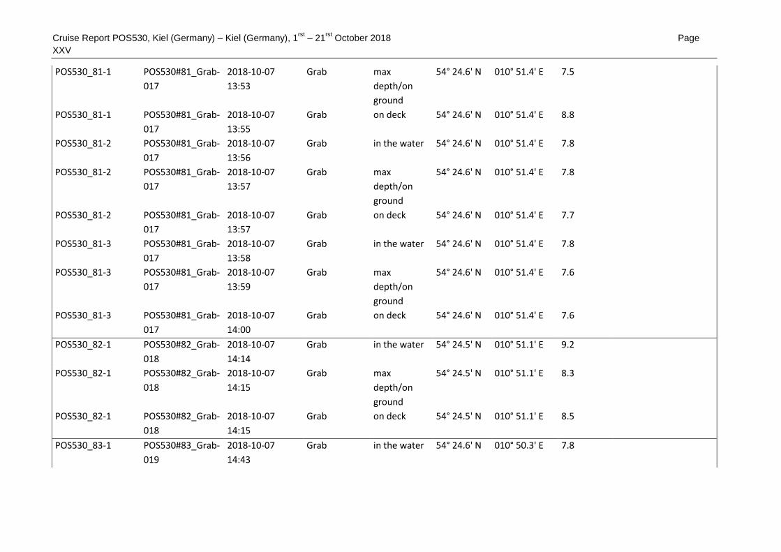
Cruise Report POS530, Kiel (Germany) – Kiel (Germany), 1rst
– 21rst
October 2018 Page
XXV
POS530_81-1 POS530#81_Grab-
017
2018-10-07
13:53
Grab max
depth/on
ground
54° 24.6' N 010° 51.4' E 7.5
POS530_81-1 POS530#81_Grab-
017
2018-10-07
13:55
Grab on deck 54° 24.6' N 010° 51.4' E 8.8
POS530_81-2 POS530#81_Grab-
017
2018-10-07
13:56
Grab in the water 54° 24.6' N 010° 51.4' E 7.8
POS530_81-2 POS530#81_Grab-
017
2018-10-07
13:57
Grab max
depth/on
ground
54° 24.6' N 010° 51.4' E 7.8
POS530_81-2 POS530#81_Grab-
017
2018-10-07
13:57
Grab on deck 54° 24.6' N 010° 51.4' E 7.7
POS530_81-3 POS530#81_Grab-
017
2018-10-07
13:58
Grab in the water 54° 24.6' N 010° 51.4' E 7.8
POS530_81-3 POS530#81_Grab-
017
2018-10-07
13:59
Grab max
depth/on
ground
54° 24.6' N 010° 51.4' E 7.6
POS530_81-3 POS530#81_Grab-
017
2018-10-07
14:00
Grab on deck 54° 24.6' N 010° 51.4' E 7.6
POS530_82-1 POS530#82_Grab-
018
2018-10-07
14:14
Grab in the water 54° 24.5' N 010° 51.1' E 9.2
POS530_82-1 POS530#82_Grab-
018
2018-10-07
14:15
Grab max
depth/on
ground
54° 24.5' N 010° 51.1' E 8.3
POS530_82-1 POS530#82_Grab-
018
2018-10-07
14:15
Grab on deck 54° 24.5' N 010° 51.1' E 8.5
POS530_83-1 POS530#83_Grab-
019
2018-10-07
14:43
Grab in the water 54° 24.6' N 010° 50.3' E 7.8

Cruise Report POS530, Kiel (Germany) – Kiel (Germany), 1rst
– 21rst
October 2018 Page
XXVI
POS530_83-1 POS530#83_Grab-
019
2018-10-07
14:44
Grab max
depth/on
ground
54° 24.6' N 010° 50.3' E 8
POS530_83-1 POS530#83_Grab-
019
2018-10-07
14:45
Grab on deck 54° 24.6' N 010° 50.3' E 9.1
POS530_84-1 POS530#84_Grab-
020
2018-10-07
14:59
Grab in the water 54° 24.6' N 010° 50.0' E 8.2
POS530_84-1 POS530#84_Grab-
020
2018-10-07
14:59
Grab max
depth/on
ground
54° 24.6' N 010° 50.0' E 8.1
POS530_84-1 POS530#84_Grab-
020
2018-10-07
15:00
Grab on deck 54° 24.6' N 010° 50.0' E 8.5
POS530_85-1 POS530#85_CTD-
043
2018-10-07
16:10
CTD in the water 54° 19.4' N 010° 42.2' E 10.6
POS530_85-1 POS530#85_CTD-
043
2018-10-07
16:13
CTD max
depth/on
ground
54° 19.4' N 010° 42.2' E 10.5
POS530_85-1 POS530#85_CTD-
043
2018-10-07
16:15
CTD on deck 54° 19.4' N 010° 42.2' E 10.6
POS530_85-2 POS530#85_GoFlo
-011
2018-10-07
16:17
GoFlo bottle in the water 54° 19.4' N 010° 42.2' E 10.6
POS530_85-2 POS530#85_GoFlo
-011
2018-10-07
16:21
GoFlo bottle max
depth/on
ground
54° 19.4' N 010° 42.2' E 10.6
POS530_85-2 POS530#85_GoFlo
-011
2018-10-07
16:23
GoFlo bottle on deck 54° 19.4' N 010° 42.3' E 10.6
POS530_86-1 POS530#86_CTD-
044
2018-10-07
16:50
CTD in the water 54° 21.1' N 010° 42.4' E 12.6

Cruise Report POS530, Kiel (Germany) – Kiel (Germany), 1rst
– 21rst
October 2018 Page
XXVII
POS530_86-1 POS530#86_CTD-
044
2018-10-07
16:53
CTD max
depth/on
ground
54° 21.1' N 010° 42.4' E 12.6
POS530_86-1 POS530#86_CTD-
044
2018-10-07
16:55
CTD on deck 54° 21.1' N 010° 42.4' E 12.5
POS530_87-1 POS530#87_CTD-
045
2018-10-07
17:27
CTD in the water 54° 23.5' N 010° 42.5' E 14.2
POS530_87-1 POS530#87_CTD-
045
2018-10-07
17:30
CTD max
depth/on
ground
54° 23.5' N 010° 42.4' E 14.2
POS530_87-1 POS530#87_CTD-
045
2018-10-07
17:32
CTD on deck 54° 23.5' N 010° 42.4' E 14.2
POS530_87-2 POS530#87_GoFlo
-012
2018-10-07
17:35
GoFlo bottle in the water 54° 23.5' N 010° 42.4' E 14.2
POS530_87-2 POS530#87_GoFlo
-012
2018-10-07
17:38
GoFlo bottle max
depth/on
ground
54° 23.5' N 010° 42.4' E 14.2
POS530_87-2 POS530#87_GoFlo
-012
2018-10-07
17:40
GoFlo bottle on deck 54° 23.5' N 010° 42.4' E 14.2
POS530_88-1 POS530#88_CTD-
046
2018-10-07
18:23
CTD in the water 54° 27.0' N 010° 42.6' E 16.6
POS530_88-1 POS530#88_CTD-
046
2018-10-07
18:26
CTD max
depth/on
ground
54° 27.0' N 010° 42.5' E 16.6
POS530_88-1 POS530#88_CTD-
046
2018-10-07
18:29
CTD on deck 54° 27.0' N 010° 42.5' E 16.5
POS530_89-1 POS530#89_CTD-
047
2018-10-07
19:00
CTD in the water 54° 28.8' N 010° 42.4' E 16.7

Cruise Report POS530, Kiel (Germany) – Kiel (Germany), 1rst
– 21rst
October 2018 Page
XXVIII
POS530_89-1 POS530#89_CTD-
047
2018-10-07
19:03
CTD max
depth/on
ground
54° 28.8' N 010° 42.4' E 16.5
POS530_89-1 POS530#89_CTD-
047
2018-10-07
19:06
CTD on deck 54° 28.8' N 010° 42.4' E 16.6
POS530_89-2 POS530#89_GoFlo
-013
2018-10-07
19:10
GoFlo bottle in the water 54° 28.9' N 010° 42.4' E 16.5
POS530_89-2 POS530#89_GoFlo
-013
2018-10-07
19:13
GoFlo bottle max
depth/on
ground
54° 28.9' N 010° 42.4' E 16.6
POS530_89-2 POS530#89_GoFlo
-013
2018-10-07
19:16
GoFlo bottle on deck 54° 28.9' N 010° 42.4' E 16.6
POS530_90-1 POS530#90_CTD-
048
2018-10-07
19:43
CTD in the water 54° 30.7' N 010° 42.4' E 13.8
POS530_90-1 POS530#90_CTD-
048
2018-10-07
19:47
CTD max
depth/on
ground
54° 30.7' N 010° 42.4' E 13.7
POS530_90-1 POS530#90_CTD-
048
2018-10-07
19:49
CTD on deck 54° 30.7' N 010° 42.4' E 14
POS530_91-1 POS530#91_CTD-
049
2018-10-07
21:15
CTD in the water 54° 28.3' N 010° 26.8' E 11.3
POS530_91-1 POS530#91_CTD-
049
2018-10-07
21:18
CTD max
depth/on
ground
54° 28.3' N 010° 26.8' E 11.3
POS530_91-1 POS530#91_CTD-
049
2018-10-07
21:21
CTD on deck 54° 28.3' N 010° 26.8' E 11.1
POS530_91-2 POS530#91_GoFlo
-014
2018-10-07
21:23
GoFlo bottle in the water 54° 28.3' N 010° 26.8' E 11.3

Cruise Report POS530, Kiel (Germany) – Kiel (Germany), 1rst
– 21rst
October 2018 Page
XXIX
POS530_91-2 POS530#91_GoFlo
-014
2018-10-07
21:24
GoFlo bottle max
depth/on
ground
54° 28.3' N 010° 26.8' E 11.3
POS530_91-2 POS530#91_GoFlo
-014
2018-10-07
21:31
GoFlo bottle on deck 54° 28.2' N 010° 26.8' E 11.3
POS530_92-1 POS530#92_CTD-
050
2018-10-07
22:30
CTD in the water 54° 23.5' N 010° 33.4' E 10
POS530_92-1 POS530#92_CTD-
050
2018-10-07
22:32
CTD max
depth/on
ground
54° 23.5' N 010° 33.4' E 9.8
POS530_92-1 POS530#92_CTD-
050
2018-10-07
22:34
CTD on deck 54° 23.5' N 010° 33.4' E 9.8
POS530_93-1 POS530#93_CTD-
051
2018-10-07
23:15
CTD in the water 54° 22.5' N 010° 38.9' E 9.3
POS530_93-1 POS530#93_CTD-
051
2018-10-07
23:17
CTD max
depth/on
ground
54° 22.5' N 010° 38.9' E 9.5
POS530_93-1 POS530#93_CTD-
051
2018-10-07
23:19
CTD on deck 54° 22.5' N 010° 38.9' E 9.6
POS530_94-1 POS530#94_CTD-
052
2018-10-08 0:08 CTD in the water 54° 19.5' N 010° 45.2' E 11.3
POS530_94-1 POS530#94_CTD-
052
2018-10-08 0:10 CTD max
depth/on
ground
54° 19.5' N 010° 45.2' E 11.3
POS530_94-1 POS530#94_CTD-
052
2018-10-08 0:12 CTD on deck 54° 19.5' N 010° 45.2' E 11.3
POS530_95-1 POS530#95_CTD-
053
2018-10-08 0:44 CTD in the water 54° 20.7' N 010° 49.2' E 11.5

Cruise Report POS530, Kiel (Germany) – Kiel (Germany), 1rst
– 21rst
October 2018 Page
XXX
POS530_95-1 POS530#95_CTD-
053
2018-10-08 0:46 CTD max
depth/on
ground
54° 20.7' N 010° 49.2' E 11.5
POS530_95-1 POS530#95_CTD-
053
2018-10-08 0:48 CTD on deck 54° 20.7' N 010° 49.2' E 11.5
POS530_96-1 POS530#96_CTD-
054
2018-10-08 1:27 CTD in the water 54° 22.4' N 010° 52.8' E 10.6
POS530_96-1 POS530#96_CTD-
054
2018-10-08 1:29 CTD max
depth/on
ground
54° 22.4' N 010° 52.8' E 10.6
POS530_96-1 POS530#96_CTD-
054
2018-10-08 1:31 CTD on deck 54° 22.4' N 010° 52.8' E 10.7
POS530_97-1 POS530#97_MB-
008
2018-10-08 2:24 Multibeam
echosounder
profile start 54° 24.8' N 010° 52.2' E 9.1
POS530_97-1 POS530#97_MB-
008
2018-10-08 6:59 Multibeam
echosounder
profile end 54° 24.8' N 010° 49.2' E 8.7
POS530_98-1 POS530#98_AUV-
002
2018-10-08 7:34 Autonomous
Underwater
Vehicle
in the water 54° 24.5' N 010° 50.5' E 8
POS530_98-1 POS530#98_AUV-
002
2018-10-08 8:46 Autonomous
Underwater
Vehicle
on deck 54° 24.6' N 010° 50.5' E 7.8
POS530_99-1 POS530#99_MB-
009
2018-10-08 9:56 Multibeam
echosounder
profile start 54° 24.6' N 010° 54.4' E 7
POS530_99-1 POS530#99_MB-
009
2018-10-08
12:48
Multibeam
echosounder
profile end 54° 24.6' N 010° 54.5' E 7.1

Cruise Report POS530, Kiel (Germany) – Kiel (Germany), 1rst
– 21rst
October 2018 Page
XXXI
POS530_100-1 POS530#100_AUV
-003
2018-10-08
13:28
Autonomous
Underwater
Vehicle
in the water 54° 24.7' N 010° 54.4' E 6.8
POS530_100-1 POS530#100_AUV
-003
2018-10-08
15:11
Autonomous
Underwater
Vehicle
on deck 54° 24.6' N 010° 54.2' E 9.3
POS530_101-1 POS530#101_SVP-
007
2018-10-08
16:14
Sound
Velocity
Profiler
in the water 54° 24.6' N 010° 54.0' E 9.3
POS530_101-1 POS530#101_SVP-
007
2018-10-08
16:17
Sound
Velocity
Profiler
on deck 54° 24.6' N 010° 54.0' E 9.5
POS530_102-1 POS530#102_MB-
010
2018-10-08
16:40
Multibeam
echosounder
profile start 54° 24.8' N 010° 54.5' E 8.1
POS530_102-1 POS530#102_MB-
010
2018-10-09 5:40 Multibeam
echosounder
profile end 54° 24.9' N 010° 51.4' E 8.1
POS530_103-1 POS530#103_AUV
-004
2018-10-09 6:14 Autonomous
Underwater
Vehicle
in the water 54° 24.6' N 010° 53.1' E 9
POS530_103-1 POS530#103_AUV
-004
2018-10-09 8:09 Autonomous
Underwater
Vehicle
on deck 54° 24.7' N 010° 53.2' E 8.8
POS530_104-1 POS530#104_AUV
-005
2018-10-09 8:39 Autonomous
Underwater
Vehicle
in the water 54° 24.6' N 010° 53.1' E 9

Cruise Report POS530, Kiel (Germany) – Kiel (Germany), 1rst
– 21rst
October 2018 Page
XXXII
POS530_104-1 POS530#104_AUV
-005
2018-10-09
10:07
Autonomous
Underwater
Vehicle
on deck 54° 24.7' N 010° 53.1' E 8.8
POS530_105-1 POS530#105_MB-
011
2018-10-09
10:33
Multibeam
echosounder
profile start 54° 24.8' N 010° 53.6' E 8.8
POS530_105-1 POS530#105_MB-
011
2018-10-09
12:50
Multibeam
echosounder
profile end 54° 24.8' N 010° 54.4' E 8.3
POS530_106-1 POS530#106_AUV
-006
2018-10-09
13:24
Autonomous
Underwater
Vehicle
in the water 54° 24.9' N 010° 54.3' E 8.3
POS530_106-1 POS530#106_AUV
-006
2018-10-09
15:19
Autonomous
Underwater
Vehicle
on deck 54° 24.9' N 010° 53.7' E 8.5
POS530_107-1 POS530#107_SVP-
008
2018-10-09
16:13
Sound
Velocity
Profiler
in the water 54° 24.9' N 010° 53.5' E 8.7
POS530_107-1 POS530#107_SVP-
008
2018-10-09
16:16
Sound
Velocity
Profiler
on deck 54° 24.9' N 010° 53.5' E 9.7
POS530_108-1 POS530#108_MB-
012
2018-10-09
16:41
Multibeam
echosounder
profile start 54° 24.8' N 010° 54.4' E 7.5
POS530_108-1 POS530#108_MB-
012
2018-10-10 5:51 Multibeam
echosounder
profile end 54° 24.4' N 010° 54.6' E 9.7
POS530_109-1 POS530#109_Dive
-002
2018-10-10 7:49 Diving
operations
station start 54° 24.6' N 010° 54.2' E 9.2 Divers leave VSL with
own boat

Cruise Report POS530, Kiel (Germany) – Kiel (Germany), 1rst
– 21rst
October 2018 Page
XXXIII
POS530_109-1 POS530#109_Dive
-002
2018-10-10
11:26
Diving
operations
station end 54° 24.6' N 010° 54.2' E 9.1 Divers back on board
POS530_110-1 POS530#110_Gra
b-021
2018-10-10
12:19
Grab in the water 54° 24.8' N 010° 53.9' E 8.2
POS530_110-1 POS530#110_Gra
b-021
2018-10-10
12:19
Grab max
depth/on
ground
54° 24.8' N 010° 53.9' E 8.2
POS530_110-1 POS530#110_Gra
b-021
2018-10-10
12:20
Grab on deck 54° 24.8' N 010° 53.9' E 8.2
POS530_110-2 POS530#110_Gra
b-021
2018-10-10
12:21
Grab in the water 54° 24.8' N 010° 53.9' E 8.1
POS530_110-2 POS530#110_Gra
b-021
2018-10-10
12:23
Grab on deck 54° 24.8' N 010° 53.9' E 8
POS530_110-2 POS530#110_Gra
b-021
2018-10-10
12:23
Grab max
depth/on
ground
54° 24.8' N 010° 53.9' E 8.1
POS530_110-3 POS530#110_Gra
b-021
2018-10-10
12:25
Grab in the water 54° 24.8' N 010° 53.9' E 8
POS530_110-3 POS530#110_Gra
b-021
2018-10-10
12:25
Grab max
depth/on
ground
54° 24.8' N 010° 53.9' E 8.8
POS530_110-3 POS530#110_Gra
b-021
2018-10-10
12:26
Grab on deck 54° 24.8' N 010° 53.8' E 8.1
POS530_111-1 POS530#111_Gra
b-022
2018-10-10
12:33
Grab in the water 54° 24.7' N 010° 53.9' E 8.3
POS530_111-1 POS530#111_Gra
b-022
2018-10-10
12:34
Grab max
depth/on
ground
54° 24.7' N 010° 53.9' E 8.5
POS530_111-1 POS530#111_Gra
b-022
2018-10-10
12:34
Grab on deck 54° 24.7' N 010° 53.9' E 8.6
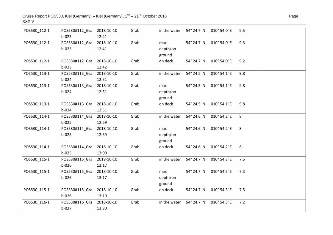
Cruise Report POS530, Kiel (Germany) – Kiel (Germany), 1rst
– 21rst
October 2018 Page
XXXIV
POS530_112-1 POS530#112_Gra
b-023
2018-10-10
12:41
Grab in the water 54° 24.7' N 010° 54.0' E 9.5
POS530_112-1 POS530#112_Gra
b-023
2018-10-10
12:41
Grab max
depth/on
ground
54° 24.7' N 010° 54.0' E 9.3
POS530_112-1 POS530#112_Gra
b-023
2018-10-10
12:42
Grab on deck 54° 24.7' N 010° 54.0' E 9.2
POS530_113-1 POS530#113_Gra
b-024
2018-10-10
12:51
Grab in the water 54° 24.5' N 010° 54.1' E 9.8
POS530_113-1 POS530#113_Gra
b-024
2018-10-10
12:51
Grab max
depth/on
ground
54° 24.5' N 010° 54.1' E 9.8
POS530_113-1 POS530#113_Gra
b-024
2018-10-10
12:51
Grab on deck 54° 24.5' N 010° 54.1' E 9.8
POS530_114-1 POS530#114_Gra
b-025
2018-10-10
12:59
Grab in the water 54° 24.6' N 010° 54.2' E 8
POS530_114-1 POS530#114_Gra
b-025
2018-10-10
12:59
Grab max
depth/on
ground
54° 24.6' N 010° 54.2' E 8
POS530_114-1 POS530#114_Gra
b-025
2018-10-10
13:00
Grab on deck 54° 24.6' N 010° 54.2' E 8
POS530_115-1 POS530#115_Gra
b-026
2018-10-10
13:17
Grab in the water 54° 24.7' N 010° 54.3' E 7.5
POS530_115-1 POS530#115_Gra
b-026
2018-10-10
13:17
Grab max
depth/on
ground
54° 24.7' N 010° 54.3' E 7.3
POS530_115-1 POS530#115_Gra
b-026
2018-10-10
13:19
Grab on deck 54° 24.7' N 010° 54.3' E 7.5
POS530_116-1 POS530#116_Gra
b-027
2018-10-10
13:30
Grab in the water 54° 24.7' N 010° 54.3' E 7.2

Cruise Report POS530, Kiel (Germany) – Kiel (Germany), 1rst
– 21rst
October 2018 Page
XXXV
POS530_116-1 POS530#116_Gra
b-027
2018-10-10
13:30
Grab max
depth/on
ground
54° 24.7' N 010° 54.3' E 7.2
POS530_116-1 POS530#116_Gra
b-027
2018-10-10
13:31
Grab on deck 54° 24.8' N 010° 54.3' E 7.1
POS530_116-2 POS530#116_Gra
b-027
2018-10-10
13:32
Grab in the water 54° 24.8' N 010° 54.3' E 7.1
POS530_116-2 POS530#116_Gra
b-027
2018-10-10
13:33
Grab max
depth/on
ground
54° 24.8' N 010° 54.3' E 7.2
POS530_116-2 POS530#116_Gra
b-027
2018-10-10
13:34
Grab on deck 54° 24.8' N 010° 54.3' E 7.2
POS530_116-3 POS530#116_Gra
b-027
2018-10-10
13:34
Grab in the water 54° 24.8' N 010° 54.3' E 7.1
POS530_116-3 POS530#116_Gra
b-027
2018-10-10
13:34
Grab max
depth/on
ground
54° 24.8' N 010° 54.3' E 7.1
POS530_116-3 POS530#116_Gra
b-027
2018-10-10
13:35
Grab on deck 54° 24.8' N 010° 54.3' E 7.3
POS530_117-1 POS530#117_Gra
b-028
2018-10-10
13:49
Grab in the water 54° 24.8' N 010° 54.4' E 8.2
POS530_117-1 POS530#117_Gra
b-028
2018-10-10
13:50
Grab max
depth/on
ground
54° 24.8' N 010° 54.4' E 8.2
POS530_117-1 POS530#117_Gra
b-028
2018-10-10
13:52
Grab on deck 54° 24.9' N 010° 54.4' E 8.3
POS530_118-1 POS530#118_Gra
b-029
2018-10-10
14:10
Grab in the water 54° 24.7' N 010° 54.2' E 7.8

Cruise Report POS530, Kiel (Germany) – Kiel (Germany), 1rst
– 21rst
October 2018 Page
XXXVI
POS530_118-1 POS530#118_Gra
b-029
2018-10-10
14:11
Grab max
depth/on
ground
54° 24.7' N 010° 54.2' E 7.8
POS530_118-1 POS530#118_Gra
b-029
2018-10-10
14:11
Grab on deck 54° 24.7' N 010° 54.2' E 7.8
POS530_119-1 POS530#119_Gra
b-030
2018-10-10
14:20
Grab in the water 54° 24.7' N 010° 54.3' E 7.7
POS530_119-1 POS530#119_Gra
b-030
2018-10-10
14:21
Grab max
depth/on
ground
54° 24.7' N 010° 54.3' E 7.6
POS530_119-1 POS530#119_Gra
b-030
2018-10-10
14:21
Grab on deck 54° 24.7' N 010° 54.3' E 7.8
POS530_119-2 POS530#119_Gra
b-030
2018-10-10
14:22
Grab in the water 54° 24.7' N 010° 54.2' E 7.7
POS530_119-2 POS530#119_Gra
b-030
2018-10-10
14:22
Grab max
depth/on
ground
54° 24.7' N 010° 54.2' E 7.8
POS530_119-2 POS530#119_Gra
b-030
2018-10-10
14:23
Grab on deck 54° 24.7' N 010° 54.2' E 7.7
POS530_120-1 POS530#120_SVP-
009
2018-10-10
22:03
Sound
Velocity
Profiler
in the water 54° 28.5' N 011° 27.5' E 23.6
POS530_120-1 POS530#120_SVP-
009
2018-10-10
22:08
Sound
Velocity
Profiler
on deck 54° 28.6' N 011° 27.5' E 24
POS530_121-1 POS530#121_MB-
013
2018-10-10
22:20
Multibeam
echosounder
profile start 54° 28.4' N 011° 26.7' E 23.2
POS530_121-1 POS530#121_MB-
013
2018-10-11 4:44 Multibeam
echosounder
profile end 54° 23.8' N 011° 30.8' E 20.8

Cruise Report POS530, Kiel (Germany) – Kiel (Germany), 1rst
– 21rst
October 2018 Page
XXXVII
POS530_122-1 POS530#122_CTD
-055
2018-10-11 6:06 CTD in the water 54° 27.4' N 011° 21.5' E 15.5
POS530_122-1 POS530#122_CTD
-055
2018-10-11 6:09 CTD max
depth/on
ground
54° 27.4' N 011° 21.5' E 15.6 15 m max
POS530_122-1 POS530#122_CTD
-055
2018-10-11 6:12 CTD on deck 54° 27.4' N 011° 21.5' E 15.6
POS530_123-1 POS530#123_CTD
-056
2018-10-11 6:58 CTD in the water 54° 23.4' N 011° 22.1' E 18.8
POS530_123-1 POS530#123_CTD
-056
2018-10-11 7:00 CTD max
depth/on
ground
54° 23.4' N 011° 22.1' E 18.8 18 m max
POS530_123-1 POS530#123_CTD
-056
2018-10-11 7:03 CTD on deck 54° 23.4' N 011° 22.1' E 18.7
POS530_124-1 POS530#124_CTD
-057
2018-10-11 7:56 CTD in the water 54° 18.9' N 011° 18.6' E 16.8
POS530_124-1 POS530#124_CTD
-057
2018-10-11 7:59 CTD max
depth/on
ground
54° 18.9' N 011° 18.6' E 17.6 16 m max
POS530_124-1 POS530#124_CTD
-057
2018-10-11 8:01 CTD on deck 54° 18.9' N 011° 18.6' E 17.1
POS530_125-1 POS530#125_CTD
-058
2018-10-11 8:51 CTD in the water 54° 14.8' N 011° 15.2' E 17.3
POS530_125-1 POS530#125_CTD
-058
2018-10-11 8:54 CTD max
depth/on
ground
54° 14.8' N 011° 15.3' E 18.6 16 m max
POS530_125-1 POS530#125_CTD
-058
2018-10-11 8:57 CTD on deck 54° 14.8' N 011° 15.3' E 18.1
POS530_126-1 POS530#126_CTD
-059
2018-10-11 9:36 CTD in the water 54° 11.6' N 011° 12.9' E 17

Cruise Report POS530, Kiel (Germany) – Kiel (Germany), 1rst
– 21rst
October 2018 Page
XXXVIII
POS530_126-1 POS530#126_CTD
-059
2018-10-11 9:39 CTD max
depth/on
ground
54° 11.6' N 011° 12.9' E 17.7 16 m max
POS530_126-1 POS530#126_CTD
-059
2018-10-11 9:41 CTD on deck 54° 11.6' N 011° 12.9' E 17.2
POS530_127-1 POS530#127_CTD
-060
2018-10-11
10:22
CTD in the water 54° 08.5' N 011° 09.7' E 19.2
POS530_127-1 POS530#127_CTD
-060
2018-10-11
10:24
CTD max
depth/on
ground
54° 08.5' N 011° 09.7' E 20.2 19 m max
POS530_127-1 POS530#127_CTD
-060
2018-10-11
10:26
CTD on deck 54° 08.4' N 011° 09.7' E 19
POS530_128-1 POS530#128_CTD
-061
2018-10-11
11:12
CTD in the water 54° 07.1' N 011° 03.2' E 11.2
POS530_128-1 POS530#128_CTD
-061
2018-10-11
11:15
CTD max
depth/on
ground
54° 07.1' N 011° 03.2' E 13 10 m max
POS530_128-1 POS530#128_CTD
-061
2018-10-11
11:17
CTD on deck 54° 07.1' N 011° 03.2' E 10.6
POS530_129-1 POS530#129_CTD
-062
2018-10-11
12:17
CTD in the water 54° 04.3' N 010° 55.3' E 17.7
POS530_129-1 POS530#129_CTD
-062
2018-10-11
12:20
CTD max
depth/on
ground
54° 04.3' N 010° 55.3' E 17.7 17 m max
POS530_129-1 POS530#129_CTD
-062
2018-10-11
12:22
CTD on deck 54° 04.3' N 010° 55.3' E 17.8
POS530_129-2 POS530#129_SVP-
010
2018-10-11
12:38
Sound
Velocity
Profiler
in the water 54° 04.3' N 010° 55.3' E 17.7

Cruise Report POS530, Kiel (Germany) – Kiel (Germany), 1rst
– 21rst
October 2018 Page
XXXIX
POS530_129-2 POS530#129_SVP-
010
2018-10-11
12:43
Sound
Velocity
Profiler
on deck 54° 04.3' N 010° 55.3' E 17.8
POS530_130-1 POS530#130_MB-
014
2018-10-11
13:28
Multibeam
echosounder
profile start 54° 04.1' N 011° 00.1' E 18.8
POS530_130-1 POS530#130_MB-
014
2018-10-12 9:12 Multibeam
echosounder
profile end 54° 05.0' N 011° 00.2' E 18.6
POS530_131-1 POS530#131_TV-
CTD-007
2018-10-12 9:30 TV-CTD in the water 54° 04.8' N 010° 59.8' E 18.8 Video and
Watersamples
POS530_131-1 POS530#131_TV-
CTD-007
2018-10-12 9:50 TV-CTD max
depth/on
ground
54° 04.8' N 010° 59.8' E 18.6 19 m max
POS530_131-1 POS530#131_TV-
CTD-007
2018-10-12 9:51 TV-CTD profile start 54° 04.8' N 010° 59.8' E 18.7
POS530_131-1 POS530#131_TV-
CTD-007
2018-10-12
10:50
TV-CTD profile end 54° 04.5' N 010° 59.7' E 18.6
POS530_131-1 POS530#131_TV-
CTD-007
2018-10-12
10:52
TV-CTD on deck 54° 04.5' N 010° 59.7' E 18.5
POS530_132-1 POS530#132_TV-
CTD-008
2018-10-12
11:15
TV-CTD in the water 54° 04.5' N 010° 59.3' E 18.5 Video
POS530_132-1 POS530#132_TV-
CTD-008
2018-10-12
11:28
TV-CTD max
depth/on
ground
54° 04.5' N 010° 59.3' E 18.6
POS530_132-1 POS530#132_TV-
CTD-008
2018-10-12
11:28
TV-CTD profile start 54° 04.5' N 010° 59.3' E 19.3

Cruise Report POS530, Kiel (Germany) – Kiel (Germany), 1rst
– 21rst
October 2018 Page XL
POS530_132-1 POS530#132_TV-
CTD-008
2018-10-12
13:06
TV-CTD profile end 54° 04.2' N 010° 59.3' E 0
POS530_132-1 POS530#132_TV-
CTD-008
2018-10-12
13:11
TV-CTD on deck 54° 04.1' N 010° 59.3' E 18.8
POS530_133-1 POS530#133_CTD
-065
2018-10-12
13:54
CTD in the water 54° 06.4' N 010° 59.5' E 18
POS530_133-1 POS530#133_CTD
-065
2018-10-12
13:57
CTD max
depth/on
ground
54° 06.4' N 010° 59.4' E 18.1 17 m max
POS530_133-1 POS530#133_CTD
-065
2018-10-12
13:59
CTD on deck 54° 06.4' N 010° 59.4' E 18.5
POS530_133-2 POS530#133_CTD
-065
2018-10-12
14:01
CTD in the water 54° 06.5' N 010° 59.4' E 18.1
POS530_133-2 POS530#133_CTD
-065
2018-10-12
14:05
CTD max
depth/on
ground
54° 06.5' N 010° 59.4' E 17.8 SL max = 17m
POS530_133-2 POS530#133_CTD
-065
2018-10-12
14:07
CTD on deck 54° 06.5' N 010° 59.4' E 18.1
POS530_134-1 POS530#134_CTD
-066
2018-10-12
14:27
CTD in the water 54° 05.7' N 010° 58.3' E 17.7
POS530_134-1 POS530#134_CTD
-066
2018-10-12
14:30
CTD max
depth/on
ground
54° 05.7' N 010° 58.3' E 18 SL max = 18m
POS530_134-1 POS530#134_CTD
-066
2018-10-12
14:32
CTD on deck 54° 05.7' N 010° 58.3' E 17.7
POS530_135-1 POS530#135_CTD
-067
2018-10-12
14:49
CTD in the water 54° 05.0' N 010° 57.0' E 18.1

Cruise Report POS530, Kiel (Germany) – Kiel (Germany), 1rst
– 21rst
October 2018 Page
XLI
POS530_135-1 POS530#135_CTD
-067
2018-10-12
14:52
CTD max
depth/on
ground
54° 05.0' N 010° 56.9' E 17.6 SL max = 18m
POS530_135-1 POS530#135_CTD
-067
2018-10-12
14:55
CTD on deck 54° 05.0' N 010° 56.9' E 17.6
POS530_136-1 POS530#136_CTD
-068
2018-10-12
15:21
CTD in the water 54° 03.9' N 010° 54.6' E 18.1
POS530_136-1 POS530#136_CTD
-068
2018-10-12
15:24
CTD max
depth/on
ground
54° 03.9' N 010° 54.5' E 18.1 SL max = 18m
POS530_136-1 POS530#136_CTD
-068
2018-10-12
15:27
CTD on deck 54° 03.9' N 010° 54.5' E 18.1
POS530_137-1 POS530#137_SVP-
011
2018-10-12
16:27
Sound
Velocity
Profiler
in the water 54° 05.0' N 011° 01.1' E 18.8
POS530_137-1 POS530#137_SVP-
011
2018-10-12
16:31
Sound
Velocity
Profiler
on deck 54° 05.0' N 011° 01.0' E 19
POS530_138-1 POS530#138_MB-
015
2018-10-12
16:45
Multibeam
echosounder
profile start 54° 05.0' N 011° 00.2' E 18.2
POS530_138-1 POS530#138_MB-
015
2018-10-13 5:40 Multibeam
echosounder
profile end 54° 05.1' N 010° 59.3' E 18.3
POS530_139-1 POS530#139_CTD
-069
2018-10-13 7:10 CTD in the water 54° 02.0' N 010° 46.7' E 9.8
POS530_139-1 POS530#139_CTD
-069
2018-10-13 7:13 CTD max
depth/on
ground
54° 02.0' N 010° 46.7' E 9.5 10 m max
POS530_139-1 POS530#139_CTD
-069
2018-10-13 7:14 CTD on deck 54° 02.0' N 010° 46.7' E 9.5

Cruise Report POS530, Kiel (Germany) – Kiel (Germany), 1rst
– 21rst
October 2018 Page
XLII
POS530_139-2 POS530#139_CTD
-069
2018-10-13 7:15 CTD in the water 54° 02.0' N 010° 46.7' E 9.2
POS530_139-2 POS530#139_CTD
-069
2018-10-13 7:19 CTD max
depth/on
ground
54° 02.1' N 010° 46.7' E 9.5 10 m max
POS530_139-2 POS530#139_CTD
-069
2018-10-13 7:20 CTD on deck 54° 02.1' N 010° 46.7' E 9.2
POS530_140-1 POS530#140_CTD
-070
2018-10-13 7:38 CTD in the water 54° 02.2' N 010° 48.1' E 12.5
POS530_140-1 POS530#140_CTD
-070
2018-10-13 7:41 CTD max
depth/on
ground
54° 02.2' N 010° 48.1' E 12.5 12 m max
POS530_140-1 POS530#140_CTD
-070
2018-10-13 7:42 CTD on deck 54° 02.2' N 010° 48.1' E 12.5
POS530_140-2 POS530#140_GoFl
o-015
2018-10-13 7:45 GoFlo bottle in the water 54° 02.2' N 010° 48.1' E 12.3
POS530_140-2 POS530#140_GoFl
o-015
2018-10-13 7:49 GoFlo bottle max
depth/on
ground
54° 02.2' N 010° 48.1' E 12.3
POS530_140-2 POS530#140_GoFl
o-015
2018-10-13 7:51 GoFlo bottle on deck 54° 02.2' N 010° 48.1' E 12.2
POS530_141-1 POS530#141_CTD
-071
2018-10-13 8:06 CTD in the water 54° 02.4' N 010° 49.0' E 15.2
POS530_141-1 POS530#141_CTD
-071
2018-10-13 8:09 CTD max
depth/on
ground
54° 02.4' N 010° 49.0' E 15.2 SL max = 15m
POS530_141-1 POS530#141_CTD
-071
2018-10-13 8:11 CTD on deck 54° 02.4' N 010° 49.0' E 15.1

Cruise Report POS530, Kiel (Germany) – Kiel (Germany), 1rst
– 21rst
October 2018 Page
XLIII
POS530_142-1 POS530#142_CTD
-072
2018-10-13 8:29 CTD in the water 54° 02.6' N 010° 50.0' E 16.2
POS530_142-1 POS530#142_CTD
-072
2018-10-13 8:31 CTD max
depth/on
ground
54° 02.6' N 010° 50.0' E 16.2 16 m max
POS530_142-1 POS530#142_CTD
-072
2018-10-13 8:33 CTD on deck 54° 02.6' N 010° 50.0' E 16.3
POS530_143-1 POS530#143_CTD
-073
2018-10-13 8:53 CTD in the water 54° 03.0' N 010° 51.4' E 16.8
POS530_143-1 POS530#143_CTD
-073
2018-10-13 8:57 CTD max
depth/on
ground
54° 03.0' N 010° 51.4' E 16.8 17 m max
POS530_143-1 POS530#143_CTD
-073
2018-10-13 8:59 CTD on deck 54° 03.0' N 010° 51.4' E 16.8
POS530_144-1 POS530#144_CTD
-074
2018-10-13 9:20 CTD in the water 54° 03.4' N 010° 53.1' E 18.1
POS530_144-1 POS530#144_CTD
-074
2018-10-13 9:24 CTD max
depth/on
ground
54° 03.4' N 010° 53.1' E 17.7 18 m max
POS530_144-1 POS530#144_CTD
-074
2018-10-13 9:27 CTD on deck 54° 03.4' N 010° 53.1' E 17.8
POS530_144-2 POS530#144_GoFl
o-016
2018-10-13 9:29 GoFlo bottle in the water 54° 03.4' N 010° 53.0' E 17.8
POS530_144-2 POS530#144_GoFl
o-016
2018-10-13 9:35 GoFlo bottle max
depth/on
ground
54° 03.4' N 010° 53.0' E 17.8
POS530_144-2 POS530#144_GoFl
o-016
2018-10-13 9:39 GoFlo bottle on deck 54° 03.4' N 010° 53.0' E 17.8

Cruise Report POS530, Kiel (Germany) – Kiel (Germany), 1rst
– 21rst
October 2018 Page
XLIV
POS530_145-1 POS530#145_AUV
-007
2018-10-13
10:47
Autonomous
Underwater
Vehicle
in the water 54° 04.8' N 010° 57.8' E 18.5
POS530_145-1 POS530#145_AUV
-007
2018-10-13
12:26
Autonomous
Underwater
Vehicle
on deck 54° 04.8' N 010° 57.9' E 18.3
POS530_146-1 POS530#146_CTD
-075
2018-10-13
13:10
CTD in the water 54° 04.9' N 010° 58.3' E 18.3
POS530_146-1 POS530#146_CTD
-075
2018-10-13
13:13
CTD max
depth/on
ground
54° 04.9' N 010° 58.3' E 18.3 8 m max
POS530_146-1 POS530#146_CTD
-075
2018-10-13
13:14
CTD on deck 54° 04.9' N 010° 58.3' E 18.1
POS530_146-2 POS530#146_CTD
-075
2018-10-13
13:16
CTD in the water 54° 04.9' N 010° 58.2' E 18.2
POS530_146-2 POS530#146_CTD
-075
2018-10-13
13:19
CTD max
depth/on
ground
54° 04.9' N 010° 58.2' E 18.3 18 m max
POS530_146-2 POS530#146_CTD
-075
2018-10-13
13:21
CTD on deck 54° 04.9' N 010° 58.3' E 18.3
POS530_146-3 POS530#146_GoFl
o-017
2018-10-13
13:26
GoFlo bottle in the water 54° 04.9' N 010° 58.2' E 18.3
POS530_146-3 POS530#146_GoFl
o-017
2018-10-13
13:33
GoFlo bottle on deck 54° 04.9' N 010° 58.3' E 18.3
POS530_147-1 POS530#147_AUV
-008
2018-10-13
14:03
Autonomous
Underwater
Vehicle
in the water 54° 04.2' N 010° 57.5' E 18.5

Cruise Report POS530, Kiel (Germany) – Kiel (Germany), 1rst
– 21rst
October 2018 Page
XLV
POS530_147-1 POS530#147_AUV
-008
2018-10-13
14:49
Autonomous
Underwater
Vehicle
on deck 54° 04.3' N 010° 57.5' E 18.6
POS530_148-1 POS530#148_SVP-
012
2018-10-13
16:07
Sound
Velocity
Profiler
in the water 54° 03.0' N 010° 47.7' E 10.1
POS530_148-1 POS530#148_SVP-
012
2018-10-13
16:12
Sound
Velocity
Profiler
on deck 54° 03.0' N 010° 47.7' E 10.2
POS530_149-1 POS530#149_MB-
016
2018-10-13
16:20
Multibeam
echosounder
profile start 54° 02.9' N 010° 47.6' E 9.1
POS530_149-1 POS530#149_MB-
016
2018-10-14 6:56 Multibeam
echosounder
profile end 54° 01.7' N 010° 48.8' E 12.3
POS530_150-1 POS530#150_AUV
-008
2018-10-14 7:21 Autonomous
Underwater
Vehicle
in the water 54° 01.8' N 010° 48.1' E 13.4
POS530_150-1 POS530#150_AUV
-008
2018-10-14 8:50 Autonomous
Underwater
Vehicle
on deck 54° 01.7' N 010° 48.1' E 13.4
POS530_151-1 POS530#151_AUV
-009
2018-10-14 9:35 Autonomous
Underwater
Vehicle
in the water 54° 02.1' N 010° 48.3' E 13.1
POS530_151-1 POS530#151_AUV
-009
2018-10-14
11:12
Autonomous
Underwater
Vehicle
on deck 54° 02.1' N 010° 48.3' E 13.2
POS530_152-1 POS530#152_CTD
-076
2018-10-14
11:45
CTD in the water 54° 00.6' N 010° 48.8' E 10.3

Cruise Report POS530, Kiel (Germany) – Kiel (Germany), 1rst
– 21rst
October 2018 Page
XLVI
POS530_152-1 POS530#152_CTD
-076
2018-10-14
11:47
CTD max
depth/on
ground
54° 00.6' N 010° 48.8' E 10.3 11 m max
POS530_152-1 POS530#152_CTD
-076
2018-10-14
11:48
CTD on deck 54° 00.6' N 010° 48.8' E 10.3
POS530_153-1 POS530#153_CTD
-077
2018-10-14
12:28
CTD in the water 54° 01.2' N 010° 52.6' E 16.2
POS530_153-1 POS530#153_CTD
-077
2018-10-14
12:30
CTD max
depth/on
ground
54° 01.2' N 010° 52.6' E 16.2 16 m max
POS530_153-1 POS530#153_CTD
-077
2018-10-14
12:32
CTD on deck 54° 01.2' N 010° 52.6' E 16.2
POS530_154-1 POS530#154_CTD
-078
2018-10-14
13:18
CTD in the water 54° 00.5' N 010° 56.6' E 16.9
POS530_154-1 POS530#154_CTD
-078
2018-10-14
13:20
CTD max
depth/on
ground
54° 00.5' N 010° 56.6' E 16.9 17 m max
POS530_154-1 POS530#154_CTD
-078
2018-10-14
13:22
CTD on deck 54° 00.5' N 010° 56.6' E 17
POS530_155-1 POS530#155_CTD
-079
2018-10-14
13:58
CTD in the water 54° 01.1' N 011° 00.3' E 19.4
POS530_155-1 POS530#155_CTD
-079
2018-10-14
14:01
CTD max
depth/on
ground
54° 01.1' N 011° 00.3' E 19.4 SL max = 19m
POS530_155-1 POS530#155_CTD
-079
2018-10-14
14:04
CTD on deck 54° 01.1' N 011° 00.3' E 19.5
POS530_156-1 POS530#156_CTD
-080
2018-10-14
14:33
CTD in the water 54° 01.6' N 011° 03.6' E 13.1

Cruise Report POS530, Kiel (Germany) – Kiel (Germany), 1rst
– 21rst
October 2018 Page
XLVII
POS530_156-1 POS530#156_CTD
-080
2018-10-14
14:36
CTD max
depth/on
ground
54° 01.6' N 011° 03.6' E 13.3 SL max = 14m
POS530_156-1 POS530#156_CTD
-080
2018-10-14
14:38
CTD on deck 54° 01.6' N 011° 03.5' E 13.3
POS530_156-2 POS530#156_GoFl
o-018
2018-10-14
14:41
GoFlo bottle in the water 54° 01.6' N 011° 03.5' E 13.4
POS530_156-2 POS530#156_GoFl
o-018
2018-10-14
14:44
GoFlo bottle max
depth/on
ground
54° 01.6' N 011° 03.5' E 13.3 SL max = 15m
POS530_156-2 POS530#156_GoFl
o-018
2018-10-14
14:46
GoFlo bottle on deck 54° 01.6' N 011° 03.5' E 13.3
POS530_157-1 POS530#157_CTD
-081
2018-10-14
15:25
CTD in the water 54° 02.9' N 011° 02.7' E 19.8
POS530_157-1 POS530#157_CTD
-081
2018-10-14
15:28
CTD max
depth/on
ground
54° 02.9' N 011° 02.7' E 19.9 SL max = 20m
POS530_157-1 POS530#157_CTD
-081
2018-10-14
15:30
CTD on deck 54° 02.9' N 011° 02.6' E 19.8
POS530_158-1 POS530#158_CTD
-082
2018-10-14
15:58
CTD in the water 54° 04.1' N 011° 01.8' E 20.3
POS530_158-1 POS530#158_CTD
-082
2018-10-14
16:03
CTD max
depth/on
ground
54° 04.1' N 011° 01.8' E 19.2 SL max = 19 m
POS530_158-1 POS530#158_CTD
-082
2018-10-14
16:05
CTD on deck 54° 04.1' N 011° 01.8' E 19.6
POS530_158-2 POS530#158_GoFl
o-019
2018-10-14
16:08
GoFlo bottle in the water 54° 04.2' N 011° 01.7' E 19.7
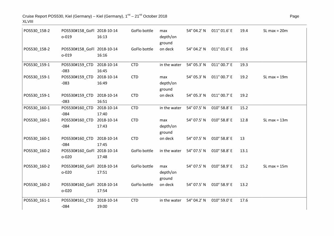
Cruise Report POS530, Kiel (Germany) – Kiel (Germany), 1rst
– 21rst
October 2018 Page
XLVIII
POS530_158-2 POS530#158_GoFl
o-019
2018-10-14
16:13
GoFlo bottle max
depth/on
ground
54° 04.2' N 011° 01.6' E 19.4 SL max = 20m
POS530_158-2 POS530#158_GoFl
o-019
2018-10-14
16:16
GoFlo bottle on deck 54° 04.2' N 011° 01.6' E 19.6
POS530_159-1 POS530#159_CTD
-083
2018-10-14
16:45
CTD in the water 54° 05.3' N 011° 00.7' E 19.3
POS530_159-1 POS530#159_CTD
-083
2018-10-14
16:49
CTD max
depth/on
ground
54° 05.3' N 011° 00.7' E 19.2 SL max = 19m
POS530_159-1 POS530#159_CTD
-083
2018-10-14
16:51
CTD on deck 54° 05.3' N 011° 00.7' E 19.2
POS530_160-1 POS530#160_CTD
-084
2018-10-14
17:40
CTD in the water 54° 07.5' N 010° 58.8' E 15.2
POS530_160-1 POS530#160_CTD
-084
2018-10-14
17:43
CTD max
depth/on
ground
54° 07.5' N 010° 58.8' E 12.8 SL max = 13m
POS530_160-1 POS530#160_CTD
-084
2018-10-14
17:45
CTD on deck 54° 07.5' N 010° 58.8' E 13
POS530_160-2 POS530#160_GoFl
o-020
2018-10-14
17:48
GoFlo bottle in the water 54° 07.5' N 010° 58.8' E 13.1
POS530_160-2 POS530#160_GoFl
o-020
2018-10-14
17:51
GoFlo bottle max
depth/on
ground
54° 07.5' N 010° 58.9' E 15.2 SL max = 15m
POS530_160-2 POS530#160_GoFl
o-020
2018-10-14
17:54
GoFlo bottle on deck 54° 07.5' N 010° 58.9' E 13.2
POS530_161-1 POS530#161_CTD
-084
2018-10-14
19:00
CTD in the water 54° 04.2' N 010° 59.0' E 17.6

Cruise Report POS530, Kiel (Germany) – Kiel (Germany), 1rst
– 21rst
October 2018 Page
XLIX
POS530_161-1 POS530#161_CTD
-084
2018-10-14
19:04
CTD max
depth/on
ground
54° 04.2' N 010° 59.0' E 17.7 18 m max
POS530_161-1 POS530#161_CTD
-084
2018-10-14
19:07
CTD on deck 54° 04.2' N 010° 59.0' E 17.7
POS530_161-2 POS530#161_GoFl
o-021
2018-10-14
19:10
GoFlo bottle in the water 54° 04.2' N 010° 59.0' E 20.3
POS530_161-2 POS530#161_GoFl
o-021
2018-10-14
19:14
GoFlo bottle max
depth/on
ground
54° 04.2' N 010° 59.0' E 17.7
POS530_161-2 POS530#161_GoFl
o-021
2018-10-14
19:14
GoFlo bottle on deck 54° 04.2' N 010° 59.0' E 17.7
POS530_162-1 POS530#162_SBP-
002
2018-10-14
20:37
Subbottom
Profiler
profile start 54° 04.2' N 010° 55.7' E 18.3
POS530_162-1 POS530#162_SBP-
002
2018-10-15 6:29 Subbottom
Profiler
profile end 54° 05.4' N 010° 58.5' E 18.2
POS530_163-1 POS530#163_TV-
CTD-009_010
2018-10-15 8:10 TV-CTD in the water 54° 02.6' N 010° 47.9' E 10.7 Video
POS530_163-1 POS530#163_TV-
CTD-009_010
2018-10-15 8:34 TV-CTD max
depth/on
ground
54° 02.6' N 010° 47.8' E 12.2 SL max = 1o m
POS530_163-1 POS530#163_TV-
CTD-009_010
2018-10-15 8:34 TV-CTD profile start 54° 02.6' N 010° 47.8' E 10.7
POS530_163-1 POS530#163_TV-
CTD-009_010
2018-10-15
10:17
TV-CTD profile end 54° 02.5' N 010° 47.9' E 12
POS530_163-1 POS530#163_TV-
CTD-009_010
2018-10-15
10:19
TV-CTD on deck 54° 02.5' N 010° 47.9' E 12.1

Cruise Report POS530, Kiel (Germany) – Kiel (Germany), 1rst
– 21rst
October 2018 Page L
POS530_164-1 POS530#164_TV-
CTD-011
2018-10-15
10:47
TV-CTD in the water 54° 01.6' N 010° 47.7' E 11.7 Video
POS530_164-1 POS530#164_TV-
CTD-011
2018-10-15
10:59
TV-CTD max
depth/on
ground
54° 01.6' N 010° 47.7' E 11.8
POS530_164-1 POS530#164_TV-
CTD-011
2018-10-15
11:00
TV-CTD profile start 54° 01.6' N 010° 47.7' E 11.8
POS530_164-1 POS530#164_TV-
CTD-011
2018-10-15
11:39
TV-CTD profile end 54° 01.6' N 010° 48.0' E 13
POS530_164-1 POS530#164_TV-
CTD-011
2018-10-15
11:43
TV-CTD on deck 54° 01.6' N 010° 48.0' E 13
POS530_165-1 POS530#165_AUV
-010
2018-10-15
12:08
Autonomous
Underwater
Vehicle
in the water 54° 01.7' N 010° 48.3' E 13.1
POS530_165-1 POS530#165_AUV
-010
2018-10-15
13:30
Autonomous
Underwater
Vehicle
on deck 54° 01.7' N 010° 48.3' E 13.1
POS530_166-1 POS530#166_AUV
-011
2018-10-15
14:19
Autonomous
Underwater
Vehicle
in the water 54° 01.7' N 010° 48.6' E 11.6
POS530_166-1 POS530#166_AUV
-011
2018-10-15
14:57
Autonomous
Underwater
Vehicle
on deck 54° 01.7' N 010° 48.6' E 12
POS530_167-1 POS530#167_SVP-
013
2018-10-15
16:11
Sound
Velocity
Profiler
in the water 54° 03.2' N 010° 48.9' E 15.7

Cruise Report POS530, Kiel (Germany) – Kiel (Germany), 1rst
– 21rst
October 2018 Page LI
POS530_167-1 POS530#167_SVP-
013
2018-10-15
16:14
Sound
Velocity
Profiler
on deck 54° 03.2' N 010° 48.9' E 15.6
POS530_168-1 POS530#168_MB-
017
2018-10-15
16:30
Multibeam
echosounder
profile start 54° 02.9' N 010° 48.9' E 13.1
POS530_168-1 POS530#168_MB-
017
2018-10-16 5:20 Multibeam
echosounder
profile end 54° 01.5' N 010° 48.8' E 9.2
POS530_169-1 POS530#169_SVP-
014
2018-10-16 5:37 Sound
Velocity
Profiler
in the water 54° 01.7' N 010° 48.2' E 13.1
POS530_169-1 POS530#169_SVP-
014
2018-10-16 5:39 Sound
Velocity
Profiler
on deck 54° 01.7' N 010° 48.2' E 13.1
POS530_170-1 POS530#170_AUV
-012
2018-10-16 6:55 Autonomous
Underwater
Vehicle
in the water 54° 02.2' N 010° 48.5' E 15.5
POS530_170-1 POS530#170_AUV
-012
2018-10-16 8:20 Autonomous
Underwater
Vehicle
on deck 54° 02.1' N 010° 48.5' E 13
POS530_171-1 POS530#171_AUV
-013
2018-10-16 8:59 Autonomous
Underwater
Vehicle
in the water 54° 02.6' N 010° 47.7' E 10.7
POS530_171-1 POS530#171_AUV
-013
2018-10-16 9:41 Autonomous
Underwater
Vehicle
on deck 54° 02.6' N 010° 47.7' E 10.5

Cruise Report POS530, Kiel (Germany) – Kiel (Germany), 1rst
– 21rst
October 2018 Page LII
POS530_172-1 POS530#172_AUV
-014
2018-10-16
10:49
Autonomous
Underwater
Vehicle
in the water 54° 02.6' N 010° 47.8' E 10.7
POS530_172-1 POS530#172_AUV
-014
2018-10-16
11:24
Autonomous
Underwater
Vehicle
on deck 54° 02.6' N 010° 47.7' E 10.8
POS530_173-1 POS530#173_AUV
-015
2018-10-16
11:56
Autonomous
Underwater
Vehicle
in the water 54° 02.7' N 010° 47.8' E 10.7
POS530_173-1 POS530#173_AUV
-015
2018-10-16
12:42
Autonomous
Underwater
Vehicle
on deck 54° 02.8' N 010° 47.8' E 10.2
POS530_174-1 POS530#174_Gra
b-031
2018-10-16
14:10
Grab in the water 54° 04.3' N 011° 00.2' E 19.5
POS530_174-1 POS530#174_Gra
b-031
2018-10-16
14:10
Grab max
depth/on
ground
54° 04.3' N 011° 00.2' E 18.7
POS530_174-1 POS530#174_Gra
b-031
2018-10-16
14:11
Grab on deck 54° 04.3' N 011° 00.2' E 19
POS530_175-1 POS530#175_Gra
b-032
2018-10-16
14:31
Grab in the water 54° 04.5' N 010° 59.8' E 18.6
POS530_175-1 POS530#175_Gra
b-032
2018-10-16
14:31
Grab max
depth/on
ground
54° 04.5' N 010° 59.8' E 18.5
POS530_175-1 POS530#175_Gra
b-032
2018-10-16
14:32
Grab on deck 54° 04.5' N 010° 59.8' E 18.6
POS530_176-1 POS530#176_Gra
b-033
2018-10-16
14:46
Grab in the water 54° 04.7' N 010° 59.7' E 18.6
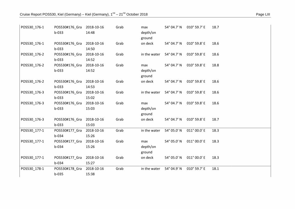
Cruise Report POS530, Kiel (Germany) – Kiel (Germany), 1rst
– 21rst
October 2018 Page LIII
POS530_176-1 POS530#176_Gra
b-033
2018-10-16
14:48
Grab max
depth/on
ground
54° 04.7' N 010° 59.7' E 18.7
POS530_176-1 POS530#176_Gra
b-033
2018-10-16
14:50
Grab on deck 54° 04.7' N 010° 59.8' E 18.6
POS530_176-2 POS530#176_Gra
b-033
2018-10-16
14:52
Grab in the water 54° 04.7' N 010° 59.8' E 18.6
POS530_176-2 POS530#176_Gra
b-033
2018-10-16
14:52
Grab max
depth/on
ground
54° 04.7' N 010° 59.8' E 18.8
POS530_176-2 POS530#176_Gra
b-033
2018-10-16
14:53
Grab on deck 54° 04.7' N 010° 59.8' E 18.6
POS530_176-3 POS530#176_Gra
b-033
2018-10-16
15:02
Grab in the water 54° 04.7' N 010° 59.8' E 18.6
POS530_176-3 POS530#176_Gra
b-033
2018-10-16
15:03
Grab max
depth/on
ground
54° 04.7' N 010° 59.8' E 18.6
POS530_176-3 POS530#176_Gra
b-033
2018-10-16
15:03
Grab on deck 54° 04.7' N 010° 59.8' E 18.7
POS530_177-1 POS530#177_Gra
b-034
2018-10-16
15:26
Grab in the water 54° 05.0' N 011° 00.0' E 18.3
POS530_177-1 POS530#177_Gra
b-034
2018-10-16
15:26
Grab max
depth/on
ground
54° 05.0' N 011° 00.0' E 18.3
POS530_177-1 POS530#177_Gra
b-034
2018-10-16
15:27
Grab on deck 54° 05.0' N 011° 00.0' E 18.3
POS530_178-1 POS530#178_Gra
b-035
2018-10-16
15:38
Grab in the water 54° 04.9' N 010° 59.7' E 18.1

Cruise Report POS530, Kiel (Germany) – Kiel (Germany), 1rst
– 21rst
October 2018 Page
LIV
POS530_178-1 POS530#178_Gra
b-035
2018-10-16
15:39
Grab max
depth/on
ground
54° 04.9' N 010° 59.7' E 18.2
POS530_178-1 POS530#178_Gra
b-035
2018-10-16
15:40
Grab on deck 54° 04.9' N 010° 59.7' E 18.3
POS530_179-1 POS530#179_Gra
b-036
2018-10-16
15:49
Grab in the water 54° 04.9' N 010° 59.5' E 16.2
POS530_179-1 POS530#179_Gra
b-036
2018-10-16
15:49
Grab max
depth/on
ground
54° 04.9' N 010° 59.5' E 16.2
POS530_179-1 POS530#179_Gra
b-036
2018-10-16
15:50
Grab on deck 54° 04.9' N 010° 59.5' E 16.1
POS530_180-1 POS530#180_Gra
b-037
2018-10-16
15:59
Grab in the water 54° 04.9' N 010° 59.4' E 18.2
POS530_180-1 POS530#180_Gra
b-037
2018-10-16
15:59
Grab max
depth/on
ground
54° 04.9' N 010° 59.4' E 18.1
POS530_180-1 POS530#180_Gra
b-037
2018-10-16
16:00
Grab on deck 54° 04.9' N 010° 59.4' E 18.2
POS530_181-1 POS530#181_Gra
b-038
2018-10-16
16:07
Grab in the water 54° 04.9' N 010° 59.4' E 18.6
POS530_181-1 POS530#181_Gra
b-038
2018-10-16
16:08
Grab max
depth/on
ground
54° 04.9' N 010° 59.4' E 18.7
POS530_181-1 POS530#181_Gra
b-038
2018-10-16
16:09
Grab on deck 54° 04.9' N 010° 59.4' E 18.7
POS530_182-1 POS530#182_Gra
b-039
2018-10-16
16:23
Grab in the water 54° 04.5' N 010° 59.4' E 18.5

Cruise Report POS530, Kiel (Germany) – Kiel (Germany), 1rst
– 21rst
October 2018 Page LV
POS530_182-1 POS530#182_Gra
b-039
2018-10-16
16:24
Grab max
depth/on
ground
54° 04.5' N 010° 59.4' E 18.6
POS530_182-1 POS530#182_Gra
b-039
2018-10-16
16:25
Grab on deck 54° 04.5' N 010° 59.4' E 18.5
POS530_183-1 POS530#183_Gra
b-040
2018-10-16
16:39
Grab in the water 54° 04.3' N 010° 58.9' E 17.8
POS530_183-1 POS530#183_Gra
b-040
2018-10-16
16:40
Grab max
depth/on
ground
54° 04.3' N 010° 58.9' E 17.8
POS530_183-1 POS530#183_Gra
b-040
2018-10-16
16:40
Grab on deck 54° 04.3' N 010° 58.9' E 18
POS530_184-1 POS530#184_Gra
b-041
2018-10-16
16:55
Grab in the water 54° 04.2' N 010° 58.5' E 18.7
POS530_184-1 POS530#184_Gra
b-041
2018-10-16
16:56
Grab max
depth/on
ground
54° 04.2' N 010° 58.5' E 18.6
POS530_184-1 POS530#184_Gra
b-041
2018-10-16
16:56
Grab on deck 54° 04.2' N 010° 58.5' E 18.6
POS530_184-2 POS530#184_Gra
b-041
2018-10-16
16:57
Grab in the water 54° 04.2' N 010° 58.5' E 18.7
POS530_184-2 POS530#184_Gra
b-041
2018-10-16
16:58
Grab max
depth/on
ground
54° 04.2' N 010° 58.5' E 18.6
POS530_184-2 POS530#184_Gra
b-041
2018-10-16
16:59
Grab on deck 54° 04.2' N 010° 58.5' E 18.6
POS530_185-1 POS530#185_Gra
b-042
2018-10-16
17:09
Grab in the water 54° 04.3' N 010° 58.4' E 18.5

Cruise Report POS530, Kiel (Germany) – Kiel (Germany), 1rst
– 21rst
October 2018 Page
LVI
POS530_185-1 POS530#185_Gra
b-042
2018-10-16
17:09
Grab max
depth/on
ground
54° 04.3' N 010° 58.4' E 18.5
POS530_185-1 POS530#185_Gra
b-042
2018-10-16
17:10
Grab on deck 54° 04.3' N 010° 58.4' E 18.6
POS530_186-1 POS530#186_Gra
b-043
2018-10-16
17:32
Grab in the water 54° 05.1' N 010° 58.4' E 18.2
POS530_186-1 POS530#186_Gra
b-043
2018-10-16
17:33
Grab max
depth/on
ground
54° 05.1' N 010° 58.4' E 18.3
POS530_186-1 POS530#186_Gra
b-043
2018-10-16
17:34
Grab on deck 54° 05.1' N 010° 58.4' E 18.3
POS530_187-1 POS530#187_Gra
b-044
2018-10-16
17:50
Grab in the water 54° 04.9' N 010° 57.8' E 18.2
POS530_187-1 POS530#187_Gra
b-044
2018-10-16
17:51
Grab max
depth/on
ground
54° 04.9' N 010° 57.8' E 18.3
POS530_187-1 POS530#187_Gra
b-044
2018-10-16
17:52
Grab on deck 54° 04.9' N 010° 57.8' E 18.3
POS530_188-1 POS530#188_Gra
b-045
2018-10-16
18:10
Grab in the water 54° 05.4' N 010° 57.8' E 17.7
POS530_188-1 POS530#188_Gra
b-045
2018-10-16
18:10
Grab max
depth/on
ground
54° 05.4' N 010° 57.8' E 17.8
POS530_188-1 POS530#188_Gra
b-045
2018-10-16
18:13
Grab on deck 54° 05.4' N 010° 57.8' E 17.8
POS530_189-1 POS530#189_Gra
b-046
2018-10-16
18:28
Grab in the water 54° 05.3' N 010° 56.7' E 17.6

Cruise Report POS530, Kiel (Germany) – Kiel (Germany), 1rst
– 21rst
October 2018 Page
LVII
POS530_189-1 POS530#189_Gra
b-046
2018-10-16
18:29
Grab max
depth/on
ground
54° 05.3' N 010° 56.7' E 17.7
POS530_189-1 POS530#189_Gra
b-046
2018-10-16
18:31
Grab on deck 54° 05.3' N 010° 56.8' E 17.6
POS530_190-1 POS530#190_Gra
b-047
2018-10-16
18:54
Grab in the water 54° 04.4' N 010° 56.1' E 18
POS530_190-1 POS530#190_Gra
b-047
2018-10-16
18:54
Grab max
depth/on
ground
54° 04.4' N 010° 56.1' E 17.8
POS530_190-1 POS530#190_Gra
b-047
2018-10-16
18:55
Grab on deck 54° 04.4' N 010° 56.1' E 18
POS530_191-1 POS530#191_Gra
b-048
2018-10-16
19:06
Grab in the water 54° 04.7' N 010° 56.0' E 15.7
POS530_191-1 POS530#191_Gra
b-048
2018-10-16
19:06
Grab max
depth/on
ground
54° 04.7' N 010° 56.0' E 16
POS530_191-1 POS530#191_Gra
b-048
2018-10-16
19:07
Grab on deck 54° 04.7' N 010° 56.0' E 15.7
POS530_192-1 POS530#192_Gra
b-049
2018-10-16
19:25
Grab in the water 54° 04.6' N 010° 57.1' E 18.3
POS530_192-1 POS530#192_Gra
b-049
2018-10-16
19:26
Grab max
depth/on
ground
54° 04.6' N 010° 57.1' E 18.5
POS530_192-1 POS530#192_Gra
b-049
2018-10-16
19:27
Grab on deck 54° 04.6' N 010° 57.1' E 18.3
POS530_193-1 POS530#193_Gra
b-050
2018-10-16
19:39
Grab in the water 54° 04.9' N 010° 56.8' E 18.5

Cruise Report POS530, Kiel (Germany) – Kiel (Germany), 1rst
– 21rst
October 2018 Page
LVIII
POS530_193-1 POS530#193_Gra
b-050
2018-10-16
19:39
Grab max
depth/on
ground
54° 04.9' N 010° 56.8' E 18.6
POS530_193-1 POS530#193_Gra
b-050
2018-10-16
19:40
Grab on deck 54° 04.9' N 010° 56.8' E 18.7
POS530_194-1 POS530#194_Gra
b-051
2018-10-16
19:54
Grab in the water 54° 04.9' N 010° 56.8' E 19.1
POS530_194-1 POS530#194_Gra
b-051
2018-10-16
19:55
Grab max
depth/on
ground
54° 04.9' N 010° 56.8' E 18.8
POS530_194-1 POS530#194_Gra
b-051
2018-10-16
19:56
Grab on deck 54° 04.9' N 010° 56.9' E 19
POS530_195-1 POS530#195_SVP-
015
2018-10-16
20:35
Sound
Velocity
Profiler
in the water 54° 05.4' N 011° 00.5' E 19.5
POS530_195-1 POS530#195_SVP-
015
2018-10-16
20:39
Sound
Velocity
Profiler
on deck 54° 05.4' N 011° 00.5' E 19.5
POS530_196-1 POS530#196_MB-
018
2018-10-16
20:48
Multibeam
echosounder
profile start 54° 05.5' N 011° 00.1' E 19.2
POS530_196-1 POS530#196_MB-
018
2018-10-17 5:08 Multibeam
echosounder
profile end 54° 04.2' N 010° 57.5' E 18.5
POS530_197-1 POS530#197_Dive
-003
2018-10-17 7:18 Diving
operations
station start 54° 02.1' N 010° 48.4' E 12.8 Divers leave VSL with
own boat
POS530_197-1 POS530#197_Dive
-003
2018-10-17
10:07
Diving
operations
station end 54° 02.6' N 010° 47.9' E 10.8 Divers back on board

Cruise Report POS530, Kiel (Germany) – Kiel (Germany), 1rst
– 21rst
October 2018 Page
LIX
POS530_198-1 POS530#198_MB-
019
2018-10-17
10:22
Multibeam
echosounder
profile start 54° 02.4' N 010° 48.4' E 14
POS530_198-1 POS530#198_MB-
019
2018-10-17
10:44
Multibeam
echosounder
profile end 54° 01.7' N 010° 48.2' E 13.3
POS530_199-1 POS530#199_AUV
-016
2018-10-17
11:18
Autonomous
Underwater
Vehicle
in the water 54° 01.8' N 010° 48.9' E 14.6
POS530_199-1 POS530#199_AUV
-016
2018-10-17
12:33
Autonomous
Underwater
Vehicle
on deck 54° 01.8' N 010° 48.8' E 14.6
POS530_200-1 POS530#200_Gra
b-052
2018-10-17
12:57
Grab in the water 54° 01.8' N 010° 47.8' E 13.1
POS530_200-1 POS530#200_Gra
b-052
2018-10-17
12:57
Grab max
depth/on
ground
54° 01.8' N 010° 47.9' E 13
POS530_200-1 POS530#200_Gra
b-052
2018-10-17
12:58
Grab on deck 54° 01.8' N 010° 47.8' E 13.1
POS530_201-1 POS530#201_Gra
b-053
2018-10-17
13:26
Grab in the water 54° 02.4' N 010° 48.2' E 14
POS530_201-1 POS530#201_Gra
b-053
2018-10-17
13:26
Grab max
depth/on
ground
54° 02.4' N 010° 48.2' E 13.8
POS530_201-1 POS530#201_Gra
b-053
2018-10-17
13:27
Grab on deck 54° 02.4' N 010° 48.2' E 13.9
POS530_202-1 POS530#202_Gra
b-054
2018-10-17
13:47
Grab in the water 54° 02.0' N 010° 49.2' E 15.6

Cruise Report POS530, Kiel (Germany) – Kiel (Germany), 1rst
– 21rst
October 2018 Page LX
POS530_202-1 POS530#202_Gra
b-054
2018-10-17
13:48
Grab max
depth/on
ground
54° 02.0' N 010° 49.2' E 15.6
POS530_202-1 POS530#202_Gra
b-054
2018-10-17
13:48
Grab on deck 54° 02.0' N 010° 49.2' E 15.5
POS530_202-2 POS530#202_Gra
b-054
2018-10-17
13:49
Grab in the water 54° 02.0' N 010° 49.2' E 15.6
POS530_202-2 POS530#202_Gra
b-054
2018-10-17
13:49
Grab max
depth/on
ground
54° 02.0' N 010° 49.2' E 15.5
POS530_202-2 POS530#202_Gra
b-054
2018-10-17
13:50
Grab on deck 54° 02.0' N 010° 49.2' E 15.6
POS530_203-1 POS530#203_Gra
b-055
2018-10-17
14:06
Grab in the water 54° 02.5' N 010° 49.0' E 15.7
POS530_203-1 POS530#203_Gra
b-055
2018-10-17
14:07
Grab max
depth/on
ground
54° 02.5' N 010° 49.0' E 15.8
POS530_203-1 POS530#203_Gra
b-055
2018-10-17
14:07
Grab on deck 54° 02.5' N 010° 49.0' E 15.7
POS530_204-1 POS530#204_Gra
b-056
2018-10-17
14:24
Grab in the water 54° 02.9' N 010° 48.6' E 15.2
POS530_204-1 POS530#204_Gra
b-056
2018-10-17
14:24
Grab max
depth/on
ground
54° 02.9' N 010° 48.6' E 15.4
POS530_204-1 POS530#204_Gra
b-056
2018-10-17
14:25
Grab on deck 54° 02.9' N 010° 48.6' E 15.3
POS530_205-1 POS530#205_Gra
b-057
2018-10-17
14:37
Grab in the water 54° 02.8' N 010° 48.9' E 13.3

Cruise Report POS530, Kiel (Germany) – Kiel (Germany), 1rst
– 21rst
October 2018 Page
LXI
POS530_205-1 POS530#205_Gra
b-057
2018-10-17
14:38
Grab max
depth/on
ground
54° 02.8' N 010° 48.9' E 13.3
POS530_205-1 POS530#205_Gra
b-057
2018-10-17
14:39
Grab on deck 54° 02.8' N 010° 48.9' E 13.3
POS530_205-2 POS530#205_Gra
b-057
2018-10-17
14:40
Grab in the water 54° 02.8' N 010° 48.9' E 13.3
POS530_205-2 POS530#205_Gra
b-057
2018-10-17
14:40
Grab max
depth/on
ground
54° 02.8' N 010° 48.9' E 13.3
POS530_205-2 POS530#205_Gra
b-057
2018-10-17
14:41
Grab on deck 54° 02.8' N 010° 48.9' E 13.3
POS530_206-1 POS530#206_CTD
-087
2018-10-17
17:17
CTD in the water 54° 03.0' N 010° 51.3' E 16.9
POS530_206-1 POS530#206_CTD
-087
2018-10-17
17:19
CTD max
depth/on
ground
54° 03.0' N 010° 51.3' E 16.8 SL max = 17m
POS530_206-1 POS530#206_CTD
-087
2018-10-17
17:20
CTD on deck 54° 02.9' N 010° 51.3' E 17.5
POS530_206-2 POS530#206_CTD
-087
2018-10-17
17:22
CTD in the water 54° 02.9' N 010° 51.3' E 16.9
POS530_206-2 POS530#206_CTD
-087
2018-10-17
17:25
CTD max
depth/on
ground
54° 02.9' N 010° 51.3' E 16.7 SL max = 17m
POS530_206-2 POS530#206_CTD
-087
2018-10-17
17:27
CTD on deck 54° 02.9' N 010° 51.3' E 16.9
POS530_207-1 POS530#207_CTD
-088
2018-10-17
19:03
CTD in the water 54° 02.5' N 011° 08.4' E 21.4

Cruise Report POS530, Kiel (Germany) – Kiel (Germany), 1rst
– 21rst
October 2018 Page
LXII
POS530_207-1 POS530#207_CTD
-088
2018-10-17
19:08
CTD max
depth/on
ground
54° 02.5' N 011° 08.4' E 21 20 m max
POS530_207-1 POS530#207_CTD
-088
2018-10-17
19:12
CTD on deck 54° 02.5' N 011° 08.5' E 21.2
POS530_208-1 POS530#208_CTD
-089
2018-10-17
19:51
CTD in the water 54° 03.8' N 011° 13.7' E 16.5
POS530_208-1 POS530#208_CTD
-089
2018-10-17
19:55
CTD max
depth/on
ground
54° 03.8' N 011° 13.7' E 16.5 16 m max
POS530_208-1 POS530#208_CTD
-089
2018-10-17
19:59
CTD on deck 54° 03.7' N 011° 13.7' E 16.7
POS530_209-1 POS530#209_CTD
-090
2018-10-17
21:00
CTD in the water 54° 06.1' N 011° 22.1' E 12.2
POS530_209-1 POS530#209_CTD
-090
2018-10-17
21:05
CTD max
depth/on
ground
54° 06.1' N 011° 22.1' E 12.1 12 m max
POS530_209-1 POS530#209_CTD
-090
2018-10-17
21:08
CTD on deck 54° 06.1' N 011° 22.1' E 12.1
POS530_210-1 POS530#210_CTD
-091
2018-10-17
22:09
CTD in the water 54° 09.4' N 011° 29.7' E 17.5
POS530_210-1 POS530#210_CTD
-091
2018-10-17
22:12
CTD max
depth/on
ground
54° 09.4' N 011° 29.7' E 17.5 17 m max
POS530_210-1 POS530#210_CTD
-091
2018-10-17
22:13
CTD on deck 54° 09.4' N 011° 29.7' E 17.4
POS530_211-1 POS530#211_CTD
-092
2018-10-17
23:25
CTD in the water 54° 14.3' N 011° 35.4' E 21.8

Cruise Report POS530, Kiel (Germany) – Kiel (Germany), 1rst
– 21rst
October 2018 Page
LXIII
POS530_211-1 POS530#211_CTD
-092
2018-10-17
23:28
CTD max
depth/on
ground
54° 14.3' N 011° 35.4' E 21.8 22 m max
POS530_211-1 POS530#211_CTD
-092
2018-10-17
23:30
CTD on deck 54° 14.3' N 011° 35.4' E 21.7
POS530_212-1 POS530212_CTD-
093
2018-10-18 0:36 CTD in the water 54° 15.1' N 011° 44.3' E 21.6
POS530_212-1 POS530#212_CTD
-093
2018-10-18 0:39 CTD max
depth/on
ground
54° 15.1' N 011° 44.4' E 21.6 22 m max
POS530_212-1 POS530#212_CTD
-093
2018-10-18 0:41 CTD on deck 54° 15.1' N 011° 44.4' E 21.7
POS530_213-1 POS530#213_CTD
-094
2018-10-18 2:10 CTD in the water 54° 15.7' N 011° 59.1' E 13.3
POS530_213-1 POS530#213_CTD
-094
2018-10-18 2:12 CTD max
depth/on
ground
54° 15.7' N 011° 59.1' E 13.2 SL max = 13m
POS530_213-1 POS530#213_CTD
-094
2018-10-18 2:14 CTD on deck 54° 15.7' N 011° 59.1' E 13.2
POS530_214-1 POS530#214_CTD
-095
2018-10-18 3:02 CTD in the water 54° 17.0' N 012° 04.6' E 14.8
POS530_214-1 POS530#214_CTD
-095
2018-10-18 3:04 CTD max
depth/on
ground
54° 17.0' N 012° 04.6' E 14.8 SL max = 15m
POS530_214-1 POS530#214_CTD
-095
2018-10-18 3:06 CTD on deck 54° 17.0' N 012° 04.6' E 14.7
POS530_215-1 POS530#215_CTD
-096
2018-10-18 3:59 CTD in the water 54° 20.6' N 012° 09.1' E 14.9
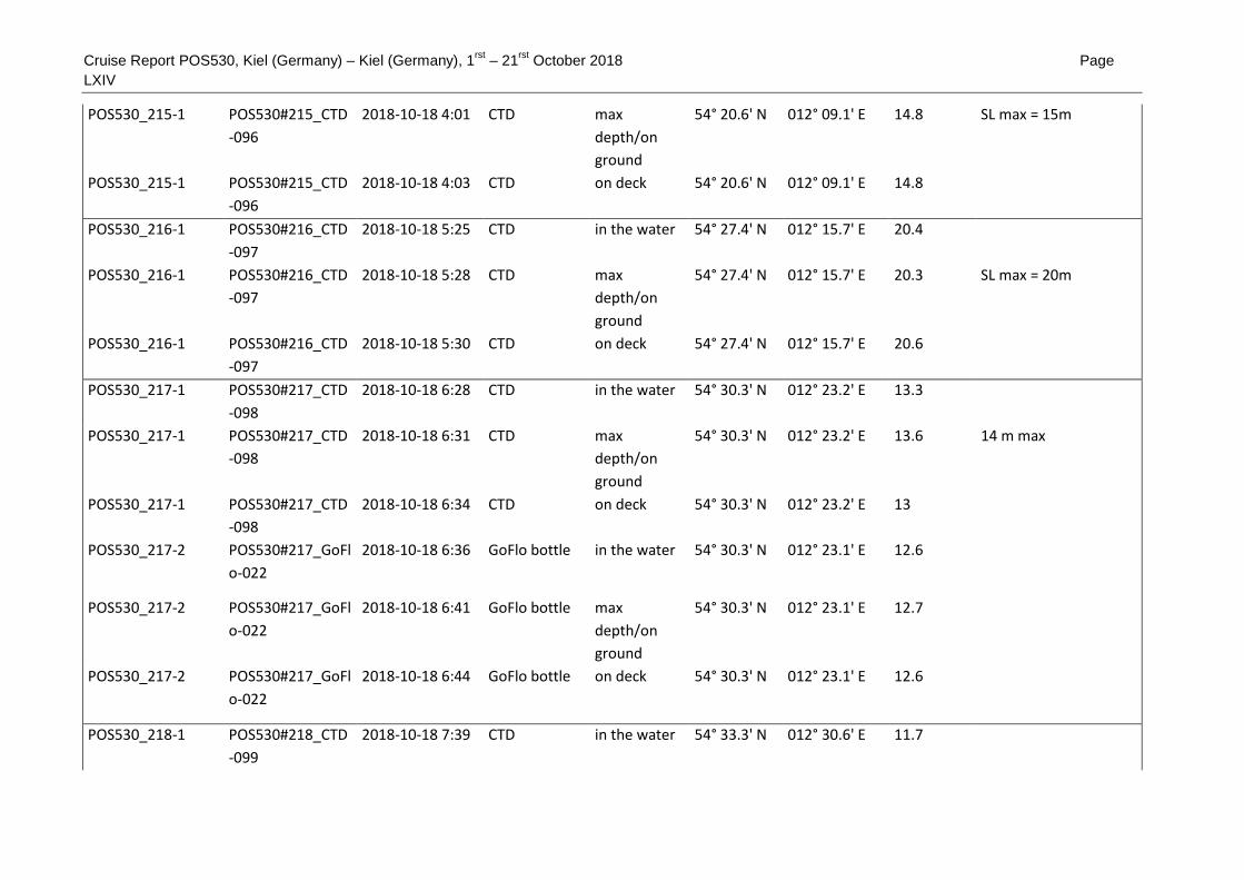
Cruise Report POS530, Kiel (Germany) – Kiel (Germany), 1rst
– 21rst
October 2018 Page
LXIV
POS530_215-1 POS530#215_CTD
-096
2018-10-18 4:01 CTD max
depth/on
ground
54° 20.6' N 012° 09.1' E 14.8 SL max = 15m
POS530_215-1 POS530#215_CTD
-096
2018-10-18 4:03 CTD on deck 54° 20.6' N 012° 09.1' E 14.8
POS530_216-1 POS530#216_CTD
-097
2018-10-18 5:25 CTD in the water 54° 27.4' N 012° 15.7' E 20.4
POS530_216-1 POS530#216_CTD
-097
2018-10-18 5:28 CTD max
depth/on
ground
54° 27.4' N 012° 15.7' E 20.3 SL max = 20m
POS530_216-1 POS530#216_CTD
-097
2018-10-18 5:30 CTD on deck 54° 27.4' N 012° 15.7' E 20.6
POS530_217-1 POS530#217_CTD
-098
2018-10-18 6:28 CTD in the water 54° 30.3' N 012° 23.2' E 13.3
POS530_217-1 POS530#217_CTD
-098
2018-10-18 6:31 CTD max
depth/on
ground
54° 30.3' N 012° 23.2' E 13.6 14 m max
POS530_217-1 POS530#217_CTD
-098
2018-10-18 6:34 CTD on deck 54° 30.3' N 012° 23.2' E 13
POS530_217-2 POS530#217_GoFl
o-022
2018-10-18 6:36 GoFlo bottle in the water 54° 30.3' N 012° 23.1' E 12.6
POS530_217-2 POS530#217_GoFl
o-022
2018-10-18 6:41 GoFlo bottle max
depth/on
ground
54° 30.3' N 012° 23.1' E 12.7
POS530_217-2 POS530#217_GoFl
o-022
2018-10-18 6:44 GoFlo bottle on deck 54° 30.3' N 012° 23.1' E 12.6
POS530_218-1 POS530#218_CTD
-099
2018-10-18 7:39 CTD in the water 54° 33.3' N 012° 30.6' E 11.7

Cruise Report POS530, Kiel (Germany) – Kiel (Germany), 1rst
– 21rst
October 2018 Page
LXV
POS530_218-1 POS530#218_CTD
-099
2018-10-18 7:42 CTD max
depth/on
ground
54° 33.3' N 012° 30.6' E 11.8 11 m max
POS530_218-1 POS530#218_CTD
-099
2018-10-18 7:45 CTD on deck 54° 33.3' N 012° 30.6' E 11.8
POS530_219-1 POS530#219_CTD
-100
2018-10-18 8:41 CTD in the water 54° 37.4' N 012° 36.7' E 14.4
POS530_219-1 POS530#219_CTD
-100
2018-10-18 8:44 CTD max
depth/on
ground
54° 37.4' N 012° 36.8' E 14.4 14 m max
POS530_219-1 POS530#219_CTD
-100
2018-10-18 8:46 CTD on deck 54° 37.4' N 012° 36.8' E 14.4
POS530_219-2 POS530#219_GoFl
o-023
2018-10-18 8:49 GoFlo bottle in the water 54° 37.4' N 012° 36.8' E 14.4
POS530_219-2 POS530#219_GoFl
o-023
2018-10-18 8:52 GoFlo bottle max
depth/on
ground
54° 37.4' N 012° 36.8' E 14.3
POS530_219-2 POS530#219_GoFl
o-023
2018-10-18 8:55 GoFlo bottle on deck 54° 37.4' N 012° 36.8' E 14.3
POS530_220-1 POS530#220_CTD
-101
2018-10-18 9:48 CTD in the water 54° 39.8' N 012° 44.8' E 13.1
POS530_220-1 POS530#220_CTD
-101
2018-10-18 9:51 CTD max
depth/on
ground
54° 39.8' N 012° 44.7' E 13 12 m max
POS530_220-1 POS530#220_CTD
-101
2018-10-18 9:53 CTD on deck 54° 39.8' N 012° 44.8' E 13
POS530_221-1 POS530#221_CTD
-102
2018-10-18
10:50
CTD in the water 54° 43.2' N 012° 52.0' E 19.8

Cruise Report POS530, Kiel (Germany) – Kiel (Germany), 1rst
– 21rst
October 2018 Page
LXVI
POS530_221-1 POS530#221_CTD
-102
2018-10-18
10:53
CTD max
depth/on
ground
54° 43.2' N 012° 52.0' E 19.8 19 m max
POS530_221-1 POS530#221_CTD
-102
2018-10-18
10:55
CTD on deck 54° 43.2' N 012° 52.0' E 19.8
POS530_221-2 POS530#221_GoFl
o-024
2018-10-18
10:58
GoFlo bottle in the water 54° 43.2' N 012° 52.0' E 19.8
POS530_221-2 POS530#221_GoFl
o-024
2018-10-18
11:02
GoFlo bottle max
depth/on
ground
54° 43.2' N 012° 52.1' E 19.8
POS530_221-2 POS530#221_GoFl
o-024
2018-10-18
11:06
GoFlo bottle on deck 54° 43.2' N 012° 52.1' E 19.9
POS530_222-1 POS530#222_CTD
-103
2018-10-18
12:10
CTD in the water 54° 47.0' N 012° 58.6' E 23.1
POS530_222-1 POS530#222_CTD
-103
2018-10-18
12:13
CTD max
depth/on
ground
54° 47.0' N 012° 58.6' E 23.1 23 m max
POS530_222-1 POS530#222_CTD
-103
2018-10-18
12:15
CTD on deck 54° 47.0' N 012° 58.7' E 23.2
POS530_223-1 POS530#223_CTD
-104
2018-10-18
13:18
CTD in the water 54° 48.5' N 013° 08.6' E 1.2
POS530_223-1 POS530#223_CTD
-104
2018-10-18
13:27
CTD max
depth/on
ground
54° 48.5' N 013° 08.6' E 0.9 37 m max
POS530_223-1 POS530#223_CTD
-104
2018-10-18
13:29
CTD on deck 54° 48.5' N 013° 08.6' E 0.9
POS530_223-2 POS530#223_GoFl
o-025
2018-10-18
13:34
GoFlo bottle in the water 54° 48.5' N 013° 08.6' E 0.6

Cruise Report POS530, Kiel (Germany) – Kiel (Germany), 1rst
– 21rst
October 2018 Page
LXVII
POS530_223-2 POS530#223_GoFl
o-025
2018-10-18
13:42
GoFlo bottle max
depth/on
ground
54° 48.5' N 013° 08.6' E 0.6
POS530_223-2 POS530#223_GoFl
o-025
2018-10-18
13:47
GoFlo bottle on deck 54° 48.5' N 013° 08.6' E 1.2
POS530_224-1 POS530#224_CTD
-105
2018-10-18
14:47
CTD in the water 54° 48.9' N 013° 17.8' E 41.1
POS530_224-1 POS530#224_CTD
-105
2018-10-18
14:51
CTD max
depth/on
ground
54° 48.9' N 013° 17.8' E 40.8 SL max = 41m
POS530_224-1 POS530#224_CTD
-105
2018-10-18
14:57
CTD on deck 54° 48.9' N 013° 17.8' E 41.1
POS530_225-1 POS530#225_CTD
-106
2018-10-18
16:02
CTD in the water 54° 49.0' N 013° 27.3' E 41.5
POS530_225-1 POS530#225_CTD
-106
2018-10-18
16:06
CTD max
depth/on
ground
54° 49.0' N 013° 27.2' E 41.6 SL max = 37m
POS530_225-1 POS530#225_CTD
-106
2018-10-18
16:14
CTD on deck 54° 49.0' N 013° 27.2' E 42.1
POS530_226-1 POS530#226_SVP-
016
2018-10-18
17:25
Sound
Velocity
Profiler
in the water 54° 47.7' N 013° 37.9' E 40.7
POS530_226-1 POS530#226_SVP-
016
2018-10-18
17:32
Sound
Velocity
Profiler
in the water 54° 47.7' N 013° 37.9' E 40.6
POS530_227-1 POS530#227_MB-
019
2018-10-18
17:45
Multibeam
echosounder
profile start 54° 47.7' N 013° 37.0' E 40.6
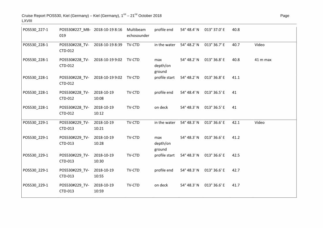
Cruise Report POS530, Kiel (Germany) – Kiel (Germany), 1rst
– 21rst
October 2018 Page
LXVIII
POS530_227-1 POS530#227_MB-
019
2018-10-19 8:16 Multibeam
echosounder
profile end 54° 48.4' N 013° 37.0' E 40.8
POS530_228-1 POS530#228_TV-
CTD-012
2018-10-19 8:39 TV-CTD in the water 54° 48.2' N 013° 36.7' E 40.7 Video
POS530_228-1 POS530#228_TV-
CTD-012
2018-10-19 9:02 TV-CTD max
depth/on
ground
54° 48.2' N 013° 36.8' E 40.8 41 m max
POS530_228-1 POS530#228_TV-
CTD-012
2018-10-19 9:02 TV-CTD profile start 54° 48.2' N 013° 36.8' E 41.1
POS530_228-1 POS530#228_TV-
CTD-012
2018-10-19
10:08
TV-CTD profile end 54° 48.4' N 013° 36.5' E 41
POS530_228-1 POS530#228_TV-
CTD-012
2018-10-19
10:12
TV-CTD on deck 54° 48.3' N 013° 36.5' E 41
POS530_229-1 POS530#229_TV-
CTD-013
2018-10-19
10:21
TV-CTD in the water 54° 48.3' N 013° 36.6' E 42.1 Video
POS530_229-1 POS530#229_TV-
CTD-013
2018-10-19
10:28
TV-CTD max
depth/on
ground
54° 48.3' N 013° 36.6' E 41.2
POS530_229-1 POS530#229_TV-
CTD-013
2018-10-19
10:30
TV-CTD profile start 54° 48.3' N 013° 36.6' E 42.5
POS530_229-1 POS530#229_TV-
CTD-013
2018-10-19
10:55
TV-CTD profile end 54° 48.3' N 013° 36.6' E 42.7
POS530_229-1 POS530#229_TV-
CTD-013
2018-10-19
10:59
TV-CTD on deck 54° 48.3' N 013° 36.6' E 41.7

Cruise Report POS530, Kiel (Germany) – Kiel (Germany), 1rst
– 21rst
October 2018 Page
LXIX
POS530_230-1 POS530#230_CTD
-109
2018-10-19
11:29
CTD in the water 54° 48.3' N 013° 33.9' E 41.7
POS530_230-1 POS530#230_CTD
-109
2018-10-19
11:37
CTD max
depth/on
ground
54° 48.3' N 013° 33.9' E 41.1 40 m max
POS530_230-1 POS530#230_CTD
-109
2018-10-19
11:40
CTD on deck 54° 48.3' N 013° 33.9' E 41.1
POS530_230-2 POS530#230_GoFl
o-026
2018-10-19
11:44
GoFlo bottle in the water 54° 48.3' N 013° 33.9' E 41.7
POS530_230-2 POS530#230_GoFl
o-026
2018-10-19
11:51
GoFlo bottle max
depth/on
ground
54° 48.3' N 013° 33.9' E 41
POS530_230-2 POS530#230_GoFl
o-026
2018-10-19
11:55
GoFlo bottle on deck 54° 48.3' N 013° 33.9' E 41.2
POS530_231-1 POS530#231_CTD
-110
2018-10-19
13:07
CTD in the water 54° 48.4' N 013° 47.4' E 40.1
POS530_231-1 POS530#231_CTD
-110
2018-10-19
13:12
CTD max
depth/on
ground
54° 48.4' N 013° 47.4' E 40.1 39 m max
POS530_231-1 POS530#231_CTD
-110
2018-10-19
13:14
CTD on deck 54° 48.4' N 013° 47.4' E 40.1
POS530_232-1 POS530#232_CTD
-111
2018-10-19
14:22
CTD in the water 54° 47.0' N 013° 57.8' E 35.8
POS530_232-1 POS530#232_CTD
-111
2018-10-19
14:28
CTD max
depth/on
ground
54° 47.0' N 013° 57.8' E 35.8 SL max = 35m
POS530_232-1 POS530#232_CTD
-111
2018-10-19
14:31
CTD on deck 54° 47.0' N 013° 57.8' E 36

Cruise Report POS530, Kiel (Germany) – Kiel (Germany), 1rst
– 21rst
October 2018 Page
LXX
POS530_233-1 POS530#233_SVP-
017
2018-10-19
16:23
Sound
Velocity
Profiler
in the water 54° 48.5' N 013° 37.7' E 41
POS530_233-1 POS530#233_SVP-
017
2018-10-19
16:28
Sound
Velocity
Profiler
on deck 54° 48.5' N 013° 37.7' E 41.1
POS530_234-1 POS530#234_MB-
020
2018-10-19
16:50
Multibeam
echosounder
profile start 54° 48.5' N 013° 37.0' E 41.5
POS530_234-1 POS530#234_MB-
020
2018-10-20 6:32 Multibeam
echosounder
profile end 54° 49.1' N 013° 31.4' E 42
POS530_235-1 POS530#235_SBP-
003
2018-10-20 7:35 Subbottom
Profiler
profile start 54° 47.8' N 013° 31.5' E 40.8
POS530_235-1 POS530#235_SBP-
003
2018-10-20
12:09
Subbottom
Profiler
profile end 54° 47.6' N 013° 34.5' E 40.7
POS530_236-1 POS530#236_Gra
b-058
2018-10-20
12:30
Grab in the water 54° 48.1' N 013° 35.8' E 41.2
POS530_236-1 POS530#236_Gra
b-058
2018-10-20
12:31
Grab max
depth/on
ground
54° 48.1' N 013° 35.8' E 41
POS530_236-1 POS530#236_Gra
b-058
2018-10-20
12:32
Grab on deck 54° 48.1' N 013° 35.8' E 41.2
POS530_236-2 POS530#236_Gra
b-058
2018-10-20
12:32
Grab in the water 54° 48.1' N 013° 35.8' E 41
POS530_236-2 POS530#236_Gra
b-058
2018-10-20
12:33
Grab max
depth/on
ground
54° 48.1' N 013° 35.8' E 41.1
POS530_236-2 POS530#236_Gra
b-058
2018-10-20
12:34
Grab on deck 54° 48.1' N 013° 35.8' E 41.2

Cruise Report POS530, Kiel (Germany) – Kiel (Germany), 1rst
– 21rst
October 2018 Page
LXXI
POS530_237-1 POS530#237_Gra
b-059
2018-10-20
13:00
Grab in the water 54° 48.1' N 013° 33.8' E 41.6
POS530_237-1 POS530#237_Gra
b-059
2018-10-20
13:01
Grab max
depth/on
ground
54° 48.1' N 013° 33.8' E 41.5
POS530_237-1 POS530#237_Gra
b-059
2018-10-20
13:03
Grab on deck 54° 48.1' N 013° 33.8' E 41.3
POS530_238-1 POS530#238_Gra
b-060
2018-10-20
13:19
Grab in the water 54° 48.1' N 013° 32.1' E 41.2
POS530_238-1 POS530#238_Gra
b-060
2018-10-20
13:20
Grab max
depth/on
ground
54° 48.1' N 013° 32.1' E 42
POS530_238-1 POS530#238_Gra
b-060
2018-10-20
13:22
Grab on deck 54° 48.1' N 013° 32.1' E 41.2
POS530_239-1 POS530#239_Gra
b-061
2018-10-20
13:37
Grab in the water 54° 48.7' N 013° 32.1' E 41.5
POS530_239-1 POS530#239_Gra
b-061
2018-10-20
13:37
Grab max
depth/on
ground
54° 48.7' N 013° 32.1' E 41.8
POS530_239-1 POS530#239_Gra
b-061
2018-10-20
13:39
Grab on deck 54° 48.7' N 013° 32.1' E 41.5
POS530_239-2 POS530#239_SVP-
018
2018-10-20
13:46
Sound
Velocity
Profiler
in the water 54° 48.7' N 013° 32.1' E 41.3
POS530_239-2 POS530#239_SVP-
018
2018-10-20
13:50
Sound
Velocity
Profiler
on deck 54° 48.7' N 013° 32.1' E 41.5
POS530_240-1 POS530#240_MB-
021
2018-10-20
14:04
Multibeam
echosounder
profile start 54° 48.1' N 013° 32.3' E 41

Cruise Report POS530, Kiel (Germany) – Kiel (Germany), 1rst
– 21rst
October 2018 Page
LXXII
POS530_240-1 POS530#240_MB-
021
2018-10-20
14:45
Multibeam
echosounder
profile end 54° 48.1' N 013° 32.2' E 41.1
POS530_241-1 POS530#241_CTD
-112
2018-10-20
22:16
CTD in the water 54° 23.2' N 012° 06.6' E 17.1
POS530_241-1 POS530#241_CTD
-112
2018-10-20
22:19
CTD max
depth/on
ground
54° 23.2' N 012° 06.6' E 16.8 16 m max
POS530_241-1 POS530#241_CTD
-112
2018-10-20
22:21
CTD on deck 54° 23.2' N 012° 06.6' E 16.8
POS530_241-2 POS530#241_GoFl
o-027
2018-10-20
22:25
GoFlo bottle in the water 54° 23.2' N 012° 06.6' E 16.8
POS530_241-2 POS530#241_GoFl
o-027
2018-10-20
22:28
GoFlo bottle max
depth/on
ground
54° 23.2' N 012° 06.6' E 17
POS530_241-2 POS530#241_GoFl
o-027
2018-10-20
22:30
GoFlo bottle on deck 54° 23.2' N 012° 06.6' E 17
POS530_242-1 POS530#242_CTD
-113
2018-10-20
23:20
CTD in the water 54° 21.9' N 011° 58.3' E 13.8
POS530_242-1 POS530#242_CTD
-113
2018-10-20
23:22
CTD max
depth/on
ground
54° 21.9' N 011° 58.3' E 13.8 13 m max
POS530_242-1 POS530#242_CTD
-113
2018-10-20
23:23
CTD on deck 54° 21.9' N 011° 58.3' E 13.8
POS530_243-1 POS530#243_CTD
-114
2018-10-21 0:17 CTD in the water 54° 21.6' N 011° 47.9' E 19.3
POS530_243-1 POS530#243_CTD
-114
2018-10-21 0:19 CTD max
depth/on
ground
54° 21.6' N 011° 47.9' E 19.5 19 m max

Cruise Report POS530, Kiel (Germany) – Kiel (Germany), 1rst
– 21rst
October 2018 Page
LXXIII
POS530_243-1 POS530#243_CTD
-114
2018-10-21 0:21 CTD on deck 54° 21.6' N 011° 48.0' E 19.3
POS530_243-2 POS530#243_GoFl
o-028
2018-10-21 0:23 GoFlo bottle in the water 54° 21.6' N 011° 48.0' E 19.3
POS530_243-2 POS530#243_GoFl
o-028
2018-10-21 0:28 GoFlo bottle max
depth/on
ground
54° 21.6' N 011° 47.9' E 19.3
POS530_243-2 POS530#243_GoFl
o-028
2018-10-21 0:31 GoFlo bottle on deck 54° 21.7' N 011° 47.9' E 19.5
POS530_244-1 POS530#244_CTD
-115
2018-10-21 1:42 CTD in the water 54° 24.5' N 011° 35.3' E 21.6
POS530_244-1 POS530#244_CTD
-115
2018-10-21 1:44 CTD max
depth/on
ground
54° 24.5' N 011° 35.3' E 21.5 21 m max
POS530_244-1 POS530#244_CTD
-115
2018-10-21 1:44 CTD on deck 54° 24.5' N 011° 35.3' E 21.7
POS530_245-1 POS530#245_CTD
-116
2018-10-21 2:29 CTD in the water 54° 27.7' N 011° 29.1' E 22.6
POS530_245-1 POS530#245_CTD
-116
2018-10-21 2:32 CTD max
depth/on
ground
54° 27.7' N 011° 29.1' E 22.6 SL max = 21m
POS530_245-1 POS530#245_CTD
-116
2018-10-21 2:34 CTD on deck 54° 27.7' N 011° 29.1' E 22.6
POS530_245-2 POS530#245_GoFl
o-029
2018-10-21 2:37 GoFlo bottle in the water 54° 27.7' N 011° 29.1' E 22.6
POS530_245-2 POS530#245_GoFl
o-029
2018-10-21 2:44 GoFlo bottle max
depth/on
ground
54° 27.7' N 011° 29.1' E 22.6 SL max = 20m
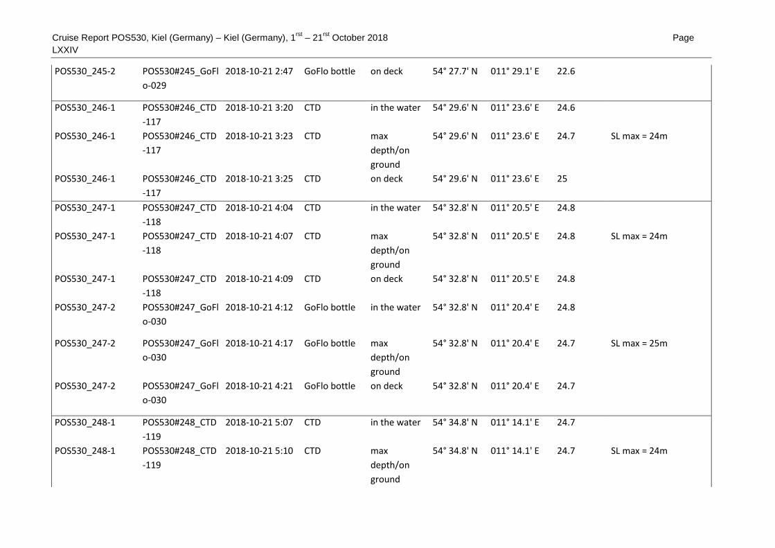
Cruise Report POS530, Kiel (Germany) – Kiel (Germany), 1rst
– 21rst
October 2018 Page
LXXIV
POS530_245-2 POS530#245_GoFl
o-029
2018-10-21 2:47 GoFlo bottle on deck 54° 27.7' N 011° 29.1' E 22.6
POS530_246-1 POS530#246_CTD
-117
2018-10-21 3:20 CTD in the water 54° 29.6' N 011° 23.6' E 24.6
POS530_246-1 POS530#246_CTD
-117
2018-10-21 3:23 CTD max
depth/on
ground
54° 29.6' N 011° 23.6' E 24.7 SL max = 24m
POS530_246-1 POS530#246_CTD
-117
2018-10-21 3:25 CTD on deck 54° 29.6' N 011° 23.6' E 25
POS530_247-1 POS530#247_CTD
-118
2018-10-21 4:04 CTD in the water 54° 32.8' N 011° 20.5' E 24.8
POS530_247-1 POS530#247_CTD
-118
2018-10-21 4:07 CTD max
depth/on
ground
54° 32.8' N 011° 20.5' E 24.8 SL max = 24m
POS530_247-1 POS530#247_CTD
-118
2018-10-21 4:09 CTD on deck 54° 32.8' N 011° 20.5' E 24.8
POS530_247-2 POS530#247_GoFl
o-030
2018-10-21 4:12 GoFlo bottle in the water 54° 32.8' N 011° 20.4' E 24.8
POS530_247-2 POS530#247_GoFl
o-030
2018-10-21 4:17 GoFlo bottle max
depth/on
ground
54° 32.8' N 011° 20.4' E 24.7 SL max = 25m
POS530_247-2 POS530#247_GoFl
o-030
2018-10-21 4:21 GoFlo bottle on deck 54° 32.8' N 011° 20.4' E 24.7
POS530_248-1 POS530#248_CTD
-119
2018-10-21 5:07 CTD in the water 54° 34.8' N 011° 14.1' E 24.7
POS530_248-1 POS530#248_CTD
-119
2018-10-21 5:10 CTD max
depth/on
ground
54° 34.8' N 011° 14.1' E 24.7 SL max = 24m

Cruise Report POS530, Kiel (Germany) – Kiel (Germany), 1rst
– 21rst
October 2018 Page
LXXV
POS530_248-1 POS530#248_CTD
-119
2018-10-21 5:12 CTD on deck 54° 34.8' N 011° 14.1' E 24.7
POS530_249-1 POS530#249_CTD
-120
2018-10-21 6:05 CTD in the water 54° 36.3' N 011° 08.8' E 23.3
POS530_249-1 POS530#249_CTD
-120
2018-10-21 6:09 CTD max
depth/on
ground
54° 36.3' N 011° 08.8' E 23.8 24 m max
POS530_249-1 POS530#249_CTD
-120
2018-10-21 6:12 CTD on deck 54° 36.3' N 011° 08.8' E 23.7
POS530_249-2 POS530#249_GoFl
o-031
2018-10-21 6:14 GoFlo bottle in the water 54° 36.3' N 011° 08.8' E 23.7
POS530_249-2 POS530#249_GoFl
o-031
2018-10-21 6:19 GoFlo bottle max
depth/on
ground
54° 36.3' N 011° 08.7' E 23.6
POS530_249-2 POS530#249_GoFl
o-031
2018-10-21 6:24 GoFlo bottle on deck 54° 36.3' N 011° 08.7' E 23.5 Completion of research
activities POS 530