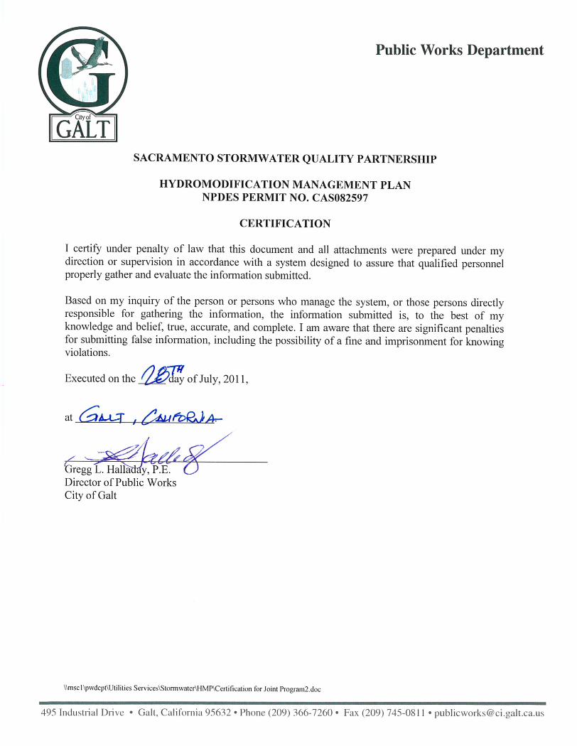
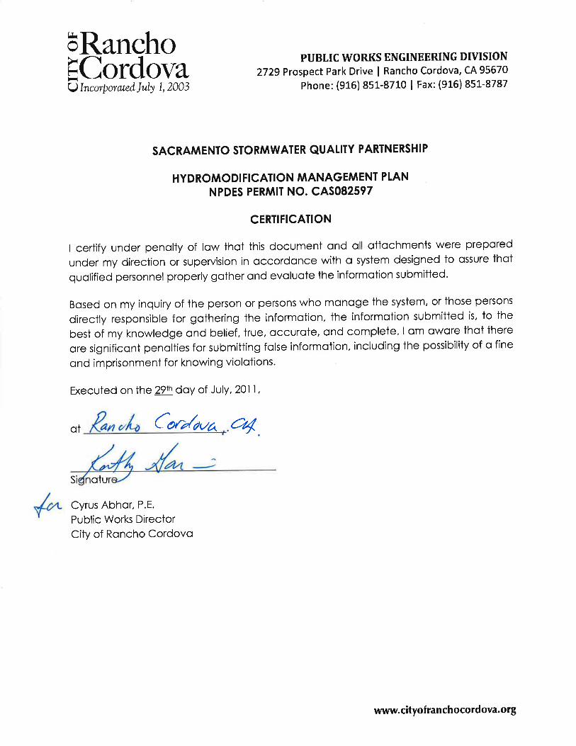
sacramento stormwater quality partnership ... · sacramento stormwater quality partnership...
TRANSCRIPT
County of Sacramento
Cities of:
Sacramento, Citrus Heights,
Elk Grove, Folsom, Galt,
Rancho Cordova
Sacramento StormwaterQuality PartnershipHydromodificationManagement Plan
July 29, 2011

ii
This page has been left intentionally blank.
iii
Sacramento Stormwater Quality Partnership
Hydromodification Management Plan (HMP)
January 28, 2011 Revised July 29, 2011
Submitted to
Central Valley Regional Water Quality Control Board 11020 Sun Center Drive #200
Rancho Cordova, CA 95670-6114
This report is intended solely for the use and benefit of the Sacramento Stormwater Quality Partnership (Partnership) and the Central Valley Regional Water Quality Control Board. No other person or entity
shall be entitled to rely on the details contained herein without the express written consent of the Partnership.
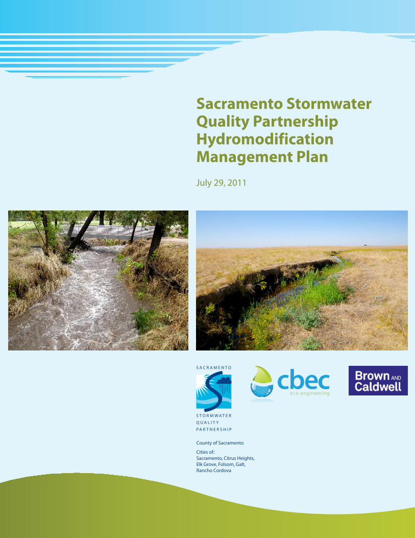
Front cover photographs by cbec, left to right: Kite Creek, a tributary to Laguna Creek, September 2010. Verde Cruz Creek, a tributary to Arcade Creek, during a storm event in October 2009.
iv
Acknowledgements HMP Work Group – Local Agency Representatives Dan Gwaltney, P.E. Associate Engineer, County of Sacramento Hong Lin, Ph.D., P.E. Senior Engineer, City of Sacramento Dalia Fadl, P.E. Assistant Engineer, County of Sacramento Sherill Huun, P.E. Supervising Engineer, City of Sacramento Dan Barry , P.E. Senior Engineer, County of Sacramento Michael Johnson, P.E. Associate Engineer, County of Sacramento Richard Dalrymple, P.E. Senior Engineer, City of Sacramento Sarah Staley, P.E. Associate Engineer, City of Folsom Fernando Duenas, P.E. Associate Engineer, City of Elk Grove Britton Snipes, P.E. Associate Engineer, City of Rancho Cordova Cesar Montes de Oca, P.E. Associate Engineer, City of Citrus Height Bill Forrest, P.E. Senior Engineer, City of Galt Project Consultant Team Chris Bowles, Ph.D., P.E. cbec eco-engineering, inc. Chris Campbell cbec eco-engineering, inc. Chris Hammersmark, Ph.D., P.E. cbec eco-engineering, inc. John Stofleth cbec eco-engineering, inc. Walker Wieland cbec eco-engineering, inc. Lilly Allen cbec eco-engineering, inc. Eric Mosolgo, P.E. Brown and Caldwell Christina Brown, P.E. Brown and Caldwell Tony Dubin, P.E. Brown and Caldwell Technical Advisory Committee Eric Stein, Ph.D. Southern California Coastal Water Research Project Holger Fuerst, P.E. Mackay & Somps Civil Engineers Other Contributors Carmel Brown, P.E. CKB Environmental Consulting, Inc. Eric Berntsen State Water Resources Control Board Jesus Alvarez GIS specialist, City of Sacramento Maria MacGunigal Information Technology Supervisor, City of Sacramento Steve Gay GIS specialist, City of Elk Grove Stephen Lai GIS Technician, County of Sacramento Betty Marchbanks Engineering Technician, City of Folsom For more information, visit: www.sacramentostormwater.org (new development link)

v
Please direct inquiries to: Dan Gwaltney, County of Sacramento, [email protected] , or Hong Lin, City of Sacramento, [email protected]

vi
This page has been left intentionally blank.

viii
This page has been left intentionally blank.

x
This page has been left intentionally blank.

xii
This page has been left intentionally blank.

xiv
This page has been left intentionally blank.

xvi
This page has been left intentionally blank.

xviii
This page has been left intentionally blank.

xx
This page has been left intentionally blank.
xxi
SACRAMENTO STORMWATER QUALITY PARTNERSHIP HYDROMODIFICATION MANAGEMENT PLAN
TABLE OF CONTENTS EXECUTIVE SUMMARY .................................................................................................................................. 1 1 INTRODUCTION ..................................................................................................................................... 7
1.1 Purpose of the Hydromodification Management Plan ................................................................. 7 1.2 Organization of Report .................................................................................................................. 7 1.3 Problem Statement ....................................................................................................................... 8 1.4 Stormwater Permit Requirements Overview ............................................................................. 10 1.5 Study Area and Watershed Characteristics ................................................................................ 10 1.6 Basis for HMP Approach ............................................................................................................. 14
1.6.1 HMP Pilot Study .................................................................................................................. 14 1.6.2 Review of Statewide Hydromodification Management Approaches ................................. 15
1.7 Hydromodification and Sediment Supply ................................................................................... 18 1.8 Stream Condition Monitoring ..................................................................................................... 19 1.9 References .................................................................................................................................. 19
2 HYDROMODIFICATION MANAGEMENT PROCESS AND STANDARDS .................................................. 27 2.1 Introduction ................................................................................................................................ 27 2.2 Sacramento HMP Process Overview and Guidance .................................................................... 27 2.3 Summary of the Methodology and Technical Approach for the HMP ....................................... 28
2.3.1 Applicability Criteria and Map (Chapter 3) ......................................................................... 28 2.3.2 Field Based Stream Susceptibility Assessment Methodology (Chapter 4) ......................... 28 2.3.3 Flow Range Determination (Chapter 5) .............................................................................. 31 2.3.4 BMP Sizing Calculator (Chapter 6) ...................................................................................... 31
2.4 HMP Management Objectives and Performance Criteria .......................................................... 32 2.5 Implementation Timeline ............................................................................................................ 32 2.6 References .................................................................................................................................. 33
3 HMP APPLICABILITY ............................................................................................................................ 35 3.1 Introduction ................................................................................................................................ 35 3.2 Applicability Criteria .................................................................................................................... 35
3.2.1 Introduction ........................................................................................................................ 35 3.2.2 Projects Discharging Directly to the Lower American River or the Sacramento River ....... 35 3.2.3 Highly Developed Watersheds ............................................................................................ 39 3.2.4 Special Drainage Areas ........................................................................................................ 45 3.2.5 Approved Projects ............................................................................................................... 48 3.2.6 Priority Projects ................................................................................................................... 49 3.2.7 Projects Discharging Directly to Exempted Channels ......................................................... 49 3.2.8 Infill Projects Exemption ..................................................................................................... 54
3.3 Applicability Map ........................................................................................................................ 55 3.3.1 Introduction ........................................................................................................................ 55
xxii
3.3.2 Production of Applicability Map ......................................................................................... 55 3.4 References .................................................................................................................................. 58
4 FIELD BASED STREAM SUSCEPTIBILITY ASSESSMENT METHODOLOGY .............................................. 61 4.1 Introduction ................................................................................................................................ 61 4.2 Modified Stream Susceptibility Assessment Tool Summary ....................................................... 62
4.2.1 Vertical Susceptibility .......................................................................................................... 63 4.2.2 Lateral Susceptibility ........................................................................................................... 67
4.3 Modifications to SCCWRP Methodology .................................................................................... 70 4.3.1 Analysis Domain .................................................................................................................. 70 4.3.2 Determination of the 10-Year Return Interval Flow (Q10) .................................................. 70 4.3.3 Cohesive Bed Material ........................................................................................................ 70 4.3.4 Swales ................................................................................................................................. 71
4.4 Required Documentation for Susceptibility Assessments .......................................................... 71 4.5 Field Test Survey Sites and Results ............................................................................................. 71
4.5.1 Sensitivity of Assessment Ratings to Decisions at Critical Nodes ....................................... 72 4.6 Conclusions and Recommendations ........................................................................................... 77 4.7 References .................................................................................................................................. 78
5 DETERMINATION OF FLOW RANGES .................................................................................................. 79 5.1 Introduction ................................................................................................................................ 79 5.2 Flow Ranges used in Other California Hydromodification Management Plans .......................... 79 5.3 Regional Studies .......................................................................................................................... 80 5.4 Methods for Determining the Critical Flow for Bed and Bank Materials ................................... 81
5.4.1 Estimating Critical Shear Strength ...................................................................................... 81 5.4.2 Estimating Critical Flow ....................................................................................................... 82 5.4.3 Estimating Q2 ....................................................................................................................... 82
5.5 Jet Testing Results ....................................................................................................................... 86 5.6 Critical Flow Results and Discussion ........................................................................................... 87
5.6.1 High Susceptibility Flow Range ........................................................................................... 87 5.6.2 Low Susceptibility Flow Range ............................................................................................ 87
5.7 Conclusions ................................................................................................................................. 88 5.8 References .................................................................................................................................. 89
6 BMP SIZING CALCULATOR ................................................................................................................... 91 6.1 Introduction ................................................................................................................................ 91 6.2 BMP Modeling Approach ............................................................................................................ 91
6.2.1 Overview of HSPF Modeling and BMP Sizing Approach ..................................................... 91 6.2.2 HSPF Modeling Overview .................................................................................................... 92 6.2.3 Develop Pre-Project and Post-Project Runoff Time Series ................................................. 93 6.2.4 Rainfall Data Evaluation ...................................................................................................... 93 6.2.5 Soils Evaluation ................................................................................................................... 94 6.2.6 Selection of Parameters for HSPF Modeling ....................................................................... 94 6.2.7 Modeling the Hydraulic Response of BMPs ........................................................................ 98 6.2.8 Modeling Approach Limitations .......................................................................................... 98
6.3 Hydromodification Control – LID BMPs ...................................................................................... 99
xxiii
6.3.1 LID Sizing Factor Development ........................................................................................... 99 6.3.2 Scenarios Modeled .............................................................................................................. 99 6.3.3 General BMP Characteristics............................................................................................. 101 6.3.4 Stormwater Planter BMP HSPF Representation ............................................................... 102 6.3.5 Iterative BMP Sizing Steps................................................................................................. 103 6.3.6 LID Option – Stormwater Planter with Underdrain .......................................................... 104 6.3.7 LID Option – Stormwater Planter without Underdrain ..................................................... 108 6.3.8 LID Option – Stormwater Planter with Full Lining ............................................................ 108 6.3.9 LID Option – Stormwater Planter in Series with Underground Vault ............................... 108 6.3.10 Sizing Factor Tables ........................................................................................................... 109
6.4 Hydromodification Control – Extended Detention BMPs ......................................................... 119 6.5 Hydromodification Control – Runoff Reduction BMPs ............................................................. 122
6.5.1 Porous Pavement .............................................................................................................. 122 6.5.2 Self-Retaining Area ............................................................................................................ 122 6.5.3 Disconnected Roof Drains ................................................................................................. 123
6.6 BMP Sizing Calculator Software ................................................................................................ 123 6.6.1 Sizing Calculator Development ......................................................................................... 123 6.6.2 User Manual ...................................................................................................................... 124
6.7 References ................................................................................................................................ 125 7 ALTERNATIVE DESIGN APPROACHES FOR HYDROMODIFICATION MANAGEMENT ......................... 127
7.1 In-Stream Control ...................................................................................................................... 127 7.2 In-Lieu Program ......................................................................................................................... 128 7.3 References ................................................................................................................................ 128
8 COORDINATION, REVIEW AND OUTREACH ...................................................................................... 129 8.1 Partnership HMP Work Group .................................................................................................. 129 8.2 Technical Advisory Committee Meetings ................................................................................. 129 8.3 Public Outreach ......................................................................................................................... 130 8.4 Regional Water Board Comments and Reply ............................................................................ 131
APPENDICES .............................................................................................................................................. 133 LIST OF FIGURES Figure 1-1 Permit Area Map ........................................................................................................................ 11 Figure 1-2 Sacramento County Major Watersheds .................................................................................... 13 Figure 2-1 HMP Process Overview Flow Chart ........................................................................................... 30 Figure 2-2 HMP Implementation Schedule ................................................................................................. 34 Figure 3-1 Applicability Criteria Flow Chart ................................................................................................ 37 Figure 3-2 Flow Duration Curves for the Lower American River and the Sacramento River ..................... 38 Figure 3-3 Verde Cruz Watershed Aerial Photo .......................................................................................... 43 Figure 3-4 Verde Cruz Watershed Land Use Map ....................................................................................... 44 Figure 3-5 SAFCA Flood Control System Features ...................................................................................... 52
xxiv
Figure 3-6 South Sacramento Streams Group ............................................................................................ 53 Figure 3-7 Applicability Map for Sacramento County ................................................................................. 57 Figure 4-1 Vertical Susceptibility Decision Tree .......................................................................................... 65 Figure 4-2 Incising/Braiding Probability Diagram and Risk Table ............................................................... 66 Figure 4-3 Lateral Susceptibility Decision Tree ........................................................................................... 68 Figure 4-4 Mass Wasting Probability Diagram and Risk Table .................................................................... 69 Figure 4-5 Susceptibility Survey Reach Locations ....................................................................................... 74 Figure 4-6 Representative Photographs of Field Susceptibility Testing Sites ............................................. 75 Figure 4-7 Representative Photographs of Field Susceptibility Testing Sites ............................................. 76 Figure 5-1 Critical Flow Determination & Jet Testing Locations ................................................................. 84 Figure 5-2 Jet Testing Apparatus ................................................................................................................ 85 Figure 6-1 HSPF PERLND Water Moisture Schematic (Adapted from HSPF User’s Manual) ...................... 97 Figure 6-2 Example FTABLE Describing Upper Layer of Stormwater Planter ........................................... 105 Figure 6-3 Example FTABLE Describing Lower Gravel Layer of Stormwater Planter ................................ 106 Figure 6-4 Stormwater Planter with Underdrain ...................................................................................... 107 Figure 6-5 Stormwater Planter without Underdrain ................................................................................ 110 Figure 6-6 Stormwater Planter with Full Lining ........................................................................................ 111 Figure 6-7 Stormwater Planter in Series with Underground Vault ........................................................... 112 Figure 6-8 Pond Sizing Routine Flow Chart ............................................................................................... 121 LIST OF TABLES Table 1-1 Summary of Selected Statewide HMP Approaches 21 Table 3-1 Illustration of the Impervious Cover as a Function of Percent of Developable Land 40 Table 3-2 Categories of Priority Projects 49 Table 3-3 Channel Velocity Limitations by Soil Type, 50 Table 4-1 Summary of Susceptibility Assessments, Including Answers to Decision Questions, Resulting
Ratings and Flow Range 73 Table 5-1 Lower and upper limits for various hydromodification plans in California. 80 Table 5-2 Summary of critical flow analysis for Low Susceptibility Flow Range. 86 Table 5-3 Summary of critical flow analysis for High Susceptibility Flow Range 87 Table 5-4 Summary of critical flow analysis for Low Susceptibility Flow Range 88 Table 6-1 Summary of Rainfall Station Data in Sacramento County 94 Table 6-2 Summary of HSPF Input Parameters for Sacramento County 95 Table 6-3 Pervious Area Runoff Scenarios 100 Table 6-4 Sizing Factors – Stormwater Planter (with and without an underdrain) – Steep Slope 113 Table 6-5 Sizing Factors – Stormwater Planter (with and without an underdrain) – Non-Steep Slope 114 Table 6-6 Sizing Factors – Stormwater Planter with Full Lining – Steep Slope 115 Table 6-7 Sizing Factors – Stormwater Planter with Full Lining – Non-Steep Slope 116 Table 6-8 Sizing Factors – Stormwater Planter in Series with Underground Vault – Steep Slope 117 Table 6-9 Sizing Factors – Stormwater Planter in Series with Underground Vault – Non-Steep Slope 118
xxv
APPENDICES
Appendix A - White Paper: Introduction to Hydromodification by the California Stormwater Quality
Association, May 20, 2009 Appendix B - Hydromodification: Principles, Problems, and Solutions, prepared by the Office of
Environmental Health Hazard Assessment and the State Water Resources Control Board, 2009 Appendix C - Part 654 Stream Restoration Design National Engineering Handbook, Chapter 8: Threshold
Channel Design, by the National Resource Conservation Service, US Department of Agriculture, August 2007
Appendix D - Hydromodification Screening Tools: Field Manual for Assessing Channel Susceptibility
(Technical Report 606), prepared by the Southern California Coastal Water Research Project, 2010 Appendix E – Addendum to Susceptibility Assessment Field Sheets Appendix F – Guidance Notes on Continuous Simulation Modeling Appendix G – Sacramento Stormwater Quality Partnership Public Workshops Documentation, December 2010 Appendix H – Response to Public Comments on the December 7, 2010 Partial Public Review Draft HMP, by the Sacramento Stormwater Quality Partnership Appendix I – Reply to Regional Water Board April 29, 2011 Comments on Sacramento Hydromodification Management Plan Appendix J - Memo: Sacramento Stormwater Quality Partnership HMP – Sensitivity Analysis of 3% Impervious Cover Change for Highly Developed Areas

xxvi
This page has been left intentionally blank.
Sacramento Stormwater Quality Partnership Hydromodification Management Plan
1
EXECUTIVE SUMMARY This plan, prepared in compliance with the Sacramento Areawide Stormwater Permit1, describes the process and standards by which urban development projects in Sacramento County will be required to assess and mitigate for adverse impacts to local creeks. These impacts are not already addressed by existing local regulations for flood protection and stormwater quality treatment, thus warranting the need for additional requirements. What is the Problem Being Addressed? When urbanization takes place, most of the natural vegetated pervious ground cover is converted to impervious surfaces such as building rooftops and paved highways, streets, and parking lots. In this transformation, the natural absorption and infiltration capabilities of the land are lost and runoff leaving the area can be significantly greater in volume, velocity, and peak flow rate than in the predevelopment condition. In addition, urbanization may reduce or eliminate vegetation such as grasses, shrubs and trees, which intercept rain and increase evapotranspiration. Runoff durations can also be extended as a result of flood control and other efforts to control peak flow rates by detaining the peak volume in stormwater detention facilities. This change in runoff characteristics from a watershed caused by changes in land use conditions (i.e., urbanization) is known as hydromodification. When development projects do not address and mitigate for this change in runoff characteristics, a variety of problems can result, such as: excess sediment flowing into streams; downstream erosion and sedimentation; flooding; disruption of natural drainage patterns, stream flows and riparian habitat; and elevated water temperatures. Conventional flood control and drainage approaches have focused on managing runoff from large storm events (e.g., 100-year return interval events or Q100), while disregarding the runoff from the smaller, more frequently occurring events. Runoff from such large events can damage a creek's stability and resources. However, studies in the last decade have shown that 95% of the "work" done on the receiving stream channels (erosion and transport of sediment from beds and banks, which leads to habitat degradation and other adverse impacts) is actually due to the smaller events (e.g., some percentage of the 2-year return interval event (Q2) up to the 10-year (Q10) event. In order to protect receiving streams from increased potential for erosion and other adverse impacts, new hydromodification management approaches must be employed to control the runoff from the smaller storm events, with consideration towards maintaining (or reproducing) the pre-project hydrology.
1 The Stormwater Permit was issued to Sacramento County and the Cities of Sacramento, Citrus Heights, Elk Grove, Folsom, Galt and Rancho Cordova (hereafter jointly referred to as the Sacramento Stormwater Quality Partnership (Partnership) in September 2008 (Order R5-2008-0142), by the Central Valley Regional Water Quality Control Board (Regional Water Board).
Sacramento Stormwater Quality Partnership Hydromodification Management Plan
2
What is the Purpose and Scope of this Plan and When Will It Be Implemented? This Hydromodification Management Plan (HMP) describes how the agencies in the Sacramento Stormwater Quality Partnership intend to implement hydromodification management in accordance with the Stormwater Permit, to protect receiving streams from increased potential for erosion and other adverse impacts. It defines the areas and types of projects in the urbanized area of Sacramento County that will be subject to the requirements, describes the standards and how they were developed, and introduces processes and tools for complying with the standards. Key requirements of the plan are summarized starting on the next page. This HMP plan is not intended to be a “manual” for applicants on how to perform hydromodification analysis and mitigation. Additional design guidance will be developed and provided on hydromodification analysis and mitigation in the future by the Partnership as described later in this Summary. This HMP is not the end-all; it represents the first step towards establishing new requirements to address hydromodification impacts in the county. The HMP is being submitted to the Regional Water Board, which will conduct a public review process, work with the Partnership to address any comments, and ultimately approve the plan. Within six months of Regional Water Board’s approval of the HMP, the agencies in the Partnership will amend their development standards to add hydromodification management and Low Impact Development requirements. The new requirements will become effective twelve months after HMP approval, at the same time that technical guidance is published to assist the development community. This timing is expected to help ensure compliance. How Was the HMP Developed? Work began in 2009 when the Partnership conducted a pilot study in the Elder Creek Watershed of Sacramento County and used the local results to inform their HMP Work Plan. Approval of the work plan by the Regional Water Board on January 29, 2010 set in motion the regulatory timeline for subsequent development of this HMP by January 29, 2011. The Partnership then retained a consultant team to assist them in preparing this document. During the process, other hydromodification management approaches in the state were studied and adapted for use in Sacramento, various technical experts were consulted, and local data was collected and analyzed through various means, including limited field investigations. The results of the local analysis showed that a large proportion of the streams sampled in the county appear to be highly susceptible to hydromodification impacts, while a small proportion of the streams sampled appear to exhibit medium to low susceptibility (i.e., the beds and banks of the stream are more resilient to erosion). When the first draft technical documents were available in December 2010, the Partnership hosted a series of meetings and workshops with stakeholders (local agency personnel, development and design community, environmental groups and regulators). This process is described at the end of the HMP in Chapter 8 and Appendices G and H.
Sacramento Stormwater Quality Partnership Hydromodification Management Plan
3
After submittal of the HMP on January 28, 2011, the Partnership continued to work with various stakeholder groups to answer their questions regarding HMP and address their concerns. Upon receiving the Regional Water Board’s comment letter for HMP on April 29, 2011, The Partnership facilitated additional meetings with Regional Water Board and stakeholders to resolve the remaining issues. The process is documented in the reply to Regional Water Board’s letter as included in Appendix I and also Chapter 8. What are the Requirements?
Chapter 2 includes a flowchart (Figure 2-1) which illustrates the steps a project applicant will use to determine applicability and design hydromodification management measures for the a given project:
1. Determine if the project is subject to the requirements (explained below) 2. Select design approach (standard vs. alternative design approach) 3. Assess susceptibility of the project's receiving stream using the methodology specified in
Chapter 4, OR elect not to perform the analysis and default to the conservative "high susceptibility" stream flow range for the design.
4. Determine design flow range for designing hydromodification management measures. The lower limit of the range is the critical flow presumed to create erosion in the local creeks and is stated as a percentage of the 2-year return interval flow:
• low susceptibility stream: 0.45 Q2 (45% of the 2-year return interval flow) to Q10 • high susceptibility stream: 0.25 Q2 to Q10
(Chapter 5 discusses the methods that were used to determine these flow ranges) 5. Size hydromodification management measures to meet the performance goals using the sizing
factors developed for Sacramento County, or use continuous simulation modeling2, to meet the performance goals. BMP sizing tools will be provided by the Partnership at the time of implementation.
What Areas and Projects are Subject to the Requirements? Chapter 3 presents a flow chart and map (Figure 3-1 and Figure 3-7, respectively) to assist a project applicant in initially determining if the project will require hydromodification management measures. The initial determination should be verified by consulting the appropriate permitting agency. Applicability will be determined using these criteria (see Chapter 3 for more details):
2 Continuous simulation modeling, in the context of hydrologic modeling, is a type of modeling that takes into account antecedent soil moisture conditions over long periods of time. It analyzes for changes in infiltration parameters and hence runoff, typically over periods of measured precipitation in excess of 30 years, and is generally considered to be a more reasonable representation of runoff than that generated through more typically used event-based hydrologic runoff models. The output from continuous simulation models are long term runoff time series which can be manipulated to generate flow duration curves, which are required for hydromodification analyses.
Sacramento Stormwater Quality Partnership Hydromodification Management Plan
4
1. A project located in an area labeled "exempt" on the Applicability Map is not subject to the requirements. The following "exempt" areas within the urbanized/urbanizing portion of the county are indicated on the Applicability Map:
a. Areas that discharge directly to receiving waters which are resilient to erosion (e.g., Sacramento or American Rivers).
b. Areas with 5 percent or less developed area. For the most part, the receiving streams in these highly urbanized areas were previously impacted by hydromodification and development occurring here in the future is not expected to worsen existing erosion problems or further degrade habitat in the receiving streams.
c. Three special drainage areas (North Natomas Basin, City of Sacramento; Metro Air Park, Sacramento County; and Shed B/Whitelock drainage corridors, City of Elk Grove) with engineered receiving channels which are resilient to erosion or with hydromodification mitigation already in place.
2. An "approved" project is not subject to the requirements. For the purposes of this HMP, a project
is considered "approved" and may be exempt from hydromodification management requirements if one of several criteria are satisfied no later than twelve months after approval of the HMP by the Regional Water Board. The criteria relate to the status of the project’s tentative map, permits and entitlements; whether it discharges to a creek segment with a valid permit from another regulatory agency; and if the project is a public project with completed design plans or an awarded contract for construction.
3. A "Priority Project" is subject to the requirements. Various categories of projects and associated
thresholds were previously approved by the Regional Water Board and established by the Partnership in 2006 to be subject to stormwater quality requirements. These projects will also be subject to hydromodification management requirements.
4. A project that discharges directly to an exempted creek(s) and/or channel(s) is not subject to the
requirements. “Exempted” creeks or channels generally have linings which prevent erosion, were built in an area where natural stream channels did not historically exist, and/or were designed and constructed for stability and resiliency in accordance with local or national standards.
5. An infill project meeting specified criteria is not subject to the requirements. The criteria
generally involve the size of the project (8 acres maximum), it’s consistency with the local General Plan, the lack of protected habitat on the site, and the location of the site in proximity to transit stops. The intent of this exemption is to promote sustainable infill development and is consisted with State CEQA Guidelines which provide a categorical exemption for such projects.
Sacramento Stormwater Quality Partnership Hydromodification Management Plan
5
What Tools and Guidance Will Be Available? Several tools and guidance will be available to project applicants for assistance in complying with the new hydromodification management requirements:
• The field based stream susceptibility assessment tool provided in Chapter 4 can be used to assess the susceptibility of Sacramento County streams to the effects of hydromodification. The tool is a locally adapted version of the Southern California Coastal Water Research Project's assessment tool.
• A BMP Sizing Calculator will be available for use by project applicants and local agency plan
reviewers to size various types of hydromodification management measures for development projects of limited scales. The calculator will be an easy-to-use, desktop-based software tool. It will incorporate sizing factor tables which have been developed using continuous simulation hydrologic modeling and integrating local data such as long term precipitation, soil characteristics, vegetative cover, and topography. Chapter 6 presents the sizing factor tables, along with a functional definition of the calculator. A flow duration control pond sizing algorithm is also in development and will also be included in the sizing calculator. The tool itself will be developed and beta tested with local project data in Spring/Summer 2011.
• Another BMP sizing tool (Sacramento Area Hydrology Model) will be developed for Hydromodification management implementation for development projects of all scales. This tool is similar to Bay Area Hydrology Model (BAHM) which is a dynamic BMP sizing tool using continuous simulation modeling. The Sacramento Area Hydrology Model will provide more BMP design options and run continuous simulation modeling in the background for every project with a user-friendly interface. This tool development is not part of the task for this HMP. The Partnership intends to develop this complementary tool during the same time as when the Design Manual is being updated. The Partnership intends to have both the BMP Sizing Calculator and the Sacramento Area Hydrology Model developed and ready for use at the time of implementation of the HMP criteria and LID requirements.
• The Partnership will update the 2007 Stormwater Quality Design Manual for Sacramento and
South Placer Regions to incorporate technical guidance for selecting and designing hydromodification management measures. The updated manual will be available approximately one year following approval of this HMP by the Regional Water Board.
Is There An Alternative Compliance Option? The project applicant can elect to follow an alternative design approach (Chapter 7). The applicant can propose an in-stream improvement project which will be subject to the approval of the local permitting agency as well as applicable state and federal regulatory agencies such as the California Department of Fish and Game, Regional Water Board and U.S. Army Corps of Engineers. An in-lieu program may also

Sacramento Stormwater Quality Partnership Hydromodification Management Plan
6
be developed by the Partnership in the future in accordance with the Stormwater Permit. An applicant choosing this option - when available - would need to demonstrate infeasibility of using hydromodifica-tion management measures on the project site and would then contribute funds for appropriate mitigation to be performed elsewhere in the watershed/county.
Sacramento Stormwater Quality Partnership Hydromodification Management Plan
7
1 INTRODUCTION 1.1 Purpose of the Hydromodification Management Plan This Hydromodification Management Plan (HMP) describes the proposed process and standards by which hydromodification management will be applied to urban development projects in Sacramento County. The HMP was prepared to meet the requirements of the Sacramento Areawide NPDES Municipal Separate Storm Sewer System Permit (Stormwater Permit) issued to Sacramento County and the Cities of Sacramento, Citrus Heights, Elk Grove, Folsom, Galt and Rancho Cordova (hereafter jointly referred to as the Sacramento Stormwater Quality Partnership (Partnership) or (Permittees) in September 2008 (Order R5-2008-0142), by the Central Valley Regional Water Quality Control Board (Regional Water Board). Further details on the permit requirements as they pertain to the HMP are given in Section 1.4. The purpose of this plan is to demonstrate how the Partnership intends to implement hydromodification management in accordance with the Stormwater Permit. This plan is not intended to be a “manual” for applicants on how to perform hydromodification analysis and mitigation. Once the HMP is approved by the Regional Water Board, the agencies in the Partnership will amend their development standards to require hydromodification management controls for development projects. They will also work together to update the Stormwater Quality Design Manual for Sacramento and South Placer Regions (Partnership, 2007). The Partnership began the process to develop this HMP in 2009. The process included completion of a pilot study in the Elder Creek Watershed of Sacramento County (Partnership, 2009), selection of a technical consultant team, and preparation and submittal of the HMP Work Plan (Partnership, 2010) as required by the Stormwater Permit. Approval of the HMP Work Plan by the Regional Water Board on January 29, 2010 set in motion the regulatory timeline for development of this HMP (due one year after approval, on January 29, 2011). Once the draft technical documents were available in late 2010, the Partnership hosted a series of meetings and workshops to present the draft HMP to stakeholders (local agency personnel, development and design community, environmental groups and regulators) for feedback. Additional details about the HMP development process are provided in this HMP. 1.2 Organization of Report The HMP is prefaced with an Executive Summary and is subsequently divided into eight chapters:
Chapter 1 (this section) provides an introduction to the HMP, describing the purpose, problem statement, Stormwater Permit requirements, study area and watershed characteristics, and basis for the HMP approach. Chapter 2 describes the HMP standards and mitigation guidance, including the hydromodification management process, management objectives, performance criteria and implementation timeline.
Sacramento Stormwater Quality Partnership Hydromodification Management Plan
8
Chapter 3 discusses applicability of the HMP requirements in the urbanized portions of Sacramento County and presents the Applicability Map. The chapter provides background information, including analyses of the local watersheds and rationale for the applicability criteria and mapping methodology. Chapter 4 presents the field based susceptibility assessment methodology, originally developed by the Southern California Coastal Water Resources Project (SCCWRP, 2010), and adapted for use in the Sacramento Area. The chapter provides guidance on employing this methodology to evaluate the susceptibility of Sacramento area streams to the effects of hydromodification. Chapter 5 provides details on the use of field testing results and analyses of past geomorphic studies of the local streams as the basis for selecting flow ranges to be used for design of hydromodification mitigation measures. Chapter 6 presents the sizing factor tables, along with a functional definition of the calculator. Chapter 7 provides information and guidance on alternative approaches to HMP analysis and mitigation methods. Chapter 8 provides a summary of the coordination and stakeholder outreach activities conducted throughout the development of this HMP.
1.3 Problem Statement
When urban development, or urbanization, takes place, most of the natural vegetated pervious ground cover is converted to impervious surfaces such as building rooftops and paved highways, streets, and parking lots. In this transformation, the natural absorption and infiltration capabilities of the land are lost. Runoff leaving a developed urban area is typically significantly greater in volume, velocity, and peak flow rate than in the predevelopment condition. In addition, urbanization may reduce or eliminate vegetation such as grasses, shrubs and trees, which help to intercept rain and increase evapotranspiration. Runoff durations can also be extended as a result of flood control and other efforts to control peak flow rates by detaining the peak volume in stormwater detention facilities. Increased volume, velocity, rate, and duration of runoff can accelerate the erosion of downstream natural channels. Significant declines in the biological integrity and physical habitat of streams and other receiving waters have been found to occur with as little as a 10% conversion from natural to impervious surfaces. The increased runoff from new development must be managed to protect against increased erosion of channel beds and banks, sediment pollutant generation, or other impacts to beneficial uses and stream habitat due to increased erosive forces (USEPA, 1999). Urbanization, flood control projects, agricultural irrigation and construction of dams for water supply and power generation, are examples of activities that can result in hydromodification. Such activities
Sacramento Stormwater Quality Partnership Hydromodification Management Plan
9
impact the hydrology of the watershed and its receiving water bodies such as creeks and rivers3. In recent years, there has been a growing awareness that while flood control is still critical to protect life and property, historical flood-control methods do not protect creek habitat, and in some cases, may aggravate erosion problems and contribute to habitat degradation. It is important to manage the water regime changes caused by urban development with a balanced approach that prevents flooding, while at the same time, protects valuable environmental resources. This HMP focuses on hydromodification management for new and redevelopment projects in the urbanized and urbanizing portions of the county. Additional background information about hydromodification impacts resulting from new development and redevelopment activities can be found in a white paper developed by the California Stormwater Quality Association White Paper (CASQA, 2009) and the Fact Sheet “Hydromodification Principles, Problems, and Solutions” developed by the Office of Environmental Health Hazard Assessment and the State Water Resources Control Board (OEHHA, 2009) (Appendix A and B, respectively). Consideration for reductions in sediment supply due to urban development is also critical, as channel stability is a long-term balance between sediment transported from, and sediment supplied to a stream reach. However, many uncertainties remain regarding how to account for sediment supply changes when designing hydromodification controls, and current Regional Board requirements do not account for alterations to sediment supply. The Sacramento Areawide Stormwater Permit (Order R5-2008-0142) provides additional background about the problem and the need for hydromodification management controls in the following findings: Finding 13 – The Permittees are…. responsible for considering potential storm water impacts when making planning decisions in order to fulfill the Clean Water Act (CWA) requirement to reduce the discharge of pollutants in municipal storm water to the maximum extent practicable from new development and redevelopment activities. In addition, the Permittees must exercise their legal authority to ensure that the increased pollutant loads and flows do not degrade the beneficial uses of the receiving water. Finding 16 - The increased runoff characteristics from new development must be controlled to protect against increased erosion of channel beds and banks, sediment pollutant generation, or other impacts to beneficial uses and stream habitat due to increased erosive forces. Finding 76 - The quality and quantity of storm water runoff must be considered early during project planning to identify permanent (post-construction) BMPs that will be included in project design, constructed as part of the project, and ultimately implemented and maintained for the life of each category of urban development in order to protect storm water quality.
3 The US EPA defines hydromodification as: “Alteration of the hydrologic characteristics of coastal and noncoastal waters, which in turn could cause degradation of water resources. In the case of a stream channel this is the process whereby a stream bank is eroded by flowing water. This typically results in the suspension of sediments in the water course.” USEPA, 1999.
Sacramento Stormwater Quality Partnership Hydromodification Management Plan
10
1.4 Stormwater Permit Requirements Overview The Stormwater Permit requires the Partnership to develop an HMP:
The HMP shall require controls to manage the increases in the magnitude (e.g., flow control), frequency, volume and duration of runoff from development projects in order to protect receiving waters from increased potential for erosion and other adverse impacts with consideration towards maintaining (or reproducing) the pre-development hydrology. (Provision 15.c.i.) This requirement does not apply to new development and redevelopment projects where the project discharges storm water runoff into creeks or storm drains where the potential for erosion, or other impacts to beneficial uses, is minimal. The HMP shall describe the criteria used in determining the site-specific conditions applied to this requirement. (Provision 15.c.ii.)
The Stormwater Permit also requires the Permittees to amend policies, codes and ordinances to integrate Low Impact Development (LID) and hydromodification controls into local agency development standards six months after approval of the HMP by the Regional Water Board:
Each Permittee shall amend, revise or adopt quantitative and qualitative development standards (including policies, codes, ordinances and/or regulations) to require implementation of LID strategies at priority new development and redevelopment projects (Provision 15b)
The Stormwater Permit further requires the Permittees to update technical guidance six months after amendment of local development standards:
The updated technical guidance shall include and encourage low impact development/ hydromodification strategies for the development community in the Sacramento urbanized area. The strategies shall be based on the existing site design control measures identified in the existing Development Standards. Prior to approval of the Development Standards, the early implementation of measures likely to be included in the Development Standards shall be encouraged by the Permittees (Provision 26).
1.5 Study Area and Watershed Characteristics The study area for the HMP includes those urbanized areas in Sacramento County shown on Figure 1-1. This includes the area to which other stormwater quality-related development standards currently apply, as well as lands in the Folsom and Elk Grove sphere of influence areas designated for future urban development. These present and future urbanized area boundaries have been incorporated into the hydromodification management applicability map introduced later in this chapter and described in more detail in Chapter 3.
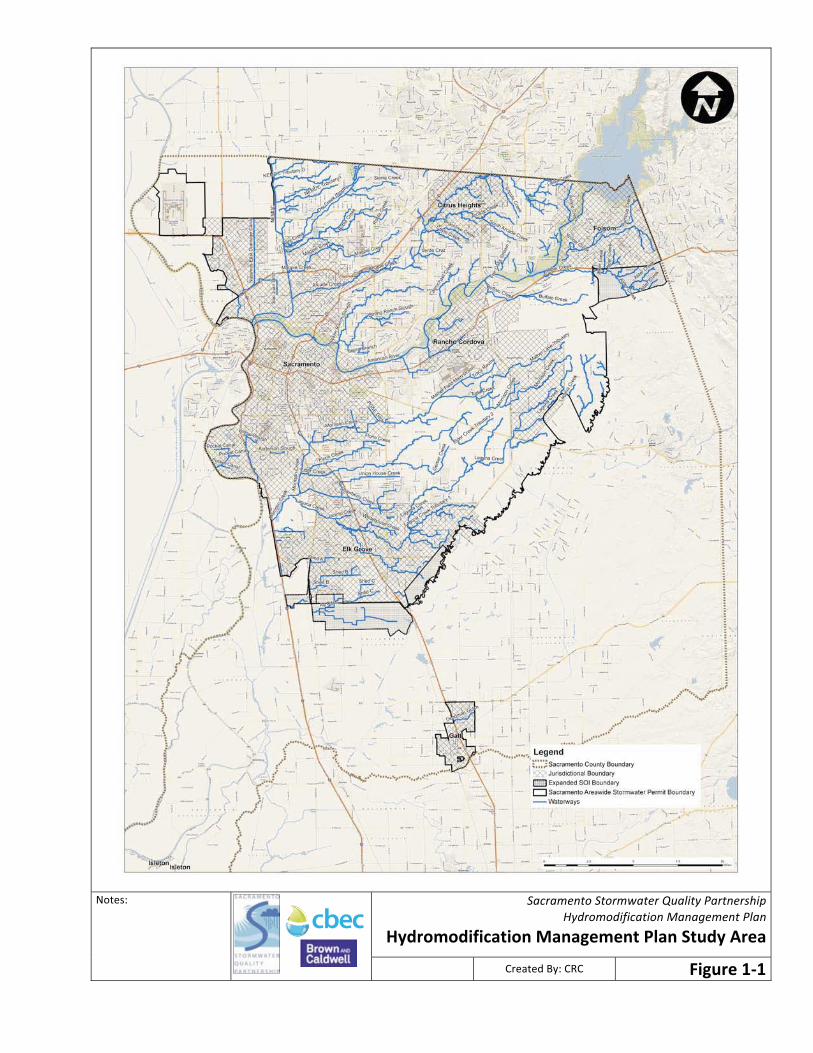
������������������ ������������������
�����������������������������
�������������� ��� ����� ����� ������������
�������� �
� ������ ����� ������������

Sacramento Stormwater Quality Partnership Hydromodification Management Plan
12
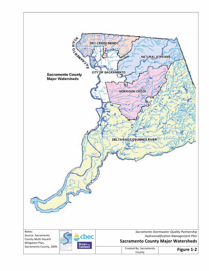
Sacramento County has delineated five major watersheds for drainage/flood management purposes (see Figure 1-2), each with their individual watercourses, and several of these watersheds will be entirely or partially encompassed by the HMP study area. Brief descriptions of the characteristics of the major watersheds are provided below. Sacramento River. All of the HMP study area within Sacramento County drains ultimately to the Sacramento River, which defines the west border of the County and flows to the southwest. Most of the City of Sacramento is located within this area, as shown on Figure 1-2. Dry Creek/NEMDC & Tributaries. Dry Creek and the Natomas East Main Drainage Canal (NEMDC, also known as Steelhead Creek) along with their tributaries are located within the northwestern portion of the County. Dry Creek drains to the NEMDC, which drains to the American River, which drains to the Sacramento River. There are ten defined watercourses within this watershed. In 1911 the Reclamation District No. 1000 was created and approximately 43 miles of levees were constructed around approximately 55,000 acres. This area came to be known as the Natomas Basin. Natural Stream Group and Tributaries. There is a group of 23 streams (not including tributaries) within the northeasterly portion of the County that are commonly referred to as the natural stream group. The major collectors are Arcade Creek and the American River. The American River drains a mountain watershed before it is dammed at Folsom Reservoir at the northeast corner of the county. Below Folsom Reservoir it flows through roughly 25 miles of mostly flat terrain until it joins the Sacramento River near downtown Sacramento. Morrison Creek Stream Group. Morrison Creek is located within the mid-southern portion of the County. There are approximately eleven creeks that drain into Morrison Creek. Summer and most of the winter flows are pumped to the Sacramento River, with an occasional wet season overflow to Beach/Stone Lakes. Beach/ Stone Lakes drain to Snodgrass Slough which in turn enters the Mokelumne River. Delta and Cosumnes River. This watershed approximately comprises the entire southern region of the County and is bounded by the City of Sacramento and Grant Line Road to the north. The area is predominantly zoned agricultural use. The Sacramento River Delta area is that portion of Sacramento County bounded on the east by the Western Pacific Railroad tracks, on the north by the southern city limits of the City of Sacramento, and on the south and west by the Sacramento County Boundary. The Cosumnes River originates in the Sierra Nevada foothills and flows through the southern part of Sacramento County. Although predominantly zoned agriculture, this area also comprises many smaller residential parcels as well.
����������������� ������������������
�����������������������������
���������� �������������������
��������
������ �� ������
������������ � ���
����� ������� ���
�� ������������������
�
�
���� ���� ��� �� ������
��������� �������
Sacramento Stormwater Quality Partnership Hydromodification Management Plan
14
1.6 Basis for HMP Approach The goals developed by the Partnership for the Sacramento HMP process include:
• Develop a consistent approach across the County regarding when and how to impose runoff flow controls from new development and redevelopment, and what those controls shall be.
• Develop an approach that works for all the permittees and is equitable for the development and landowner community.
• Build on others’ experiences rather than duplicate prior efforts. • Produce a relatively straightforward set of tools that can be used by permittees’ planners and
engineers and the development community. The Sacramento HMP approach was influenced by a local pilot study completed in March 2009, a review of other approaches State-wide, and consultation with an advisory committee and several key stormwater programs (e.g., San Diego and Contra Costa), as described in the following sections. 1.6.1 HMP Pilot Study As a first step toward developing the HMP, the Partnership completed a pilot study to develop and test ideas that could be incorporated into the HMP (cbec, 2009). The Partnership selected the Elder Creek watershed in south Sacramento County for the pilot project. That watershed, to include Gerber Creek, was selected because it represents a range of development conditions, from arable and grazing land uses in the upper watershed, transitioning through partial development to fully developed areas in the lower watershed. In the upper watershed Elder Creek is relatively undisturbed, while in the middle and lower parts of the watershed the creek transitions to more relatively disturbed, including concrete-lined channel segments. See the pilot study report for more details about the watershed (Partnership, 2009). The Pilot Study focused on developing and testing the methodologies and tools that could be used in the HMP. It focused on three key tools:
1. Applicability criteria and mapping, to be used to identify where there is more than minimal potential for erosion or other harm from increased runoff from new development and therefore control measures will be required (i.e. will not be exempt per Permit provision 15c.2 (see Section 1.4)). A sample applicability map was developed for the Elder Creek watershed, based on potential applicability criteria.
2. Susceptibility assessment, to be used to identify the susceptibility of receiving waters to erosion, as required by Permit provision 15c.1.f. A sample susceptibility map/approach was developed for the Elder Creek watershed.
3. A concept for a decision-support tool for applying the hydromodification management requirements to specific projects.