sage-grouse planning effort - forest service sage-grouse planning effort - forest service utah...
TRANSCRIPT

Sage-G
rouse
Pla
nnin
g E
ffort
- Fore
st Serv
iceSage-G
rouse
Pla
nnin
g E
ffort
- Fore
st Serv
iceUtah Greater Sage-Grouse
Draft Land Use Plan Amendments /Draft Environmental Impact Statement

Sage-G
rouse
Pla
nnin
g E
ffort
- Fore
st Serv
iceSage-G
rouse
Pla
nnin
g E
ffort
- Fore
st Serv
iceGreater Sage-Grouse Range-Wide Habitat Map
• GRSG habitat in Utah is naturally fragmented, located at the southern extent of the range, and is often connected to larger areas of habitat in adjacent states.
• GRSG Habitat in the Utah planning area comprises approximately 5 percent of habitat range-wide.• Utah provides habitat for less than 5 percent of known male GRSG populations range-wide.
WAFWA Management Zones and GRSG Breeding Bird Densities

Sage-G
rouse
Pla
nnin
g E
ffort
- Fore
st Serv
iceSage-G
rouse
Pla
nnin
g E
ffort
- Fore
st Serv
icePrivate
37.5%BLM
34.5%USFS
11.3%SITLA
8.6%Tribal
5.5%DWR
1.7%Military
0.5%Others
0.4%
Utah Sub-Region Planning Area
There are 3,313,800 acres of GRSG habitat with BLM and Forest Service surface estate, with 694,880 acres of federal mineral estate with non-federal surface.
Within planning area, there are approximately 7,242,930 acres of GRSG habitat, with surface land status as follows:
Sage-G
rouse
Pla
nnin
g E
ffort
- Fore
st Serv
iceSage-G
rouse
Pla
nnin
g E
ffort
- Fore
st Serv
ice
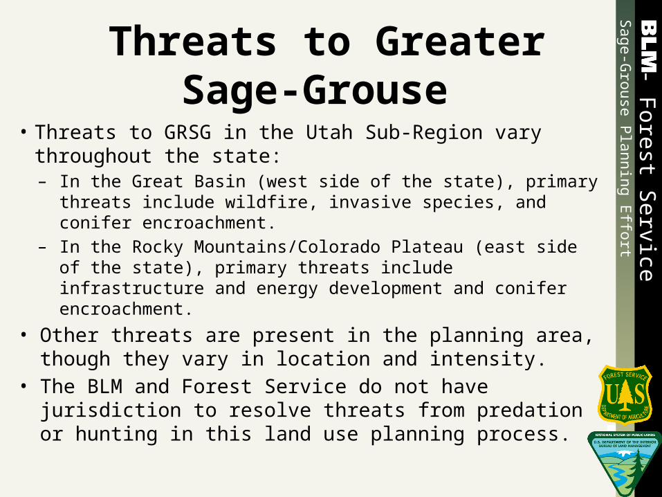
Threats to Greater Sage-Grouse
• Threats to GRSG in the Utah Sub-Region vary throughout the state: – In the Great Basin (west side of the state), primary threats
include wildfire, invasive species, and conifer encroachment.– In the Rocky Mountains/Colorado Plateau (east side of the
state), primary threats include infrastructure and energy development and conifer encroachment.
• Other threats are present in the planning area, though they vary in location and intensity.
• The BLM and Forest Service do not have jurisdiction to resolve threats from predation or hunting in this land use planning process.

Sage-G
rouse
Pla
nnin
g E
ffort
- Fore
st Serv
iceSage-G
rouse
Pla
nnin
g E
ffort
- Fore
st Serv
ice
Sage-Grouse Management Areas
• The Draft EIS categorizes GRSG habitat into one of two levels:– Preliminary priority management areas (PPMAs) are
lands that would be managed to maintain and sustain GRSG populations in the planning area (i.e., lands with the highest conservation value).
– Preliminary general management areas (PGMAs) are lands that are not as important as PPMAs.
• Under Alternative E, areas with the highest conservation value are referred to as Sage-Grouse Management Areas (SGMAs) or Core-Areas rather than PPMAs.

Sage-G
rouse
Pla
nnin
g E
ffort
- Fore
st Serv
iceSage-G
rouse
Pla
nnin
g E
ffort
- Fore
st Serv
ice
Alternative ThemesAlternative Theme (Alternative Based On…) Disturbance CapAlternative A Current Management from 14 BLM and 6 Forest Service Land
Use PlansNone
Alternative B Based on the National Technical Team Report (per BLM IM-2012-044)
3% - includes discrete anthropogenic disturbances, including existing disturbances, but does not include fire as disturbance
Alternative C Citizen Proposed Alternative (based on National Technical Team Report plus additional items from scoping) C1 = No livestock grazing C2 = Substantial reduction in livestock grazing
3% - Definition is similar to Alternative B, but includes fire and vegetation treatments that reduce sagebrush as disturbance
Alternative D Sub-Regional Alternative (developed by the Utah BLM in cooperation with the Forest Service Intermountain Region and local USFWS)
5% - Definition is similar to Alternative B
Alternative E1 Based on State of Utah’s Conservation Plan for Greater Sage-Grouse in Utah
5% - includes only new disturbances, and includes fire
Alternative E2 Based on State of Wyoming’s Governor’s Executive Orders 2011-05 and 2013-3
5% - includes existing disturbances, and includes fire

Sage-G
rouse
Pla
nnin
g E
ffort
- Fore
st Serv
iceSage-G
rouse
Pla
nnin
g E
ffort
- Fore
st Serv
ice
Sage-Grouse Management Areas
Total PPMA Total PGMA% GRSG Habitat
in PPMA% of PACs in
PPMA1
% GRSG in PPMA
Alternative B 2,781,700 532,100 82% 97% 98.7%
Alternative C 3,313,800 0 100% 100% 100%
Alternative D 2,760,300 553,500 83% 97.5% 98.9%
Alternative E 2,711,200 (SGMA/Core)2
650,680 (Out of SGMA/
Non-Core)82% 100% 97.1%
1 - PAC: Priority Areas for Conservation2 - SGMA: Sage-Grouse Management Area

Sage-G
rouse
Pla
nnin
g E
ffort
- Fore
st Serv
iceSage-G
rouse
Pla
nnin
g E
ffort
- Fore
st Serv
ice
Vegetation and Fire ManagementManagement Actions
Alternative A Alternative B Alternative C Alternative D Alternative E1 Alternative E2Vegetation
• Prioritization is given to projects that benefit multiple resources.
Wildland Fire
• Prescribed fire and non-fire fuels treatments are allowed.
• Prioritize fire suppression to protect human life and high value resources.
Vegetation – in PPMA
• Manage landscape so that 70% provides sagebrush habitat.
• Prioritize implementation of restoration projects.
• Do not allow treatments in winter ranges.
• Do not reduce sagebrush canopy cover to less than 15%.
Wildland Fire – in PPMA
• Implement fuels management RDFs.
• Prioritize suppression, immediately after life and property, to conserve the habitat.
• Do not use fire to treat sagebrush in areas with less than 12 inches precipitation.
Vegetation – in PPMA
• Restore areas to meet ecological site description.
• Prioritize implementation of restoration projects including existing seedings composed of perennial grasses.
• Do not allow treatments in winter ranges.
• Do not reduce sagebrush canopy cover to less than 15%.
• Emphasis on passive restoration.
Wildland Fire – in PPMA
• Implement fuels management RDFs.
• Prioritize suppression, immediately after life and property, to conserve the habitat.
• Do not use fire to treat sagebrush in areas with less than 12 inches precipitation.
Vegetation – in PPMA
• Manage landscape so that 50% provides sagebrush habitat.
• Reduce conifer encroachment.
• Prioritize implementation of restoration projects.
• Only allow treatments in winter habitat that reduce wildfire risk or improve winter range.
Wildland Fire – in PPMA
• Implement fuels management RDFs.
• Complete and maintain GRSG Landscape Wildfire & Invasive Species Habitat Assessments that establish suppression priorities.
• Allow the use of prescribed fire after considering other options. Avoid use of fire in low elevation Wyoming sagebrush.
Vegetation – in SGMAs
• Aggressively treat encroaching juniper.
• Enhance an average of 25,000 acres of habitat annually.
• Increase the total GRSG habitat within and adjacent to SGMAs by an average of 50,000 acres per year.
• Sagebrush treatments in winter habitat should maintain 80% of the habitat as tall sagebrush.
Wildland Fire – in SGMA
• Create and implement a statewide fire agency agreements that will eliminate jurisdictional boundaries and allow for immediate response to natural fire in GRSG habitat within SGMAs.
• Allow the use of prescribed fire only in higher elevations.
Vegetation – in Core
• Refer to WGFD Protocols for Treating Sagebrush to benefit Sage-Grouse.
Wildland Fire – in Core
• Work collaboratively with partners at the State and local level to maintain and enhance GRSG habitats.
• In core areas, prioritize suppression, immediately after firefighter and public safety to conserve the habitat.

Sage-G
rouse
Pla
nnin
g E
ffort
- Fore
st Serv
iceSage-G
rouse
Pla
nnin
g E
ffort
- Fore
st Serv
ice
Range ManagementManagement Actions
Alternative A Alternative B Alternative C Alternative D Alternative E
• Maintain current management from 14 BLM and 6 Forest Service LUPs.
• Available for livestock grazing with no changes in permitted AUMs (329,521 – BLM / 265,373 – FS).
• Manage livestock grazing to meet Rangeland Health Standards (RHS), or the Forest Service equivalent.
• Available for livestock grazing with no change in permitted AUMs (329,521 – BLM / 265,373 – FS).
• Manage livestock grazing to meet Rangeland Health Standards (RHS), or the Forest Service equivalent, and in accordance with science based GRSG habitat guidelines.
• Make changes to livestock grazing to comply with GRSG habitat guidelines.
• Prioritize completion of rangeland health assessments and processing grazing permits in PPMAs.
Alt C1
• Unavailable to livestock grazing.
• No AUMs in PPMA available for livestock grazing.
Alt C2
• Within allotments that overlap mapped occupied GRSG habitat, reduce permitted AUMs.
• Approximately 40 percent reduction in AUMs from current permitted levels (197,713 – BLM / 159,224 – FS).
• Manage livestock grazing to meet Rangeland Health Standards (RHS), or the Forest Service equivalent, and in accordance with science based GRSG habitat guidelines.
• Prioritize completion of rangeland health assessments and processing grazing permits within PPMAs.
• Available for livestock grazing, with no change in permitted AUMs (329,521 – BLM / 265,373 – FS).
• Manage livestock grazing to meet RHS, or the Forest Service equivalent, and incorporate science-based GRSG habitat guidelines into health assessments.
• Make changes to livestock grazing to comply with GRSG habitat guidelines.
• Prioritize completion of rangeland health assessments and process grazing permits in areas with the best opportunities for conserving, enhancing or restoring habitat for GRSG.
• Available for livestock grazing, with no change in permitted AUMs (329,521 – BLM / 265,373 – FS).
• Manage livestock grazing to meet RHS, or the Forest Service equivalent
Alt E1
• Consider GRSG seasonal habitat requirements when managing sagebrush rangelands.
• Address site specific concerns about the effects of livestock grazing on GRSG through application of BMPs, including those identified by the Department of Agricultures Grazing Improvement Program.
Alt E2
• Management livestock Grazing in accordance with the Wyoming Governor’s Executive Order 2013-03 and using “Grazing Influence, Management, and Objective Development in Wyoming’s Greater Sage-Grouse Habitat” for guidance.

Sage-G
rouse
Pla
nnin
g E
ffort
- Fore
st Serv
iceSage-G
rouse
Pla
nnin
g E
ffort
- Fore
st Serv
ice
Lands and RealtyManagement Actions
Alternative A Alternative B Alternative C Alternative D Alternative E
• Maintain current management from 14 BLM and 6 Forest Service LUPs.
• Manage Rights of Way (ROWs) and Forest Service Special Use Authorizations (SUAs) in GRSG habitat as follows (acres):
o No restrictions: 3,219,000
o ROW Avoidance: 67,200
o ROW Exclusion: 27,600
• Designate 177,700 acres of designated corridors in GRSG habitat.
Manage ROWs and SUAs in GRSG habitat as follows (acres):
o No restrictions: 0
o ROW Avoidance: 529,600
o ROW Exclusion: 2,784,200
• Exclude new ROWs/SUAs in PPMA.
• Avoid new ROWs/SUAs in PGMAs.
• Designate 130,200 acres as ROW corridors. Undesignate ROW corridors that currently do not have any ROWs/SUAs (47,500 acres).
• Within designated ROW corridors encumbered by existing ROW/SUA authorizations, only allow new ROWs if the project can be completed within the existing disturbed area
Manage ROWs and SUAs in occupied GRSG habitat as follows (acres):
o No restrictions: 0
o ROW Avoidance: 0
o ROW Exclusion: 3,313,800
• Exclude new ROWs/SUAs in mapped occupied GRSG habitat.
• Undesignate all designated ROW corridors within GRSG mapped occupied habitat.
Management varies by ROW type.
Transmission lines (acres)4 mile exclusion around leks in PPMAo No restrictions: 522,600o ROW Avoidance: 1,368,900o ROW Exclusion: 1,422,300
Pipelines (acres)Avoidance in PPMAo No restrictions: 532,000o ROW Avoidance: 2,754,200o ROW Exclusion: 27,600
Communication Sites (acres)1 mile exclusion around leks in PPMAo No restrictions: 531,900o ROW Avoidance: 2,562,000o ROW Exclusion: 219,900
Wind (acres)Exclusion in PPMAo No restrictions: 522,500o ROW Avoidance: 9,400o ROW Exclusion: 2,781,900
ROW Corridors o Retain 89,400 acres of designated
corridor.o Limit 48,400 aces of designated
corridor to underground use only. o Undesignate 39,700 acres.o Designate 31,700 acres of new
corridor.
• Within designated corridors collocate new ROW/SUA as close as technically feasible to existing facilities.
Manage ROWs/SUAs as follows (acres):
o No restrictions: 607,400
o ROW Avoidance: 2,654,000
o ROW Exclusion: 52,400
Alt E1
• Manage SGMAs as ROW avoidance areas with stipulations.
• Site new linear transmission features in existing corridors, or at a minimum, in concert with existing linear features in SGMAs.
Alt E2
• Manage Core Areas as exclusion for new ROW/SUA permits.
• New SUAs may be issued in existing designated corridors for buried utilities with appropriate GRSG seasonal timing constraints applied.

Sage-G
rouse
Pla
nnin
g E
ffort
- Fore
st Serv
iceSage-G
rouse
Pla
nnin
g E
ffort
- Fore
st Serv
ice
Minerals ManagementManagement Actions
Alternative A Alternative B Alternative C Alternative D Alternative E Alternative E2
• Maintain current management from 14 BLM and 6 Forest Service LUPs.
• Fluid mineral leasing categories vary greatly.
• Most GRSG mapped occupied habitat is open coal leasing and development, non-energy mineral leasing and development, locatable mineral development, and mineral material disposal. Stipulations vary throughout the planning area.
• Close PPMA to the following minerals activities:
• New fluid mineral leasing.
• New non-energy leasable mineral leasing.
• New mineral material sales
• Find PPMA unsuitable for surface mining of coal.
• Recommend PPMA for withdrawal from mineral entry.
• Apply required design features as conditions of approval to all authorizations in mapped occupied habitat, including authorizations associated with existing leases.
• Do not allow surface occupancy on existing federal leases in PPMA (exceptions apply).
• Close occupied GRSG habitat to the following minerals activities:
• New fluid mineral leasing.
• New non-energy leasable mineral leasing.
• New mineral material sales
• Find occupied GRSG habitat unsuitable for surface mining of coal.
• Recommend occupied GRSG habitat for withdrawal from mineral entry.
• Apply required design features as conditions of approval to all authorizations in mapped occupied habitat, including authorizations associated with existing leases.
• Do not allow surface occupancy on existing federal leases in occupied GRSG habitat (exceptions apply).
• NSO within 4 miles of a lek in PPMA. CSU in PPMA beyond the 4 mile lek buffer.
• Mapped occupied GRSG habitat would not be unsuitable for surface mining of coal. Leases would be subject to specific stipulations.
• Close PPMA to surface mining of non-energy leasable minerals, but keep open to underground mining, subject to specific stipulations.
• GRSG habitat would be open for locatable mineral entry. Work with claimants to apply use restrictions in PPMA.
• Close PPMA within 1 mile of a lek to noncommercial mineral material sales. Open beyond 1 mile with stipulations. Close PPMA to commercial mineral material sales.
• Apply required design features as conditions of approval to all authorizations (exceptions apply).
• NSO when visible within 1 mile of a lek in SGMAs. CSU outside the 1 mile lek buffer.
• Mapped occupied GRSG habitat would not be unsuitable for surface mining of coal. Leases in SGMAs would be subject to specific stipulations.
• SGMAs would be open to non-energy leasable mineral leasing, subject to specific stipulations.
• GRSG habitat would be open for locatable mineral entry. Work with claimants to apply seasonal and use restrictions in SGMAs.
• SGMAs would be open to mineral material disposal subject to specific stipulations.
• NSO within 0.6 mile of a lek in Core. CSU outside the 0.6 mile lek buffer.
• Determine suitability upon receipt of coal lease applications.
• Core areas would be open to non-energy leasable mineral leasing, subject to specific stipulations.
• Recommend withdrawal from mineral entry based on risk to the GRSG.
• Core areas would be open to mineral material disposal subject to specific stipulations.
• Minimize impacts to GRSG in core areas by applying conditions of approval to exploration and development permits.

Sage-G
rouse
Pla
nnin
g E
ffort
- Fore
st Serv
iceSage-G
rouse
Pla
nnin
g E
ffort
- Fore
st Serv
ice
Additional Management ActionsResource Alternative A Alternative B Alternative C Alternative D Alternative E
Wild Horses • Manage wild horse populations within established AMLs.
• Periodically evaluate and make adjustments to AMLs based on monitoring data.
• Prioritize gathers based on monitoring data.
• Manage wild horse populations within established AMLs.
• Within PPMAs, prioritize the evaluation of AMLs based on achieving GRSG habitat objectives.
• Prioritize gathers in PPMAs, unless removals are necessary in other areas to prevent catastrophic impacts.
• Manage wild horse populations within established AMLs.
• Prioritize gathers in PPMAs, unless removals are necessary in other areas to prevent catastrophic environmental issues.
Alt C2
• Reduce AMLs by 25% in mapped occupied GRSG habitat.
• Manage wild horse populations within established AMLs.
• Within PPMAs, prioritize the evaluation of AMLs based achieving GRSG habitat objectives.
• Prioritize gathers in PPMAs, unless removals are necessary in other areas to prevent catastrophic impacts.
Alt E1
• Manage wild horse populations within established AMLs.
• Periodically evaluate and make adjustments to AMLs based on monitoring data.
• Prioritize gathers based on monitoring data.
Travel and Transportation
• OHV use will be managed per existing area-designations, including 797,000 acres open to cross-country use.
• Limit OHVs to existing routes in PPMAs.
• Complete travel planning within 5 years.
• No new roads or road upgrades in PPMA unless beneficial to GRSG or needed for safety.
• Close 555,700 acres of GRSG habitat to OHV use.
• Complete travel planning within 5 years, and consider additional route closures.
• Prohibit new road construction in GRSG habitat within 4 miles of occupied GRSG leks, and avoid new road construction in mapped occupied GRSG habitat.
• Limit OHVs to existing routes in mapped occupied GRSG habitat.
• Prioritize travel planning where there is a potential to impact GRSG habitat.
• Manage travel networks to improve sustainability, minimize GRSG impacts, maintain motorist safety, and prevent unauthorized cross-country travel.
Alt E1
• GRSG nesting and winter habitat in SGMAs that is currently open to cross-country use would be limited to existing routes.
• Travel management plans should include consideration for GRSG.
ACECs (BLM) and Zoological Areas (Forest Service)
No existing ACECs or Zoological Areas are designated specifically to protect GRSG.
No new ACECs or Zoological Areas would be designated.
Designate and manage 15 areas (2,233,800 acres) as ACECs (BLM) and GRSG Zoological Areas (Forest Service) to function as sagebrush reserves to conserve GRSG.
No new ACECs or Zoological Areas would be designated.
No new ACECs or Zoological Areas would be designated.
Sage-G
rouse
Pla
nnin
g E
ffort
- Fore
st Serv
iceSage-G
rouse
Pla
nnin
g E
ffort
- Fore
st Serv
ice
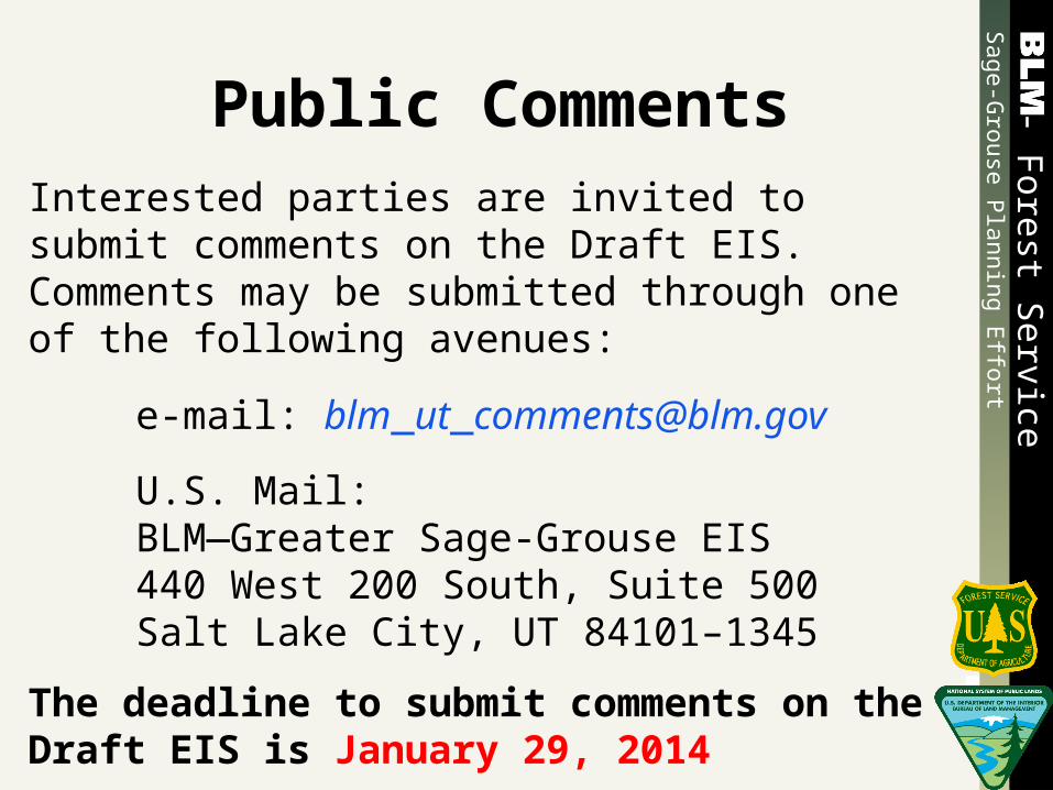
Public CommentsInterested parties are invited to submit comments on the Draft EIS. Comments may be submitted through one of the following avenues:
e-mail: [email protected]
U.S. Mail:BLM—Greater Sage-Grouse EIS440 West 200 South, Suite 500Salt Lake City, UT 84101–1345
The deadline to submit comments on the Draft EIS is January 29, 2014

Sage-G
rouse
Pla
nnin
g E
ffort
- Fore
st Serv
iceSage-G
rouse
Pla
nnin
g E
ffort
- Fore
st Serv
ice
Planning Process Timeline
Action When
Draft EIS Released for Public Review November 1, 2013
90-Day Public Comment Period Ends January 29, 2014
Proposed Land Use Plan Amendments / Final EIS Released
June 2014*
Issue BLM and Forest Service Records of Decision
September 2014*
* Dates are subject to change.