san francisco gis: distribution and application development approaches bay area automated mapping...
Post on 19-Dec-2015
218 views
TRANSCRIPT

San Francisco GIS: distribution and
application development approaches
Bay Area Automated Mapping Association (BAAMA) Meeting April 2002
Erich SeamonDepartment of Telecommunications and Information Services
City and County of San Francisco875 Stevenson, 5th floor
San Francisco, CA [email protected]
(415) 554-0808

Introduction• Overview of Enterprise GIS for SFOverview of Enterprise GIS for SF
• Keys to SuccessKeys to Success
• Technology examplesTechnology examples
Department of Telecommunications & Information Services

Overview of San Francisco Enterprise GIS
• One primary Citywide data integrator, distributor, and enterprise application developer
• Development of a dynamic, distributed spatial data warehouse
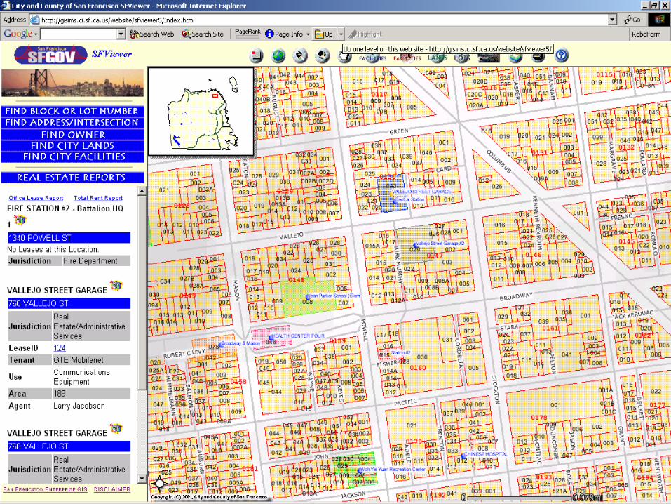
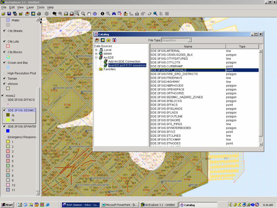
• Implementation of multiple entry points for spatial data access/analysis – Direct connect via ArcSDE (need local client)– map services (secure and unsecure)– data download
• Examination of data distribution policies• Design of appropriate citywide organizational model
Department of Telecommunications & Information Services

Keys to success
• Robust data warehouse architecture• Multi-faceted access to GIS data
– device agnostic– multi-platform– ability to combine data from various locations
• Ability to scale vertically (more robust applications, deeper data) as well as horizontally (increased performance, load, etc.)
Department of Telecommunications & Information Services
Flexible foundations allow for the most diversity
Flexible foundations allow for the most diversity

Software use
• SF ESRI Master Purchase Agreement• Enterprise GIS: Full ArcGIS 8.1.2 suite
– development Arc/Info-ArcEditor-Arcview floating licenses– ArcSDE 8.1.2 (intranet and internet)– ArcIMS 3.1 (intranet and internet)– ArcPress, ArcPAD 6.0
• City departments can purchase additional licenses under MPA (floating or independent)
• Current ESRI license use is ~ 400 licenses (all inclusive)
Department of Telecommunications & Information Services

Enterprise GIS Architecture
Department of Telecommunications & Information Services
DB ServerDB ServerArcSDEArcSDE
DB2/Spatial ExtenderDB2/Spatial ExtenderWindows 2000Windows 2000
ArcIMS Map ServerWindows 2000
•ASP
IBM NetfinityIBM Netfinity1.5 GHz/1GB Ram1.5 GHz/1GB Ram
RAID 5RAID 5
Intranet
ProductionProduction DevelopmentDevelopment
ArcSDEArcSDEDB2DB2
ArcIMSArcIMSSFGOV
SFGOV
ClientsClients
ClientsClients

Direct
Connect ArcIMSMap serviceData
Download
ArcSDEArcSDE ArcSDEArcSDE
Departmental SystemsDepartmental Systems
Enterprise GIS ServersEnterprise GIS Servers
Departmental Systems
Departmental Systems
PublicPublic


Department of Telecommunications & Information Services
Erich Seamon
Dept. of Telecom. and Information Services
875 Stevenson, 5th floorSan Francisco, CA 94103
www.sfgov.org/gis