satellite radar observations in support of landslide … radar observations in support of landslide...
TRANSCRIPT

Satellite radar observations in support of
landslide disaster risk reduction
Professor Zhenhong Li
School of Engineering
Newcastle University
United Kingdom
(Email: [email protected])
Newcastle Imaging Geodesy Team
Centre for Observation and Modelling of Earthquakes, Volcanoes and
tectonics (COMET)
Chengdu University of Technology: Keren Dai, Qiang Xu
Tongji University: Tengteng Qu, Chun Liu
Wuhan University: Deren Li, Jingnan Liu
Acknowledgements

Transforming Our World: The 2030 Plan for Global Action -
Article 76: “We will promote transparent and accountable scaling-up
of appropriate public-private cooperation to exploit the contribution to
be made by a wide range of data, including Earth observation and
geo-spatial information, while ensuring national ownership in
supporting and tracking progress.”
The Agenda 2030 for
Sustainable Development
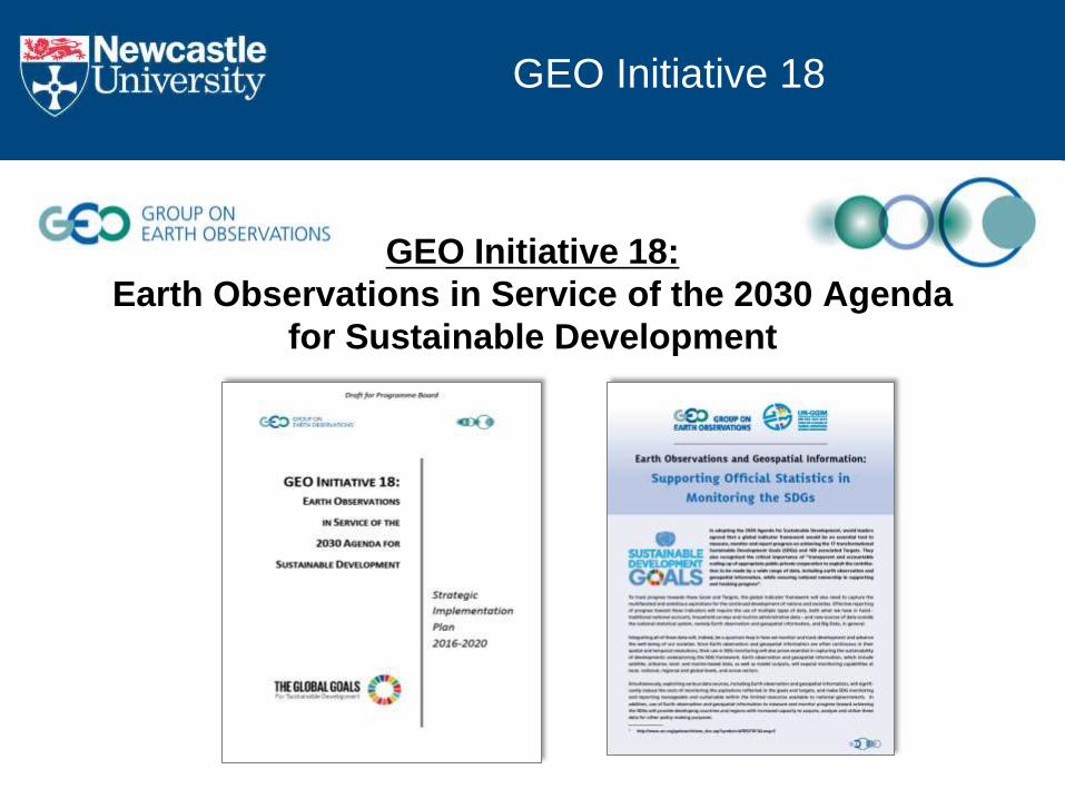
GEO Initiative 18:
Earth Observations in Service of the 2030 Agenda
for Sustainable Development
GEO Initiative 18
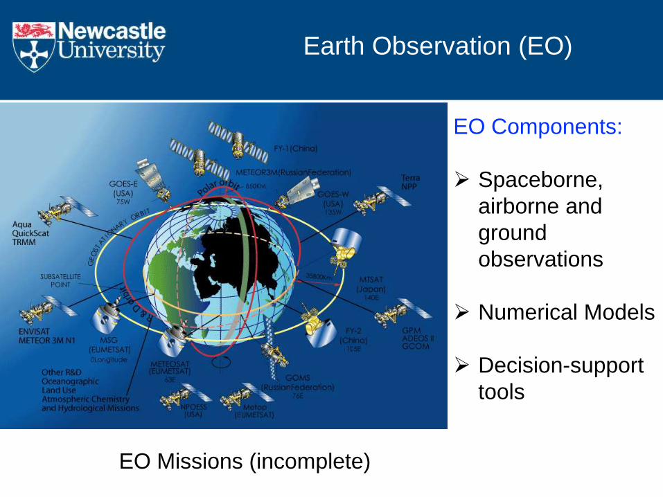
Earth Observation (EO)
EO Missions (incomplete)
EO Components:
Spaceborne,
airborne and
ground
observations
Numerical Models
Decision-support
tools
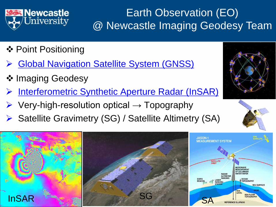
Point Positioning
Global Navigation Satellite System (GNSS)
Imaging Geodesy
Interferometric Synthetic Aperture Radar (InSAR)
Very-high-resolution optical → Topography
Satellite Gravimetry (SG) / Satellite Altimetry (SA)
InSAR SA
Earth Observation (EO)
@ Newcastle Imaging Geodesy Team
SG
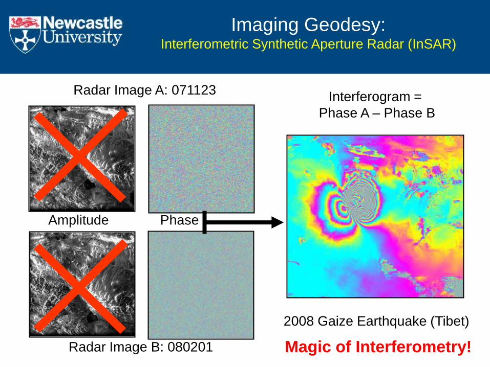
Radar Image B: 080201
Radar Image A: 071123
2008 Gaize Earthquake (Tibet)
Interferogram =
Phase A – Phase B
Amplitude Phase
Imaging Geodesy: Interferometric Synthetic Aperture Radar (InSAR)
Magic of Interferometry!
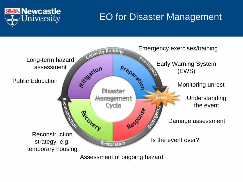
Early Warning System
(EWS)
Monitoring unrest
Damage assessment
Understanding
the event
Assessment of ongoing hazard
Is the event over? Reconstruction
strategy: e.g.
temporary housing
Long-term hazard
assessment
EO for Disaster Management
Emergency exercises/training
Public Education
Disaster Response/Preparation:
The 2017 Maoxian (China) landslides
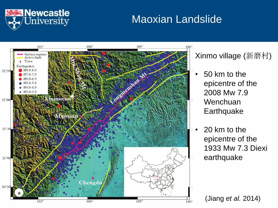
Xinmo village (新磨村)
• 50 km to the
epicentre of the
2008 Mw 7.9
Wenchuan
Earthquake
• 20 km to the
epicentre of the
1933 Mw 7.3 Diexi
earthquake
(Jiang et al. 2014)
Maoxian Landslide

Xinmo Village (新磨村): Pre-event
Gaofen-2 Imagery
(08 April 2017)
Xinmo Village
Xinmo Village: Pre-event
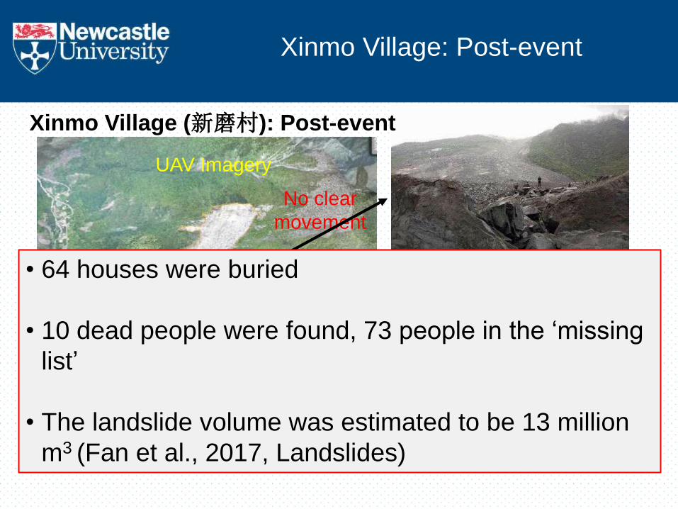
Xinmo Village (新磨村): Post-event
UAV Imagery
Landslide
No clear
movement
• 64 houses were buried
• 10 dead people were found, 73 people in the ‘missing
list’
• The landslide volume was estimated to be 13 million
m3 (Fan et al., 2017, Landslides)
Xinmo Village: Post-event
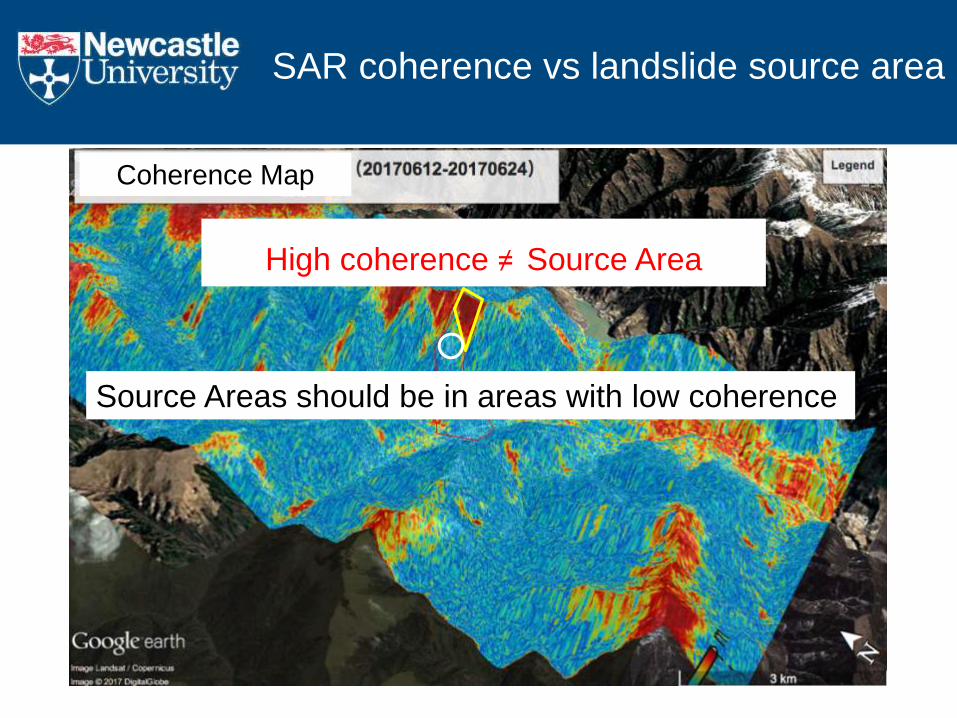
High coherence ≠ Source Area
Source Areas should be in areas with low coherence
Coherence Map
SAR coherence vs landslide source area
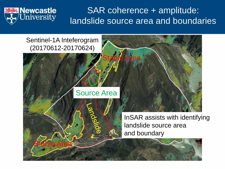
Sentinel-1A Inteferogram
(20170612-20170624)
Stable area
Stable area
Source Area
InSAR assists with identifying
landslide source area
and boundary
SAR coherence + amplitude:
landslide source area and boundaries
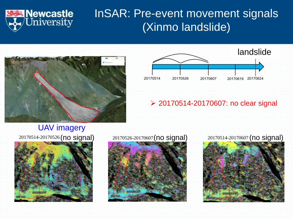
UAV imagery
20170514-20170607: no clear signal
landslide
20170514-20170607(无明显形变) (no signal) 20170526-20170607(无明显形变) (no signal) 20170514-20170526(无明显形变) (no signal)
InSAR: Pre-event movement signals
(Xinmo landslide)
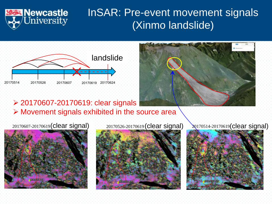
20170607-20170619: clear signals
Movement signals exhibited in the source area
landslide
20170607-20170619(有明显形变) (clear signal) 20170526-20170619(有明显形变) (clear signal) 20170514-20170619(有明显形变) (clear signal)
InSAR: Pre-event movement signals
(Xinmo landslide)
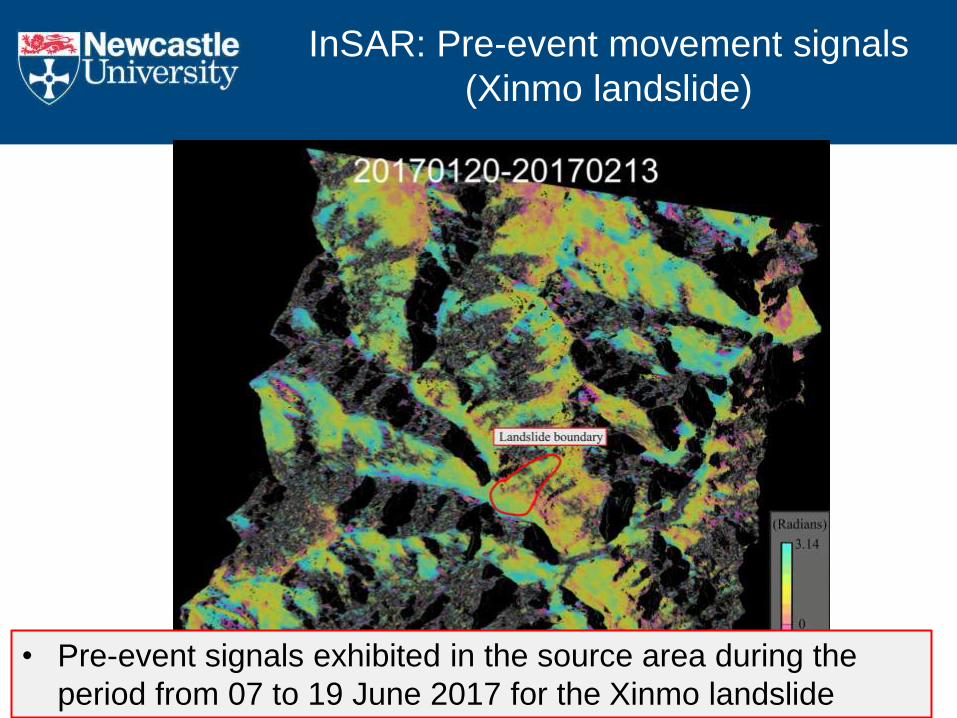
InSAR: Pre-event movement signals
(Xinmo landslide)
• Pre-event signals exhibited in the source area during the
period from 07 to 19 June 2017 for the Xinmo landslide
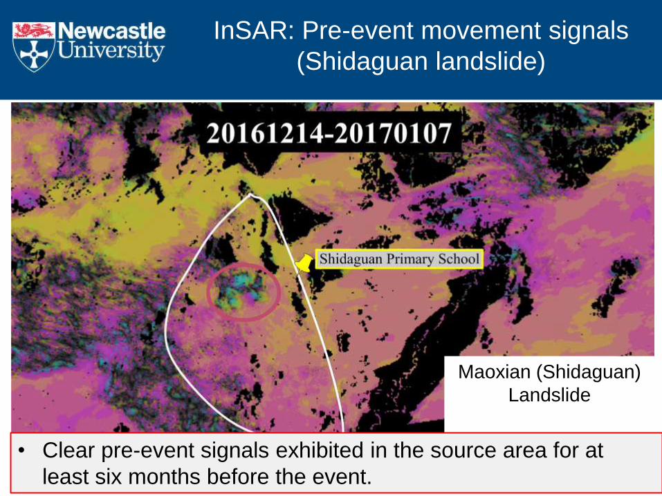
Maoxian (Shidaguan)
Landslide
Pre-event signals
InSAR: Pre-event movement signals
(Shidaguan landslide)
• Clear pre-event signals exhibited in the source area for at
least six months before the event.
• It is hard (if not possible) to predict when landslides
will occur
However
• If we can detect movement at a very early stage then
in many cases it is likely we would have time to put
Early Warning Systems in place to save lives.
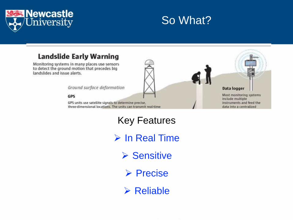
So What?
http://old.seattletimes.com/ABPub/2014/04/04/2023300805.jpg
Key Features
In Real Time
Sensitive
Precise
Reliable

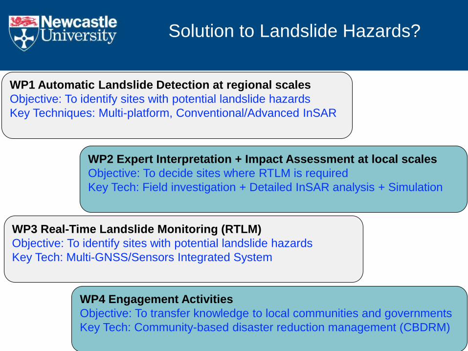
WP2 Expert Interpretation + Impact Assessment at local scales
Objective: To decide sites where RTLM is required
Key Tech: Field investigation + Detailed InSAR analysis + Simulation
WP3 Real-Time Landslide Monitoring (RTLM)
Objective: To identify sites with potential landslide hazards
Key Tech: Multi-GNSS/Sensors Integrated System
WP1 Automatic Landslide Detection at regional scales
Objective: To identify sites with potential landslide hazards
Key Techniques: Multi-platform, Conventional/Advanced InSAR
WP4 Engagement Activities
Objective: To transfer knowledge to local communities and governments
Key Tech: Community-based disaster reduction management (CBDRM)
Solution to Landslide Hazards?
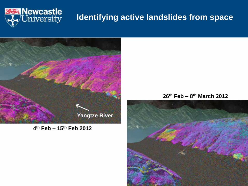
Identifying active landslides from space
Yangtze River
4th Feb – 15th Feb 2012
26th Feb – 8th March 2012
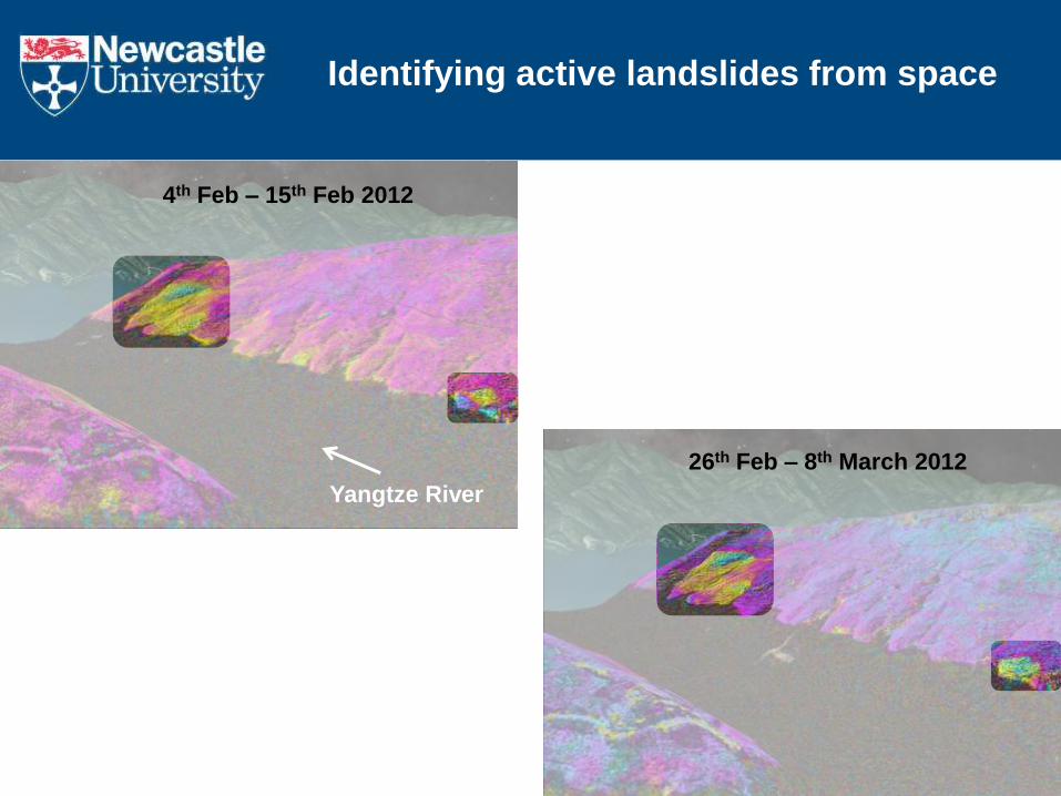
Yangtze River
4th Feb – 15th Feb 2012
26th Feb – 8th March 2012
Identifying active landslides from space
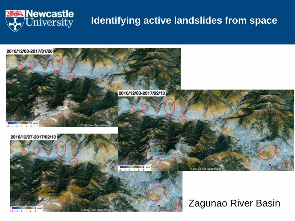
Identifying active landslides from space
Zagunao River Basin

WP2 Expert Interpretation + Impact Assessment at local scales
Objective: To decide sites where RTLM is required
Key Tech: Field investigation + Detailed InSAR analysis + Simulation
WP3 Real-Time Landslide Monitoring (RTLM)
Objective: To identify sites with potential landslide hazards
Key Tech: Multi-GNSS/Sensors Integrated System
WP1 Automatic Landslide Detection at regional scales
Objective: To identify sites with potential landslide hazards
Key Techniques: Multi-platform, Conventional/Advanced InSAR
WP4 Engagement Activities
Objective: To transfer knowledge to local communities and governments
Key Tech: Community-based disaster reduction management (CBDRM)
Solution to Landslide Hazards?
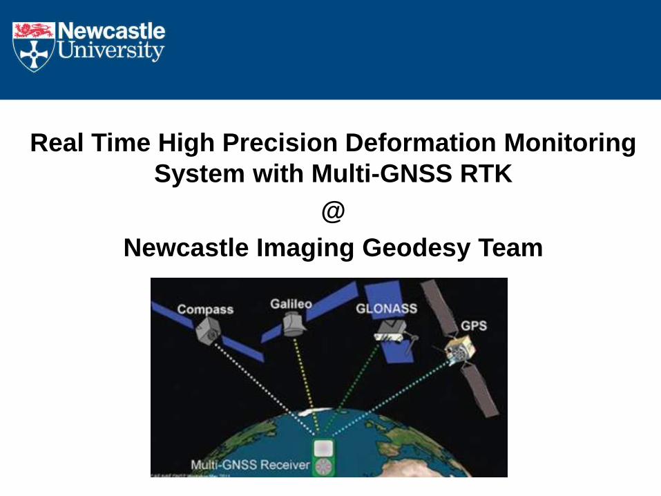
Real Time High Precision Deformation Monitoring
System with Multi-GNSS RTK
@
Newcastle Imaging Geodesy Team
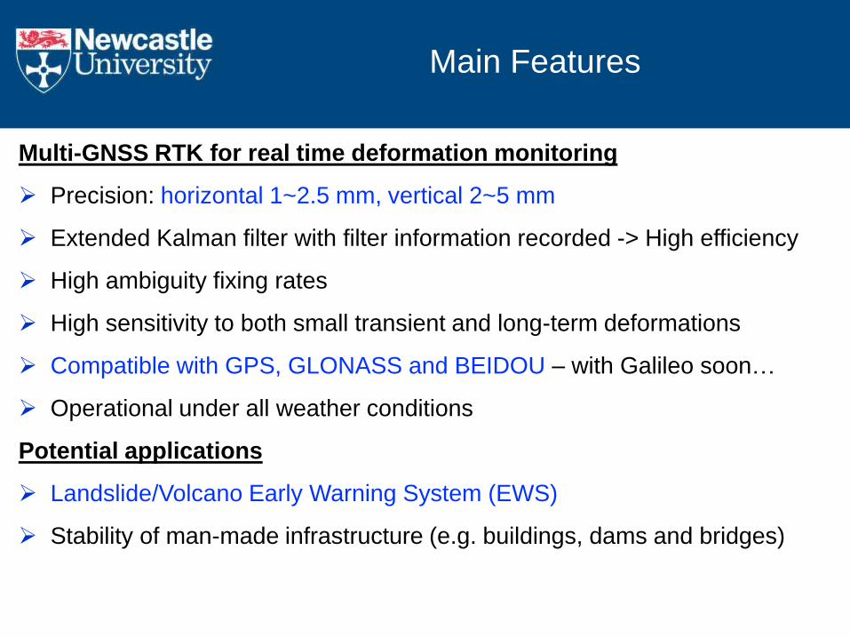
Main Features
Multi-GNSS RTK for real time deformation monitoring
Precision: horizontal 1~2.5 mm, vertical 2~5 mm
Extended Kalman filter with filter information recorded -> High efficiency
High ambiguity fixing rates
High sensitivity to both small transient and long-term deformations
Compatible with GPS, GLONASS and BEIDOU – with Galileo soon…
Operational under all weather conditions
Potential applications
Landslide/Volcano Early Warning System (EWS)
Stability of man-made infrastructure (e.g. buildings, dams and bridges)
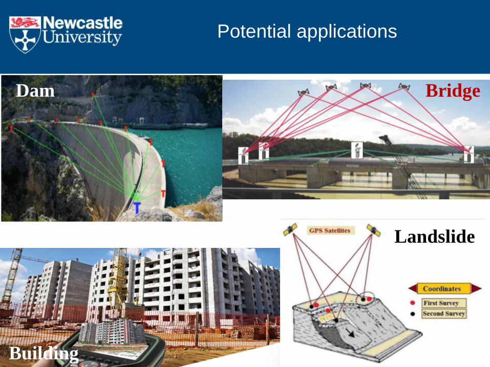
Dam Bridge
Landslide
Building
Potential applications
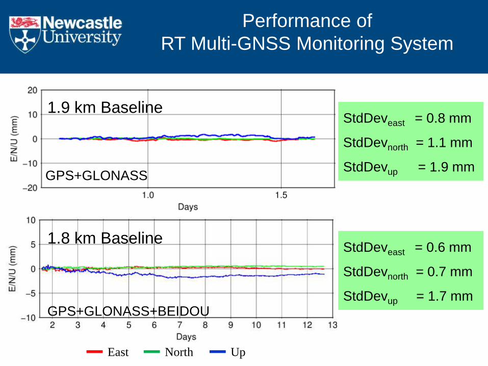
Performance of
RT Multi-GNSS Monitoring System
GPS+GLONASS+BEIDOU
GPS+GLONASS
East North Up
StdDeveast = 0.8 mm
StdDevnorth = 1.1 mm
StdDevup = 1.9 mm
StdDeveast = 0.6 mm
StdDevnorth = 0.7 mm
StdDevup = 1.7 mm
1.9 km Baseline
1.8 km Baseline

Two landslides
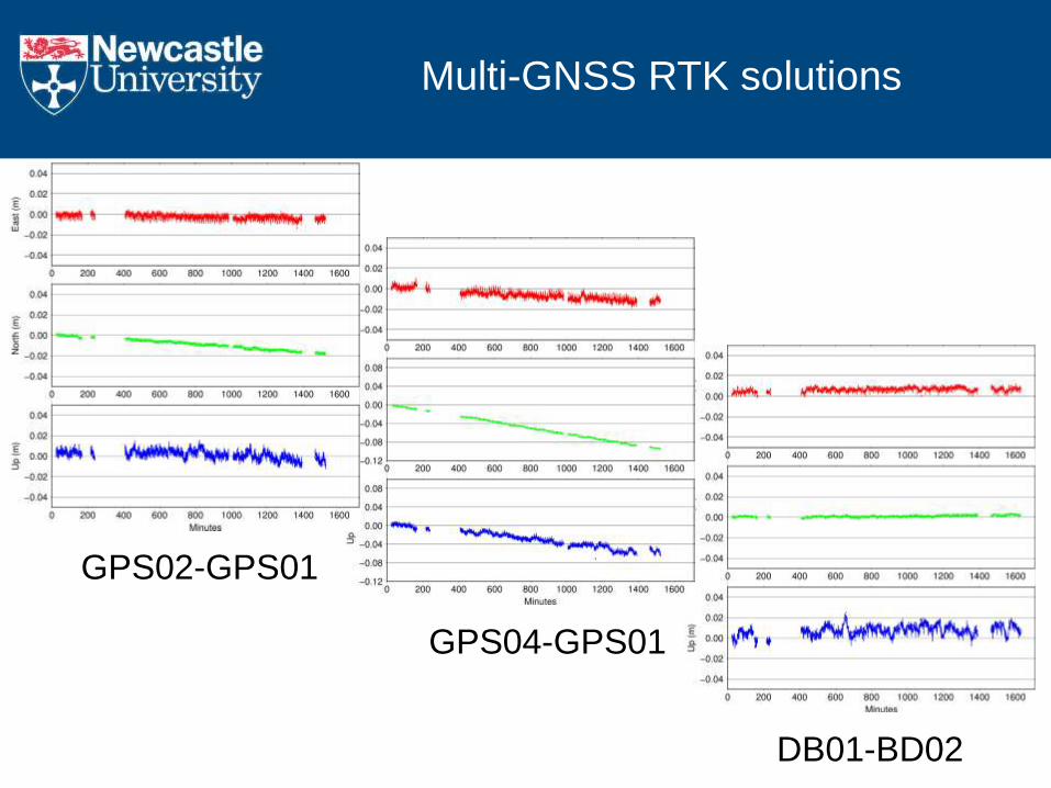
Multi-GNSS RTK solutions
GPS02-GPS01
GPS04-GPS01
DB01-BD02
WP2 Expert Interpretation + Impact Assessment at local scales
Objective: To decide sites where RTLM is required
Key Tech: Field investigation + Detailed InSAR analysis + Simulation
WP3 Real-Time Landslide Monitoring (RTLM)
Objective: To identify sites with potential landslide hazards
Key Tech: Multi-GNSS/Sensors Integrated System
WP1 Automatic Landslide Detection at regional scales
Objective: To identify sites with potential landslide hazards
Key Techniques: Multi-platform, Conventional/Advanced InSAR
WP4 Engagement Activities
Objective: To transfer knowledge to local communities and governments
Key Tech: Community-based disaster reduction management (CBDRM)
Solution to Landslide Hazards?


Conclusions
Satellite radar observation can play a key role in DRR
EO for Landslide Disasters:
Future Work: - How to extract the useful information from BIG DATA automatically?
- How to best build Early Warning Systems (EWSs) to save lives?
- How to better transfer EO+DRR knowledge to local communities?
Disaster Response -> Recovery -> Mitigation -> Preparation