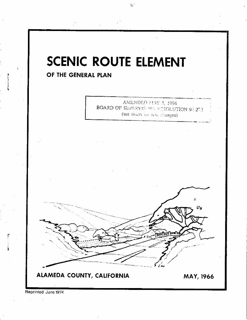
scenic route element general plan - alameda county government
TRANSCRIPT
It.i
þ
t¡It
ilb
rÌ
h
SCEN¡C ROUTE ELEMENTOF THE GENERAI PLAN
Ai\4.[ji{ ÐirD i!, 1.,1 \]tsOARD 0F SLtpf:tiViS..'{t: ,,,
(see itì5ür'r ;\ii r,_: y,r
q ï {_)L-¡l
:,!ûi_u"itOt{ 9.1
. ìr.ìIiles)
AIAMEDA COUNTY, CAIIFORNIA MAY, 1966
Reprinted June 1974
A]\TET\IDTÍE}ITS TOALA}IEDA COUNTY SCET{IC ROUTE ELEI\{EI{T
(Adopted l\lay 5, 1960
Amended l\fay 5, L994Board of Supervisors Resolution 94-272
Neu' language is indicated in italícs; deletions are shown in strileeet¡t.
Page 16, Road*'ay srandards were deleted.
SCENIC ROUTE ELEMENT OF THE GENERAL PLAN
County of Alameda, State of California
AL,{MEDA COUNTY BOARD OF SUPERVISORS
John D. Murphy, Chai¡man
Leland W. Sweeney, Vice ChairmanRobert E. Hannon
Earl R. Strathman, County Administrator
ALAMEDA COUNTY PLANNING COMMISSION
Harry W. Spencer, Chai¡man
P. J. DeBernardi, Vice ChairmanEdward E. Enos
John P. Gardella
Advisory Members
John D. Mrnphy, Boa¡d of Supervisors
James F. Vivrette, CountY SurveYor
Victor L. Taugher, County Building Official
J. Frank Coakley, District Attorney
William H. Fraley, Planning Di¡ector
May, L)66
Kent D. PurselEmanuel P. Razeto
Ma¡tin C. KauffmanHoward F. Kuder
George R. Vaughns
lll
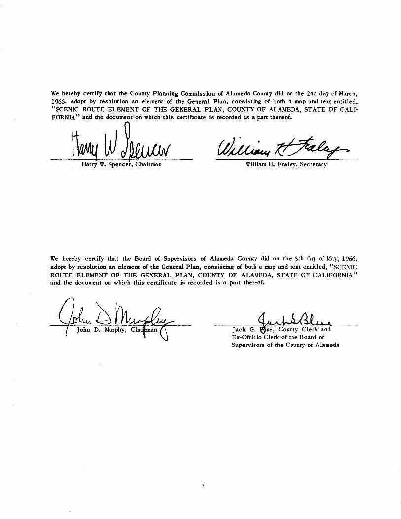
Ve hereby certify that the Cormty Planning Commission of ,{lameda Counry did on the 2nd day of March,1966, adopt by resolution ao element of the General Plan, consisting of both a map and text entitled,"scENIc RourE ELEMENT oF TIIE GENERAL pLÂN, coLJNTy oF ALAMEDA, srATE oF c.,{LI-FORNIA'' and the document on which this certificate is recorded is a part thereof.
It',"rlillw*
We hereby certify that the Board of Supervisors of Alameda County did on the 5th day of May,l966,adopt by resolution an elemenr of the General Plan, consisting of both a map and text entitled, "SCENICROUTE ELEMENT OF THE GENERAL PLAN, COTJNTY OF ALÂMEDA, STATE OF CÁLIFORNIA''and the document on which this certificate is recorded is a pan thereof.
Ex-Officio Clerk of the Board ofSupervisors of the County of Alameda
Villiram H. Fraley, Secretary
, County Clerk and
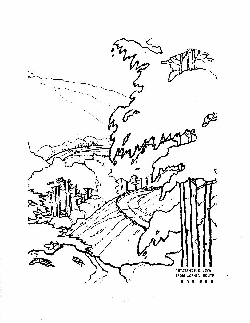
OUISTANDING VIEW
TROM SCENIC BOUTE
l ll l.r I
vl
PREF,{CE
The Scenic Route Element of the General Plan is intended to serve as a means of continuing coordinationamong the city and county planning functions of Aianeda County and the State Division of Highways inthe development of a county-wide systeo of scenic routes, appropriate portions of which would be adoptedor expanded upon by each city and the state. Local, regional and state agencies have reviec¡ed the sug-gested plan, and recommendations for changes and additions have been included in the Scenic RouteElement. Coo¡dination of poposals has beeo sought with adiaceot counties for those routes that crosscounty boundaries. A number of cities and recreation agencies have endorsed the Scenic Route Elementof the General Plan in principle.
The plan, consisting of a continuous county-wide scenic route system is also intended to serve as a guideto local jurisdictions for development of more detailed, individual city scenic route plans to supplementthe county plan.
The Scenic Route Plan is fruther intended to serve as a guide for development of city and county legis-lation and programs rhat will protect and enhance the scenic values along routes designated in the planand in other areas in the county visible from scenic routes. The plan map includes those routes shov¿n
on the map entitled "Proposed Scenic Roads -- Alameda Counry, A.l¡ameda County Planning Commission,December, 1964 " 1rl and i¡cludes supplemental routes deemed to be of outstanding quality or whichprovide access to important scenic, recreationalr.cultural or historic points.
During development of the plan valuable assistance and cooperation has been extended by official representatives of many cities, local and regional recreation agencies, adiacent counties and the State
Division of Highways. The Âlameda County Planning Department gratefully acknowledges this assistanceas well as rhar ertended by tt{t. Robert Tetlow, Âssociate P¡ofessor of Landscape ,{rchitecture, Collegeof Envi¡onmental Design, University of California, Berkeley, and lulr. David Arbegast of Theodore Osmundson
and Associates, San Francisco, in providing photographs of the Bay Area as sor¡rce material for scenic
route sketches.
l/ This ¡rurp was prepared in coordination with cities in the counry and adjacent counties and c/as sub-
mitted, via rhe State Division of Highways, by the ,l,lameda Counry Board of Supervisors as recommenda-
rions ro be considered in the Br¡¡eau of Public Roads Nøtìonal Scetìc Roads and Parkuøys Stady,
vll


LIST OF PLATES
Outstanding View From Scenic Roure
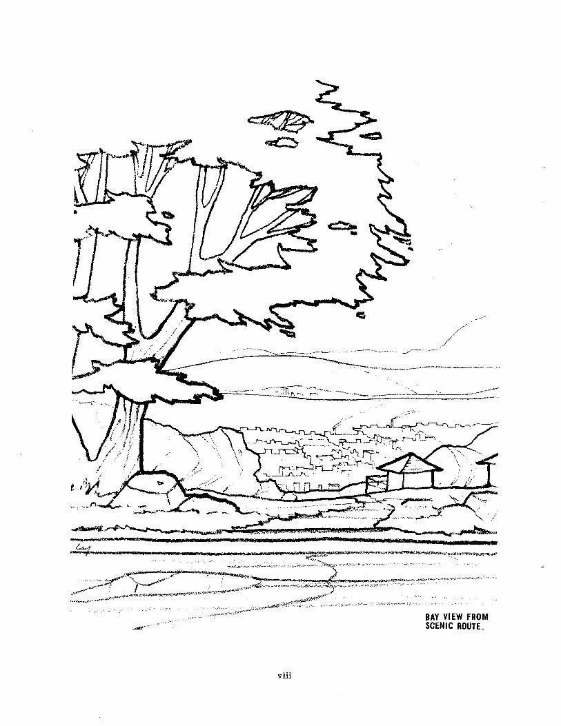
Bay View From Scenic Route
Scenic Rural-Recreation Route
Types of Scenic Routes
Corridor of Outstanding Scenic Quality
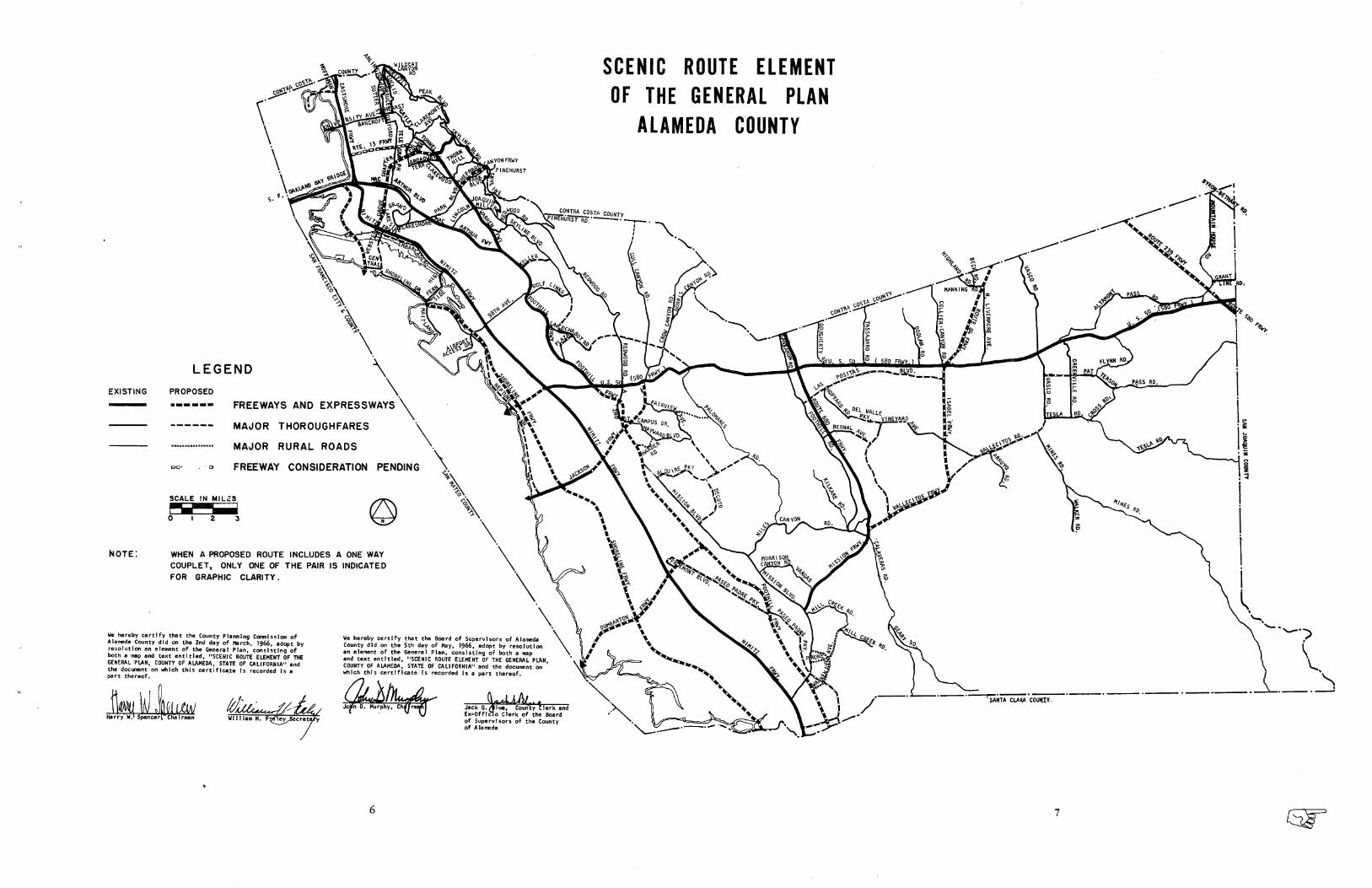
Scenic Rorre Element of the General Plan Map
fuea of Outstanding Scenic Beauty Along Maior Scenic Thoroughfare
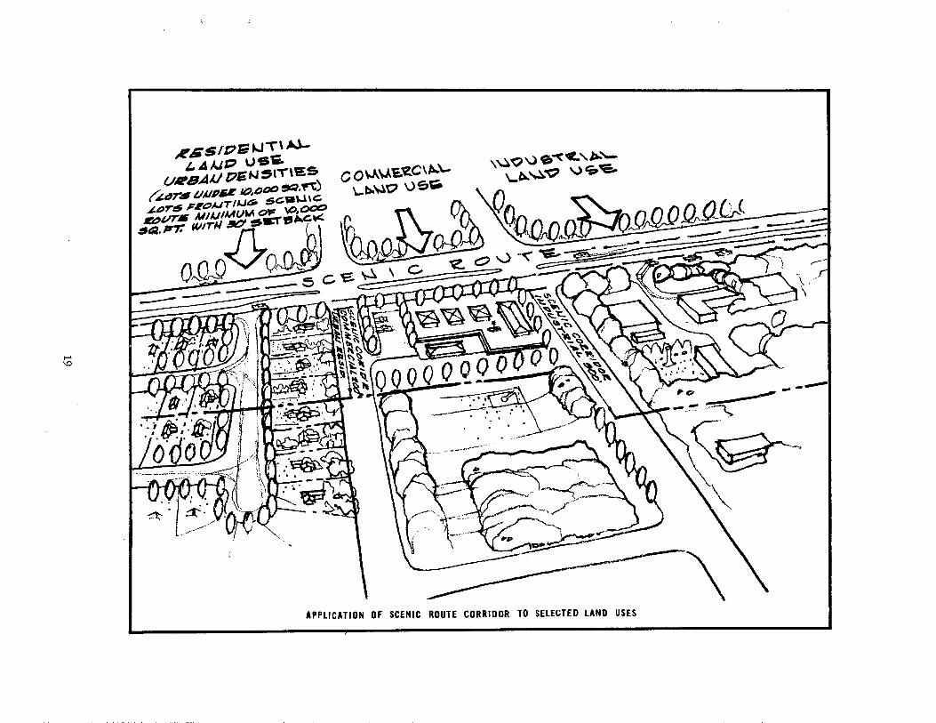
Application of Scenic Route Corridor to Selected Land Uses
vt
xtt
Page
vttt
6,7
t9
at
. ...)'.. !.t
"' \ ). :)*'.*_+_¿ \+ . "*.-.. *-<;-;-*",,i,1;
:"
1
SCENIC RURA[. ,åÞ,
RECREATION ROUTE
-
'_.*.\___*.,1r;;:; :.,
xtt
INTRODUCTION
Purþoses
The Scenic Route Plan, consisting of sext and map, is designed to serve as a guide for establishment
of programs and legislati,on dealing with the development of a system of scenic routes and the Preserva-rion and enhancemenr of scenic qualities and of natural scenic areas adjacent to and visible from scenic
routes.
Stated more fully, the plan is intended to establish official basic policy regarding:
1. Objectives, principles, and general standards for development of a scenic route system and
preservation and enhancement of adjacent scenic areas, and other areas of the county visiblefrom the scenic route.
Definition and designation of a scenic route system and adjacent scenic ateas.
Coordinarion of scenic roure proposals and programs among all levels of government: federal,
state, regional, county, and city.
Guidance to local jurisdictions in the development of more detailed individual city scenic
route system plans to supplement'the comprehensive, county-wide scenic route network.
Employment of all available, appropriate scenic conservation legislation.
Development of legislarive measures and official progrâms to Protect and enhance scenic
values along scenic roures, and other areas of the county which are visible from, and have
an effect on the quality of the view from the scenic route.
Coo¡dination
Coordination at federal, state and local levels is necessary: (1) to assure a comprehensive county'wide
scenic route plan tþt provides a framework for and includes the plans of other agencies and that provides
harmonious developmenr; and (2) to assure con¿inuous Protection of scenic values along routes. Co'
ordinarion will also be required ro determine which agency or agencies should be tesponsible for controls,
for acquisition of properry tirle or development rights, if necessary, and to inform each level of govern-
ment of various laws at other levels of government concerning property acquisition and opportunities for
obtaining funds.
2.
3.
4.
6.
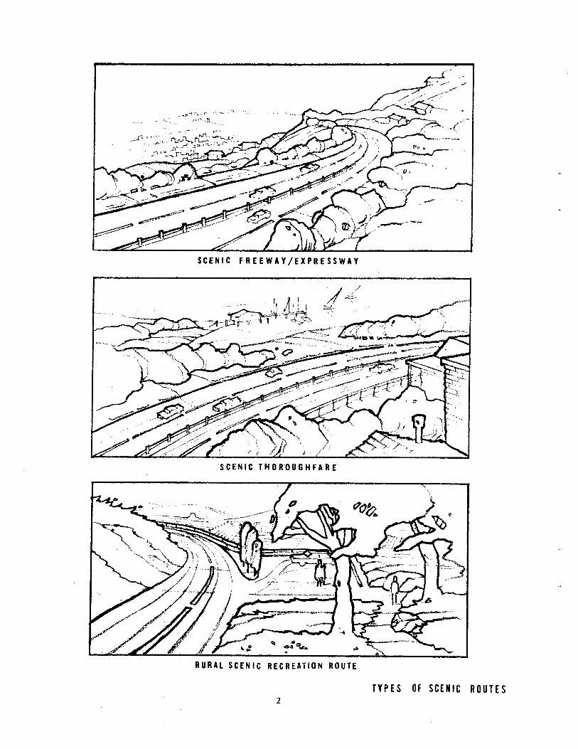
scEl{rc tREEwAY /EX?RESSWtY
SCENIT THOROUGHFARE
RURAT SCENIC RECREATION ROlTE
TYPES Of SCTIIIC ROUTES
De linítions
Â. Types of Scenic Routes
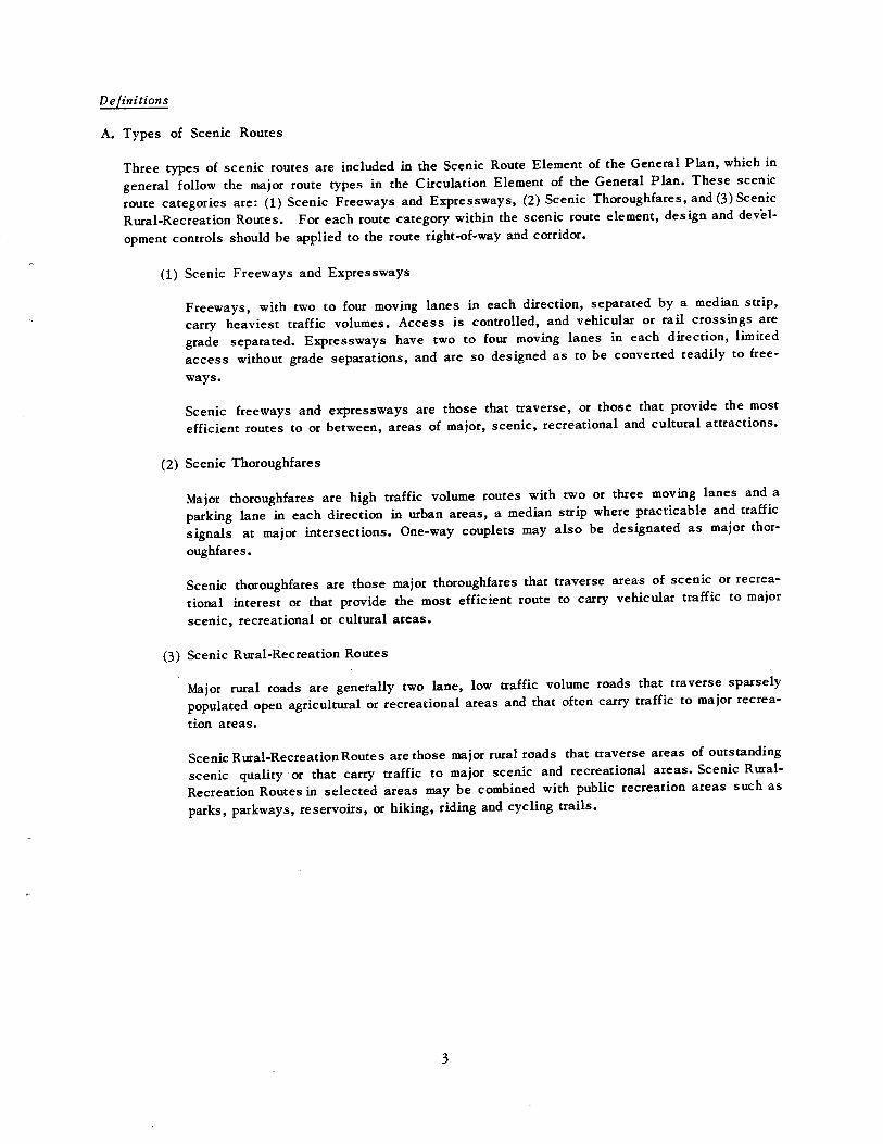
Three types of scenic roures are included in the Scenic Route Element of the General Plan, which in
general iollow the major route rypes in rhe Ci¡culation Eleoent of the General Plan. These scenic
route caregories are: (l) Scenic Freeways and Erpressways, (2) Scenic Thoroughfares, and (3) Scenic
Ru¡al-Recrearion Roures. For each route category within the scenic route element, design and devèl'
opmenr controls should be applied to the route right-of'way and corridor.
(1) Scenic Freeways and Expressways
Freeways, with two to fout moving lanes in each di¡ection' seParated by a median strip,
carry heaviesr traffic volumes. Access is conaolled, and vehicular or rail crossings are
grade separated. Expressways have rwo to four moving lanes in each direction, limited
access without gr.d" "ep"rasions'
and are so designed as to be converted readily to free-
ways.
Scenic freeways and expressways are those that traverser or those that provide the most
efficient routes to or between, areas of major, scenic, recreational and cultural attractions'
(l) Scenic Thoroughfares
Major thoroughfares are high çafÍic volume routes with two or three moving lanes and a
parking lane in each direction in urban areas, a median striP where Practicable and traffic
"ign"t" at øajot intersections. One-way couplets may also be designated as major thor-
oughfares.
Scenic thoroughfares are those maior thoroughfares that traverse areas of scenic or recrea-
tional interest or that provide the most efficient route to carry vehiculat traffic to major
scenic, recreational or cultu¡al areas.
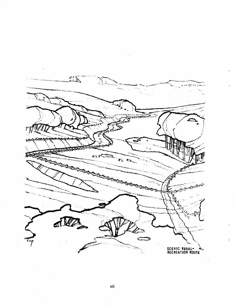
(3) Scenic Rural'Recreation Routes
Maior rural roads are generally two lane, low t¡affic volume roads that traverse sparsely
populated open agricultural or recreational areas and that often carry traffic to major recrea-
tion areas.
Scenic Ru¡al-RecreationRoutes are those m jor rural roads that traverse areas of outstanding
scenic quality.or rhat carry traffic to major scer¡ic and recreational areas. Scenic Rr¡ral-
Rec¡eation Routes in selected areas rDay be combined with public recreation areas such as
parks, parkways, reservoirs, or hiking, riding and cycling trails'
B. Elements of Scenic Routes
Routes consist of three elements: 11¡ the right-of-way, (2) the adjacent scenic conidor, and (3) areasextending beyond the scenic caridor.
(1) The Right-of-Way
The right-of-way includes the paved road and adjacent lands required for roadway prorec-tion, storm drainage, public utilities, pedestrian travel and roadside planting. The right-of-way would either be oq¡ned in fee by the state or owned by or dedicated to the local jurisdic-tion. Whe¡e appropriate, it may also include public roadside rests, cycling, riding and hikingtrails.
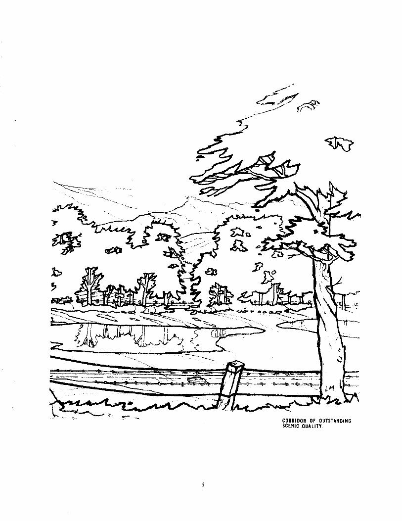
(2) The Scenic Co¡ridor
Scenic corridors are a¡eas that extend beyond the scenic route right-of-way that are of suf-ficient scenic quality to be acquired by state or local juisdictions, or areas to which devel-opment controls should be applied for puposes of preserving and enhancing relatively nearbyviews or maintaining unobstructed distant views along the scenic route and providing a
pleasant route of travel. The scenic corridor should also include slope and utility ease-ments, and in selected areas, public roadside rests, cycling, riding and hiking trails. Widthof scenic corridors will vary from the depth of lots adjacent to the right-of-way in highlyurban areas to a distance of one thousand feet in rural areas having a high scenic quality.Development controls should be applied to preserve and enhance scenic qualities, restrictunsightly use of land, control height of structures, and provide site design and architecturalguidance along the entire scenic corridor.
(l) Areas Extending Beyond Scenic Corridors
Because views from scenic routes çrill extend beyond scenic corridors and comprise theremainder of the county, certain basic general requirements for development will be neces-s¿rry to preserve and enhance the attractiveness of all areas" Both developed and undevelopedareas will require development guidance and controls.
(a) Developed Areas:
The primary method of adding to the attractiveness of developed areas within the counrybeyond the scenic route corridor will be requirements to insure preservation of out-standing views, through preservation of existing trees, establishment of new landscap-ing, and controls on the location and type of utility and communication towers, poles,and lines, and of outdoor advertising signs and structures.
(b) Undeveloped,{reas:
In undeveloped areas of the county, guidance and control of development will includegrading and natural vegctation removal regulations, prese¡vation of natural sneambeds,landscaping, control of location and type of utility and communication towers, poles andlines, and of outdoor advertising signs and sructures.
a.'lFaó
"4îno
JÀ
' ¡-\--'\--\<-:-
^-
âo,r
ryb,æ
CORRIDOR OF OUTSTANDIl{GSCENIC OUALITY.

\
SCEI{IC ROUTE ELEME}IT
flF THE GENERAL PTAN
ATAMEIIA COUNTY\\ HUÂSI
J,ÊEoffi:r^ couxr.Y_.
,gle
L EG END \EXISTING PROPOSED
-
l--r--
NOTE:
I!*'/,.sÈ
e-o-1
SCALE IN MILESFtrFT=or23
\\ 'r' a¿'
WHEN A PROPOSEO ROUTE
COUPLET, ONLY ONE OF
FOR GRAPHIC CLARITY.
INCLUDES A ONE WAY
THE PAIR IS INDICATED
Vê hcreby ccrtlfy thåt thc Couhty ptrnn¡n9 Cffi¡sslon ofAlaædâ C@nry dtd ø thê 2nd d6y of t{srch, 1966, rd@t byresolutlo !n 6lercnt of the GGncrål plàn, coslstlng ofboth ã Ép ônd text cntttlGd, '¡SCEIIC nOUft ¡L¡¡etf õf fggGEilEnAL PLAll, CoUtllY 0F ALAHEDA, SfAtE OF C¡LtFORItA', ôñdthc dæ@nt oh rhlch th¡s ccrtifl@to ls rscordêd ¡s sært thêroof.
\\
y¿ hêrcby cê¡tlfy thot thê B€rd of Supêrvlsors of Alaæd¡County dld o thè 5rh dðy of t{ey, 1966, sdopt by resoluttdan êlcrcnt of the ccnêrôl Plåô, conslsilng of both a Èpånd tcxt êntltlcd, "SCENIC Ro[m ELEåEilt OF lHE GENERAI ptÂ[,CoUI{TY 0F ALAHEDA, STATE 0F CåLtFoRÑ|A'¡ .nd tho dæuænt dHhlch thls cêrtlfløtê ls rêcordêd ls a Dârt thercof.
I\
\ .|
of Supcrvlsors of thê Countyof Alaæds
'wàr,
\-t-ÊIElo
FREEWAYS AND EXPRESSWAVS \
MAJOR THOROUGHFARES
MAJOR RURAL ROADS
FREEWAY CONSIDERATION PENDING
5AÌT CLAn^ Cqqifr..
\--v-'--¡
R\ l.o
4-_ì
ër--o- i'
øtéjë{-Pe-4ú
{ß8" "1
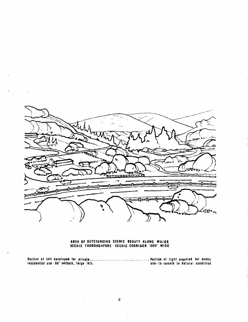
rREA OF OUÏSIIIIDII{G SCETIIC BEAUTY ALONG IilAJORscENtc TH0RoUGHtARE -SCEr{tC CoRRtD0R 1000' WIDE
Portlon rt llft dcvrloprd for Drlv¡lr ..... Portlon al rlghl ¡cqulrGd for publlcrtsldtntl¡l usG - 50' ¡llb¡ct, lrrgr lots. usc. l0 rrmeln ln Írlurel c0ndltl0n.


PLÂN POLICIES
OBIECTIVES
To establish a continuous system of routes, that will be convenient to all persons in AlamedaCounty, and that will increase the enioyment of, and opportunities for, recreational and culturalpursuits and tourism in Alameda County and adjacent counties by providing for scenic pleasuredrives and scenic routes to all major recreation areas and cultural centers throughout the countyand adjacent areas.
To conserve, enhance, and protect scenic views observable from scenic routes.
To provide multiple recreational uses, trails and roadside rests, picnicking and observation pointswhen appropriate on present or future publicly oq'ned lands adjacent to scenic routes, and to pro-vide a means of coordinating scenic route trails wÏth other trail systems within the county.
To assist in stabilizing or increasing property values and the economy of Alameda County throughpreserving and adding to its attractions.
10
PRINCIPLES
PRINCIPLES THAT .{PPLY TO THE SCENIC ROUTE SYSTEM
Prouide a Continuous, Conuenient System of Sceníc Roates
A system of scenic routes should be complete enough to be convenient to all persons in AlamedaCounty and to provide continuous pleasurable driving within major scenic areas and between majorscenic areas and recreational and cultural centers in Alameda County and adjacent areas. Theroutes should afford aesthetically pleasing viec/s to both the traveller and the outside observerthroughout the entire system.
Establisb EÍficient dnd Attractìue Connectìng Línks
The scenic route system should include attractive and efficient links between routes of majorscenic value and recreational and cultural centers. These links should include certain freewavsand other roadways, coordinated among appropriate jurisdictions.
Prouide Variety ol Scenic Routes
A variety of experiences such as changes in terrain, vegetation, land forms and view should be
provided in the selection of routes within the system. The geographical location and distributionof roures should be selected to provide the traveller v¡ith a choice from among the outstandingscenic values within the countv.
Prouide lor Unimþeded Pleasure Drìuìn?
Relatively uninterrupted movement of pleasure driving vehicles on scenic routes should be accom-modated rhrough control of access, through avoidance of stop signs and through synchronization oftraffic signals whenever possible on scenic expressways and thoroughfares. Through movement oftrucking should be prohibited on scenic routes unless no generally paralleling through routes areprovided within a reasonable distance.
Coordinate Scenic Routes and Recreation Areø.s
Maximum coordination of scenic routes and adjacent public recreation areas such as parks, scenicourlooks, roadside resrs, cycling, hiking and riding trails should be planned. Recreation routes and
trails should continue into adjacent counties to provide continuous networks for the enjoyment ofthe public. Scenic route recreation trails should be coordinated with existing and planned local,regional and state trails.
11
Coordìnate Sceníc Route Plans witb Generøl Plans
Scenic route plans should supplement the l¡and use and circulation elements of city and counrygeneral plans and should be in conformance with general plan policies and objectives.
As a mear¡s of implementing city and counry general plans and protecting and enha¡cing scenicvalues, city and county legislation that includes standards should be established to coordinare,guide and control preservation and development of scenic routes, scenic corridors and areas beyondthe scenic corridor. (See section on implementation for further detail.)
PRINCIPLES THAT APPLY TO SCENIC ROUTE RIGHTS{F.WAY
Design Sceníc Roates to Mìní@
Scenic routes should be designed so as to avoid excessive cutting, filling and grading.
Desígn Sceníc Roates Íor Leísuely Rathet tban Hígb Speed Trøuel
With the exception of scenic freeways aíd expressways, scenic routes should be designed formoderate speeds to reduce conflicts with pleasure driving vehicles and to reduce cut and fill needs.
Establìsb Roaduql, T¡aÍlíc and Recreøtíoøal Facílítíes ín Rígbts.oÍ:Way
Paved roadways and sructures directly relating to the. scenic route, including bridges, tunnels,embankments, embankment .protectors, guard rails, drainage structures and facilities, light stand-ards, route location and directional signs or other signs pertaining to the use of the scenic route,should be permitted within the rightof-way. Structures relating to roadside resrs or other publicrecreational facilities should also be provided where appropriate.
Enbønce Scenìc Route Rigbts-oÍ-Way thrcugb O.atstandìng Desígn oÍ Hígbuøy Stractares
Scenic route rights-of-way should be made as att¡active as possible through appropriate design ofroadways and sructure appurtenances, as well as adjacent utilities, street furniture and trafficand other official signs.
Landscø^e RìRbts-of-Watt of Exísting and Proþosed Routes
Âll existing and proposed scenic route rights-of-way should be landscaped for improveu¡ent of scenicqualities and for erosion control where necessary. In general, landscaping should provide a fore-ground f¡amework for background views; landscape materials should not forn a solid visual barrierexcept to screen existing unsightly views caused by elements that cannot be removed or satis-factorily improved. Rights-of-way should be çrell maintained to present a continuing pleasingaPPearance.
12
Utílíze Sceníc Roate ldentílìcdtion Sip¡s
Appropriate scenic route identification signs should be placed periodically along all scenic route
rights-of-way ro indicate to the traveller that he is entering or riding on a route within the scenic
route system.
PRINCIPLES THAT APPLY TO SCENIC ROUTE CORRIDORS
Prouíde Íor Normdl IJses of Land and Protect Agdìnst UnsíRhtlv Featu¡es
In both urban and rural areas, normally permitted uses of land should be allowed in scenic cor'ridors, except that panoramic vieq¡s and vistas should be preserved and enhanced through supple-menring normal zoning regulations with special (see Scenic Route Comidor Development Standards,
page 18) height, area, and sideyard regulations; through providing architectural and site design
review; through prohibition and removal of billboards, signs not relevant to the main use of the
properry, obt¡usive signs, automobile wrecking and junk yards, and similar unsightly development
or use of land. Design and location of all signs should be regulated to Prevent conglomerations ofunsightly signs along roadsides.
Locøte Trunsnìssíon Touers dnd Lines Outsíde oÍ Sceníc Route Conidors When Feasíble
New overhead transmission towers and liqes should not be located rvithin scenic coridors when
it is feasible to locate them elsewhere.
Under$ound Utílíty Distríbutíon Línes Wben Fedsíble; Møke Ouerbedd Línes lnconsþícuous
New, relocated or existing utility distribution lines should be placed underground whenever feasible.
Vhen it is not feasible to place lines underground, they should be located so as to be inconspicuous
from the scenic route. Poles of an improved design should be used wherever possible. Combined or
adjacent rights-of-way and common poles should be used wherever feasible.
Estdblísb Arcbítectaral and Sìte DesíRn Reuíew
fuchirectural and site design review by the appropriate local jurisdiction should be provided for
each site and for all nev¡ or altered structures so that particular consideration will be given to aFpearances that will enhance scenic qualities from the scenic routes. Originality in landscape and
consrrucrion design should be encouraged. Such designs should be in keeping with cityscape and
natu¡al sþline and reflect the densiry, movement and activities of the popul,ation.
lJse Landscaþìnp to lncfease scerric Qudlitíes of sceníc Route coftídors
Landscaping should be designed and maintained in scenic route corridors to provide added visr¡al
interest, to frame scenic views, and to screen unsightly views.
L3
Acquire Public Ownersbiþ ol Oþen Sþace Easements, o¡ Deaeloþment Rígbts ol Oþen Sþace AreasHauíng Outstandìng Scenìc Valaes
Development rights or full ownership of ponions of scenic route corridors having high open spacescenic qualities that would be dcstroyed by any development should be purchased by the appropriatejurisdiction, city or county, or state. There should also be public acquisition of appropriate openspace lands for roadside rests, observation points, and recreation trails in ponions of scenic ¡outecorridors.
Prouíde and Encourape Continainp Maí¡tenance of Sceníc Rotte Conìdorc
Continuing maintenance of scenic route corridors that thc public owns or has rights to should bcprovided. Private owners of areas vithin the scenic route conidor should be encouaged to povidemaintenance of landscape and structu¡es as a means of improving the scenic quality of the scenicroute.
Límìt Hígbwøy Basì¡ess and Commercíal Deueloþmen, to Eme¡penc! Needs on Sceníc Rural Routes
Highway business and commercial developnent on sccnic ru¡al routes should be linited to eatingestablishments and automobile service stations in arcas where such facilities would not otherwisebe accessible within 20 minutes driving time. Such facilitics should be dcsigned in such a m¿¡nner
as to be compatible with the scenic surroundiogs.
PRINCIPLES THAT APPLY TO BOTH THE SCENIC ROUTE CORRIDOR ,{¡¡D THE REMAINDER OFTHE COUNTY
Retaín Public Eøsements for Recredtíon T¡aìls
Âll public easements should remain free and clear of any structure or improveroents other thanplanting, unless required by public necessity, as a means of providing unobst¡ucted areas forfuture recreation trails.
Landscaþe dll Prcþerties and Sbeels
All new building sites, including parking areas and vehicular entrances in business; commercialand industrial areas should be landscaped, and street trees should be planted along all rights-of-way in the county as a means of improving the scenic quality of the county.
Encoarøpe Ouners of Larpe Holdínps to Protect and Enbønce Areøs ol Scenic Values
Public agencies and private individuals having control of large holdings should be encouraged toptorecr and enhance natural resources q'ithin their properties. Cooperation should also be soughtq'ith oq¡ners of smaller lots and with community improvement and conservation groups.
t4
Desíp¡t Hìll A¡ea Sl¡eets dnd Access Driues to be Comþatible wíth Natural Featu¡es
Hill area street and access drive alignments should be designed to preserve stands of maturetrees; and in such a manner as to be compatible with the natu¡al topography. Na¡rorv and one-waystreets should be utilized in hill areas where necessary to preserve natural features.
Control Tree Remoual
No matu¡e trees should be removed without permission of the local jurisdiction as a means ofpreserving the scenic quality of the county.
Cont¡ol Alteration ol St¡eambeds dnd Bodíes of ttdter
Alteration of streambeds or bodies of rvater and adjacent vegetation should be permitted only withapproval of the local jurisdiction, as a means of preserving the natu¡al scenic qualiry of streamcourses, bodies of waterrvegetationandwildlife in the county. Development along edges of sreams,canals, reservoirs, and other bodies of water should be designed and treated so as to result innaturalistic, a¡chitectural or sculptural forms.
Control Alteration of Bdy Shoreline
Alterarion to submerged l.and, or upland or watercourse affected by tidal action, should be per-mitted only with approval of plans by the local jurisdiction and the San Francisco Bay Conserva-sion and Development Commission, as a means of presewing significant scenic shoreline andmarshl,and areas within the county.
PRINCIPLES THAT APPLY TO AREAS BEYOND THE SCENIC ROUTE CORRIDORS
Preserue dnd Enbance Natardl Sceníc Qaalítíes in A¡eas Beyond the Scenic Co¡idor
Views from scenic routes-will comprise essentially all of the remainder of the county beyond the
limits of the scenic corridø: the corridor is intended to establish a framework for the observationof the views beyond. Therefore, in all a¡eas in the counry extending beyond the scenic route cor-ridors, scenic qualities should be preserved through retaining the general cha¡acter of naturalslopes and natural formations, and through preservation and enhancement of wate! areas, watercourses, vegetario¡r and wildlife habitats. Development of lands adjacent to scenic route corridorsshould nor obsrrucr views of scenic areas and development should be visually compatible with thenatural scenic qualities.
Prouíde lor Normal Ilses of La¡td but Límít Oueùead IJtilitíes dnd Outdoor Aduertísíng Structares
ln both developed and r¡ndeveloped areas, outdoor advertising structures, utility and communication
towers, poles and vyi¡es should be located only where they will not detract from significant scenicviews. .{ll other structures and use of land should be permitted as specified in the local zoningordinance as supplenented by special height regulations (see General Scenic Development Stand-
ards, page 20).
L'
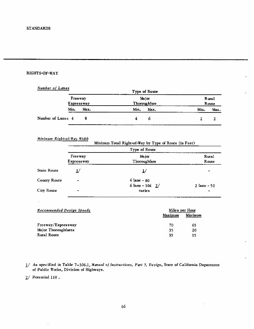
STANDARDS
RIGHTS.OF.W.AY
Number of LanesTlpe of Route
Freeway MaiorExpressway Thoroughfare
Rr¡¡alRoute
Min. lvlax. Min. I'fax. Min. Max.
Number of Lanes 4
lúinimun Rìebt.ol-W øy WìdtbMinimum Total Right-of-Vay by Type of Route (in Feet)
Type of Route
FreewayErpressway
MajorThoroughfare
RuralRoute
State Route
County Route
City Route
v v4 lane - 806 lane - 104
varies2 lane - 50)/
Recomnende d D e sípn Sþ ee ds
Freeway,/Expresswayl"lajor ThoroughfaresRu¡al Route
As specified in Table 7-306.1, Manudl of lnstructíons,of Public Works, Division of Highways.
Potential 110 .
Miles per HourMaximum Mini¡num
65
2015
70
35
3'
L/
2/
t6
Pøtt 7, Desìgn, State of California Department
CORRIDORS
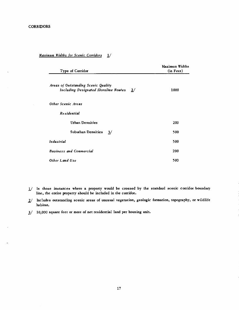
Maxìmam Widtbs for Sceníc Conidors U
Type of CorridorI\daximum Vidths
(in Feet)
Ateøs of Outstandìng Sceníc QualítyIncluding Desígnøted Sborcli¡e Routes U 1000
Otber Sceníc Areøs
Resídentíal
Urban Densities 200
Suburban Densities y 500
Industriøl 500
Basíness ønd Commetcíøl 200
Othet Ldnd Use 500
U In those instances where a property would be crossed by the standard scenic co¡ridor boundaryline, the entire property should be included in the co¡ridor.
U lncludes outstanding scenic areas of unusual vegetation, geologic formation, topography, or wildlifehabitat.
y 10,000 squaÍe feet or more of net residential lard per housing .ni¡.
L7
SCENIC ROUTE CORRIDOR DEVELOPMENT STANDARDS
In undeveloped areas proposed for residential use in scenic corridors, lots immediately adjacentro rhe scenic route right-of-way should have a minimum lot size area per housing unit of 10,000square feet rvith 100 feet minimum fronting the right-of-way and 100 feet minimum average width insingle family or planned development zoning districts, or the minimum specified in the zoningdistrict, whichever is greater, and 5,000 squäre feet minimum lot size per housing unit in multipledistricts or the minimum specified in the zoning districtr, whicheve¡ is greater.
Vithin the scenic corrido¡s in residential areas, residential structur€s should have a setback of at
least 50 feet from the right-of-way to provide sufficient open spece to permit scenic viec's and'toprovide a space buffer from traffic above normal volumes using the scenic route.
Because of the unsightly effect of a series of tall individr¡al radio or television antennae in areas
where adequate reception cannot be obtained from individual antenna that extend five feet or lessabove the roofline, the local government body should encourage the establishment of a publicutiliry for community antenna reception.
In co¡ridors along scenic roures with outstanding distant views above the roadbed, no buildingstructr¡re of more than one story in height should be permitted where it would obst¡uct views,excepting within and inrmediately adjacent to central business disnict locations. On lots where the
building srrucrure is higher than the roadbed in corridors along routes with outstanding distantviews, the combined width of sideyards should equal or erceed the u¡idth of the building structrue
as measured parallel to the roadbed.
On downslope scenic corridors along routes v¡ith outstanding scenic views, no building structureof more than one story should project above the highest point of the paved road directly in front ofthe building srrucrure, and no wall, fence, solid row of trees or other plants should project above
the building srrucrrue or above the roadbed, whichever is higher. Where single story building struc'tures are higher than the roadbed, there should be no wall, fence, ot Plant material that is not lo'cated directly berween the main building structure and the roadbed that will obstruct the viewfrom automobiles on the scenic route.
18
'l û'frj001
{--,.n,
00-
' ..Iâ. I
-'*ù*.i'
IPPTICTTIOH OT SCENIC ROUTE CORR]OOR TO SETEUTED TAND USES
SEâ:
GENERÂL SCENIC DEVELOPMENT ST,{NDARDS
The following applies to both the scenic route corridors and the remainder of the county:
o In all zoning dist¡icts q¡here the allowable height limit exceeds 35 feet, each proposed structureover 35 feet, except utility poles and lines, should be reviewed by the local jutisdiction for approval to insu¡e that such srructure will not conflict with any view from any scenic route.
Âlteration to natrual or artificial land contours should not be permitted without a grading permitissr¡ed by the local iurisdiction as a means of preserving and enhancing the natu¡al topography andvegetation in developable areas. Mass grading should not be permitted. The following criteriashould be applied in the review of grading permits in developable areas:
r As a means of peserving natural "ridge skylines" ç,ithin the county, no major ridgelineshould be altered ro rhe exrent that an a¡tificial ridgeline results. Minor grading to allowconsrrucrion of individual dwellings should be permitted as approved on the site developoentrevieq¡.
.{ccess roads should be located and designed to keep grading to a minimum.
Natu¡al ground contours in slope areas over l0 percent should not be altered Dore than 5
percent overall, excepr in such slope areas where large stands of mature vegetation, scenicnatural form¡tions or natural watercourses exist, where grading should be limited so as to
Preserve the natu¡al featu¡es.
Any contour altered by grading should be restored by means of land sculptr.uing in such amanner as to minimize run-off and erosion problems, and should be planted with low main-rctrance, fire resistant plant materials that are compatible with the eristing environment.
20
IMPLEMENTATION OF SCENIC ROUTE ELEMENT
2L
IMPLEMENTATION OF SCENIC ROUTE ELEMENT
Resþonsibilíties lor Scenic Routes
Route selection, determination of right-of-way width and general design standards for county roads arethe responsibility of the Planning Department and the County Surveyor; in cities, of the planning andengineering departments; for state routes, a joint responsibility of state and county and city officials.Final design standards, and construction and maintenance of the paved road and appurtenances are theresponsibility of the County Surveyor or city or state engineers. All right-of-way land would be owned infee by the state, or owned by or dedicated to the local jr.uisdiction.
Requhed Actions
o Adoption by the county and by cities within the county of scenic route elements to general plans.
r Periodic review of the scenic route elements by the county and by cities within the county.
o Continued cooperation of cities, adjacent counties, local and regional recreational and planningagencies and all appropriate state agencies in various programs leading to the implementation ofthe scenic route plan.
o Adoption and application by the county and cities therein of legisl,ation for control and develop-ment in accordance with scenic route plan principles and standards including:
'/-.. Zoning Ordinance supplements which will be based on scenic route planning principles andstandards and will include regulations on:
¡ land useso building heightso building setbackso residential densityo building coverage¡ lot areao planned unit development and cluster developmento architectural and site design reviewo historical preservation. on-premise signs. outdoor advertising and time limits for removal of nonconforming signso flood plain. screening and landscapingo quarries and other excavations
2. Subdivision regulations which q'ill be based on scenic route planning principles and standardsand will include:
r limiting of cut and fill. tree Presefvation and planting
22
o bank seeding and planting¡ limited access onto scenic highway¡ low density use of sceep land. se¡back from water's edge. easement dedicationo screening. road design standards. uriderground utilities
l. Building Code enforcement which will significantly, although indirectly, contribute to the im-provement of aesthetic qualities.
4. Main¡enance Controls including:
r Housing Code - Strict enforcement of a housing code and abatement of violations, as in an
r¡rban renewal project.¡ Fire Prevention - Enforcement of a fire prevention code can indi¡ectly conaibute to the scenic
route program. Fi¡e prevention programs should avoid uncontrolled burns which may destroynarive flora of scenic value. Appropriate planting and maintenance would avoid such ameasure.
o Litter Conrrol - An anti-litter ordinance should be effectively enforced. Public areas under
the jruisdicrion of the local government should be carefully maintained.¡ Weed and lnsect Control - Attention should be given to the use of weed and insect control
measures to eliminate unsightly conditions in the scenic corridor and other pertinent areasbeyond the corridor and to avoid the destruction of scenic native flora.
¡ Water Pollution - Water quality control should be enforced on the basis of odor and appear-ance as well as health løzatd, particularly within San Francisco Bay, streams and lakeswithin and beyond the scenic corrido¡.
o Foresrry Practice Vhere ,{pplicable - Regulations governing cutting, clean-up, and reforesta-tion in rimber operations should be reviewed for thei¡ use in implementing the scenic routeprog¡am, and should be enforced with the Program in view.
J. Streambed, canal, lake and reservoi¡ protection legislation to establish a system for reviewand approval of alterations to inland water bodies or watercouÍses.
6. Bay fill tegislation ro establish a system for reviec/ and approval of proposed bay fill projects.
7. Application of existing legislative programs and development policy for additional legislativetools to acquire land, open space easements or development rights in scenic corridors.
g. .{pplication ro srare and federal government bodies by the County Board of Supervisors and cicycouncils for grants for acquisition of property, or open space easemenss or development rightsin the scenic corridor, and for landscaping along all routes in the county.
p. Preparation of detailed development plans of scenic routes showing paved road, right-of-way,scenic corridor, public areas and facilities.
10. Prepa¡ation and initiation of scenic corridor and scenic area pilot projects by county and cities.
11. Establishment of official programs at the city and county levels to encourage landscaping ofall building sites and to provide street trees along all rights-of-way.
12. Application to the state for inclusion of state routes in the State Master Plan for "ScenicHighwaystt and for designation of "Official State Scenic Highways".
23
APPENDD( A
RESOLUTIONS OF SCENIC ROUTE ELEMENTOF THE GENERAL PLAN ADOPTION
THE COUNTY PLA,NNING COMMISSION OF .ALAMEDA COUNTYHAYWARD, CALIFORNIA
RESOLUTION NO. 7454 - .A,t meeting held March 2, L966
Introduced by Commissioner P. J. DeBernardiSeconded by Commissioner John P. Ga¡della
WHEREAS pursuant to the provisions of the Planning Law (Title 7 of the Government Code) itis the function and duty of the county planning agency of Alameda Counry, California, to prepare and ofthe County Planning Commission to adopt a comprehensive long term general plan for the physical de-velopment of the county, such plan to be known as the General Plan, and to provide that the Board ofSupervisors of Alameda County may adopt all or any part of said general plan or any subject thereof forall and any part of the county; and
WHEREAS said Planning Law provides that said general plan may include elements dealingwith subjects which in the judgement of the planning agency relate to the physical development of the
county; and
V/HEREAS this county planning agency in coordination with agencies and park districts in the
county has prepared a text containing planning objectives, principles, and standards for a scenic routesystem for the County of Alameda and a plan nrap for the incorporated and unincorporated area of the
County indicating scenic routes, which in the judgement of the planning agency relates to thephysicaldevelopment of the county; and
VHEREAS a public hearing was held by the County Planning Commission on the considerationand adoption of said element of the general plan on February 21, 1966, at the hour of 1:30 p.m. in the
County of Alameda Veterans Memorial Building, 22737 lvlain Street, Hayward, California; continued toMarch Z, 1966 at the hou¡ of 1:30 p.m. in the County of ,{lameda Veterans Memorial Building, 22737 MainStreet, Hayward, California; and
WHEREAS objectives, principles, standards and route proposals in said element of the General
Plan have been generally endorsed by cities and recreation agencies in Alameda County, and generally
supported by those in attendance at the public hearing; and
VHEREAS it sarisfactorily appears to this Commission that the public interest, necessity,convenience and general welfare crill be best served by the adoption of said element of the General
Plan: Now Therefore
BE IT RESOLVED that rhis County Planning Commission does hereby adopt a scenic route
element of the General Plan, consisting of a text and map enritled, SCENIC ROUTE ELEMENT OF THEGENERAL PLAN, Á,LAMED,T COUNTY, STÂTE OF CALIFORNIA: ANd
BE IT FLJRTHER RESOLVED thar the County Planning Commission does hereby recommend thatthe Board of Supervisors adopt the same.
ADOPTED BY THE FOLLOWING VOTE:
AYES: DeBernardi, Kuder, Gardella, Enos, Vaughns, and Chairman Spencer.
NOES: None.ABSENT: Kauff¡nan
WILLIAM H. FRALEY . PLANNING DIRECTOR & SECRETARYCOUNTY PLANNING COMMISSION OF ALAMEDA COUNTY
24
THE BOÁ,RD OF SUPERVISORS OF ALAMEDA COUNTYOAKLAND, CALIFORNIA
RESOLUTION NO. TL668T At meeting held May 5, 1966
ADOPT SCENIC ROUTE ELEùIENT . GENERAL PL,4N
WHEREAS, pursuant ro rhe provisions of the Planning Law (fitle 7 of the Government Code), itis the function and the duty of the county planning agency of ,tlameda County, Califomiar to prepare and
of rhe Counry Planning Commission of Alameda Cbunty to adopt a comptehensive long term general plan
for the physical development of the county, such plan to be known as the General Plan, and to provide
thar rhe Board of Supervisors of .Alameda County may adopt all or any part of said general plan or any
subject thereof for all and any part of the county; and
WHEREAS, said Planning Law provides that said general plan may include elements dealing
with subjects which in the iudgment of the planning agency relate to the physical development of the
counry; and
WHEREAS, said Counry Planning Commission, in coordination with agencies and park districtsin the cor¡nry, did preEare a text containing planning objectives, principles, and standards for a scenic
roure sysrem for rhe Counry of Alameda and a plan map for the incorporated and unincorporated area of
the County indicating scenic roures, which in the judgment of the planning agency relates to the physical
development of the county; and
WHERE,1S, after holding a public hearing thereon in the manner prescribed by law, the County
Planning Commission did recommend to this Board of Supervisors that the public interest, necessiry,
convenience and general welfare will be best served by the adoption of said scenic route element of the
General Plan, consisting of a text and map entitled, SCENIC ROUTE ELEMENT OF THE GENERAL
PLAN, AL,{MEDA COUNTY, STATE OF CALIFORNIA; and
WHEREAS, said County Planning Commission did advise this Board of Supervisors that the ob-
jectives, principles, standards and route proposals in said element of the General Plan have been general-
ly endorsed by cities and rec¡eation agencies in Alameda County, and generally supported by those in
attendance at the public hearing; and
WHEREAS, this Board of Supervisors did hold public hearings to consider the adoption of said
element of the General Plan. norice of which was duly given in all respects as required by law; and
WHEREAS, on April lg, 1966, this Board of Supervisors did by Resolution No. 1165314 adopt
the scenic roure element of the General Plan, consisting of a text and map entitledr SCENIC ROUTE
ELEMENT OF THE GENERAL PLA.N, ALAMEDA COUNTY, STATE OF CALIFORNIA, With fOIIOWiNg
two (2) excePtions:
1. Relocation oÍ a proposed road previously shown as extending easterly from Whipple Road at
Mission Boulevard to a location extending easterly from Decoto Road at Mission Boulevard,
sourh of and beyond the perimeter of the proposed Dry Creek Ranch Park, and
2. Removal of a proposed connection between Estudillo Avenue and a proposed Sþline Boule-
vard extension; and
which exceptions were referred to the Planning Commission for review and report; and
WHEREAS, said Planning Commission did find that the changes contained in said excePtions do
meet rhe objectives and principles of the SCENIC ROUTE ELEMENT OF THE GENERAL PLAN' COUNTY
oF ALAMEDA, STATE OF CALIFORNLA, and of its Resolution No. 74J4; and
25
WHEREAS' said Planning Commission did further find that said changes would provide betterrelationships bet¡veen subject scenic roures and adjacent land uses;
NOW, THEREFORE, BE IT RESOLVED that this Board of Supervisors does and it hereby adoptthe scenic route element of the General Plan, consisting of a texr and map enrirled, SCENIC ROUTEELEMENT OF THE GENERÂL PL.{N, ALÂMEDA COUNTY, STATE OF C,{LIFORNIA, as amended bythe above-listed exceptions.
PLANNING STAFF
William H. Fraley, Planning Di¡ectorJohn Jay Thomas, Principal Planner
Charles R. Dunann, Senior PlannerBruce C. Fry, Senior Planner
Richa¡d P. Flynn, Zoning Adminisrraror
Glenda BroderBarbara CotroneoBetty CrolyRuth DunannDarlene DwanCharles FureyJames Johst
Arnold JonasKaren Kessinger
John LaueTom LayRay LincolnAdolph MartinelliGeorgia Rubiolo
26
t¡
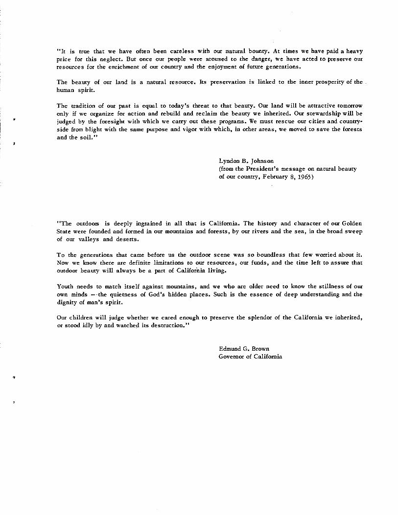
"It is rrue thar we have often been careless c¡ith our natural bounry. ,{,t times we have paid a heavyprice for this neglect. But once our people were aroused to the danger, we have acted to preserve outresources for the enrichment of our country and the enjoyment of future generations.
The beaury of ou¡ land is a natr¡ral resource. Its preservation is linked to the inner prosperity of thehuman spirit.
The t¡adition of ou¡ past is equal to today's threat to that beauty. Our land will be attractive tomorowonly if we organize for action and rebuild and recl,aim the beaury we inherited. Our stewardship will bejudged by the foresight with which we carry out these programs. Ve must rescue our cities and country-side fron blight with the same purpose and vigor with which, in other areas, we moved to save the fo¡estsand the soil."
Lyndon B. Johnson(from the Presidentts message on natural beautyof our country, February 8, 1,965)
"The outdoos is deeply ingrained in all that is California. The history and character of or¡r GoldenState were founded and formed in our mountains and forests, by our rivers and the sea, in the broad sweepof ou¡ valleys and deserts.
To the generations that came before us the outdoor scene was so boundless that few worried about it.Nou¡ we know there are definite limitations to or¡r resources, our funds, and the time left to assure thatoutdoor beauty will always be a pa.rt of Califor'nia living.
Youth needs to r¡atch itself against mountains, and we who are older need to knoc/ the stillness of ourown minds ---the quietness of Godts hidden places. Such is the essence of deep understanding and thedignity of man's spirit.
Our child¡en will judge whether we cared enough to preserve the splendor of the California u/e inherited,or stood idly by and watched its destruction.t'
Edmund G. BrownGovernor of California