sear macualay 3 - macaulay institute · where are we going? • context for hydromorphology •...
TRANSCRIPT
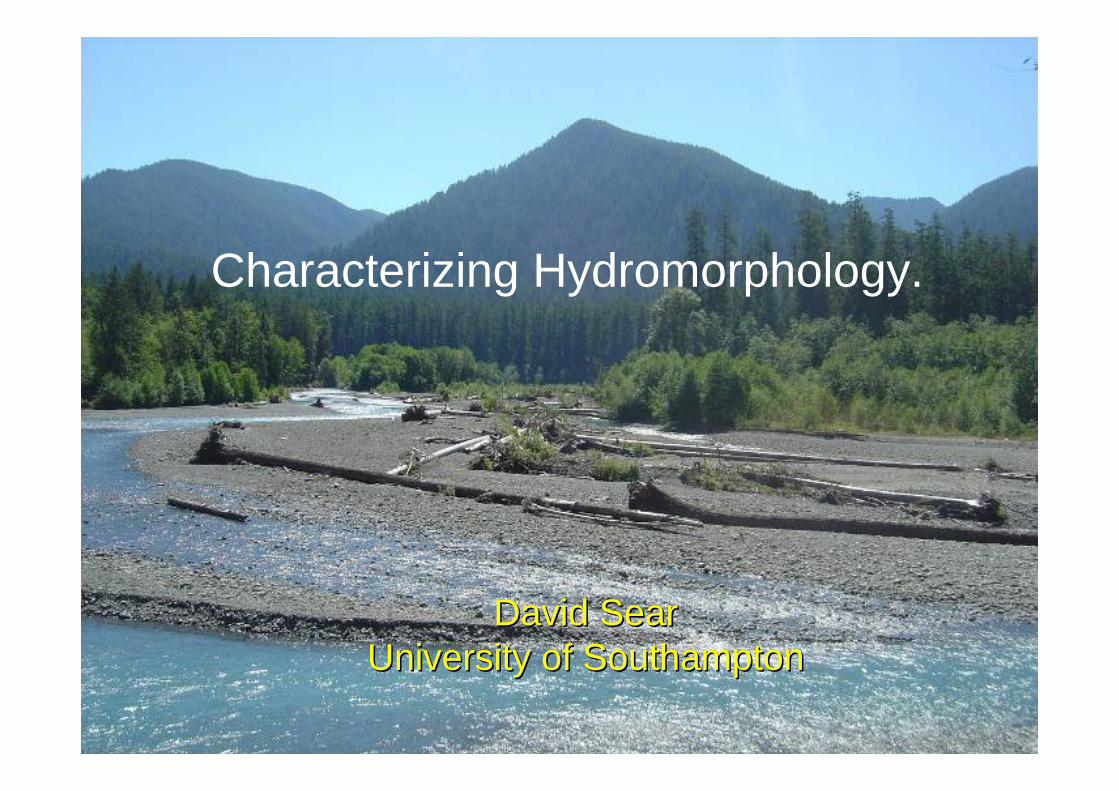
Characterizing Hydromorphology.
David SearDavid SearUniversity of SouthamptonUniversity of Southampton
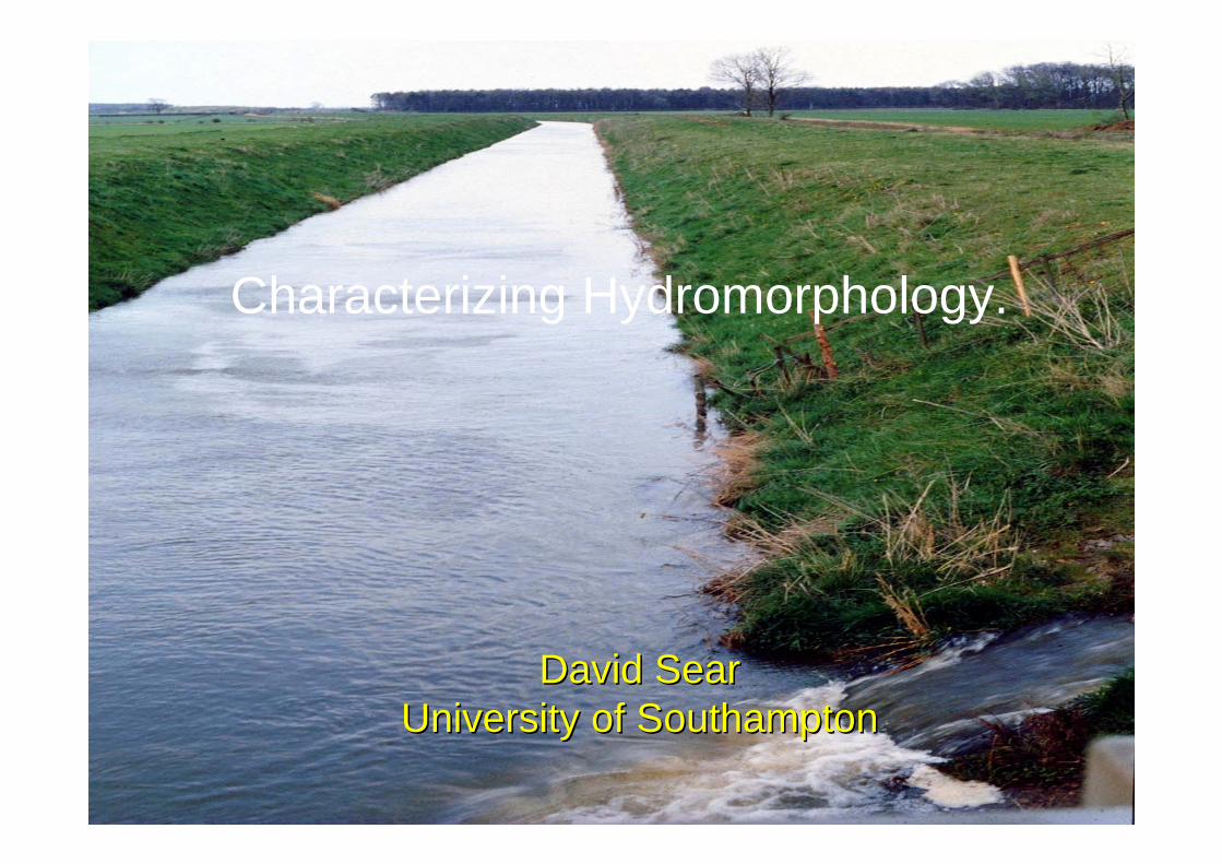
Characterizing Hydromorphology.
David SearDavid SearUniversity of SouthamptonUniversity of Southampton
Where are we going?
• Context for Hydromorphology• Basic Principles for Hydromorphology• How do we characterize Hydromorphology?• Simplifying complexity – Classifications &
typologies.• Summary Points
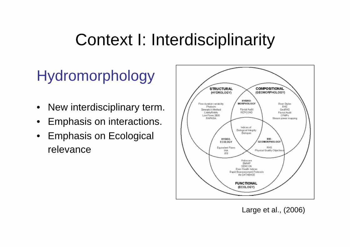
Context I: Interdisciplinarity
Hydromorphology
• New interdisciplinary term.• Emphasis on interactions.• Emphasis on Ecological
relevance
Large et al., (2006)
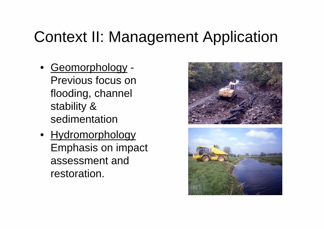
Context II: Management Application
• Geomorphology -Previous focus on flooding, channel stability & sedimentation
• HydromorphologyEmphasis on impact assessment and restoration.
Context III: Policy & Legislation
• Water Framework Directive
• Endangered Species Act
• Habitat’s Directive etc………
Requirements of Hydromorphology
• To be able to identify an un-natural divergence in system processes and form.
• To be able to attribute cause(s) to that divergence.
• Be able to contribute to the design of mitigation measures.
• Contribute robust monitoring procedures to support adaptive management.
Hydromorphology needs…
1. To have tools and methods for identifying natural vs. impacted hydromorphology.(Reference Conditions)
2. Be able to link hydromorphology to ecological processes and biological responses.(Physical habitat)
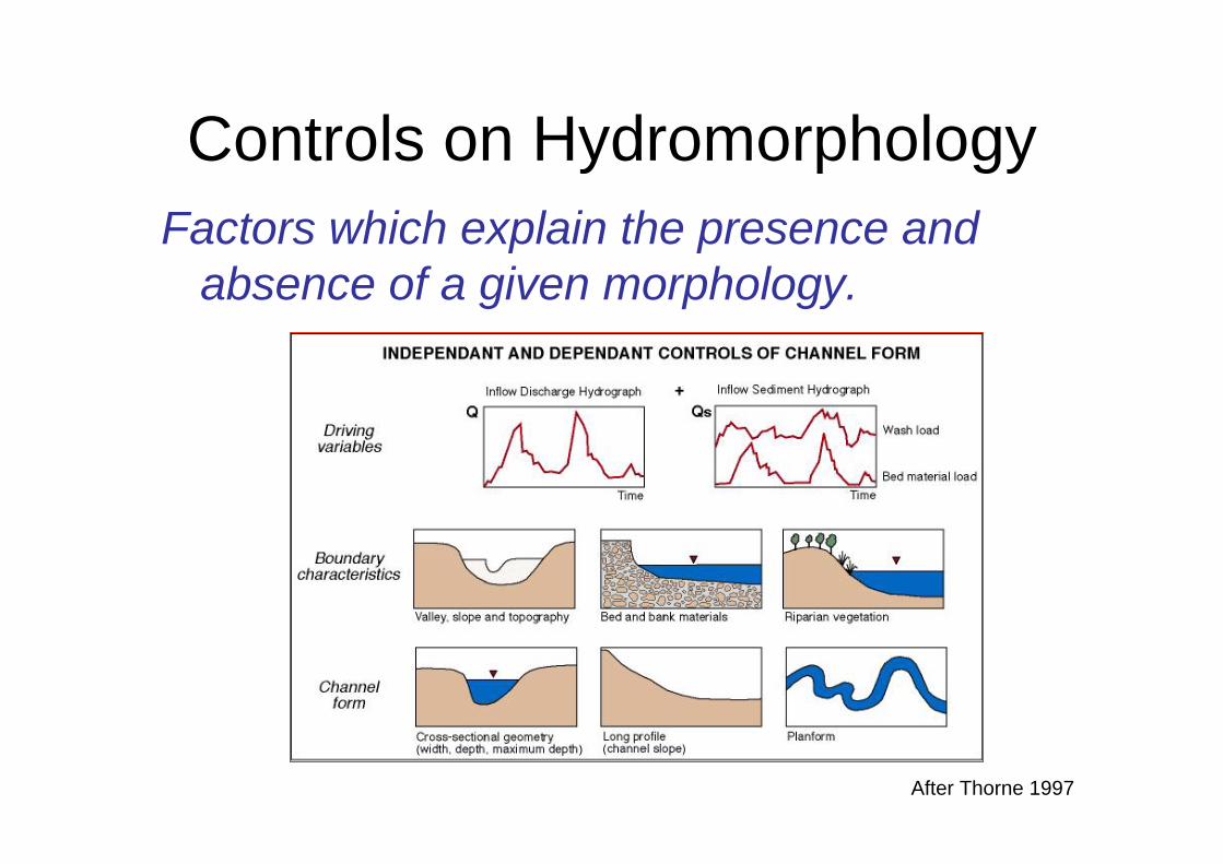
Controls on HydromorphologyFactors which explain the presence and
absence of a given morphology.
After Thorne 1997
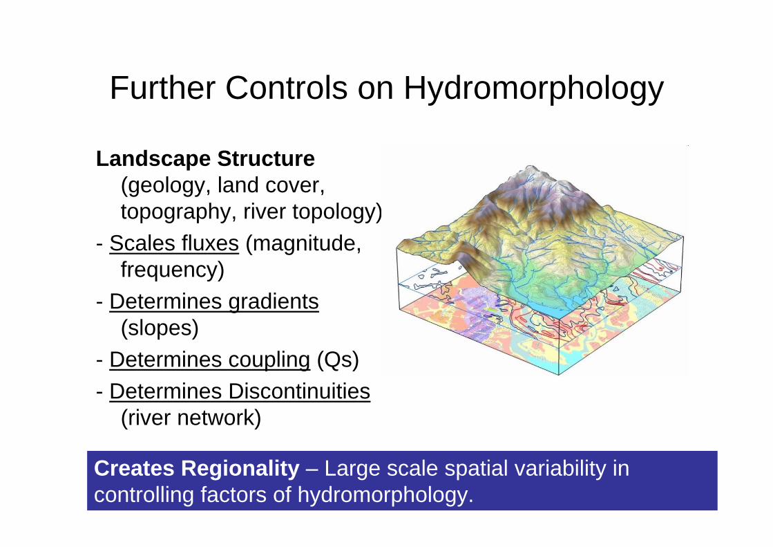
Further Controls on Hydromorphology
Landscape Structure(geology, land cover, topography, river topology)
- Scales fluxes (magnitude, frequency)
- Determines gradients(slopes)
- Determines coupling (Qs)- Determines Discontinuities
(river network)
Creates Regionality – Large scale spatial variability in controlling factors of hydromorphology.
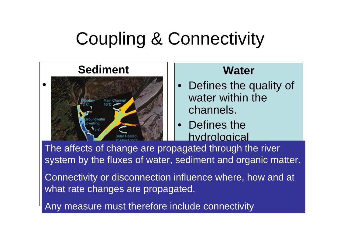
Coupling & ConnectivitySediment
• Defines the relationship between sediment sources on the land and the river network.
• Defines the relationship between sediment sources within the channel.
Water• Defines the quality of
water within the channels.
• Defines the hydrological characteristics of the river.
Hauer & Hill (2006)
The affects of change are propagated through the river system by the fluxes of water, sediment and organic matter.
Connectivity or disconnection influence where, how and at what rate changes are propagated.
Any measure must therefore include connectivity
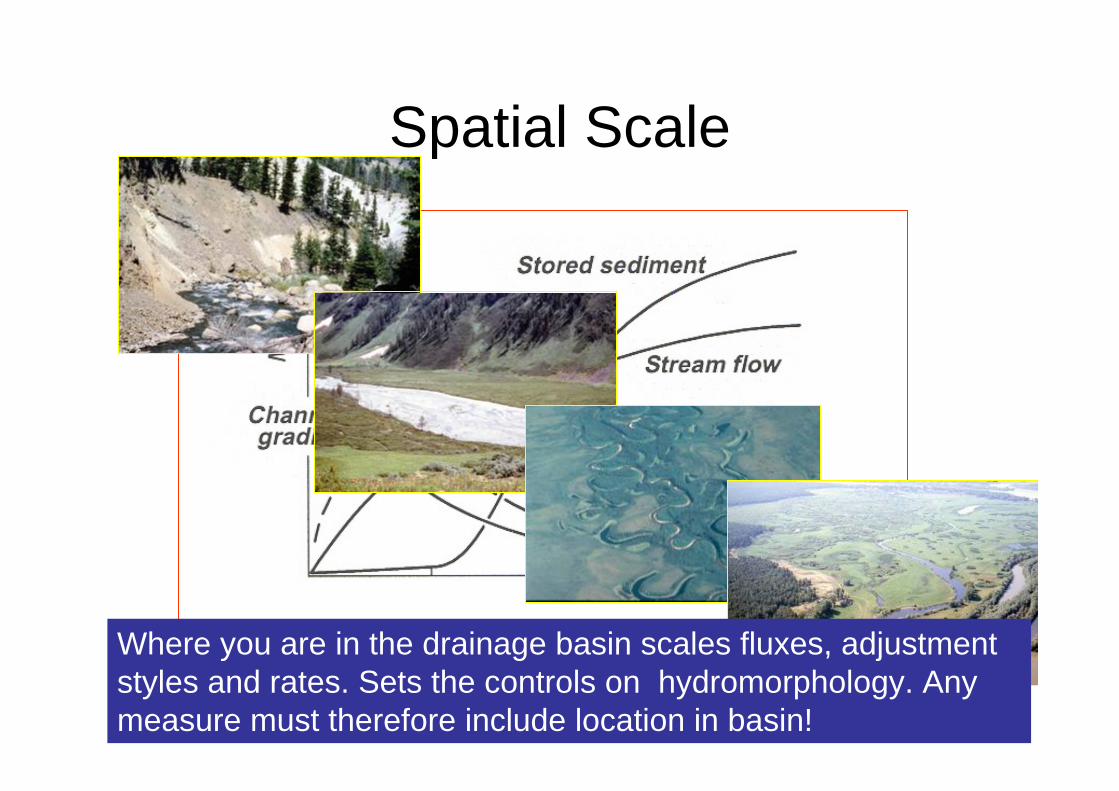
Spatial Scale
Where you are in the drainage basin scales fluxes, adjustment styles and rates. Sets the controls on hydromorphology. Any measure must therefore include location in basin!
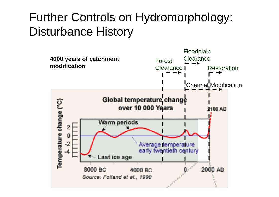
Further Controls on Hydromorphology: Disturbance History
Channel Modification
RestorationForest Clearance
Floodplain Clearance4000 years of catchment
modification
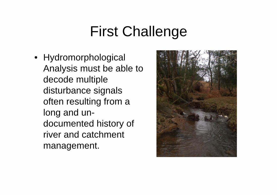
First Challenge
• HydromorphologicalAnalysis must be able to decode multiple disturbance signals often resulting from a long and un-documented history of river and catchment management.
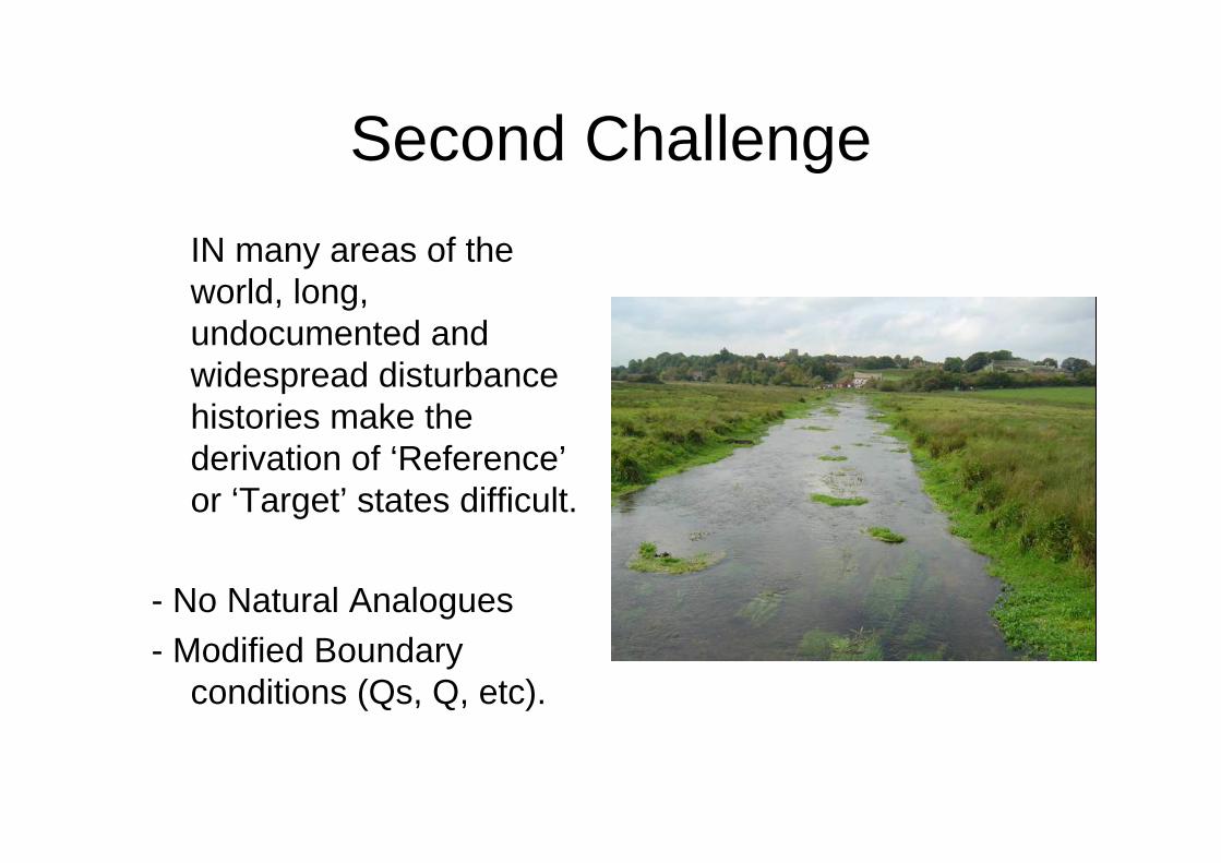
Second ChallengeIN many areas of the world, long, undocumented and widespread disturbance histories make the derivation of ‘Reference’ or ‘Target’ states difficult.
- No Natural Analogues- Modified Boundary
conditions (Qs, Q, etc).
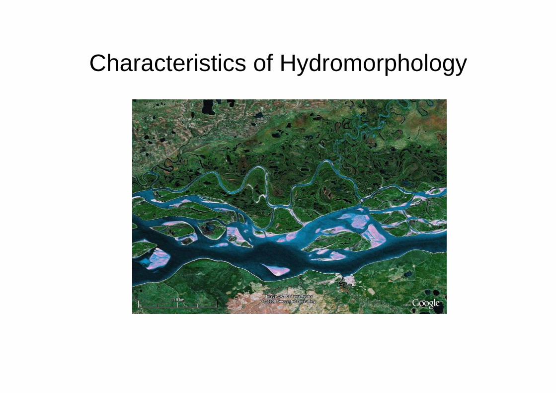
Characteristics of Hydromorphology
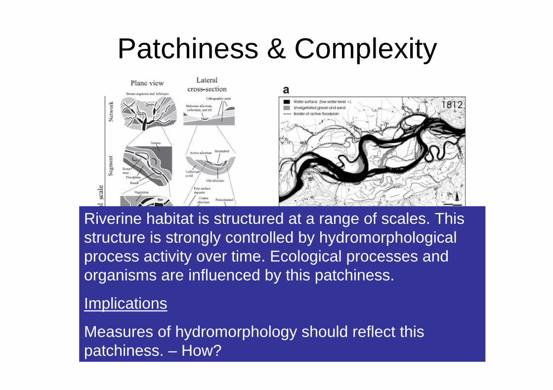
Patchiness & Complexity
Poole (2002) Jungwirth et al., (2005)
Riverine habitat is structured at a range of scales. This structure is strongly controlled by hydromorphologicalprocess activity over time. Ecological processes and organisms are influenced by this patchiness.
Implications
Measures of hydromorphology should reflect this patchiness. – How?
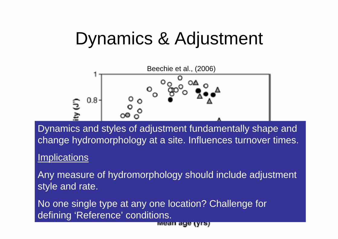
Dynamics & Adjustment
Bonnie et al., (2006)Wheaton et al., (in press)
Beechie et al., (2006)
Dynamics and styles of adjustment fundamentally shape and change hydromorphology at a site. Influences turnover times.
Implications
Any measure of hydromorphology should include adjustment style and rate.
No one single type at any one location? Challenge for defining ‘Reference’ conditions.
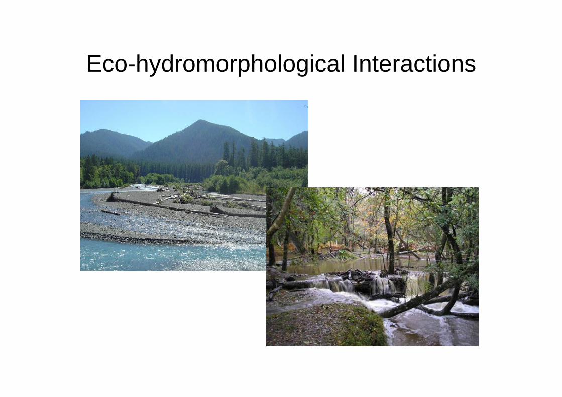
Eco-hydromorphological Interactions
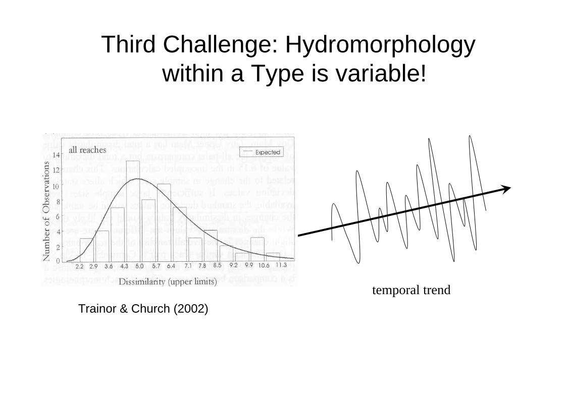
Third Challenge: Hydromorphology within a Type is variable!
mean
variance
temporal trendTrainor & Church (2002)
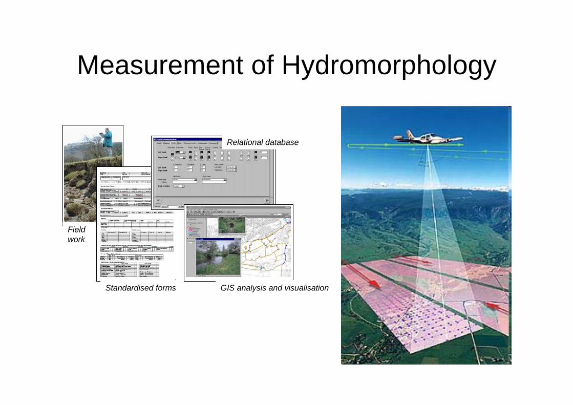
Measurement of Hydromorphology
Fieldwork
Standardised forms
Relational database
GIS analysis and visualisation
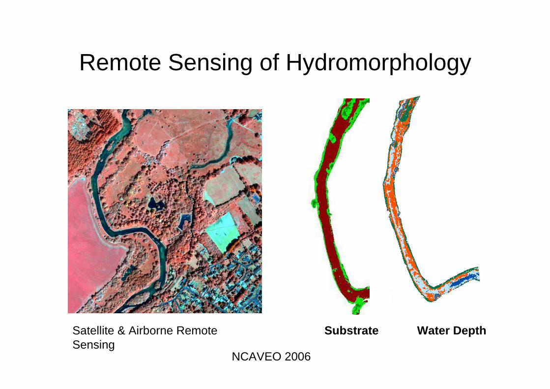
Remote Sensing of Hydromorphology
Water DepthSubstrateSatellite & Airborne Remote Sensing
NCAVEO 2006
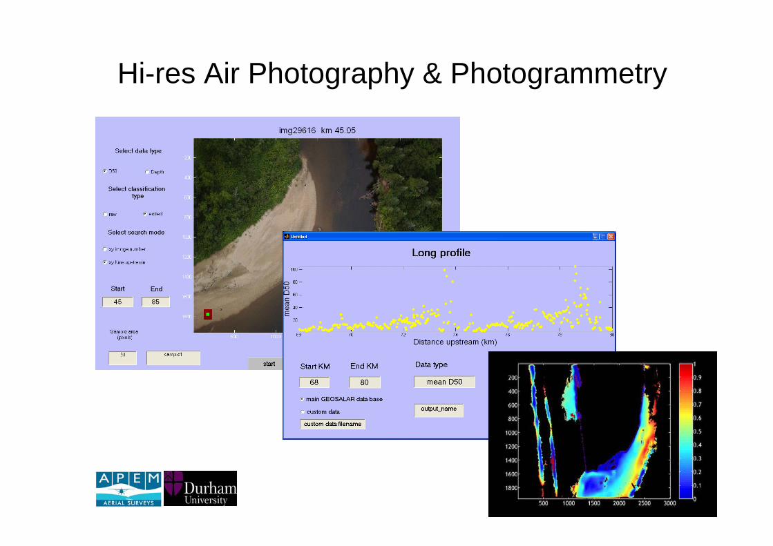
Hi-res Air Photography & Photogrammetry
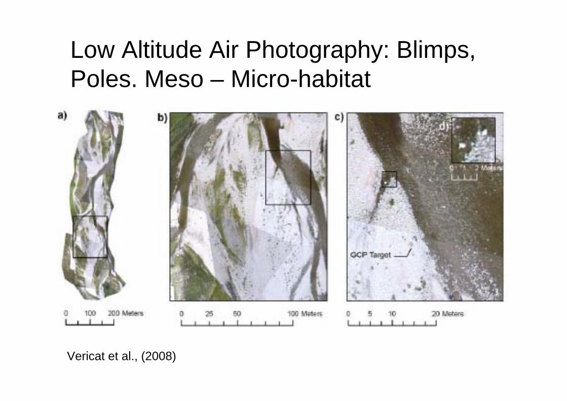
Low Altitude Air Photography: Blimps, Poles. Meso – Micro-habitat
Vericat et al., (2008)
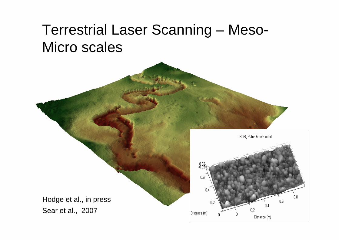
Terrestrial Laser Scanning – Meso-Micro scales
Hodge et al., in pressSear et al., 2007
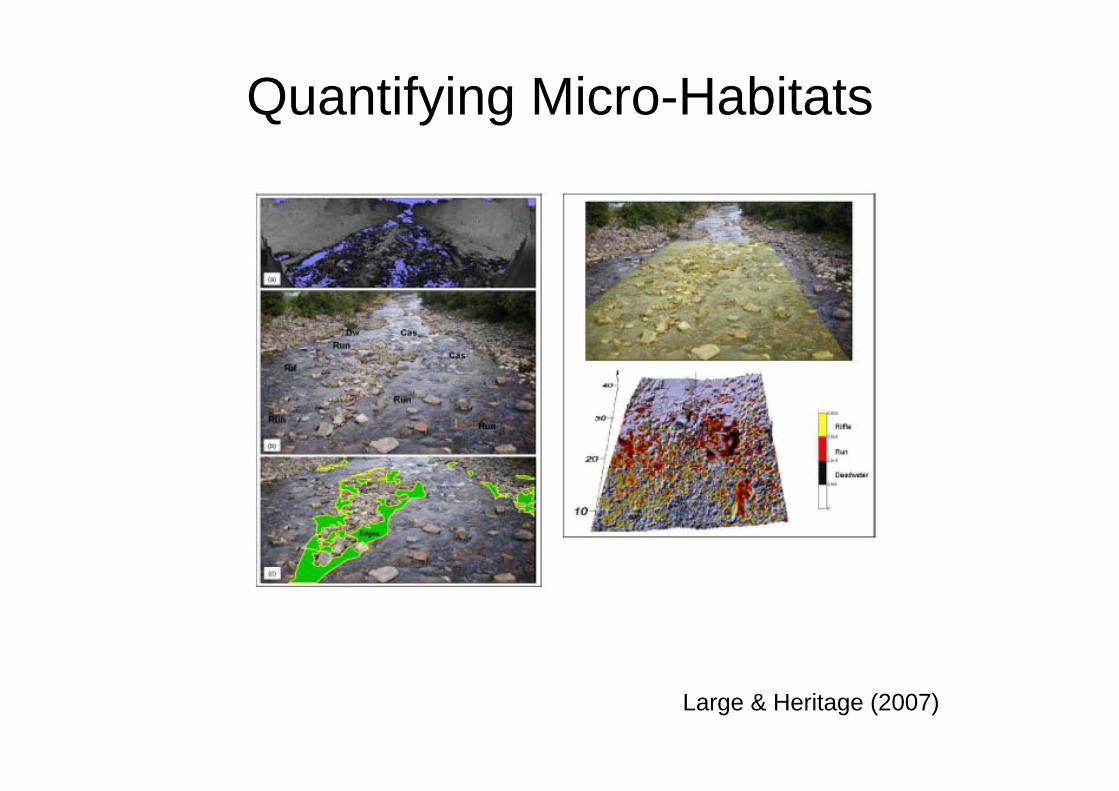
Large & Heritage (2007)
Quantifying Micro-Habitats
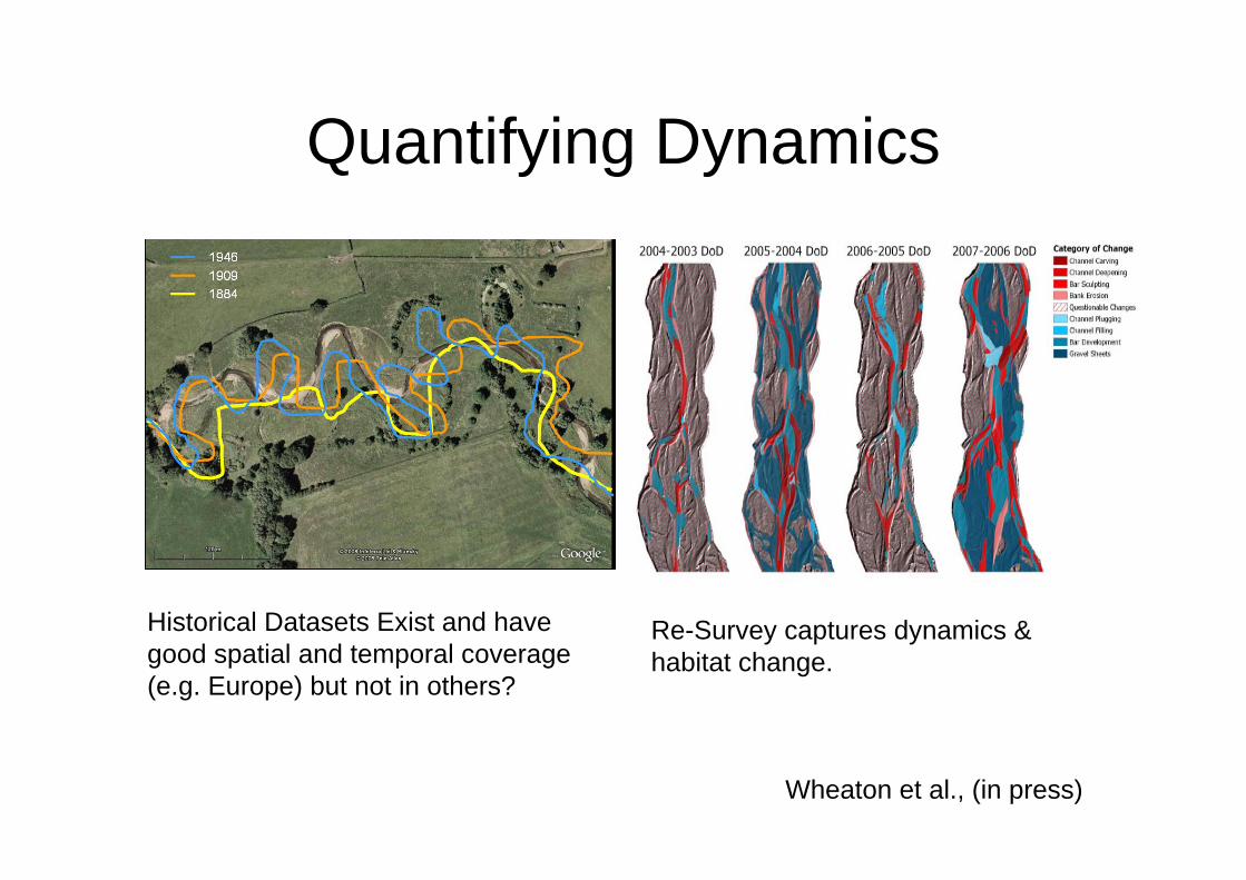
Quantifying Dynamics
Historical Datasets Exist and have good spatial and temporal coverage (e.g. Europe) but not in others?
Wheaton et al., (in press)
Re-Survey captures dynamics & habitat change.
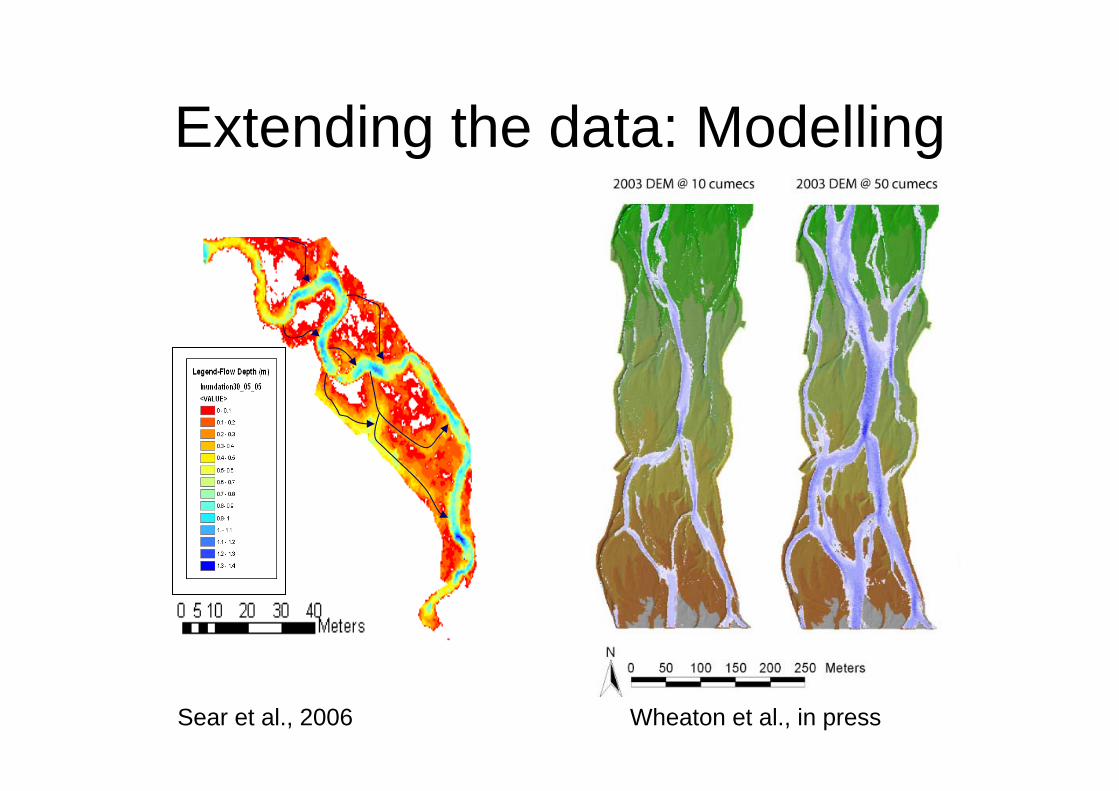
Extending the data: Modelling
Wheaton et al., in pressSear et al., 2006
Summary so far…..• Controls and characteristics exist that are accepted by
most scientists, some cross disciplinary boundaries.• There are a range of tools available to quantify the
controls and characteristics of hydromorphology but they vary in applicability with scale and river type.
• Technology is beginning to enable data capture across scale boundaries.
Still require frameworks for data analysis and defensible methods for transferring data into information that is useful to river managers and other disciplines.
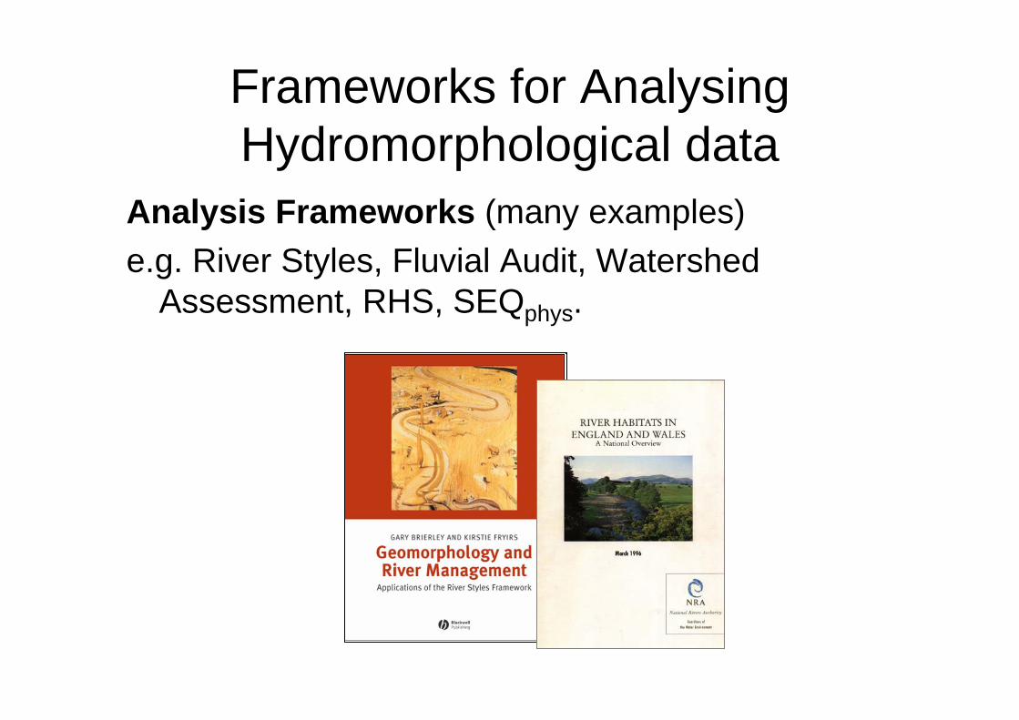
Frameworks for Analysing Hydromorphological data
Analysis Frameworks (many examples)e.g. River Styles, Fluvial Audit, Watershed
Assessment, RHS, SEQphys.
Classification – Why?• To permit comparison between reaches• To facilitate detection of change (Class A –
Class B).• To facilitate management by identification of
reaches with similar controls/characteristics.• As the contextual precursor to more detailed
description. (ie my organisms prefer pool-riffle than plane bed).
• To predict behaviour in response to changeTo structure the complexity of river ecosystems at spatial scales that permit understanding and communication between disciplines and with end users
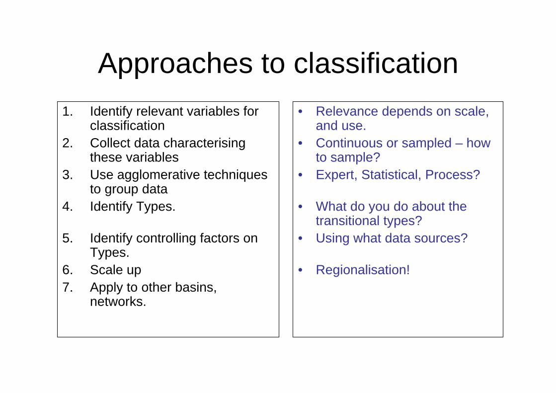
Approaches to classification1. Identify relevant variables for
classification2. Collect data characterising
these variables 3. Use agglomerative techniques
to group data4. Identify Types.
5. Identify controlling factors on Types.
6. Scale up 7. Apply to other basins,
networks.
• Relevance depends on scale, and use.
• Continuous or sampled – how to sample?
• Expert, Statistical, Process?
• What do you do about the transitional types?
• Using what data sources?
• Regionalisation!
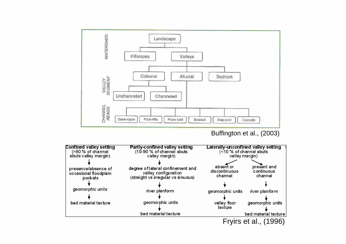
Buffington et al., (2003)
Fryirs et al., (1996)

“Upland” River Styles (Fryirs et al 1996)
Reference State Disturbed State
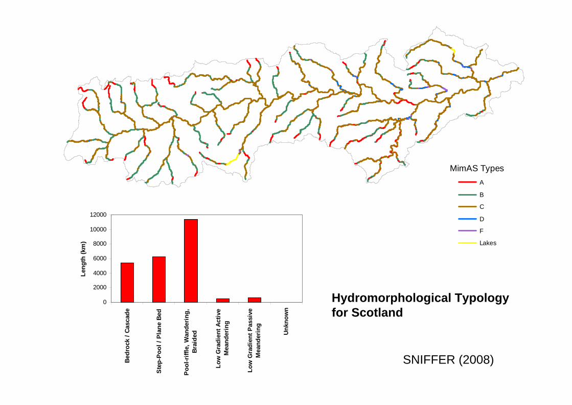
MimAS TypesA
B
C
D
F
Lakes
0
2000
4000
6000
8000
10000
12000
Bedr
ock
/ Cas
cade
Ste
p-Po
ol /
Pla
ne B
ed
Poo
l-riff
le, W
ande
ring,
Brai
ded
Low
Gra
dien
t Act
ive
Mea
nder
ing
Low
Gra
dien
t Pas
sive
Mea
nder
ing
Unk
now
n
Leng
th (k
m)
SNIFFER (2008)
Hydromorphological Typology for Scotland
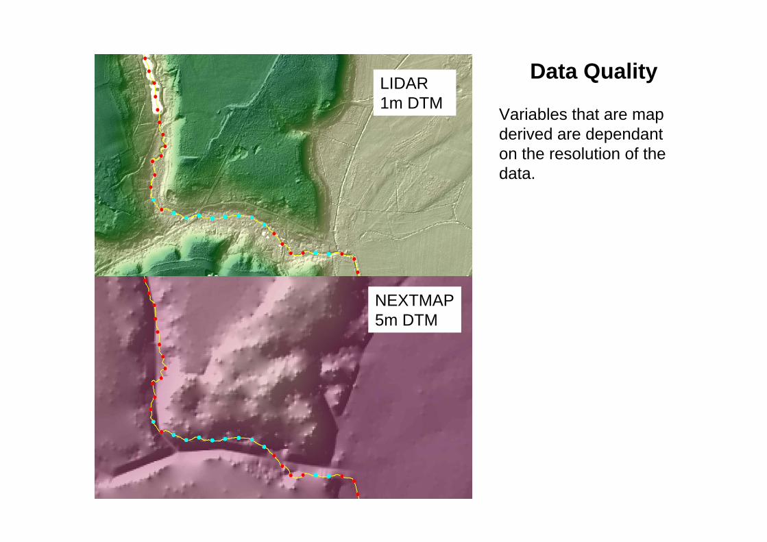
Data QualityLIDAR 1m DTM
NEXTMAP 5m DTM
Variables that are map derived are dependant on the resolution of the data.
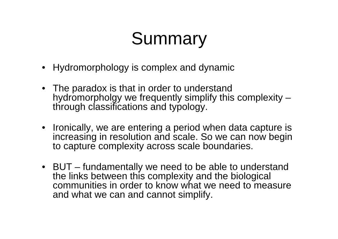
Summary• Hydromorphology is complex and dynamic
• The paradox is that in order to understand hydromorpholgy we frequently simplify this complexity –through classifications and typology.
• Ironically, we are entering a period when data capture is increasing in resolution and scale. So we can now begin to capture complexity across scale boundaries.
• BUT – fundamentally we need to be able to understand the links between this complexity and the biological communities in order to know what we need to measure and what we can and cannot simplify.
3 questions
1. What measurements of hydromorphology are truly relevant to biological communities?
2. How do we incorporate dynamics?
3. How do we deal with complexity? (Is Hierarchical Classification sufficient or necessary?).