section 3.7 land use and planning - santa barbara …clup) and the coastal zoning ordinance ......
TRANSCRIPT

Section 3.7 Land Use and Planning
3.7.1 Introduction This section provides information on the existing and planned uses of the Project Site and existing land use activities in the Project vicinity. It also summarizes the land use policies and regulations applicable to the Project Site and assesses land use impacts of the Proposed Project, No Project Alternative, and Partial Gravel Removal Alternative. The information in this section is based on the 1982 Final Environmental Impact Report (EIR), associated studies, information provided by the Dunes Center and City of Santa Maria, and regional information available in previous environmental impact reports prepared by the County, and the County’s Comprehensive Plan and Local Coastal Program (LCP), including the Coastal Land Use Plan (CLUP) and the Coastal Zoning Ordinance (CZO). This section also incorporates data and analyses from Section 3.9, Recreation to support assessment of potential land use impacts. A detailed analysis of Project consistency with various policies is presented in Chapter 5, Consistency with Plans and Policies.
Shell Guadalupe Dunes Gravel Remediation In-Lieu ProposalDraft Supplemental Environmental Impact Report 3.7-1 May 2014
3.7.2 Environmental Setting The Project Site is located within the Rancho Guadalupe Dunes County Park, a 620-acre park in the northwestern-most corner of Santa Barbara County. The Rancho Guadalupe Dunes County Park is a recreational area located in the coastal dune system known as Guadalupe-Nipomo Dunes Complex in the western portion of the Santa Maria Valley. The Santa Maria Valley is a productive agricultural area that extends from northwestern Santa Barbara County and southwestern San Luis Obispo County. The Santa Maria Valley is an approximately 154 square mile valley along the watershed of the Santa Maria River. The valley floor is characterized by level to rolling lowlands surrounding the Santa Maria River. Land use in the valley is predominantly agricultural; however, the cities of Santa Maria and the town of Nipomo have undergone substantial growth over the last several decades and represent substantial concentrations of urban use. Extractive resource activities also occur within the Santa Maria Valley, including petroleum and sand mining. The Project Site is predominantly rural, with substantial agricultural and open space uses occurring in the vicinity. The nearest municipality is the City of Guadalupe, located approximately 2.5 miles to the east of the Project Site. Guadalupe is a small agricultural incorporated city, which supports extensive agricultural development that occurs along the historic floodplains of the Santa Maria River. Agricultural uses including row crops and pasture dominates much of the area immediately east and southeast of the Project Site. The Pacific Ocean constitutes the main feature west of the Project Site. The Santa Maria River runs into the estuary and to the Pacific Ocean, crossing through the dunes just north of the Project Site. The Guadalupe-Nipomo Dunes National Wildlife Refuge occupies approximately 2,550 acres of the dune complex north of the river, in San Luis Obispo County. The Project Site is located in the Guadalupe Nipomo Dune Complex, which extends approximately 18-miles from near the City of Pismo Beach in southern San Luis Obispo County to Mussel Rock in

County of Santa Barbara Section 3.7 Land Use and Planning northern Santa Barbara County. The Guadalupe-Nipomo Dunes Complex encompasses approximately 15,000 acres, which are largely under public ownership and management for habitat protection and recreation. Managing agencies and entities include the U.S. Fish and Wildlife Service (USFWS), California State Parks, the County of Santa Barbara, and the Land Conservancy of San Luis Obispo County. The Rancho Guadalupe Dunes County Park is managed by Santa Barbara County. A commercial sand mining company operates within the Rancho Guadalupe Dunes County Park, situated adjacently east of the Project Site. The Gordon Sand Company maintains use of the access road that runs through the Project Site to the sand pit that is located in the eastern portion of the Project Site. The Project Site is designated as ‘Open Lands’ by the Comprehensive Plan (see Figure 3.7-1) and located within an area zoned as RES-320 (Resource Management) by the Santa Barbara County Coastal Zoning Ordinance (CZO). Additionally, the Rancho Guadalupe Dunes Park parking lot and a small portion of the Santa Maria River to the northeast of the site is zoned as REC (recreation). Santa Barbara County considers current uses in the vicinity of the Project Site to consist of open space and recreation. Surrounding lands are zoned as AG-II-320 (minimum gross acreage is 320 acres), and AG-II-100 (minimum gross acreage is 100 acres). The Project Site is located within Environmentally Sensitive Habitat (ESH) designated by the County (see Figure 3.3-1; County of Santa Barbara 2014).
3.7 3 Regulatory Setting This section presents applicable land use policies and regulations, including the CLUP, other Comprehensive Plan elements, the CZO, and the California Coastal Act (CCA). A detailed policy analysis is presented in Chapter 5, Consistency with Plans and Policies. .
3.7.3.1 State
California Coastal Act The CCA of 1976, as amended, established the California Coastal Commission (CCC) as a permanent state coastal management and regulatory agency and created a state and local government partnership to ensure that public concerns of statewide importance are reflected in the local decisions about coastal development. The CCA (Public Resources Code § 30000 et seq.) was enacted by the State Legislature to provide long-term protection of California’s 1,100-mile coastline for the benefit of current and future generations. Section 30001.5 states that the goals are to: • Protect, maintain, and where feasible, enhance and restore the overall quality of the coastal zone environment and its natural and artificial resources; • Assure orderly, balanced utilization and conservation of coastal zone resources, taking into account the social and economic needs of the people of the state; • Maximize public access to and along the coast and maximize public recreational opportunities in the coastal zone consistent with sound resource conservation principles and constitutionally protected rights of private property owners; • Assure priority for coastal-dependent and coastal-related development over other development on the coast;
Shell Guadalupe Dunes Gravel Remediation In-Lieu ProposalDraft Supplemental Environmental Impact Report 3.7-2 May 2014

Gua
dalu
pe
S
treet
Oso Flaco Lake Road
Division Street
Thornberry Roa
d
Simas Street
11th Street
SANTA BARBARA COUNTY SAN LUIS OBISPO COUNTY
Obispo Street
Flower Street
8th Street
Betteravia Road
West Main Street
Santa
Maria River
Oso Flaco Creek1
1
166
GRAVELGRAVELREMEDIATIONREMEDIATION
SITESSITES
GRAVELREMEDIATION
SITES
GuadalupeGuadalupeGuadalupe
PACIFIC
OCEAN
Guadalupe Beach
AG-II-40AG-II-40
AG-II-100AG-II-100
AG-II-100AG-II-100
AG-II-100AG-II-100
AG-II-320AG-II-320
AG-I-10AG-I-10
AG-II-40AG-II-40
AG-II-40AG-II-40AG-II-40
AG-II-100
AG-II-100
AG-II-100
AG-II-320
RES-320
REC
REC
AG-I-10
AG-II-40
AG-II-40
LEGEND
Land Use
Santa Barbara County Zoning DesignationsCounty Boundary
Assessors Parcel Boundary
Zoning Boundary
Agriculture
Incorporated City
Open Space/Rural
Recreation
Agriculture I/Minimum Parcel Size – 10 Acres
Agriculture II/Minimum Parcel Size – 40 Acres
Agriculture II/Minimum Parcel Size – 100 Acres
Agriculture II/Minimum Parcel Size – 320 Acres
Recreation
Resource Management/MinimumParcel Size – 320 Acres (Coastal Zone)
AG-I-10
AG-II-40
AG-II-100
AG-II-320
REC
RES-320
0 4,000
SCALE IN FEET
N
3.7-1FIGUREVicinity Land Use and Zoning
Shell Guadalupe Dunes Gravel Remediation In-lieu Project

County of Santa Barbara Section 3.7 Land Use and Planning
• Encourage state and local initiatives and cooperation in preparing procedures to implement coordinated planning and development for mutually beneficial uses, including educational uses, in the coastal zone. The CCA mandates that local governments and constitutional entities prepare a land use plan and schedule of implementing actions to carry out the policies of the CCA. The policies constitute the standards used by the CCC to determine the adequacy of these plans and the permissibility of proposed development (Public Resources Code, Div. 20, Ch. 3). Policies presented in the CLUPs of local jurisdictions mirror, and in some cases expand on, CCA policies. Santa Barbara County has a certified CLUP and the County and CCC would use the CLUP in reviewing the Project. The specific policies of the CCA address issues such as shoreline public access and recreation, lower cost visitor accommodations, terrestrial and marine habitat protection, visual resources, landform alteration, water quality, transportation, development design, and public works. CCA sections of particular importance to this Project include those that call for minimizing alteration of natural landforms and processes and those that support retention and expansion of coastal recreational uses, including: Section 30116. Sensitive coastal resource areas. "Sensitive coastal resource areas" are those identifiable and geographically bounded land and water areas within the coastal zone of vital interest and sensitivity. "Sensitive coastal resource areas" include the following features, which are considered most relevant to the Project: • nificant recreational value Areas possessing sig• Highly scenic areas • Areas that provide existing coastal housing or recreational opportunities for low- and moderate-income persons Section 30220. Protection of certain water-oriented activities. Coastal areas suited for water-oriented recreational activities that cannot readily be provided at inland water areas shall be protected for such uses. Section 30221. Oceanfront land; protection for recreational use and development. Oceanfront land suitable for recreational use shall be protected for recreational use and development unless present and foreseeable future demand for public or commercial recreational activities that could be accommodated on the property is already adequately provided for in the area. Section 30223. Upland areas. Upland areas necessary to support coastal recreational uses shall be reserved for such uses, where feasible. Section 30253. Minimization of adverse impacts. New development shall: (1) Minimize risks to life and property in areas of high geologic, flood, and fire hazard. (2) Assure stability and structural integrity, and neither create nor contribute significantly to erosion, geologic instability, or destruction of the site or surrounding area or in any way require the construction of protective devices that would substantially alter natural landforms along bluffs and cliffs.
Shell Guadalupe Dunes Gravel Remediation In-Lieu ProposalDraft Supplemental Environmental Impact Report 3.7-4 May 2014

County of Santa Barbara Section 3.7 Land Use and Planning
Shell Guadalupe Dunes Gravel Remediation In-Lieu ProposalDraft Supplemental Environmental Impact Report 3.7-5 May 2014
3.7.3.2 Local A number of County of Santa Barbara policy and planning documents address land use and development. The guiding element that defines the blueprint for physical development in the coastal zone is the CLUP, which is part of the County’s Comprehensive Plan. However, the coastal zone is also subject to the policies of the County’s overall Comprehensive Plan, including the Land Use Element. When the policies established by these plans conflict, the CLUP takes precedence. The CLUP policies most relevant to the Proposed Project are summarized below and in Chapter 5, Consistency with Plans and Policies. Other plans and policies that may be important to the evaluation of a particular environmental issue are presented in issue-specific analyses presented below, and throughout Chapter 3 of this Supplemental Environmental Impact Report (SEIR). Coastal Land Use Plan The purpose of the CLUP is to “protect coastal resources, provide greater access and recreational opportunities for the public’s enjoyment, while allowing for orderly and well-planned urban development and the siting of coastal-dependent and coastal-related industry.” The CLUP addresses siting of development, hazard avoidance, and planning for recreational activities. Regarding recreation, the CLUP notes that “the County of Santa Barbara spans 110 miles of shoreline of which only 20.4 miles (18.5 percent) are publicly owned beaches. There is a need for more accessways to the County shoreline, particularly in the South Coast urban area.”1 The CLUP also notes that “Existing beach parks owned by the county and state are being used to capacity, especially during summer weekends. At times of peak demand, existing facilities are insufficient to accommodate recreational needs and people are turned away. Moreover, county and state recreational demand projections indicate that facility deficiencies exist for most recreation activities. These deficiencies are expected to increase due to growth in population, tourism, and the popularity of many coastal dependent or related recreational activities. Consequently, a program of land acquisition and facility development needs to be implemented if demand for coastal recreation is to be satisfied.” Relevant CLUP policies are presented below:
Policy 1-2: Where policies within the land use plan overlap, the policy which is the most protective of coastal resources shall take precedence. Policy 1-4: Prior to the issuance of a coastal development permit the County shall make the finding that the development reasonably meets the standards set forth in all applicable land use plan policies. Policy 6-3: All oil and gas development in areas designated as environmentally sensitive habitats in the land use plan shall be subject to environmental review.
1 The CLUP is based on 30-year-old data. Public ownership of the shoreline in Santa Barbara County has been increased by acquisitions such as Ellwood Mesa, Douglas Family Preserve, and the Carpinteria Bluffs which have added approximately 2 miles of publicly owned shoreline in the South County. Together with Point Sal and Guadalupe open space acquisitions in the North County which have added approximately 2 miles of shoreline, the total is approximately 24 miles, or roughly 20 percent of the County’s shoreline.

County of Santa Barbara Section 3.7 Land Use and Planning
Policy 6-4: Upon completion of production, the area affected by the drilling, processing, or other related petroleum activity, shall be appropriately contoured, reseeded, and landscaped to conform with the surrounding topography and vegetation. Policy 6-12: Due to scenic and natural resources in areas between Point Conception and the Santa Maria River, marine terminals are not considered at present as appropriate development in that area. If activity under lease sale #53 results in a need for marine terminal(s) in the North County, detailed studies shall be undertaken to determine appropriate location(s). No onshore facilities, except pipelines, shall be located on any environmentally sensitive habitat areas. Policy 6-30: applies to all onshore land uses that are, or at one time were, wholly or partially dedicated to the production, processing, storage, and transportation of oil or gas derived from offshore reservoirs. Implementing procedures: a. The County shall establish a process in its Coastal and Inland Zoning Codes for determining if, based on reasonable evidence, permitted land uses or independent business functions thereof have discontinued operations permanently. The County shall also establish a discretionary process to permit the removal, retention, or abandonment in-place of facilities, structures, and improvements associated with permitted land uses determined to be abandoned, and to reclaim host sites to natural conditions, or other conditions, in compliance with applicable laws and permits. This permit shall be independent of any development permits associated with future use of the land, but may be processed concurrently with development permits b. Permittees shall obtain all applicable permits to remove (or retain) facilities, structures, and other improvements, and reclaim the host site upon the intentional abandonment of operations of a permitted land use. Otherwise, the permittee shall obtain either County approval to defer abandonment or all applicable permits to remove facilities and reclaim host sites under the following circumstances: 1) Any event designated in an existing County permit that would require consideration of abandonment; or 2) The permitted land use has become idled. Policy 7-1: The County shall take all necessary steps to protect and defend the public’s constitutionally guaranteed rights of access to and along the shoreline. Policy 7-23: In order to ensure preservation of the natural and archaeological resources of the Guadalupe Dunes and expand public opportunities for low intensity recreation, the County shall: a. Adopt and enforce an ordinance prohibiting ORV use, hang gliding, and overnight camping on the sand dunes. ing lot. b. Repair and expand the existing County park facilities. c. Provide more attractive restroomd. Provide limited picnic facilities. e. Install attractive signs informing the public of the ecological importance and fragility of the dunes and wetland. f. Restrict the County Park to low intensity recreational uses, i.e., walking, fishing, and
s Gravel Remediation In-Lieu ProposalDraft Supplemental Environmental Impact Report 3.7-6 May 2014
picnicking. g. Provide at least one part-time ranger to enforce rules. Shell Guadalupe Dune
County of Santa Barbara Section 3.7 Land Use and Planning h. Pursue alternative methods for expanding the park area south to Mussel Rock.
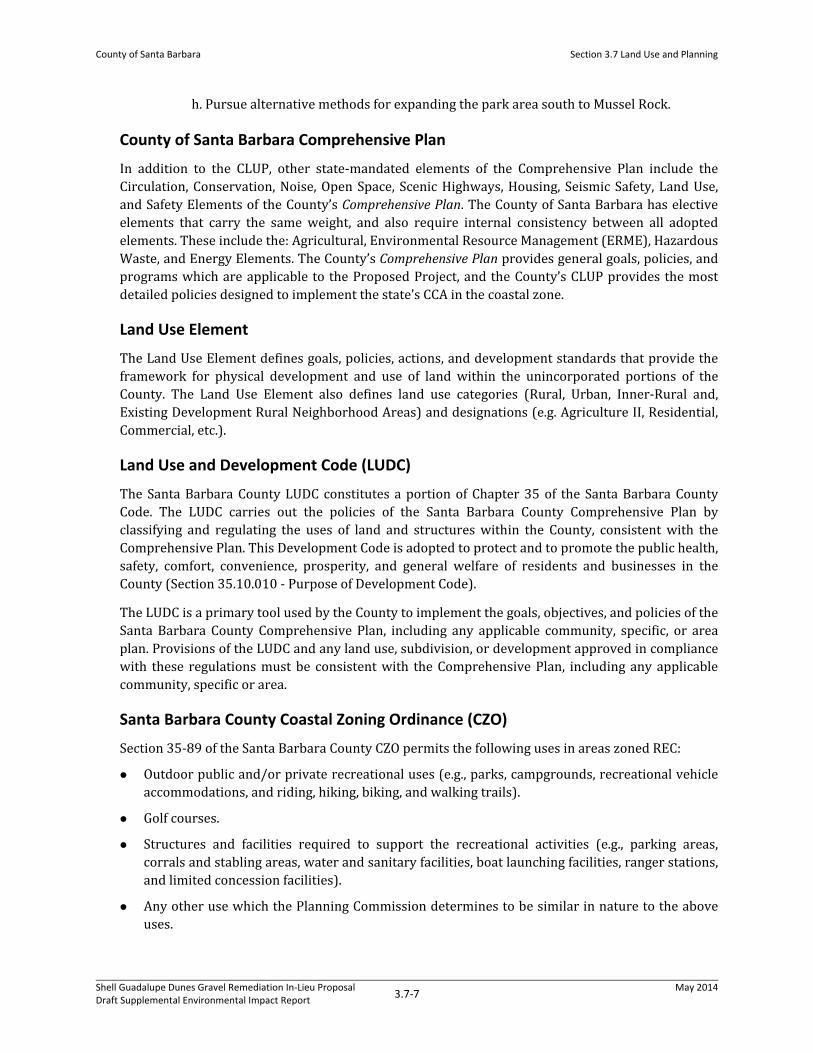
County of Santa Barbara Comprehensive Plan In addition to the CLUP, other state-mandated elements of the Comprehensive Plan include the Circulation, Conservation, Noise, Open Space, Scenic Highways, Housing, Seismic Safety, Land Use, and Safety Elements of the County’s Comprehensive Plan. The County of Santa Barbara has elective elements that carry the same weight, and also require internal consistency between all adopted elements. These include the: Agricultural, Environmental Resource Management (ERME), Hazardous Waste, and Energy Elements. The County’s Comprehensive Plan provides general goals, policies, and programs which are applicable to the Proposed Project, and the County’s CLUP provides the most detailed policies designed to implement the state’s CCA in the coastal zone. Land Use Element The Land Use Element defines goals, policies, actions, and development standards that provide the framework for physical development and use of land within the unincorporated portions of the County. The Land Use Element also defines land use categories (Rural, Urban, Inner-Rural and, Existing Development Rural Neighborhood Areas) and designations (e.g. Agriculture II, Residential, Commercial, etc.). Land Use and Development Code (LUDC) The Santa Barbara County LUDC constitutes a portion of Chapter 35 of the Santa Barbara County Code. The LUDC carries out the policies of the Santa Barbara County Comprehensive Plan by classifying and regulating the uses of land and structures within the County, consistent with the Comprehensive Plan. This Development Code is adopted to protect and to promote the public health, safety, comfort, convenience, prosperity, and general welfare of residents and businesses in the County (Section 35.10.010 - Purpose of Development Code). The LUDC is a primary tool used by the County to implement the goals, objectives, and policies of the Santa Barbara County Comprehensive Plan, including any applicable community, specific, or area plan. Provisions of the LUDC and any land use, subdivision, or development approved in compliance with these regulations must be consistent with the Comprehensive Plan, including any applicable community, specific or area. Santa Barbara County Coastal Zoning Ordinance (CZO) Section 35-89 of the Santa Barbara County CZO permits the following uses in areas zoned REC:
Outdoor public and/or private recreational uses (e.g., parks, campgrounds, recreational vehicle ns, and riding, hiking, biking, and walking trails). accommodatio Golf courses. Structures and facilities required to support the recreational activities (e.g., parking areas, corrals and stabling areas, water and sanitary facilities, boat launching facilities, ranger stations, and limited concession facilities). Any other use which the Planning Commission determines to be similar in nature to the above uses.
Shell Guadalupe Dunes Gravel Remediation In-Lieu ProposalDraft Supplemental Environmental Impact Report 3.7-7 May 2014

County of Santa Barbara Section 3.7 Land Use and Planning
3.7.4 Environmental Impact Analysis This section discusses the potential land use and planning impacts associated with the Proposed Project, the No Project Alternative, and the Partial Gravel Removal Alternative. Projects or project features that have the potential to conflict with land use plans, policies, or ordinances, or otherwise are not consistent with surrounding land uses, may result in significant land use impacts. 3.7.4.1 Thresholds of Significance
CEQA Guidelines With respect to land use and planning, applicable sections of Appendix G of the California Environmental Quality Act (CEQA) Guidelines state that a project would normally have a significant impact on the environment if it would: Physically divide an established community. Conflict with any applicable land use plan, policy, or regulation of an agency with jurisdiction over the project (including, but not limited to, a general plan, specific plan, local coastal program, or zoning ordinance) adopted for the purpose of avoiding or mitigating an environmental effect. Conflict with any applicable habitat conservation plan or natural community conservation plan.
3.7.4.2 Project Impacts The discussion of the impact follows, and mitigation measures are presented in Section 3.7.4.3. Table 3.7-1 below provides a summary of the impacts related to land use from the Proposed Project. Impact LU-1. Impacts to community development and/or incompatible land uses. The Proposed Project would leave the Project Site in its current condition. Land use conditions at the Rancho Guadalupe Dunes County Park and vicinity would remain as they are described in Section 3.7.2., Environmental Setting. No development, alteration, or future alteration of land uses or established communities at the Project Site or in the Project vicinity would result from the Proposed Project. Therefore, this impact is considered less than significant (Class III). Impact LU-2. Impacts related to compatibility with applicable land use plans, policies, or regulations of agencies with jurisdiction over the project (including, but not limited to, a general plan, specific plan, local coastal program, or zoning ordinance) adopted for the purpose of avoiding or mitigating an environmental
Shell Guadalupe Dunes Gravel Remediation In-Lieu ProposalDraft Supplemental Environmental Impact Report 3.7-8 May 2014
effect. The Proposed Project would leave the Project Site in its current condition. Land use conditions at the Rancho Guadalupe Dunes County Park and vicinity would remain as they are described in Section 3.7.2., Environmental Setting. The Proposed Project would leave imported gravel in the Upper Area, Road Site, Site 2, and Site D. Policy 6-4 of the Santa Barbara Coastal Land Use Plan (CLUP) states that areas affect by petroleum production shall be “appropriately contoured, reseeded, and landscaped to conform with the surrounding topography and vegetation” upon completion of production. Conditional Use Permit (82-CP-75[cz]) and Coastal Development Permit (96-CDP-10) issued for the oil development within the Project Site require removal of all imported

County of Santa Barbara Section 3.7 Land Use and Planning materials consistent with this policy. Under the Proposed Project, these permits would be modified to leave remnant gravel in place. As described in Section 3.1, Aesthetics and Visual Resources, and Section 3.3, Biological Resources, gravel occurring within the Project Site has largely become naturalized due to shifting sands and established vegetation, which have resulted in a dune setting that currently conforms to surrounding topography and vegetation. As such, remnant gravel does not significantly affect the landscape, contours, or vegetation within the Project Site, and the Proposed Project would be consistent with CLUP Policy 6-4. In addition, the Proposed Project would not result in changes to established sensitive vegetation or western snowy plover use of the area. Therefore, the Propose Project would be potentially consistent with CLUP Policy 3-14, which states “natural features, landforms, and native vegetation, such as trees, shall be preserved to the maximum extent feasible”. Therefore, the Proposed Project remains consistent with applicable plans, policies, and regulations. As such, this impact is considered less than significant (Class III). A discussion of the Proposed Project’s consistency with applicable plans and policies are provided in Chapter 5, Consistency with
Plans and Policies. Impact LU-3. Impacts related to compatibility with any applicable habitat
nconservation plan or natural community co servation plan. The Proposed Project would leave the Project Site in its current condition. Land use conditions at the Rancho Guadalupe Dunes County Park and vicinity would remain as they are described in Section 3.7.2, Environmental Setting. The Proposed Project would not conflict with any applicable habitat conservation plan or natural community conservation plan. Therefore, this impact is considered less than significant (Class III). More information regarding policy consistency can be found in Chapter 5, Consistency with Plans and Polices. 3.7.4.3 No Project Alternative This section discusses the impacts to land use from the No Project Alternative. Table 3.7-1 below provides a summary of the land use impacts resulting from the No Project Alternative.
Impact ALT1-LU-1. Impacts to community development and/or incompatible land uses. The removal of gravel from the Upper Area, Road Site, Site 2, and Site D as a result of the No Project Alternative would not result in development, alteration, or future alteration of land uses or established communities at the Project Site or in the Project vicinity. Surrounding land uses and zoning would remain as described in Section 3.7.2, Environmental Setting. Therefore, this impact is considered less than significant (Class III). Impact ALT1-LU-2. Impacts related to compatibility with applicable land use plans, policies, or regulations of agencies with jurisdiction over the project (including, but not limited to, a general plan, specific plan, local coastal program, or zoning ordinance) adopted for the purpose of avoiding or mitigating an environmental
Shell Guadalupe Dunes Gravel Remediation In-Lieu ProposalDraft Supplemental Environmental Impact Report 3.7-9 May 2014
effect. The No Project Alternative would complete the remediation of the site and return it to conditions present prior to exploration and production activities at the site to the extent feasible. While this

County of Santa Barbara Section 3.7 Land Use and Planning action would be implemented consistent with County conditional use permit and coastal development permit requirements, implementation would result in short-term adverse impacts to sensitive habitats and species. These impacts would disturb ESH and potentially result in the removal of native vegetation, potentially inconsistent with CLUP Policy 3-14, which states “natural features, landforms, and native vegetation, such as trees, shall be preserved to the maximum extent feasible” and CLUP Policy 9-26, which states “When sites are graded or developed, areas with significant amounts of native vegetation shall be preserved…”. Similarly, Coastal Act Section 30240 requires that “(a) environmentally sensitive habitat areas shall be protected against any significant disruption of habitat values, and only uses dependent on those resources shall be allowed within those areas; and (b) Development in areas adjacent to environmentally sensitive habitat areas and parks and recreation areas shall be sited and designed to prevent impacts which would significantly degrade those areas, and shall be compatible with the continuance of those habitat and recreation areas.”While short-term adverse effects to ESH would occur under the No Project Alternative, implementation of the No Project Alternative would result in the removal of introduced gravel and return of the site to the sand dune conditions more representative of the naturally occurring habitat that existed within the site prior to oil production activities. Therefore, although short-term adverse effects to ESH and sensitive species would occur, with implementation of measures described in Section 3.3, Biological Resources, impacts to ESH and sensitive species would be reduce to less than significant, and would therefore be potentially consistent with County CLUP Policy 3-14, Policy 9-26, and Coastal Act Section 30240. A discussion of the No Action Alternative’s consistency with applicable plans and policies are provided in Chapter 5, Consistency with Plans and Policies. Impacts would remain less than significant after mitigation (Class II).
3.7.4.4 Partial Gravel Removal Alternative This section discusses the impacts to land use from the Partial Gravel Removal Alternative. Table 3.7-1 below provides a summary of the land use impacts resulting from the Partial Gravel Removal Alternative. Impact ALT2-LU-1. Impacts to community development and/or incompatible land uses The removal of gravel from the Road Site and Site D as a result of the Partial Gravel Removal Alternative would not result in development, alteration, or future alteration of land uses or established communities at the Project Site or in the Project vicinity. Surrounding land uses and zoning would remain as described in Section 3.7.2, Environmental Setting. Therefore, this impact is considered less than significant (Class III). Impact ALT2-LU-2. Impacts related to compatibility with applicable land use plans, policies, or regulations of agencies with jurisdiction over the project (including, but not limited to, a general plan, specific plan, local coastal program, or zoning ordinance) adopted for the purpose of avoiding or mitigating an environmental
Shell Guadalupe Dunes Gravel Remediation In-Lieu ProposalDraft Supplemental Environmental Impact Report 3.7-10 May 2014
effect. The Partial Gravel Removal Alternative would complete the remediation of the site and return it to conditions present prior to exploration and production activities at the site to the extent feasible. While this action would be implemented consistent with County conditional use permit and coastal

County of Santa Barbara Section 3.7 Land Use and Planning development permit requirements, implementation would result in short-term adverse impacts to sensitive habitats and species. These impacts would disturb ESH and potentially result in the removal of native vegetation, potentially inconsistent with CLUP Policy 3-14, which states “natural features, landforms, and native vegetation, such as trees, shall be preserved to the maximum extent feasible” and CLUP Policy 9-26, which states “When sites are graded or developed, areas with significant amounts of native vegetation shall be preserved…”. Similarly, Coastal Act Section 30240 requires that “(a) environmentally sensitive habitat areas shall be protected against any significant disruption of habitat values, and only uses dependent on those resources shall be allowed within those areas; and (b) Development in areas adjacent to environmentally sensitive habitat areas and parks and recreation areas shall be sited and designed to prevent impacts which would significantly degrade those areas, and shall be compatible with the continuance of those habitat and recreation areas.”While short-term adverse effects to ESH would occur under the Partial Gravel Removal, implementation of the Partial Gravel Removal Alternative would result in the removal of introduced gravel and return of the site to the sand dune conditions more representative of the naturally occurring habitat that existed within the site prior to oil production activities. Therefore, although short-term adverse effects to ESH and sensitive species would occur, with implementation of measures described in Section 3.3, Biological Resources, impacts to ESH and sensitive species would be reduce to less than significant, and would therefore be potentially consistent with County CLUP Policy 3-14, Policy 9-26, and Coastal Act Section 30240. A discussion of the Partial Gravel Removal Alternative’s consistency with applicable plans and policies are provided in Chapter 5, Consistency
with Plans and Policies. Impacts would remain less than significant after mitigation (Class II).
Shell Guadalupe Dunes Gravel Remediation In-Lieu ProposalDraft Supplemental Environmental Impact Report 3.7-11 May 2014

County of Santa Barbara Section 3.7 Land Use and Planning
Shell Guadalupe Dunes Gravel Remediation In-Lieu ProposalDraft Supplemental Environmental Impact Report 3.7-12 May 2014
Table 3.7-1. Summary of Land Use Impacts
Land Use Impacts Mitigation Measure
Residual Significance
Proposed Project Impact LU-1. Impacts to community development and/or incompatible land uses. No Mitigation Required Less than Significant (Class III) Impact LU-2. Impacts related to compatibility with applicable land use plans, policies, or regulations of agencies with jurisdiction over the project (including, but not limited to, a general plan, specific plan, local coastal program, or zoning ordinance) adopted for the purpose of avoiding or mitigating an environmental effect.
No Mitigation Required Less than Significant (Class III)
Impact LU-3. Impacts related to compatibility with any applicable habitat conservation plan or natural community conservation plan. No Mitigation Required Less than Significant (Class III) No Project Alternative Impact ALT1-LU-1. Impacts to commundevelopment and/or incompatible land uses ity No Mitigation Required Less than Significant (Class III) Impact ALT1-LU-2. Impacts related to compatibility with applicable land use plans, policies, or regulations of agencies with jurisdiction over the project (including, but not limited to, a general plan, specific plan, local coastal program, or zoning ordinance) adopted for the purpose of avoiding or mitigating an environmental effect.
MM 1982-BIO-1 Less than Significant after Mitigation (Class II)
Partial Gravel Removal Alternative Impact ALT2-LU-1. Impacts to commundevelopment and/or incompatible land uses ity No Mitigation Required Less than Significant (Class III) Impact ALT2-LU-2. Impacts related to compatibility with applicable land use plans, policies, or regulations of agencies with jurisdiction over the project (including, but not limited to, a general plan, specific plan, local coastal program, or zoning ordinance) adopted for the purpose of avoiding or mitigating an environmental effect.
MM 1982-BIO-1 Less than Significant after Mitigation (Class II)