select bus service · 9 select bus service: the first five years ... m86 m79 m66 m31, m57 m16, m23...
TRANSCRIPT
1
SelectBusService

2 New York City Department of Transportation
Contents
3 Overview
6 The SBS Process
7 SBS: Comprehensive Corridor Planning
9 Select Bus Service: The First Five Years
10 SBS Routes in Operation
13 SBS Performance
14 Phase II SBS Corridors
17 Case Studies
2 New York City Department of Transportation
3
Overview
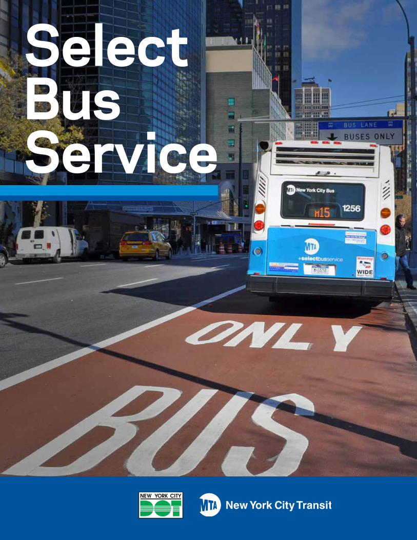
Select Bus Service (SBS), New York City’s brand of bus rapid transit, offers fast, frequent, and reliable bus service on high-ridership bus routes, forming a citywide bus rapid transit (BRT) network that supplements and complements the existing subway network. NYC’s first SBS route was implemented on Fordham Road and Pelham Parkway in the Bronx in 2008, after several years of planning and community outreach. The New York City Department of Transportation (NYCDOT) in partnership with MTA New York City Transit and MTA Bus will have implemented a total of seven new SBS services by Spring 2014.
Since SBS’s inception in 2008, SBS services have saved 8 million hours in passenger travel time, and have served over 20,000 additional bus passengers daily. Ridership has grown on SBS routes, even during periods that bus ridership citywide declined.
SBS projects are developed through a community-based planning process that includes extensive public input and feedback from project inception to post-implementation. SBS projects have won plaudits from riders and key stakeholders, who have experienced the benefits in mobility and accessibility.
Implementation of these seven routes represents the most comprehensive BRT program implemented in a similar amount of time in the nation. This has been accomplished through a focus on bus priority elements that can be implemented quickly and with currently available funding. These elements include:
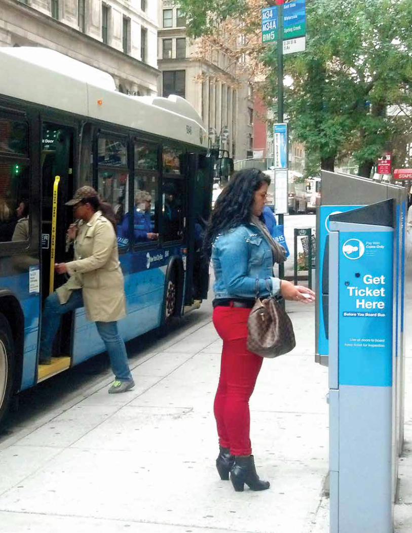
• Off-board fare payment, which reduces time spent at bus stops
• Low-floor, three-door buses with speed boarding
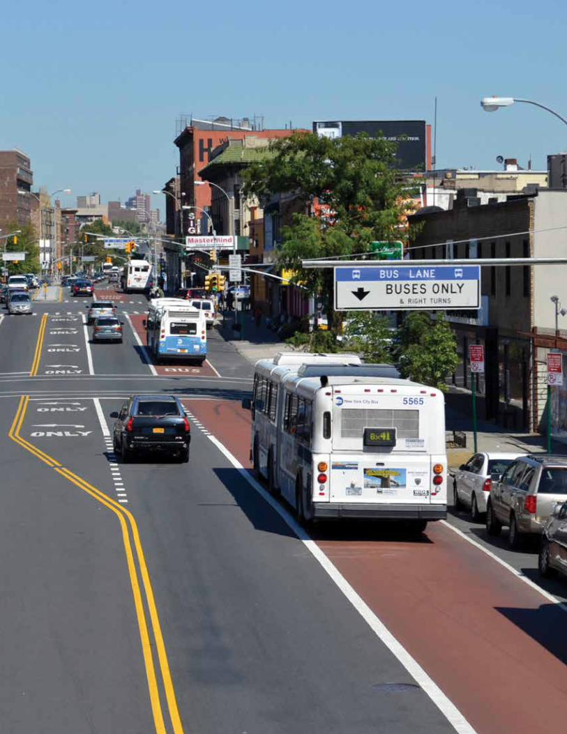
• On-street bus lanes which speed bus travel
• Transit signal priority which reduces the delay at red lights
• Wider stop spacing
• Improved passenger information
4 New York City Department of Transportation
Bx41: Webster Av
Q70: Woodside-Jackson Heightsto LGA
TheBronx
Queens
Man
hatt
an
Brooklyn
StatenIsland
Staten Island Mall
Bay Ridge
Sheepshead Bay
Williamsburg
Co-Op CityInwood
The Hub
Williamsbridge
South Ferry
S79: Hylan Blvd
B44: Nostrand Ave/Rogers Ave
M34/M34A: 34 St
Bx12: Fordham Rd/ Pelham Pkwy
M15:First Av/Second Av
N
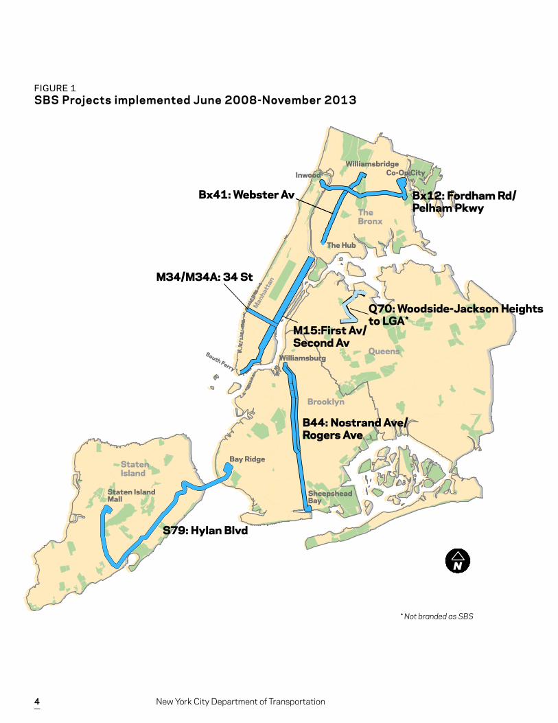
FIGURE 1 SBS Projects implemented June 2008-November 2013
* Not branded as SBS
*
5
The initial set of BRT corridors were selected as part of the NYC Bus Rapid Transit Study, completed in 2006. These Phase I SBS projects were implemented between June 2008 (Bx12 SBS on Fordham Road) and the introduction of Nostrand Avenue/Rogers Avenue SBS on November 2013.
After the success of Bx12 SBS, DOT and the MTA sought to identify a longer list of corridors for bus priority improvements. The resulting Phase II Plan identified 16 corridors for future BRT development. Two Phase II services have been implemented: Webster Avenue in the Bronx, and service to LaGuardia Airport from Woodside and Jackson Heights. In addition, an SBS service on 125th Street in Manhattan, also serving LaGuardia airport, will be implemented in Spring 2014.
This report profiles each of the SBS projects implemented to date, the benefits that SBS has brought to these communities, and plans for Phase II.
The Phase II planning process recognized that SBS treatments similar to those in the initial corridors would be appropriate on some Phase II corridors, while other corridors would offer opportunities for different bus priority designs that have not been implemented to date. This report surveys additional treatments which can be considered for future SBS corridors, highlighting where and how these approaches have been implemented in other large global cities.
This survey of SBS accomplishments to date and opportunities for future SBS implementations will serve to inform a public dialog over the best way to continue development of a dynamic and effective BRT program in New York City, building on the productive partnership between NYCDOT, the MTA and communities throughout the five boroughs.
Overview
6 New York City Department of Transportation
1
2
3
4
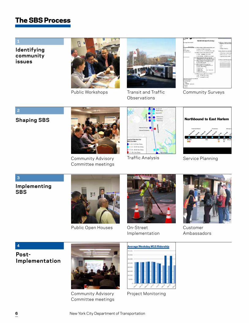
The SBS Process
Identifying community issues
Shaping SBS
Post-Implementation
Implementing SBS
BusTalk www.mta.info ¯˘¿
Southbound to South Ferry
M15Northbound to East Harlem
E 126 St
E 116 St
E 125 St
E 106 St
E 88 St
E 79 St
E 100 St
E 57 St
E 42 St
E 34 St
E 28 St
E 23 St
E 14 St
E Housto
n St
Catherin
e St
Fulton S
t
Wall S
t
South Ferry
E 49/50 S
t
M106M116
East Harlem
M16, M23 M14 M21 M22 M5, M20M86 M79 M66 M31, M57
Upper East Side Murray Hill East Village Chinatown Financial District
M50 M42 M16, M34
E 67/68 S
t
Grand S
t
Manhattan
L F -R1
E 34 St
South Ferry
Wall S
t
Fulton S
t
Catherin
e St
E 23 St
E 42 St
E 50 St
E 57 St
E 67/68 S
t
E 79 St
E 86 St
E 96/97 S
t
106 St
E 116 St
E 125 St
E 29 St
M5, M20
East Harlem
M22 M66M31, M57 M79 M86 M96 M106 M116 Bx15, M60, M35, M100
M14M21 M16, M23
Upper East SideMurray HillChinatown
M16, M34 M42 M50
E 14 St
E 1St
Financial District
Manhattan
Grand S
t
LF-R1
327_10_C
Public Workshops
Public Open Houses
Transit and Traffic Observations
On-Street Implementation
Community Surveys
Customer Ambassadors
Community Advisory Committee meetings
Community Advisory Committee meetings
Traffic Analysis
Project Monitoring
Service Planning
7
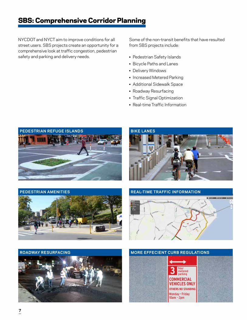
SBS: Comprehensive Corridor Planning
NYCDOT and NYCT aim to improve conditions for all street users. SBS projects create an opportunity for a comprehensive look at traffic congestion, pedestrian safety and parking and delivery needs.
Some of the non-transit benefits that have resulted from SBS projects include:
• Pedestrian Safety Islands• Bicycle Paths and Lanes• Delivery Windows• Increased Metered Parking• Additional Sidewalk Space• Roadway Resurfacing• Traffic Signal Optimization• Real-time Traffic Information
PEDESTRIAN REFUGE ISLANDS
PEDESTRIAN AMENITIES
ROADWAY RESURFACING
BIKE LANES
REAL-TIME TRAFFIC INFORMATION
MORE EFFECIENT CURB REGULATIONS
8 New York City Department of Transportation
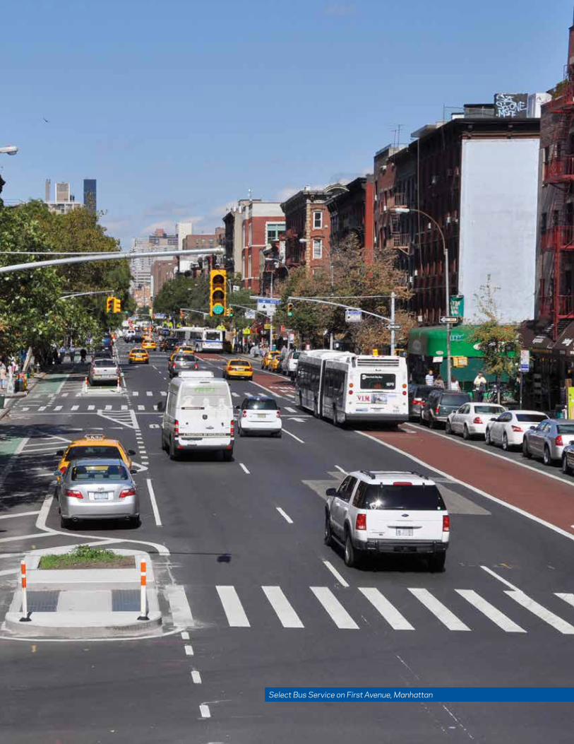
Select Bus Service on First Avenue, Manhattan
9
Select Bus Service: The First Five Years
• Six new SBS services were implemented since 2008 (along with M60 SBS coming in Spring 2014), bringing project benefits to riders as quickly as possible.
• The chief goal of the SBS program is to make the buses faster, more reliable and easily identified as a premium service.
• SBS serves all five boroughs of the city, focusing on high-ridership bus routes.
• SBS routes are complementary to the city’s extensive subway system; duplicating subway service would be inefficient and ineffective.
• Each SBS project has included an extensive public engagement process involving community boards, business improvement districts, merchant associations, civic groups as well as state and local elected officials.
• Dedicated bus lanes, off-board fare payment, transit signal priority and branding are the key elements.
• NYCDOT and NYCT have focused on fast implementation to bring benefits quickly and show results quickly within constrained rights-of-way and without lengthy capital construction. This has been crucial to program sucess; New Yorkers could see what SBS is, see how it worked, and evaluate suitability for the next corridor being planned.
• These projects have led to up to 20% faster bus service, and 10-20% increases in corridor ridership in the first year of service.
Since June 2008:
Key elements of SBS development and implementation are:
100 million SBS trips citywide
8 million person-hours saved
38+ miles of SBS bus lanes
10 New York City Department of Transportation
PROJECT ELEMENTS/COSTS
• Curbside bus lanes ($4M)• Transit Signal Priority ($2M)• Off-Board Fare Payment ($4M)• New Bus Shelters ($0M)*
TRAVEL TIME SAVINGS20% IN FIRST YEAR
RIDERSHIP GROWTH10% IN FIRST YEAR
SBS Routes in Operation
SBS Routes in Operation
Bx12 SBS provides a key crosstown transit connection in the Bronx.
Ridership on M34 SBS has grown even as ridership on other Manhattan crosstown routes has declined.
M15 SBS is the highest ridership bus route in NYC.
PROJECT ELEMENTS/COSTS
• Offset and curbside bus lanes ($5M)• Transit Signal Priority ($1M)• Off-Board Fare Payment ($4M)• Bus bulbs ($7.5M)
TRAVEL TIME SAVINGS 18% IN FIRST YEAR
RIDERSHIP GROWTH 10% IN FIRST YEAR
PROJECT ELEMENTS/COSTS
• Offset and curbside bus lanes ($4M)• Off-Board Fare Payment ($4M)• Bus bulbs ($15M)
TRAVEL TIME SAVINGS23% IN FIRST YEAR
RIDERSHIP GROWTH12% SINCE 2011
Bx12FORDHAM ROAD/PELHAM PARKWAY
IMPLEMENTED JUNE 2008
OVERALL PROJECT COST ~$10 MILLION
M34/34A34TH STREET
IMPLEMENTED NOVEMBER 2011
OVERALL PROJECT COST ~$27 MILLION
M15FIRST AVENUE/SECOND AVENUE
IMPLEMENTEDOCTOBER 2010
OVERALL PROJECT COST ~$17.5 MILLION
* New bus shelters are installed under franchise agreement.
11
PROJECT ELEMENTS/COSTS
• Curbside bus lanes ($3M)• Transit Signal Priority ($2M)• Real-time travel information
for drivers ($0.5M)• Simplified route path
TRAVEL TIME SAVINGS13-19% SIX MONTHS AFTER LAUNCH
RIDERSHIP GROWTH5-10%
SBS Routes in Operation
SBS Routes in Operation
Bus lanes serve a large number of express and local bus routes in addition to S79 SBS.
Improvements to Williamsburg Bridge Plaza provide passenger amenities for several other bus routes.
Bx41 SBS was planned and implemented more quickly than any other SBS project to date.
PROJECT ELEMENTS
• Offset and curbside bus lanes ($4M)• Transit Signal Priority ($1M)• Off-Board Fare Payment ($2M)• Bus bulbs (in development)
TRAVEL TIME SAVINGS*More than 15% since launch
*Preliminary results
PROJECT ELEMENTS (SINGLE CAPITAL PROJECT)
• Offset and curbside bus lanes• Transit Signal Priority• Off-Board Fare Payment• Bus bulbs
Results will be available in 2014.
S79HYLAN BOULEVARD
IMPLEMENTED SEPTEMBER 2012
OVERALL PROJECT COST~$7 MILLION
B44NOSTRAND AVENUE/ROGERS AVENUE
IMPLEMENTED:NOVEMBER 2013
OVERALL PROJECT COST ~$15 MILLION
Bx41WEBSTER AVENUE
IMPLEMENTED JUNE 2013
OVERALL PROJECT COST~$9 MILLION
12 New York City Department of Transportation
13
PROJECT CITY COST ($M) Excluding buses
TRAVEL TIME CHANGE
WEEKDAY RIDERSHIP
First year
M15 SBS New York, NY $18M 18% 55,900
Bx12 SBS New York, NY $10M 20% 45,400
34th Street SBS New York, NY $5M 22% 19,800
S79 SBS New York, NY $6M 16% 9,200
Average SBS New York, NY $10M 19% 32,600
Silver Line (Washington Street) Boston, MA $14M 17% 14,000
Health Line Cleveland, OH $164M 7% 21,200
EmX Eugene, OR $19M 4% 5,400
MAX Las Vegas $8M 35% 7,000
Orange Line Los Angeles, CA $324M 6% 20,000
Wilshire Metro Rapid Los Angeles, CA $5M 29% 90,300
Ventura Metro Rapid Los Angeles, CA $3M 23% 13,500
South Miami-Dade Busway Miami, FL $43M 0% 7,200
Lymmo Orlando, FL $21M 0% 4,200
Average other U.S. BRT $67M 13% 20,300
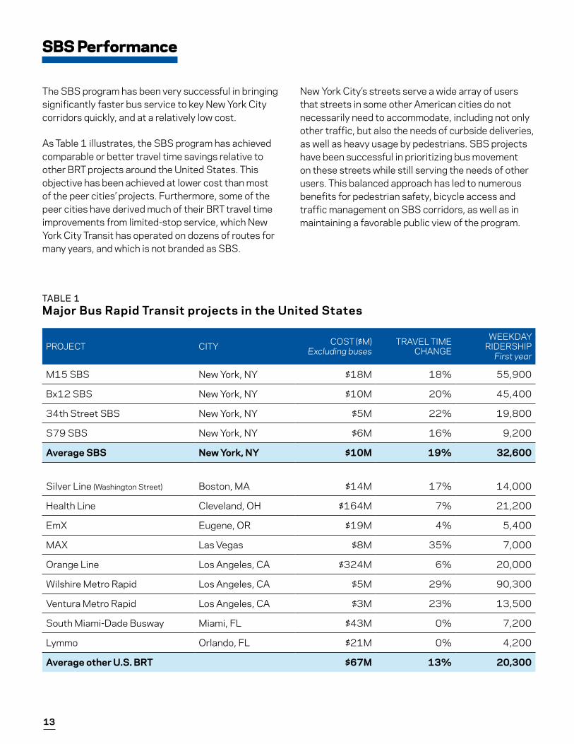
SBS Performance
The SBS program has been very successful in bringing significantly faster bus service to key New York City corridors quickly, and at a relatively low cost.
As Table 1 illustrates, the SBS program has achieved comparable or better travel time savings relative to other BRT projects around the United States. This objective has been achieved at lower cost than most of the peer cities’ projects. Furthermore, some of the peer cities have derived much of their BRT travel time improvements from limited-stop service, which New York City Transit has operated on dozens of routes for many years, and which is not branded as SBS.
New York City’s streets serve a wide array of users that streets in some other American cities do not necessarily need to accommodate, including not only other traffic, but also the needs of curbside deliveries, as well as heavy usage by pedestrians. SBS projects have been successful in prioritizing bus movement on these streets while still serving the needs of other users. This balanced approach has led to numerous benefits for pedestrian safety, bicycle access and traffic management on SBS corridors, as well as in maintaining a favorable public view of the program.
TABLE 1Major Bus Rapid Transit projects in the United States
14 New York City Department of Transportation
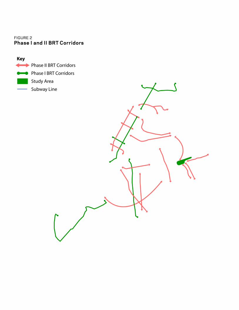
Phase II BRT Corridors
Phase I BRT Corridors
Key
Study Area
Subway Line
FIGURE 2 Phase I and II BRT Corridors
15
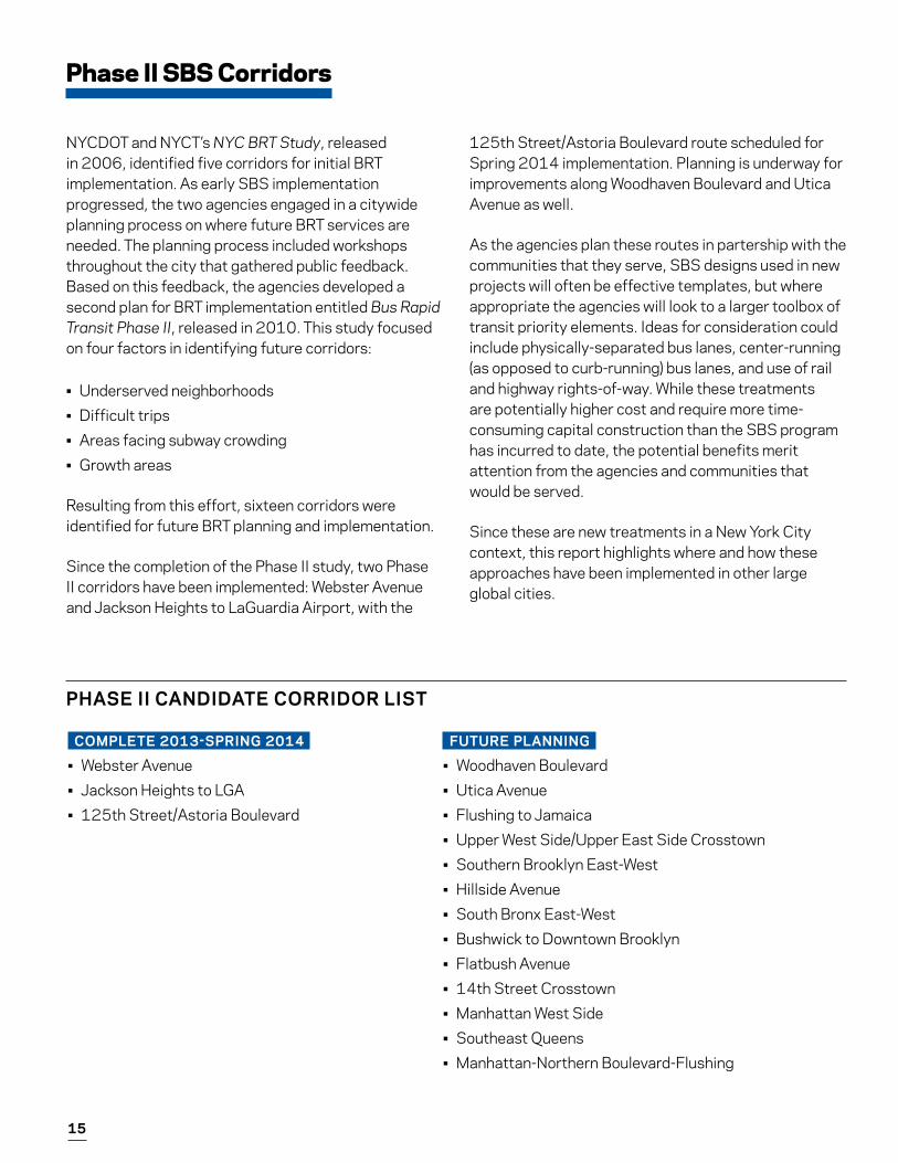
COMPLETE 2013-SPRING 2014
• Webster Avenue• Jackson Heights to LGA• 125th Street/Astoria Boulevard
Phase II SBS Corridors
NYCDOT and NYCT’s NYC BRT Study, released in 2006, identified five corridors for initial BRT implementation. As early SBS implementation progressed, the two agencies engaged in a citywide planning process on where future BRT services are needed. The planning process included workshops throughout the city that gathered public feedback. Based on this feedback, the agencies developed a second plan for BRT implementation entitled Bus Rapid Transit Phase II, released in 2010. This study focused on four factors in identifying future corridors:
• Underserved neighborhoods• Difficult trips • Areas facing subway crowding• Growth areas
Resulting from this effort, sixteen corridors were identified for future BRT planning and implementation.
Since the completion of the Phase II study, two Phase II corridors have been implemented: Webster Avenue and Jackson Heights to LaGuardia Airport, with the
125th Street/Astoria Boulevard route scheduled for Spring 2014 implementation. Planning is underway for improvements along Woodhaven Boulevard and Utica Avenue as well.
As the agencies plan these routes in partership with the communities that they serve, SBS designs used in new projects will often be effective templates, but where appropriate the agencies will look to a larger toolbox of transit priority elements. Ideas for consideration could include physically-separated bus lanes, center-running (as opposed to curb-running) bus lanes, and use of rail and highway rights-of-way. While these treatments are potentially higher cost and require more time-consuming capital construction than the SBS program has incurred to date, the potential benefits merit attention from the agencies and communities that would be served.
Since these are new treatments in a New York City context, this report highlights where and how these approaches have been implemented in other large global cities.
FUTURE PLANNING
• Woodhaven Boulevard • Utica Avenue• Flushing to Jamaica• Upper West Side/Upper East Side Crosstown• Southern Brooklyn East-West• Hillside Avenue• South Bronx East-West• Bushwick to Downtown Brooklyn• Flatbush Avenue• 14th Street Crosstown• Manhattan West Side• Southeast Queens• Manhattan-Northern Boulevard-Flushing
PHASE II CANDIDATE CORRIDOR LIST
16 New York City Department of Transportation
17
Case Studies
1. Paris Mobilien2. San Francisco Muni Van Ness Avenue BRT3. Cleveland RTA HealthLine BRT4. Los Angeles MTA Orange Line5. Istanbul Metrobus
18 New York City Department of Transportation
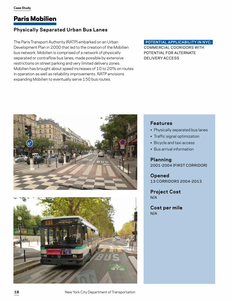
Paris Mobilien
Physically Separated Urban Bus Lanes
Case Study
The Paris Transport Authority (RATP) embarked on an Urban Development Plan in 2000 that led to the creation of the Mobilien bus network. Mobilien is comprised of a network of physically separated or contraflow bus lanes, made possible by extensive restrictions on street parking and very limited delivery zones. Mobilien has brought about speed increases of 10 to 20% on routes in operation as well as reliability improvements. RATP envisions expanding Mobilien to eventually serve 150 bus routes.
Features• Physically separated bus lanes• Traffic signal optimization• Bicycle and taxi access• Bus arrival information
Planning2001-2004 (FIRST CORRIDOR)
Opened13 CORRIDORS 2004-2013
Project CostN/A
Cost per mileN/A
POTENTIAL APPLICABILITY IN NYC:COMMERCIAL COORIDORS WITH POTENTIAL FOR ALTERNATE DELIVERY ACCESS

19
San Francisco Muni Van Ness Avenue BRT:
Center Median Busway on an Urban Commercial Street
Case Study
The San Francisco County Transportation Authority completed the Van Ness BRT feasibility study in 2006. Subsequent planning documents call for a center median busway for roughly two miles of Van Ness Avenue from Lombard Street to Mission Street. Muni local routes and Golden Gate Transit express routes currently carry over 43,000 daily passengers, with over 16,000 boardings within the Van Ness corridor. SFCTA projects a ridership increase of 25 percent with the conversion to BRT, but has run into numerous delays on the road to implementation.
Features• Center median busway• Off-board fare payment• Transit signal oriority• Left-turn restrictions• Pedestrian safety
improvements• Bus arrival information
Planning2008-PRESENT
Opening2018 (PROJECTED)
Project Cost$126 MILLION (ESTIMATED)
Cost per mile$63 MILLION/MILE
POTENTIAL APPLICABILITY IN NYC:WIDE TWO-WAY COMMERCIAL BOULEVARDS
RENDERING OF BRT PLAN
Current condition.
RENDERING OF BRT PLAN
20 New York City Department of Transportation
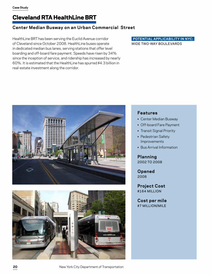
Cleveland RTA HealthLine BRT
Center Median Busway on an Urban Commercial Street
Case Study
HealthLine BRT has been serving the Euclid Avenue corridor of Cleveland since October 2008. HealthLine buses operate in dedicated median bus lanes, serving stations that offer level boarding and off-board fare payment. Speeds have risen by 34% since the inception of service, and ridership has increased by nearly 60%. It is estimated that the HealthLine has spurred $4.3 billion in real-estate investment along the corridor.
Features• Center Median Busway• Off-board Fare Payment• Transit Signal Priority• Pedestrian Safety
Improvements• Bus Arrival Information
Planning2002 TO 2008
Opened2008
Project Cost$164 MILLION
Cost per mile$7 MILLION/MILE
POTENTIAL APPLICABILITY IN NYC:WIDE TWO-WAY BOULEVARDS
21
Los Angeles MTA Orange Line
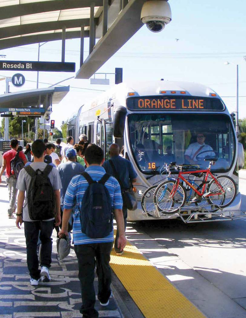
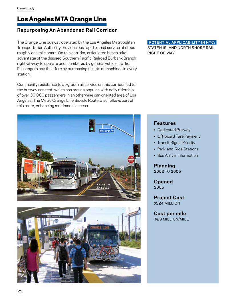
Repurposing An Abandoned Rail Corridor
Case Study
The Orange Line busway operated by the Los Angeles Metropolitan Transportation Authority provides bus rapid transit service at stops roughly one mile apart. On this corridor, articulated buses take advantage of the disused Southern Pacific Railroad Burbank Branch right-of-way to operate unencumbered by general vehicle traffic. Passengers pay their fare by purchasing tickets at machines in every station.
Community resistance to at-grade rail service on this corridor led to the busway concept, which has proven popular, with daily ridership of over 30,000 passengers in an otherwise car-oriented area of Los Angeles. The Metro Orange Line Bicycle Route also follows part of this route, enhancing multimodal access.
Features• Dedicated Busway• Off-board Fare Payment• Transit Signal Priority• Park-and-Ride Stations• Bus Arrival Information
Planning2002 TO 2005
Opened2005
Project Cost$324 MILLION
Cost per mile $23 MILLION/MILE
POTENTIAL APPLICABILITY IN NYC:STATEN ISLAND NORTH SHORE RAIL RIGHT-OF-WAY
22 New York City Department of Transportation
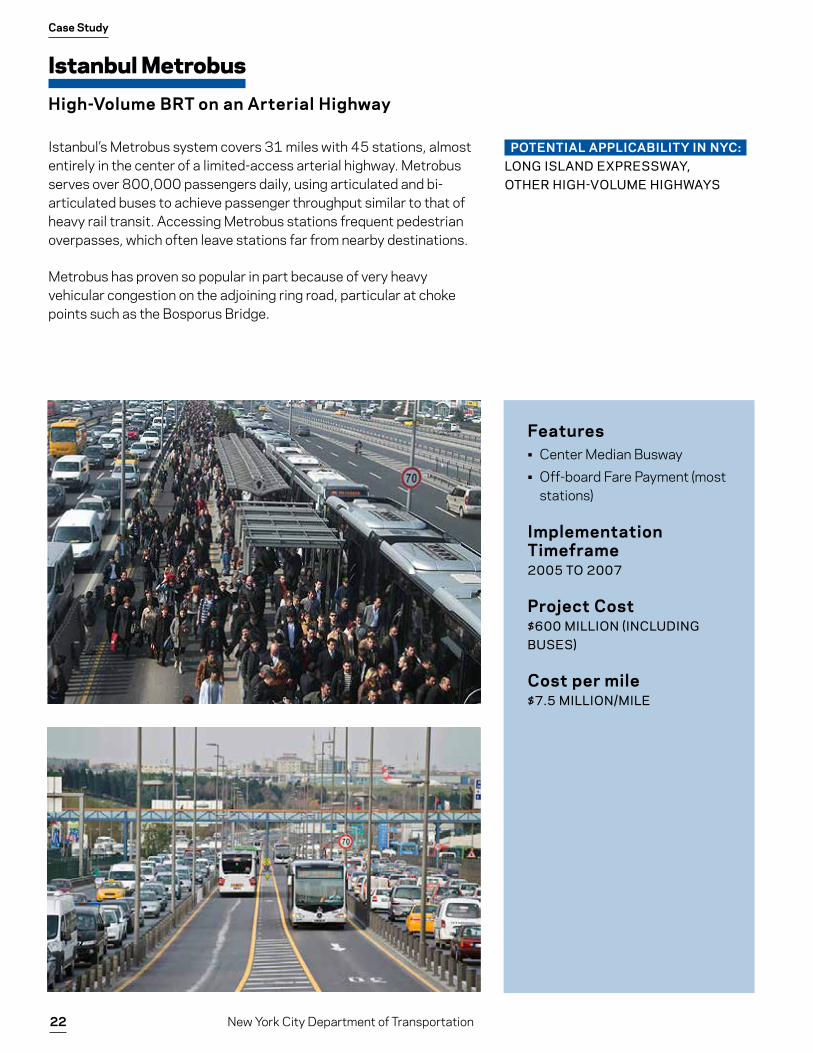
Istanbul Metrobus
High-Volume BRT on an Arterial Highway
Case Study
Istanbul’s Metrobus system covers 31 miles with 45 stations, almost entirely in the center of a limited-access arterial highway. Metrobus serves over 800,000 passengers daily, using articulated and bi-articulated buses to achieve passenger throughput similar to that of heavy rail transit. Accessing Metrobus stations frequent pedestrian overpasses, which often leave stations far from nearby destinations.
Metrobus has proven so popular in part because of very heavy vehicular congestion on the adjoining ring road, particular at choke points such as the Bosporus Bridge.
Features• Center Median Busway• Off-board Fare Payment (most
stations)
Implementation Timeframe2005 TO 2007
Project Cost$600 MILLION (INCLUDING BUSES)
Cost per mile$7.5 MILLION/MILE
POTENTIAL APPLICABILITY IN NYC:LONG ISLAND EXPRESSWAY, OTHER HIGH-VOLUME HIGHWAYS

23
24 New York City Department of Transportation