settlement monitoring using space-borne infrastructure projects · 2019. 11. 25. · settlement...
TRANSCRIPT

Settlement monitoring using space-borne radar interferometry in the context of large infrastructure projects
2. Symposium zur angewandten Satellitenerdbeobachtung, 12.-13.11.2019, Köln
Regula Frauenfelder and Carsten HauserNorwegian Geotechnical Institute
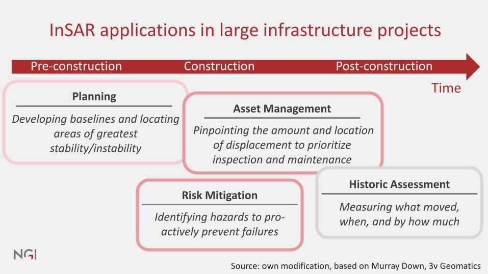
InSAR applications in large infrastructure projects
Pre-construction Construction Post-construction
Time
Source: own modification, based on Murray Down, 3v Geomatics
Planning
Developing baselines and locating areas of greatest
stability/instability
Asset Management
Pinpointing the amount and location of displacement to prioritize inspection and maintenance
Risk Mitigation
Identifying hazards to pro-actively prevent failures
Historic Assessment
Measuring what moved, when, and by how much

Planning / InSAR in the pre-construction phase
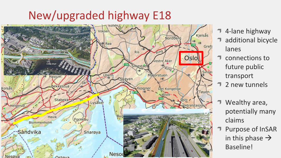
New/upgraded highway E184-lane highwayadditional bicycle lanesconnections to future public transport2 new tunnels
Wealthy area, potentially many claimsPurpose of InSARin this phase Baseline!
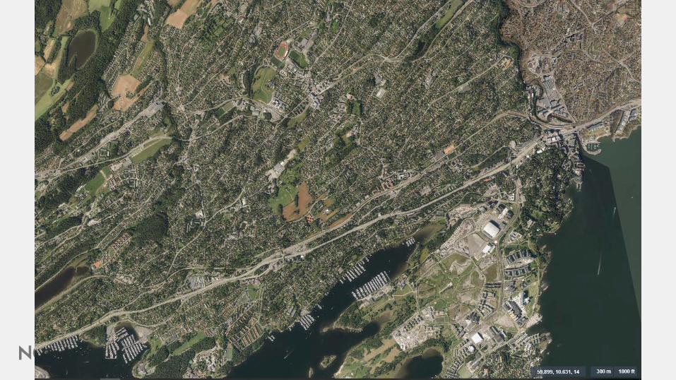

No. of measurement points 220’060
Coverage 7.3 km2
Average point density, total area 27’250 pts./km2
Satellite data source: TSX spotlight, April 2014 to December 2018,Copyright © 2014-2018 DLR, Distribution Airbus DS / Infoterra GmbH.

Satellite data source: TSX spotlight, April 2014 to December 2018,Copyright © 2014-2018 DLR, Distribution Airbus DS / Infoterra GmbH.

Satellite data source: TSX spotlight, April 2014 to December 2018,Copyright © 2014-2018 DLR, Distribution Airbus DS / Infoterra GmbH.

Buildings in the «influence zone»
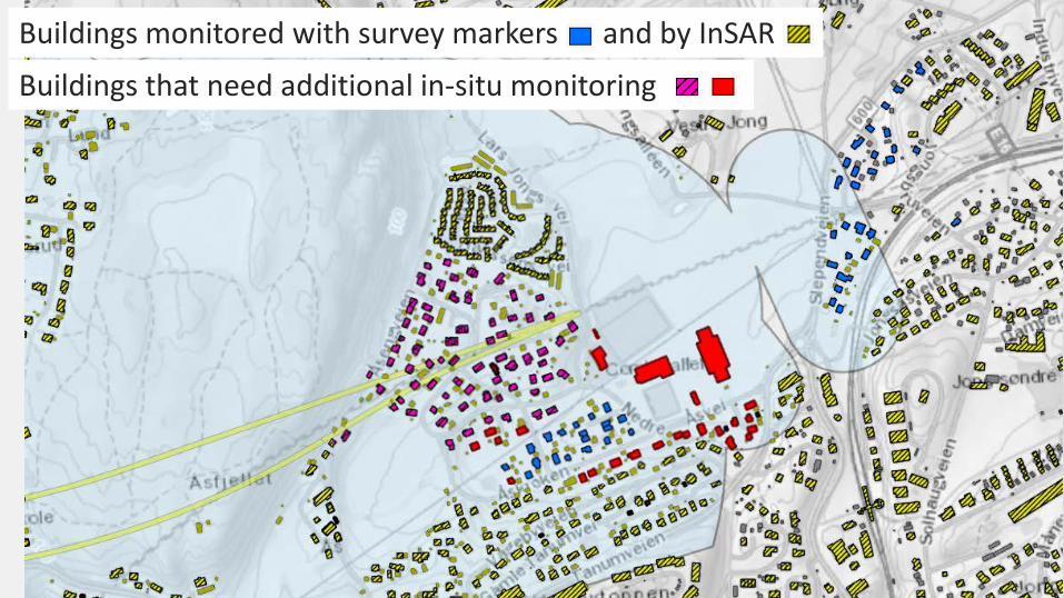
Buildings monitored with survey markers and by InSAR
Buildings that need additional in-situ monitoring

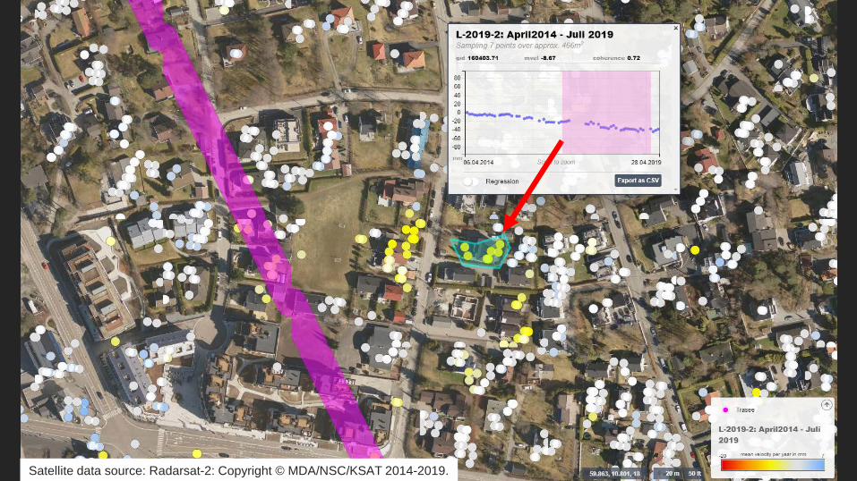
Asset Management/Risk MitigationInSAR during construction
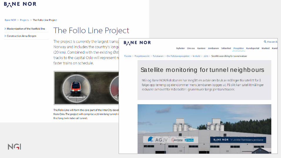
Satellite monitoring for tunnel neighbours

Tunnel Boring Machine (TBM) advancement
Durchbruch 26.2.2019

No. of measurement points 211’888
Coverage 104 km2
Average point density, total area 3057 pts./km2
Average point density in built-up areas 6733 pts./km2
Satellite data source: Radarsat-2: Copyright © MDA/NSC/KSAT 2014-2019.

I am a TBM
Satellite data source: Radarsat-2: Copyright © MDA/NSC/KSAT 2014-2019.
Satellite data source: Radarsat-2: Copyright © MDA/NSC/KSAT 2014-2019.

Extend in-situ series with InSAR
Nivellement series 2
Nivellement series 1
InSAR
House 2
House 3
House 1
House 4

Historic assessment /InSAR in the post-construction phase

Development of the area 2001 vs. 2018 vs. 2026++
2001 2018Source: Bo i Bjørvika, Facebook, 29.11.2018
Oslo Fjord City, 2026

Settlements due to deep excavations
Deep excavations have the potential to lower pore pressure and cause settlements over huge areasExtensive construction activities for 15 yearsLeakages due to drilling activities (piles and anchors)Normally consolidated clay

Settlements in protected old masonry buildings
Image source: Rolf Øhman


Satellite data source: TSX staring spotlight, January 2014 to June 2018,Copyright © 2014-2018 DLR, Distribution Airbus DS / Infoterra GmbH.
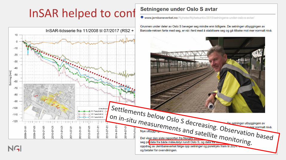
InSAR helped to confirm successful mitigation

Summary I
Radar interferometry offers substantial added-value to geotechnical and civil engineering work and is today successfully applied in big infrastructure projects, alongside targeted traditional levelling of selected “hot-spot” objects.
Depending on the spatial resolution of the satellite data, the InSAR results can be used to gain an overview over settlement/subsidence hotspots, or they can be directly tied to pre-existing in-situ measurement records.

Summary II
The method can be applied for historical assessments, in order to measure what has moved when and by how much (Oslo central railway station example). This, provided that necessary satellite data is available.
Preferably, however, the method is applied for planning and asset management prior to construction (E18 example).
And/or for risk mitigation during construction (Follo Line tunnelling example).

AcknowledgementsThe main funding for these projects came from Bane NOR and the Norwegian Public Roads Administration. In addition, some activities were funded by the Norwegian Space Centre and the Norwegian Research Council. We are grateful to Bane NOR and the Norwegian Public Roads Administration for their permission to present these results.
Data Sources:─ TerraSAR-X: Copyright © 2014-2018 DLR,
Distribution Airbus DS/Infoterra GmbH─ Radarsat-2: Copyright © MDA/NSC/KSAT 2014-2019

NORGES GEOTEKNISKE INSTITUTTNGI.NO
#onsafeground