shorelines & shoreline landforms - michigan state …michal76/classstudyguides/... ·...
TRANSCRIPT
Geomorphology Exam 4 Study Guide
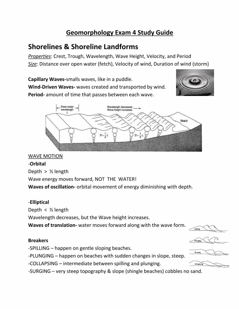
Shorelines & Shoreline Landforms Properties: Crest, Trough, Wavelength, Wave Height, Velocity, and Period
Size: Distance over open water (fetch), Velocity of wind, Duration of wind (storm)
Capillary Waves-smalls waves, like in a puddle.
Wind-Driven Waves- waves created and transported by wind.
Period- amount of time that passes between each wave.
WAVE MOTION
-Orbital
Depth > ½ length
Wave energy moves forward, NOT THE WATER!
Waves of oscillation- orbital movement of energy diminishing with depth.
-Elliptical
Depth < ½ length
Wavelength decreases, but the Wave height increases.
Waves of translation- water moves forward along with the wave form.
Breakers
-SPILLING – happen on gentle sloping beaches.
-PLUNGING – happen on beaches with sudden changes in slope, steep.
-COLLAPSING – intermediate between spilling and plunging.
-SURGING – very steep topography & slope (shingle beaches) cobbles no sand.
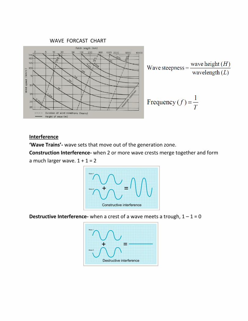
WAVE FORCAST CHART
Interference
‘Wave Trains’- wave sets that move out of the generation zone.
Construction Interference- when 2 or more wave crests merge together and form
a much larger wave. 1 + 1 = 2
Destructive Interference- when a crest of a wave meets a trough, 1 – 1 = 0
Other Forces in the Sea
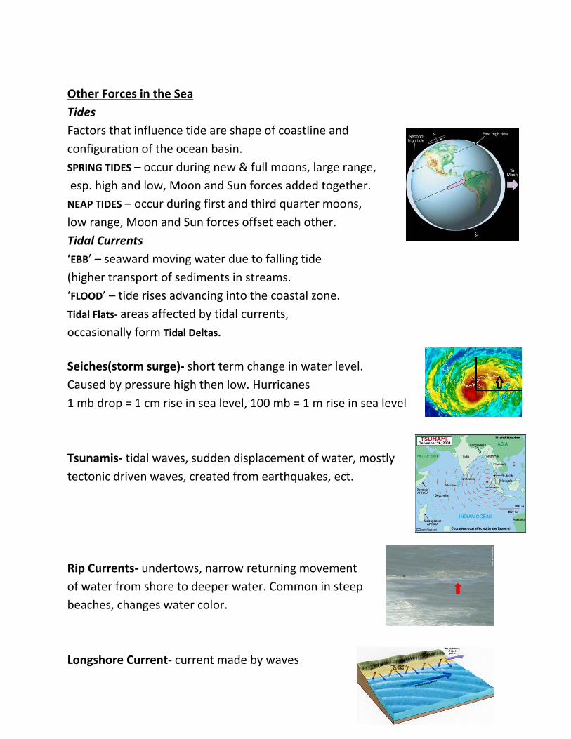
Tides
Factors that influence tide are shape of coastline and
configuration of the ocean basin.
SPRING TIDES – occur during new & full moons, large range,
esp. high and low, Moon and Sun forces added together.
NEAP TIDES – occur during first and third quarter moons,
low range, Moon and Sun forces offset each other.
Tidal Currents
‘EBB’ – seaward moving water due to falling tide
(higher transport of sediments in streams.
‘FLOOD’ – tide rises advancing into the coastal zone.
Tidal Flats- areas affected by tidal currents,
occasionally form Tidal Deltas.
Seiches(storm surge)- short term change in water level.
Caused by pressure high then low. Hurricanes
1 mb drop = 1 cm rise in sea level, 100 mb = 1 m rise in sea level
Tsunamis- tidal waves, sudden displacement of water, mostly
tectonic driven waves, created from earthquakes, ect.
Rip Currents- undertows, narrow returning movement
of water from shore to deeper water. Common in steep
beaches, changes water color.
Longshore Current- current made by waves
moving towards shore obliquely. (angle)
Refraction- bending of waves due to shoreline
or bottom conditions.
Swash- sediments being transported on the shore by waves.
Backwash- sediments being returned to the water in the
quickest route possible.
Beach Cusps- rhythmic, evenly spread, waves divided by cusps.
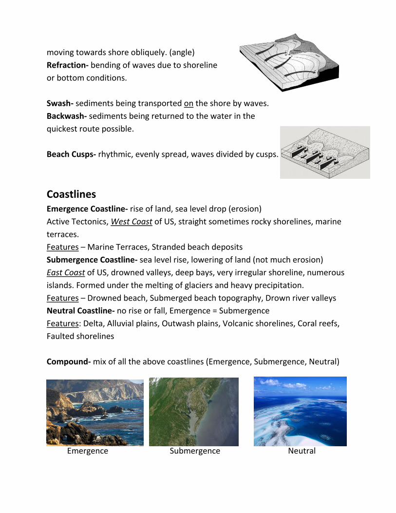
Coastlines Emergence Coastline- rise of land, sea level drop (erosion)
Active Tectonics, West Coast of US, straight sometimes rocky shorelines, marine
terraces.
Features – Marine Terraces, Stranded beach deposits
Submergence Coastline- sea level rise, lowering of land (not much erosion)
East Coast of US, drowned valleys, deep bays, very irregular shoreline, numerous
islands. Formed under the melting of glaciers and heavy precipitation.
Features – Drowned beach, Submerged beach topography, Drown river valleys
Neutral Coastline- no rise or fall, Emergence = Submergence
Features: Delta, Alluvial plains, Outwash plains, Volcanic shorelines, Coral reefs,
Faulted shorelines
Compound- mix of all the above coastlines (Emergence, Submergence, Neutral)
Emergence Submergence Neutral
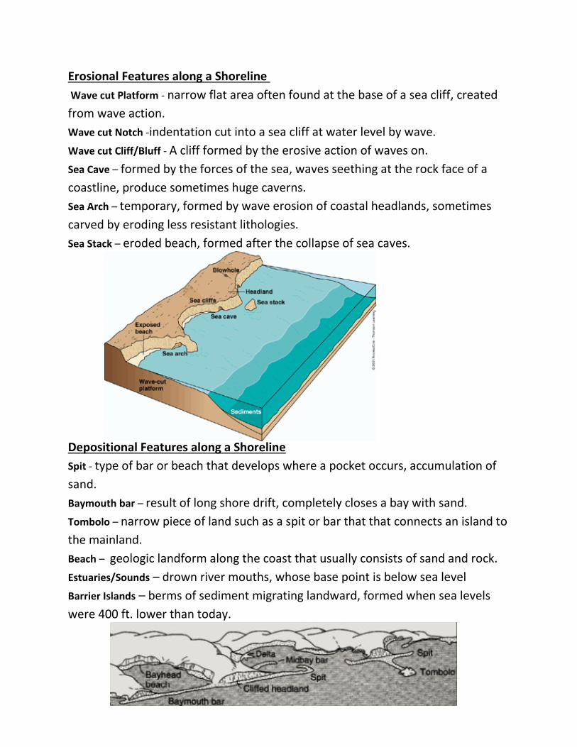
Erosional Features along a Shoreline
Wave cut Platform - narrow flat area often found at the base of a sea cliff, created
from wave action.
Wave cut Notch -indentation cut into a sea cliff at water level by wave.
Wave cut Cliff/Bluff - A cliff formed by the erosive action of waves on.
Sea Cave – formed by the forces of the sea, waves seething at the rock face of a
coastline, produce sometimes huge caverns.
Sea Arch – temporary, formed by wave erosion of coastal headlands, sometimes
carved by eroding less resistant lithologies.
Sea Stack – eroded beach, formed after the collapse of sea caves.
Depositional Features along a Shoreline
Spit - type of bar or beach that develops where a pocket occurs, accumulation of
sand.
Baymouth bar – result of long shore drift, completely closes a bay with sand.
Tombolo – narrow piece of land such as a spit or bar that that connects an island to
the mainland.
Beach – geologic landform along the coast that usually consists of sand and rock.
Estuaries/Sounds – drown river mouths, whose base point is below sea level
Barrier Islands – berms of sediment migrating landward, formed when sea levels
were 400 ft. lower than today.
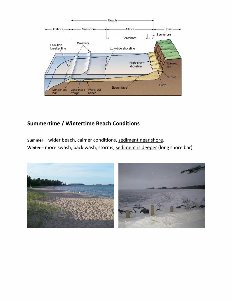
Summertime / Wintertime Beach Conditions
Summer – wider beach, calmer conditions, sediment near shore.
Winter – more swash, back wash, storms, sediment is deeper (long shore bar)
Karst (Yugoslavian term)
“Terrain with distinctive landforms & drainage arising from greater rock solubility
in natural water than is found elsewhere.” (Jennings 1985)
-Highly soluble rock
-Unique drainage pattern resulting from Karst processes
-Liquid water v.s. Soluble rocks (limestone, ect.)
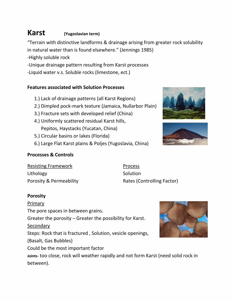
Features associated with Solution Processes
1.) Lack of drainage patterns (all Karst Regions)
2.) Dimpled pock-mark texture (Jamaica, Nullarbor Plain)
3.) Fracture sets with developed relief (China)
4.) Uniformly scattered residual Karst hills,
Pepitos, Haystacks (Yucatan, China)
5.) Circular basins or lakes (Florida)
6.) Large Flat Karst plains & Poljes (Yugoslavia, China)
Processes & Controls
Resisting Framework Process
Lithology Solution
Porosity & Permeability Rates (Controlling Factor)
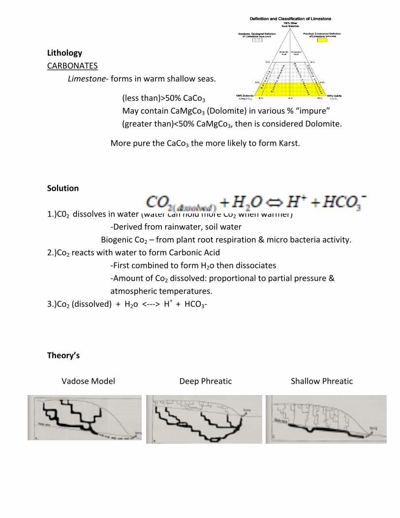
Porosity
Primary
The pore spaces in between grains.
Greater the porosity – Greater the possibility for Karst.
Secondary
Steps: Rock that is fractured , Solution, vesicle openings,
(Basalt, Gas Bubbles)
Could be the most important factor
Joints- too close, rock will weather rapidly and not form Karst (need solid rock in
between).
Lithology
CARBONATES
Limestone- forms in warm shallow seas.
(less than)>50% CaCo3
May contain CaMgCo3 (Dolomite) in various % “impure”
(greater than)<50% CaMgCo3, then is considered Dolomite.
More pure the CaCo3 the more likely to form Karst.
Solution
1.)C02 dissolves in water (water can hold more Co2 when warmer)
-Derived from rainwater, soil water
Biogenic Co2 – from plant root respiration & micro bacteria activity.
2.)Co2 reacts with water to form Carbonic Acid
-First combined to form H2o then dissociates
-Amount of Co2 dissolved: proportional to partial pressure &
atmospheric temperatures.
3.)Co2 (dissolved) + H2o <---> H+ + HCO3-
Theory’s
Vadose Model Deep Phreatic Shallow Phreatic

Karst Landforms
+SINKHOLES (Dolines) – funnel shaped depression (a sink)
Morphometry – 2 m - 100 m depth, 10 m – 1,000 m width
Bowl, Funnel, Cylinder shaped
Solution & Collapse common with most dolines
Rarely occur singly (Common to Florida)
+UVALAS – very large depressions formed by coalescence of
several dolines, a compound doline.
+POLJES – very large depressions with steep walls and a
flat floor, Commonly formed by faults between
two different lithologies (ex: limestone / granite).
Karst Valleys
+BLIND & DRY VALLEYS – where a stream disappears underground.
+POCKET VALLEYS – form where water returns to the surface.
(opposite of blind valley)
+COCKPIT & TOWER KARST – dominated by residual hills.
(Central Guangti Province, China)
Geologic work underground
+CAVERNS – most are created by acidic groundwater dissolving
soluble rock at or just below the surface of saturation.
Composed of DRIP STONE (travertine) – calcite deposited
as dripping water evaporates, collectively called
SPELEOTHEMS. (columns, soda straws, drip curtains).
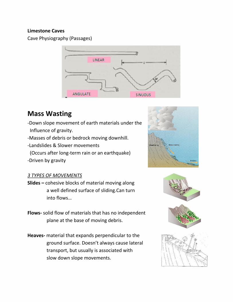
Limestone Caves
Cave Physiography (Passages)
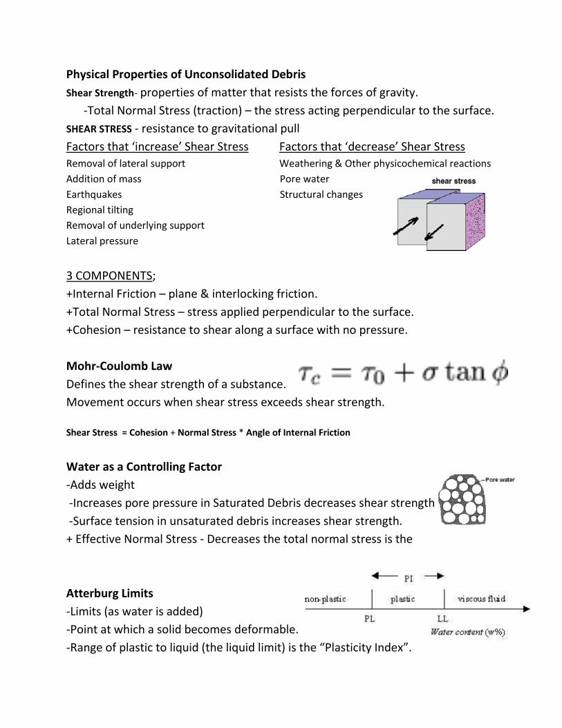
Mass Wasting -Down slope movement of earth materials under the
Influence of gravity.
-Masses of debris or bedrock moving downhill.
-Landslides & Slower movements
(Occurs after long-term rain or an earthquake)
-Driven by gravity
3 TYPES OF MOVEMENTS
Slides – cohesive blocks of material moving along
a well defined surface of sliding.Can turn
into flows…
Flows- solid flow of materials that has no independent
plane at the base of moving debris.
Heaves- material that expands perpendicular to the
ground surface. Doesn’t always cause lateral
transport, but usually is associated with
slow down slope movements.
Physical Properties of Unconsolidated Debris
Shear Strength- properties of matter that resists the forces of gravity.
-Total Normal Stress (traction) – the stress acting perpendicular to the surface.
SHEAR STRESS - resistance to gravitational pull
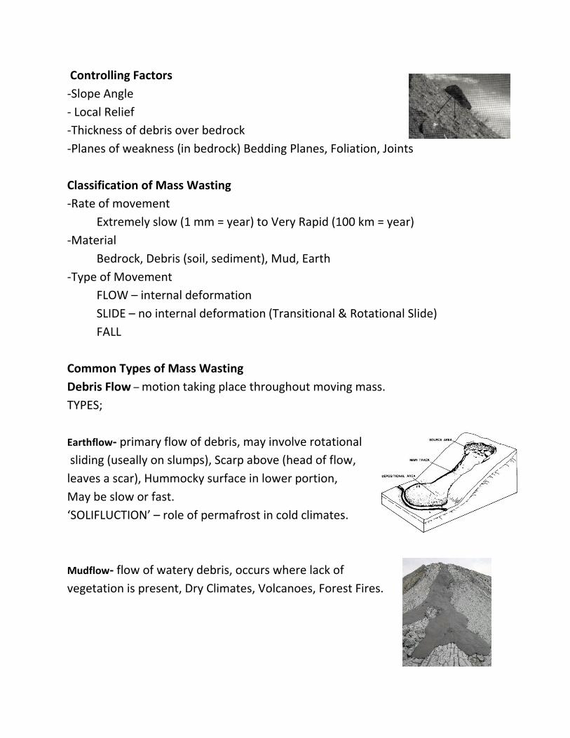
Factors that ‘increase’ Shear Stress Factors that ‘decrease’ Shear Stress
Removal of lateral support Weathering & Other physicochemical reactions
Addition of mass Pore water
Earthquakes Structural changes
Regional tilting
Removal of underlying support
Lateral pressure
3 COMPONENTS;
+Internal Friction – plane & interlocking friction.
+Total Normal Stress – stress applied perpendicular to the surface.
+Cohesion – resistance to shear along a surface with no pressure.
Mohr-Coulomb Law
Defines the shear strength of a substance.
Movement occurs when shear stress exceeds shear strength.
Shear Stress = Cohesion + Normal Stress * Angle of Internal Friction
Water as a Controlling Factor
-Adds weight
-Increases pore pressure in Saturated Debris decreases shear strength
-Surface tension in unsaturated debris increases shear strength.
+ Effective Normal Stress - Decreases the total normal stress is the
Atterburg Limits
-Limits (as water is added)
-Point at which a solid becomes deformable.
-Range of plastic to liquid (the liquid limit) is the “Plasticity Index”.
Controlling Factors
-Slope Angle
- Local Relief
-Thickness of debris over bedrock
-Planes of weakness (in bedrock) Bedding Planes, Foliation, Joints
Classification of Mass Wasting
-Rate of movement
Extremely slow (1 mm = year) to Very Rapid (100 km = year)
-Material
Bedrock, Debris (soil, sediment), Mud, Earth
-Type of Movement
FLOW – internal deformation
SLIDE – no internal deformation (Transitional & Rotational Slide)
FALL
Common Types of Mass Wasting
Debris Flow – motion taking place throughout moving mass.
TYPES;
Earthflow- primary flow of debris, may involve rotational
sliding (useally on slumps), Scarp above (head of flow,
leaves a scar), Hummocky surface in lower portion,
May be slow or fast.
‘SOLIFLUCTION’ – role of permafrost in cold climates.
Mudflow- flow of watery debris, occurs where lack of
vegetation is present, Dry Climates, Volcanoes, Forest Fires.
Patterned Ground- Permafrost weak in spots causes
linear areas of rock accumulation caused by gravity.
Found: Alaska, even MARS!
Rockfall- Bedrock breaking loose on cliffs.
‘TALUS’ – Web shape accumulation at the base of a slope.
Continues to move under heave slope.
Rockslide- Rocks sliding along planes of weakness
parallel to the slope, bed rock is involved.
Slope ‘Stitching’- the drilling of holes, then embedding
a big bolt with concrete into the rock. Holds and stitches
rock material together.
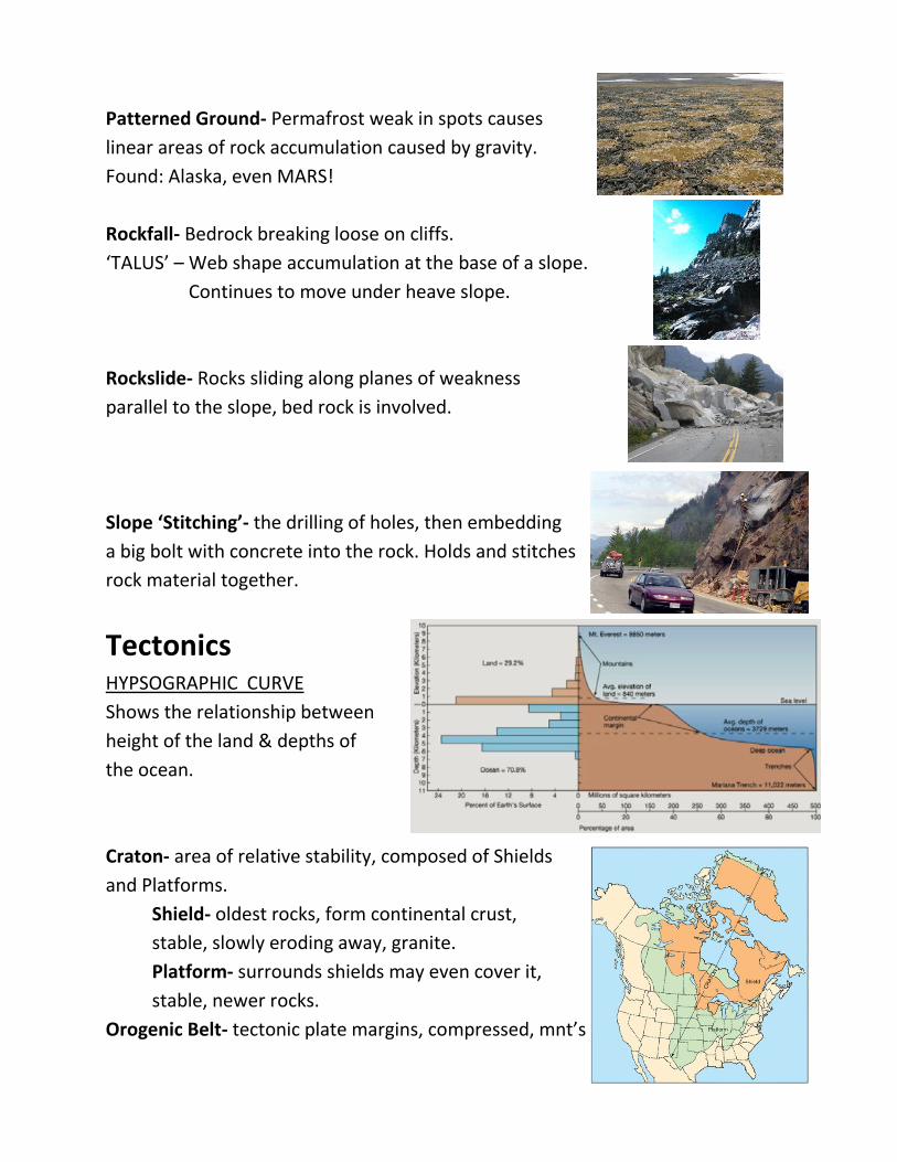
Tectonics HYPSOGRAPHIC CURVE
Shows the relationship between
height of the land & depths of
the ocean.
Craton- area of relative stability, composed of Shields
and Platforms.
Shield- oldest rocks, form continental crust,
stable, slowly eroding away, granite.
Platform- surrounds shields may even cover it,
stable, newer rocks.
Orogenic Belt- tectonic plate margins, compressed, mnt’s
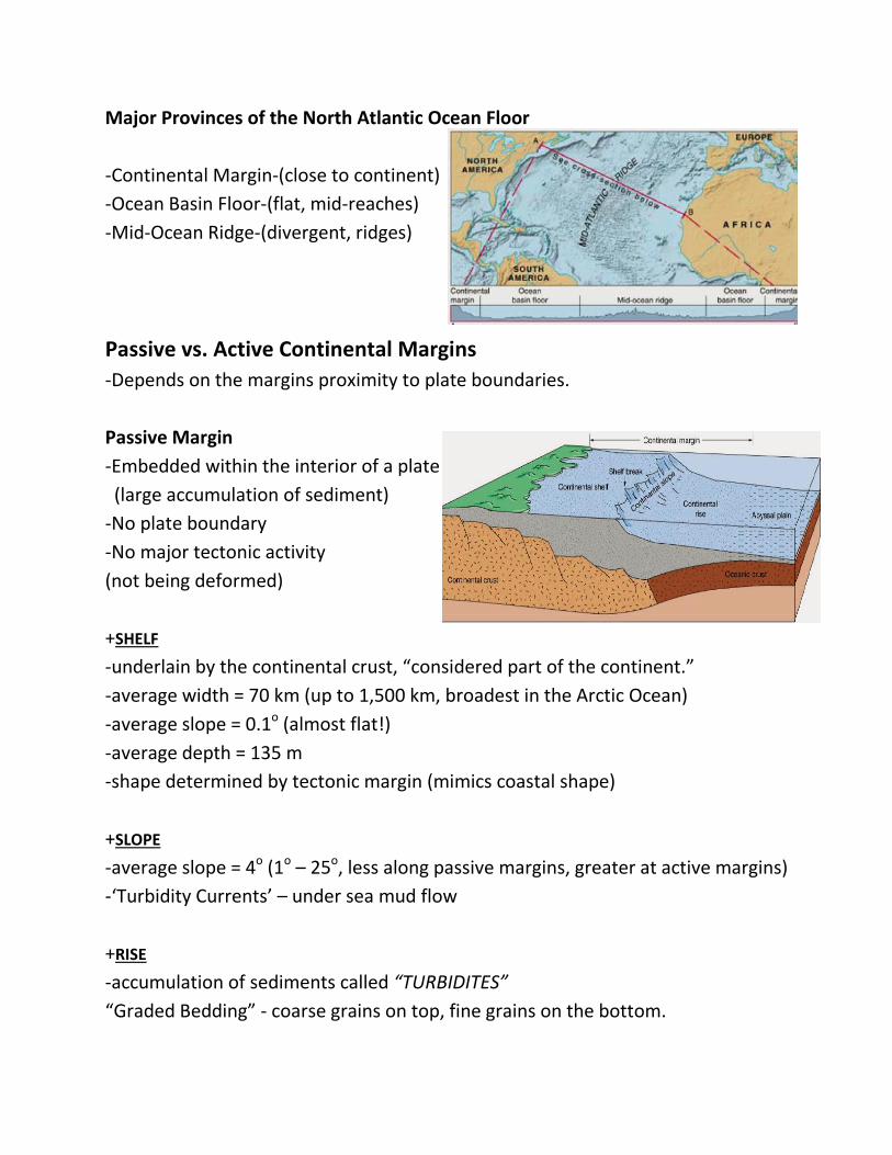
Major Provinces of the North Atlantic Ocean Floor
-Continental Margin-(close to continent)
-Ocean Basin Floor-(flat, mid-reaches)
-Mid-Ocean Ridge-(divergent, ridges)
Passive vs. Active Continental Margins
-Depends on the margins proximity to plate boundaries.
Passive Margin
-Embedded within the interior of a plate
(large accumulation of sediment)
-No plate boundary
-No major tectonic activity
(not being deformed)
+SHELF
-underlain by the continental crust, “considered part of the continent.”
-average width = 70 km (up to 1,500 km, broadest in the Arctic Ocean)
-average slope = 0.1o (almost flat!)
-average depth = 135 m
-shape determined by tectonic margin (mimics coastal shape)
+SLOPE
-average slope = 4o (1o – 25o, less along passive margins, greater at active margins)
-‘Turbidity Currents’ – under sea mud flow
+RISE
-accumulation of sediments called “TURBIDITES”
“Graded Bedding” - coarse grains on top, fine grains on the bottom.
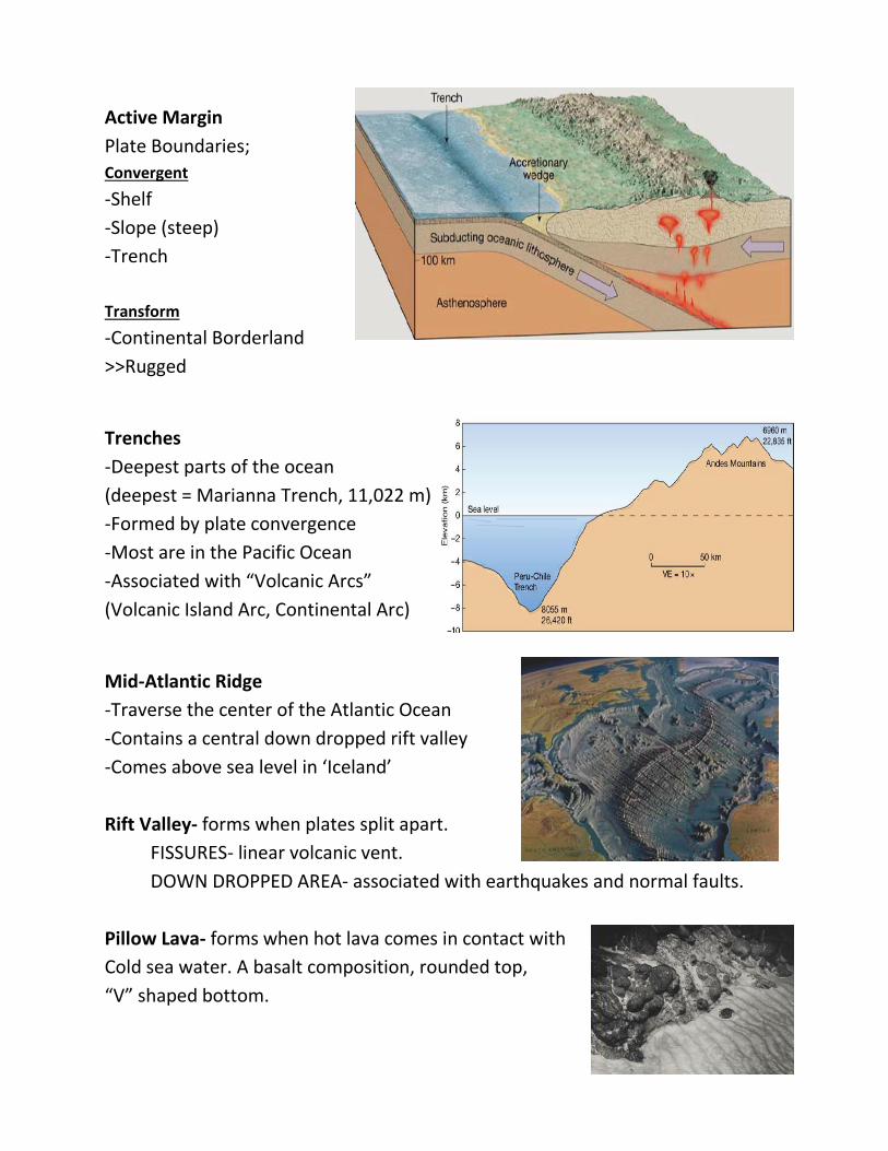
Active Margin
Plate Boundaries;
Convergent
-Shelf
-Slope (steep)
-Trench
Transform
-Continental Borderland
>>Rugged
Trenches
-Deepest parts of the ocean
(deepest = Marianna Trench, 11,022 m)
-Formed by plate convergence
-Most are in the Pacific Ocean
-Associated with “Volcanic Arcs”
(Volcanic Island Arc, Continental Arc)
Mid-Atlantic Ridge
-Traverse the center of the Atlantic Ocean
-Contains a central down dropped rift valley
-Comes above sea level in ‘Iceland’
Rift Valley- forms when plates split apart.
FISSURES- linear volcanic vent.
DOWN DROPPED AREA- associated with earthquakes and normal faults.
Pillow Lava- forms when hot lava comes in contact with
Cold sea water. A basalt composition, rounded top,
“V” shaped bottom.
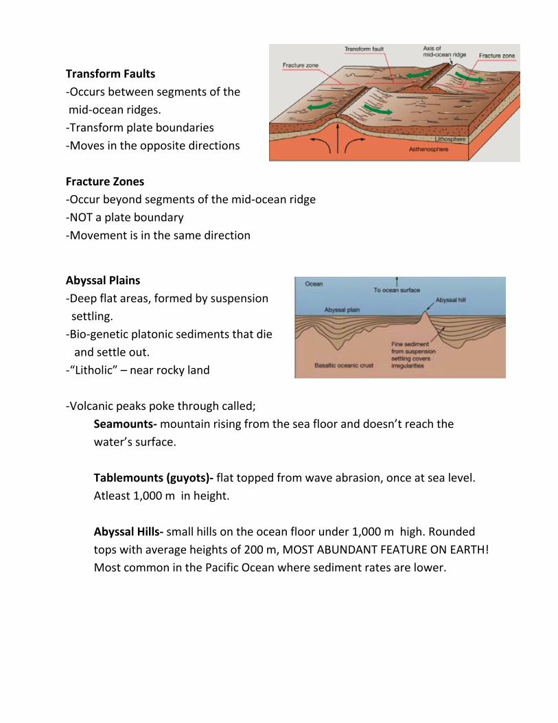
Transform Faults
-Occurs between segments of the
mid-ocean ridges.
-Transform plate boundaries
-Moves in the opposite directions
Fracture Zones
-Occur beyond segments of the mid-ocean ridge
-NOT a plate boundary
-Movement is in the same direction
Abyssal Plains
-Deep flat areas, formed by suspension
settling.
-Bio-genetic platonic sediments that die
and settle out.
-“Litholic” – near rocky land
-Volcanic peaks poke through called;
Seamounts- mountain rising from the sea floor and doesn’t reach the
water’s surface.
Tablemounts (guyots)- flat topped from wave abrasion, once at sea level.
Atleast 1,000 m in height.
Abyssal Hills- small hills on the ocean floor under 1,000 m high. Rounded
tops with average heights of 200 m, MOST ABUNDANT FEATURE ON EARTH!
Most common in the Pacific Ocean where sediment rates are lower.