site investigation report proposed construction at
TRANSCRIPT
Head Office Chiltern House, Earl Howe Road Holmer Green, High Wycombe Buckinghamshire HP15 6QT
t: 01494 712 494e: [email protected] w: www.soilconsultants.co.uk
Harwich Office Haven House, Albemarle Street Harwich, Essex CO12 3HL t: 01255 241639 e: [email protected]
Registered in England No 1814762 – 36 Harefield Road, Uxbridge, Middlesex UB8 1PH VAT No 491 8249 15
Cardiff Office 23 Romilly Road Cardiff CF5 1FH t: 02920 403575 e: [email protected]
SITE INVESTIGATION REPORT PROPOSED CONSTRUCTION AT: 129 Blenheim Crescent, LONDON W11 2EQ
Client:
Fiona Murphy & Anatole Kaletsky 129 Blenheim Crescent London W11 2EQ
Engineers:
Fluid Structures Limited Second Floor 21 St Georges Road London SE1 6ES
Report ref: 9631/OT/SCW Date: 14 August 2014 [Rev 0]
9631/OT Site Investigation Report – 129 Blenheim Crescent, London W11 2EQ Client: Fiona Murphy & Anatole Kaletsky Engineers: Fluid Structures
14 August 2014 [Rev 0]
SITE INVESTIGATION REPORT PROPOSED CONSTRUCTION AT: 129 Blenheim Crescent, LONDON W11 2EQ DOCUMENT ISSUE STATUS: Issue Date Description Author Checked/approved
Rev 0 14 August 2014 Final
Opher Tolkovsky
BSc, MSc, DIC, CGeol, FGS
Stuart Wagstaff
BSc, MSc, FGS, CGeol
Soil Consultants Ltd [SCL] has prepared this Report for the Client in accordance with the Terms of Appointment under which our services were performed. No other warranty, expressed or implied, is made as to the professional advice included in this Report or any other services provided by us. This Report may not be relied upon by any other party without the prior and express written agreement of SCL.
9631/OT Site Investigation Report – 129 Blenheim Crescent, London W11 2EQ Client: Fiona Murphy & Anatole Kaletsky Engineers: Fluid Structures
14 August 2014 [Rev 0]
TABLE OF CONTENTS
1.0 Introduction ..................................................................................................................... 1 2.0 Site description ................................................................................................................. 1 3.0 Site history and geological/environmental information ........................................................... 2
3.1 Groundsure historical map pack and reports ..................................................................... 2 3.2 Walk-over survey .......................................................................................................... 4
4.0 Exploratory work ............................................................................................................... 4 5.0 Ground conditions ............................................................................................................. 5
5.1 Made Ground ................................................................................................................ 6 5.2 London Clay Formation ................................................................................................... 6 5.3 Groundwater ................................................................................................................. 6 5.4 Environmental observations ............................................................................................ 6 5.5 Existing foundations ....................................................................................................... 6
6.0 Geotechnical assessment ................................................................................................... 7 6.1 Basement excavation and retaining wall ........................................................................... 7 6.2 Spread/raft foundations ................................................................................................. 8 6.3 Basement slab [non raft] ................................................................................................ 9 6.4 Foundation Concrete .................................................................................................... 10
7.0 BASEMENT IMPACT ASSESSMENT – LAND STABILITY .......................................................... 10 7.1 Stage 1 - Screening ..................................................................................................... 10 7.2 Land Stability .............................................................................................................. 11 7.3 Stage 2 - Scoping ........................................................................................................ 13 7.4 Land Stability .............................................................................................................. 13 7.5 Conclusions ................................................................................................................ 13
8.0 Environmental appraisal ................................................................................................... 13 8.1 Environmental setting and context ................................................................................. 14 8.2 Potential contamination sources [on-site and off-site] ...................................................... 14 8.3 Contamination testing .................................................................................................. 14 8.4 Ground gas ................................................................................................................. 15 8.5 Disposal of excavated soils ........................................................................................... 15 8.6 Risk Assessment and Conceptual Model .......................................................................... 15
General Information, Limitations and Exceptions
9631/OT Site Investigation Report – 129 Blenheim Crescent, London W11 2EQ Client: Fiona Murphy & Anatole Kaletsky Engineers: Fluid Structures
14 August 2014 [Rev 0]
APPENDIX A
Fieldwork, in-situ testing and monitoring
Window sample borehole records Trial pit records Hand vane profile vs depth Hand penetrometer profile vs depth
Laboratory testing and monitoring Summary of classification test results Natural moisture content and index properties vs depth Plasticity Charts
Contamination and sulphate/pH testing [QTS Environmental] General soil suite [including soluble sulphate/pH results] Waste Acceptance Criteria test results
Plans, drawings & photographs Site Plan Location Map
APPENDIX B
GroundSure historical maps [Ref SCL-1573292] GroundSure EnviroInsight Report [Ref SCL-1573293] GroundSure GeoInsight Report [Ref SCL-1573294]
APPENDIX C
Stephen Buss [Environmental Consulting Ltd] - 129 Blenheim Crescent: Screening and Scoping - Basement Impact Assessment [Doc no 2014-003-005-001], August 2014
9631/OT Site Investigation Report – 129 Blenheim Crescent, London W11 2EQ Page 1Client: Fiona Murphy & Anatole Kaletsky Engineers: Fluid Structures
14 August 2014 [Rev 0]
1.0 INTRODUCTION
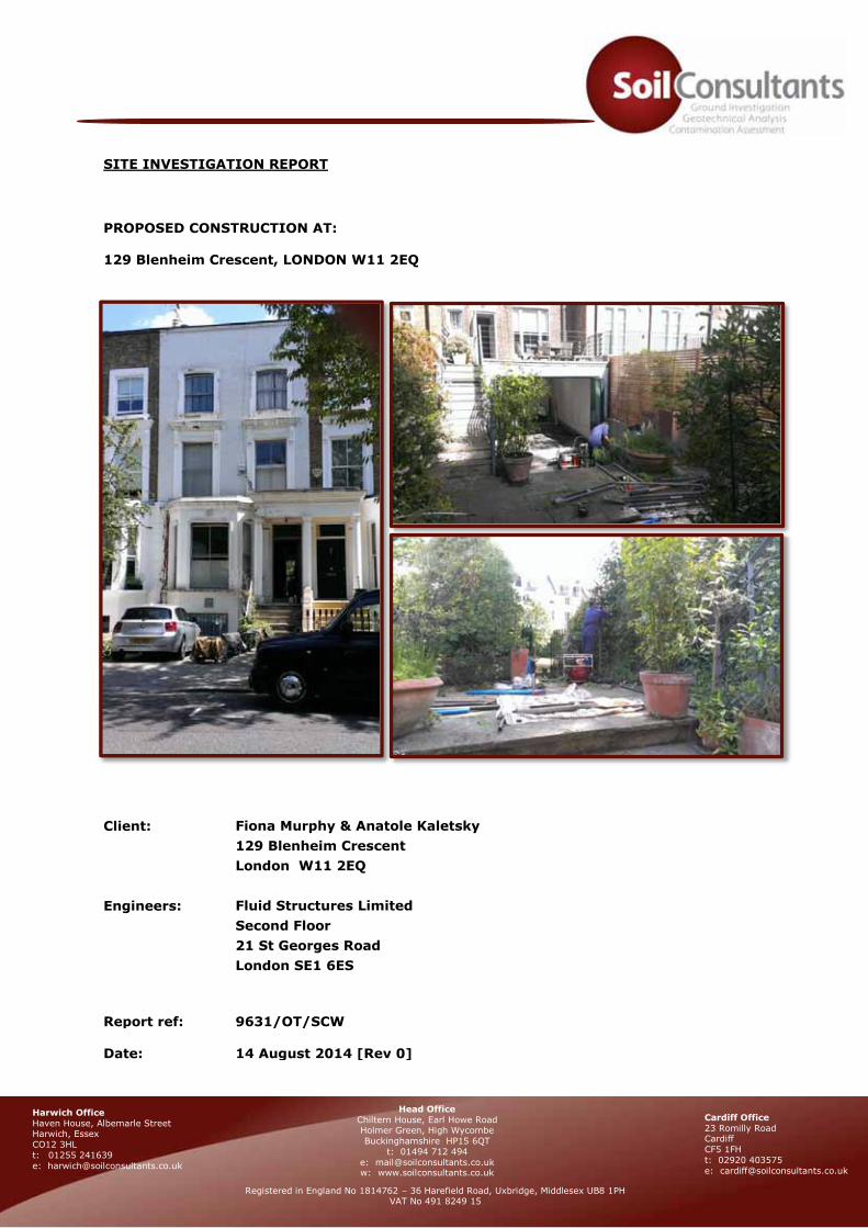
Consideration is being given to constructing a single-storey basement extension beneath the rear section
and rear garden of 129 Blenheim Crescent, London. In connection with the proposed works, Soil
Consultants Ltd [SCL] were commissioned to carry out a ground investigation to include the following
elements:
Desk Study to identify site history and potential contaminative uses
Intrusive work to identify the ground sequence and geotechnical parameters
Provision of recommendations for foundation design and basement construction
Basement impact assessment [screening / scoping]
Contamination appraisal, risk assessment and conceptual model
This report reviews the desk study information, describes the investigation undertaken, gives a summary
of the ground conditions encountered and then provides foundation design recommendations together
with a basement impact assessment, an outline contamination assessment and conceptual model.
2.0 SITE DESCRIPTION
The site is located in a residential area of Notting Hill, in the Royal Borough of Kensington & Chelsea in
west London, at approximate NGR 524250E 180910N, as shown on the Location Maps in Appendix A,
forming a rectangular shape with overall dimensions of approximately 6m x 32m. The property
comprises a four-storey [including semi-basement] terraced residential house with a fully paved front
drive and rear garden mostly comprising pavement/concrete with vegetated borders [flowerbeds and
shrubs] and an area of decking above a single-storey rear extension which extends into the garden. The
garden rises towards the SE by about 1.1m via a series of steps [see Site Plan in Appendix A for details].
The property has similar residential properties on either side. The adjoining property to the north-east is
understood to contain a basement level beneath the rear garden. Beyond the rear garden [to the south-
east] is a communal garden/park and a large [about 25m high] Ash[?] tree is present some 6.0m from
the rear site boundary.
The site is located on a flank of a hill with ground levels rising gently [gradient of about 1:100] towards
the south and east. Information on Ordnance Survey mapping indicates a level of +9.7m OD at the
junction of Clarendon Road and Blenheim Crescent [to the west of the site].
The proposals [see appended Site Plan] are to construct a basement level below the rear part of the
house and the majority of the rear garden, with depths of up to about 3.5m to 4.5m envisaged [the
deeper excavation beneath the rear (higher) section of the garden].
9631/OT Site Investigation Report – 129 Blenheim Crescent, London W11 2EQ Page 2Client: Fiona Murphy & Anatole Kaletsky Engineers: Fluid Structures
14 August 2014 [Rev 0]
3.0 SITE HISTORY AND GEOLOGICAL/ENVIRONMENTAL INFORMATION
3.1 Groundsure historical map pack and reports
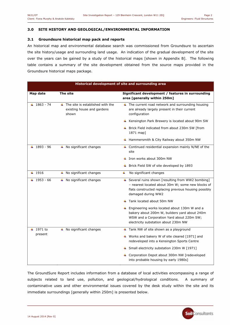
An historical map and environmental database search was commissioned from Groundsure to ascertain
the site history/usage and surrounding land usage. An indication of the gradual development of the site
over the years can be gained by a study of the historical maps [shown in Appendix B]. The following
table contains a summary of the site development obtained from the source maps provided in the
Groundsure historical maps package.
Historical development of site and surrounding area
Map date The site Significant development / features in surrounding area [generally within 250m]
1863 - 74 The site is established with the existing house and gardens shown
The current road network and surrounding housing are already largely present in their current configuration
Kensington Park Brewery is located about 90m SW
Brick Field indicated from about 230m SW [from 1871 map]
Hammersmith & City Railway about 350m NW
1893 - 96 No significant changes Continued residential expansion mainly N/NE of the site
Iron works about 300m NW
Brick Field SW of site developed by 1893
1916 No significant changes No significant changes
1953 - 66 No significant changes Several ruins shown [resulting from WW2 bombing] – nearest located about 30m W; some new blocks of flats constructed replacing previous housing possibly damaged during WW2
Tank located about 50m NW
Engineering works located about 130m W and a bakery about 200m W, builders yard about 240m WSW and a Corporation Yard about 220m SW; electricity substation about 230m NW
1971 to present
No significant changes Tank NW of site shown as a playground
Works and bakery W of site cleared [1971] and redeveloped into a Kensington Sports Centre
Small electricity substation 230m W [1971]
Corporation Depot about 300m NW [redeveloped into probable housing by early 1980s]
The GroundSure Report includes information from a database of local activities encompassing a range of
subjects related to land use, pollution, and geological/hydrological conditions. A summary of
contaminative uses and other environmental issues covered by the desk study within the site and its
immediate surroundings [generally within 250m] is presented below.
9631/OT Site Investigation Report – 129 Blenheim Crescent, London W11 2EQ Page 3Client: Fiona Murphy & Anatole Kaletsky Engineers: Fluid Structures
14 August 2014 [Rev 0]
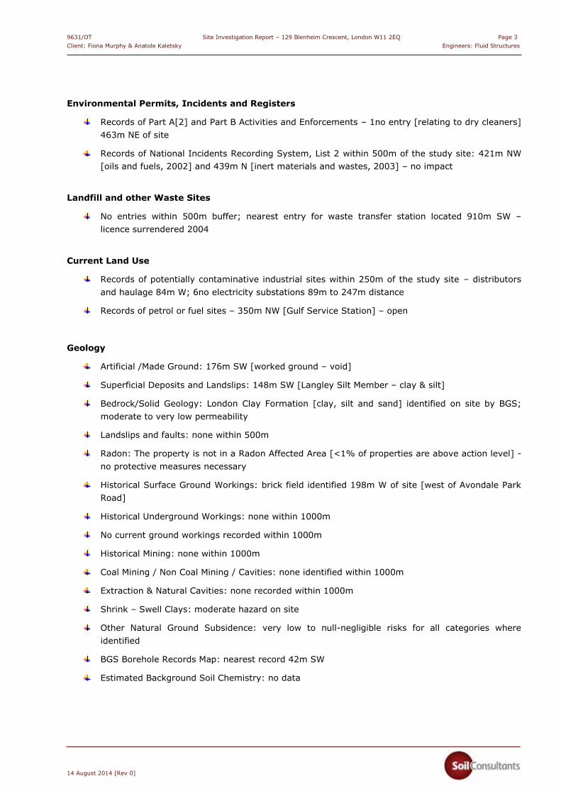
Environmental Permits, Incidents and Registers
Records of Part A[2] and Part B Activities and Enforcements – 1no entry [relating to dry cleaners] 463m NE of site
Records of National Incidents Recording System, List 2 within 500m of the study site: 421m NW [oils and fuels, 2002] and 439m N [inert materials and wastes, 2003] – no impact
Landfill and other Waste Sites
No entries within 500m buffer; nearest entry for waste transfer station located 910m SW – licence surrendered 2004
Current Land Use
Records of potentially contaminative industrial sites within 250m of the study site – distributors and haulage 84m W; 6no electricity substations 89m to 247m distance
Records of petrol or fuel sites – 350m NW [Gulf Service Station] – open
Geology
Artificial /Made Ground: 176m SW [worked ground – void]
Superficial Deposits and Landslips: 148m SW [Langley Silt Member – clay & silt]
Bedrock/Solid Geology: London Clay Formation [clay, silt and sand] identified on site by BGS; moderate to very low permeability
Landslips and faults: none within 500m
Radon: The property is not in a Radon Affected Area [<1% of properties are above action level] - no protective measures necessary
Historical Surface Ground Workings: brick field identified 198m W of site [west of Avondale Park Road]
Historical Underground Workings: none within 1000m
No current ground workings recorded within 1000m
Historical Mining: none within 1000m
Coal Mining / Non Coal Mining / Cavities: none identified within 1000m
Extraction & Natural Cavities: none recorded within 1000m
Shrink – Swell Clays: moderate hazard on site
Other Natural Ground Subsidence: very low to null-negligible risks for all categories where identified
BGS Borehole Records Map: nearest record 42m SW
Estimated Background Soil Chemistry: no data

9631/OT Site Investigation Report – 129 Blenheim Crescent, London W11 2EQ Page 4Client: Fiona Murphy & Anatole Kaletsky Engineers: Fluid Structures
14 August 2014 [Rev 0]
Railways and Tunnels
No records within 250m buffer
Hydrogeology and Hydrology
Aquifer within superficial deposits: recorded 148m SW
Aquifer within bedrock deposits: ‘Unproductive’ aquifer on site
Groundwater/surface water/potable water abstraction: nearest record [point abstraction for cooling] 490m SE
Source Protection Zones: none within 500m
Groundwater Vulnerability and Soil Leaching Potential – no data within 500m
No river, biological or chemical quality, detailed river network or surface water features within 250m
Flooding
No flood zones identified within 250m
No flood defences/flood storage areas within 250m
Groundwater Flooding Susceptibility Areas within 50m of site: none [not prone]
Designated Environmentally Sensitive Sites
Wormwood Scrubs [Natural England] – 1404m NW
3.2 Walk-over survey
Our site walkover survey was undertaken in conjunction with the fieldwork on 22 July 2014. The site was
in a tidy/very good state of repair with no particular features of concern noted at the site or the
neighbouring areas [where visual access was available]. No fuel oil or other tanks/containers were
observed.
Overall we have not identified any particular features [such as fuel tanks], materials [such as chemical
containers, asbestos/cement sheeting] or land use within the site or in its immediate vicinity which are
likely to give rise to significant contamination risks and we thus have no particular concerns in this
regard.
4.0 EXPLORATORY WORK
The fieldwork was carried out on 22 July 2014 and comprised the following elements:
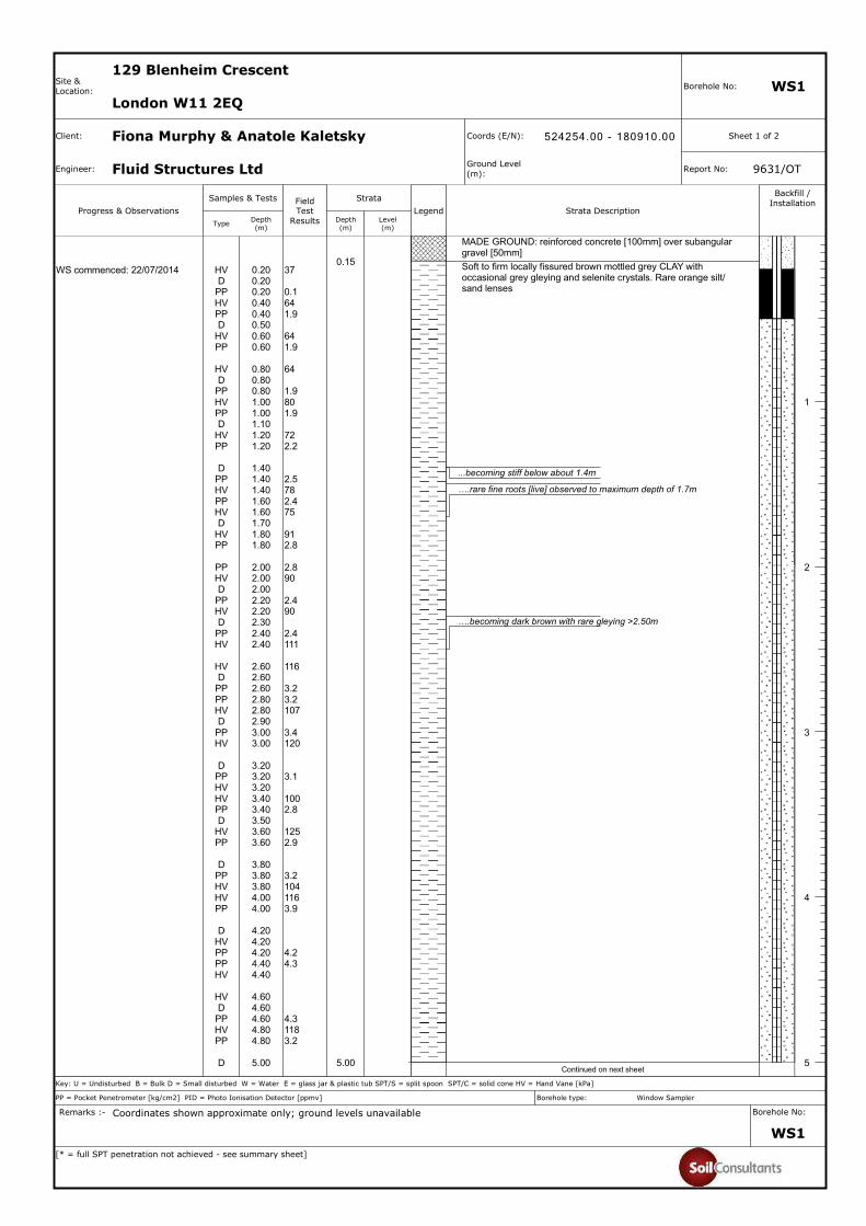
Window sample borehole
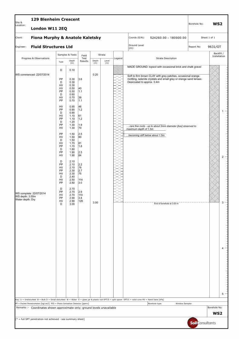
Two boreholes [WS1 & WS2] were constructed in the garden area east of the house to provide
information on the near surface geology and ground/groundwater conditions, and to facilitate sampling
9631/OT Site Investigation Report – 129 Blenheim Crescent, London W11 2EQ Page 5Client: Fiona Murphy & Anatole Kaletsky Engineers: Fluid Structures
14 August 2014 [Rev 0]
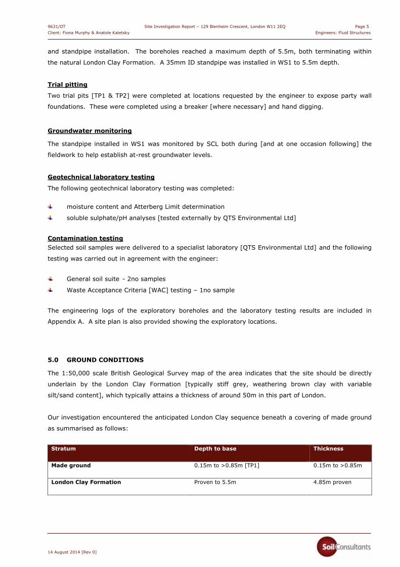
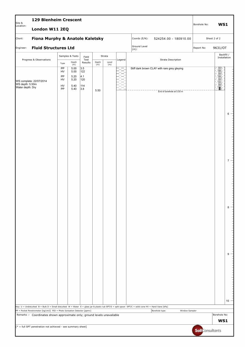
and standpipe installation. The boreholes reached a maximum depth of 5.5m, both terminating within
the natural London Clay Formation. A 35mm ID standpipe was installed in WS1 to 5.5m depth.
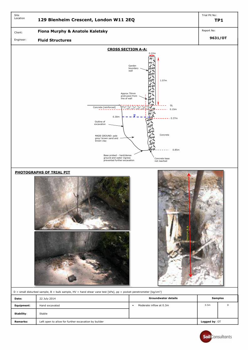
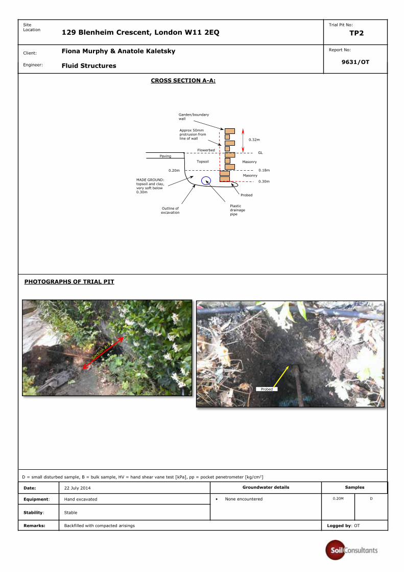
Trial pitting
Two trial pits [TP1 & TP2] were completed at locations requested by the engineer to expose party wall
foundations. These were completed using a breaker [where necessary] and hand digging.
Groundwater monitoring
The standpipe installed in WS1 was monitored by SCL both during [and at one occasion following] the
fieldwork to help establish at-rest groundwater levels.
Geotechnical laboratory testing
The following geotechnical laboratory testing was completed:
moisture content and Atterberg Limit determination
soluble sulphate/pH analyses [tested externally by QTS Environmental Ltd]
Contamination testing Selected soil samples were delivered to a specialist laboratory [QTS Environmental Ltd] and the following
testing was carried out in agreement with the engineer:
General soil suite - 2no samples
Waste Acceptance Criteria [WAC] testing – 1no sample
The engineering logs of the exploratory boreholes and the laboratory testing results are included in
Appendix A. A site plan is also provided showing the exploratory locations.
5.0 GROUND CONDITIONS
The 1:50,000 scale British Geological Survey map of the area indicates that the site should be directly
underlain by the London Clay Formation [typically stiff grey, weathering brown clay with variable
silt/sand content], which typically attains a thickness of around 50m in this part of London.
Our investigation encountered the anticipated London Clay sequence beneath a covering of made ground
as summarised as follows:
Stratum Depth to base
Thickness
Made ground
0.15m to >0.85m [TP1] 0.15m to >0.85m
London Clay Formation
Proven to 5.5m
4.85m proven
9631/OT Site Investigation Report – 129 Blenheim Crescent, London W11 2EQ Page 6 Client: Fiona Murphy & Anatole Kaletsky Engineers: Fluid Structures
14 August 2014 [Rev 0]
5.1 Made Ground
Made ground was met in all exploratory locations, beneath reinforced concrete surfacing [WS1, TP1] or
topsoil [TP2], followed by clay, sand and/or gravel, depending on the location. The greatest thickness
was in TP1 [base not proved] which exposed the disturbed ground to the rear of the adjacent property’s
basement wall.
5.2 London Clay Formation
The London Clay was encountered beneath the made ground in both boreholes, comprising brown
mottled grey and occasionally orange [weathered] clay with rare orange silt/fine sand patches and
selenite crystals. With depth the stratum became darker brown with occasional grey gleying and
fissuring. Occasional fine roots were observed in WS1 & WS2 to depths ranging between 1.7 & 1.5m
respectively.
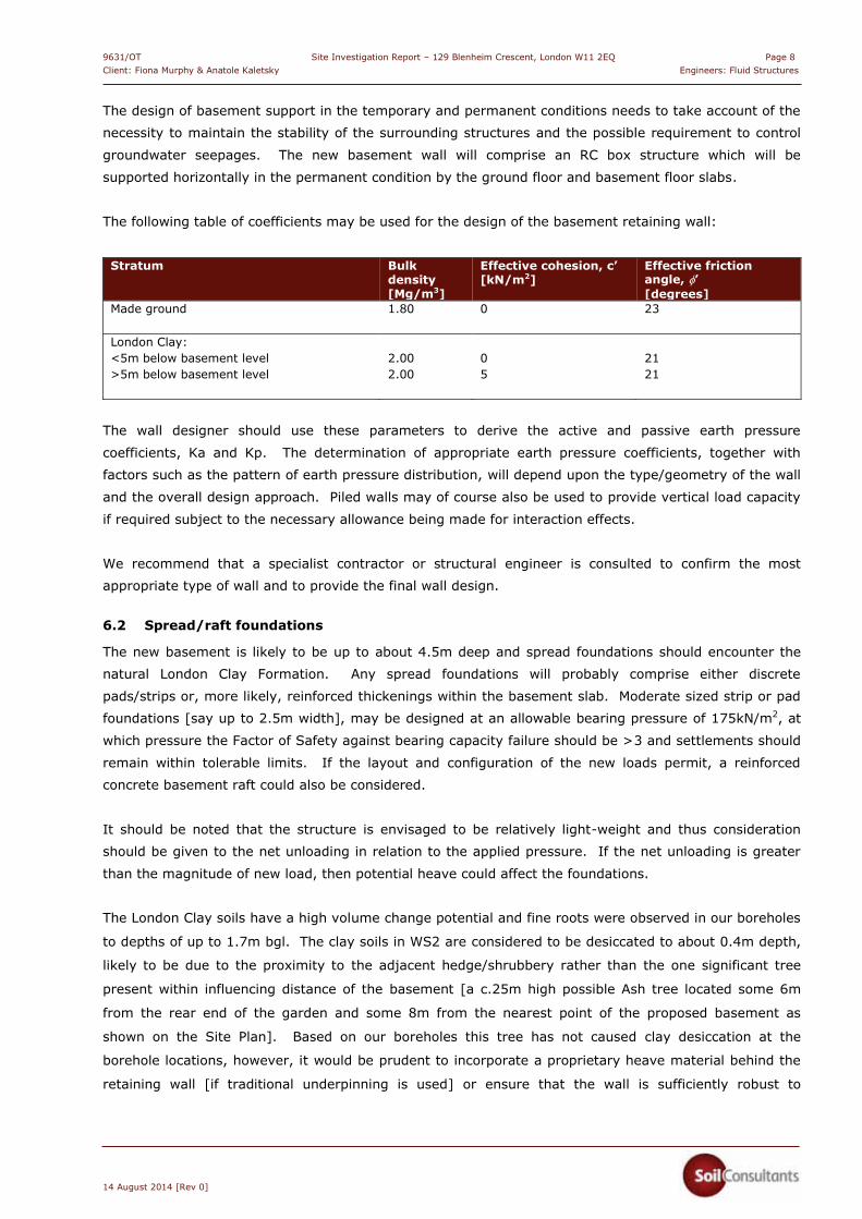
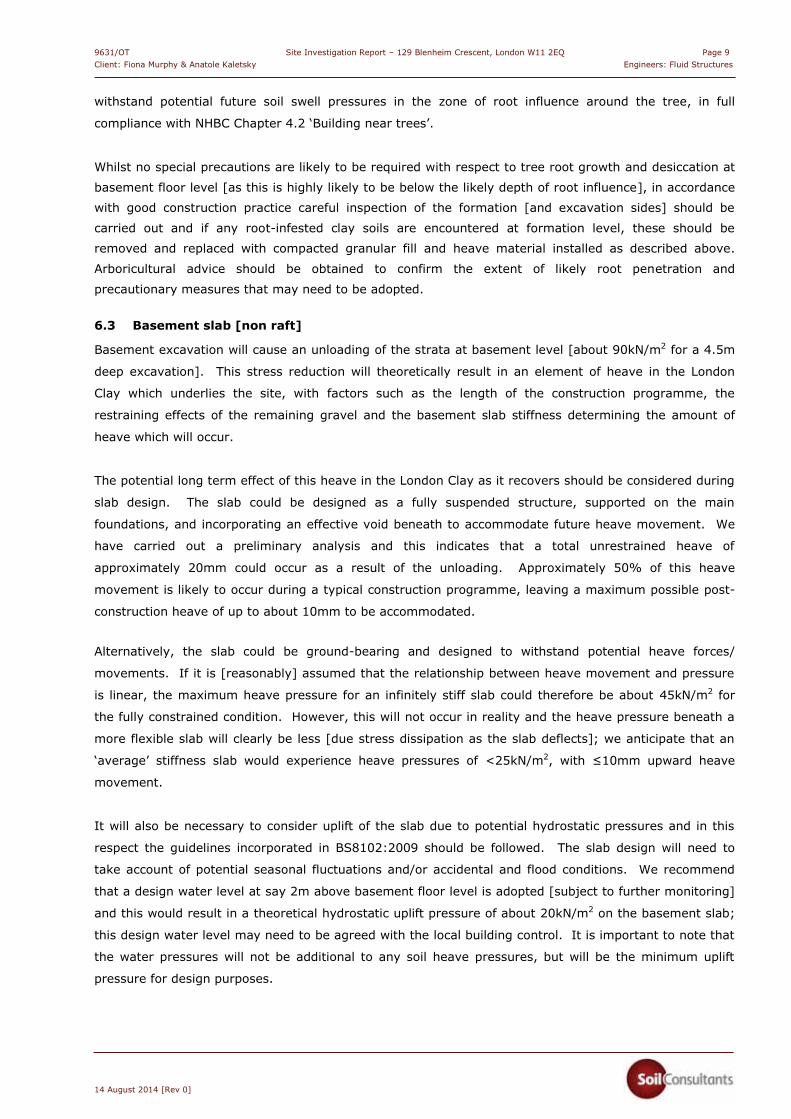
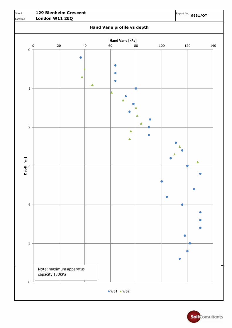
Shear strength testing [using hand shear vane] was undertaken at close intervals. The results are shown
in Appendix A and indicate a general increase in strength with increasing depth [typical of the London
Clay] with initial medium strength, below about 1.5m depth becoming high strength. Similar results are
indicated from the pocket penetrometer testing. The strength profile from the two boreholes show a
close similarity below about 1m depth; at shallower depths the strengths recorded in WS2 were
significantly lower than in WS1, which is attributed to disturbance of the shallow soils in the flower bed.
Atterberg Limit tests classify the London Clay as very high plasticity clay with a high volume change
potential [NHBC Chapter 4.2 ‘Building near trees’ classification], which are typical of this stratum.
5.3 Groundwater
Groundwater was not present in either borehole during the investigation, although water inflow was
observed in TP1 with water standing at 0.3m depth bgl. A 35mm ID standpipe installed to the base of
WS1 was dry following installation. Monitoring undertaken on 08 August 2014 showed at-rest water
depth at 3.59m bgl. We noted that an adjacent trench, excavated by the contractor along the party wall
as a continuation to TP1 [following our investigation] had standing water at 0.7m depth on 08 August.
The source of this shallow water is assessed to be shallow leakage in the neighbouring garden rather
than ‘natural’ groundwater. Seasonal variations should be anticipated, however, and longer term
monitoring of the standpipe is recommended to help establish these variations.
5.4 Environmental observations
No visual or olfactory signs of gross contamination were observed in any of the strata.
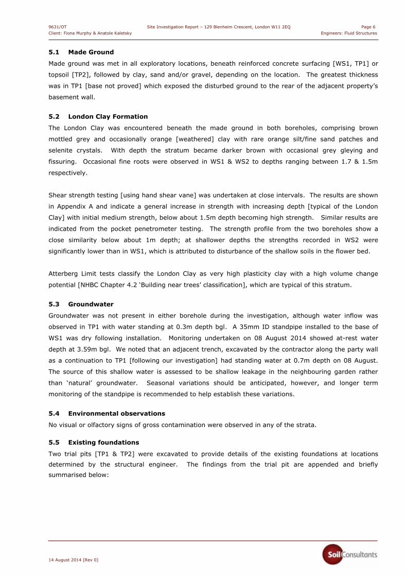
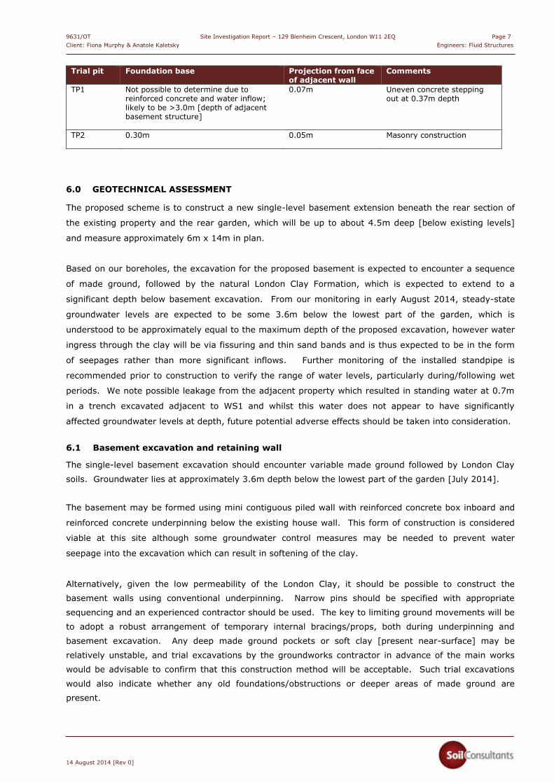
5.5 Existing foundations
Two trial pits [TP1 & TP2] were excavated to provide details of the existing foundations at locations
determined by the structural engineer. The findings from the trial pit are appended and briefly
summarised below:
9631/OT Site Investigation Report – 129 Blenheim Crescent, London W11 2EQ Page 7 Client: Fiona Murphy & Anatole Kaletsky Engineers: Fluid Structures
14 August 2014 [Rev 0]
Trial pit Foundation base
Projection from face of adjacent wall
Comments
TP1 Not possible to determine due to reinforced concrete and water inflow; likely to be >3.0m [depth of adjacent basement structure]
0.07m
Uneven concrete stepping out at 0.37m depth
TP2 0.30m
0.05m
Masonry construction
6.0 GEOTECHNICAL ASSESSMENT
The proposed scheme is to construct a new single-level basement extension beneath the rear section of
the existing property and the rear garden, which will be up to about 4.5m deep [below existing levels]
and measure approximately 6m x 14m in plan.
Based on our boreholes, the excavation for the proposed basement is expected to encounter a sequence
of made ground, followed by the natural London Clay Formation, which is expected to extend to a
significant depth below basement excavation. From our monitoring in early August 2014, steady-state
groundwater levels are expected to be some 3.6m below the lowest part of the garden, which is
understood to be approximately equal to the maximum depth of the proposed excavation, however water
ingress through the clay will be via fissuring and thin sand bands and is thus expected to be in the form
of seepages rather than more significant inflows. Further monitoring of the installed standpipe is
recommended prior to construction to verify the range of water levels, particularly during/following wet
periods. We note possible leakage from the adjacent property which resulted in standing water at 0.7m
in a trench excavated adjacent to WS1 and whilst this water does not appear to have significantly
affected groundwater levels at depth, future potential adverse effects should be taken into consideration.
6.1 Basement excavation and retaining wall
The single-level basement excavation should encounter variable made ground followed by London Clay
soils. Groundwater lies at approximately 3.6m depth below the lowest part of the garden [July 2014].
The basement may be formed using mini contiguous piled wall with reinforced concrete box inboard and
reinforced concrete underpinning below the existing house wall. This form of construction is considered
viable at this site although some groundwater control measures may be needed to prevent water
seepage into the excavation which can result in softening of the clay.
Alternatively, given the low permeability of the London Clay, it should be possible to construct the
basement walls using conventional underpinning. Narrow pins should be specified with appropriate
sequencing and an experienced contractor should be used. The key to limiting ground movements will be
to adopt a robust arrangement of temporary internal bracings/props, both during underpinning and
basement excavation. Any deep made ground pockets or soft clay [present near-surface] may be
relatively unstable, and trial excavations by the groundworks contractor in advance of the main works
would be advisable to confirm that this construction method will be acceptable. Such trial excavations
would also indicate whether any old foundations/obstructions or deeper areas of made ground are
present.
9631/OT Site Investigation Report – 129 Blenheim Crescent, London W11 2EQ Page 8 Client: Fiona Murphy & Anatole Kaletsky Engineers: Fluid Structures
14 August 2014 [Rev 0]
The design of basement support in the temporary and permanent conditions needs to take account of the
necessity to maintain the stability of the surrounding structures and the possible requirement to control
groundwater seepages. The new basement wall will comprise an RC box structure which will be
supported horizontally in the permanent condition by the ground floor and basement floor slabs.
The following table of coefficients may be used for the design of the basement retaining wall:
Stratum Bulk
density [Mg/m3]
Effective cohesion, c’ [kN/m2]
Effective friction angle, �’ [degrees]
Made ground
1.80 0 23
London Clay: <5m below basement level >5m below basement level
2.00 2.00
0 5
21 21
The wall designer should use these parameters to derive the active and passive earth pressure
coefficients, Ka and Kp. The determination of appropriate earth pressure coefficients, together with
factors such as the pattern of earth pressure distribution, will depend upon the type/geometry of the wall
and the overall design approach. Piled walls may of course also be used to provide vertical load capacity
if required subject to the necessary allowance being made for interaction effects.
We recommend that a specialist contractor or structural engineer is consulted to confirm the most
appropriate type of wall and to provide the final wall design.
6.2 Spread/raft foundations
The new basement is likely to be up to about 4.5m deep and spread foundations should encounter the
natural London Clay Formation. Any spread foundations will probably comprise either discrete
pads/strips or, more likely, reinforced thickenings within the basement slab. Moderate sized strip or pad
foundations [say up to 2.5m width], may be designed at an allowable bearing pressure of 175kN/m2, at
which pressure the Factor of Safety against bearing capacity failure should be >3 and settlements should
remain within tolerable limits. If the layout and configuration of the new loads permit, a reinforced
concrete basement raft could also be considered.
It should be noted that the structure is envisaged to be relatively light-weight and thus consideration
should be given to the net unloading in relation to the applied pressure. If the net unloading is greater
than the magnitude of new load, then potential heave could affect the foundations.
The London Clay soils have a high volume change potential and fine roots were observed in our boreholes
to depths of up to 1.7m bgl. The clay soils in WS2 are considered to be desiccated to about 0.4m depth,
likely to be due to the proximity to the adjacent hedge/shrubbery rather than the one significant tree
present within influencing distance of the basement [a c.25m high possible Ash tree located some 6m
from the rear end of the garden and some 8m from the nearest point of the proposed basement as
shown on the Site Plan]. Based on our boreholes this tree has not caused clay desiccation at the
borehole locations, however, it would be prudent to incorporate a proprietary heave material behind the
retaining wall [if traditional underpinning is used] or ensure that the wall is sufficiently robust to
9631/OT Site Investigation Report – 129 Blenheim Crescent, London W11 2EQ Page 9 Client: Fiona Murphy & Anatole Kaletsky Engineers: Fluid Structures
14 August 2014 [Rev 0]
withstand potential future soil swell pressures in the zone of root influence around the tree, in full
compliance with NHBC Chapter 4.2 ‘Building near trees’.
Whilst no special precautions are likely to be required with respect to tree root growth and desiccation at
basement floor level [as this is highly likely to be below the likely depth of root influence], in accordance
with good construction practice careful inspection of the formation [and excavation sides] should be
carried out and if any root-infested clay soils are encountered at formation level, these should be
removed and replaced with compacted granular fill and heave material installed as described above.
Arboricultural advice should be obtained to confirm the extent of likely root penetration and
precautionary measures that may need to be adopted.
6.3 Basement slab [non raft]
Basement excavation will cause an unloading of the strata at basement level [about 90kN/m2 for a 4.5m
deep excavation]. This stress reduction will theoretically result in an element of heave in the London
Clay which underlies the site, with factors such as the length of the construction programme, the
restraining effects of the remaining gravel and the basement slab stiffness determining the amount of
heave which will occur.
The potential long term effect of this heave in the London Clay as it recovers should be considered during
slab design. The slab could be designed as a fully suspended structure, supported on the main
foundations, and incorporating an effective void beneath to accommodate future heave movement. We
have carried out a preliminary analysis and this indicates that a total unrestrained heave of
approximately 20mm could occur as a result of the unloading. Approximately 50% of this heave
movement is likely to occur during a typical construction programme, leaving a maximum possible post-
construction heave of up to about 10mm to be accommodated.
Alternatively, the slab could be ground-bearing and designed to withstand potential heave forces/
movements. If it is [reasonably] assumed that the relationship between heave movement and pressure
is linear, the maximum heave pressure for an infinitely stiff slab could therefore be about 45kN/m2 for
the fully constrained condition. However, this will not occur in reality and the heave pressure beneath a
more flexible slab will clearly be less [due stress dissipation as the slab deflects]; we anticipate that an
‘average’ stiffness slab would experience heave pressures of <25kN/m2, with ≤10mm upward heave
movement.
It will also be necessary to consider uplift of the slab due to potential hydrostatic pressures and in this
respect the guidelines incorporated in BS8102:2009 should be followed. The slab design will need to
take account of potential seasonal fluctuations and/or accidental and flood conditions. We recommend
that a design water level at say 2m above basement floor level is adopted [subject to further monitoring]
and this would result in a theoretical hydrostatic uplift pressure of about 20kN/m2 on the basement slab;
this design water level may need to be agreed with the local building control. It is important to note that
the water pressures will not be additional to any soil heave pressures, but will be the minimum uplift
pressure for design purposes.
9631/OT Site Investigation Report – 129 Blenheim Crescent, London W11 2EQ Page 10 Client: Fiona Murphy & Anatole Kaletsky Engineers: Fluid Structures
14 August 2014 [Rev 0]
We recommend that a specialist contractor is consulted to confirm the most appropriate type of retaining
wall and to provide the final wall design.
6.4 Foundation Concrete
Concentrations of soluble sulphates and pH values were measured on a number of soil samples; the
results are given in Appendix A. Overall, a Design Sulphate Class DS-4 [Table C1 given in BRE Special
Digest 1:2005, 3rd Edition, ‘Concrete in aggressive ground’] is considered to be applicable for the site.
We assess the site to have static groundwater conditions. Our recommendation is therefore that buried
concrete should be designed in accordance with ACEC Site Class AC-3s.
7.0 BASEMENT IMPACT ASSESSMENT – LAND STABILITY
This section of the report assesses the potential impact relating to the proposed subterranean
development in terms of ‘Land Stability’ as required by The Royal Borough of Kensington and Chelsea
planning guidance ‘Subterranean Development, Supplementary Planning Document – Adopted May
2009, Local Development Framework’ Section and by PPG 14 [1990].
The hydrological/hydrogeological aspects of the basement impact assessment [screening and scoping
report Ref. 2014-003-005-001, dated August 2014] was undertaken by a specialist hydrogeologist
[Stephen Buss – Environmental Consulting Ltd] and is presented as Appendix C.
7.1 Stage 1 - Screening
The proposed development involves excavating to a depth of about 4.5m below ground level, to construct
a basement with an area of approximately 85m2 below the rear section of the property and the majority
of the rear garden. The ground investigation reported above provides site-specific information on the
ground and groundwater conditions at this site to allow this assessment to be made.
RBKC guidance ‘Subterranean Development, Supplementary Planning Document – Adopted May 2009,
Local Development Framework’ Section 6 details the requirements of RBKC in terms of construction
method statements [CMS]. The following section addresses the key geological/land stability issues upon
which the CMS [reported separately by the Engineer] needs to be based. This ‘Land Stability’ screening
provided below is generally based on the comprehensive guidance of the London Borough of Camden for
basement impact assessments [Arup 2010, Camden Borough Council, 2011 – CPG4]. Key hydrological
and hydrogeological issues have been addressed in a separate report [see Appendix C] which should be
read in conjunction with this report.
The purpose of the screening stage is to determine whether a full Basement Impact Assessment is
required and CPG4 provides flowcharts for each of the three disciplines [Groundwater Flow, Land Stability
and Surface Flow/Flooding] for this purpose, identifying a series of questions. An answer of ‘Yes’ or
‘Unknown’ will require progression to Stage 2 of the CPG4 categories. Answers of ‘No’ indicate that no
further investigation is generally required - these answers require written justification. The purpose of
this section is to present the screening stage for the Land Stability discipline.
9631/OT Site Investigation Report – 129 Blenheim Crescent, London W11 2EQ Page 11 Client: Fiona Murphy & Anatole Kaletsky Engineers: Fluid Structures
14 August 2014 [Rev 0]
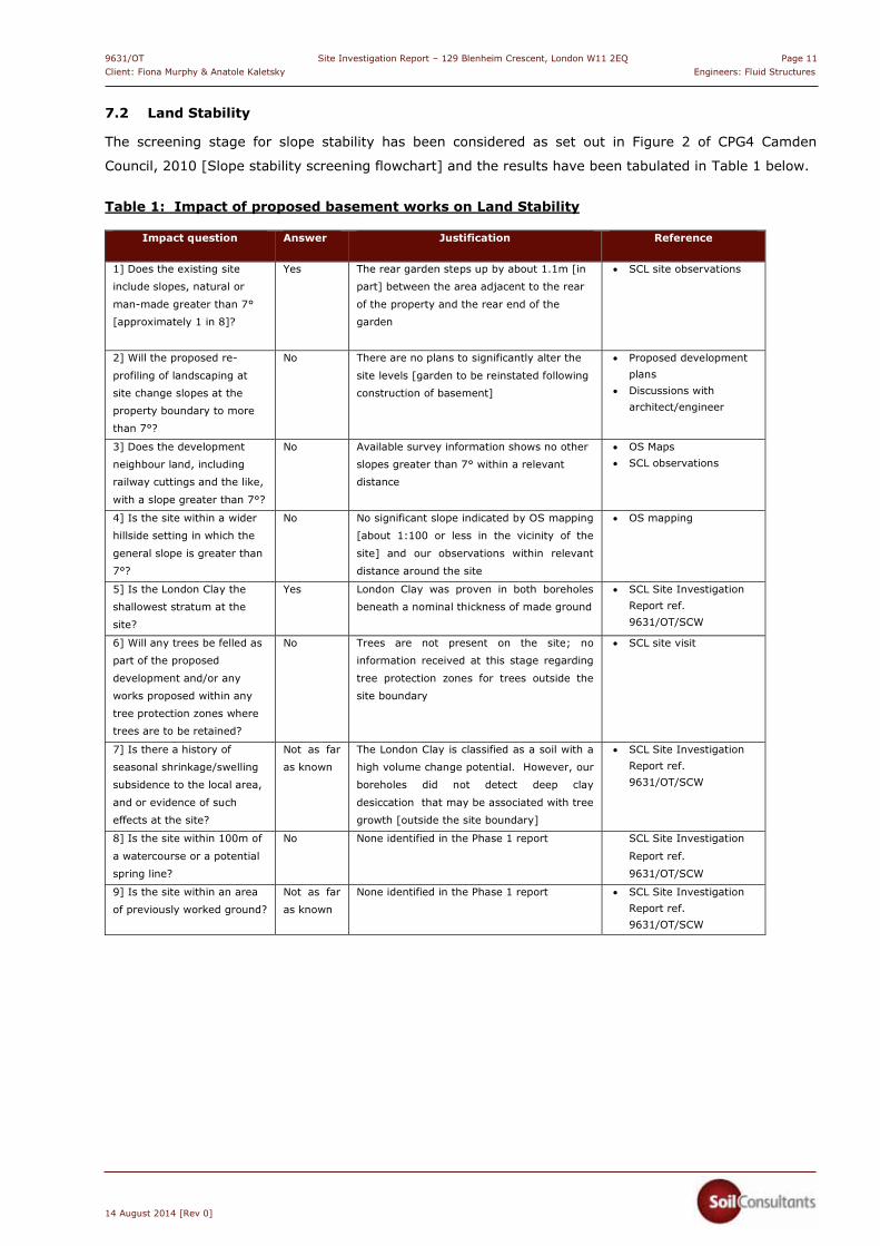
7.2 Land Stability
The screening stage for slope stability has been considered as set out in Figure 2 of CPG4 Camden
Council, 2010 [Slope stability screening flowchart] and the results have been tabulated in Table 1 below.
Table 1: Impact of proposed basement works on Land Stability
Impact question Answer Justification Reference
1] Does the existing site
include slopes, natural or
man-made greater than 7°
[approximately 1 in 8]?
Yes The rear garden steps up by about 1.1m [in
part] between the area adjacent to the rear
of the property and the rear end of the
garden
� SCL site observations
2] Will the proposed re-
profiling of landscaping at
site change slopes at the
property boundary to more
than 7°?
No There are no plans to significantly alter the
site levels [garden to be reinstated following
construction of basement]
� Proposed development plans
� Discussions with architect/engineer
3] Does the development
neighbour land, including
railway cuttings and the like,
with a slope greater than 7°?
No Available survey information shows no other
slopes greater than 7° within a relevant
distance
� OS Maps � SCL observations
4] Is the site within a wider
hillside setting in which the
general slope is greater than
7°?
No No significant slope indicated by OS mapping
[about 1:100 or less in the vicinity of the
site] and our observations within relevant
distance around the site
� OS mapping
5] Is the London Clay the
shallowest stratum at the
site?
Yes London Clay was proven in both boreholes
beneath a nominal thickness of made ground
� SCL Site Investigation Report ref. 9631/OT/SCW
6] Will any trees be felled as
part of the proposed
development and/or any
works proposed within any
tree protection zones where
trees are to be retained?
No Trees are not present on the site; no
information received at this stage regarding
tree protection zones for trees outside the
site boundary
� SCL site visit
7] Is there a history of
seasonal shrinkage/swelling
subsidence to the local area,
and or evidence of such
effects at the site?
Not as far
as known
The London Clay is classified as a soil with a
high volume change potential. However, our
boreholes did not detect deep clay
desiccation that may be associated with tree
growth [outside the site boundary]
� SCL Site Investigation Report ref. 9631/OT/SCW
8] Is the site within 100m of
a watercourse or a potential
spring line?
No None identified in the Phase 1 report SCL Site Investigation
Report ref.
9631/OT/SCW
9] Is the site within an area
of previously worked ground?
Not as far
as known
None identified in the Phase 1 report � SCL Site Investigation Report ref. 9631/OT/SCW

9631/OT Site Investigation Report – 129 Blenheim Crescent, London W11 2EQ Page 12Client: Fiona Murphy & Anatole Kaletsky Engineers: Fluid Structures
14 August 2014 [Rev 0]
Impact question Answer Justification Reference
10] Is the site within an
aquifer? If so; will the
proposed basement extend
beneath the water table such
that dewatering may be
required during construction?
No The London Clay is classified as an
unproductive aquifer
A standpipe installed during the SCL
investigation was monitored in early August
2014 [WS1, located in the lowest part of the
garden] with water recorded at 3.59m bgl.
Some groundwater control measures may be
required during basement construction
[depending on final excavation depths and
water levels at the time of construction].
Seasonal variations should also be expected
Significant dewatering highly unlikely to be
necessary
� SCL Site Investigation Report ref. 9631/OT/SCW
11] Is the site within 50m of
any Ponds?
No No records within 250m SCL Site Investigation
Report ref.
9631/OT/SCW
12] Is the site within 5m of a
highway or pedestrian right
of way?
No The proposed basement is in the rear part of
the plot
� Proposed development plans/information from the engineers
13] Will the proposed
basement significantly
increase the differential
depth of foundations relative
to neighbouring properties?
Yes Basement retaining walls will extend below
founding levels of the property to the south,
however the property/rear garden to the
north is thought to already contain a
basement - the new basement would have a
similar depth
Carefully-designed and constructed
underpinning or other form of retaining
structure will be essential to ensure that no
adverse effects occur due to the construction
The movement expected from a properly
constructed and supported wall should be
relatively small
� Proposed development plans/information from the engineers
14] Is the site over [or
within] the exclusion zone of
any tunnels, e.g. railway
lines?
No None known to exist within relevant distance
of the site
� None identified in the Phase 1 report
� Internet mapping
Responses of note are as follows:
Question 1 [Does the existing site include slopes, natural or man-made greater than 7°
(approximately 1 in 8)?] is answered ‘yes’ as the rear garden is rises up by about 1.1m [to the SE];
the change in elevation is retained by a series of steps. This and the majority of the rear garden will
be largely excavated as part of the construction.
Question 7 [Shrink/swell] is answered ‘Unknown’. The London Clay is the shallowest strata present,
beneath the made ground; the absence of any trees on-site and our boreholes [which did not detect
deep clay desiccation that may be associated with tree growth outside the site boundary] would
suggest that related shrink/swell concerns should not be a major issue and the answer would likely
be ‘No’.

9631/OT Site Investigation Report – 129 Blenheim Crescent, London W11 2EQ Page 13Client: Fiona Murphy & Anatole Kaletsky Engineers: Fluid Structures
14 August 2014 [Rev 0]
Question 13 [Will the proposed basement significantly increase the differential depth of foundations
relative to neighbouring properties?] is answered ‘Yes’ - carefully-designed and constructed
underpinning / retaining structure will be essential to ensure that no adverse effects occur due to the
construction; the movement expected from a properly constructed and supported wall should be
relatively small.
7.3 Stage 2 - Scoping
The purpose of Stage 2 is to assess the potential impacts of the proposed scheme that Stage 1 has
indicated require further consideration.
These are addressed below for each of the relevant disciplines.
7.4 Land Stability
As identified in Table 1 the slopes within influential distance of the site are all shallow [<7 °] and no
significant impact is anticipated on sloping ground in terms of land stability provided that the design and
construction of the scheme ensure that temporary or permanent slopes within the site are supported or
battered back to ensure that instability is avoided and ground movements are kept to an absolute
minimum.
Soil volume change [Question 7] is unlikely to be a significant issue as there are no nearby trees and the
new founding depth for the proposed basement will be about 3.5m to 4.5m below ground level [hence
well below the influence of any current vegetation].
The differential depth of the proposed foundations in relation to neighbouring properties
[Question 13] is such that underpinning of party wall foundations [to the south of the site] will be
required whilst the presence of a basement to the north means that this part of the excavation is unlikely
to require underpinning.
7.5 Conclusions
From the available information we consider that the risk to ground stability from this development should
be LOW. This is on the condition that the works are undertaken by reputable experienced specialists and
the temporary and permanent works are adequately designed, with due consideration to the geology and
hydrogeology of the site and surrounding areas.
8.0 ENVIRONMENTAL APPRAISAL
This appraisal adopts the current UK practice which uses the Source-Pathway-Receptor methodology to
assess contamination risks. For a site to be designated as contaminated a plausible linkage between any
identified sources and receptors must be identified, i.e. whether significant pollution linkages [SPLs] are
present. In considering the potential for contamination to cause a significant effect, the extent and
nature of the potential source are assessed and pathways/receptors identified; without an SPL there is
9631/OT Site Investigation Report – 129 Blenheim Crescent, London W11 2EQ Page 14 Client: Fiona Murphy & Anatole Kaletsky Engineers: Fluid Structures
14 August 2014 [Rev 0]
theoretically no risk to the receptors from contamination. The assessed risks to the various potential
receptors are summarised in the tabulated Conceptual Site Model which forms Section 8.6 of this report.
8.1 Environmental setting and context
The Site is underlain by an unproductive bedrock aquifer, it is not located in a source protection zone or a
flood zone or environmentally-sensitive area. There are no water abstractions or surface water features
nearby. Overall, the site is assessed as being of Low Environmental Sensitivity.
8.2 Potential contamination sources [on-site and off-site]
The Phase 1 [Desk Study] has not indicated any manufacturing/industrial usage at the site or in close
proximity with the vast majority of use appearing to be residential/community buildings. Kensington
Park Brewery was historically located about 90m distance, an unspecified historical tank some 50m
distance and a ‘Brick Field’ some 230m distance; all have since been redeveloped.
From our walkover survey of the site no significant sources of potential contamination have been noted
within the site or its immediate surroundings.
Overall, based on the available information, we consider there to be a Low risk potential with regard to
contaminative sources which could affect the site.
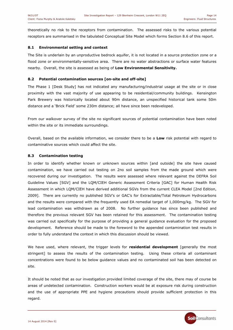
8.3 Contamination testing
In order to identify whether known or unknown sources within [and outside] the site have caused
contamination, we have carried out testing on 2no soil samples from the made ground which were
recovered during our investigation. The results were assessed where relevant against the DEFRA Soil
Guideline Values [SGV] and the LQM/CIEH Generic Assessment Criteria [GAC] for Human Health Risk
Assessment in which LQM/CIEH have derived additional SGVs from the current CLEA Model [2nd Edition,
2009]. There are currently no published SGV’s or GAC’s for Extractable/Total Petroleum Hydrocarbons
and the results were compared with the frequently used EA remedial target of 1,000mg/kg. The SGV for
lead contamination was withdrawn as of 2008. No further guidance has since been published and
therefore the previous relevant SGV has been retained for this assessment. The contamination testing
was carried out specifically for the purpose of providing a general guidance evaluation for the proposed
development. Reference should be made to the foreword to the appended contamination test results in
order to fully understand the context in which this discussion should be viewed.
We have used, where relevant, the trigger levels for residential development [generally the most
stringent] to assess the results of the contamination testing. Using these criteria all contaminant
concentrations were found to be below guidance values and no contaminated soil has been detected on
site.
It should be noted that as our investigation provided limited coverage of the site, there may of course be
areas of undetected contamination. Construction workers would be at exposure risk during construction
and the use of appropriate PPE and hygiene precautions should provide sufficient protection in this
regard.
9631/OT Site Investigation Report – 129 Blenheim Crescent, London W11 2EQ Page 15Client: Fiona Murphy & Anatole Kaletsky Engineers: Fluid Structures
14 August 2014 [Rev 0]
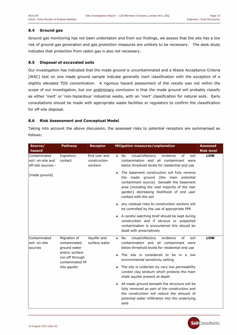
8.4 Ground gas
Ground gas monitoring has not been undertaken and from our findings, we assess that the site has a low
risk of ground gas generation and gas protection measures are unlikely to be necessary. The desk study
indicates that protection from radon gas is also not necessary.
8.5 Disposal of excavated soils
Our investigation has indicated that the made ground is uncontaminated and a Waste Acceptance Criteria
[WAC] test on one made ground sample indicate generally inert classification with the exception of a
slightly elevated TDS concentration. A rigorous hazard assessment of the results was not within the
scope of our investigation, but our preliminary conclusion is that the made ground will probably classify
as either ‘inert’ or ‘non-hazardous’ industrial waste, with an ‘inert’ classification for natural soils. Early
consultations should be made with appropriate waste facilities or regulators to confirm the classification
for off-site disposal.
8.6 Risk Assessment and Conceptual Model
Taking into account the above discussion, the assessed risks to potential receptors are summarised as
follows:
Source/ hazard
Pathway Receptor Mitigation measures/explanation Assessed Risk level
Contaminated soil: on-site and off-site sources - [made ground]
Ingestion/ contact
End user and construction workers
No visual/olfactory evidence of soil contamination and all contaminant were below threshold levels for residential end use
The basement construction will fully remove the made ground [the main potential contaminant source] beneath the basement area [including the vast majority of the rear garden] decreasing likelihood of end user contact with the soil
any residual risks to construction workers will be controlled by the use of appropriate PPE
A careful watching brief should be kept during construction and if obvious or suspected contamination is encountered this should be dealt with prescriptively
LOW
Contaminated soil: on-site sources
Migration of contaminated ground water and/or surface run-off through contaminated fill into aquifer
Aquifer and surface water
No visual/olfactory evidence of soil contamination and all contaminant were below threshold levels for residential end use
The site is considered to be in a low environmental sensitivity setting
The site is underlain by very low permeability London clay stratum which protects the main chalk aquifer present at depth
All made ground beneath the structure will be fully removed as part of the construction and the construction will reduce the amount of potential water infiltration into the underlying soils
LOW
9631/OT Site Investigation Report – 129 Blenheim Crescent, London W11 2EQ Page 16Client: Fiona Murphy & Anatole Kaletsky Engineers: Fluid Structures
14 August 2014 [Rev 0]
Source/ hazard
Pathway Receptor Mitigation measures/explanation Assessed Risk level
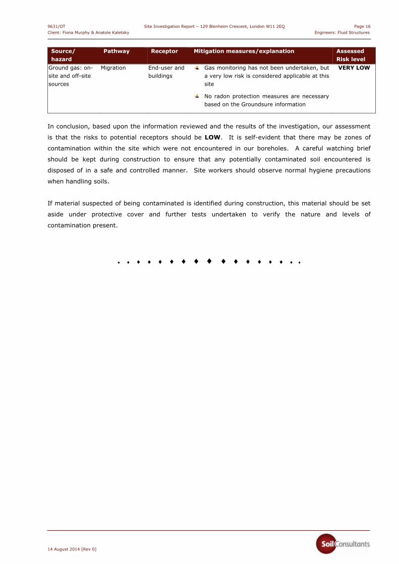
Ground gas: on-site and off-site sources
Migration End-user and buildings
Gas monitoring has not been undertaken, but a very low risk is considered applicable at this site
No radon protection measures are necessary based on the Groundsure information
VERY LOW
In conclusion, based upon the information reviewed and the results of the investigation, our assessment
is that the risks to potential receptors should be LOW. It is self-evident that there may be zones of
contamination within the site which were not encountered in our boreholes. A careful watching brief
should be kept during construction to ensure that any potentially contaminated soil encountered is
disposed of in a safe and controlled manner. Site workers should observe normal hygiene precautions
when handling soils.
If material suspected of being contaminated is identified during construction, this material should be set
aside under protective cover and further tests undertaken to verify the nature and levels of
contamination present.
� � � � � � � � � � � � � � � � �
9631/OT Site Investigation Report – 129 Blenheim Crescent, London W11 2EQ Page 1 Client: Fiona Murphy & Anatole Kaletsky Engineers: Fluid Structures
14 August 2014 [Rev 0]
GENERAL INFORMATION, LIMITATIONS AND EXCEPTIONS
Unless otherwise stated, our Report should be construed as being a Ground Investigation Report [GIR] as defined in BS EN1997-2. Our Report is not intended to be and should not be viewed or treated as a Geotechnical Design Report [GDR] as defined in EN1997-2. Any ‘design’ recommendations which are provided are for guidance only and are intended to allow the designer to assess the results and implications of our investigation/testing and to permit preliminary design of relevant elements of the proposed scheme.
The methods of investigation used have been chosen taking into account the constraints of the site including but not limited to access and space limitations. Where it has not been possible to reasonably use an EC7 compliant investigation technique we have adopted a practical technique to obtain indicative soil parameters and any interpretation is based upon our engineering experience and relevant published information.
The Report is issued on the condition that Soil Consultants Ltd will under no circumstances be liable for any loss arising directly or indirectly from ground conditions between the exploratory points which differ from those identified during our investigation. In addition Soil Consultants Ltd will not be liable for any loss arising directly or indirectly from any opinion given on the possible configuration of strata both between the exploratory points and/or below the maximum depth of the investigation; such opinions, where given, are for guidance only and no liability can be accepted as to their accuracy. The results of any measurements taken may vary spatially or with time and further confirmatory measurements should be made after any significant delay in using this Report.
Comments made relating to ground-water or ground-gas are based upon observations made during our investigation unless otherwise stated. Ground-water and ground-gas conditions may vary with time from those reported due to factors such as seasonal effects, atmospheric effects and and/or tidal conditions. We recommend that if monitoring installations have been included as part of our investigation, continued monitoring should be carried out to maximise the information gained.
Specific geotechnical features/hazards such as [but not limited to] areas of root-related desiccation and dissolution features in chalk/soluble rock can exist in discrete localised areas - there can be no certainty that any or all of such features/hazards have been located, sampled or identified. Where a risk is identified the designer should provide appropriate contingencies to mitigate the risk through additional exploratory work and/or an engineered solution.
Where a specific risk of ground dissolution features has been identified in our Report [anything above a ‘low’ risk rating], reference should be made to the local building control to establish whether there are any specific local requirements for foundation design and appropriate allowances should be incorporated into the design. If such a risk assessment was not within the scope of our investigation and where it is deemed that the ground sequence may give rise to such a risk [for example near-surface chalk strata] it is recommended that an appropriate assessment should be undertaken prior to design of foundations.
Where spread foundations are used, we recommend that all excavations are inspected and approved by suitably experienced personnel; appropriate inspection records should be kept. This should also apply to any structures which are in direct contact with the soil where the soil could have a detrimental effect on performance or integrity of the structure.
Ground contamination often exists in small discrete areas - there can be no certainty that any or all such areas have been located, sampled or identified.
The findings and opinions conveyed in this Report may be based on information from a variety of sources such as previous desk studies, investigations or chemical analyses. Soil Consultants Limited cannot and does not provide any guarantee as to the authenticity, accuracy or reliability of such information from third parties; such information has not been independently verified unless stated in our Report.
Our Report is written in the context of an agreed scope of work between Soil Consultants Ltd and the Client and should not be used in any different context. In light of additional information becoming available, improved practices and changes in legislation, amendment or re-interpretation of the assessment or the Report in part or in whole may be necessary after its original publication.
Unless otherwise stated our investigation does not include an arboricultural survey, asbestos survey, ecological survey or flood risk assessment and these should be deemed to be outside the scope of our investigation.

9631/OT Site Investigation Report – 129 Blenheim Crescent, London W11 2EQ Page 2Client: Fiona Murphy & Anatole Kaletsky Engineers: Fluid Structures
14 August 2014 [Rev 0]
APPENDIX A
Fieldwork, in-situ testing and monitoring
Window sample borehole records Hand vane profile vs depth Hand penetrometer profile vs depth
Laboratory testing and monitoring Natural moisture content and index property testing Plasticity Charts Groundwater monitoring results
Contamination and sulphate/pH testing [QTS Environmental] General soil suite [including soluble sulphate/pH results]
Plans, drawings & photographs Site Plan Location Map
������������
����������� ������
�������������������� ���
������ ������������� ������!�����"� ���������� ����������� ������� �����������
�������� �������������������� �������� ����!� "�#���� $%&��'(
)�* �+�,�+�������-������,����.�/�,��!����������-����0�,�0��������,�������1�����#��������-��2(���,��#�����#����2(���,���������34�,�3����4����5.2�6��
22�,�2.���2�����!�����5.��!�6��27/�,�2���7��������/������5##! 6� ��������*#� 0���8���!#���
"�!��.�� 9 ������������8���##�:�!������*;��������� ������� ����-�� ��������
���5<�,�������2(�#����������������� ���9�������!!��*������6��
2���������'-��� �����
�������������� �� ����
��!#������(����
(*#� /�#���!�
=����(���
"������
������
/�#���!�
����
����
�� ���!�
������ �������/����#���
��������������������������� ��!�����"��#���$%&'(%)'��(�'#�)�!����"��� � �������)��'))*���$$%���&��+��� )��(��*�,-�.�+� /����'$��')�(��*�()�*�(�'�$�)�� ����*$ ')$���'�����'(��$�) $'�)�$�$�
����������� �������������� �����
�������������� ������������������ ������������� ���������
��������������������� ��������� ��!"�#$�
,� �%�����0 �$/��
��.������7����������
�
�
1
�
�
23 ���� 1�� ����
44 ���� ���23 ���� 5�44 ���� ��6� ����
23 ��5� 5�44 ��5� ��6
23 ��7� 5�� ��7�
44 ��7� ��623 ���� 7�44 ���� ��6� ����
23 ���� ��44 ���� ���
� ����44 ���� ���23 ���� �744 ��5� ���23 ��5� ��� ����
23 ��7� 6�44 ��7� ��7
44 ���� ��723 ���� 6�� ����
44 ���� ���23 ���� 6�� ��1�
44 ���� ���23 ���� ���
23 ��5� ��5� ��5�
44 ��5� 1��44 ��7� 1��23 ��7� ���� ��6�
44 1��� 1��23 1��� ���
� 1���44 1��� 1��23 1���23 1��� ���44 1��� ��7� 1���
23 1�5� ���44 1�5� ��6
� 1�7�44 1�7� 1��23 1�7� ���23 ���� ��544 ���� 1�6
� ����23 ����44 ���� ���44 ���� ��123 ����
23 ��5�� ��5�
44 ��5� ��123 ��7� ��744 ��7� 1��
� ����
������������
����������� ������
�������������������� ���
������ ������������� ������!�����"� ���������� ����������� ������� �����������
�������� �������������������� �������� ����!� "�#���� $%&��'(
)�* �+�,�+�������-������,����.�/�,��!����������-����0�,�0��������,�������1�����#��������-��2(���,��#�����#����2(���,���������34�,�3����4����5.2�6��
22�,�2.���2�����!�����5.��!�6��27/�,�2���7��������/������5##! 6� ��������*#� 0���8���!#���
"�!��.�� 9 ������������8���##�:�!������*;��������� ������� ����-�� ��������
���5<�,�������2(�#����������������� ���9�������!!��*������6��
2���������'-��� �����
������8)� ����� �� ��������8 /��������' ����8 /����*
��!#������(����
(*#� /�#���!�
=����(���
"������
������
/�#���!�
����
�� ���!�
������ �������/����#���
� ����'�9�&��+�,-�.�+� /��'���(��*�()�*�(
�����&���/�)��' �������
��.������7����������
5
�
7
6
��
44 ���� 1��23 ���� ���
44 ���� ���23 ���� ���
23 ���� ���44 ���� 1�7
������������
����������� ������
�������������������� ���
������ ������������� ������!�����"� ���������� ����������� �������� �����������
�������� �������������������� ������������� � !�"���� #$%��&'
(�) �*�+�*�������,������+����-�.�+�� ����������,����/�+�/��������+�������0�����"��������,��1'���+��"�����"����1'���+���������23�+�2����3����4-1�5��
11�+�1-���1����� �����4-�� 65��17.�+�1���7��������.������4"" �5� ��������)"� /���8��� "���
!� ��-�� 9 ������������8���""�:� ������);����������������������,�� ��������
���4<�+�������1'�"���������������������9������� ��)������5��
1���������&,���������
�������������� �� ����
��������������� �� ���������������������������������
�� "������'����
')"� .�"��� �
=����'���!������
������
.�"��� �
����
����
������ �
������ �������.����"���
������ !"#������$�%��&%�������$%����'�%�(�������(�)��*��
��+�����+%���'��&�,-�.�&%���)����������$/�����$%�������)�������%)/�$���%������$���$���$�����)����������)��$����$�$�����$%��������������0������
�������������� �� �������������������������������� �����������������������������
���������� ��������������������
���+�'�����������������
��-������7����������
�
�
�
�
1
� ����
22 ���� ��3� ����45 ����45 ��1� ��22 ��1� ���� ��3�45 ���� �622 ���� ���
45 ��7� �322 ��7� ���� ��7�45 ���� 3�22 ���� ���� ����22 ���� ��745 ���� ��
22 ��1� ��145 ��1� 6�� ��1�45 ���� 6�22 ���� ��6� ��6�22 ��7� ��145 ��7� 6�
� ����22 ���� ���45 ���� �322 ���� ���45 ���� �1� ����45 ��1� ���22 ��1� ���
� ����22 ���� ��745 ���� ���22 ��7� ��645 ��7� ��6� ����
Site Location 129 Blenheim Crescent, London W11 2EQ
Trial Pit No:
TP1
Client: Engineer:
Fiona Murphy & Anatole Kaletsky Fluid Structures
Report No:
9631/OT
D = small disturbed sample, B = bulk sample, HV = hand shear vane test [kPa], pp = pocket penetrometer [kg/cm2]
Date: 22 July 2014 Groundwater details Samples
Equipment: Hand excavated • Moderate inflow at 0.3m 0.5m D
Stability: Stable
Remarks: Left open to allow for further excavation by builder Logged by: OT
PHOTOGRAPHS OF TRIAL PIT
Concrete base not reached
Outline of excavation
CROSS SECTION A-A:
MADE GROUND: pale grey/ brown sand and brown clay
Concrete [reinforced] GL
Garden boundary wall
0.85m
Base probed – hard/dense ground and water ingress prevented further excavation
0.15m
0.30m 0.37m
0.22m
Concrete
1.07m
Approx 70mm protrusion from line of wall
Site Location 129 Blenheim Crescent, London W11 2EQ
Trial Pit No:
TP2
Client: Engineer:
Fiona Murphy & Anatole Kaletsky Fluid Structures
Report No:
9631/OT
D = small disturbed sample, B = bulk sample, HV = hand shear vane test [kPa], pp = pocket penetrometer [kg/cm2]
Date: 22 July 2014 Groundwater details Samples
Equipment: Hand excavated • None encountered 0.20M D
Stability: Stable
Remarks: Backfilled with compacted arisings Logged by: OT
PHOTOGRAPHS OF TRIAL PIT
Outline of excavation
CROSS SECTION A-A:
MADE GROUND: topsoil and clay, very soft below 0.30m
Paving
Probed
Plastic drainage pipe
0.32m
GL
Topsoil
0.18m
0.30m
0.20m
Flowerbed
Probed
Approx 50mm protrusion from line of wall
Garden/boundary wall
Masonry
Masonry
Site & Report No:
Location
129 Blenheim Crescent9631/OT
London W11 2EQ
Hand Vane profile vs depth
0
1
2
3
4
5
6
0 20 40 60 80 100 120 140
Dep
th [
m]
Hand Vane [kPa]
WS1 WS2
Note: maximum apparatus capacity 130kPa
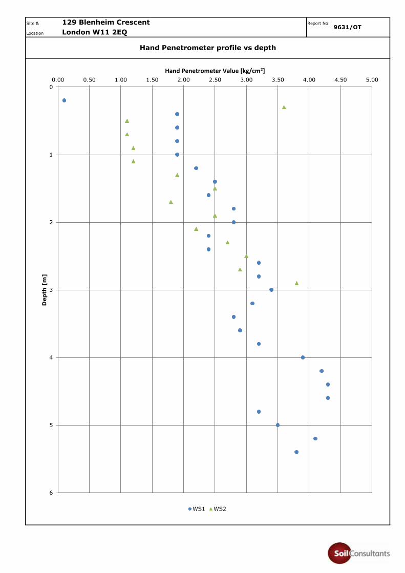
Site & Report No:
Location
129 Blenheim Crescent9631/OT
London W11 2EQ
Hand Penetrometer profile vs depth
0
1
2
3
4
5
6
0.00 0.50 1.00 1.50 2.00 2.50 3.00 3.50 4.00 4.50 5.00
Dep
th [
m]
Hand Penetrometer Value [kg/cm2]
WS1 WS2

Site & Report
Location No:
SUMMARY OF CLASSIFICATION TEST RESULTS
BH ID Depth (m)
Type w (%)
wL (%)
wP (%)
Pass 425 (%)
IP (%)
Mod IP
(%)
IL (%)
LOI (%)
WS1 0.50 D 28
WS1 0.80 D 29
WS1 1.10 D 31 74 21 >95 53 0.19
WS1 1.40 D 29
WS1 1.70 D 30
WS1 2.00 D 30
WS1 2.30 D 28 76 21 >95 55 0.13
WS1 2.60 D 28
WS1 2.90 D 27
WS1 3.20 D 27
WS1 3.50 D 28 75 25 >95 50 0.06
WS1 3.80 D 29
WS1 4.20 D 26
WS1 4.60 D 29
WS1 5.00 D 29 77 23 >95 54 0.11
WS2 0.30 D 24
WS2 0.60 D 34
WS2 0.90 D 28 74 18 >95 56 0.18
WS2 1.20 D 25
Testing in accordance with BS EN ISO 17892 unless specified otherwise Date: 12 Aug 14
Modified Plasticity Index calculated in accordance with NHBC Standards Chapter 4.2 (reported if %passing 425mm <95%)
Percent passing 425�m: by estimation, by hand* or by sieving**
Brown mottled grey CLAY
129 Blenheim Crescent9631/OT
London W11 2EQ
Description
Brown mottled grey CLAY
Brown mottled grey CLAY
Brown mottled grey CLAY
Brown mottled grey CLAY
Brown mottled grey CLAY
Brown mottled grey CLAY
Brown mottled grey CLAY
(Classification Sheet 1 of 2)
Brown mottled grey CLAY
Brown mottled grey CLAY
Brown mottled grey CLAY
Brown mottled grey CLAY
Brown mottled grey CLAY
Brown mottled grey CLAY
Dark brown CLAY
Brown CLAY with grey patches [DESICCATED]
Brown CLAY with grey patches
Brown CLAY with grey patches
Brown CLAY with grey patches
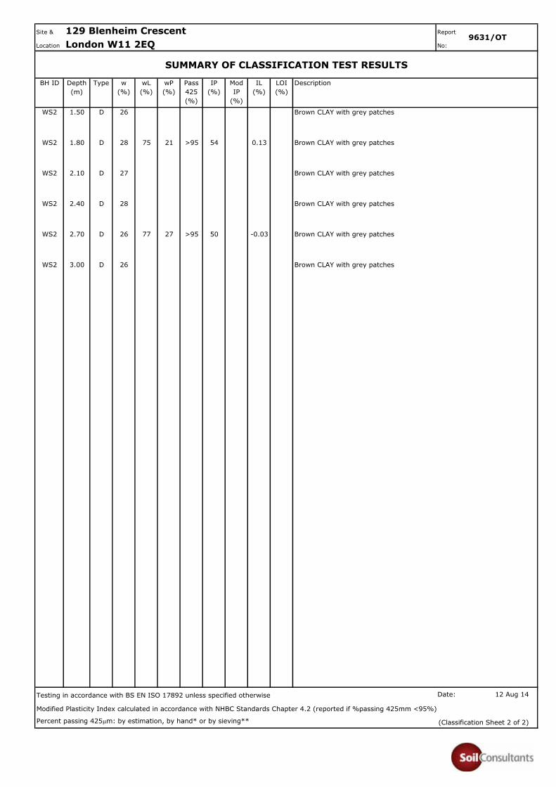
Site & Report
Location No:
SUMMARY OF CLASSIFICATION TEST RESULTS
BH ID Depth (m)
Type w (%)
wL (%)
wP (%)
Pass 425 (%)
IP (%)
Mod IP
(%)
IL (%)
LOI (%)
WS2 1.50 D 26
WS2 1.80 D 28 75 21 >95 54 0.13
WS2 2.10 D 27
WS2 2.40 D 28
WS2 2.70 D 26 77 27 >95 50 -0.03
WS2 3.00 D 26
Testing in accordance with BS EN ISO 17892 unless specified otherwise Date: 12 Aug 14
Modified Plasticity Index calculated in accordance with NHBC Standards Chapter 4.2 (reported if %passing 425mm <95%)
Percent passing 425�m: by estimation, by hand* or by sieving**
129 Blenheim Crescent9631/OT
London W11 2EQ
Description
Brown CLAY with grey patches
Brown CLAY with grey patches
Brown CLAY with grey patches
Brown CLAY with grey patches
Brown CLAY with grey patches
Brown CLAY with grey patches
(Classification Sheet 2 of 2)

Site & Report No:
Location
129 Blenheim Crescent9631/OT
London W11 2EQ
Natural Moisture Content and Index Properties vs depth
0.00
1.00
2.00
3.00
4.00
5.00
6.000 10 20 30 40 50 60 70 80 90
Dep
th [
mb
gl]
Moisture content [%]
NMC Liquid Limit Plastic Limit
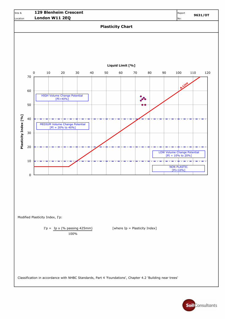
Site & Report
Location No:
Modified Plasticity Index, I'p:
I'p = Ip x (% passing 425mm) [where Ip = Plasticity Index]
100%
Classification in accordance with NHBC Standards, Part 4 'Foundations', Chapter 4.2 'Building near trees'
129 Blenheim Crescent9631/OT
London W11 2EQ
Plasticity Chart
0
10
20
30
40
50
60
700 10 20 30 40 50 60 70 80 90 100 110 120
Pla
stic
ity
Ind
ex [
%]
Liquid Limit [%]
HIGH Volume Change Potential [PI>40%]
MEDIUM Volume Change Potential [PI = 20% to 40%]
LOW Volume Change Potential [PI = 10% to 20%]
NON PLASTIC [PI<10%]
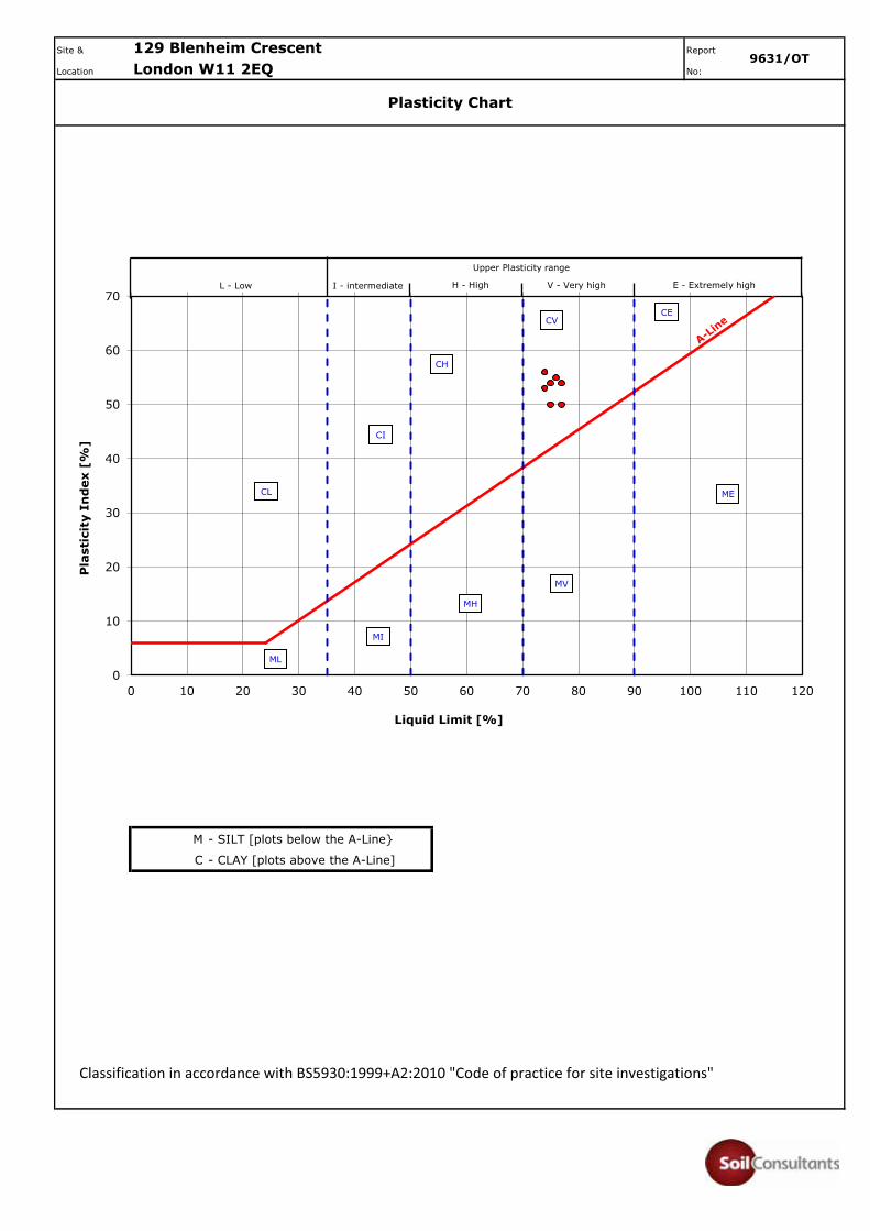
Site & Report
Location No:
M - SILT [plots below the A-Line}
C - CLAY [plots above the A-Line]
Classification in accordance with BS5930:1999+A2:2010 "Code of practice for site investigations"
129 Blenheim Crescent9631/OT
London W11 2EQ
Plasticity Chart
0
10
20
30
40
50
60
70
0 10 20 30 40 50 60 70 80 90 100 110 120
Pla
stic
ity
Ind
ex [
%]
Liquid Limit [%]
L - Low I - intermediate H - High V - Very high E - Extremely high
CL
CI
CH
CE
ML
MI
MV
ME
MH
Upper Plasticity range
CV
9631/OT Site Investigation Report – 129 Blenheim Crescent, London W11 2EQ Page 5 Client: Fiona Murphy & Anatole Kaletsky Engineers: Fluid Structures
14 August 2014 [Rev 0]
FOREWORD TO CONTAMINATION TESTING AND ASSESSMENT
The following statements are designed to inform and guide the Client and other potential parties intending to rely upon this report, with the express intent of protecting them from misunderstanding as to the extent and thus the potential associated risks that may result from proceeding without further evaluations or guidance. 1] Unless otherwise stated in this report, the testing of soils and waters is based on a range of commonly occurring
potential contaminants for the specific purpose of providing a general guidance evaluation for the proposed form of development. Thus, the range of potential contaminants is neither exhaustive nor specifically targeted to any previous known uses or influences upon the site.
2] The amount and scope of the testing should not be assumed to be exhaustive but has been selected, at this stage,
to provide a reasonable, general view of the site ground conditions. In many cases this situation is quite sufficient for the site to be characterised for the purposes of development and related Health and Safety matters for persons involved in or directly affected by the site development works. It must be understood, however, that in certain circumstances aspects or areas of the site may require further investigation and testing in order to fully clarify and characterise contamination issues, both for regulatory compliance and for commercial reasons.
3] The scope of the contamination testing must not automatically be regarded as being sufficient to fully formulate a
remediation scheme. For such a scheme it may be necessary to consider further testing to verify the effectiveness of the remedial work after the site has been treated. It must be understood that a remediation scheme which brings a site into a sufficient state for the proposed development (“fit for purpose”) under current legislation and published guidance, may result in some contamination being left in-situ. It is possible that forthcoming legislation may result in a site being classified by the Local Authority and assigned a “Degree of Risk” related to previous use or known contamination.
4] The scope of the environmental investigation and contamination testing must not be automatically regarded as
sufficient to satisfy the requirements in the wider environmental setting. The risks to adjacent properties and to the water environment are assessed by the regulatory authorities and there may be a requirement to carry out further exploration, testing and, possibly monitoring in the short or long term. It is not possible to sensibly predict the nature and extent of such additional requirements as these are the direct result of submissions to and liaison with the regulatory authorities. It is imperative, therefore, that such submissions and contacts are made as soon as possible, especially if there are perceived to be critical features of the site and proposed scheme, in this context.
5] New testing criteria have been implemented by the Environment Agency to enable a waste disposal classification
to be made. The date of implementation of this Waste Acceptance Criteria [WAC] was July 2005. It is this testing that will be used by the waste regulatory authorities, including waste disposal sites, to designate soils for disposal in landfill sites. In certain circumstances, to satisfy the waste regulations, there may be the necessity to carry out additional testing to clarify and confirm the nature of any contamination that may be present. If commercial requirements are significant then this process may also necessitate further field operations to clarify the extent of certain features. Thus, the waste classification must be obtained from the waste regulation authorities or a licensed waste disposal site and we strongly recommend that this classification is obtained as soon as possible and certainly prior to establishing any costings or procedures for this or related aspects of the scheme.
Opher Tolkovsky QTS Environmental Ltd
Soil Consultants Ltd Unit 1Rose Lane Industrial EstateRose LaneLenham HeathKentME17 2JN
t: 01622 [email protected]
Site Reference: 129 Blenheim Crescent, London W11 2EQ
Project / Job Ref: 9631/OT
Order No: 9631/OT
Sample Receipt Date: 25/07/2014
Sample Scheduled Date: 25/07/2014
Report Issue Number: 1
Reporting Date: 04/08/2014
Authorised by: Authorised by:
Russell Jarvis Kevin OldDirector DirectorOn behalf of QTS Environmental Ltd On behalf of QTS Environmental Ltd
Chiltern HouseEarl Howe RoadHolmer GreenHigh WycombeBuckinghamshireHP15 6QT
QTS Environmental Report No: 14-23335
by:
QTS Environmental Ltd - Registered in England No 06620874 Page 1 of 8
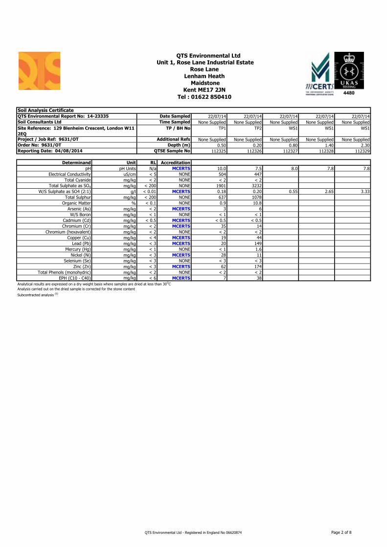
22/07/14 22/07/14 22/07/14 22/07/14 22/07/14None Supplied None Supplied None Supplied None Supplied None Supplied
TP1 TP2 WS1 WS1 WS1
None Supplied None Supplied None Supplied None Supplied None Supplied0.50 0.20 0.80 1.40 2.30
112325 112326 112327 112328 112329
Determinand Unit RL Accreditation
pH pH Units N/a MCERTS 10.0 7.5 8.0 7.8 7.8Electrical Conductivity uS/cm < 5 NONE 504 447
Total Cyanide mg/kg < 2 NONE < 2 < 2Total Sulphate as SO4 mg/kg < 200 NONE 1901 3232
W/S Sulphate as SO4 (2:1) g/l < 0.01 MCERTS 0.18 0.20 0.55 2.65 3.33Total Sulphur mg/kg < 200 NONE 637 1078
Organic Matter % < 0.1 NONE 0.9 10.8Arsenic (As) mg/kg < 2 MCERTS 3 6W/S Boron mg/kg < 1 NONE < 1 < 1
Cadmium (Cd) mg/kg < 0.5 MCERTS < 0.5 < 0.5Chromium (Cr) mg/kg < 2 MCERTS 35 14
Chromium (hexavalent) mg/kg < 2 NONE < 2 < 2Copper (Cu) mg/kg < 4 MCERTS 19 44
Lead (Pb) mg/kg < 3 MCERTS 20 149Mercury (Hg) mg/kg < 1 NONE < 1 1.6
Nickel (Ni) mg/kg < 3 MCERTS 28 11Selenium (Se) mg/kg < 3 NONE < 3 < 3
Zinc (Zn) mg/kg < 3 MCERTS 62 174Total Phenols (monohydric) mg/kg < 2 NONE < 2 < 2
EPH (C10 - C40) mg/kg < 6 MCERTS 7 38Analytical results are expressed on a dry weight basis where samples are dried at less than 30OC
Subcontracted analysis (S)
Date Sampled
Soil Consultants Ltd Time Sampled
QTS Environmental Ltd ' Unit 1, Rose Lane Industrial Estate
Rose Lane
Lenham Heath
Maidstone
Kent ME17 2JN
Site Reference: 129 Blenheim Crescent, London W11
2EQ
TP / BH No
Tel : 01622 850410 '
Soil Analysis CertificateQTS Environmental Report No: 14-23335
Reporting Date: 04/08/2014 QTSE Sample No
Analysis carried out on the dried sample is corrected for the stone content
Project / Job Ref: 9631/OT Additional Refs
Order No: 9631/OT Depth (m)
QTS Environmental Ltd - Registered in England No 06620874 Page 2 of 8
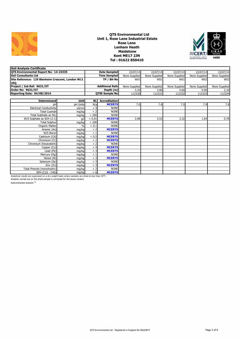
22/07/14 22/07/14 22/07/14 22/07/14 22/07/14None Supplied None Supplied None Supplied None Supplied None Supplied
WS1 WS1 WS1 WS2 WS2
None Supplied None Supplied None Supplied None Supplied None Supplied3.20 3.80 4.60 0.90 2.10
112330 112331 112332 112333 112334
Determinand Unit RL Accreditation
pH pH Units N/a MCERTS 7.0 7.6 7.5 7.9 7.8Electrical Conductivity uS/cm < 5 NONE
Total Cyanide mg/kg < 2 NONETotal Sulphate as SO4 mg/kg < 200 NONE
W/S Sulphate as SO4 (2:1) g/l < 0.01 MCERTS 3.98 3.53 3.32 1.64 0.78Total Sulphur mg/kg < 200 NONE
Organic Matter % < 0.1 NONEArsenic (As) mg/kg < 2 MCERTS
W/S Boron mg/kg < 1 NONECadmium (Cd) mg/kg < 0.5 MCERTS
Chromium (Cr) mg/kg < 2 MCERTS
Chromium (hexavalent) mg/kg < 2 NONECopper (Cu) mg/kg < 4 MCERTS
Lead (Pb) mg/kg < 3 MCERTS
Mercury (Hg) mg/kg < 1 NONENickel (Ni) mg/kg < 3 MCERTS
Selenium (Se) mg/kg < 3 NONEZinc (Zn) mg/kg < 3 MCERTS
Total Phenols (monohydric) mg/kg < 2 NONEEPH (C10 - C40) mg/kg < 6 MCERTS
Analytical results are expressed on a dry weight basis where samples are dried at less than 30OC
Subcontracted analysis (S)
QTS Environmental Ltd ' Unit 1, Rose Lane Industrial Estate
Rose Lane
Lenham Heath
Maidstone
Soil Consultants Ltd Time Sampled
TP / BH No
Project / Job Ref: 9631/OT Additional Refs
Order No: 9631/OT Depth (m)
Kent ME17 2JN
Tel : 01622 850410 '
Soil Analysis CertificateQTS Environmental Report No: 14-23335 Date Sampled
Reporting Date: 04/08/2014 QTSE Sample No
Analysis carried out on the dried sample is corrected for the stone content
Site Reference: 129 Blenheim Crescent, London W11
2EQ
QTS Environmental Ltd - Registered in England No 06620874 Page 3 of 8
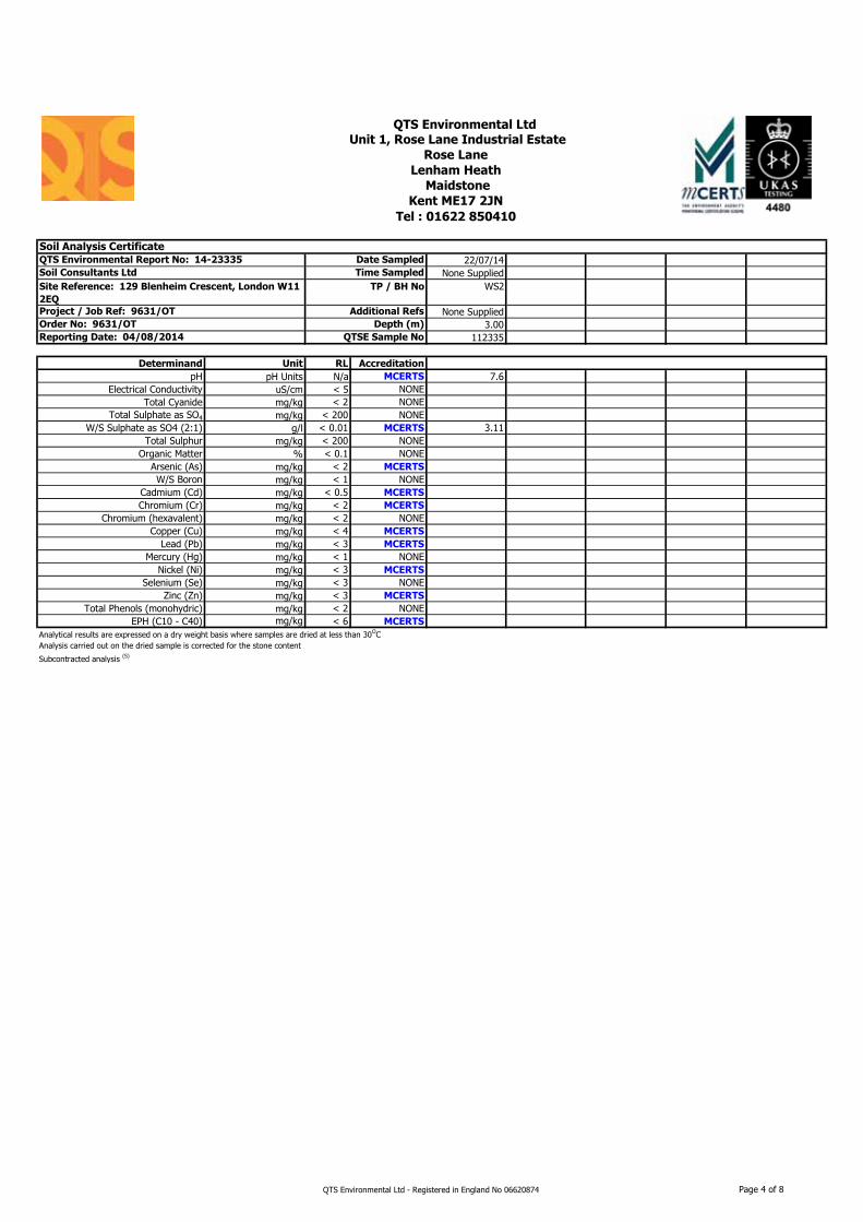
22/07/14None Supplied
WS2
None Supplied3.00
112335
Determinand Unit RL Accreditation
pH pH Units N/a MCERTS 7.6Electrical Conductivity uS/cm < 5 NONE
Total Cyanide mg/kg < 2 NONETotal Sulphate as SO4 mg/kg < 200 NONE
W/S Sulphate as SO4 (2:1) g/l < 0.01 MCERTS 3.11Total Sulphur mg/kg < 200 NONE
Organic Matter % < 0.1 NONEArsenic (As) mg/kg < 2 MCERTS
W/S Boron mg/kg < 1 NONECadmium (Cd) mg/kg < 0.5 MCERTS
Chromium (Cr) mg/kg < 2 MCERTS
Chromium (hexavalent) mg/kg < 2 NONECopper (Cu) mg/kg < 4 MCERTS
Lead (Pb) mg/kg < 3 MCERTS
Mercury (Hg) mg/kg < 1 NONENickel (Ni) mg/kg < 3 MCERTS
Selenium (Se) mg/kg < 3 NONEZinc (Zn) mg/kg < 3 MCERTS
Total Phenols (monohydric) mg/kg < 2 NONEEPH (C10 - C40) mg/kg < 6 MCERTS
Analytical results are expressed on a dry weight basis where samples are dried at less than 30OC
Subcontracted analysis (S)
QTS Environmental Ltd ' Unit 1, Rose Lane Industrial Estate
Rose Lane
Lenham Heath
Maidstone
Kent ME17 2JN
Tel : 01622 850410 '
Soil Analysis CertificateQTS Environmental Report No: 14-23335 Date Sampled
Soil Consultants Ltd Time Sampled
Reporting Date: 04/08/2014 QTSE Sample No
Analysis carried out on the dried sample is corrected for the stone content
Site Reference: 129 Blenheim Crescent, London W11
2EQ
TP / BH No
Project / Job Ref: 9631/OT Additional Refs
Order No: 9631/OT Depth (m)
QTS Environmental Ltd - Registered in England No 06620874 Page 4 of 8
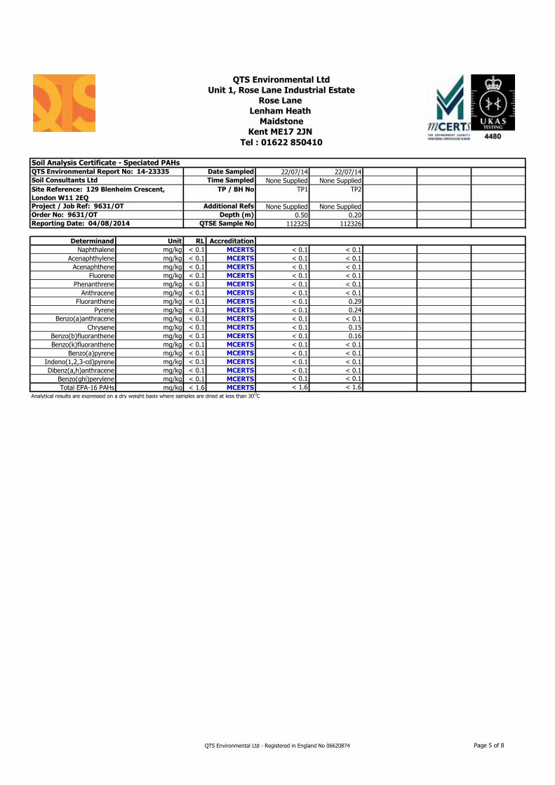
22/07/14 22/07/14None Supplied None Supplied
TP1 TP2
None Supplied None Supplied0.50 0.20
112325 112326
Determinand Unit RL Accreditation
Naphthalene mg/kg < 0.1 MCERTS < 0.1 < 0.1Acenaphthylene mg/kg < 0.1 MCERTS < 0.1 < 0.1
Acenaphthene mg/kg < 0.1 MCERTS < 0.1 < 0.1Fluorene mg/kg < 0.1 MCERTS < 0.1 < 0.1
Phenanthrene mg/kg < 0.1 MCERTS < 0.1 < 0.1Anthracene mg/kg < 0.1 MCERTS < 0.1 < 0.1
Fluoranthene mg/kg < 0.1 MCERTS < 0.1 0.29Pyrene mg/kg < 0.1 MCERTS < 0.1 0.24
Benzo(a)anthracene mg/kg < 0.1 MCERTS < 0.1 < 0.1Chrysene mg/kg < 0.1 MCERTS < 0.1 0.15
Benzo(b)fluoranthene mg/kg < 0.1 MCERTS < 0.1 0.16Benzo(k)fluoranthene mg/kg < 0.1 MCERTS < 0.1 < 0.1
Benzo(a)pyrene mg/kg < 0.1 MCERTS < 0.1 < 0.1Indeno(1,2,3-cd)pyrene mg/kg < 0.1 MCERTS < 0.1 < 0.1Dibenz(a,h)anthracene mg/kg < 0.1 MCERTS < 0.1 < 0.1
Benzo(ghi)perylene mg/kg < 0.1 MCERTS < 0.1 < 0.1Total EPA-16 PAHs mg/kg < 1.6 MCERTS < 1.6 < 1.6
Analytical results are expressed on a dry weight basis where samples are dried at less than 30OC
QTS Environmental Ltd
Unit 1, Rose Lane Industrial Estate
Rose Lane
Lenham Heath
Maidstone
Kent ME17 2JN
Tel : 01622 850410 '
Soil Analysis Certificate - Speciated PAHsQTS Environmental Report No: 14-23335 Date Sampled
Soil Consultants Ltd Time Sampled
Reporting Date: 04/08/2014 QTSE Sample No
Site Reference: 129 Blenheim Crescent,
London W11 2EQ
TP / BH No
Project / Job Ref: 9631/OT Additional Refs
Order No: 9631/OT Depth (m)
QTS Environmental Ltd - Registered in England No 06620874 Page 5 of 8
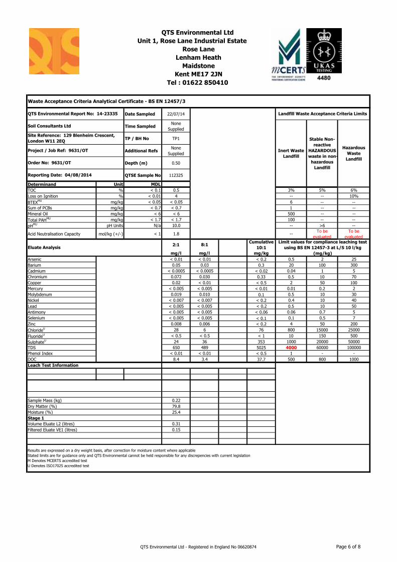
Date Sampled 22/07/14
Time SampledNone
Supplied
TP / BH No TP1
Additional RefsNone
Supplied
Depth (m) 0.50
QTSE Sample No 112325
Determinand Unit MDL
TOC % < 0.1 0.5 3% 5% 6%Loss on Ignition % < 0.01 4 -- -- 10%BTEXMU mg/kg < 0.05 < 0.05 6 -- --Sum of PCBs mg/kg < 0.7 < 0.7 1 -- --Mineral Oil mg/kg < 6 < 6 500 -- --Total PAHMU mg/kg < 1.7 < 1.7 100 -- --pHMU pH Units N/a 10.0 -- >6 --
Acid Neutralisation Capacity mol/kg (+/-) < 1 1.8 -- To be evaluated
To be evaluated
2:1 8:1Cumulative
10:1
mg/l mg/l mg/kg
Arsenic < 0.01 < 0.01 < 0.2 0.5 2 25Barium 0.05 0.03 0.3 20 100 300Cadmium < 0.0005 < 0.0005 < 0.02 0.04 1 5Chromium 0.072 0.030 0.33 0.5 10 70Copper 0.02 < 0.01 < 0.5 2 50 100Mercury < 0.005 < 0.005 < 0.01 0.01 0.2 2Molybdenum 0.019 0.010 0.1 0.5 10 30Nickel < 0.007 < 0.007 < 0.2 0.4 10 40Lead < 0.005 < 0.005 < 0.2 0.5 10 50Antimony < 0.005 < 0.005 < 0.06 0.06 0.7 5Selenium < 0.005 < 0.005 < 0.1 0.1 0.5 7Zinc 0.008 0.006 < 0.2 4 50 200ChlorideU 28 6 76 800 15000 25000FluorideU < 0.5 < 0.5 < 1 10 150 500SulphateU 24 36 353 1000 20000 50000TDS 650 489 5025 4000 60000 100000Phenol Index < 0.01 < 0.01 < 0.5 1 - -DOC 8.4 3.4 37.7 500 800 1000
Sample Mass (kg) 0.22Dry Matter (%) 79.8Moisture (%) 25.4Stage 1
Volume Eluate L2 (litres) 0.31Filtered Eluate VE1 (litres) 0.15
QTS Environmental Ltd
Unit 1, Rose Lane Industrial Estate
Rose Lane
Lenham Heath
Maidstone
Kent ME17 2JN
Tel : 01622 850410
Waste Acceptance Criteria Analytical Certificate - BS EN 12457/3
QTS Environmental Report No: 14-23335 Landflll Waste Acceptance Criteria Limits
Soil Consultants Ltd
Inert Waste
Landfill
Stable Non-
reactive
HAZARDOUS
waste in non-
hazardous
Landfill
Hazardous
Waste
Landfill
Site Reference: 129 Blenheim Crescent,
London W11 2EQ
Project / Job Ref: 9631/OT
Order No: 9631/OT
Reporting Date: 04/08/2014
Eluate Analysis
Limit values for compliance leaching test
using BS EN 12457-3 at L/S 10 l/kg
(mg/kg)
Results are expressed on a dry weight basis, after correction for moisture content where applicableStated limits are for guidance only and QTS Environmental cannot be held responsible for any discrepencies with current legislationM Denotes MCERTS accredited testU Denotes ISO17025 accredited test
Leach Test Information
QTS Environmental Ltd - Registered in England No 06620874 Page 6 of 8
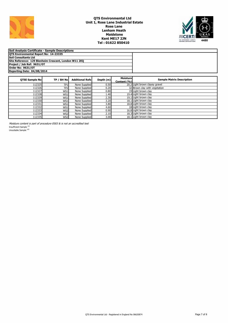
QTSE Sample No TP / BH No Additional Refs Depth (m)Moisture
Content (%)
112325 TP1 None Supplied 0.50 20.2 112326 TP2 None Supplied 0.20 32 112327 WS1 None Supplied 0.80 19 112328 WS1 None Supplied 1.40 19.4 112329 WS1 None Supplied 2.30 19.1 112330 WS1 None Supplied 3.20 18.1 112331 WS1 None Supplied 3.80 18.8 112332 WS1 None Supplied 4.60 18 112333 WS2 None Supplied 0.90 16.8 112334 WS2 None Supplied 2.10 18.3 112335 WS2 None Supplied 3.00 18.1
Moisture content is part of procedure E003 & is not an accredited testInsufficient Sample I/S
Unsuitable Sample U/S
QTS Environmental Ltd
Unit 1, Rose Lane Industrial Estate
Rose Lane
Lenham Heath
Maidstone
Kent ME17 2JN
Tel : 01622 850410 '
Soil Analysis Certificate - Sample DescriptionsQTS Environmental Report No: 14-23335
Soil Consultants Ltd
Site Reference: 129 Blenheim Crescent, London W11 2EQ
Project / Job Ref: 9631/OT
Order No: 9631/OT
Reporting Date: 04/08/2014
Sample Matrix Description
Light brown clayey gravelBrown clay with vegetationLight brown clay
Light brown clayLight brown clay
Light brown clayLight brown clayLight brown clayLight brown clayLight brown clayLight brown clay
QTS Environmental Ltd - Registered in England No 06620874 Page 7 of 8
Matrix Analysed
On
Determinand Brief Method Description Method
NoSoil D Boron - Water Soluble Determination of water soluble boron in soil by 2:1 hot water extract followed by ICP-OES E012Soil AR BTEX Determination of BTEX by headspace GC-MS E001Soil D Cations Determination of cations in soil by aqua-regia digestion followed by ICP-OES E002Soil D Chloride - Water Soluble (2:1) Determination of chloride by extraction with water & analysed by ion chromatography E009
Soil AR Chromium - Hexavalent Determination of hexavalent chromium in soil by extraction in water then by acidification, addition of 1,5 diphenylcarbazide followed by colorimetry E016
Soil AR Cyanide - Complex Determination of complex cyanide by distillation followed by colorimetry E015Soil AR Cyanide - Free Determination of free cyanide by distillation followed by colorimetry E015Soil AR Cyanide - Total Determination of total cyanide by distillation followed by colorimetry E015Soil D Cyclohexane Extractable Matter (CEM) Gravimetrically determined through extraction with cyclohexane E011Soil AR Diesel Range Organics (C10 - C24) Determination of hexane/acetone extractable hydrocarbons by GC-FID E004
Soil AR Electrical Conductivity Determination of electrical conductivity by addition of saturated calcium sulphate followed by electrometric measurement E022
Soil AR Electrical Conductivity Determination of electrical conductivity by addition of water followed by electrometric measurement E023
Soil D Elemental Sulphur Determination of elemental sulphur by solvent extraction followed by GC-MS E020Soil AR EPH (C10 – C40) Determination of acetone/hexane extractable hydrocarbons by GC-FID E004Soil AR EPH Product ID Determination of acetone/hexane extractable hydrocarbons by GC-FID E004Soil AR EPH TEXAS Determination of acetone/hexane extractable hydrocarbons by GC-FID E004Soil D Fluoride - Water Soluble Determination of Fluoride by extraction with water & analysed by ion chromatography E009
Soil D FOC (Fraction Organic Carbon) Determination of fraction of organic carbon by oxidising with potassium dichromate followed by titration with iron (II) sulphate E010
Soil D Loss on Ignition @ 450oC Determination of loss on ignition in soil by gravimetrically with the sample being ignited in a muffle furnace E019
Soil D Magnesium - Water Soluble Determination of water soluble magnesium by extraction with water followed by ICP-OES E025Soil D Metals Determination of metals by aqua-regia digestion followed by ICP-OES E002
Soil AR Mineral Oil (C10 - C40) Determination of hexane/acetone extractable hydrocarbons by GC-FID fractionating with SPE cartridge E004
Soil AR Moisture Content Moisture content; determined gravimetrically E003Soil D Nitrate - Water Soluble (2:1) Determination of nitrate by extraction with water & analysed by ion chromatography E009
Soil D Organic Matter Determination of organic matter by oxidising with potassium dichromate followed by titration with iron (II) sulphate E010
Soil AR PAH - Speciated (EPA 16) Determination of PAH compounds by extraction in acetone and hexane followed by GC-MS with the use of surrogate and internal standards E005
Soil AR PCB - 7 Congeners Determination of PCB by extraction with acetone and hexane followed by GC-MS E008Soil D Petroleum Ether Extract (PEE) Gravimetrically determined through extraction with petroleum ether E011Soil AR pH Determination of pH by addition of water followed by electrometric measurement E007Soil AR Phenols - Total (monohydric) Determination of phenols by distillation followed by colorimetry E021Soil D Phosphate - Water Soluble (2:1) Determination of phosphate by extraction with water & analysed by ion chromatography E009Soil D Sulphate (as SO4) - Total Determination of total sulphate by extraction with 10% HCl followed by ICP-OES E013Soil D Sulphate (as SO4) - Water Soluble (2:1) Determination of sulphate by extraction with water & analysed by ion chromatography E009Soil D Sulphate (as SO4) - Water Soluble (2:1) Determination of water soluble sulphate by extraction with water followed by ICP-OES E014Soil AR Sulphide Determination of sulphide by distillation followed by colorimetry E018Soil D Sulphur - Total Determination of total sulphur by extraction with aqua-regia followed by ICP-OES E024
Soil AR SVOC Determination of semi-volatile organic compounds by extraction in acetone and hexane followed by GC-MS E006
Soil AR Thiocyanate (as SCN) Determination of thiocyanate by extraction in caustic soda followed by acidification followed by addition of ferric nitrate followed by colorimetry E017
Soil D Toluene Extractable Matter (TEM) Gravimetrically determined through extraction with toluene E011
Soil D Total Organic Carbon (TOC) Determination of organic matter by oxidising with potassium dichromate followed by titration with iron (II) sulphate E010
Soil AR TPH CWG Determination of hexane/acetone extractable hydrocarbons by GC-FID fractionating with SPE cartridge E004
Soil AR TPH LQM Determination of hexane/acetone extractable hydrocarbons by GC-FID fractionating with SPE cartridge E004
Soil AR VOCs Determination of volatile organic compounds by headspace GC-MS E001Soil AR VPH (C6 - C10) Determination of hydrocarbons C6-C10 by headspace GC-MS E001
D Dried
AR As Received
QTS Environmental Ltd
Unit 1, Rose Lane Industrial Estate
Rose Lane
Lenham Heath
Maidstone
Kent ME17 2JN
Order No: 9631/OT
Reporting Date: 04/08/2014
Tel : 01622 850410 '
Soil Analysis Certificate - Methodology & Miscellaneous InformationQTS Environmental Report No: 14-23335
Soil Consultants Ltd
Site Reference: 129 Blenheim Crescent, London W11 2EQ
Project / Job Ref: 9631/OT
QTS Environmental Ltd - Registered in England No 06620874 Page 8 of 8

Site Plan
Fig No
Site Location 129 Blenheim Crescent, London W11 2EQ Report
No 9631/OT
0 10m
Approx
Indicative
Approx outline - proposed basement
WS1
Existing [Ash?] tree, ~25m high
WS2
TP2
TP1
Green shaded area of garden about 1.1m higher than yellow -shaded area

Approx NGR of site 524250E, 180910N
Fig No
Location Map
ReportNo 9631/OT129 Blenheim Crescent, London W11 2EQSite
Location
SITE
Contains Ordnance Survey data © Crown copyright and database right 2014
Contains Ordnance Survey data © Crown copyright and database right 2014
SITE

9631/OT Site Investigation Report – 129 Blenheim Crescent, London W11 2EQ Page 3Client: Fiona Murphy & Anatole Kaletsky Engineers: Fluid Structures
14 August 2014 [Rev 0]
APPENDIX B
GroundSure historical maps [Ref SCL-1573292] GroundSure EnviroInsight Report [Ref SCL-1573293] GroundSure GeoInsight Report [Ref SCL-1573294]
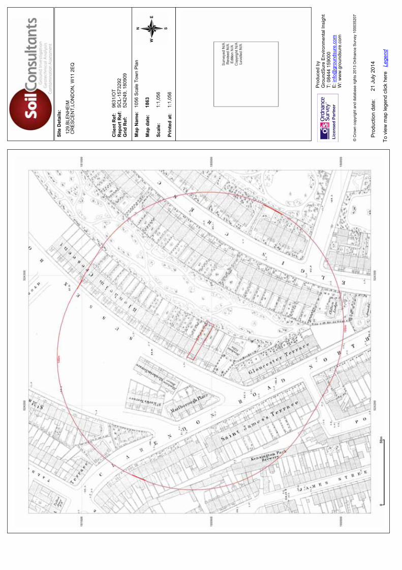
Site
Det
ails
:
Clie
nt R
ef:
R
epor
t Ref
: G
rid R
ef:
Map
Nam
e:
Map
dat
e:
Scal
e:
Prin
ted
at:
Prod
uced
by
G
roun
dSur
e En
viro
nmen
tal I
nsig
ht
T: 0
8444
159
000
E: in
fo@
grou
ndsu
re.c
om
W: w
ww
.gro
unds
ure.
com
Pro
duct
ion
date
:
To v
iew
map
lege
nd c
lick
here
Le
gend
© C
row
n co
pyrig
ht a
nd d
atab
ase
right
s 20
13 O
rdna
nce
Sur
vey
1000
3520
7
129,
BLE
NH
EIM
CR
ES
CE
NT,
LON
DO
N, W
11 2
EQ
9631
/OT
SC
L-15
7329
252
4249
, 180
909
1056
Sca
le T
own
Pla
n
1863
1:1,
056
1:1,
056
21 J
uly
2014

Site
Det
ails
:
Clie
nt R
ef:
R
epor
t Ref
: G
rid R
ef:
Map
Nam
e:
Map
dat
e:
Scal
e:
Prin
ted
at:
Prod
uced
by
G
roun
dSur
e En
viro
nmen
tal I
nsig
ht
T: 0
8444
159
000
E: in
fo@
grou
ndsu
re.c
om
W: w
ww
.gro
unds
ure.
com
Pro
duct
ion
date
:
To v
iew
map
lege
nd c
lick
here
Le
gend
© C
row
n co
pyrig
ht a
nd d
atab
ase
right
s 20
13 O
rdna
nce
Sur
vey
1000
3520
7
129,
BLE
NH
EIM
CR
ES
CE
NT,
LON
DO
N, W
11 2
EQ
9631
/OT
SC
L-15
7329
252
4249
, 180
909
1056
Sca
le T
own
Pla
n
1867
1:1,
056
1:1,
056
21 J
uly
2014
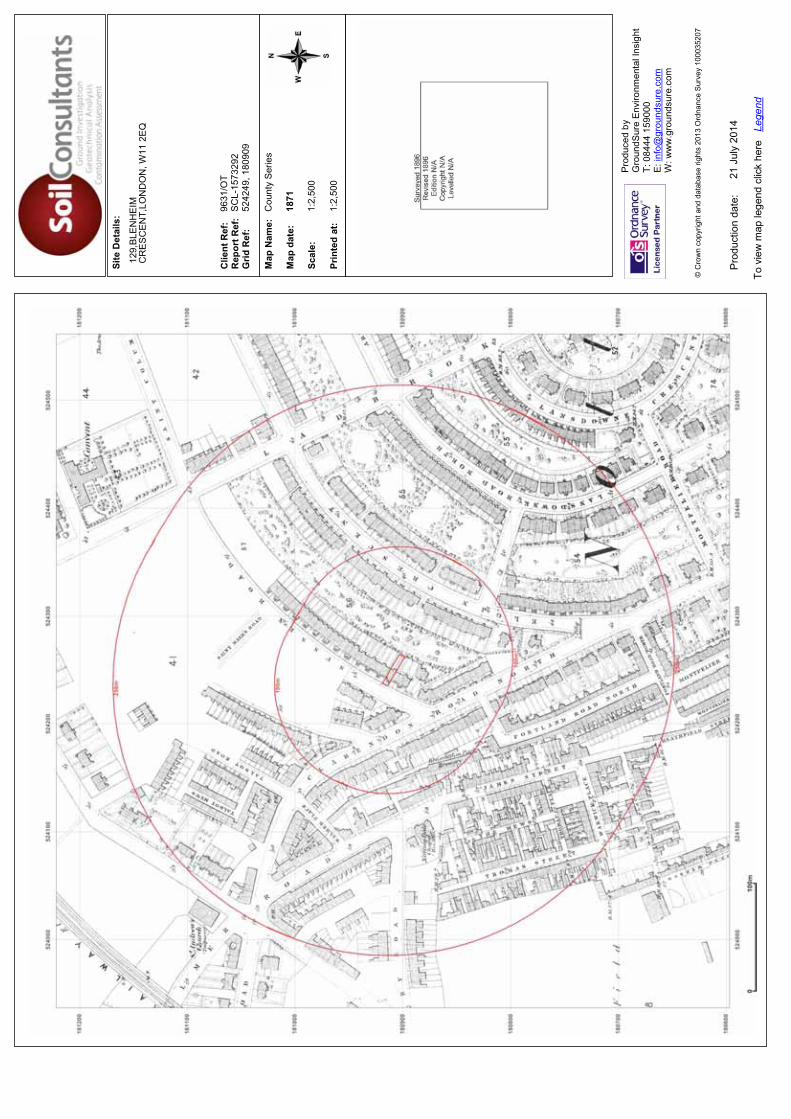
Site
Det
ails
:
Clie
nt R
ef:
R
epor
t Ref
: G
rid R
ef:
Map
Nam
e:
Map
dat
e:
Scal
e:
Prin
ted
at:
Prod
uced
by
G
roun
dSur
e En
viro
nmen
tal I
nsig
ht
T: 0
8444
159
000
E: in
fo@
grou
ndsu
re.c
om
W: w
ww
.gro
unds
ure.
com
Pro
duct
ion
date
:
To v
iew
map
lege
nd c
lick
here
Le
gend
© C
row
n co
pyrig
ht a
nd d
atab
ase
right
s 20
13 O
rdna
nce
Sur
vey
1000
3520
7
129,
BLE
NH
EIM
CR
ES
CE
NT,
LON
DO
N, W
11 2
EQ
9631
/OT
SC
L-15
7329
252
4249
, 180
909
Cou
nty
Ser
ies
1871
1:2,
500
1:2,
500
21 J
uly
2014
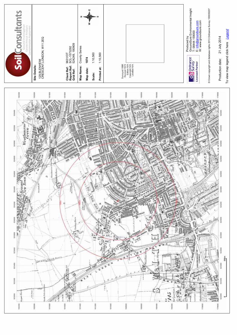
Site
Det
ails
:
Clie
nt R
ef:
R
epor
t Ref
: G
rid R
ef:
Map
Nam
e:
Map
dat
e:
Scal
e:
Prin
ted
at:
Prod
uced
by
G
roun
dSur
e En
viro
nmen
tal I
nsig
ht
T: 0
8444
159
000
E: in
fo@
grou
ndsu
re.c
om
W: w
ww
.gro
unds
ure.
com
Pro
duct
ion
date
:
To v
iew
map
lege
nd c
lick
here
Le
gend
© C
row
n co
pyrig
ht a
nd d
atab
ase
right
s 20
13 O
rdna
nce
Sur
vey
1000
3520
7
129,
BLE
NH
EIM
CR
ES
CE
NT,
LON
DO
N, W
11 2
EQ
9631
/OT
SC
L-15
7329
252
4249
, 180
909
Cou
nty
Ser
ies
1874
1:10
,560
1:10
,560
21 J
uly
2014
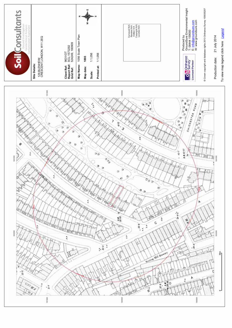
Site
Det
ails
:
Clie
nt R
ef:
R
epor
t Ref
: G
rid R
ef:
Map
Nam
e:
Map
dat
e:
Scal
e:
Prin
ted
at:
Prod
uced
by
G
roun
dSur
e En
viro
nmen
tal I
nsig
ht
T: 0
8444
159
000
E: in
fo@
grou
ndsu
re.c
om
W: w
ww
.gro
unds
ure.
com
Pro
duct
ion
date
:
To v
iew
map
lege
nd c
lick
here
Le
gend
© C
row
n co
pyrig
ht a
nd d
atab
ase
right
s 20
13 O
rdna
nce
Sur
vey
1000
3520
7
129,
BLE
NH
EIM
CR
ES
CE
NT,
LON
DO
N, W
11 2
EQ
9631
/OT
SC
L-15
7329
252
4249
, 180
909
1056
Sca
le T
own
Pla
n
1893
1:1,
056
1:1,
056
21 J
uly
2014
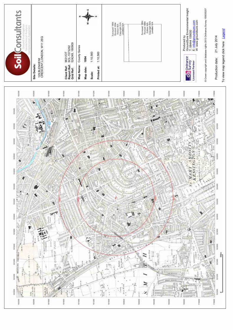
Site
Det
ails
:
Clie
nt R
ef:
R
epor
t Ref
: G
rid R
ef:
Map
Nam
e:
Map
dat
e:
Scal
e:
Prin
ted
at:
Prod
uced
by
G
roun
dSur
e En
viro
nmen
tal I
nsig
ht
T: 0
8444
159
000
E: in
fo@
grou
ndsu
re.c
om
W: w
ww
.gro
unds
ure.
com
Pro
duct
ion
date
:
To v
iew
map
lege
nd c
lick
here
Le
gend
© C
row
n co
pyrig
ht a
nd d
atab
ase
right
s 20
13 O
rdna
nce
Sur
vey
1000
3520
7
129,
BLE
NH
EIM
CR
ES
CE
NT,
LON
DO
N, W
11 2
EQ
9631
/OT
SC
L-15
7329
252
4249
, 180
909
Cou
nty
Ser
ies
1894
1:10
,560
1:10
,560
21 J
uly
2014
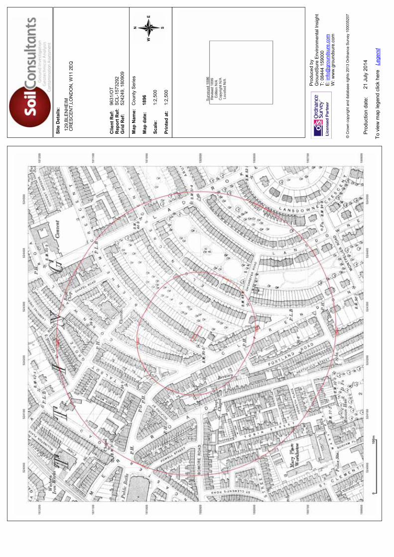
Site
Det
ails
:
Clie
nt R
ef:
R
epor
t Ref
: G
rid R
ef:
Map
Nam
e:
Map
dat
e:
Scal
e:
Prin
ted
at:
Prod
uced
by
G
roun
dSur
e En
viro
nmen
tal I
nsig
ht
T: 0
8444
159
000
E: in
fo@
grou
ndsu
re.c
om
W: w
ww
.gro
unds
ure.
com
Pro
duct
ion
date
:
To v
iew
map
lege
nd c
lick
here
Le
gend
© C
row
n co
pyrig
ht a
nd d
atab
ase
right
s 20
13 O
rdna
nce
Sur
vey
1000
3520
7
129,
BLE
NH
EIM
CR
ES
CE
NT,
LON
DO
N, W
11 2
EQ
9631
/OT
SC
L-15
7329
252
4249
, 180
909
Cou
nty
Ser
ies
1896
1:2,
500
1:2,
500
21 J
uly
2014
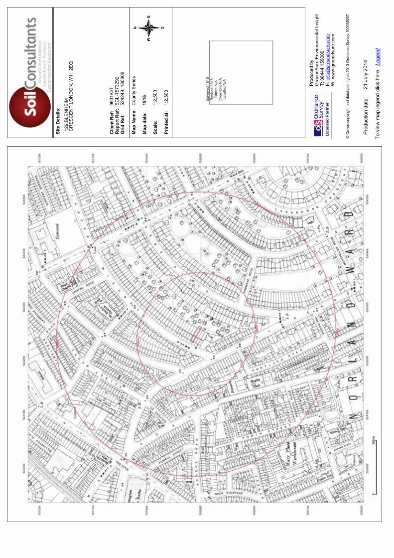
Site
Det
ails
:
Clie
nt R
ef:
R
epor
t Ref
: G
rid R
ef:
Map
Nam
e:
Map
dat
e:
Scal
e:
Prin
ted
at:
Prod
uced
by
G
roun
dSur
e En
viro
nmen
tal I
nsig
ht
T: 0
8444
159
000
E: in
fo@
grou
ndsu
re.c
om
W: w
ww
.gro
unds
ure.
com
Pro
duct
ion
date
:
To v
iew
map
lege
nd c
lick
here
Le
gend
© C
row
n co
pyrig
ht a
nd d
atab
ase
right
s 20
13 O
rdna
nce
Sur
vey
1000
3520
7
129,
BLE
NH
EIM
CR
ES
CE
NT,
LON
DO
N, W
11 2
EQ
9631
/OT
SC
L-15
7329
252
4249
, 180
909
Cou
nty
Ser
ies
1916
1:2,
500
1:2,
500
21 J
uly
2014
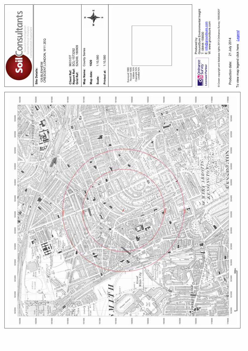
Site
Det
ails
:
Clie
nt R
ef:
R
epor
t Ref
: G
rid R
ef:
Map
Nam
e:
Map
dat
e:
Scal
e:
Prin
ted
at:
Prod
uced
by
G
roun
dSur
e En
viro
nmen
tal I
nsig
ht
T: 0
8444
159
000
E: in
fo@
grou
ndsu
re.c
om
W: w
ww
.gro
unds
ure.
com
Pro
duct
ion
date
:
To v
iew
map
lege
nd c
lick
here
Le
gend
© C
row
n co
pyrig
ht a
nd d
atab
ase
right
s 20
13 O
rdna
nce
Sur
vey
1000
3520
7
129,
BLE
NH
EIM
CR
ES
CE
NT,
LON
DO
N, W
11 2
EQ
9631
/OT
SC
L-15
7329
252
4249
, 180
909
Cou
nty
Ser
ies
1920
1:10
,560
1:10
,560
21 J
uly
2014

Site
Det
ails
:
Clie
nt R
ef:
R
epor
t Ref
: G
rid R
ef:
Map
Nam
e:
Map
dat
e:
Scal
e:
Prin
ted
at:
Prod
uced
by
G
roun
dSur
e En
viro
nmen
tal I
nsig
ht
T: 0
8444
159
000
E: in
fo@
grou
ndsu
re.c
om
W: w
ww
.gro
unds
ure.
com
Pro
duct
ion
date
:
To v
iew
map
lege
nd c
lick
here
Le
gend
© C
row
n co
pyrig
ht a
nd d
atab
ase
right
s 20
13 O
rdna
nce
Sur
vey
1000
3520
7
129,
BLE
NH
EIM
CR
ES
CE
NT,
LON
DO
N, W
11 2
EQ
9631
/OT
SC
L-15
7329
252
4249
, 180
909
Pro
visi
onal
1947
-195
1
1:10
,560
1:10
,560
21 J
uly
2014
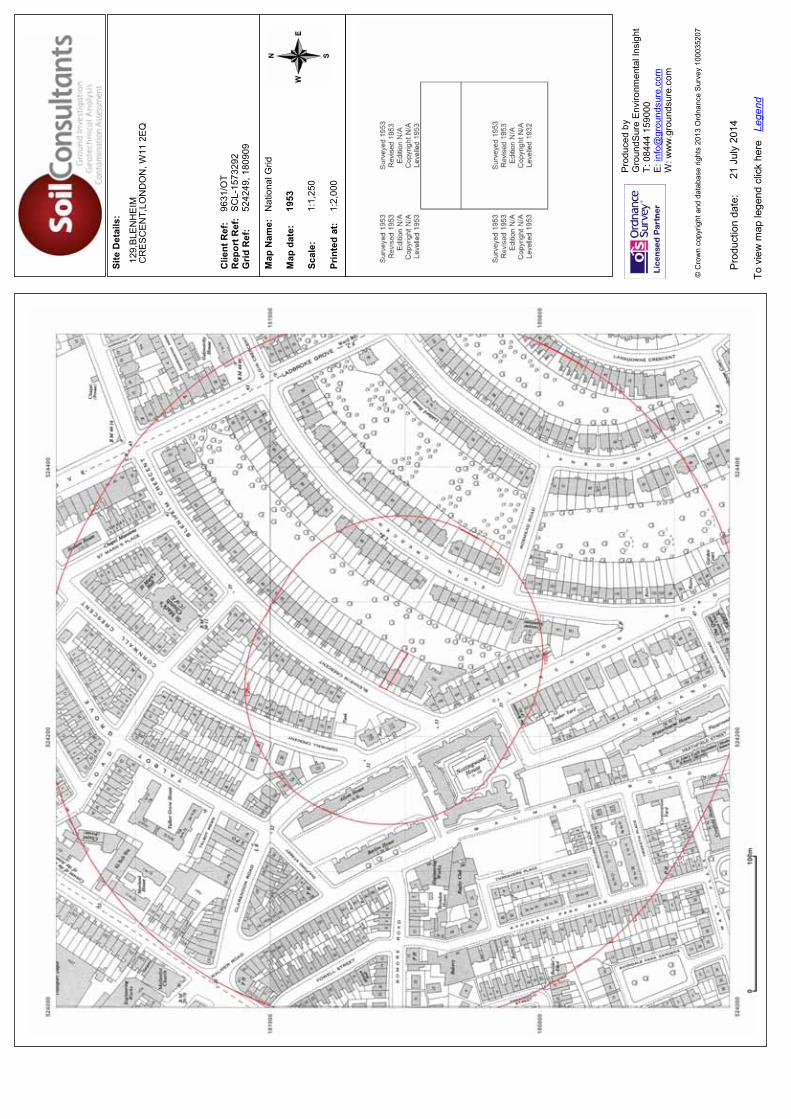
Site
Det
ails
:
Clie
nt R
ef:
R
epor
t Ref
: G
rid R
ef:
Map
Nam
e:
Map
dat
e:
Scal
e:
Prin
ted
at:
Prod
uced
by
G
roun
dSur
e En
viro
nmen
tal I
nsig
ht
T: 0
8444
159
000
E: in
fo@
grou
ndsu
re.c
om
W: w
ww
.gro
unds
ure.
com
Pro
duct
ion
date
:
To v
iew
map
lege
nd c
lick
here
Le
gend
© C
row
n co
pyrig
ht a
nd d
atab
ase
right
s 20
13 O
rdna
nce
Sur
vey
1000
3520
7
129,
BLE
NH
EIM
CR
ES
CE
NT,
LON
DO
N, W
11 2
EQ
9631
/OT
SC
L-15
7329
252
4249
, 180
909
Nat
iona
l Grid
1953
1:1,
250
1:2,
000
21 J
uly
2014

Site
Det
ails
:
Clie
nt R
ef:
R
epor
t Ref
: G
rid R
ef:
Map
Nam
e:
Map
dat
e:
Scal
e:
Prin
ted
at:
Prod
uced
by
G
roun
dSur
e En
viro
nmen
tal I
nsig
ht
T: 0
8444
159
000
E: in
fo@
grou
ndsu
re.c
om
W: w
ww
.gro
unds
ure.
com
Pro
duct
ion
date
:
To v
iew
map
lege
nd c
lick
here
Le
gend
© C
row
n co
pyrig
ht a
nd d
atab
ase
right
s 20
13 O
rdna
nce
Sur
vey
1000
3520
7
129,
BLE
NH
EIM
CR
ES
CE
NT,
LON
DO
N, W
11 2
EQ
9631
/OT
SC
L-15
7329
252
4249
, 180
909
Nat
iona
l Grid
1953
1:2,
500
1:2,
500
21 J
uly
2014
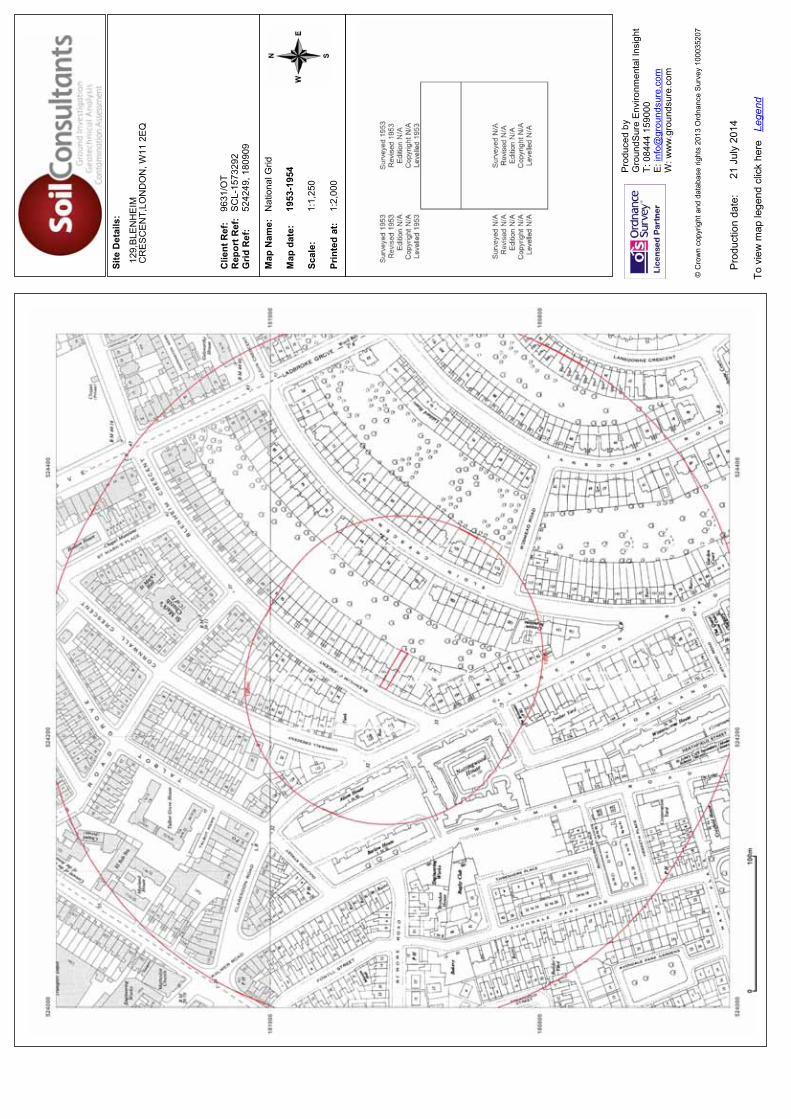
Site
Det
ails
:
Clie
nt R
ef:
R
epor
t Ref
: G
rid R
ef:
Map
Nam
e:
Map
dat
e:
Scal
e:
Prin
ted
at:
Prod
uced
by
G
roun
dSur
e En
viro
nmen
tal I
nsig
ht
T: 0
8444
159
000
E: in
fo@
grou
ndsu
re.c
om
W: w
ww
.gro
unds
ure.
com
Pro
duct
ion
date
:
To v
iew
map
lege
nd c
lick
here
Le
gend
© C
row
n co
pyrig
ht a
nd d
atab
ase
right
s 20
13 O
rdna
nce
Sur
vey
1000
3520
7
129,
BLE
NH
EIM
CR
ES
CE
NT,
LON
DO
N, W
11 2
EQ
9631
/OT
SC
L-15
7329
252
4249
, 180
909
Nat
iona
l Grid
1953
-195
4
1:1,
250
1:2,
000
21 J
uly
2014
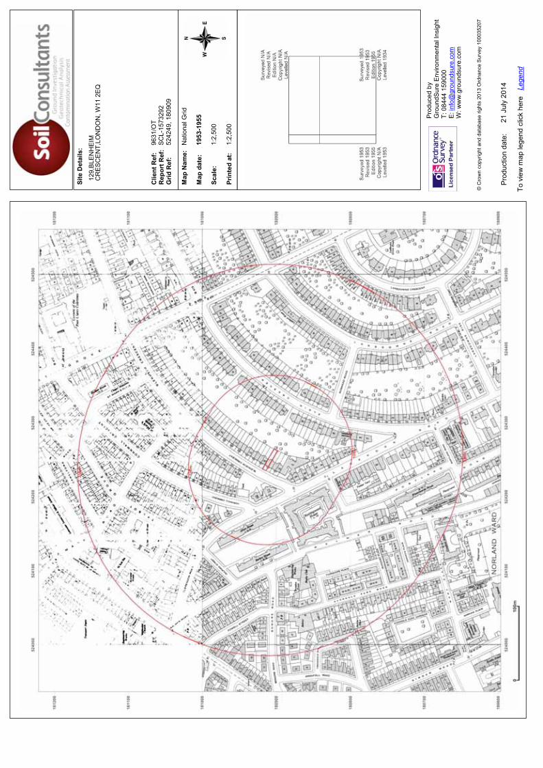
Site
Det
ails
:
Clie
nt R
ef:
R
epor
t Ref
: G
rid R
ef:
Map
Nam
e:
Map
dat
e:
Scal
e:
Prin
ted
at:
Prod
uced
by
G
roun
dSur
e En
viro
nmen
tal I
nsig
ht
T: 0
8444
159
000
E: in
fo@
grou
ndsu
re.c
om
W: w
ww
.gro
unds
ure.
com
Pro
duct
ion
date
:
To v
iew
map
lege
nd c
lick
here
Le
gend
© C
row
n co
pyrig
ht a
nd d
atab
ase
right
s 20
13 O
rdna
nce
Sur
vey
1000
3520
7
129,
BLE
NH
EIM
CR
ES
CE
NT,
LON
DO
N, W
11 2
EQ
9631
/OT
SC
L-15
7329
252
4249
, 180
909
Nat
iona
l Grid
1953
-195
5
1:2,
500
1:2,
500
21 J
uly
2014

Site
Det
ails
:
Clie
nt R
ef:
R
epor
t Ref
: G
rid R
ef:
Map
Nam
e:
Map
dat
e:
Scal
e:
Prin
ted
at:
Prod
uced
by
G
roun
dSur
e En
viro
nmen
tal I
nsig
ht
T: 0
8444
159
000
E: in
fo@
grou
ndsu
re.c
om
W: w
ww
.gro
unds
ure.
com
Pro
duct
ion
date
:
To v
iew
map
lege
nd c
lick
here
Le
gend
© C
row
n co
pyrig
ht a
nd d
atab
ase
right
s 20
13 O
rdna
nce
Sur
vey
1000
3520
7
129,
BLE
NH
EIM
CR
ES
CE
NT,
LON
DO
N, W
11 2
EQ
9631
/OT
SC
L-15
7329
252
4249
, 180
909
Nat
iona
l Grid
1954
-195
5
1:1,
250
1:2,
000
21 J
uly
2014
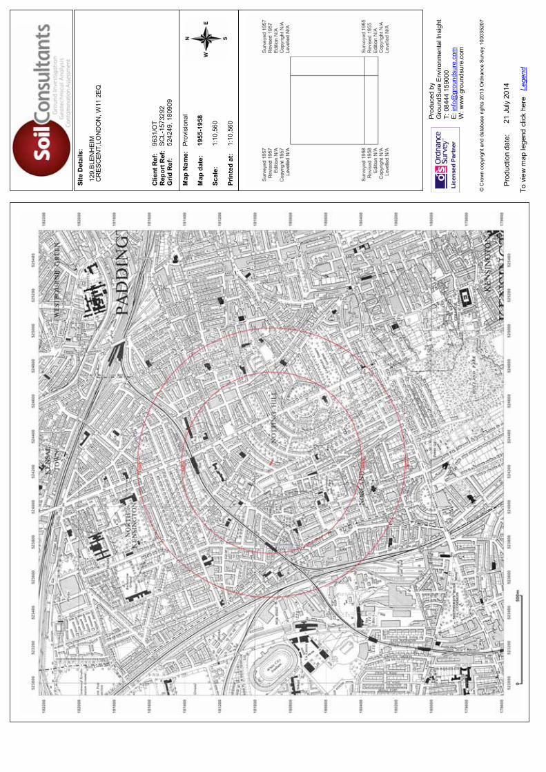
Site
Det
ails
:
Clie
nt R
ef:
R
epor
t Ref
: G
rid R
ef:
Map
Nam
e:
Map
dat
e:
Scal
e:
Prin
ted
at:
Prod
uced
by
G
roun
dSur
e En
viro
nmen
tal I
nsig
ht
T: 0
8444
159
000
E: in
fo@
grou
ndsu
re.c
om
W: w
ww
.gro
unds
ure.
com
Pro
duct
ion
date
:
To v
iew
map
lege
nd c
lick
here
Le
gend
© C
row
n co
pyrig
ht a
nd d
atab
ase
right
s 20
13 O
rdna
nce
Sur
vey
1000
3520
7
129,
BLE
NH
EIM
CR
ES
CE
NT,
LON
DO
N, W
11 2
EQ
9631
/OT
SC
L-15
7329
252
4249
, 180
909
Pro
visi
onal
1955
-195
8
1:10
,560
1:10
,560
21 J
uly
2014
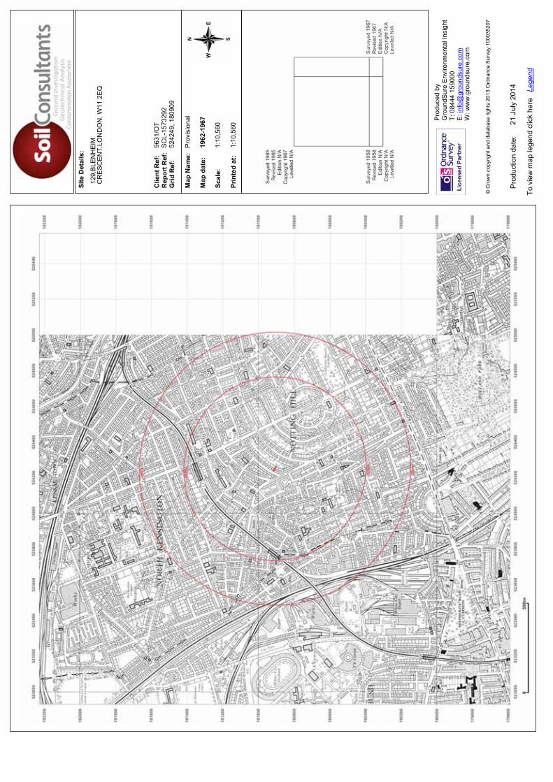
Site
Det
ails
:
Clie
nt R
ef:
R
epor
t Ref
: G
rid R
ef:
Map
Nam
e:
Map
dat
e:
Scal
e:
Prin
ted
at:
Prod
uced
by
G
roun
dSur
e En
viro
nmen
tal I
nsig
ht
T: 0
8444
159
000
E: in
fo@
grou
ndsu
re.c
om
W: w
ww
.gro
unds
ure.
com
Pro
duct
ion
date
:
To v
iew
map
lege
nd c
lick
here
Le
gend
© C
row
n co
pyrig
ht a
nd d
atab
ase
right
s 20
13 O
rdna
nce
Sur
vey
1000
3520
7
129,
BLE
NH
EIM
CR
ES
CE
NT,
LON
DO
N, W
11 2
EQ
9631
/OT
SC
L-15
7329
252
4249
, 180
909
Pro
visi
onal
1962
-196
7
1:10
,560
1:10
,560
21 J
uly
2014
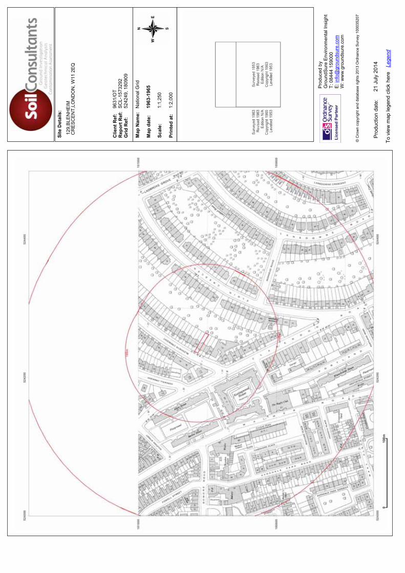
Site
Det
ails
:
Clie
nt R
ef:
R
epor
t Ref
: G
rid R
ef:
Map
Nam
e:
Map
dat
e:
Scal
e:
Prin
ted
at:
Prod
uced
by
G
roun
dSur
e En
viro
nmen
tal I
nsig
ht
T: 0
8444
159
000
E: in
fo@
grou
ndsu
re.c
om
W: w
ww
.gro
unds
ure.
com
Pro
duct
ion
date
:
To v
iew
map
lege
nd c
lick
here
Le
gend
© C
row
n co
pyrig
ht a
nd d
atab
ase
right
s 20
13 O
rdna
nce
Sur
vey
1000
3520
7
129,
BLE
NH
EIM
CR
ES
CE
NT,
LON
DO
N, W
11 2
EQ
9631
/OT
SC
L-15
7329
252
4249
, 180
909
Nat
iona
l Grid
1963
-196
5
1:1,
250
1:2,
000
21 J
uly
2014
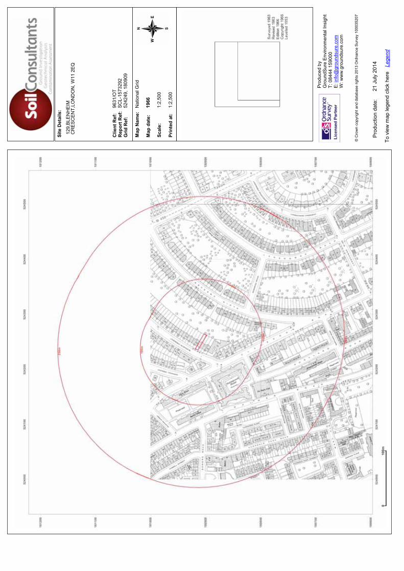
Site
Det
ails
:
Clie
nt R
ef:
R
epor
t Ref
: G
rid R
ef:
Map
Nam
e:
Map
dat
e:
Scal
e:
Prin
ted
at:
Prod
uced
by
G
roun
dSur
e En
viro
nmen
tal I
nsig
ht
T: 0
8444
159
000
E: in
fo@
grou
ndsu
re.c
om
W: w
ww
.gro
unds
ure.
com
Pro
duct
ion
date
:
To v
iew
map
lege
nd c
lick
here
Le
gend
© C
row
n co
pyrig
ht a
nd d
atab
ase
right
s 20
13 O
rdna
nce
Sur
vey
1000
3520
7
129,
BLE
NH
EIM
CR
ES
CE
NT,
LON
DO
N, W
11 2
EQ
9631
/OT
SC
L-15
7329
252
4249
, 180
909
Nat
iona
l Grid
1966
1:2,
500
1:2,
500
21 J
uly
2014
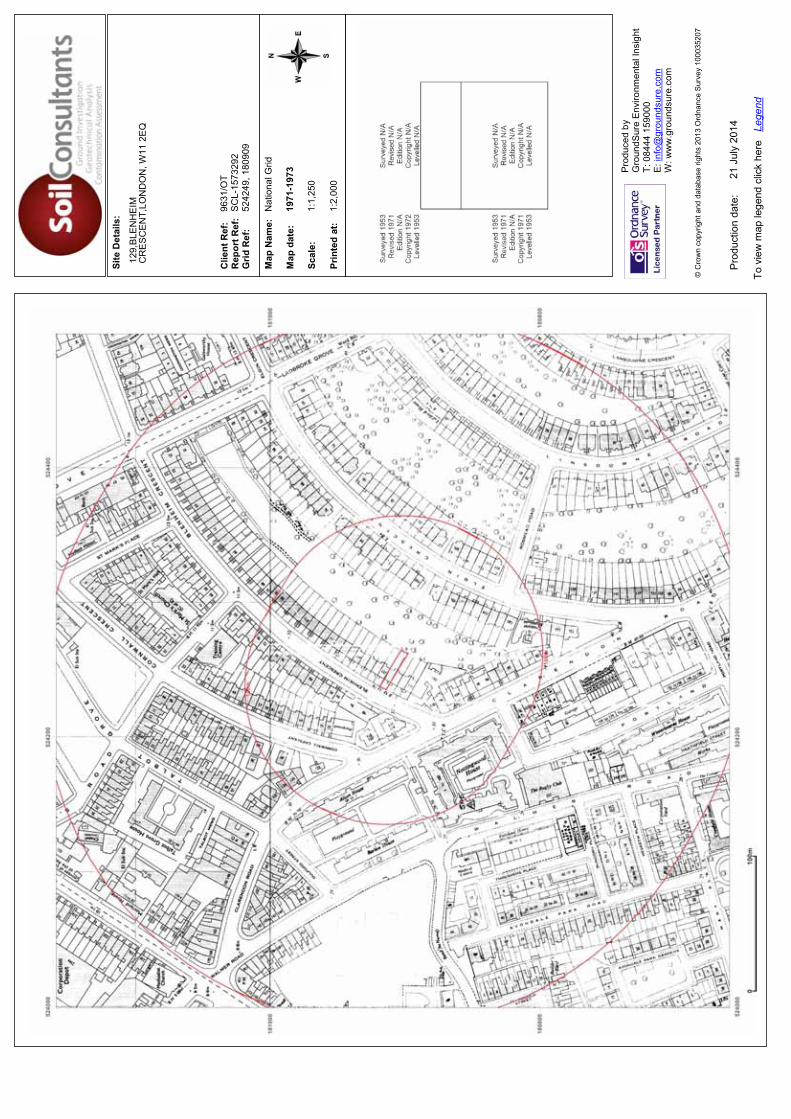
Site
Det
ails
:
Clie
nt R
ef:
R
epor
t Ref
: G
rid R
ef:
Map
Nam
e:
Map
dat
e:
Scal
e:
Prin
ted
at:
Prod
uced
by
G
roun
dSur
e En
viro
nmen
tal I
nsig
ht
T: 0
8444
159
000
E: in
fo@
grou
ndsu
re.c
om
W: w
ww
.gro
unds
ure.
com
Pro
duct
ion
date
:
To v
iew
map
lege
nd c
lick
here
Le
gend
© C
row
n co
pyrig
ht a
nd d
atab
ase
right
s 20
13 O
rdna
nce
Sur
vey
1000
3520
7
129,
BLE
NH
EIM
CR
ES
CE
NT,
LON
DO
N, W
11 2
EQ
9631
/OT
SC
L-15
7329
252
4249
, 180
909
Nat
iona
l Grid
1971
-197
3
1:1,
250
1:2,
000
21 J
uly
2014
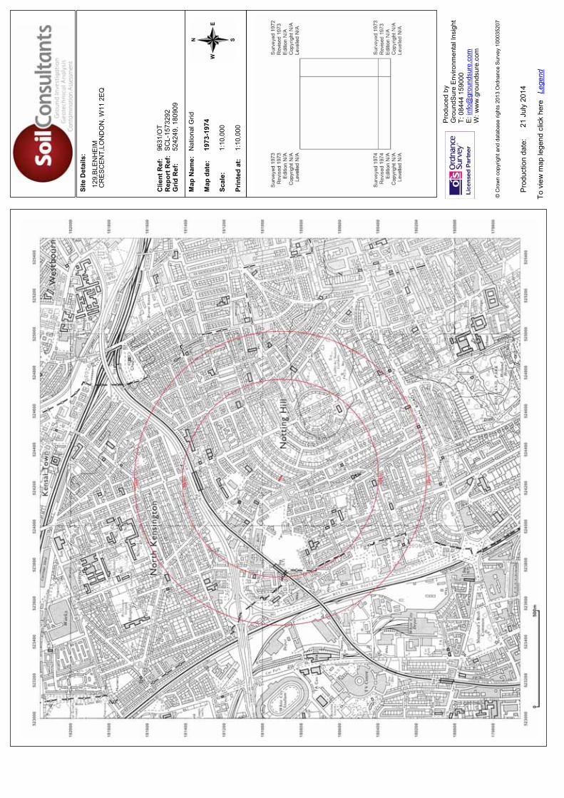
Site
Det
ails
:
Clie
nt R
ef:
R
epor
t Ref
: G
rid R
ef:
Map
Nam
e:
Map
dat
e:
Scal
e:
Prin
ted
at:
Prod
uced
by
G
roun
dSur
e En
viro
nmen
tal I
nsig
ht
T: 0
8444
159
000
E: in
fo@
grou
ndsu
re.c
om
W: w
ww
.gro
unds
ure.
com
Pro
duct
ion
date
:
To v
iew
map
lege
nd c
lick
here
Le
gend
© C
row
n co
pyrig
ht a
nd d
atab
ase
right
s 20
13 O
rdna
nce
Sur
vey
1000
3520
7
129,
BLE
NH
EIM
CR
ES
CE
NT,
LON
DO
N, W
11 2
EQ
9631
/OT
SC
L-15
7329
252
4249
, 180
909
Nat
iona
l Grid
1973
-197
4
1:10
,000
1:10
,000
21 J
uly
2014

Site
Det
ails
:
Clie
nt R
ef:
R
epor
t Ref
: G
rid R
ef:
Map
Nam
e:
Map
dat
e:
Scal
e:
Prin
ted
at:
Prod
uced
by
G
roun
dSur
e En
viro
nmen
tal I
nsig
ht
T: 0
8444
159
000
E: in
fo@
grou
ndsu
re.c
om
W: w
ww
.gro
unds
ure.
com
Pro
duct
ion
date
:
To v
iew
map
lege
nd c
lick
here
Le
gend
© C
row
n co
pyrig
ht a
nd d
atab
ase
right
s 20
13 O
rdna
nce
Sur
vey
1000
3520
7
129,
BLE
NH
EIM
CR
ES
CE
NT,
LON
DO
N, W
11 2
EQ
9631
/OT
SC
L-15
7329
252
4249
, 180
909
Nat
iona
l Grid
1973
-197
7
1:1,
250
1:2,
000
21 J
uly
2014
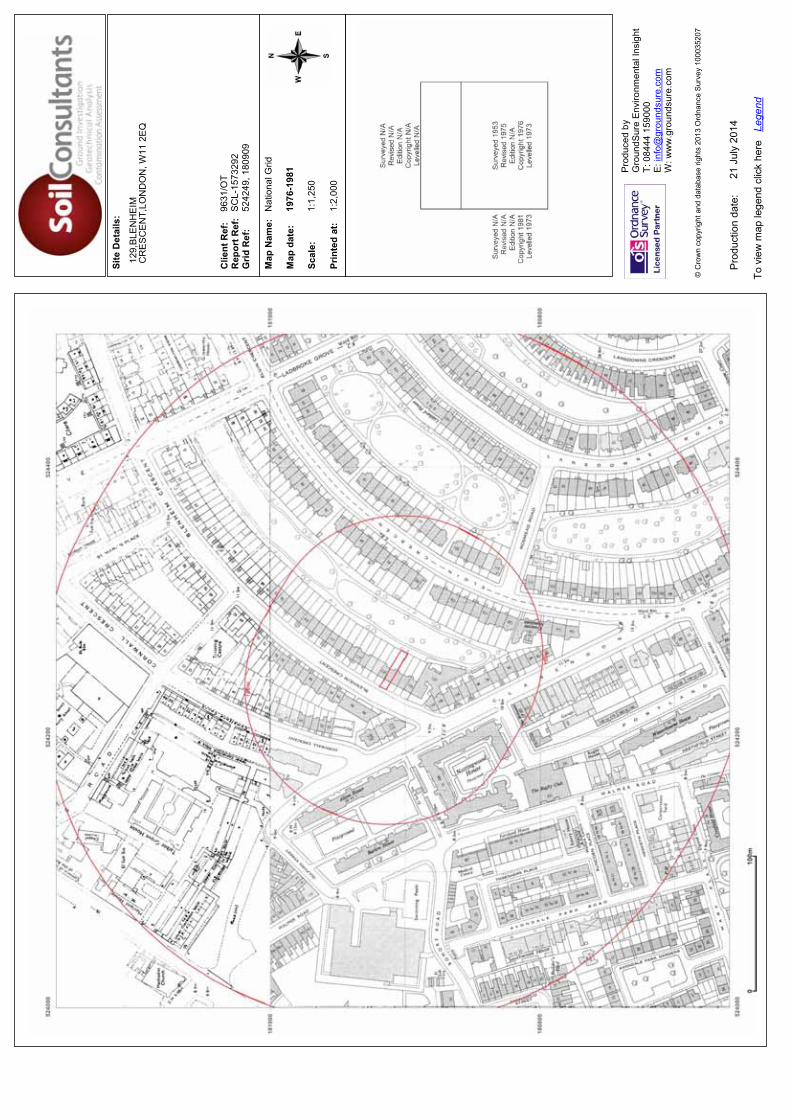
Site
Det
ails
:
Clie
nt R
ef:
R
epor
t Ref
: G
rid R
ef:
Map
Nam
e:
Map
dat
e:
Scal
e:
Prin
ted
at:
Prod
uced
by
G
roun
dSur
e En
viro
nmen
tal I
nsig
ht
T: 0
8444
159
000
E: in
fo@
grou
ndsu
re.c
om
W: w
ww
.gro
unds
ure.
com
Pro
duct
ion
date
:
To v
iew
map
lege
nd c
lick
here
Le
gend
© C
row
n co
pyrig
ht a
nd d
atab
ase
right
s 20
13 O
rdna
nce
Sur
vey
1000
3520
7
129,
BLE
NH
EIM
CR
ES
CE
NT,
LON
DO
N, W
11 2
EQ
9631
/OT
SC
L-15
7329
252
4249
, 180
909
Nat
iona
l Grid
1976
-198
1
1:1,
250
1:2,
000
21 J
uly
2014
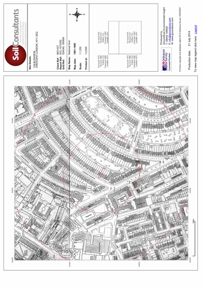
Site
Det
ails
:
Clie
nt R
ef:
R
epor
t Ref
: G
rid R
ef:
Map
Nam
e:
Map
dat
e:
Scal
e:
Prin
ted
at:
Prod
uced
by
G
roun
dSur
e En
viro
nmen
tal I
nsig
ht
T: 0
8444
159
000
E: in
fo@
grou
ndsu
re.c
om
W: w
ww
.gro
unds
ure.
com
Pro
duct
ion
date
:
To v
iew
map
lege
nd c
lick
here
Le
gend
© C
row
n co
pyrig
ht a
nd d
atab
ase
right
s 20
13 O
rdna
nce
Sur
vey
1000
3520
7
129,
BLE
NH
EIM
CR
ES
CE
NT,
LON
DO
N, W
11 2
EQ
9631
/OT
SC
L-15
7329
252
4249
, 180
909
Nat
iona
l Grid
1981
-198
6
1:1,
250
1:2,
000
21 J
uly
2014
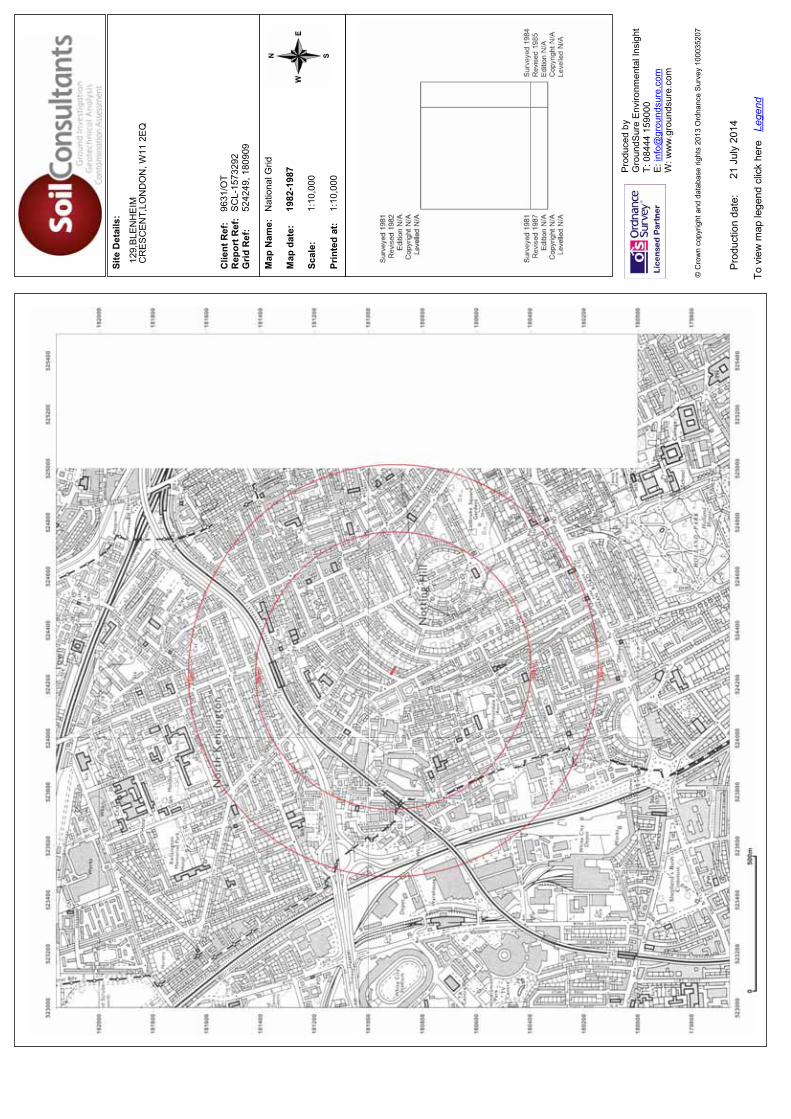
Site
Det
ails
:
Clie
nt R
ef:
R
epor
t Ref
: G
rid R
ef:
Map
Nam
e:
Map
dat
e:
Scal
e:
Prin
ted
at:
Prod
uced
by
G
roun
dSur
e En
viro
nmen
tal I
nsig
ht
T: 0
8444
159
000
E: in
fo@
grou
ndsu
re.c
om
W: w
ww
.gro
unds
ure.
com
Pro
duct
ion
date
:
To v
iew
map
lege
nd c
lick
here
Le
gend
© C
row
n co
pyrig
ht a
nd d
atab
ase
right
s 20
13 O
rdna
nce
Sur
vey
1000
3520
7
129,
BLE
NH
EIM
CR
ES
CE
NT,
LON
DO
N, W
11 2
EQ
9631
/OT
SC
L-15
7329
252
4249
, 180
909
Nat
iona
l Grid
1982
-198
7
1:10
,000
1:10
,000
21 J
uly
2014
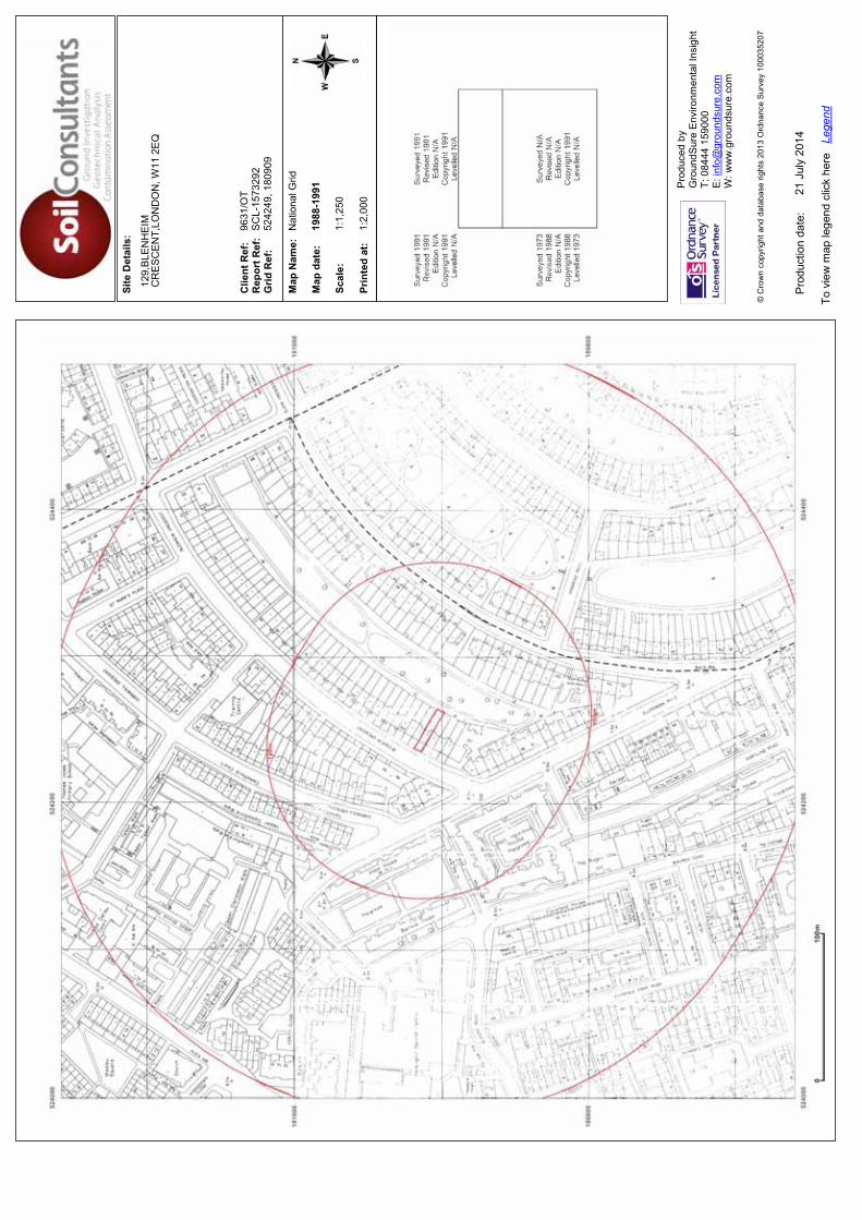
Site
Det
ails
:
Clie
nt R
ef:
R
epor
t Ref
: G
rid R
ef:
Map
Nam
e:
Map
dat
e:
Scal
e:
Prin
ted
at:
Prod
uced
by
G
roun
dSur
e En
viro
nmen
tal I
nsig
ht
T: 0
8444
159
000
E: in
fo@
grou
ndsu
re.c
om
W: w
ww
.gro
unds
ure.
com
Pro
duct
ion
date
:
To v
iew
map
lege
nd c
lick
here
Le
gend
© C
row
n co
pyrig
ht a
nd d
atab
ase
right
s 20
13 O
rdna
nce
Sur
vey
1000
3520
7
129,
BLE
NH
EIM
CR
ES
CE
NT,
LON
DO
N, W
11 2
EQ
9631
/OT
SC
L-15
7329
252
4249
, 180
909
Nat
iona
l Grid
1988
-199
1
1:1,
250
1:2,
000
21 J
uly
2014
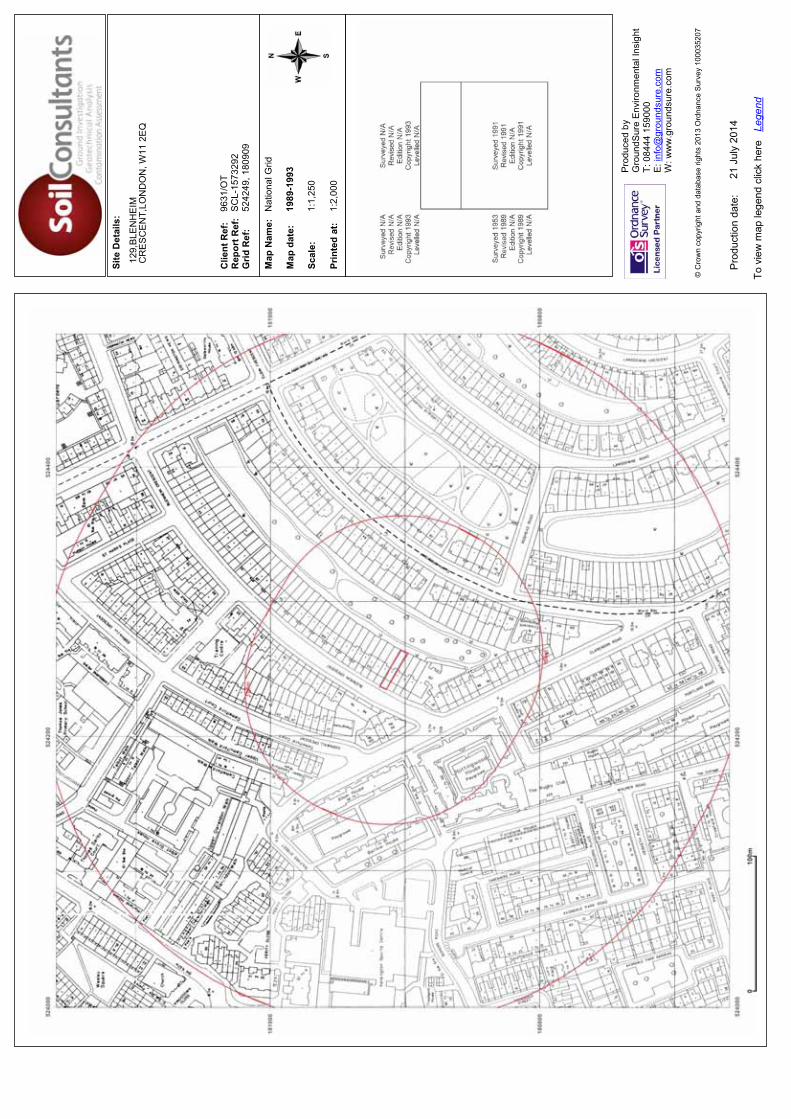
Site
Det
ails
:
Clie
nt R
ef:
R
epor
t Ref
: G
rid R
ef:
Map
Nam
e:
Map
dat
e:
Scal
e:
Prin
ted
at:
Prod
uced
by
G
roun
dSur
e En
viro
nmen
tal I
nsig
ht
T: 0
8444
159
000
E: in
fo@
grou
ndsu
re.c
om
W: w
ww
.gro
unds
ure.
com
Pro
duct
ion
date
:
To v
iew
map
lege
nd c
lick
here
Le
gend
© C
row
n co
pyrig
ht a
nd d
atab
ase
right
s 20
13 O
rdna
nce
Sur
vey
1000
3520
7
129,
BLE
NH
EIM
CR
ES
CE
NT,
LON
DO
N, W
11 2
EQ
9631
/OT
SC
L-15
7329
252
4249
, 180
909
Nat
iona
l Grid
1989
-199
3
1:1,
250
1:2,
000
21 J
uly
2014
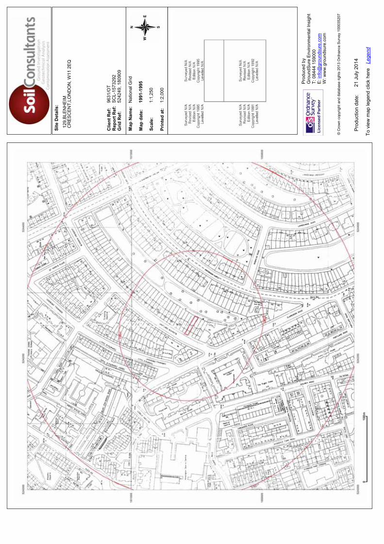
Site
Det
ails
:
Clie
nt R
ef:
R
epor
t Ref
: G
rid R
ef:
Map
Nam
e:
Map
dat
e:
Scal
e:
Prin
ted
at:
Prod
uced
by
G
roun
dSur
e En
viro
nmen
tal I
nsig
ht
T: 0
8444
159
000
E: in
fo@
grou
ndsu
re.c
om
W: w
ww
.gro
unds
ure.
com
Pro
duct
ion
date
:
To v
iew
map
lege
nd c
lick
here
Le
gend
© C
row
n co
pyrig
ht a
nd d
atab
ase
right
s 20
13 O
rdna
nce
Sur
vey
1000
3520
7
129,
BLE
NH
EIM
CR
ES
CE
NT,
LON
DO
N, W
11 2
EQ
9631
/OT
SC
L-15
7329
252
4249
, 180
909
Nat
iona
l Grid
1991
-199
5
1:1,
250
1:2,
000
21 J
uly
2014
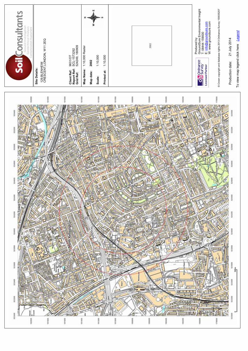
Site
Det
ails
:
Clie
nt R
ef:
R
epor
t Ref
: G
rid R
ef:
Map
Nam
e:
Map
dat
e:
Scal
e:
Prin
ted
at:
Prod
uced
by
G
roun
dSur
e En
viro
nmen
tal I
nsig
ht
T: 0
8444
159
000
E: in
fo@
grou
ndsu
re.c
om
W: w
ww
.gro
unds
ure.
com
Pro
duct
ion
date
:
To v
iew
map
lege
nd c
lick
here
Le
gend
© C
row
n co
pyrig
ht a
nd d
atab
ase
right
s 20
13 O
rdna
nce
Sur
vey
1000
3520
7
129,
BLE
NH
EIM
CR
ES
CE
NT,
LON
DO
N, W
11 2
EQ
9631
/OT
SC
L-15
7329
252
4249
, 180
909
1:10
,000
Ras
ter
2002
1:10
,000
1:10
,000
21 J
uly
2014
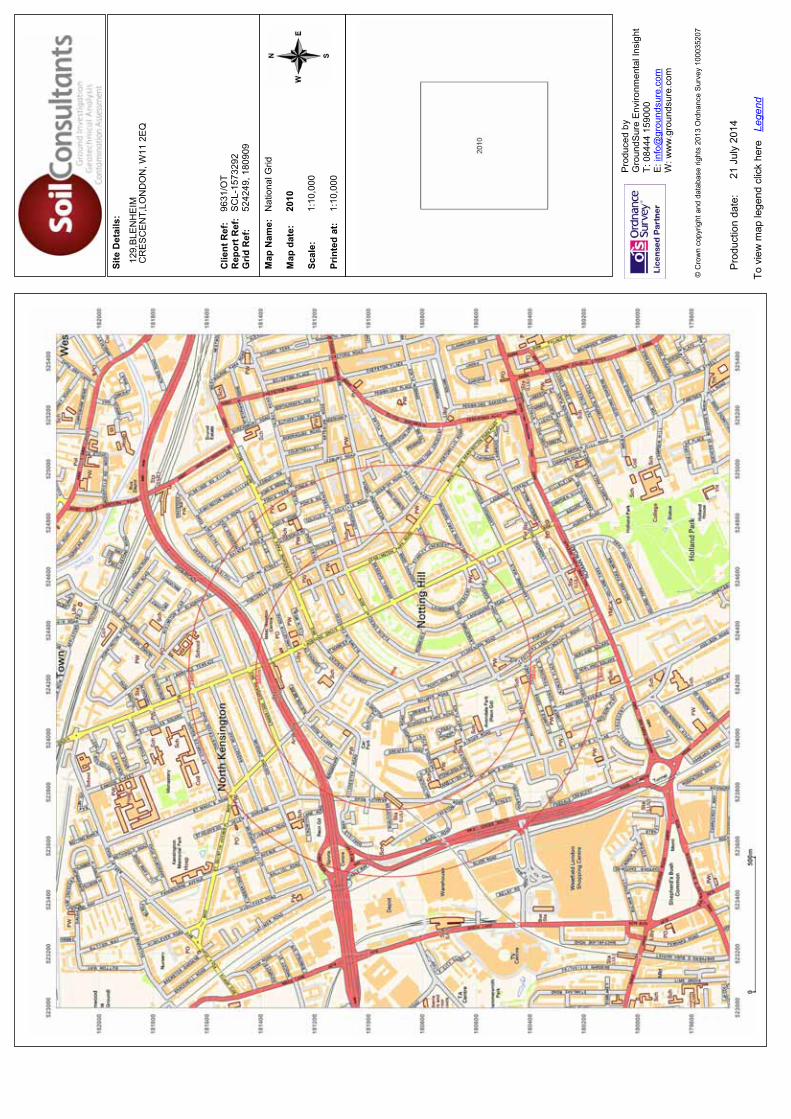
Site
Det
ails
:
Clie
nt R
ef:
R
epor
t Ref
: G
rid R
ef:
Map
Nam
e:
Map
dat
e:
Scal
e:
Prin
ted
at:
Prod
uced
by
G
roun
dSur
e En
viro
nmen
tal I
nsig
ht
T: 0
8444
159
000
E: in
fo@
grou
ndsu
re.c
om
W: w
ww
.gro
unds
ure.
com
Pro
duct
ion
date
:
To v
iew
map
lege
nd c
lick
here
Le
gend
© C
row
n co
pyrig
ht a
nd d
atab
ase
right
s 20
13 O
rdna
nce
Sur
vey
1000
3520
7
129,
BLE
NH
EIM
CR
ES
CE
NT,
LON
DO
N, W
11 2
EQ
9631
/OT
SC
L-15
7329
252
4249
, 180
909
Nat
iona
l Grid
2010
1:10
,000
1:10
,000
21 J
uly
2014

Site
Det
ails
:
Clie
nt R
ef:
R
epor
t Ref
: G
rid R
ef:
Map
Nam
e:
Map
dat
e:
Scal
e:
Prin
ted
at:
Prod
uced
by
G
roun
dSur
e En
viro
nmen
tal I
nsig
ht
T: 0
8444
159
000
E: in
fo@
grou
ndsu
re.c
om
W: w
ww
.gro
unds
ure.
com
Pro
duct
ion
date
:
To v
iew
map
lege
nd c
lick
here
Le
gend
© C
row
n co
pyrig
ht a
nd d
atab
ase
right
s 20
13 O
rdna
nce
Sur
vey
1000
3520
7
129,
BLE
NH
EIM
CR
ES
CE
NT,
LON
DO
N, W
11 2
EQ
9631
/OT
SC
L-15
7329
252
4249
, 180
909
Nat
iona
l Grid
2014
1:10
,000
1:10
,000
21 J
uly
2014