social dynamics and local trading pattern in the bantaeng ... · sejarah dan purbakala (formerly...
TRANSCRIPT

i
Social Dynamics and Local Trading Patternin the Bantaeng Region, South Sulawesi (Indonesia)
circa 17th century
WIDYA NAYATI
Doctoranda/Drain Archaeology.
(Universitas Gadjah Mada, Yogyakarta, Indonesia)M.A.
in Archaeology(The Australian National University, Canberra, Australia).
NATIONAL UNIVERSITY OF SINGAPORE2005
ii
Social Dynamics and Local Trading Patternin the Bantaeng Region, South Sulawesi (Indonesia)
circa 17th century
WIDYA NAYATI
Doctoranda/Dra.in Archaeology
(Universitas Gadjah Mada, Yogyakarta, Indonesia)M.A.
in Archaeology(The Australian National University, Canberra, Australia).
A THESIS SUBMITTED FOR THE DEGREE OFDOCTOR OF PHILOSOPHY
THE SOUTHEAST ASIAN STUDIES PROGRAMME
NATIONAL UNIVERSITY OF SINGAPORE2005

iii
Declaration:
This dissertation is submitted to the National University of Singapore inaccordance with the requirements of the degree of Doctor of Philosophyin the Southeast Asian Studies Programme, Faculty of Arts and SocialSciences. It has not been submitted for any other degree or diploma of anyexamining body. Except where specifically acknowledged, it is all the originalwork of the author.

iv
ACKNOWLEDGMENTS
BARANGSIAPA yang bertakwa kepada Allah,niscaya Dia akan mengadakan baginya jalan keluar (dari kesulitan).
Dan Allah akan memberinya rezeki dari jalan yang tiada disangka-sangkanya.Dan barangsiapa yang bertawakal kepada Allah,
niscaya Allah akan mencukupkan (keperluan)-nya.”
(QS At-Thalaq: 2-3)
This thesis would not have been possible without the generous help and support
from a number of people to whom I am forever indebted. My most sincere gratitude and
heartfelt appreciation goes to Associate Professor Dr. John Norman Miksic, my ‘guru’ and
my supervisor, for his full support, assistance, and guidance throughout the entire period of
learning archaeology, especially during the last five years.
My thanks also go to Associate Professor Dr. Paul Kratoska, for his willingness to
become my co-supervisor.
This thesis is based on a study initially supported by the Lee Foundation of Singapore
and some private donors who do not want to be specifically mentioned here. It was conducted
in the year of 2000 in the Bantaeng regency of South Sulawesi, Indonesia under the auspices
of the Arkeologi Nasional (formerly Pusat Penelitian Arkeologi Nasional) and the Direktorat
Sejarah dan Purbakala (formerly Direktorat Perlindungan Pembinaan Sejarah dan Purbakala)
and their regional offices: the Balai Arkeologi Makassar and the Balai Pelestarian Sejarah
dan Purbakala (formerly Suaka Perlindungan Sejarah dan Purbakala) South Sulawesi and
Southeast Sulawesi provinces. I gratefully acknowledge the funding from the Lee Foundation
Singapore and some private donors both from Indonesia and Australia.

v
The fieldwork would not have been possible without the facilitation provided by
many people, both personally and officially. My thanks go to Prof. Dr. Hasan Muarif Ambary,
former head of the Pusat Penelitian Arkeologi Nasional, Dr. I Gusti Ngurah Anom, Drs.
Nunus Supardi, Drs. Hari Untoro Drajat, former Director of the Direktorat Perlindungan
Pembinaan Sejarah dan Purbakala Republik Indonesia, and to Dr Harris Sukendar. Head
of Pusat Arkeologi Nasional, all of whom gave their support and encouragement to me to
do the research, both in my former research site in Southeastern Maluku Province, and in
Bantaeng, South Sulawesi Province. Support has also been obtained from: Drs. Sabiruddin
Sila and Dr. Ali Fadillah (head and former head of the Balai Arkeologi Makassar), and Drs.
Gunadi M. Hum (former head of the Suaka Peninggalan Sejarah dan Purbakala Propinsi
Sulsel-Sulteng), who generously assisted me during my research in South Sulawesi. My
research was made possible because of their generosity in solving my financial problems
and obtaining research permits both for fieldwork in their areas and for analyzing the material
findings. The Archaeology Department, Gadjah Mada University, in Yogyakarta assisted
me with a special permit which enabled me to conduct archaeological research both in
Southeast Maluku Province and Bantaeng region (south Sulawesi), to use the Department
facilities for analyzing artifacts and also to recruite some field assistants. Moreover, Karya
Utama Citra Mandiri in Makassar provided me with basic data on the southern peninsula of
south Sulawesi. I express my deepest thanks and my gratitude to all those individuals and
institutions mentioned above whose support smoothed my research activities.
My sincere thanks and heartfelt appreciation go to The National University of
Singapore, which provided me with a research scholarship from August 1998 to February
2002. Furthermore, the university employed me as a Teaching Assistant from August 2002

vi
to February 2003, for which I am most grateful. I also thank the Head of the Southeast
Asian Studies Programme at NUS, Prof Dr. Ileto , the former heads Dr. Hong Lysa and
Prof. Dr. Chua Beng Huat, and the administrative staff members at SEASP-NUS, particularly
Ms. Lucy Tan, Mrs. Rohani bte Jantan, and Mrs. Rohani Binte Sungib, and former
administration staff members Mrs. Farida and Ms. Gracie Lim who lend me their support.
I am grateful to Mr. Lee Seng Gie, director of the Lee Foundation-Singapore and
his two staff members, Ms. Florence and Ms. Sally, who frequently assisted me with their
expert help, supported me administratively during my two periods of fieldwork in Bantaeng
region, and made it possible for me to attend the South Sulawesi History Seminar in Canberra
in the year 2000.
I am thankful to the Dean of Fakultas Ilmu Budaya, Universitas Gadjah Mada, Dr.
Syamsul Hadi, M.A.; S.U., and former Deans Fakultas Sastra Universitas Gadjah Mada:
Prof. Dr. Safri Sairin, M.A., Prof. Dr. Djoko Suryo, Prof. Dr. Hj. Siti Chamamah Suratno,
who gave permission to me to undertake advanced study in Singapore. Their support made
it possible for me to continue my study in Singapore.
I am indebted to the Head of the Archaeology Department, Universitas Gadjah
Mada Yogyakarta, Dr. Inajati Adrisijanti; Assistant to the Head of Department Dra. Anggraeni,
M.A; the former head of Department, Drs. Tjahjono Prasodjo M.A, Drs. Djoko Dwiyanto,
and all the staff who have supported me and taken over my duties during my five-year
absence.
My thanks also go personally to Prof. Dr. Sumijati Atmosudiro, former head of the
Archaeology Department, who encouraged me to undertake further study while I was working

vii
under her guidance as an assistant to the Head of Department. I am thankful to Drs. Tjahjono
Prasodjo, M.A. who generously agreed to take over my duties so that I was able to continue
my study at NUS. My thanks also go to Dr. Daud Aris Tanudirjo; Dra. DS. Nugrahani;
Marwi Kurniati; Sektiadi S.S; Ir. Augrit Gumalag; Ir. Marley, and Drs. Nur Tatto who
always enthusiastically provided me with data, ideas, drawings, and information. Thanks
also to Dr. Inajati Adrisijanti Romli, my senior in the Indonesian Islamic Archaeology section,
who let me go adventuring with ‘wild’ ways in understanding the past — both with aerial
photography and ethnohistoric data.
My thanks go to Drs. Dukut Santoso, head of Balai Studi Konservasi Borobudur,
who granted me access to analyses of metal artifacts in his office. Thanks especially go to
Sukronedi, S.Si. for his metal analysis, to Karaeng Demmanari from Balai Arkeologi
Makassar for porcelain analysis, and to Boedi Sampurna, MD from the Medical Faculty
Gadjah Mada University for bone analysis. Their help and expertise have been very important
for the completion of this dissertation.
My special appreciation goes to Prof. Dr. Campbell Macknight, Dr. David Bulbeck,
Dr. Heddy Ahimsa-Putra, and the South Sulawesi community who introduced me to ‘Sulawesi
Selatan History’. My thanks also go to Mr. Wayne Bougas who ‘opened’ Bantaeng to
public interest.
Special thanks go to Mrs. Brigid Ballard for her precious time spent editing and
helping me with the language from Down Under at the BJ house at Mollymook and Duffy
Street in Canberra. Her support and help cannot be recompensed with just the words
‘thanks Mum’.

viii
Special thanks also go to Ms. Gretchen Mary Engel, Mbak Nia, Marwi, Augrit,
Atik, Ino’, Sekti, Riris Purbasari, Sony, Ahmad Rosyadi, Rahmadya, Neli, Mira, Adith and
Mbak Rita who supported me in so many different ways at so many different times. Their
support has made my plans run much more smoothly.
My deep apology and regret go to some people in southeast Maluku — Aru, Kei
Kecil, Kei Besar, and Tanimbar islands — because I was not able to return there for further
research due to the ongoing political conflict. The support of Fordatkotsu family in Saumlaki
(Tanimbar island), the Koedoeboen family (Kei islands), Johny Lambers (Aru island), and
Mr. Sudarto—head of the local airport in Dobo (Aru island) was valuable. I also pay respect
to the late Mr. Eko (RIP), former Inspektur Wilayah Kabupaten Maluku Tenggara, who
regrettably passed away upon hearing about the conflict in Kei Island which involved his
people, neighbors, relatives and friends.
I must give credit to Dr. Peter Veth, Prof. Dr. Matthew Spriggs, and Dr. Sue
O’Connor who introduced me to the significance of Aru Island. Mr. Piet Tallo-Governor of
Nusa Tenggara Timur-formerly Bupati of Timor Tengah Selatan regency in NTT has stimulated
my interest in exploring Timor. Moreover I thank the Center of Asia Pacific Studies Universitas
Gadjah Mada Yogyakarta, which gave an opportunity for me to do research in Babo-
Bintuni, in Papua. My exploration of Maluku, west Timor, and Babo-Bintuni (Papua) has
enlarged my understanding on the importance of studying the periphery.
The Thamrin Baso family (Makassar), the Gumalag family (Makassar), the Rukka
Pabe family (Bantaeng), the Mappatan family (Bantaeng), and Drs. Amier Sampara (Bantaeng)
all generously provided me with housing and information during my fieldwork in Makassar
and Bantaeng. Their help was very significant as it enabled me to conduct my research in

ix
‘the porcelain looting areas’. Moreover, two families in Yogyakarta, the Yatiman Syafei
family (Kotagede-Yogyakarta) and the Bagus Suharjono family (Yogyakarta) always
supported me in every way, and I greatly appreciate this.
My gratitude also goes to my colleagues and my assistants during the fieldwork:
Drs. Budianto Hakim, Sarjiyanto, S.S., Mansyur, Drs. Khaeruddin Daeng Paewa, Drs. M.
Nur Tatto, Drs. Rusman Rukka, Dra. Nila Mappatan, Didik Suhartono, S.S., and Neli
Triana, S.S. I express my heartfelt thanks to them for their patience and tolerance during my
fieldwork. Moreover, my thanks go to Safri Habibu- the Macucuk expert; Syamsu-the man
with ‘I want to help you mbak’; Najamuddin-the ex-prisoner, together with Syamsul, Roding,
Adi, Syakban, Doding and his crews, who helped me with the hard digging work which was
different from their own practice of looting. My thanks also go to the people of Bantaeng
who readily recalled their memories and shared them with me during my fieldwork-especially
Pinati of Gantarangkeke and Bapak-Bapak Kaum in Lembang Gantarangkeke and Onto. I
really appreciated their help, support, and kindness of all sorts, which made it possible for
me to write this dissertation.
Ms. Mala Rajo Sathian, Mrs. Yulianti Parani, Dr. Kyle Latinis, and Syah Alam have
shared with me their experience of being a ‘student’ at NUS. Ms. Novida Abbas, Ms.
Ratna Suranti, Mrs. Fera, Mr. Omar Chin, and Ms. Cheryl shared the first year with me in
College Green, Fort Canning, and Kampung Glam. Novita, Buboy, Chua Bann, Henry,
and Ed Tadem helped cherish the last stage of my study. Moreover, my special thanks go to
Maila, Vincente, Ananda, and Henry Xu Ke who helped me during the last-minute work.
My life in Singapore for the past three years was based in Pasir Panjang, the

x
Indonesian House of Singapore. Shanty Syahrir, Riyana Miranti, Lina Irawati, Reyni Irriani,
Siswa Rizali, Tengku Rahmatsyah, Aditya Sari, Cung Sopandi, Mahendra, Henry Feriady,
Simon, Rita Manik, Ananda, Henrik and Richard have all shared the life there as one big
family. The diverse experiences and ways of life of the Pasar Panjang residents have in one
way or another enriched each one of us.
I thank to Mrs. Hashimah Johari with her library experience. My appreciation goes
to Mrs. Heimun Miksic and Mrs. Rohani bte Jantan who made living in Singapore so much
easier for me. Moreover, I thank Ibu Yeniar and Ibu Roos Hasyim who help me with
passport administration in Jakarta and in Singapore.
My gratitude goes also to Lucia Krisdinarti MD (cardiologist) and Ibnu Purwanto
MD (ontologist) who took the best care possible of my father until he passed away peacefully,
and my mother who became strong enough to allow me to leave home to complete the
revision of this dissertation. Their attention has been very important, both in treating my
parents and in helping me personally to deal with the situation.
My very special gratitude goes to my dear parents: Prof. Drs. Asdi S. Dipodjojo
(who passed away on the 11th of October 2004) and Prof. Dr. Endang Daruni, for their
understanding, prayers, love, help, support, and encouragement to sustain this long work.
Their continuing support is immeasurable. I also thank my house helpers, Siti Rubeti and
Nurjanah, who always kept my artifacts in proper order, better than I do. My apology goes
to my parents and family for my long absence which prevented me from performing my duty
as a daughter and sister.
Finally and above all, I dedicate this work to my father and my mother and those
who are ‘mothers’ to me, and to my Bapak.
xi
Table of Contents
Acknowledgment
Table of Contents
Abstract
Summary
List of Maps
List of Figures
List of Drawing
List of Diagrams
Chapter 1 Introduction
1. Geographic Models in Regional Archaeology.............................................................8
2. Historical Background of Trading Activity in the Indonesian Archipelago....................11
2.1. Rice Trade and Inter-island Networks..............................................................12
2.2.Control of Land and Surplus Production............................................................13
3. Organization of the Thesis..........................................................................................21
4. The Bantaeng Region as a Site for Research.............................................................23
4.1. Bantaeng’s Modern Situation............................................................................27
4.2. Settlement and Transport...................................................................................32
5. Research Aims, Methods, and Data Collection ........................................................40
6. Problems Encountered in the Field and the Laboratory..............................................56

xii
Chapter 2 Theoretical Framework
1. Historical and Archaeological Studies on Trading Activity in the Indonesian
Archipelago.............................................................................................................65
2. The Role of Local Trade in Long Distance Trading Networks.....................................74
3. Ethnographic Studies of Trade in the Indonesian Archipelago.....................................76
4. Central Place Model of Trade...................................................................................86
5. Dendritic Model of Spatial Analysis...........................................................................98
6. Bantaeng:Possibility of Applying Dendritic and Central Place Models.......................104
Chapter 3 Contemporary Bantaeng: Economy and Society during
the Post-Independence Period
1. Contemporary Bantaeng.........................................................................................117
2.1. Urban Changes: Bantaeng City........................................................................121
2.2. Rural Changes: Self-sufficiency vs Dependency...............................................130
2.3. Bantaeng: Agricultural Producers.....................................................................143
2.4. Bantaeng: Sea Producers...............................................................................149
3. The Transportation Network: Interrelations in Bantaeng Region...............................150
4. The Characteristics of Bantaeng Economic Life: Ethnographic
Data vs Dendritic and Central Place Models..........................................................154
Chapter 4 Contemporary Bantaeng: Alternative Models of Economic Activity
1. Ethnographic Data on Trading Activity in the Bantaeng Region.................................174
2. Application of Dendritic and Central Place Models in the Bantaeng Region..............207

xiii
2.1 The Dendritic Possibilities in Bantaeng Region...................................................208
2.2. The Central Place Model Possibilities in the Bantaeng Region..........................216
3. Difficulty in Applying the Dendritic and the Central Place Models in
the Bantaeng Region..............................................................................................221
4. Conclusion.............................................................................................................224
Chapter 5 Archaeological Evidence for Bantaeng’s Rise and Decline
as a Center of Long Distance Maritime Trade and the Impact
of these Changes on Artifact Distribution
1. Bantaeng: the Growth of Political Organization........................................................230
2. Bantaeng: Evidence of Contact and Long Distance Trade........................................237
3. Pre-modern Ways of Life of Bantaeng....................................................................249
3.1. Pre-ceramic Period........................................................................................250
3.2. Tomanurung Period.......................................................................................254
3.3. Colonial Period and Transition of Islam...........................................................275
3.4. Post-Independence Period.............................................................................279
4. Looters vs Archaeological Study of Bantaeng: Finds of Luxury Items......................280
Chapter 6 Understanding Dynamics of Life in Bantaeng Region from
Archaeological Excavation
1. Method of Archaeological Activity..........................................................................296
2. Burial Activities in Bantaeng in Circa 17th................................................................297
3. Dendritic and Central Place Patterns in the Bantaeng Region: Over Time..................335

xiv
4. Historical Reconstruction of Bantaeng Region.........................................................341
Chapter 7 Reflections on Bantaeng Trading Patterns in the Past
1. The Dinamics of Bantaeng Uncovered History.............................................................361
2. Political and Social Life of Bantaeng : The Importance of Hinterland Areas ..............366
3. Bantaeng: The Dynamics of Local Trading..............................................................369
4. Implications of Studying Local Trading Networks .................................................379
Bibliography
xv
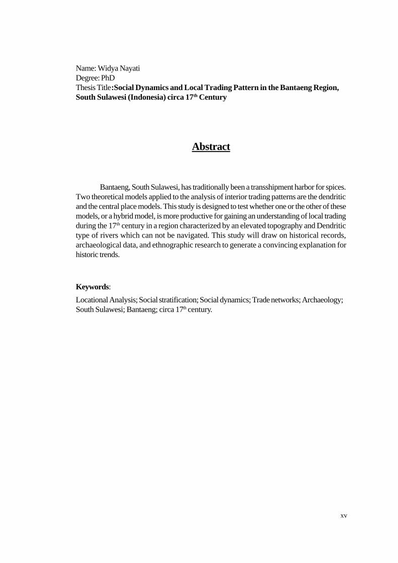
Name: Widya NayatiDegree: PhDThesis Title:Social Dynamics and Local Trading Pattern in the Bantaeng Region,South Sulawesi (Indonesia) circa 17th Century
Abstract
Bantaeng, South Sulawesi, has traditionally been a transshipment harbor for spices.Two theoretical models applied to the analysis of interior trading patterns are the dendriticand the central place models. This study is designed to test whether one or the other of thesemodels, or a hybrid model, is more productive for gaining an understanding of local tradingduring the 17th century in a region characterized by an elevated topography and Dendritictype of rivers which can not be navigated. This study will draw on historical records,archaeological data, and ethnographic research to generate a convincing explanation forhistoric trends.
Keywords:
Locational Analysis; Social stratification; Social dynamics; Trade networks; Archaeology;South Sulawesi; Bantaeng; circa 17th century.

xvi
Summary
The major trade networks operating in eastern Indonesia during the 17th century arerelatively well known but there remains a significant gap in the historical records relating tothe internal trade network. However, using archaeological and ethnographic approachesand drawing on two theoretical models, the dendritic and the central place models, used toanalyze and interpret trading patterns, it is possible to reconstruct the nature of that tradingsystem.
The dynamic of the local trading system, which continued throughout this period, isassumed to have played a particularly important role despite isolation from direct involvementin the expanding long distance trade. Little is known about how the local people sustainedtheir trading activities during this period of change, or about the trading patterns that evolvedto meet the new challenges.
In this thesis I have focused my research on Bantaeng, as this area has the advantageof being slightly peripheral to the main trade routes, in a mixed landscape region, and producinga range of goods for both local and wider markets. Bantaeng, a Kabupaten (regency) insouth Sulawesi (Indonesia) has historically been, at various times, a vassal of three kingdoms:Majapahit, Luwu’ and Gowa. Several palaces (Ballaq Lompoa), which are fundamental tothe local culture, have been recorded in this region. The Bantaeng region has also traditionallybeen a transshipment harbor for spices and other resources.
This study is designed to test which of these models, or a hybrid model, is moreproductive for gaining an understanding of local interior trading during the 17th century in aregion characterized by an elevated topography. The main contribution which this study willmake is to draw not only on historical records but also on archaeological data and morecurrent ethnographic research in order to generate a convincing explanation for historicaltrading trends.
Based on the archaeological and ethnographical approaches, it can be seen that theelite local group created a long distance trading network during the peak trading period ofthe 16th century to gain access to luxury items used for burials and ceremonials. In contrast,the non-elite trading groups developed their local trading activities to meet their subsistenceneeds. A significant shift in trading patterns along the coastal area of Bantaeng occurred inthe 17th century when the VOC began to dominate the transshipment activity, a change thatwas parallel to the introduction of Islam by the Gowa Kingdom. Evidence for the separationof political and sacred centers from the trading centers, the unequal distribution of luxuryobjects, and in land ownership supports this interpretation. This study has found that ahybrid local trading pattern in Bantaeng was characteristic of the dynamic social adaptationof the Bantaeng region in this period.
Keywords:
Locational analysis; Social stratification; Social dynamics; Trade networks; Archaeology;South Sulawesi; Bantaeng; circa 17th century.
xvii
List of Maps
Map 1: Location of Bantaeng in Indonesia ...............................................................24Map 2: Location of Bantaeng in Relation to other Regency in south Sulawesi Province........................................................................................25Map 3: Bantaeng in Relation to Bulukumba, Jeneponto and Takalar Regencies of south Sulawesi Province..........................................................26Map 4: Administration of Bantaeng Regency.............................................................29Map 5: Rivers in Bantaeng Regency.........................................................................30Map 6: Distribution of Producing Areas in Bantaeng Region (3D)..............................32Map 7: Village in Relation to Transportation Network in Bantaeng Region (2D).........34Map 8: Archaeological Sites in Relation to Rivers in Bantaeng Region (2D and 3D)................................................................................................48Map 9: Ballaq Lompoa in Relation to Rivers in Bantaeng Region (3D).................... 49Map 10: Ballaq Lompoa in Relation to Transportation Networks,
Archaeological Sites, and Villages in Bantaeng Region (3D).......................50Map 11: Archaeological Findings in Bantaeng Region (3D).........................................51Map 12: Location of Ballaq Lompoa in Relation to Transportation
Network, Archaeological Sites, and Villages in Bantaeng Region.................106Map 13: Archaeological Sites in Relation to Rivers in Bantaeng Region .....................111Map 14: Location of Trading in Relation to Asphalt Road in Bantaeng Region ...........114Map 15: Settlements in Relation to Rivers and Transportation Network in Bantaeng Region........................................................................................118Map 16: Vegetables and Coffee Sources in Relation to Transportation
Network...................................................................................................121Map 17: Bantaeng in 1923.......................................................................................126Map 18: Location of Ballaq Lompoa in Bantaeng Region..........................................140Map 19: Trading Centers, Settlements, and Transportation Networks in Bantaeng Region........................................................................................150Map 20: Location of Ballaq Lompoa in Relation to Transportation Network and Villages in Bantaeng Region.................................................................153Map 21: Trading Centers in Relation to Transportation Network, Rivers and Villages in Bantaeng Region........................................................................157Map 22: Vanished Trading Centers in Relation to Villages.........................................158Map 23: Location of Trading Centers in the Bantaeng Landscape.............................164Map 24: Trading centers in Relation to Transportation Network, Rivers, and Villages in Bantaeng Region........................................................................164Map 25: Trading Center in Realtion to Elevation in Bantaeng Region.........................176Map 26: Location of Trading Centers in Bantaeng Region.........................................178Map 27: Trading Centers in Relation to Transportation Network, Rivers, and Villages in Bantaeng Region........................................................................180Map 28: Monday market in Relation to Transportation Network in Bantaeng
Region......................................................................................... ...........186

xviii
Map 29: Tuesday market in Relation to Transportation Network in BantaengRegion......................................................................................................187
Map 30: Wednesday market in Relation to Transportation Network in BantaengRegion......................................................................................................188
Map 31: Thursday market in Relation to Transportation Network in BantaengRegion......................................................................................................189
Map 32: Friday market in Relation to Transportation Network in Bantaeng Region....191Map 33: Saturday market in Relation to Transportation Network in Bantaeng
Region......................................................................................................192Map 34: Ballaq Lompoa in Relation to Rivers in Bantaeng Region.............................198Map 35: Location of Trading Centers in Relation to Asphalt Road in Bantaeng
Region......................................................................................................200Map 36: Flow of People to Trading Centers in Bantaeng Region...............................203Map 37: Location of Trading Centers in the Bantaeng Region...................................204Map 38: Trading Centers in Relation to Transportation Network, Rivers, and
Villages in Bantaeng Region.......................................................................205Map 39: Location Sources in Bantaeng Region and Makassar..................................214Map 40: Location of Ballaq Lompoa in Relation to Elevation in Bantaeng
Region......................................................................................................232Map 41: Archaeological Sites in Relation to Rivers in Bantaeng Region.....................239Map 42: Ballaq Lompoa in Relation to Archaeological Sites and Findings..................240Map 43: Location of Batu Ejaya and Panganreang Tudea in Association to Balong LoE ............................................................................................255Map 44: Location of Borong Toa in Association to Binanga Panaikang......................257Map 45: Location of Borong Kapala in Association to Salo Maesa, Salo Kallamassang, Salo Kaloling, and Salo Nipa-nipa ................................261Map 46: Ballaq Lompoa in Relation to Rivers in bantaeng Region.............................265Map 47: Location of Onto in Association to Calendu river........................................269Map 48: Location of Borong Toa in Association to Binanga Panaikang.....................270Map 49: Lembang Gantarangkeke and Gantarangkeke in Association to Salo Tarung Batu, Salo Nipa-nipa, Salo Biyasa, and Salo Limpangan.................272Map 50: Archaeological Sites and Rivers In Bantaeng Region...................................296Map 51: Bantaeng city in Assosiation to Calendu and Binanga Tangnga-Tangnga.......299Map 52: Location of Borong Kapala in association to Salo Maesa, Salo Kalamassang, Salo Kaloling, and Salo Nipa-nipa................................315Map 53: Ballaq Lompoa in Relation to Rivers in Bantaeng Region...........................337Map 54: Location of Ballaq Lompoa in Relation to Transportation Network
and Villages in Bantaeng Region..................................................................338Map 55: Market,Ballaq Lompoa, Archaeological Sites and Rivers in Bantaeng Region........................................................................................339Map 56: Flow of People to Trading Centers in Bantaeng Region..............................341Map 57: Ballaq Lompoa in Relation to Archaeological Sites and Rivers in Bantaeng Region........................................................................................342Map 58: Ballaq Lompoa in Relation to Rivers in Bantaeng Region...........................343Map 59: Location of Onto in assosiation of Calendu river.........................................344Map 60: Location of Batu Ejaya and Panganreang Tudea in Assosiation to Balung LoE...............................................................................................344

xix
List of Figures
Figure 1: River in Bantaeng Region ................................................................................. 31Figure 2: River in Bantaeng Region ................................................................................. 31Figure 3: Houses surrounded by hills and sawah fields in Kampung Beru, Bantaeng. ........ 32Figure 4: Terraced rice fields near Labbo, North East Bantaeng region. ........................... 33Figure 5: A kolong used as warehouse in Onto village, Bantaeng region. ........................... 34Figure 6: In Lembang Gantarangkeke, a kolong serves as the venue for a social
gathering. ......................................................................................................... 35Figure 7: Women and children taking part in the bustling activities of the central market
place in Parang, Bantaeng region. ..................................................................... 35Figure 8: Family of six returning with their purchases after a day at the market. ............... 36Figure 9: Bantaeng city from Sinowa (485 m ASL). This place now is only a fishing
harbour. ............................................................................................................ 36Figure 10: Hulu Tangnga-Tanga River. ............................................................................. 37Figure 11: Dato-dato collection of Haji Doding. ................................................................ 38Figure 12: Dato-dato collection of Haji Doding. ................................................................ 39Figure 13: Traders provide their own facilities as seen in BaroE. ...................................... 92Figure 14: Facilities built by traders in village market. ....................................................... 93Figure 15: A typical INPRES market: Layoa market. ....................................................... 93Figure 16: A typical INPRES market: Loka market. ......................................................... 93Figure 17: Colonial-period building in Letta, now used as Karaeng’ house, Bantaeng city. 122Figure 18: Chinese shophouse near Pasar Lama, Bantaeng city. .................................... 122Figure 19: A colonial-period building now used to house primary school in Bantaeng city. 123Figure 20: This Netherlands Indies-style building is now the site of a military quarter in
Bantaeng city. .............................................................................................. 123Figure 21: A gravelled road leading to BaroE market ..................................................... 130Figure 22: A farmer leads his horses down a well-threaded dirt road in the Kampala
area. ............................................................................................................. 131Figure 23: A trail leading to village in Bullowe. ............................................................... 131Figure 24: A trail runs across the Jene type of river in Bullowe ....................................... 132Figure 25: Prau at Calendu river .................................................................................... 133Figure 26: Numerous people traverse this road to get to Parang Market. ........................ 134Figure 27: There are three means transportation in Bantaeng: on foot, by horse, and via
public buses. ................................................................................................. 134Figure 28: In the Ballaq Lompoa Lembang Gantarangkeke: from left: Pak Kaum, Pinati
(passed away in October 2000), back: person who takes care of Pinati. ........ 139Figure 29: Ballaq Lompoa (Royal Palace) in Gantarangkeke. ......................................... 140Figure 30: People work at ladang in Onto Area. ............................................................. 144Figure 31: The mountain-framed environment of Bantaeng ensures a steady source of
rainfall for padi fields of the.district. .............................................................. 144Figure 32: An irrigation canal build alongside an asphalt ................................................145Figure 33: A candlenut forest in Onto area ..................................................................... 146Figure 34: Across the river and follow the track-Borong Kapala. ................................... 151Figure 35: Track in Lembang Gantarangkeke. ................................................................ 152Figure 36: In the midst of parched grass runs a path which leads to ‘rumah ladang’ in
Loka area. .................................................................................................... 152Figure 37: The Ballaq Lompoa (Royal Palace) in Bantaeng City. ................................... 154

xx
Figure 38: The gaukang of Lembang Gantarangkeke, a worship for the local people. ..... 154Figure 39: This permanent buildings in trading center in Bantaeng Region ...................... 155Figure 40: This Permanent buildings replace traditional structures in Banyorang market . 155Figure 41: Semi permanent buildings in BaroE market .................................................... 155Figure 42: This patch of vacant field was the site of a market which is no longer convened,
Kampala area. .............................................................................................. 160Figure 43: A house, which serves also as a warung in BaroE area .................................. 172Figure 44: Warung in Sinoa area .................................................................................... 172Figure 45: Women and children taking part in the bustling activities of central market
place in Parang, Bantaeng Region...............................................................182Figure 46: Traders in Parang market conduct their activities on the open field.................182Figure 47: Numerous people traverse this road to get to the Parang market. ................... 184Figure 48: There are three means of transportation in Bantaeng: on foot, by horse, and
via public buses. .......................................................................................... 185Figure 49: A warung located at Sinowa area. ................................................................. 193Figure 50: A close-up view of the shop showing the string-up packets of snacks for
sale. ............................................................................................................. 193Figure 51: A detailed image of the goods sold in the warung. .......................................... 194Figure 52: The Banyorang market is a scene of the bustle and hustle as people conduct
trade with one another .................................................................................. 195Figure 53: Iron tools trader and buyer in Banyorang market. .......................................... 196Figure 54: A tobacco seller is surrounded by a group of men as they take relaxing smoke
and haggle over the price, Parang Market. .................................................... 196Figure 55: Candlenut forest in Bantaeng region .............................................................. 242Figure 56: Sawah in Labbo, North East Bantaeng .......................................................... 243Figure 57: Ballaq Lompoa in Letta, Bantaeng city .......................................................... 246Figure 58: Microlith found in Batu Ejaya, March 2000 .................................................... 250Figure 59: Plestered area in Batu Ejaya site ................................................................... 253Figure 60: Decorated potsherds found in Borong Kapala, in 2000 ................................... 253Figure 61: Decorated potsherds found in Borong Kapala, March 2000 ........................... 253Figure 62: Situation of Borong Kapala, March 2000 ....................................................... 258Figure 63: Dato-dato collection of Haji Doding ............................................................... 258Figure 64: Detail hairdo of female Dato-dato collection Haji Doding ............................... 259Figure 65: Female Dato-dato collection Haji Doding ....................................................... 259Figure 66: Artefacts found by Haji Doding (from top left) Bronze talam, part of bowl, part
of bowl, part of mirror frame, part of plate, part of bowl, part of bronze mirrorframe, terracota Dato-dato, and blue bead. ................................................... 260
Figure 67: Candlenuts forest in Bantaeng region ............................................................ 260Figure 68: Observation in Borong Kapala, March 2000 .................................................. 263Figure 69: Part of La’lang Bata in Onto. ........................................................................ 267Figure 70: Stone arrangement as sacred center in Onto.................................................. 267Figure 71: Stone arrangement in Onto located at the pile of earth ................................... 268Figure 72: Ballaq Lompoa Sinowa .................................................................................. 270Figure 73: Rainfeed field located north of Ballaq Lompoa Sinowa .................................. 271Figure 74: Borong Toa from coastal area ....................................................................... 271Figure 75: Blue bead collection of Haji Doding ............................................................... 287Figure 76: Bead found by local people at Borong Kindang .............................................. 287Figure 77: Borong Toa sites ........................................................................................... 292Figure 78: Pak Safry demonstrates the use of the macucuk in Benteng Batu Terang,
Bantaeng city............................................................................................ 298
xxi
Figure 79: Pak Syamsu similarly shows how to carry out the macucuk method atanother archaeological site, Bissampole, Bantaeng city..................................298
Figure 80: During excavation at BSP/X-0/TP-6 discovered chicken bones,fragment of bricks and door slot associated to human bones and importedceramics dated 16th-17th............................................................................301
Figure 81: This box (BSP/X-0/TP-8) has disturbed as fragment of imported ceramicshave found scattered associated to fragment of human bones........................301
Figure 82: Humerus (left and right) was discovered at 80 cm under soil surface atBisampole (Bantaeng city)............................................................................302
Figure 83: These metal artifacts were discovered at box BSP/X-0/TP-6 associated tohuman bones..............................................................................................302
Figure 84: Box BSP/X-0/TP-6.....................................................................................302Figure 85: No human bones found at stone arrangement. As shown at box
LGK/X-0/TP-3..........................................................................................307Figure 86: A stone arrangement has been excavated at Lembang Gantarangkeke. We
discovered a lidded imported ceramic dated 14th century, but no indicationof human bones..........................................................................................309
Figure 87: Checking at south area of Lembang Gantarangkeke. People informed thatsurrounding this box has found Balubu. Excavation at Box LGK/X-0/TP-5found out that the soil in this area is maximum 60cm from surface.................309
Figure 88: Excavation at south area of Lembang Gantarangkeke—box LGK/X-0/TP-7...311Figure 89: Potshards interpreted as parts of vessels and jars discovered at ladang
south of Balla Lompoa Lembang Gantarangkeke..........................................311Figure 90: Passaungang Tauwa, is located south of Balla Lompoa Gantarangkeke..........311Figure 91: Findings from GK/X-0/TP-1........................................................................313Figure 92: Findings from GK/X-0/TP-2........................................................................313Figure 93: Part of stone arrangement found at north site of Benteng Batu Terang...........313Figure 94: Surface finding at Benteng Batu Terang.......................................................316Figure 95: Stone arrangement at Borong Kapala. There is no archaeological finding
in this test pit..............................................................................................318Figure 96: Some of stone arrangement at Lembang Gantarangkeke. This site is very
expensive to be excavated. One meter square cost Rp. 1,000,000 andif there are findings, the owner need extra money for the findings..................319
Figure 97: A lidded imported ceramics box dated 14th century was discovered underthe stone, but no human bones have been found...........................................320
Figure 98: Detail dagger found associated to left humerus.............................................320Figure 99: Potshards interpreted as vessels and jars discovered in Borong Kapala
(box-BRK/X-0/TP-1).................................................................................330Figure 100: Haji Doding’s way of excavation. The way he finds artifacts is different
from archaeological excavation, as seen from box BRK/X-0/TP-1...............330Figure 101: Stone wall located at south part of Lembang Gantarangkeke village............332Figure 102: A lidded imported ceramic dated 14th century discovered at box
LGK/X-0/TP-2.........................................................................................333Figure 103: Tibula and Humerus discovered at 80 cm from soil surface at Bisampole,
Bantaeng city (box BSP/X-0/TP-6) ..........................................................334Figure 104: Fragment of Imported Ceramics found associated to fragment human
bones at BSP/X-0/TP-9.............................................................................334Figure 105: Binanga Tanga-Tangga to Flores sea and to Hilir. Un-navigable river............356

xxii
List of Tables
Table 1: Distribution of Archaeological sites within Bantaeng region..............................53Table 2: Market in Bantaeng region...........................................................................179Table 3: List of Rulers in Bantaeng Political Organization....................................233-234Table 4: Characteristic of Sites within Bantaeng Region..............................................240Table 5: Metal Artifacts finding in Bantaeng Region....................................................241Table 6: Distribution of Imported Ceramics in the Bantaeng Region............................241Table 7: Type of imported Ceramics in Bantaeng Region............................................242Table 8: List of human analysis found in Bantaeng by
Mr. Budi Sampoerna M.D................................................................. 322-326
xxiii
List of Drawings
Drawing 1: Ballaq Lompoa in Lembang Gantarangkeke...........................................141Drawing 2: Ballaq Lompoa in Gantarangkeke..........................................................141Drawing 3: Map of Bissampole and Palangtikang Region District of Bantaeng
With plotted test pits..............................................................................300Drawing 4: Bissampole plan and section BSP/X-0/TP-9..........................................301Drawing 5: Bissampole plan and section of trench BSP/X-0/TP-6............................303Drawing 6: Detail of stone structure (grave) plan and section LGK/X-0/TP-3
Lembang Gantarangkeke ......................................................................307Drawing 7: Map of Lembang Gantarangkeke with plotted test pit.............................308Drawing 8: Plan and section of test pit LGK/X-0/TP-2 Lembang Gantarangkeke.....310Drawing 9: Site location Gantarangkeke with plotted test pit....................................312Drawing 10: Map of Borongkapala site with plotted test pit ......................................316Drawing 11: Stone arrangement at Borong Kapala Region with plotted test pit...........317Drawing 12: Concentration of stone arrangement Lembang Gantarangkeke................318Drawing 13: Division between center and periphery in Bantaeng Region: Case Lembang Gantarangkeke............................................................353
xxiv
List of Diagrams
Diagram 1: Central Place Model K-3 .........................................................................88Diagram 2: Central Place Model K-4..........................................................................89Diagram 3: Central Place Model K-7..........................................................................89Diagram 4: Dendritic model.......................................................................................101Diagram 5: Dendritic Model......................................................................................209Diagram 6: Flow of Sources within Bantaeng Region.................................................210Diagram 7: Flow of Sources within Bantaeng Region..................................................211Diagram 8: Flow of Sources from Onto and Sinowa within Bantaeng Region..............212Diagram 9: Flow of Vegetables and Kapok from Bantaeng........................................214Diagram 10: Possibilities flow of sources within Bantaeng Region ..............................215